|
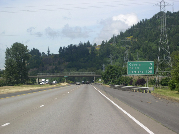
| Departing Eugene, mileage is given for the next exit, Coburg, as well as for Salem and Portland. 05/22/06 |
|
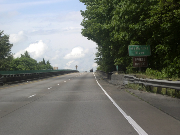
| Interstate 5 crosses the McKenzie River via the Spores Bridge. The bridge is named for Jacob Spores, one of the original settlers of the upcoming town of Coburg. 05/22/06 |
|
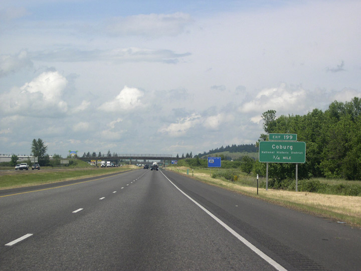
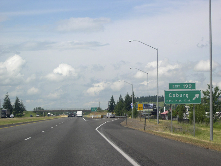
| The succeeding exit along I-5 north is for Pearl Street and the city of Coburg. Coburg. Settled in 1847, nearly twelve years before Oregon statehood, Coburg was awarded a National Historic District designation in 1986. 05/22/06 |
|
| Van Duyn Road ties into the diamond interchange (Exit 199) with I-5 at Coburg from the east. 05/22/06 |
|
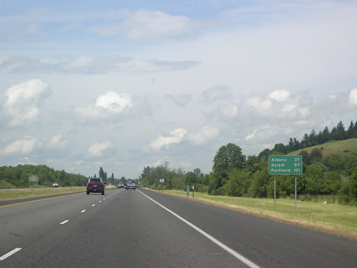
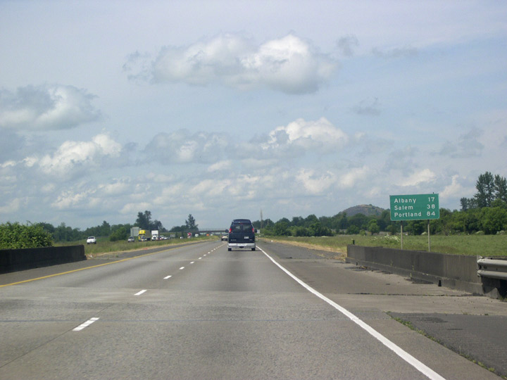
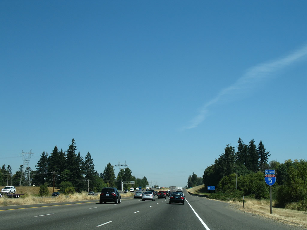
| The city of Albany lies 37 miles north, followed by Portland in 101 miles. 05/22/06 |
|
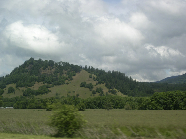
| The southern Willamette Valley is dotted with low, oak and fir-covered hills. The hills are quite green during the spring, but the grass will turn golden-brown by summer. 05/22/06 |
|
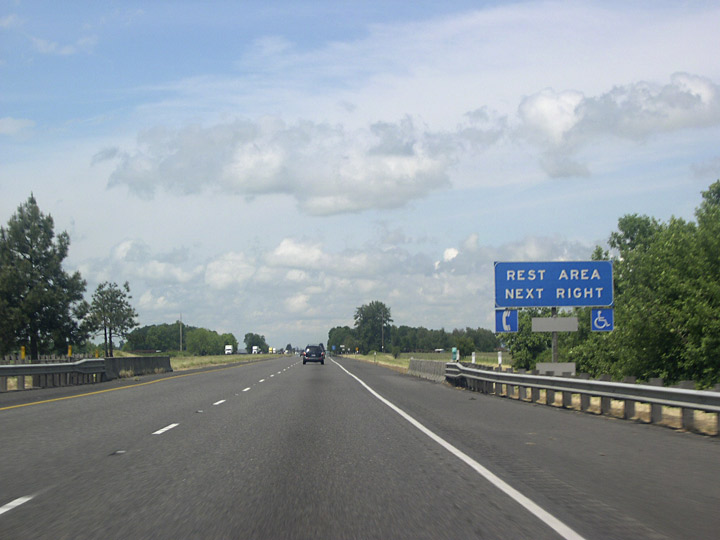
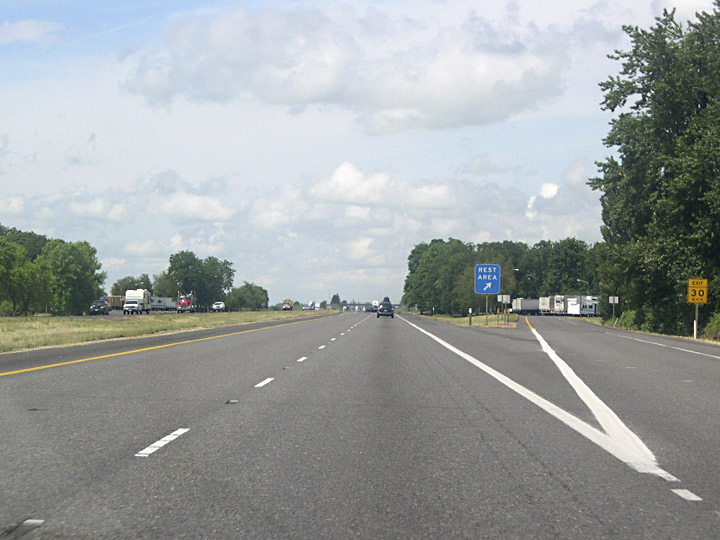
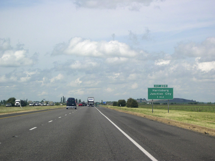
| The Oak Grove Rest Areas lie three miles south of Exit 209. Unlike some of the rest areas in southern Oregon which are nestled in picturesque woodlands, those north of Eugene lie within farm country. 05/22/06 |
|
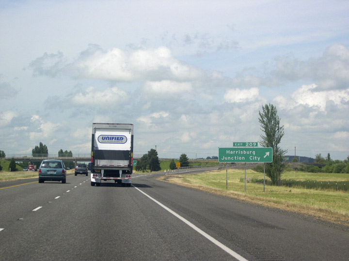
| Exit 209 joins I-5 with Diamond Hill Road to Harrisburg and Junction City in one mile. 05/22/06 |
|
| Diamond Hill Road leads five miles west from I-5 to the city of Harrisburg. Following OR 99E southbound from Harrisburg leads to Junction City, named in the 1880s for a hoped-for (but unrealized) railroad junction. The city later became the southern terminus of the U.S. 99 split. 05/22/06 |
|
| Interstate 5 in the southern Willamette Valley includes one of the longest straight aways along the freeway north of the Sacramento Valley way back at Redding, California. 05/22/06 |
|
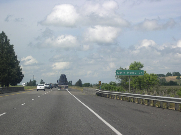
| Northbound I-5 crosses over Little Muddy Creek. 05/22/06 |
|
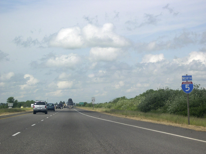
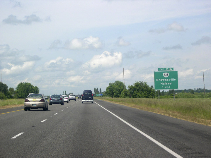
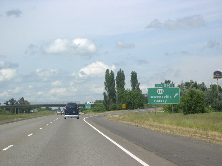
| Advancing north, Interstate 5 approaches a diamond interchange (Exit 216) with OR 228. 05/22/06 |
|
| Westbound OR 228 leads to OR 99E at the small city of Halsey. OR 228 continues four miles east from Exit 216 to the city of Brownsville and 19 miles to U.S. 20 in Sweet Home. 05/22/06 |
|
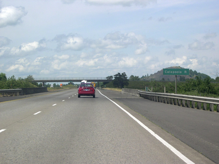
| The ensuing exit northbound lies 11 miles ahead outside Albany. The freeway spans the Calapooia River along this rural stretch. 05/22/06 |
|
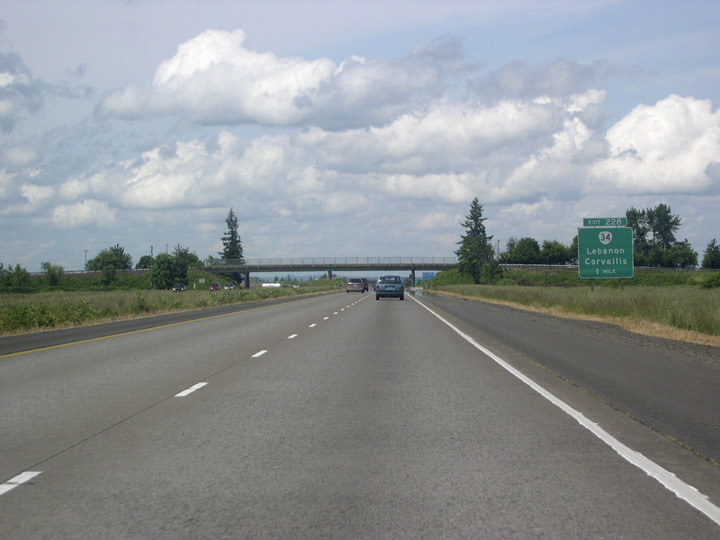
| Interstate 5 stays east of the old Pacific Highway branches, bypassing the Willamette Valley city of Corvallis. Located west of forthcoming Exit 228 along OR 34, Corvallis is the home of Oregon State University. Corvallis' tourist web site claims the city to be "the Pacific Northwest's most beautiful college town." 05/22/06 |
|
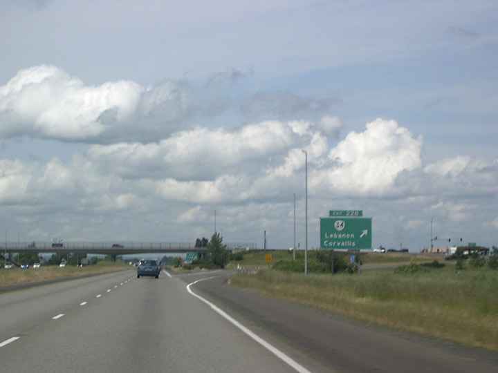
| Entering the six-ramp parclo interchange (Exit 228) with OR 34 on I-5 north. OR 34 westbound crosses OR 99E at an interchange within the city of Tangent, 2.4 miles to the west. 05/22/06 |
|
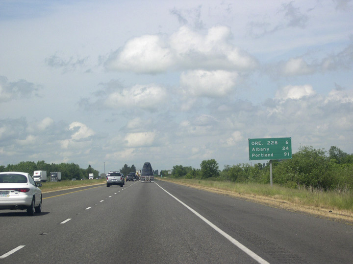
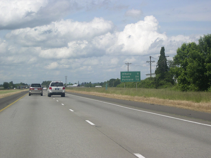
| A nearly uninterrupted 30 mile stretch through Oregon farm country concludes at Albany in five miles. Portland is still 72 miles north. 05/22/06 |
|
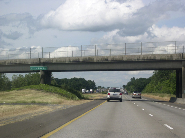
| A few rural roads cross the freeway on overpasses such as this one that carries Seven Mile Lane over Interstate 5 south of Albany. 05/22/06 |
|
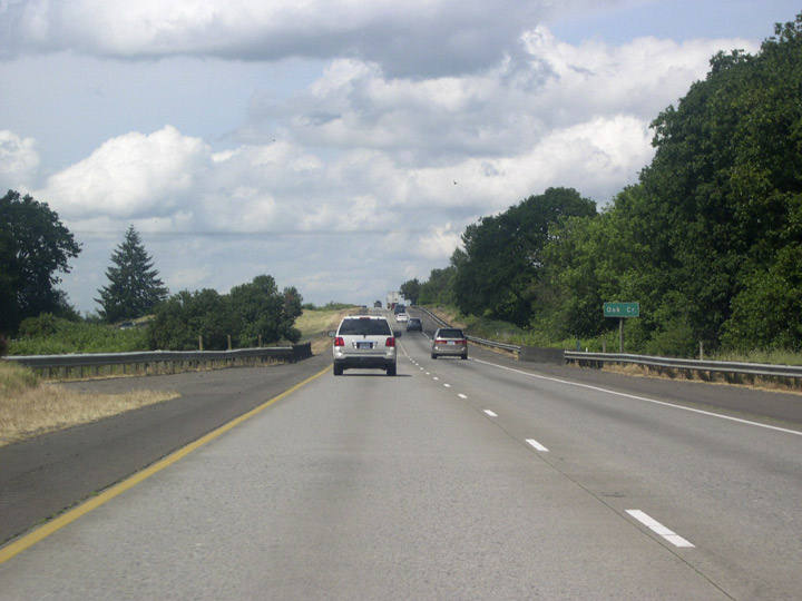
| Oak Creek is aptly named; the large trees with the dark spreading canopies on either side of the freeway are Oregon white oaks, the only native oak species in the northern half of the state. 05/22/06 |
|
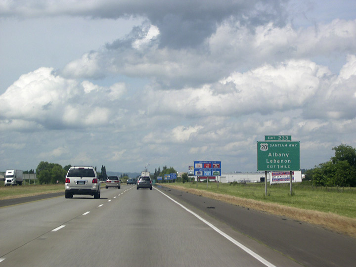
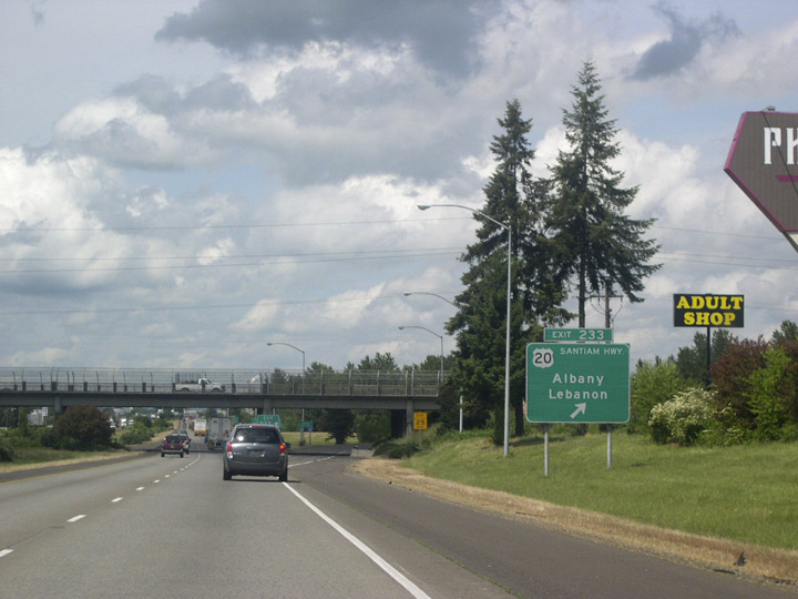
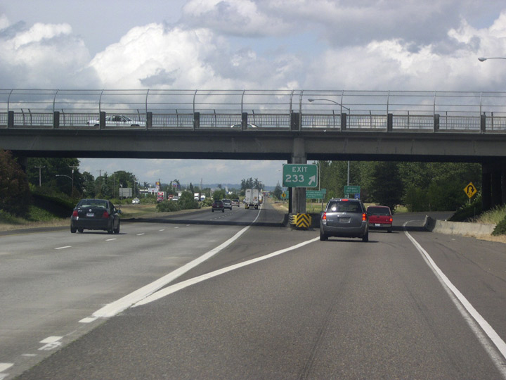
| The freeway crosses Albany city limits at milepost 233 just ahead of U.S. 20. Albany was settled in 1848, and in a pattern repeated throughout the state, named for the settlers' hometown- in this case Albany, New York. Officially incorporated in 1864, the city boasts itself to be "the rare metals capitol of the world," with local industries producing zirconium, hafnium, and titanium. 05/22/06 |
|
| Known as Santiam Highway east of Albany, U.S. 20 crosses the Cascade Crest at Santiam pass en route to Bend. Lebanon is located at the junction of U.S. 20 and OR 34. Westbound, the US highway heads into Albany where it meets OR 99E (Pacific Boulevard). 05/22/06 |
|
| Known as Santiam Highway east of Albany, U.S. 20 crosses the Cascade Crest at Santiam pass en route to Bend. Lebanon is located at the junction of U.S. 20 and OR 34. Westbound, the US highway heads into Albany where it meets OR 99E (Pacific Boulevard).
05/22/06 |
|
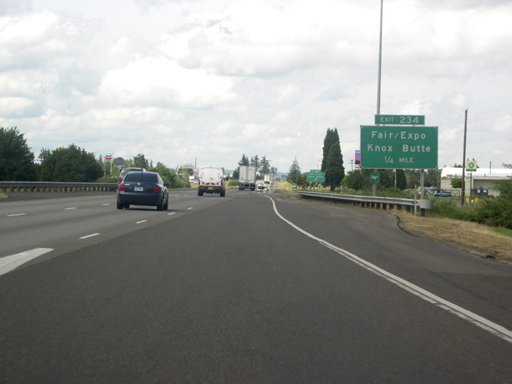
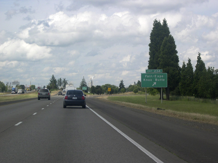
| The ensuing off-ramp (Exit 234) departs in a quarter mile for OR 99E (Pacific Boulevard) along the west side of the freeway. 05/22/06 |
|
| East of Exit 234, Knox Butte Road skirts the south slope of Knox Butte before meeting U.S. 20 near the South Santiam River. 05/22/06 |
|
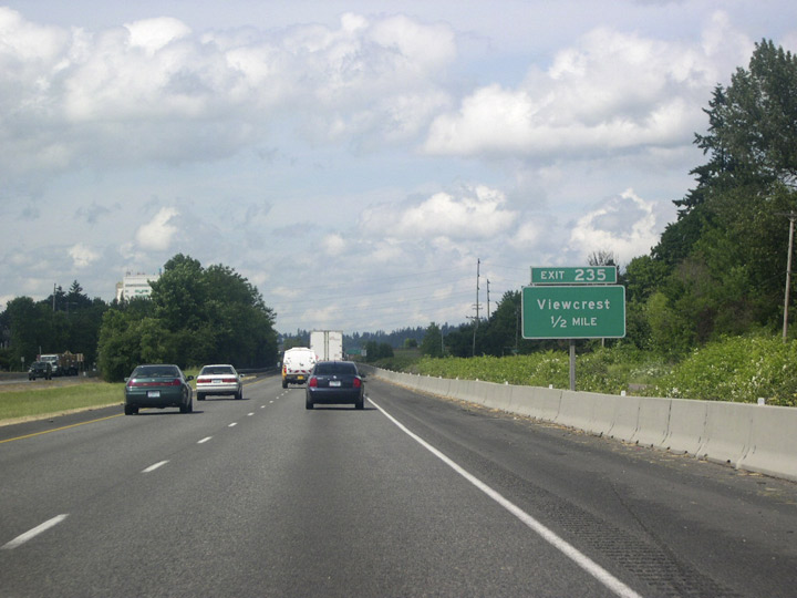
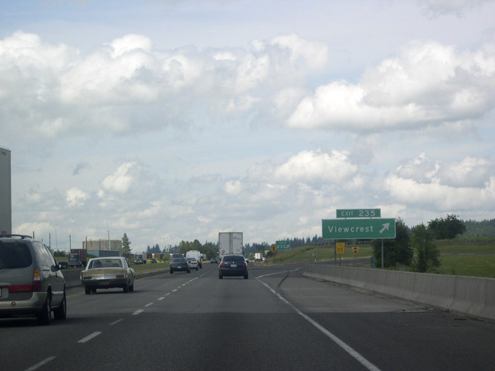
| Northbound Interstate 5 leaves Albany ahead of Exit 235 for Viewcrest.
There was a time when Albany had a reputation for bad odors emanating from a Weyerhauser paper mill, located to the west of the freeway. "You can always smell Albany before you see it," the old saying went, but efforts eventually curbed the odor, and with that went a little piece of I-5 lore. 05/22/06 |
|
| Exit 235 consists of RIRO (right in right out) ramps with parallel Century Drive north of Old Salem Road. Old Salem Road represents a portion of the old Pacific Highway between Albany and Salem. 05/22/06 |
|
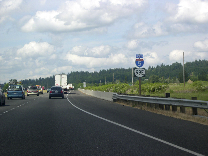
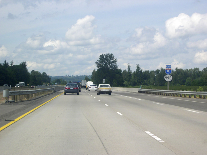
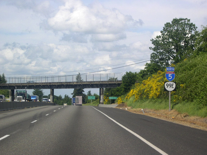
| OR 99E runs concurrent with Interstate 5 north from Pacific Boulevard in Albany. 05/22/06 |
|
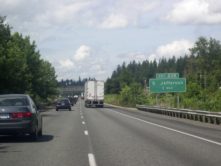
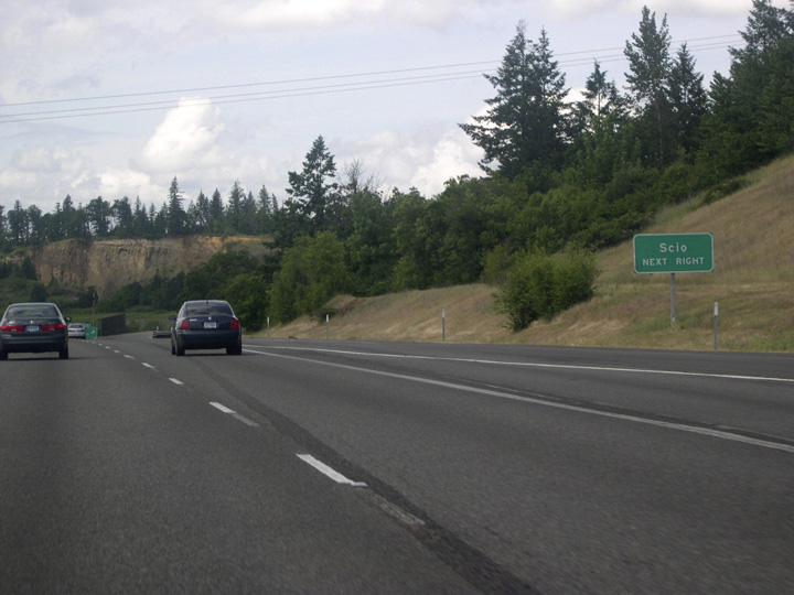
| The drive along I-5 through the Willamette Valley becomes less monotonous as the freeway traverses a landscape of gently rolling tree-covered hills between Albany and Salem. Passing by the city of Millersburg, I-5 advances one mile to the South Jefferson and Scio exit. 05/22/06 |
|
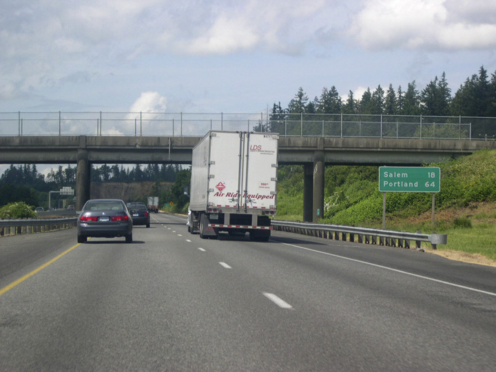
| Depending on traffic, Portland is just a little over an hour away at 64 miles to the north. Salem, 18 miles away, is fast approaching. 05/22/06 |
|
| The small city of Scio lies 11 miles to the east along the Jefferson-Scio Highway beyond the city of Jefferson. 05/22/06 |
|
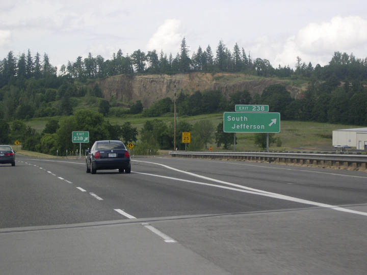
| Old Salem Road north and Jefferson Highway west come together at the folded diamond interchange (Exit 238) with Interstate 5. Jefferson lies just across the Santiam River in Marion County. There is no town of "South Jefferson"; the exit sign merely indicates that this is the south access to the city. 05/22/06 |
|
| A parclo A2 interchange (Exit 239) follows along I-5 north with Dever-Conner Road. This rural exchange serves agricultural areas west of the Santiam River. 05/22/06 |
|
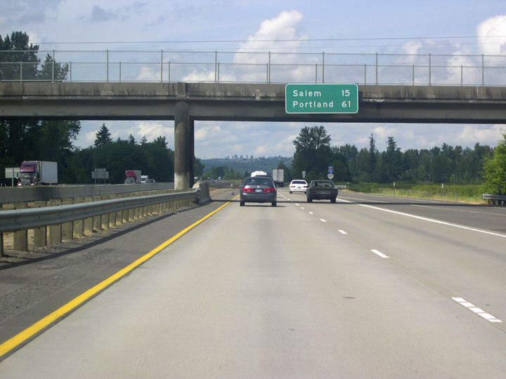
| Continuing north from Dever-Conner Road, Interstate 5 & OR 99 reaches Salem in 15 miles and Portland in 61 miles. 05/22/06 |
|
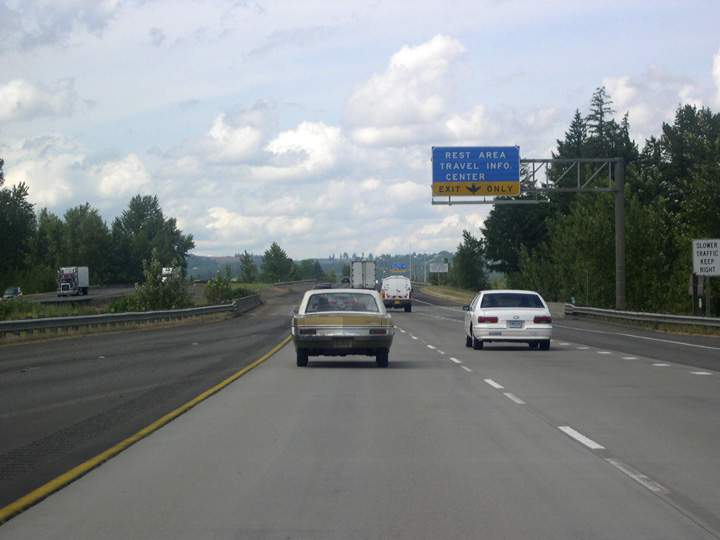
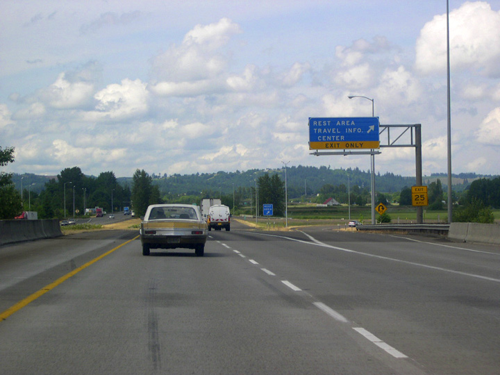
| Northbound Interstate 5 crosses the Santiam River into Marion County and immediately encounters a rest area and travel information center. The latter is a covered kiosk with maps and other travel information. 05/22/06 |
|
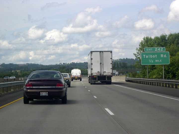
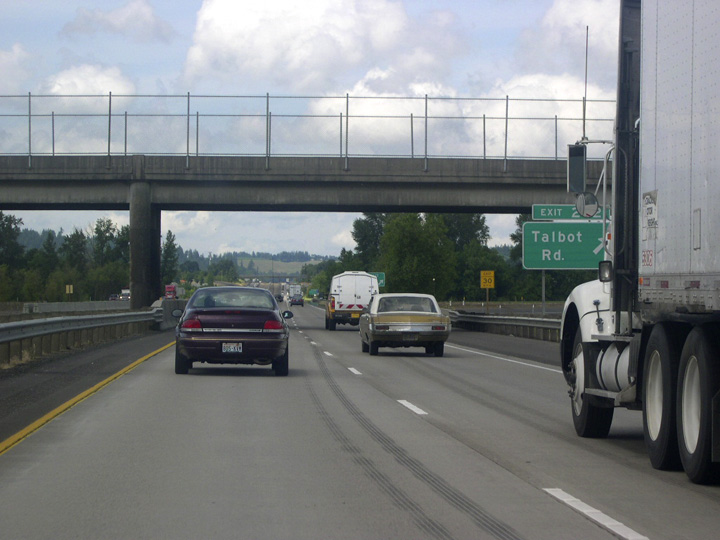
| A parclo B2 interchange (Exit 242) joins Interstate 5 with Talbot Road north of the Santiam River Rest Area. 05/22/06 |
|
| Talbot Road heads west from the freeway to unincorporated Tablot and Buena Vista Road and the Buena Vista Ferry. The ferry crosses the Willamette River just north of its confluence with the Santiam River. 05/22/06 |
|
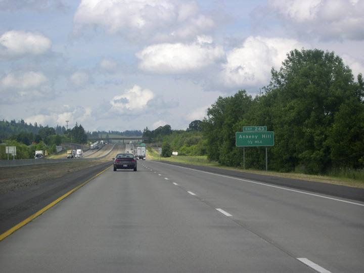
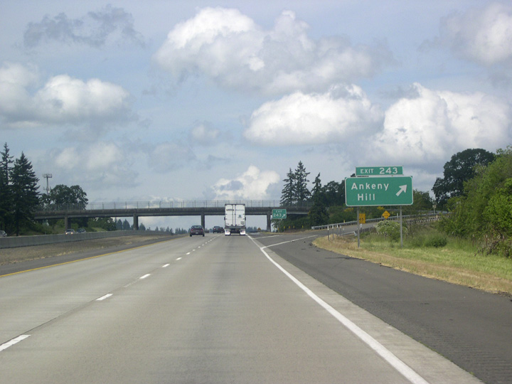
| Interstate 5 meets Ankeny Hill Road at Exit 243, a typical rural diamond interchange. 05/22/06 |
|
| Northwest of the Exit 234, Ankeny Hill Road travels through Ankeny National Wildlife Refuge to Buena Vista Road. Eastbound Ankeny Road links I-5 with Jefferson Highway. 05/22/06 |
|
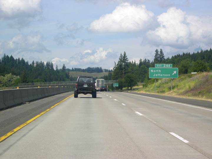
| Exit 244 represents the north end of Jefferson Highway, which has been roughly paralleling Interstate 5 to the east since Exit 238. 05/22/06 |
|
| Interstate 5 widens to three lanes in each direction on the approach to the state capitol in Salem. Conspicuous yellow-blooming Scotch Broom on surrounding hillsides appear attractive, but this plant is considered a severe pest. Scoth Broom is one of many alien plant species that thrive in the mild climate of the Willamette Valley. 05/22/06 |
|
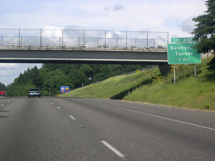
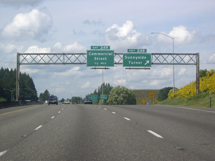
| One mile south of Exit 248 for Sunnyside and Turner. Sunnyside lies a short distance west of I-5. Turner is a city of over 1,800 located three miles to the east along Delaney Road. 05/22/06 |
|
| Community Interchanges Identification Signs are used along Interstate 5 through the Salem area. 05/22/06 |
|
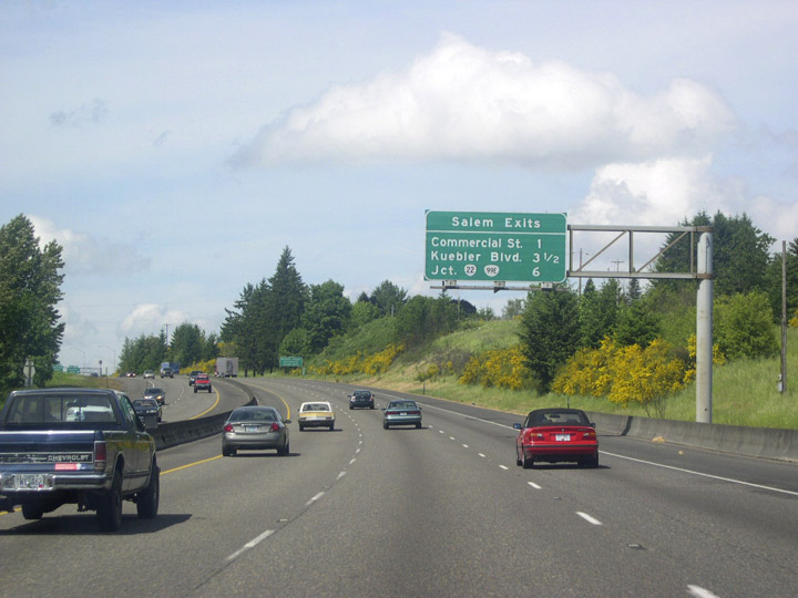
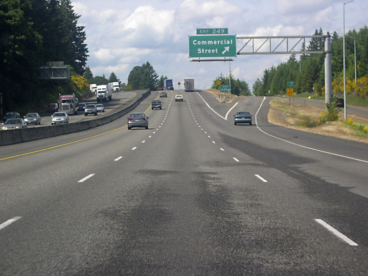
| Exits 248 and 249 depart in quick succession from I-5 north for Delaney Road and Commercial Street into Salem. Directly east of the freeway along Rodgers Creek is the Enchanted Forest. Located along the frontage road (Enchanted Way SE), this local attraction began as the work of single individual in the 1960s. It eventually grew into a full-fledged amusement park with a storybook theme. 05/22/06 |
|
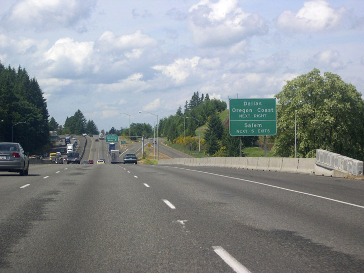
| The next five exits lead into Salem, Oregon's capitol and second largest city. One of the state's oldest towns, Salem was platted on a former mission site in 1844 and was named after Salem, Massachusetts. OR 22 and 223 lead west from Salem to Dallas. The Oregon Coast is a little over an hour's drive west on OR 22. 05/22/06 |
|
| A c/d roadway extends north from Delaney Road to the wye interchange (Exit 249) with Commercial Street. Formerly signed as OR 99E, Commercial Street is a commercial arterial leading north six miles to OR 22 in Downtown Salem. 05/22/06 |
|
| Formerly routed down Commercial Street, OR 99E remains co-signed with Interstate 5 past Exit 249. 05/22/06 |
|
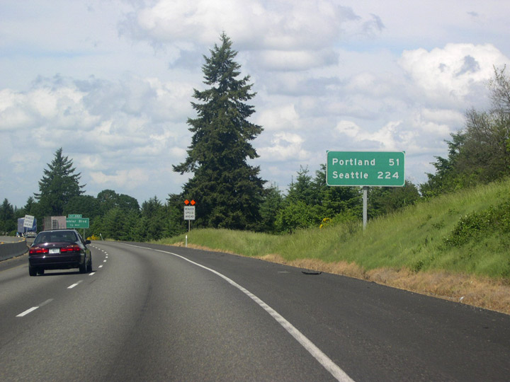
| As usual, the newer and larger city of Seattle upstages the older, smaller city of Portland. Distance to the Emerald City, 224 miles, is given even before Interstate 5 reaches Portland, which is still 51 miles north. 05/22/06 |
|
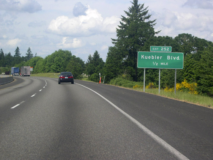
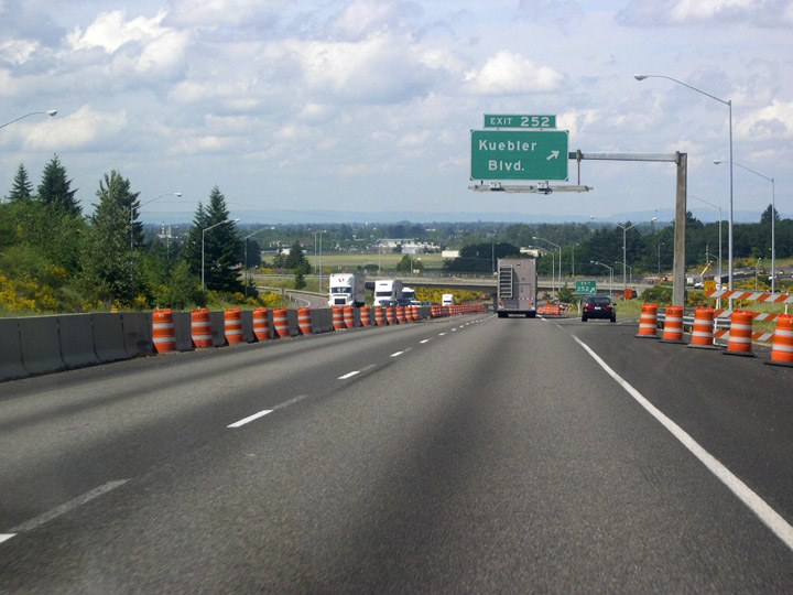
| Exit 252 departs in a half mile for Keubler Boulevard, which leads west to Commercial Street for the Salem Historic District. 05/22/06 |
|
| Kuebler Boulevard is an arterial belt route joining south Salem with OR 22 (Santiam Highway) to the northeast via Cordon Road. 05/22/06 |
|
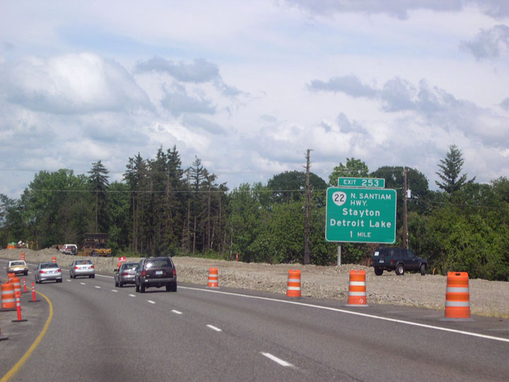
| Curving to the northeast around McNary Field (SLE), I-5 next meets OR 22 (North Santiam Highway). 05/22/06 |
|
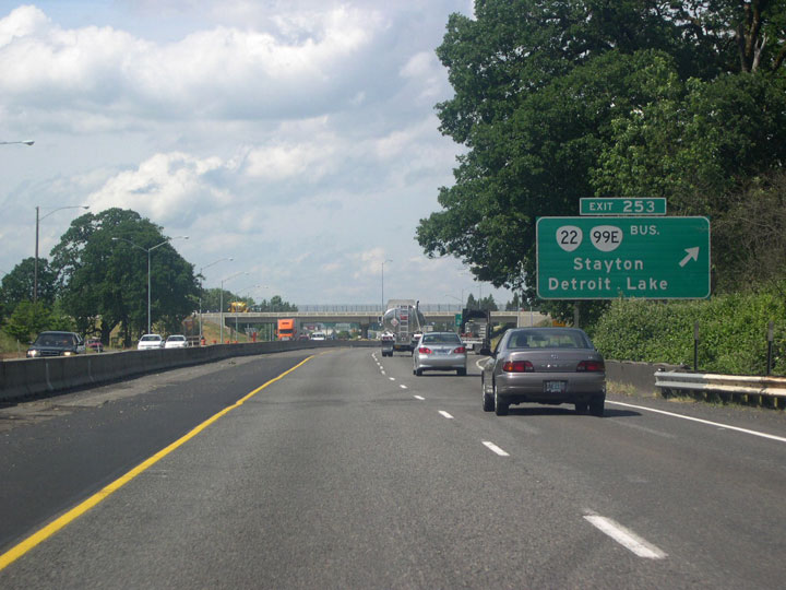
| Entering the six-ramp parclo interchange with OR 22 on I-5 & OR 99E north. West of Exit 253, OR 22 (North Santiam Highway) heads into Salem along Mission Street. OR 99E Business west to Downtown Salem and north along Salem Parkway, was subsequently decommissioned. 05/22/06 |
|
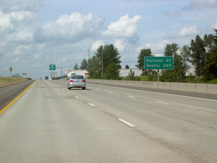
| The speed limit through the Salem vicinity along I-5 is consistently posted at 60 m.p.h. Approaching State Street, Portland is 47 miles away, followed by Seattle in 220 miles. 05/22/06 |
|
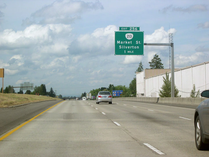
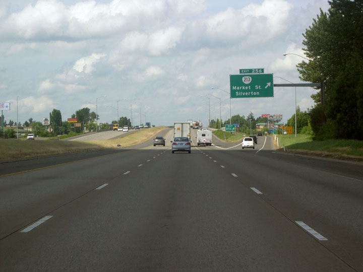
| A single point urban interchange (SPUI) joins I-5 with OR 213 (Market Street) 1.25 miles north of State Street. 05/22/06 |
|
| Exit 256 leaves I-5 north for Market Street and OR 213. OR 213 dog legs north along Lancaster Drive to Silverton Road en route to the cities of Silverton and Molalla. Westbound Market Street heads to the Salem city center. 05/22/06 |
|
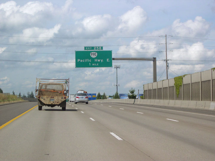
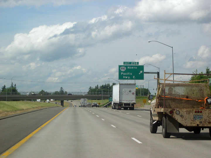
| OR 99E branches northeast from Interstate 5 at Upcoming exit 258. 05/22/06 |
|
| Chemeketa Community College lies east of Exit 258 and south of Pacific Highway East along Lancaster Drive in the community of Hayesville. 05/22/06 |
|
| The old alignment of U.S. 99E/OR 99E (Portland Road NE) extends from central Salem to a six-ramp parclo interchange (Exit 258) with Interstate 5. OR 99E rejoins its original alignment and continues northbound as Pacific Highway East. 05/22/06 |
|
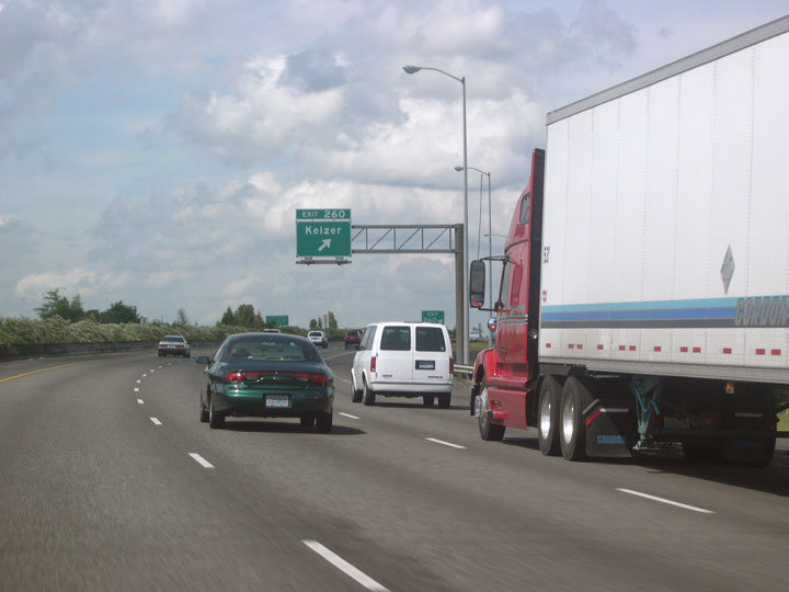
| Forthcoming Exit 260 for Chemawa Road and the city of Keizer also leads motorists toward the Oregon Garden. Located in the city of Silverton and dedicated in 1999, the site features over 20 specialty gardens and is watered with recycled wastewater. 05/22/06 |
|
| Exit 260 partitions from I-5 north ahead of the wye interchange with the north end of Salem Parkway (proposed Interstate 305). Chemawa Road east becomes Hazelgreen Road ahead of Silverton and the Oregon Garden. The Salem suburb of Keizer lies directly west of the freeway here. 05/22/06 |
|
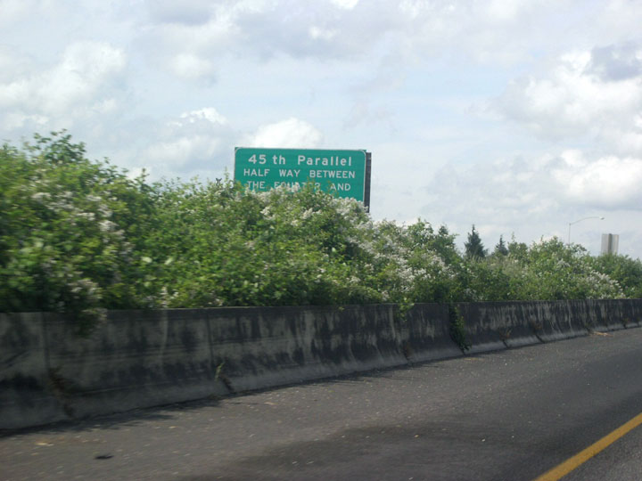
| Northbound drivers on Interstate 5 will be closer to the North Pole than they are to the equator after the freeway crosses the 45th parallel just north of Keizer. 05/22/06 |
|
| The on-ramp from Salem Parkway (former OR 99E Business) merges with I-5 north beyond the Chemawa Road overpass. 05/22/06 |
|
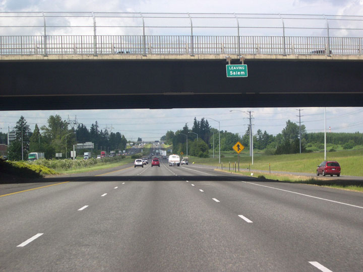
| Interstate 5 heads north to Portland. There will be at least three lanes in each direction for the rest of the way to the Rose City. 05/22/06, 08/27/06 |
|
| The first distance sign after leaving the Salem area shows Portland is 40 miles away. Distances to Seattle are no longer given. 05/22/06 |
|
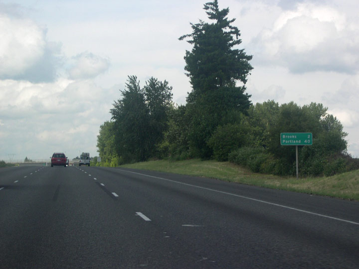
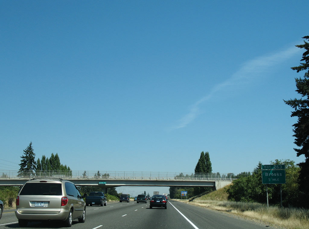
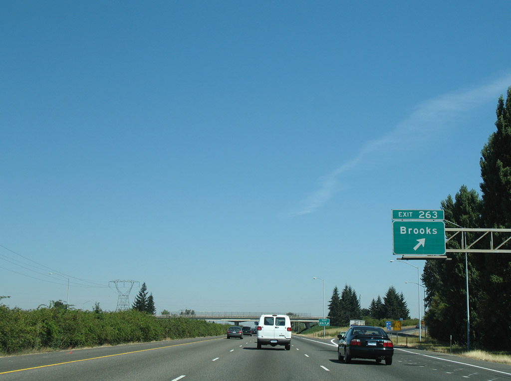
| Continuing north, Interstate 5 travels one mile to Exit 263 for the unincorporated community of Brooks. 08/27/06 |
|
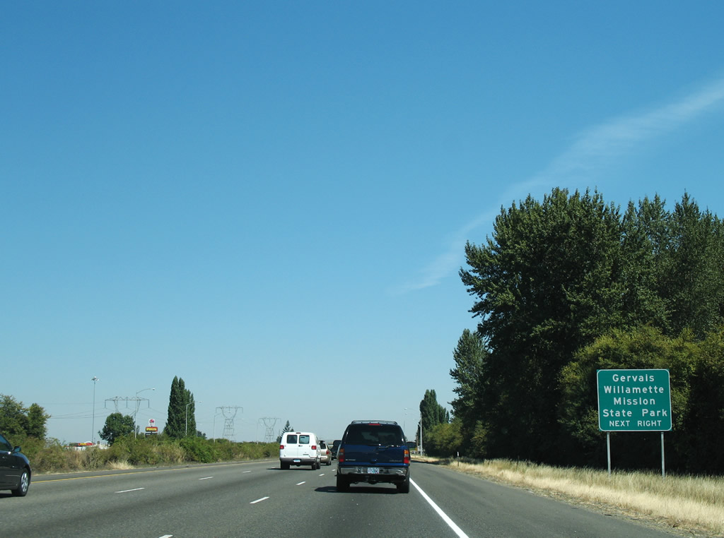
| Parallel OR 99E (Pacific Highway East) leads northeast from Brooks to the city of Gervais. Willamette Mission State Park lies 5.7 miles to the northwest of the approaching diamond interchange at Exit 263. 08/27/06 |
|
| Interstate 5 reaches Exit 263 for Brooklake Road west to Wheatland Road and east to OR 99E (Portland Road) in Brooks. 08/27/06 |
|
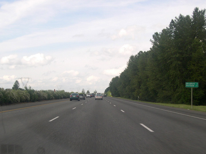
| The ensuing straight aways north from Brooks lead I-5 eight miles to the city of Woodburn. High-voltage transmission lines run along the west side of the freeway almost to Wilsonville. 05/22/06, 08/27/06 |
|
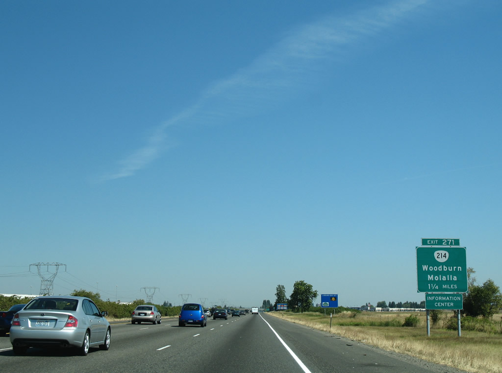
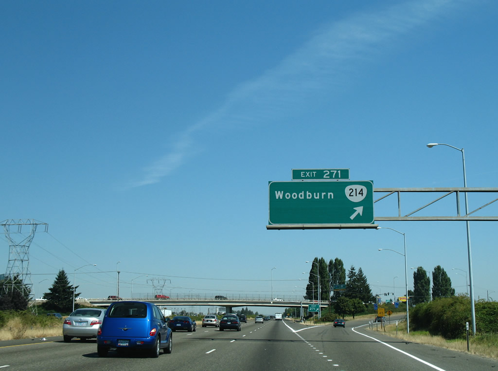
| Interstate 5 converges with OR 214 (Hillsboro-Silverton Highway) within western reaches of Woodburn. Surrounded by Willamette Valley farmland, this city of over 25,000 is home to the annual Woodburn Tulip Festival. 08/27/06 |
|
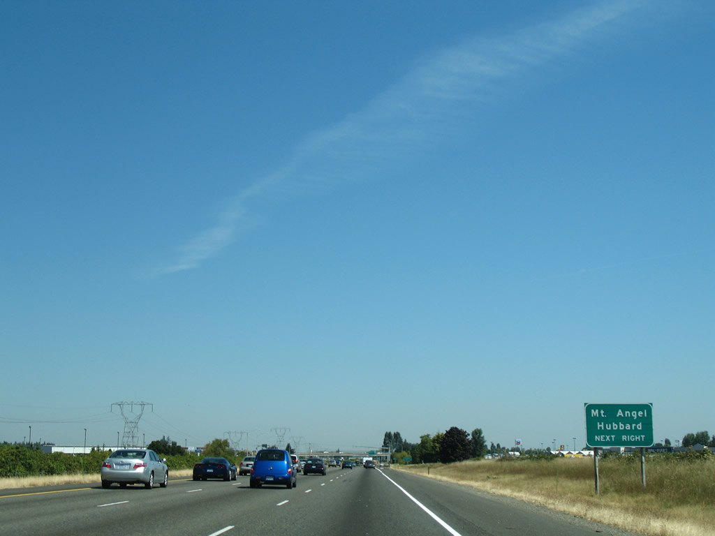
| South from Woodburn, OR 214 travels to Mt. Angel, home of the locally famous Mt. Angel Oktoberfest. Hubbard lies north of Woodburn on OR 99E. 08/27/06 |
|
| Interstate 5 meets OR 214 at a six-ramp parclo interchange (Exit 217) by the Woodburn Premium Outlets. OR 214 west leads to Newberg. OR 211 extends east from OR 214 and 99E in Woodburn 12 miles to the city of Molalla. 08/27/06 |
|
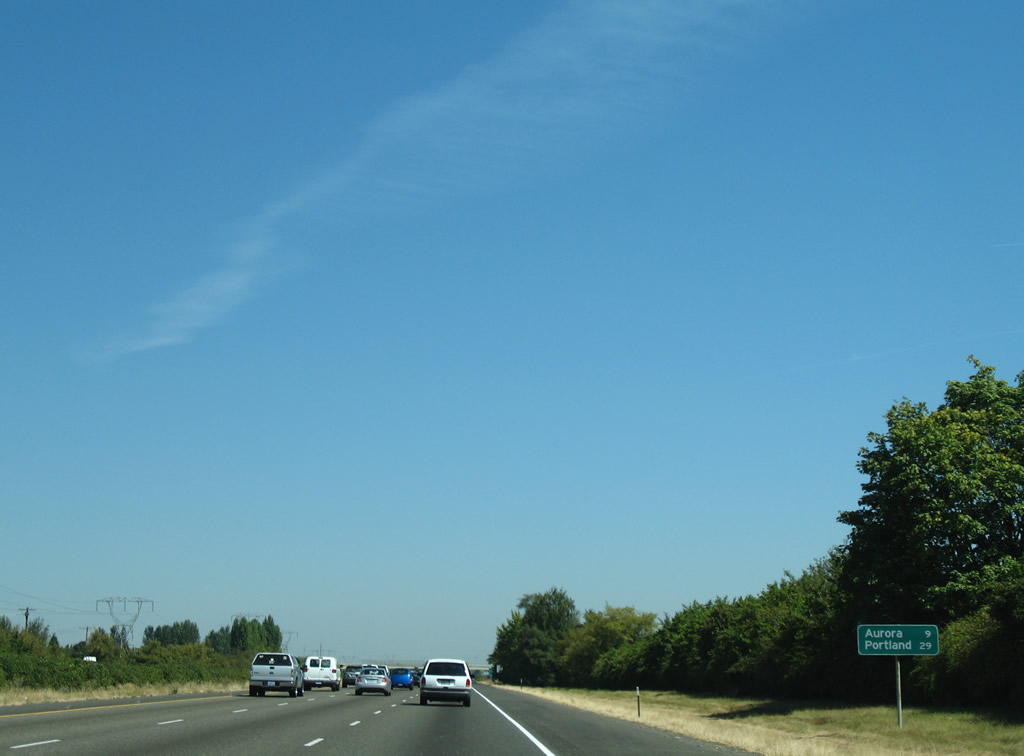
| The scenery does not change much after leaving Woodburn. Portland is now 29 miles north. 08/27/06 |
|
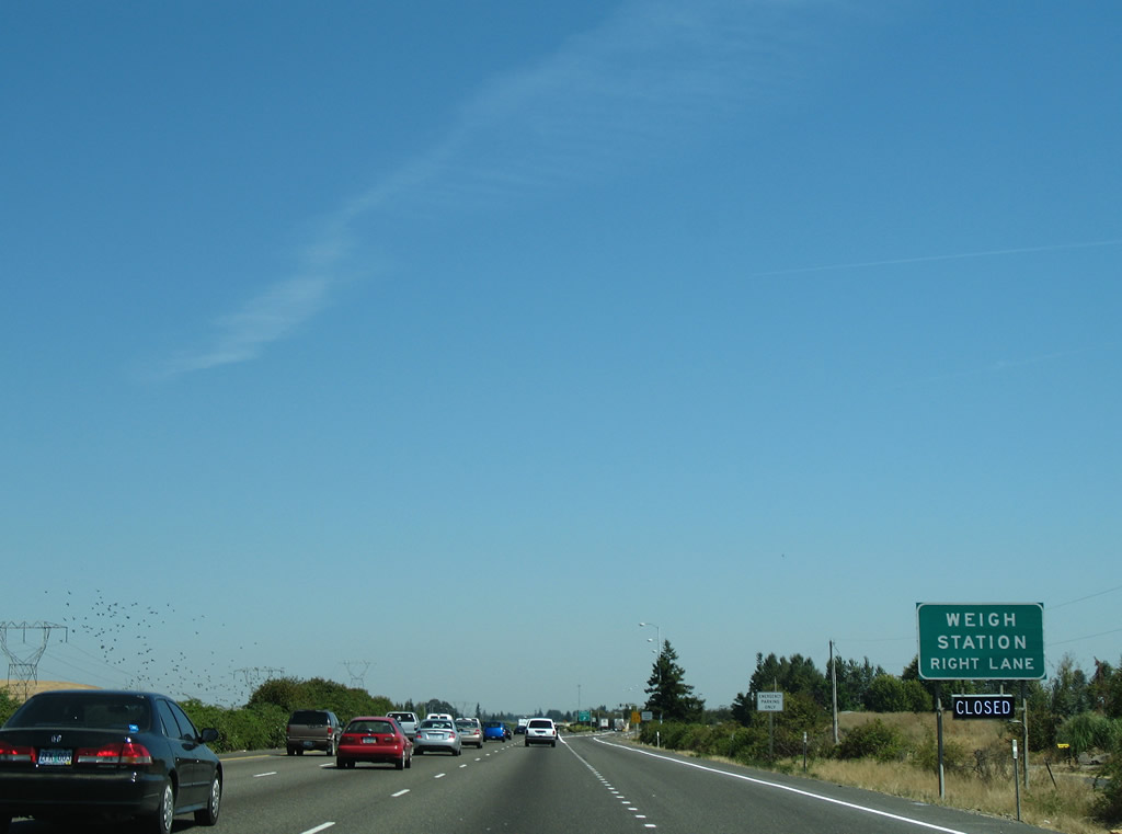
| The weigh station north of Woodburn operates with a "green light" weigh-in -motion preclearance site, allowing trucks equipped with certain transponders to bypass the station. This option saves fuel and reduces emissions. 08/27/06 |
|
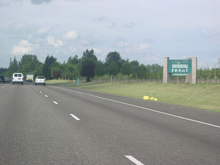
| An Oregon Turf and Tree Farms sign reminds travelers that the Willamette Valley is one of the nation's premiere nursery stock and grass growing regions. A mild but seasonal climate provides a long growing season while still allowing for sufficient winter chilling many temperate plants need. 05/22/06 |
|
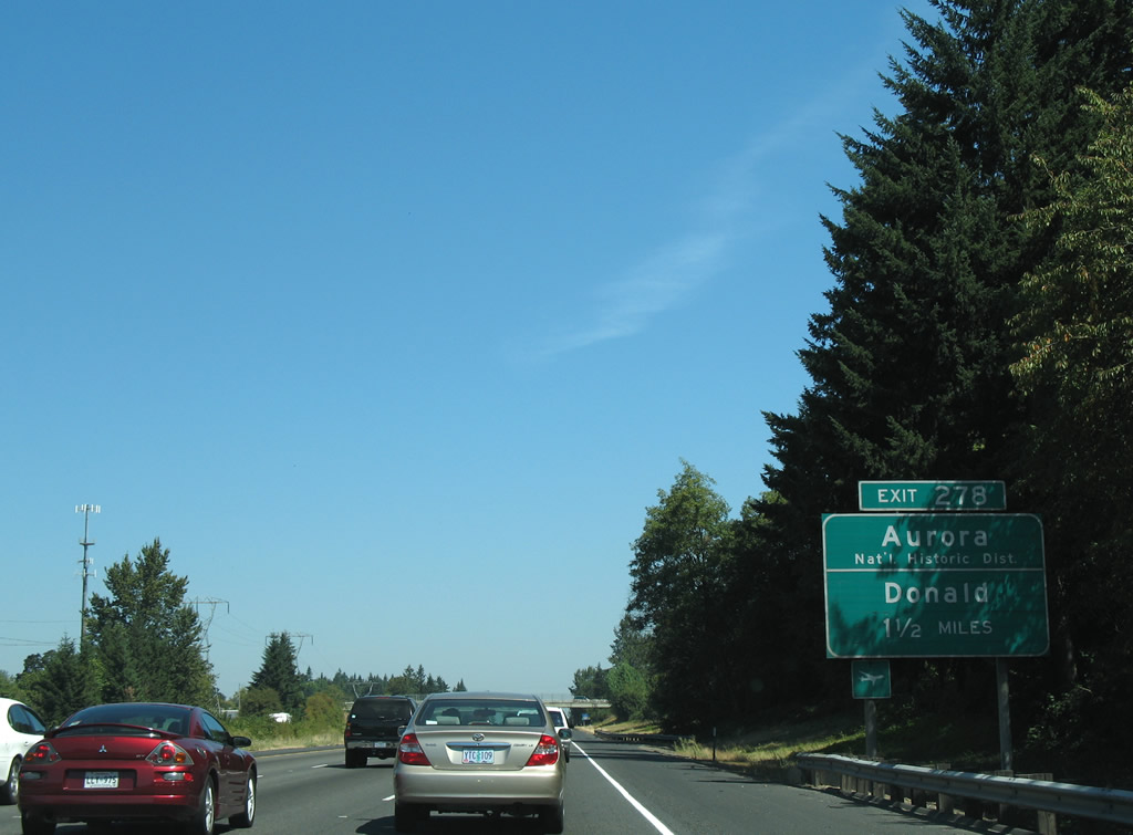
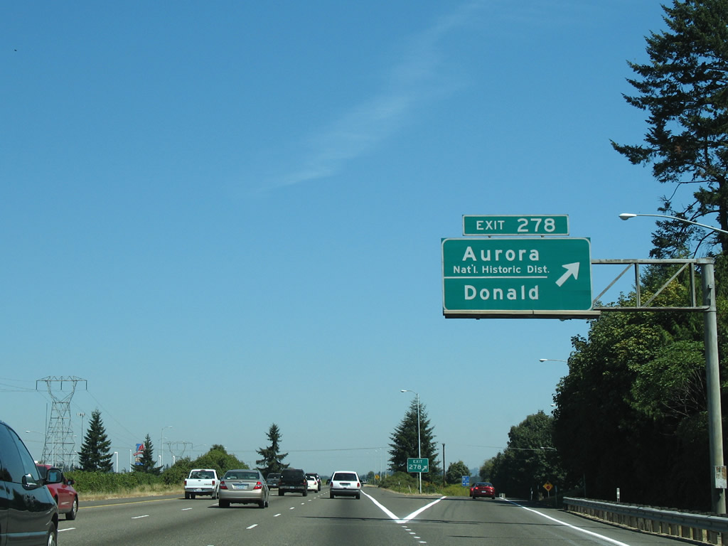
| Ehlen Road connects Interstate 5 from the succeeding exit with the city of Aurora. Located 2.7 miles to the east, Aurora includes a National Historic District and is the location of the Old Aurora Colony Museum. Some of Oregon's oldest Euro-American sites are located in this part of the state. 08/27/06 |
|
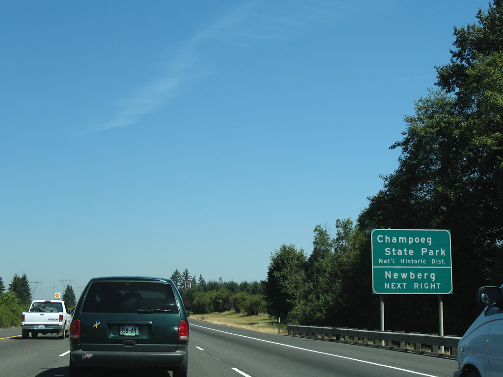
| Also accessible from Exit 278 is another National Historic District, Champoeg State Park, located west of the freeway along the Willamette River. A French name, "Champoeg" is pronounced "sham-POO-ee". 08/27/06 |
|
| Northbound Interstate 5 enters the diamond interchange (Exit 278) with Ehlen Road to the northeast of the city of Donald. 08/27/06 |
|
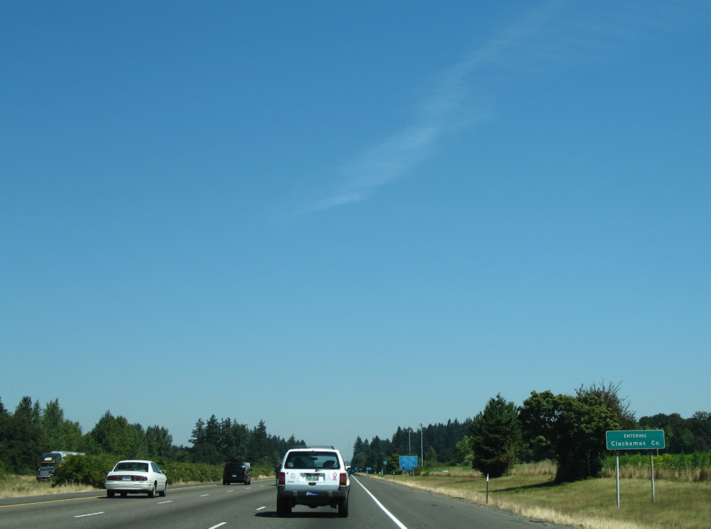
| I-5 crosses into Clackamas County. 08/27/06 |
Page Updated 11-29-2010.

 North
North