|
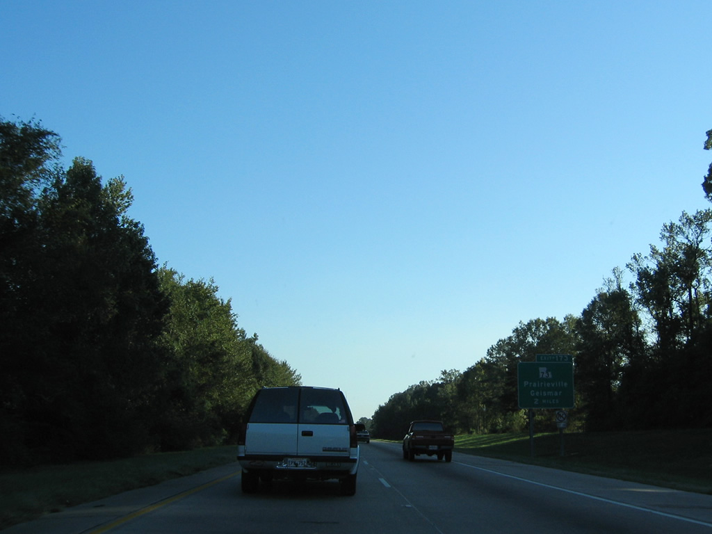
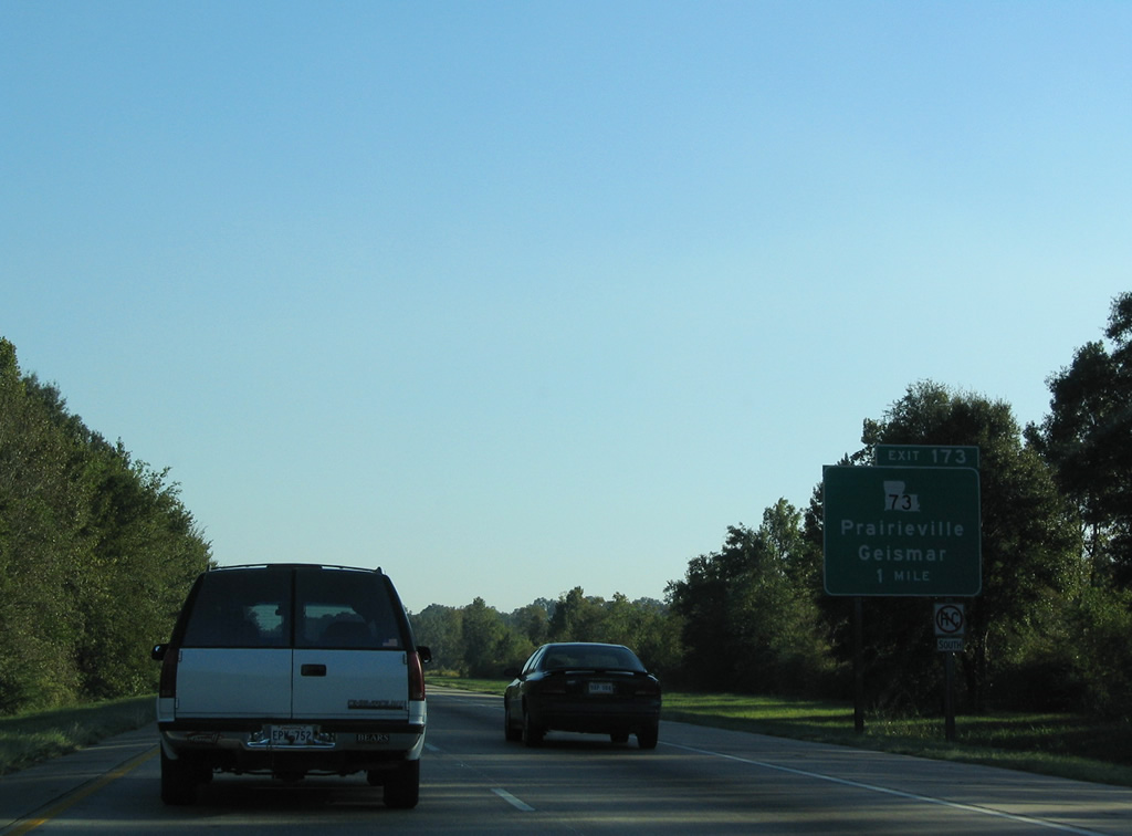
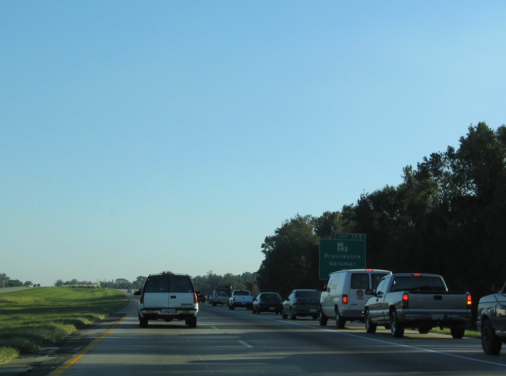
| LA 73 loops 26.3 miles from Saint Phillips Street at Downtown Baton Rouge to Geismar and LA 75. The state highway serves the Praireville community within the vicinity of Exit 173. 10/22/03 |
|
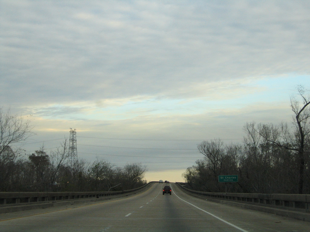
| One mile out from the diamond interchange (Exit 173) with LA 73 (Old Jefferson Highway) along Interstate 10 east. 10/22/03 |
|
| Commuter traffic separates at succeeding exits from I-10 eastt throughout Ascension Parish. Traffic counts decrease from a peak of 66,897 [2010] vehicles per day (vpd) ahead of Exit 173 to 27,708 [2010] vpd beyond Exit 187. 10/22/03 |
|
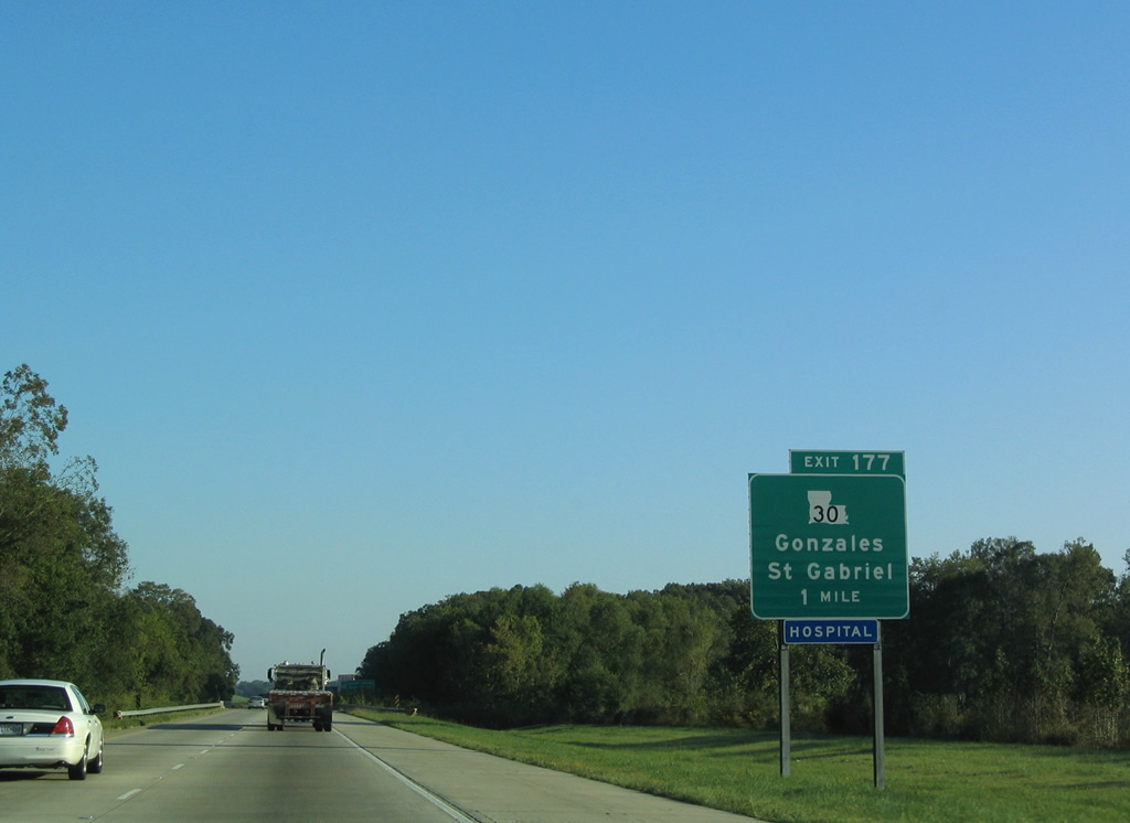
| Beginning at I-10 in Baton Rouge at Exit 155B, LA 30 returns to Interstate 10 at Exit 177 in the city of Gonzalez. 10/22/03 |
|
| Westward LA 30 ventures ten miles to the Mississippi River community of Saint Gabriel and LA 74. The highway also provides an alternate route to Geismar via LA 73. 10/22/03 |
|
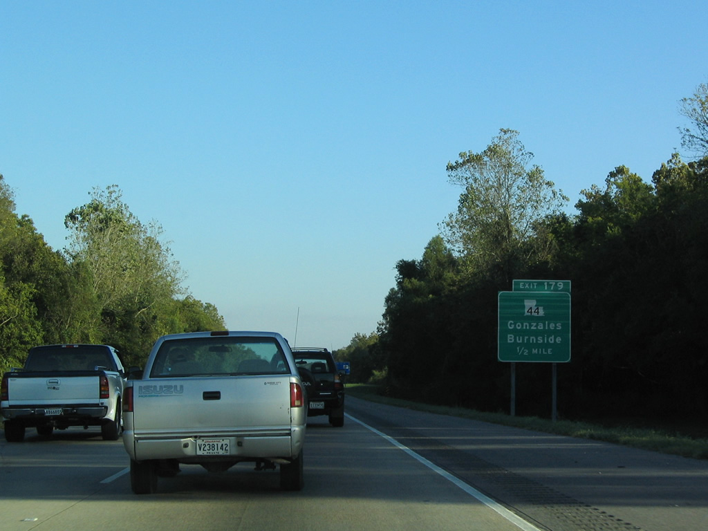
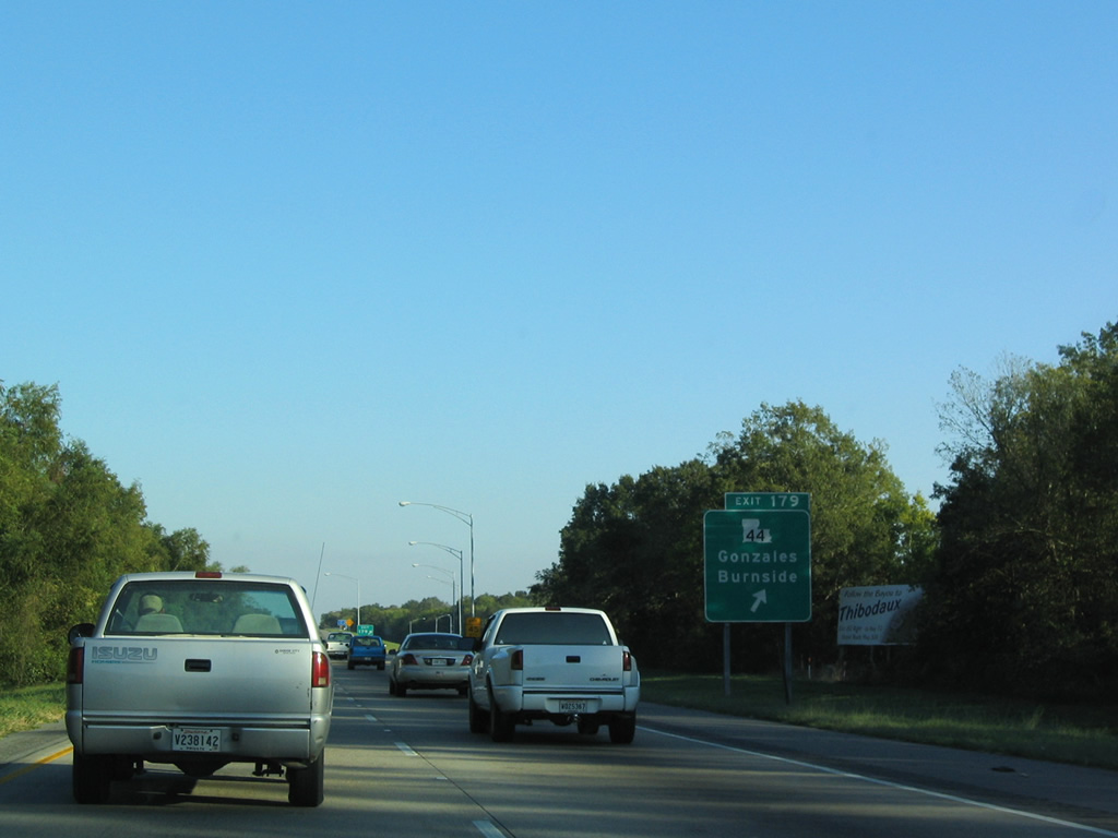
| LA 44 (Burnside Avenue) represents the second access point for the city of Gonzalez on I-10. The 50.1 mile highway straddles the Mississippi River between Laplace and Burnside before turning northward toward Gonzalez and Exit 179. 10/22/03 |
|
| I-10 eastbound at the diamond interchange (Exit 179) with LA 44 (Burnside Avenue). LA 44 travels five miles north of U.S. 61 and Gonzalez to LA 42 at Little Prairie. LA 44 travels 3.5 miles southward to Burnside. 10/22/03 |
|
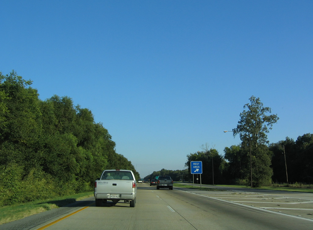
| A pair of rest areas lined both sides of Interstate 10 between Exit 178 and 182. Closed by 2005, these facilities were subsequently demolished. 10/22/03 |
|
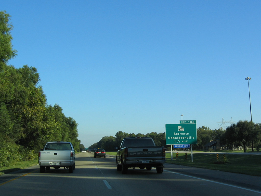
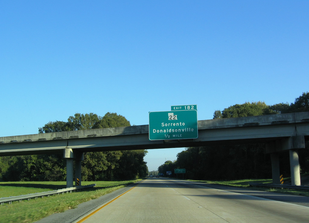
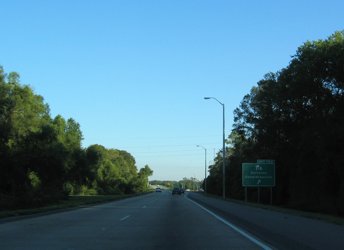
| The diamond interchange (Exit 181) with LA 22 lies 1.25 miles southeast of the former rest area. LA 22 converges with I-10 two miles south of Sorrento and U.S. 61 (Airline Highway). 10/22/03 |
|
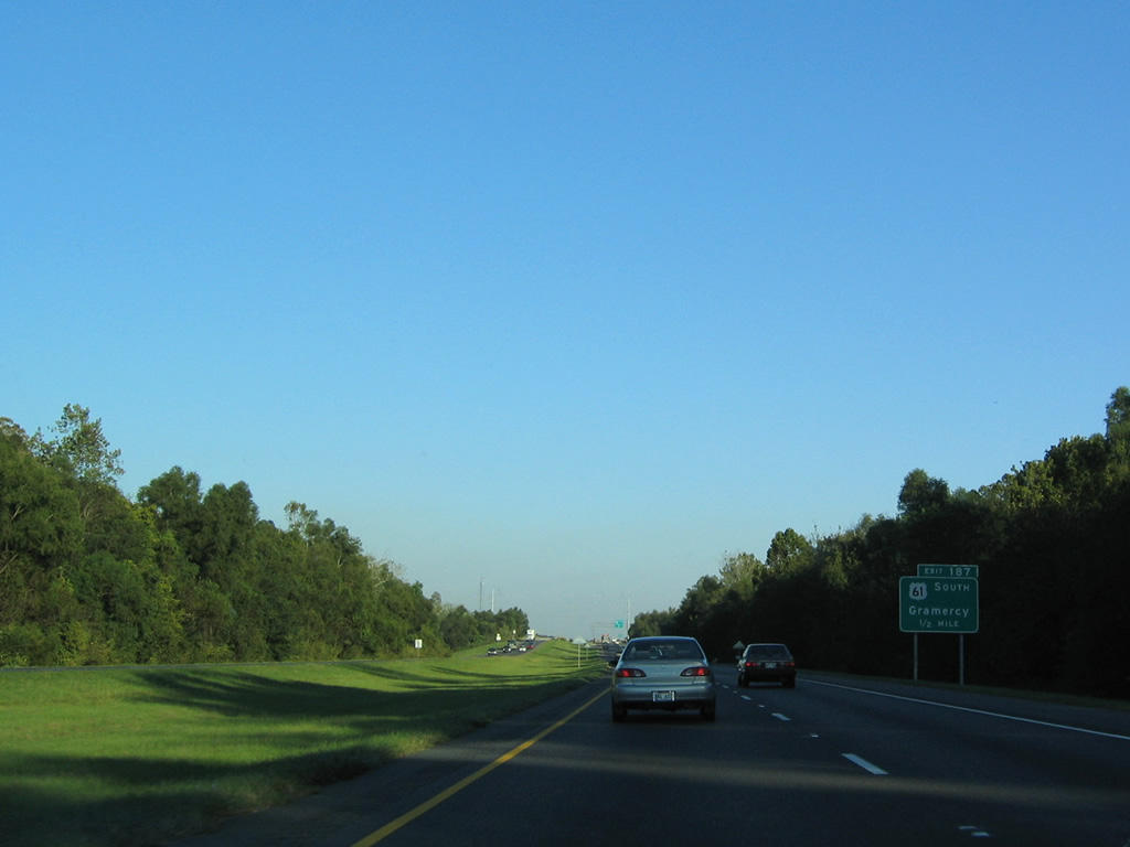
| Exit 182 departs a half mile beyond the LA 941 overpass for LA 22/70. A 50.9 mile long route from LA 22 nearby to Morgan City, LA 70 is the lone Mississippi River crossing between Baton Rouge and Gramercy. LA 70 crosses the waterway between Union and Donaldsonville along the Sunshine Bridge. 10/22/03 |
|
| LA 22 begins eight miles west of Interstate 10 at LA 75 and the riverside community of Darrow. The state highway forms a 71.9 mile arc through Sorrento, Ponchatoula, and the Lake Pontchartrain Northshore communities of Madisonville and Mandeville. 10/22/03 |
|
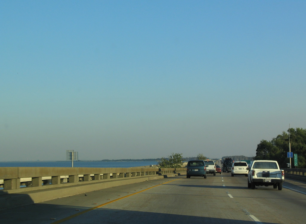
| Interstate 10 passes by Bayou Conway along the lengthy stretch traversing wetland areas east to Kenner in Jefferson Parish. 10/22/03 |
|
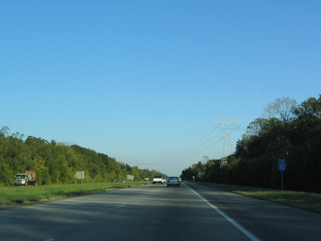
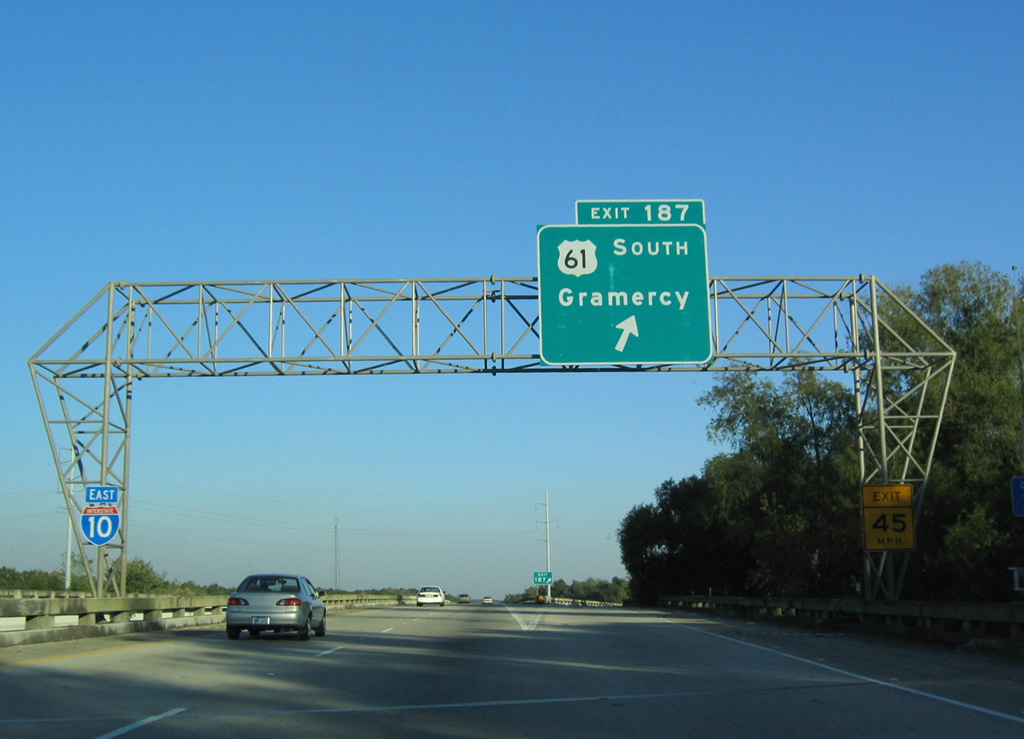
| U.S. 61 (Airline Highway) angles southeast across Interstate 10 at Exit 187 en route to the town of Gramercy along the Mississippi River. 10/22/03 |
|
| I-10/U.S. 61 converge at overlapping wye interchanges. Exit 187 joins I-10 east with southbound U.S. 61 (Airline Highway). Both highways east enter Maurepas Swamp Wildlife Management Area within the next three miles. 10/22/03 |
|
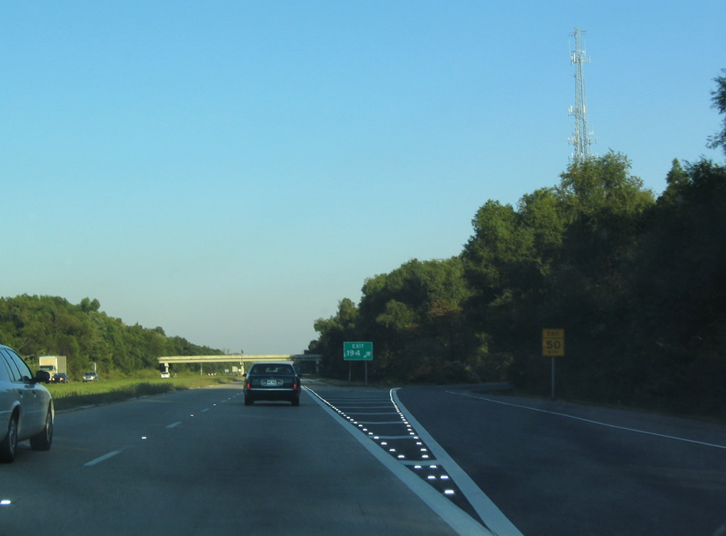
| I-10 meets LA 641 at a diamond interchange (Exit 194) within the northeastern corner of Saint James Parish. LA 641 stems south 6.86 miles to the Veterans Memorial Bridge (LA 3213) across the Mississippi River and LA 44 (Jefferson Highway) in Gramercy. The exchange with LA 641 opened in 1981. 10/22/03 |
|
| Interstate 10 expands onto a pair of viaducts 3.55 miles eastward across the Reserve Relief Canal through St. John the Baptist Parish. This stretch of freeway was completed in 1975. 10/22/03 |
|
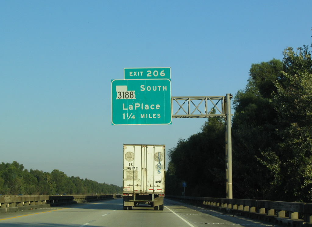
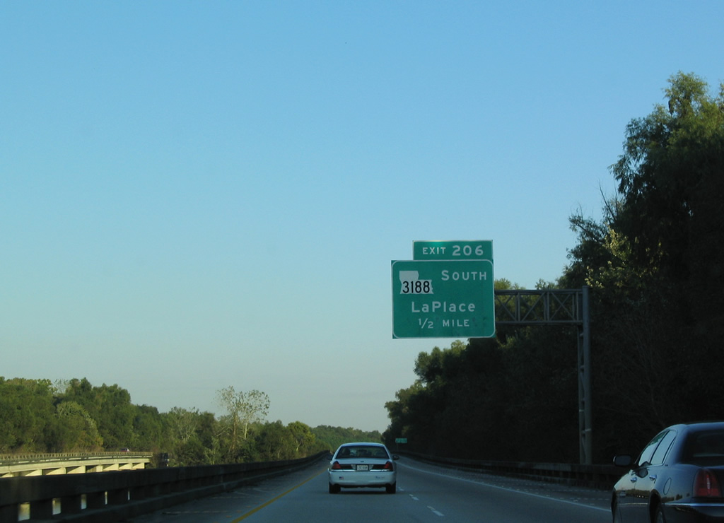
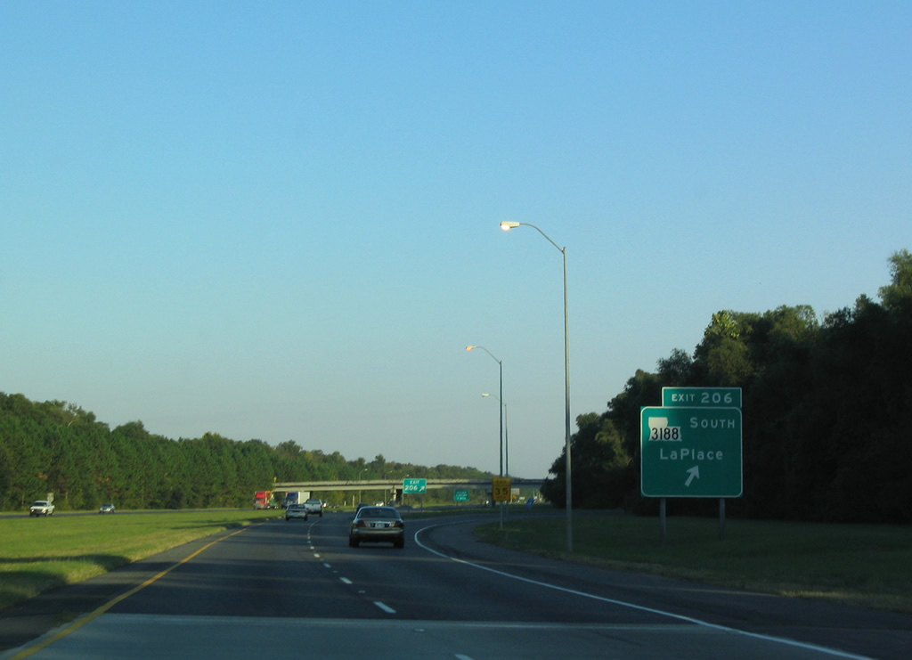
| Leaving Maurepas Swamp Wildlife Management Area, a 12 mile exit less stretch concludes at LA 3188 (Belle Terre Boulevard), a 3.11 mile long connector between I-10 and U.S. 61 (Airline Highway). 10/22/03 |
|
| LA 3188 (Belle Terre Boulevard) opened south from the trumpet interchange (Exit 206) with I-10 in 1984. 10/22/03 |
|
| The bedroom community of La Place spreads along the U.S. 61 corridor between LA 54 near Garyville and U.S. 51 (Main Street). A four lane arterial, LA 3188 winds southward between subdivisions and apartment complexes. 10/22/03 |
|
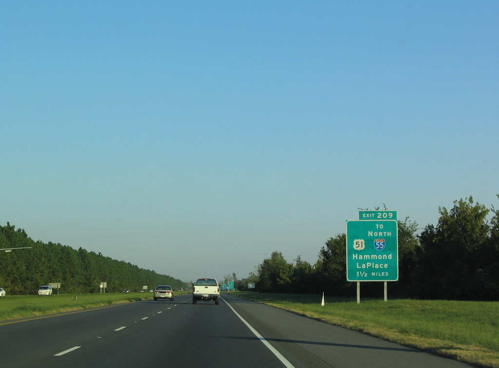
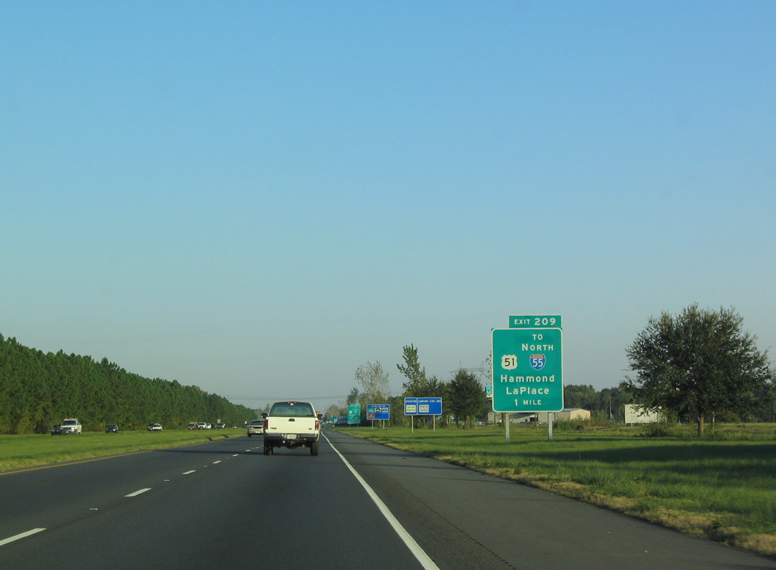
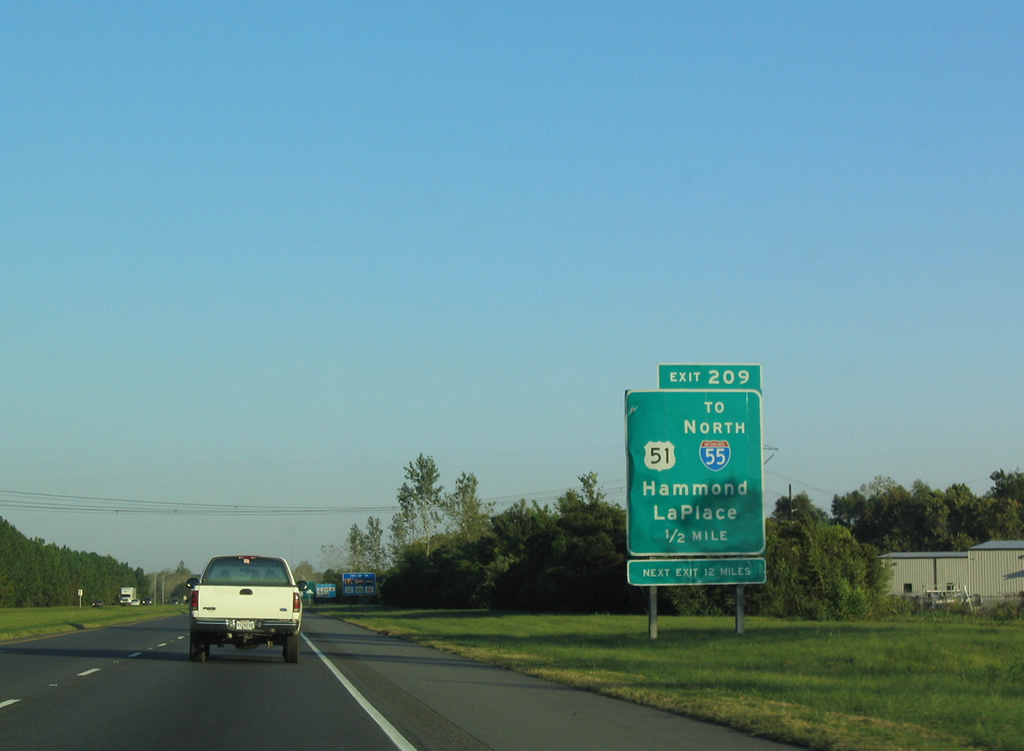
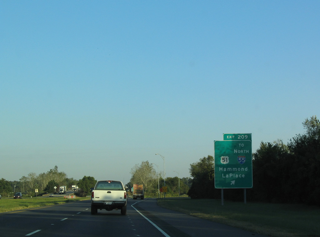
| A Breezewood connection joins I-10 east with Interstate 55 north via U.S. 51 at Exit 209. U.S. 51 stems 3.60 miles north from U.S. 61 to combine with I-55 nearby. The two overlap north to Exit 28 at Hammond. 10/22/03 |
|
| One mile out from the diamond interchange (Exit 209) with U.S. 51. I-55 constitutes a 964 mile long route northward to Jackson, Mississippi, Memphis, Tennessee, St. Louis, Missouri, and Springfield, Illinois. The freeway concludes at Lakeshore Drive (U.S. 41) outside Downtown Chicago. 10/22/03 |
|
| Suburban development spreads north between LA 3188 and U.S. 51 from La Place to the south side of I-10. U.S. 51 (Main Street) expands to a five lane boulevard between Exit 209 and U.S. 61 (Airline Highway). 10/22/03 |
|
| Exit 209 departs Interstate 10 east to U.S. 51 (Main Street). U.S. 51 combines with I-55 north in 0.7 miles. I-55/U.S. 51 elevate on a narrow strip of land between Lakes Maurepas and Pontchartrain. Beyond the 21 mile long viaduct are the cities of Ponchatoula and Hammond. 10/22/03 |
|
| Southbound Interstate 55 concludes at a wye interchange with I-10 east. Traffic counts swell from 38,578 [2011] vpd ahead of I-55 to 56,319 [2011] vpd beyond the merge. 10/22/03 |
|
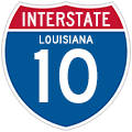
| A state-named shield for Interstate 10 formerly posted at the merge with I-55 south. This was the last original shield posted along I-10 eastbound in Louisiana. 05/24/06 |
|
| Predating the 1993-completion of I-310, the distance sign posted after I-55 references Loyola Drive at Kenner in ten miles. 10/22/03 |
|
| Interstate 10 angles toward the Lake Pontchartrain shoreline and exits St. John the Baptist Parish for St. Charles Parish. 01/15/06 |
|
| The freeway turns southeasterly from a levee to pass over the periphery of Lake Pontchartrain a short distance east from the parish line. 10/22/03 |
|
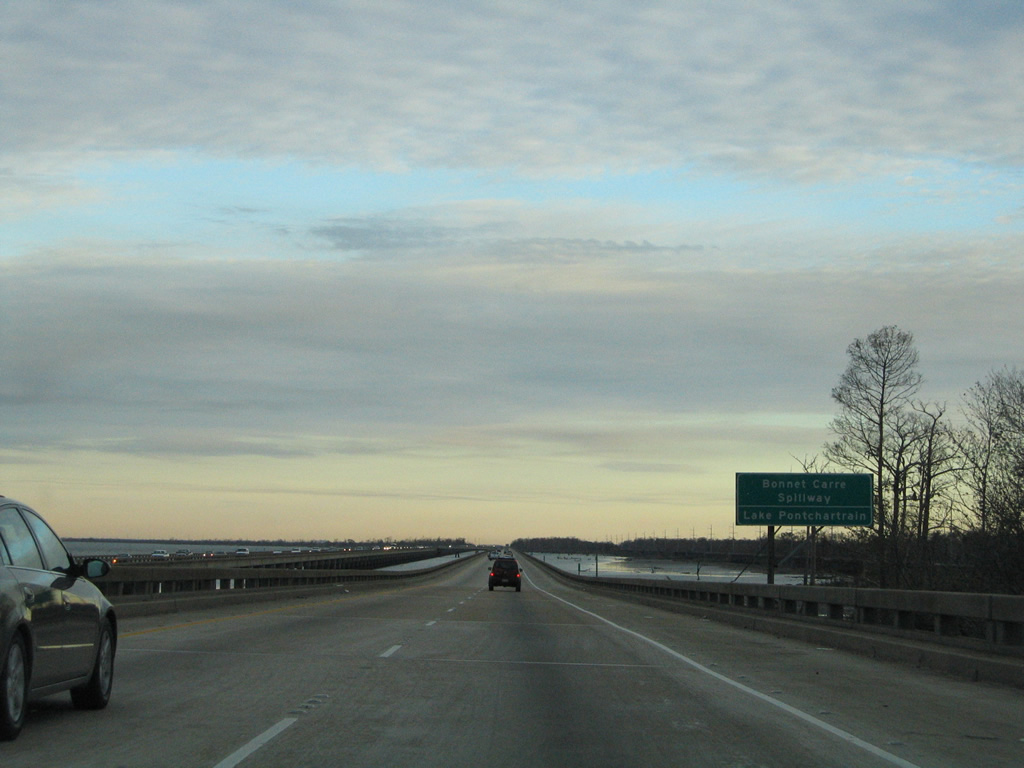
| I-10 traverses Lake Pontchartrain and the Bonnet Carre Spillway. The Spillway was constructed in 1931 as a safeguard against Mississippi River flooding downstream. When in operation, a portion of the water flowing down the Mississippi River is diverted through the spillway into Lake Pontchartrain.1 01/15/06 |
|
| The Interstate 10 viaducts across St. Charles Parish were completed in 1972. 10/22/03 |
|
| A transmission corridor spans Lake Pontchartrain from a junction just offshore to Kenner. 10/22/03 |
|
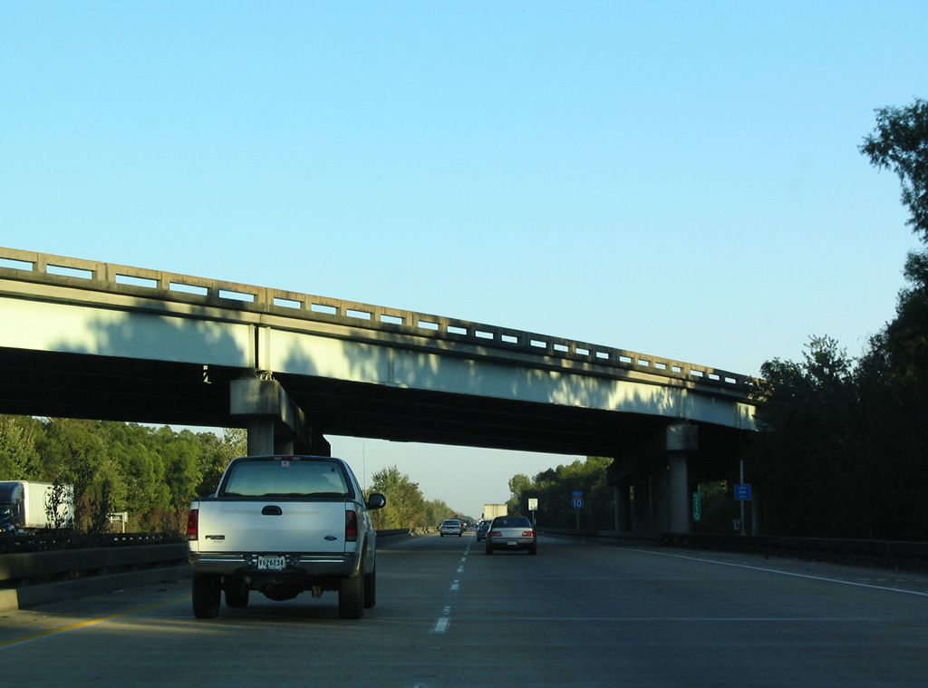
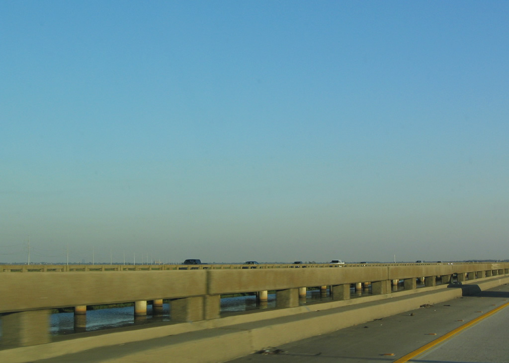
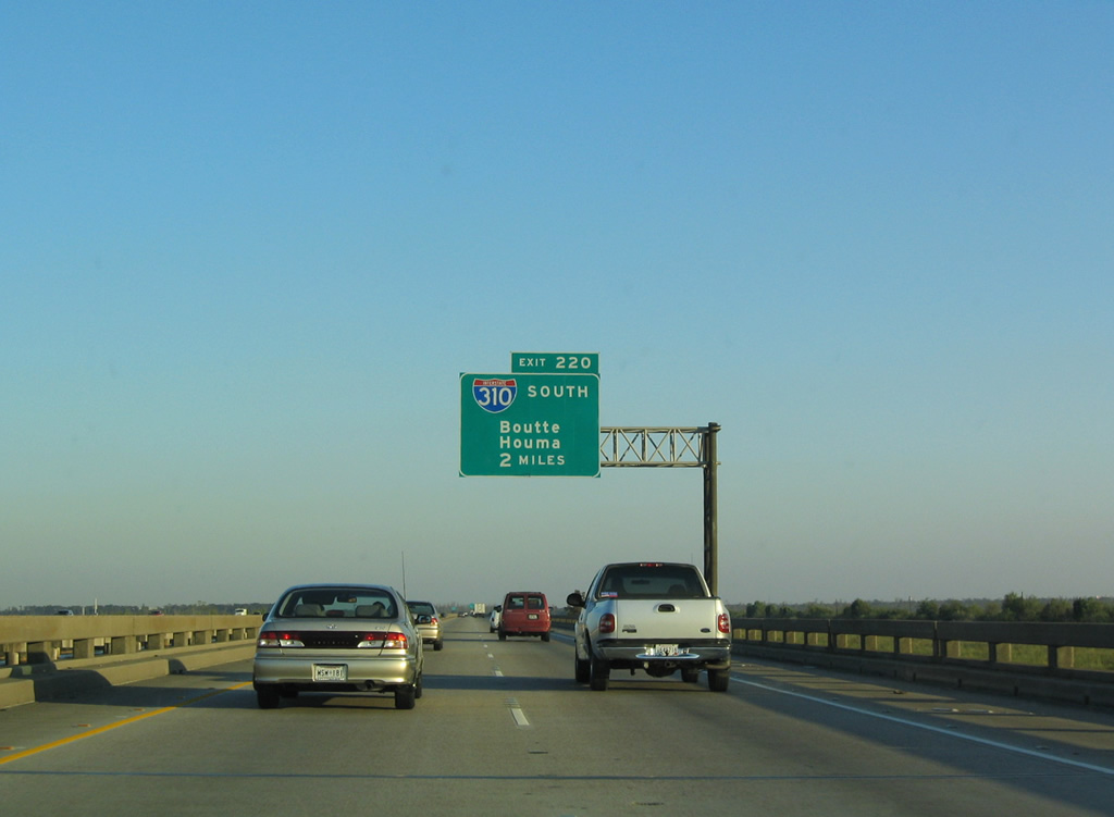
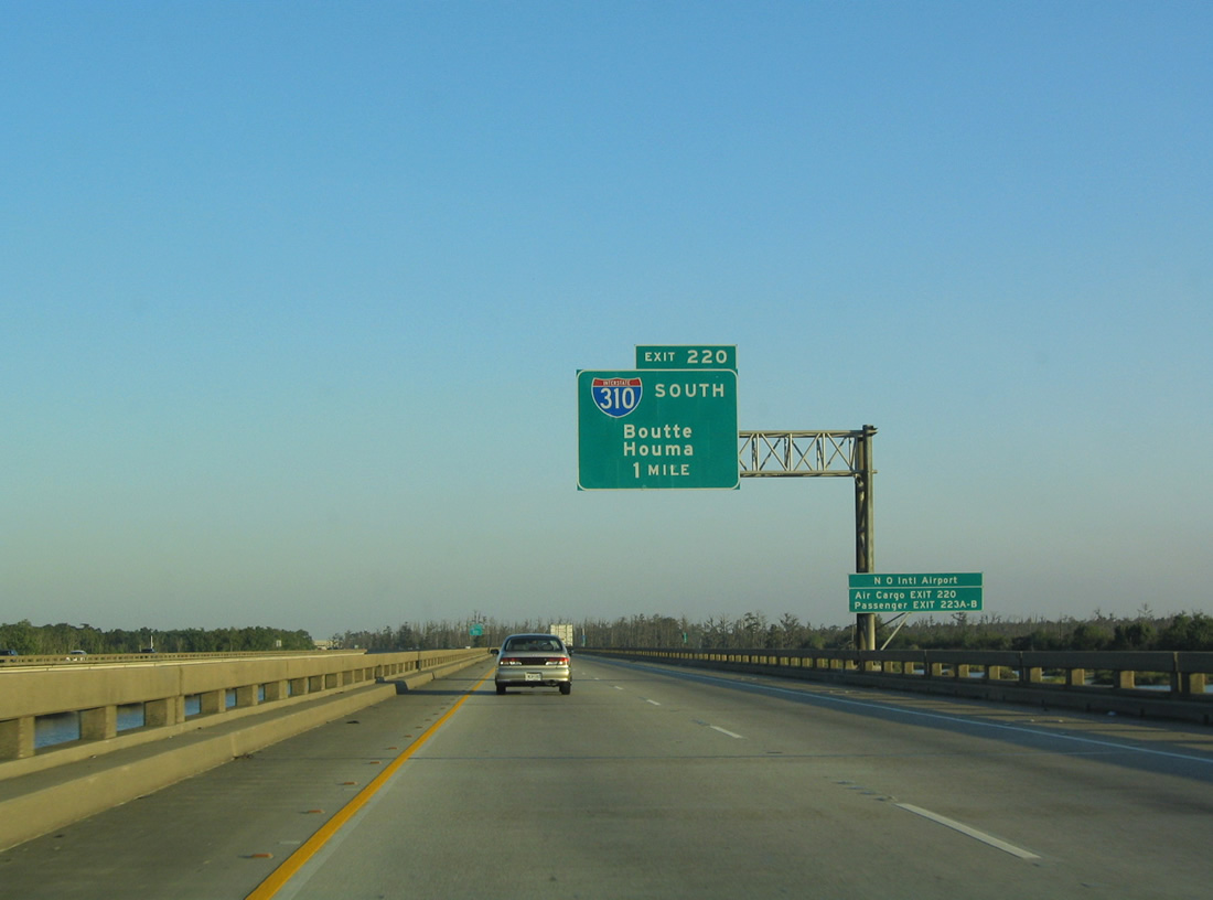
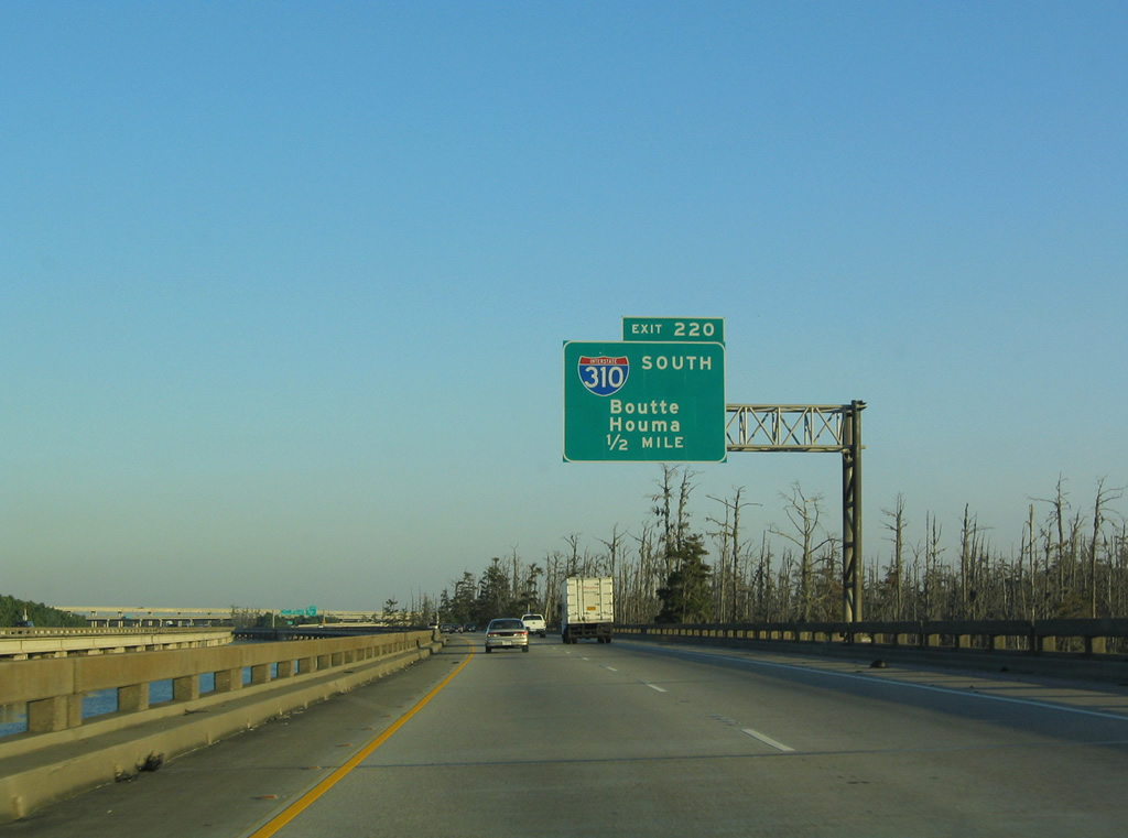
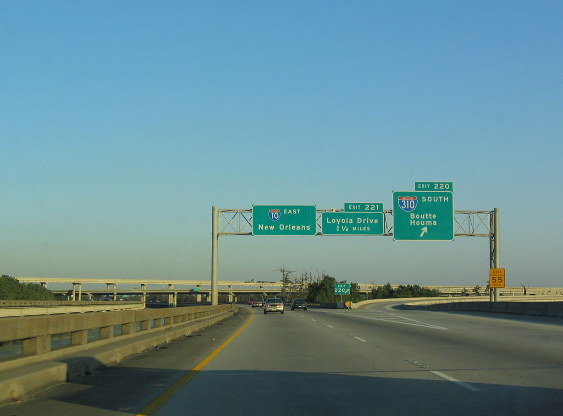
| Two miles west of Exit 220 for Interstate 310 south. The control cities of Boutte and Houma are displayed on a green-out. 10/22/03 |
|
| The final segment of I-310 opened was the directional T interchange (Exit 220) with I-10 and the 2.25 mile long viaduct south to U.S. 61 (Airline Highway).
Louis Armstrong New Orleans International Airport (MSY) lies southeast of the I-10/310 exchange along U.S. 61. 10/22/03 |
|
| Providing the eastern leg of a route to Houma and Morgan City via U.S. 90, Interstate 310 stretches 11.80 miles southwest from Exit 220 to Boutte. 10/22/03 |
|
| The first five miles of I-310 elevate along a bridge system. This stretch of viaduct in conjunction with I-10 east from I-55 at Laplace and I-55 north to Ponchatoula give a grand total of 38 miles of continuous elevated roadway. I-310 spans the Mississippi River between Destrehan and Luling across the Hale Boggs Bridge built in 1983. 10/22/03 |
|
| High speed flyovers carry I-10 westbound traffic onto I-310 south and I-310 northbound onto I-10 westbound above prime tupelo and cypress swamp. 10/22/03 |
|
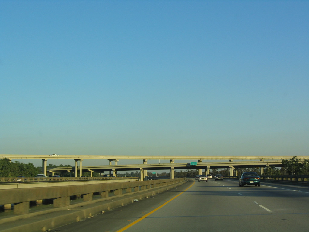
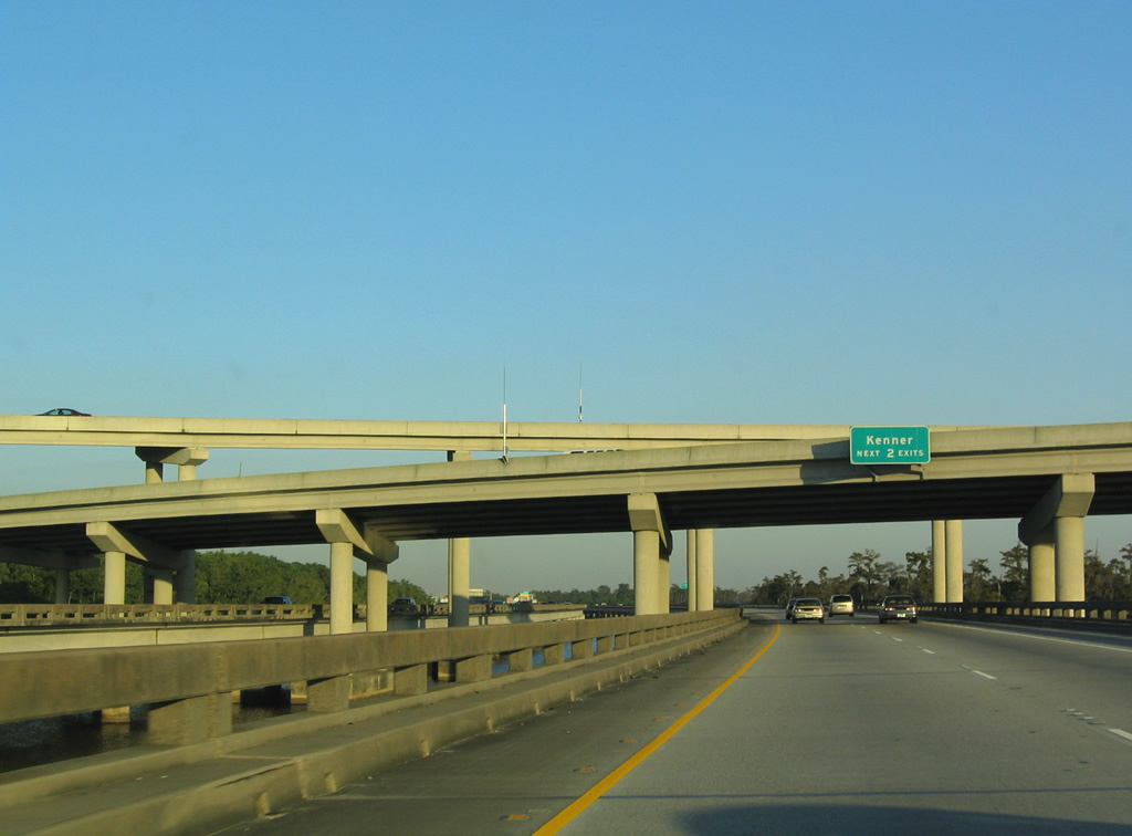
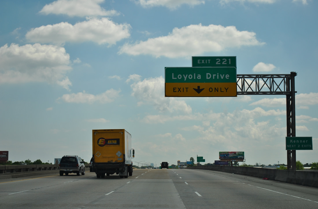
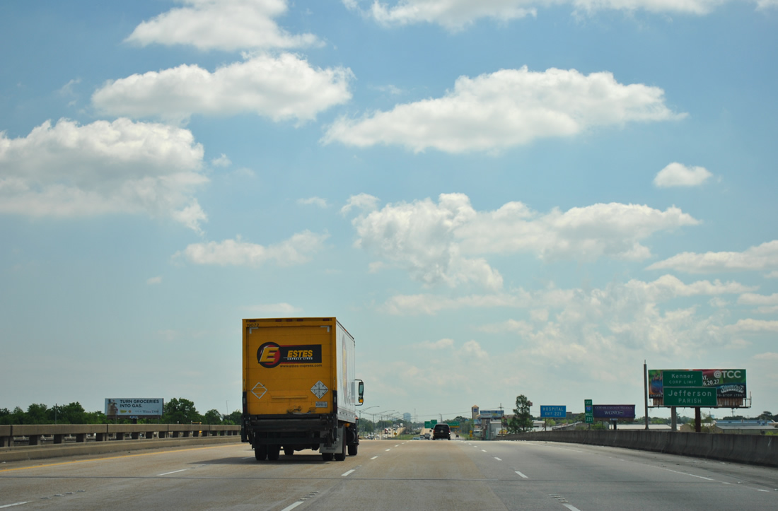
| Continuing from I-310, Interstate 10 enters the city of Kenner. Home to 66,702 as of the 2010 census, Kenner has two interchanges along I-10 (Exit 221 and 223). 10/22/03 |
|
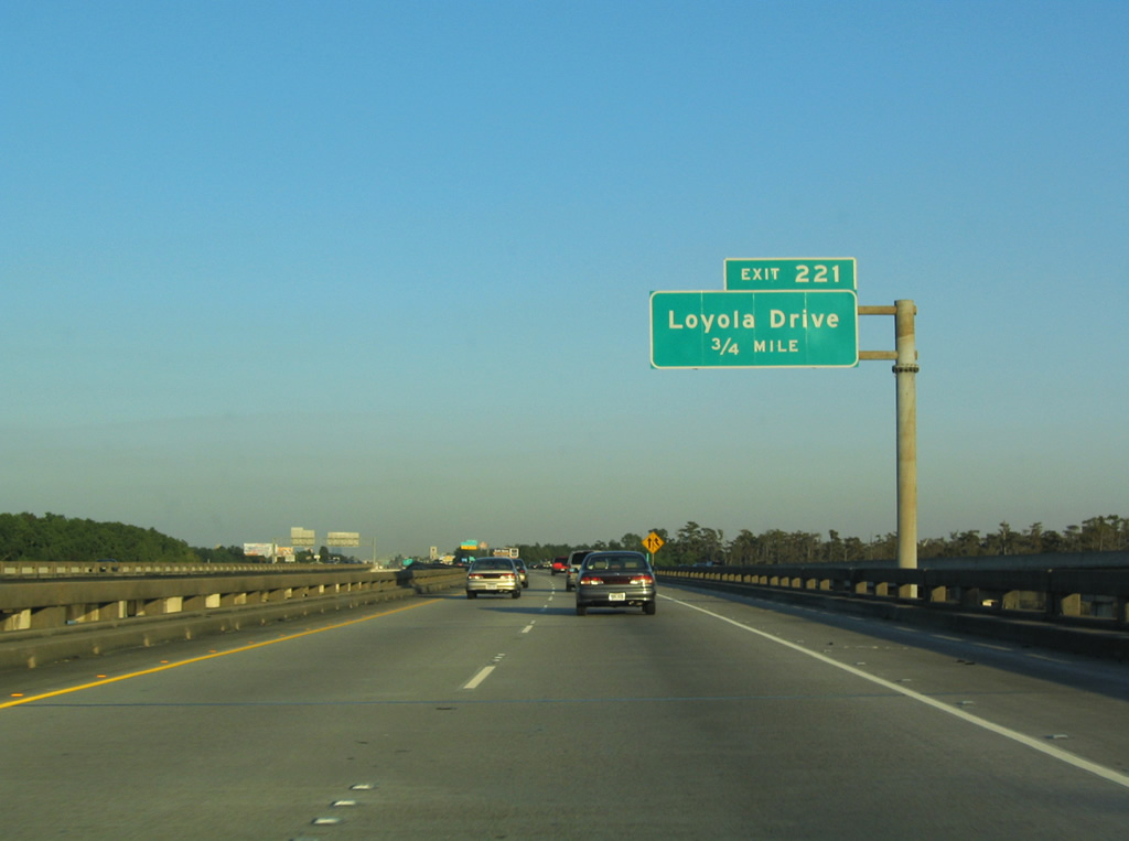
| Exit 221 joins Interstate 10 with Loyola Drive at a diamond interchange in one mile. Traffic from I-310 north adds two additional lanes ahead of the exchange. 10/22/03 |
|
| Loyola Drive constitutes a multi-lane arterial northward from parallel Veterans Memorial Highway to Joe Yennie Boulevard through Kenner. 04/20/12 |
|
| Spanning Duncan Canal, Interstate 10 enters both Jefferson Parish and the city of Kenner. The viaduct that began in Laplace concludes. 04/20/12 |
Page Updated 09-18-2012.

 East
East