|
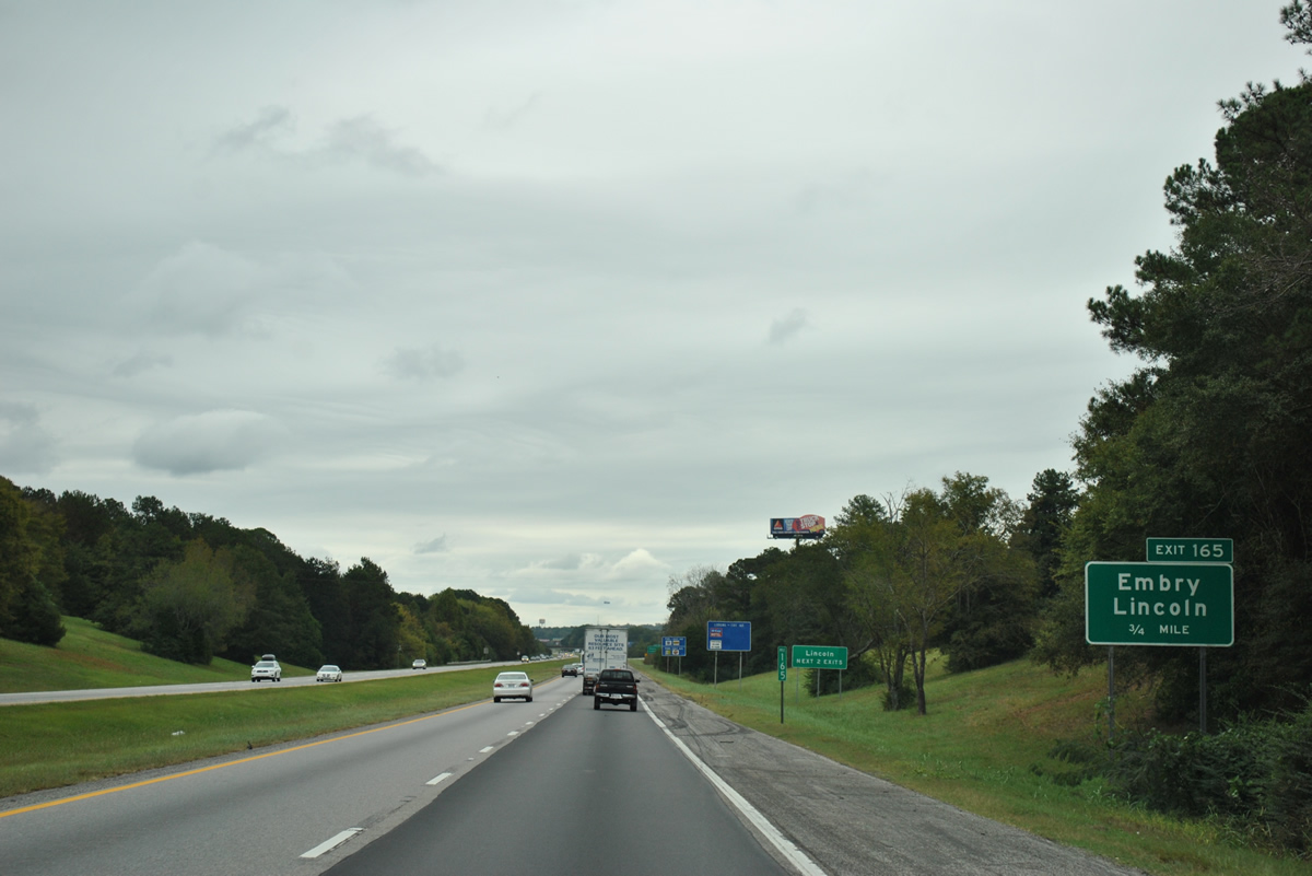
| Interstate 20 crosses Logan Martin Lake and emerges in Talladega County one mile ahead of the Exit 165 diamond interchange with Stemly Road (Talladega County 207). Talladega County 207 meanders 8.5 miles south from U.S. 78 (Bankhead Highway) to SR 34 (Stemley Bridge Road) along the periphery of Logan Martin Lake. 10/07/12 |
|
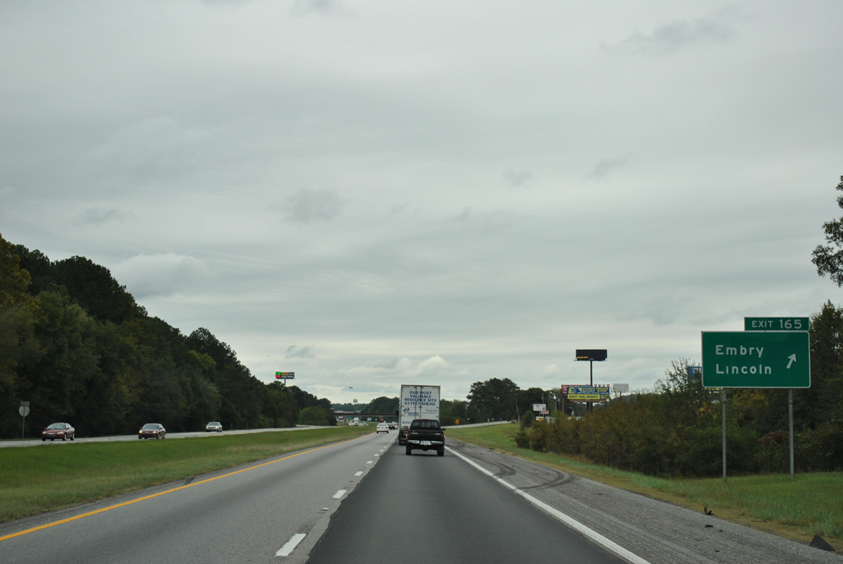
| Eastbound at the Exit 165 ramp departure to Talladega County 207 (Stemly Road). The settlement of Embry lies at the cross roads of Talladega County 354 (McCraig Road) and Stemly Road adjacent to Interstate 20. Interstate 20 enters the city limits of Lincoln ahead of Exit 165 and remains in the municipality to Airport Road (ahead of Exit 173). 10/07/12 |
|
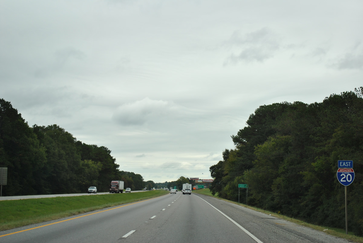
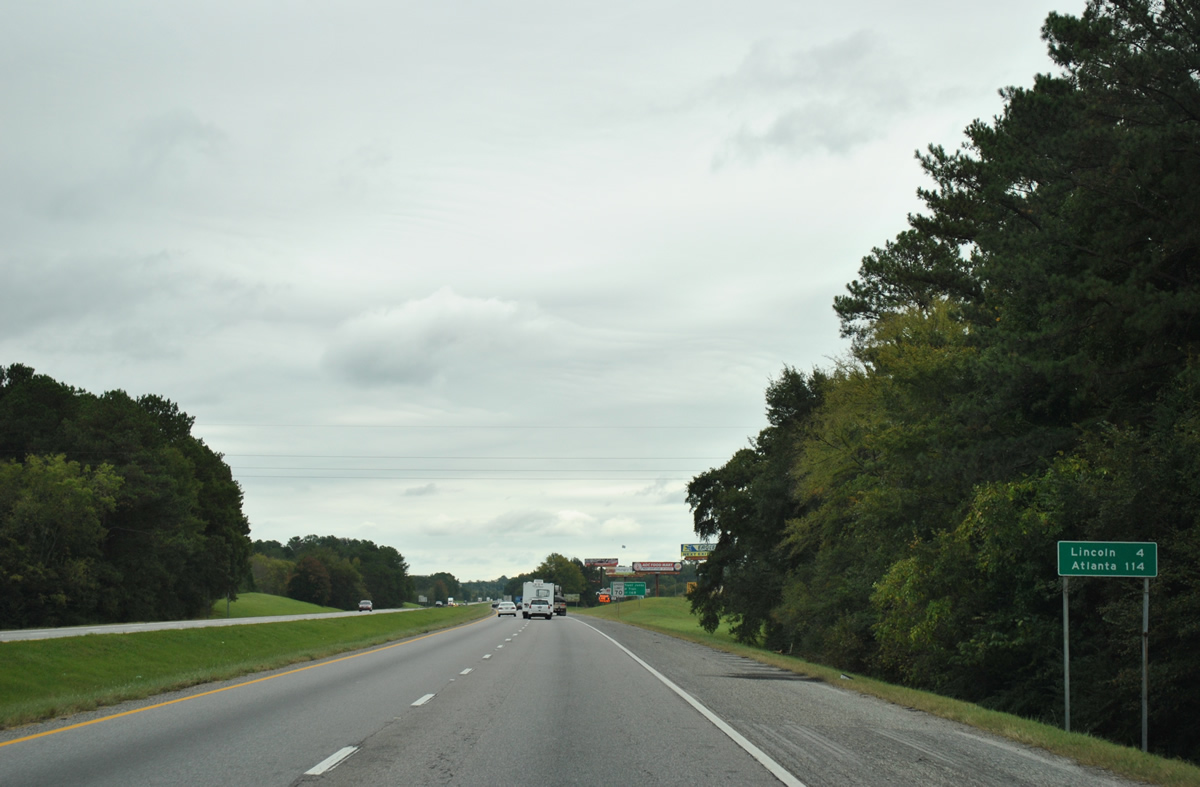
| Interstate 20 continues east through Lincoln on the 114 mile drive to Atlanta. 10/07/12 |
|
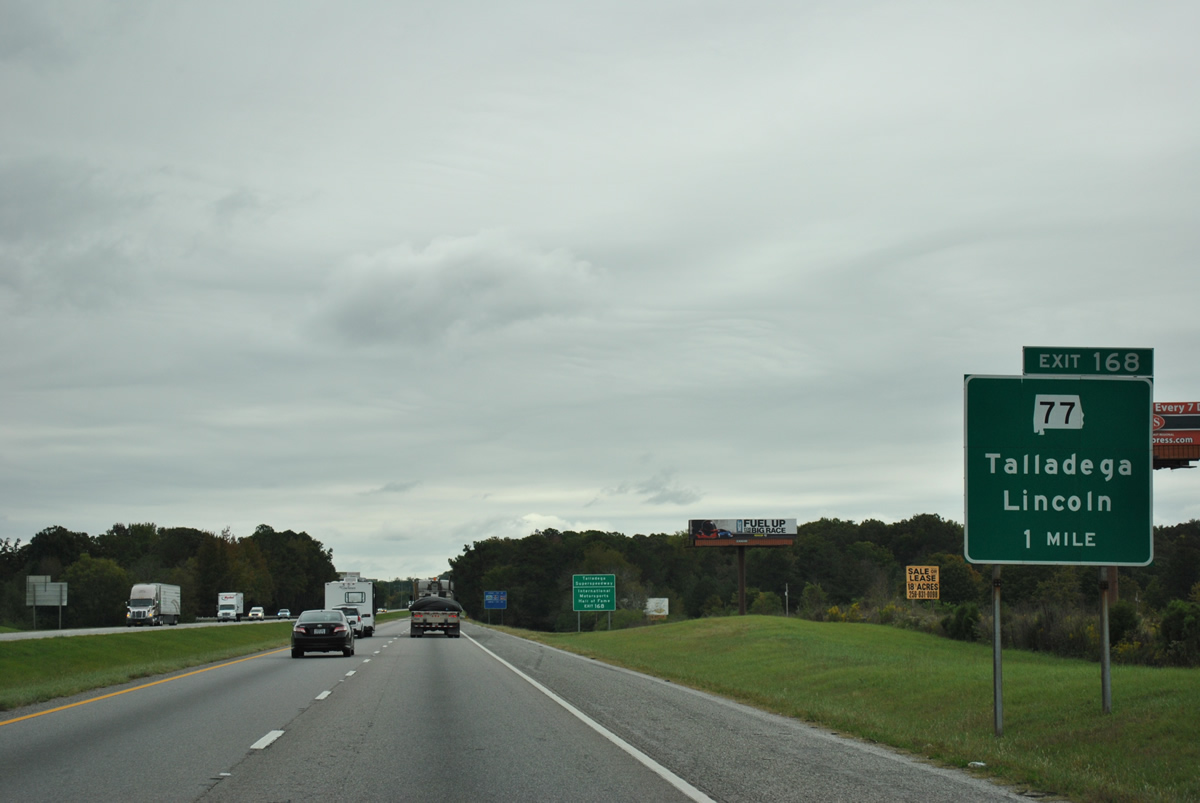
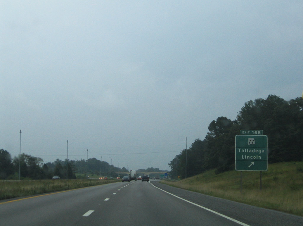
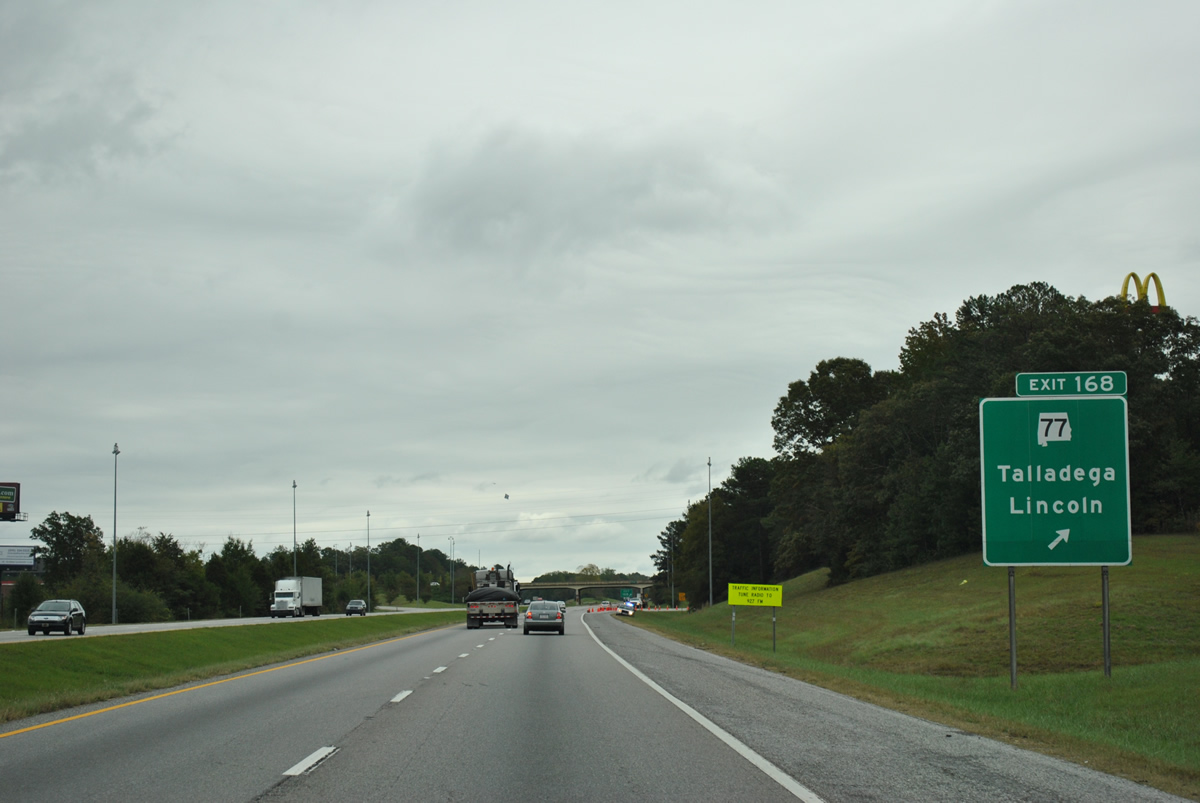
| One mile west of the Exit 168 diamond interchange with SR 77 along Interstate 20 east. SR 77 travels 112.33 miles overall between U.S. 431 at Attalla and U.S. 431 at Lafayette. 10/07/12 |
|
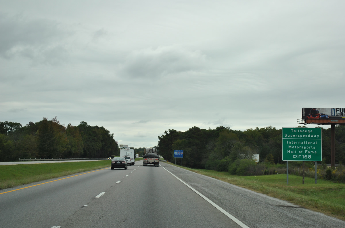
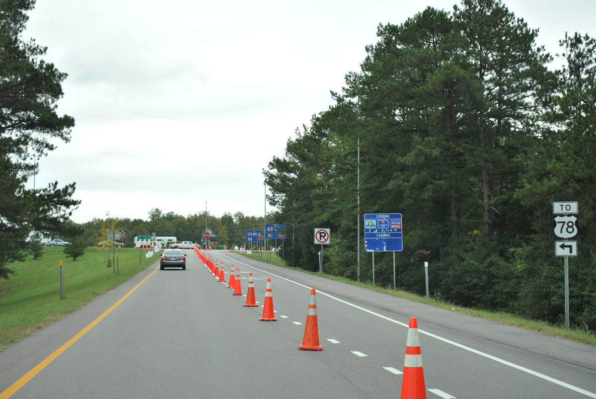
| Exit 168 provides one of two access points from Interstate 20 for Talladega Superspeedway and the International Motorsports Hall of Fame. Home to two NASCAR Sprint Cup events and other stock car races, the track was constructed in 1968-89 at the site of former Anniston Air Force Base with its first race on September 13, 1969. The 2,000-acre site features a 2.66 mile track where world stock car records of 212.809 miles per hour were set by Bill Elliot in 1987 and the 500 mile stock car record set in 1997 by Mark Martin with an average speed of 188.354 miles per hour. The facility seats 143,231. More history found at the Talladega Superspeedway web site. 10/07/12 |
|
| Drivers bound for SR 77 leave Interstate 20 eastbound at Exit 168. SR 77 leads 27.5 miles north to U.S. 411 at Rainbow City and 11.5 miles south to SR 21 in Downtown Talladega. An original guide sign for SR 77 remained in service until 2005. 07/15/05, 10/07/12 |
|
| During NASCAR Cup races at Talladega Superspeedway, traffic along SR 77 is restricted between Interstate 20 and the city of Talladega. County Road 399 (Speedway Boulevard), 0.7 miles to the south, provides the main access point to the track from the west. All five lanes of CR-399 flow inbound ahead of a race and outbound after one. 10/07/12 |
|
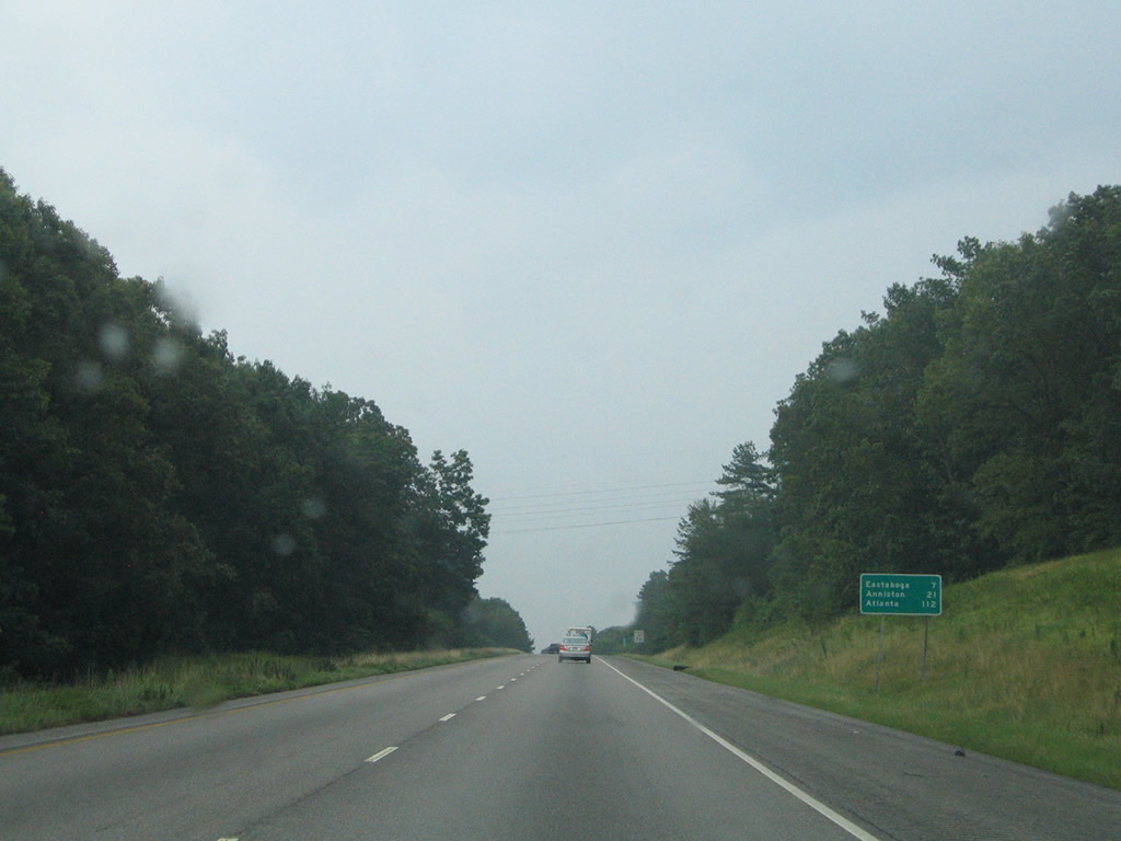
| Interstate 20 heads east parallel to Talladega County 399 (Speedway Boulevard) to Old Eastaboga. Eastaboga is a seven mile drive via County Road 005 (John N. Willis Avenue). Anniston and Atlanta follow at 21 and 112 miles out. 07/15/05 |
|
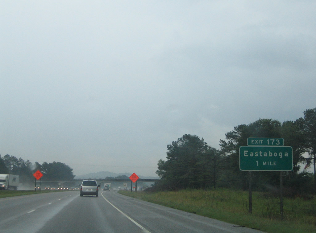
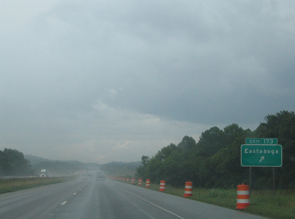
| Interstate 20 eastbound on the one mile approach to Exit 173 and Talladega County 005. This rural diamond interchange lies 1.5 miles south of Eastaboga and U.S. 78. 07/15/05 |
|
| Talladega County 005 (Eastaboga Road) leads south 3.5 miles to Turner and 8.6 miles to the new Talladega bypass (SR 275) outside of the county seat. Speedway Boulevard (CR-399) stems west from CR-005 to Talladega Municipal Airport and Talladega Superspeedway and southeast to SR 21 near Curry. 07/15/05 |
|
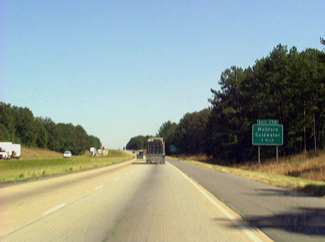
| Approaching the first of three Anniston area interchanges of Interstate 20 east. Exit 179 connects with Talladega County 467 (Priebes Mill Road) west and SR 202 (Donald G. Holmes Bypass) north to Coldwater. SR 202 was extended southward from U.S. 78 by spring 2006. The state route encircles Coldwater Mountain northeast to West End and Anniston.
I-20 was expanded to six lanes since this photo was taken. The town of Munford lies along SR 21 six miles to the southwest via Priebes Mill Road. 09/29/03 |
|
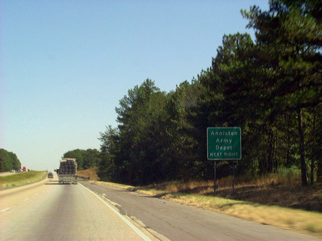
| The Exit 179 interchange also serves the Anniston Army Depot via SR 202 north. The facility is involved in the repair of military vehicles as well as the storage of various chemical weapons and other larger scale munitions. 09/29/03 |
|
| Entering the Anniston metropolitan area on Interstate 20 eastbound. Anniston and Oxford lie along the U.S. 431 & SR 21 corridor north of Interstate 20. Exits 185 and 188 serve the Calhoun County seat. 07/15/05 |
|
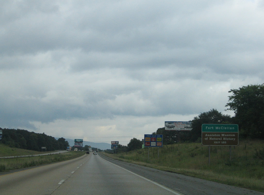
| Interstate 20 straddles the Talladega and Calhoun County line ahead of a diamond interchange (Exit 185) with SR 21 (Lake Street). SR 21 merges with U.S. 431 north of Interstate 20 at U.S. 78 (Hamric Drive). From there U.S. 431 & SR 21 travel through Oxford to Anniston. The former Fort McClellan military reservation, closed in 1999, lies east of Anniston along the SR 21 corridor. Among the attractions in town is the Anniston Museum of Natural History. 07/15/05 |
|
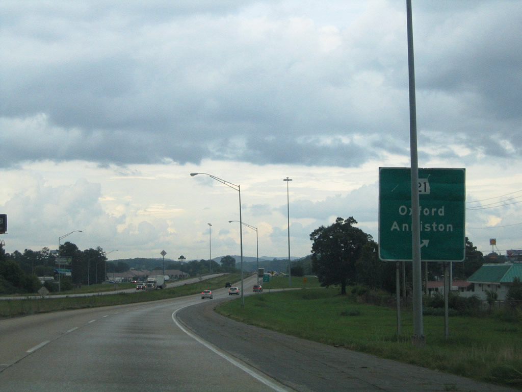
| Eastbound at the Exit 185 off-ramp to SR 21 (Jacksonville State University Highway) on Interstate 20. SR 21 enters the area from Talladega, Manford, and the Anniston Metropolitan Airport (ANB) to the southwest. The state highway combines with U.S. 431 along Quintard Drive through both downtown Oxford and Anniston. U.S. 431 joins Anniston with Gadsden 33 miles to the north. 07/15/05 |
|
| Interstate 20 shield posted after the on-ramp from SR 21. Progress20 construction underway between December 2011 and Fall 2013 expands the stretch of freeway between mile marker 185.83 and 193.78 to six overall lanes. 07/15/05 |
|
| Atlanta is now less than 100 miles along Interstate 20 east. U.S. 431 is the next control point as the freeway is already within the Anniston city limits. 07/15/05 |
|
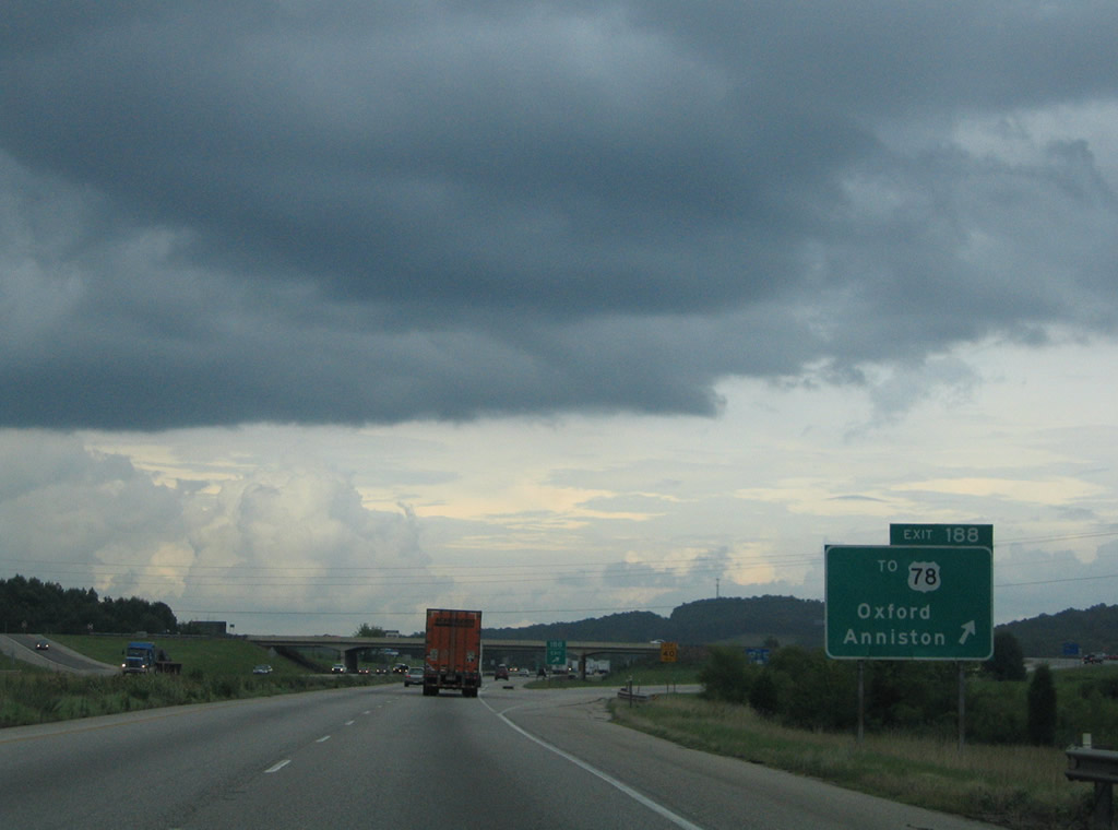
| One mile ahead of the diamond interchange at Exit 188 near Boiling Spring in east Oxford. The forthcoming exchange links with a four lane connector (Morgan Road) between Interstate 20 and parallel U.S. 78 & 431 at Golden Springs Road. Golden Springs Road continues the roadway north to the new Anniston Eastern Bypass. 09/29/03 |
|
| Morgan Road passes over U.S. 78/431 and a Norfolk Southern Railroad line at a partial interchange nearby. The road continues north from there to Golden Springs. The Anniston Eastern Bypass is a four lane highway traveling west of the Skeleton Mountains to SR 21 and U.S. 431 beyond their split at Saks. 07/15/05 |
|
| Interstate 20 eastbound at Exit 188 (Morgan Road). Construction is also extended Morgan Road (Leon Smith Parkway) south to Friendship Road and a realigned McIntosh Road near Hicks. Mountains to the south within the Talladega National Forest arise along the horizon. Included within these low peaks is Mt. Cheaha, the tallest point in the state of Alabama at 2,405 feet. 07/15/05 |
|
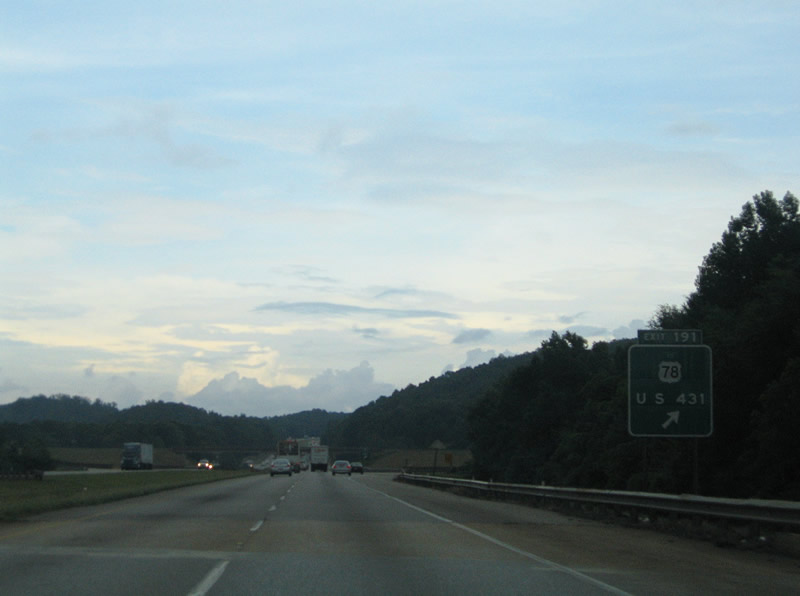
| The final interchange of Interstate 20 within Calhoun County is Exit 191 with U.S. 431. U.S. 431 travels north-south between U.S. 78 and the Randolph County seat of Wedowee. Note that the sign pictured here is original button copy. 07/15/05 |
|
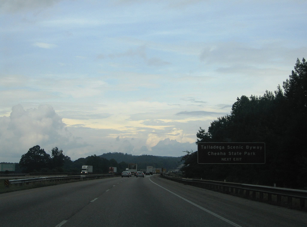
| Attractions within the Talladega National Forest include the Talladega Scenic Byway (SR 281) and Cheaha State Park. SR 281 straddles Talladega, Cheaha, and Horseblock Mountain southwest from U.S. 431 toward Campbell Springs. U.S. 431 meets the state highway 3.5 miles to the southeast at a grade separated intersection. 09/29/03 |
|
| A second button copy guide sign directed motorists onto the Exit 191 off-ramp for U.S. 431 to U.S. 78. U.S. 431 north merges with U.S. 78 west a half mile north of the diamond interchange with Interstate 20. U.S. 78 (Bankhead Highway) continues east to Old Davisville (SR 9), Cleburne and the north end of the Talladega Scenic Byway (SR 281). 07/15/05 |
|
| Interstate 20 sees a roadway split through the Talladega National Forest east of the SR 281 over crossing. 07/15/05 |
|
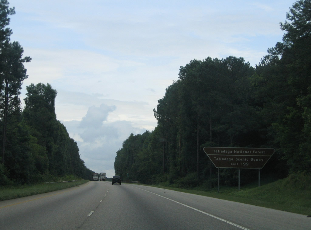
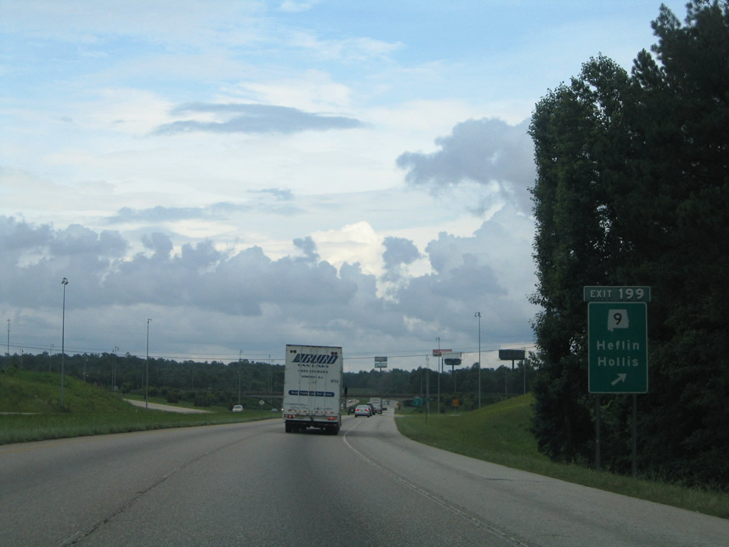
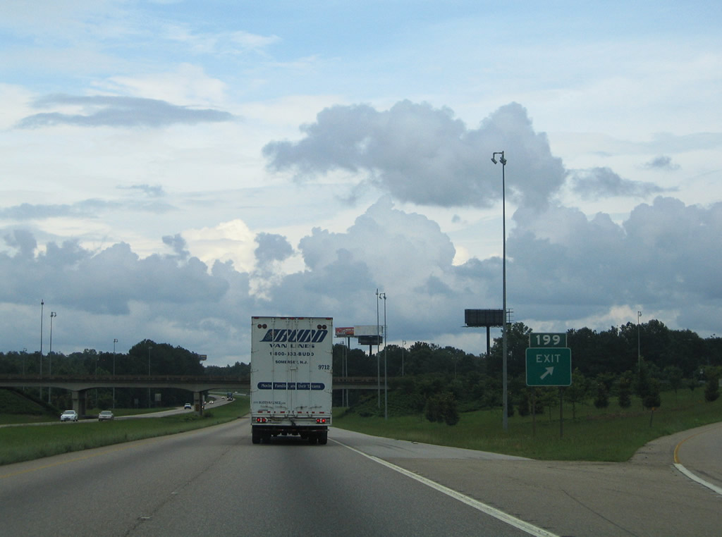
| The next exit of the I-20 is Exit 199 at SR 9 (Almon Street) near the Cleburne County seat of Heflin. Exits 191 and 199 both serve Talladega National Forest and SR 281 (Talladega Scenic Drive). 07/15/05 |
|
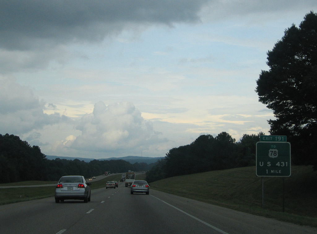
| SR 9 joins U.S. 78 for a 4.3 mile overlap between Old Davisville and Heflin. The state route turns south onto Almon Street for 1.5 miles to the Exit 199 diamond interchange with Interstate 20. SR 9 continues from I-20 nine miles to Hollis Crossroads (U.S. 431) and 25 miles to Lineville. 07/15/05 |
|
| A Texas style button copy exit sign stands at the gore point for Exit 199. SR 9 leads north from U.S. 78, 21 miles to Piedmont and 38 miles to Centre. U.S. 78 follows Ross Street through downtown Heflin to SR 46. 07/15/05 |
|
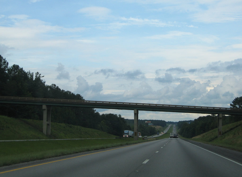
| Interstate 20 descends gradually toward the Exit 205 diamond interchange with SR 46. Pictured here is the Cleburne County 18 over crossing. SR 46 travels five miles east from its beginning in Heflin to the freeway. 07/15/05 |
|
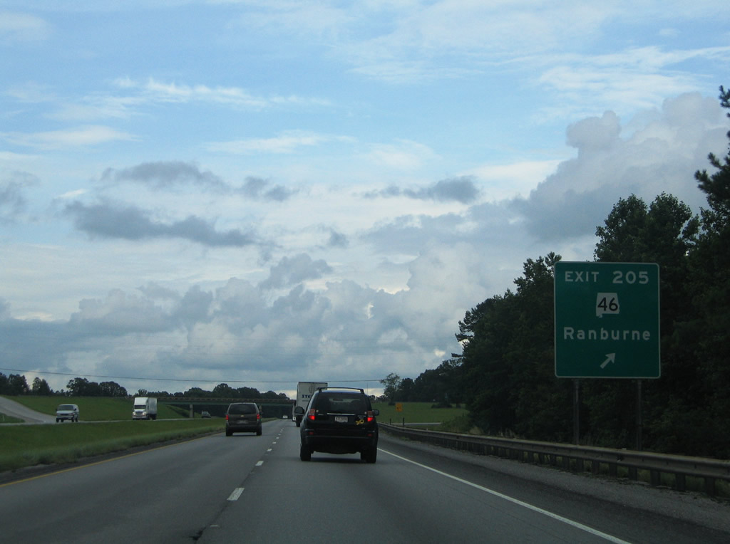
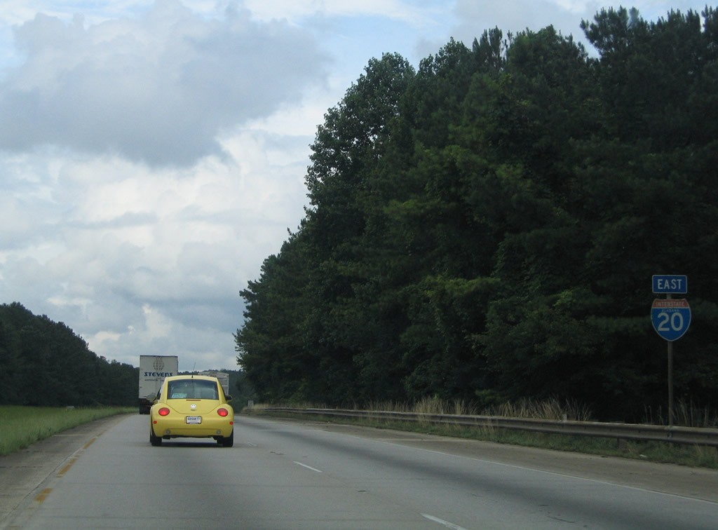
| A New Jersey Turnpike-style guide sign directs motorists onto the Exit 205 off-ramp to SR 46. SR 46 ventures eight miles southeast to Trickem and 14 miles to Ranburne. The state highway transitions into Georgia 166 on the six mile drive between Ranburne and Bowdon, Georgia. 07/15/05 |
|
| Another Progress20 progress rebuilds and expands 1.86 miles of freeway between a point west of the Tallapoosa River to east of County Road 49 (Exit 210). This work was in progress between December 2011 and Fall 2013. 07/15/05 |
|
| Interstate 20 meanders east through forested hills to next meet Cleburne County 49 at a diamond interchange (Exit 210) by the settlement of Abernathy. 07/15/05 |
|
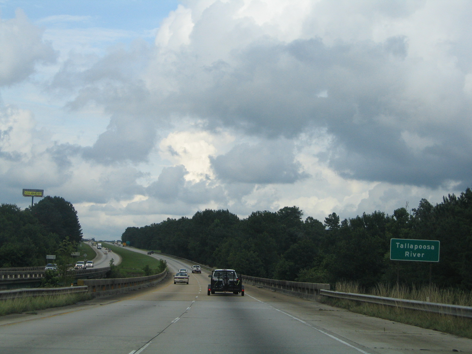
| Interstate 20 crosses the Tallapoosa River ahead of the Exit 210 off-ramp to Cleburne County 49. The river flows south into Lake Wedowee. 07/15/05 |
|
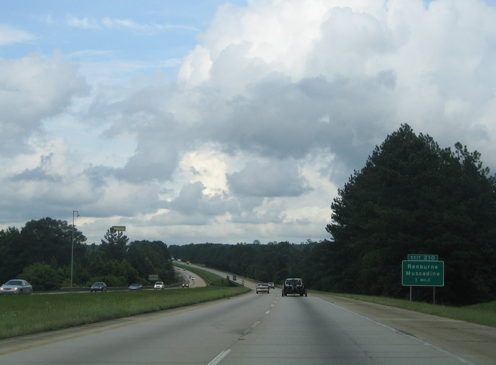
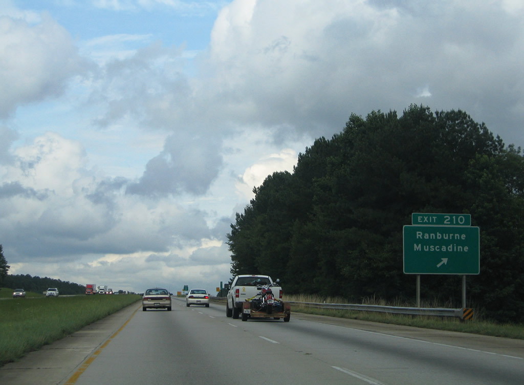
| Exit 210 departs Interstate 20 eastbound at Abernathy. Cleburne County 49 meanders south 11.5 miles through the settlements of New Hopewell and Macedonia to SR 46 at Ranburne. The county road continues 8.3 miles north through Lebanon and Muscadine to U.S. 78. 07/15/05 |
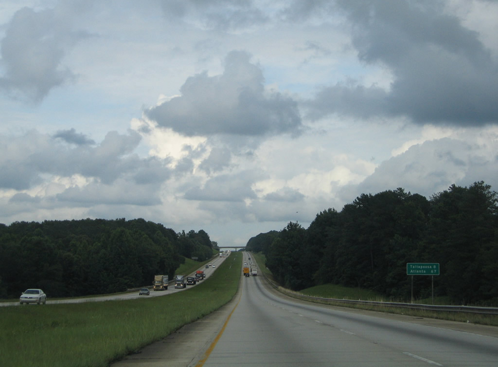
|
| The last distance sign posted within Alabama lists the distances to Tallapoosa and Atlanta, Georgia. Interstate 20 next meets Georgia 100 (Exit 5), 4.7 miles south of Tallapoosa and U.S. 78 & Georgia 8. Cleburne County 66 crosses over the freeway on the horizon in this scene. 07/15/05 |
Page Updated 10-11-2012.


 East
East