|
| Interstate 35 enters Kansas City, Missouri through an industrial area at Westside South. A welcome sign stands by the gore point at the Eaton Street entrance ramp. 06/18/15 |
|
| A seven lane viaduct spans BNSF and Union Pacific Railroad lines and Southwest Boulevard, the historic alignment of both U.S. 69 Alternate and U.S. 169 Alternate. 06/18/15 |
|
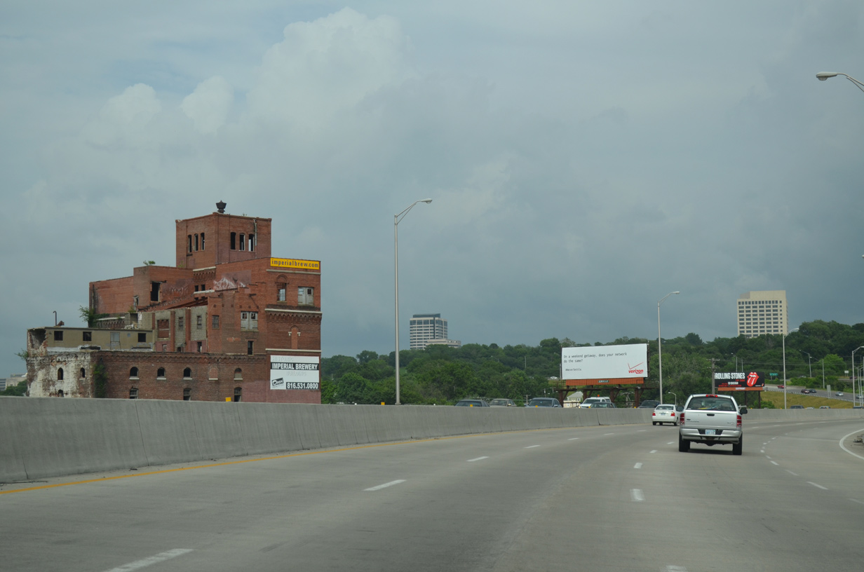
| The Turkey Creek Expressway portion of I-35 leads northeast from Kansas City, Kansas to overtake Southwest Trafficway by Penn Valley Park. The wide grassy median at Westside South alludes to an unconstructed route in the 1950s Kansas City expressway plan.1 06/18/15 |
|
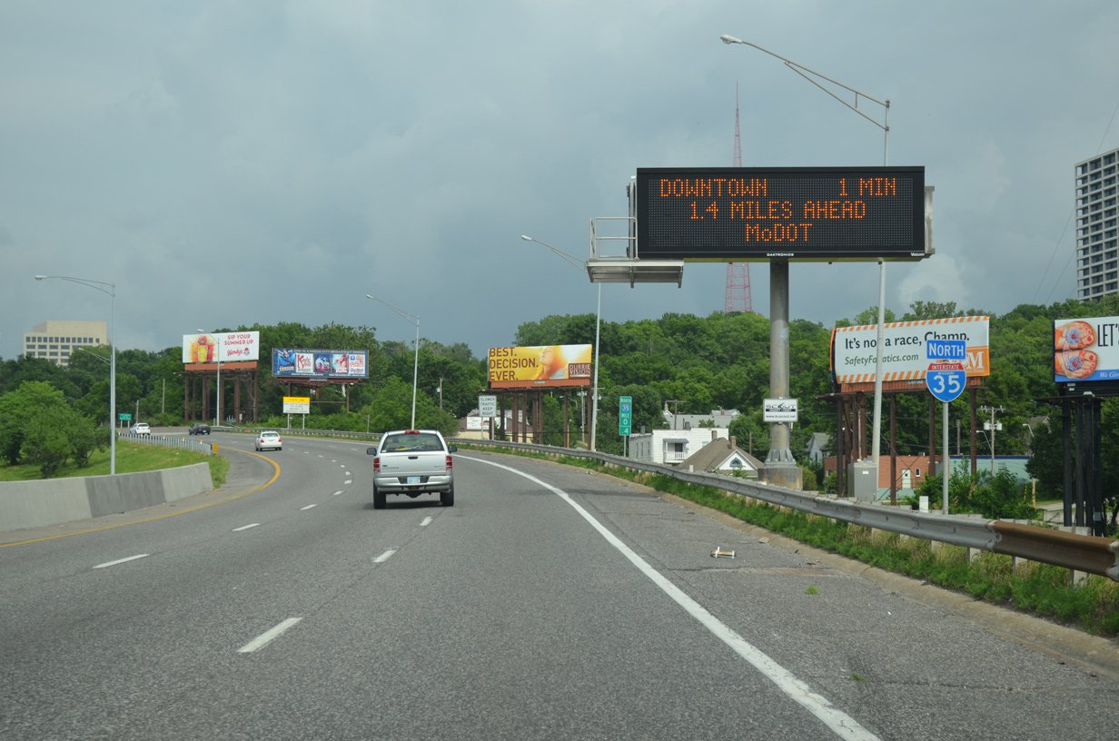
| Curving north, Interstate 35 advances toward the Westside North neighborhood (Exit 1C) and I-670 (Exit 2U). 06/18/15 |
|
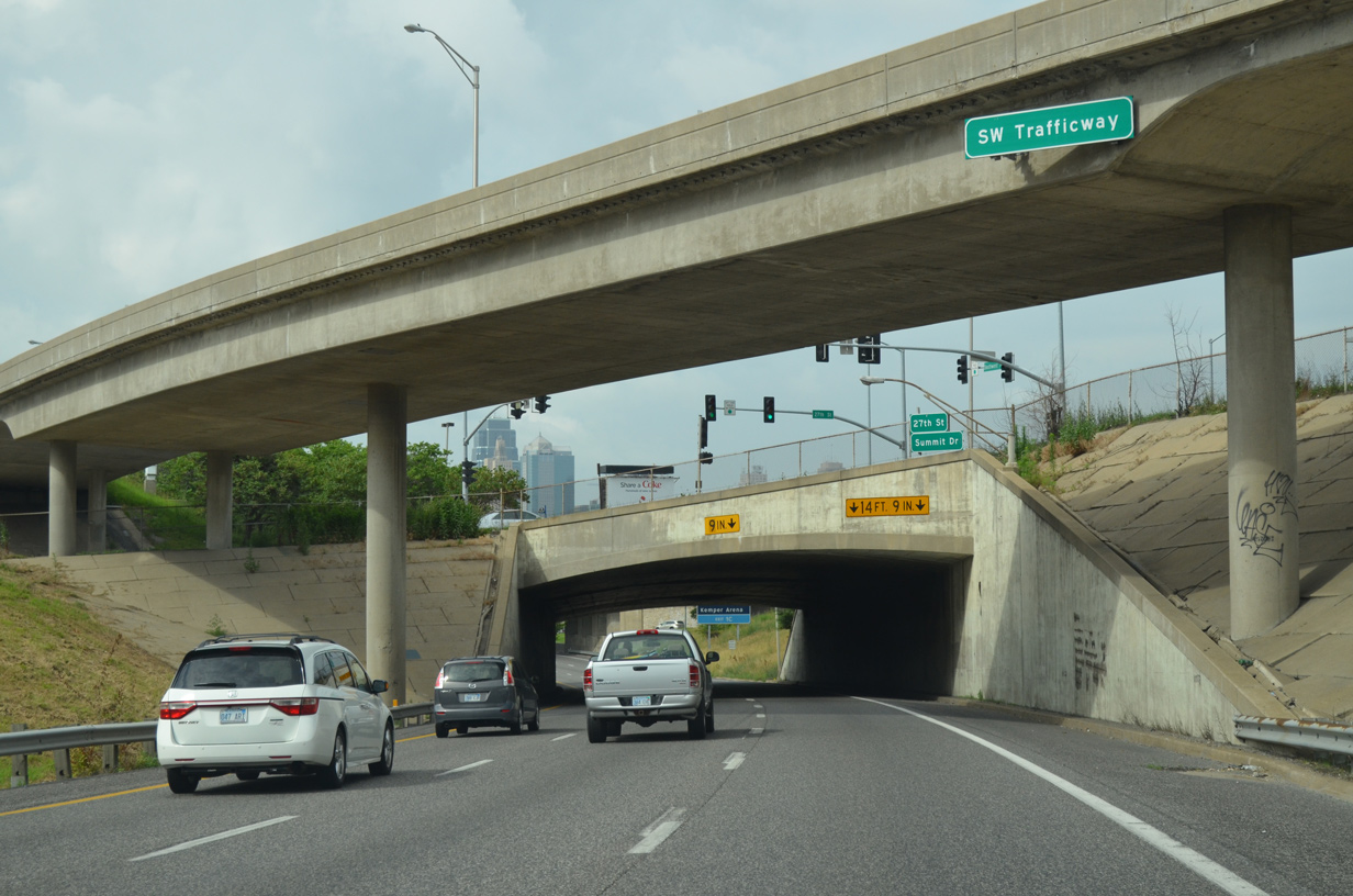
| Northbound I-35 passes under a 1966-built flyover taking traffic from southbound onto the Southwest Trafficway and below the intersection of 27th Street and Summit Drive. 06/18/15 |
|
| A second wye interchange (Exit 1B on southbound) adds traffic from Broadway Boulevard / Penn Valley Drive. Vertical clearances are below interstate standards at 14 foot 11 inches. 06/18/15 |
|
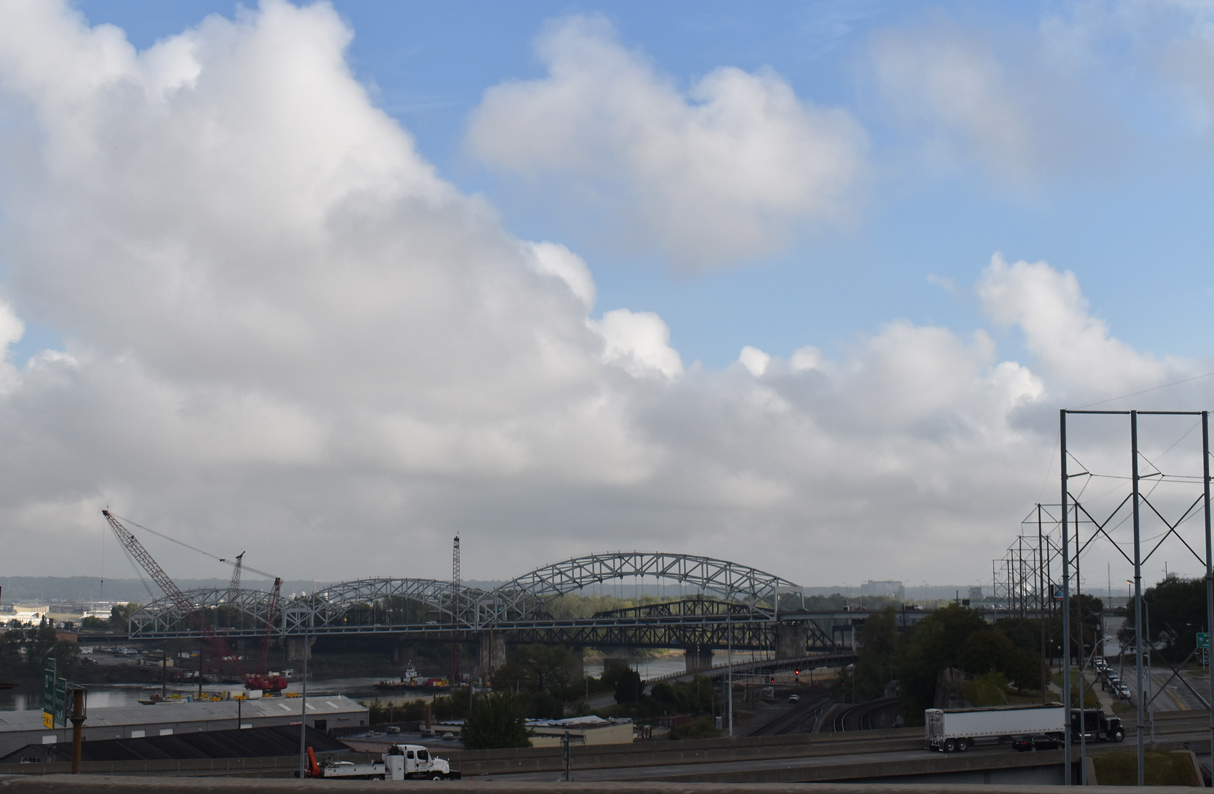
| The roadways of Interstate 35 come together across a nine lane viaduct above 24th Street and Kansas City Terminal (KCT) Railway lines. 06/18/15 |
|
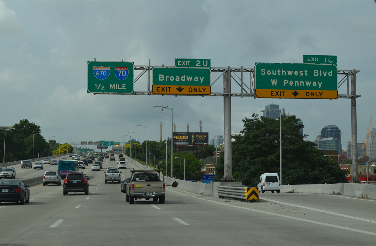
| Exit 1C lowers from the viaduct to Pennway Street, one block north of Southwest Boulevard. Four lanes continue north along I-35 to Exit 2U for Broadway and Interstate 670. 06/18/15 |
|
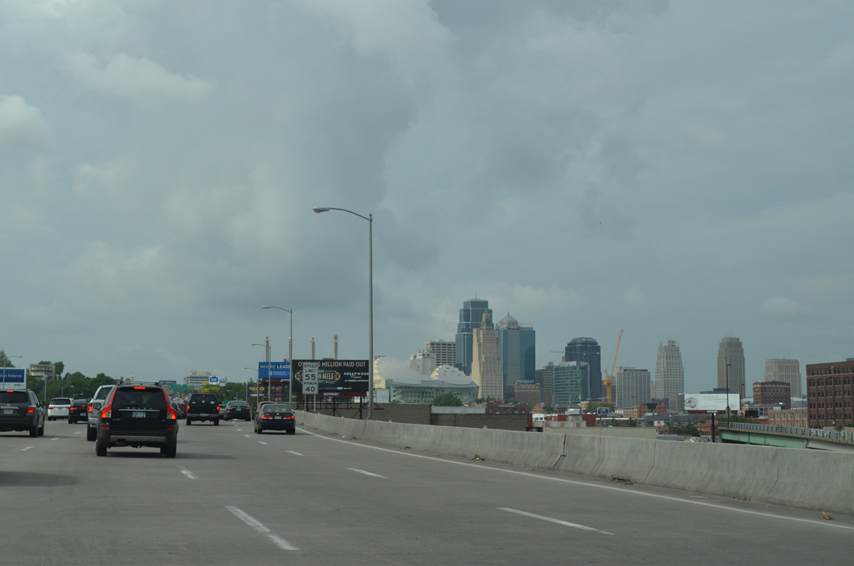
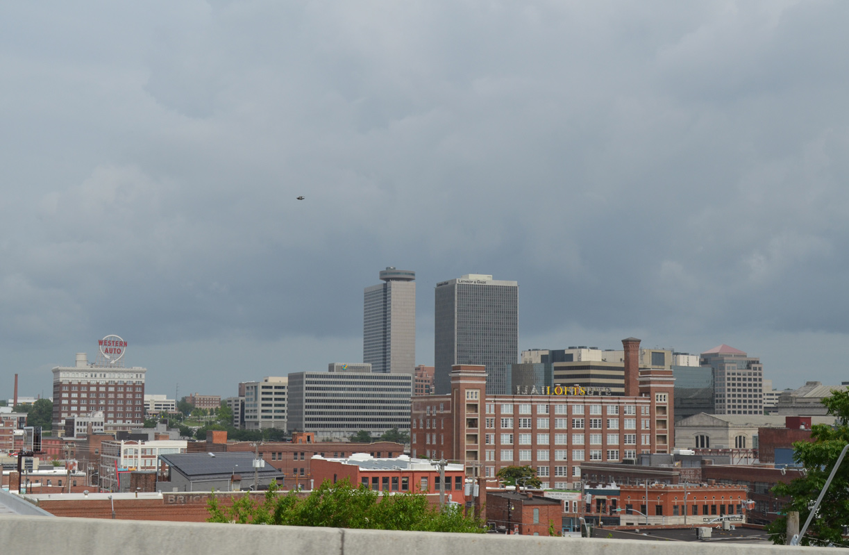
| Downtown Kansas City comes into view as Interstate 35 remains elevated to 20th Street. 06/18/15 |
|
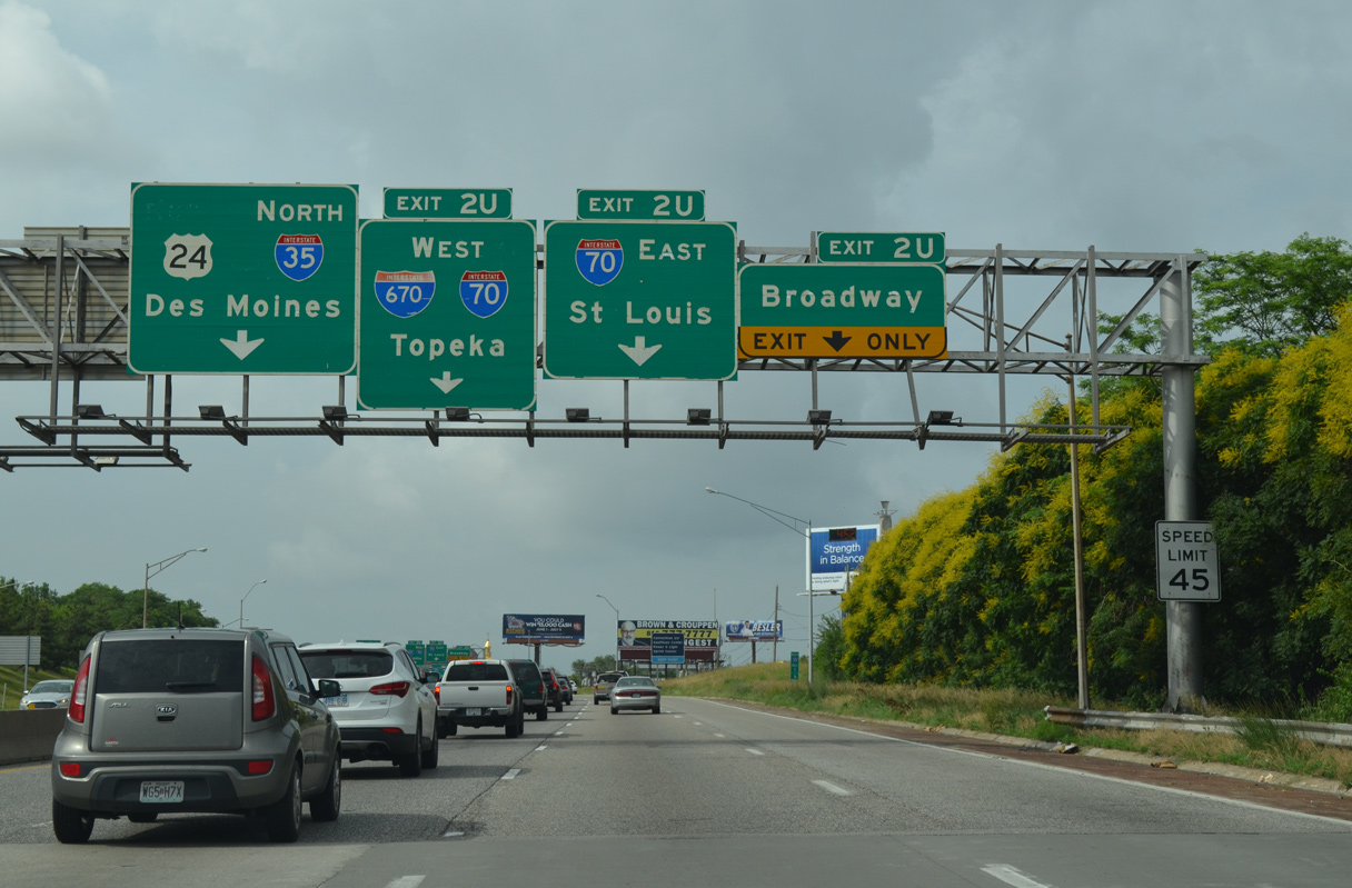
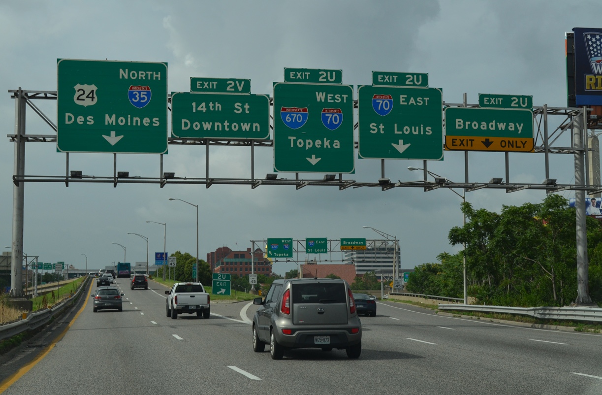
| Forthcoming Exit 2U is with the Alphabet Loop encircling the Kansas City Central Business District. Interstate 670 runs along the south leg of the loop directly to I-70 east while I-35 makes up the west leg along Quality Hill. Exit 2U also serves Broadway to the nearby Kansas City Convention Center. 06/18/15 |
|
| Three lanes separate from I-35 north for Broadway, I-670 east to I-70 at Paseo West and I-670 west to I-70 at Riverview in Kansas City, Kansas. 06/18/15 |
|
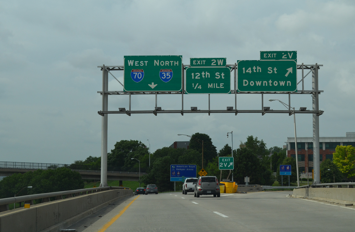
| Exit 2V separates from Interstate 35 north from the highest level of the exchange (Exit 2U) with I-670. The off-ramp connects with 14th and Washington Streets by the Kansas City Convention Center. 06/18/15 |
|
| A weaving traffic pattern ensues between the entrance ramp from I-670 west and adjacent departure of Exit 2W to 12th Street. 12th Street crosses Downtown to the east and follows a double deck viaduct west to the West Bottoms industrial area near Hy-Vee Arena. 10/07/21 |
|
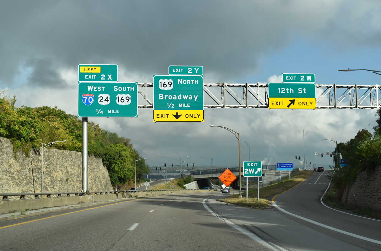
| Straddling the west side of Quality Hill, a terraced section of I-35 separates the northbound roadway up to 35 feet above the adjacent southbound lanes. The 12th Street on-ramp forms a third lane to Exit 2Y for U.S. 169 north as Left Exit 2X departs for I-70/U.S. 24-40-169 west to Kansas City, Kansas. 10/07/21 |
|
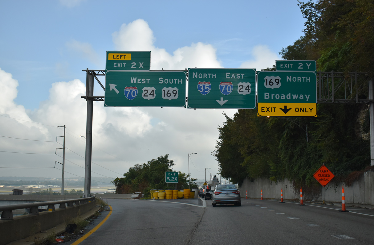
| I-35 north combines with I-70/U.S. 24-40 east along the North Loop. I-70 west leads across Kansas City, Kansas to Topeka and Denver, Colorado. U.S. 24/40 overlap with the freeway west to the Kansas Turnpike at Bonner Springs. 10/07/21 |
|
| High flyovers connect Interstate 35 north with I-70 west and from I-70 east to I-35 south as part of a three-wye interchange (Exit 2X). The exit ramps were built in 1967. 10/07/21 |
|
| Construction underway from July 2021 to December 2024 replaces the John Jordan "Buck" O'Neil Memorial Bridge taking U.S. 169 north across the Missouri River from Exit 2Y to North Kansas City. U.S. 169 south combines with I-70/U.S. 24-40 west to S 7th Street in Kansas City, Kansas. 10/07/21 |
|
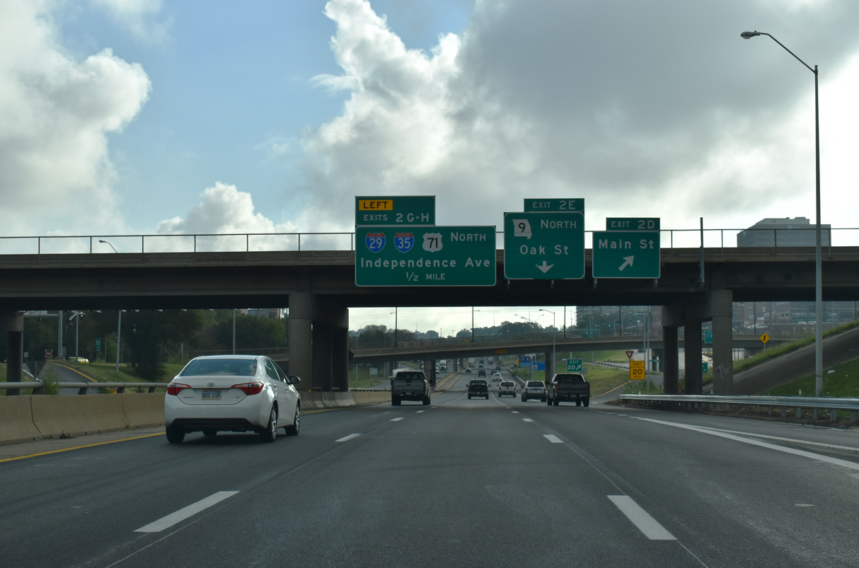
| The north leg of the Alphabet Loop travels below grade by a series of closely placed entrance and exit ramps. Exit 2D departs from I-35 north / I-70 east next onto parallel 6th Street at Main Street. 06/19/15 |
|
| Main Street leads south into the heart of Downtown while Route 9 originates just to the east at Locust Street and Admiral Boulevard. 10/07/21 |
|
| Commerce Tower and 909 Walnut rise along E 9th Street from the Kansas City Financial District south of I-35/70 at Main Street. 10/07/21 |
|
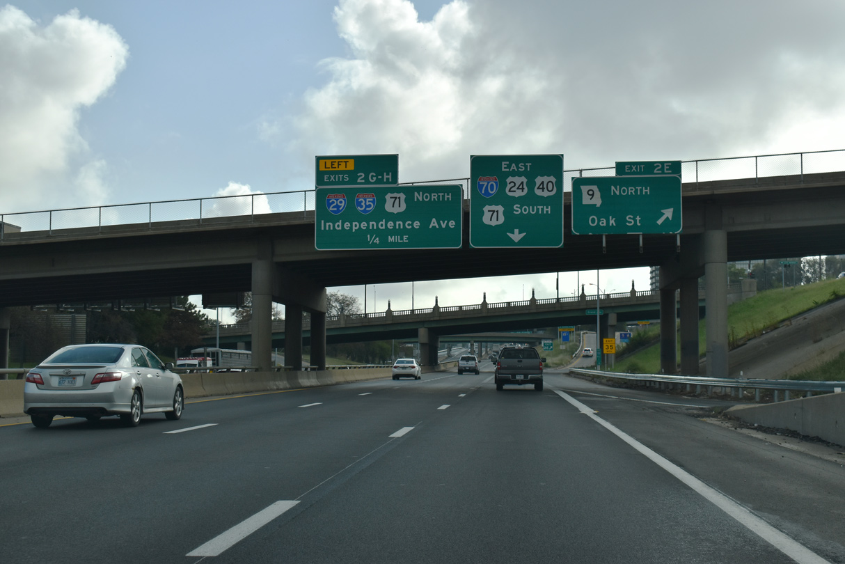
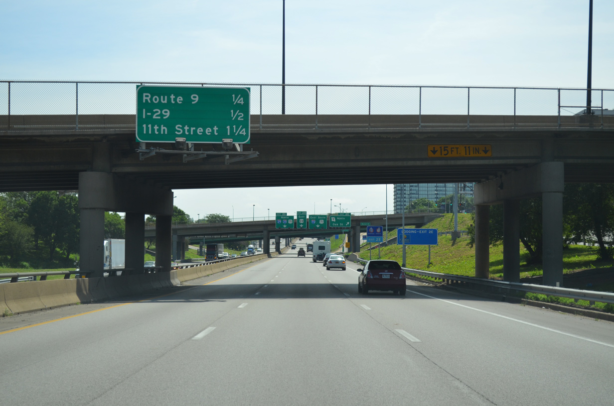
| Walnut Street and Grand Boulevard span the North Loop one quarter mile from Exit 2E to Page Street south to Oak Street and Route 9 north. I-35 turns north alongside the beginning of I-29 at the succeeding exit. 06/19/15 |
|
| Route 9 forms a 14.28 mile long loop from the directional cloverleaf interchange (Exit 2E) with I-35/70 to I-29/U.S. 71 at Barry Road in northwest Kansas City. 10/07/21 |
|
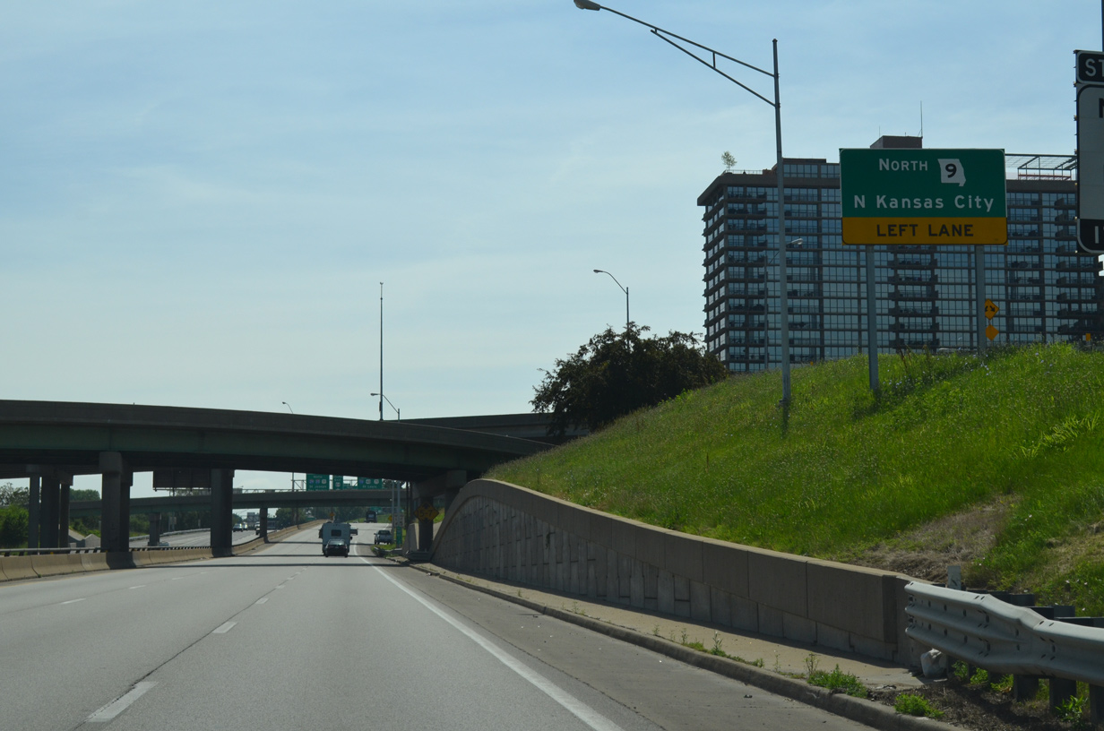
| A flyover connects the North Loop east and adjacent E 6th Street with Route 9 across the Heart of America Bridge to North Kansas City. 06/19/15 |
|
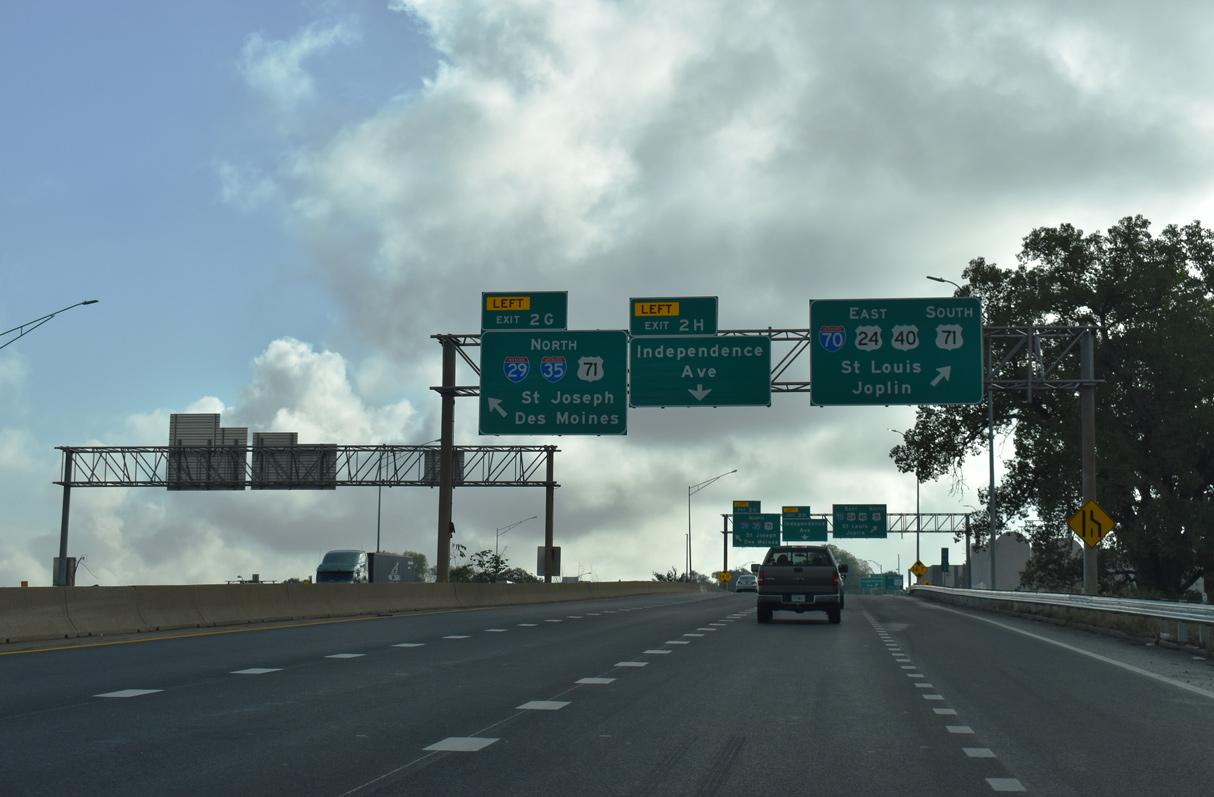
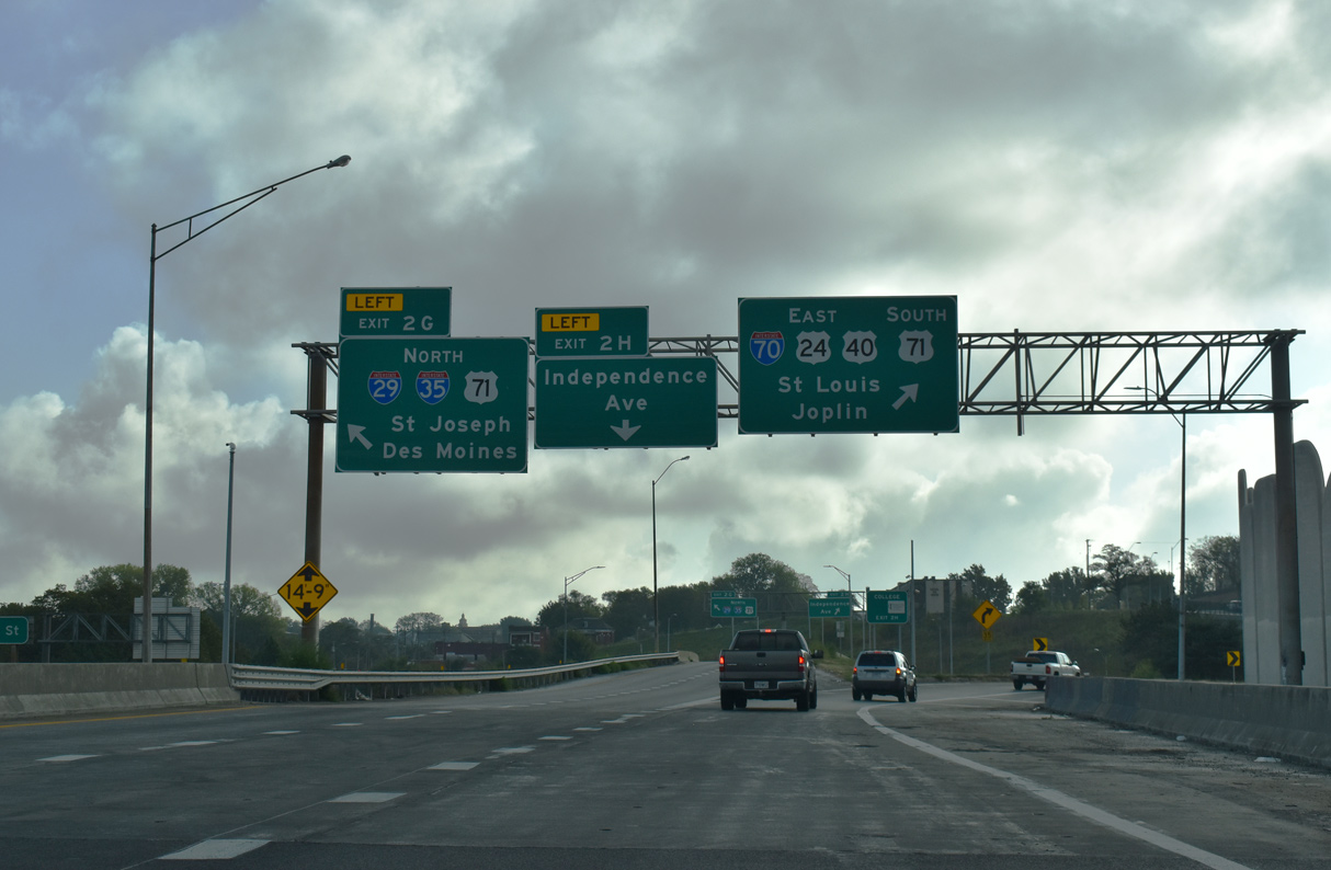
| I-35 north and I-70 east split at a directional T interchange (Exit 2G). I-70/U.S. 24-40 combine with U.S. 71 south along the east leg of the Alphabet Loop along Paseo West. 10/07/21 |
|
| I-29 begins at Left Exit 2G where I-35 turns north alongside U.S. 71 on the Midtown Freeway through North Kansas City. 10/07/21 |
|
| I-29, I-35 and U.S. 71 curve northward between the Columbus Park neighborhood and Belvidere Park with six overall lanes. The ensuing exit is with Front Street at the Northeast Industrial District. 06/18/15 |
|
| The first confirming marker for Interstate 29 precedes the wye interchange with The Paseo. The kcICON Project redesigned the adjacent exchange to remove a left entrance ramp from The Paseo south onto I-29/35 north. It also raised the bridge clearance for the southbound overpass. 06/18/15 |
|
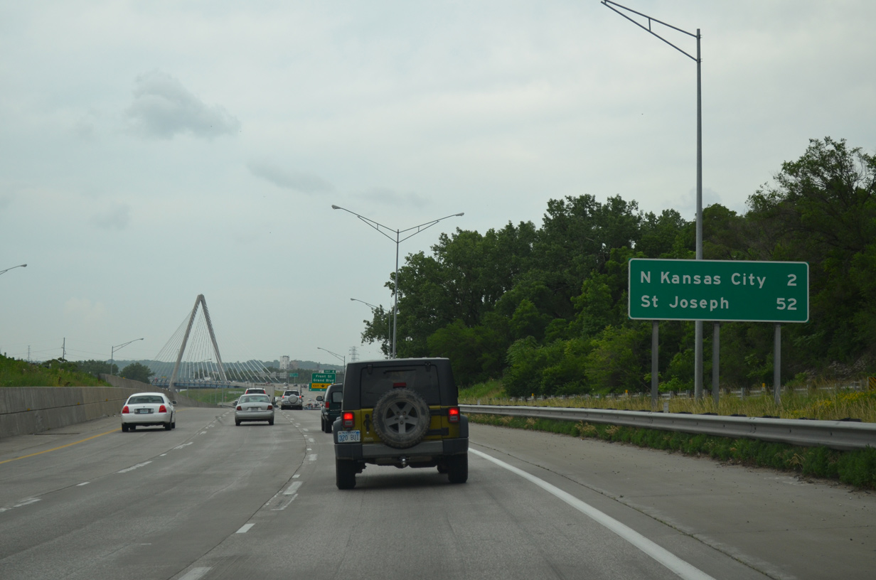
| The entrance ramp from The Paseo merges onto I-29/35 north two miles ahead of North Kansas City, and 52 miles south of St. Joseph. 06/18/15 |
|
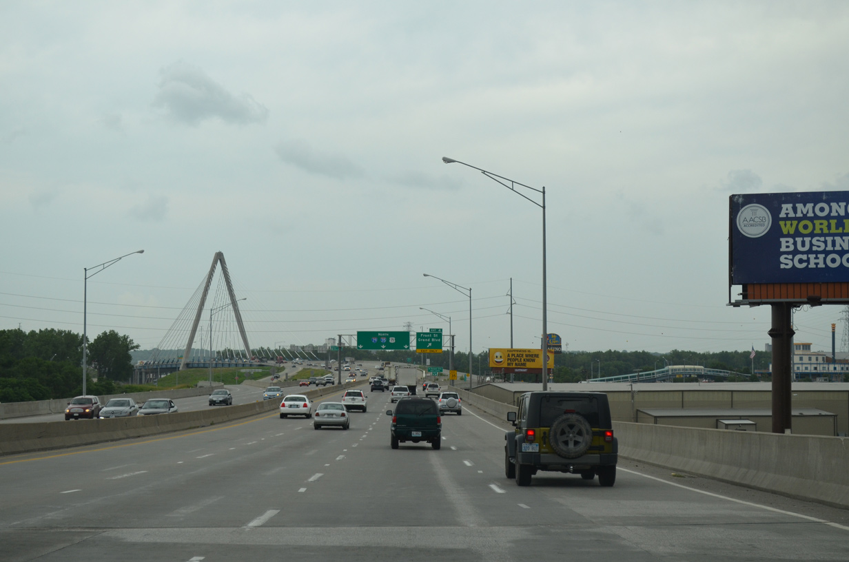
| An auxiliary lane opens northward from The Paseo to the Christopher S. Bond Bridge. Forthcoming Front Street parallels the Missouri River west to Berkley Park and Grand Avenue and east to Bally's casino and Riverfront Park. 06/18/15 |
|
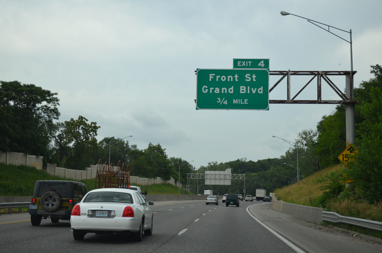
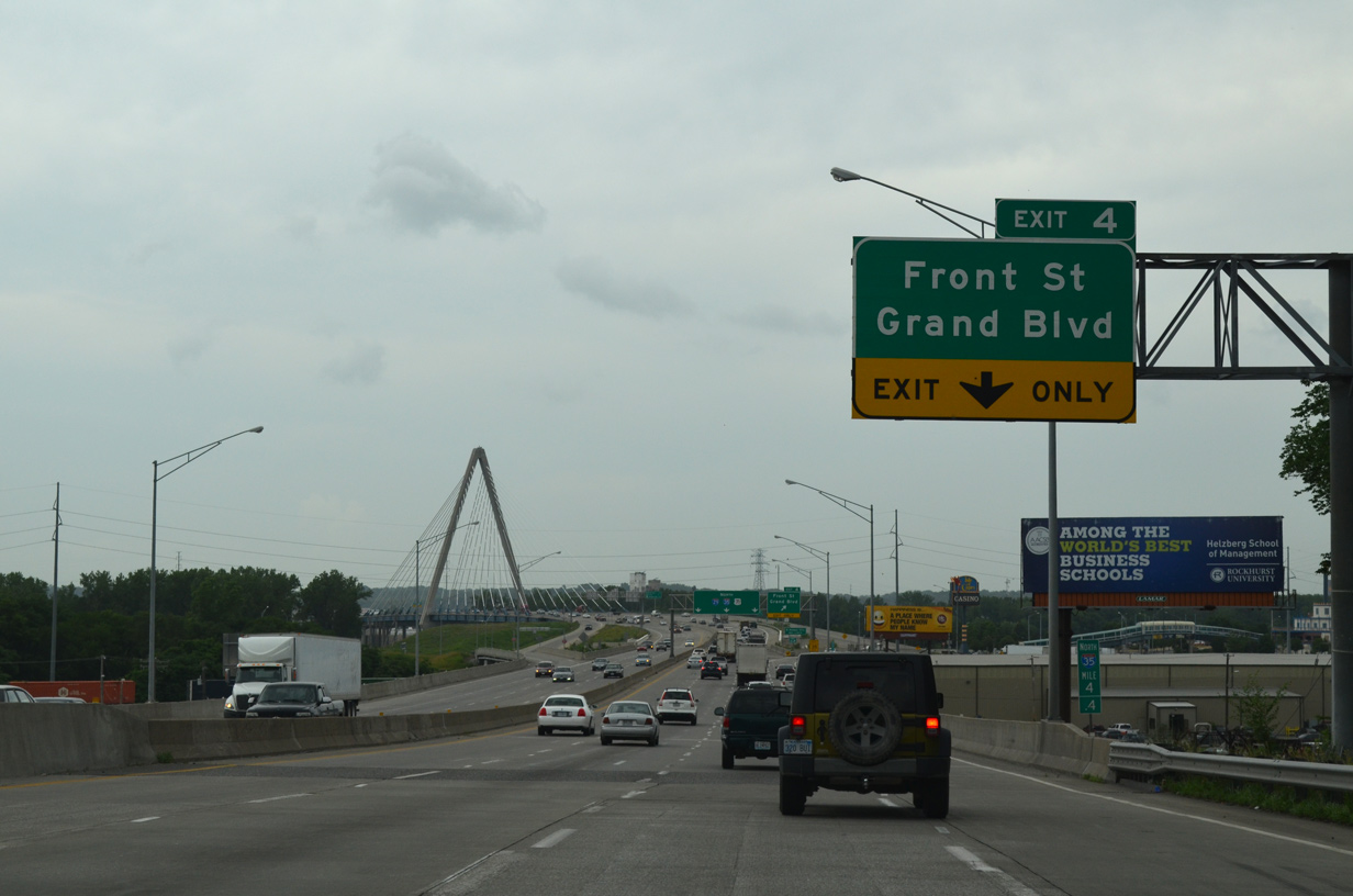
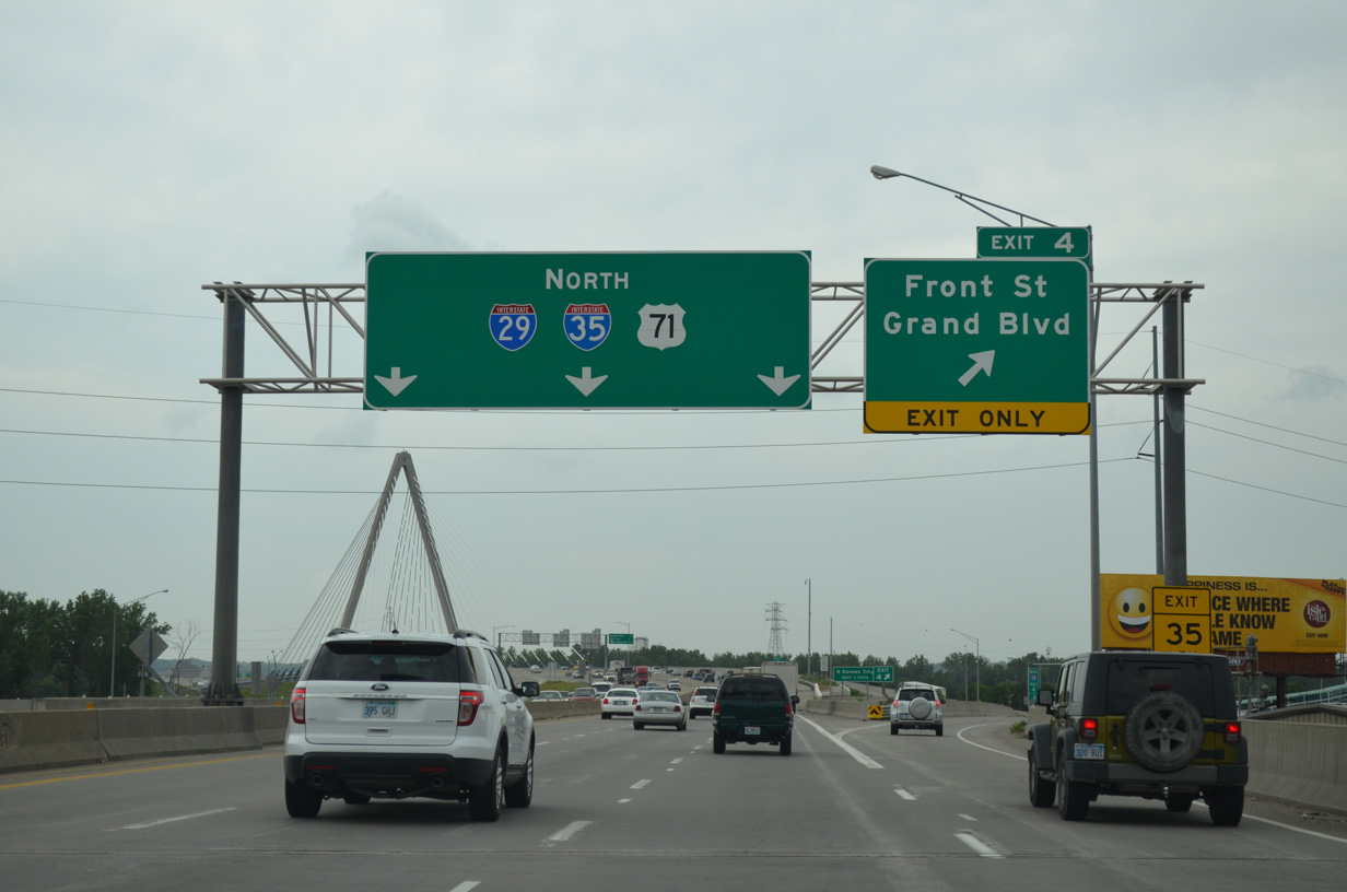
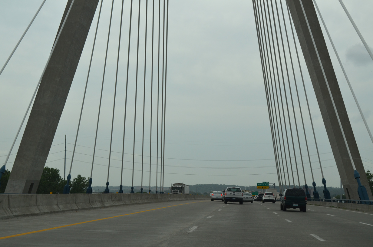
| I-29/35-U.S. 71 span Guinotte Avenue and several Union Pacific Railroad lines on a viaduct leading to Exit 4. This stretch was expanded to eight lanes during the kcICON Project from March 2008 to February 2011. 06/18/15 |
|
| The kcICON Project replaced a folded diamond interchange with substandard ramps to Front Street with a SPUI. 06/18/15 |
|
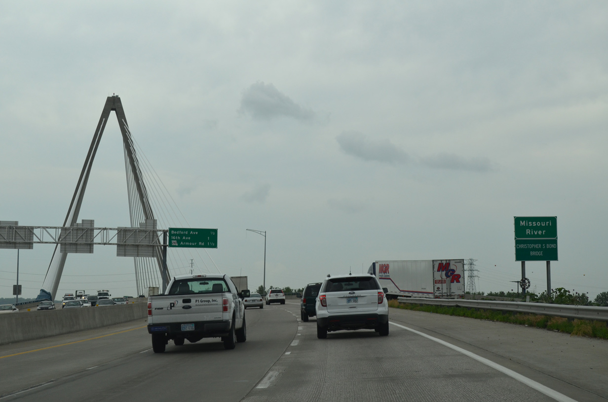
| The Christopher S. Bond Bridge spans the Missouri River from the Columbus Park and Northeast Industrial Areas to the city of North Kansas City. 06/18/15 |
|
| The succeeding three exits fall within the industrial city of North Kansas City. 06/18/15 |
|
| The Christopher S. Bond Bridge was dedicated on October 17, 2010. It replaced an aging four lane suspension bridge, the Paseo Bridge, which was dismantled by the end of 2011.2 06/18/15 |
|
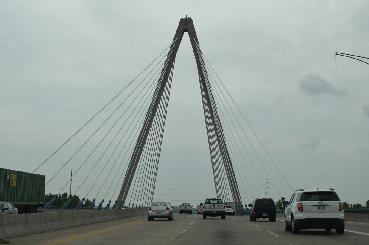
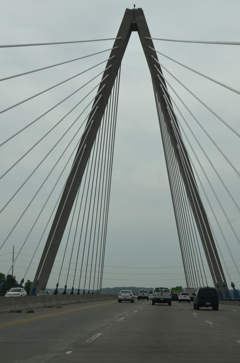
| With a triangular shaped pylon rising to a height of 314 feet, the cable stayed bridge supports a 137 foot wide deck accommodating seven lanes of traffic and 35 feet of shoulder space. The span provides a navigation clearance of 50 feet on the Missouri River.2 06/18/15 |
|
| Completed six months ahead of schedule, the overall kcICON project rebuilt four miles I-29/35, from the Alphabet Loop north to Route 210, within a $232 million budget.2 06/18/15 |
|
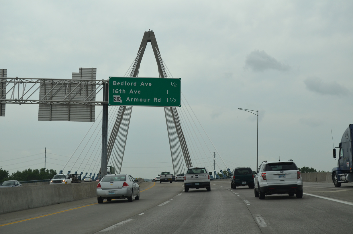
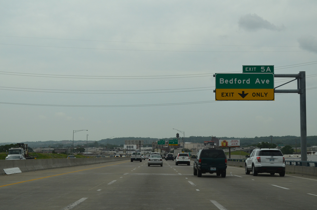
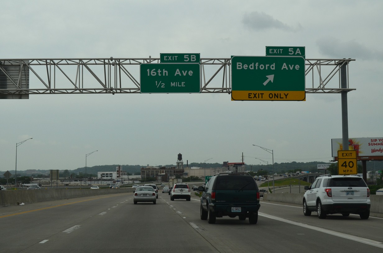
| Northbound I-29/35-U.S. 71 passes over Levee Road ahead of the split diamond interchange (Exit 5A) for Bedford Avenue. 06/18/15 |
|
| Bedford Avenue runs along the south side of the Norfolk Southern and BNSF Rail yards by a number of warehouses to the east. The street west leads to 10th Avenue and Route 9 (Burlington Street). 06/18/15 |
|
| Advancing north from Levee Road, I-29/35-U.S. 71 elevates onto a six lane viaduct spanning the NS and BNSF Railroad yard. 06/18/15 |
|
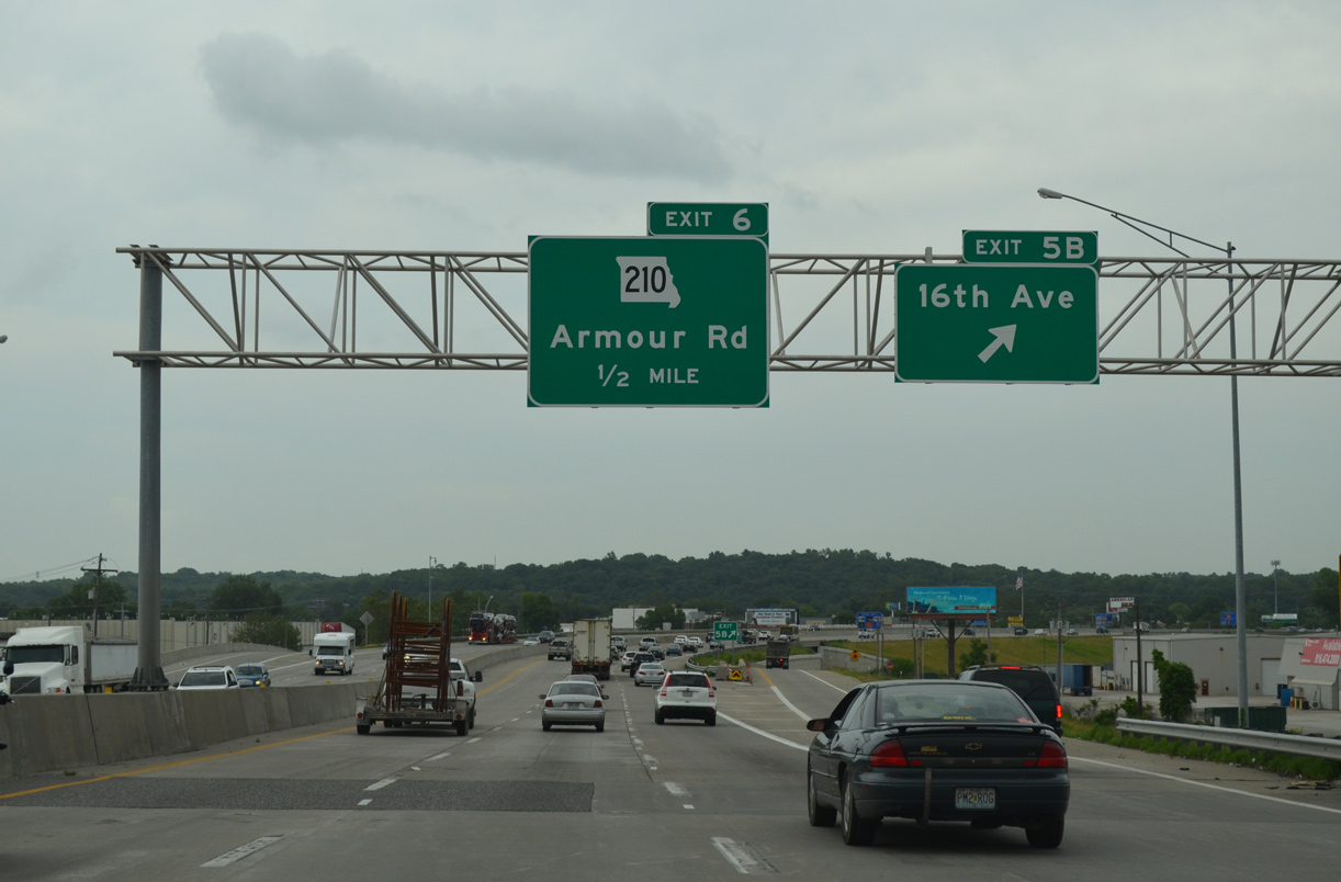
| Exit 5B follows as a half diamond interchange with 16th Avenue west to a warehouse district. The kcICON project replaced a loop ramp here. 06/18/15 |
|
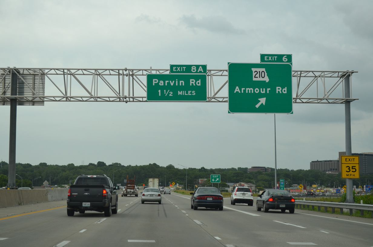
| The cloverleaf interchange (Exit 6) with Armour Road west and Route 210 east was redesigned to eliminate two loop ramps and realign the southbound off-ramp from Armour Road east. A 33.63 mile long route to Randolph, east Kansas City, River Bend and Richmond, Route 210 begins at I-29/35. 06/18/15 |
|
| Northbound traffic on I-29/35 reenters Kansas City beyond a ridge line and ahead of North Hills Park and the River Forest neighborhood. 06/18/15 |
|
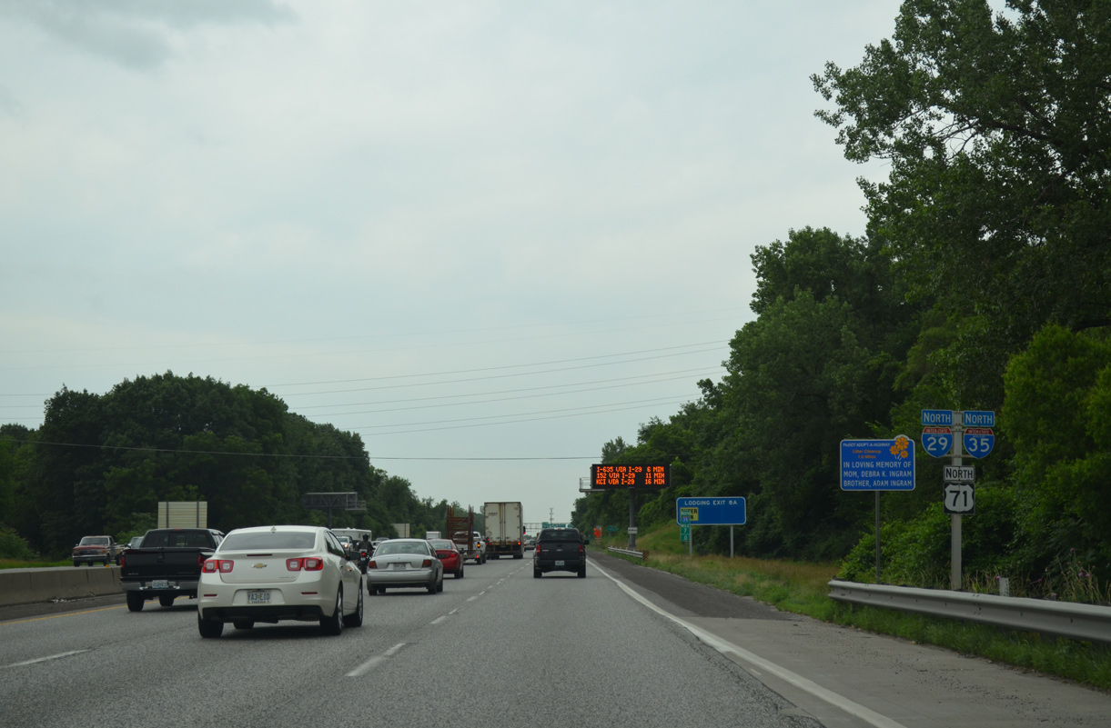
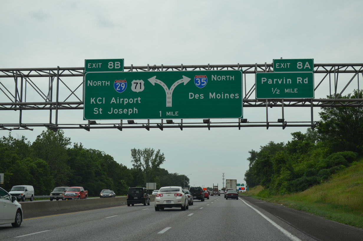
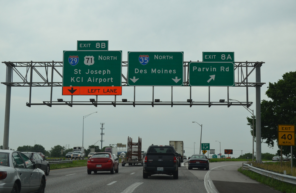
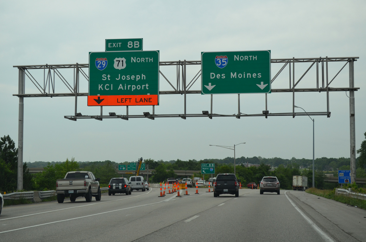
| Traffic partitions into two lane ramps for I-29/U.S. 71 north to Kansas City International Airport (MCI) and I-35 northeast to Liberty in one mile. A folded diamond interchange (Exit 8A) precedes the separation at Parvin Road. 06/18/15 |
|
| Parvin Road connects the freeway with residential areas and apartment complexes west at Crestview and east in River Forest. I-29 and I-35 split to the immediate north at Exit 8B. 06/18/15 |
|
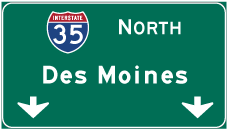
| I-35 turns northeast to leave Kansas City at Claycomo while I-29/U.S. 71 angle northwest through Gladstone and by Riverside to the Kansas City Northland area. I-35 continues to Des Moines, Iowa while I-29 joins the KC area with Omaha and Council Bluffs, Iowa. 06/18/15 |
|
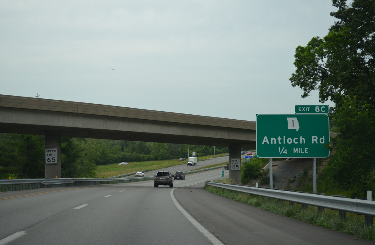
| Interstate 35 turns east beyond the partition with I-29 by the Colonial Square and Chaumiere neighborhoods of Kansas City to a diamond interchange (Exit 8C) with Route 1 (Antioch Road). 06/18/15 |
|
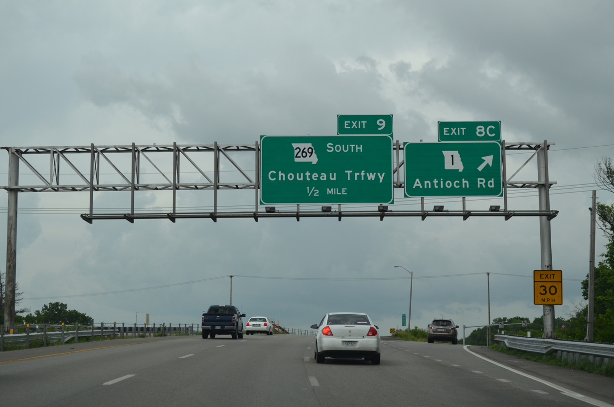
| Route 1 (Antioch Road) is an urban highway traveling 7.30 miles north from Route 210 (Armour Road) in North Kansas City to Gladstone and Route 152 at Indiana Avenue. Route 269 (Chouteau Trafficway) ends at Exit 9 in a half mile. 06/18/15 |
|
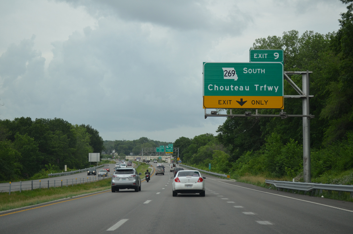
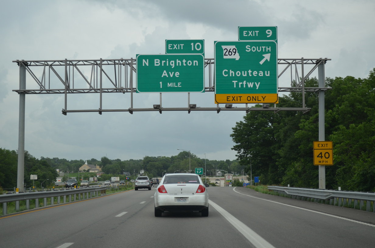
| Interstate 35 expands with auxiliary lanes between Exits 8C and 9. The diamond interchange with Route 269 lies east of Chaumiere Woods Park at Chouteau Crossings shopping center. 06/18/15 |
|
| Chouteau Trafficway comprises a controlled access arterial southward 2.1 miles to the Missouri River and 3.33 miles overall as Route 269 to Front Street in the Northeast Industrial District. Chouteau Traffic winds north from Exit 9 as a local arterial to U.S. 69 (Vivion Road), Antioch Crossing shopping center and Antioch Road. 06/18/15 |
|
| Angling northeast, I-35 passes between Chouteau Park and the Winnwood neighborhood by milepost 10. 06/18/15 |
|
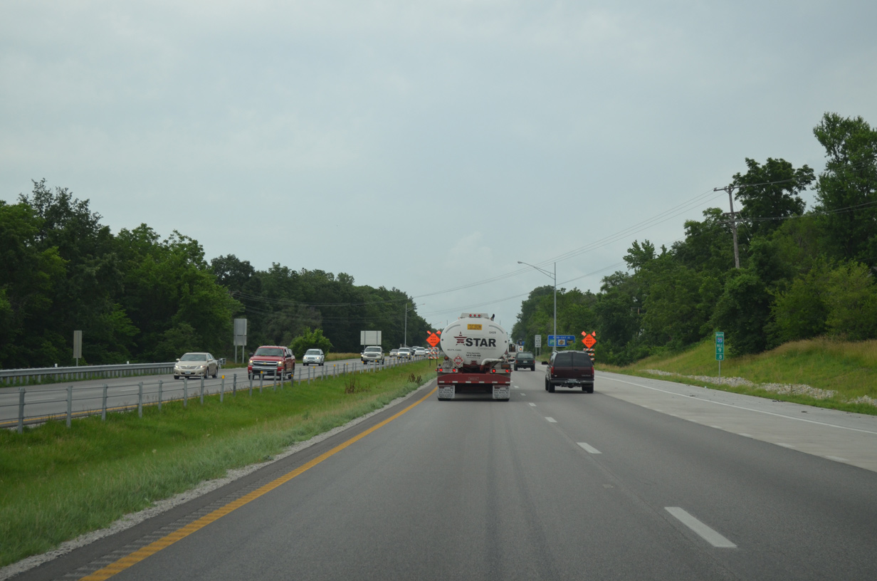
| A half diamond interchange connects northbound I-35 with North Brighton Avenue to the Glenhaven and Maple Park West communities. U.S. 69 (Vivion Road) crosses paths with I-35 just east of Brighton Avenue at Exit 11. 06/18/15 |
|
| U.S. 69 (Vivion Road) heads east along a commercial boulevard by the Ravenwood-Somerset community to Exit 11. The route expands into a four lane, divided highway through the Maple Park West neighborhood east of I-35. I-35 parallels U.S. 69 northeast to Exit 12 with I-435 at Claycomo. 06/18/15 |
|
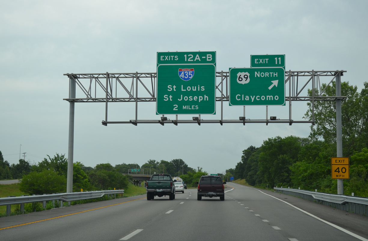
| Interstate 35 north splits with a wye interchange (Exit 11) for U.S. 69 (Vivion Road) north into the city of Claycomo. 06/18/15 |
|
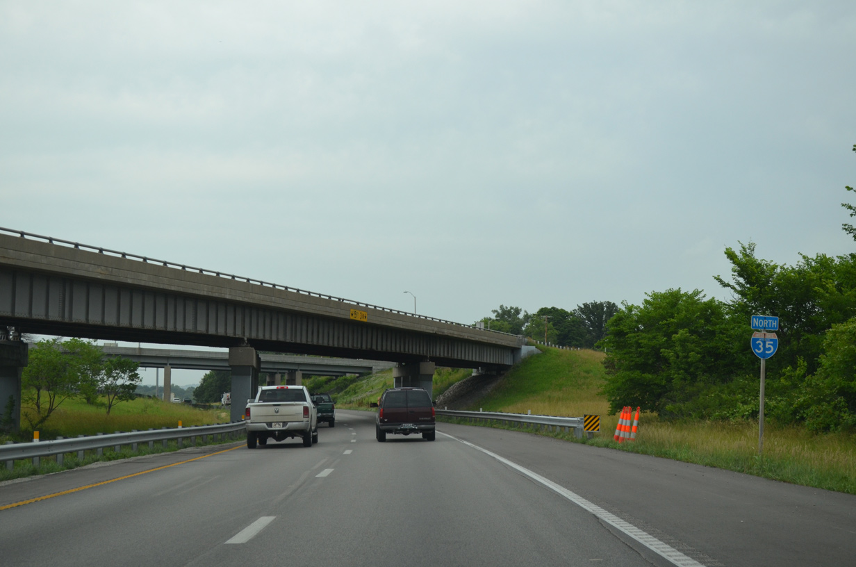
| A second confirming marker appears after the entrance ramp from U.S. 69 (Vivion Road) north. Interstate 35 parallels Mill Creek along a forested stretch as it leaves the Kansas City limits. 06/18/15 |
|
| Interstate 435 originally ended at a directional T interchange with I-35 in Claycomo. The northern portion of the loop was completed by 1986, with ramps added from I-35 north to I-435 north at Exit 12B and from the beltway south to I-35 back into Kansas City. 06/18/15 |
|
| A diamond interchange connects the Kansas City beltway with adjacent U.S. 69 by the Ford Kansas City Assembly Plant. Ramps to U.S. 69 provide some connectivity with Interstate 35. 06/18/15 |
|
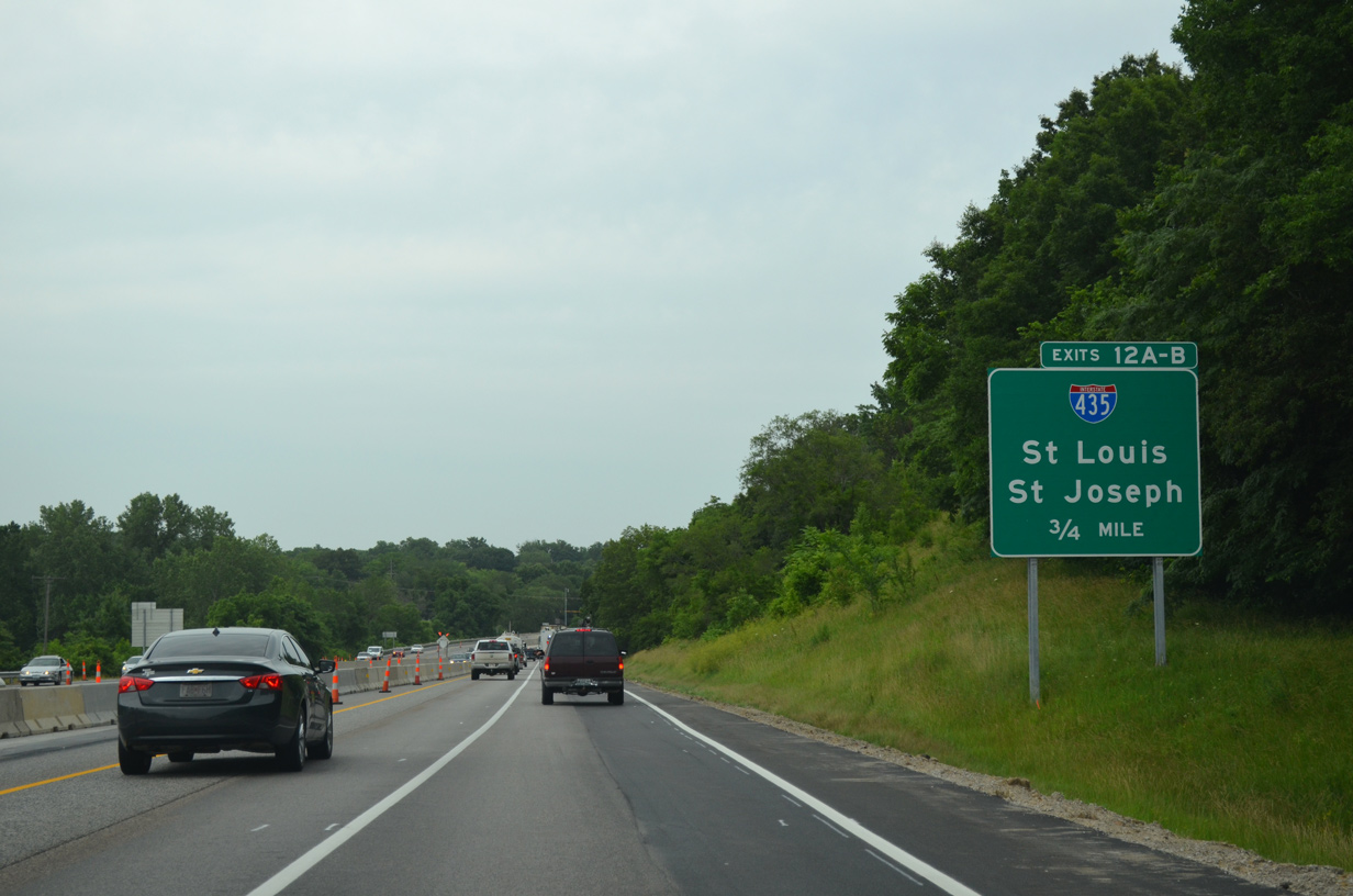
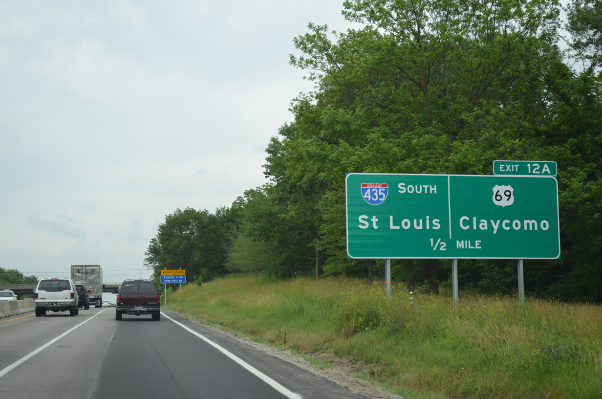
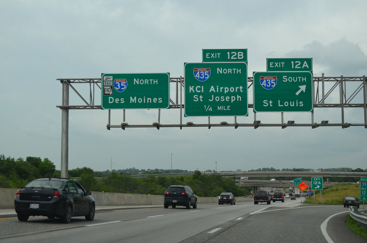
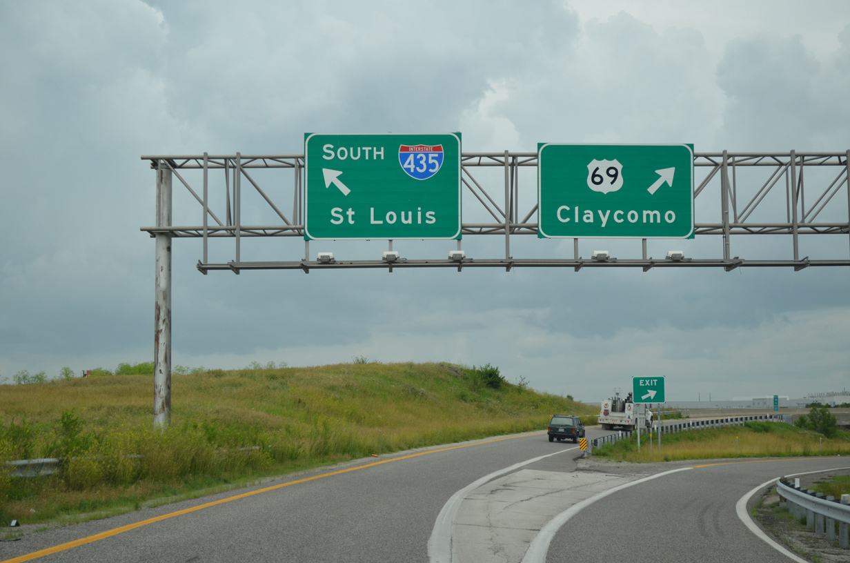
| Route 110 (Chicago-Kansas City Expressway) begins as I-35 north reaches Exit 12A for I-435 south to I-70 and St. Louis. The CKC overlays I-35 northward to U.S. 36 at Cameron. Exit 12B separates for I-435 north as it wraps around the Kansas City Northland toward Smithville and Kansas City International Airport (MCI). 06/18/15 |
|
| Exit 12A separates into ramps for U.S. 69 at Claycomo and Interstate 435 south to Winnetonka in Kansas City and Randolph. U.S. 69 north combines with I-35 just to the north at Pleasant Valley. 06/18/15 |
Page Updated 10-20-2021.

 North
North


 East
East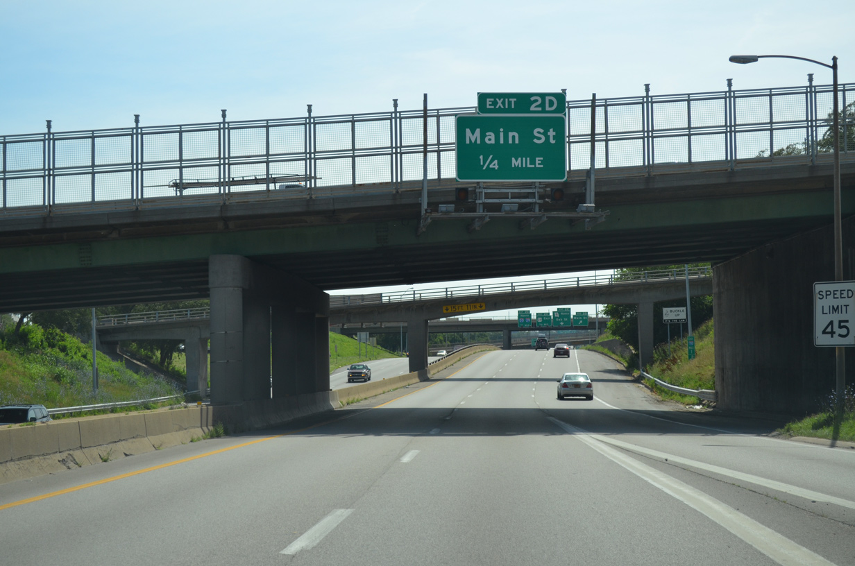

 North
North