|
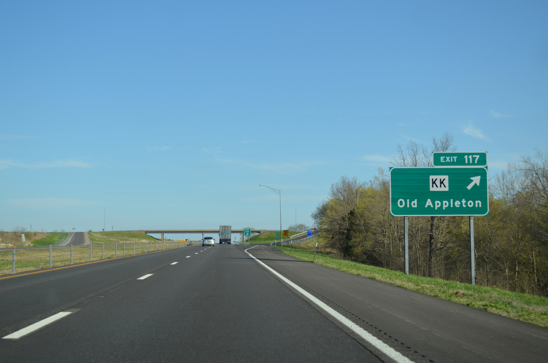
| Exit 117 is the first of nine interchanges along Interstate 55 in Cape Girardeau County. Joining the freeway ahead is Highway KK leading east to U.S. 61 at Old Appleton. 04/13/13 |
|
| West from the diamond interchange (Exit 117) with I-55, Highway KK travels 17.51 miles overall between U.S. 61 and Route 51. The rural highway connects the settlements of Arnsberg, Friedheim, Hilderbrand and Lixville. 04/13/13 |
|
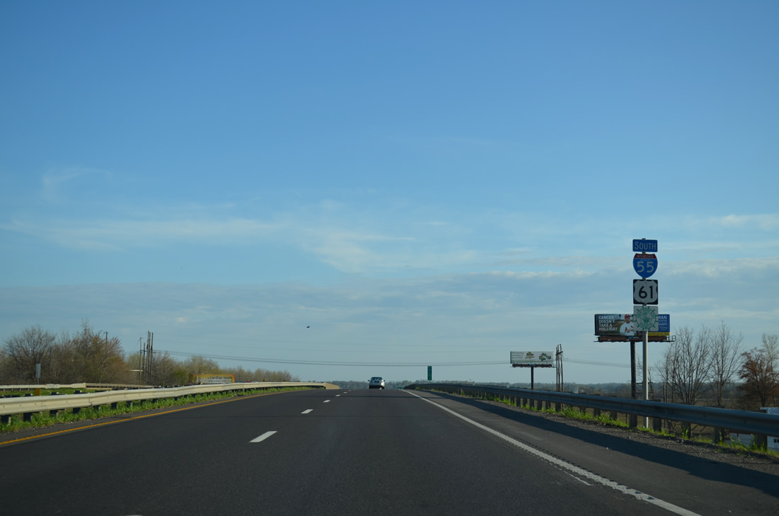
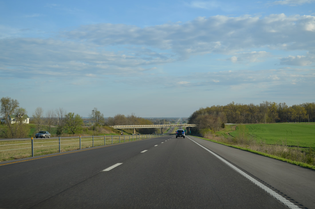
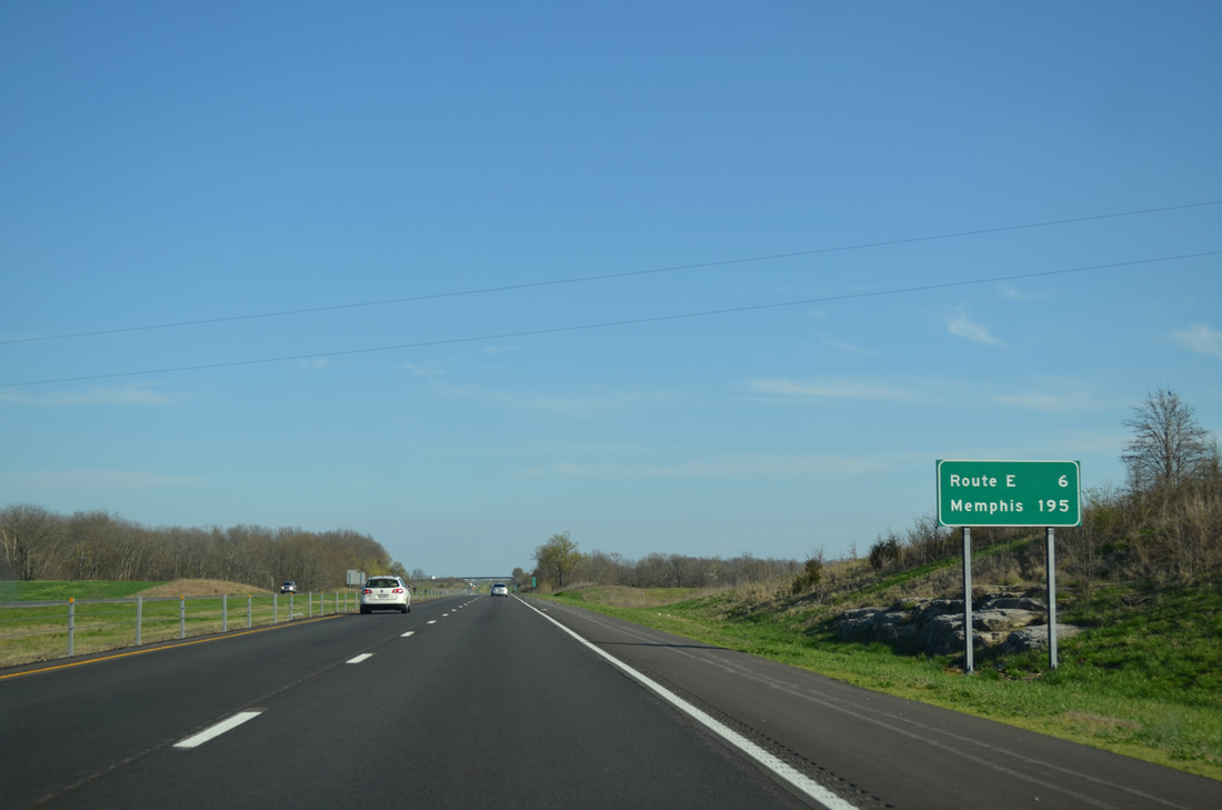
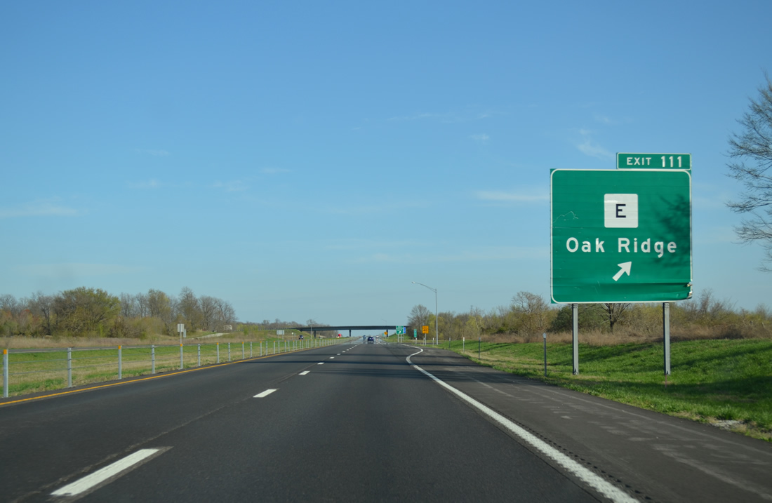
| Interstate 55 bee lines another six miles to Highway E while Memphis is nearly a three hour drive to the south. 04/13/13 |
|
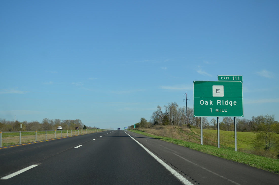
| Exit 111 with Highway E was planned in 1969 but not constructed for another three decades. Having opened October 9, 2001 at a cost of $2.38 million, the new exit interrupted the longest exit less stretch of I-55 in Missouri.1 The parclo A2 interchange provides access to the villages of Oak Ridge to the west and Pocahontas to the east. 04/13/13 |
|
| 6.29 miles in length Highway E heads west from Exit 111 to Highway B beyond Oak Ridge and east to U.S. 61 at County Road 530. 04/13/13 |
|
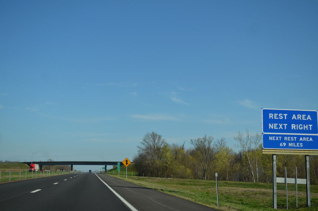
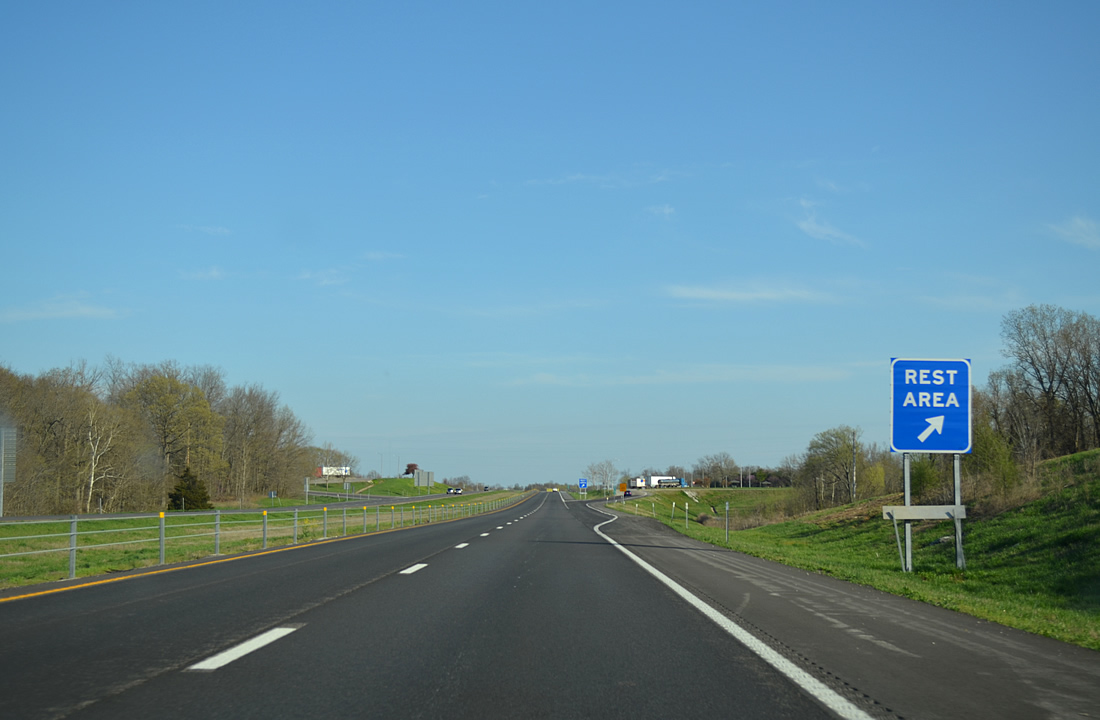
| The first of two rest areas along I-55 south in Missouri lies just south of Highway E. 04/13/13 |
|
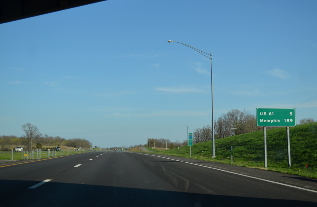
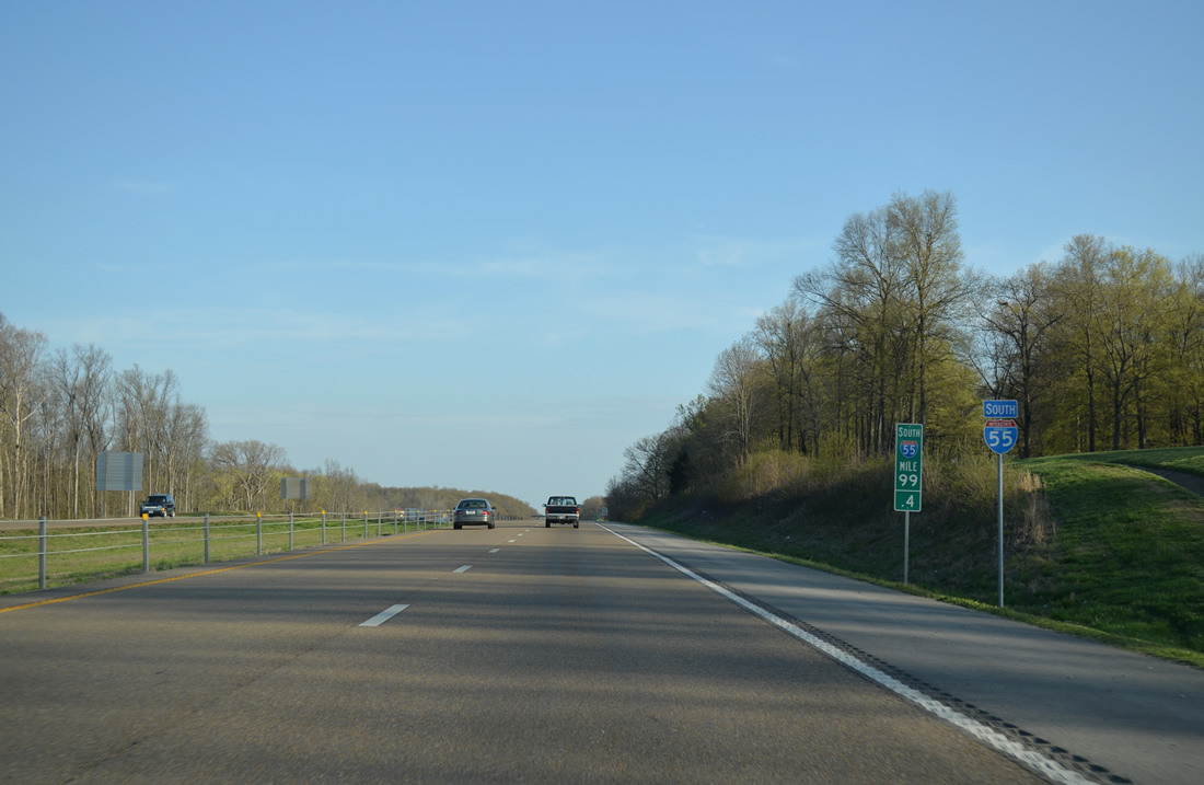
| U.S. 61 crosses paths with Interstate 55 for the first time since Exit 170 in five miles. Memphis is 189 miles to the south. 04/13/13 |
|
| County Road 433 appears alongside Interstate 55 by this reassurance marker preceding the rest area. 04/13/13 |
|
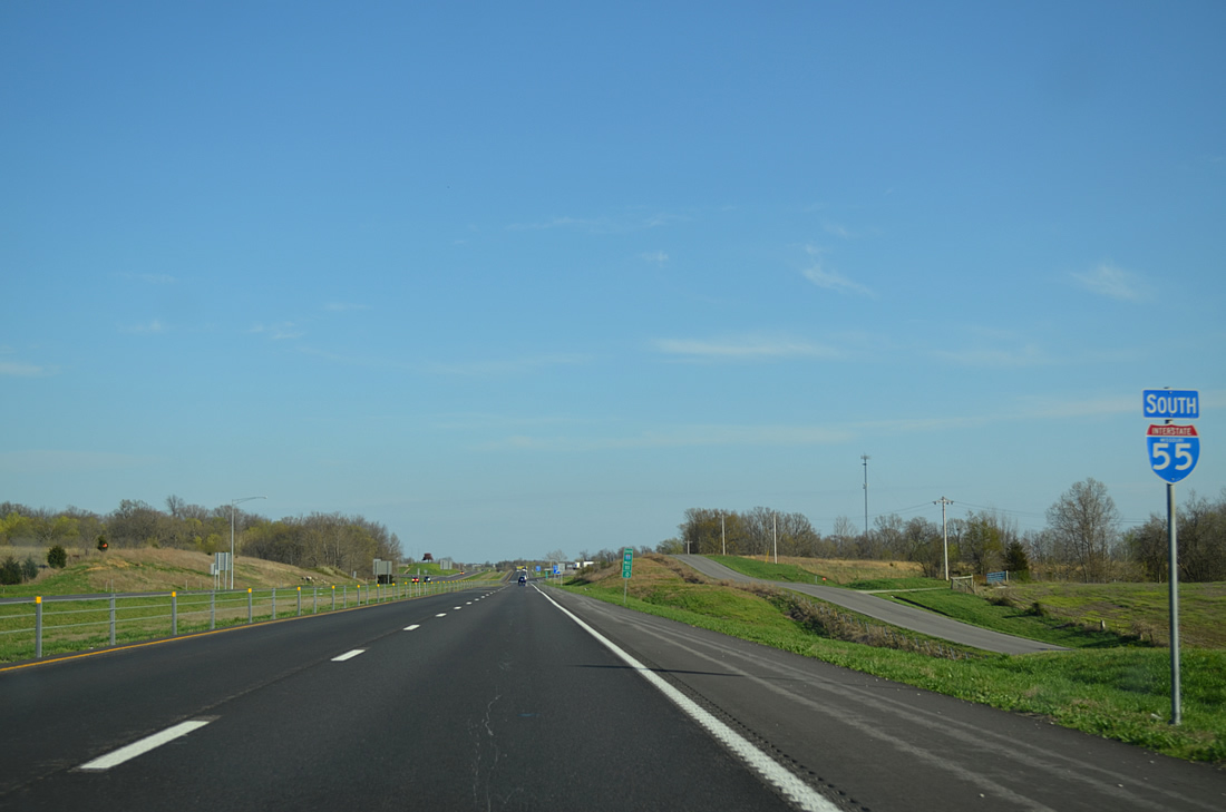
| Rest areas serve travelers in both directions of Interstate 55 in Cape Girardeau County. 04/13/13 |
|
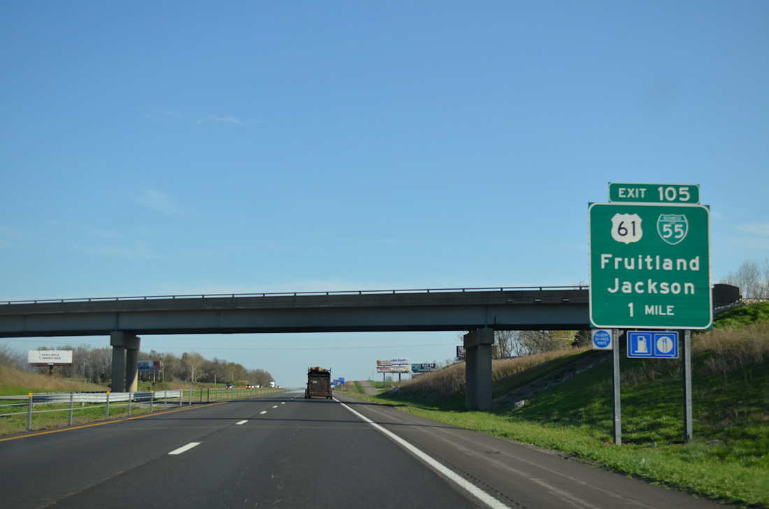
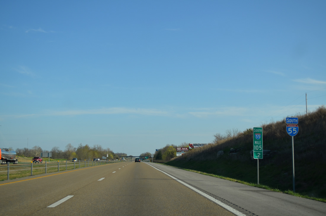
| Passing under Highway FF near Fruitland, Interstate 55 advances to the exchange with U.S. 61 south into the city of Jackson. 15.79 miles in length, Business Loop I-55 coinicdes with U.S. 61 south from Exit 105 through both Jackson and Cape Girardeau. 04/13/13 |
|
| A diamond interchange joins Interstate 55 south with U.S. 61 north to Route 177 east and Fruitland, and Business Loop I-55/U.S. 61 south to High Street and Downtown Jackson. 04/13/13 |
|
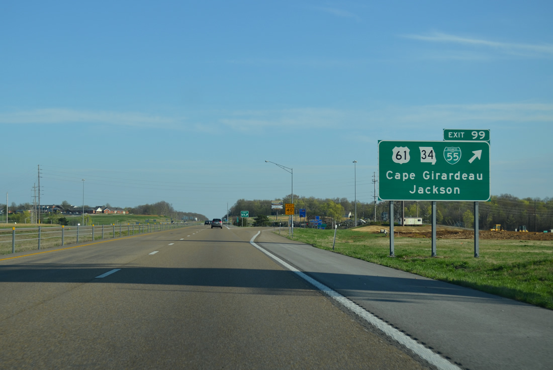
| Interstate 55 stays east of Jackson, straddling portions of the city limits to Exit 99. 04/13/13 |
|
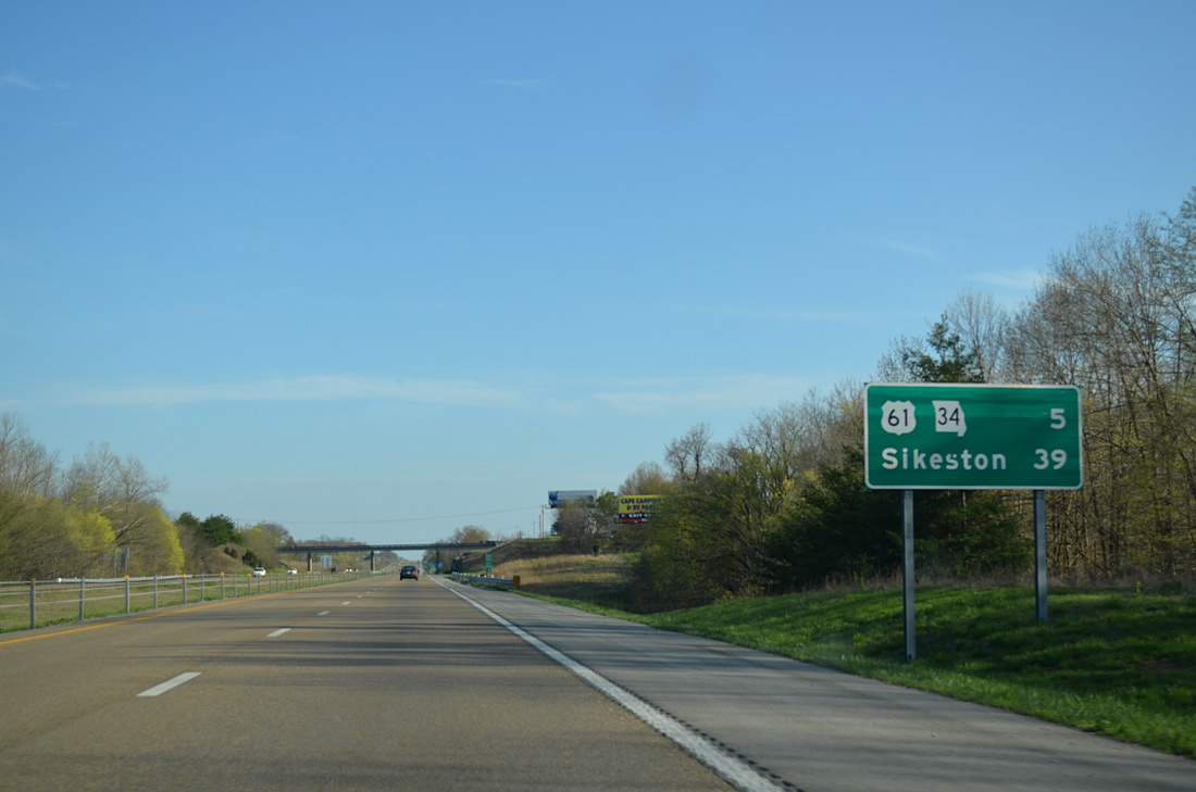
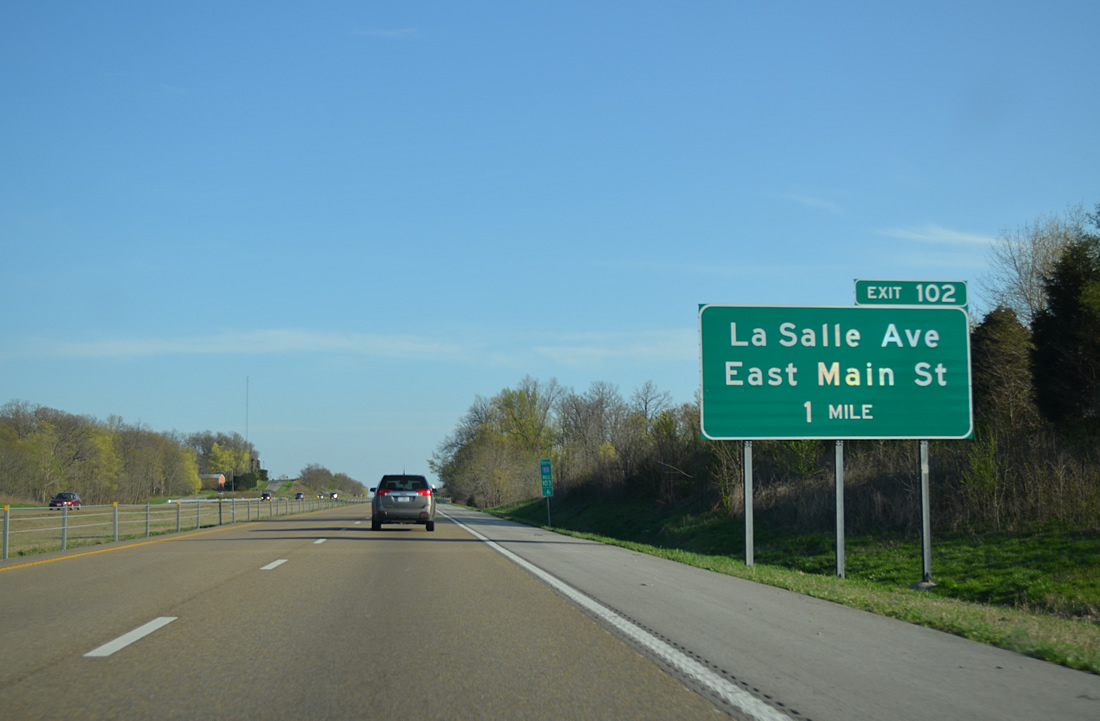
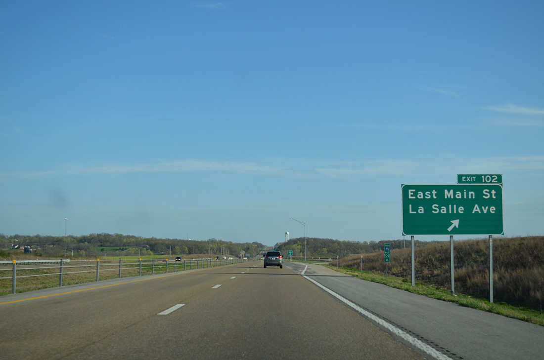
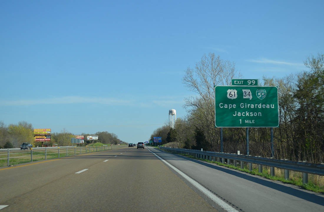
| U.S. 61/Route 34 represents the next entry on southbound distance signs for Cape Girardeau in five miles. Forthcoming Exit 102 was constructed as part of a $10.8 million project linking E Main Street in Jackson with La Salle Avenue north of Cape Girardeau.2 The exchange opened in late 2007. 04/13/13 |
|
| E Main Street was extended from Oak Hill Road in Jackson to Exit 102 on December 17, 2007. The project opens up land for development, much of which is owned by Southeast Missouri State University. Work on the overall project commenced in September 2006.3 04/13/13 |
|
| Interstate 55 south formally enters the northern most portions of Cape Girardeau just ahead of the diamond interchange (Exit 102) with E Main Street west and La Salle Avenue east. The extension of La Salle Avenue west from Highway W was completed in September 2009.4 04/13/13 |
|
| South of Exit 102, Interstate 55 crosses both Williams Creek and County Road 306. 04/13/13 |
|
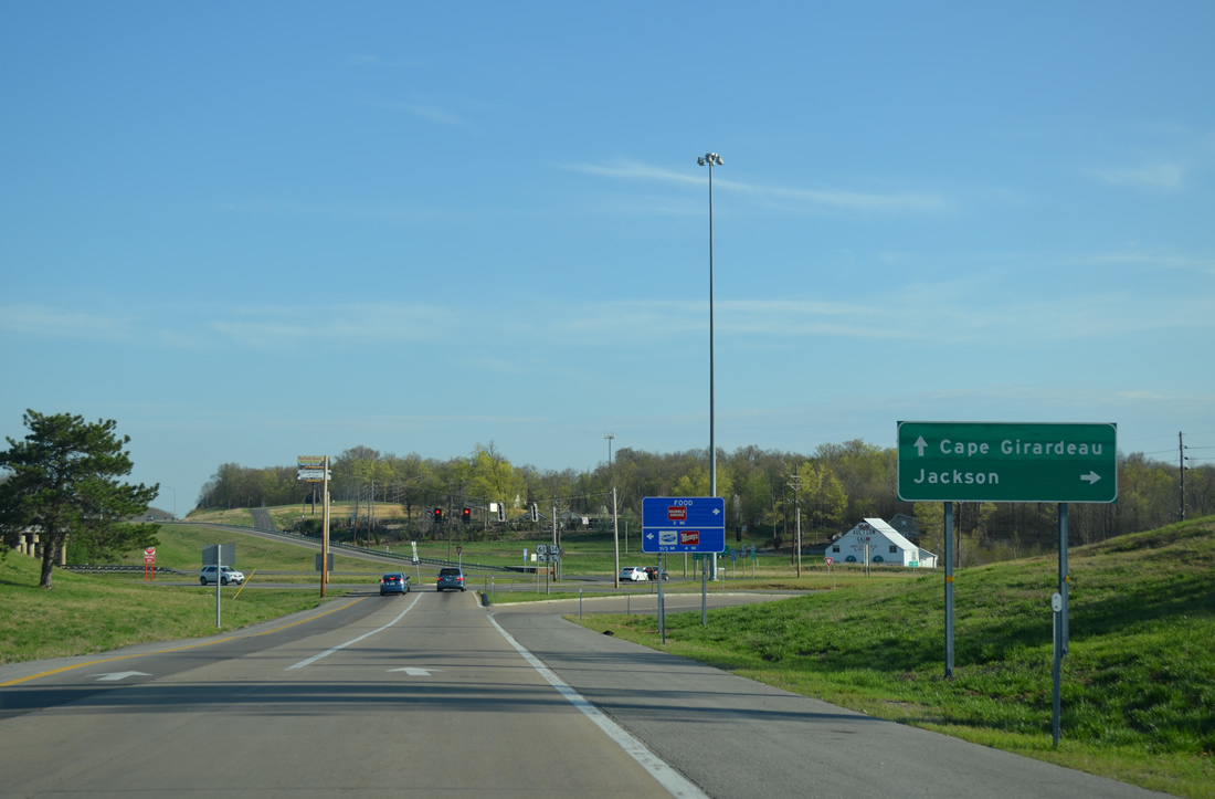
| Route 34 joins U.S. 61/Business Loop I-55 southeast from Hope Street and the end of Route 25 north and Route 72 east in Jackson. The three routes meet I-55 at a split diamond interchange (Exit 99) in one mile. 04/13/13 |
|
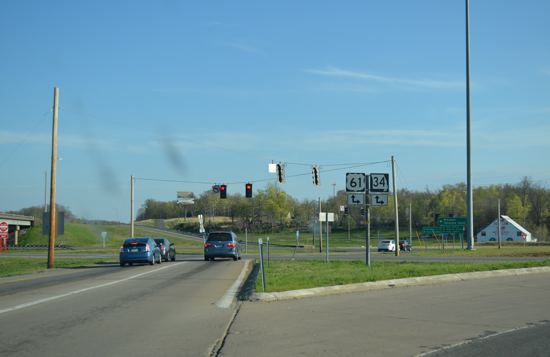
| Business Loop I-55/U.S. 61-Route 34 continue east along Kingshighway through Cape Girardeau. Route 34 splits with the business route for Shawnee Parkway (Route 74) east to the Bill Emerson Memorial Bridge across the Mississippi River. A 103.50 mile long highway, Route 34 travels between Route 49 at Piedmont and IL 146 near East Cape Girardeau, Illinois. 04/13/13 |
|
| Taking Exit 99 to Business Loop I-55, U.S. 61 and Route 34. Route 34 joins Jackson with Marble Hill to the west. 04/13/13 |
|
| A short connector crosses Business Loop I-55/U.S. 61 north for Kingshighway south into Cape Girardeau. 04/13/13 |
|
| Interstate 55 straddles western reaches of Cape Girardeau for the next six miles. 04/13/13 |
|
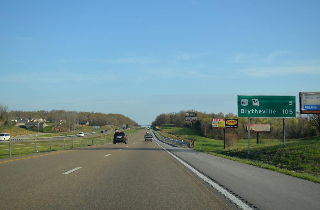
| The next distance sign references the return of U.S. 61 and Business Loop I-55 south in five miles, and uses Blytheville, Arkansas in place of Memphis, Tennessee. Two additional exits in Cape Girardeau precede the interchange complex with U.S. 61/Route 74. 04/13/13 |
|
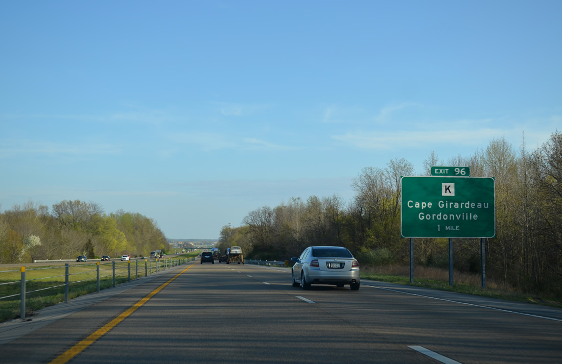
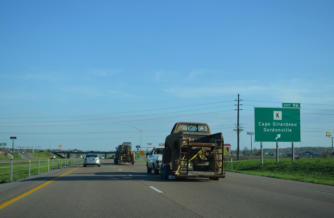
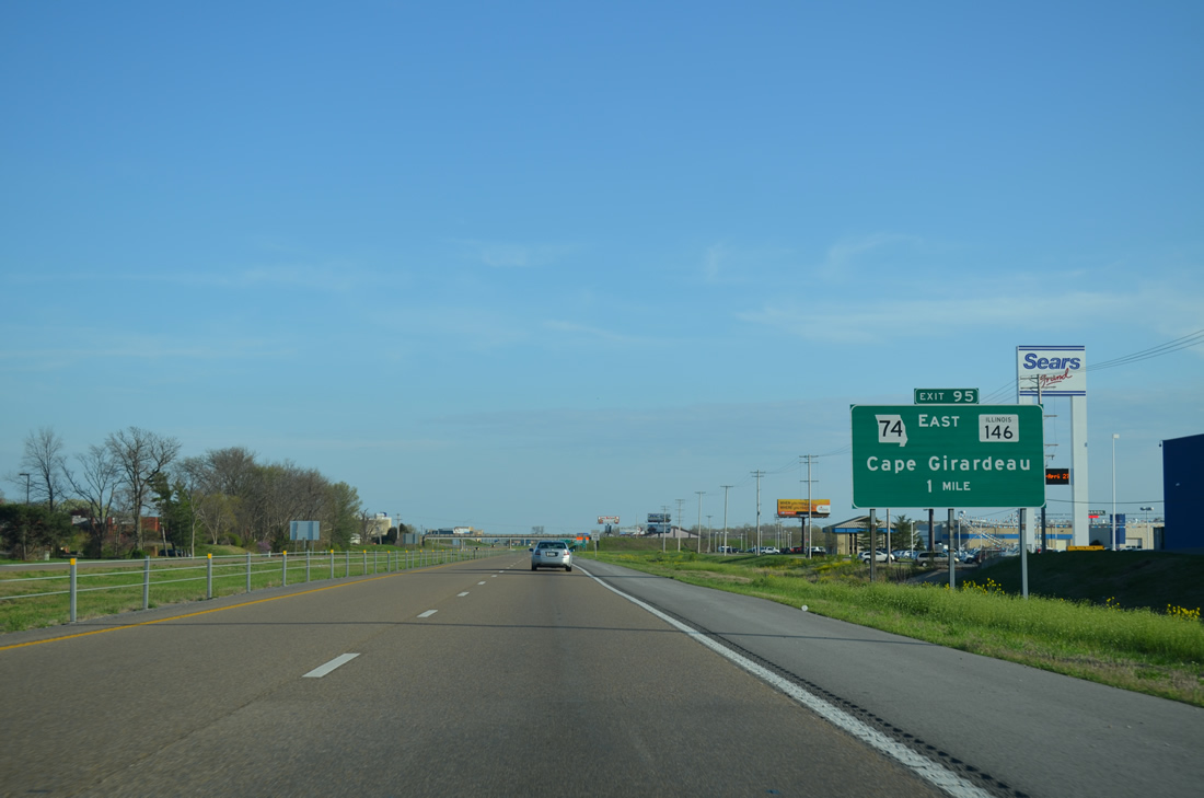
| Highway K joins Interstate 55 with the commercialized west side of Cape Girardeau in one mile. Anchored by Westpark Mall, the retail area lines both sides of I-55 to Exit 95. 04/13/13 |
|
| Highway K (William Street) comprises a 6.56 mile route east from the diamond interchange at Exit 96 to U.S. 61/Route 34 (Kingshighway) and west to Route 25 near Gordonville. William Street east from Kingshighway to Sprigg Street is the former alignment of Route 34. 04/13/13 |
|
| Big box retail lines parallel Siemers Drive to the west while office parks front the east side of I-55 by Mt. Auburn Road. 04/13/13 |
|
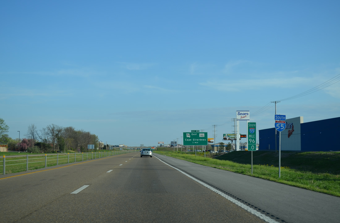
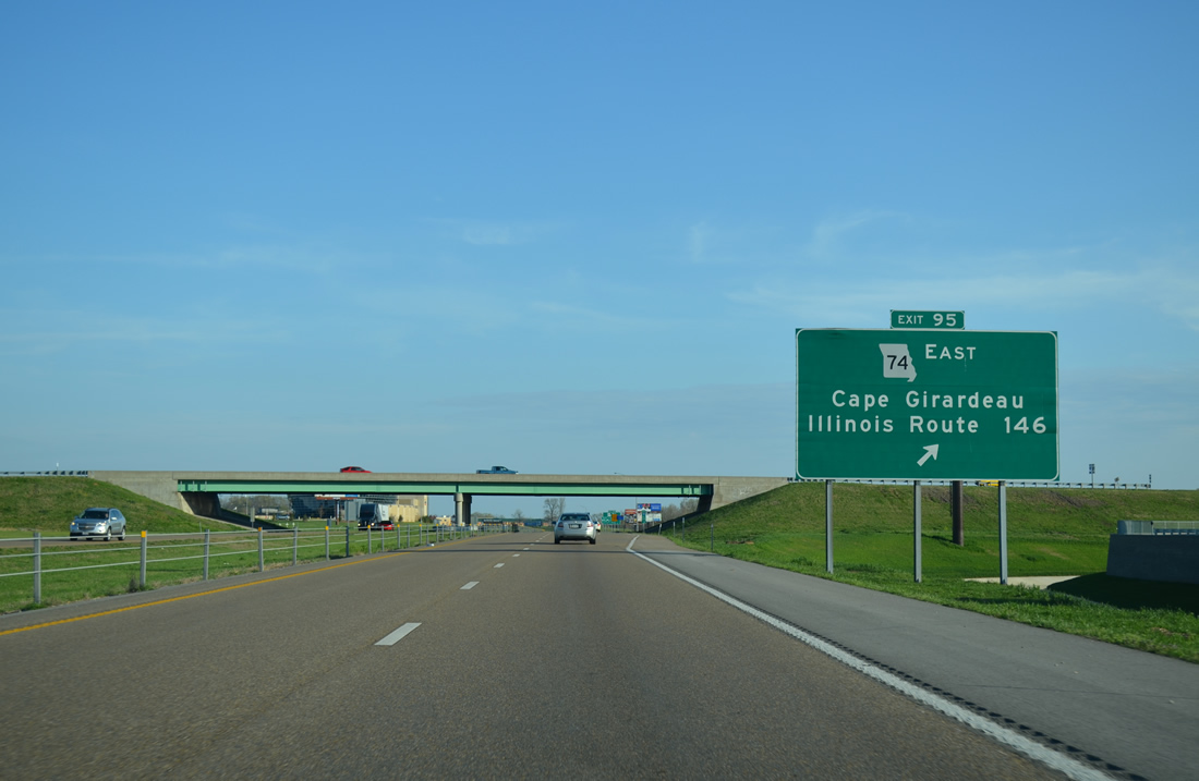
| A parclo interchange joins I-55 with Route 74 (Shawnee Parkway) east in one mile. 1.7 miles of Shawnee Parkway opened to traffic in February 1996 between Business Loop I-55/U.S. 61 (Kingshighway) and Sprigg Street (former Route 74). The remaining 1.1 mile section of new Route 74 west to Exit 95 opened to traffic on October 17, 1997. Costing $29.2 million to build, Shawnee Parkway was named after the adjacent Shawnee Park Sports Complex.5 04/13/13 |
|
| Bloomfield Road spans Interstate 55 south at a distance sign posted 173 miles north of Memphis. The sign specifications predate the opening of Exit 95 with Route 74 east to the Bill Emerson Memorial Bridge. 04/13/13 |
|
| Route 74 was relocated from an overlap with U.S. 61 (Kingshighway) north to Southern Expressway east and Sprigg Street north when the Bill Emerson Memorial Bridge opened to traffic on December 13, 2003. The $100 million span replaced a two lane truss bridge to the north. The 4,000 foot long cable-stayed bridge carries four lanes of traffic, linking Route 34/74 with IL 146 east to IL 3.6 04/13/13 |
|
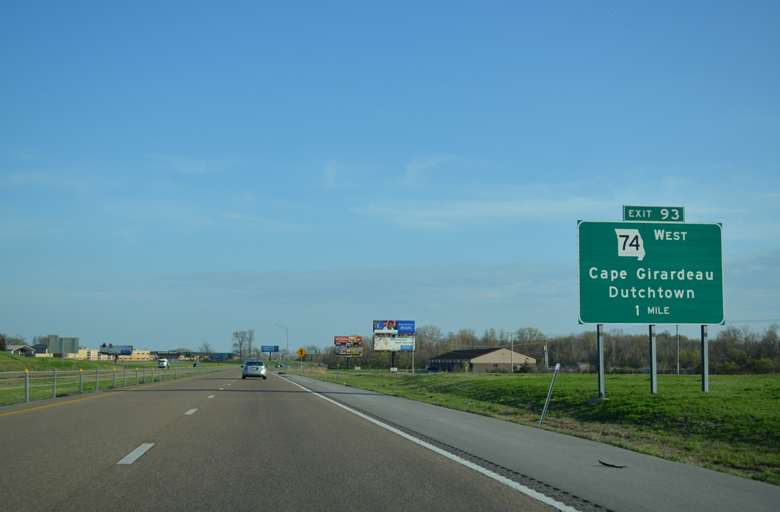
| Route 74 branches west from Interstate 55 south to conclude a 10.57 mile route at Route 25 and Highway A at Dutchtown. 04/13/13 |
|
| Reassurance shields posted for the short overlap between I-55/Route 74 south. The state highway shifted to the freeway when Shawnee Parkway opened to traffic. 04/13/13 |
|
| Scott City is the next destination of Interstate 55 south from Cape Girardeau. New Madrid, 50 miles away, appears on distance signs in place of Sikeston, Blytheville or Memphis. 04/13/13 |
|
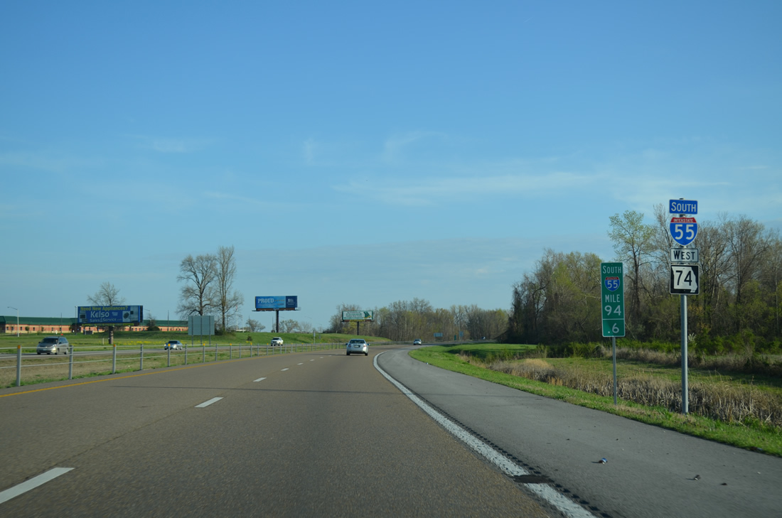
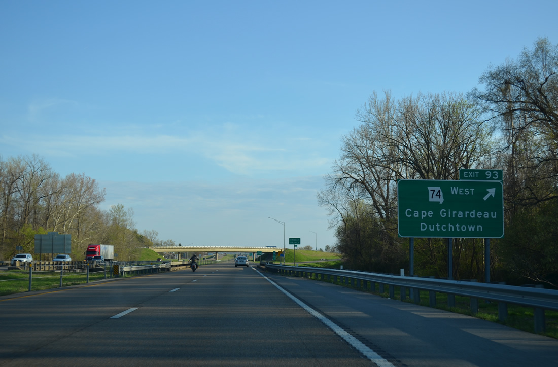
| Exit 93 leads away from I-55 south for the continuation of Route 74 west to Dutchtown. A wye ties into the parclo interchange, bringing U.S. 61 south onto the freeway and concluding Business Loop I-55. 04/13/13 |
|
| U.S. 61 and the Great River Road accompany Interstate 55 south to Scott City. The overlap spans a Burlington Northern Railroad line just beyond Exit 93 near Black Land Bottom. 04/13/13 |
|
| Highway AB, a 9.57 mile route west to Route 25/77 at Blomeyer and east to Highway K at SEMO Port (Southeast Missouri Regional Port), meets I-55/U.S. 61 in one mile. 04/13/13 |
|
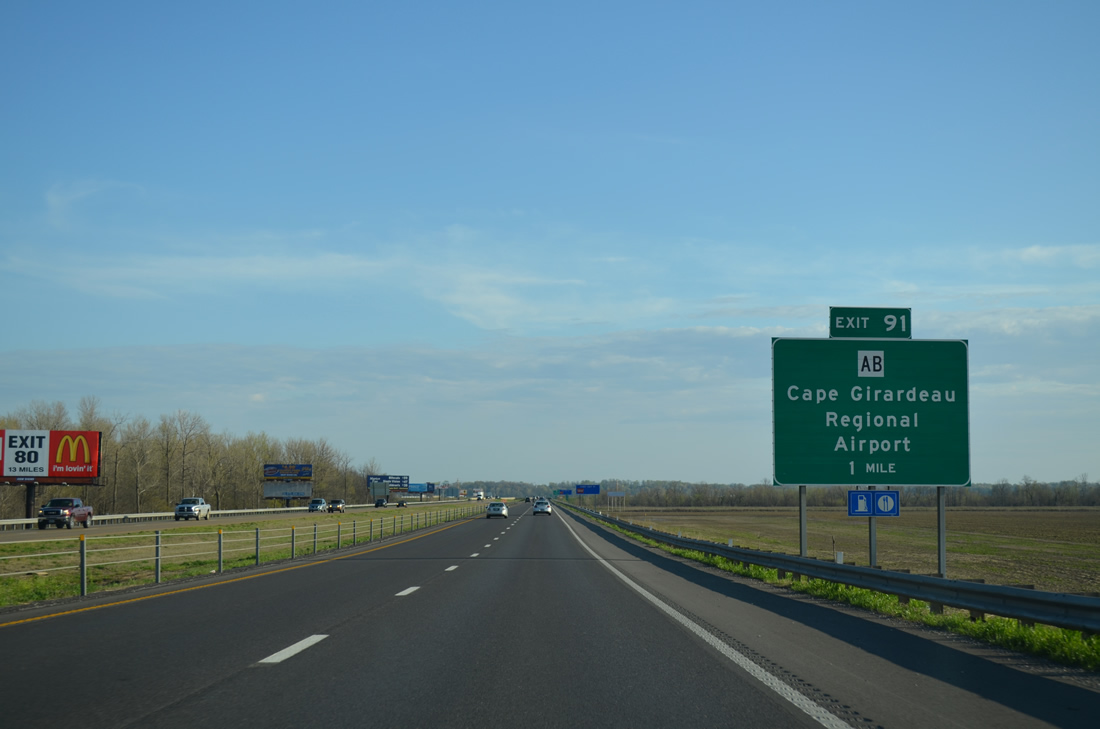
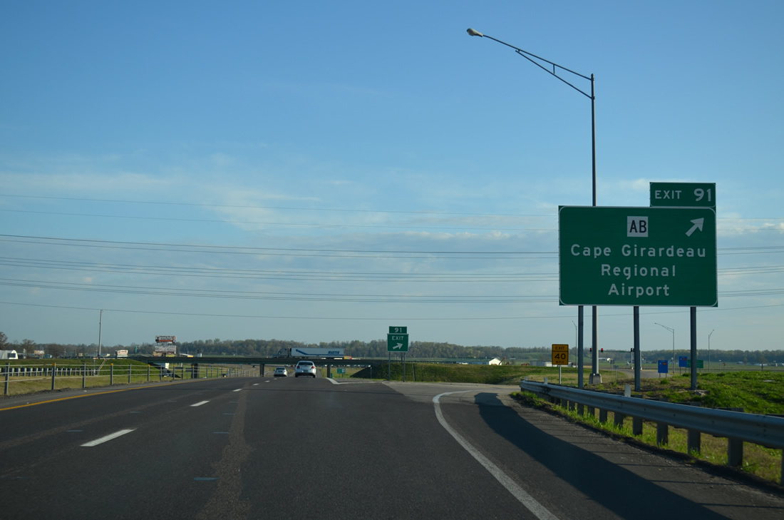
| The southbound freeway spans the Headwater Diversion Channel ahead of the diamond interchange at Exit 91. Highway AB connects I-55/U.S. 61 with Airport Road south to Cape Girardeau Regional Airport (CGI) nearby. 04/13/13 |
|
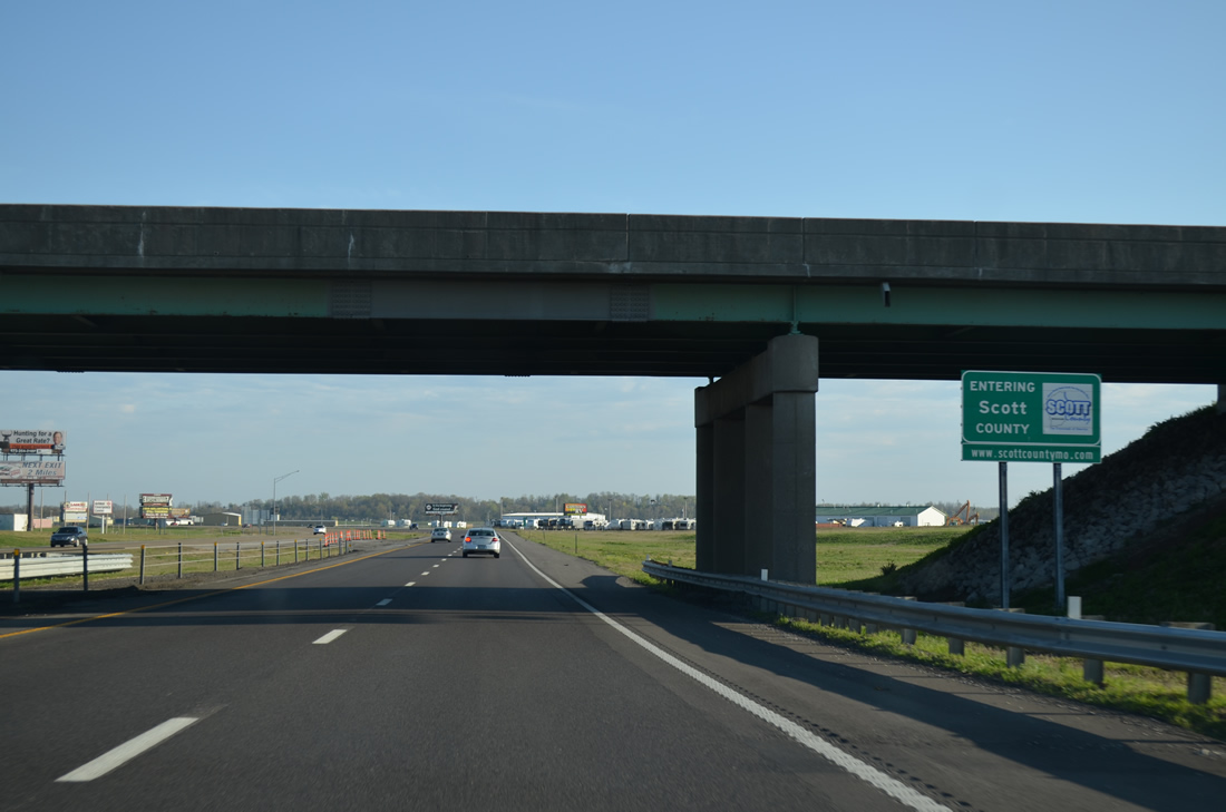
| 27.25 miles of Interstate 55 south through Cape Girardeau County conclude as Highway AB lines the Scott County line through Exit 91. 04/13/13 |
|
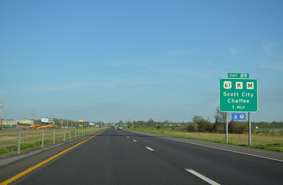
| Traveling alongside Cape Girardeau Regional Airport, Interstate 55 and U.S. 61 part ways at a forthcoming folded diamond interchange (Exit 89). Exit 89 connects the pair with Highway M west to Chaffee and Highway K (Main Street) east to Downtown Scott City. 04/13/13 |
|
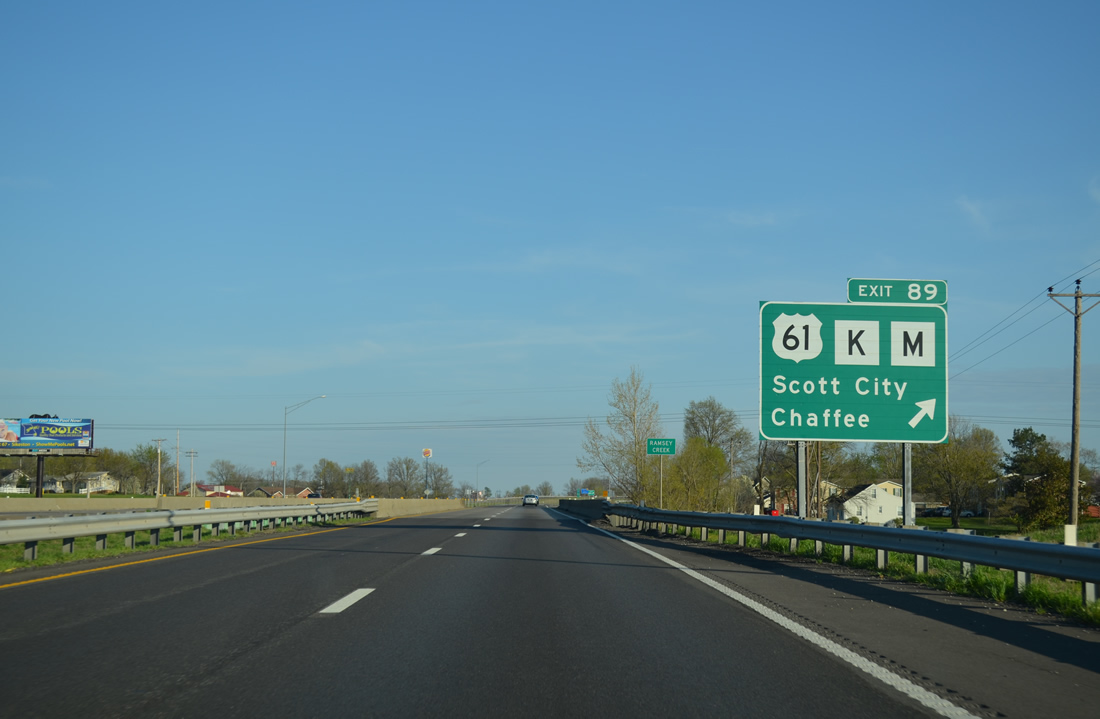
| Crossing Ramsey Creek, U.S. 61 partitions with I-55 south for Exit 89 and Main Street. The route dog legs east to a loop ramp spanning the adjacent Union Pacific Railroad en route to Kelso and Benton. 04/13/13 |
|
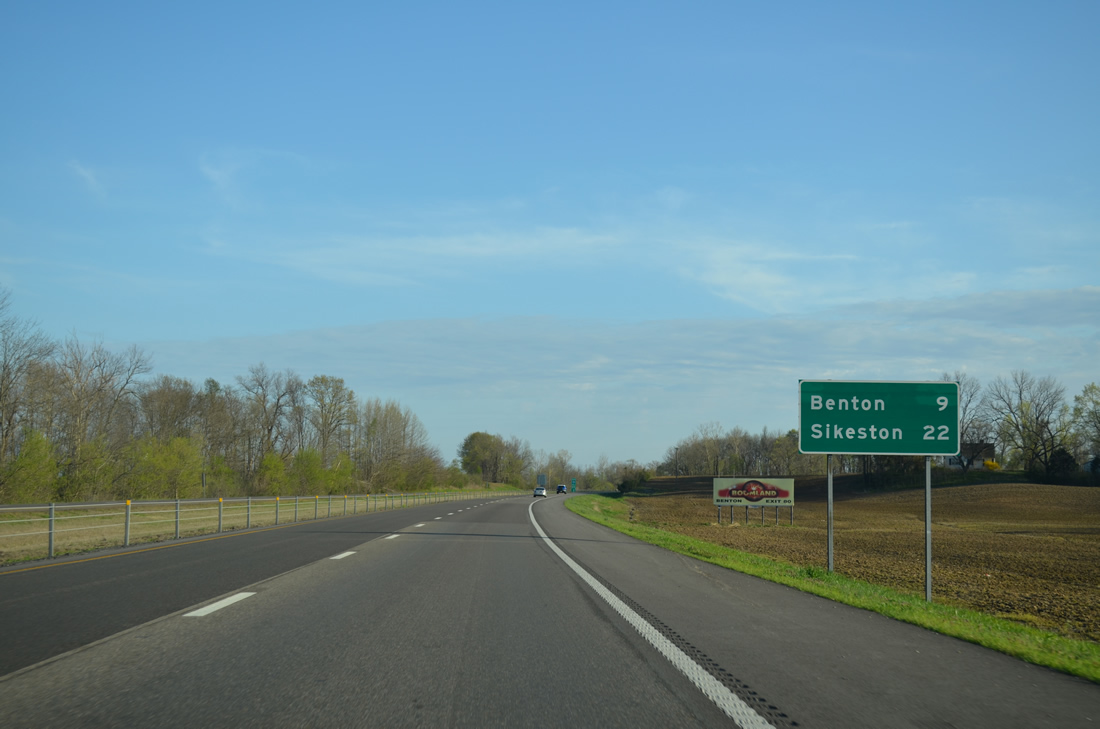
| Benton, the Scott County seat, is nine miles to the south. Sikeston, the largest city along I-55 south to Blytheville, AR follows in 22 miles. 04/13/13 |
|
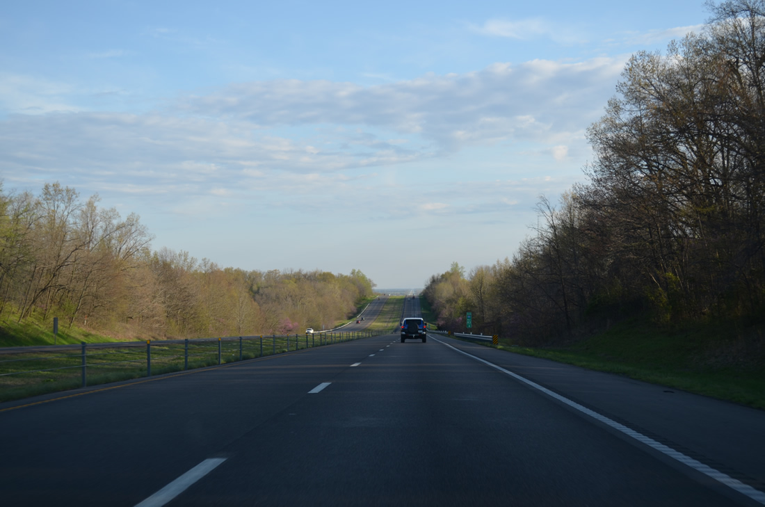
| Interstate 55 undulates across forested hills between level farmland abutting Ramsey Creek for several miles before rising to 550 feet in elevation near milepost 83. This stretch of freeway was completed in 1962. 04/13/13 |
|
| Highway E angles northeast from Benton to Commerce, following a bluff to Powers Island. Interstate 55 drops nearly 100 feet in elevation from the bluff to an agricultural plain. 04/13/13 |
|
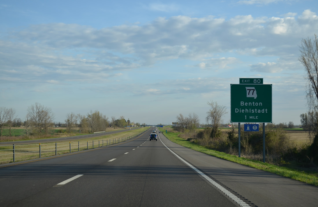
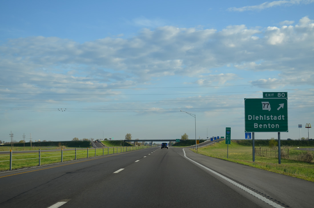
| Route 77, which started in Jackson west of Exit 99, finally crosses paths with Interstate 55 at Exit 80 near Benton. The 69.38 mile long highway overlaps with U.S. 61 from Morley to Benton before resuming a southward course east of I-55, 12 miles to Diehlstadt. 04/13/13 |
|
| Exit 80 constitutes a diamond interchange with Route 77, 1.6 miles east of U.S. 61 (Winchester Street) in Benton. Route 77 joins U.S. 62 east from south of Diehlstadt to Charleston and Wilson City before turning south to the Dorena-Hickman Ferry landing. 04/13/13 |
|
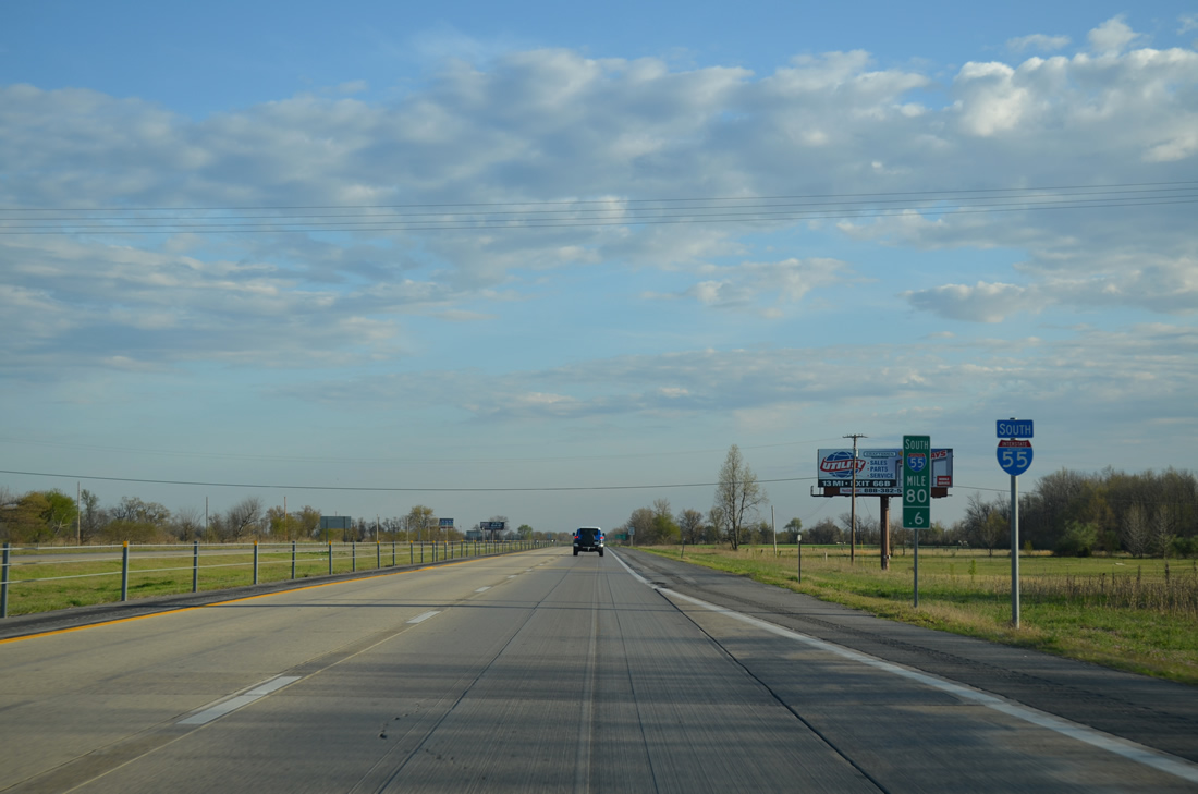
| Interstate 55 leads south by Blodgett on an 11 mile exit less stretch. 04/13/13 |
|
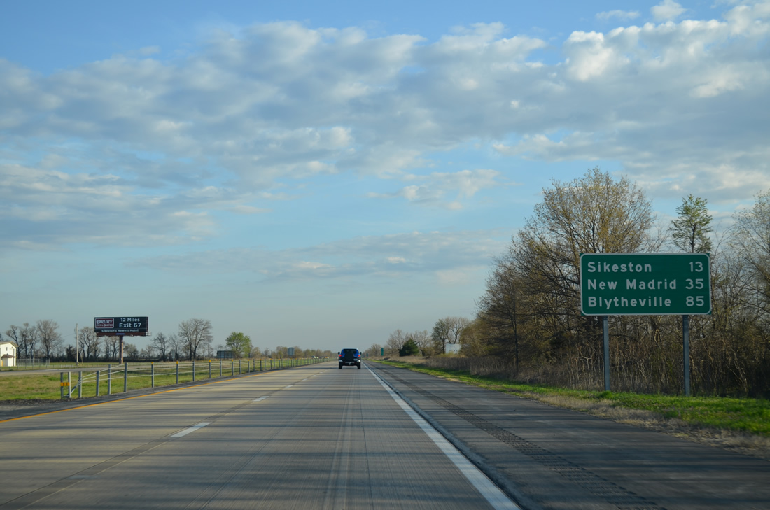
| Sikeston, served by three exits along I-55 south, lies 12 miles to the south. New Madrid, county seat of New Madrid County, is a half hour away while Blytheville, Arkansas is 85 miles out. 04/13/13 |
|
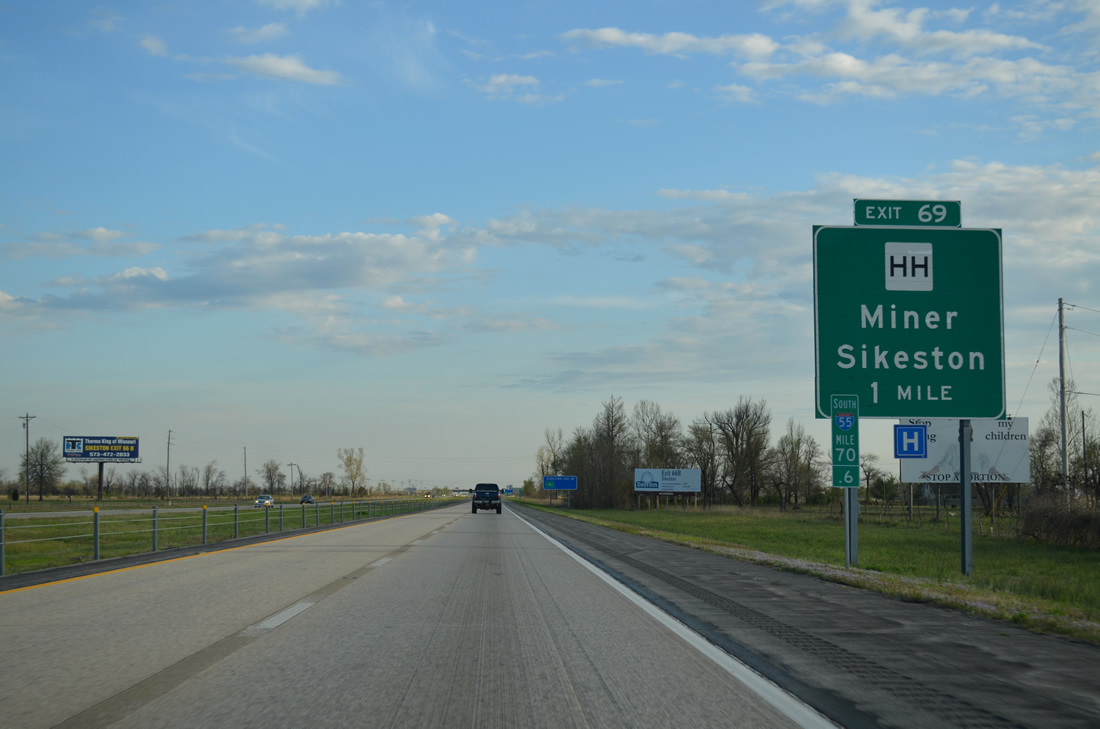
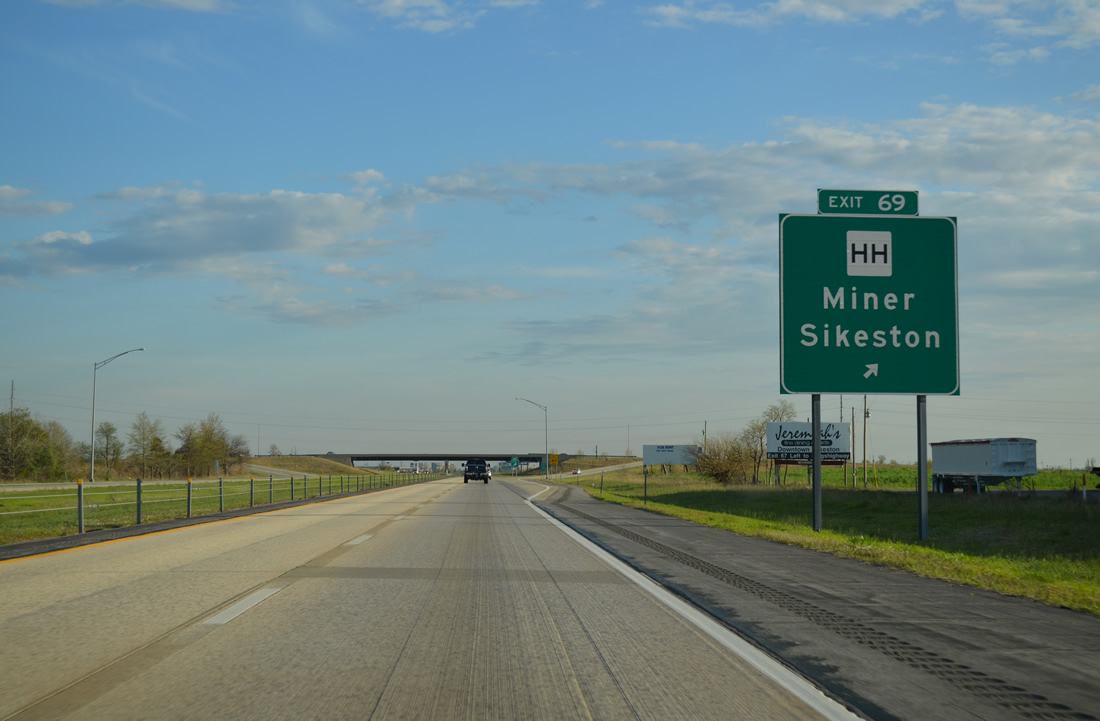
| The diamond interchange at Exit 69 with Highway HH opened to traffic in 1998. Highway HH runs west from I-55 through the northern outskirts of Miner and Sikeston. 04/13/13 |
|
| Highway HH links Interstate 55 with U.S. 61 to the west as part of a 4.42 mile long route. County Road 538 ties into the exchange from rural areas of Miner to the east. 04/13/13 |
|
| Continuing south through the city of Miner, Interstate 55 parallels Highway H and Interstate Drive by an industrial park area. 04/13/13 |
|
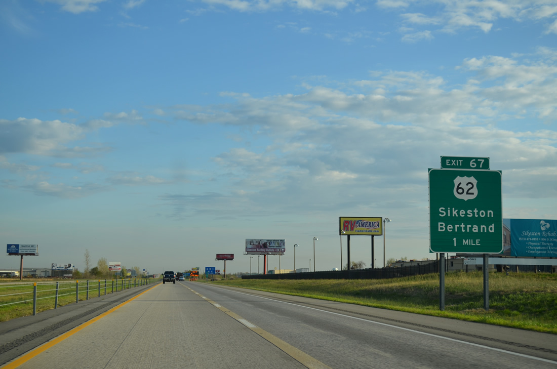
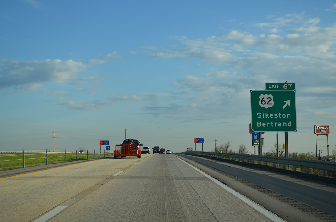
| U.S. 62 (Malone Avenue) parallels a Union Pacific Railroad west to Downtown Sikeston and east from Miner to the city of Bertrand. A folded diamond interchange (Exit 67) joins the route with I-55 in one mile. 04/13/13 |
|
| Exit 67 loops away from I-55 south for U.S. 62 (Malone Avenue) in Miner. Malone Avenue constitutes a commercial boulevard west to Sikeston Memorial Airport (SIK) and the U.S. 62 turn onto Main Street (U.S. 61) south. East of Miner, U.S. 62 parallels Interstate 57 through Bertrand and Charleston to combine with U.S. 60 east through Wilson City, Birds Point and Cairo, Illinois. 04/13/13 |
|
| U.S. 60 overlaps with Interstate 57 west from Charleston to the freeway end at Exits 66B/A in 0.75 miles. I-57 leads north from Charleston to Marion, Mount Vernon and Effingham, Illinois as part of a regional route joining Chicago with Memphis, Tennessee. 04/13/13 |
|
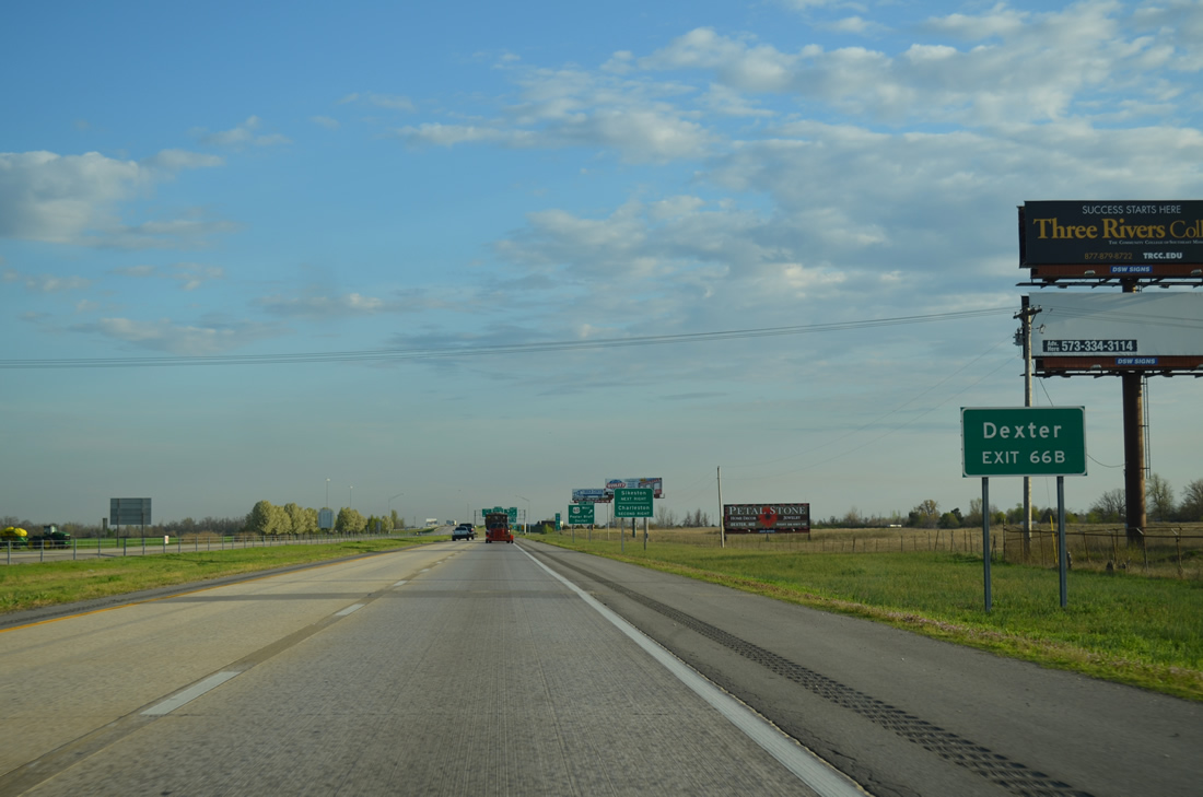
| U.S. 60 advances beyond the I-57 end to bypass Sikeston along an expressway west 23 miles to Dexter. 04/13/13 |
|
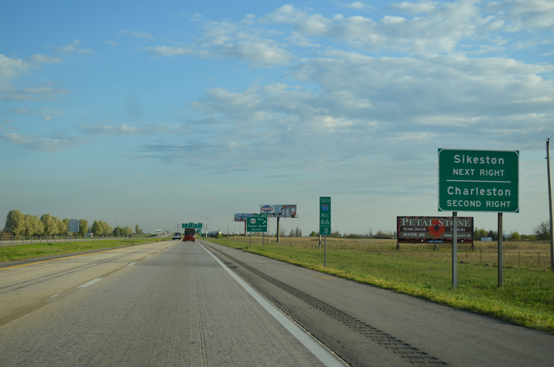
| Exit 60B to U.S. 60 west provides a third route to Sikeston from Interstate 55 south. The U.S. 60 expressway meets U.S. 61/62 (South Main Street) in 2.8 miles. Charleston, the seat of adjacent Mississippi County, is ten miles to the east via Exit 60A. 04/13/13 |
|
| All of U.S. 60 across southern Missouri, except for the stretch west from Monet, carries at least four overall lanes. Poplar Bluff lies 50 miles to the west along U.S. 60 Business. 04/13/13 |
|
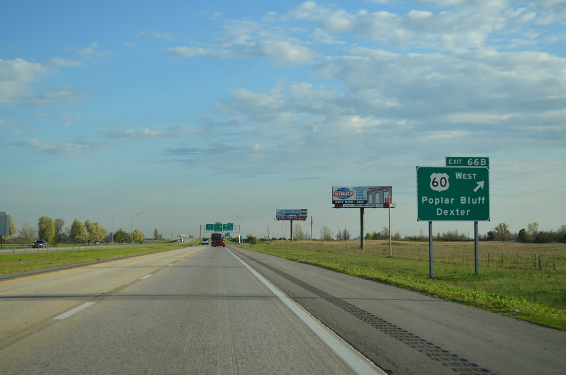
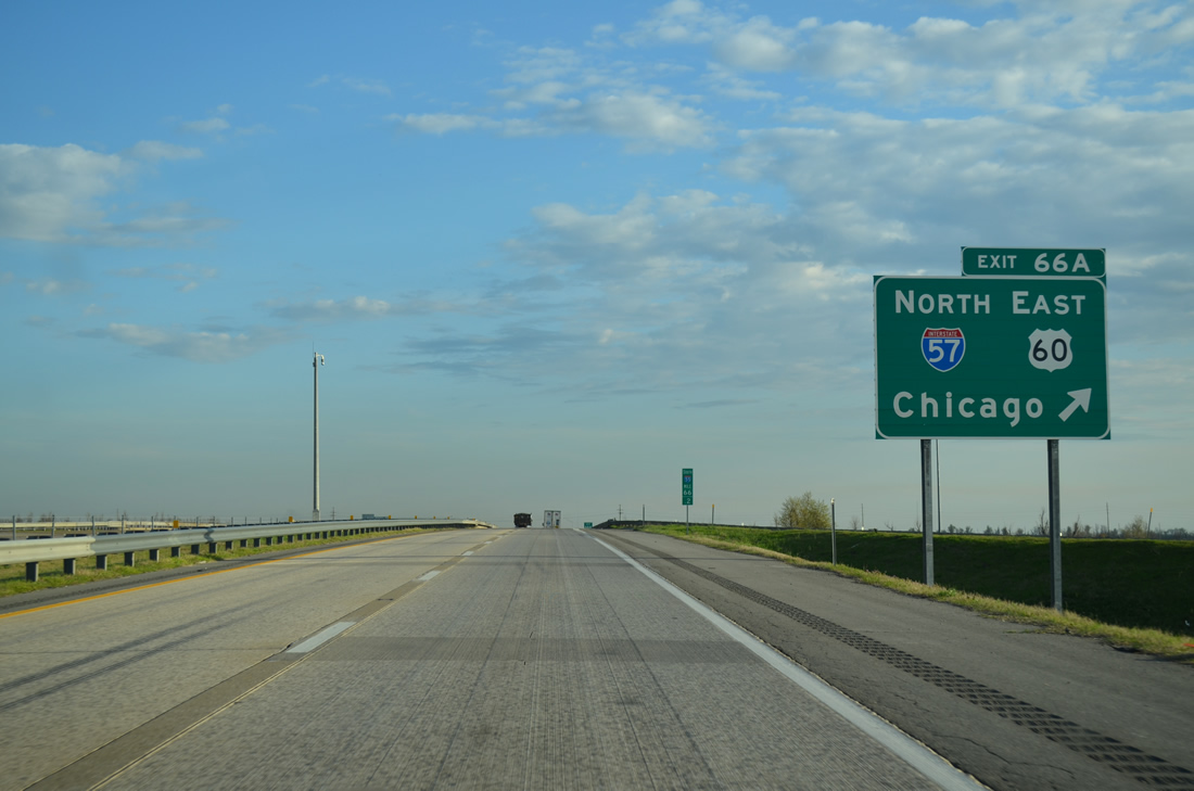
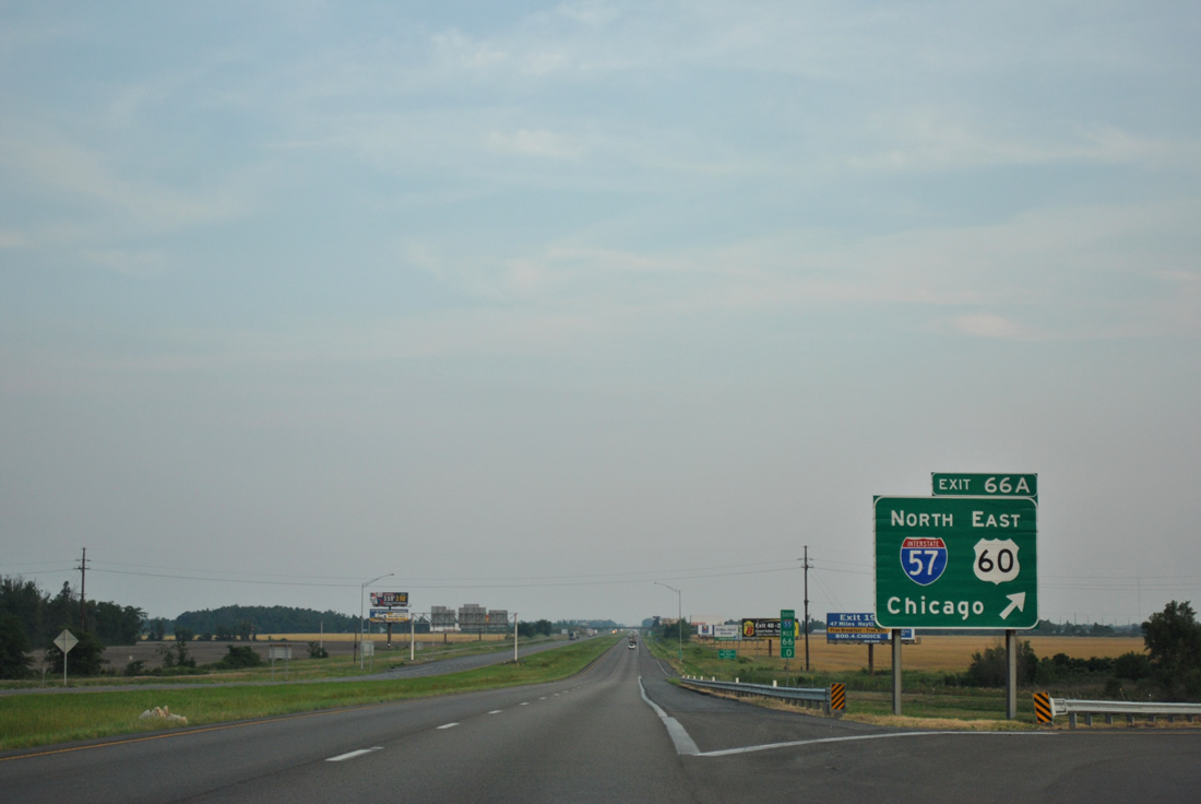
| Exit 66 B departs Interstate 55 south to U.S. 60 west and Future I-57 to Dexter and Poplar Bluff. U.S. 60 reaches Springfield in 229 miles.
Exit 66 A leaves next for I-57/U.S. 60 east to Charleston and Cairo, Illinois. 04/13/13 |
|
| Interstate 57 initially leads east before turning north toward Mound City, Illinois across the Mississippi River bridge opened in June 1978. 386 miles long, I-57 generally serves rural areas and smaller cities north to Kankakee and the south side of Chicago. 04/13/13 |
|
| This guide sign at Exit 66 A was replaced after September 2012. A conventional gore point sign replaced it. U.S. 60 east from I-57 in Charleston continues to Cairo, Illinois and La Center and Paducah, Kentucky. 06/01/11 |
|
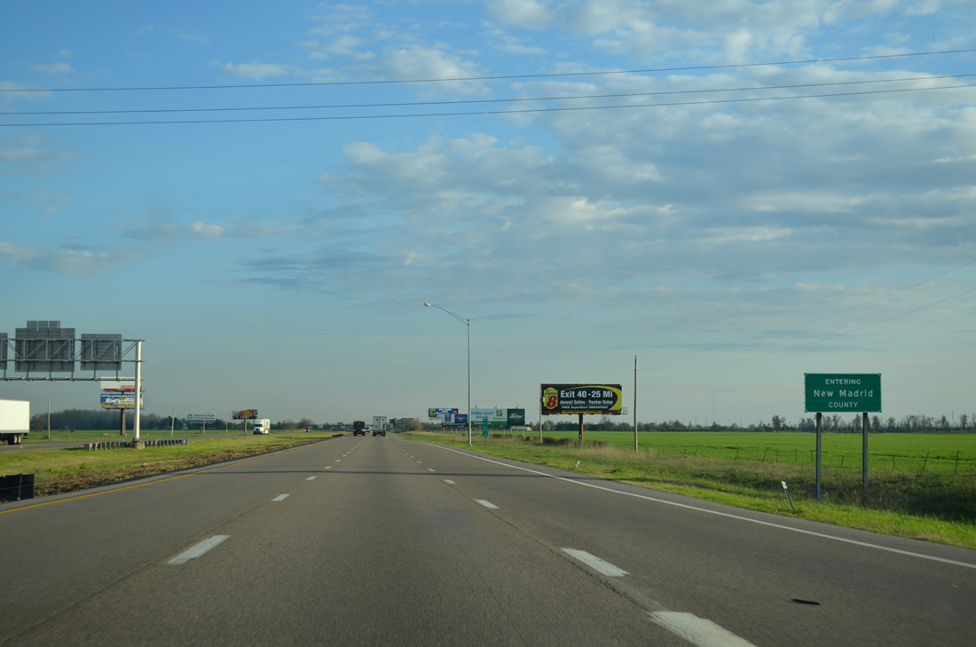
| The New Madrid County line crosses southern reaches of the cloverleaf interchange with Interstate 57 north and U.S. 60. I-55 runs 26.13 miles through Scott County. 04/13/13 |
Page Updated 11-18-2013.

 South
South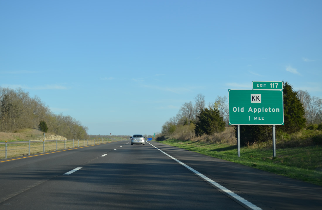


 South
South