|
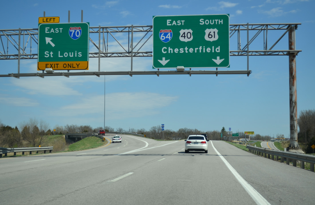
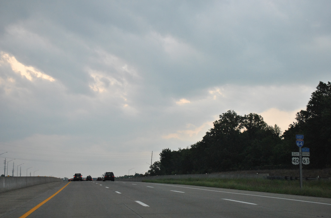
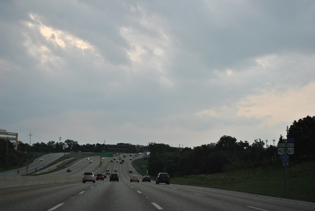
| Interstate 64 begins as U.S. 40 combines with U.S. 61 south from I-70 east at Exit 210 A. As traffic merges from the right, a left side ramp departs for I-70 east, carrying motorists from the Avenues of the Saints corridor east to O'Fallon, St. Peters and St. Charles. 04/13/13 |
|
| Both I-64 and I-70 head to St. Louis. The two meet again in East St. Louis, Illinois. 04/13/13 |
|
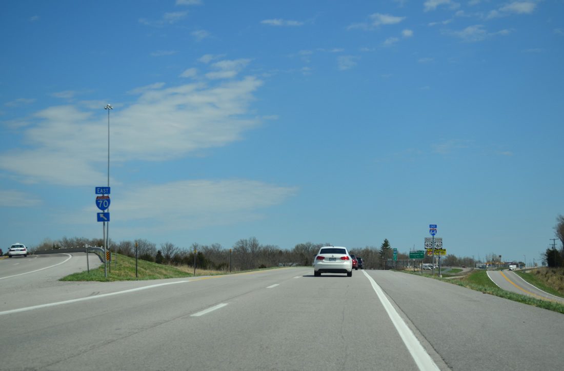
| The first reassurance marker of Interstate 64 follows the left side ramp to I-70 east. 04/13/13 |
|
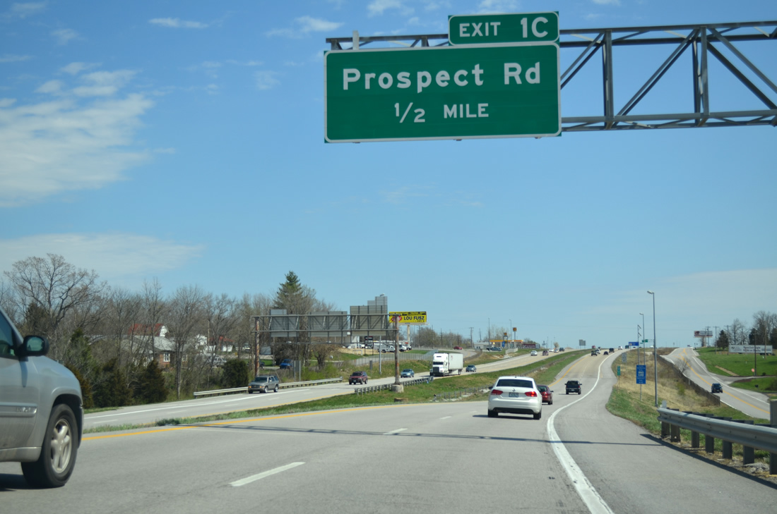
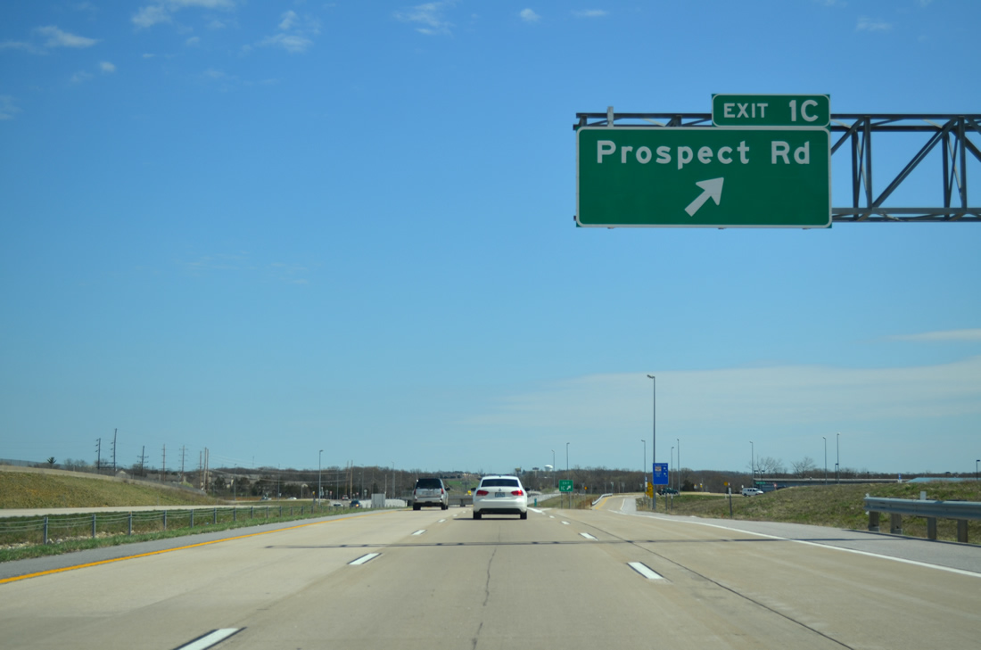
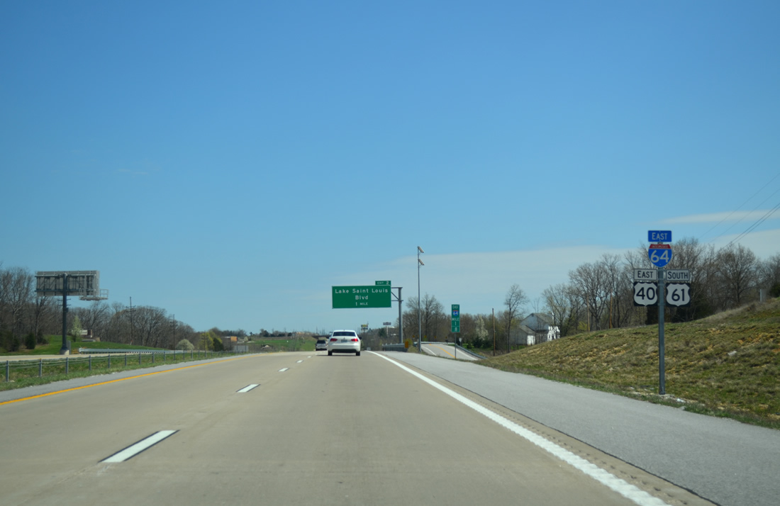
| Exit 1C is the first of two interchanges along I-64/U.S. 40-61 for the city of Lake St. Louis. The forthcoming diamond interchange joins the freeway with Prospect Road. 04/13/13 |
|
| Roundabouts join the Exit 1C ramps with Prospect Road. The local road heads east to Freymuth Road near Founders Park and Lake Sainte Louise and west to become Duello Road south en route to Highway N. 04/13/13 |
|
| A frontage road (South Service Road) accompanies the south side of the freeway as drivers pass by the second I-64 reassurance marker. 04/13/13 |
|
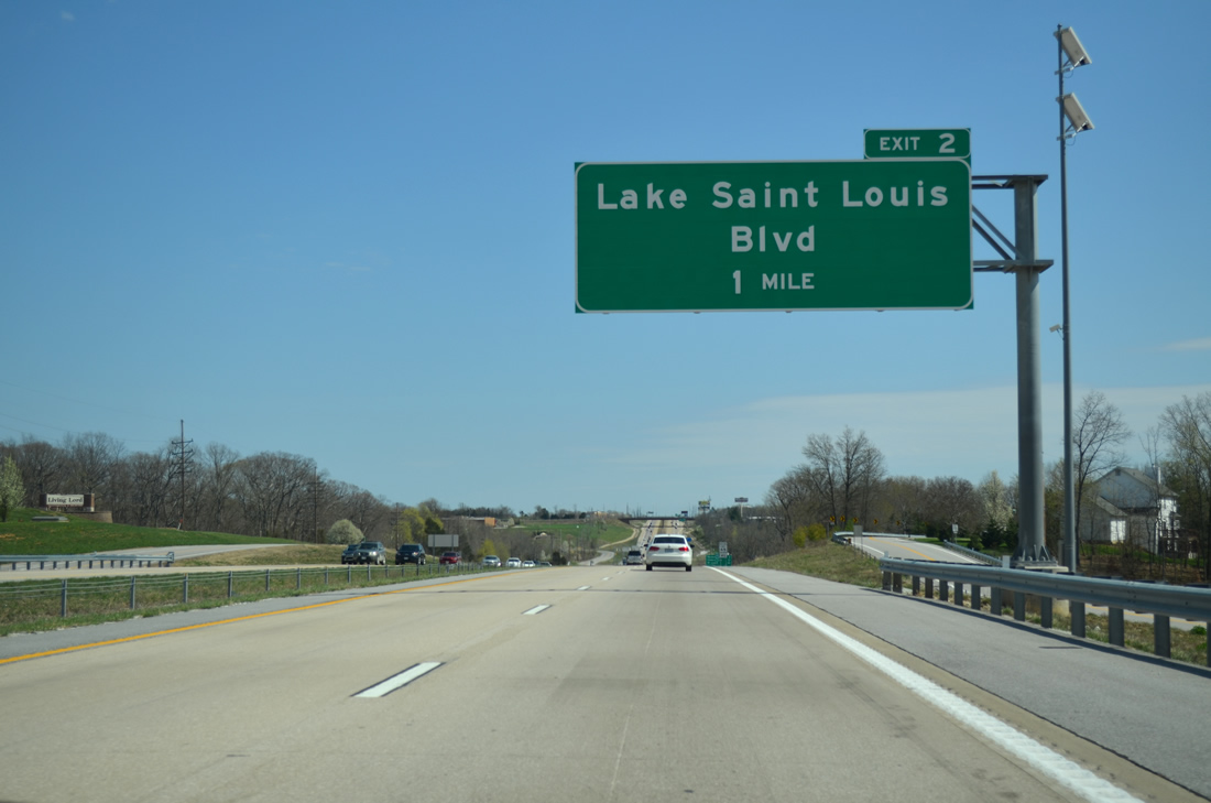
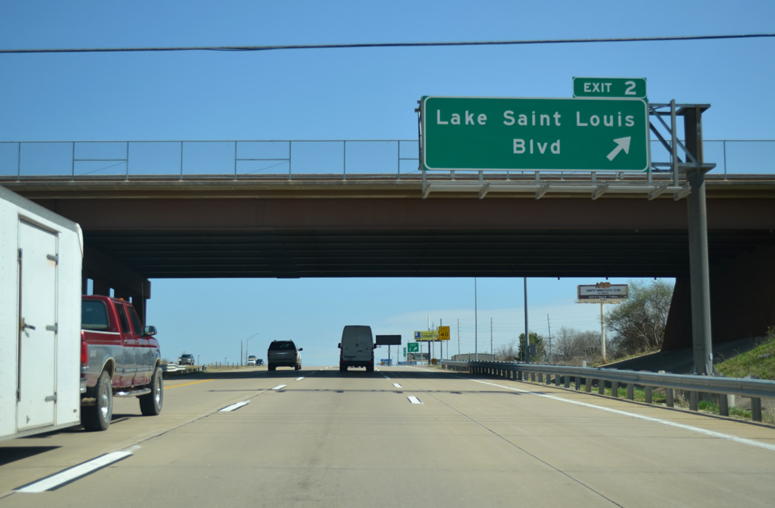
| I-64/U.S. 40-61 east span the western reaches of Lake Saint Louis on the one mile approach to Exit 2 with Lake St. Louis Boulevard. 04/13/13 |
|
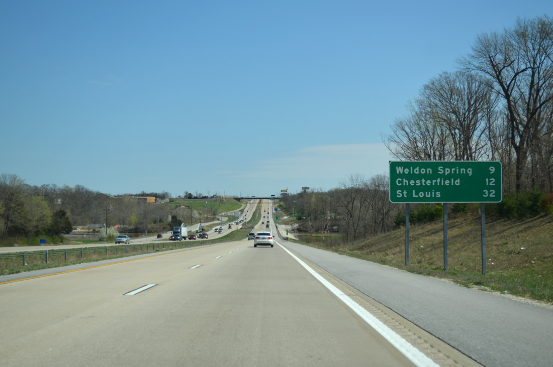
| The first distance sign for Interstate 64 resides nine miles ahead of Weldon Spring and 12 miles from the St. Louis County city of Chesterfield. 04/13/13 |
|
| North Outer Road, the north side frontage road and former alignment of U.S. 40/61, spans Lake St. Louis across a pony truss bridge. Peruque Creek feeds the lake from the west. 05/04/12 |
|
| Lake St. Louis Boulevard encircles Lake St. Louis eastward from Exit 2 by a number of subdivisions to Exit 214 of Interstate 70. Heading south from I-64/U.S. 40-61, the boulevard travels to Highway N. 04/13/13 |
|
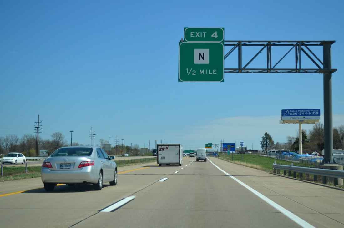
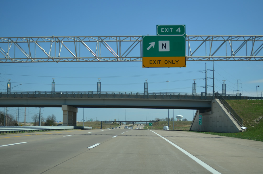
| Highway N and I-64/U.S. 40-61 come together at a parclo interchange (Exit 4) in one mile. 04/13/13 |
|
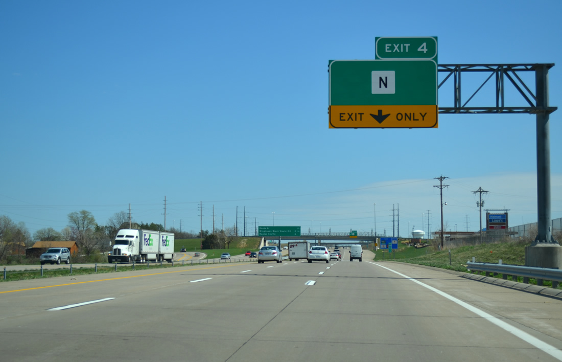
| I-64-U.S. 40/61 east leave the city of Lake St. Louis at Exit 4. 04/13/13 |
|
| A third eastbound lane begins ahead of the Ronald Reagan Drive overpass for Exit 4 and Highway N. A sprawling retail area flanks the west side of Highway N as the route leaves the O'Fallon area for rural Pauldingville on the Warren County line. 04/13/13 |
|
| The first in a series of interchange sequence sign posted along I-64 precedes Exit 4 by one quarter mile. WingHaven Boulevard east and Route K north round out the exits for O'Fallon over the next six miles. 04/13/13 |
|
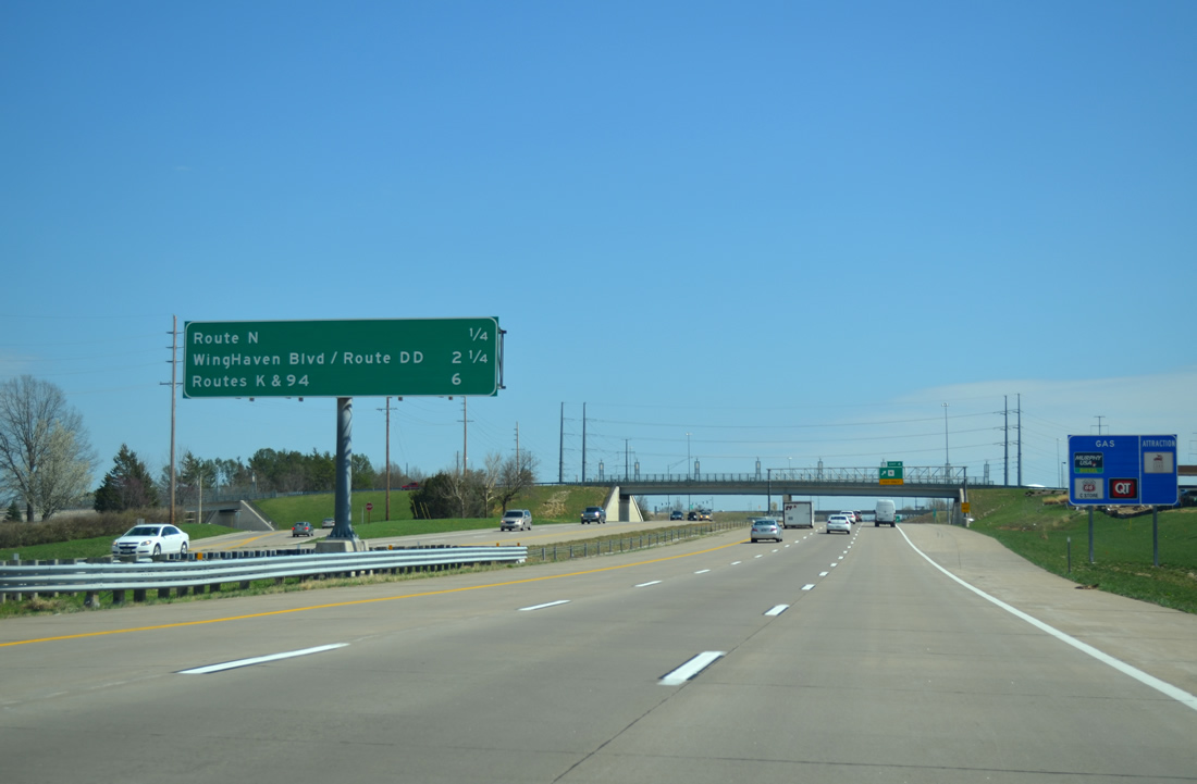
| Highway N stretches 20.8 miles from Highway T on the county line east to Missouri 94 in southwest St. Peters. The route presently follows a dog leg south and east from Exit 4 to become Outer Road 364 through the outskirts of O'Fallon. Outer Road 364 is the frontage road for the Missouri 364 freeway leading east to Maryland Heights. 04/13/13 |
|
| The footprint of Exit 4 includes a stub for an eventual upgrade of the cloverleaf interchange with Missouri 364. Missouri 364 constitutes a freeway from south St. Peters east to Interstate 270. Construction underway to lengthen the route to I-64 was completed on November 1, 2014. 04/13/13 |
|
| Emerging from under the Old Highway N overpass, motorists pass by the next set of shields for I-64/U.S. 40-61. 05/04/12 |
|
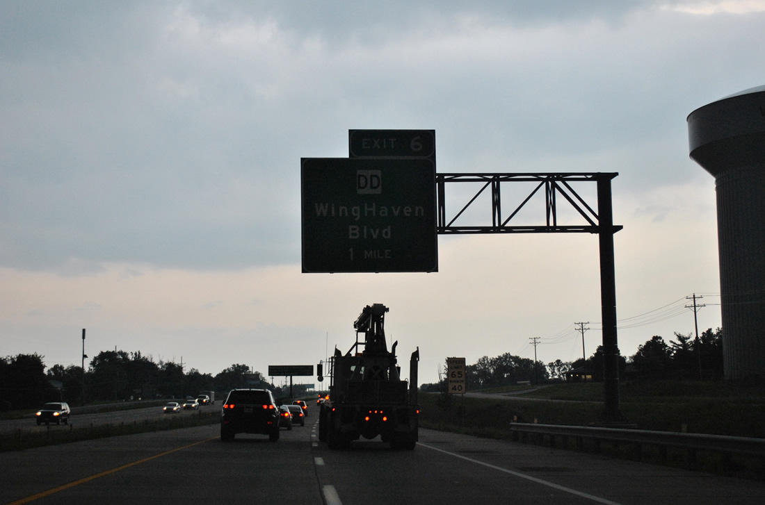
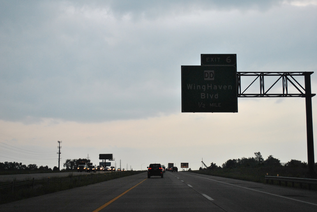
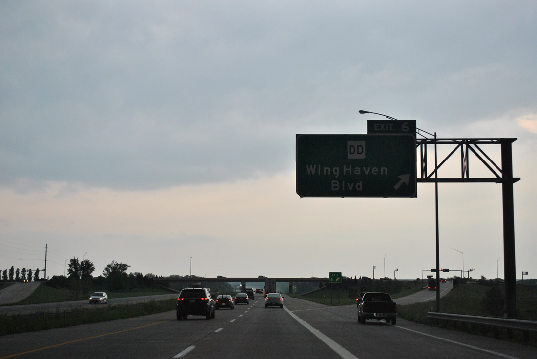
| A diamond interchange (Exit 6) joins I-64-U.S. 40/61 east with the east end of Highway DD in one mile. 05/04/12 |
|
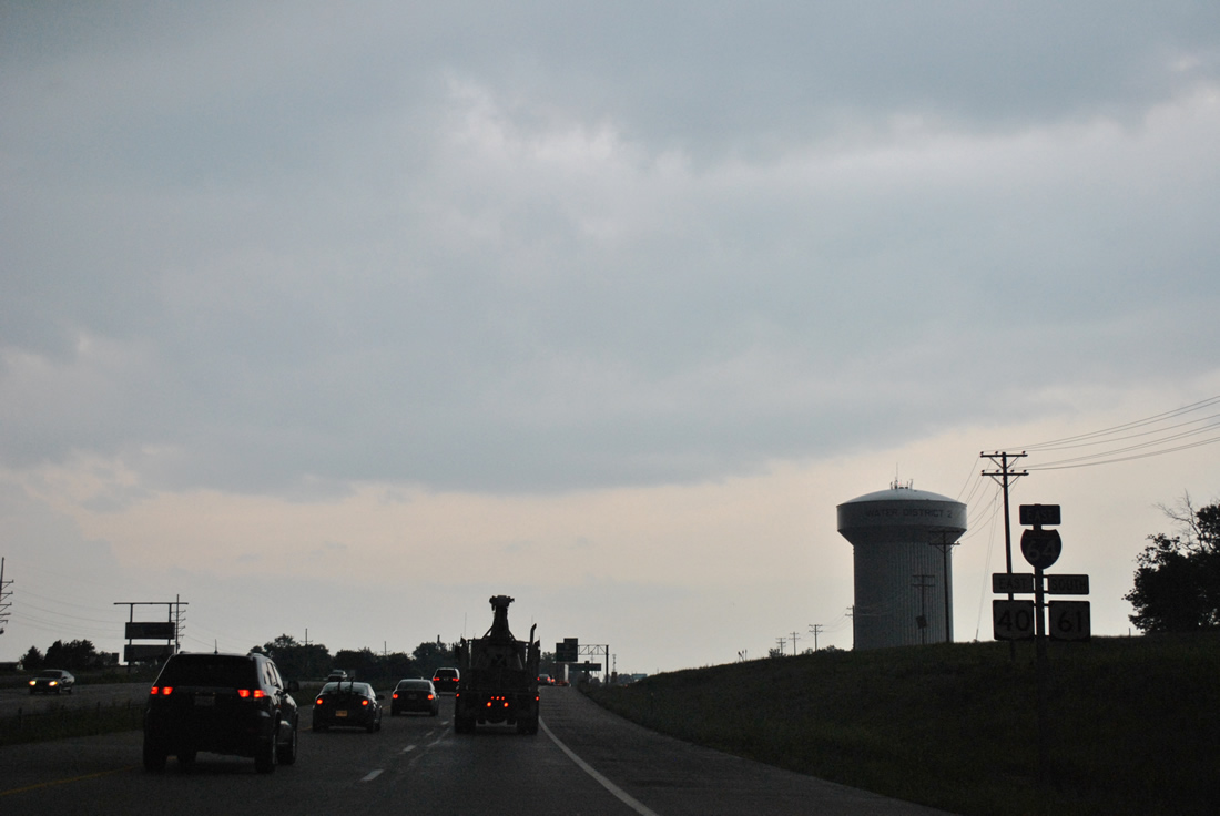
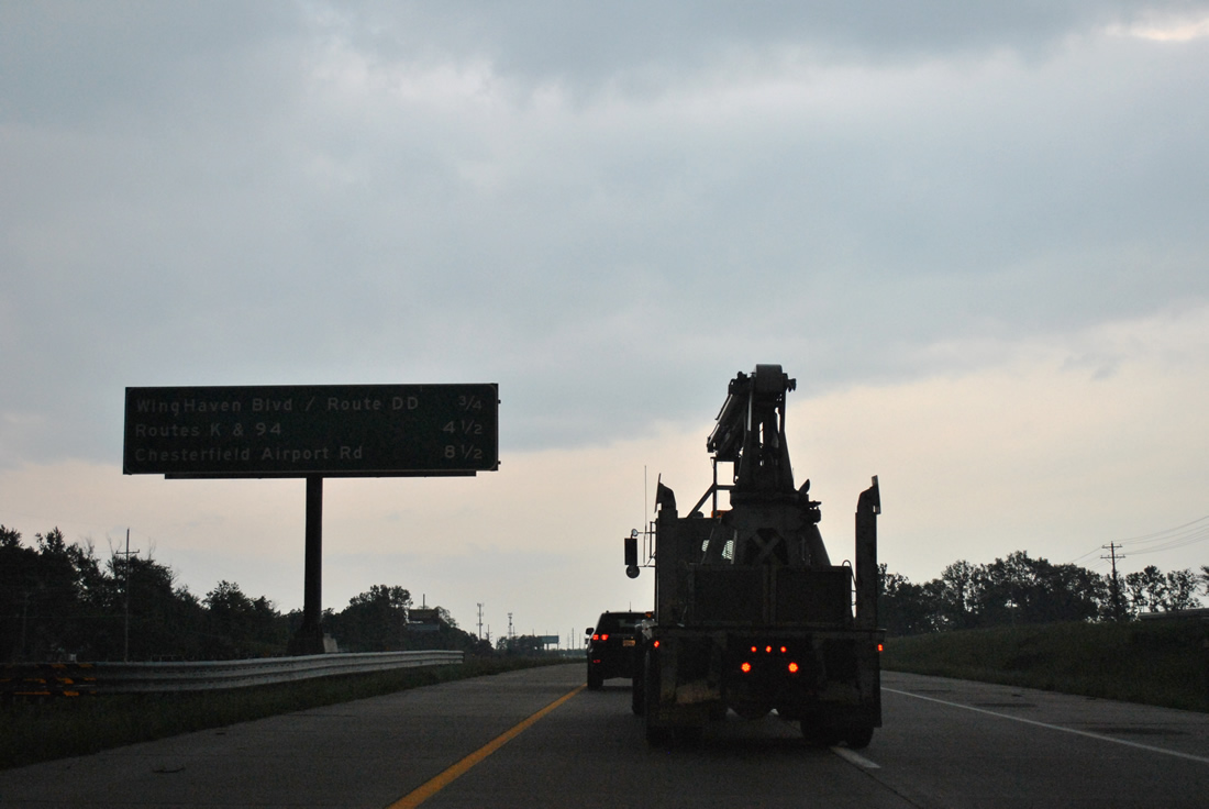
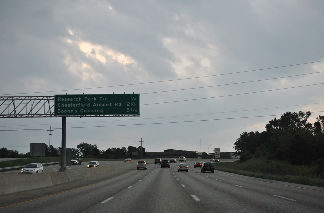
| Chesterfield Airport Road lies 8.5 miles ahead as the first St. Louis County exit off I-64/U.S. 40-61. Highway K south and Missouri 94 meet I-64 at back to back interchanges in 4.5 miles. 05/04/12 |
|
| WingHaven Boulevard continues the roadway east from the end of Highway DD and Exit 6 into southwest O'Fallon. 05/04/12 |
|
| Exit 6 leaves I-64-U.S. 40/61 east for Highway DD south to Missouri 94 near Defiance and WingHaven Boulevard north to Highway N at Bryan Road. 05/04/12 |
|
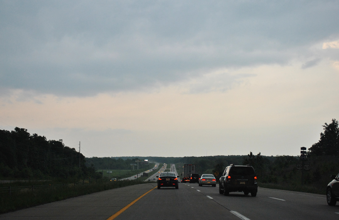
| I-64/U.S. 40-61 straddle the O'Fallon city line and boundary of August A. Busch Memorial Wildlife Area to the approaching crossing of Dardenne Creek. 05/04/12 |
|
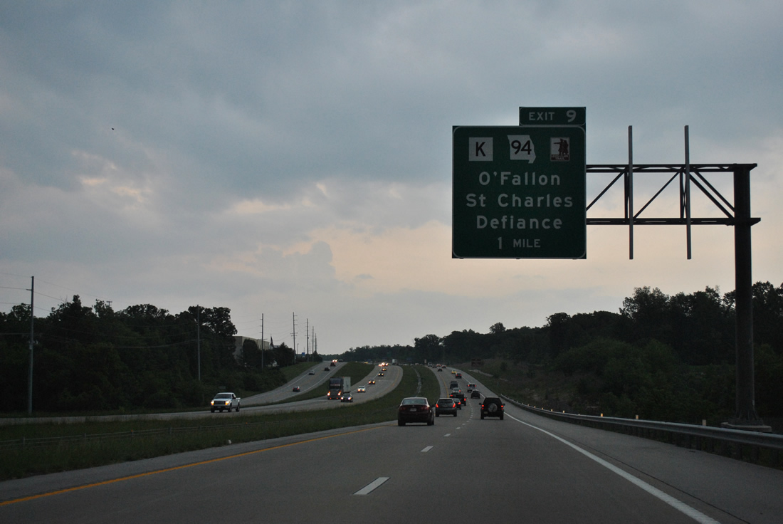
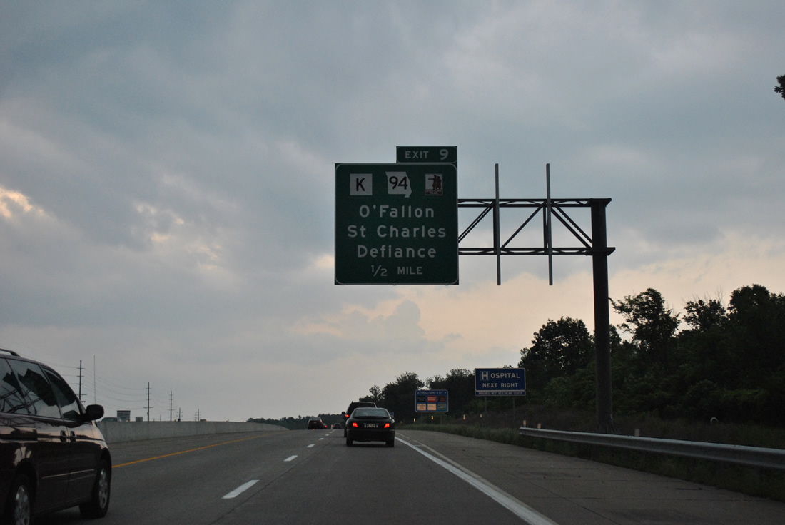
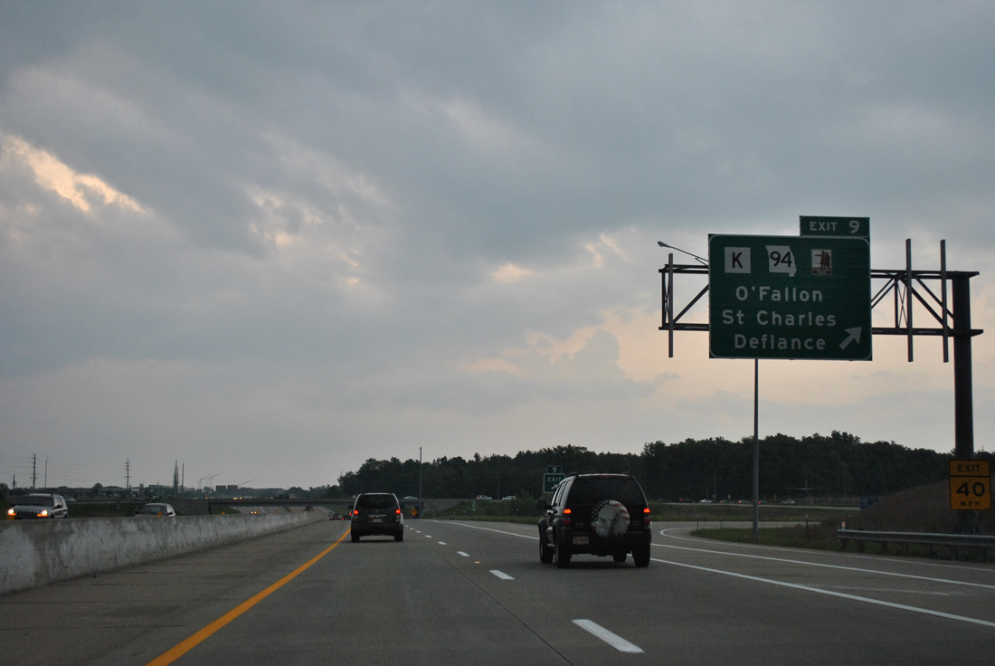
| Next in line for eastbound motorists is the Exit 9 off-ramp for both Highway K north and Missouri 94. A parclo interchange joins I-64 with Highway K north to O'Fallon and Dardenne Prairie while South Outer Road stems east from the ramp end to Missouri 94 nearby. 05/04/12 |
|
| Missouri 94 exits the Weldon Spring Wildlife Area east from Interstate 64 and transitions into a controlled access arterial east through Weldon Spring. The state highway leads directly to the current Missouri 364 freeway end at Pitman Hill Road in south St. Peters. 05/04/12 |
|
| Highway K travels 6.56 miles north from I-64/U.S. 40-61 to Exit 217 of I-70 in O'Fallon. MO 94 leads southwest along a rural course to Defiance while the route northeast joins MO 364 east to St. Charles. 05/04/12 |
|
| South Outer Road comes into view as I-64-U.S. 40/61 east approach the parclo interchange with Missouri 94. 05/04/12 |
|
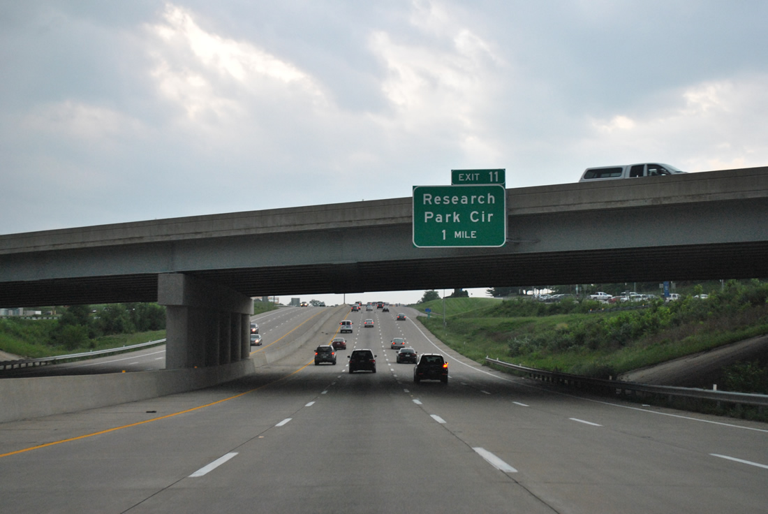
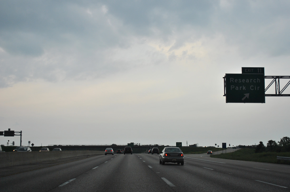
| The final St. Charles County exit lies one mile ahead with Research Park Circle. 05/04/12 |
|
| Technology Drive remains the east side frontage road, generally following the old alignment of U.S. 40/61 to Wolfrum Road east into Weldon Spring. 05/04/12 |
|
| I-64/U.S. 40-61 continue into Chesterfield from Weldon Spring, with three exits serving the St. Louis County suburb. 05/04/12 |
|
| Research Park Circle stems west from Technology Drive and Exit 11 into Missouri Research Park by Missouri Bluffs Golf Club. 05/04/12 |
|
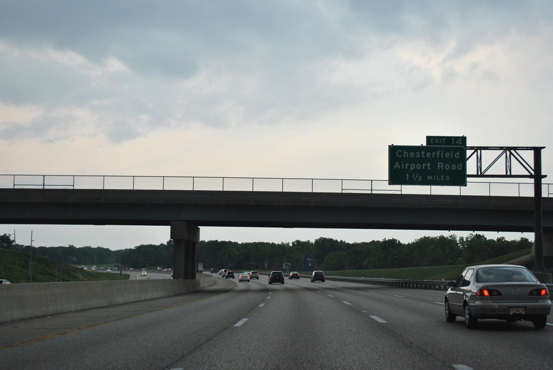
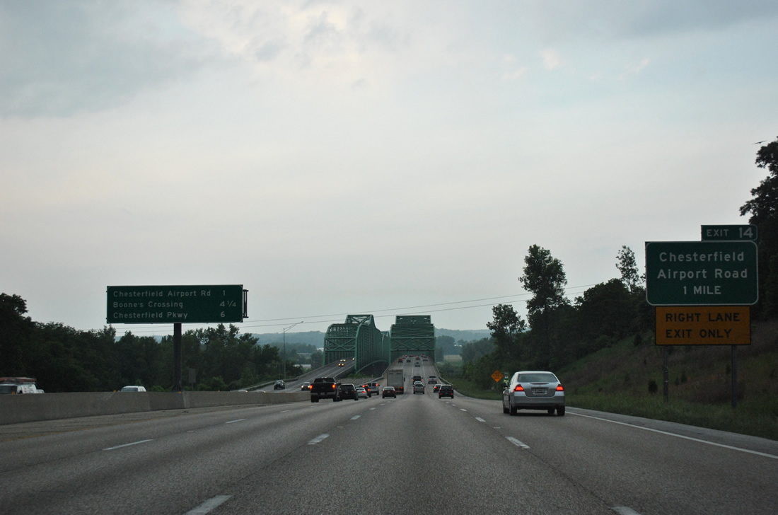
| I-64/U.S. 40-61 travel southward from Weldon Spring to a wye interchange (Exit 14) with Chesterfield Airport Road in 1.5 miles. 05/04/12 |
|
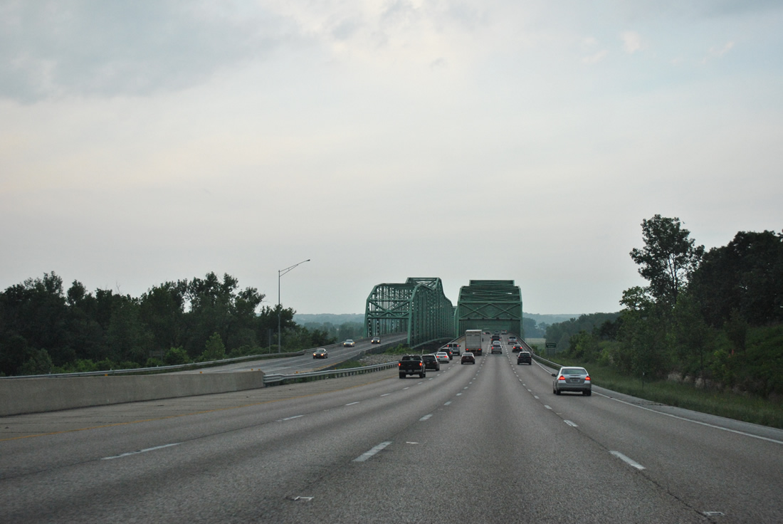
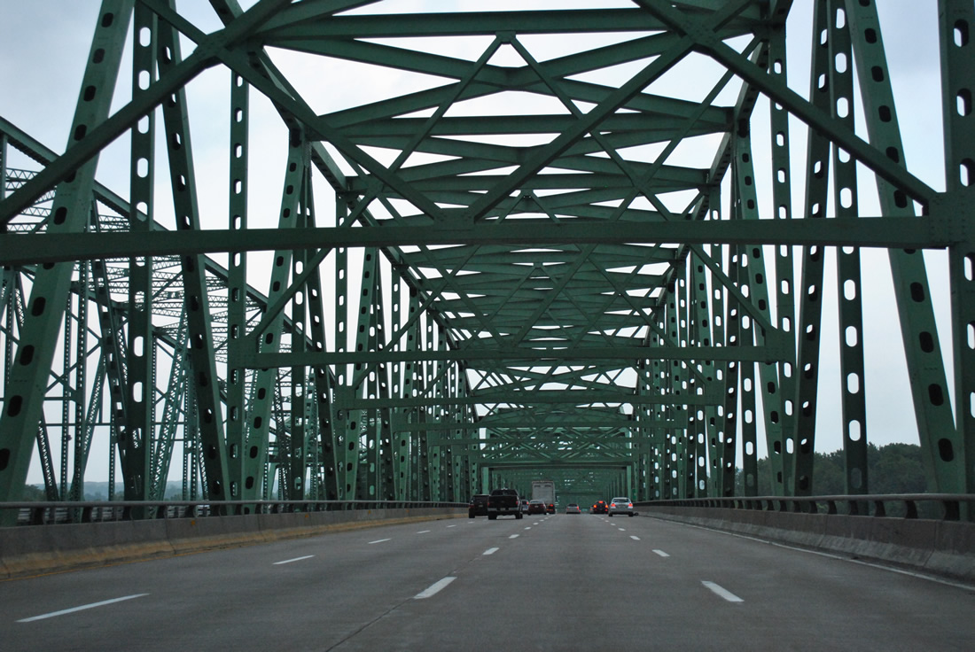
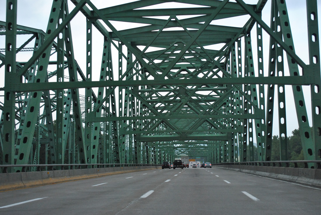
| Four lanes of Interstate 64 east near the Daniel Boone Bridge across the Missouri River. The right lane defaults onto Chesterfield Airport Road east beyond the through truss bridge. 05/04/12 |
|
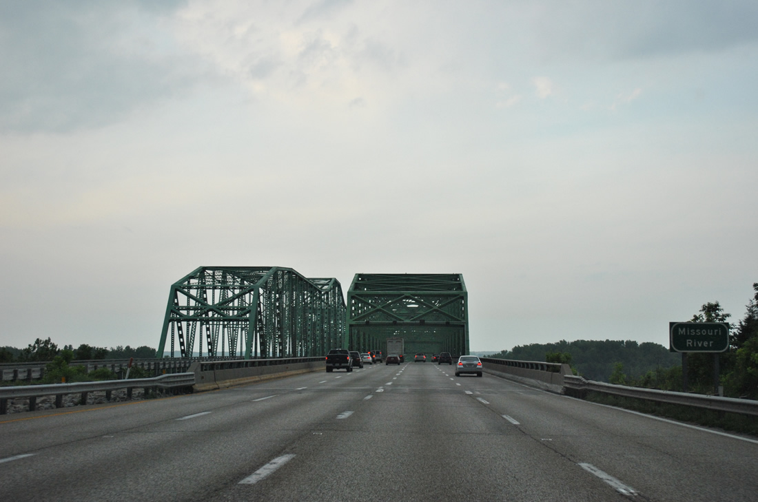
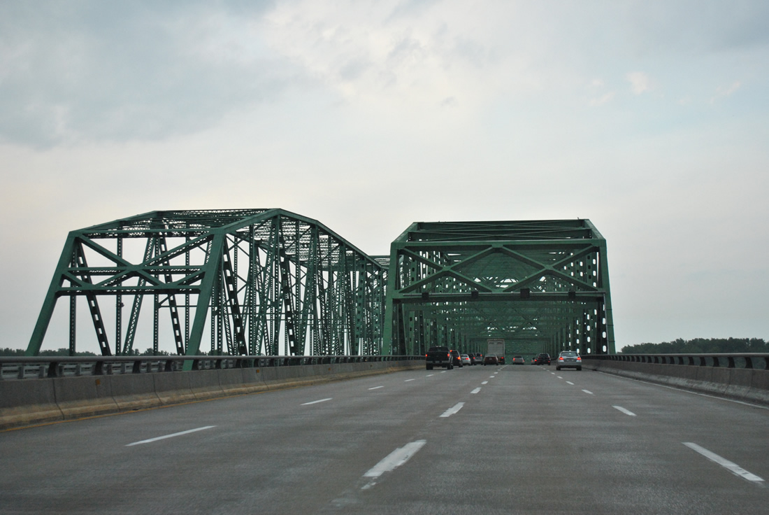
| Previously a pair of truss bridges carried motorists on I-64/U.S. 40-61 across the Missouri River. The eastbound span, opened in August 1989, accommodated four lanes while the 1935-built westbound bridge provided for just three lanes with no shoulders. A $111 million project broke ground on January 3, 2013 to add a new girder bridge on the west side of the crossing. Work ran through December 31, 2015.1 05/04/12 |
|
| The eastbound bridge shifted to westbound traffic upon completion of the new span to the south. This expanded I-64/U.S. 40-61 to eight overall lanes across the Missouri River, with added pedestrian/bicycle access on the new bridge. 05/04/12 |
|
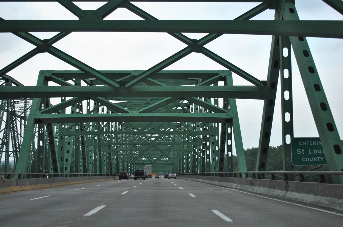
| Eastbound travelers enter St. Louis County and the Chesterfield city limits at the midpoint of the Daniel Boone Bridge. The span is 2,614 feet in length.2 05/04/12 |
Page Updated 11-13-2013.


 East
East  South
South