|
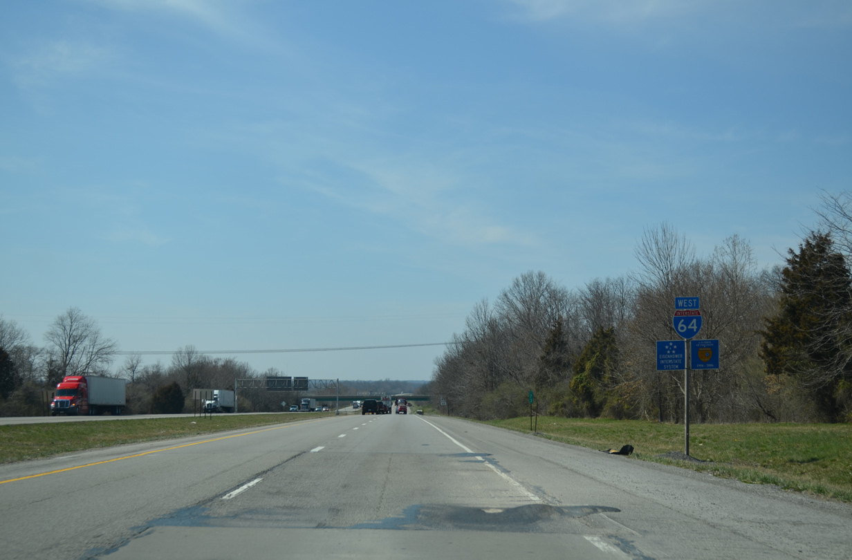
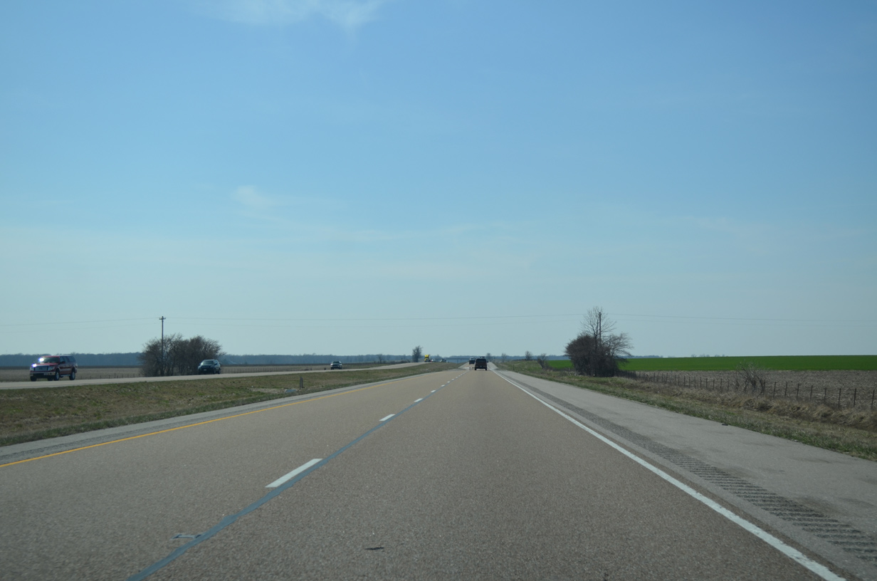
| Interstate 64 curves northwest from I-57 and the city of Mt. Vernon along a rural stretch to cross the Big Muddy River. 04/05/13 |
|
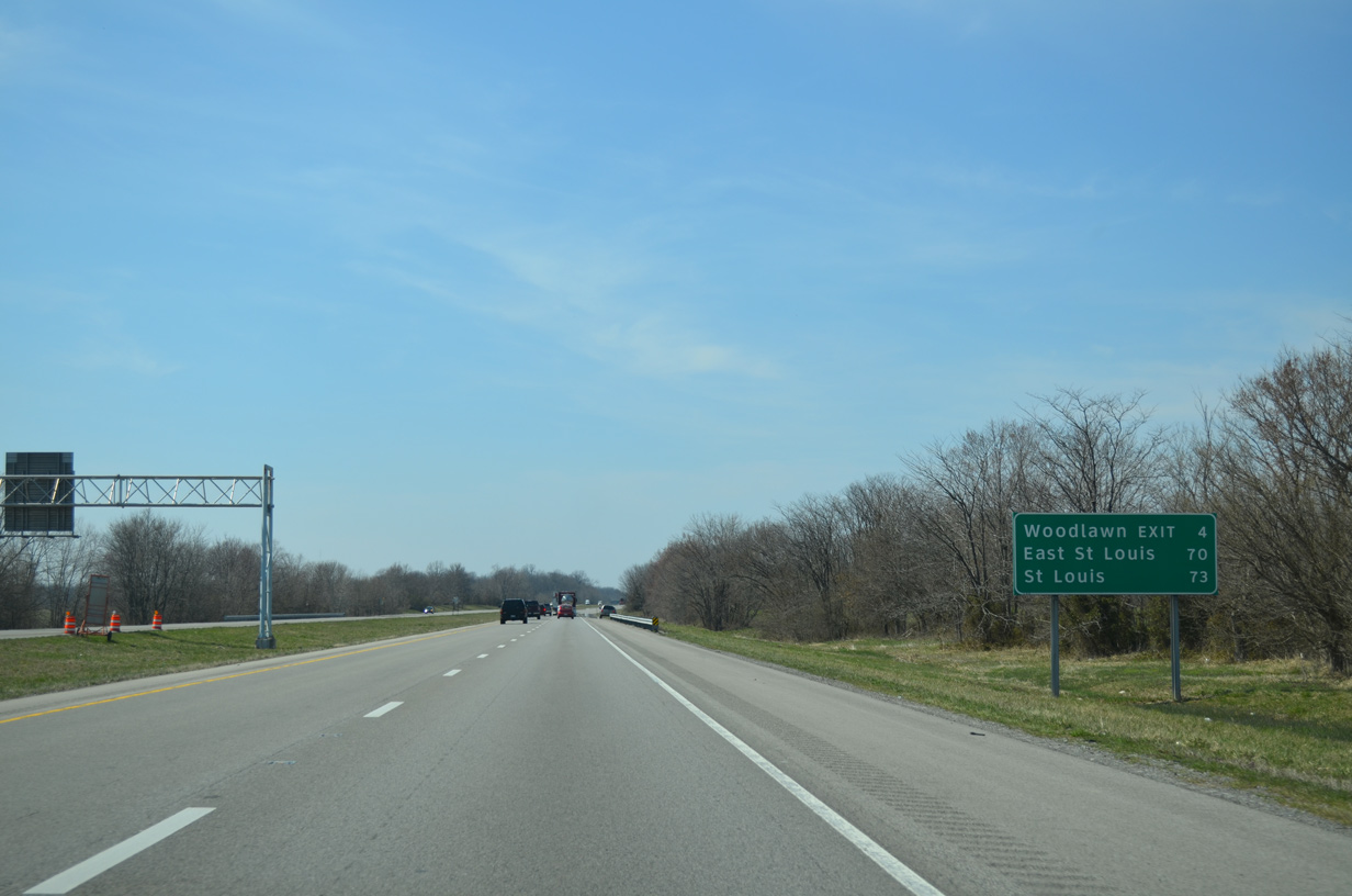
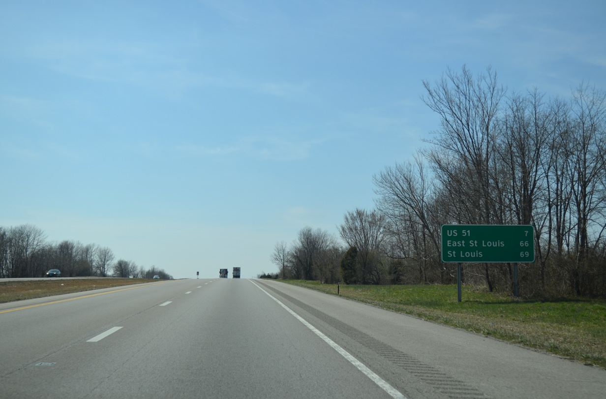
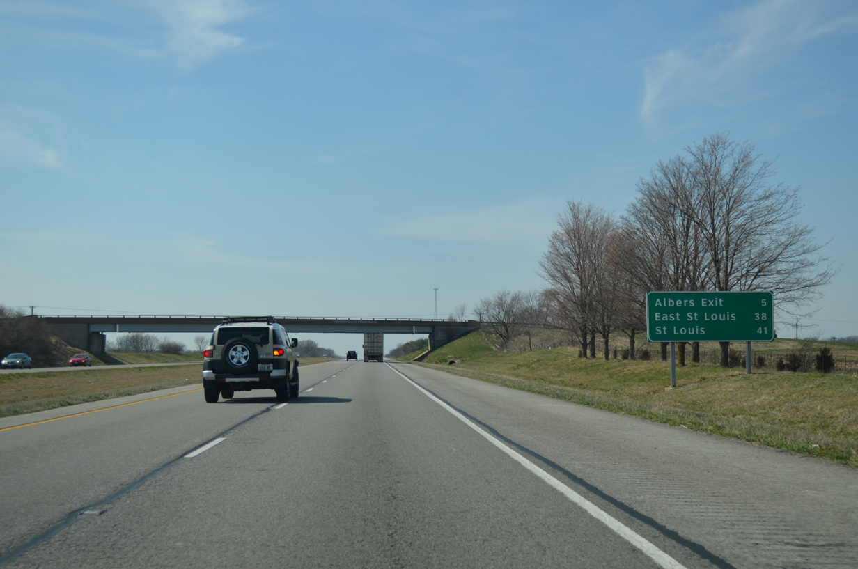
| A distance sign appears before Harper Creek referencing East St. Louis in 70 miles and Downtown St. Louis in 73 miles. 04/05/13 |
|
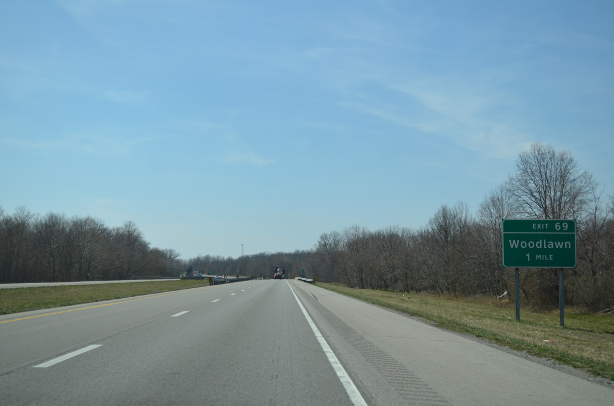
| Jefferson County Route 9 stems south from parallel CR 10 (Richview Road) 1.1 miles to a diamond interchange (Exit 69) with Interstate 64. 04/05/13 |
|
| South from Exit 69, County Road 9 continues to the village of Woodlawn along Central Street. 04/05/13 |
|
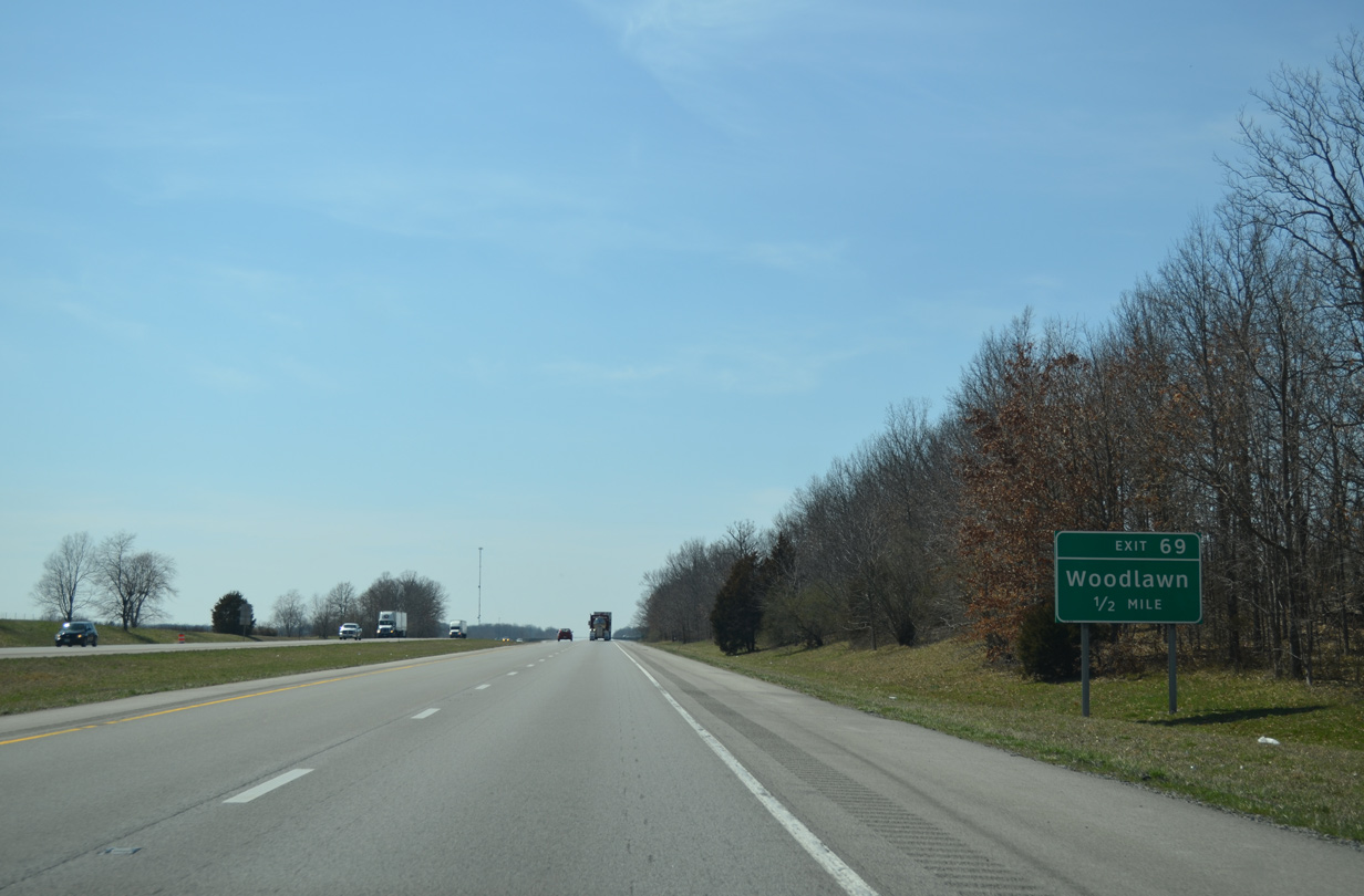
| Exit 69 leaves Interstate 64 west for County Road 9. CR 9 briefly overlaps with IL 15 (former U.S. 150), south of Woodlawn, en route to Waltonville. 04/05/13 |
|
| Westbound reassurance marker posted after Exit 69. Vassar Road parallels the south side of I-64 as a rural frontage road for the next mile. 04/05/13 |
|
| Preceding the BNSF Railroad and Fairdrive Lane (CR 15) underpass is a distance sign posted 66 miles from East St. Louis. 04/05/13 |
|
| Interstate 64 bends northwest through a forested area by Rayse Creek. 04/05/13 |
|
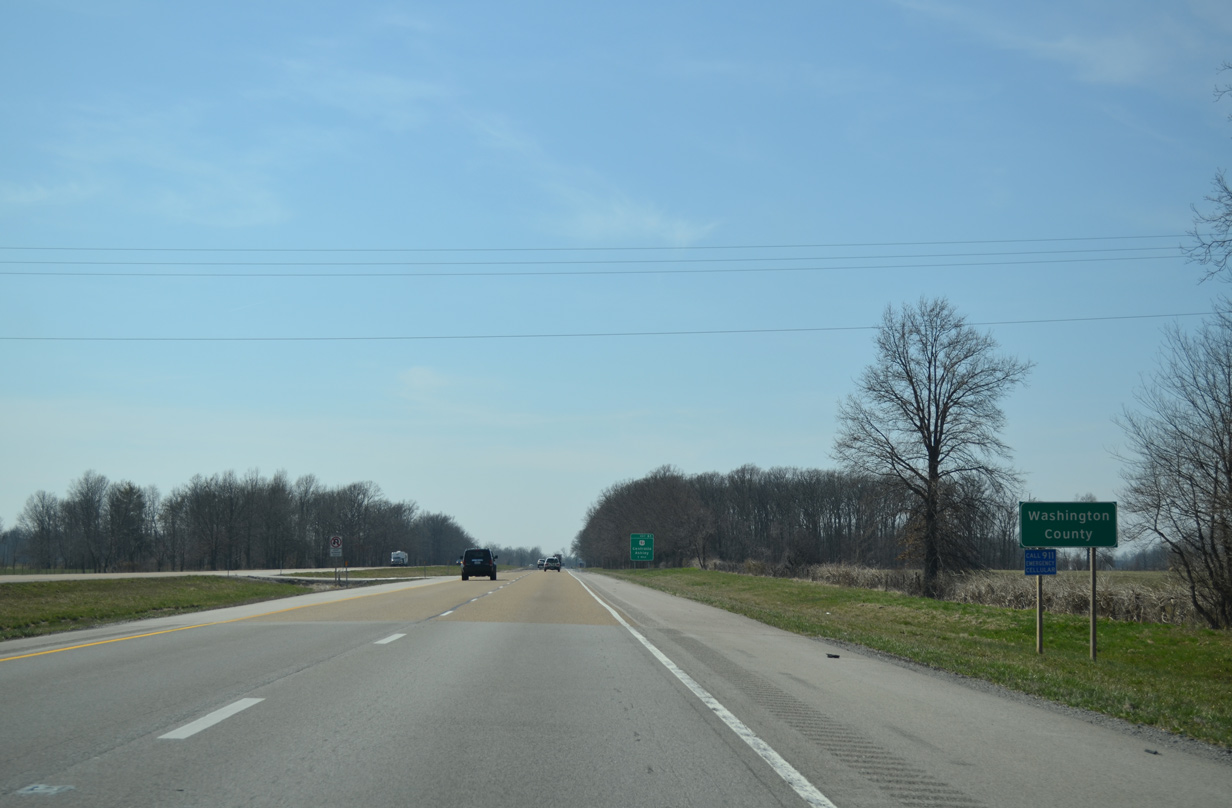
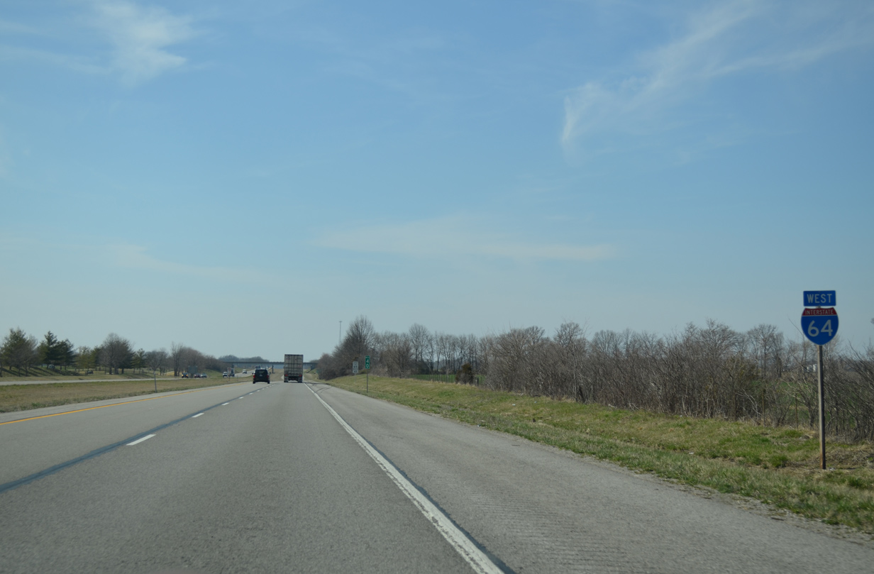
| The freeway curves westward again to cross the Washington County line. 04/05/13 |
|
| U.S. 51, a 1,286 mile route from LaPlace, Louisiana to Hurley, Wisconsin, crosses paths with Interstate 64 at the village of Richview. 04/05/13 |
|
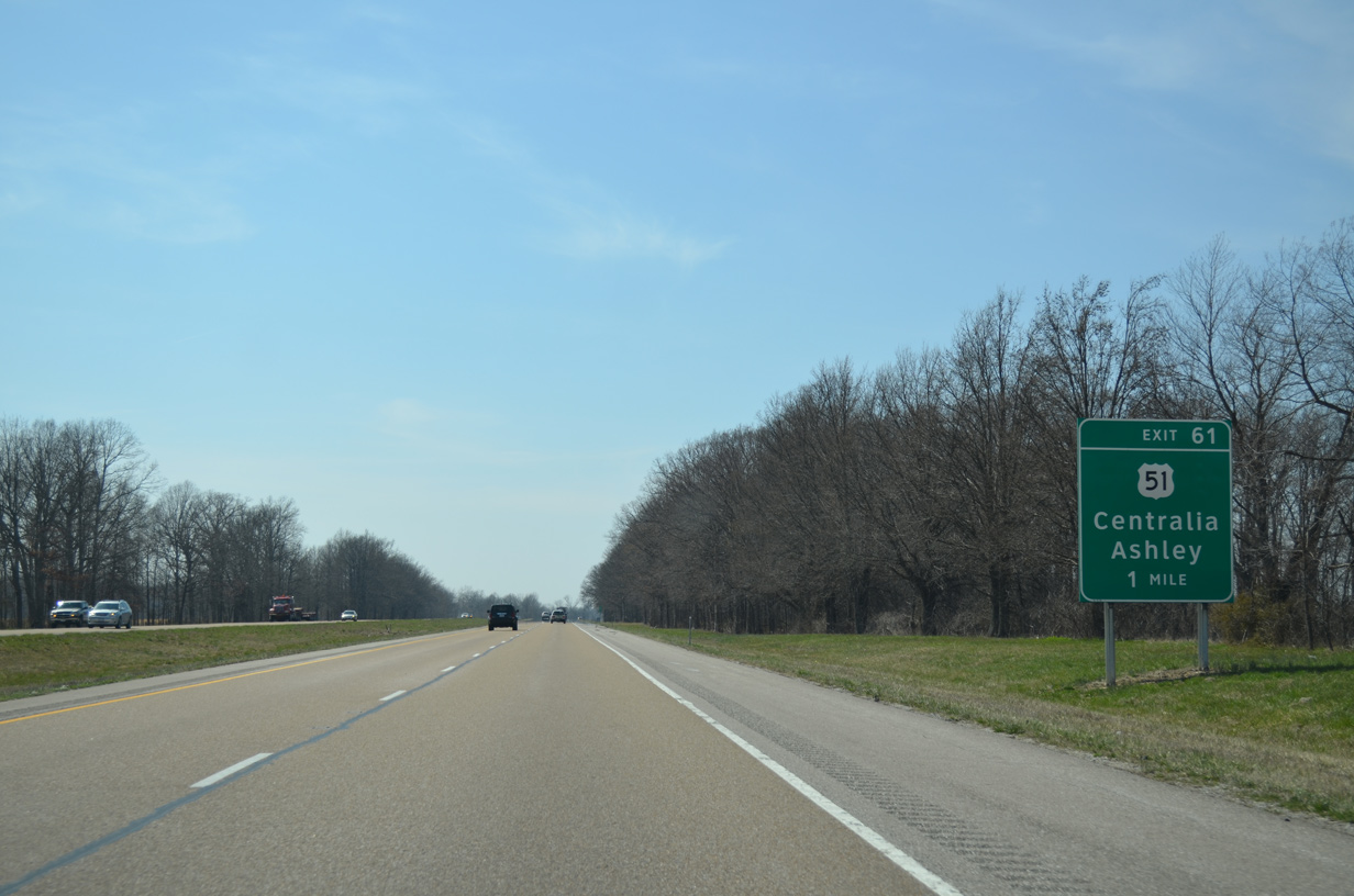
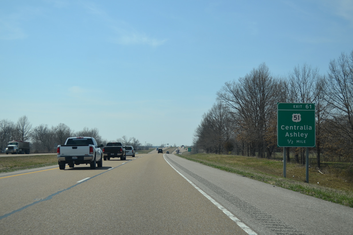
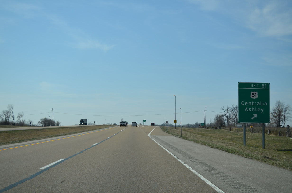
| One half mile ahead of the diamond interchange (Exit 61) with U.S. 51 on I-64 west. U.S. 51 travels an expressway north nine miles to the city of Centralia. An interchange with IL 177 lies four miles north by the village of Irvington. 04/05/13 |
|
| U.S. 51 runs five miles south from Exit 61 through Richview to overlap with IL 15 (former U.S. 460) west through the city of Ashley. U.S. 51 takes a rural route south to Du Quoin and Carbondale. 04/05/13 |
|
| Interstate 64 crosses over a CN Railroad line that parallels U.S. 51 by this westbound shield assembly. 04/05/13 |
|
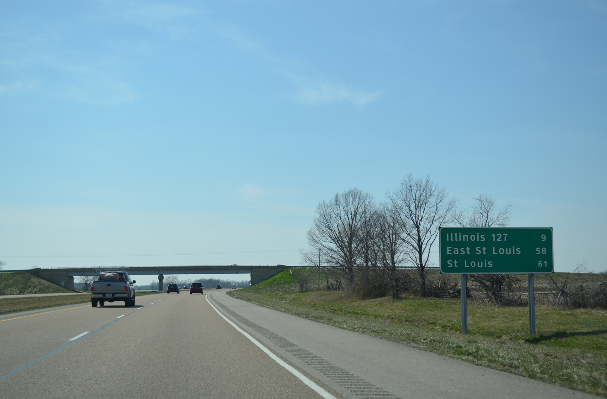
| An 11 mile exit less stretch ensues along I-64 west. East St. Louis is 58 miles away. 04/05/13 |
|
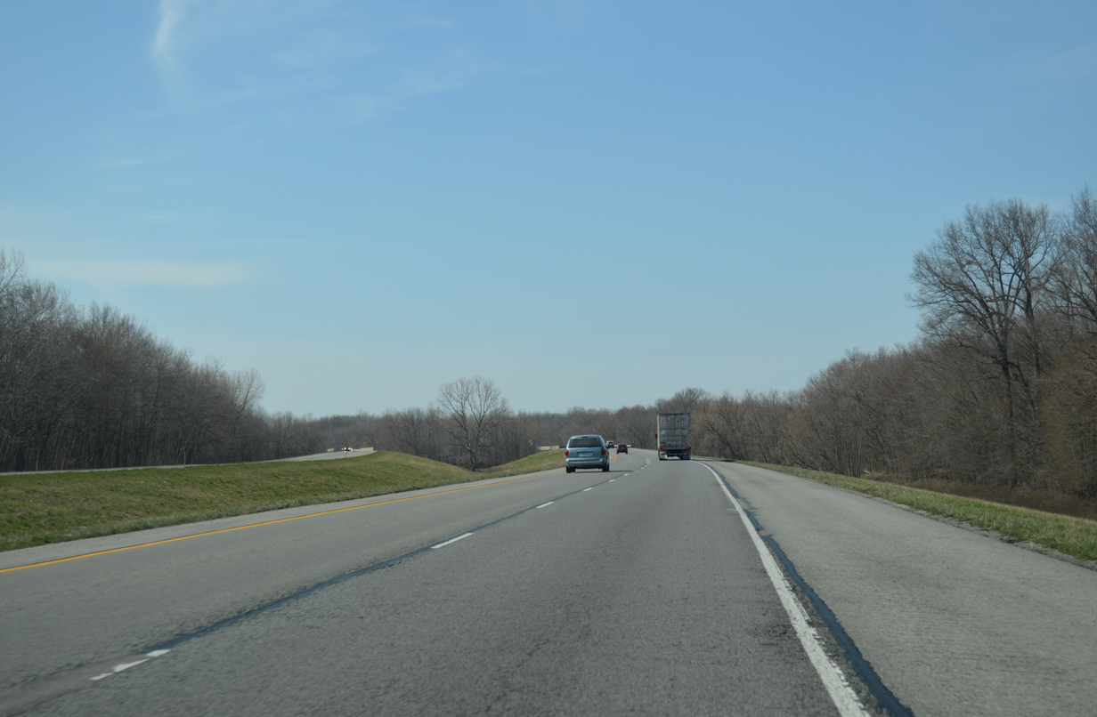
| Interstate 64 traverses open farm land along the Irvington and Richview township lines for the next several miles. 04/05/13 |
|
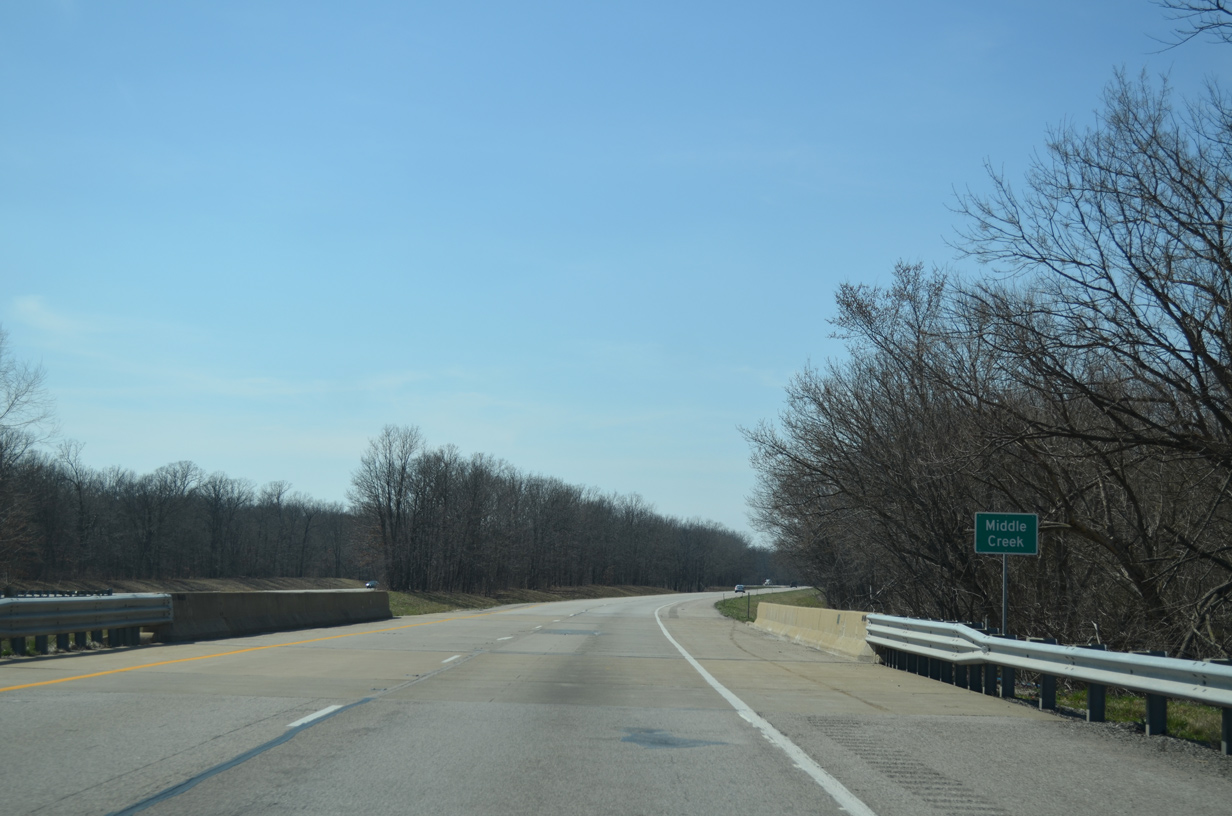
| Spanning Middle Creek, I-64 has slight elevation changes and a forested median over the next 1.5 miles. 04/05/13 |
|
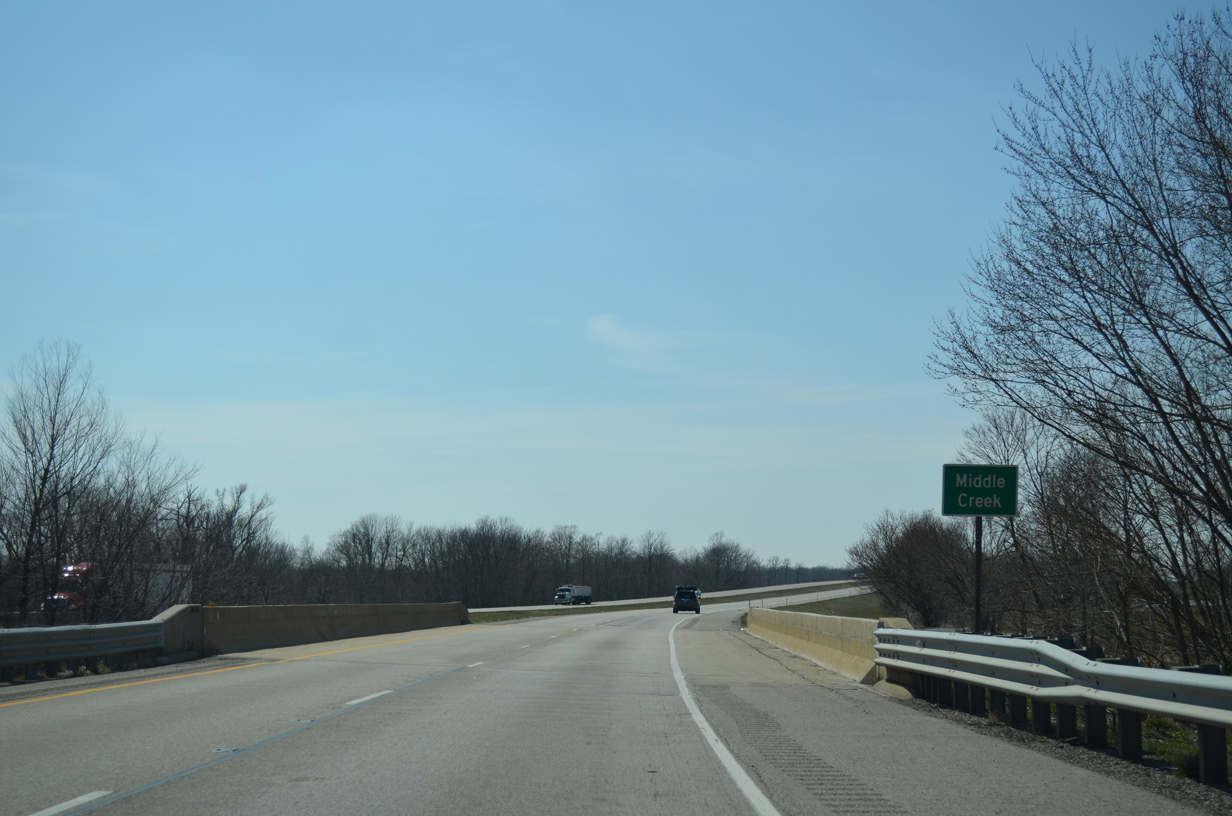
| Waters of Middle Creek flow west underneath I-64 again as the freeway shifts northward on a parallel alignment to the outskirts of Nashville. 04/05/13 |
|
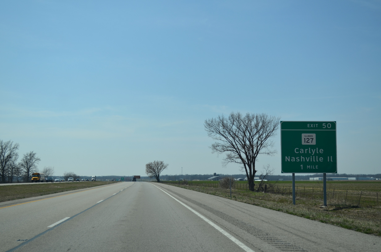
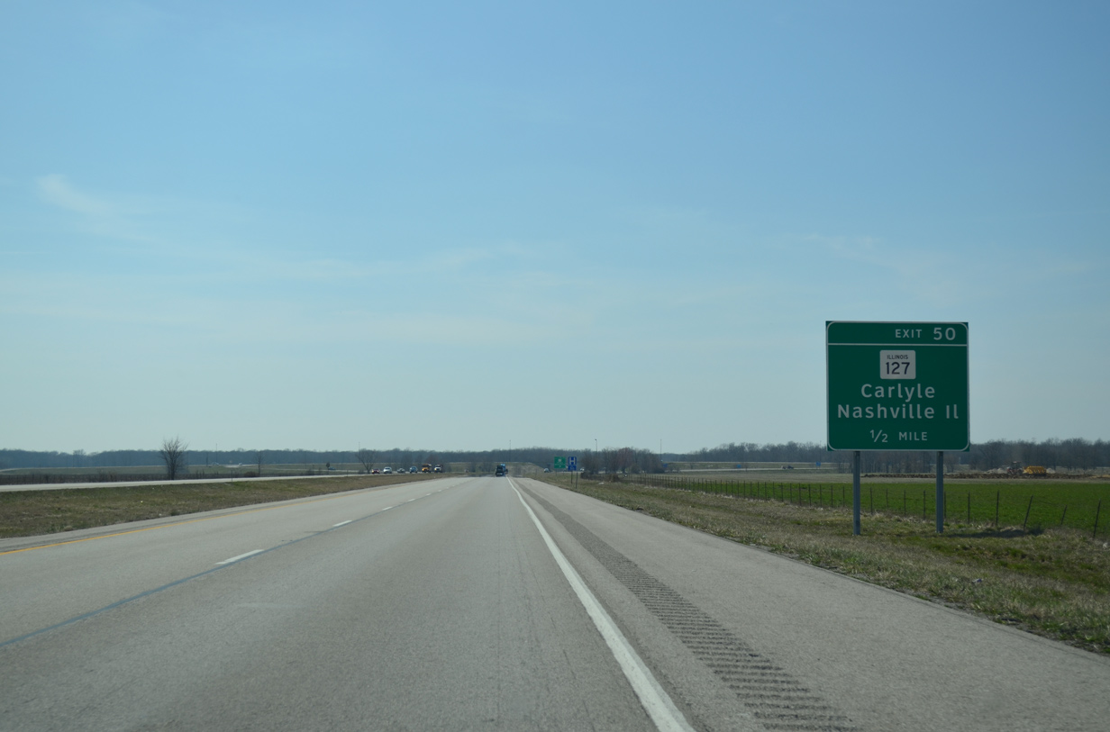
| Signs for IL 127 at Exit 50 to Nashville include IL. This was done to reduce confusion for eastbound motorists bound for the Tennessee city. 04/05/13 |
|
| IL 127 runs north along Mill Street through the Nashville city center to exit the residential street grid alongside a number of industrial parks. The state route and I-64 come together at a diamond interchange (Exit 50) in one half mile. 04/05/13 |
|
| A 179 mile route, IL 127 travels south to Unity and north to Raymond through the southern half of the state. Locally the route heads north to the village of New Minden. 04/05/13 |
|
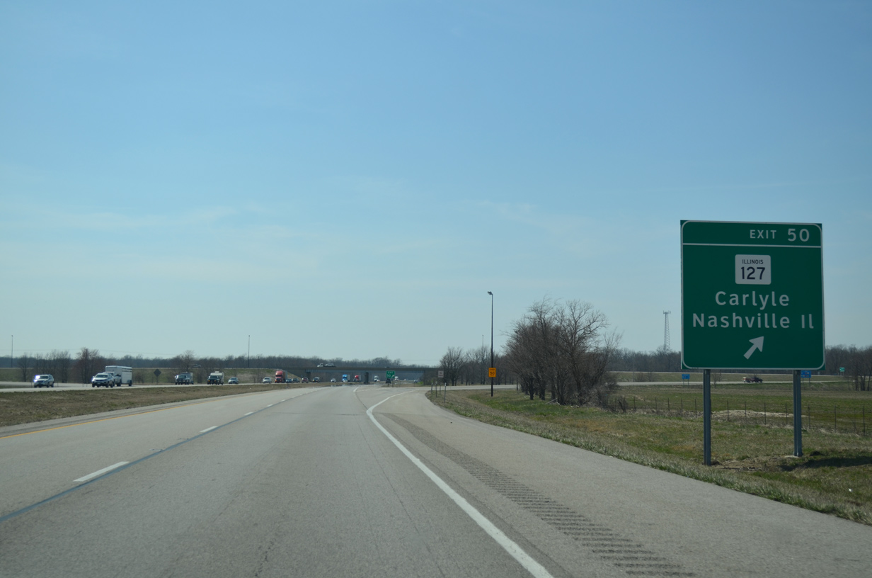
| Taking Exit 50 to IL 127 south into Nashville. Carlyle, seat of adjacent Clinton County, is a 16 mile drive to the north. 04/05/13 |
|
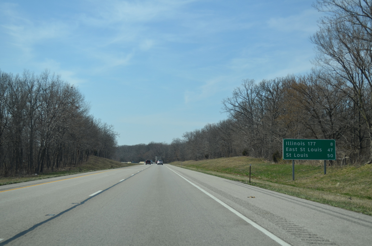
| Eight miles separate Nashville from the diamond interchange with IL 177, the next westbound exit. St. Louis is 50 miles to the west. 04/05/13 |
|
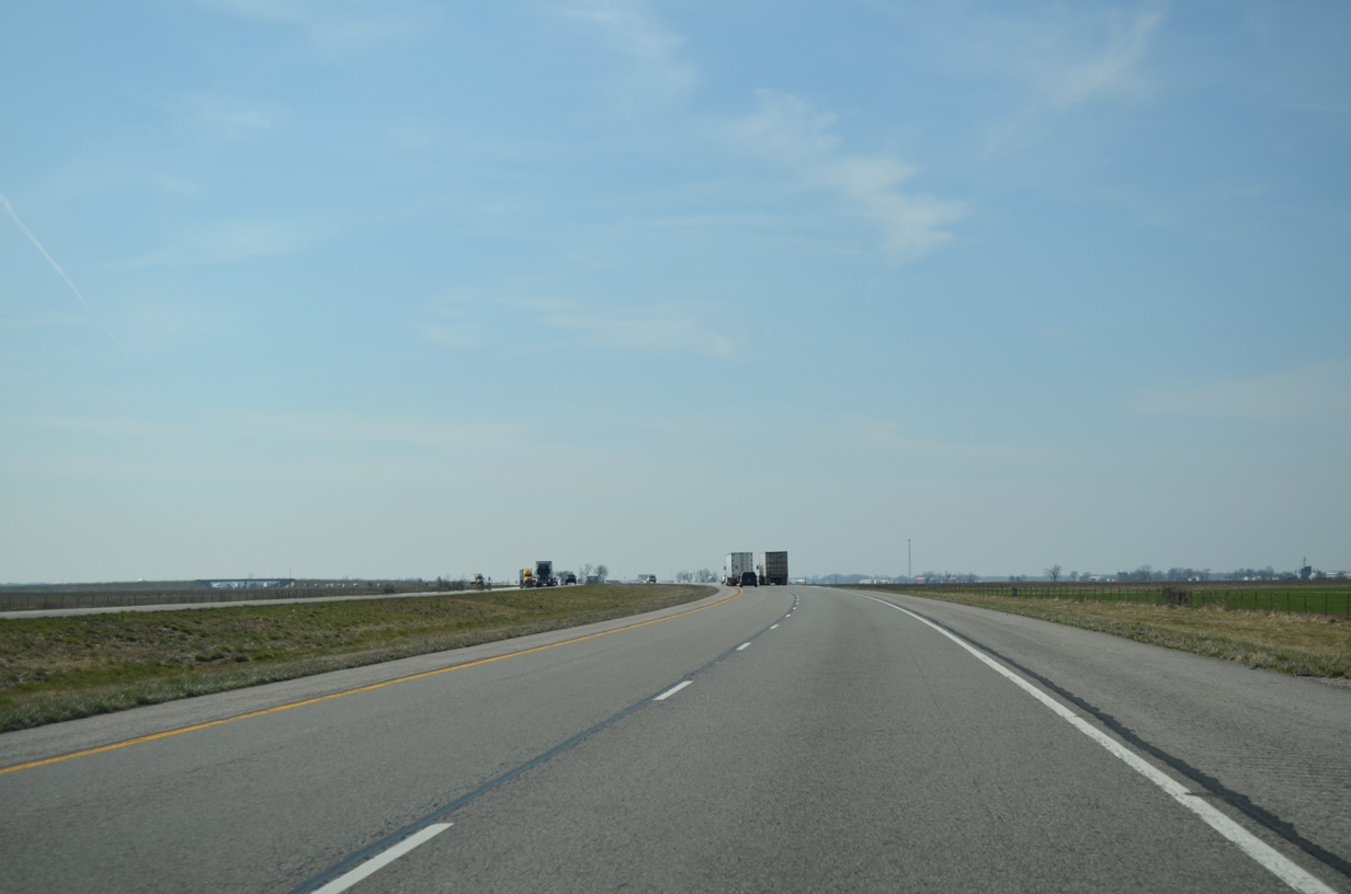
| Interstate 64 emerges from forested areas surrounding Little Crooked Creek and its tributaries to again cross widespread agricultural areas. This scene looks at a curve preceding the County Road 4 overpass north of Addieville. 04/05/13 |
|
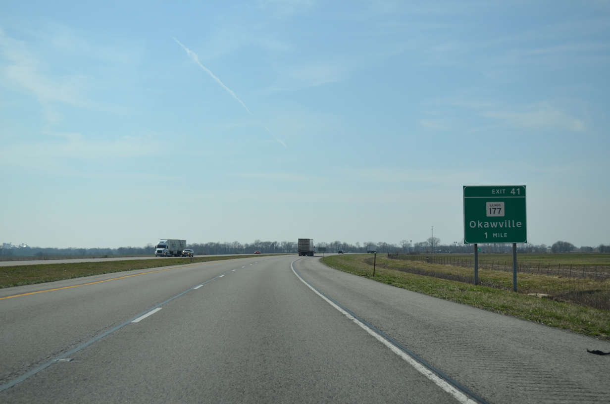
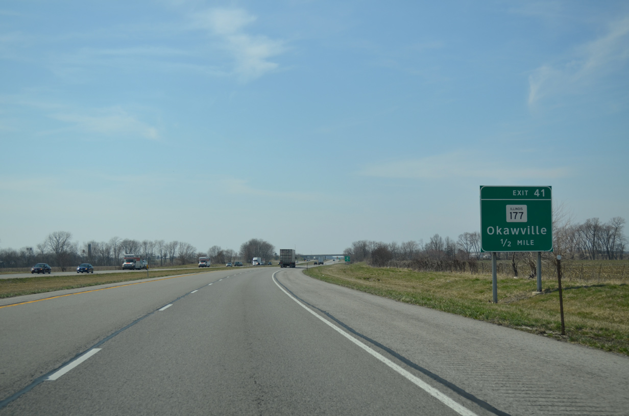
| IL 177 bee lines west from U.S. 51 at Irvington to meet Interstate 64 at Exit 41 in one mile. 04/05/13 |
|
| IL 177 follows High Street west into the village of Okawville. The state route turns south onto Front Street through the business district before joining IL 160 west along Elm Street for an eight mile overlap to New Memphis. 04/05/13 |
|
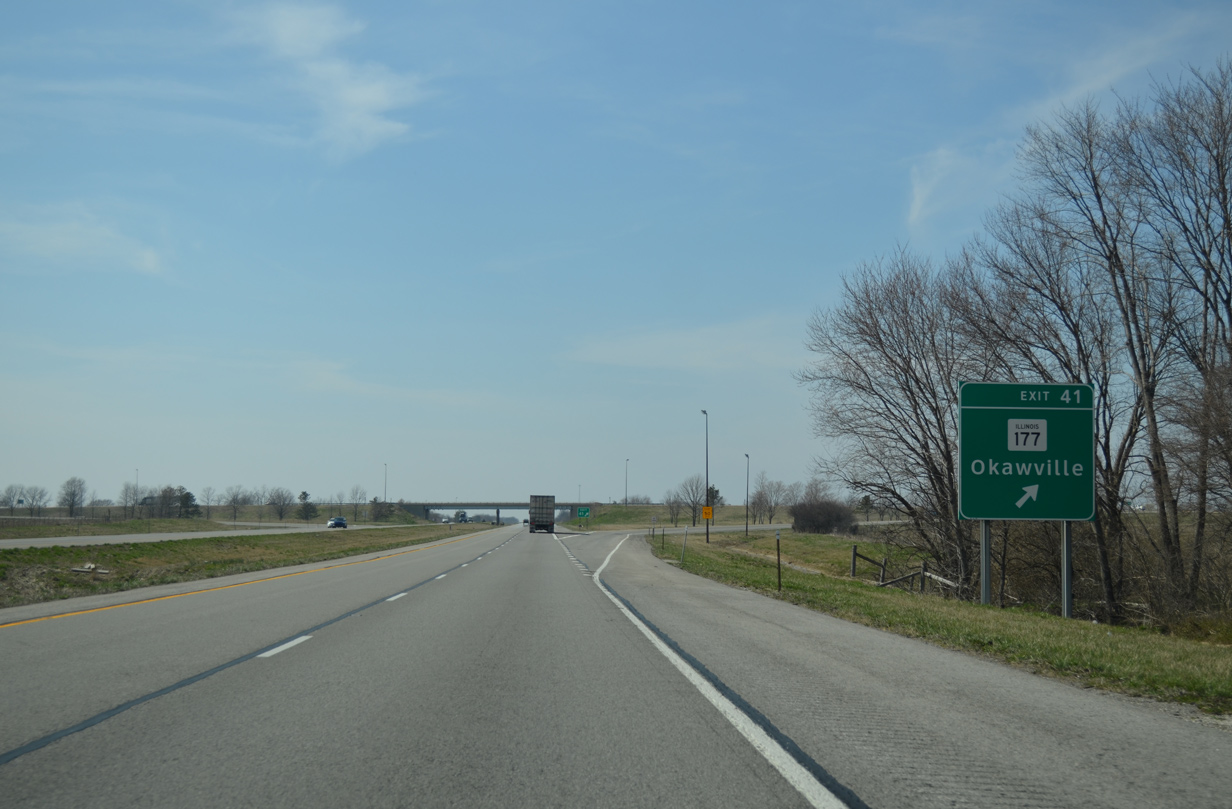
| Exit 41 departs Interstate 64 west on the outskirts of Okawville. Overall IL 177 comprises a 49 mile route from Irvington west to Belleville (IL 159). 04/05/13 |
|
| Interstate 64 generally travels northwest from Okawville on the six mile stretch to Exit 34. 04/05/13 |
|
| A roadway separation occurs ahead of the Kaskaskia River and Horseshoe Lake along I-64 west. 04/05/13 |
|
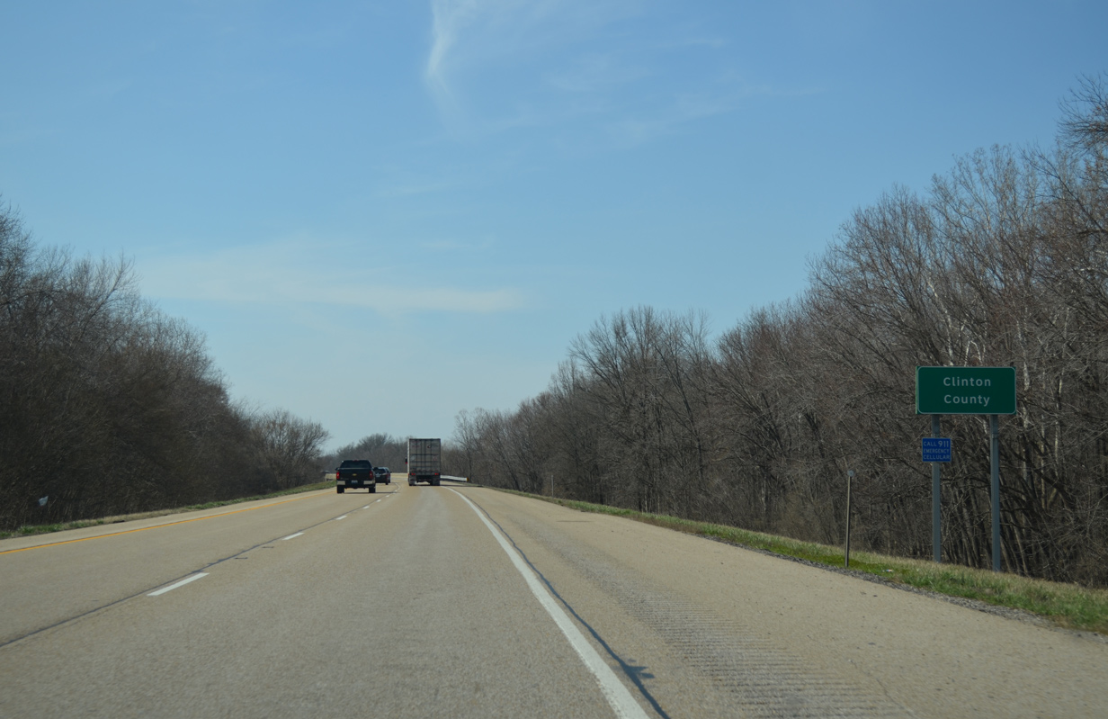
| The Kaskaskia River separates Washington and Clinton County across Interstate 64. 04/05/13 |
|
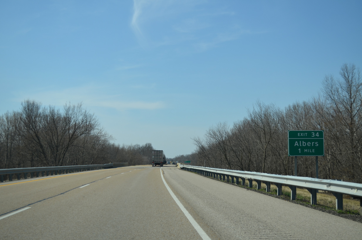
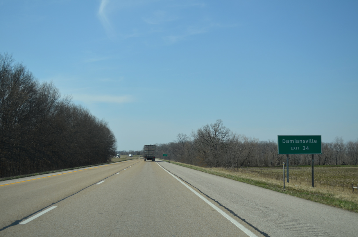
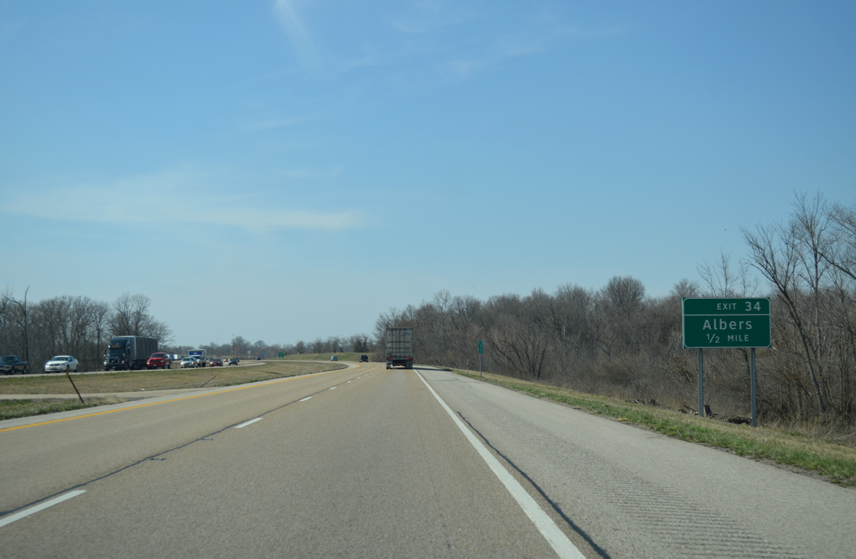
| Albers Road south and Airport Road east come together at a diamond interchange (Exit 34) with Interstate 64 in one mile. 04/05/13 |
|
| The village of Damiansville spreads along the north side of Interstate 64 from Exit 34 westward to Sugar Creek. 04/05/13 |
|
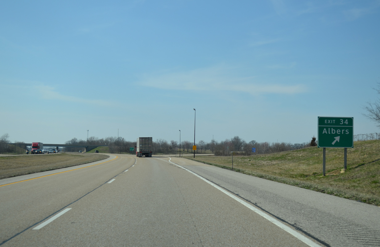
| Albers Road heads north from Exit 34, partially as County Road 23 through Damiansville, to become County Road 8 north to the village of Albers. 04/05/13 |
|
| Westbound I-64 at Exit 34 to Albers Road north and Airport Road west.
Airport Road extends west four miles to IL 160 north of New Memphis and south of New Baden. There is no direct access to IL 160 from I-64 otherwise. 04/05/13 |
|
| Interstate 64 passes by Damiansville Community Park beyond this westbound reassurance marker. 04/05/13 |
|
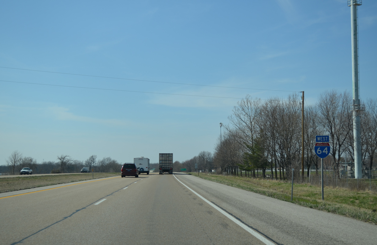
| East St. Louis is a half hour away. Downtown St. Louis, via I-44 east, follows in 34 miles. 04/05/13 |
|
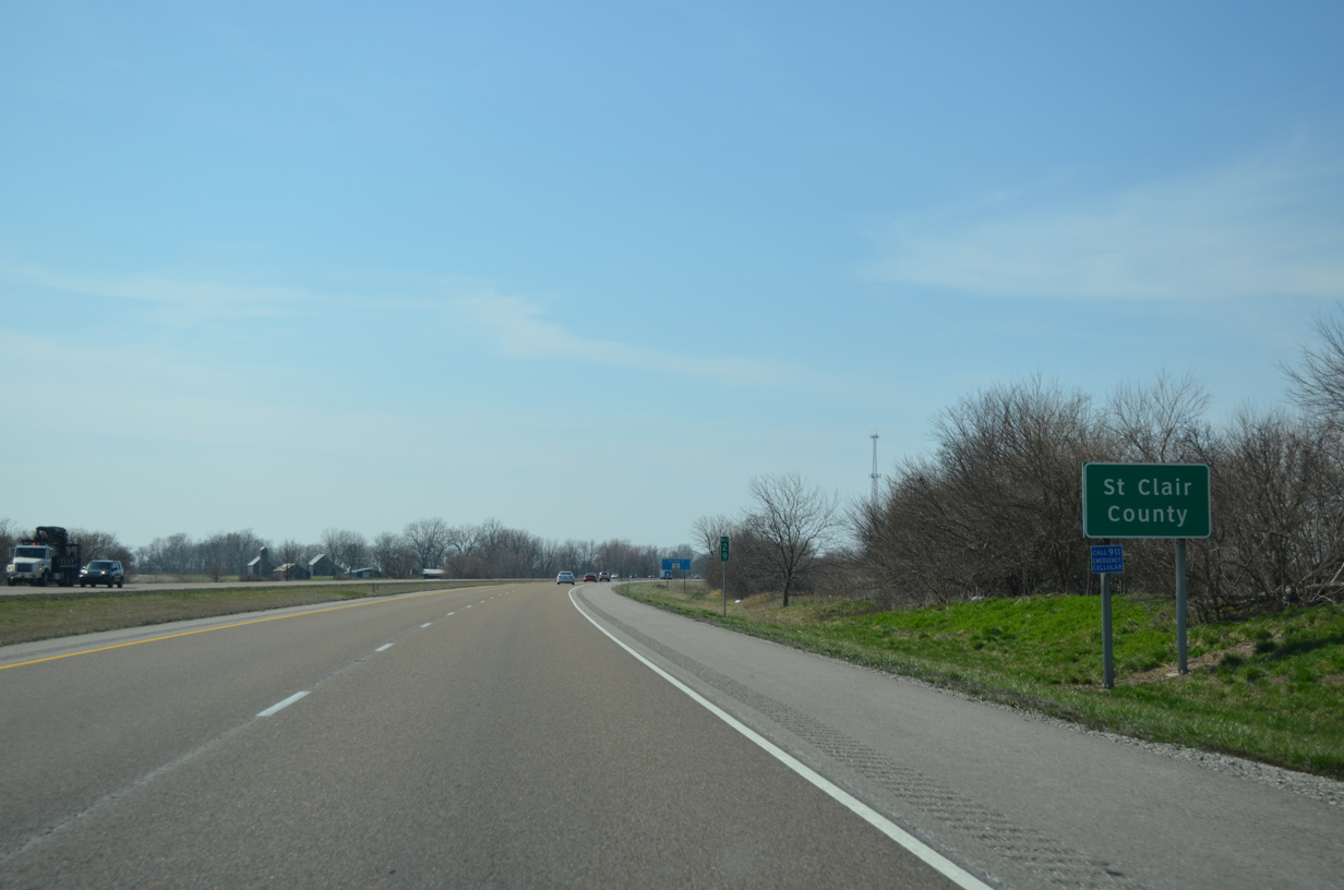
| I-64 crosses into St. Clair County one mile west of IL 160 at the CR 10 overpass. 29 miles of the freeway remain in Illinois. 04/05/13 |
|
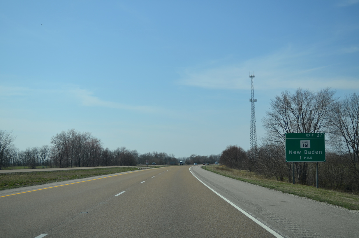
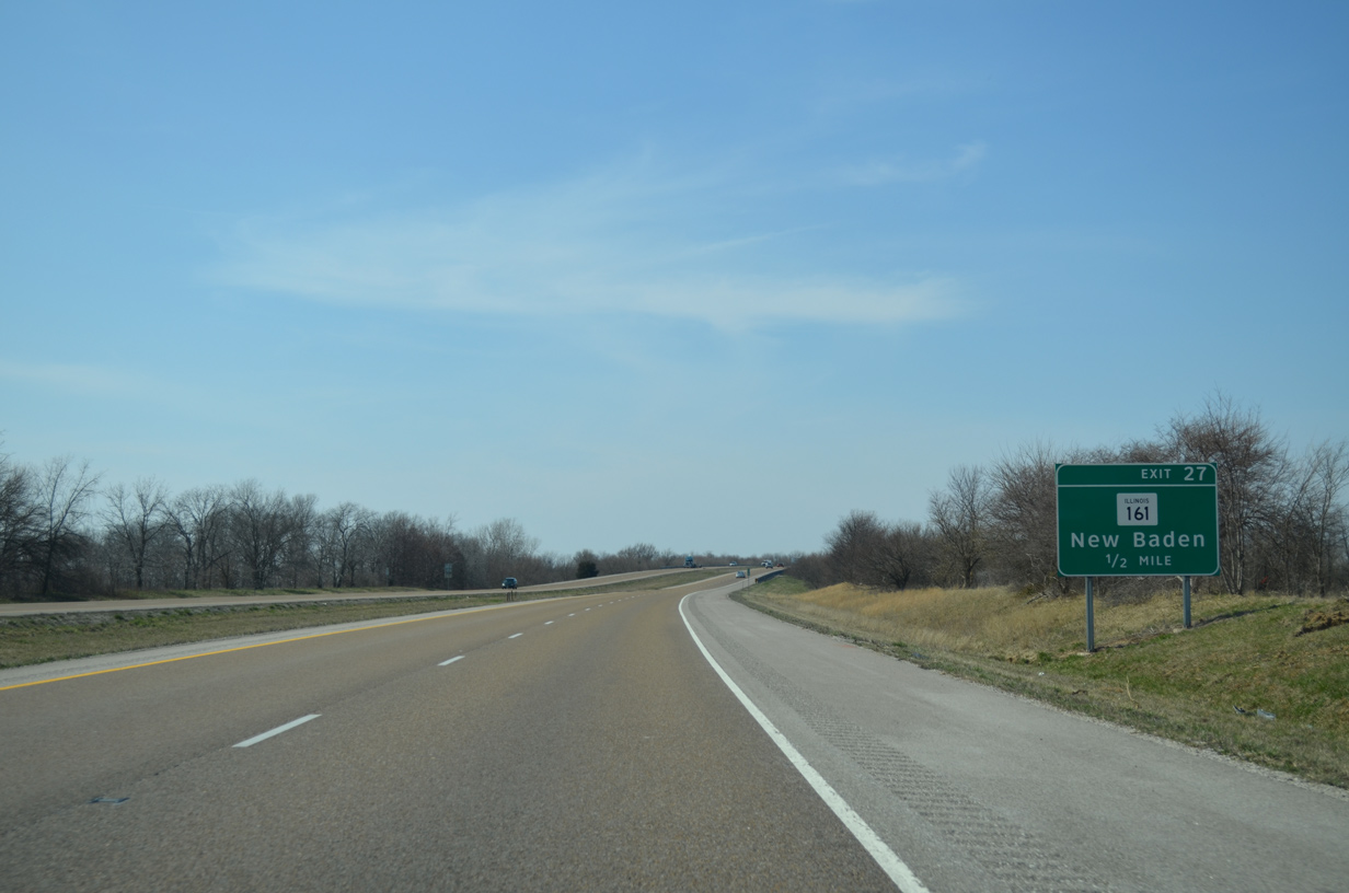
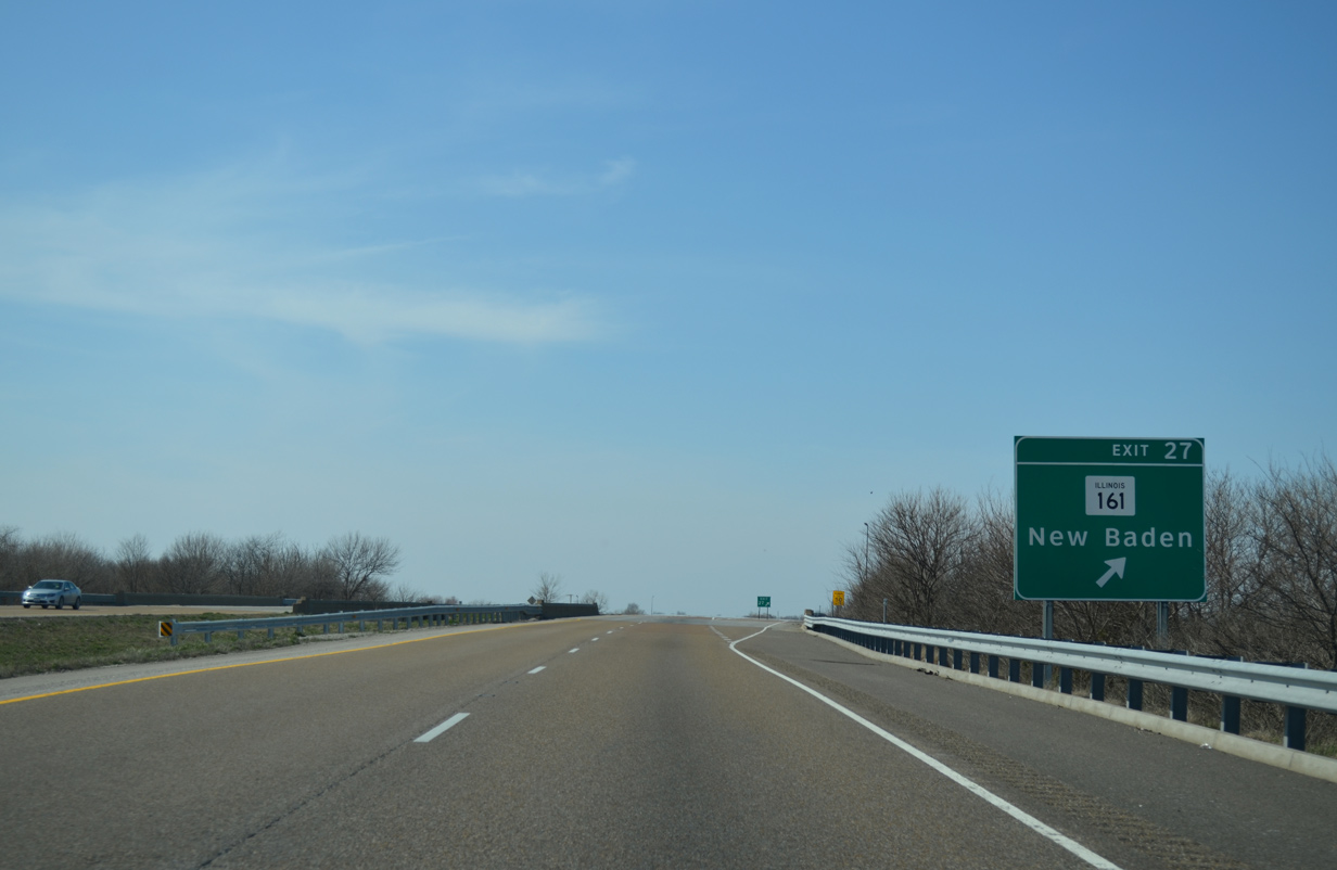
| Curving northwest around New Baden, Interstate 64 next meets IL 161 (Hanover Street) on the west side of the village. 04/05/13 |
|
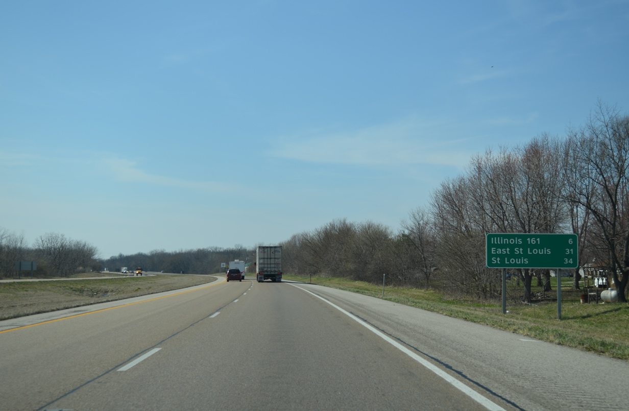
| IL 161 travels west 59 miles from IL 37 in Marion County near I-57 to Fairview Heights, near I-64 at Exit 9. 04/05/13 |
|
| I-64 west spans a Norfolk Southern Railroad line leading into the rural diamond interchange (Exit 27) with IL 161. IL 161 follows Harper Street east through the New Baden business district. Westward, the state route dog legs south 0.75 miles en route to Mascoutah. 04/05/13 |
|
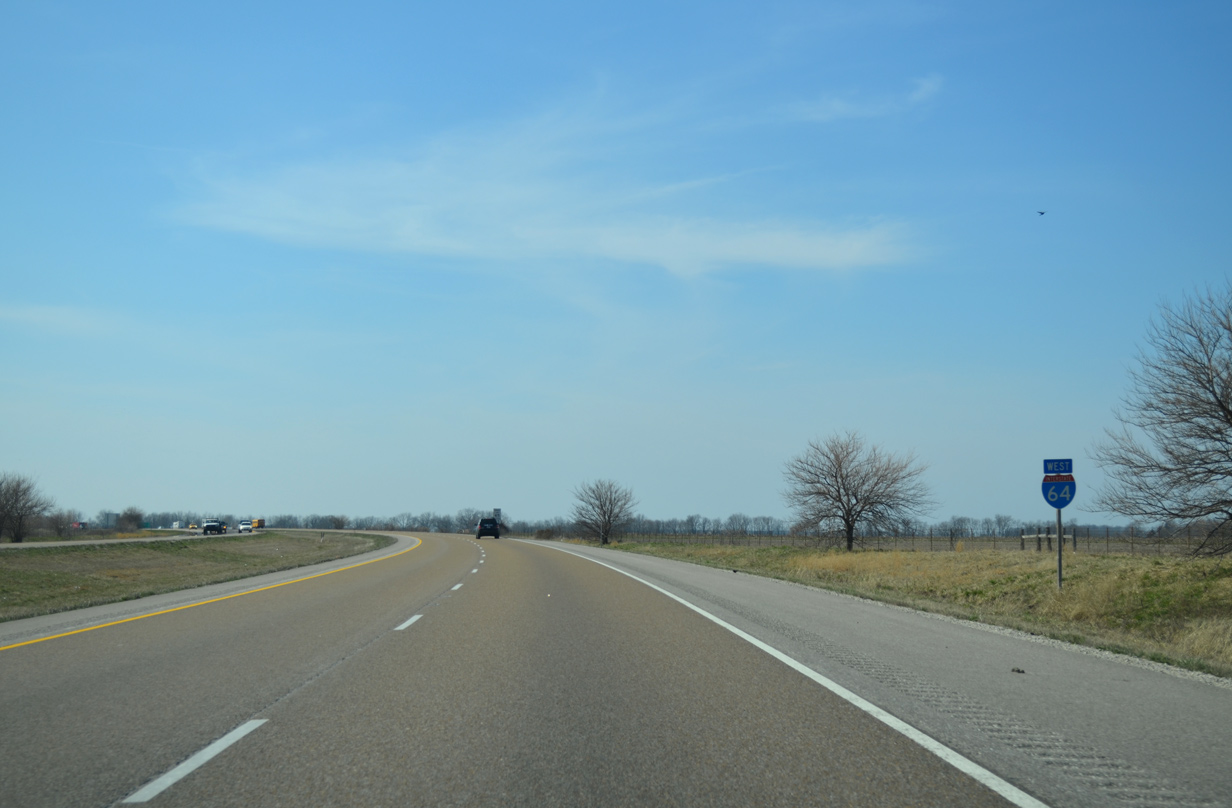
| Interstate 64 curves northwest from New Baden ahead of the County Route 50 overpass. 04/05/13 |
|
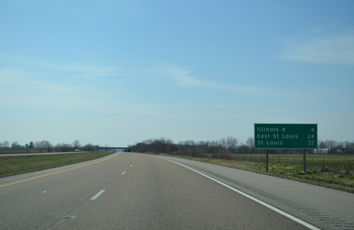
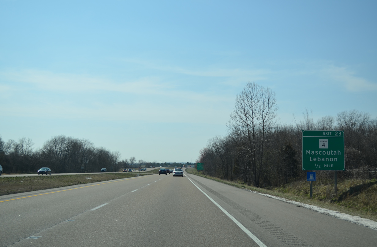
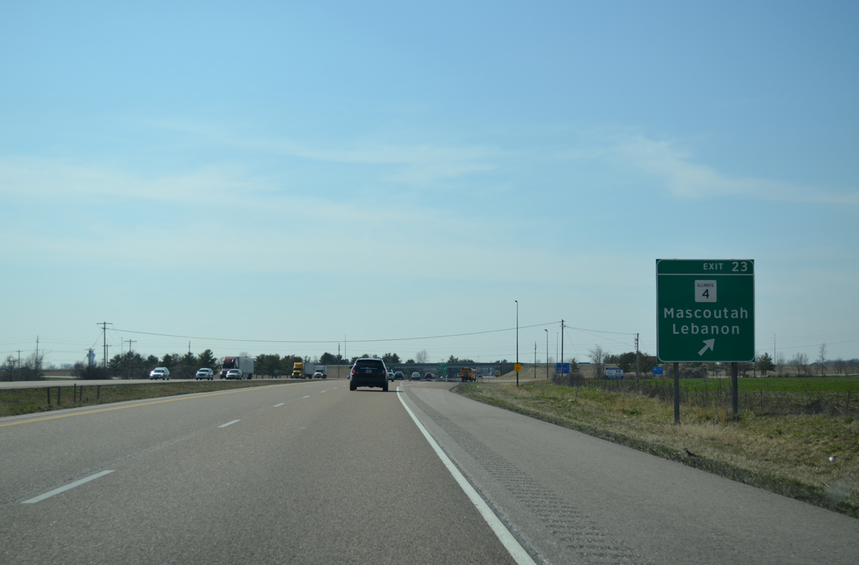
| The succeeding exit links I-64 with IL 4 in northern reaches of the Mascoutah city limits. East St. Louis is 24 miles to the west. 04/05/13 |
|
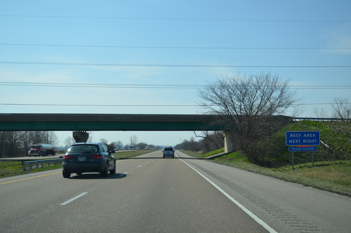
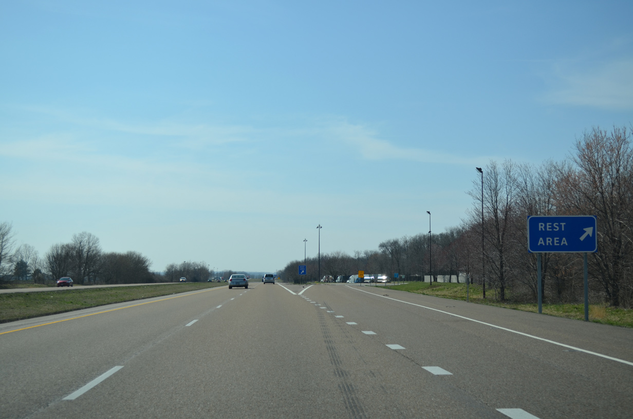
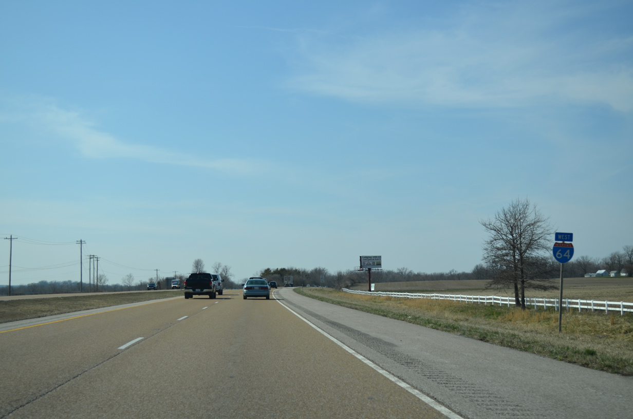
| County Route 50 spans Interstate 64 north from IL 161 to Summerfield ahead of the final westbound rest area. 04/05/13 |
|
| Westbound I-64 at the St. Clair County rest area. The eastbound facility lies a short distance to the west. 04/05/13 |
|
| The diamond interchange at Exit 23 connects I-64 west with IL 4. The rural exit serves adjacent MidAmerica St. Louis Airport (BLV), a Joint Use Airport on the grounds of Scott Air Force Base. The airport commenced operations in November 1997.1 04/05/13 |
|
| IL 4 turns southeast from BLV Airport through the city of Mascoutah. The state route takes Jefferson Street through the residential street grid. 04/05/13 |
|
| North from Exit 23, IL 4 leaves Mascoutah on a three mile course to the city of Lebanon and a short overlap with U.S. 50 along Madison Street. The state route runs 160 miles overall from IL 13/127, north of Murphysboro, to Springfield. 04/05/13 |
|
| Suburban development encroaches the north side of Interstate 64 as the freeway leaves Mascoutah ahead of Silver Creek. 04/05/13 |
|
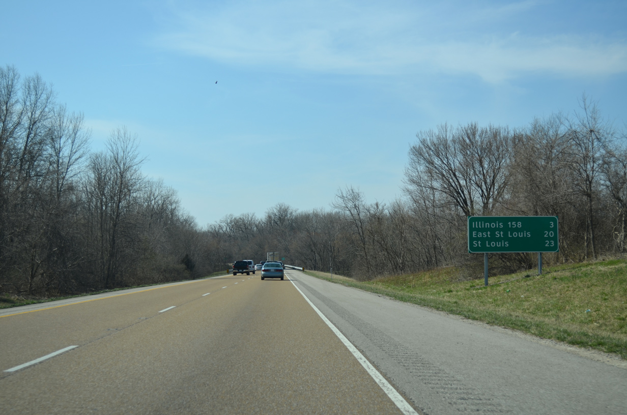
| I-64 separates with a forested median across both Silver Creek and Silver Creek Ditch. East St. Louis is 20 miles to the west. 04/05/13 |
|
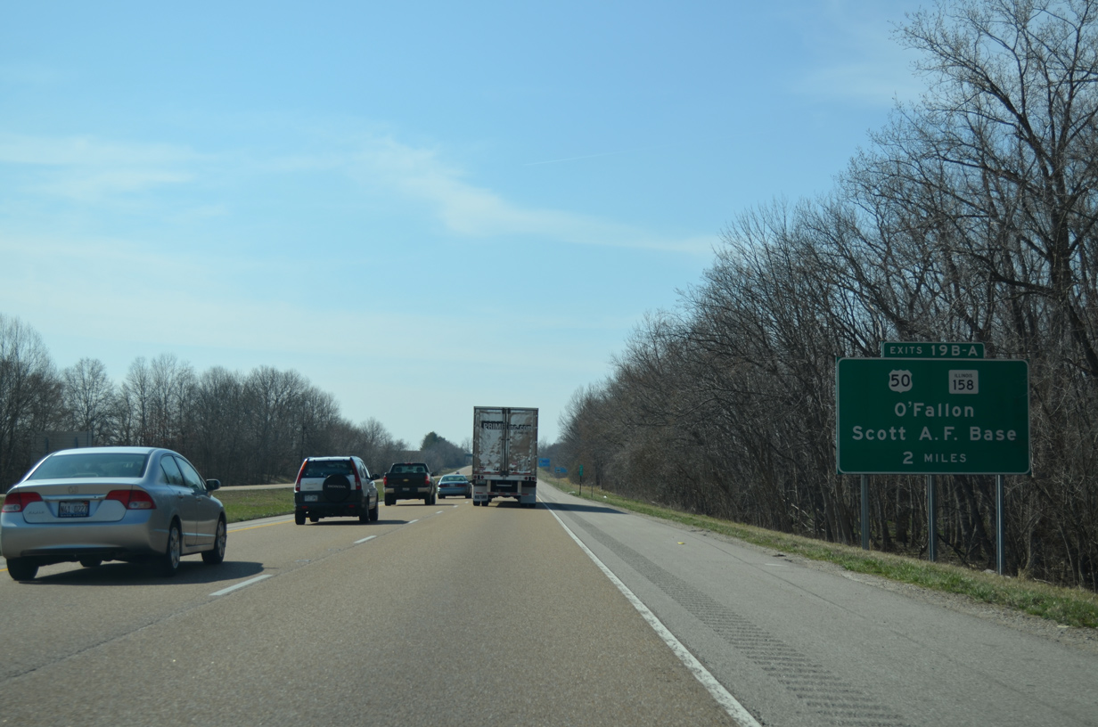
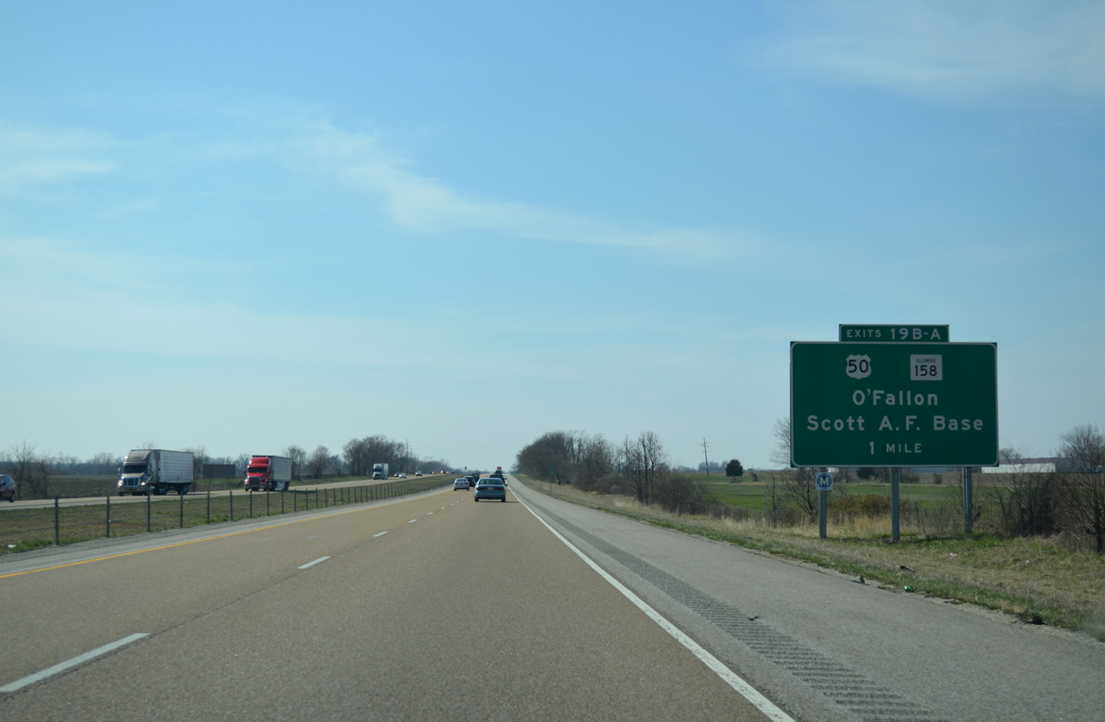
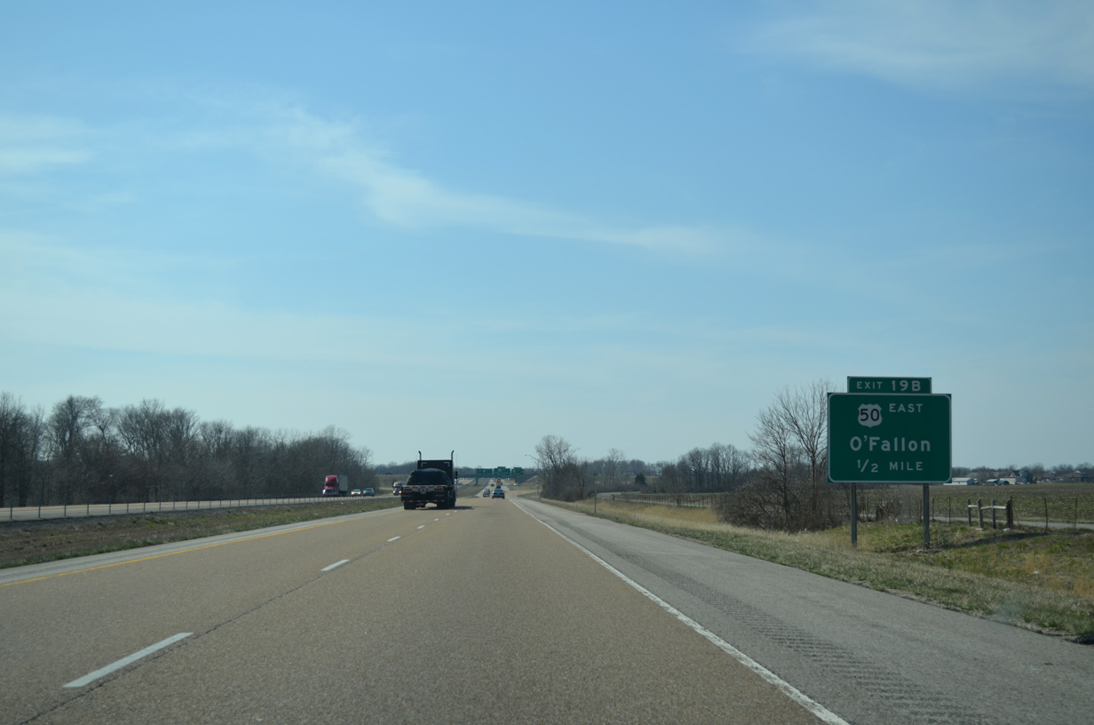
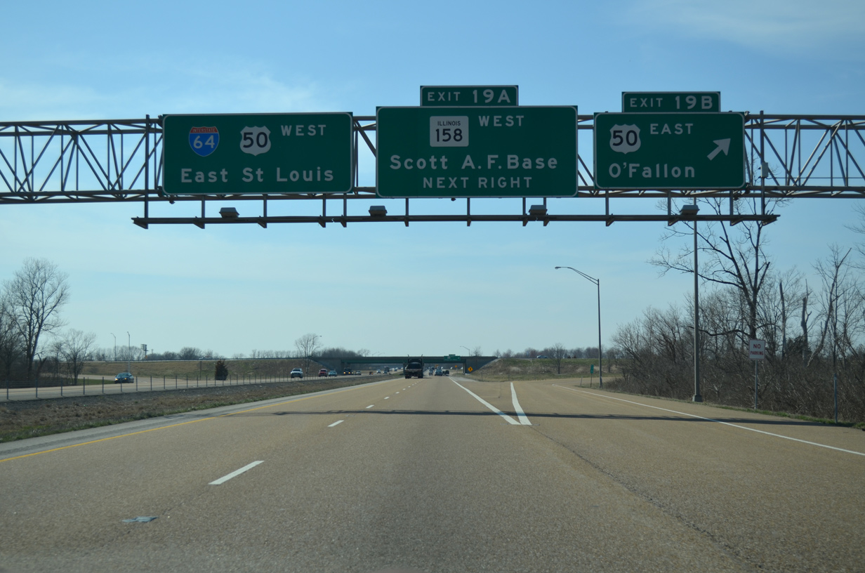
| Interstate 64 and U.S. 50 meet for the first time between O'Fallon and Fairview Heights. The nearly coast to coast highway combines with I-64 west at a cloverleaf interchange (Exits 19 B/A) in two miles. 04/05/13 |
|
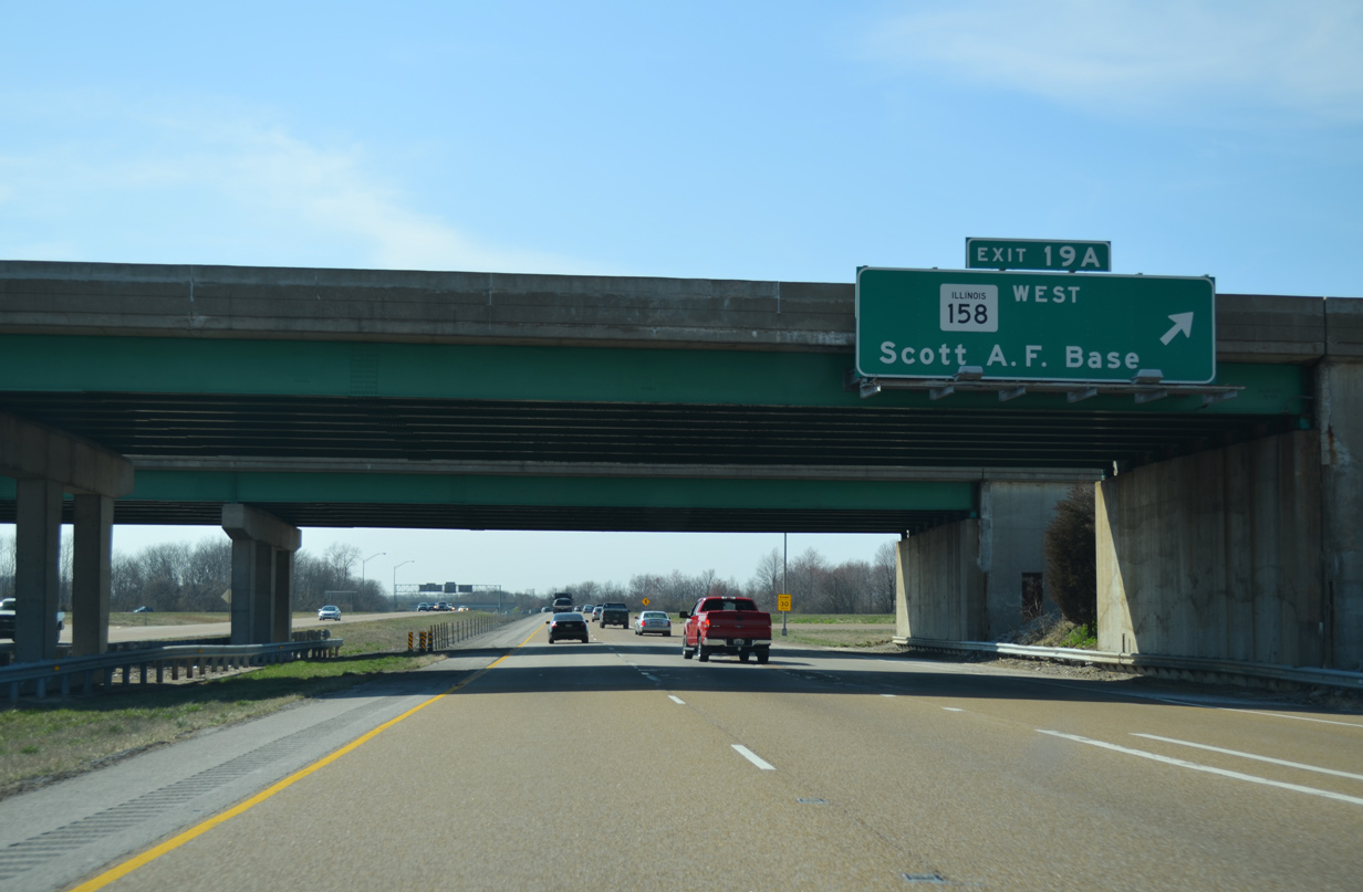
| U.S. 50 combines with IL 158 south along an expressway (Air Mobility Drive) leading toward Scott Air Force Base from O'Fallon. IL 158 begins at the east end of East Highway 50, which is old U.S. 50 across O'Fallon, 0.7 miles north of I-64. 04/05/13 |
|
| U.S. 50 travels west from Vincennes, Indiana to Olney, Salem, Carlyle and other rural towns along the original planned corridor for Interstate 64. The route combines with I-64 west through O'Fallon, Shiloh and Fairview Heights while the old route, still named US Hwy 50, winds west along a commercial route through O'Fallon. 04/05/13 |
|
| Exit 19 B parts ways for U.S. 50/IL 158 east to Scott-Troy Road (CR 61) north, US Hwy 50 west into O'Fallon, and U.S. 50 east to Lebanon. 04/05/13 |
|
| IL 158 heads 3.7 miles south from Exit 19 A to overlap with IL 161 east as part of a loop back west to Belleville. The 24 mile route of IL 158 concludes at IL 3 in Columbia. 04/05/13 |
Page Updated 12-16-2014.

 West
West