|
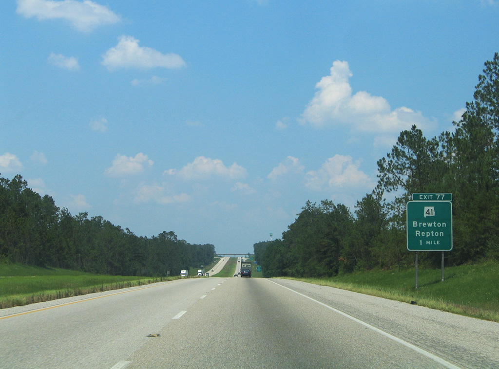
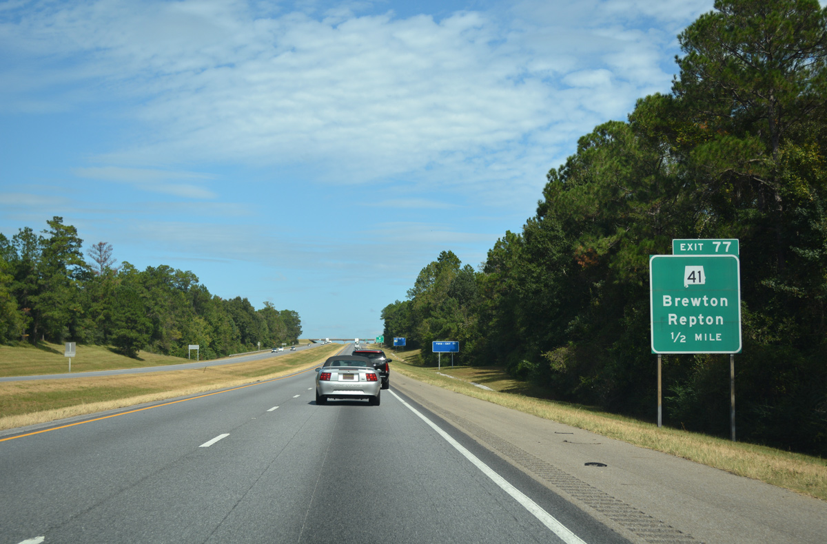
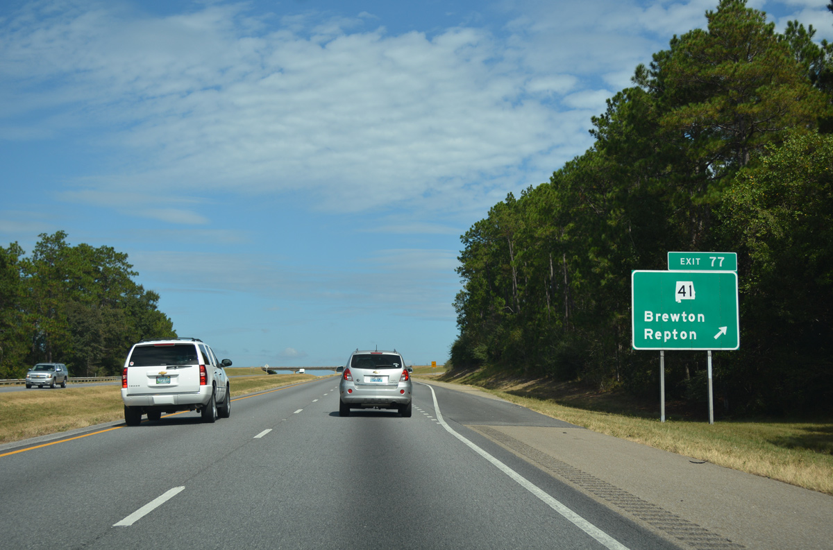
| The diamond interchange (Exit 77) with SR 41 lies 1.6 miles north within Conecuh County. SR 41 constitutes a 127.48 mile route from the Florida state line to Selma. The one mile sign for Exit 77 has been missing since 2011. 06/21/05 |
|
| Brewton was once rated as one of the most livable small towns in America. It is located 17 miles to the southeast along SR 41. Northward SR 41 travels ten miles to the town of Repton, where it overlaps with U.S. 84 towards the Monroe County seat of Monroeville. 10/06/16 |
|
| South from Exit 77 and Brewton, SR 41 continues into the Sunshine State as SR 87. Long term plans call for expansion of the two state corridors to four lanes, as they link I-65 with the Emerald Coast at Navarre. 10/06/16 |
|
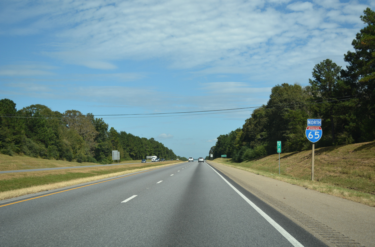
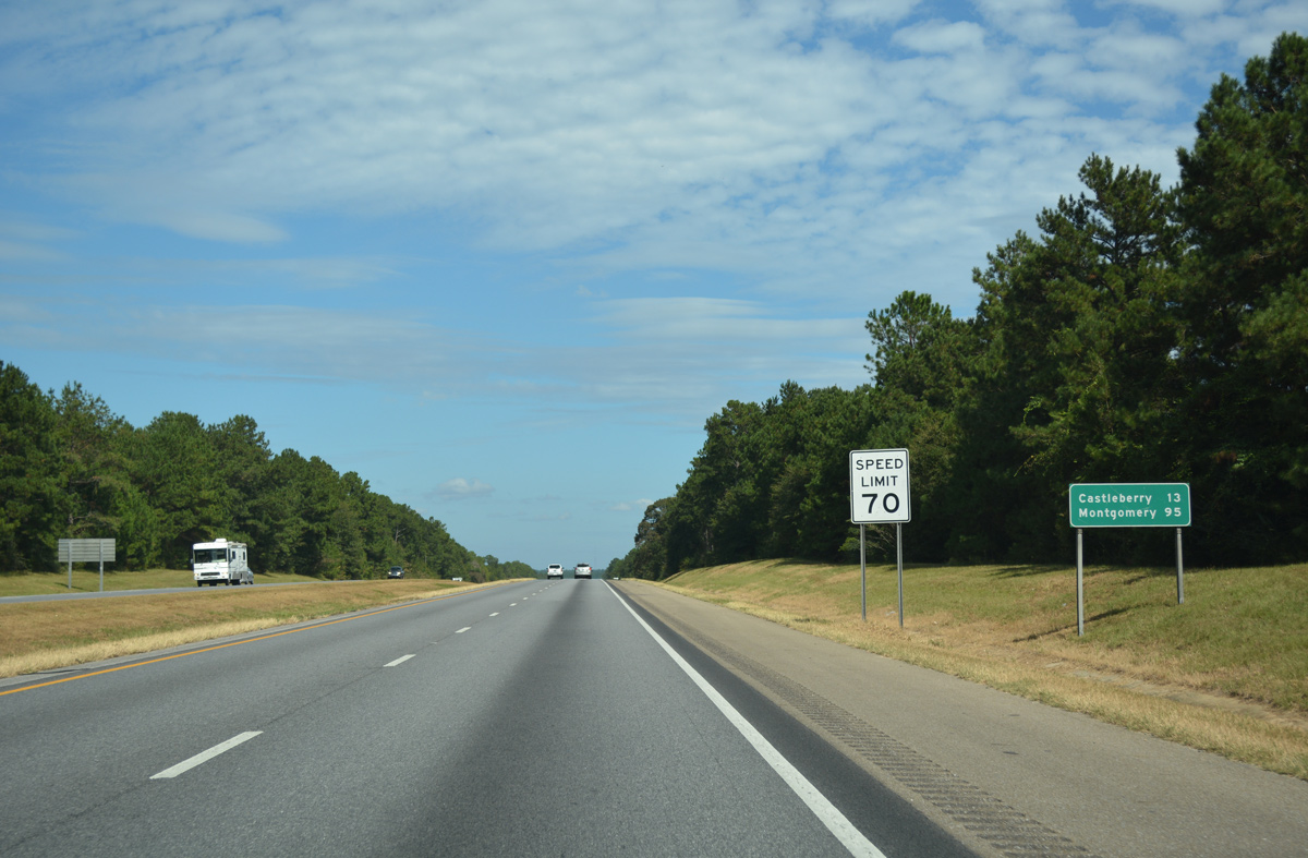
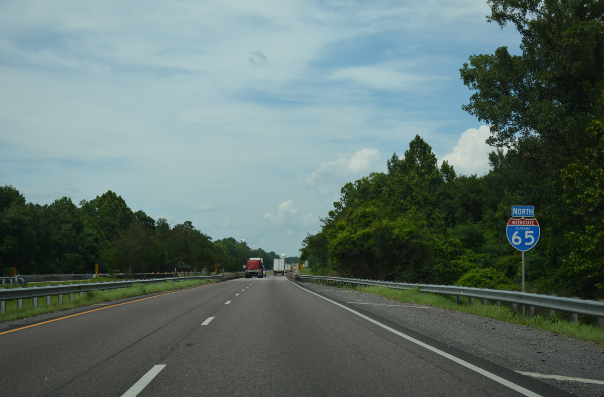
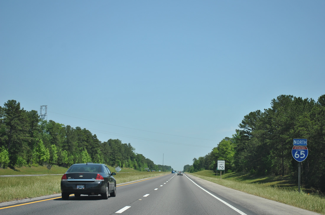
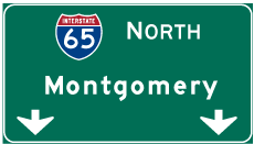
| Continuing north from SR 41 on Interstate 65, Castleberry lies 13 miles ahead, followed by Montgomery in 95 miles. 10/06/16 |
|
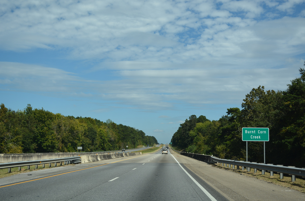
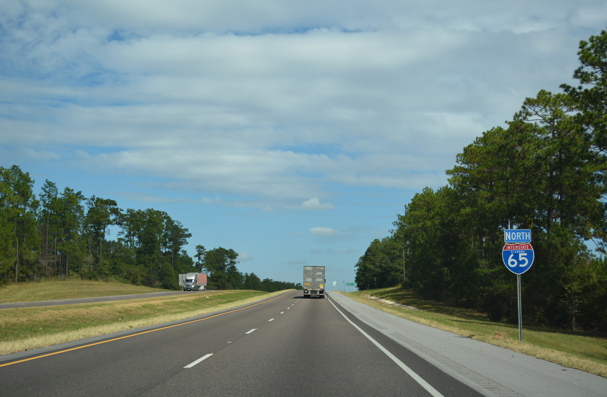
| Interstate 65 crosses Burnt Corn and Brushy Creeks along the forested stretch through southern Conecuh County. 10/06/16 |
|
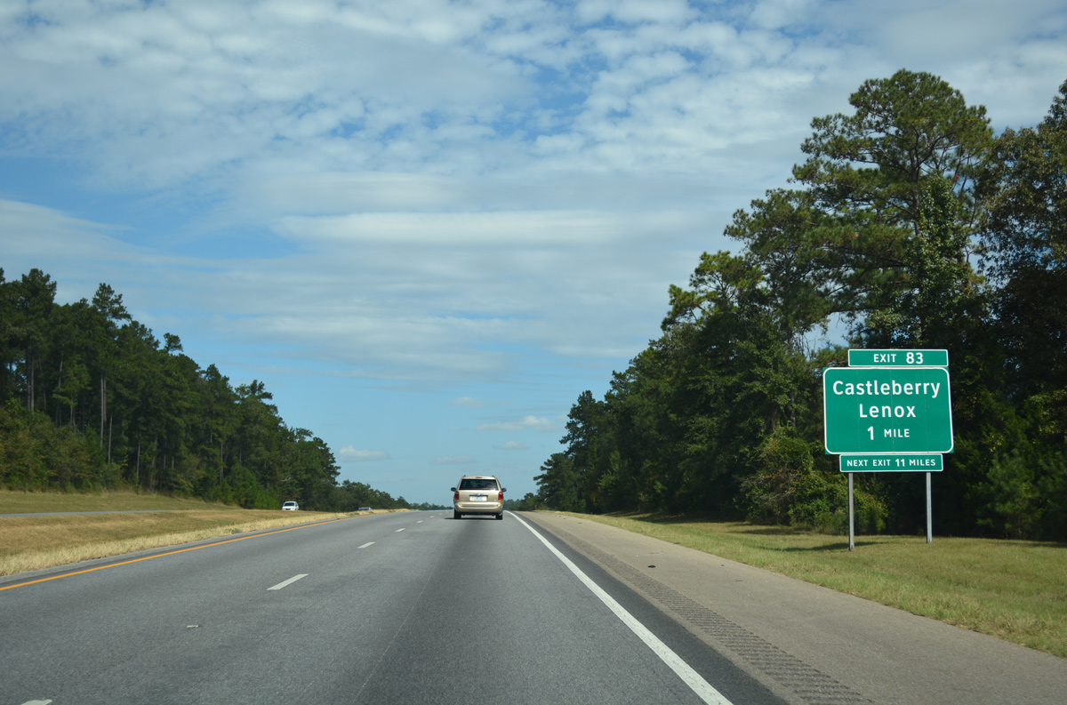
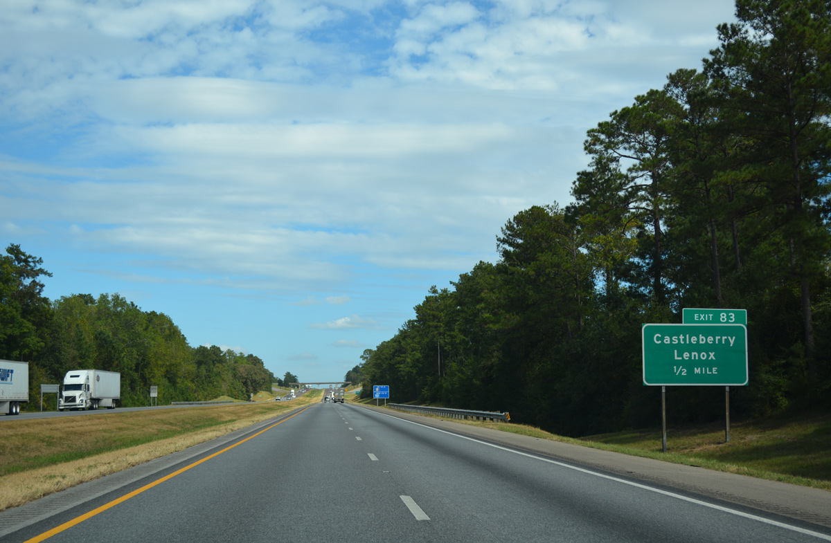
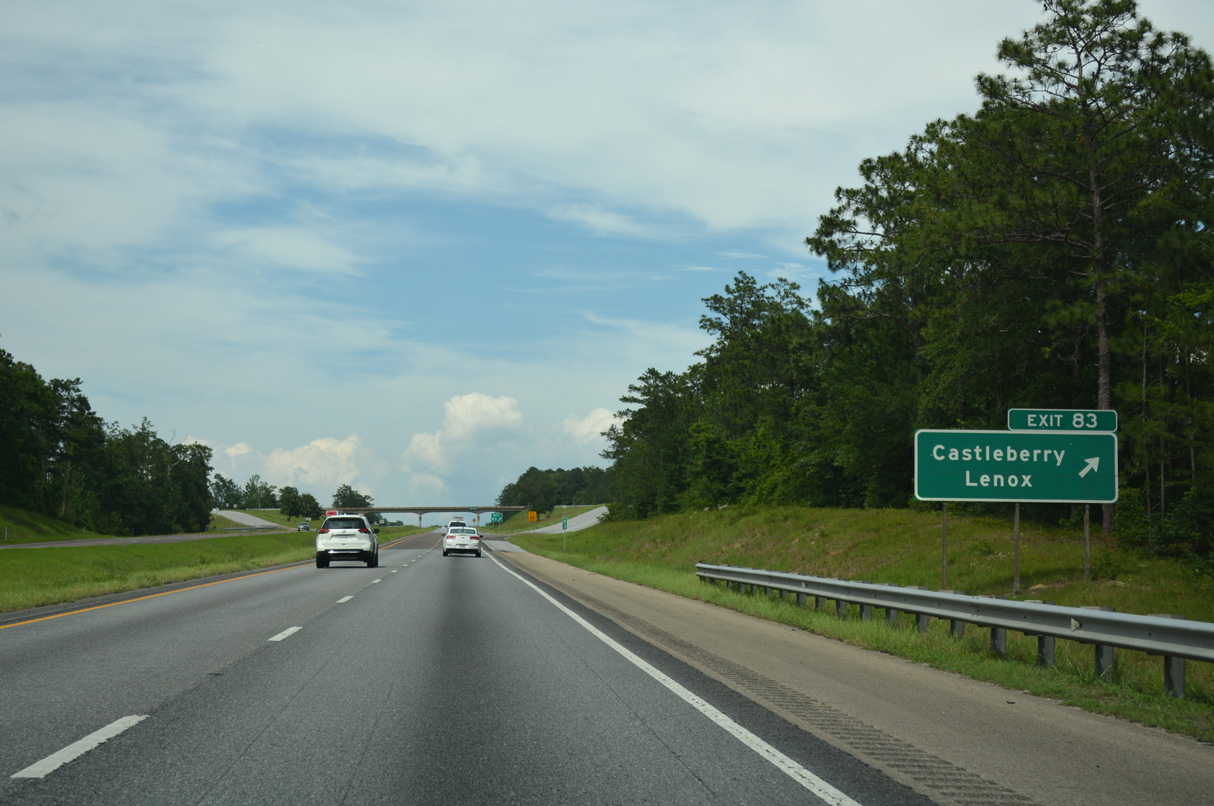
| One mile south of the diamond interchange (Exit 83) with CR 6 on I-65 north. This sign was the first to use Clearview font along Interstate 65 between Mobile and Montgomery. 10/06/16 |
|
| CR 6 constitutes a rural route west from Exit 83 to the community of Lenox and SR 41 near Repton. 10/06/16 |
|
| CR 6 meanders east from Exit 83 through the settlements of Sand Cut and London to become Cleveland Avenue through the rural town of Castleberry. 06/07/17 |
|
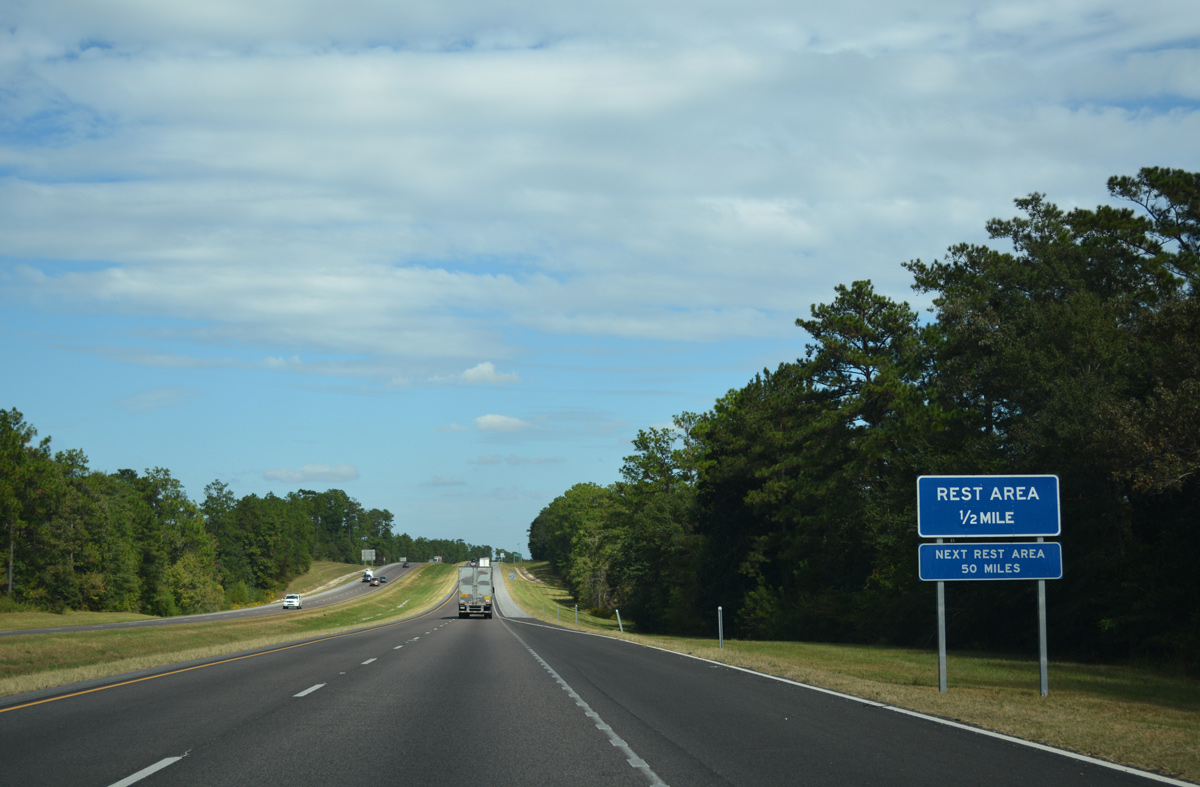
| A northbound side rest area follows between Exit 83 and the Joe Reeves Road overpass along Interstate 65. 10/06/16 |
|
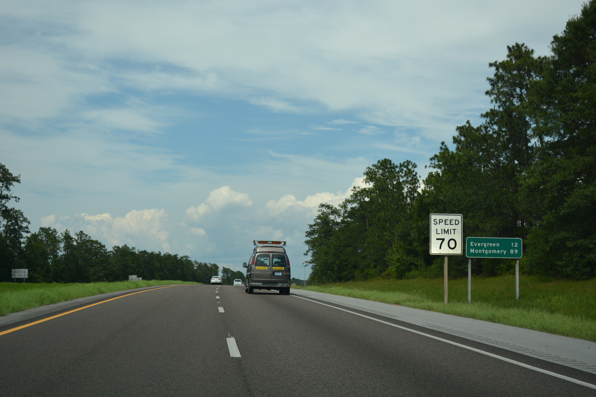
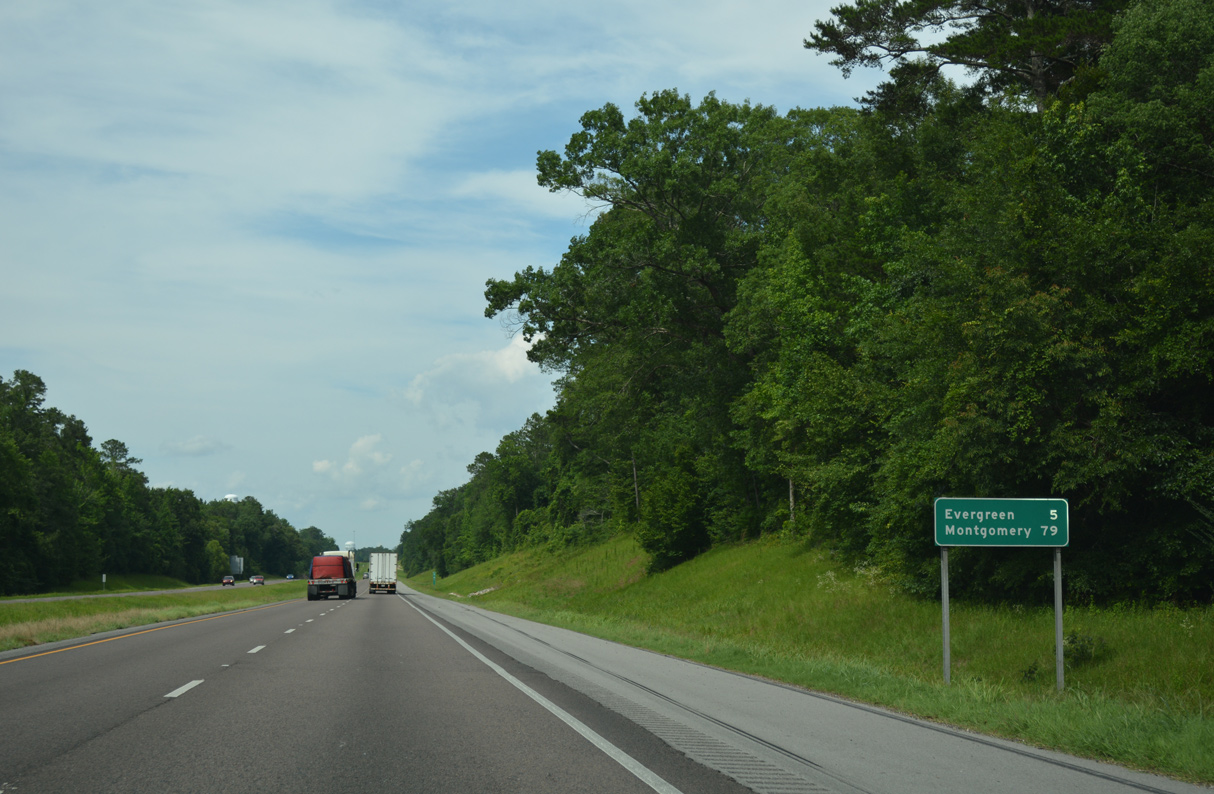
| North from CR 6, Interstate 65 continues 12 miles to Evergreen and 83 miles to the Alabama capital city. 10/06/16, 06/07/17 |
|
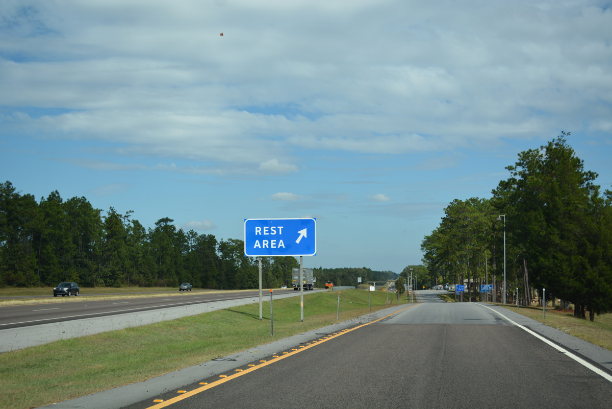
| The Conecuh County rest area along I-65 north is the first along the 887 mile route to Northwest Indiana. A southbound facility is located four miles further north by Jordan Creek. 10/06/16 |
|
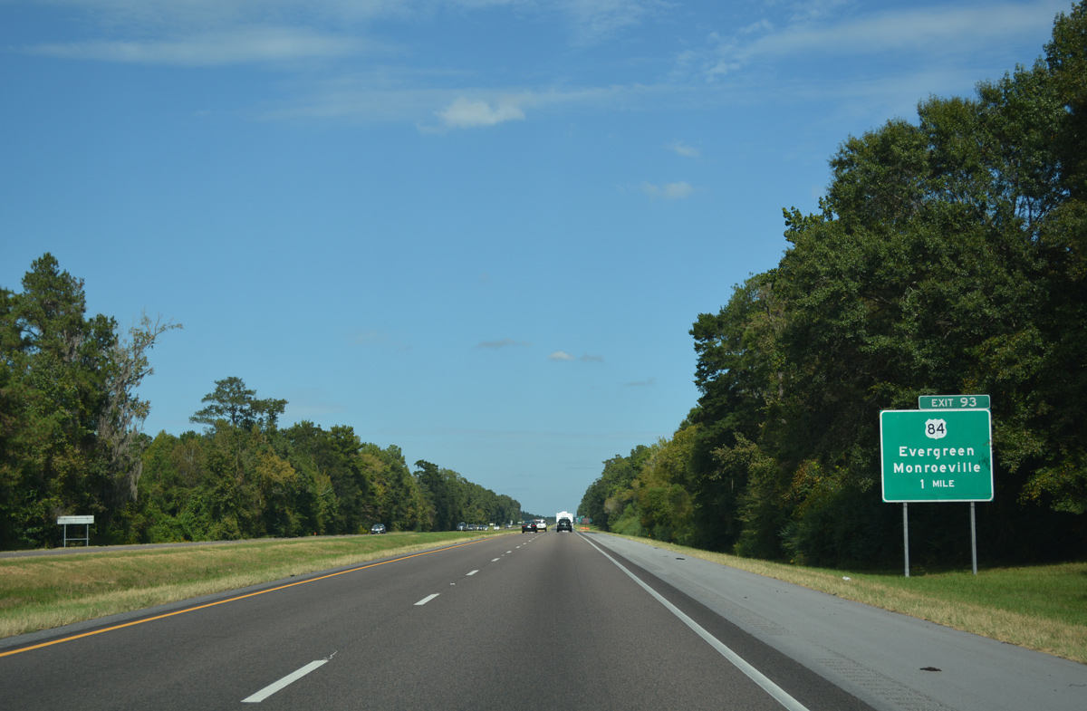
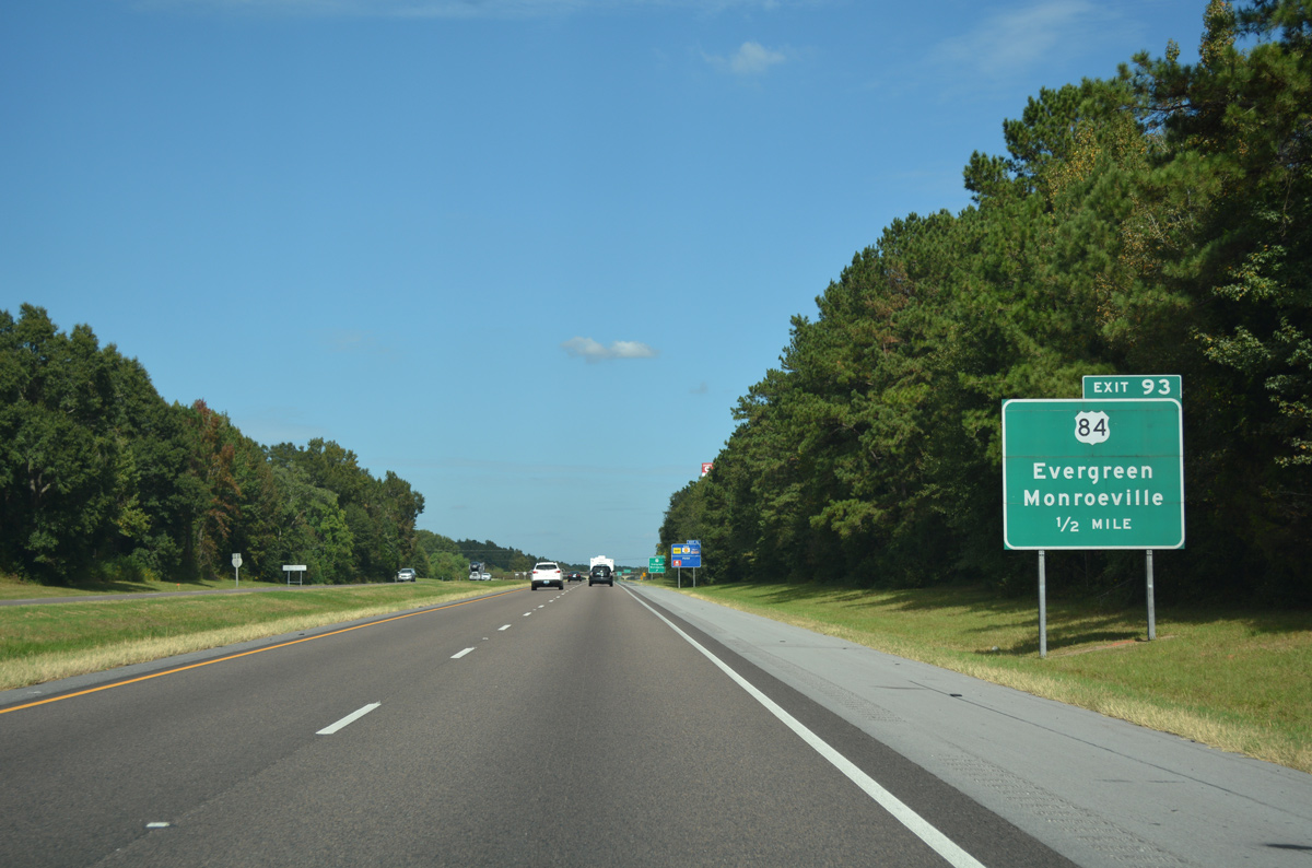
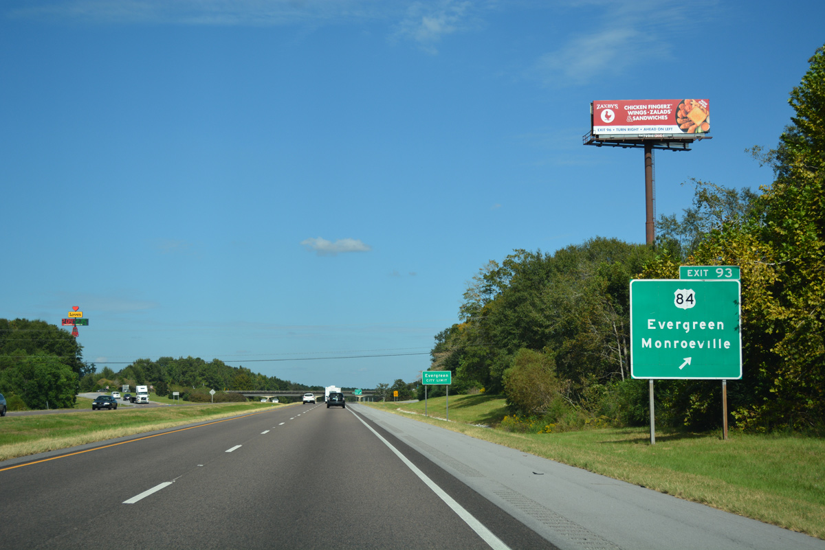
| U.S. 84 and Interstate 65 converge to the southwest of the Evergreen city limits at Exit 93. Monroeville, originally along U.S. 84 but now bypassed, is 24 miles to the west. 10/06/16 |
|
| U.S. 84 represents one of three Alabama River crossings between Selma and Interstate 65 across the delta region in Lower Alabama. U.S. 84 spans the river between Grove Hill and Monroeville to the northwest. 10/06/16 |
|
| East from Exit 93, U.S. 84 combines with U.S. 31 at Fairview for an 8.8 mile overlap through Downtown Evergreen. U.S. 84 joins the Conecuh County seat with Andalusia, Opp, Enterprise and Dothan to the southeast. 10/06/16 |
|
| Interstate 65 spans Murder Creek by this reassurance shield. 06/07/17 |
|
| Although already alongside the city limits of Evergreen, the city center is still a five mile drive via Interstate 65 north and SR 83 south. 06/07/17 |
|
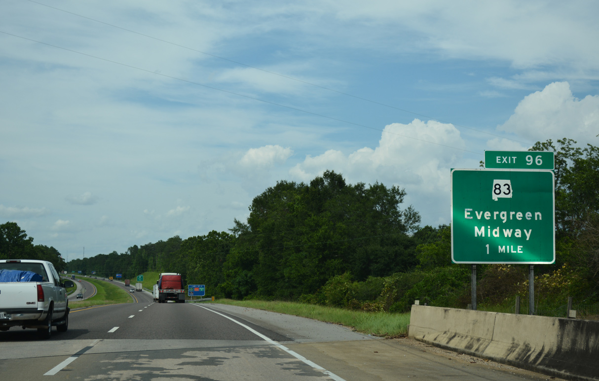
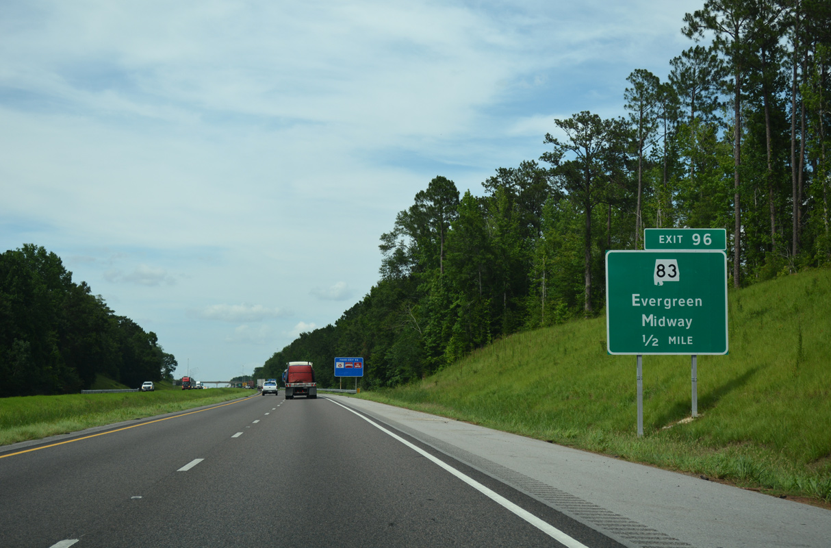
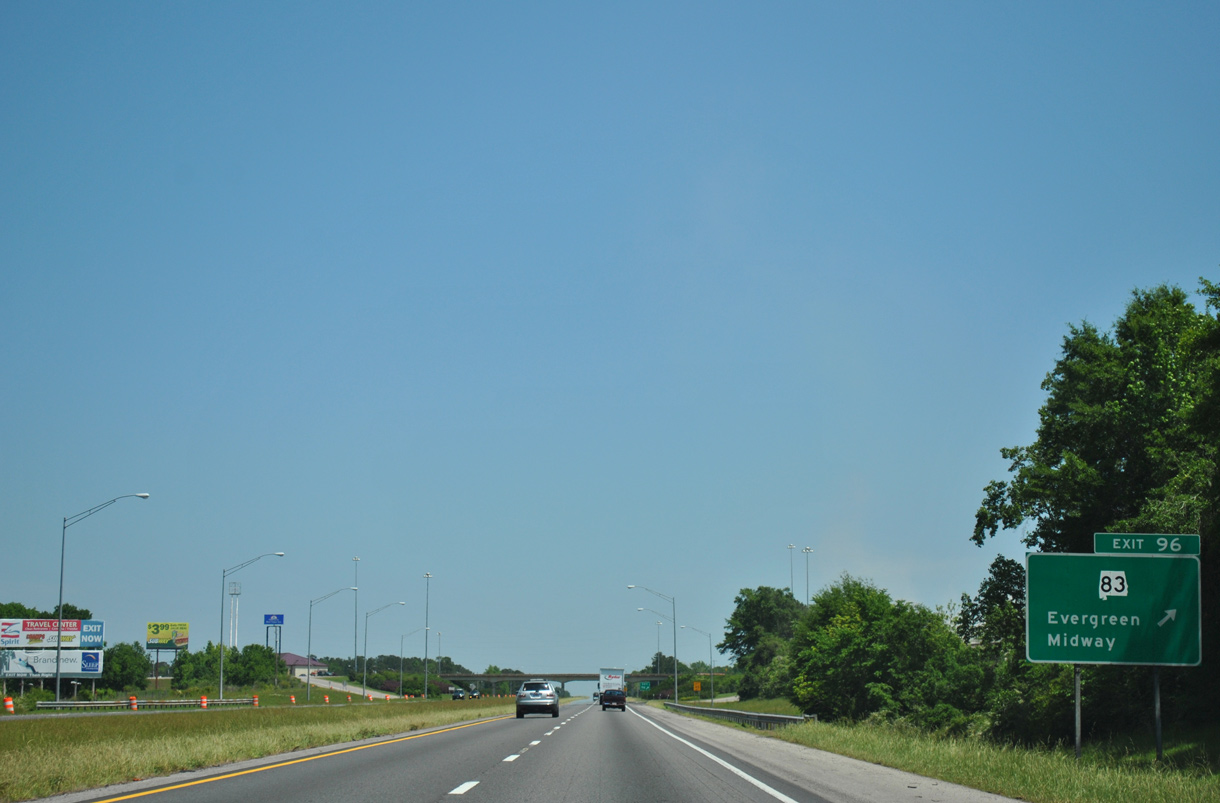
| I-65 crosses over County Route 20 (Loree Road) one mile south of Exit 96 for SR 83 (Liberty Hill Drive). 06/07/17 |
|
| SR 83 (Liberty Hill Drive) heads two miles south to the Evergreen business district at Rural Street and U.S. 31/84 (Front Street). The 24.27 mile long route travels from Evergreen to SR 47 at Midway. 06/07/17 |
|
| An array of industrial businesses and traveler services surround the diamond interchange (Exit 96) joining I-65 with SR 83. A nearby meat processing factory occasionally produces visible smoke at the exchange. Conecuh County is known for its spicy Conecuh sausage. 04/13/12 |
|
| Interstate 65 northbound shield posted ahead of the County Road 30 overpass in north Evergreen. 04/13/12 |
|
| Montgomery is about an hour north of Evergreen. Rural Owassa is next reached in four miles. 04/13/12 |
|
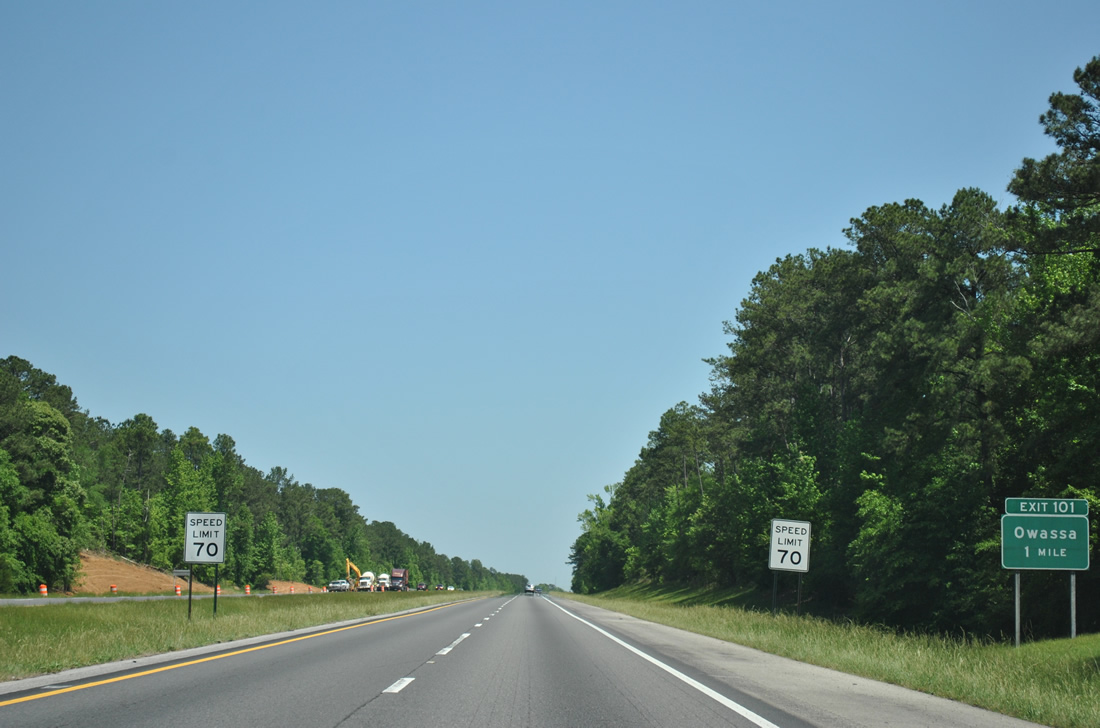
| Conecuh County 29 travels northeast from SR 83 (Liberty Hill Drive) in Evergreen to cross paths with Interstate 65 at Exit 101. 04/13/12 |
|
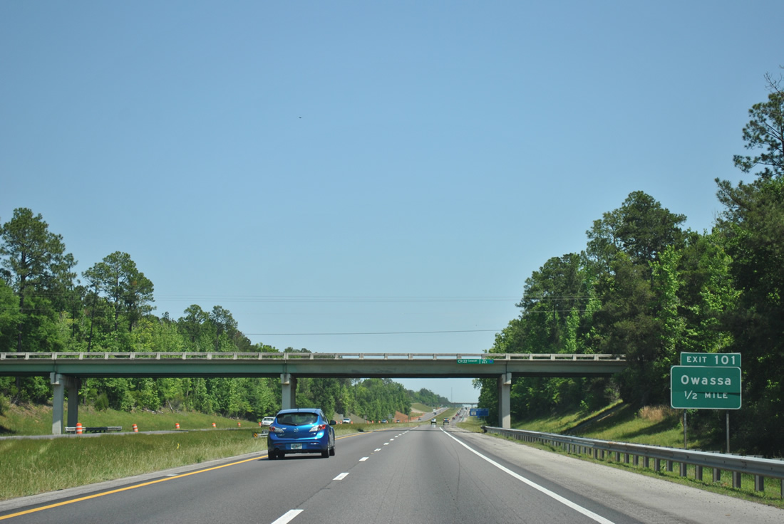
| County Road 22 passes over Interstate 65 from Owassa west to Lake Shirley, one half mile south of the diamond interchange (Exit 101) with County Road 29. 04/13/12 |
|
| Exit 101 departs Interstate 65 north to County Road 29 (Owassa Road). Continuing north from Owassa, Conecuh County 29 becomes Monroe County 29 en route to SR 47 at Old Texas. 04/13/12 |
|
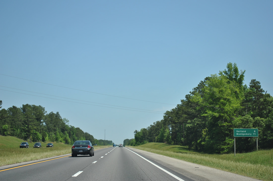
| The rural settlement of Garland represents the next destination of Interstate 65 northbound as the freeway approaches Butler County. 04/13/12 |
|
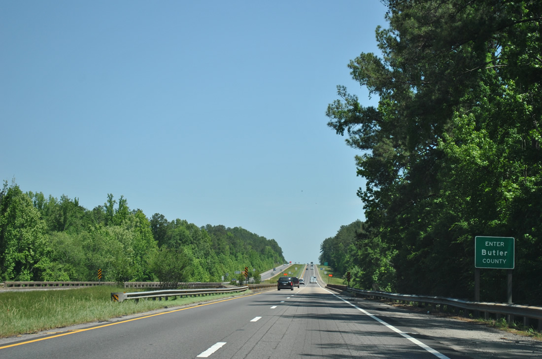
| Spanning the Sepulga River, Interstate 65 ends a 29.765 mile swath in Conecuh County. 04/13/12 |
|
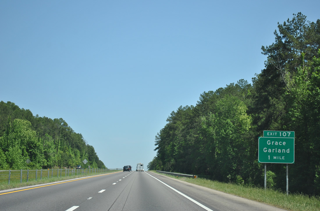
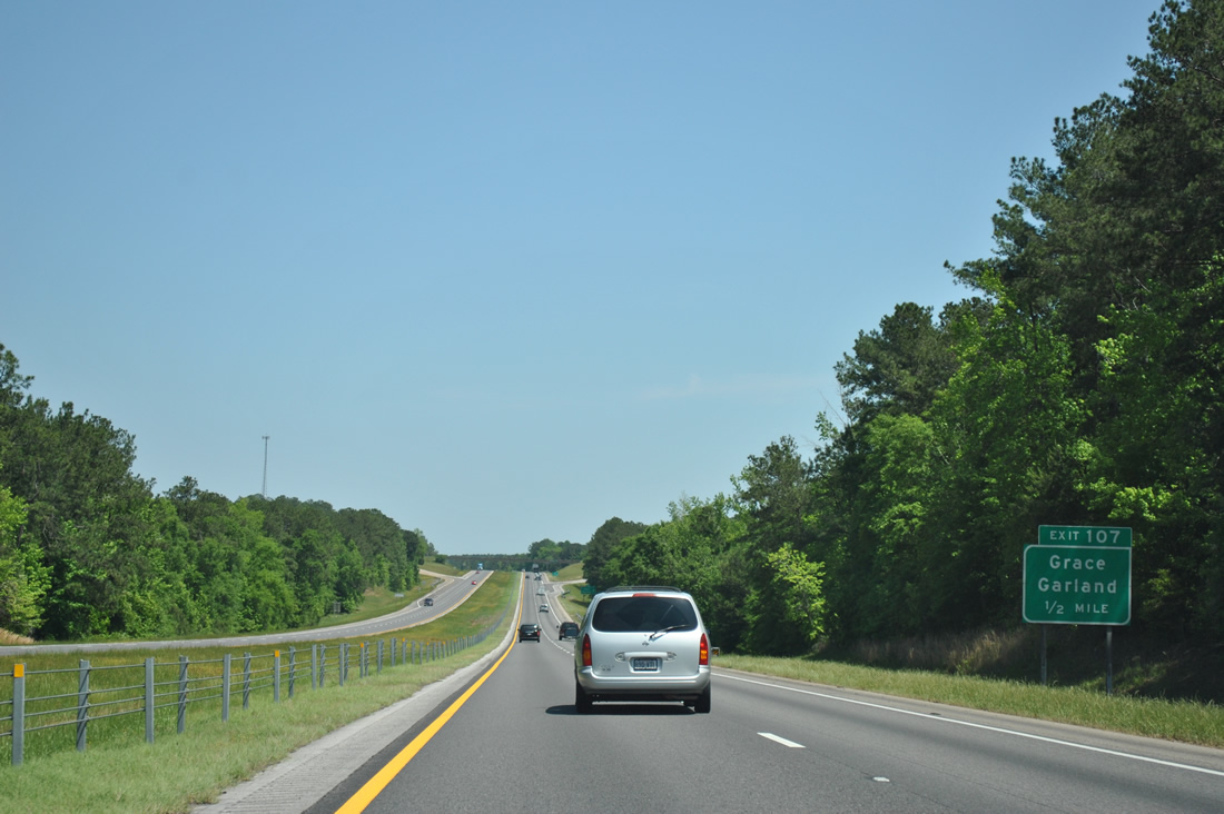
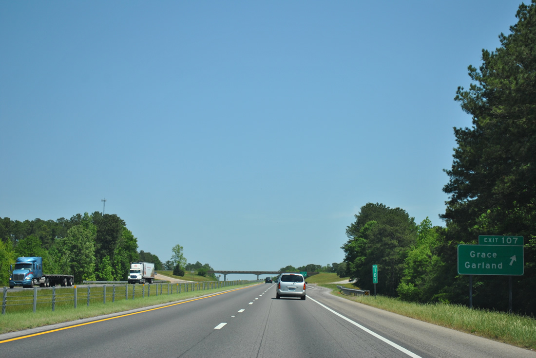
| The first of four Butler County interchanges, Exit 107 serves the settlements of Grace and Garland via County Road 7. 04/13/12 |
|
| One half mile southwest of Exit 107 to County Road 7 (Hank Williams Road). CR 7 travels north from Mt. Olive and Interstate 65 to Grace and SR 106 near Midway. 04/13/12 |
|
| Entering the diamond interchange (Exit 107) with Hank Williams Road on I-65 north. CR 7 east to CR 8 leads motorists to U.S. 31 (Mobile Road) at the town of McKenzie. 04/13/12 |
|
| Nine miles separates Mt. Olive and Georgiana on Interstate 65 northbound. 04/13/12 |
|
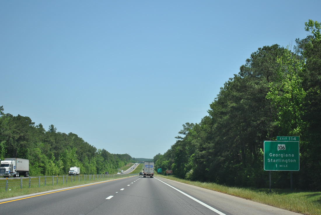
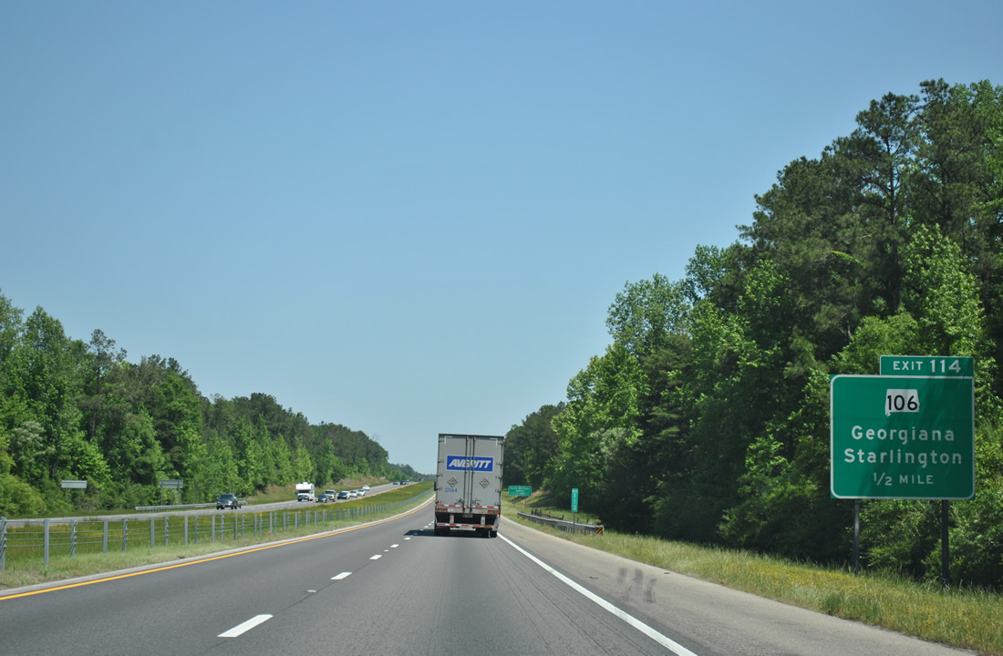
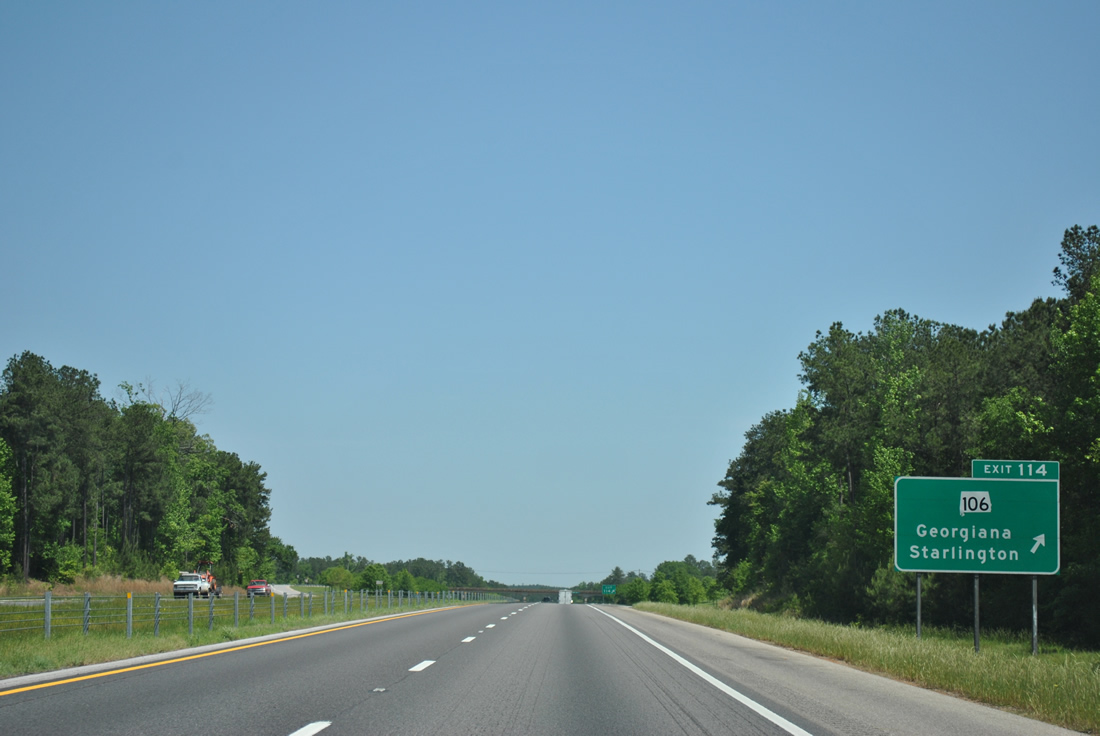
| SR 55 north and SR 106 meet Interstate 65 on the west side of Georgiana at Exit 114 in one mile. SR 55 was extended north to end at the freeway in February 2014. 04/13/12 |
|
| SR 106 ends at the Butler / Monroe County line to the west of Starlington. There the state route becomes Conecuh County Road 106 en route Midway and SR 47. 04/13/12 |
|
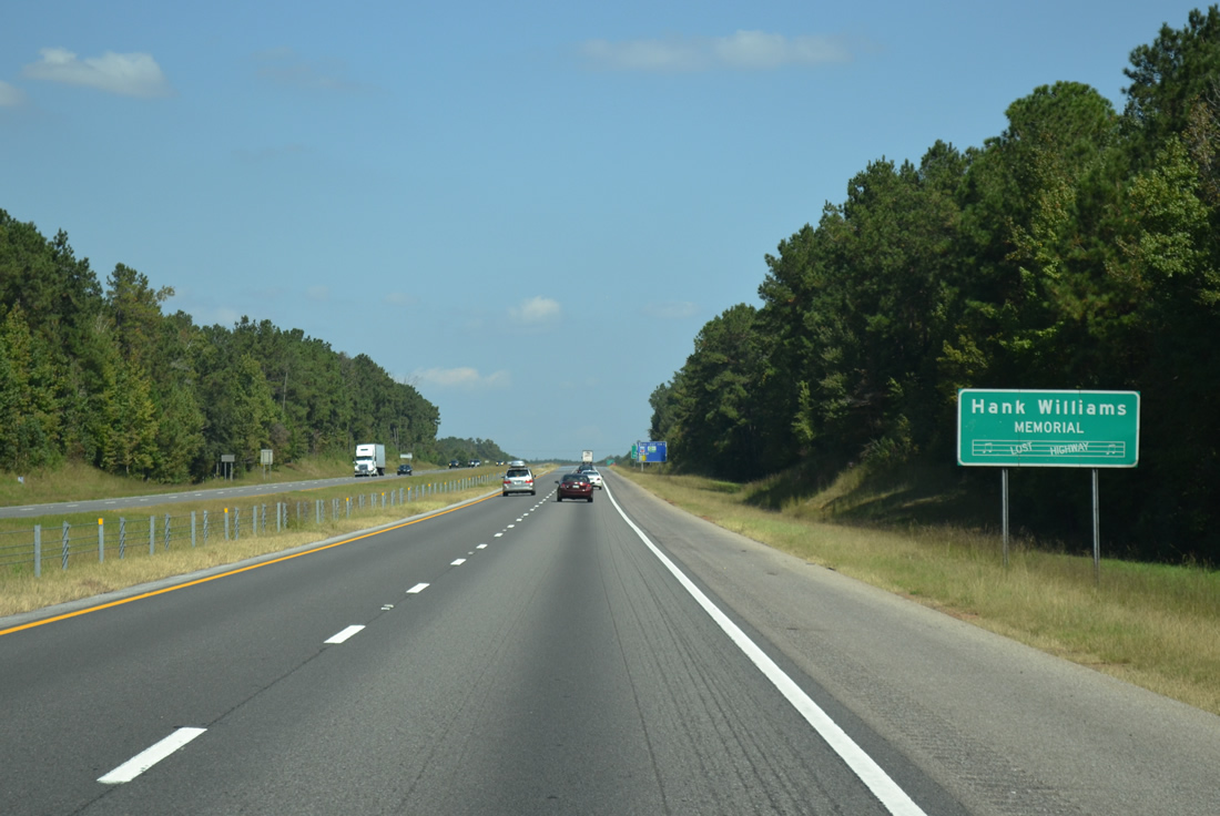
| The stretch of Interstate 65 leading north to Montgomery is dedicated as the "Hank Williams Memorial Lost Highway" as Georgiana is the boyhood home of the legendary county singer. A southbound version of this sign can be found north of the capital city. 10/06/12 |
|
| Exit 114 leaves Interstate 65 north for SR 55 south and SR 106 east into Georgiana. SR 106 concludes its 40.82 mile course at U.S. 29 near Brantley while SR 55 leads southeast to Andalusia. 04/13/12 |
|
| Reassurance marker for Interstate 65 north posted at Panther Creek. 04/13/12 |
|
| A long forested stretch leads Interstate 65 northeast into the city of Greenville. 04/13/12 |
|
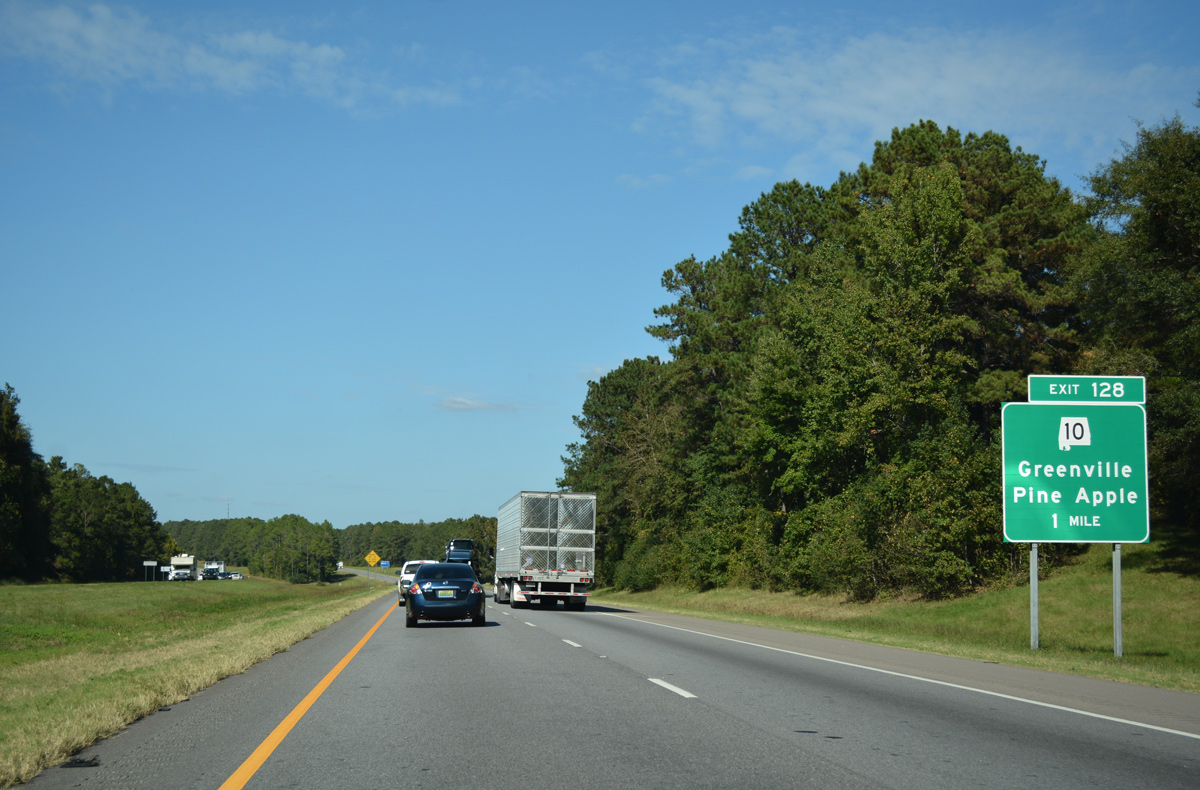
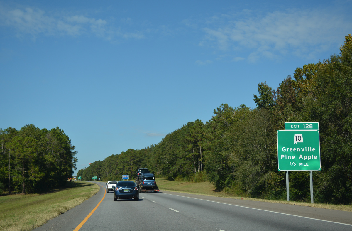
| Meeting the freeway at the first of two Greenville interchanges is SR 10 (Pineapple Highway) in one mile. 10/06/16 |
|
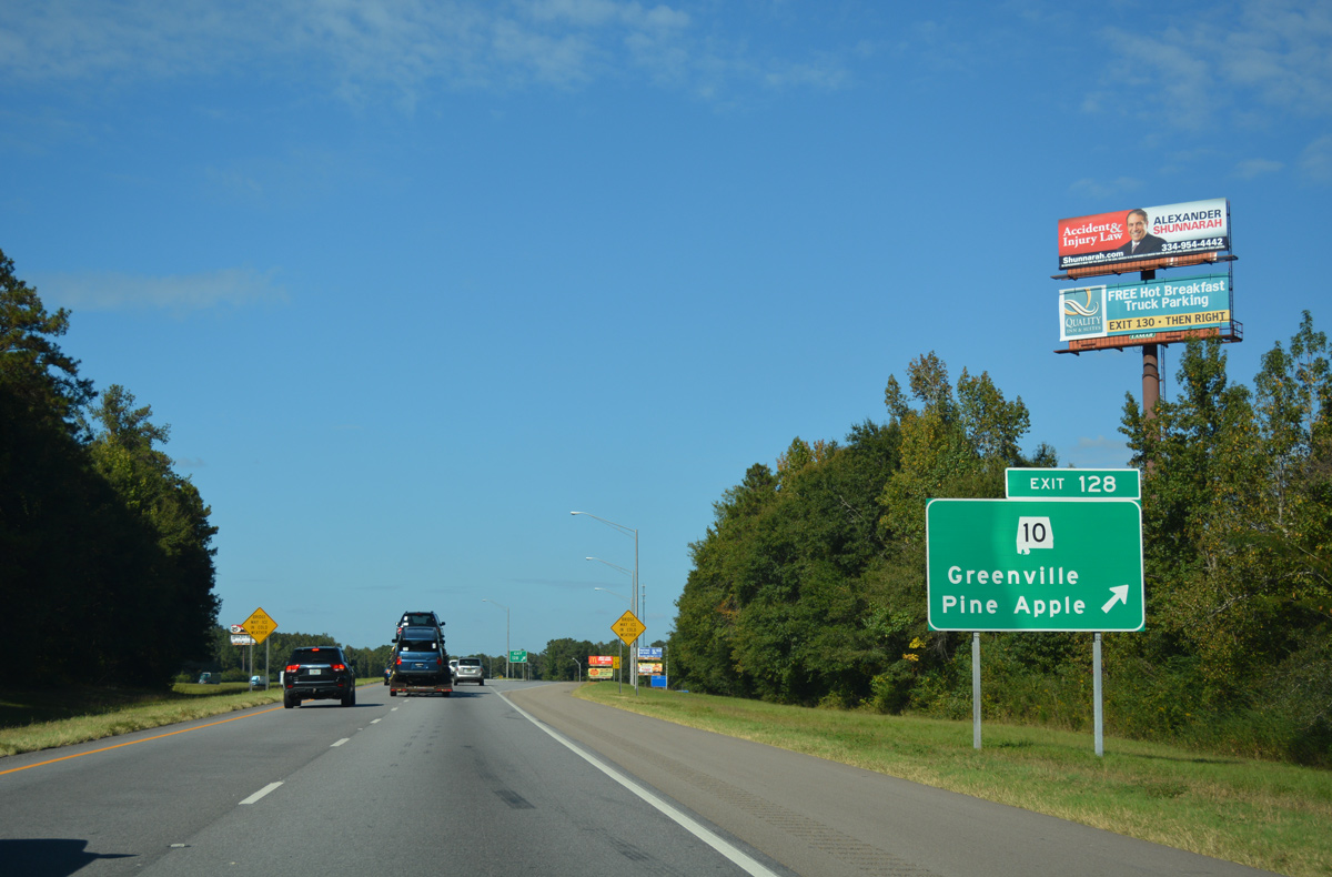
| A diamond interchange connects I-65 with SR 10 on the west side of Evergreen. SR 10 stretches across the width of the state 230.72 miles between the Mississippi line, northwest of Butler, and the Georgia line, east of Abbeville. 10/06/16 |
|
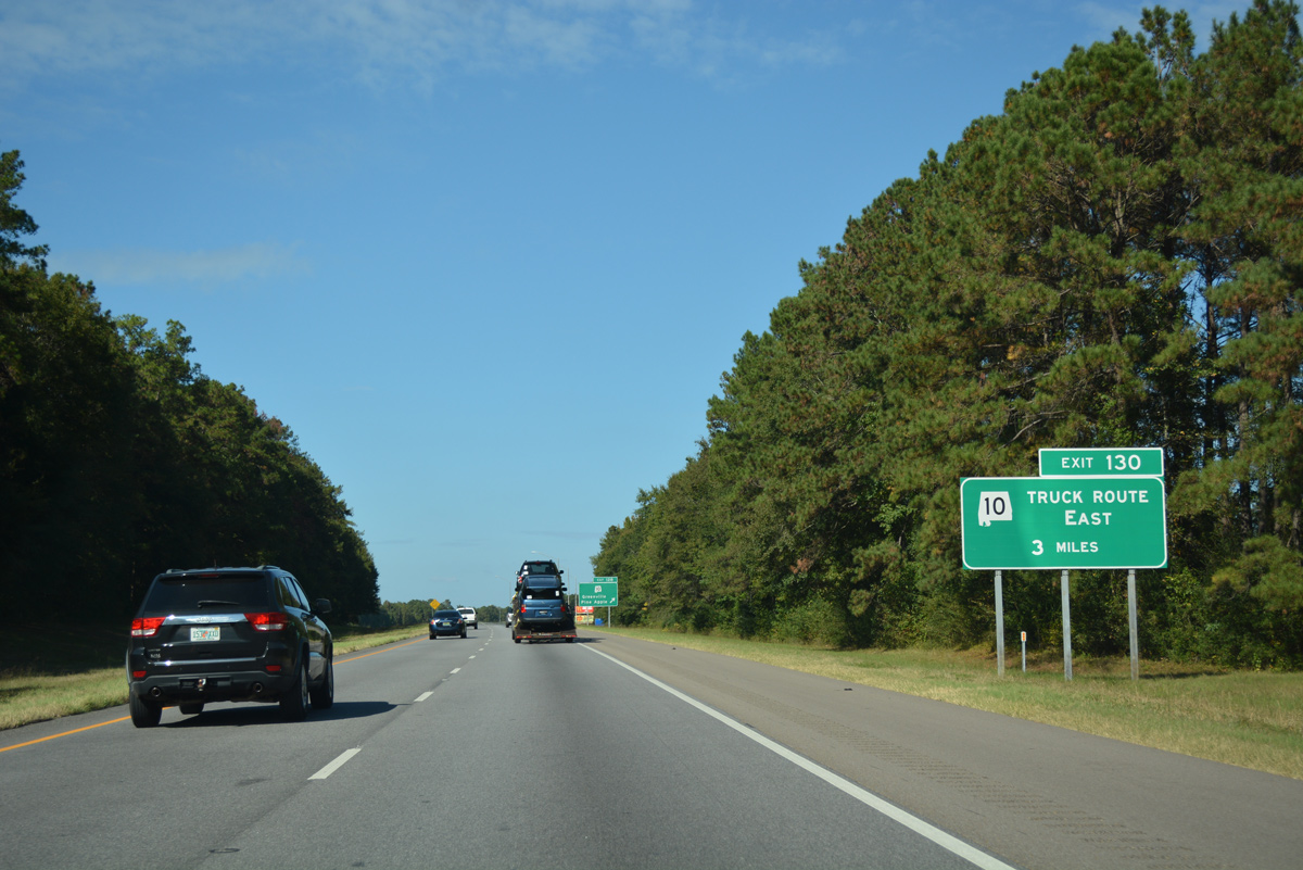
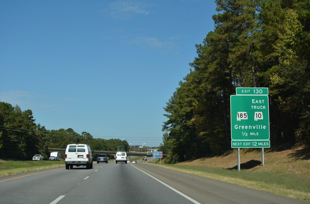
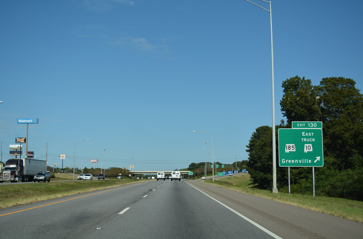
| SR 10 is the main route between Greenville and Troy. For truck travel interests around the Butler County seat of Greenville, a bypass is in place for the state route via Exit 130 / SR 185. SR 185 also has a truck route around the city. 10/06/16 |
|
| SR 10 ventures 20 miles west from Exit 128 to the Wilcox County town of Pine Apple and 42 miles to the county seat of Camden. 10/06/16 |
|
| Interstate 65 travels through northwestern reaches of the Greenville city limits. 10/06/16 |
|
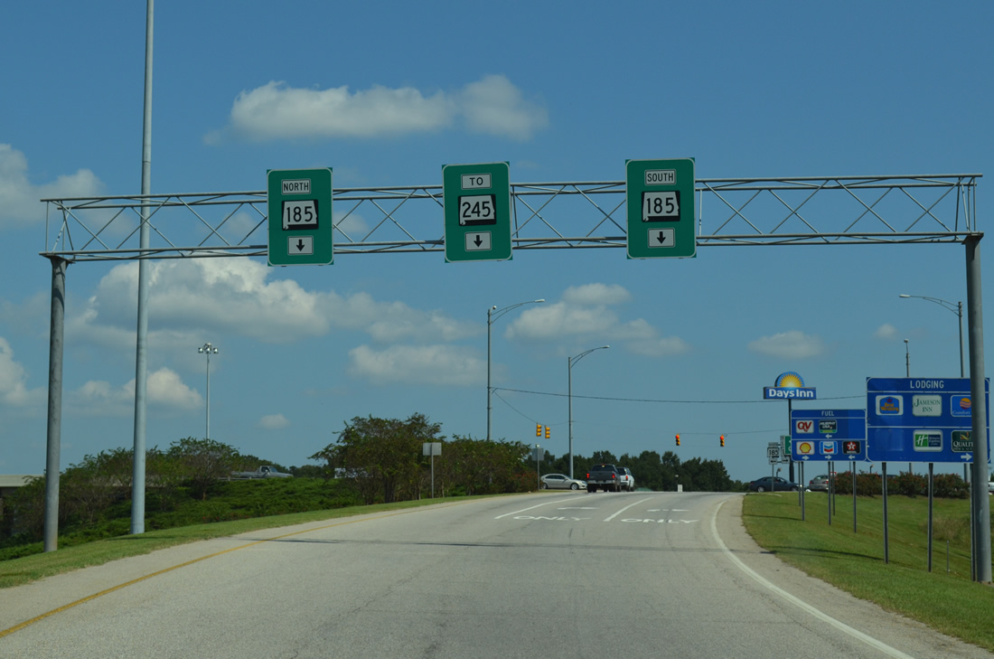
| SR 185 takes College Street north through central Greenville to join Fort Dale Road northwest to a commercialized diamond interchange (Exit 130) with I-65. 10/06/16 |
|
| CR 42 (Manningham Road) passes over Interstate 65 a half mile south of Exit 130 for SR 185. SR 185 overall comprises 23.13 mile loop west from U.S. 31 through Greenville and Fort Deposit. 10/06/16 |
|
| SR 10 Truck dog legs south along SR 185 (Fort Dale Road) to acompany SR 245 (Greenville Bypass) around the north side of Greenville to SR 10 (Commerce Street). 10/06/16 |
|
| Taking Exit 130 to SR 185 (Fort Dale Road) from I-65 north. SR 245 serves an array of industrial businesses and Mac Crenshaw Memorial Airport (PRN) along its 2.59 mile course from nearby. 10/06/12 |
|
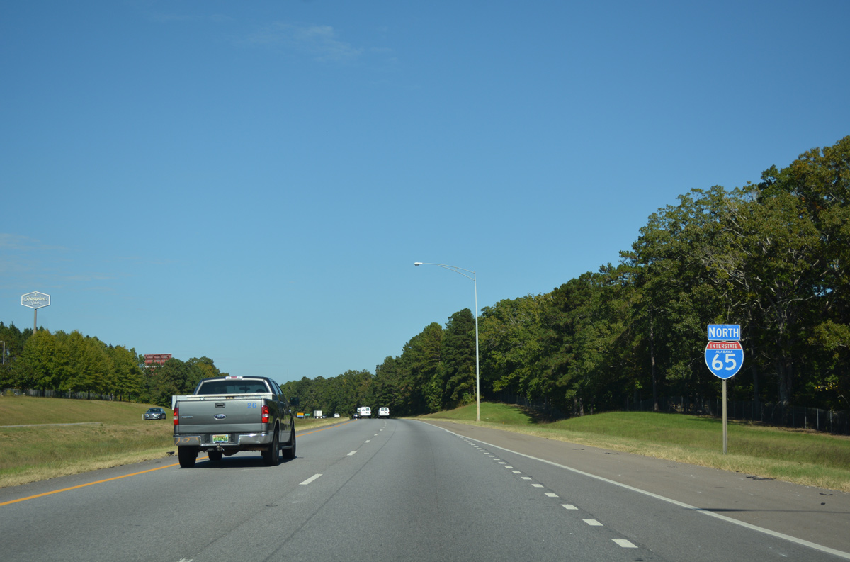
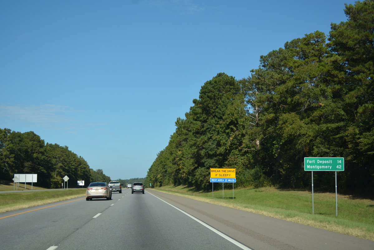
| Interstate 65 exits the city limits of Greenville on a 14 mile drive to Fort Deposit. Montgomery is now 42 miles to the north. 10/06/16 |
|
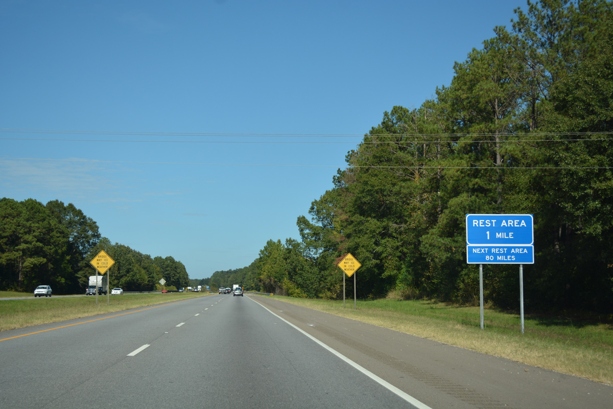
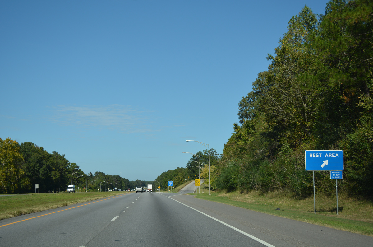
| A pair of rest areas line Interstate 65 east of Permsimmon Creekahead and west of County Road 45 (Airport Road). 10/06/16 |
|
| Crossing Pigeon Creek along Interstate 65 north near the Butler County 75 overpass and Lowndes County line. 06/21/05 |
|
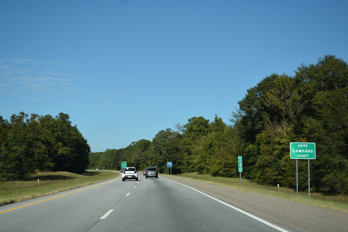
| Entering Lowndes County, 34.428 miles north of the Butler County entrance of Interstate 65 north. 10/06/16 |
Page Updated 11-21-2020.

 North
North