|
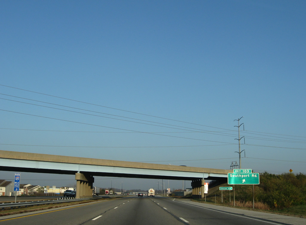
| Development increases along Interstate 65 from St. Francis Hospital, near the Stop Eleven Road overpass, to the commercialized parclo interchange with Southport Road (Exit 103). 11/05/09 |
|
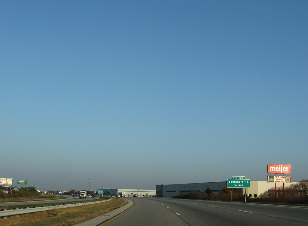
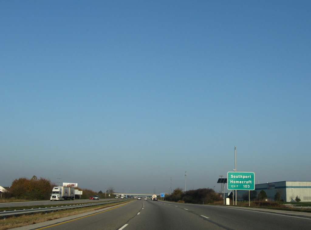
| Southport Road connects Interstate 65 with the cities of Southport and Homecroft to the west along Madison Avenue (former SR 431). 11/05/09 |
|
| Exit 103 departs from under the Emerson Avenue overpass of Interstate 65 northbound. Southport Road ventures west to Southern Dunes and Mann Road and east to the community of Acton. 11/05/09 |
|
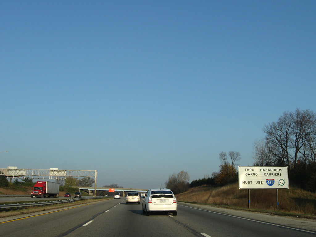
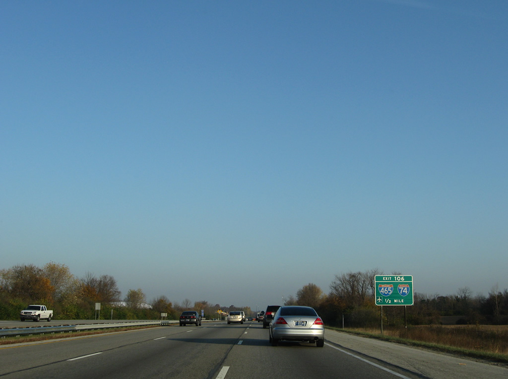
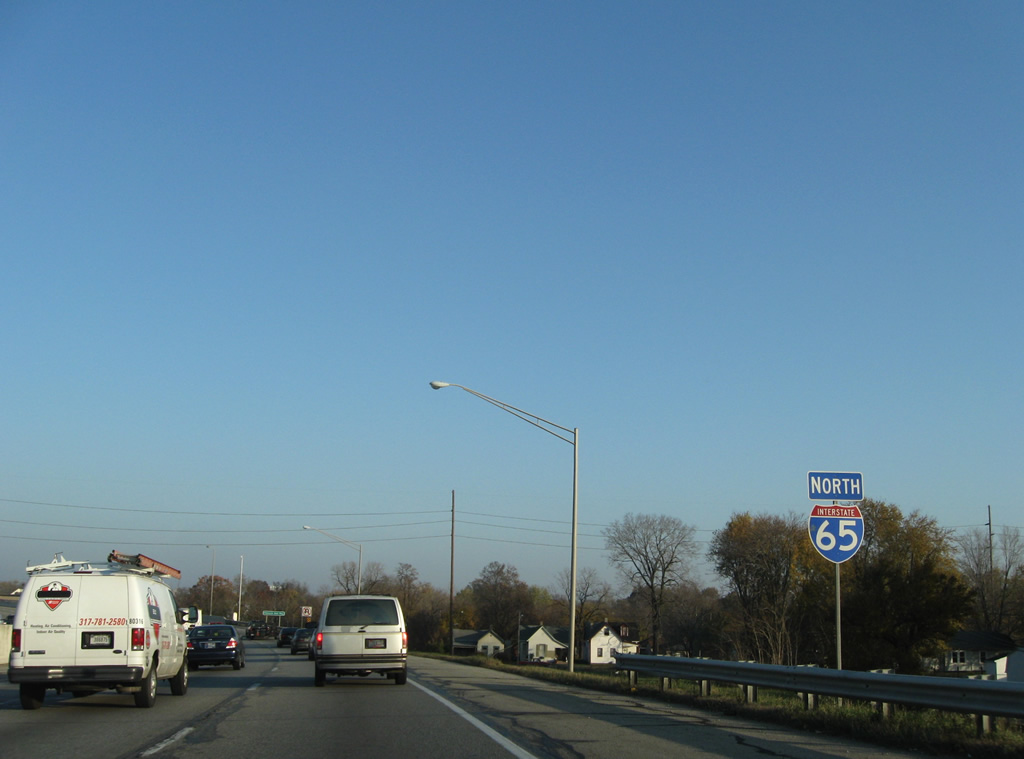
| Posted in anticipation of the next interchange, truckers carrying hazardous cargo are required to use Interstate 465 when traveling through the city of Indianapolis. Hazmat-based cargo is restricted from passing through the city via Interstates 65 or 70 otherwise. 11/05/09 |
|
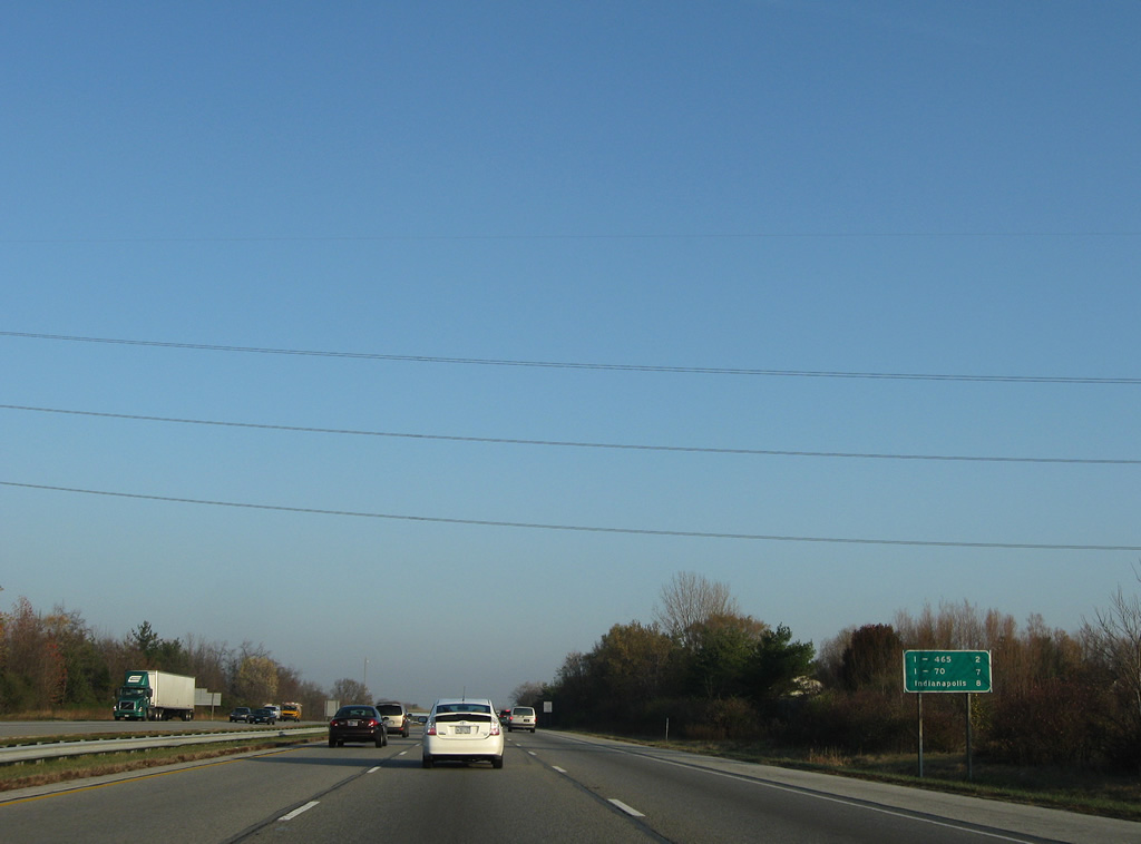
| Although already within the city limits of Indianapolis, downtown is still another eight mile to the north. Interstate 465 meets I-65 in two miles and I-70 in seven miles. 11/05/09 |
|
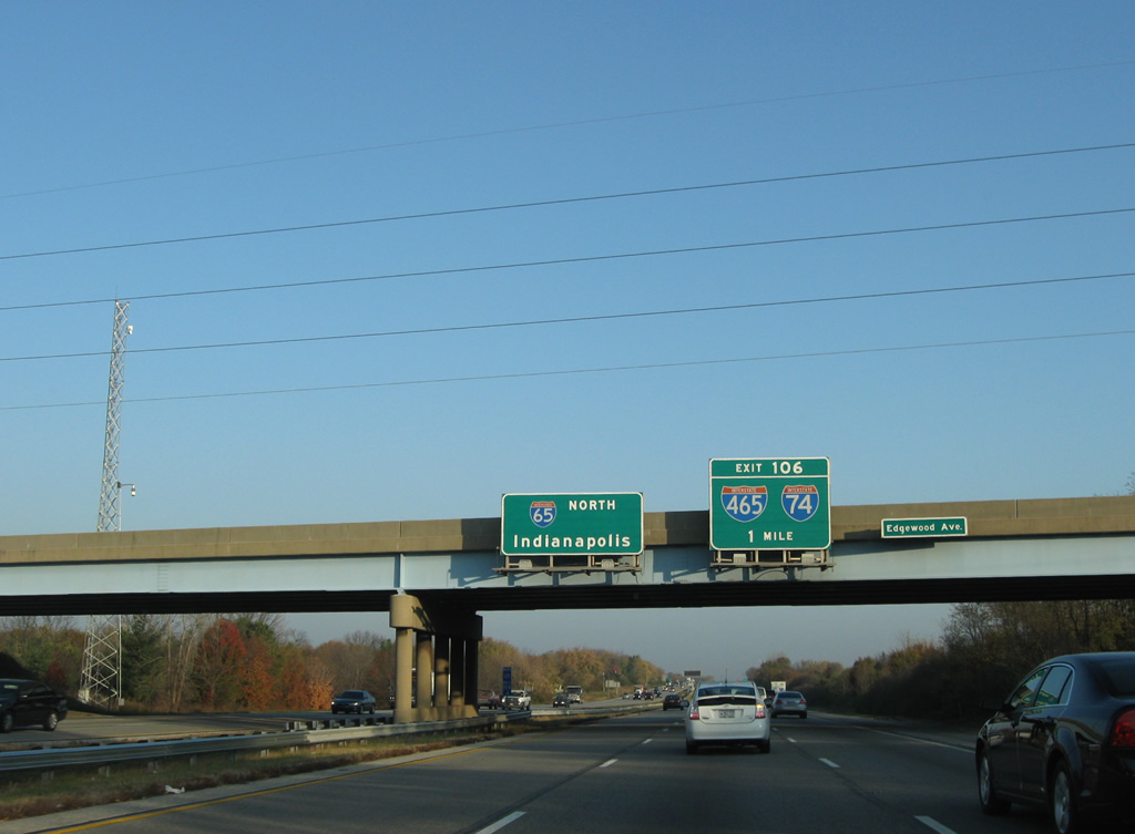
| Attached to the Edgewood Avenue overpass is the one mile guide sign for I-74/465. Interstate 74 utilizes the southern half of the Indianapolis beltway to pass through the capital city. 11/05/09 |
|
| I-74/465 west lead ten miles to Interstate 70 next to Indianapolis International Airport. A new terminal for the airport opened in 2008 via Weir Cook Memorial Drive from Exit 69 of Interstate 70. 11/05/09 |
|
| A directional cloverleaf interchange joins Interstate 65 and the beltway. The exchange utilizes sharp left side ramps.
This changes in 2013 with construction to expand the ramp from I-65 north to I-465 & 74 east and a new flyover from I-465 & 74 west to I-65 south as part of the Operation Indy Commute project.2 11/05/09 |
|
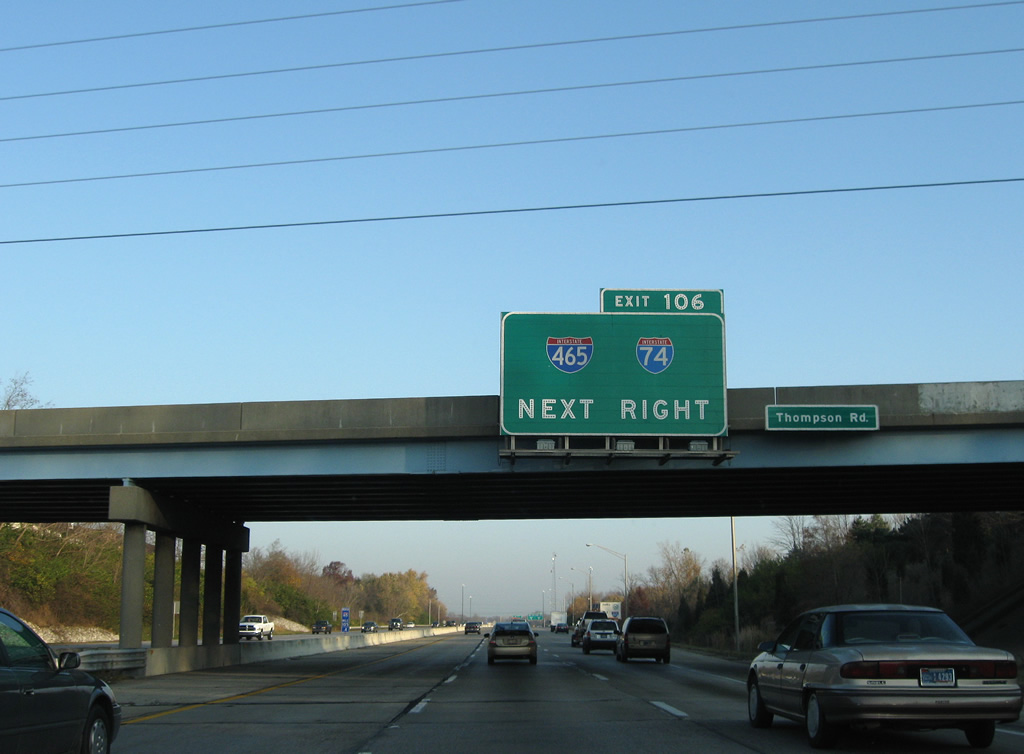
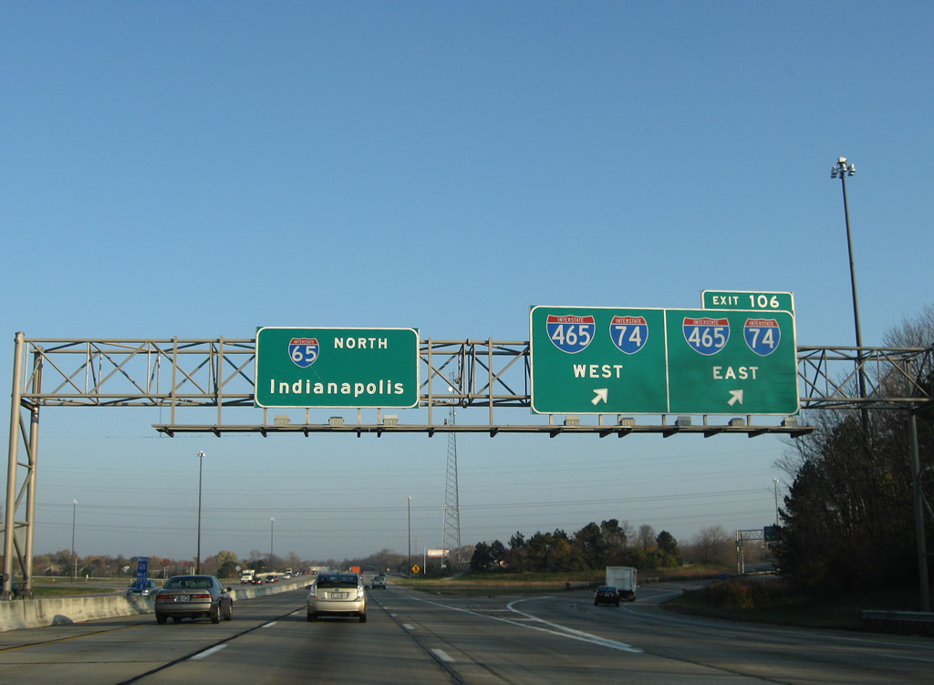
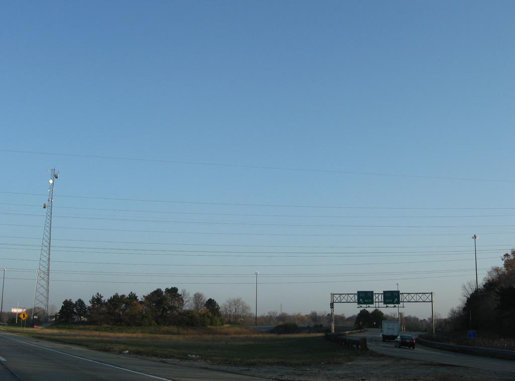
| Exit 106 carries all traffic in unison from Interstate 65 north to I-74/465. The two combine for 20.60 miles northwest to Speedway and east to Five Points. The Beltway uses no control cities, not even for connections for Interstates radiating out from Indianapolis. 11/05/09 |
|
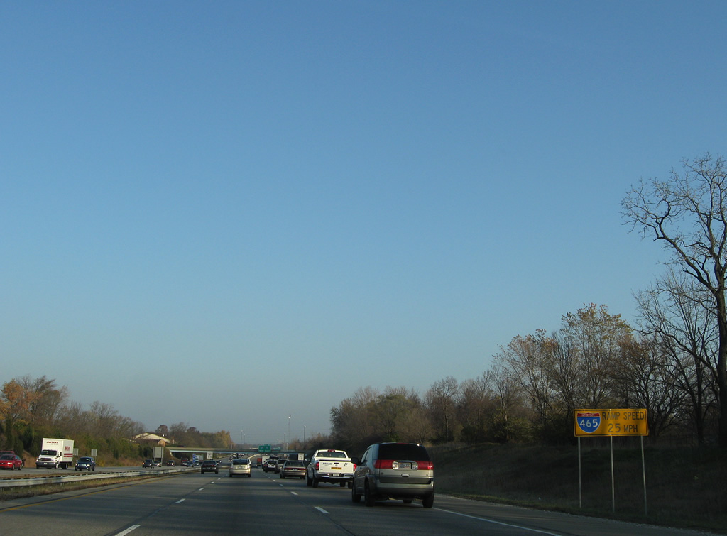
| A third in a series of advisory signs informs motorists with hazardous cargo to use Interstate 465. Interstate 65 north expands to four lanes briefly to Exit 106. 11/05/09 |
|
| Northbound at the Exit 106 off-ramp to I-74/465. Interstate 74 continues southeast to Shelbyville, Greensburg and Cincinnati and west from the beltway to Brownsburg, Crawfordsville, and Danville, Illinois. 11/05/09 |
|
| A parting shot of the Exit 106 ramp partition to I-74/465 west to the airport and east to Beech Grove. 11/05/09 |
|
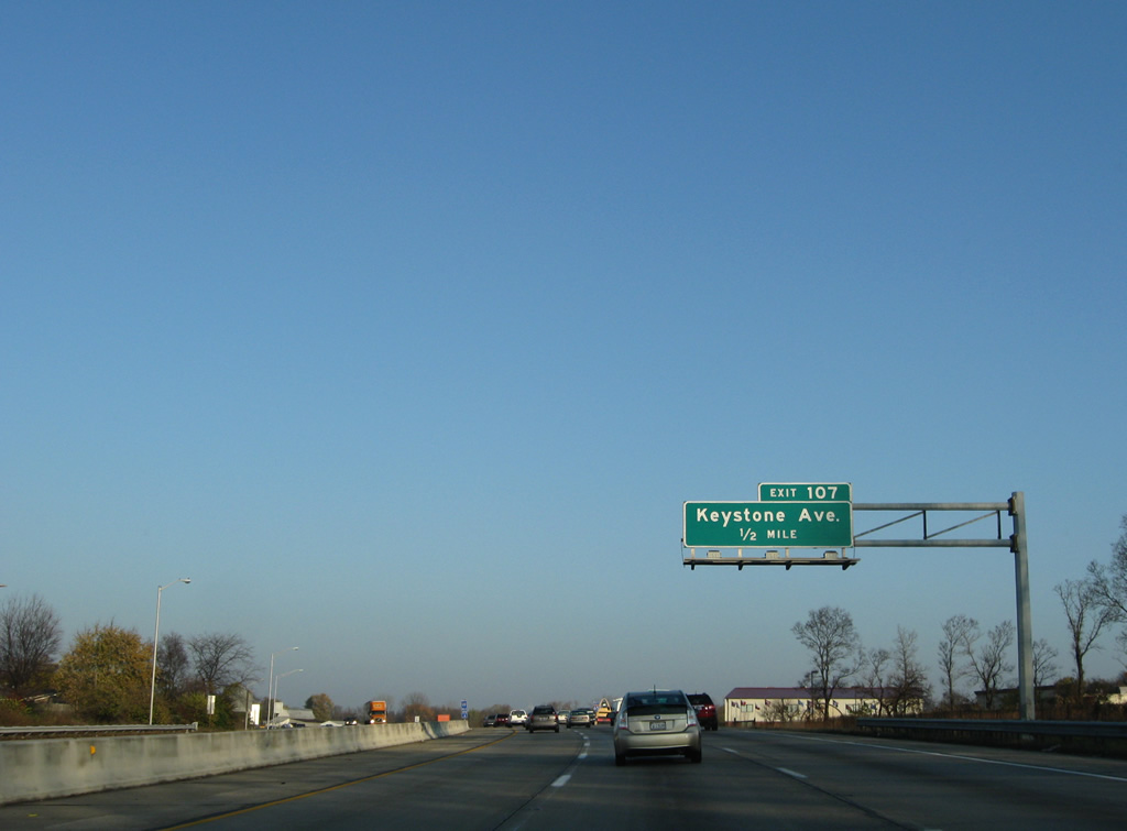
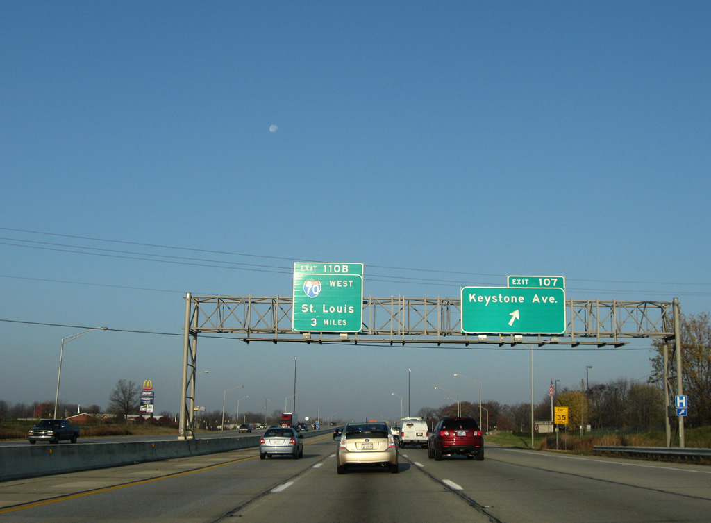
| Keystone Avenue stems north from the Rosedale Hills community to the Exit 107 diamond interchange with Interstate 65 north in one half mile. 11/05/09 |
|
| Interstate 65 continues with six overall lanes through south Indianapolis. 11/05/09 |
|
| Exit 107 leaves Interstate 65 north for Keystone Avenue at the three mile approach to Interstate 70 west (Exit 110B). Keystone Avenue continues north to Sarah Shank Golf Course and the Near Southeast neighborhood of the city. 11/05/09 |
|
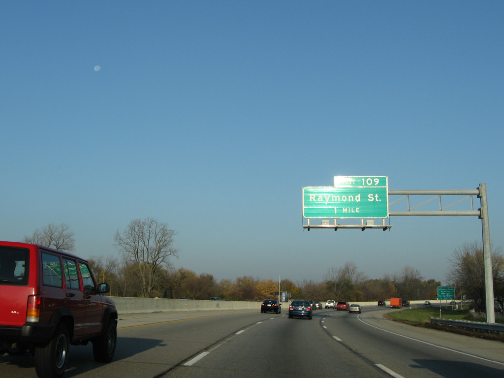
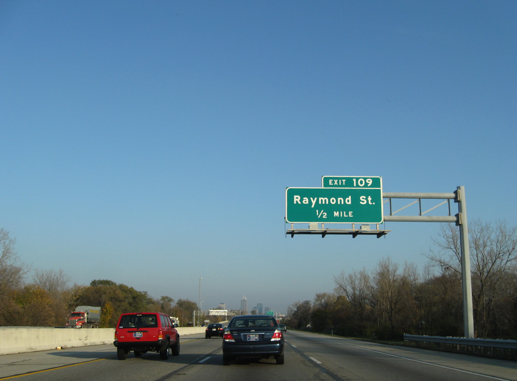
| Turning northwesterly, Interstate 65 next meets Raymond Street in one mile at Exit 109. 11/05/09 |
|
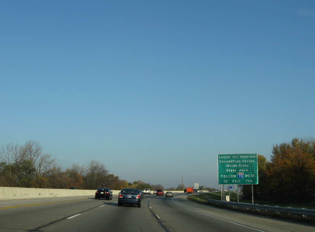
| Visitors bound for Lucas Oil Stadium, home of the NFL Indianapolis Colts, the Convention Center, and White River State Park should follow Interstate 70 along the south side of downtown Indianapolis to Exit 79A (Missouri Street). 11/05/09 |
|
| Raymond Street comprises a multi-lane boulevard west to Near Southside and Garfield Park and east to Near Southeast from the six-ramp parclo interchange of Exit 109. 11/05/09 |
|
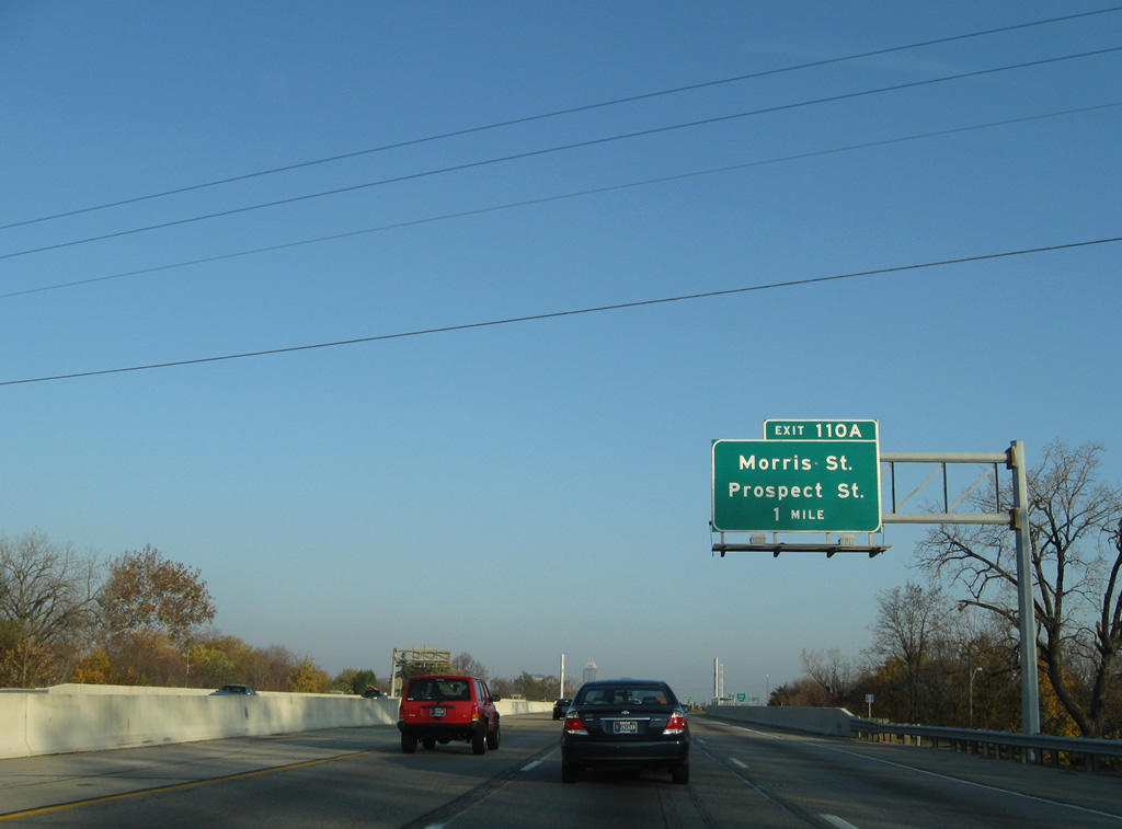
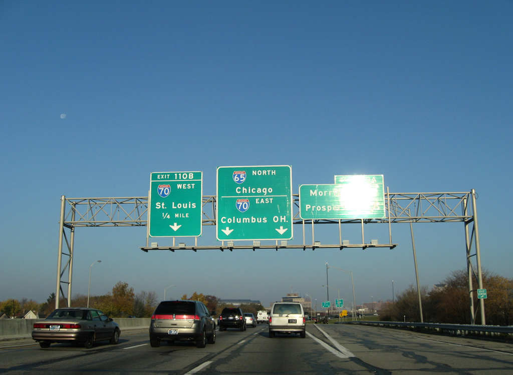
| Exit 110A quickly follows Exit 109 onto Morris and Prospect Streets. Morris Street parallels Interstate 70 through Near Southside to the Belmont community; Prospect Street continues the street east through Fountain Square to Southeastern Avenue (old U.S. 421). Leonard Street also stems north from Exit 110A to Virginia Avenue outside Downtown. 11/05/09 |
|
| Signage prepares motorists for the Interstate 70 eastbound merge onto Interstate 65 north by downtown as Exit 109 parts ways with the freeway mainline. Raymond Street ventures east to Southeastern Avenue (former U.S. 421) in Southeast Indianapolis and west to become the Sam Jones Expressway ahead of Holt Road and Interstate 70. Interstate 70 heads west from downtown to West Indianapolis before turning southwest at Stout Field to meet Sam Jones Expressway at Park Fletcher. 11/05/09 |
|
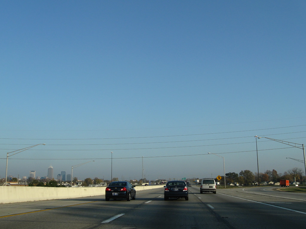
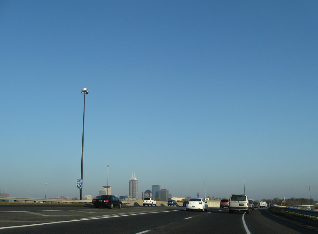
| Indianapolis' skyline continues along the northern horizon of Interstate 65 to the merge with Interstate 70 east. 11/05/09 |
|
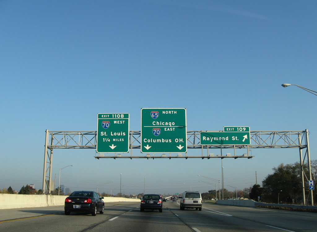
| The left lane defaults onto Interstate 70 west at Exit 110B in one half mile. Interstate 70 joins Indianapolis with Terre Haute, Effingham, Illinois and St. Louis, Missouri. 11/05/09 |
|
| Reassurance marker posted for Interstate 65 north ahead of Pleasant Run. 11/05/09 |
|
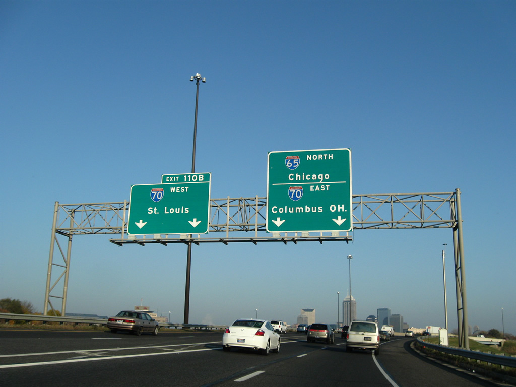
| Just ahead of the tri-level stack interchange with Interstate 70 west (Exit 110B) is the Exit 110A ramp departure to the one way couplet of Morris Street east and Prospect Street west. Interstate 70 travels 11 miles west to Indianapolis International Airport and 156 miles overall in the state of Indiana. 11/05/09 |
|
| Drivers bound for Interstate 70 west to St. Louis branch away from Interstate 65 north at Exit 110B. Interstate 70, completed in Indiana in 1976, stretches 2,153 miles across ten states from Cove Fort, Utah to Baltimore, Maryland. 11/05/09 |
|
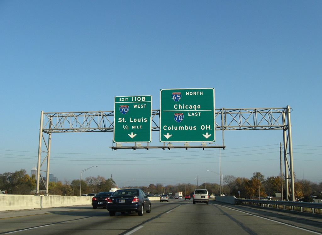
| A 24 inch shield assembly indicates Interstate 70 west on the Exit 110B off-ramp from Interstate 65 north. I-70 east shares 2.13 miles with I-65 north in Indianapolis. 11/05/09 |
|
| Interstate 70 east joins Interstate 65 north south of the Virginia Avenue overpass at the 3/4 mile approach to Exit 111 for Washington Street (former U.S. 40 and U.S. 421). The multiplex between I-65/70 use Interstate 65's mile markers for exits and remain depressed for the southern half to Washington Street. 12/17/11 |
|
| North of the Virginia Avenue overpass, the left lane becomes a travel lane for Interstate 65 north toward Chicago while the far right lane becomes an exit only lane for Exit 111 (Washington Street). Interstate 70 east continues in the middle two lanes. This stretch of the multiplex from the South Split to Exit 111 is known for the traffic shifting lanes to transition from one interstate to another. Even northbound Interstate 65 traffic has to move over two lanes to continue onward. For these reasons, this stretch of interstate is known as the Spaghetti Bowl. 11/05/09 |
|
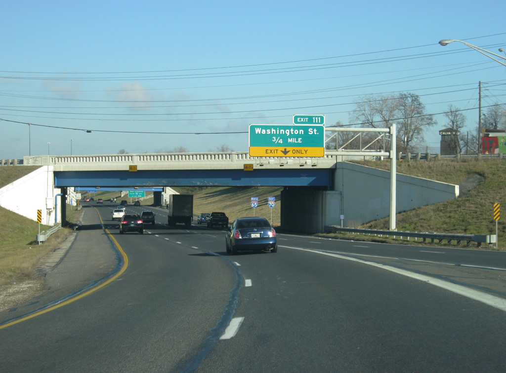
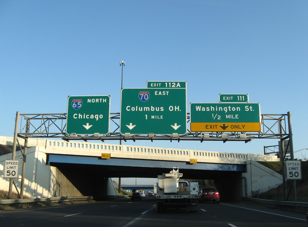
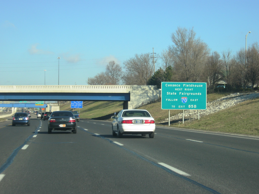
| Traffic for Bankers Life Fieldhouse (formerly Conseco Fieldhouse) is directed to use Exit 111 to Washington Street. Traffic bound for the Indiana State Fairgrounds are encouraged to stay on Interstate 70 to Exit 85B (Keystone Avenue). 12/17/11 |
|
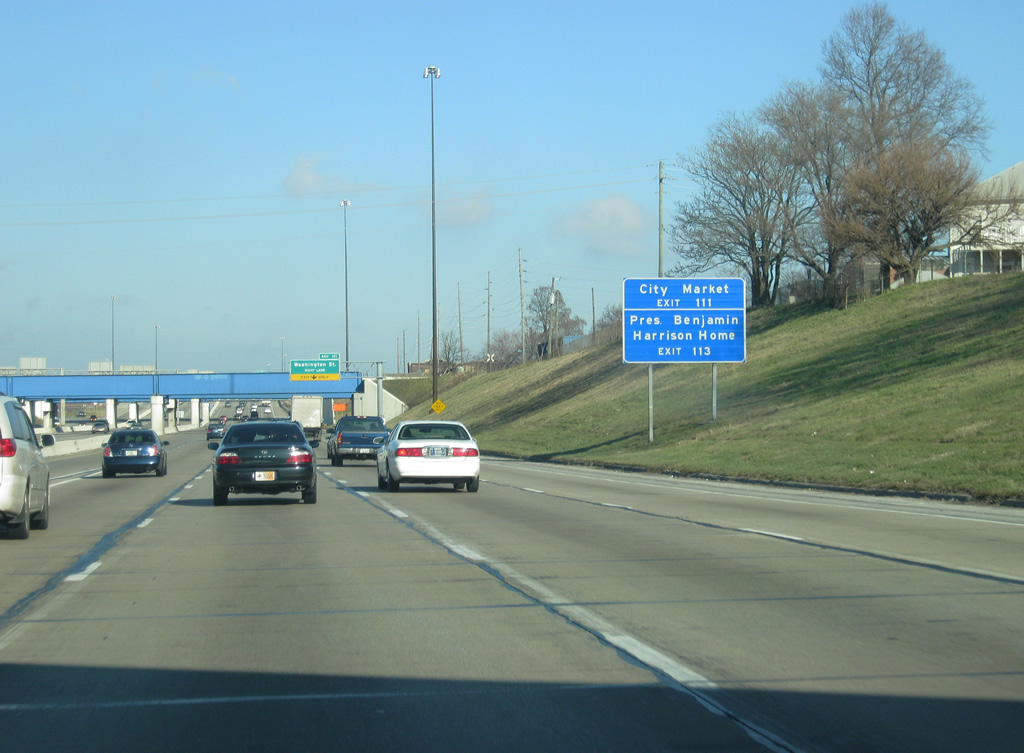
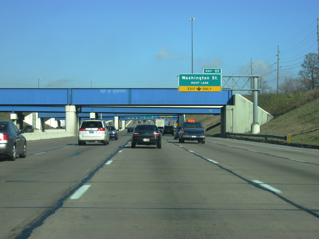
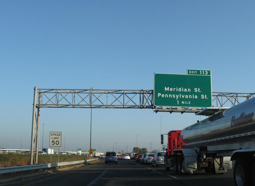
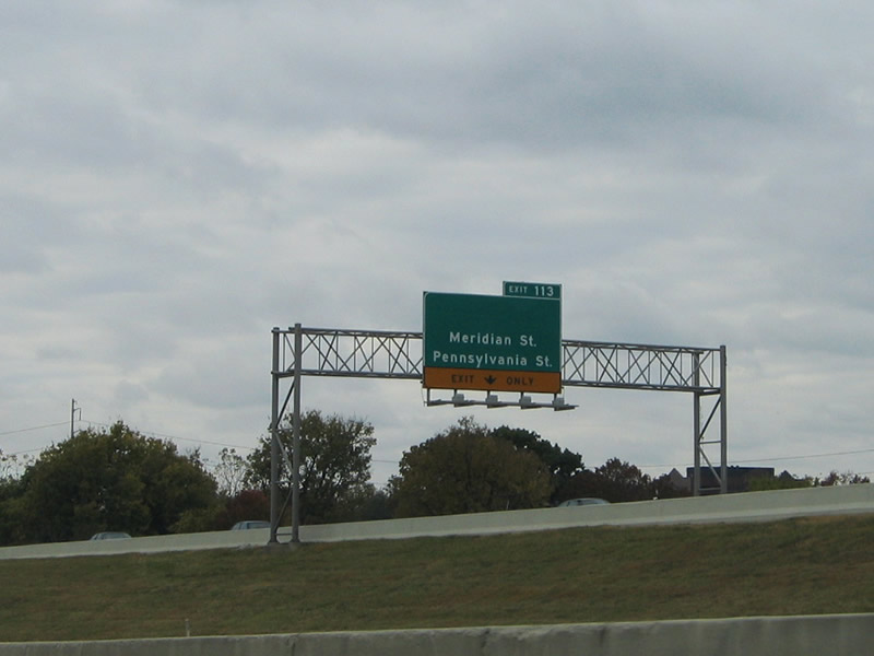
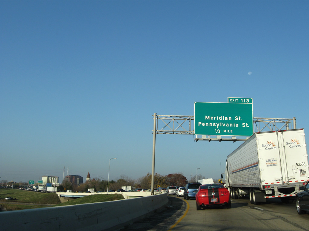
| The City Market can be reached by using Exit 111 to Market Street. Until the ramp was redesigned in 2008, the Exit 111 ramp ran straight to Market Street. The rebuilt interchange shifted the ramp to reach Washington Street, one block south of Market. Market Street can be reached by going north for one block from the ramp along Pine Street. The home of President Benjamin Harrison, located in the Old Northside neighborhood can be reached via Exit 113 (Meridian Street) further north. 12/17/11 |
|
| An entrance ramp from Calvary Street to the left becomes the fifth lane going northbound Interstate 65 and eastbound Interstate 70 underneath a series of overpasses. The far right lane continues on its course toward Exit 111 and Washington Street. Washington Street, originally the National Road and later on U.S. 40, is the main west-east road across Indianapolis, connecting Downtown with the Holy Cross, Willard Park, Irish Hill, and Irvington neighborhoods. U.S. 421 also ran down Washington Street to the Southeastern Avenue intersection, just east of Exit 111. Southeastern Avenue carried U.S. 421 southeast toward Cincinnati. 12/17/11 |
|
| The far right lane now exits for Exit 111 to Washington Street. As previously mentioned, Market Street can be reached from this ramp one block north of Washington Street. Market Street leads to Monument Circle, the heart of Indianapolis, and the Indiana Statehouse. As the interstate multiplex ascends from its depression, the right two lanes become dedicated to Interstate 70 eastbound traffic while the left two lanes carry the Interstate 65 northbound traffic. 12/17/11 |
|
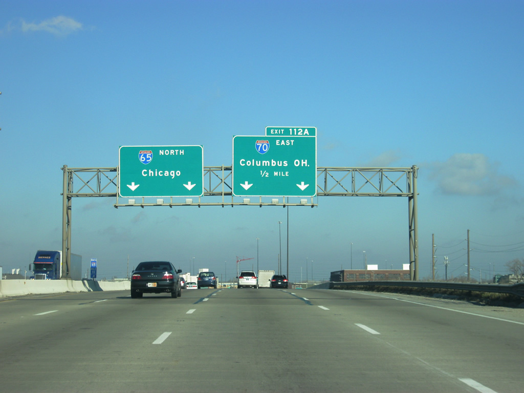
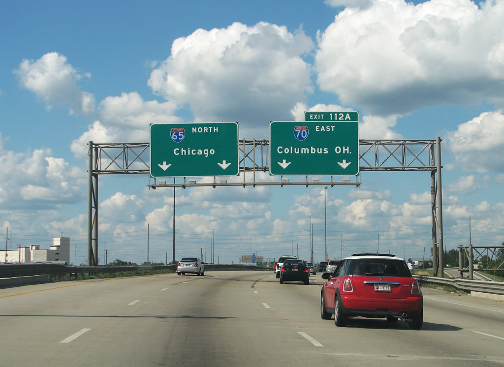
| Now passing over Washington and Market Streets, the Interstate 65/70 multiplex takes on a different character for its northern half as an elevated highway. Interstate 70 east exits off the multiplex in one half mile via Exit 112A. The multiplex from the South Split to the North Split was rebuilt in the early 2000s as part of a two-month project known as Hyperfix. The project rebuilt many of the bridges and the concrete sections of the multiplex. 12/17/11 |
|
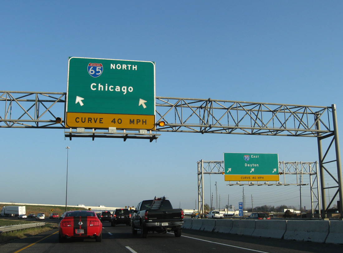
| I-65/70 near their partition (Exit 112A) east of downtown Indianapolis. The freeway passes over East Michigan Street in this scene as ramps from Pine Street join both sides of the Interstate pair. Interstate 65 continues toward the west as it on its northward journey toward Lebanon, Lafayette, Gary and Chicago, Illinois at the interchange locally known as the North Split. Provisions at the forthcoming directional interchange were made for the unconstructed Northeast Freeway. The Northeast Freeway was planned to head north to the unbuilt 30th Street Freeway and northeast along a corridor paralleling Sutherland Avenue, Fall Creek Parkway North Drive and Binford Boulevard to Interstate 69.1 07/31/09 |
|
| Interstate 65 continues along a two lane directional ramp from Exit 112A and Interstate 70 east. The freeway turns west toward a split diamond interchange (Exit 113) with Pennsylvania Street south, Meridian Street (former U.S. 31/SR 37), and Illinois Street north. 11/05/09 |
|
| The barriers between the parting I-65 north and I-70 east conceal a concrete stub built in anticipation of the Northeast Freeway northbound. 11/05/09 |
|
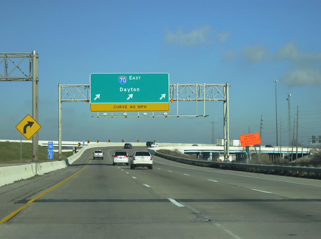
| Along with the entrance ramp from Pine Street, the exit ramp onto Interstate 70 eastbound is three lanes wide. The Hyperfix project expanded this ramp and is the reason that the signage now reads a control city of Dayton instead of Columbus. As the ramp turns toward the northeast, it picks up two exit ramps from Interstate 65 southbound. 12/17/11 |
|
| The northbound mainline passes under the southbound Interstate 65 to eastbound Interstate 70 ramp while both pass above a dirt trail that was slated to carry traffic from the Northeast Freeway southward onto I-65 & 70. A stub also exists on the ramp above for I-65 south to the unbuilt Northeast Freeway north. 11/05/09 |
|
| Traffic merge onto Interstate 65 northbound from Interstate 70 pass by a stub for the unconstructed on-ramp from the Northeast Freeway south and see an advance sign for Exit 113 (Pennsylvania Street south, Meridian Street and Illinois Street north). 11/05/09 |
|
| Continuing westward from Interstate 70, motorists pass over the I-70 westbound mainline and College Avenue on the half mile approach to Exit 113. Forthcoming Meridian Street (old U.S. 31) leads south from the Near Northside neighborhood directly into Downtown, culminating at Monument Circle. Adjacent Pennsylvania and Illinois Streets comprise a one way street couplet. 11/05/09 |
|
| High rises of downtown Indianapolis rise beyond the Interstate 65 southbound overpass above College Avenue in this scene. 11/05/09 |
|
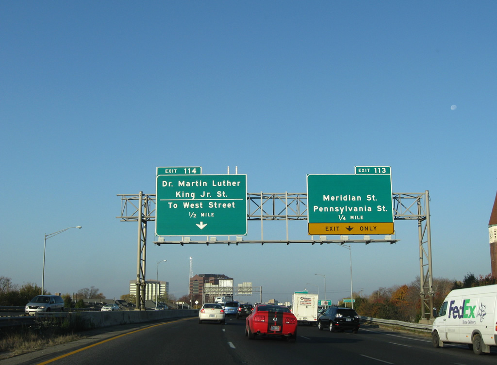
| Ramps combine to form a four lane mainline of Interstate 65 north to Exit 113. The former U.S. 31 off-ramp claims the right lane onto 12th Street. Exit 114 follows as a left side ramp to the Dr. Martin Luther King, Jr. Street and West Street connector. 11/05/09 |
|
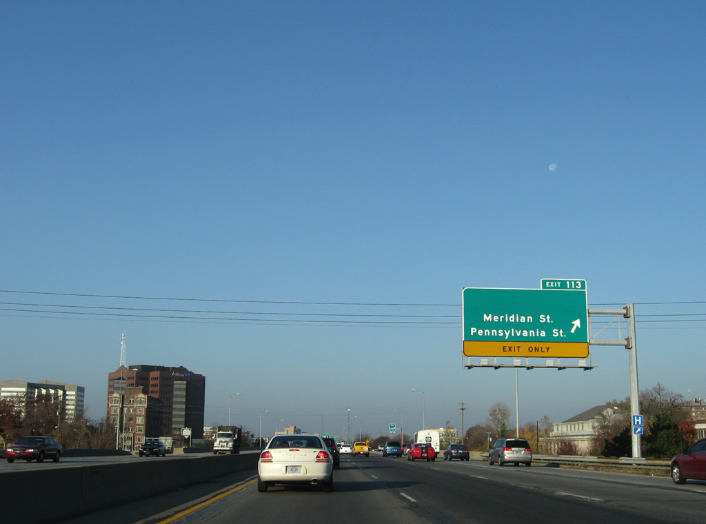
| Exit 113 drops from Interstate 65 northbound onto 12th Street ahead of its intersections with the three north-south streets. Meridian Street leads north from Downtown to Broad Ripple, Meridian Hills and Far Northside before exiting Indianapolis at Carmel and the Indianapolis beltway. Meridian Street remains as U.S. 31 leading northward from Interstate 465. 11/05/09 |
|
| A rare use of an overhead assembly for an exit gore point as Exit 113 of Interstate 65 northbound. State Road 37 followed U.S. 31 along Meridian Street to 38th Street (former U.S. 36) where the route turned east to Fall Creek Parkway and Binford Boulevard. 11/05/09 |
|
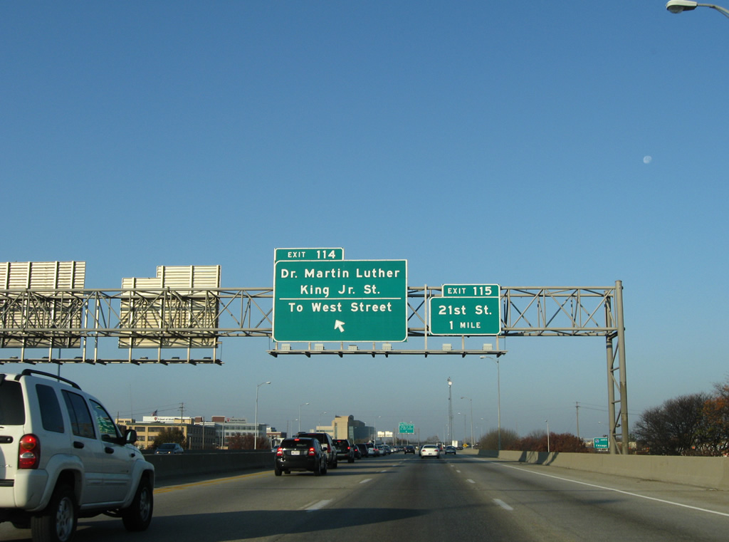
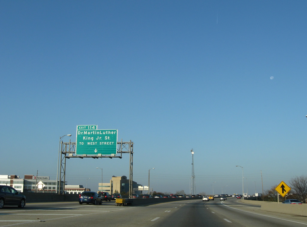
| Interstate 65 north travels a viaduct above Pennsylvania, Meridian and Illinois Streets ahead of the Exit 114 ramp departure to Dr. Martin Luther King, Jr. and West Streets. The upcoming directional interchange was built in anticipation of the unconstructed North Leg Extension Freeway. As envisioned, that freeway would have run 1.9 miles and carried six lanes from I-65 west to the planned Harding Freeway by Belmont Park.1 11/05/09 |
|
| Interstate 65 begins to turn northward at the partition with Exit 114. An on-ramp joins from West 12th Street and old U.S. 31 to the right. Exit 114 ends at a traffic light with the southbound ramp from I-65. Motorists turn onto a stub freeway from there, passing under West 11th Street, to West 10th and Dr. Martin Luther King, Jr. Streets. MLK and West Streets were originally the route of U.S. 36 and 421. 11/05/09 |
|
| A reassurance marker for Interstate 65 north follows as the mainline passes over the northbound on-ramp from West Street. 11/05/09 |
|
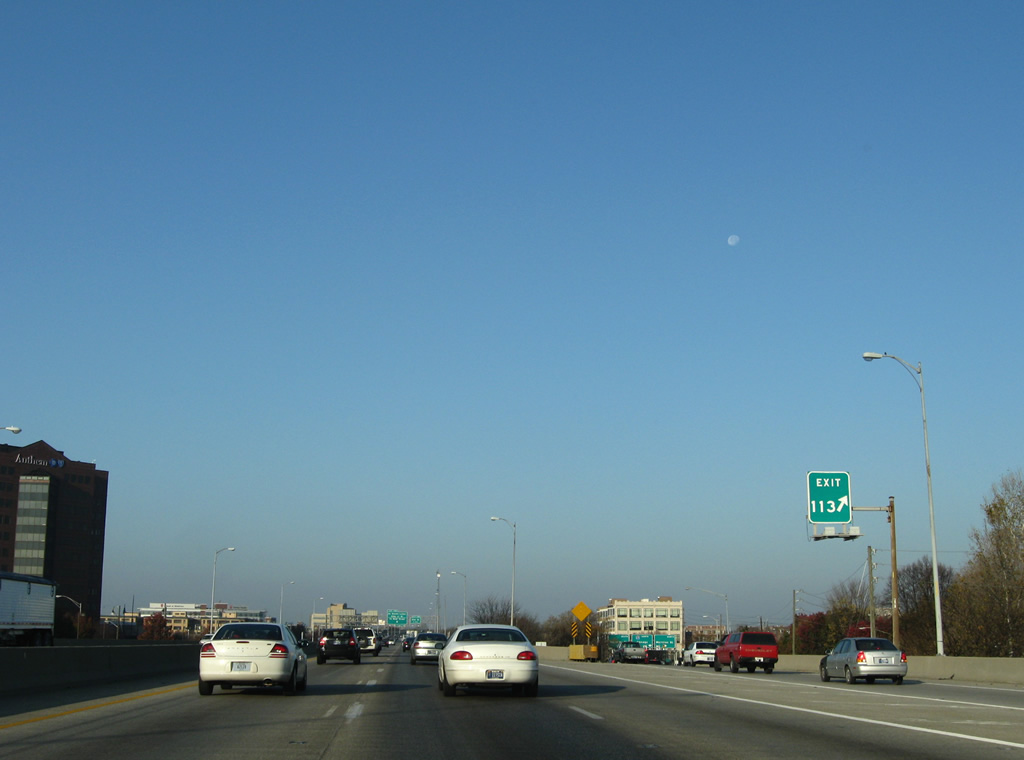
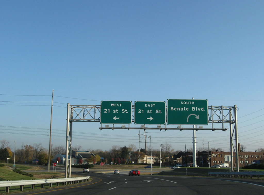
| A parclo interchange (Exit 115) joins Interstate 65 next with West 21st Street at Senate Boulevard. 11/05/09 |
|
| Taking Exit 115, drivers are provided with a loop ramp onto Senate Boulevard southbound to Methodist Hospital and West 16th Street. 21st Street otherwise connects I-65 with adjacent Dr. Martin Luther King, Jr. Street (Old U.S. 36 & 421) and Meridian Street (old U.S. 31/SR 37) at Near Northside. 11/05/09 |
|
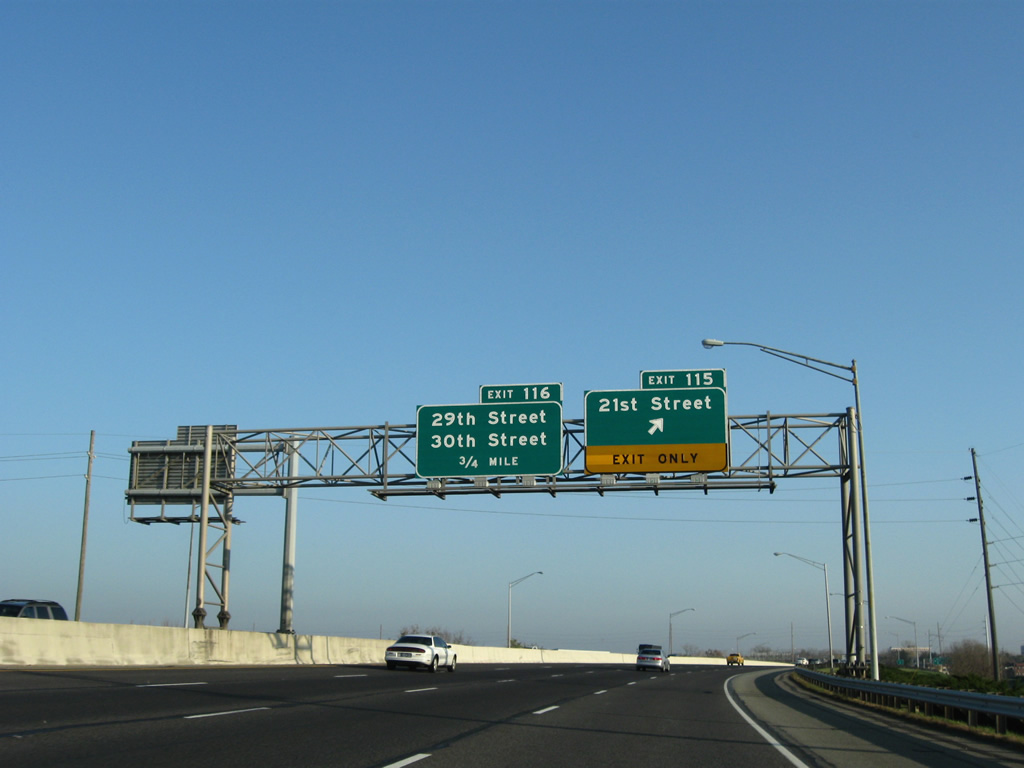
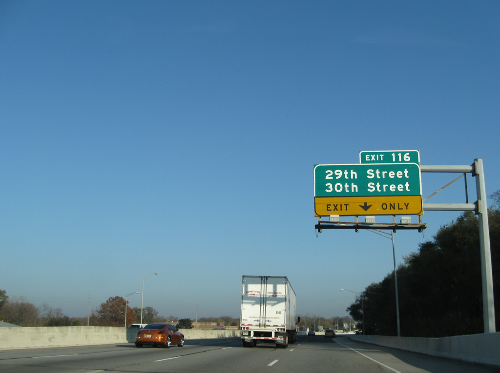
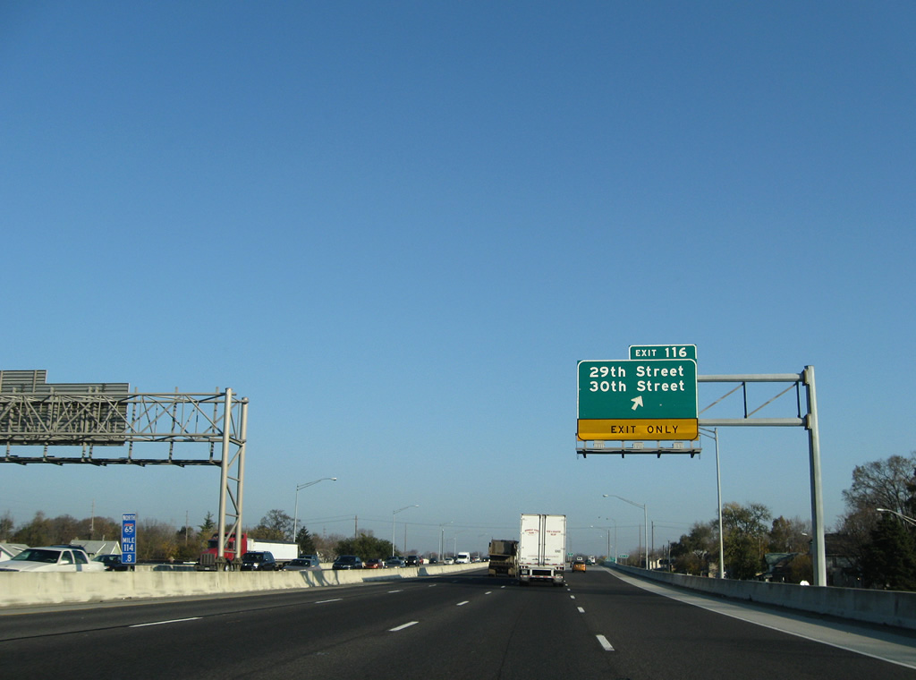
| Interstate 65 spans Fall Creek and gains an auxiliary lane to the Exit 116 half diamond interchange with 29th and 30th Streets. 11/05/09 |
|
| Exit 116 departs Interstate 65 north. 29th/30th Streets form a one way couplet between the Near Northwest and Fall Creek neighborhoods of the city. A 1.7 mile long freeway was also envisioned in the 1968 Indianapolis Transportation Plan running east along 30th Street to the planned Northeast Freeway.1 11/05/09 |
|
| A parclo interchange compliments Exit 116 of northbound as Exit 117 of I-65 southbound at Dr. Martin Luther King, Jr. Street. A northbound on-ramp merges ahead of the Clifton Street overpass and this shield from that interchange. 11/05/09 |
|
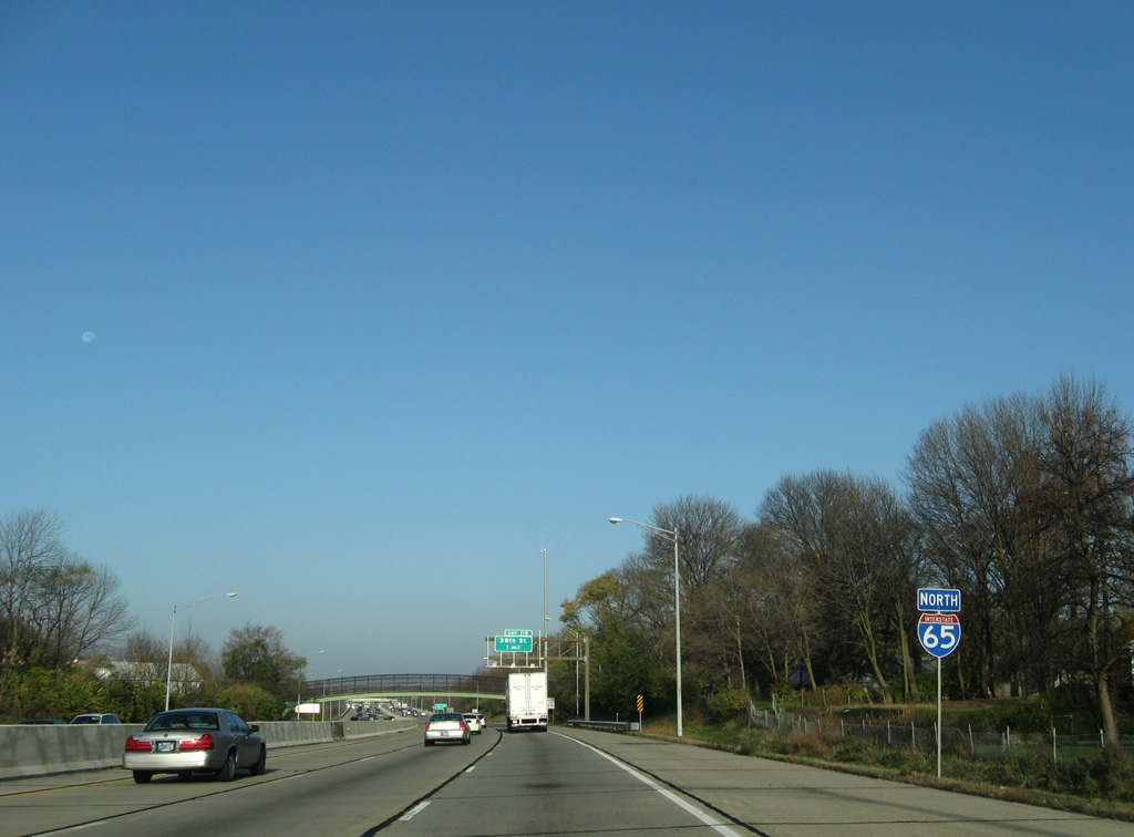
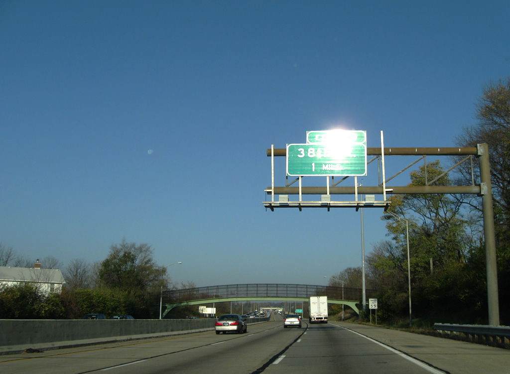
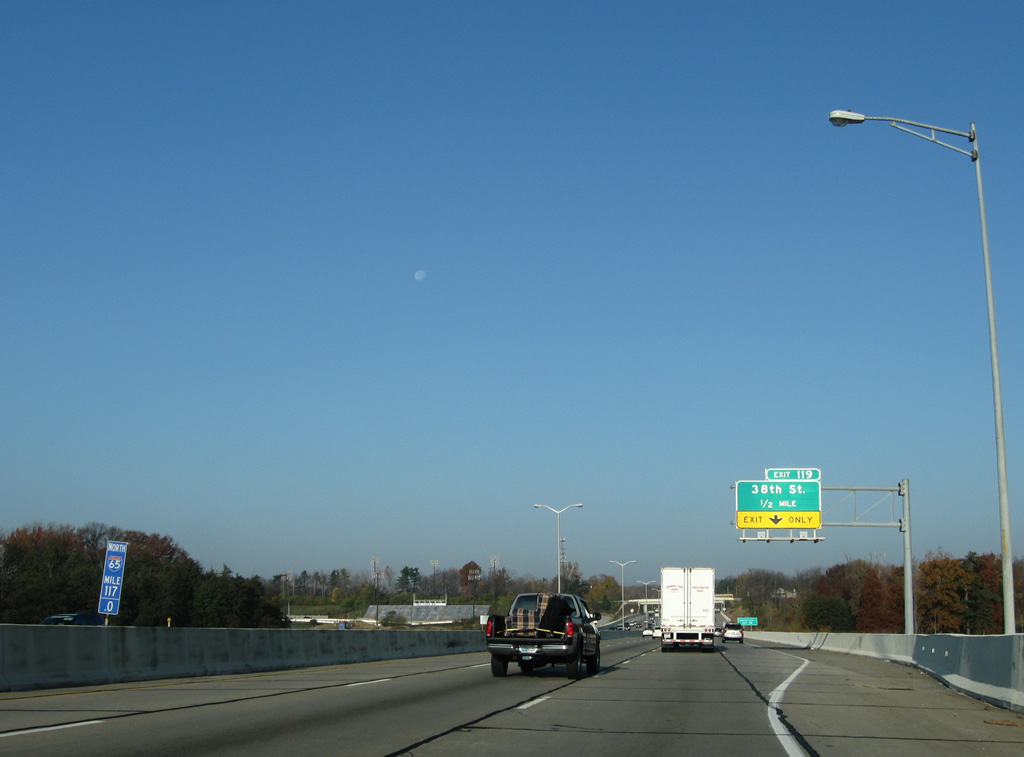
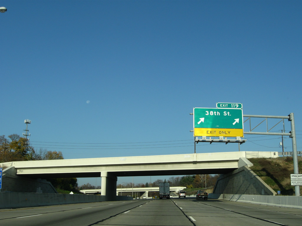
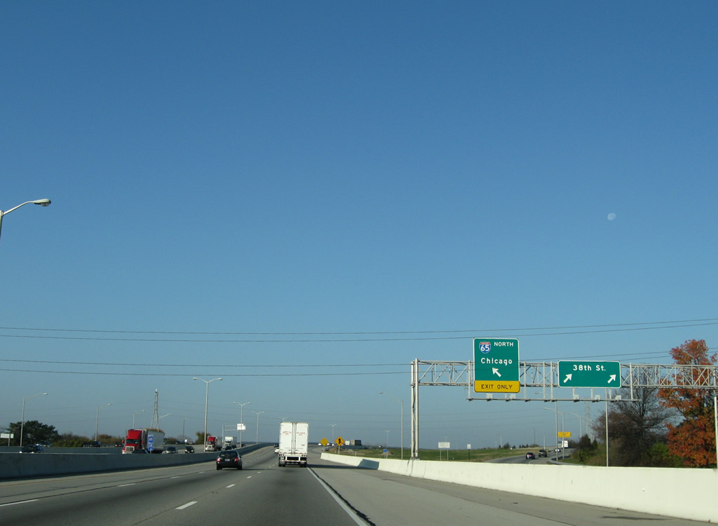
| Continuing northwest, Interstate 65 travels one mile to a series of ramps with parallel 38th Street (Exit 119). 11/05/09 |
|
| I-65 spans the White River just ahead of the half diamond interchange at Exit 119. 38th Street enters the I-65 frontage from Near Northwest and Mapleton and services movements to Kessler Boulevard and Guion Road via separate ramps from the freeway mainline. 11/05/09 |
|
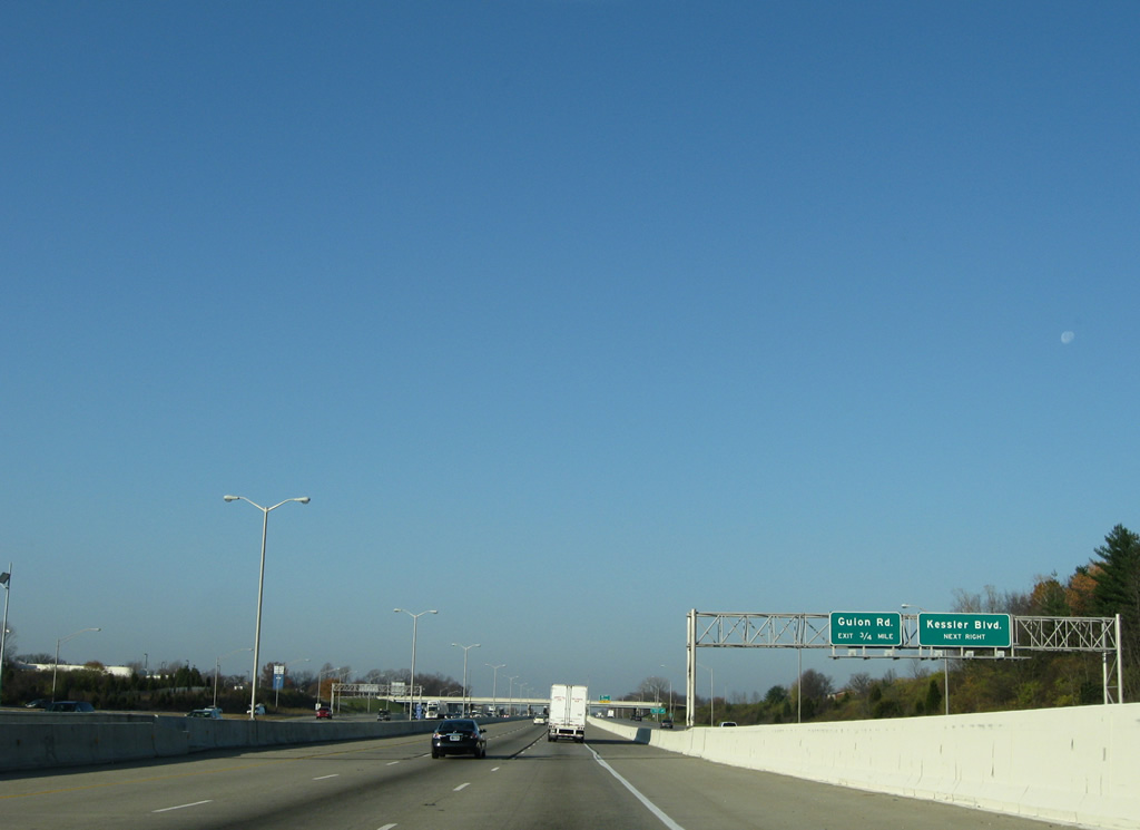
| Passing by Riverside Park, Interstate 65 turns westward and accompanies 38th Street, which partitions into one way service roads at Exit 119. A folded diamond interchange follows between the parallel road and Kessler Boulevard. 11/05/09 |
|
| A two lane ramp joins 38th Street westbound from Interstate 65 northbound. A loop ramp to Kessler Boulevard follows. Interests to Marian University should use Exit 119 to Kessler Boulevard south and 30th Street east. 11/05/09 |
|
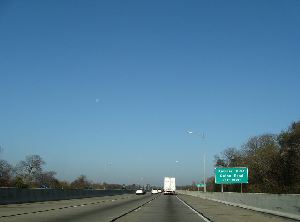
| An adjacent sign bridge directs motorists to Kessler Boulevard ahead and Guion Road in three quarters of a mile. Kessler Boulevard leads south to Brooklyn Heights and Lafayette Road (former U.S. 52) and north to Broadmoor and 56th Street. 11/05/09 |
|
| Kessler Boulevard passes over Interstate 65 and 38th Street in this scene. 11/05/09 |
|
| Beyond the turn off for Guion Road, a local road serving the Eagledale and Guion Creek neighborhoods, 38th Street leaves the Interstate 65 corridor for Lafayette Square Mall and Exit 17 of the Indianapolis Beltway. 11/05/09 |
|
| Interstate 65 resumes a northward course, following Eagle Creek to Exit 121. 11/05/09 |
|
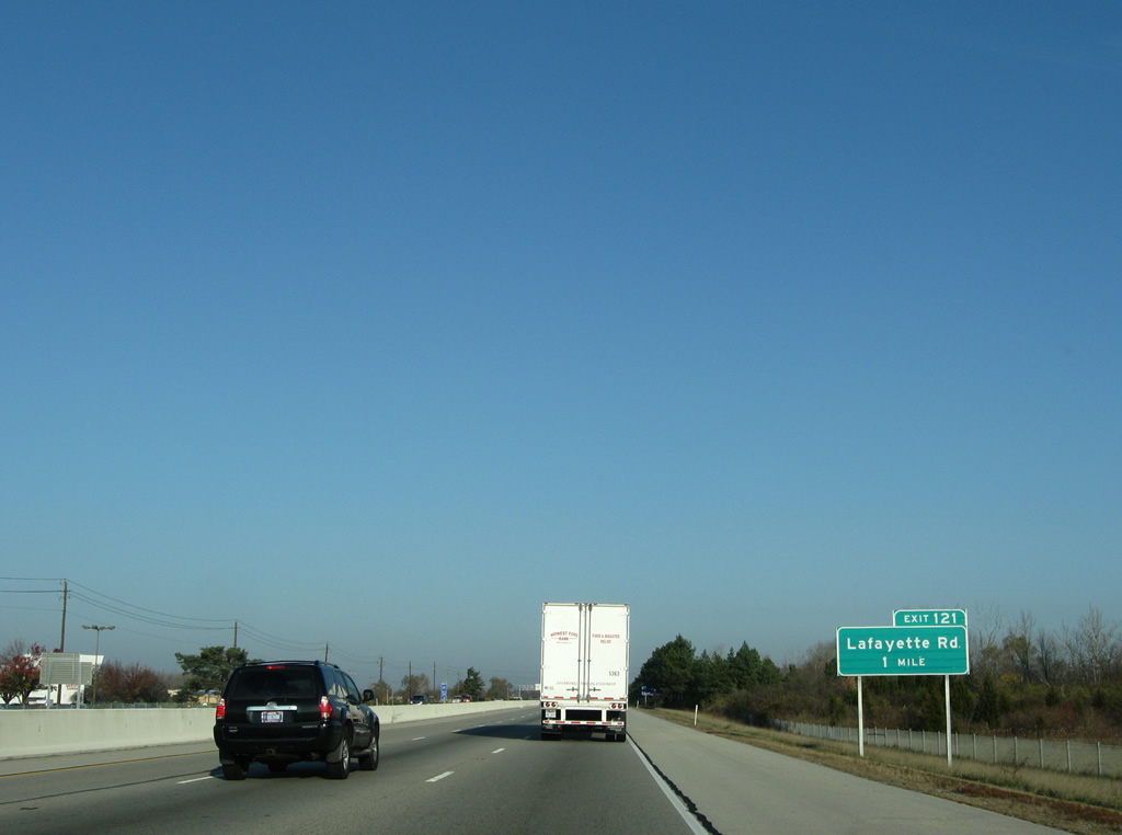
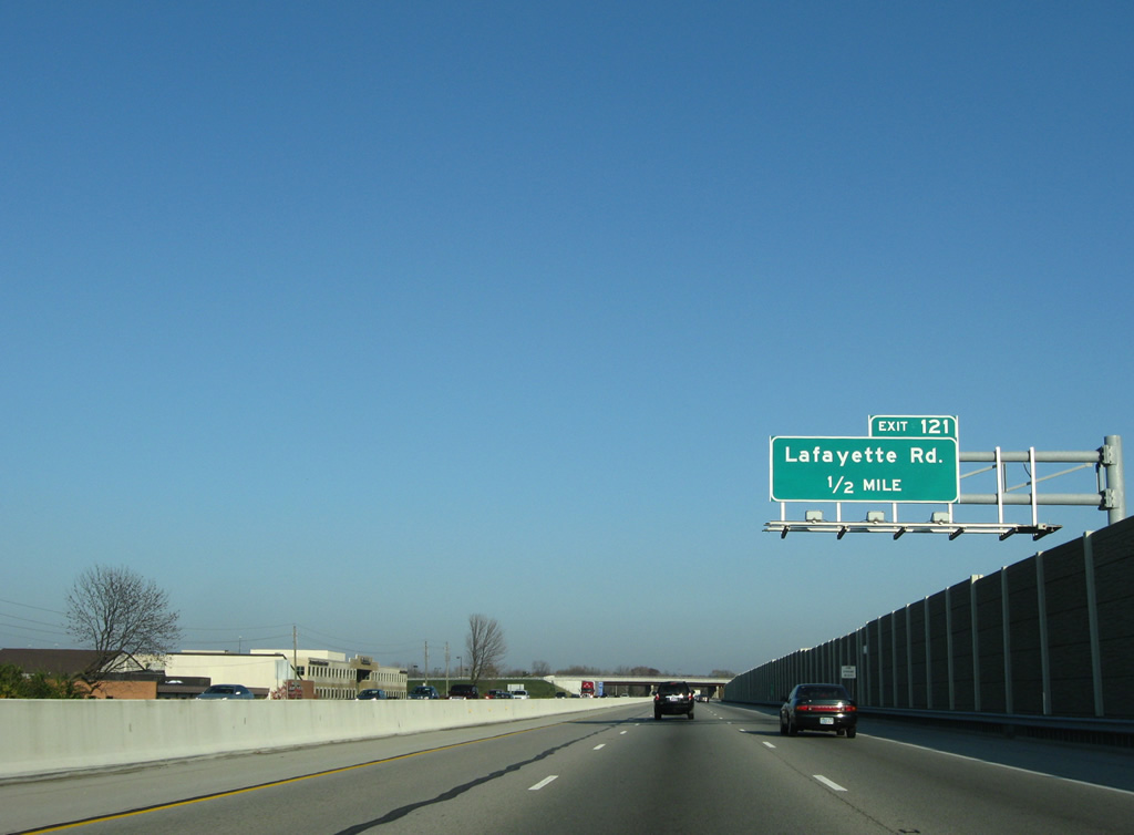
| Lafayette Road, the original path of U.S. 52, meets Interstate 65 in one mile at a diamond interchange (Exit 121). 11/05/09 |
|
| Lafayette Road comprises a busy commercial arterial leading northwest from Eagledale to Lafayette Square and Exit 121. 11/05/09 |
|
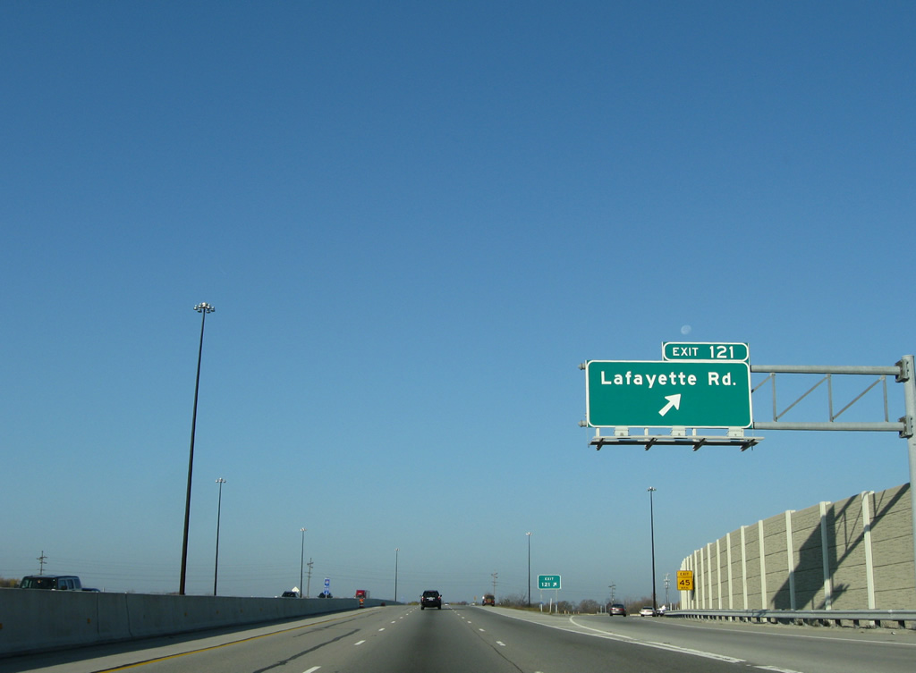
| Northbound at the ramp departure of Exit 121 to Lafayette Road. Old U.S. 52 parallels Interstate 65 closely through the Trader's Point section of northwest Indianapolis. 11/05/09 |
|
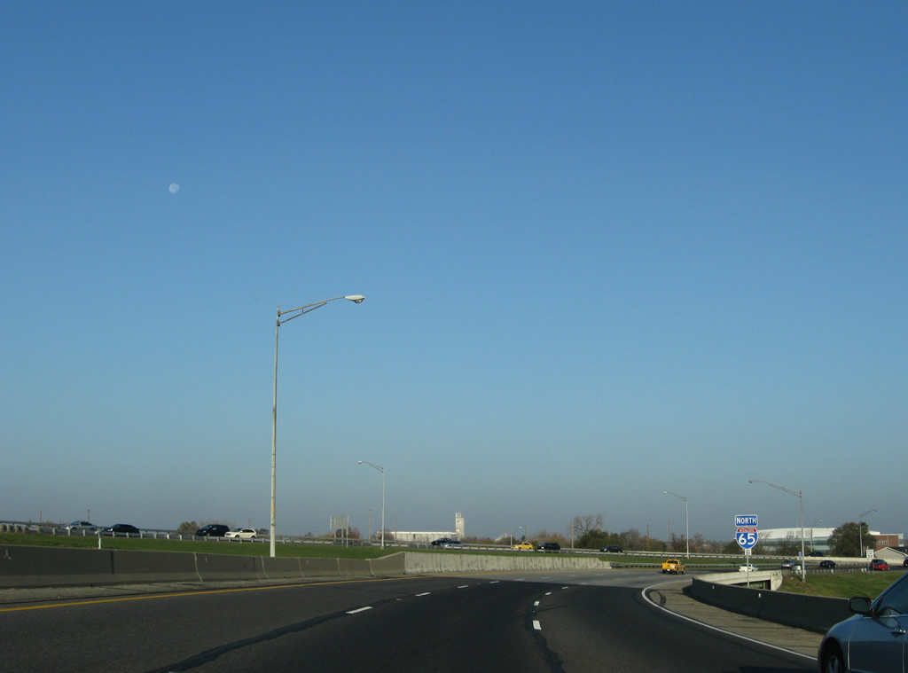
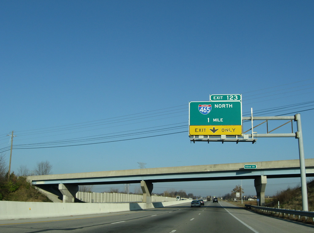
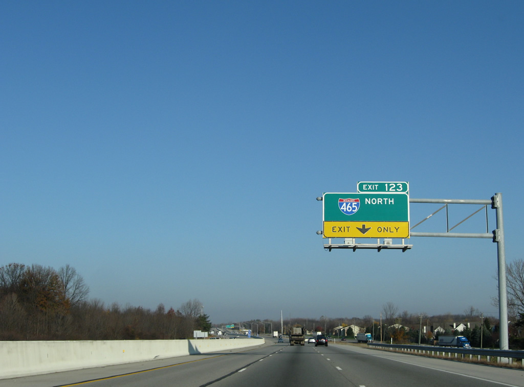
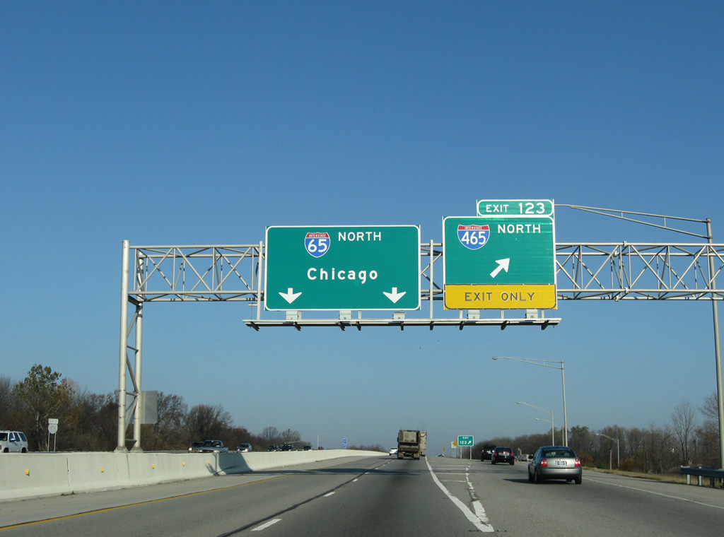
| Interstates 65 and 465 cross each in other in such a way that only partial movements are needed between the two freeways. Exit 123 provides northbound access only to the beltway through the Park 100 area and Boone County. 11/05/09 |
|
| Exit 123 includes high speed directional ramps from I-465 north to I-65 north and I-65 south to I-465 south. Two short ramps joins the freeways directly from Interstate 65 north to the beltway north and I-465 south to I-65 south. There are no other movements at the Eagle Creek Park area junction. 11/05/09 |
|
| Interstate 65 reduces to two northbound lanes at the Exit 123 off-ramp to Interstate 465 north. The freeway remains with just four lanes to the west end of Interstate 865. Interstate 465 meets the east end of Interstate 865 in five miles near Zionsville. 11/05/09 |
|
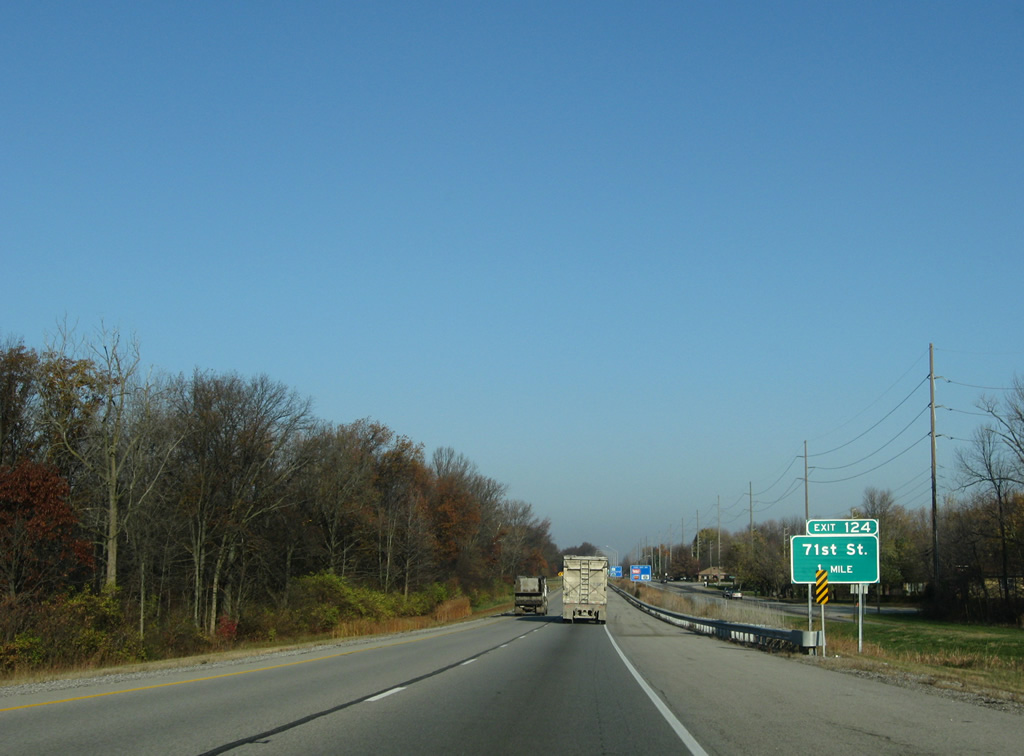
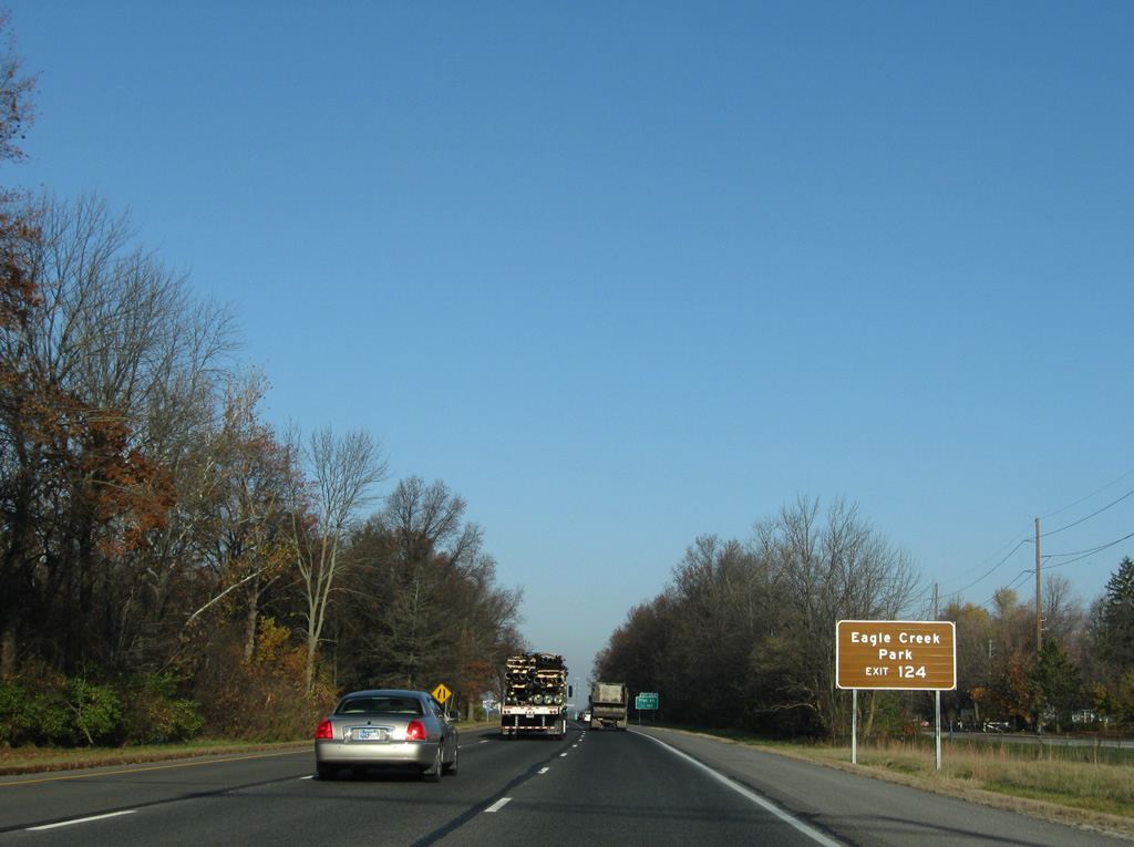
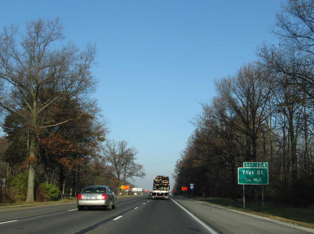
| Lafayette Road (Old U.S. 52) lines the northbound side of Interstate 65 directly on the one mile approach to Exit 124, West 71st Street. 11/05/09 |
|
| A left side ramp adds traffic from Interstate 465 northbound to Interstate 65 north, one half mile south of the Exit 124 diamond interchange with 71st Street. 11/05/09 |
|
| Lands west of Interstate 65 along this stretch reside with Eagle Creek Park, a city-run facility. 11/05/09 |
|
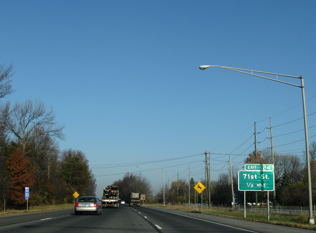
| 71st Street connects Interstate 65 with Eagle Creek Parkway south and Trader's Point and Park 100 to the east. 11/05/09 |
|
| A reassurance marker is posted as the left lane gained from Interstate 465 north concludes. 11/05/09 |
|
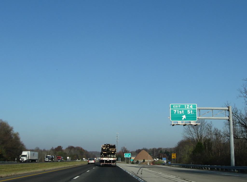
| Exit 124 quickly follows onto 71st Street east and Eagle Creek Parkway south. Lafayette Road (old U.S. 52) intersects 71st Street nearby. 11/05/09 |
|
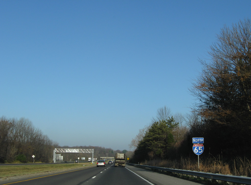
| Continuing northwest alongside the Trader's Point area of Indianapolis along Interstate 65 north. 11/05/09 |
|
| Interstate 65 spans Eagle Creek, the name sake of the adjacent park, along a pair of 1960 built bridges. 11/05/09 |
|
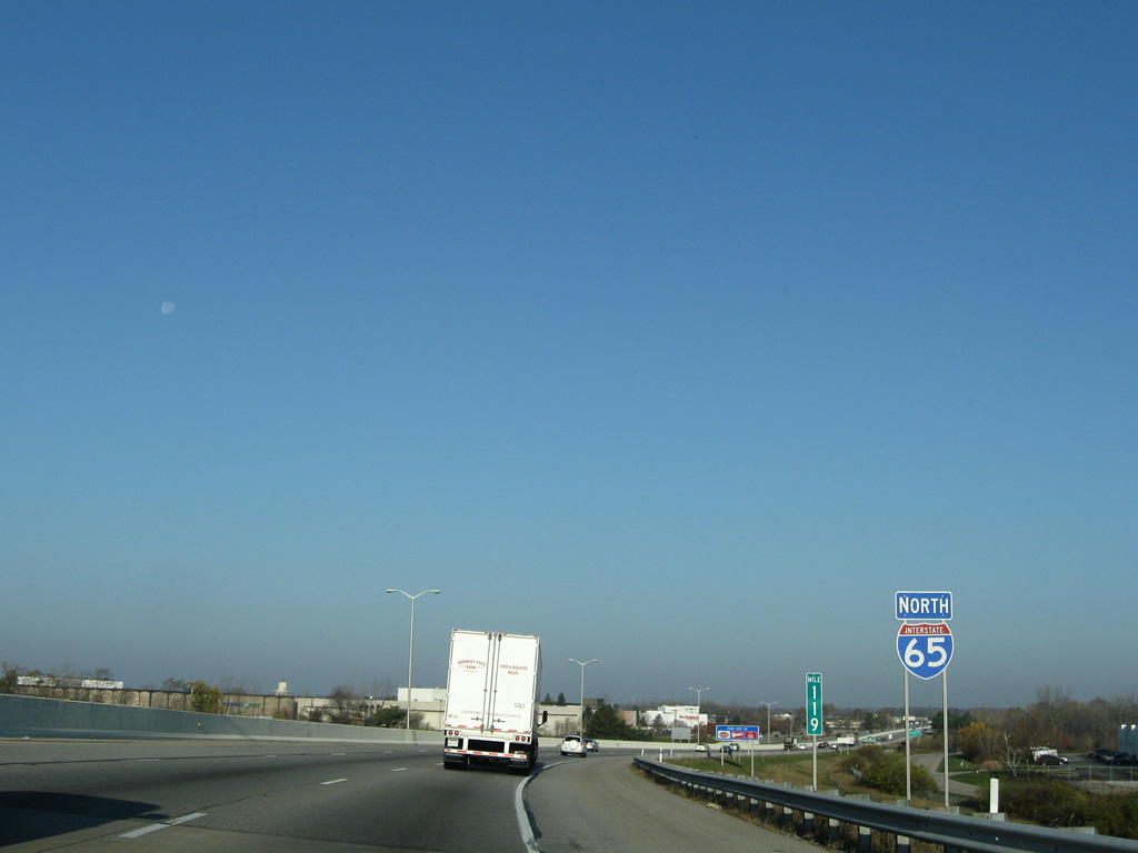
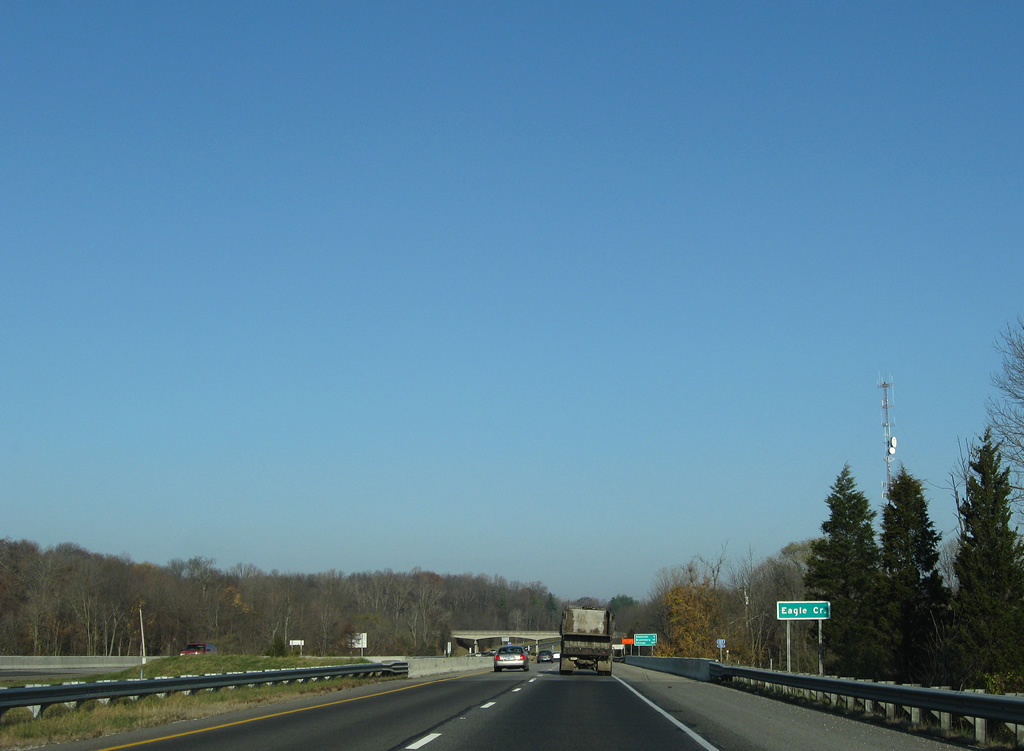
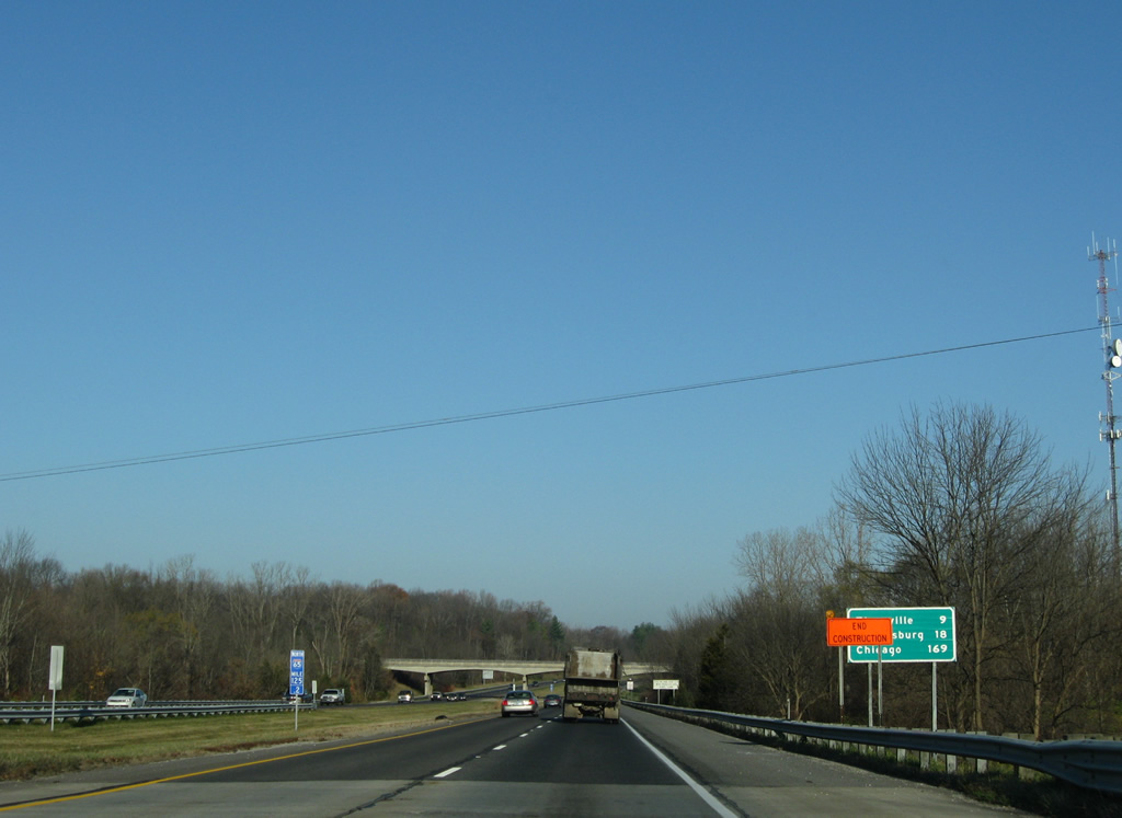
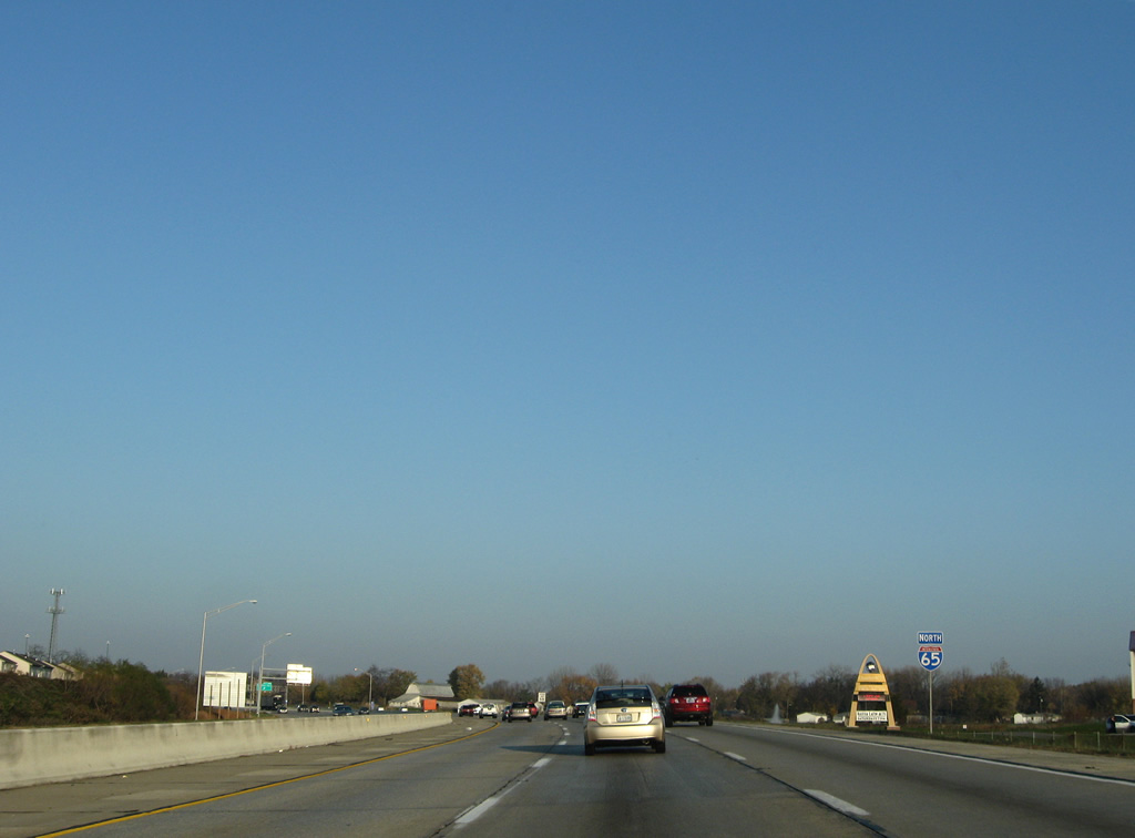
| Obscured due to a construction sign in this photo, the first distance sign posted since south of I-74/465 highlights the distance to Zionsville, Brownsburg (via SR 267 south) and Chicago. 11/05/09 |
|
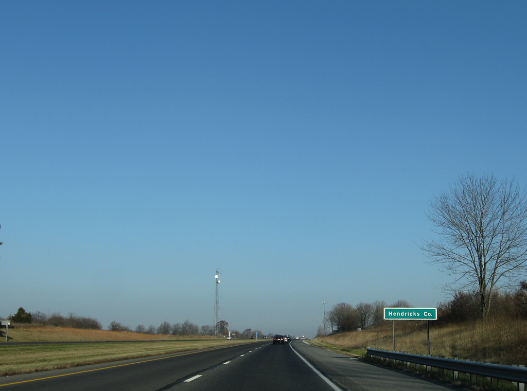
| Interstate 65 briefly enters the northeast corner of Hendricks County. 11/05/09 |
Page Updated 01-06-2012.

 North
North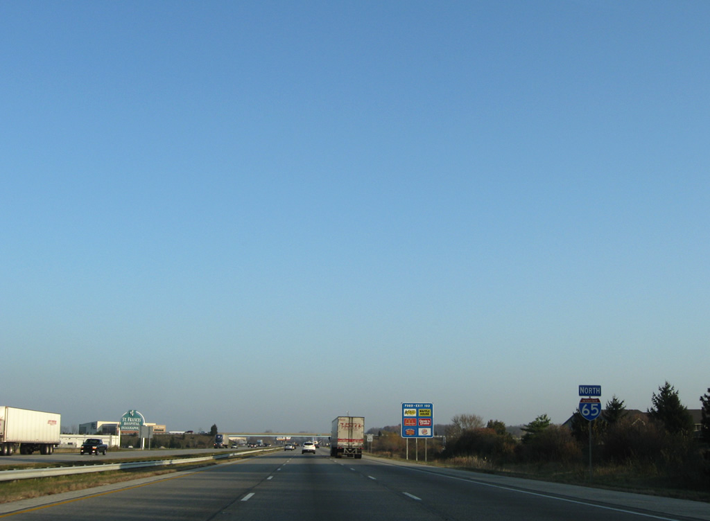
 East
East