Interstate 65 is six lanes wide south toward the suburbs of Northwest Indiana. Due to growth in the communities of Merrillville, Hobart and Crown Point, I-65 was rebuilt and widened in the 1990s from Exit 259 south to Exit 253 (U.S. 30) as the first step in a larger series of projects to improve the interstate system in Northwest Indiana. Work finished with the completion of the interchange with I-65 and I-80-94/U.S. 6 in 2011.
|
| Interstate 65 begins at a signalized intersection with U.S. 12/20 (Dunes Highway) and Taylor Road. The first confirming marker stands to the immediate south. 11/05/09 |
|
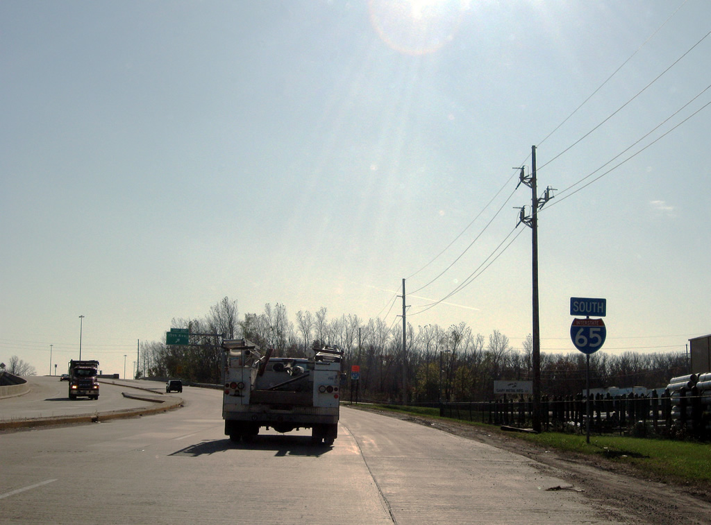
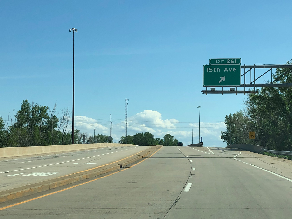
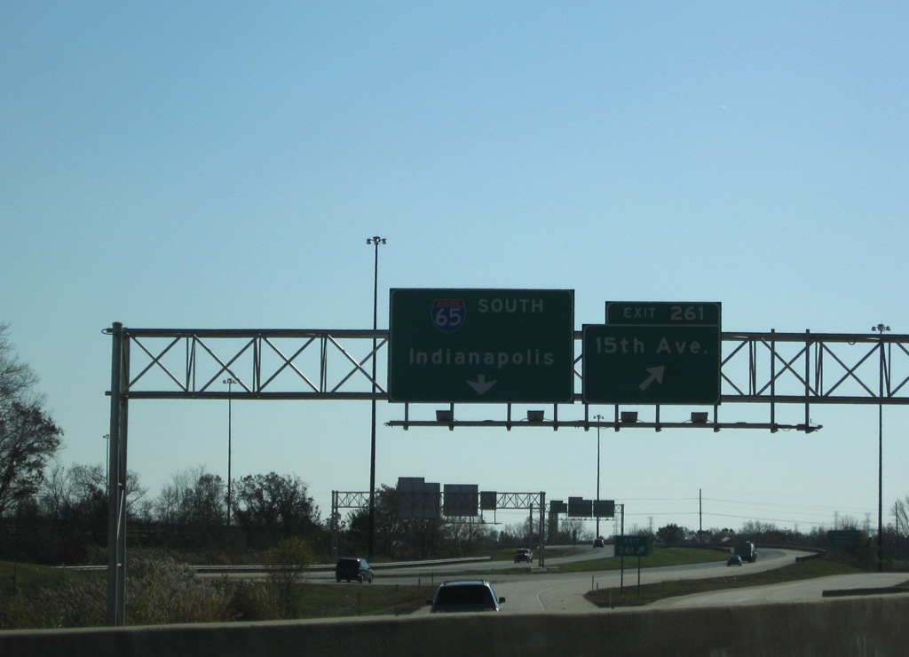
| Circumventing a wye interchange with adjacent I-90 (Indiana Toll Road), Exit 261 follows to E 15th Street. E 15th Street connects I-65 with Martin Luther King Drive and Aetna Street, mainly serving industrial sites and the Aetna community in east Gary. 05/30/20 |
|
| Motorists entering Interstate 65 from the Indiana Toll Road are provided with a slip ramp for Exit 261 to 15th Avenue as well. 11/05/09 |
|
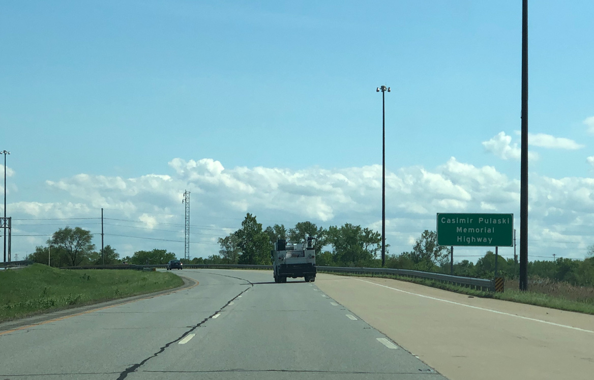
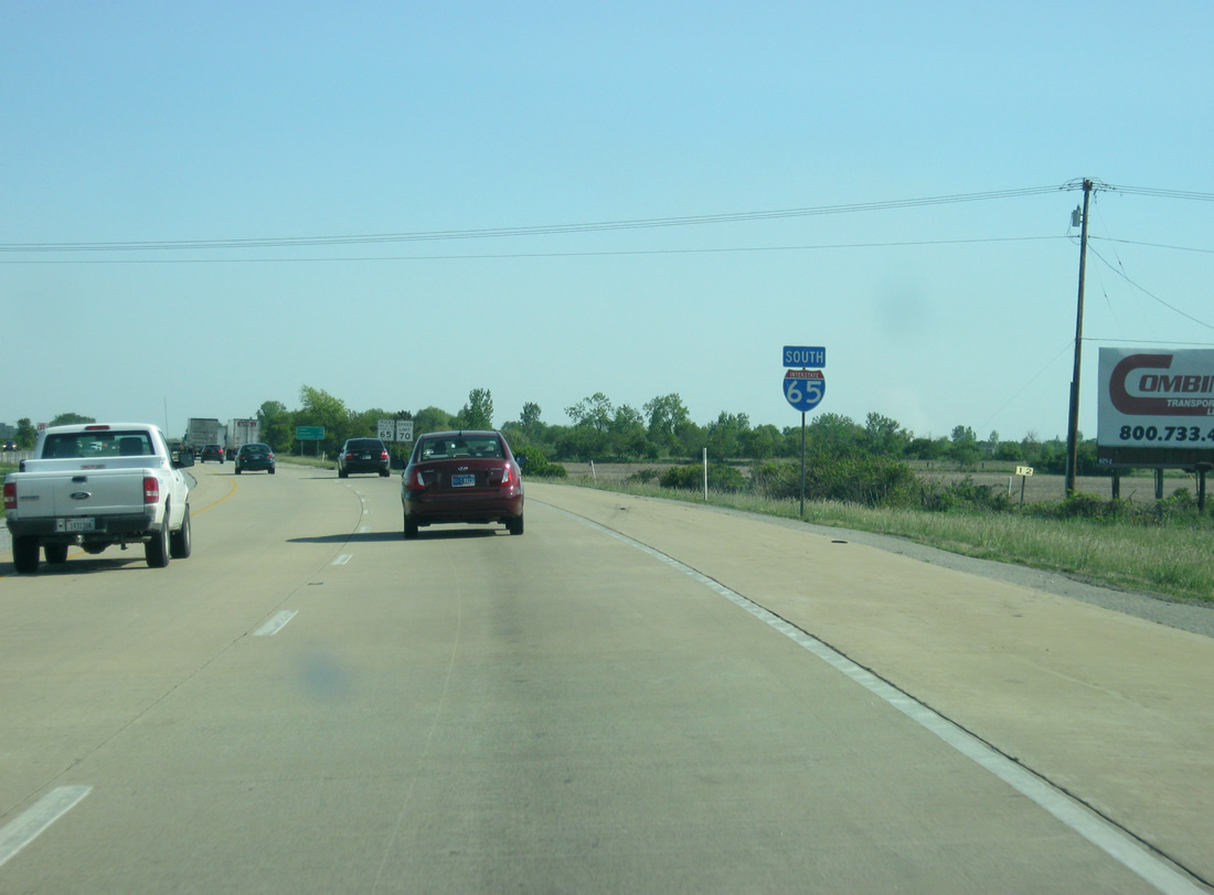
| Interstate 65 is designated the Casimir Pulaski Memorial Highway throughout Lake County. 05/30/20 |
|
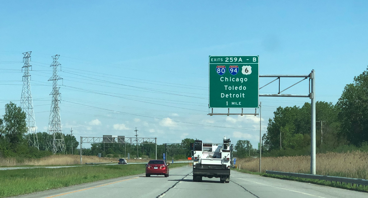
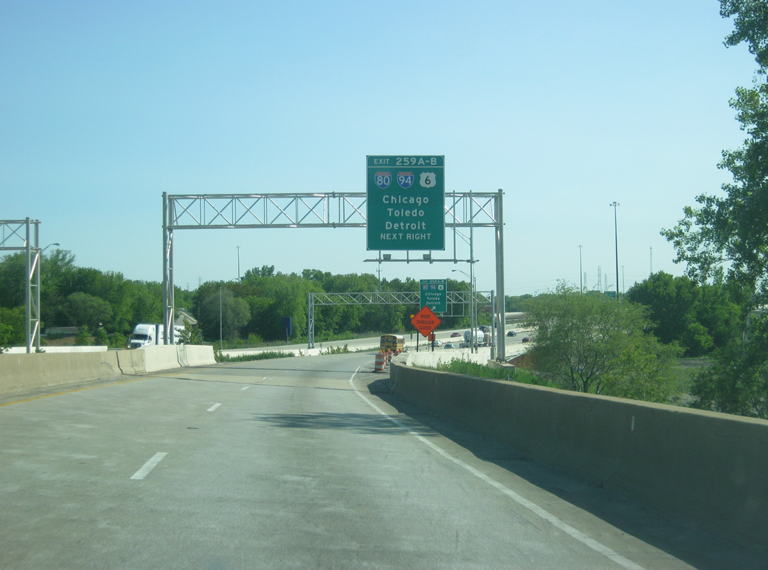
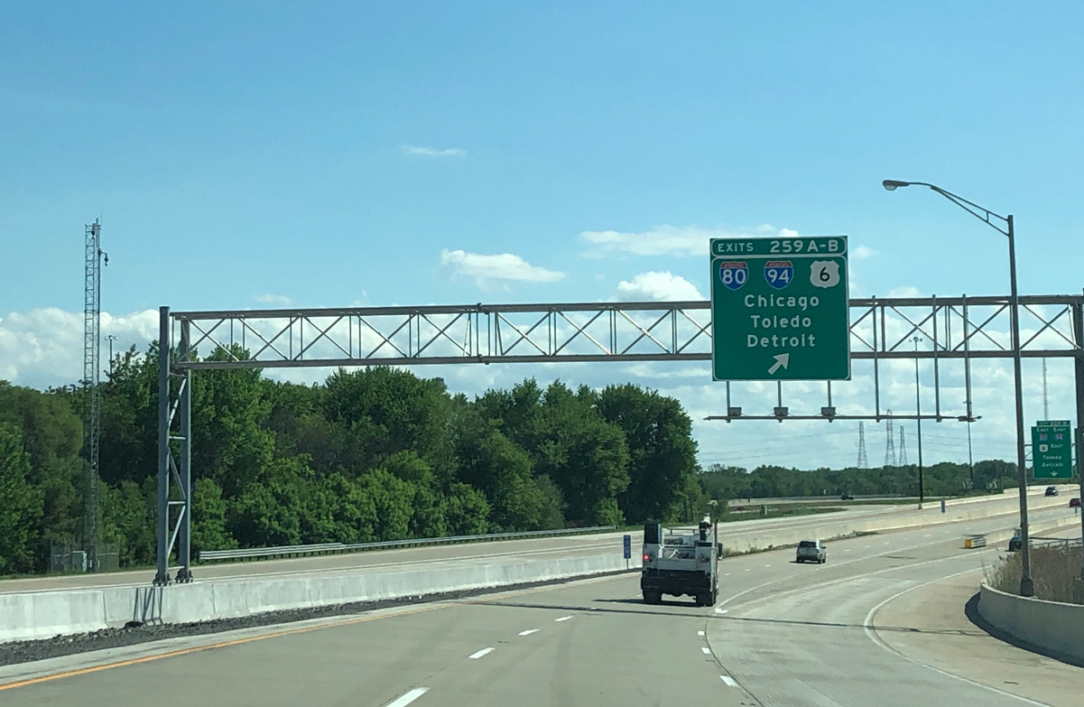
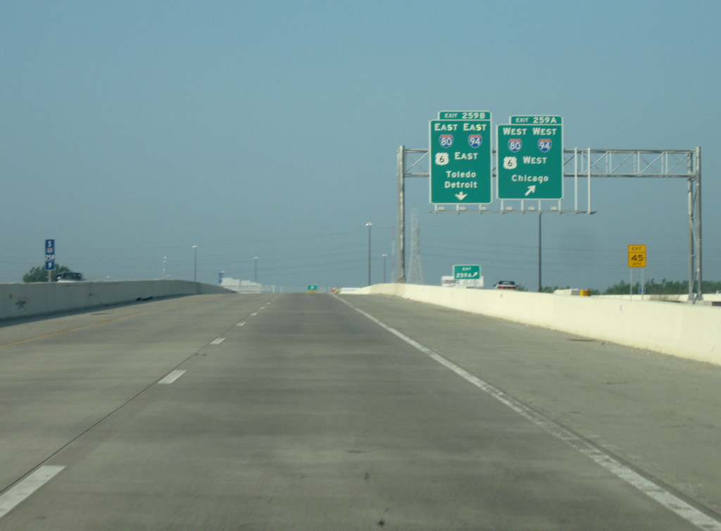
| I-65 converges with I-80/94/U.S. 6 (Frank Borman Expressway) at a directional cloverleaf interchange (Exit 259). Construction finished in Summer 2011 replaced the loop ramp from I-80/94 west to I-65 south with a flyover. 05/30/20 |
|
| I-80 joins Interstate 94 west with U.S. 6 at Lake Station for an 18.53 mile overlap west to Lansing, Illinois and the Tri-State Tollway. U.S. 6 follows I-80/94 west to Torrence Avenue in Lansing. 05/14/12 |
|
| A distributor roadway (Exit 259) separates from I-65 south to I-80/94. Named the Tri-State Expressway before 1969, Frank Borman Expressway represents one of the oldest freeways in the state. Designated SR 420, it was completed by 1952 from the Illinois line through Hammond.1 05/30/20 |
|
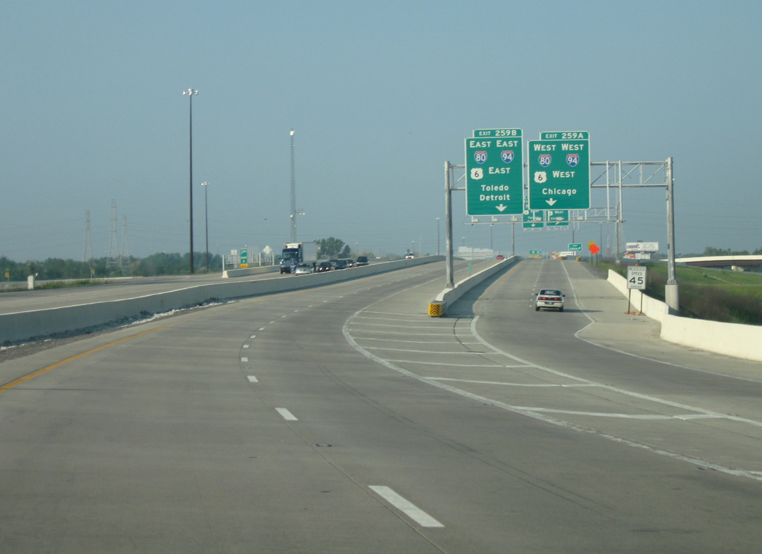
| Exit 259A follows from the distributor lane for I-80/94-U.S. 6 west to Gary, Hammond, Chicago, and the Quad Cities. 05/23/10 |
|
| Exit 259B loops onto a c/d roadway along I-80/94-U.S. 6 east to SR 51 (Ripley Street) and the Indiana Toll Road at Lake Station. I-94 continues east to Portage, Michigan City and Detroit, Michigan. I-80 joins I-90 east to South Bend, Elkhart and Toledo, Ohio. U.S. 6 follows SR 51 south to Ridge Road east through south Portage. 05/23/10 |
|
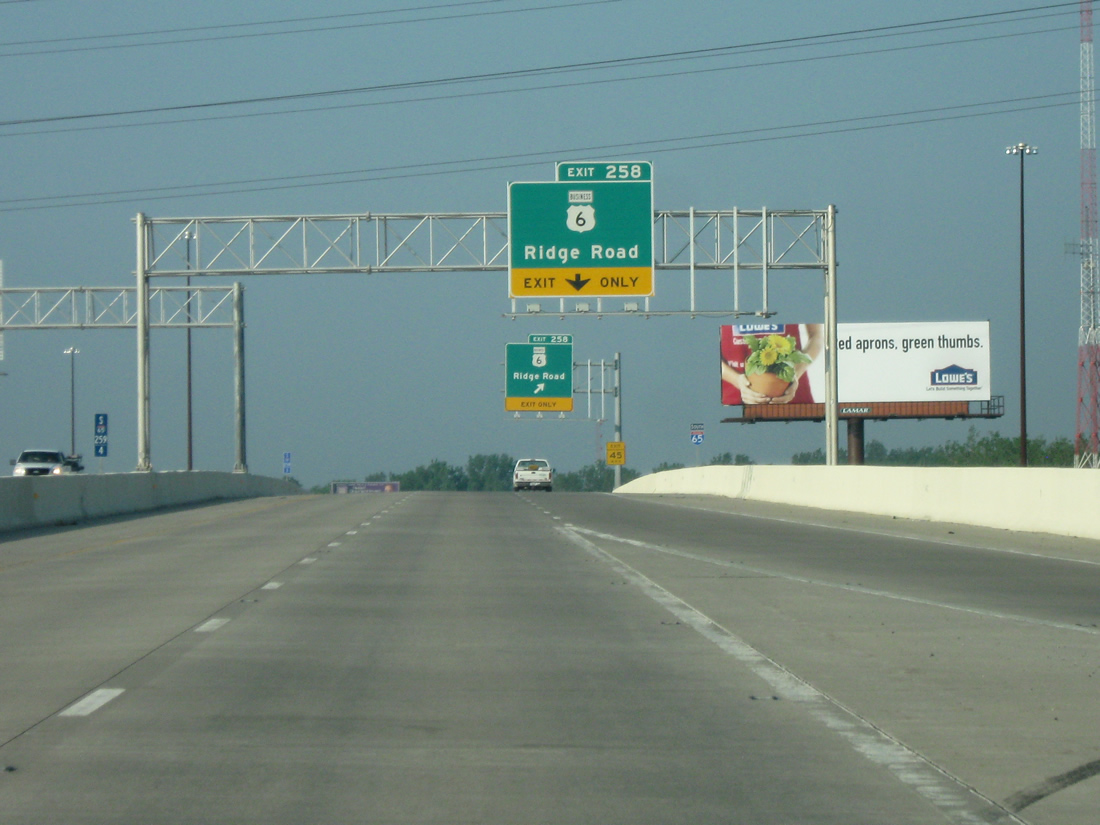
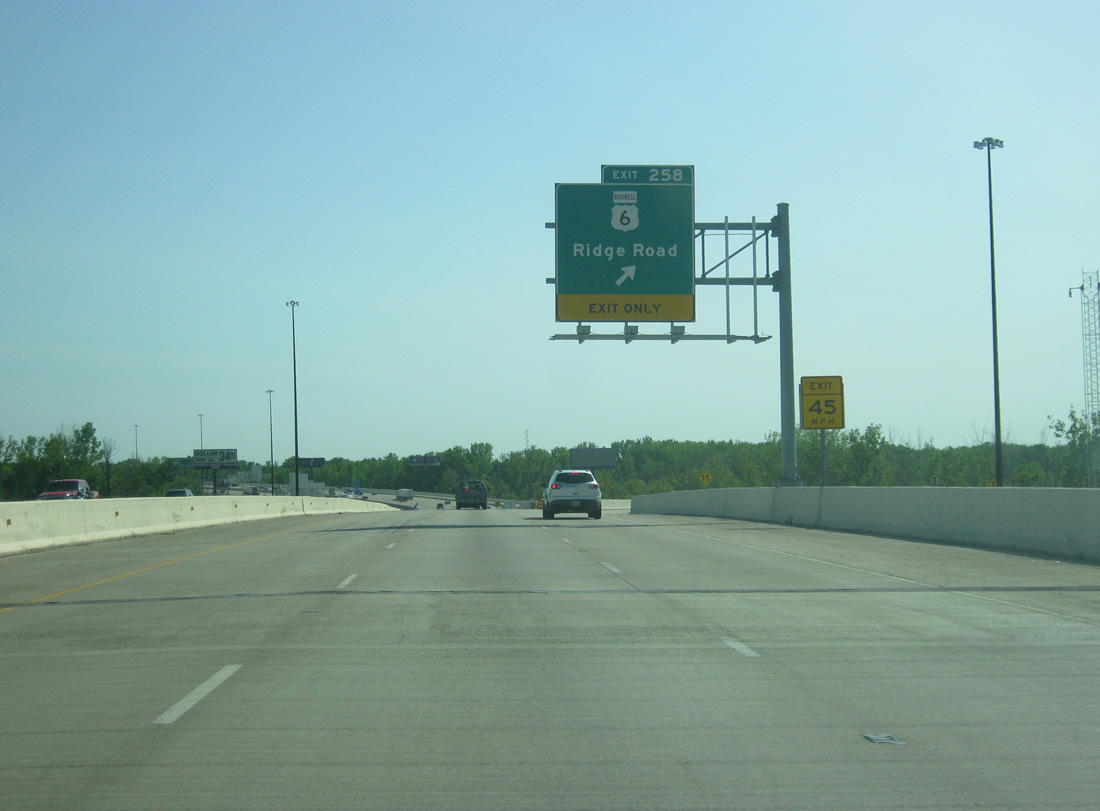
| An auxiliary lane opens along I-65 south from I-80/94 to Exit 258 for Ridge Road. Ridge Road extends west from SR 51/U.S. 6 (Adam Benjamin Highway) as 37th Avenue along the New Chicago and Hobart city line. Sparsely signed, the arterial doubles as U.S. 6 Business between SR 51 and U.S. 41 (Indianapolis Boulevard) in Highland. 05/23/10 |
|
| Ridge Road (U.S. 6 Business) links I-65 with Glen Park in south Gary, Griffith and Highland. The business route ends at U.S. 41 disconnected from U.S. 6. 05/14/12 |
|
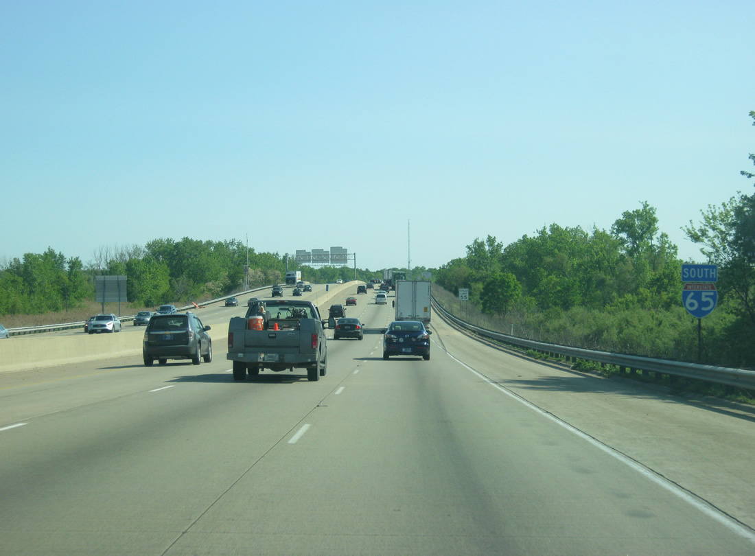
| The Northwest Connector adds traffic onto Interstate 65 south from the Borman Expressway east via a wye interchange. The ensuing interchanges, 61st Avenue (Exit 255) and U.S. 30 (Exit 253), follow within the city of Merrillville. 05/14/12 |
|
| The off-ramp at Exit 258 intersects U.S. 6 Business (Ridge Road) at a stop sign. Ridge Road west serves interests to the Gary Career Center and Ivy Tech Community College of Indiana. 09/03/05 |
|
| Confirming marker posted south of the entrance ramp from Ridge Road (U.S. 6 Business). 05/14/12 |
|
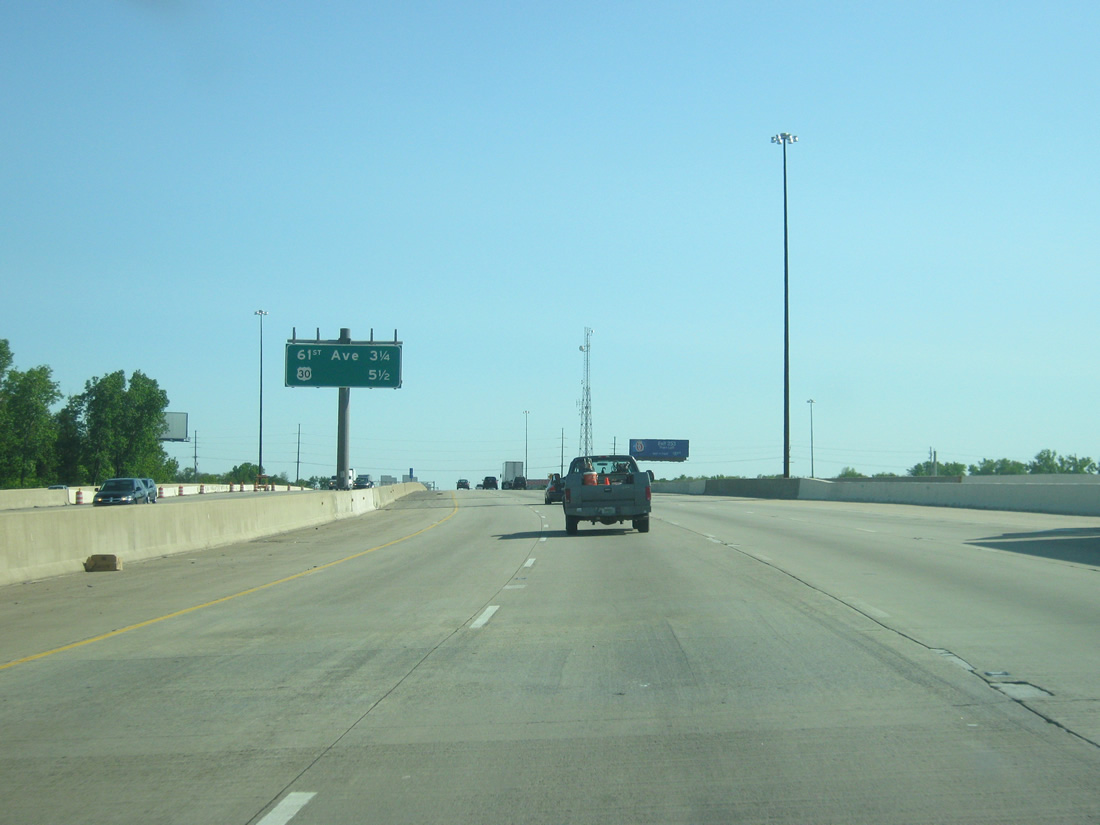
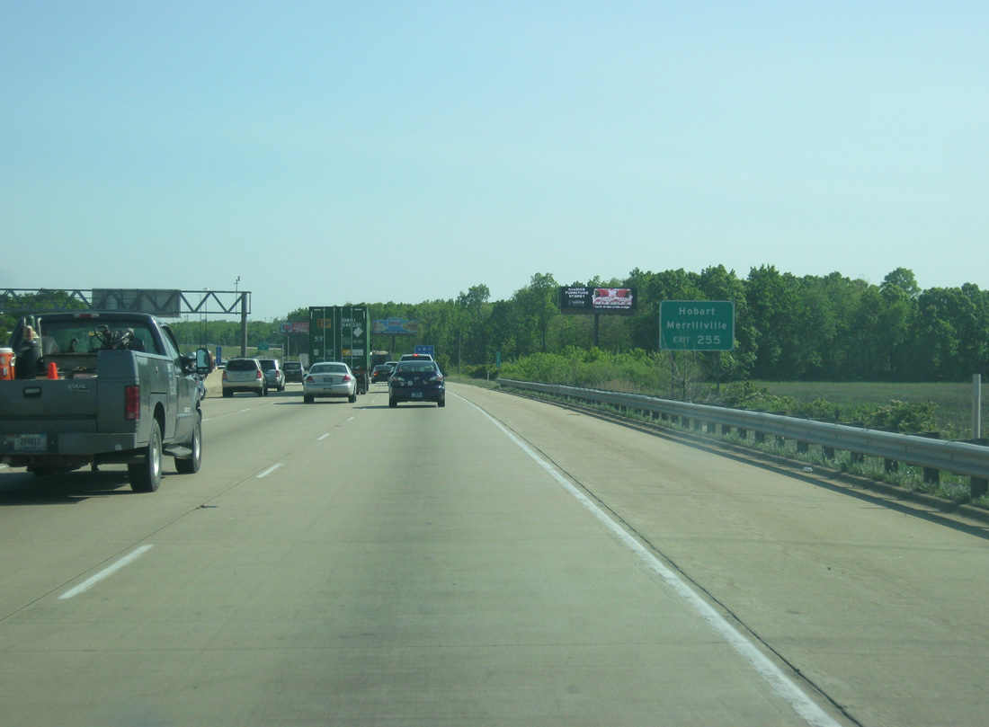
| Both the communities of Hobart and Merrillville are served at the 61st Avenue six-ramp parclo interchange (Exit 255). The Hobart city line resides just east of Exit 255. 05/14/12 |
|
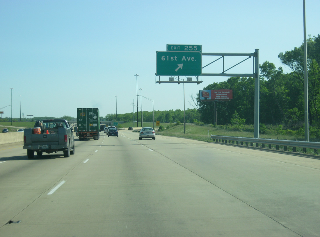
| Exit 255 departs Interstate 65 south for 61st Avenue. Heading west, 61st Avenue ends at SR 55 (Taft Street) in Merrillville. Eastward from Exit 255, 61st Avenue concludes at SR 51 (Lake Park Avenue) near Ainsworth. 05/14/12 |
|
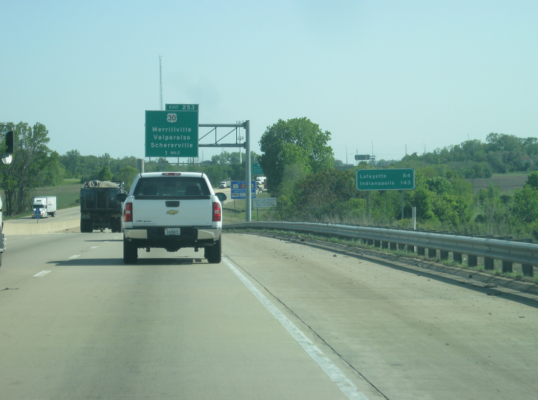
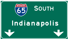
| The first distance sign on southbound Interstate 65 gives the distances to Lafayette (84 miles) and the Indiana capital city of Indianapolis (143 miles). Indianapolis is roughly a three-hour drive from the Chicago area and is slightly less than that from this point. 05/14/12 |
|
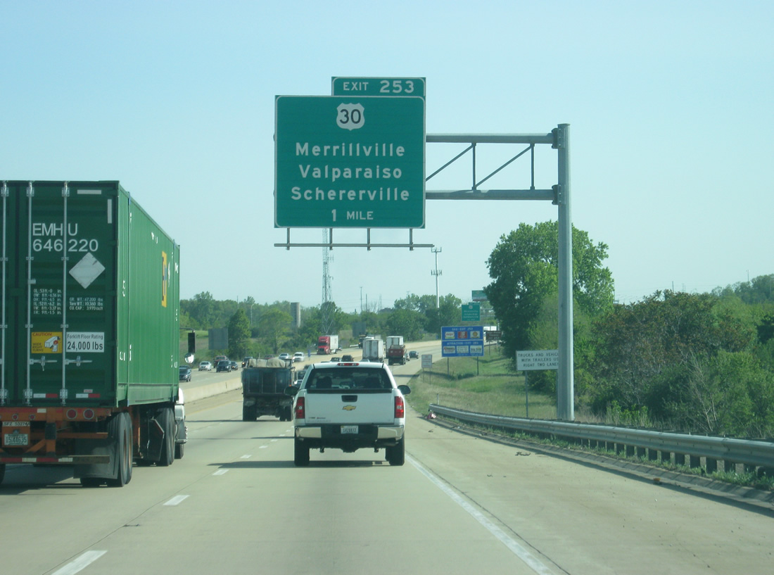
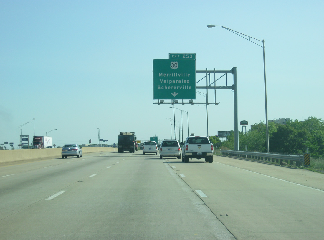
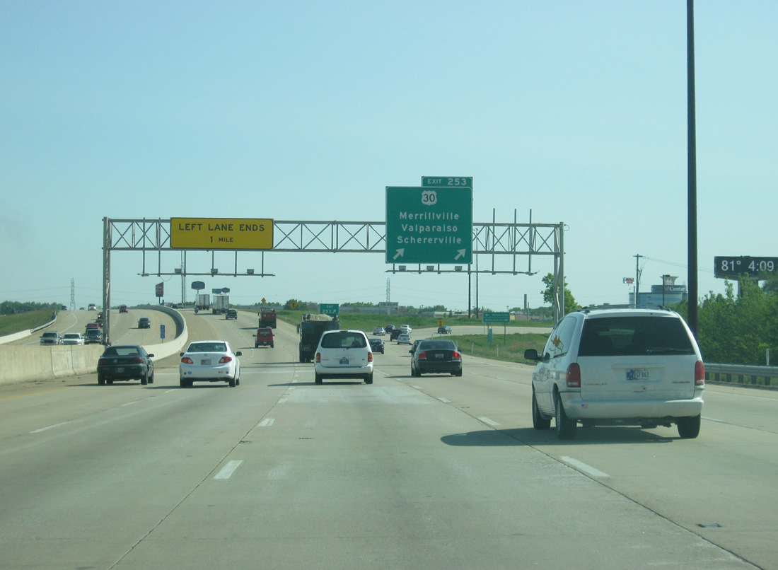
| Beyond the distance sign is the one mile approach to Exit 253 with U.S. 30 (81st Avenue). U.S. 30 represents among the most important highways across Northern Indiana, linking the Northwest Indiana area with the Fort Wayne metro area. 05/14/12 |
|
| U.S. 30 joins the Northwest Indiana cities of Schererville, Merrillville and Valparaiso with Plymouth, Warsaw, Columbia City and Fort Wayne as a four lane corridor. Adjacent to Exit 253, the US Route consists of a commercial arterial with businesses lining both sides of the interchange, including Star Plaza Theatre and Westfield Southlake Mall nearby. 05/14/12 |
|
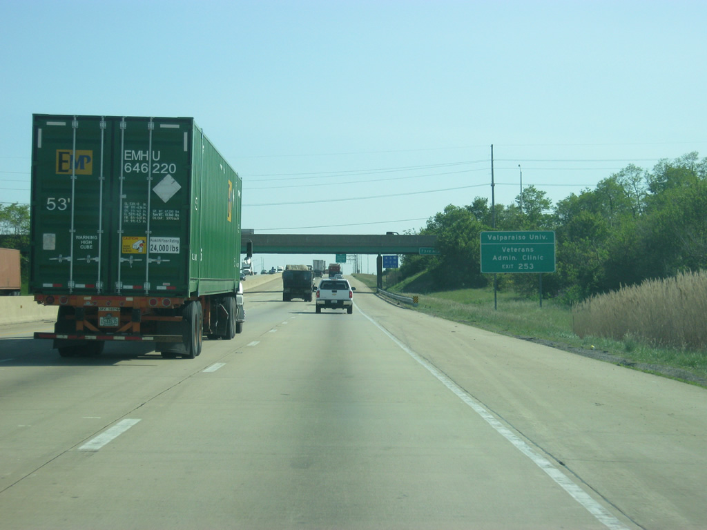
| Valparaiso University (Valpo for short) is located 15 miles to the east in the Porter County seat of Valparaiso. The VA Clinic is less than three miles away via U.S. 30 west and SR 53 (Broadway) in northern Crown Point. 05/14/12 |
|
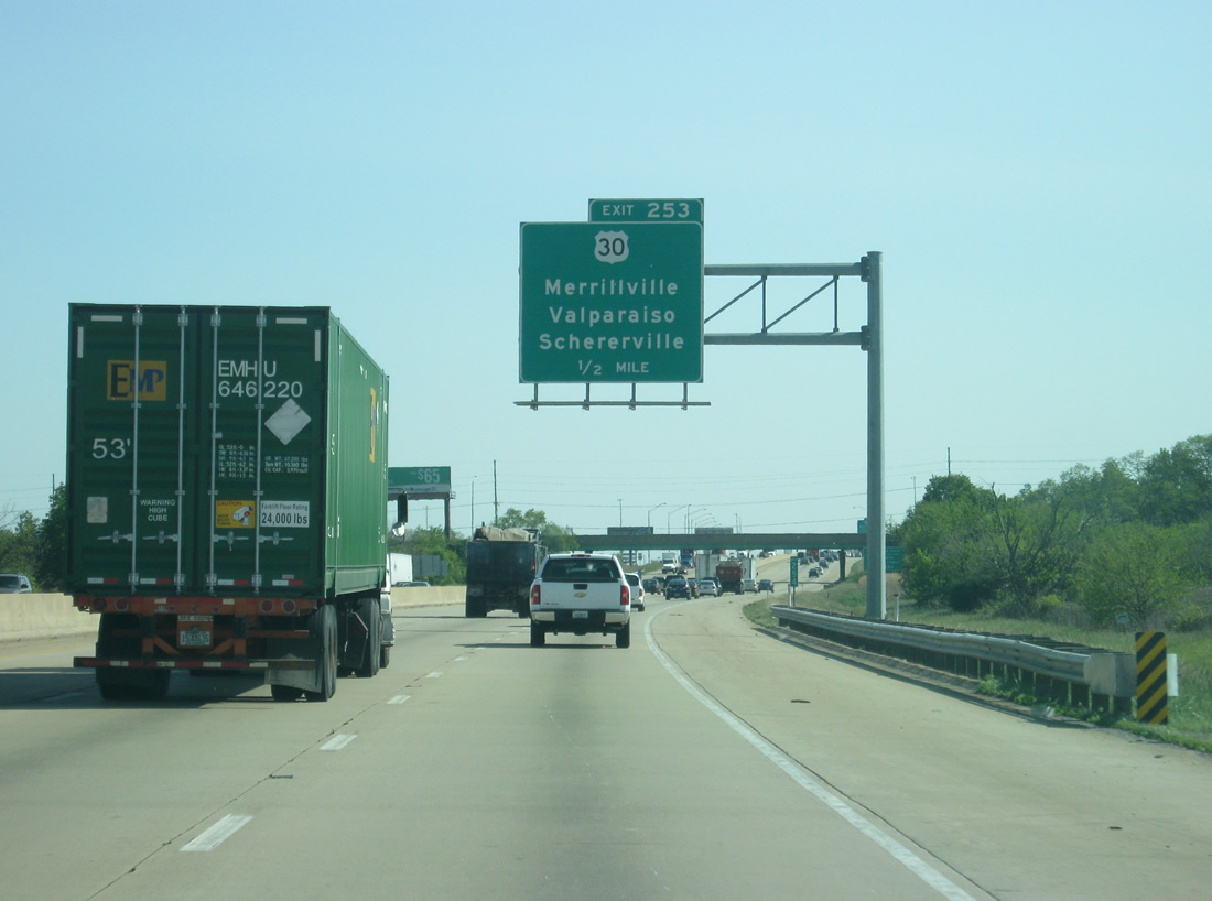
| An additional lane opens to the right to anticipate the traffic leaving Interstate 65 south for U.S. 30 at Exit 253. Originally a cloverleaf interchange, loop ramps from Interstate 65 to U.S. 30 were eliminated to remove weaving traffic concerns at Exit 253. U.S. 30 travels a busy route west from Merrillville to Schererville and Dyer, concluding the 151.8 mile cross state route near Ford Heights, Illinois. The Illinois state line is less than twelve miles from Exit 253. 05/14/12 |
|
| Two lanes of traffic exit off of southbound Interstate 65 for U.S. 30 at Exit 253. U.S. 30 ventures east 14 miles to Valparaiso, generally staying south of the city by Valparaiso University. The left lane for Interstate 65 will leave the highway one mile south of Exit 253. 05/14/12 |
|
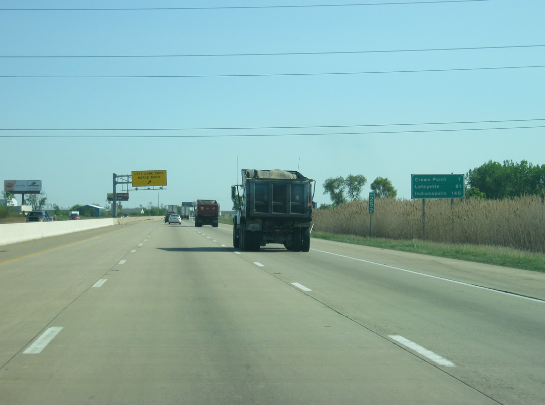
| South of the U.S. 30 corridor, Interstate 65 is seven miles from Crown Point, 81 miles from Lafayette and 140 miles from Indianapolis. Indianapolis remains the control city throughout along Interstate 65 south while Lafayette and Rensellaer are the main secondary controls that will occupy the second line on the distance signs. 05/14/12 |
|
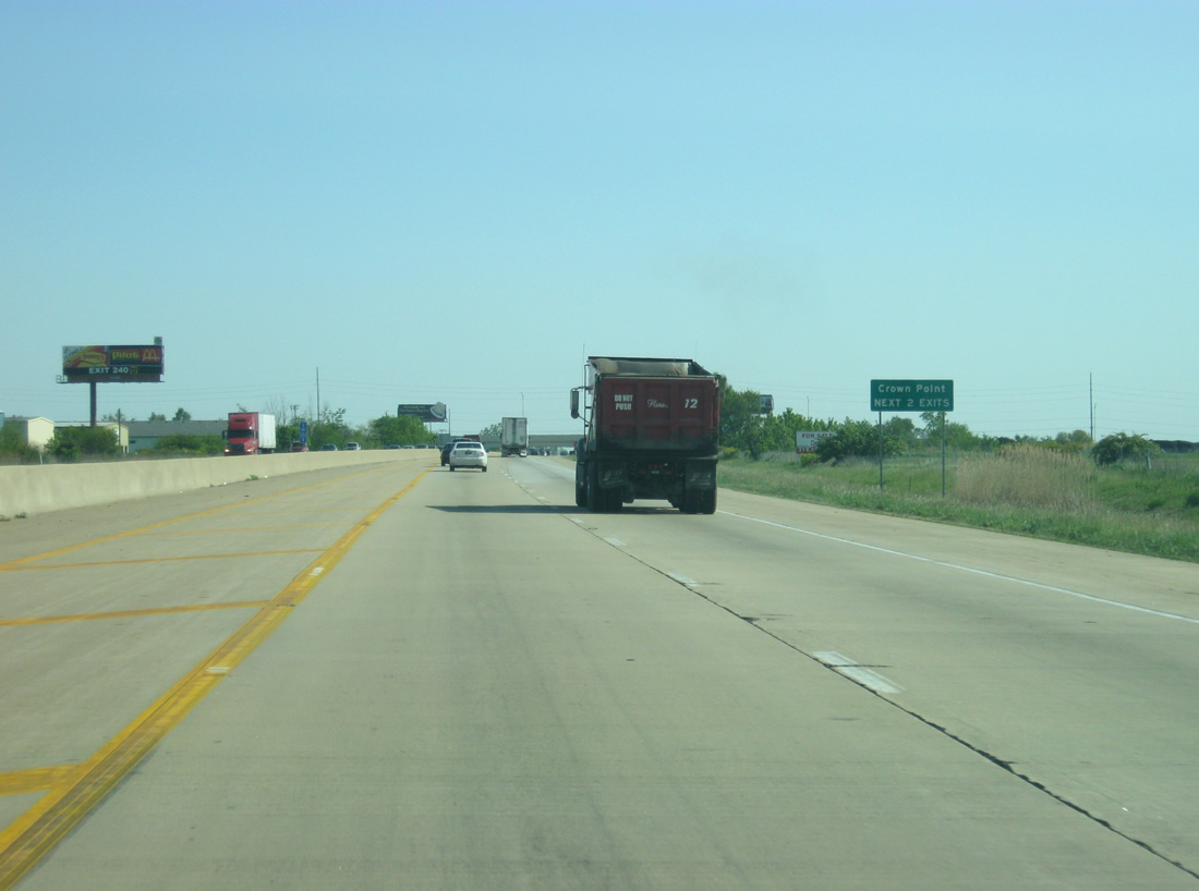
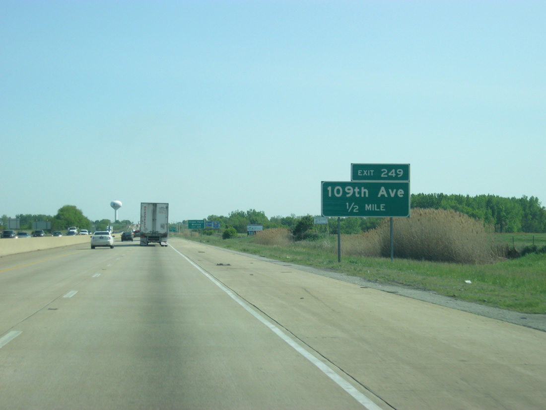
| The left lane collapses as Interstate 65 approaches the Crown Point area. Until 2011, Crown Point, the growing county seat of Lake County, was served only by one interchange (at U.S. 231). Now it is also served by Interstate 65's newest interchange at 109th Avenue. 05/14/12 |
|
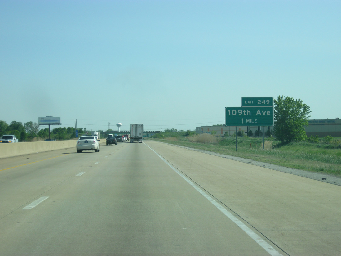
| Approaching the Exit 249 diamond interchange with East 109th Avenue at Crown Point. A new diamond interchange was built between 2009 and 2010 to provide another route to Crown Point and a new route to Winfield from Interstate 65. 05/14/12 |
|
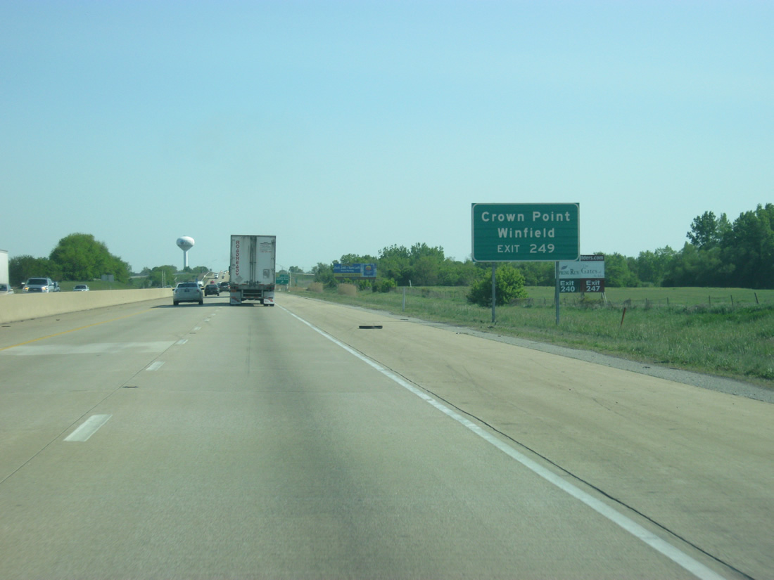
| The city of Crown Point and the town of Winfield are the controls for 109th Avenue and its interchange with Interstate 65, which broke up a five mile stretch between the exits at U.S. 30 and U.S. 231 in a fast-growing region of Lake County. 05/14/12 |
|
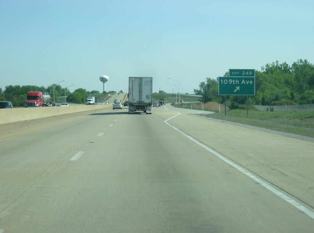
| Exit 249 turns off of Interstate 65 south for 109th Avenue. 109th Street becomes North Street upon entering the Crown Point city limits to the west, providing a direct connection with Downtown Crown Point. Winfield and Lake Holiday lie to the east. Rural areas surrounding Exit 249 are expected to grow with the September 30, 2010 opened interchange. 05/14/12 |
|
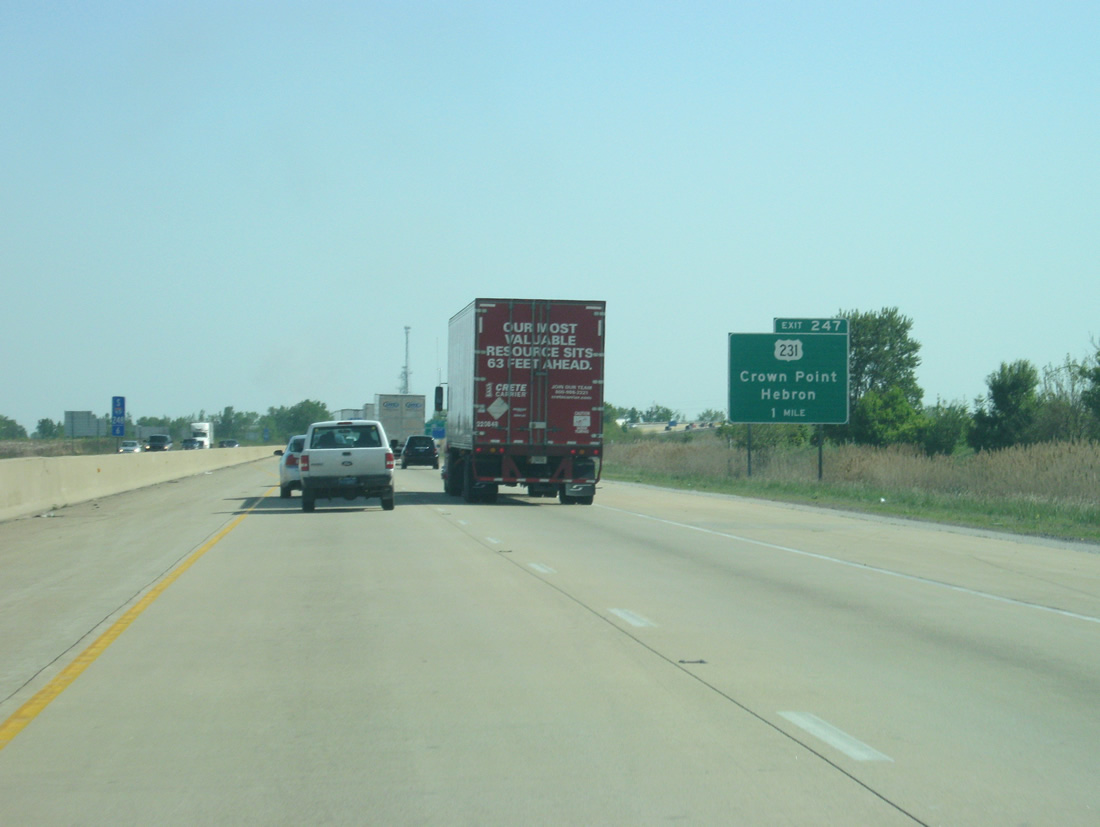
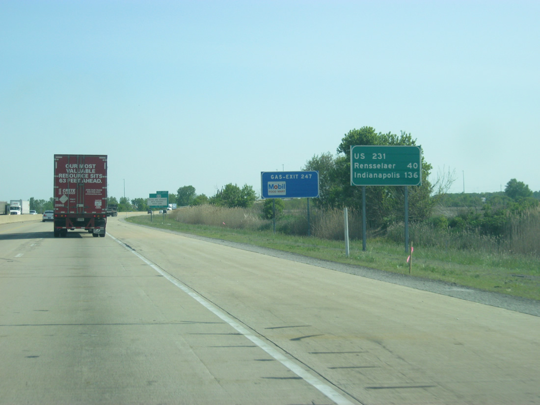
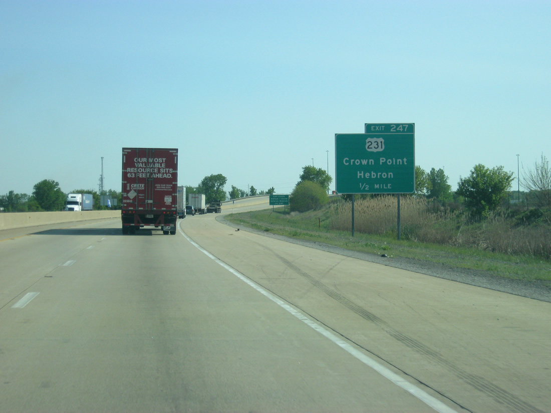
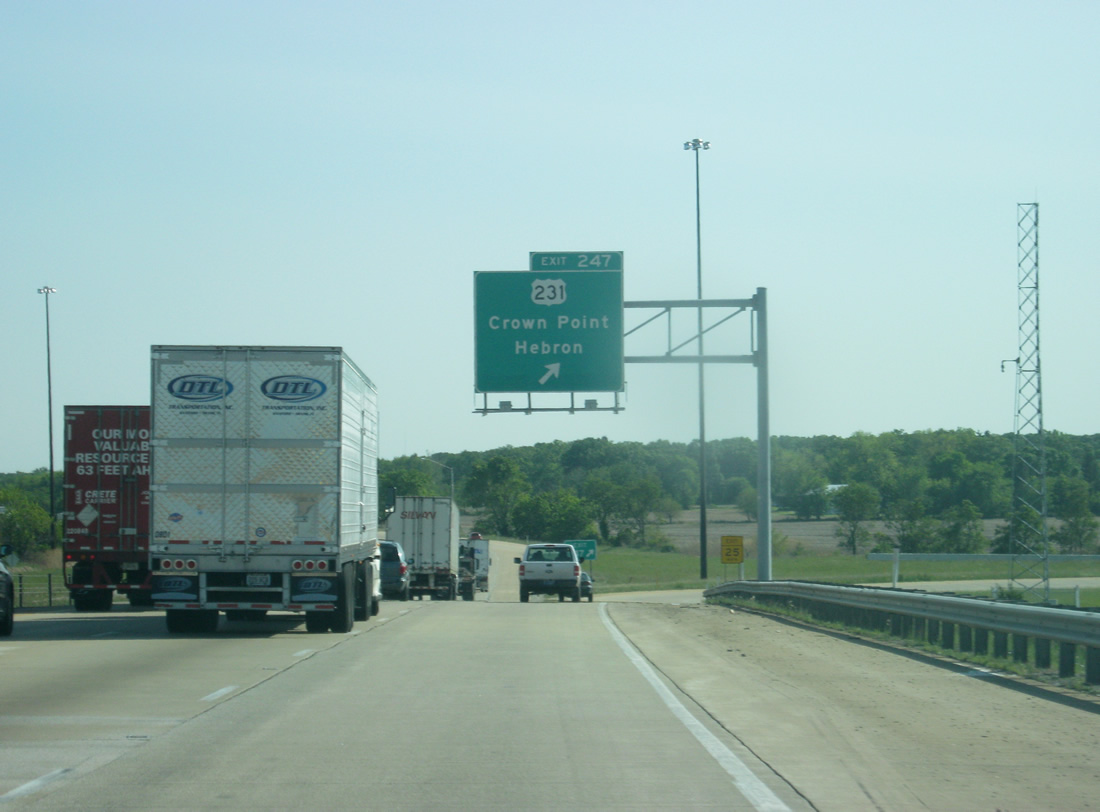
| Interstate 65 meets with U.S. 231 for the first time to the southeast of Downtown Crown Point at Exit 247. The 912 mile U.S. highway begins in St. John at U.S. 41 about seven miles to the west and continues south through Indiana, Kentucky, Tennessee, Alabama and Florida, ending in Panama City. U.S. 231 crosses Interstate 65 four times in the northern half of Indiana. 05/14/12 |
|
| A distance sign posted after Exit 249 gives no distance to U.S. 231 (less than a mile due to the previous sign) and gives the distances to Rensellaer (40 miles) and Indianapolis (136 miles). 05/14/12 |
|
| U.S. 231 travels for 9.3 miles from the folded diamond interchange with Interstate 65 to the southeast toward the town of Hebron in Porter County, passing through Leroy en route. Ramps to U.S. 231 connect with the US highway on the south side due to the original placement of a since removed railroad line. 05/14/12 |
|
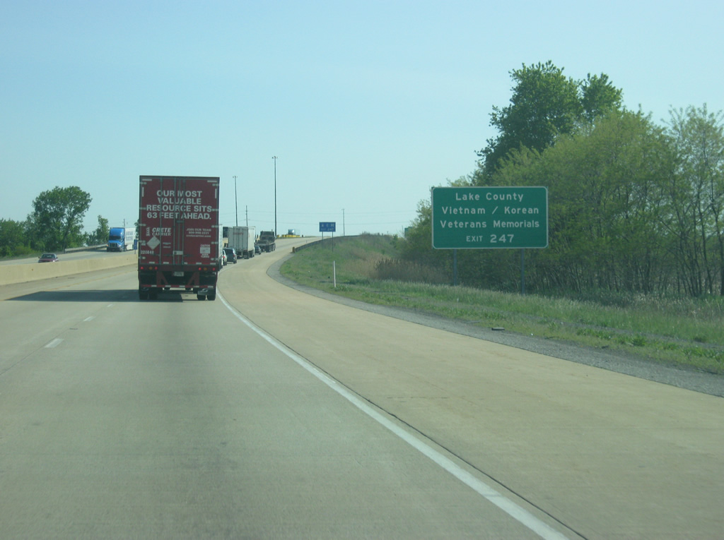
| The Lake County Vietnam and Korean War Veterans Memorials can be reached by taking U.S. 231 to the southeast of Exit 247. 05/14/12 |
|
| U.S. 231 ventures 1.5 miles northwest to a short overlap with SR 55 along Joliet Street in Crown Point. SR 53 begins nearby and leads northward parallel to Interstate 65 to Gary and Interstate 90 (Indiana Toll Road). U.S. 231 otherwise ends 5.6 miles west of SR 55 at U.S. 41 near St. John. 05/14/12 |
|
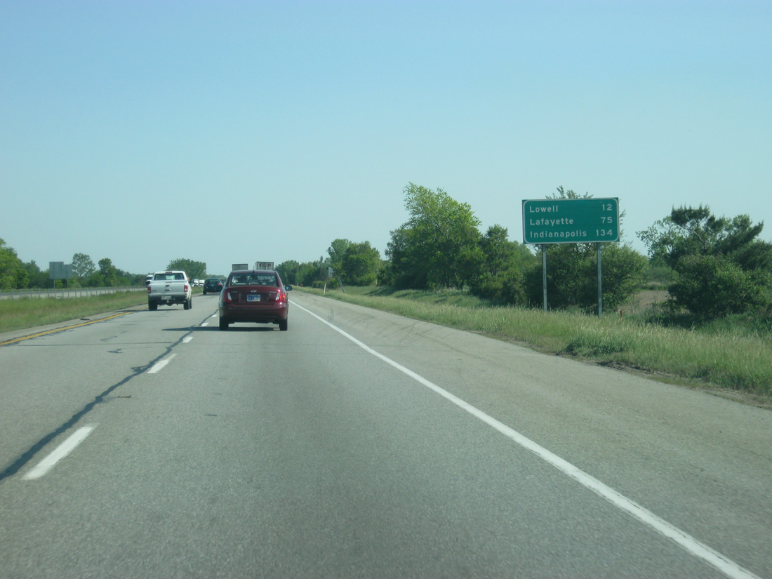
| An Interstate 65 reassurance shield and distance sign greets motorists to the south of the folded diamond interchange with U.S. 231. From this point on, Interstate 65 leaves the suburban fringes of Northwest Indiana and the greater Chicago region and enters the rural farmland of southern Lake County. Lowell lies 15 miles away while Lafayette and Indianapolis follow at 75 and 134 miles respectively. 05/14/12 |
|
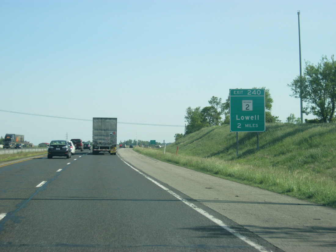
| SR 2 and Interstate 65 come together at the settlement of Dinwiddie and a diamond interchange. Drivers bound for SR 2 west to Orchard Grove and Lowell or SR 2 east to Hebron and Valparaiso exit Interstate 65 southbound at Exit 240. SR 2 is otherwise rural to Lowell and Hebron, tallying 81 miles from the Illinois state line to U.S. 31 at South Bend. 05/14/12 |
|
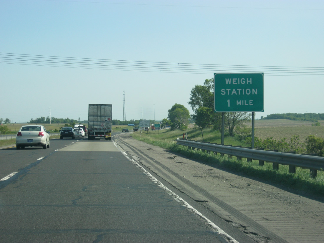
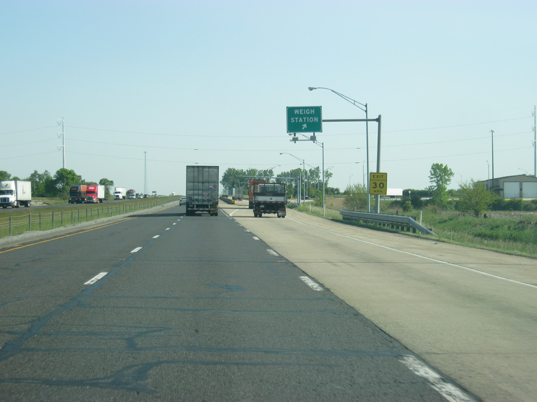
| A weigh station serves southbound trucks in the space about a mile to the north of Exit 140 along Interstate 65. 05/14/12 |
|
| The southbound weigh station was open at this time while the northbound weigh station at roughly the same location has been abandoned. 05/14/12 |
|
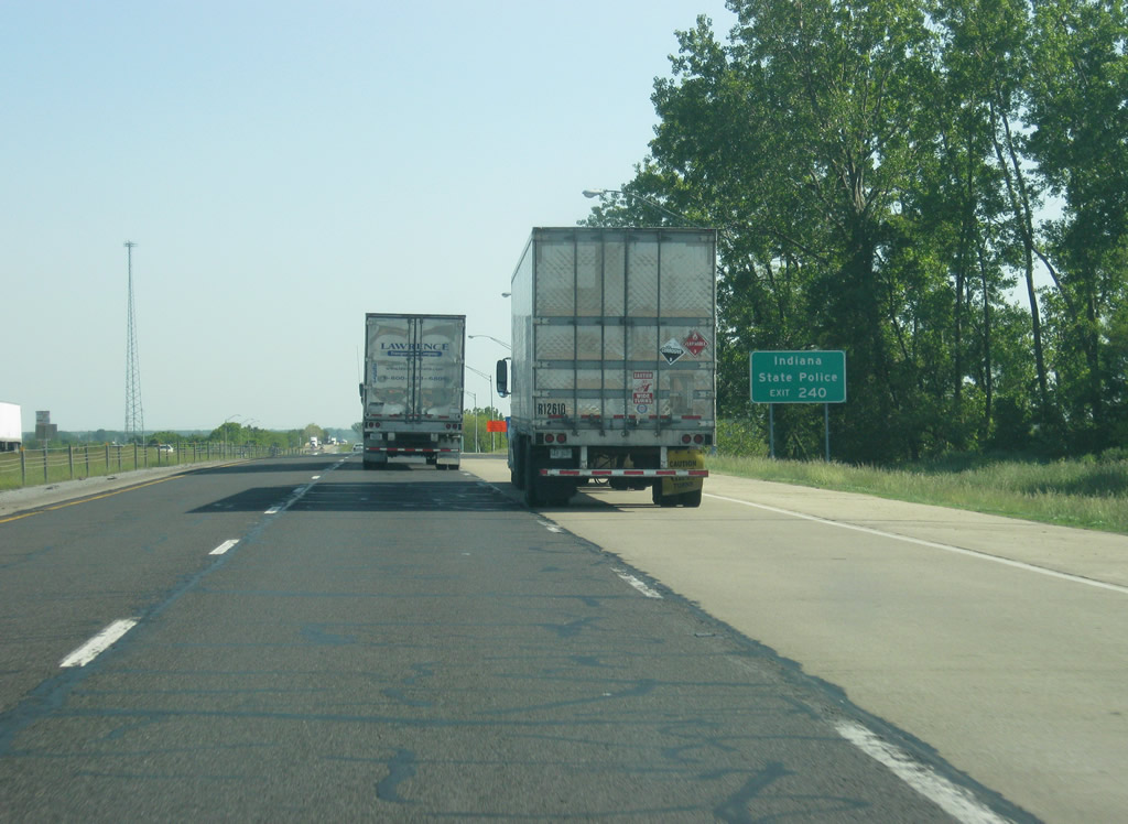
| The Indiana State Police post serving the Northwest Indiana region is located along SR 2 off of Exit 140 from Interstate 65. 05/14/12 |
|
| Taking the Exit 240 off-ramp to SR 2 from Interstate 65 south, motorists see an assortment of traveler services nearby. Due to the added traffic, SR 2 in the vicinity of Exit 140 will be widened to four lanes with added turn lanes at nearby Colorado Street and the ramps for Interstate 65. In addition, the ramps themselves will be widened to handle the additional traffic. This project will be finished in the summer of 2013.2 05/14/12 |
|
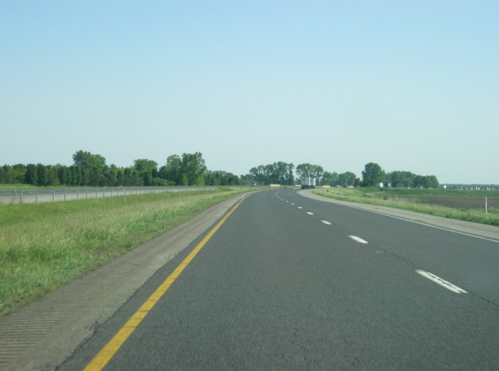
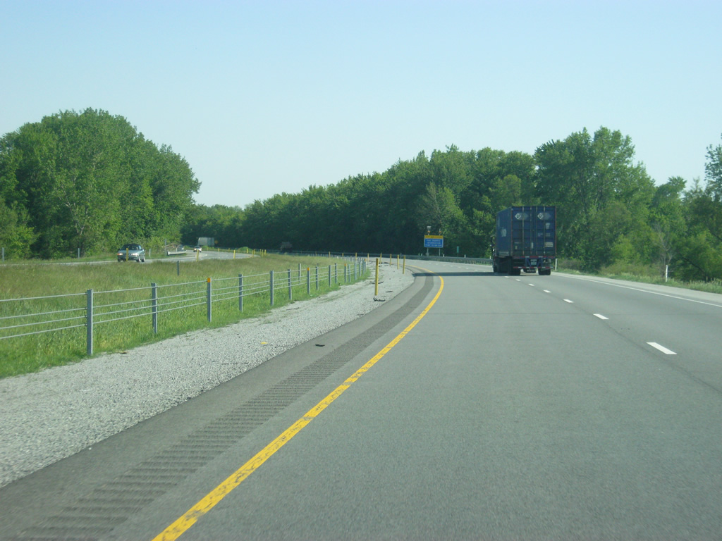
| Beyond Exit 140, Interstate 65 turns toward the southeast as the highway crosses the far southern tier of Lake County. Slowly since the Merrillville area, Interstate 65 has been descending from the top of the Valparaiso Moraine, a hilly section of Lake County which forms the ancient lakeshore for Lake Michigan. In the far southern sections of Lake County, Interstate 65 crosses into the Kankakee Outwash Plain, which forms along the Kankakee River in a section that used to contain some of the largest freshwater marshes in the state prior to its draining. Today, it forms some of the best farmland in the state. 05/14/12 |
|
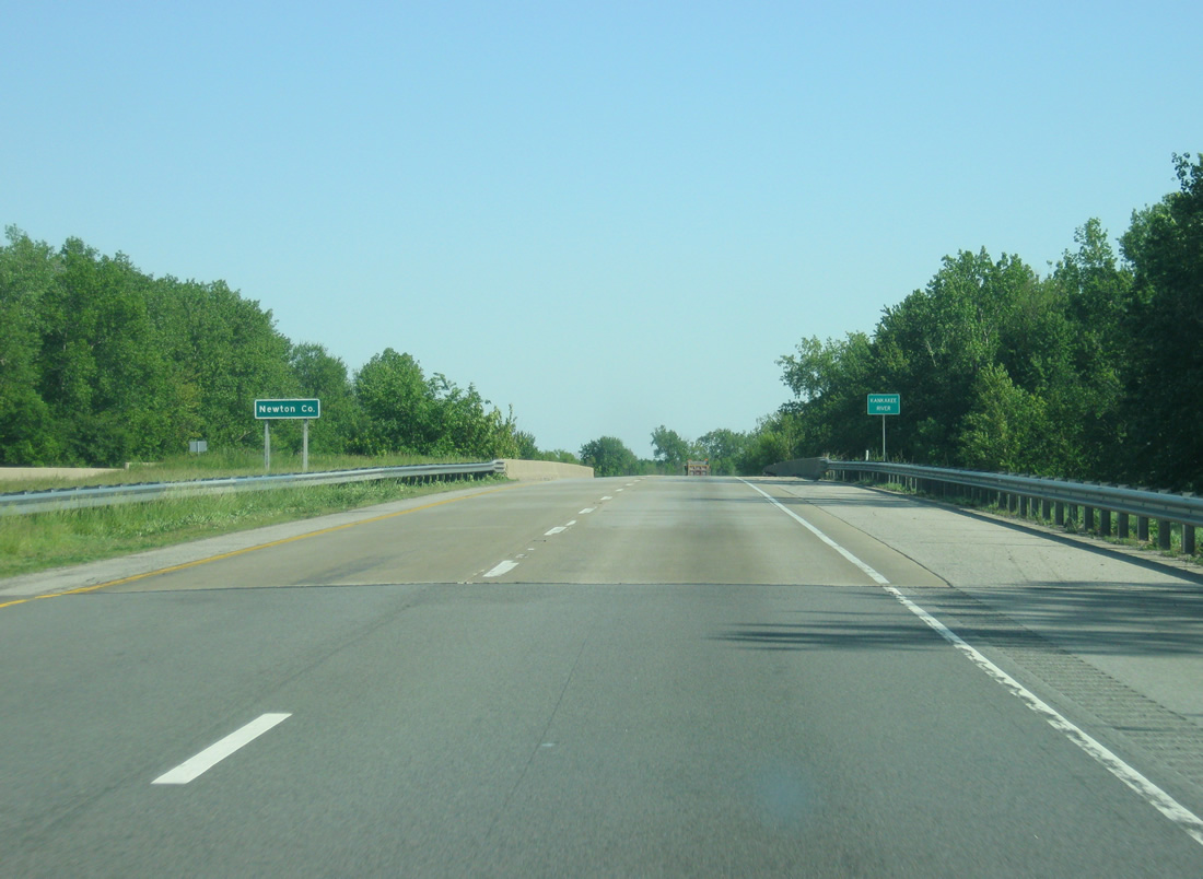
| The channelized Kankakee River separates Lake and Newton Counties at Interstate 65 southbound. This stretch of road was completed in 1966. 05/14/12 |
Page Updated 10-26-2020.

 South
South