|
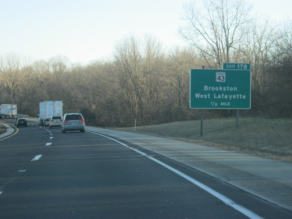
| After entering Tippecanoe County, SR 43 crosses paths with Interstate 65 at Battle Ground via a parclo interchange (Exit 178). Another two-segment route, SR 43 travels from West Lafayette to Reynolds to the north and Cincinnati and Whitehall to the south. 12/29/11 |
|
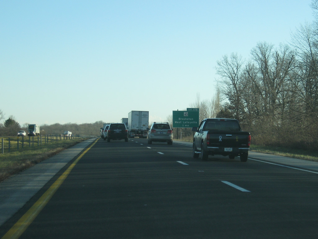
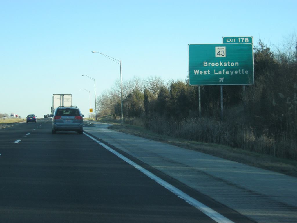
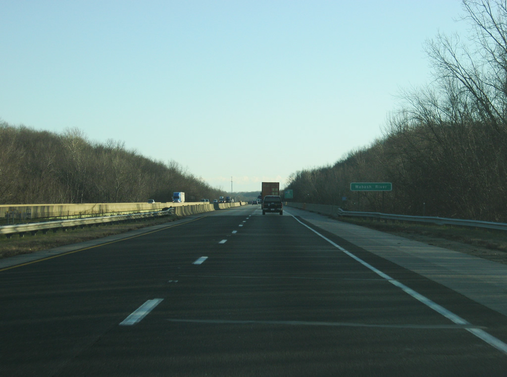
| One half mile south of Exit 178 for SR 43 on I-65. The state road joins Battle Ground and Interstate 65 with Brookston (SR 18) in adjacent White County. SR 43 north also serves interests to Lakes Shafer and Freeman of the Tippecanoe River via connections with U.S. 421 at Reynolds. 12/29/11 |
|
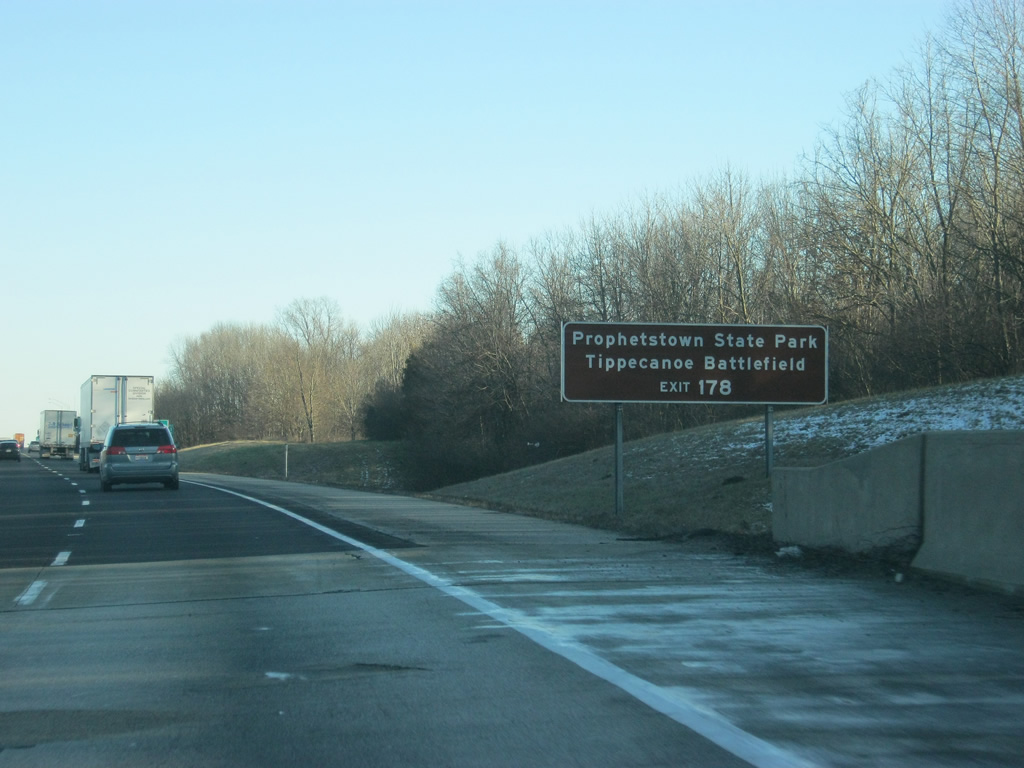
| Both the Prophetstown State Park and Tippecanoe Battlefield are accessed via SR 43 and SR 225 near the town of Battle Ground. 12/29/11 |
|
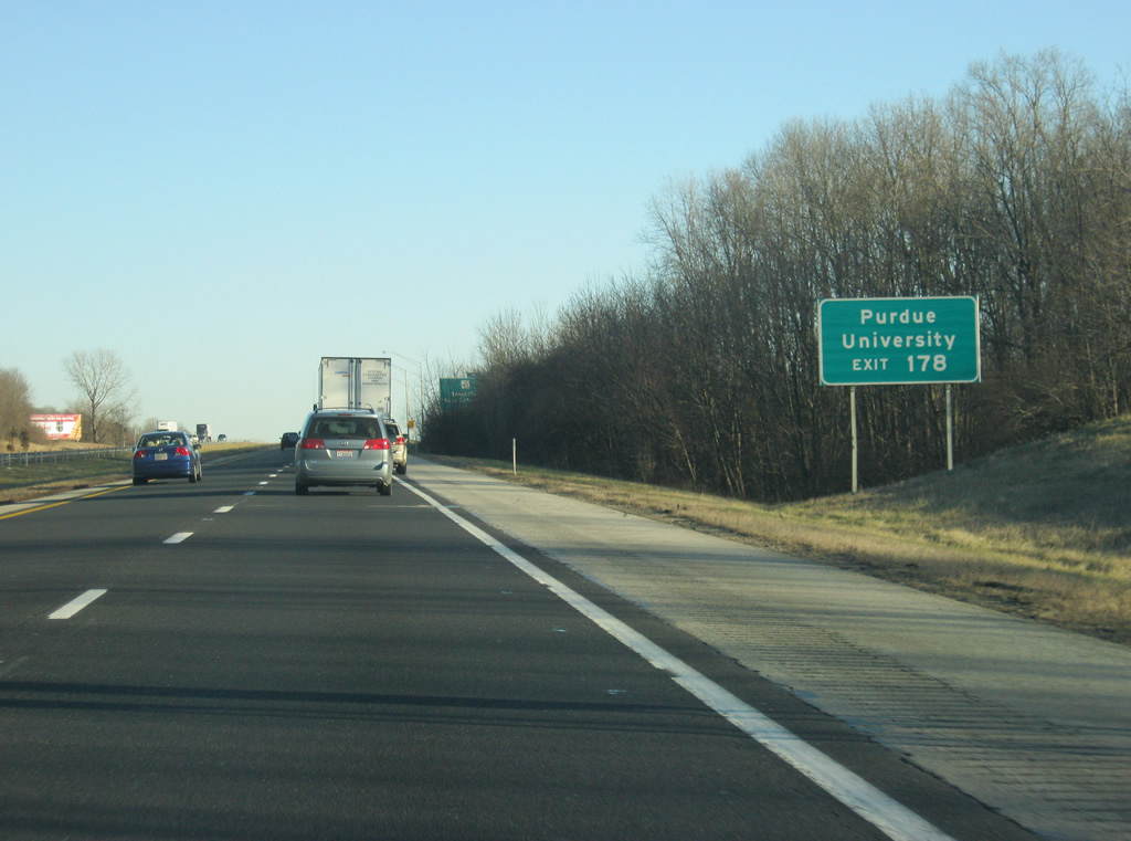
| SR 43 provides the most direct access to Purdue University in West Lafayette from Interstate 65 southbound. 12/29/11 |
|
| Exit 178 departs Interstate 65 south for SR 43 south into the city of West Lafayette and the larger city of Lafayette, across the Wabash River. 12/29/11 |
|
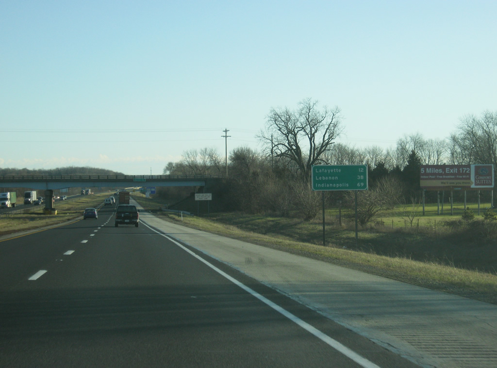
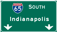
| South of Exit 178, Lafayette is 12 miles away. Lebanon is 38 miles further south with Indianapolis at 69 miles. 12/29/11 |
|
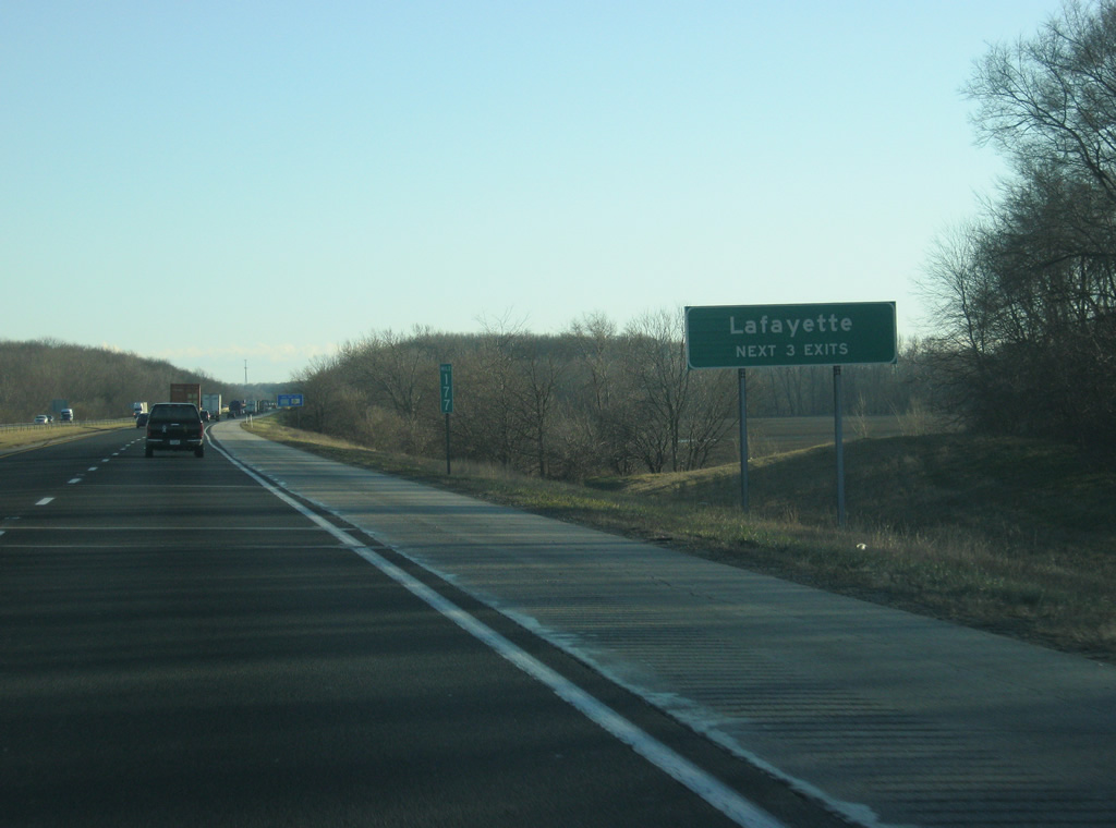
| The next three exits along Interstate 65 serve the Tippecanoe County seat of Lafayette. Lafayette is the largest community along Interstate 65 between Northwest Indiana and Indianapolis. 12/29/11 |
|
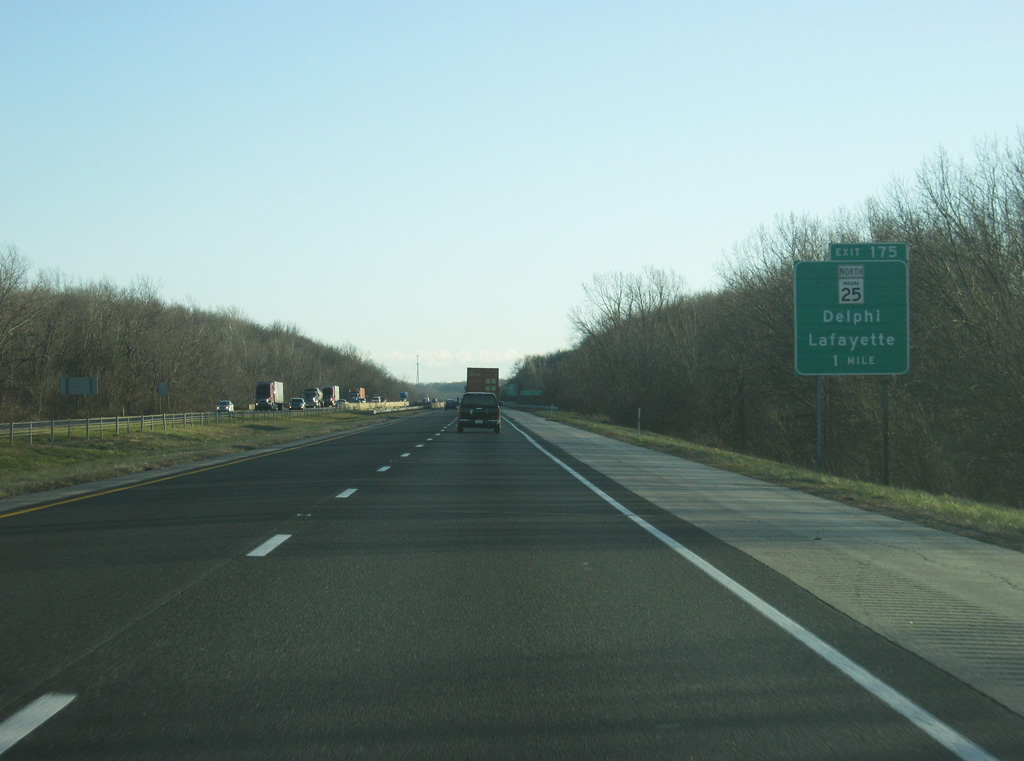
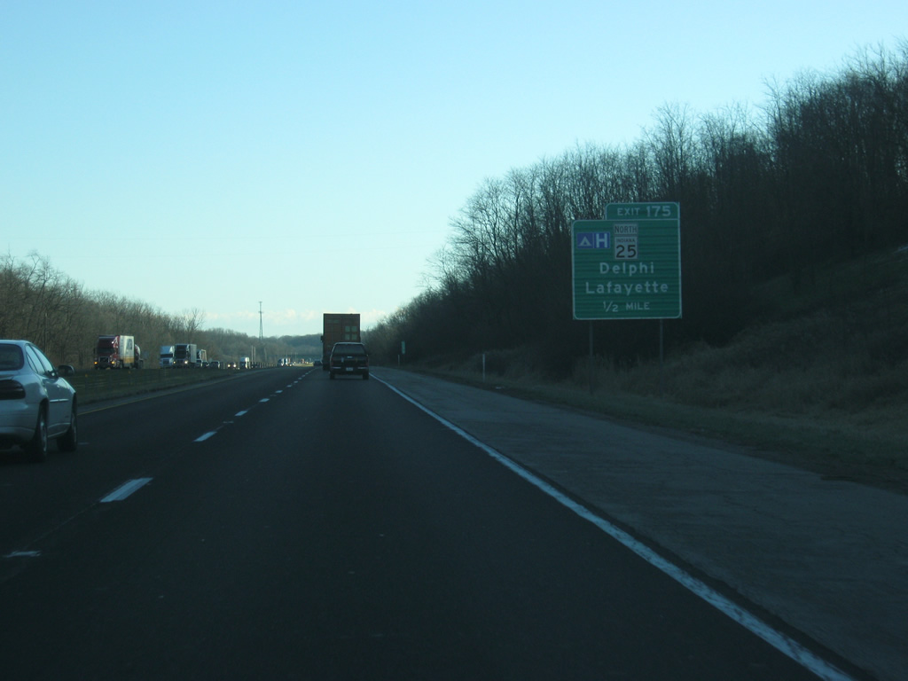
| Approaching the bridge over the Wabash River, Interstate 65 is one mile north of the Exit 175 diamond interchange with SR 25 north and Schuyler Avenue (former SR 25) south. INDOT is currently upgrading SR 25 from Lafayette to Logansport as part of the Hoosier Heartland Industrial Corridor. 12/29/11 |
|
| Less than a mile from Exit 175, Interstate 65 crosses the Wabash River. 12/29/11 |
|
| SR 25 travels 32 miles northeast from Lafayette to Logansport parallel to a Norfolk Southern Railroad line. The state road bypasses, or will bypass as part of the expressway upgrade project, several towns along the way including Americus, Delphi, Rockfield, Burrows, and Clymers. Photos and additional information of the SR 25 project can be found on the AARoads Forum. 12/29/11 |
|
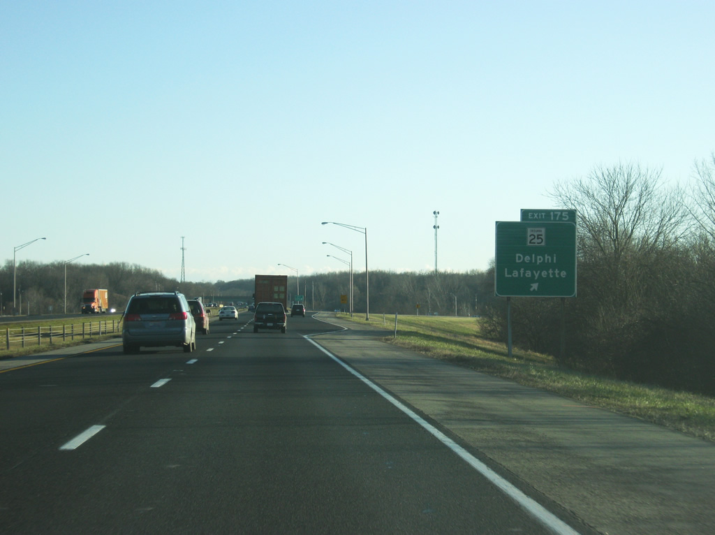
| SR 25 joins Interstate 65 south at Exit 175. SR 25 continues north from Logansport to Rochester and a northern terminus at Warsaw. Schuyler Avenue (former SR 25 south) serves the industrial north side of Lafayette from Wildcat Creek to U.S. 52 (Sagamore Parkway). SR 25 used to run through Lafayette on a shared alignment with U.S. 52 (Sagamore Parkway) between Schuyler Avenue and Teal Road. The state road now follows Interstate 65 southeast to Exit 168 before following SR 38 northwest to U.S. 52 (Sagamore Parkway). 12/29/11 |
|
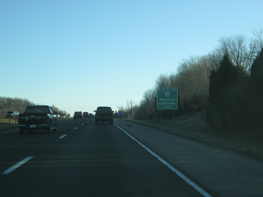
| South of Exit 175, SR 26 is two miles away, with Lebanon at 35 miles. Indianapolis is 62 miles to the south. 12/29/11 |
|
| SR 26 represents another cross-state route between the Illinois and Ohio State lines. The highway enters Indiana as Illinois 9 near Ambia and exits the state as SR 119 near Bellefontaine for a distance of 150.1 miles. 12/29/11 |
|
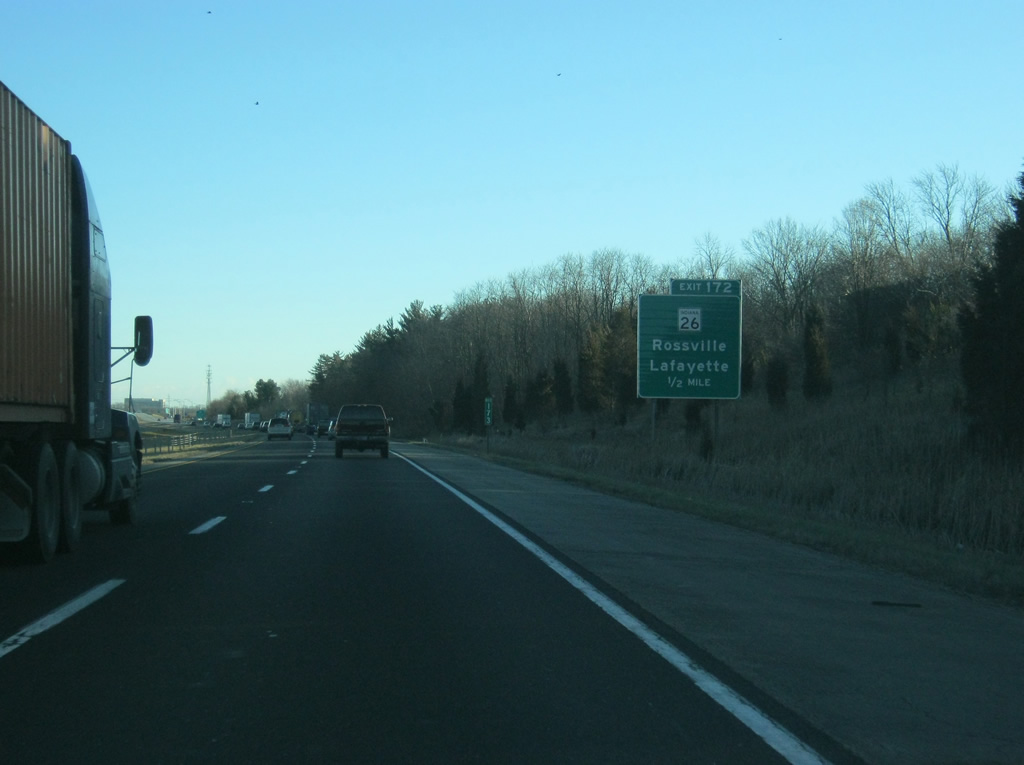
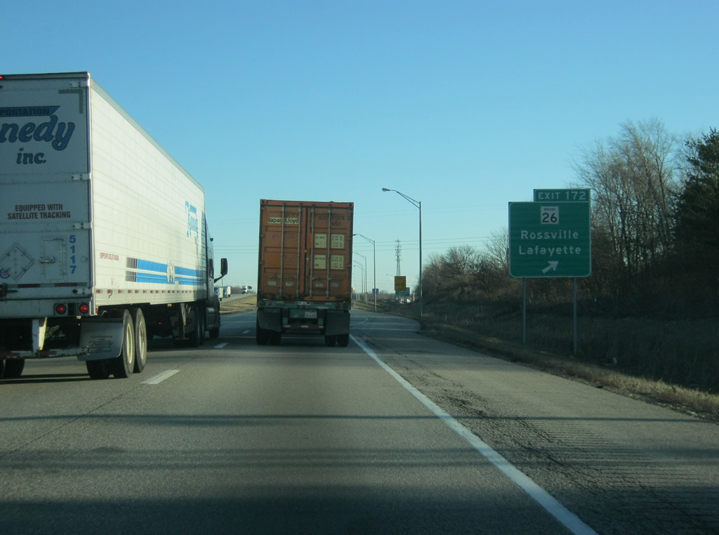
| One half mile south of Exit 172 with SR 26. SR 26 joins Lafayette with suburbs to Monitor beside I-65 en route to Rossville and Kokomo to the east. Following completion of the U.S. 231 bypass around West Lafayette in 2013, SR 26 was rerouted along U.S. 231 to SR 25 (Teal Road), following SR 25 east to Interstate 65 at Exit 168 before returning north to Exit 172.1 12/29/11 |
|
| SR 26 constitutes a commercialized arterial leading west from Exit 172 off Interstate 65 to U.S. 52 (Sagamore Parkway) in Lafayette. The road was rebuilt from Interstate 65 west to U.S. 52 (Sagamore Parkway) in 2010. 12/29/11 |
|
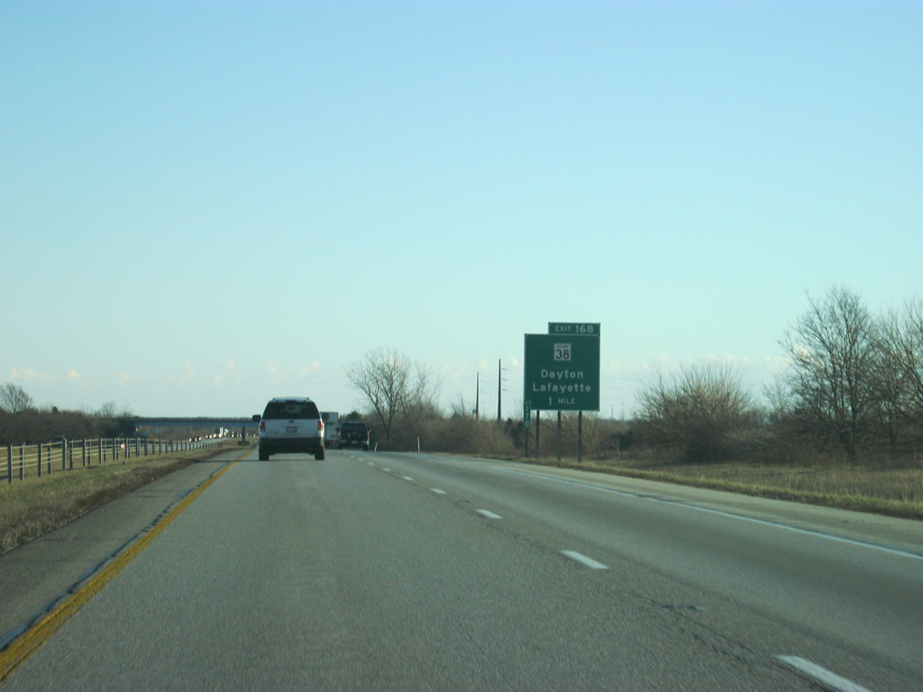
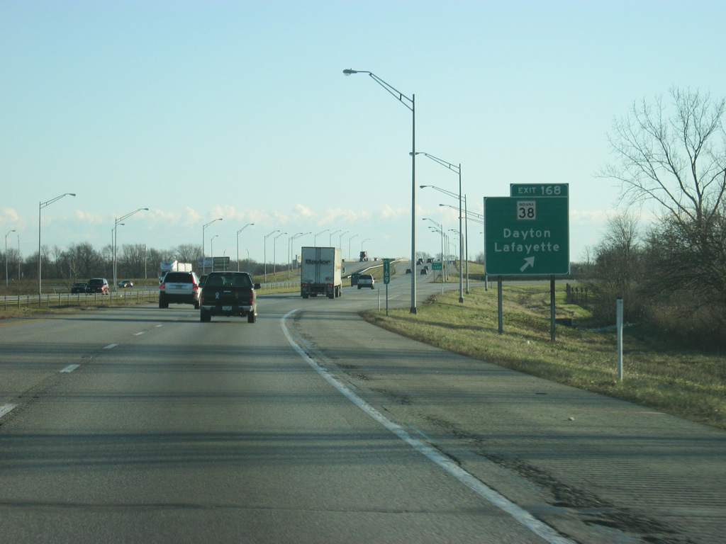
| Three miles south of Exit 172, Interstate 65 next approaches a folded diamond interchange (Exit 168) with SR 25 south and SR 38 by the town of Dayton. SR 38 begins in Lafayette, from U.S. 52 and SR 25 near Tippecanoe Mall, and leads east to Dayton, Mulberry and U.S. 421 south to Frankfort. Overall the state road stretches 116.4 miles to Noblesville, Pendleton, New Castle and Richmond. 12/29/11 |
|
| SR 25 west from U.S. 52 joins Lafayette with Ivy Tech Community College of Indiana and Shadeland ahead of a southerly turn to Wingate, Waynetown and SR 32 west of Crawfordsville. The highway serves the Subaru Plant that is at the northwest side of the interchange. 12/29/11 |
|
| South of Exit 168, Interstate 65 gains traffic as it connects the Lafayette area with Indianapolis. There are no more exits in Tippecanoe County after Exit 168. 12/29/11 |
|
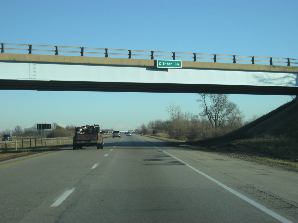
| Interstate 65 enters the southwest corner of Clinton County. 12/29/11 |
|
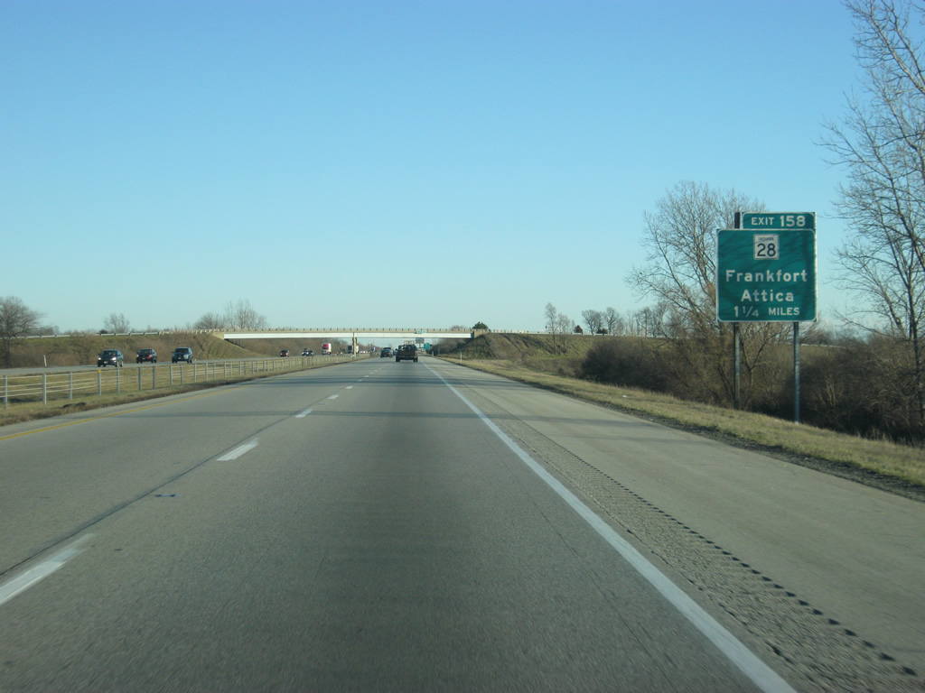
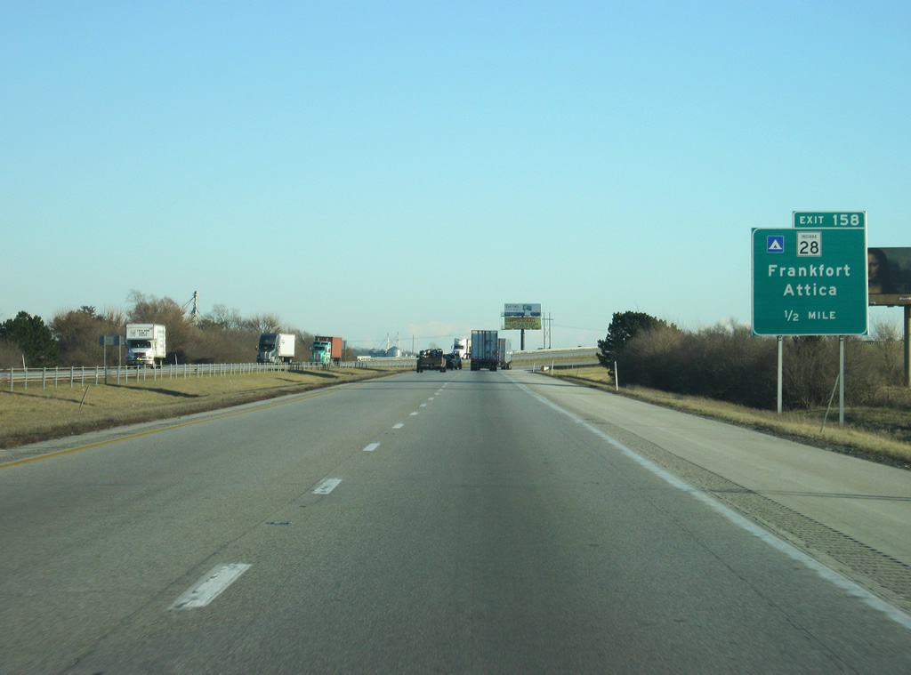
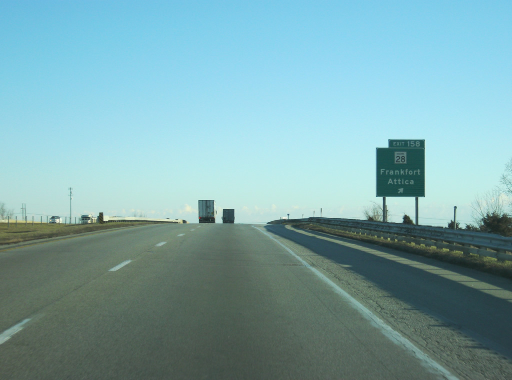
| 1.25 miles north of the Exit 158 ramp departure to SR 28 along Interstate 65 south. A 152.8 mile route, SR 28 travels across Indiana from the Illinois state line to Williamsport, Attica, Frankfort, Tipton, Elwood, Albany, Ridgeville and Union City. 12/29/11 |
|
| SR 28 heads west from U.S. 52 toward the Fountain County town of Attica, 32 miles to the west. 12/29/11 |
|
| SR 28 comprises a four lane divided highway leading east from Exit 158 nine miles to the Clinton County seat of Frankfort. Westward the state road travels 1.3 miles to Fickle and U.S. 52 near Clarks Hill. 12/29/11 |
|
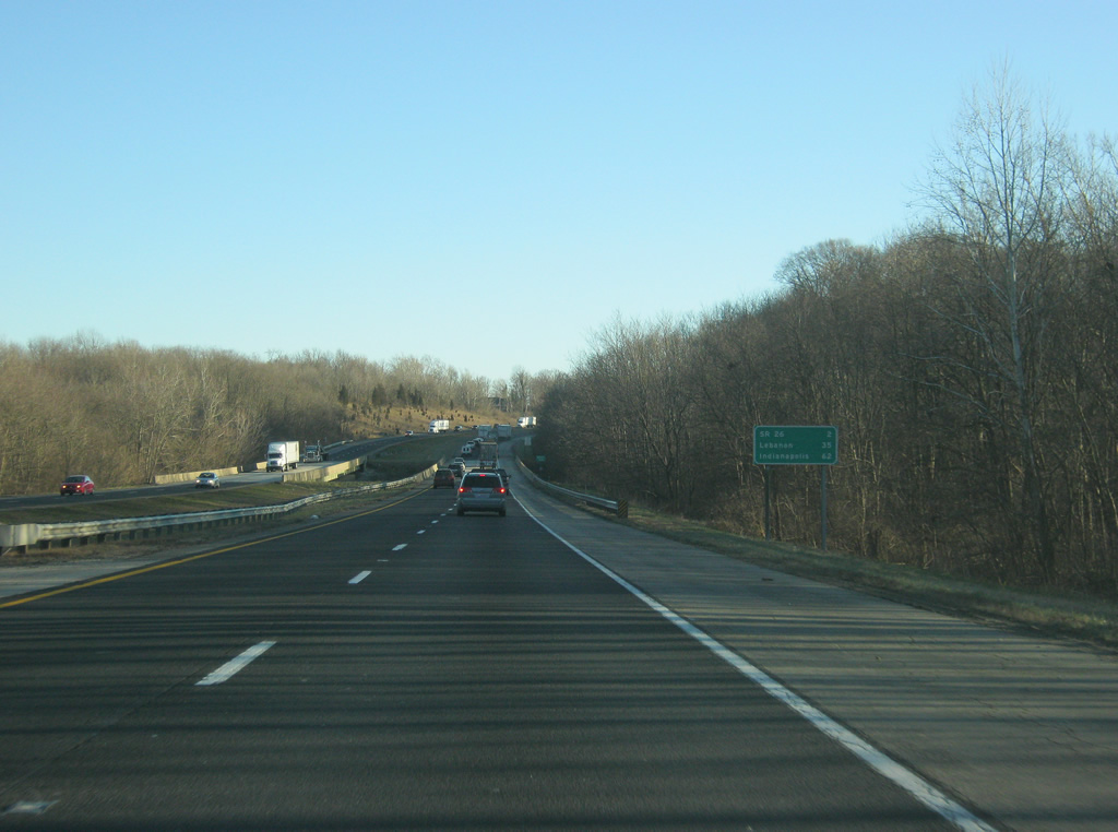
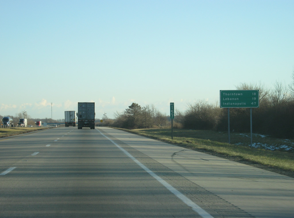
| South of Exit 158, the next town is Thorntown at 18 miles away. Lebanon is 19 miles down Interstate 65 while Indianapolis is now 47 miles away. 12/29/11 |
|
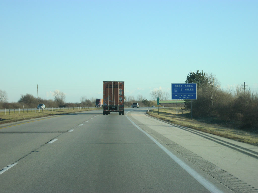
| Nearing the Boone County line, the third set of rest areas on Interstate 65 southbound is two miles away. 12/29/11 |
|
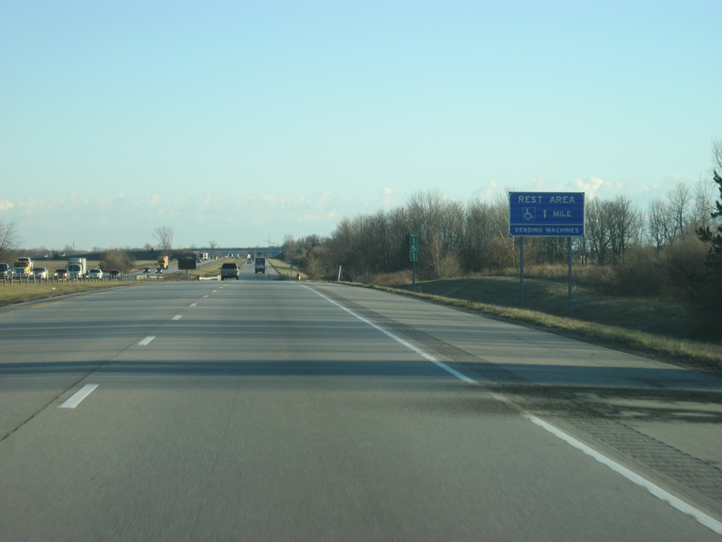
| The rest area is now a mile away; it is the last facility until the Indianapolis area with the next one appearing 73 miles down the road near Taylorsville. 12/29/11 |
|
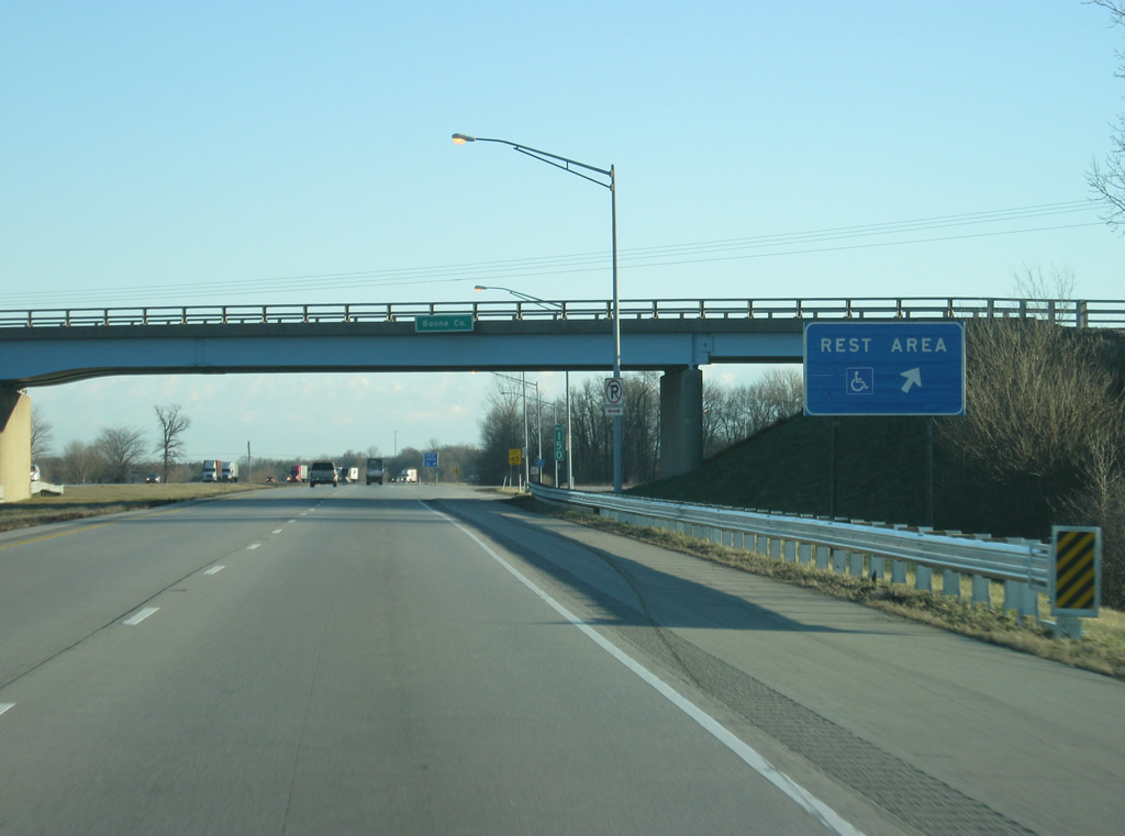
| Interstate 65 crosses into Boone County at the exit ramp to the rest area. 12/29/11 |
Page Updated 02-29-2012.

 South
South