|
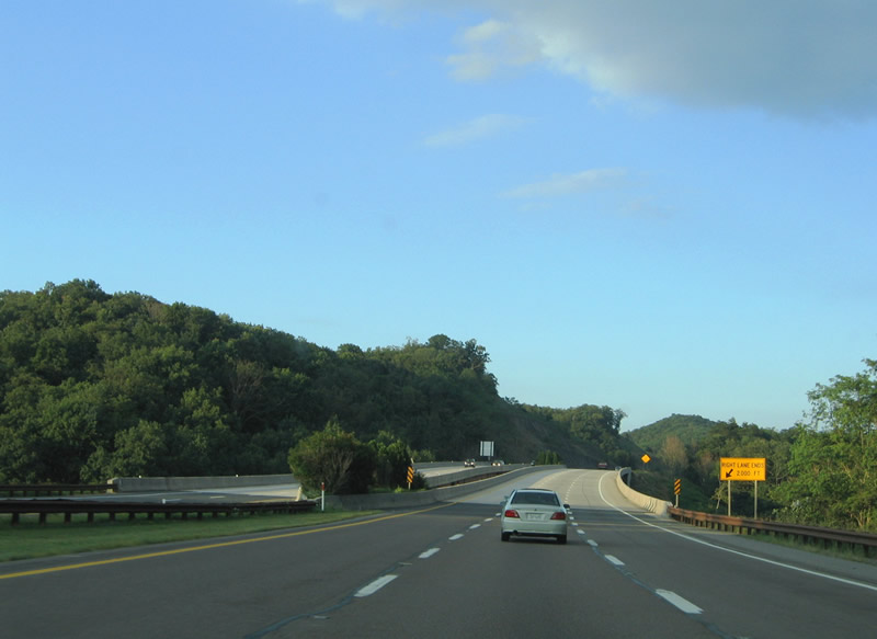
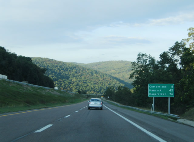
| I-68/U.S. 40 descend at a 6% grade from Frostburg east to LaVale. The city of Cumberland lies eight miles ahead at the merge with U.S. 220. 08/07/04 |
|
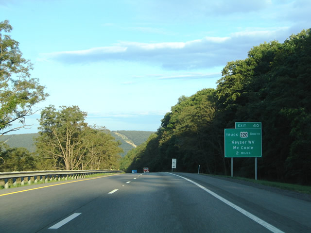
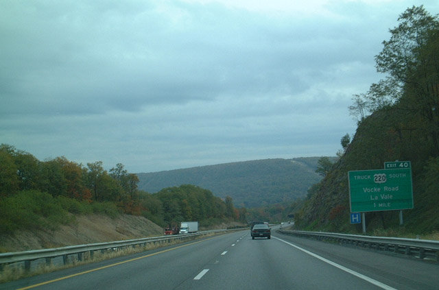
| I-68/U.S. 40 reaches the community of LaVale at the Exit 40 interchange with Braddock Road (MD 49). All truck traffic destined for McCoole, Keyser, West Virginia, and points south should use Vocke Road south from Exit 40 to MD 53 (Winchester Road) at Winchester. 08/07/04 |
|
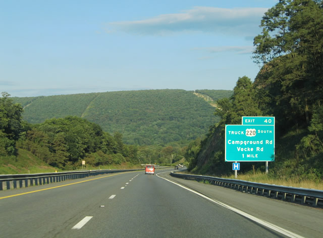
| A parclo interchange joins I-68/U.S. 40 with Braddock, Campground, and Vocke Roads at Lavale. Campground Road stems south from U.S. 40 Alternate (National Highway) to Braddock Road and Exit 40. Vocke Road links Braddock Road with MD 53 (Winchester Road) to the southwest. 08/07/04 |
|
| A look at the replaced one mile button copy guide sign for U.S. 220 Truck (Vocke Road) on I-68/U.S. 40 east. U.S. 220 Truck follows MD 53 (Winchester Road) three miles south from Exit 40 to U.S. 220 (McMullen Highway) at Cresaptown. 10/12/01 |
|
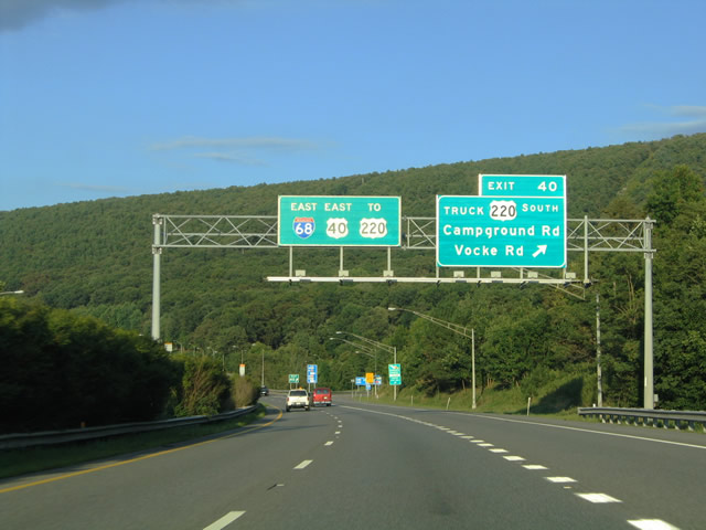
| An on-ramp brings traffic onto I-68/U.S. 40 east from MD 53 (Winchester Road) ahead of the Exit 40 off-ramp to Braddock and Vocke Roads. Braddock Road carries MD 49 east from Campground Road to the city of Cumberland. 08/07/04 |
|
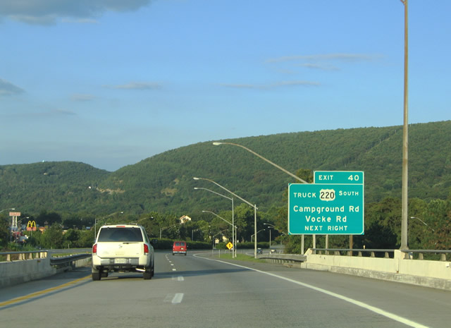
| Eastbound I-68/U.S. 40 at Exit 40 for U.S. 220 Truck (Vocke Road). Campground Road carries drivers north to U.S. 40 Alternate (National Highway) into LaVale. U.S. 40 Alternate parallels the National Freeway closely between MD 53 and Campground Road. 08/07/04 |
|
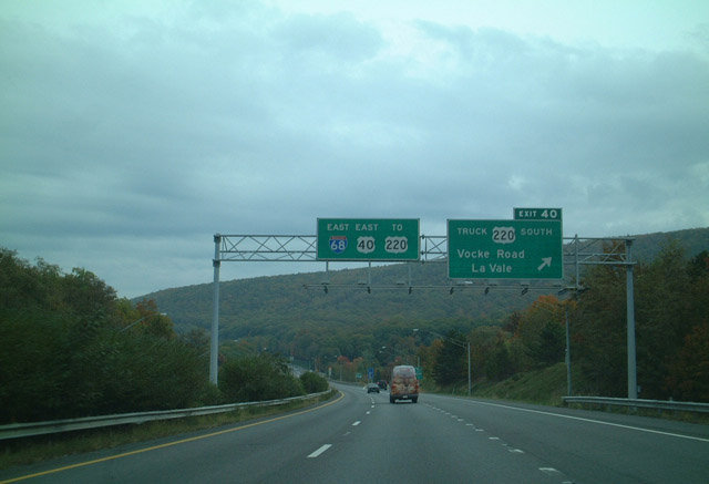
| A look at the previous set of overheads posted at Exit 40 on I-68/U.S. 40 east. U.S. 220 Truck (Vocke & Winchester Roads) south to U.S. 220 (McMullen Highway) serves the southwest Allegany communities of Pinto, Rawling, Dawson, and McCoole on the 17 mile drive to Keyser, West Virginia. 10/12/01 |
|
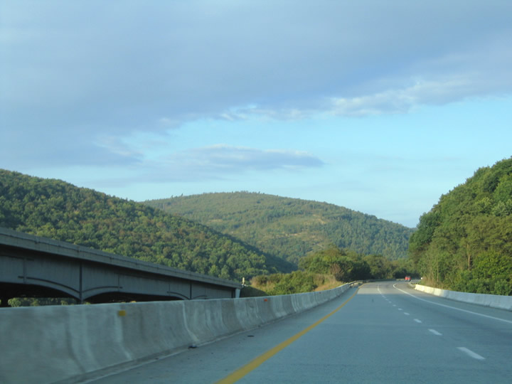
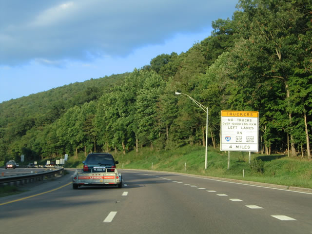
| Interstate 68 and U.S. 40 enters the city of Cumberland along a winding stretch. A truck restriction is placed on the left-lane of the National Freeway four miles ahead. 08/07/04 |
|
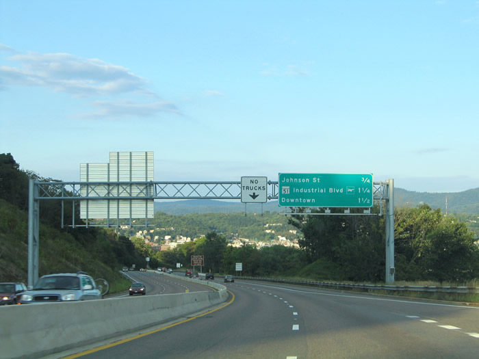
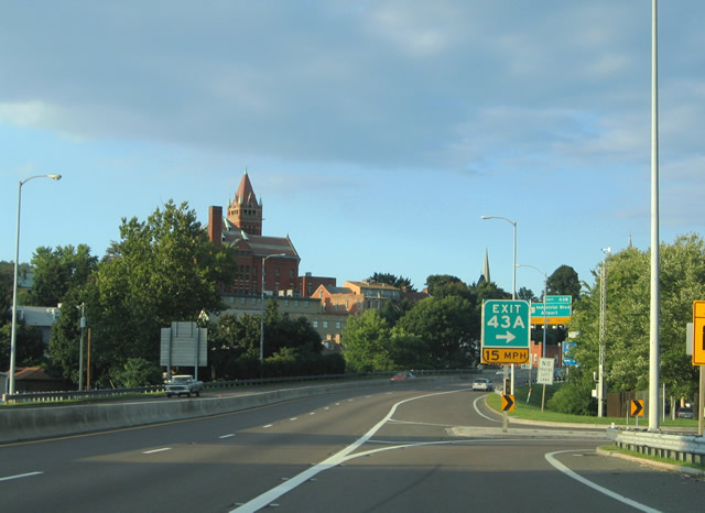
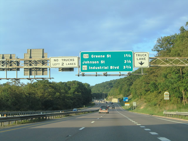
| This distance sign along eastbound Interstate 68 and U.S. 40 provides the distance to the next three exits: Exit 42, U.S. 220; Exit 43A, Johnson Street; and Exit 43B, MD 51. These overhead distance signs are common in the vicinity of Cumberland. 08/07/04 |
|
| One mile ahead of Exit 62 with U.S. 220 south on I-68 eastbound. U.S. 220 is a major Appalachian route, extending south from Cumberland into West Virginia and Virginia in the shadow of the mountains. 10/12/01 |
|
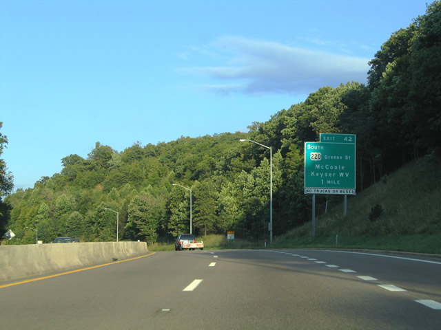
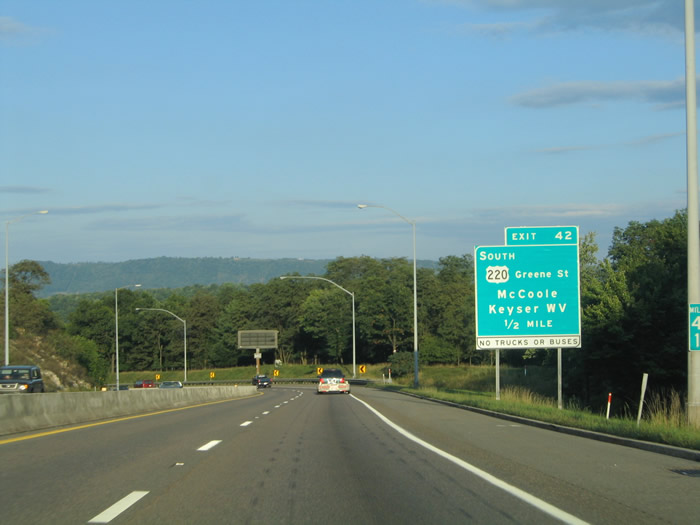
| The replacement one mile guide sign of Exit 42 situated along I-68/U.S. 40 east and U.S. 220 Truck north. Keyser, West Virginia and McCoole were added to U.S. 220 and Greene Street on the reflectorized guide sign. 08/07/04 |
|
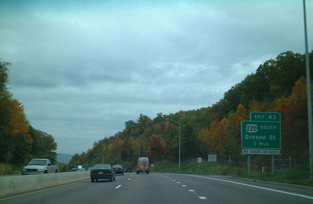
| One half mile ahead of the diamond interchange (Exit 42) with U.S. 220 (McMullen Highway) & Greene Street. U.S. 220 northbound merges onto the National Freeway between Exits 42 and 46. Greene Street continues into Cumberland to Baltimore Street along the original U.S. 220 alignment. 08/07/04 |
|
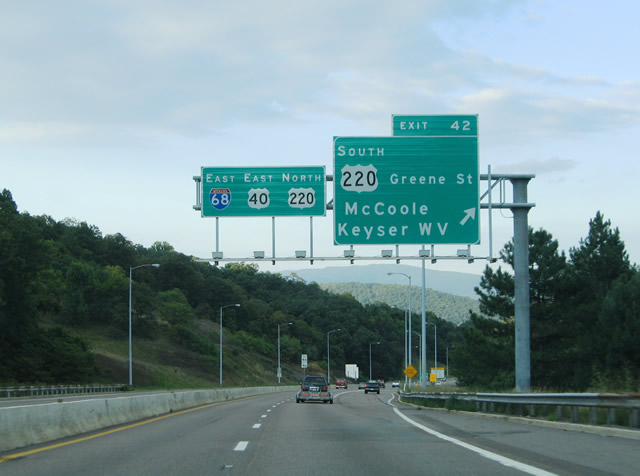
| The merge of U.S. 220 north onto I-68/U.S. 40 east at Exit 42. A truck and bus ban is in effect for U.S. 220 (McMullen Highway) on the four mile drive between west Cumberland and Cresaptown. 08/07/04 |
|
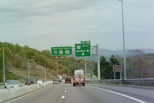
| The previous set of overheads used at the Exit 42 ramp departure to U.S. 220 south and Greene Street east. U.S. 220 ventures two miles southwest from I-68/U.S. 40 to Potomac Park. A small welcome sign marks the Cumberland city line to the right. 10/12/01 |
|
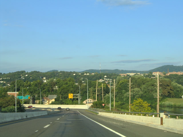
| U.S. 220 northbound drivers merge onto the freeway ahead of downtown Cumberland. An interchange sequence sign indicates the upcoming Cumberland exits. 08/07/04 |
|
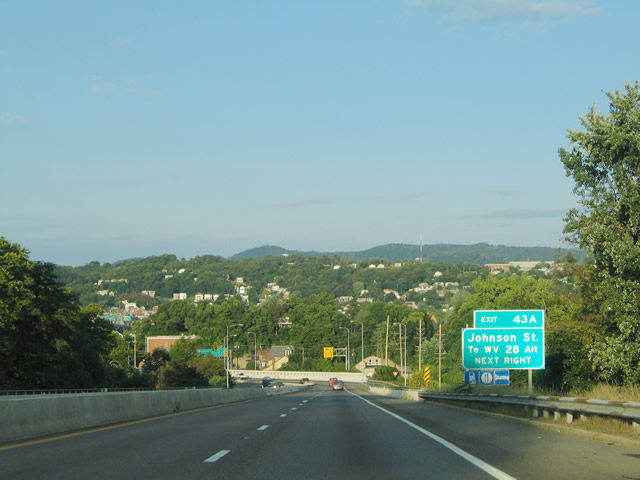
| The ensuing off-ramp along eastbound Interstate 68 leads to Johnson Street (Exit 43A) for Johnson Street. Johnson Street travels north to Greene Street and serves as a connection to WV 28 Alternate and Ridgeley. 08/07/04 |
|
| The next exit along eastbound Interstate 68 is Exit 43A, Johnson Street. Johnson Street leads north to Greene Street one block west of Water Street. The interchange serves WV 28 Alternate at Ridgeley, West Virginia via Water Street south across the Potomac River. The Potomac River serves as the southern boundary of the state of Maryland for its entire length (except on the Delmarva Peninsula). 08/07/04 |
|
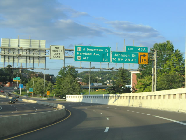
| Exit 43A leaves I-68/U.S. 40 east for Johnson Street and WV 28 Alternate (Bridge Street). WV 28 Alternate travels south along the Potomac River to WV 28 at Wiley Ford. 08/07/04 |
|
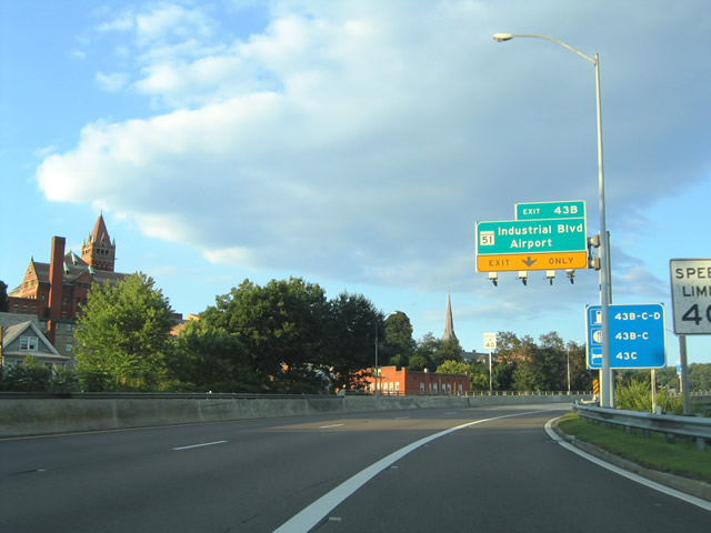
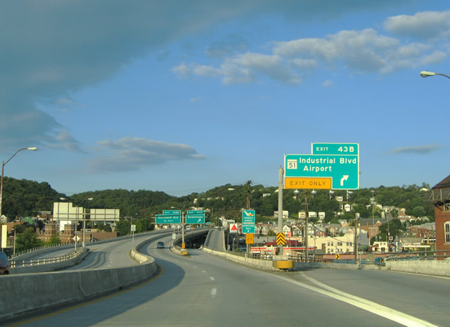
| The Johnson Street on-ramp forms an auxiliary lane to Exit 43B for MD 51 (Industrial Boulevard) south and Mechanic Street north. Industrial Boulevard comprises a four lane divided highway from I-68/U.S. 40-220 southeast to Evitts Creek. Connections with Canal Parkway and WV 28 serve Greater Cumberland Regional Airport (CBE). 08/07/04 |
|
| Interstate 68 elevates onto a four lane viaduct over Johnson Street, Wills Creek, and the CSX Railroad, ahead of the Exit 43B off-ramp to MD 51 (Industrial Boulevard) south and Mechanic Street north. MD 51 overall travels 26 miles between Cumberland and the Potomac River at Paw Paw, West Virginia. 08/07/04 |
|
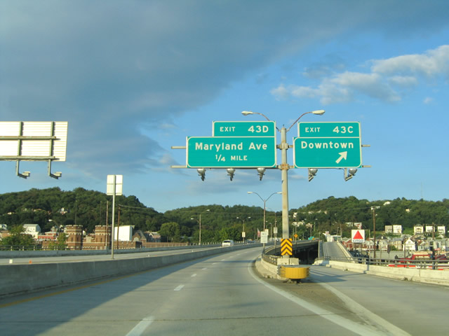
| After Exit 43B (MD 51), eastbound Interstate 68/U.S. 40 reaches Exit 43C, downtown Cumberland (Queen City Drive). The exits are fast and furious on this stretch of 40-mph freeway. The left lanes are best for through traffic due to the merging and limited sight distance here. This is not an Interstate-standard freeway. 08/07/04 |
|
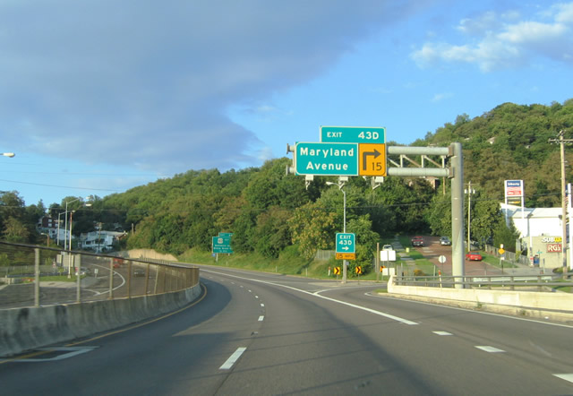
| Eastbound Interstate 68/U.S. 40 approaching Exit 43D, Maryland Avenue. Exit 43D loops onto adjacent Emily Street ahead of its intersection with Maryland Avenue. Maryland Avenue flows north from MD 51 at Virginia Street to the National Freeway and Harrison Street. Again, note the narrow right of way for the freeway through downtown. 08/07/04 |
|
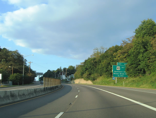
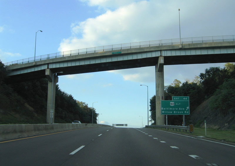
| Next, eastbound Interstate 68/U.S. 40 approaches Exit 44, U.S. 40 Alternate (Baltimore Avenue) and Willow Brook Road (MD 639). U.S. 40 Alternate ends at I-68/U.S. 40-220 at the Exit 44 diamond interchange. 08/07/04 |
|
| Monroe Street travels high above the National Freeway ahead of the ramp departure (Exit 44) for U.S. 40 Alternate (Baltimore Avenue) west and MD 639 (Willow Brook Road) east. The interchange represents the original eastern terminus of U.S. 48, where original U.S. 40 took over from Baltimore Avenue. MD 639 stems east from here to Allegany College and Williams Road. 08/07/04 |
|
| I-68/U.S. 40 east and U.S. 220 north within the Exit 45 interchange with U.S. 40 Alternate & MD 639. For some reason a U.S. 220 northbound trailblazer resides near the Baltimore Avenue under crossing. U.S. 220 leaves the freeway two miles ahead. 08/07/04 |
|
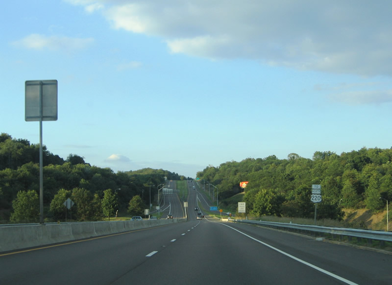
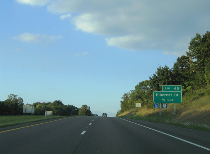
| The National Freeway leaves the city of Cumberland just ahead of the Exit 45 interchange with Hillcrest Drive. Hillcrest Drive snakes northwest from Country Club Drive to Old U.S. 40 and Blake Lane just outside the city limits. 08/07/04 |
|
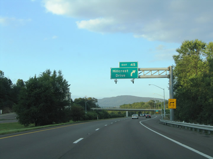
| Exit 45 departs the freeway onto adjacent Old U.S. 40 ahead of its intersection with Hillcrest Drive. Hillcrest Drive cross over I-68/U.S. 40-220 between Old U.S. 40 and Blake Lane. The drive otherwise travels southeast to Country Club Road near Cumberland Country Club. 08/07/04 |
|
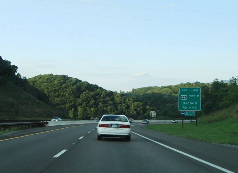
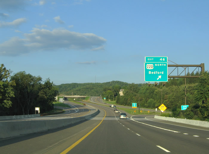
| Eastbound Interstate 68 approaching U.S. 220 North (Exit 46) to Bedford and I-99. 08/07/04 |
|
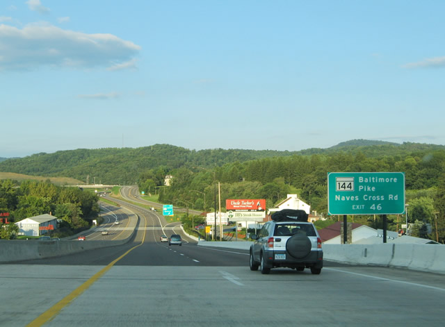
| U.S. 220 (Naves Cross Road) connects I-68 at Exit 46 with MD 144 (Baltimore Pike). MD 144 is the discontinuous route designation for the older sections of U.S. 40 throughout the state. 08/07/04 |
|
| U.S. 220 northbound leaves I-68/U.S. 40 west at Exit 46. The US route follows Baltimore Pike west briefly to Christie Road, and then Naves Cross Road west to Bedford Road north. U.S. 220 heads north to Bedford, Pennsylvania along Appalachian Regional Development Corridor O, then follows Interstate 99 from there to Bald Eagle and State College. 08/07/04 |
|
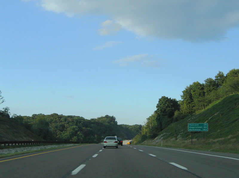
| I-68/U.S. 40 east veer northeast between Wolf Mill (Exit 46) and Rocky Gap State Park. The National Freeway sees a distance sign with the Interstate 70 destinations of Hagerstown and Baltimore ahead of the Elk Lick Run bridges. 08/07/04 |
|
| MD 144 (Baltimore Pike) crosses over I-68/U.S. 40 one mile west of the Pleasant Valley Road diamond interchange (Exit 50). Old Johnson Road intersects the Baltimore Pike to the right as MD 144 turns east to parallel the National Freeway. 08/07/04 |
|
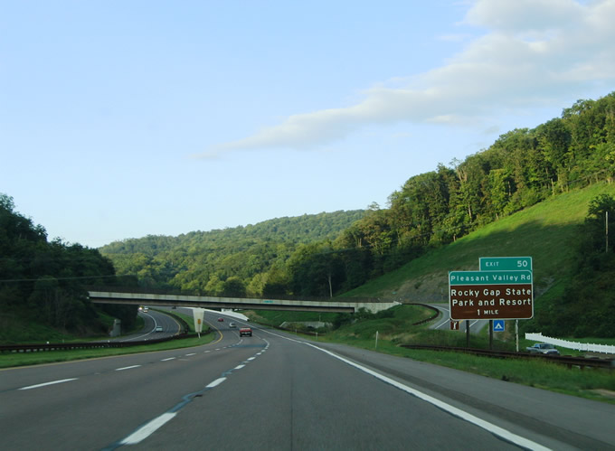
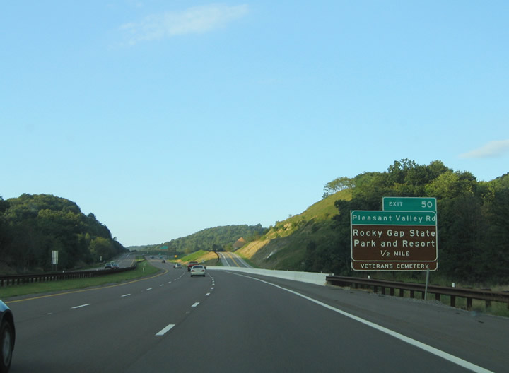
| I-68/U.S. 40 and nearby MD 144 (Baltimore Pike) eastbound one half mile from their respective junctions with Pleasant Valley Road. Pleasant Valley Road ventures north from Baltimore Pike into Rocky Gap State Park. The state park is home to Rocky Gap Veterans Cemetery and Rocky Gap Lake. 08/07/04 |
|
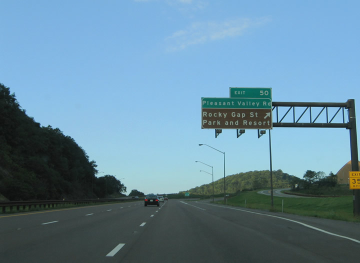
| Exit 50 leaves I-68/U.S. 40 (National Freeway) for Pleasant Valley Road. Pleasant Valley Road intersects Old Hancock Road 0.75 miles north within Rocky Gap State Park. MD 144 continues east two miles to meet the National Freeway at Exit 52. 08/07/04 |
|
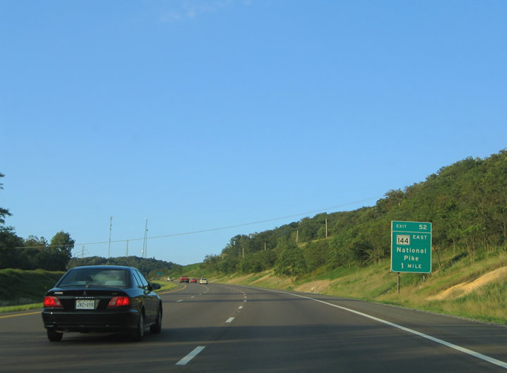
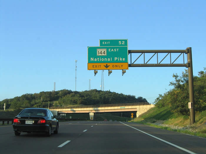
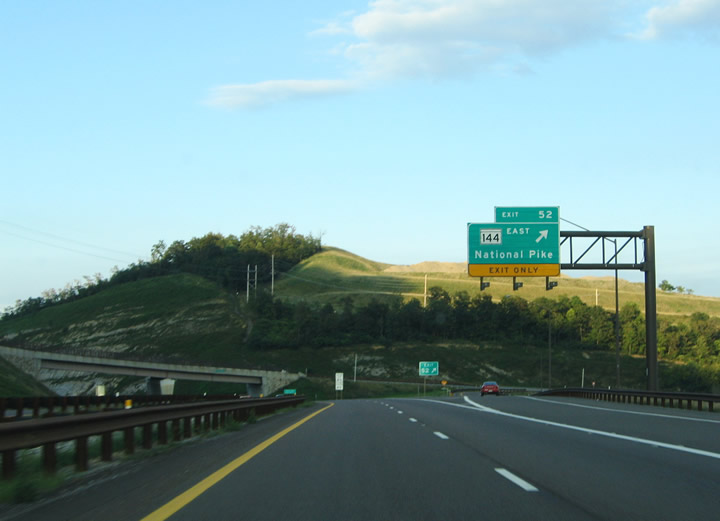
| MD 144 (National Pike) crosses over I-68/U.S. 40 twice ahead of their exchange at Exit 52. 08/07/04 |
|
| MD 144/National Pike follows old U.S. 40. It would almost make more sense to consolidate Alternate U.S. 40, Scenic U.S. 40, and MD 144 back into its original designation (U.S. 40) and remove the duplicate route from the freeway. 08/07/04 |
|
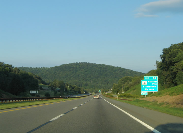
| I-68/U.S. 40 eastbound at the ramp departure onto MD 144 (National Pike) east. The state route passes over the freeway in the distance. MD 144 travels three miles east from here to Flintstone. 08/07/04 |
|
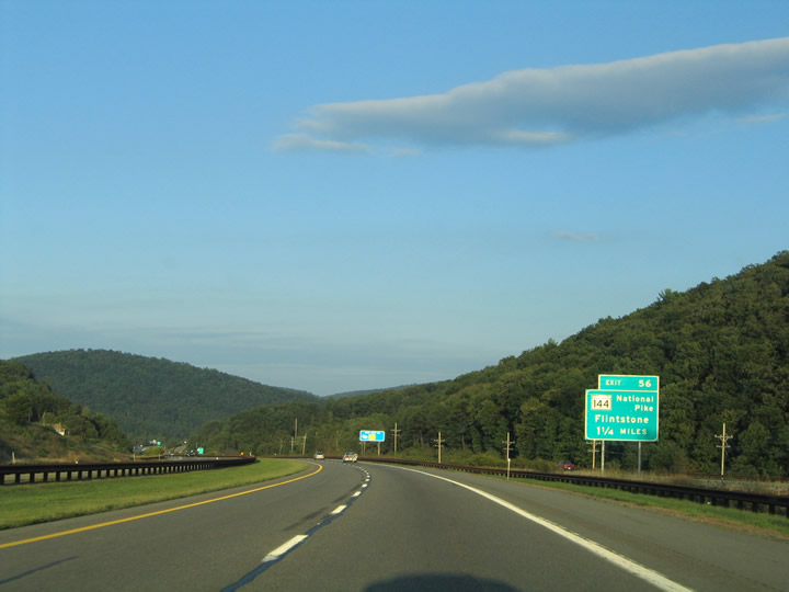
| Eastbound I-68/U.S. 40 approaches MD 144 (National Pike) and Exit 56. MD 144 remains along the former U.S. 40. The National Road was one of the first roads built by the federal government. Construction of this link between the East Coast and the Northwest Territory (now Illinois) began in 1811, and the first section was opened in 1818 between Cumberland, Maryland, and Wheeling, West Virginia. The National Road was later extended to Columbus, Ohio, and ultimately Vandalia, Illinois. Once U.S. 40 was commissioned in 1926, the "National Road" appellation was applied to its entire length from San Francisco eastward. 08/07/04 |
|
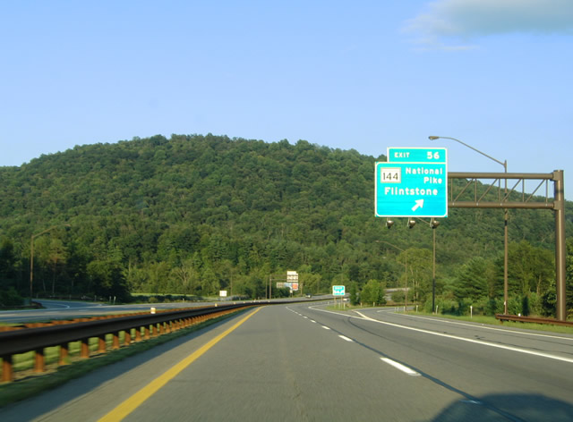
| A folded diamond interchange ties I-68/U.S. 40 with MD 144 (National Pike) to the south and Flintstone Drive to the north. Both roadways intersect Murleys Branch Road to the east. Murleys Branch Road and Black Valley Road continue north from Exit 56 to PA 326 and Hewitt. 08/07/04 |
|
| I-68/U.S. 40 eastbound at the Exit 56 off-ramp onto the adjacent MD 144 (National Pike). Murleys Branch Road ventures 3.7 miles north from Rush to intersect the National Pike at Flintstone. 08/07/04 |
Page Updated 03-14-2005.


 East
East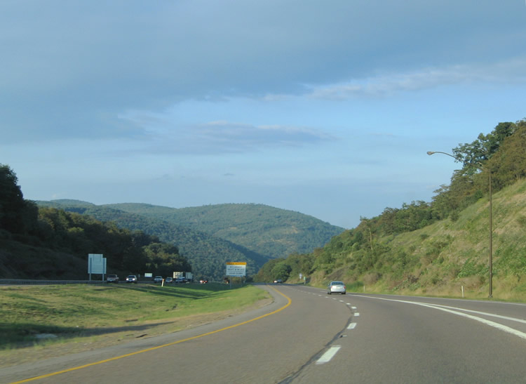
 North
North