|
| Continuing into far southwestern Monroe County, Interstate 69 crosses over Indian Creek for a second time before turning eastward again. 08/28/19 |
|
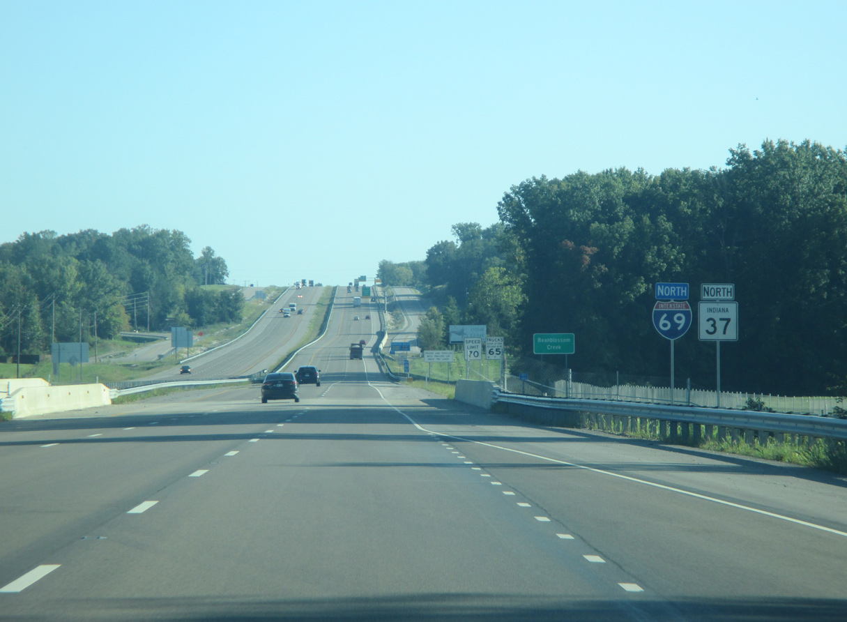
| I-69 spans Indian Creek for a third time ahead of Burch Road. Common along Section 4 of I-69, blue signs reference the requirement for only a minimum amount of salt to be used during the winter months. 08/28/19 |
|
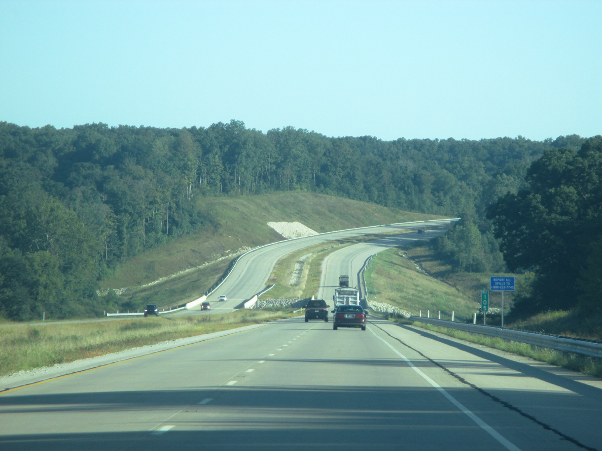
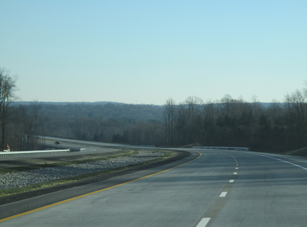
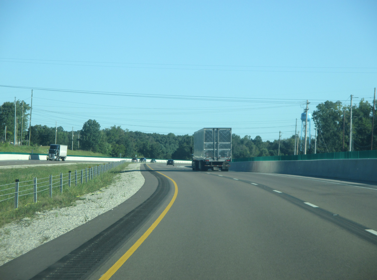
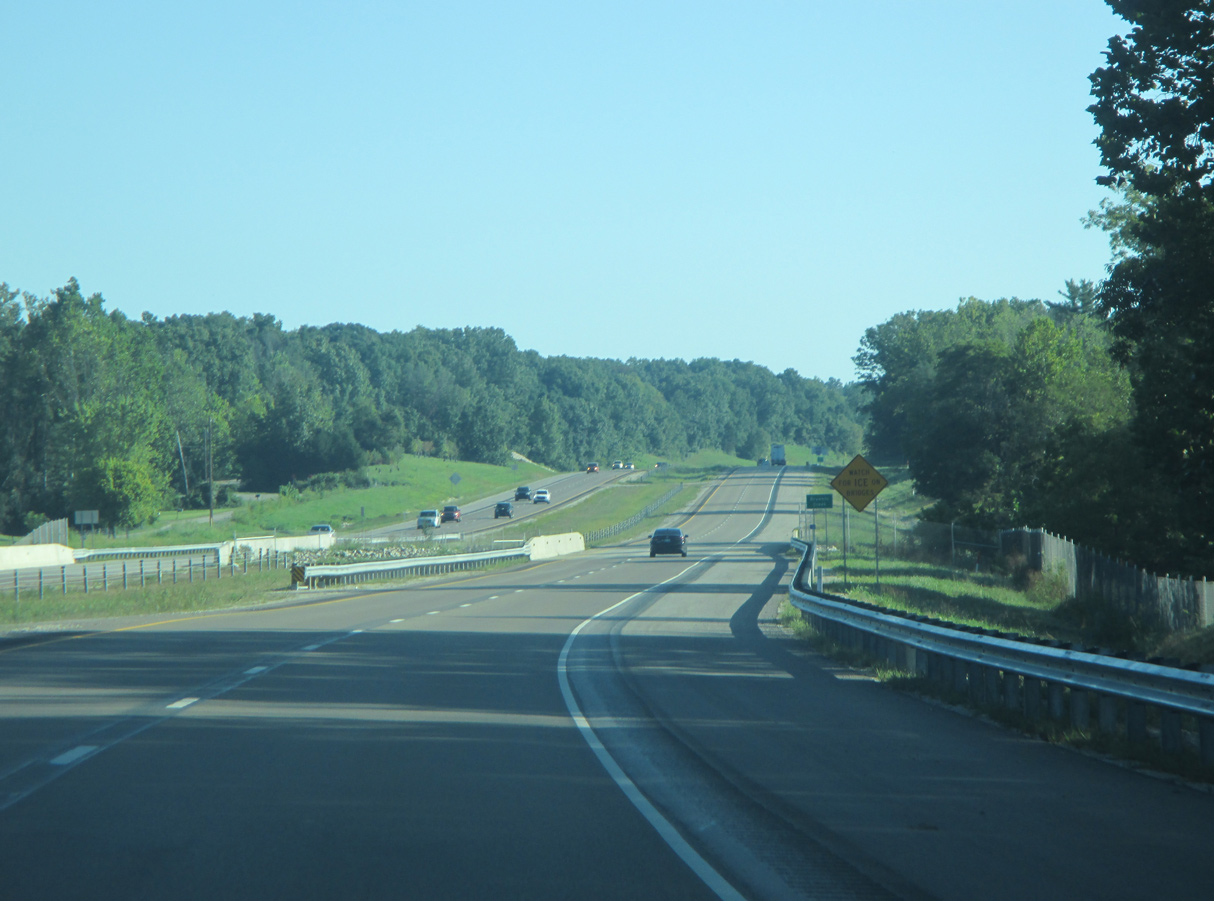
| Sweeping S-curves lead Interstate 69 eastward across hilly terrain between Sanford and Kirksville. The freeway crests around 890 feet above sea level on this long stretch, which is devoid of exits to curb development. 12/19/15 |
|
| Harmony Road spans Interstate 69 north from Kirksville. Per a post on the AARoads Forum, the bridge rises over 90 feet above the roadway, likely making it the tallest over a highway in the state of Indiana. 12/19/15 |
|
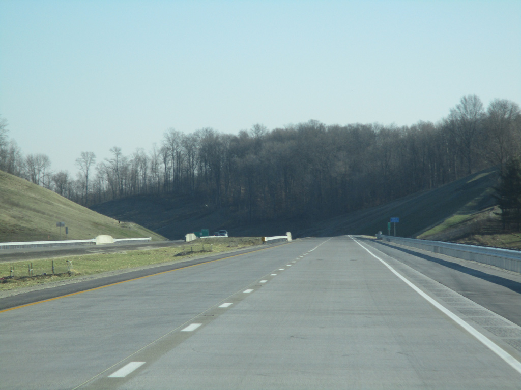
| East of the Harmony Road overpass, Interstate 69 gradually turns back toward the north, passing by the rural community of Victor. 12/19/15 |
|
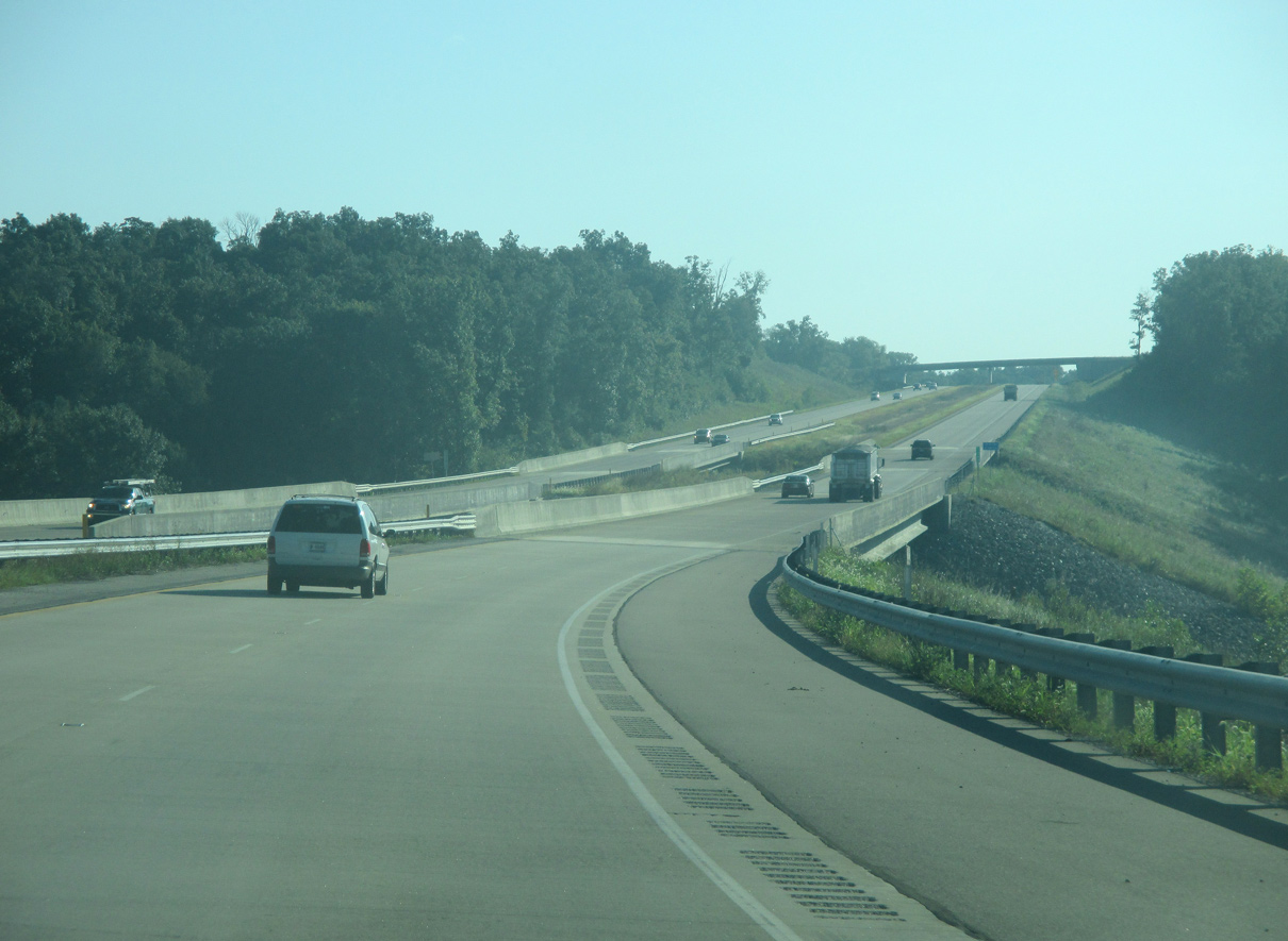
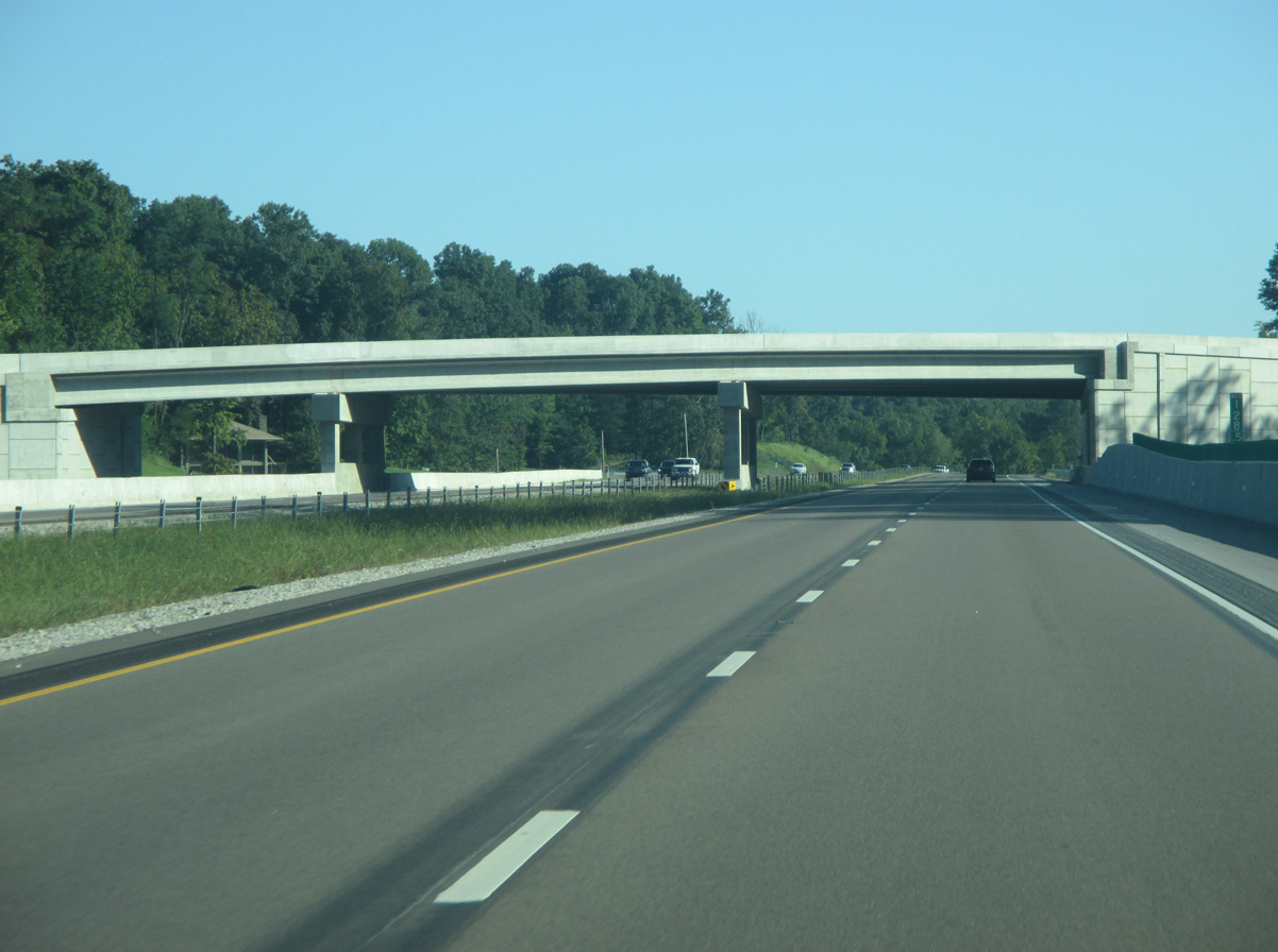
| The nearly 100 mile rural stretch of Interstate 69 north from Evansville concludes three miles north of the Lodge Road underpass. The freeway leaves the rural outskirts of Bloomington for suburban areas along the west side of the city. 12/19/15 |
|
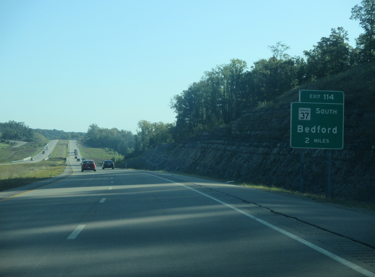
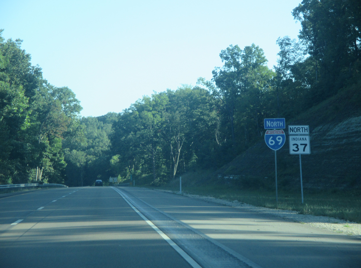
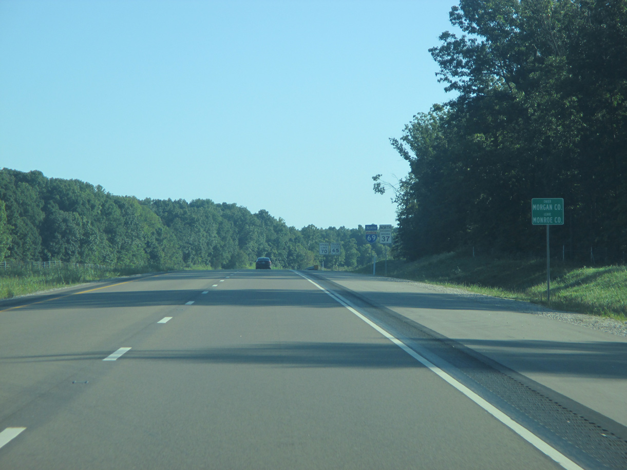
| Running in two sections for a total of 229 miles, forthcoming SR 37 is the longest state road in Indiana. The southern segment travels 215 miles northward from Tell City through Paoli, Bedford, Indianapolis, Noblesville and Elwood to SR 9 in Marion. I-69 and SR 37 run concurrent for 74 miles from Bloomington to Fishers. 08/28/19 |
|
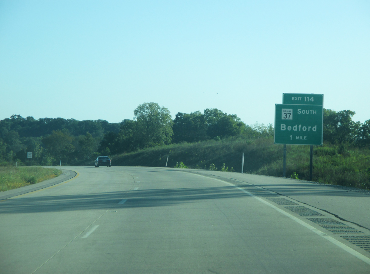
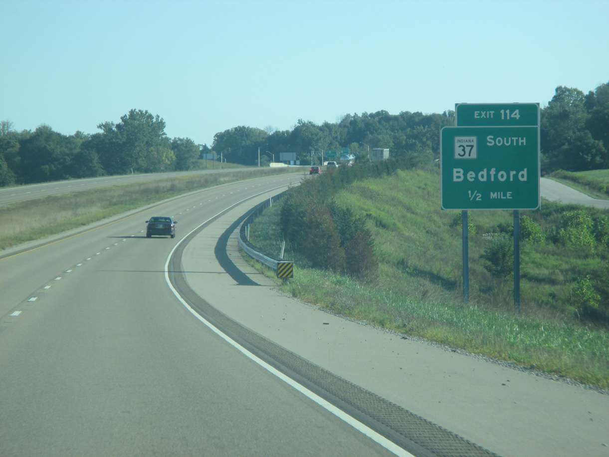
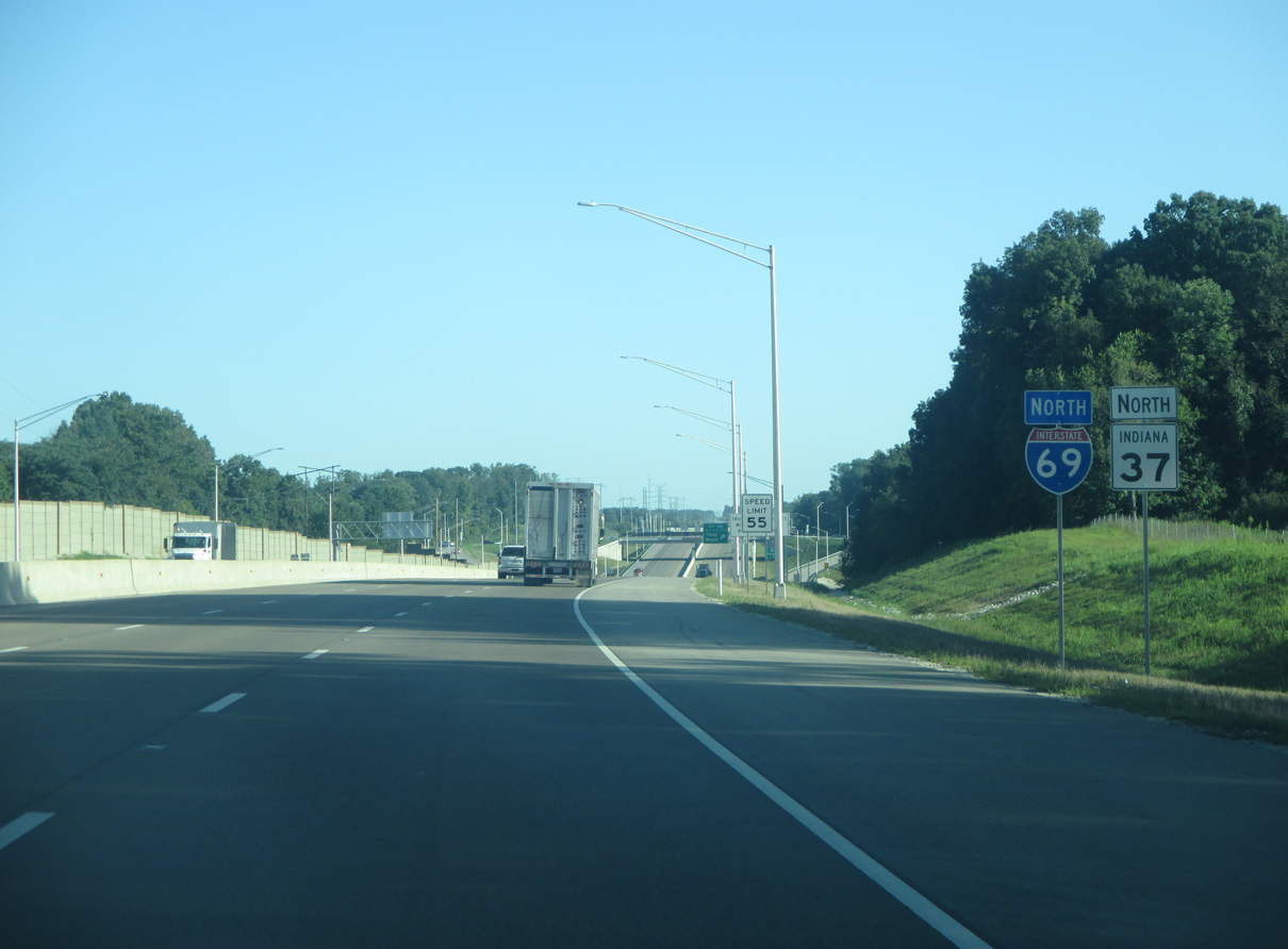
| Speed limits decrease to 55 MPH as I-69 enters the Bloomington urbanized area. SR 37 ties into the freeway from the Lawrence County seat of Bedford, 20 miles to the south of Exit 114. 08/28/19 |
|
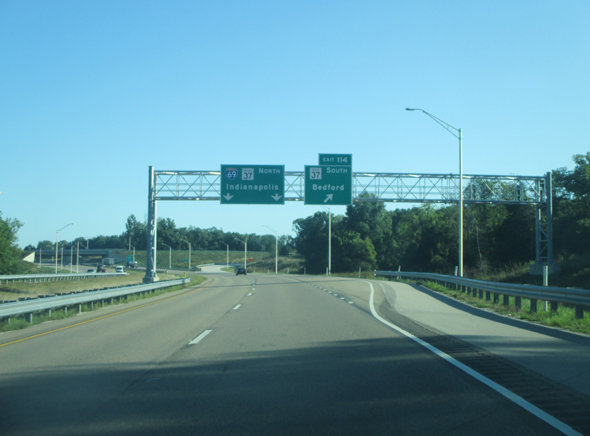
| I-69 concluded at the trumpet interchange (Exit 114) with SR 37 south as of December 9, 2015. I-69 was extended northward along Section 5 as of September 18, 2018. Original plans for the exchange at SR 37 included a stoplight intersection, where the freeway would have simply ended at SR 37, and a dumbbell style interchange for SR 37 south. 08/28/19 |
|
| South from Exit 114, SR 37 continues as a four lane expressway across southern Monroe County past the communities of Harrodsburg, Oolitic and Bedford. North from their merge, I-69/SR 37 advance to Bloomington, Martinsville and Indianapolis (55 miles away). 08/28/19 |
|
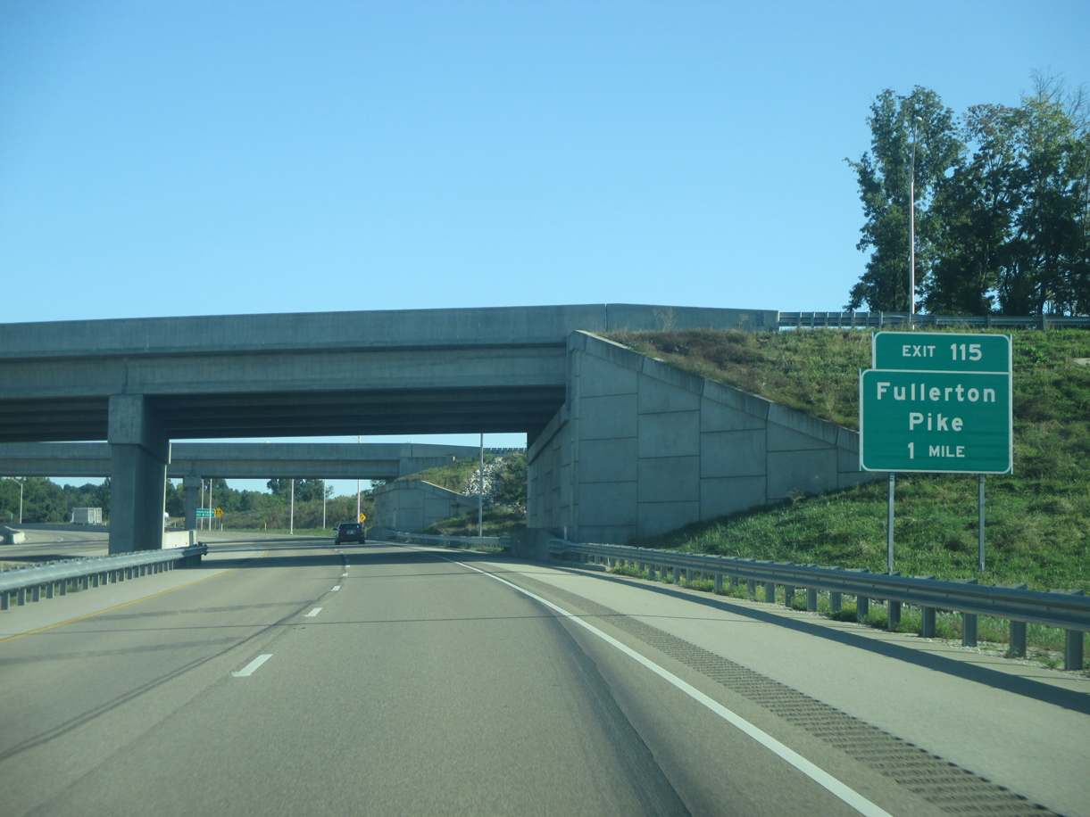
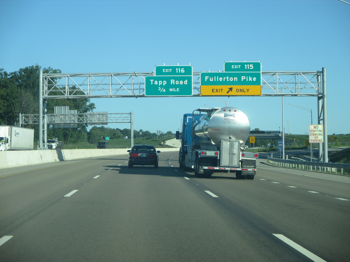
| Interstate 69 passes underneath the ramps for SR 37 south on the one mile approach to Exit 115 with Fullerton Pike. The upcoming dumbbell interchange serves the far southwestern suburbs of Bloomington. 08/28/19 |
|
| With a population over 80,000, the Monroe County seat of Bloomington is served by the next five interchanges along I-69/SR 37 north. Bloomington is the major business and retail center for the surrounding region of South Central Indiana. 08/28/19 |
|
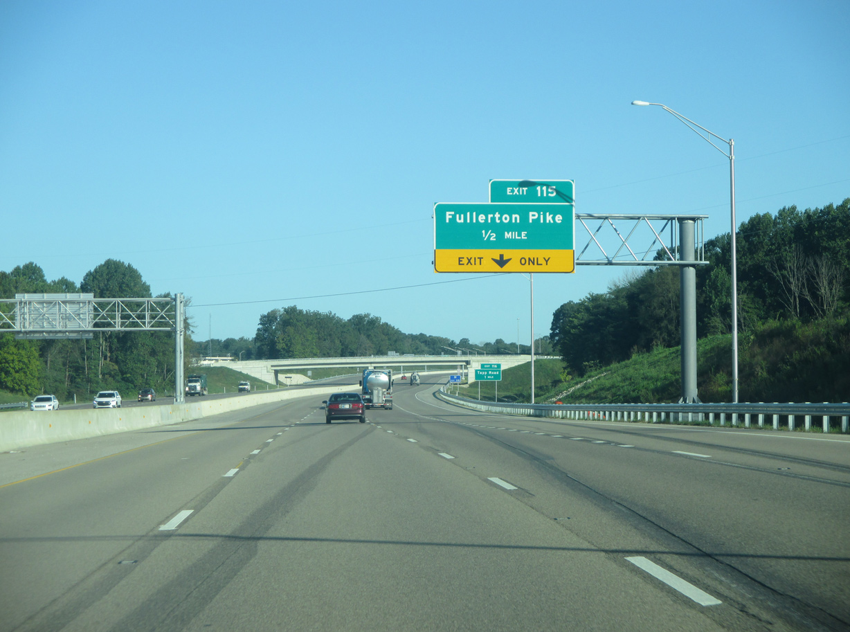
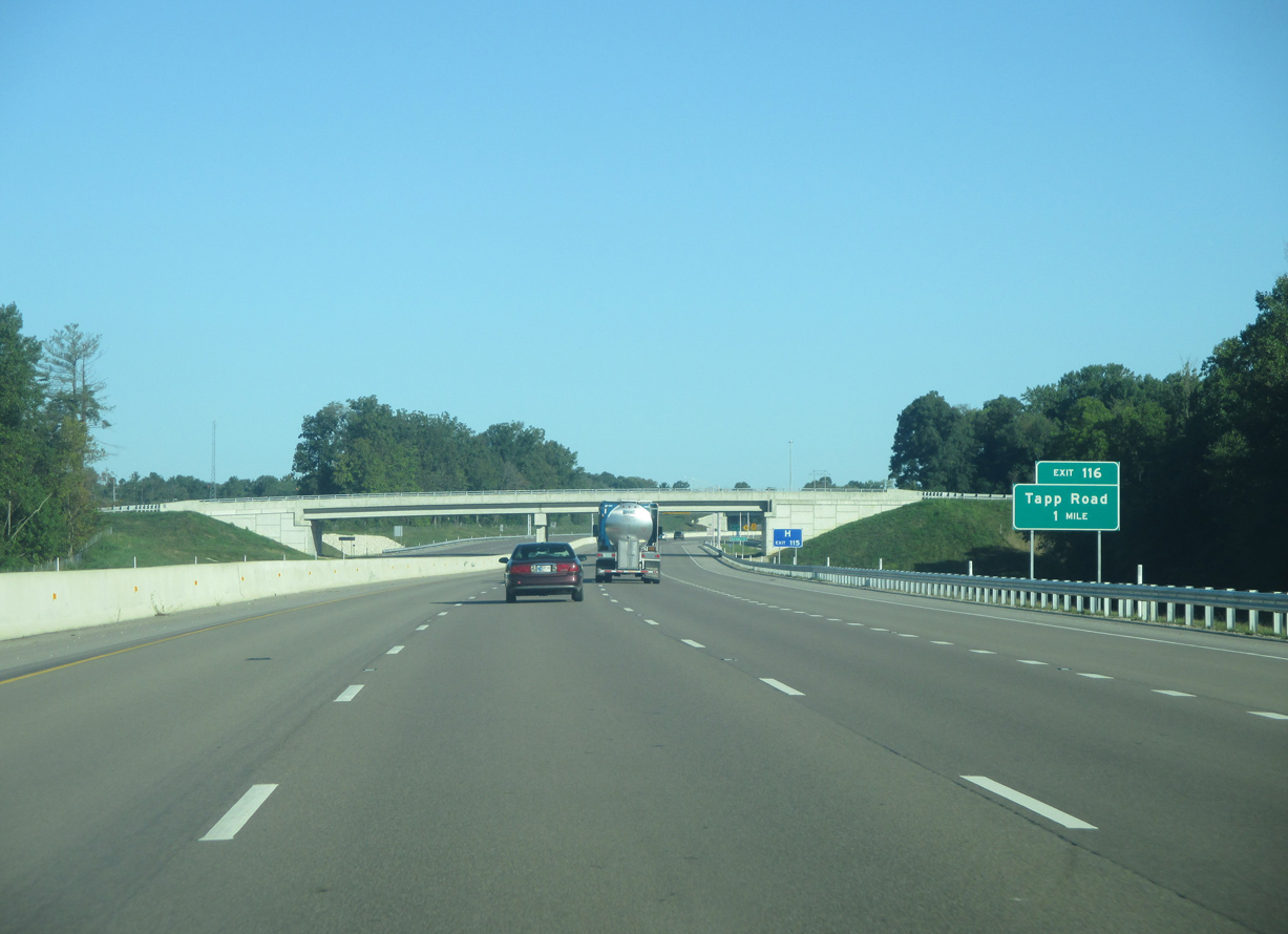
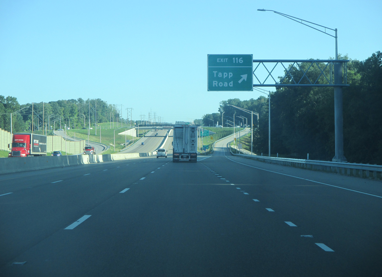
| With traffic from SR 37 added, I-69 expands to eight overall lanes including auxiliary lanes. Exit 116 with Tapp Road lies one mile away. Tapp Road is a major arterial across the south side of Bloomington, the only such roadway to stretch from Interstate 69 to Bloomington's east side. 08/28/19 |
|
| Exit 115 departs I-69/SR 37 north for Fullerton Pike and Monroe Hospital. Monroe County is planning to extend Fullerton Pike east from its end at Rockport Road to Gordon Pike. This will create another east-west corridor across the far south side of Bloomington. 08/28/19 |
|
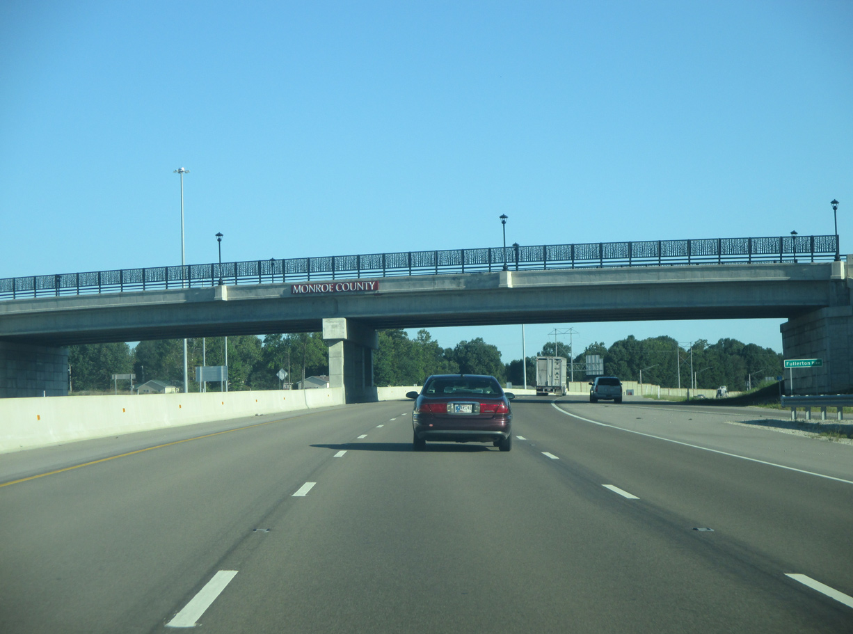
| Opened on August 6, 2017, the interchange with Fullerton Pike (Exit 115) was the first completed during the conversion of SR 37 to I-69. Community identifier elements were added to several of the overpasses over the freeway through Bloomington. Monroe County is spelled out in the colors of Indiana University, cream and crimson. 08/28/19 |
|
| Interstate 69 and SR 37 north assume a northern trajectory past Exit 115. 08/28/19 |
|
| Entering the dumbbell interchange (Exit 116) with Tapp Road on I-69/SR 37 north. Tapp Road heads west to Leonard Springs Road and east toward Rockport Road. Tapp Road changes name three times as it crosses Bloomington's south side. 08/28/19 |
|
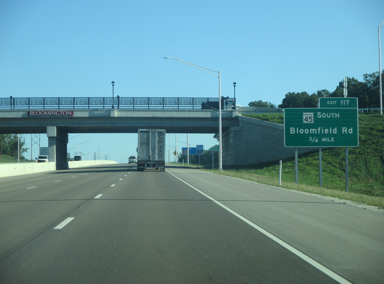
| I-69/SR 37 advance 0.75 miles from the Tapp Road overpass to Exit 117 for SR 45 (Bloomfield Road) south. 08/28/19 |
|
| Auxiliary lanes open along both roadways for I-69/SR 37 between Exits 116 and 117. The freeway passes by Wapehani Mountain Bike Park with a 55 MPH speed limit. 08/28/19 |
|
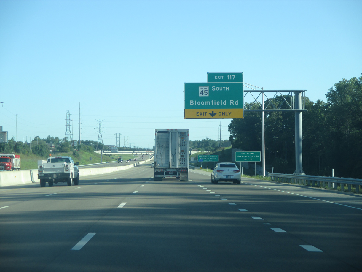
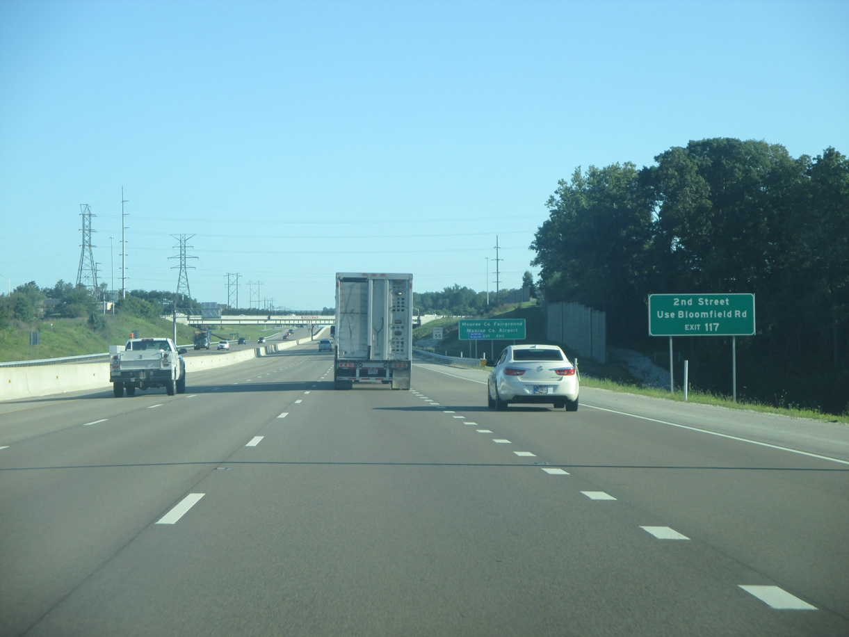
| Bloomfield Road heads northeast toward the Bloomington business district, becoming 2nd Street at Patterson Drive. 08/28/19 |
|
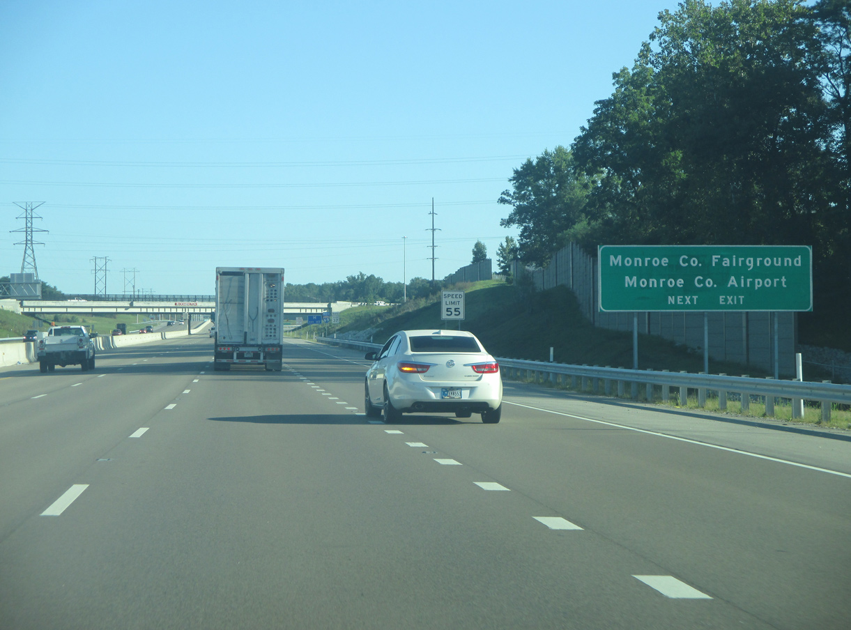
| Both the Monroe County Fairgrounds and Monroe County Airport (BMG) can be reached via SR 45 (Bloomfield Road) south 1.4 miles to Airport Road. 08/28/19 |
|
| The folded diamond interchange with SR 45 was built in the 1970s when SR 37 was moved onto the then new four lane expressway that bypassed Bloomington. The exchange was incorporated into I-69 at Exit 117. 08/28/19 |
|
| Indiana State Road 45 travels southwest to Stanford and Cincinnati along an increasingly rural course. The bulk of traffic that used SR 45 to Bloomington shifted to Interstate 69. 08/28/19 |
|
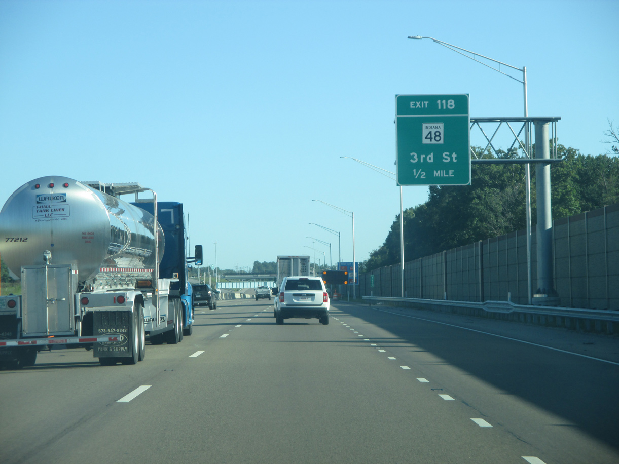
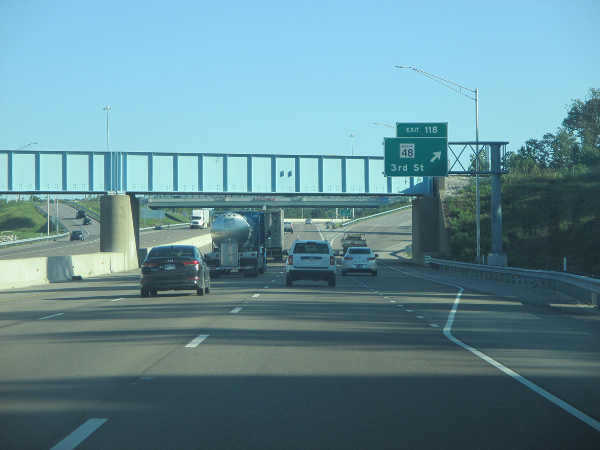
| I-69/SR 37 north converge with SR 48 at 3rd Street in 0.75 miles. SR 48 is a minor highway split in three separate segments. Within Monroe County, SR 48 runs 6.0 miles west to SR 43 at Whitehall. 08/28/19 |
|
| SR 45 combines with I-69/SR 37 north ahead of Exit 118. A heavily traveled route on the west side of Bloomington, 3rd Street was expanded to four lanes from Adams Street 3.4 miles west to Hartstrait Road. 08/28/19 |
|
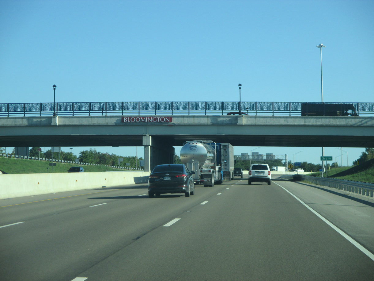
| Passing underneath the Indiana Rail Road, I-69/SR 37-45 northbound reach Exit 118 for SR 48 (3rd Street) west. This diamond interchange represents the highest concentration of motorists services along Interstate 69 since Evansville, as well as the most direct connection to Downtown Bloomington. 08/28/19 |
|
| The exchange connecting I-69 with 3rd Street at Exit 118 is largely the same as the one originally built along the SR 37 expressway. The overpass was widened and the ramps were rebuilt. 08/28/19 |
|
| SR 45 is omitted along the concurrency with I-69/SR 37 north of the 3rd Street entrance ramp. 08/28/19 |
|
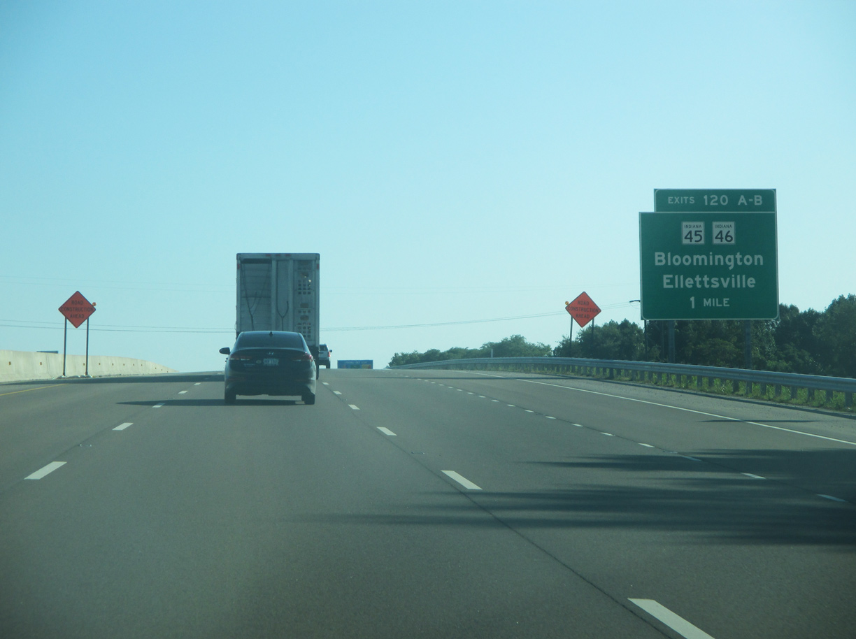
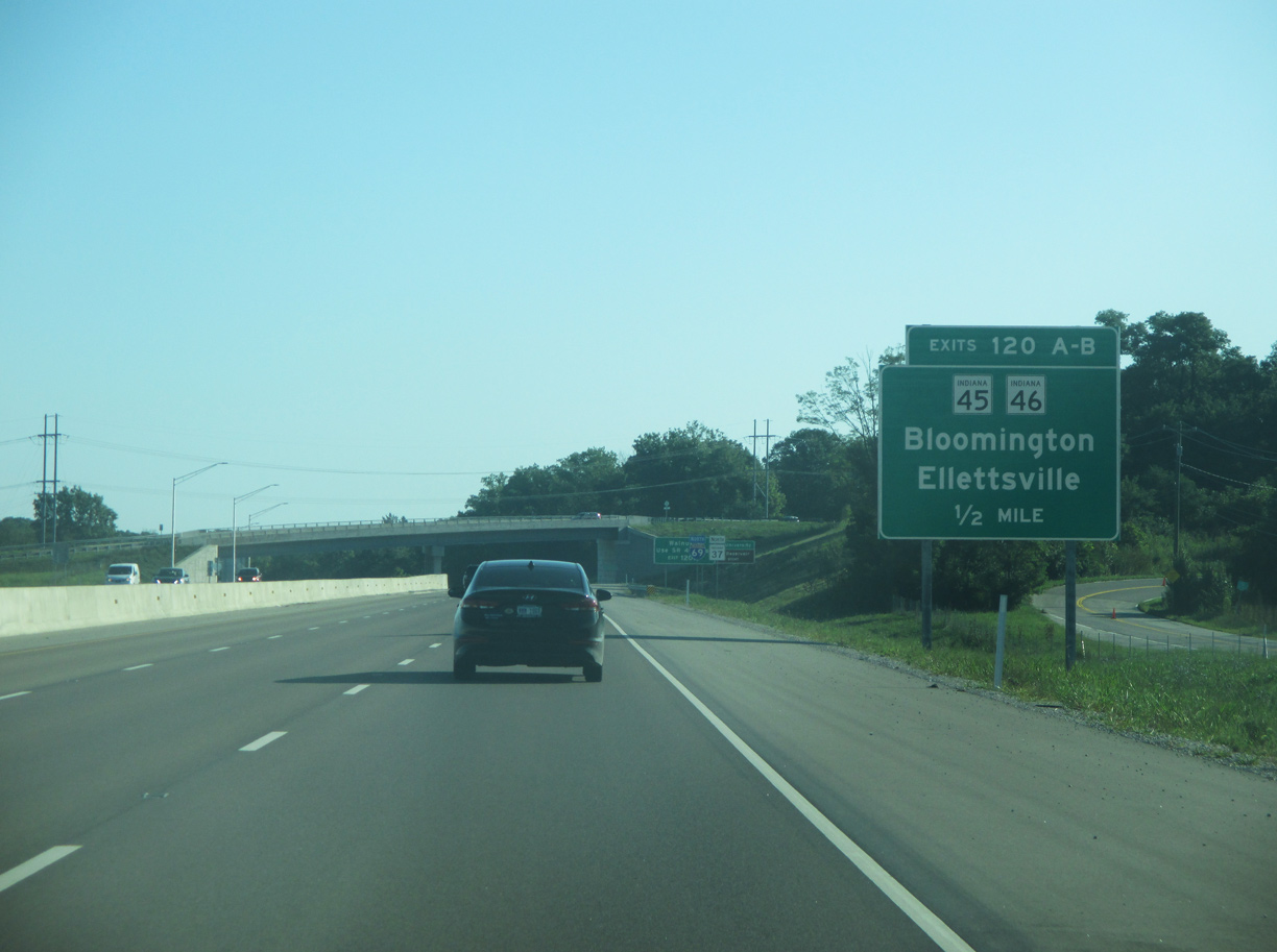
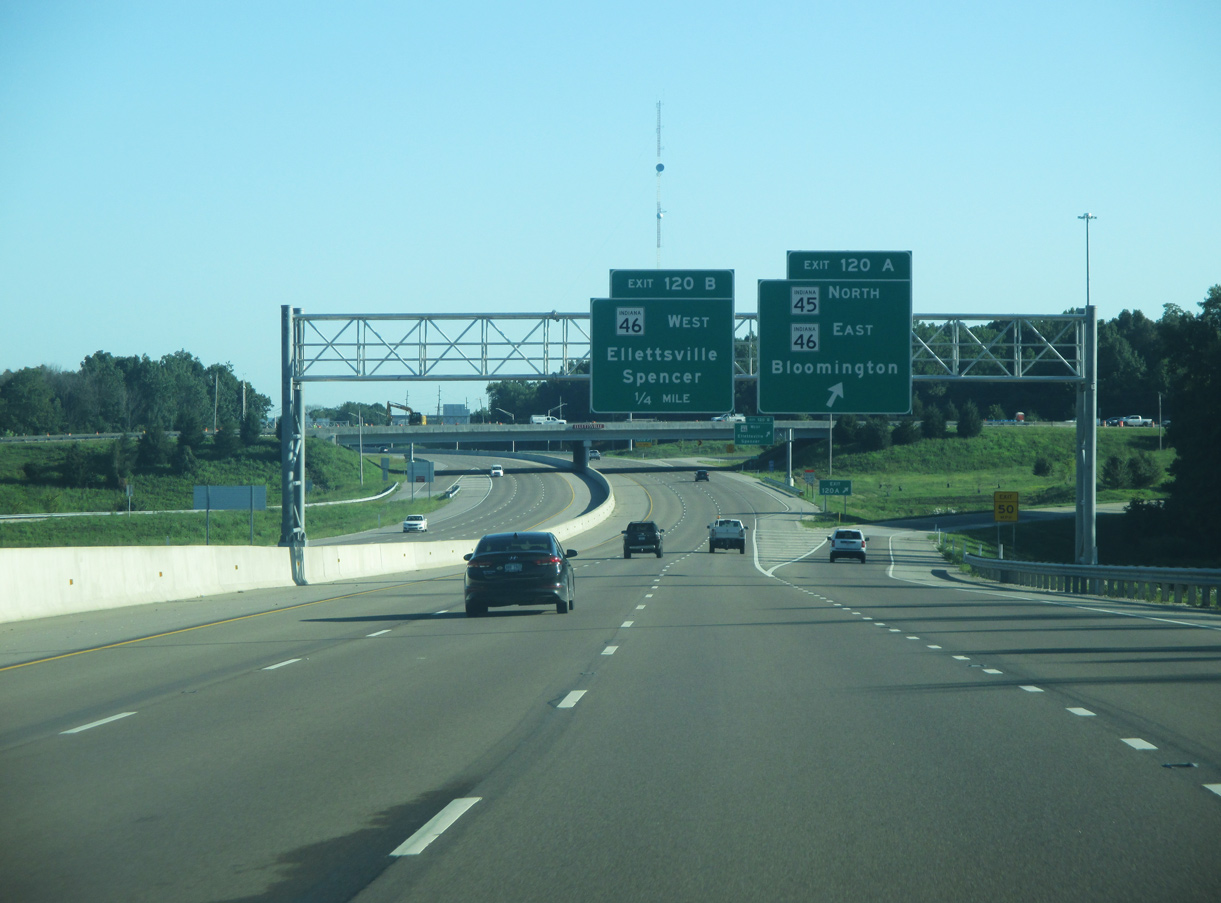
| An auxiliary lane accompanies I-69/SR 37 northbound to their split with SR 45 at Exit 120A for SR 46 east. The six-ramp parclo interchange with SR 46 opened in 2002 as part of a larger project to realign SR 46 from SR 37 northwest toward the community of Ellettsville. 08/28/19 |
|
| SR 46 constitutes a major highway across South Central Indiana. Part of the National Highway System (NHS) from Spencer to Nashville and Columbus, SR 46 runs 154 miles east from Terre Haute to near West Harrison on the Ohio state line. 08/28/19 |
|
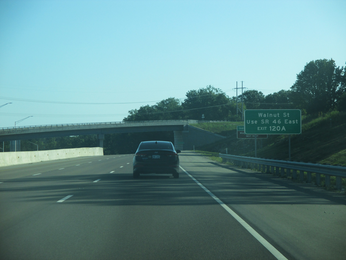
| Vernal Pike spans I-69/SR 37-45 beyond this supplemental sign for Walnut Street. The overpass replaced a signalized intersection along the SR 37 expressway. Walnut Street, the former alignment of SR 37, intersects SR 45/46, 1.1 miles east of Exit 120A. 08/28/19 |
|
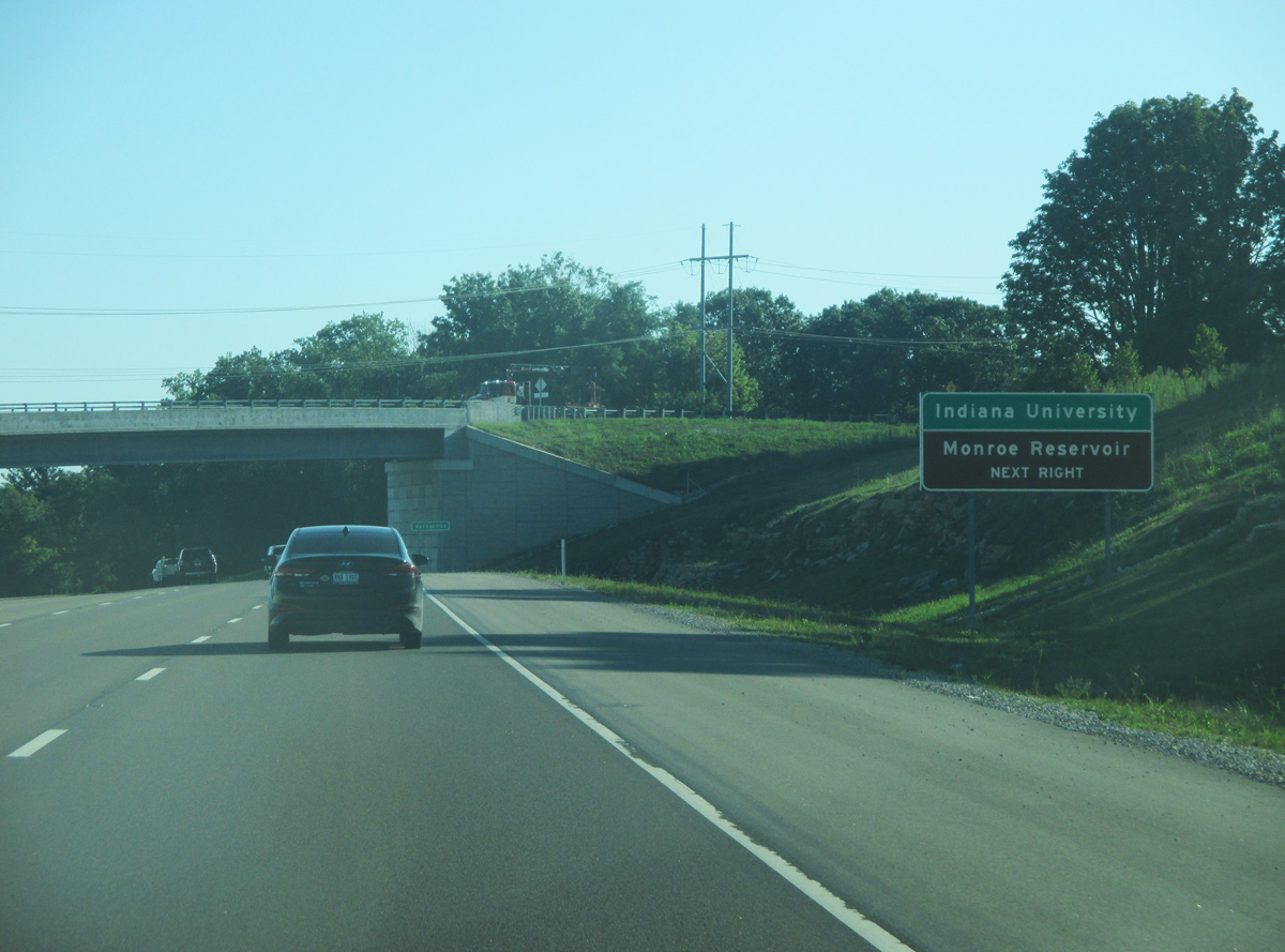
| Located to the east, Indiana University is the most well known attraction in Bloomington. The largest lake in the state, Monroe Reservoir is a very popular recreation area throughout the year. It lies southeast of Bloomington. 08/28/19 |
|
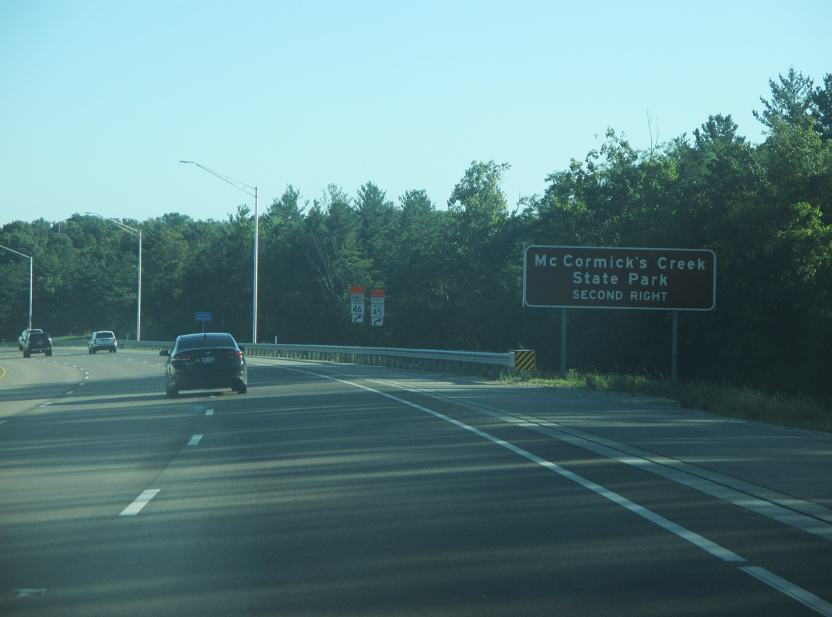
| 12.3 miles northwest from Exit 120B, SR 46 travels to McCormick's Creek State Park outside Spencer. A popular attraction for residents of the area, McCormick's Creek is the oldest in the Indiana State Park system. 08/28/19 |
|
| SR 45 parts ways with I-69/SR 37 north to combine with SR 46 for 3.2 miles between Exit 120A and E 10th Street around the Indiana University campus. The arterial bypass of Bloomington along SR 45/46 was widened by 2012 to four lanes. 08/28/19 |
|
| West from Exit 120B, SR 46 constitutes a four lane highway through the town of Ellettsville, a suburb of Bloomington, and Spencer, the seat of neighboring Owen County. The interchange joining SR 36/45/46 was incorporated into the upgrade to I-69 with only minor changes. 08/28/19 |
|
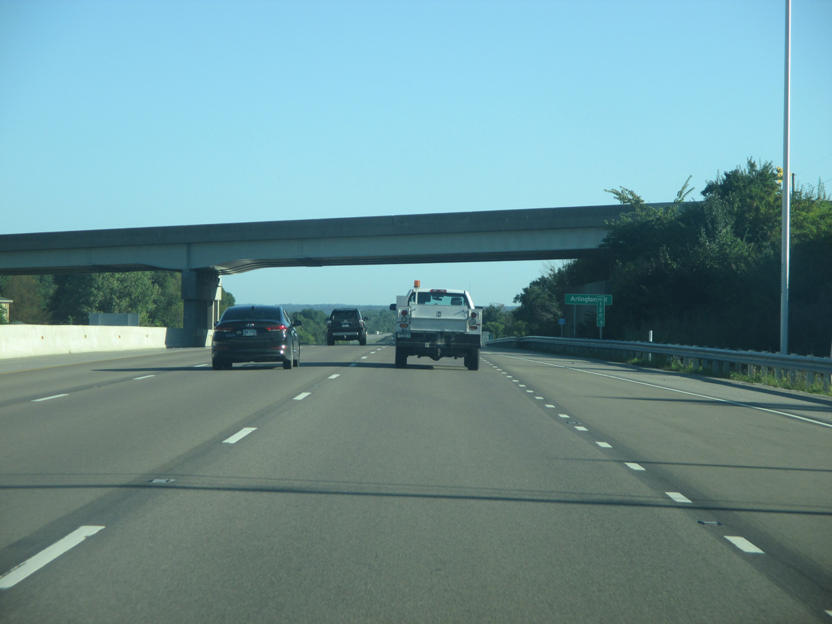
| Arlington Road, the original route for SR 46 from Bloomington to Ellettsville, spans I-69/SR 37 just north of Exit 120. Prior to 2002, SR 46 dog legged north alongside SR 37 from an at-grade intersection where Exit 120 was built to Arlington Road west. 08/28/19 |
|
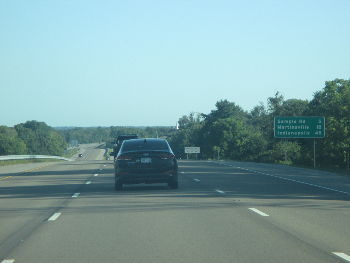
| Continuing beyond Arlington Road, I-69/SR 37 north are five miles away from the interchange (Exit 125) with Sample Road. The Morgan County seat of Martinsville follows in 18 miles and Indianapolis in 48 miles. 08/28/19 |
|
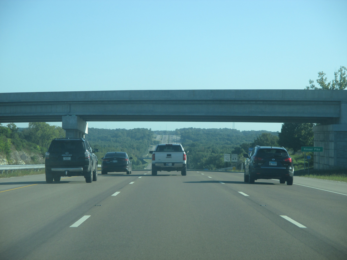
| Kinser Pike travels over I-69/SR 37. The Bloomington city street was extended across the freeway to connect with Bottom Road at Beanblossom Creek valley. I-69 retains six lanes northward to accommodate Indiana University commuters and heavier traffic between Bloomington and Indianapolis. 08/28/19 |
|
| The speed limit along I-69/SR 37 increases to 70 MPH as the six lane freeway lowers into the Beanblossom Creek valley. A wye interchange with the north end of Walnut Street (SR 37 Business) ties into this stretch. 08/28/19 |
|
| I-69/SR 37 overtake the original alignment of State Road 37 leading north from Walnut Street in Bloomington. 08/28/19 |
|
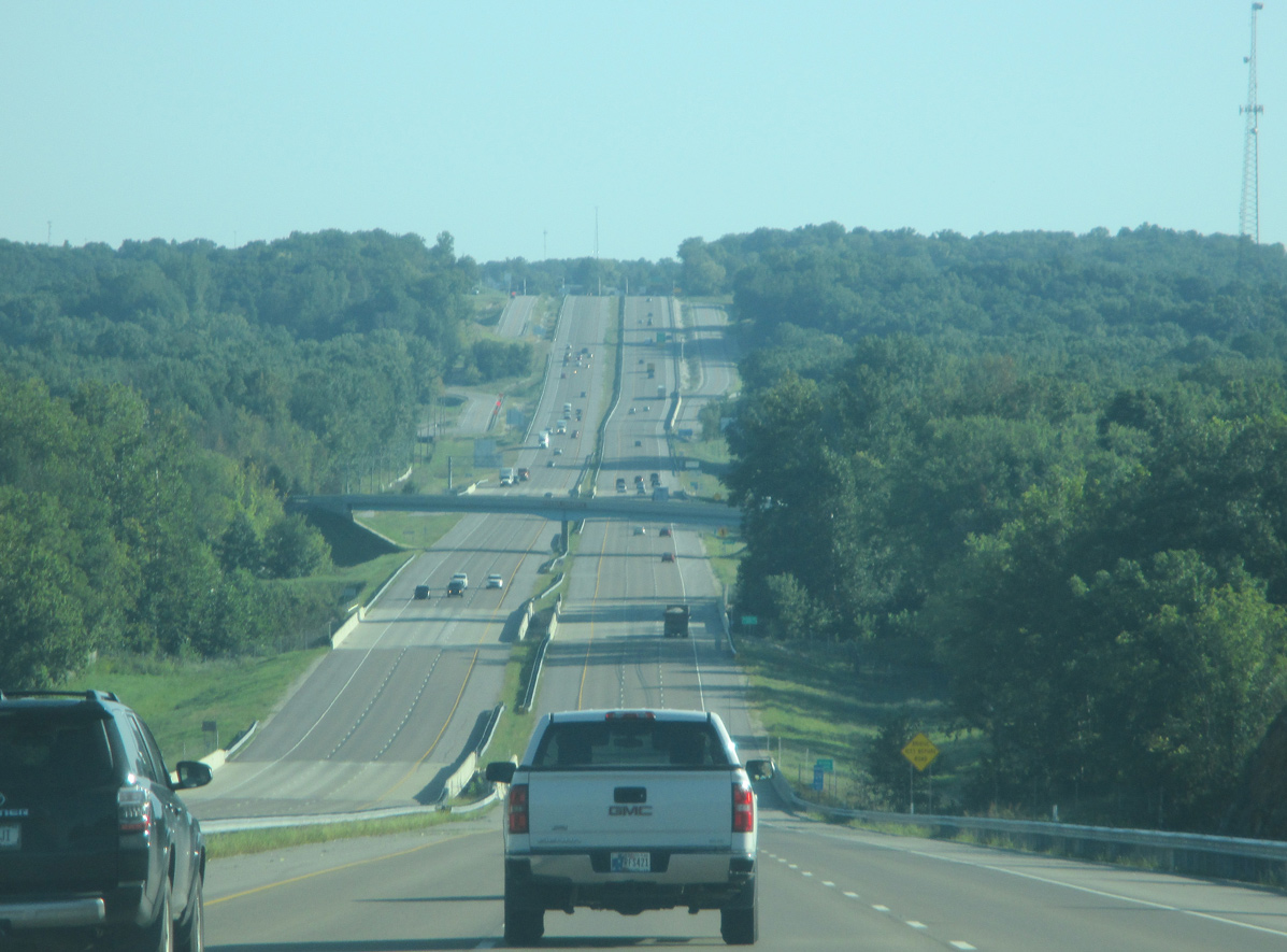
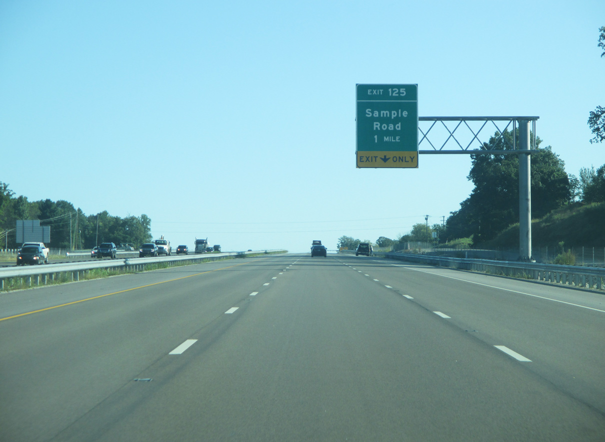
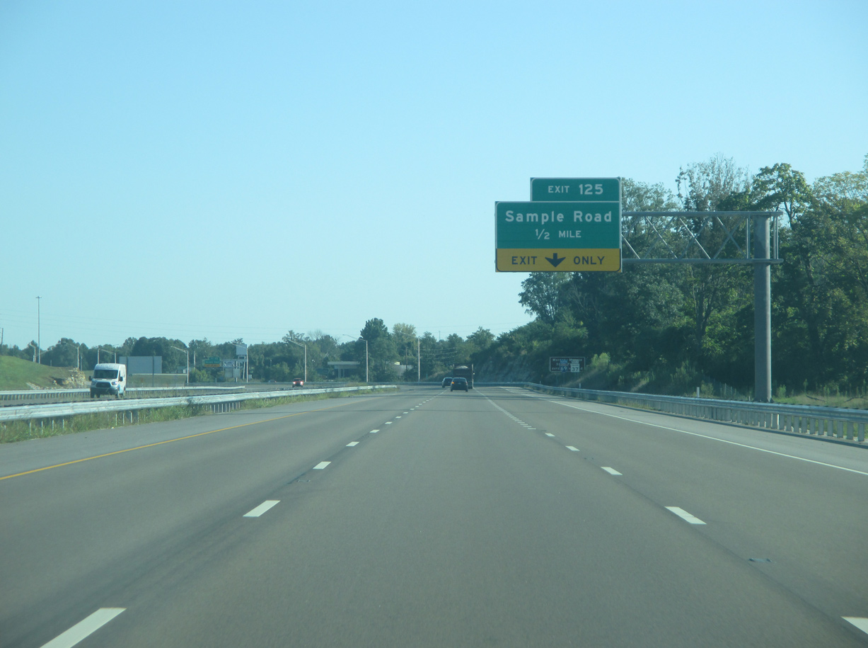
| Climbing from the Beanblossom Creek valley, I-69/SR 37 advance to within one mile of Exit 125 with Sample Road. Exit 125 connects the freeway with the rural northern part of Monroe County. 08/28/19 |
|
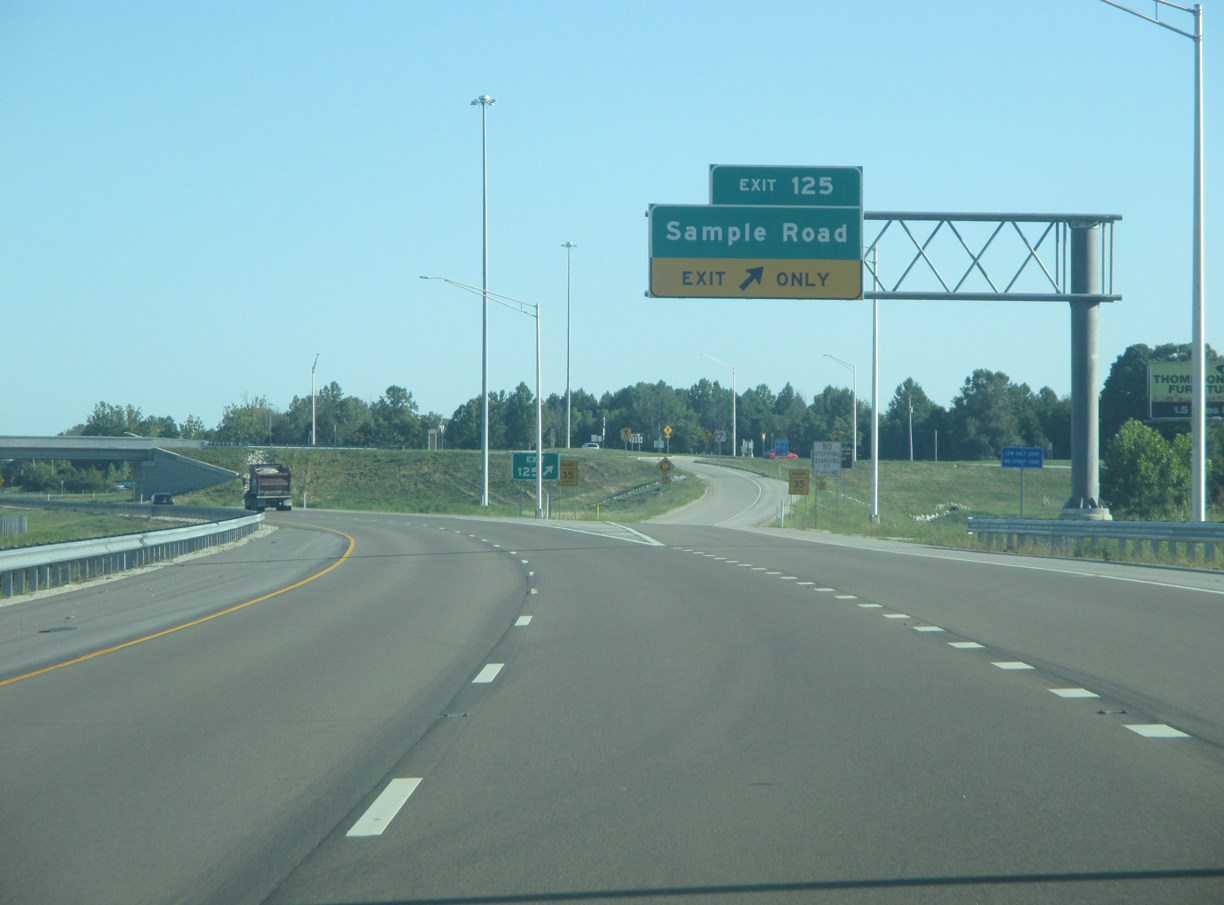
| The right lane drops along I-69/SR 37 northbound at Exit 125. Sample Road runs east to Wayport Road, the eastern freeway frontage road, and Old SR 37. Burma Road stems south from nearby as the western frontage road for I-69. 08/28/19 |
|
| Located to the east via Sample Road and Old SR 37, Morgan-Monroe State Forest is served by both Exit 125 and Exit 134 from I-69/SR 37 northbound. The state forest previously was directly accessible from SR 37. 08/28/19 |
|
| A dumbbell interchange with a loop ramp joins I-69/SR 37 with Sample Road at Exit 125. Sample Road west connects with Simpson Chapel Road to Bottom Road. 08/28/19 |
|
| Wayport Road accompanies the east side of I-69/SR 37 northward to several residences and businesses along with Oliver Winery, an important attraction in this part of Monroe County. 08/28/19 |
|
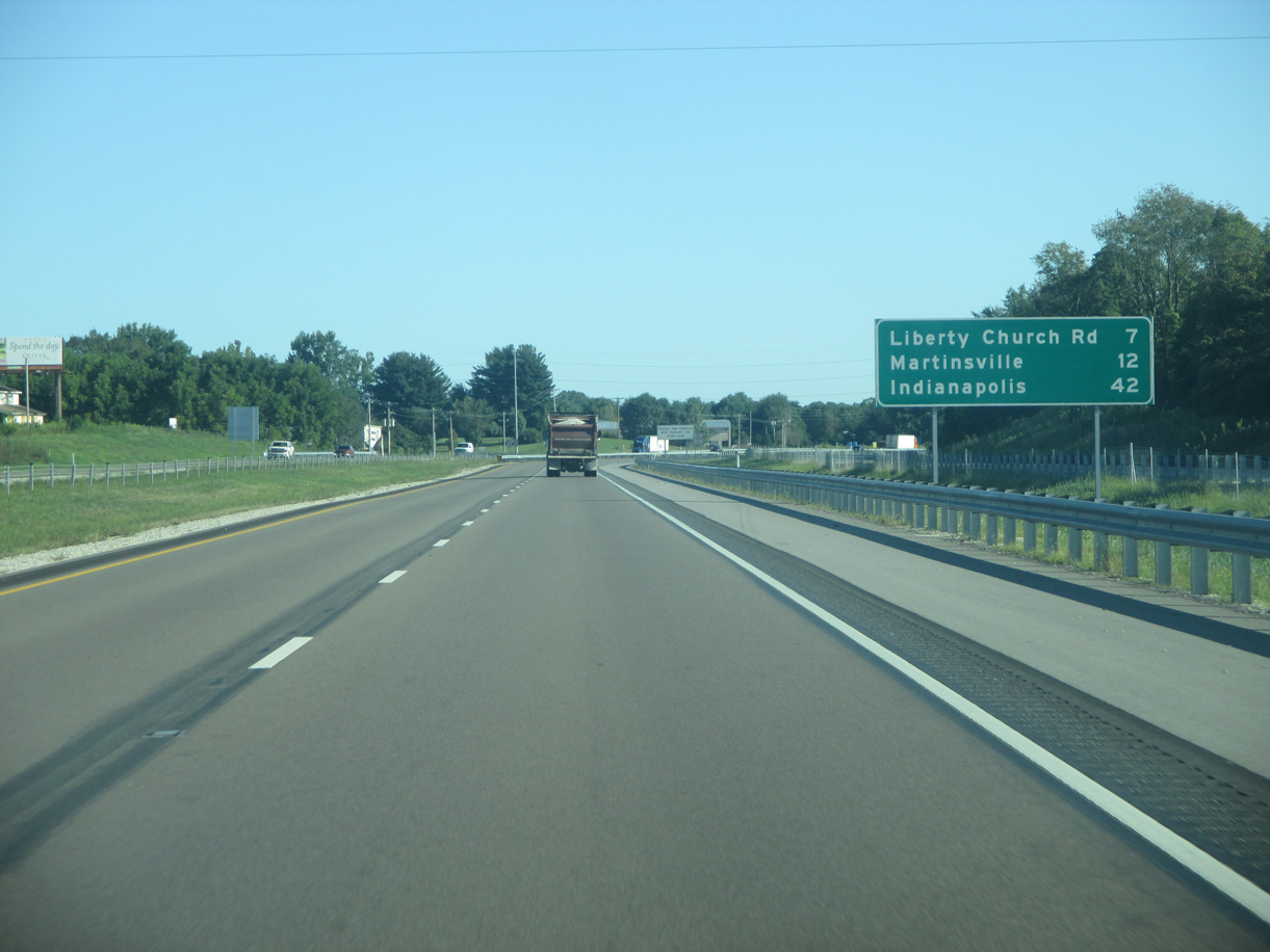
| The succeeding exit is seven miles away. Martinsville is five miles further, and Indianapolis is 42 miles to the northeast. 08/28/19 |
|
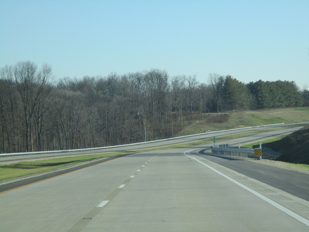
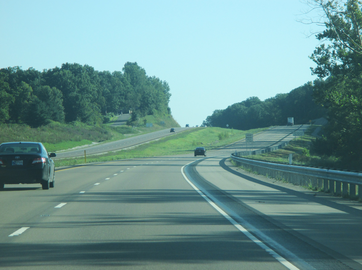
| Navigating through an S-curve, Interstate 69 continues directly over the previous route of the SR 37 expressway. With a narrower right of way, the adjacent frontage roads occasionally abut the outside shoulders. INDOT recorded 32,316 vpd on this section in 2019. 08/28/19 |
|
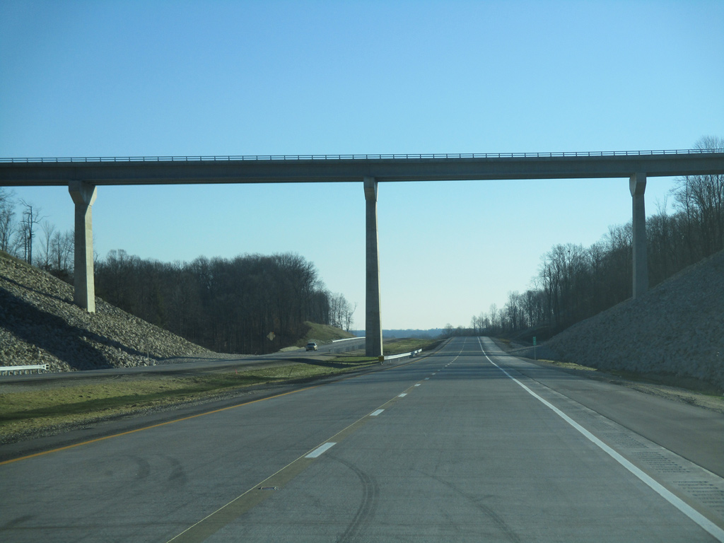
| Chambers Pike is the lone crossing over I-69/SR 37 between Exits 125 and 134. The bridge also spans adjacent Burma Road. 08/28/19 |
|
| A wide median separate the roadways for I-69/SR 37 through Morgan-Monroe State Forest. 08/28/19 |
|
| The northbound lanes of Interstate 69 through Morgan-Monroe State Forest run directly over the original alignment of SR 37. The southbound roadway for SR 37 was constructed in the 1970s during four lane expansion. 08/28/19 |
|
| The roadways of I-69/SR 37 converge ahead of Bryant Creek. Bryants Creek Road formerly intersected SR 37 at this location. 08/28/19 |
|
| I-69/SR 37 north enters Morgan County. Morgan County represents the midpoint between the Bloomington and Indianapolis areas. 08/28/19 |
|
| I-69/SR 37 continue northward into the White River Valley. These hills are also part of Morgan-Monroe State Forest, which is a popular recreational area. Realigned around the 1950s, the route of I-69/SR 37 replaced a previous alignment along a series of county roads from Martinsville south into the state forest. 08/28/19 |
|
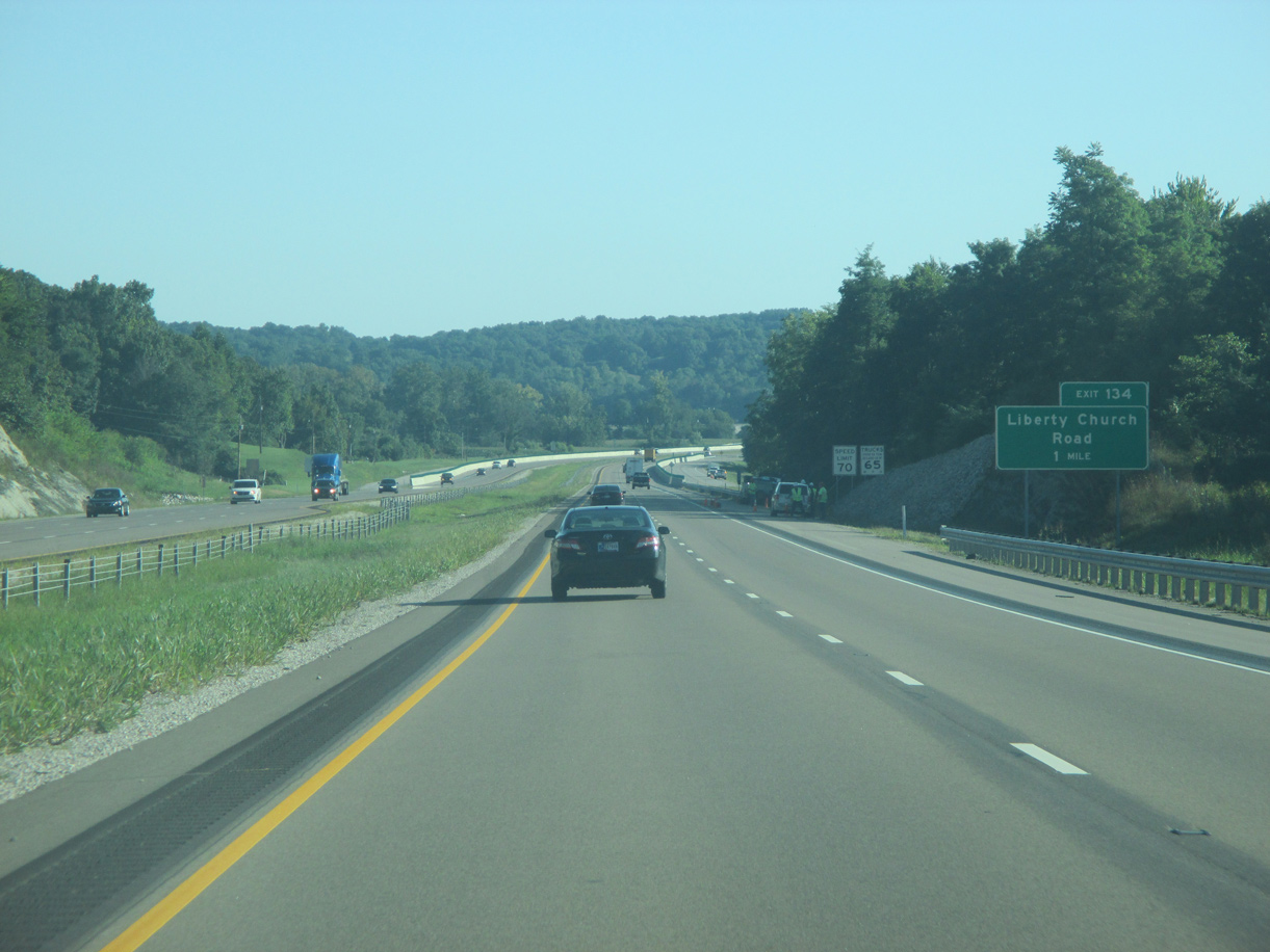
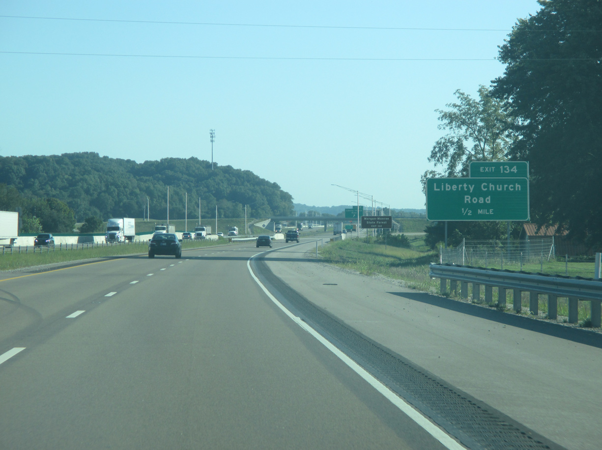
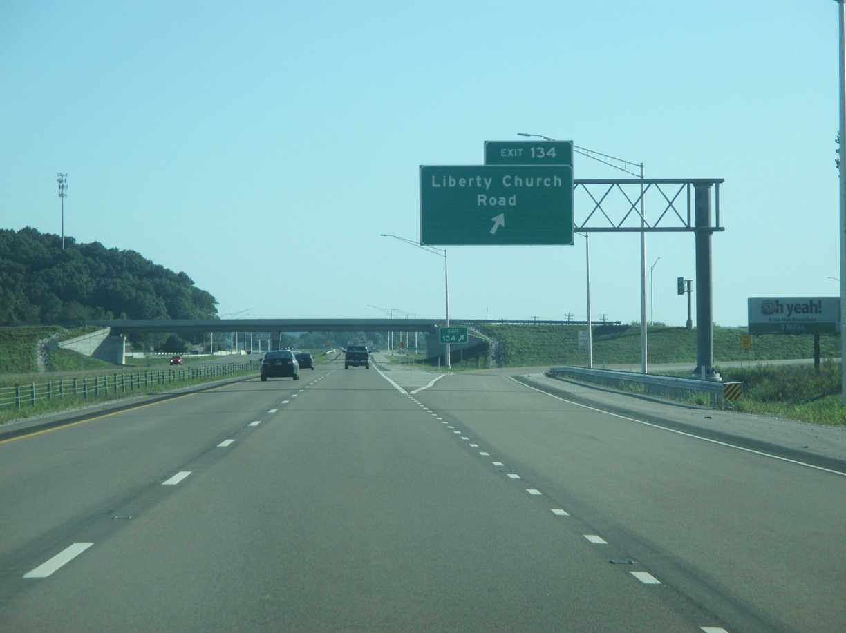
| The diamond interchange (Exit 134) with Liberty Church Road is the last built along Section 5 of Interstate 69. Construction on Section 6 got underway in March 2019. 08/28/19 |
|
| Old SR 37 and Turkey Track Roads form the service roads for I-69 leading into the exchange with Liberty Church Road. Liberty Church Road links the freeway with Godsey Road to the west. Godsey Road connects with Paragon Road to SR 67 at the town of Paragon. 08/28/19 |
|
| Exit 134 departs I-69/SR 37 north for Liberty Church Road east to Jordan Road and the rural community of Prather. The road's namesake, Liberty Christian Church, lies a half mile away. 08/28/19 |
|
| Old State Road 37 continues alongside I-69/SR 37 northward from Exit 134. 08/28/19 |
|
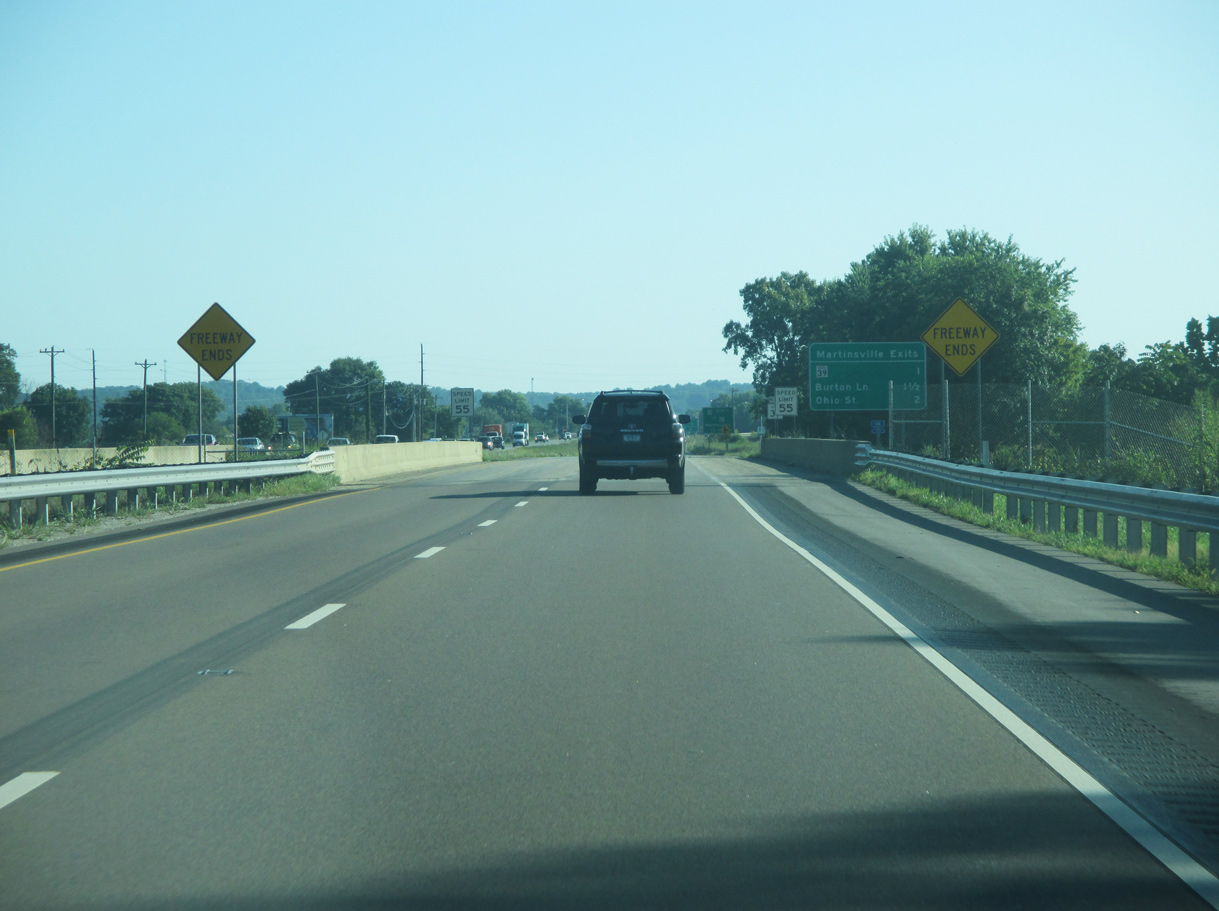
| Crossing Jordan Creek, SR 37 continues four miles north into the city of Martinsville. Section 6 of I-69 overlays all of SR 37 over the ensuing 30 miles to Indianapolis. 08/28/19 |
|
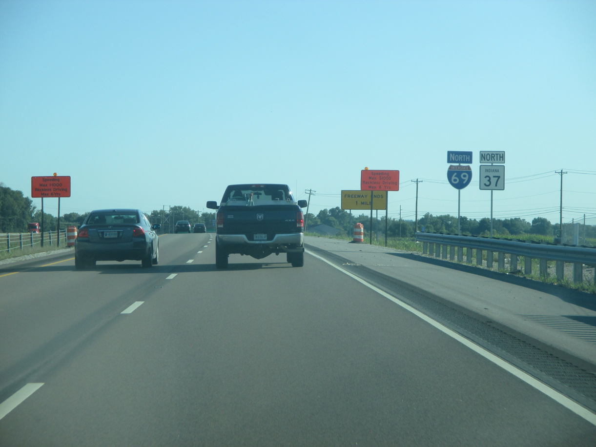
| Interstate 69 unceremoniously ends at the bridges over Indian Creek, 1.5 miles north of Liberty Church Road. SR 37 extends along the four lane expressway into Martinsville. Construction through Fall 2021 upgrades 5.6 miles of SR 37 north to Morgan Street as the next section of I-69. 08/28/19 |
Page Updated 05-10-2020.

 North
North