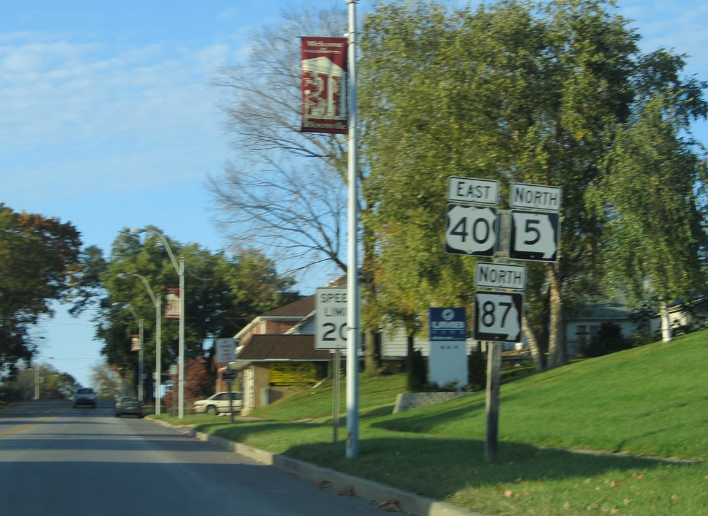
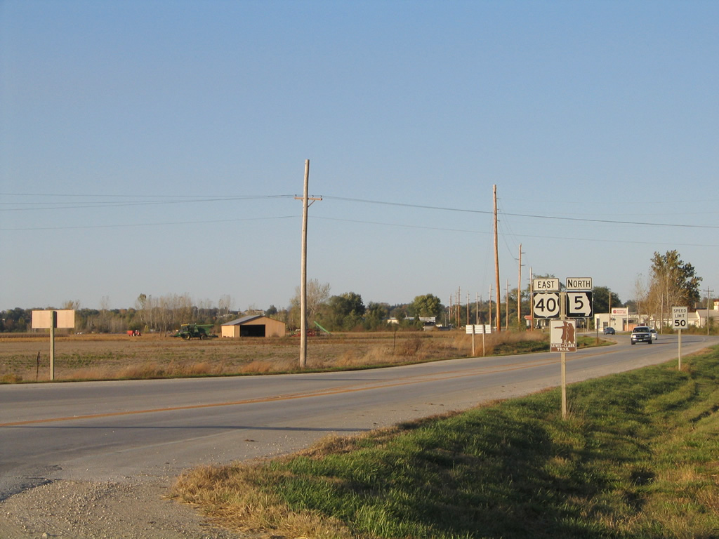
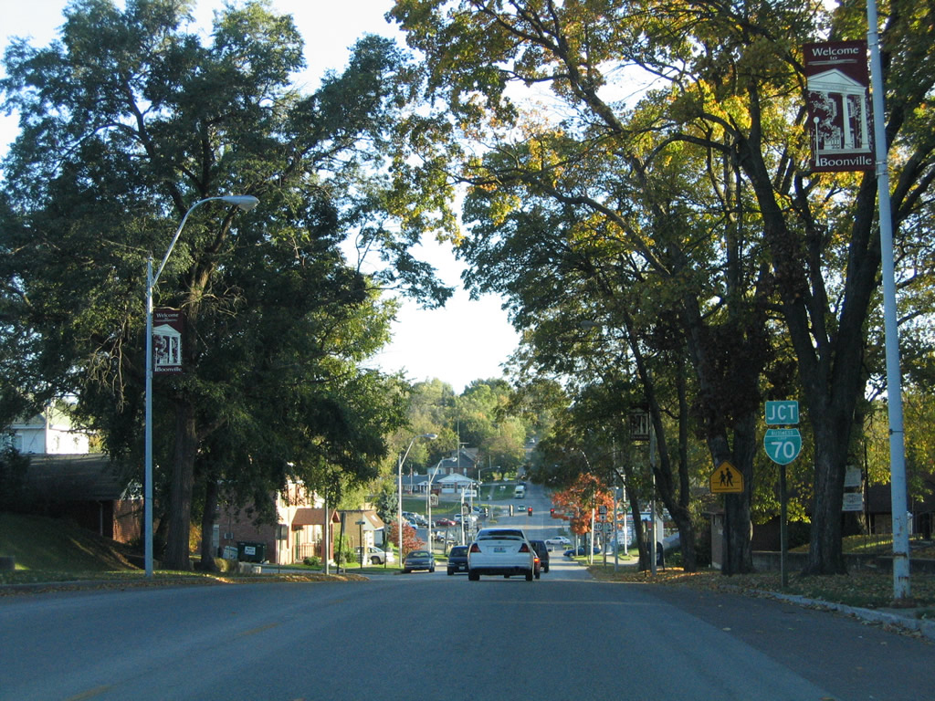
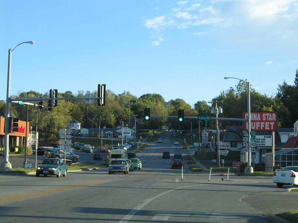
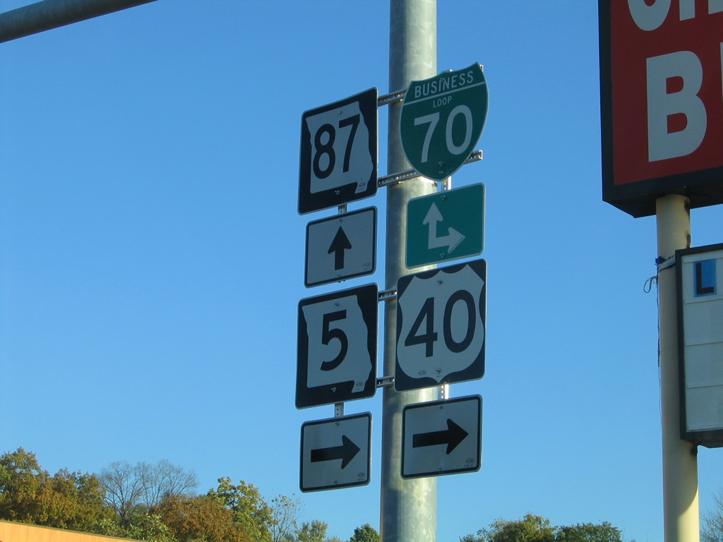
Following a combination of U.S. 40, Route 5 and Route 87, Business Loop I-70 at Boonville consists of a 6.7 mile loop north of I-70 between Exits 101 and 106. U.S. 40/Route 5 overlay the western half of the route to Downtown Boonville. U.S. 40 east leaves the I-70 corridor via this path for a course across the Missouri River to the Rocheport area and Midway. The US highway west from Exit 101 combines with I-70 to Grain Valley and Blue Spring in the east Kansas City suburbs.
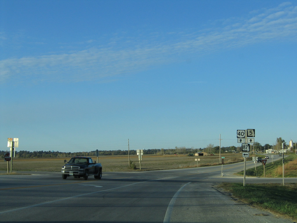
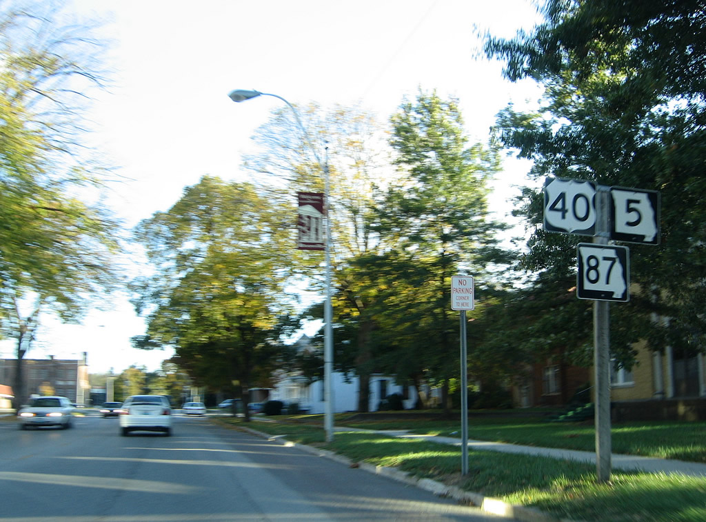
Missouri Route 5 links Boonville with New Franklin to the north and Syracuse to the south. The state highway doubles alongside both U.S. 40 and Business Loop I-70 between Exit 101 and Main Street. Route 87 joins the Business Loop east along Bingham Road to Exit 106 while en route to Jamestown. The state highway also combines with U.S. 40/Route 5 across the Missouri River to join Boonville with Glasgow to the northwest.
The official 1964 Missouri State Highway Map shows Business Loop I-70 cosigned with Missouri Route 41. Route 41 now ends at Exit 98, opposite Route 135 south to Pilot Grove.
|
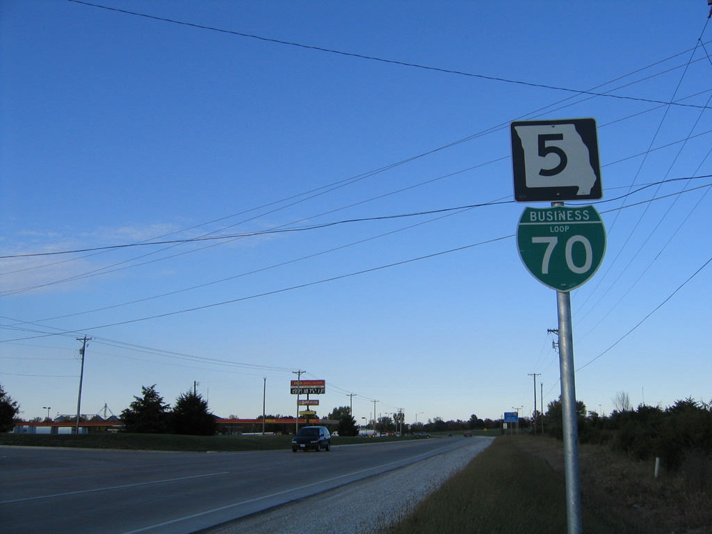
| The first shield assembly for Business Loop I-70 appears along Missouri 5 just north of the diamond interchange with Interstate 70. U.S. 40 is omitted from this assembly posted on Ashley Road. 10/16/04 |
|
| The trio leave the intersection with Sportsman Road west, which is the historic alignment of U.S. 40 leading west from Boonville to Missouri 41. 10/16/04 |
|
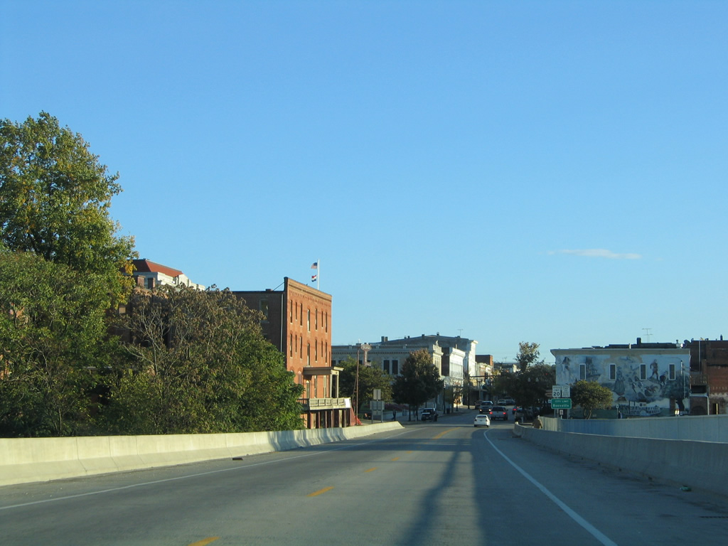
| Business Loop I-70, U.S. 40 and Missouri 5 (Ashley Road) lower from a bluff toward the street grid of Columbia. A truck climbing lane accompanies the westbound direction. 10/16/04 |
|
| Sombart Road links Business Loop I-70 with parallel Santa Fe Trail to the north. Santa Fe Trail leads east to become Spring Street into Downtown Boonville. Use the route for a Lewis & Clark Historical Marker at Harley Park. 10/16/04 |
|
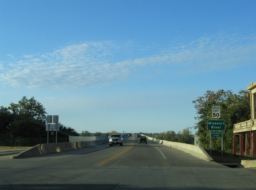
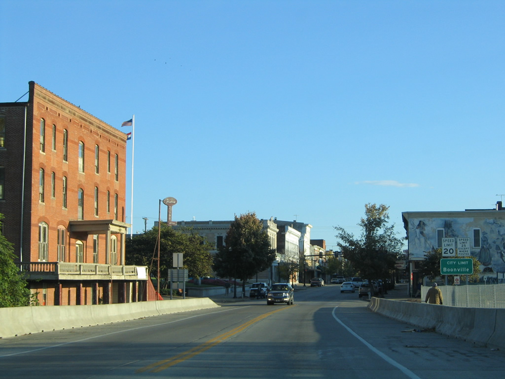
| Business Loop I-70/U.S. 40 turn onto Elm Street from Ashley Street ahead of Missouri 87 (Main Street). 10/16/04 |
|
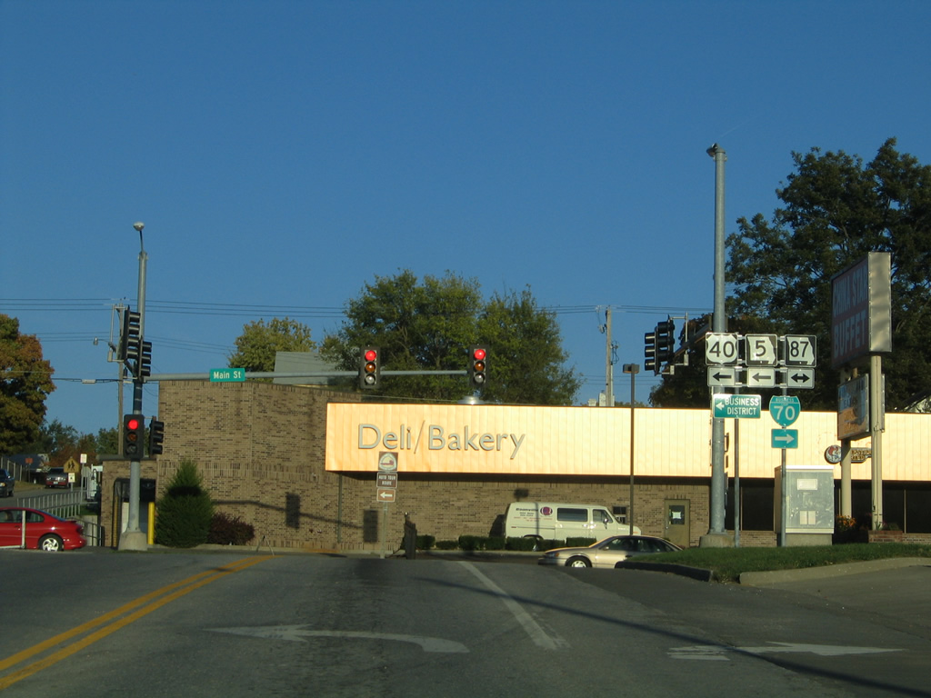
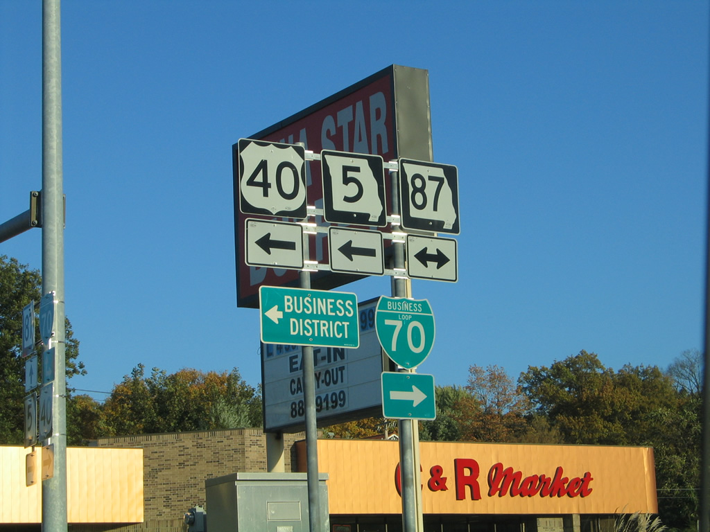
| U.S. 40/Route 5 combine with Route 87 north along Main Street through Downtown Boonville while Business Loop I-70 turns south along Main for Bingham Road east with Route 87. 10/16/04 |
|
| Main Street runs through the Boonville business district north to the Missouri River Bridge and Howard County line. Route 87 splits with U.S. 40/Route 5 at the north end of the span for Glasgow while U.S. 40/Route 5 continue toward Franklin and New Franklin. 10/16/04 |
|
| Elm Street leads Business Loop I-70/U.S. 40-Route 5 away from Main Street (Route 87) to Ashley Road for an exit of the Boonville street grid. 10/16/04 |
|
| A deactivated four-way flasher at the intersection of Elm and 3rd Streets where Business Loop I-70 climbs westward. 10/16/04 |
|
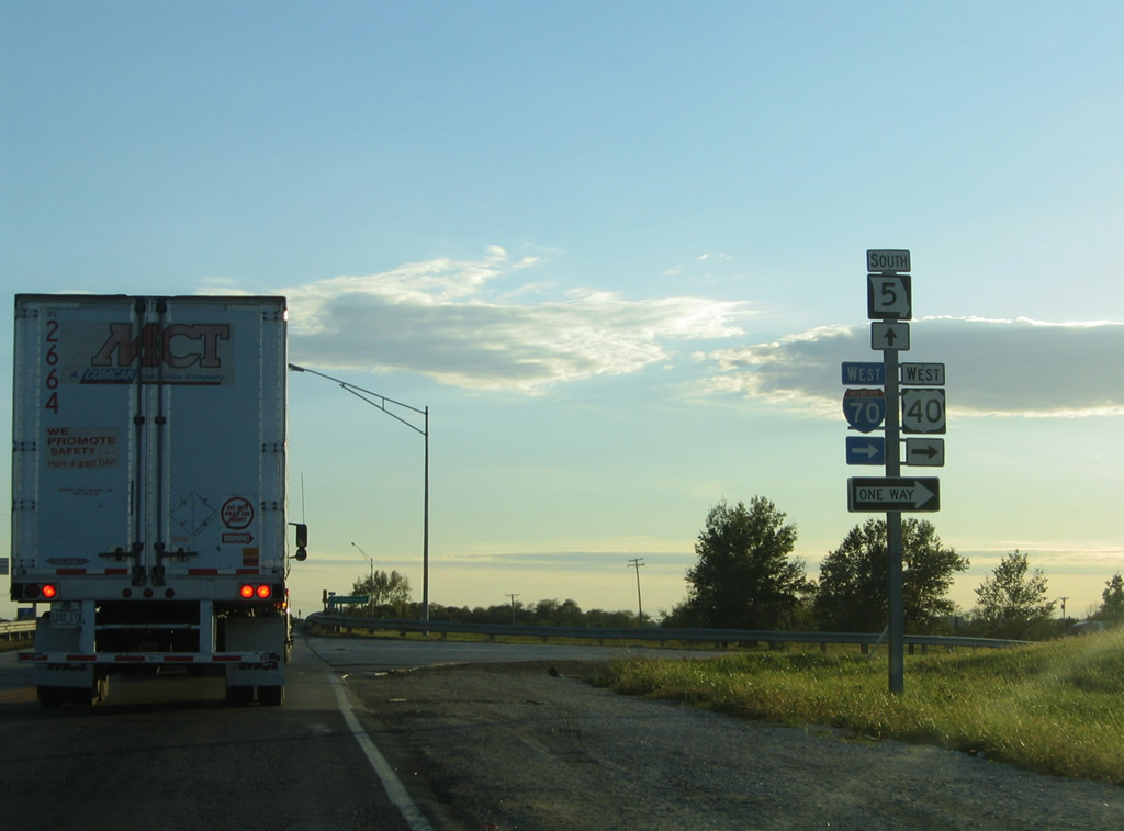
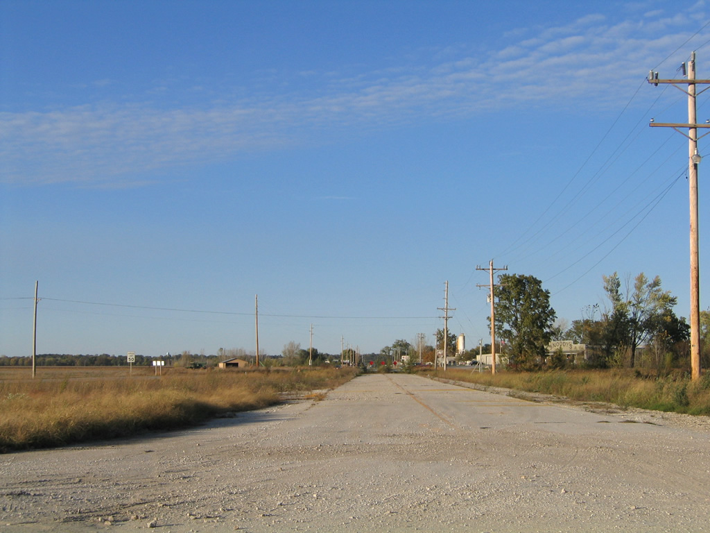
| A shield assembly for Business Loop I-70-U.S. 40 west and Missouri 5 south follows the intersection with Sportsman Road west. Sportsman Road is the historic alignment of U.S. 40 leading west from Boonville to Missouri 41. 10/16/04 |
|
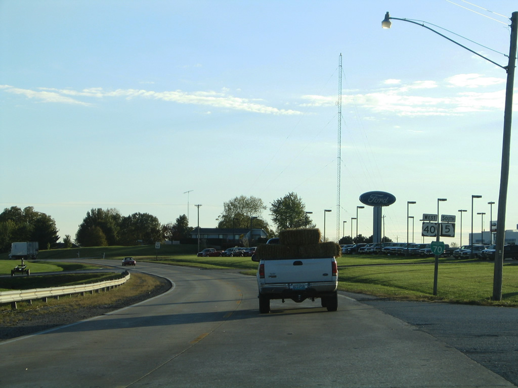
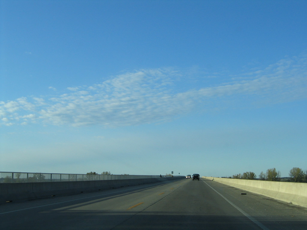
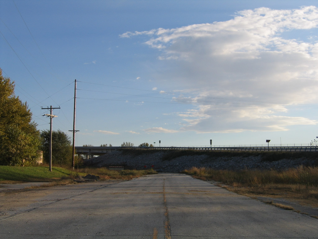
| Entering the diamond interchange with Interstate 70, Business Loop I-70 ends as U.S. 40 rejoins the freeway west to Grain Valley. Missouri Route 5 continues south toward Billingsville and Bellair. 10/16/04 |
|
| U.S. 40 and Route 5/87 combine for 1.3 miles from Elm Street north to Howard County. Main Street enters the Boonville business district just north of Business Loop I-70. 10/16/04 |
|
| Main Street north at Locust Street as U.S. 40/Route 5-87 enter Downtown Boonville. Locust Street is a former alignment of both Route 87 and Route 98 heading east to 11th Street south. Route 98 begins outside of Boonville via Business Loop I-70/Route 87 south. 10/16/04 |
|
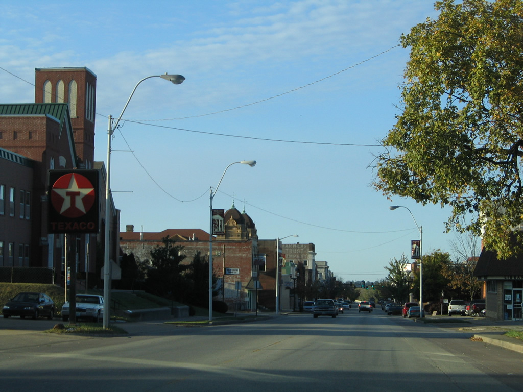
| Northbound Main Street at Spring Street, which leads west to become Santa Fe Trail. The Santa Fe Trail was an 1800s transportation route from Franklin, just north of the Missouri River, to Santa Fe, New Mexico. The paved route heads west from Boonville to Arrow Rock and Independence, mostly mirroring the course of the river to the north.1 10/16/04 |
|
| U.S. 40/Route 5-87 (Main Street) north next intersect Morgan Street. Morgan Street runs west to Harley Park and east to a prison and fiberboard plant. 10/16/04 |
|
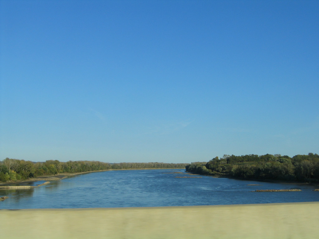
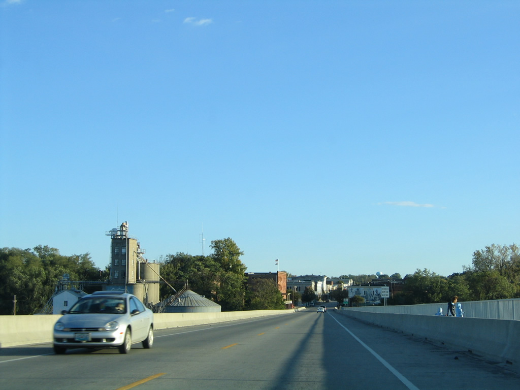
| The Boonslick Bridge carries U.S. 40/Route 5-87 across the Missouri River from Main Street to Howard County. 10/16/04 |
|
| Completed in 1995, the Boonslick bridge replaced a 1924-through truss bridge over the Missouri River. The 2,666-foot bridge accommodates two travel lanes with a 18.1 foot wide deck.2 10/16/04 |
|
| Lowering onto an agricultural plain north of the Missouri River, Route 87 separates with U.S. 40/Route 5 north for Boonesboro. 10/16/04 |
|
| Route 87 runs northward 20.4 miles from the Cooper County line to Route 5/240 in Glasgow. Route 5 loops north and west from New Franklin via Estill and Fayette beyond U.S. 40. 10/16/04 |
|
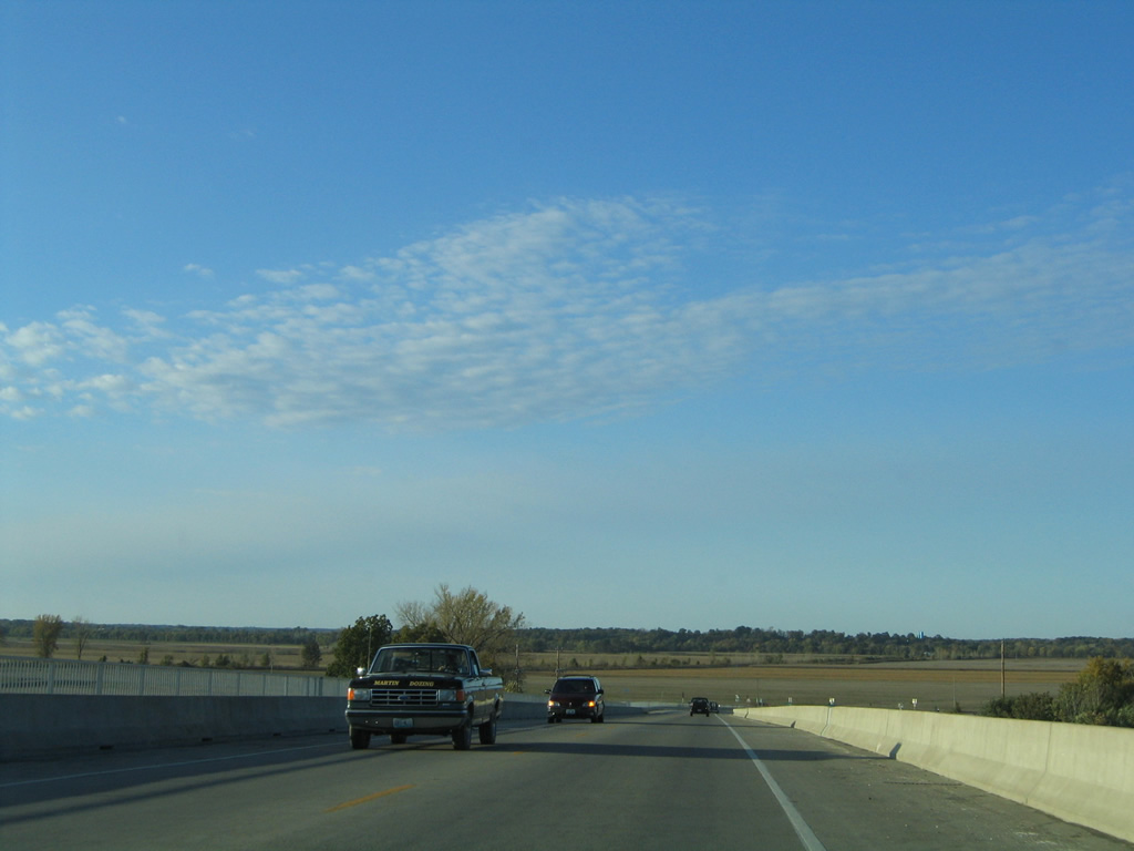
| U.S. 40 east / Route 5 north continue another mile before separating to Rocheport and New Franklin respectively. 10/16/04 |
|
| Route 87 combines with U.S. 40/Route 5 south to immediately cross the Missouri River on the Boonslick Bridge. 10/16/04 |
|
| An abandoned lift bridge remains in place west of the Boonslick Bridge. The span was a part of the Missouri-Kansas-Texas (M-K-T) Railroad line. The railroad discontinued operations in 1986, leading to its acquisition by the Missouri Department of Natural Resources for the eventual establishment of Katy Trail State Park. This span is not a part of the 240 mile long trail, which utilizes the Boonslick Bridge across the Missouri River.3 10/16/04 |
|
| The Boonslick Bridge opened in 1995 to replace a six-span through-truss bridge built in 1924.2 10/16/04 |
|
| U.S. 40/Route 5-87 south enter both the city of Boonville and Cooper County midway across the Boonslick Bridge. Main Street carries the three through the business district. 10/16/04 |
|
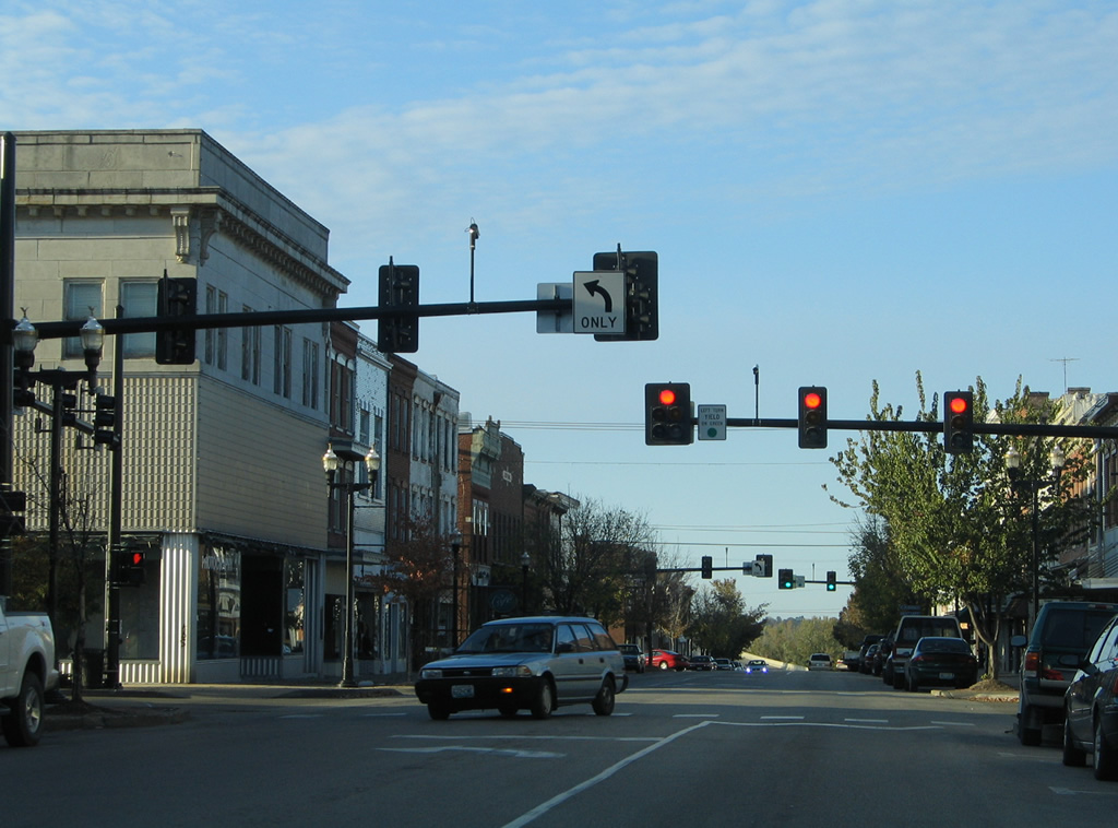
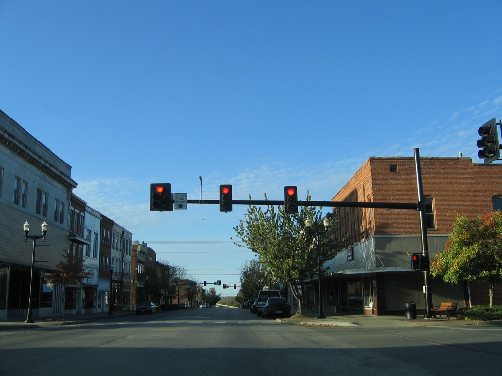
| Morgan Street intersects U.S. 40/Route 5-87 at the first of two Downtown Boonville traffic lights. 10/16/04 |
|
| Spring Street follows, heading west from 9th Street to become Santa Fe Trail by Harley Park. 10/16/04 |
|
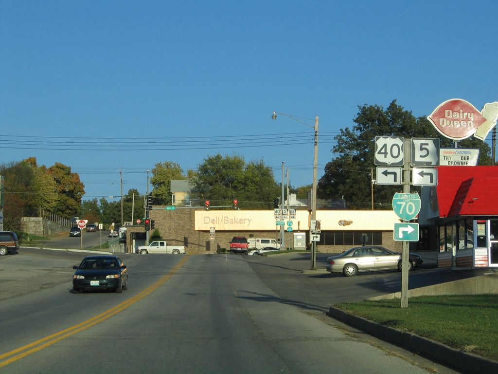
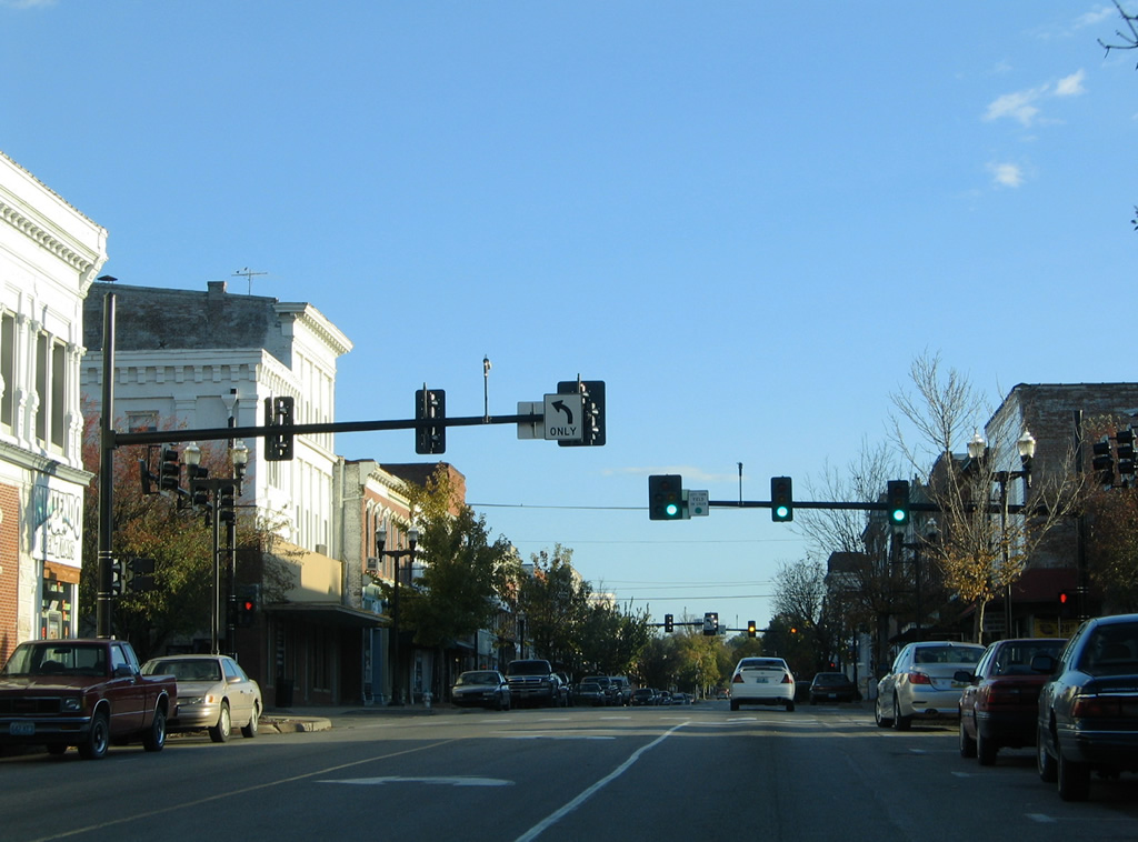
| Locust Street ties into Main Street just north of this former shield assembly for U.S. 40/Route 5-87. The assembly, removed after 2004, was a leftover from when Locust Street was in the state system as both Route 87 south / Route 98 east to 11th Street south to Bingham Road. 10/16/04 |
|
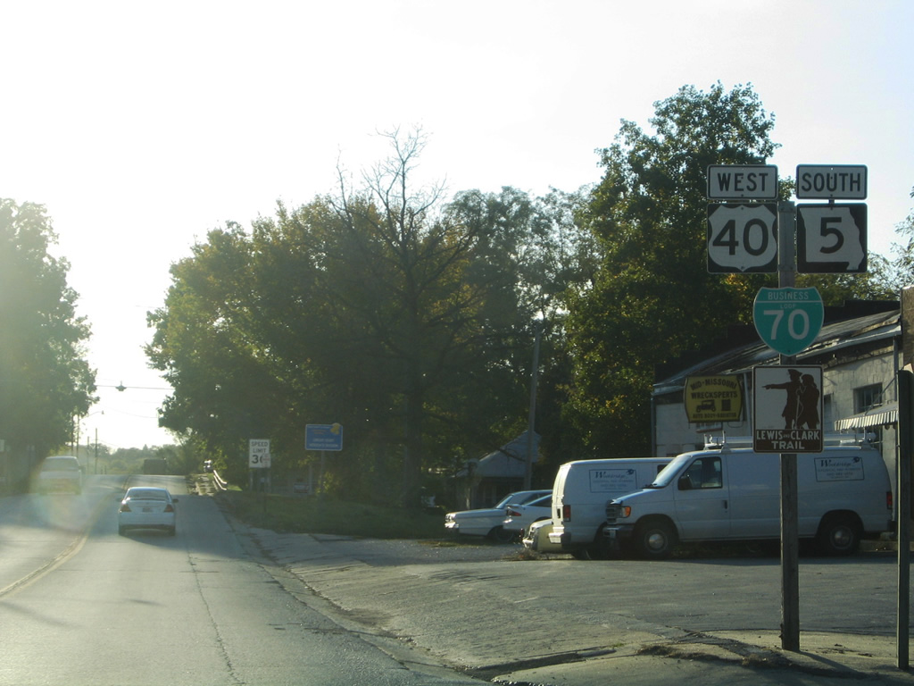
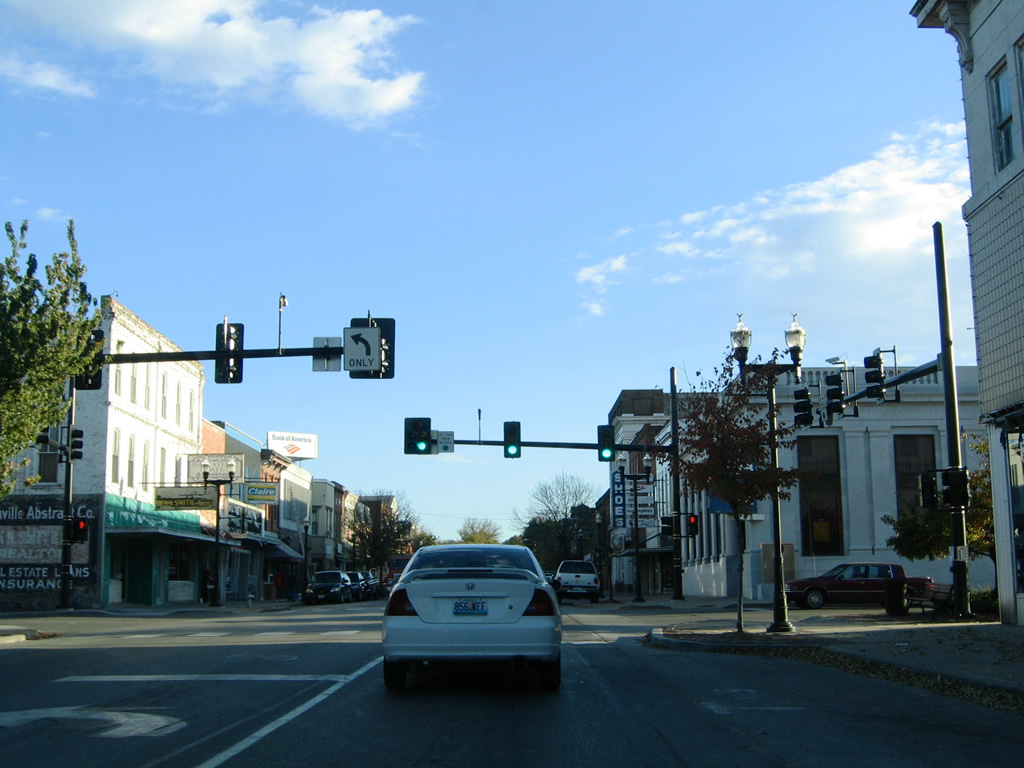
| Main Street lowers toward the signalized intersection with Business Loop I-70, which follows Elm Street west to Ashley Road through southwest Boonville. 10/16/04 |
|
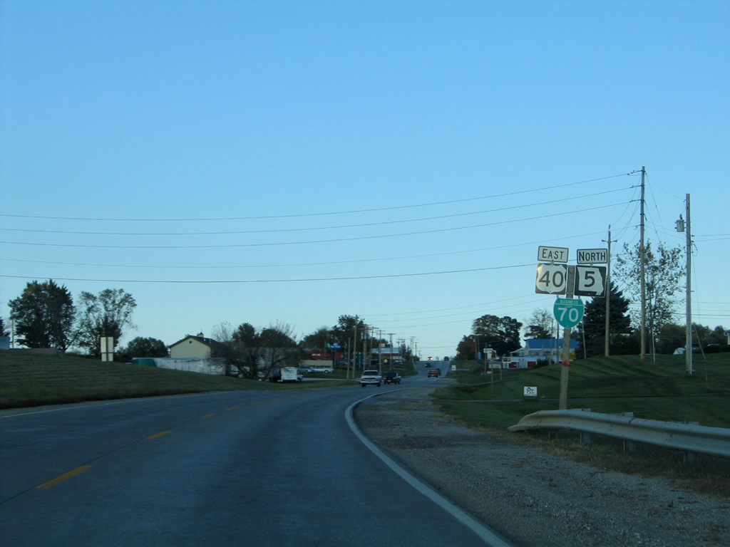
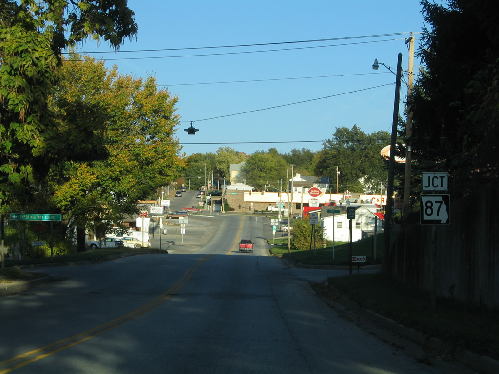
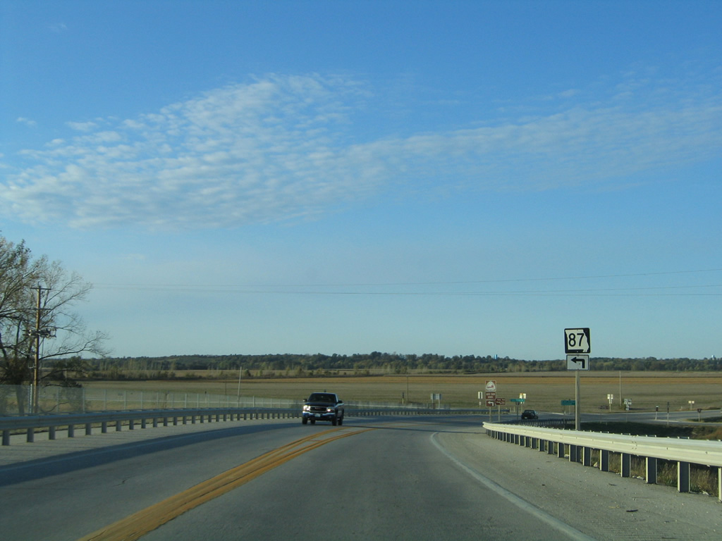
| U.S. 40/Route 5 south part ways with Route 87 (Main Street) south for Business Loop I-70 west to I-70 at Exit 101. Route 87 south joins Business Loop I-70 east to Exit 106. 10/16/04 |
|
| A portion of old roadbed remains in tact east of the Boonslick Bridge from the former alignment of U.S. 40/Route 5-87 that led to the truss bridge built across the Missouri River in 1924. 10/16/04 |
|
| Looking north at Old U.S. 40/Route 5 from the original split with Route 87 north. The new alignment travels just west of this abandoned stretch of highway. 10/16/04 |
Page Updated 11-12-2013.


 East
East