
Interstate 70 stretches from Hancock and the Pennsylvania state line to I-695 and the city of Baltimore. Originally I-70 partitioned into separate branches at Frederick. Interstate 70S followed today&apos:s I-270 while Interstate 70N followed the present day I-70 mainline.
Within Maryland, Interstate 70 supplemented or directly overlaid the U.S. 40 corridor from Baltimore west to Hancock. This includes the stretch from Exit 82 west to Exit 59, which opened in 1970 as I-70N.
The 1.95 mile long spur of I-70 within the Baltimore Beltway (Interstate 695) ends at a park and ride lot above MD 122 (Security Boulevard). This lightly traveled stretch of freeway was slated for demolition as part of a Maryland Transit Administration (MTA) project to construct the Red Line subway into Baltimore. Proposed work outlined the removal of the MD 122 and I-70 interchange and conversion of the six-lane freeway into a two-lane parkway. It was to be renamed Cooks Boulevard and maintained by the Maryland State Highway Administration.1
Interstate 70 Maryland Guides
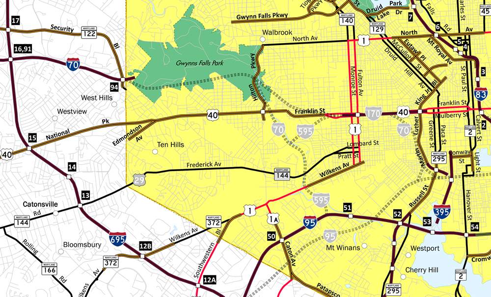
Two alignments were planned for Interstate 70 through the city of Baltimore. Traveling east through Gwynns Falls Park, the first proposed alignment of I-70N merged with the U.S. 40 corridor before turning south to end at the eventual alignment of I-95 near the Baltimore Ravens stadium. Subsequent changes shifted Interstate 70N more southeasterly to connect with I-95 east of Caton Avenue while establishing a freeway spur (Interstate 170) eastward along U.S. 40.
Community opposition stopped construction east into Gwynns Falls and Leakin Parks. A section of freeway opened as Interstate 170 between the one-way couplet along U.S. 40 and ramp stubs were built for the planned east end of I-70 along Interstate 95 at Exit 51. A final proposal outlined a spur (Interstate 595) utilizing a portion of the planned I-70 corridor northwest from I-95 to the section of Interstate 170.
 scenes scenes |
 | Monocacy Boulevard connects MD 144 (East Patrick Street) and Frederick Municipal Airport with I-70/U.S. 40 westbound in Frederick. Monocacy Boulevard and South Street see a folded diamond interchange with the freeway (Exit 55), east of the merge with Interstate 270. 12/30/08 |
 | MD 27, which originates at Interstate 270 Exit 16 and heads north via Ridge Road through northwestern Montgomery County before entering Frederick County and meeting Interstate 70 in Mount Airy. It intersects Interstate 70 and U.S. 40 at Exit 68 at a high speed interchange befitting a connection from a divided highway to an Interstate highway. This photo shows that intersection as seen from northbound MD 27 at I-70/U.S. 40. From this interchange, MD 27 continues northeast as a rural highway to Westminster (MD 140) and ultimately Manchester (MD 30). 06/01/03 |
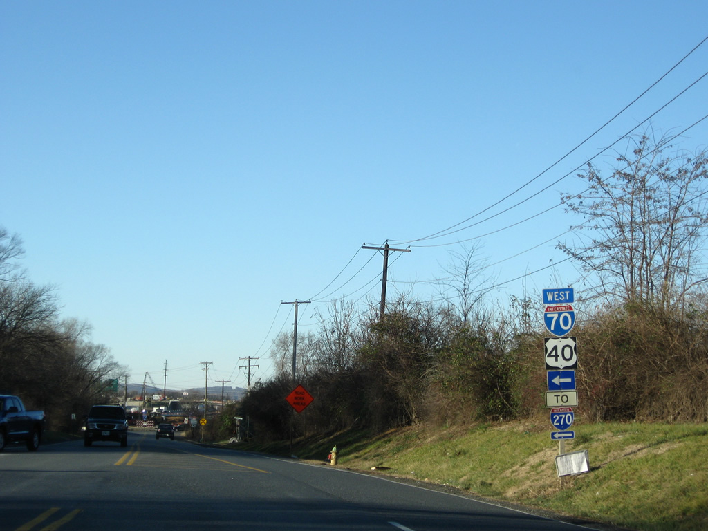
  | Ingleside Avenue lines the northwest quadrant of the interchange between Interstate 70 and MD 122 (Security Boulevard). The surface street doubles as the access route from Security Boulevard to Interstate 70 west in this role. Parallel Drive exits the Social Security Administration complex to end at Ingleside Avenue ahead of the freeway ramp. Drivers taking Parallel Drive see an independent ramp to Interstate 70 of Ingleside Avenue as well. 07/02/10 |
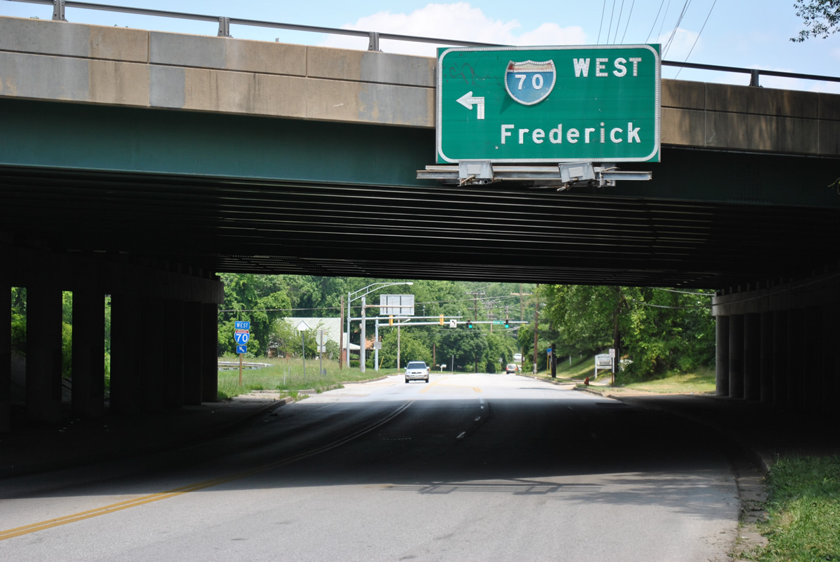 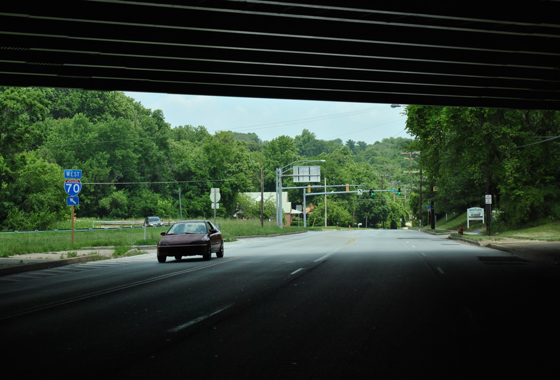 | Heading east on Ingleside Avenue from the West Hills neighborhood to Interstate 70 west. An original button copy sign alluded to the previous designation of Interstate 70 as Interstate 70N. The button copy numbers for 7 and 0 were repositioned when the letter N was removed. 06/20/12 |
- AASHTO U.S. Route Numbering Committee meeting May 29, 2014.
http://ballot.transportation.org/FileDownload.aspx?attachmentType=Item&ID=1166
Photo Credits:
06/01/03, 12/30/08, 07/02/10, 06/20/12 by AARoads
Connect with:
Interstate 68 - National Freeway
Interstate 81
Interstate 270
Interstate 695 - Baltimore Beltway
U.S. 15
U.S. 29
U.S. 40
Page Updated 06-08-2014.