|
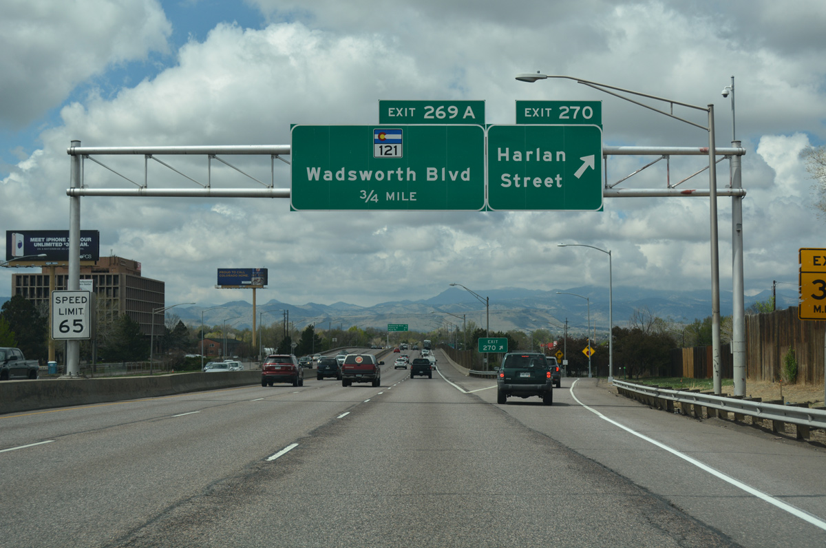
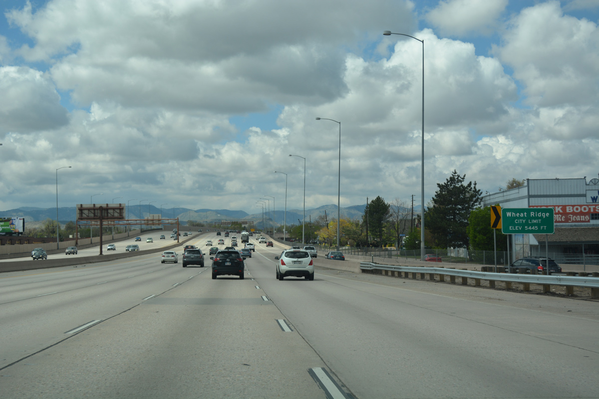
| Upon crossing Sheridan Boulevard (SH 95), Interstate 70 leaves Denver and enters Jefferson County. The freeway runs north of Lake Rhoda to a modified diamond interchange (Exit 270) with 48th Avenue and Harlan Street. 04/22/17 |
|
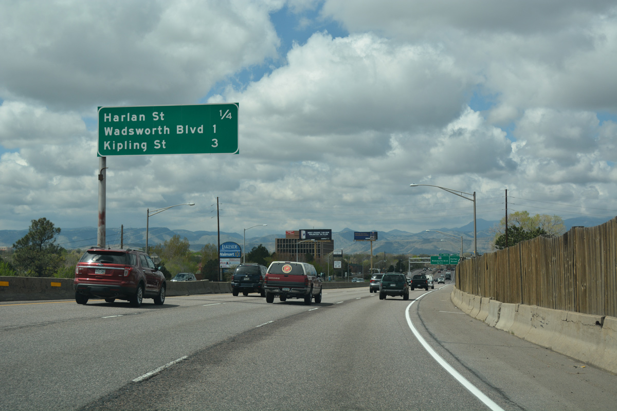
| Harlan Street leads north from Exit 270 to become Clear Creek Drive through Regis in Denver to 52nd Avenue on the Adams County line. South from I-70, Harlan Street separates the town of Lakeside from Wheat Ridge to a retail area at 44th Avenue. 04/22/17 |
|
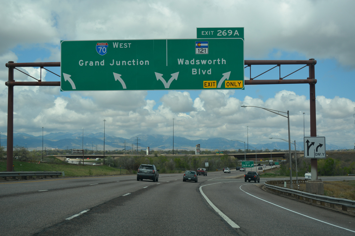
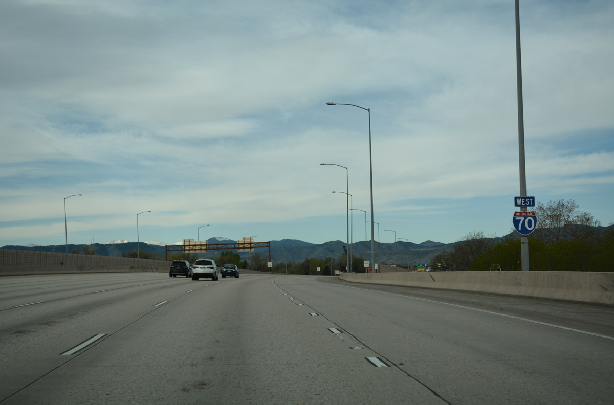
| Advancing from Lakeside, I-70 turns north to converge with the west end of I-76 in southeast Arvada. Ramps between the two freeways intertwine with adjacent Exit 269A for SH 121 (Wadsworth Boulevard). I-70 otherwise separates Arvada from Wheatridge to Ward Road (Exit 265). 04/22/17 |
|
| Exit 269A forms a distributor roadway, carrying traffic from both I-70 west and I-76 west to SH 121 (Wadsworth Boulevard). SH 121 comprises a nearly 31 mile urban boulevard or suburban arterial south to Lakewood and Ken Caryl Ranch and north to Arvada, Westminster and U.S. 287 at Broomfield. 04/22/17 |
|
| Crossing Clear Creek, Interstate 70 clips the southeastern corner of the Arvada city limits. Ramps from I-70 east and SH 121 combine overhead as the eastbound beginning of I-76 to Brighton, Fort Morgan and Sterling. 08/28/04 |
|
| The advent of traffic from the wye interchange (Exit 269B from I-70 east) with Interstate 76 west swells I-70 westbound to five overall lanes as the freeway reenters Wheat Ridge. 04/22/17 |
|
| This reassurance marker for Interstate 70 west stands within the directional cloverleaf interchange at SH 121 (Wadsworth Boulevard). 04/23/17 |
|
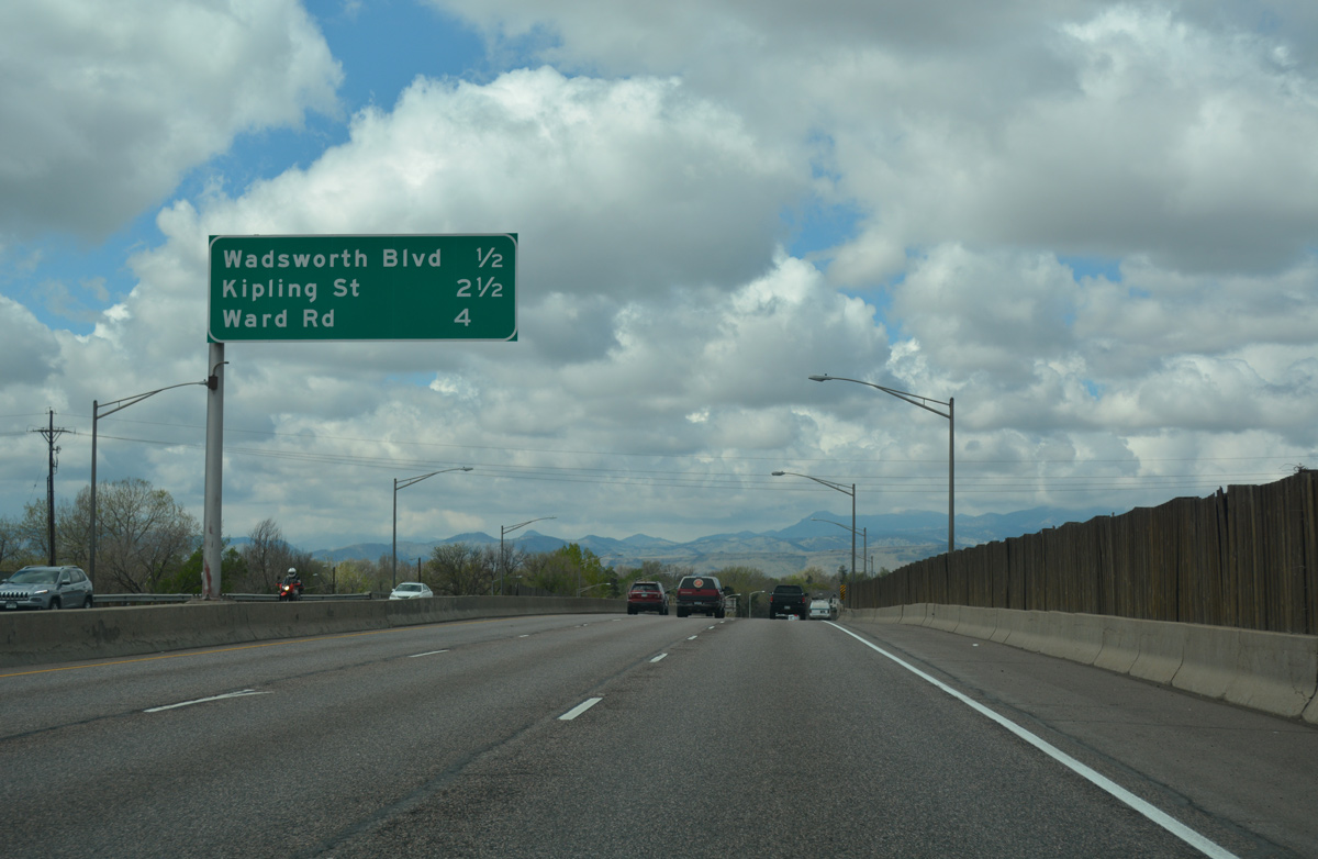
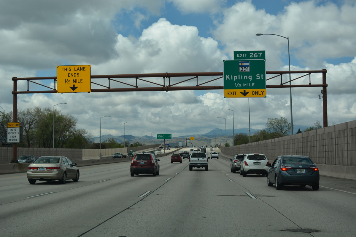
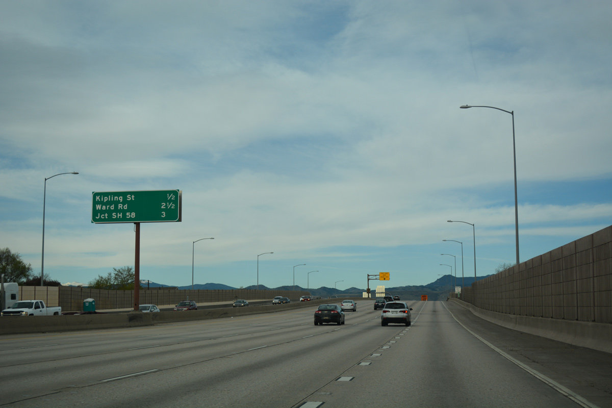
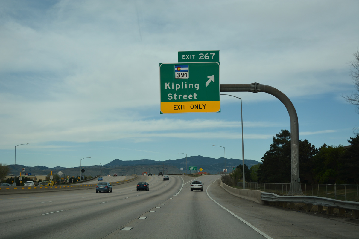
| SH 391 (Kipling Street) concludes a 9.64 mile long route north from U.S. 285 in Lakewood at Exit 267 in one half mile. 04/22/17 |
|
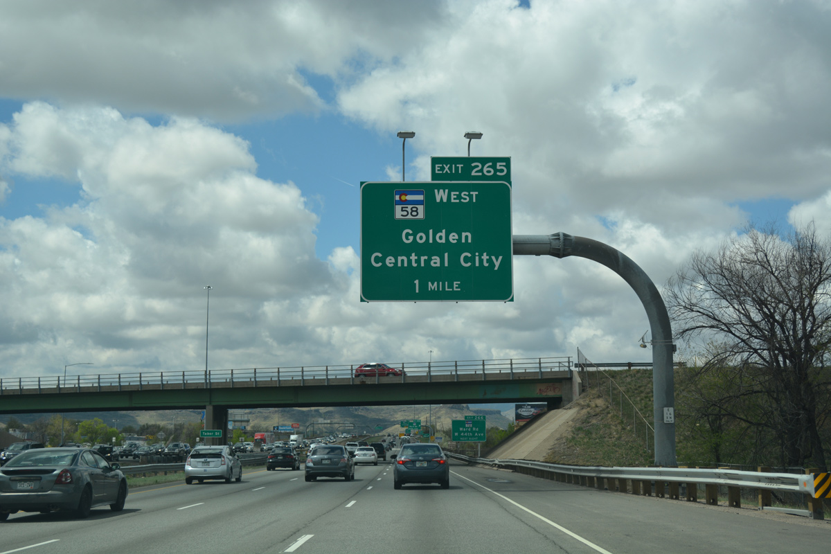
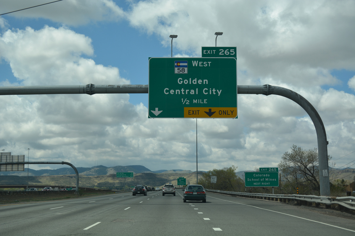
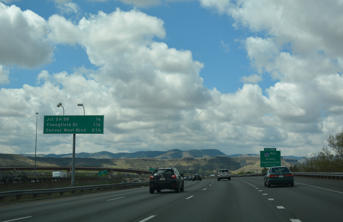
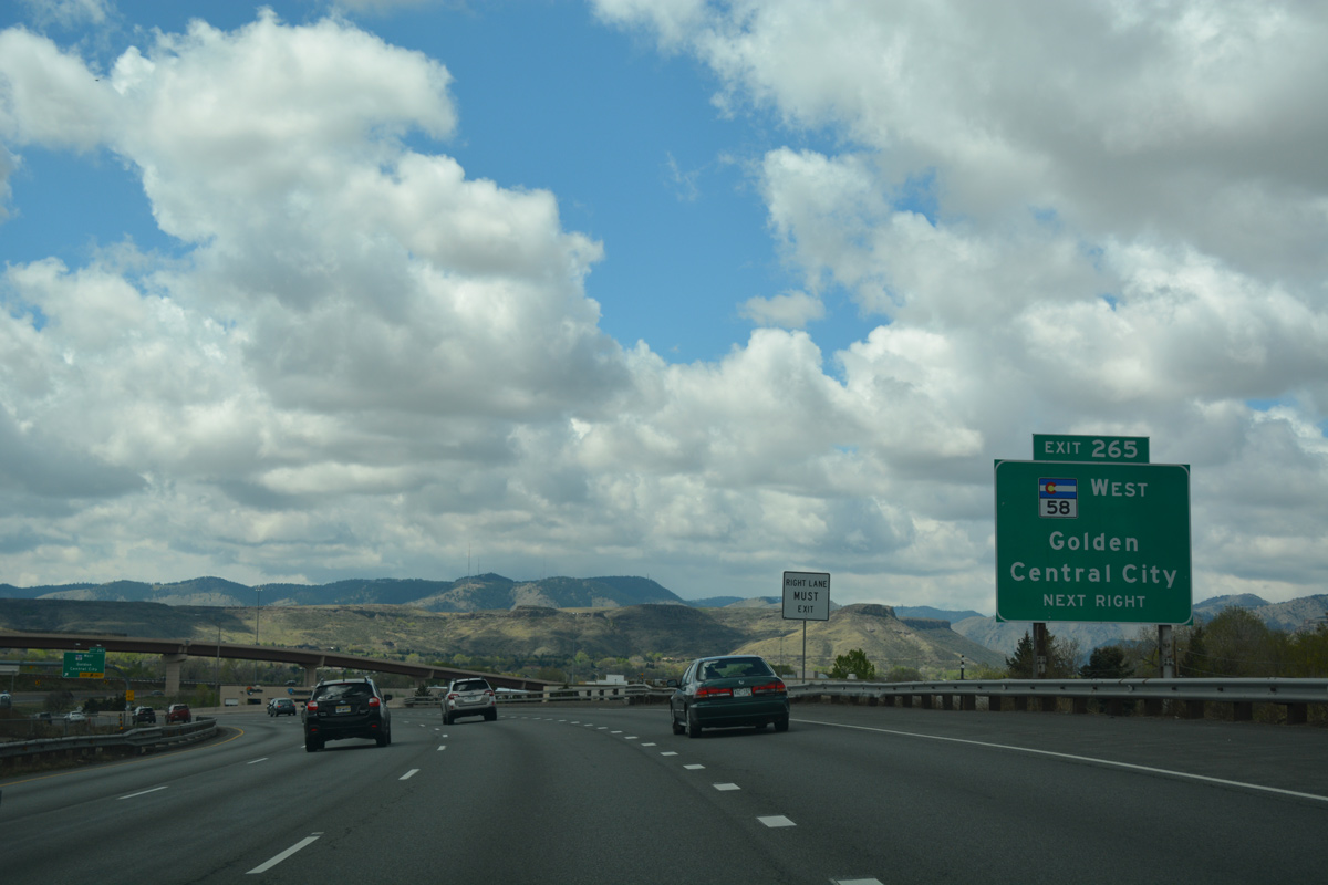
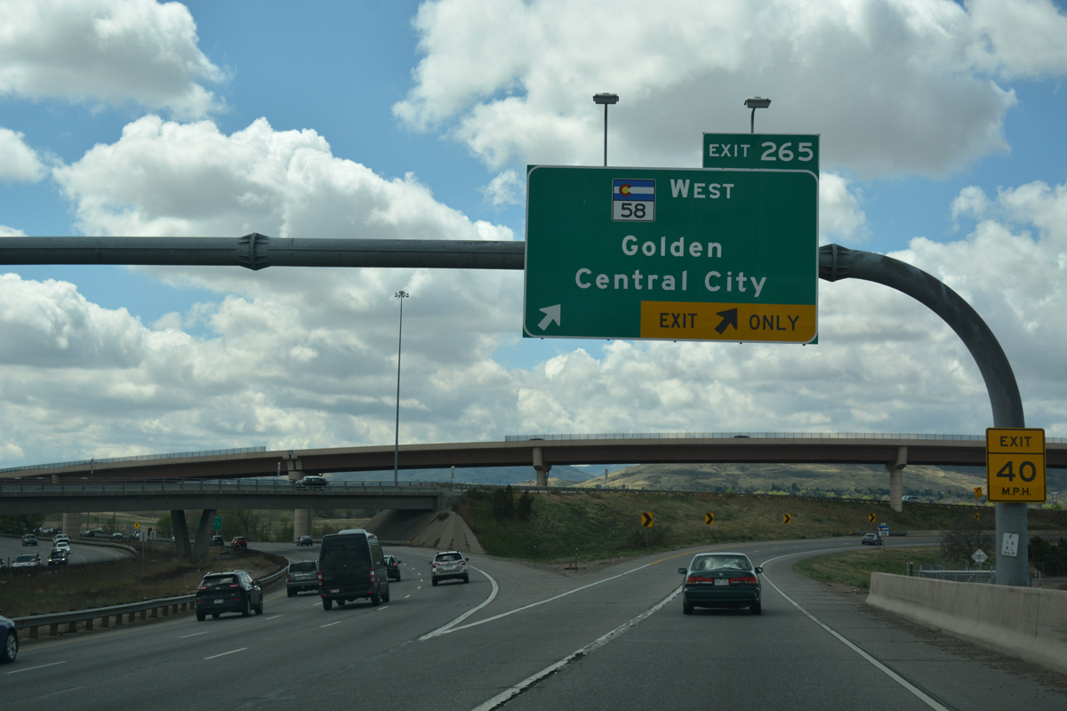
| SH 58 (Golden Freeway) branches west from Interstate 70 in three miles. The freeway turns south to Lakewood from there. 04/23/17 |
|
| A diamond interchange (Exit 267) joins Interstate 70 with SH 391 (Kipling Street) south through Wheat Ridge. Kipling Parkway extends north as a locally maintained arterial into Arvada. 04/23/17 |
|
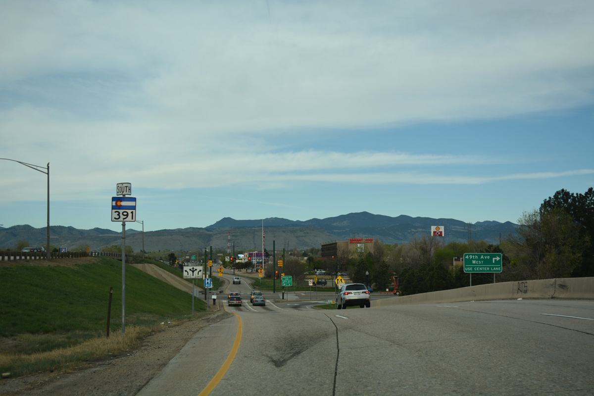
| Taking Exit 267 from I-70 west to SH 391 (Kipling Street) south. Kipling Street intersects 49th Avenue nearby amid a retail area spreading north to Ridge Road. 04/23/17 |
|
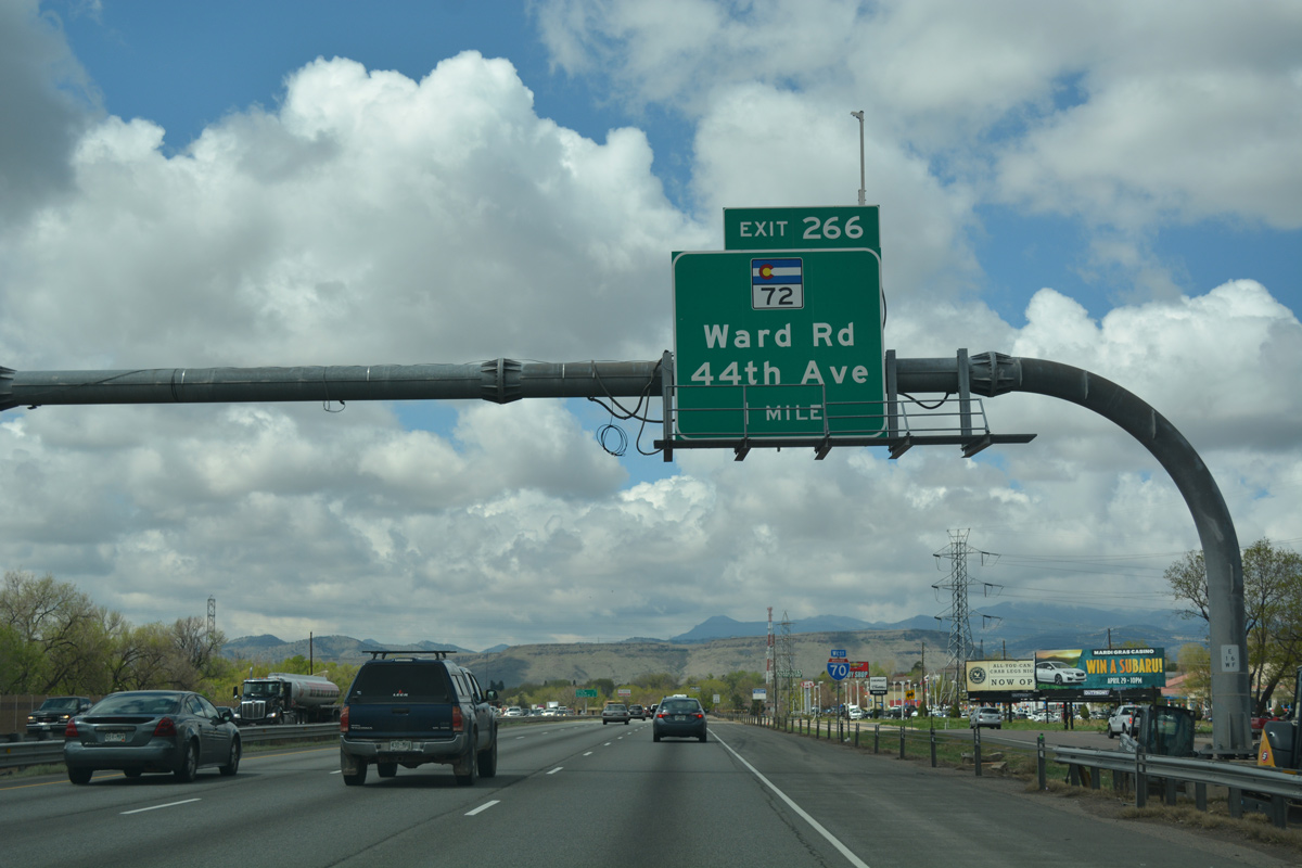
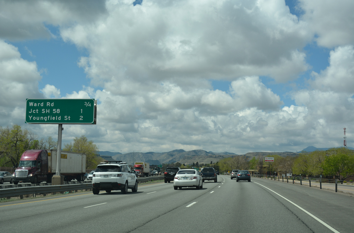
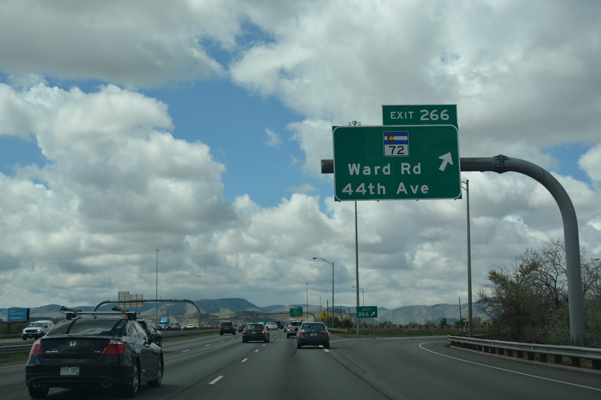
| Forthcoming SH 72 (Ward Road) stems north from 44th Avenue and Exit 266 to 64th Avenue in Arvada. 04/22/17 |
|
| Frontage roads accompany Interstate 70 west from Kipling Street to Tabor Street. 04/22/17 |
|
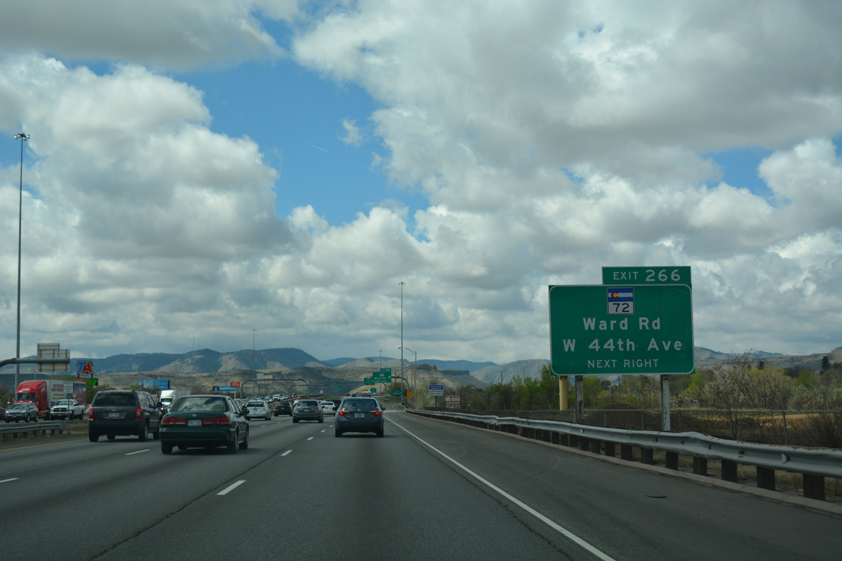
| A half mile ahead of the folded diamond interchange (Exit 266) with Ward Road on I-70 west. 04/22/17 |
|
| SH 58 is a 5.63 mile long freeway joining Interstate 70 with the city of Golden and U.S. 6 through Clear Creek Canyon from just west of SH 72 (Ward Road). 04/22/17 |
|
| Traveling 54.06 miles overall to SH 7 at Raymond, SH 72 follows a stair stepped route through Arvada to leave the suburban city west through Coal Creek Canyon to Nederland. 04/22/17 |
|
| Exit 266 departs from Interstate 70 west for SH 72 (Ward Road) and 44th Avenue (old SH 58). 04/22/17 |
|
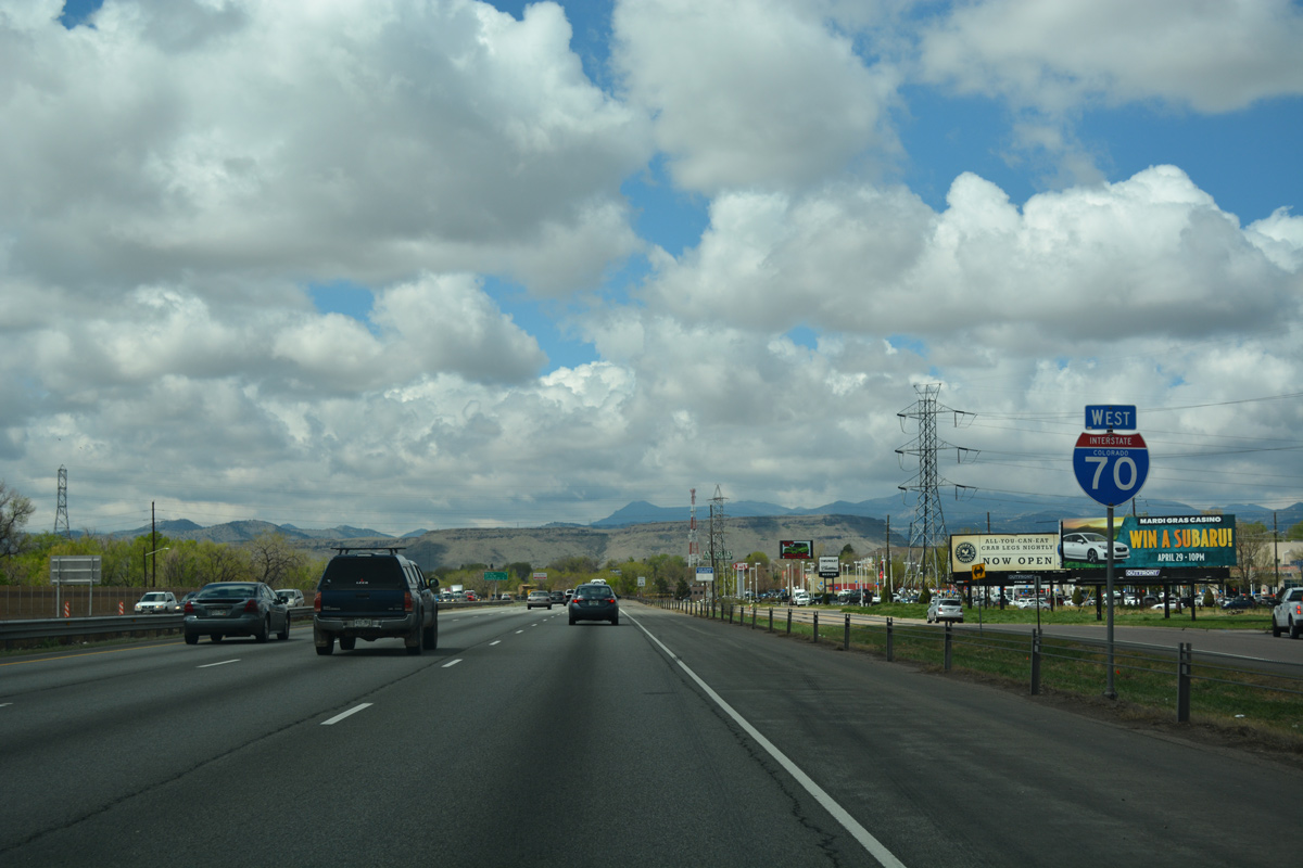
| Curving south, Interstate 70 gains an auxiliary lane from Ward Road to Exit 265 with SH 58 west. 04/22/17 |
|
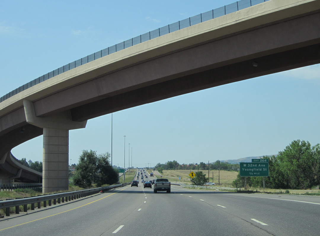
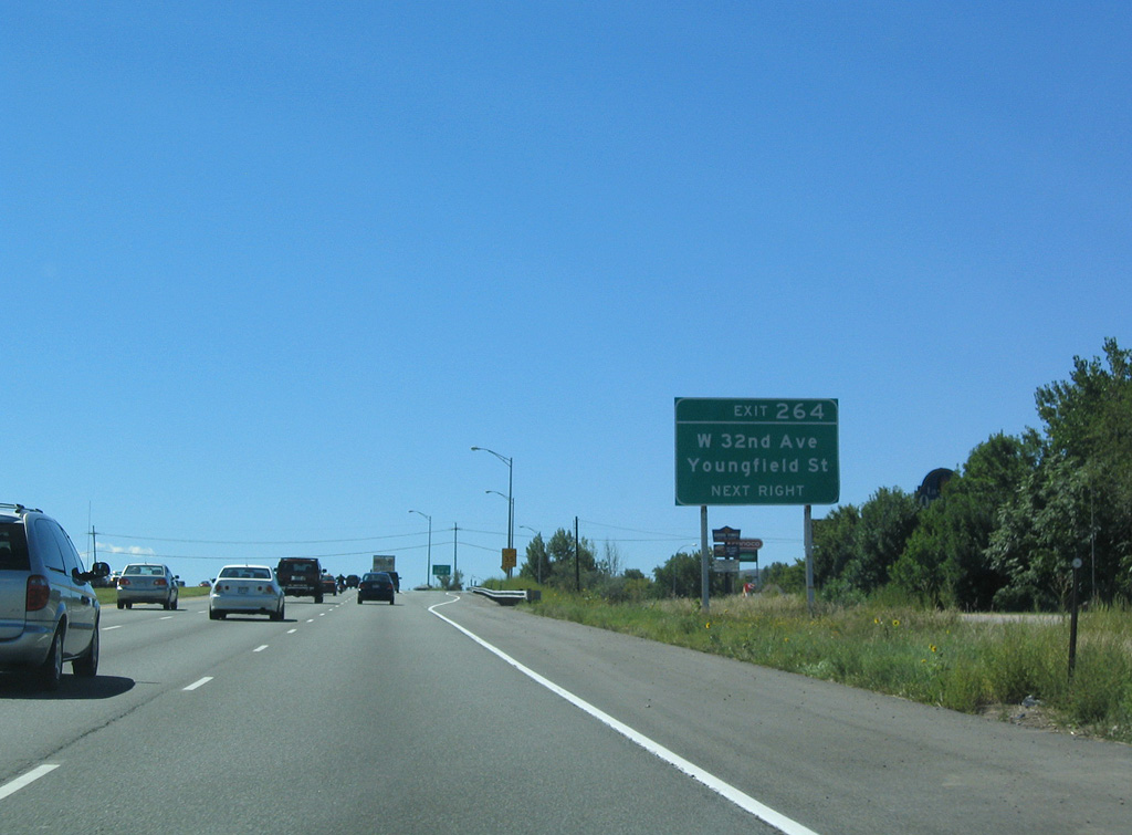
| Youngfield Street (Exit 264), 1.25 miles ahead, represents the first of three interchanges along I-70 west for the city of Lakewood. 04/22/17 |
|
| The Golden Freeway replaced 44th Avenue west as the alignment for SH 58 by 1974. The high speed route parallels Clear Creek west between North and South Table Mountains toward Downtown Golden. 04/22/17 |
|
| Exit 265 was expanded from a wye to a semi directional T interchange to provide full access between SH 58 and I-70 by 2008. 04/22/17 |
|
| Interstate 70 runs alongside Youngfield Street south to Exit 264 for Clear Creek Drive and 32nd Avenue. Youngfield Street, a 1930s alignment of SH 173, continues to Wide Acres and Colfax Avenue in Lakewood. 07/04/12 |
|
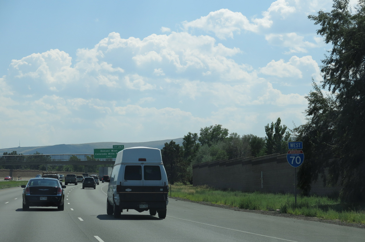
| Progressing south between South Table Mountain and Maple Grove Reservoir, I-70 reaches the Denver West area of Lakewood in 2.25 miles and meets Business Loop I-70/U.S. 40 at Exit 263 in 3.25 miles. 08/28/04 |
|
| 32nd Avenue west passes around the north slope of South Table Mountain to enter Downtown Golden near the main Coors Brewing Company. East from Exit 264, 32nd Avenue travels through the Applewood Village community of Wheat Ridge. 08/28/04 |
|
| Interstate 70 curves southwest out from the city of Wheat Ridge near Maple Grove Reservoir. 08/15/13 |
|
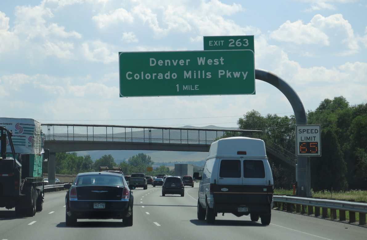
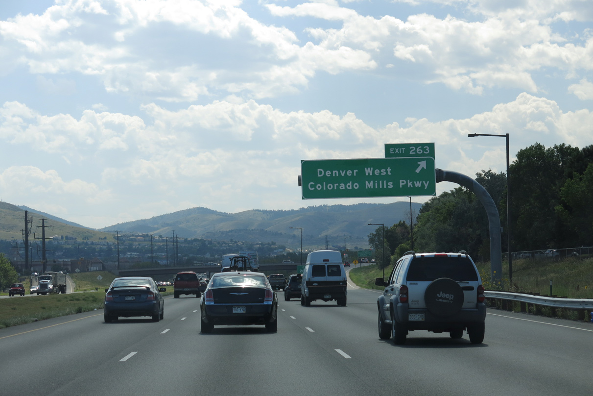
| Angling southwest, I-70 converges with Denver West Marriott Boulevard north and Denver West Colorado Mills Parkway south in one mile. Collectively the arterials serve an array of apartments, offices buildings and retail making up Denver West. 08/15/13 |
|
| Business Loop I-70/U.S. 40 (Colfax Avenue) head west from Colorado Mills mall to meet I-70 at the succeeding exit. Colfax Avenue provides the connection to U.S. 6 (6th Avenue) west through Golden, as there is no direct access to the expressway from I-70 directly. 08/15/13 |
|
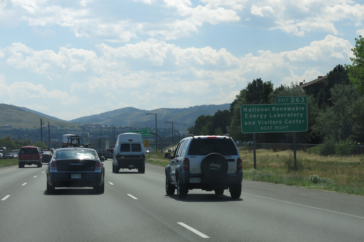
| Exit 263 links Interstate 70 with adjacent Denver West Parkway to the National Renewable Energy Lab on the south side of South Table Mountain. 08/15/13 |
|
| Entering the diamond interchange (Exit 263) with Denver West Marriott Boulevard and Denver West Colorado Mills Parkway on Interstate 70 west. 08/15/13 |
|
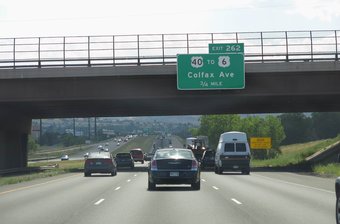
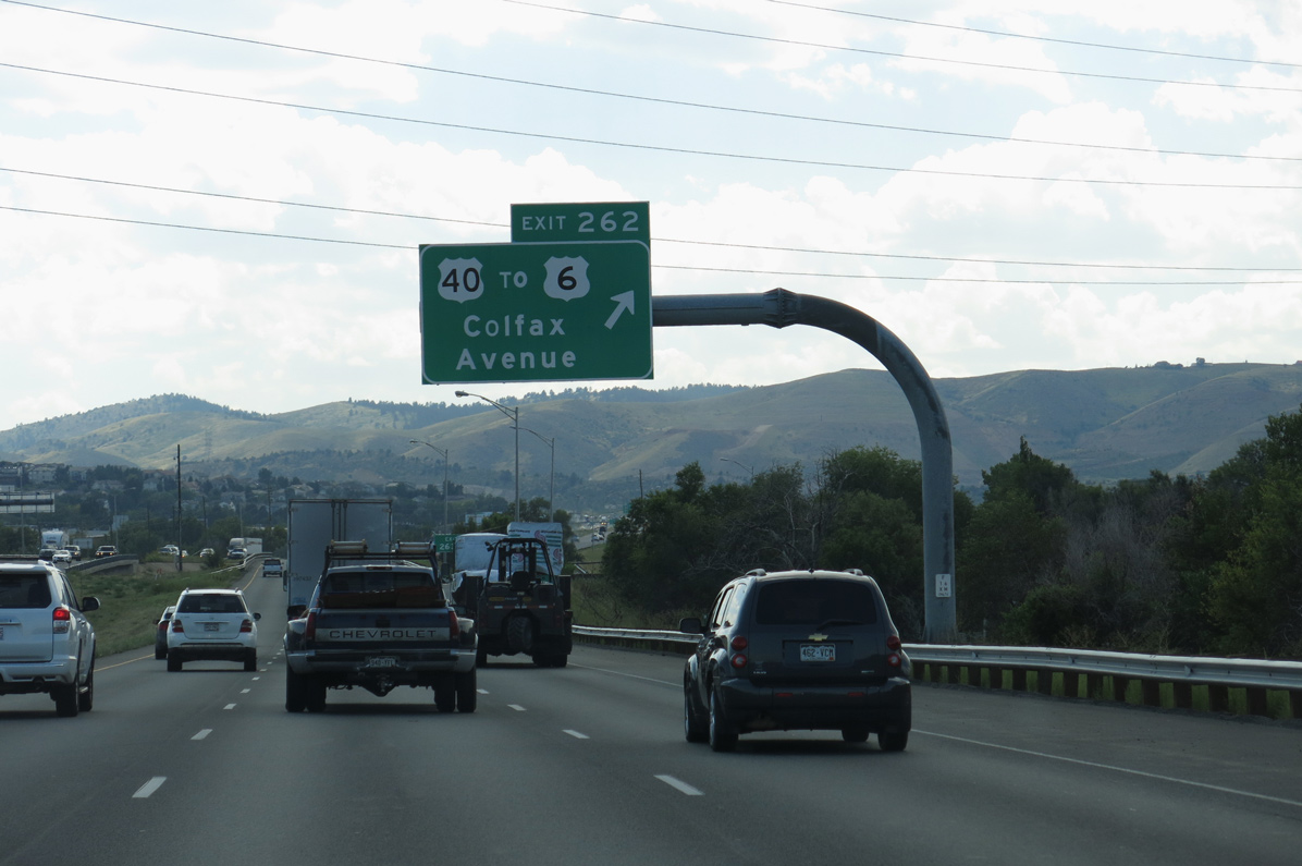
| Entering the city of Lakewood, I-70 converges with Business Loop I-70/U.S. 40 (Colfax Avenue) at Exit 262. Business Loop I-70 branched west from I-70 in east Aurora at Exit 288. 08/15/13 |
|
| Green Mountain and Dinosaur Ridge appear to the southwest as Interstate 70 advances to the diamond interchange (Exit 262) with Colfax Avenue. 08/15/13 |
|
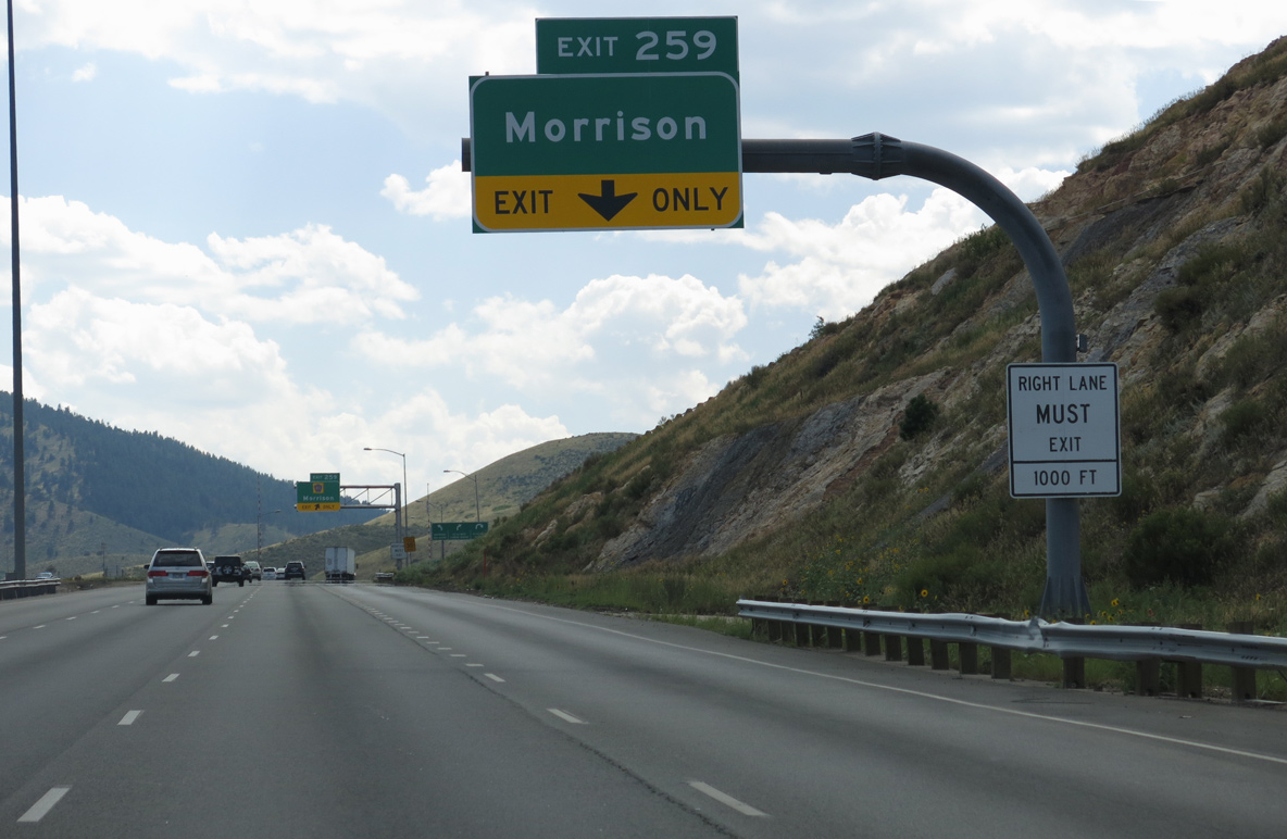
| Colfax Avenue crosses southern areas of Golden by a mix of car dealerships, big box retail, industrial parks and mobile home communities to Heritage Square Amusement Park and Exit 259. 08/15/13 |
|
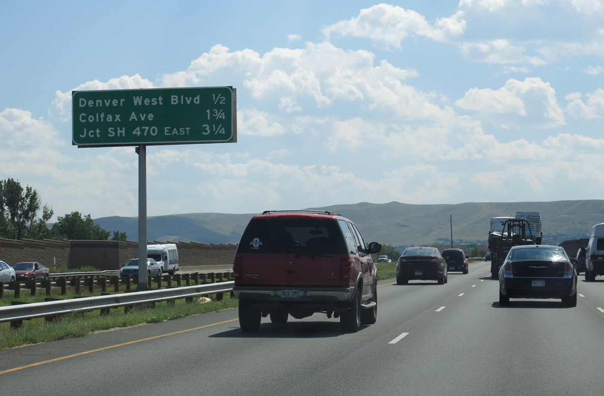
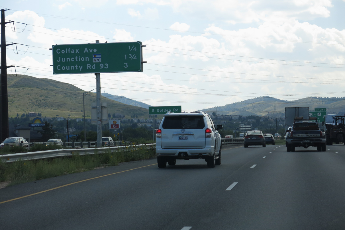
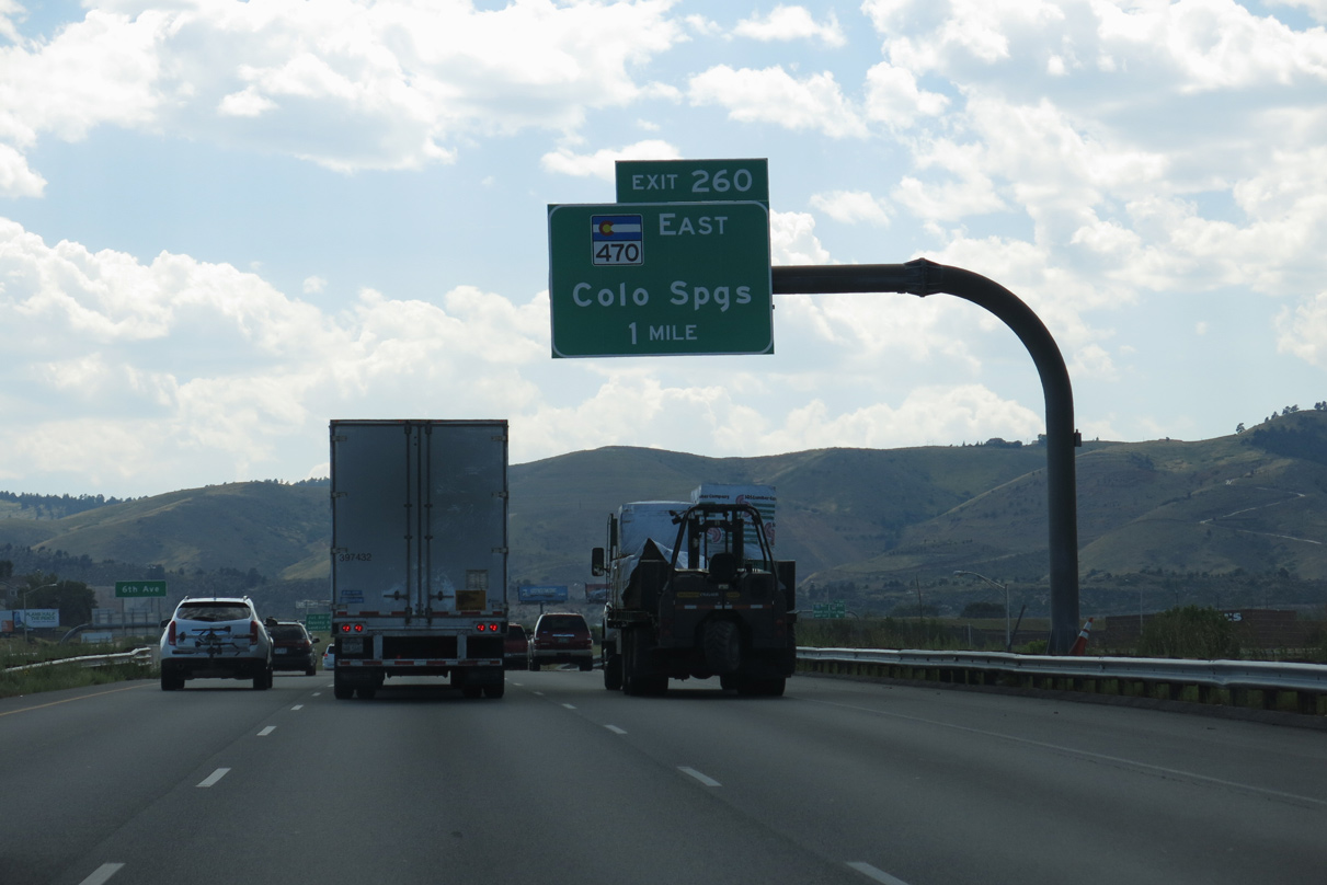
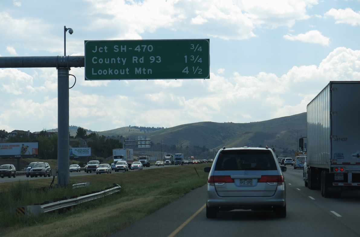
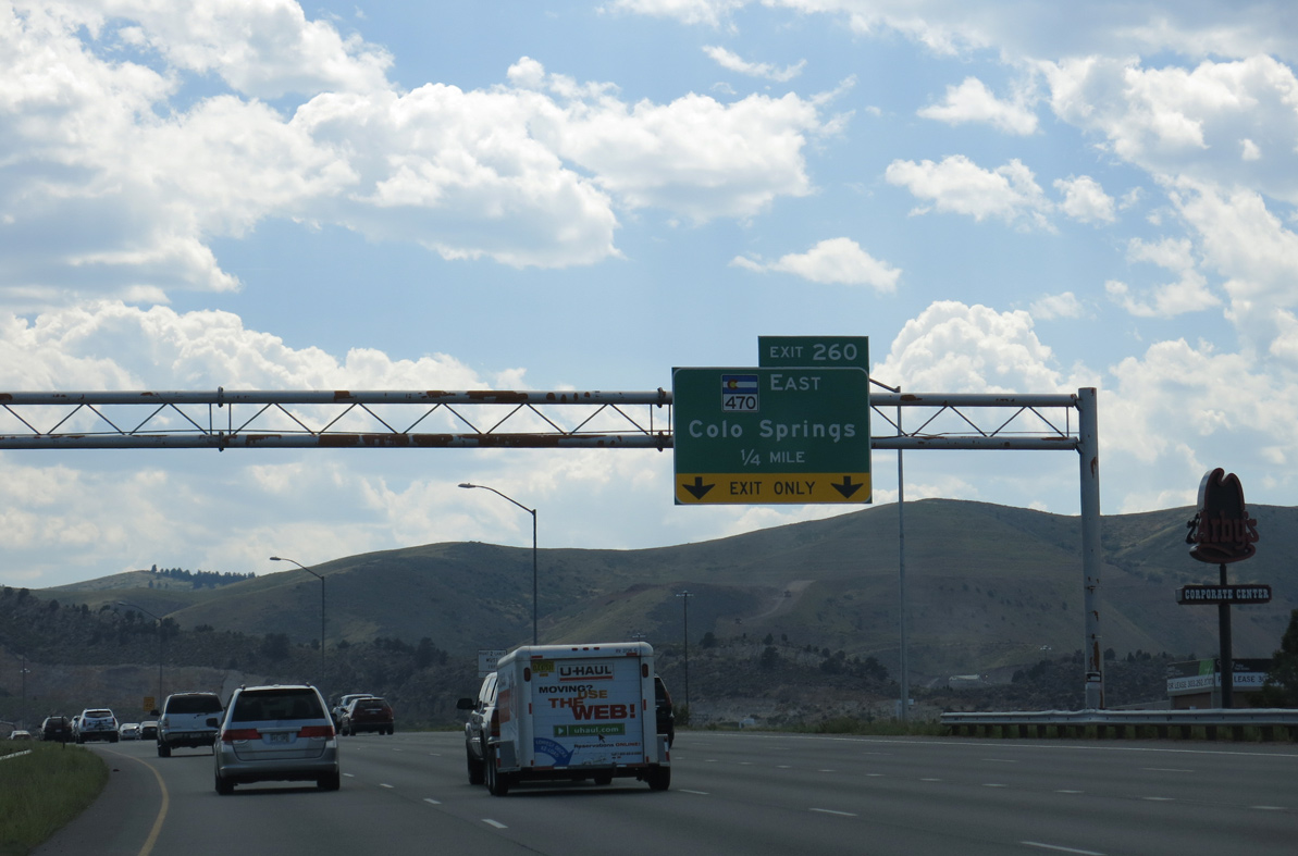
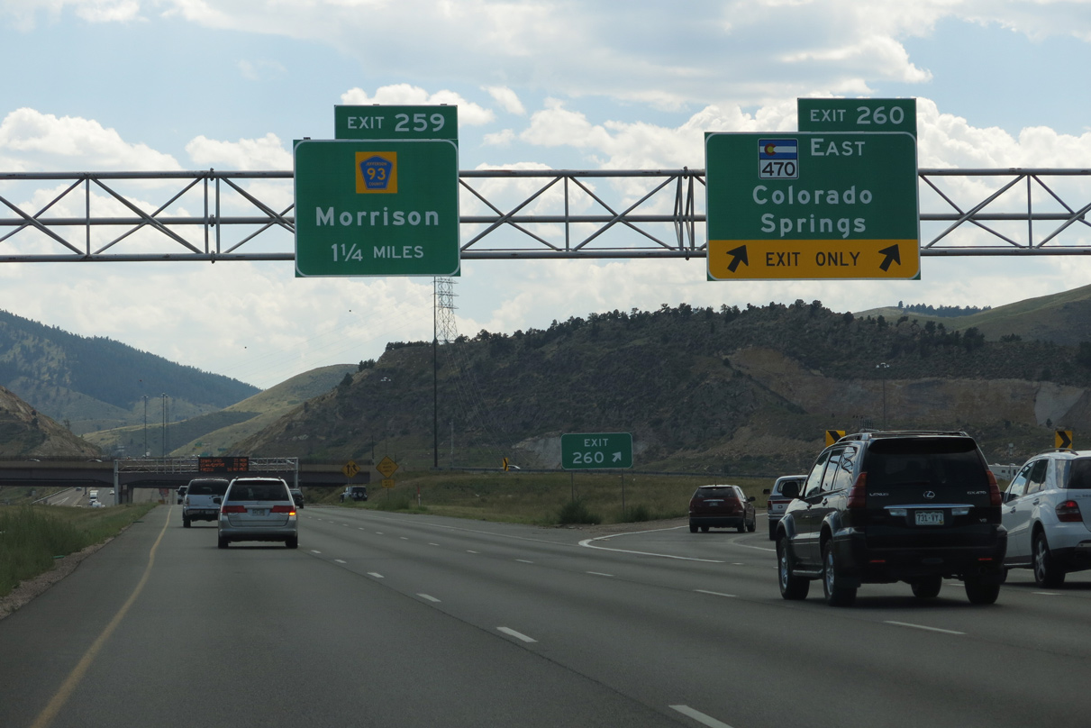
| Exit 260 departs in one mile for C-470 east, the belt route encircling the Jefferson County suburbs south of Lakewood to Highlands Ranch in Douglas County. 08/15/13 |
|
| A directional ramp adds traffic to I-70 west from U.S. 6 (Sixth Avenue) west ahead of C-470 and County Road 93 south along Dinosaur Ridge. 08/15/13 |
|
| C-470 (Centennial Parkway) serves the town of Morrison, Bear Creek Lake Park, Chatfield State Park and the cities of Littleton and Centennial along a 27.41 mile long course to Interstate 25 at Lone Tree. 08/15/13 |
|
| Exit 260 provides access to C-470 south. The freeway extension north to U.S. 6 at Johnson Road was completed in 2000. Ramps were added from C-470 south to I-70 west and from I-70 east to C-470 north by 2006. 08/15/13 |
|
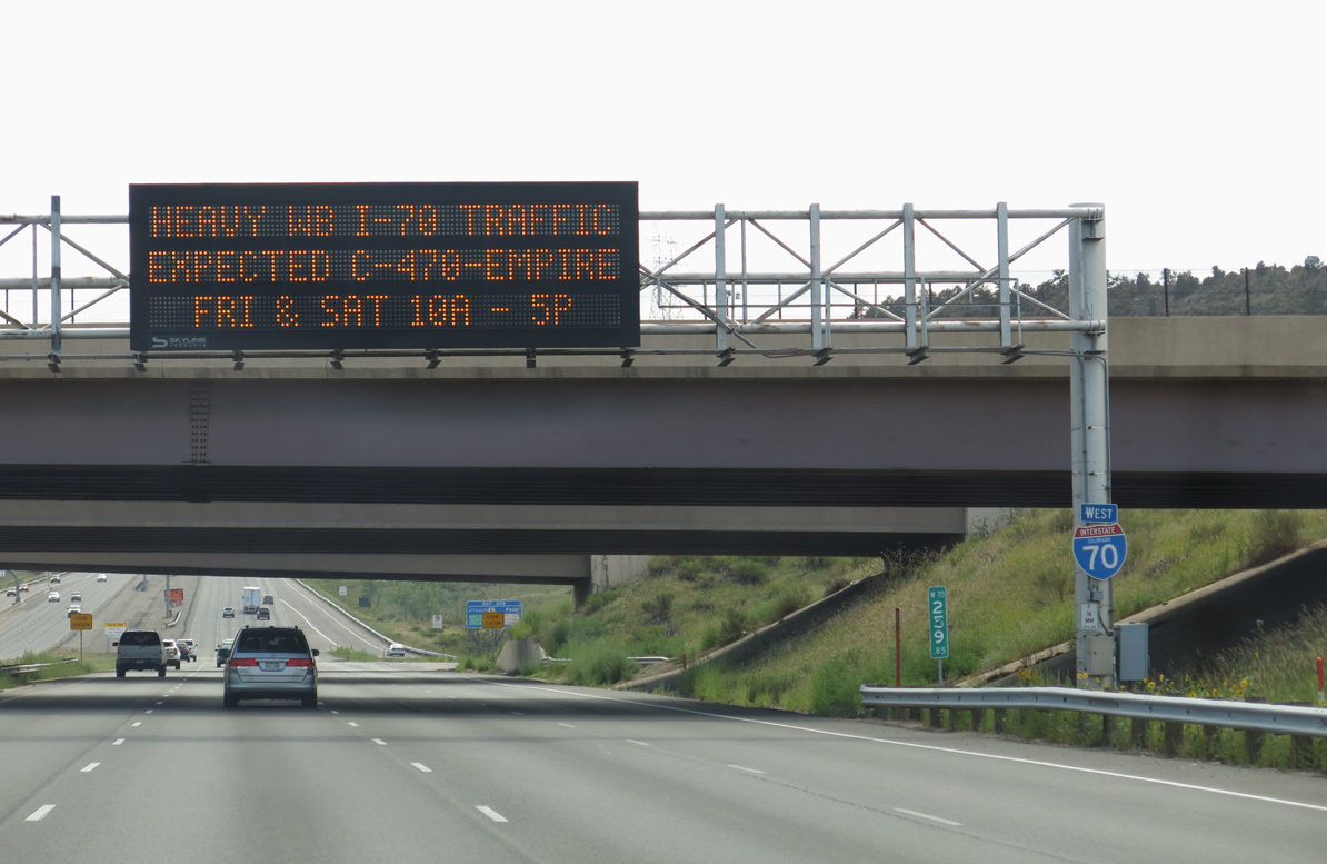
| A dynamic message sign at the C-470 overpass provides information related to traffic congestion and weather conditions that may affect freeway travel along Interstate 70 west in the higher elevations. 08/15/13 |
|
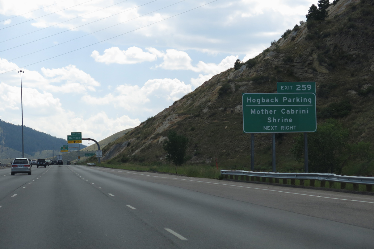
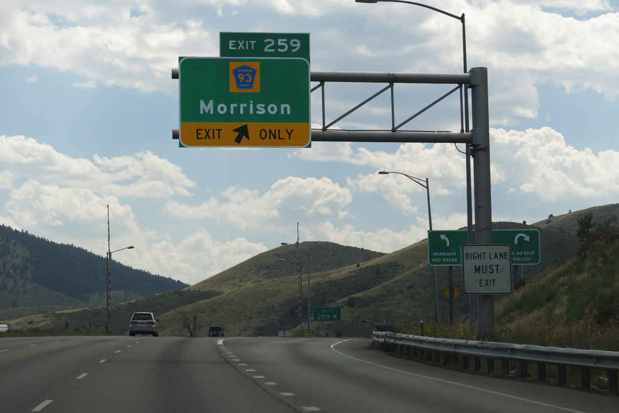
| Forthcoming County Road 93 spurs south from Exit 259 along Dinosaur Ridge and the Hogback. Business Loop I-70 ties in from adjacent U.S. 40 to the north, which leads west to the Mother Cabrini Shrine. 08/15/13 |
|
| CR 93 replaced SH 26, which was truncated from SH 8 at Morrison north and east to SH 88 (Federal Boulevard) in Denver. CR 93 and Hog Back Road) provide a local route to Dinosaur Ridge and Mount Vernon Avenue in Morrison. 08/15/13 |
|
| Park-n-Ride lots lie next to the diamond interchange (Exit 259) joining I-70 with Business Loop I-70 (Colfax Avenue) east, U.S. 40 and CR 93 south. 08/15/13 |
|
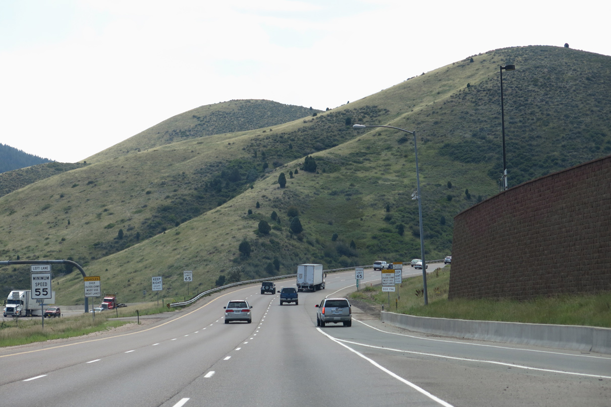
| Interstate 70 enters Mount Vernon Canyon west of Dinosaur Ridge and the Hogback. 08/15/13 |
|
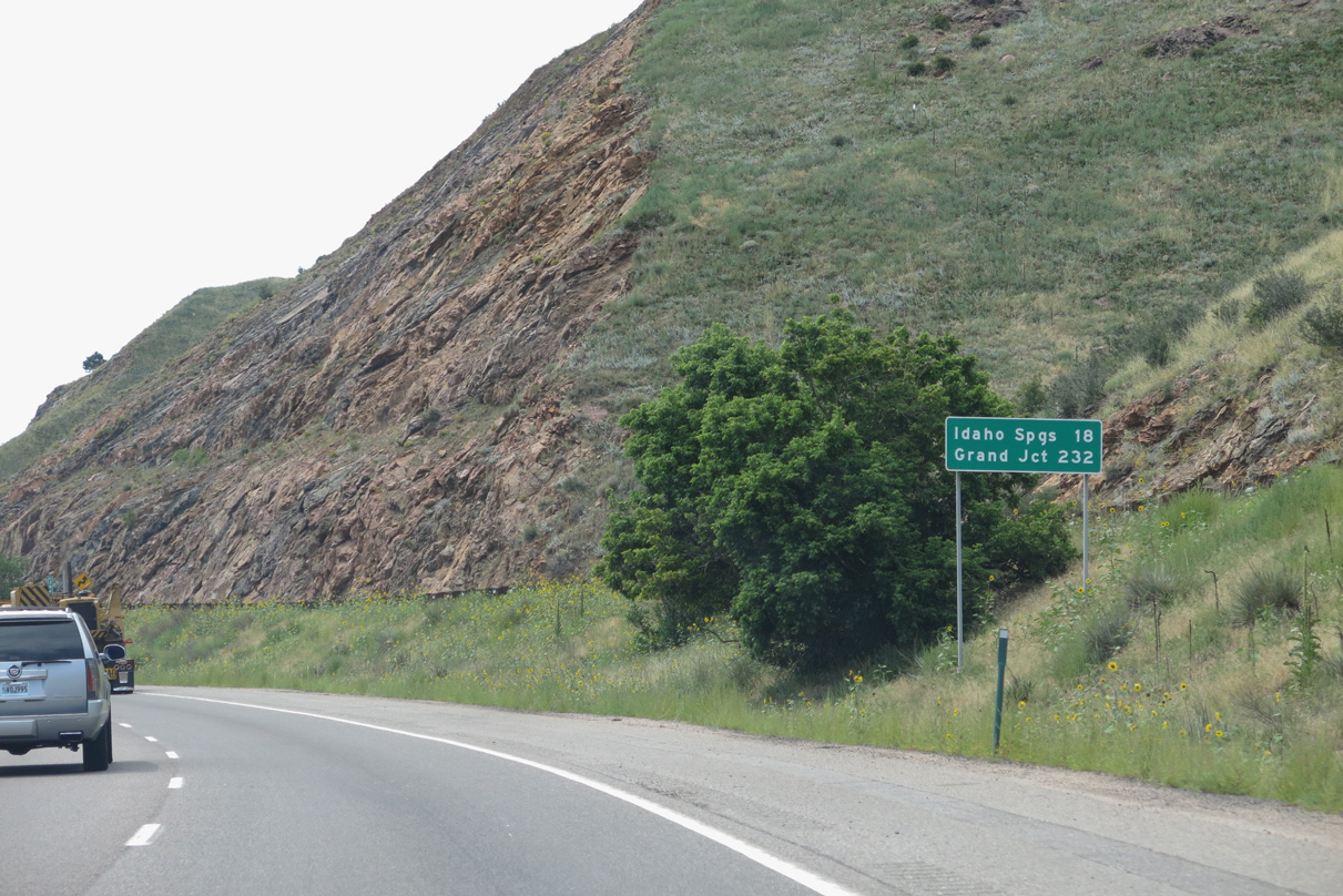
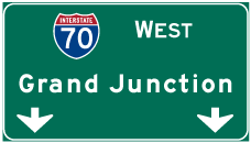
| Interstate 70 gains nearly 1,000 feet in elevation over the 18 mile course to the Idaho Springs city center. Grand Junction is 232 miles to the west. 08/15/13 |
|
| Mt. Vernon Creek flows along the south side of Interstate 70 and north of Lininger Mountain. 08/15/13 |
|
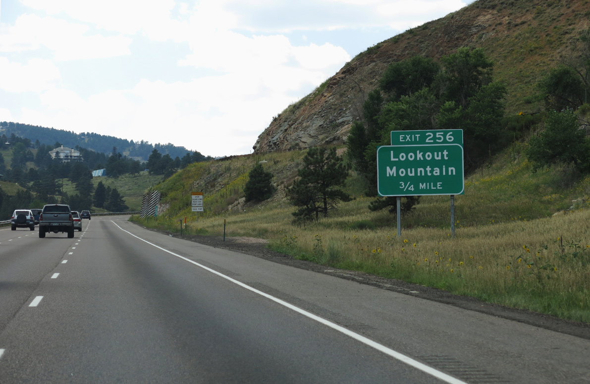
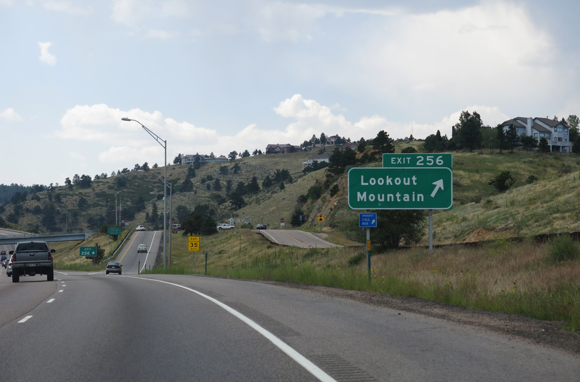
| Interstate 70 climbs along a 6% grade through Mount Vernon Canyon to Exit 256 for U.S. 40, Genesee Ridge Road west and Grapevine Road east. 08/15/13 |
|
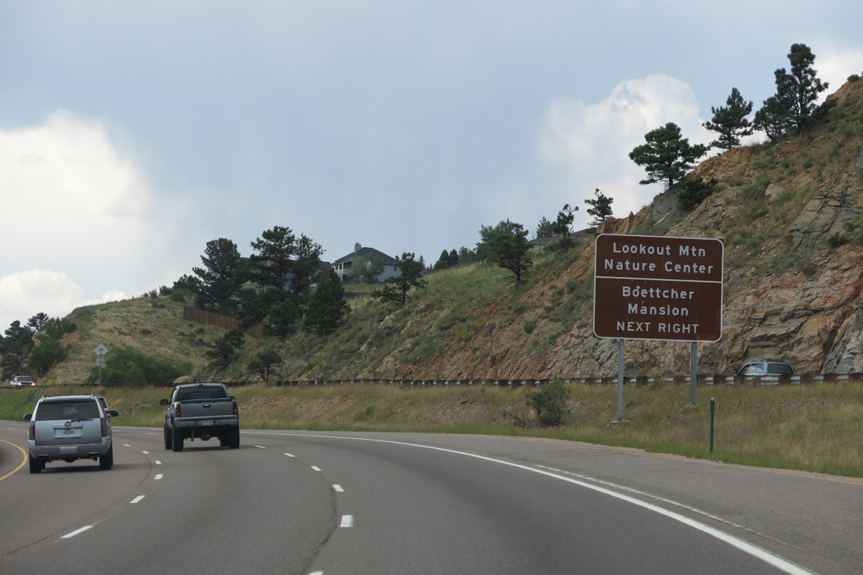
| U.S. 40 shifts north from Mt. Vernon Canyon to connect with Lookout Mountain Road. Lookout Mountain Road meanders north to the Paradise Hills neighborhood, Lookout Mountain Nature Center and Preserve and Buffalo Bill's Grave. 08/15/13 |
|
| Genesee Ridge Road west and Grapevine Road east connect with the diamond interchange at Exit 256 from the unincorporated community of Genesee. 08/15/13 |
Page Updated 01-19-2022.

 West
West