|
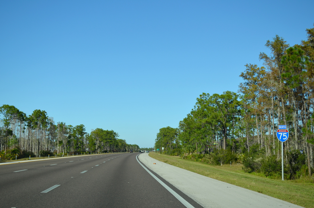
| The off freeway rest area at Daniels Parkway lies adjacent to this confirming marker north of Exit 131. 11/22/12 |
|
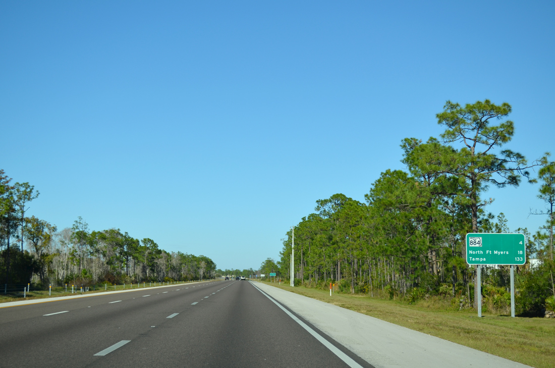
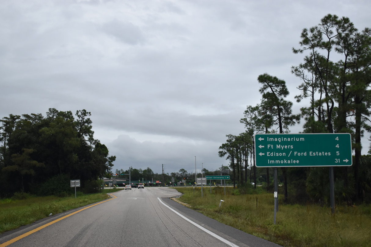
| SR 884 meets Interstate 75 at the first of four exits serving Fort Myers in four miles while North Fort Myers (18 miles) is accessed via SR 78 beyond the Caloosahatchee River. 11/22/12 |
|
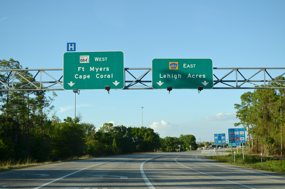
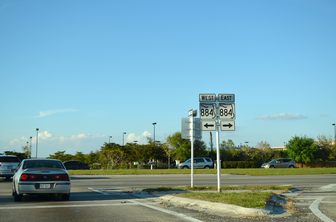
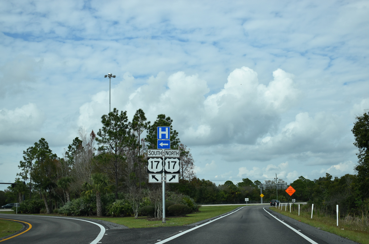
| SR 884 (Colonial Boulevard) leads west to U.S. 41 (Cleveland Avenue) in Fort Myers, where it becomes CR 884 en route to Cape Coral via the tolled Midpoint Memorial Bridge. 11/22/12 |
|
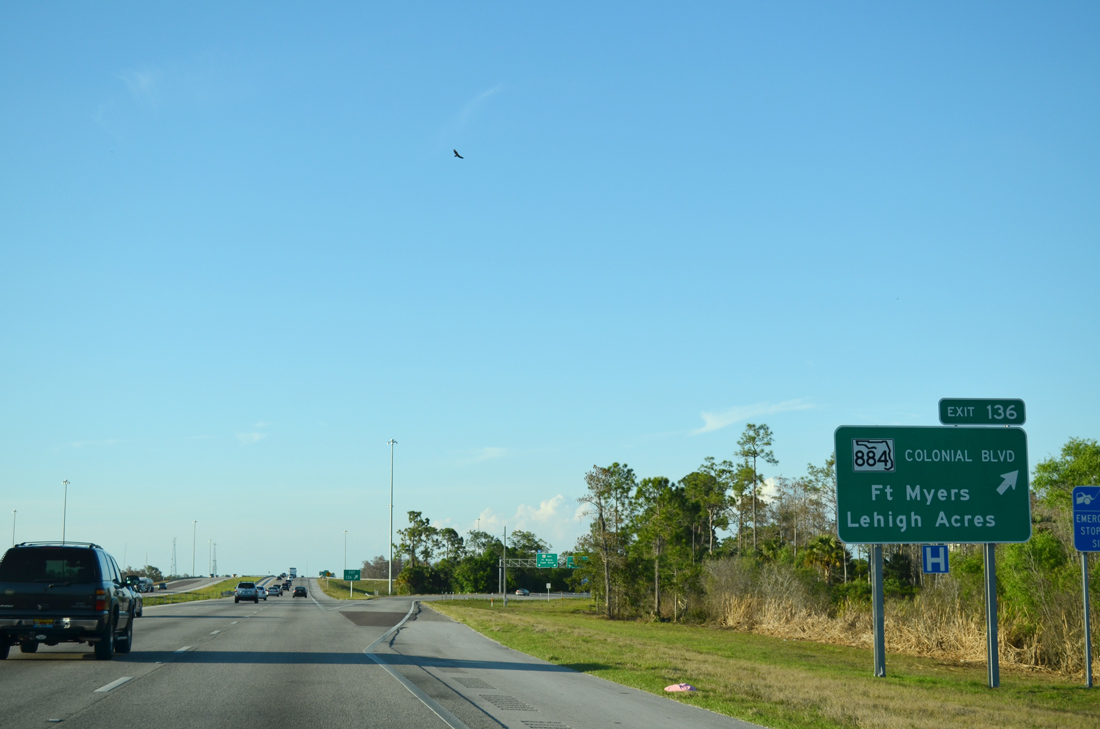
| CR 884 also extends east 19.77 miles from SR 883 to Lehigh Acres. The county road eventually turns north along Joel Boulevard to SR 80 near Alva. 03/04/14 |
|
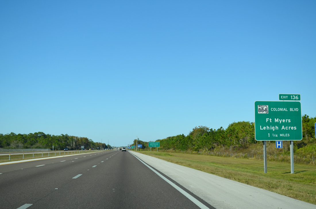
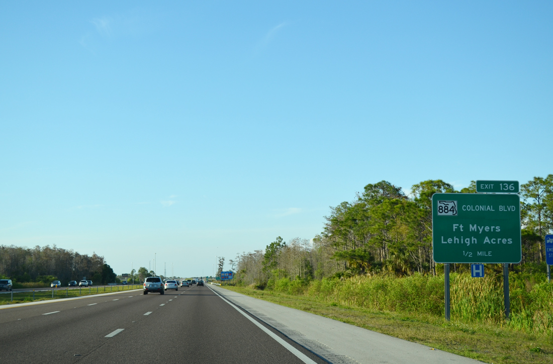
| Exit 136 leaves for SR 884 (Colonial Boulevard) west to nearby Calusa Nature Center and Planetarium and east to Lehigh Acres. Previously anticipated for 2019, constructed underway from early 2021 to early 2024 converts the parclo interchange here into a 12 lane wide DDI.1 03/04/14 |
|
| Associated work along SR 884 during the interchange redesign project at I-75 rebuilds the intersection along Colonial Boulevard at parallel Ortiz Avenue (CR 865) into a continuous flow intersection (CFI).1 03/04/14 |
|
| SR 884 continues east from I-75 another 0.5 miles to Cypress Slough where Lee County Road 884 takes over to Lehigh Acres. 03/04/14 |
|
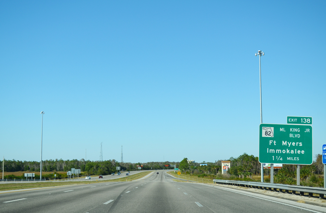
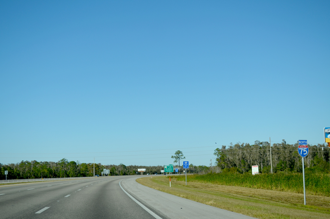
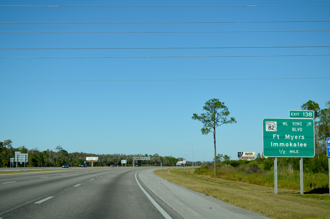
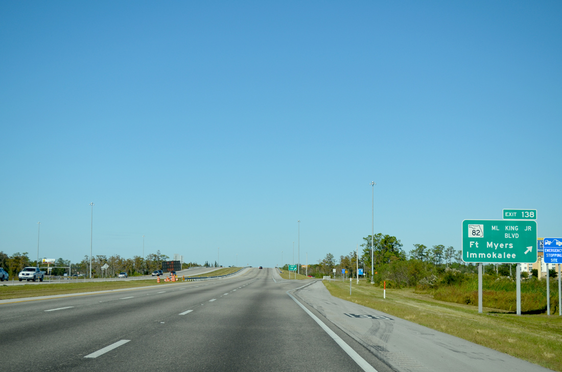
| Crossing over SR 884, I-75 proceeds north 1.25 miles to SR 82 (Martin Luther King Jr. Boulevard). 11/22/12 |
|
| Interstate 75 curves northeasterly between SR 884 (Colonial Boulevard) and the diamond interchange at Exit 138. 11/22/12 |
|
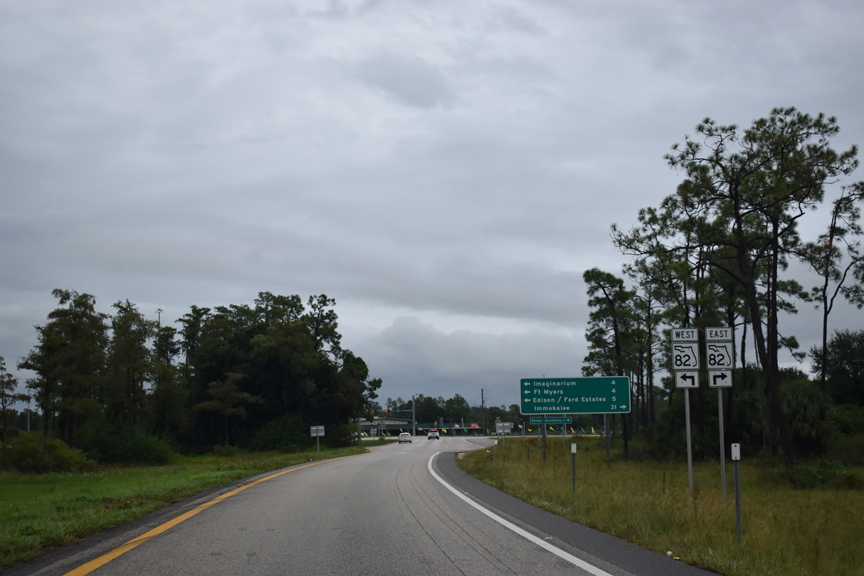
| Originating in Downtown Fort Myers, SR 82 angles southeast 29.88 miles to SR 29 in northeastern Collier County. 11/22/12 |
|
| Heading 10.9 miles southeast, SR 82 constitutes a six lane arterial to Rue Labeau Circle at the community of Lehigh Acres. 11/22/12 |
|
| 4.4 miles west from Exit 138, SR 82 follows Martin Luther King Jr. Boulevard (former Anderson Avenue) directly into Downtown Fort Myers, where it meets U.S. 41, McGregor Boulevard (former SR 867), U.S. 41 Business and SR 80 (Main Street) at the Five Points interchange. 10/03/20 |
|
| SR 82 provides another route east from I-75 toward Immokalee via the connection with SR 29 south. Immokalee is one of the largest tomato growing centers in the U.S. 10/03/20 |
|
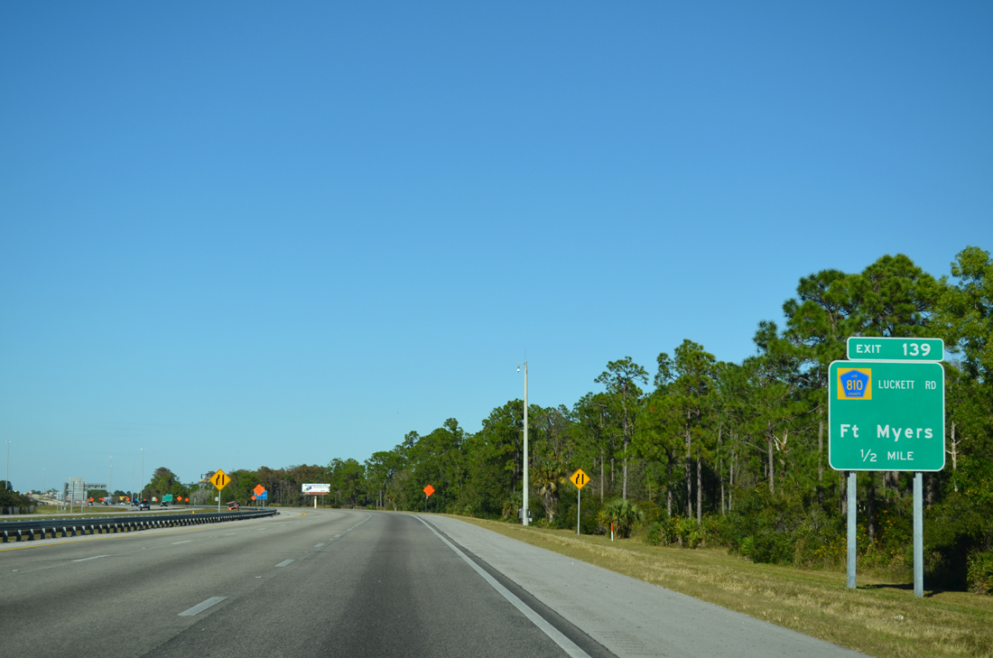
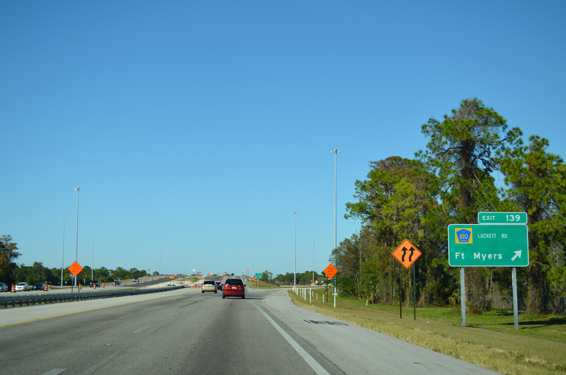
| The succeeding exit on I-75 north is for Luckett Road (CR 810). Luckett Road west links the freeway with nearby CR 865 (Ortiz Avenue) in the vicinity of Tice. 11/22/12 |
|
| Interstate 75 north enters the diamond interchange (Exit 139) with Luckett Road (CR 810). Like many other county maintained roads in Lee County, CR 810 is only acknowledged along I-75. 11/22/12 |
|
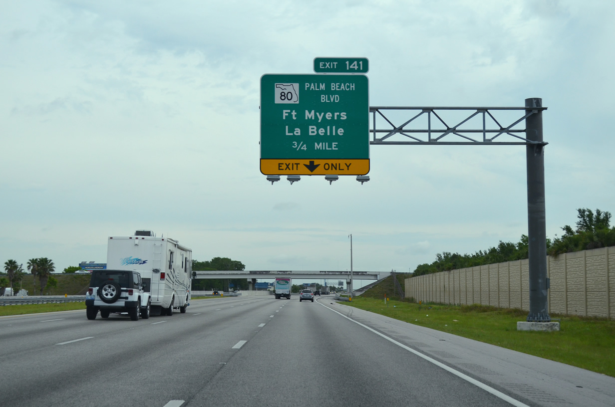
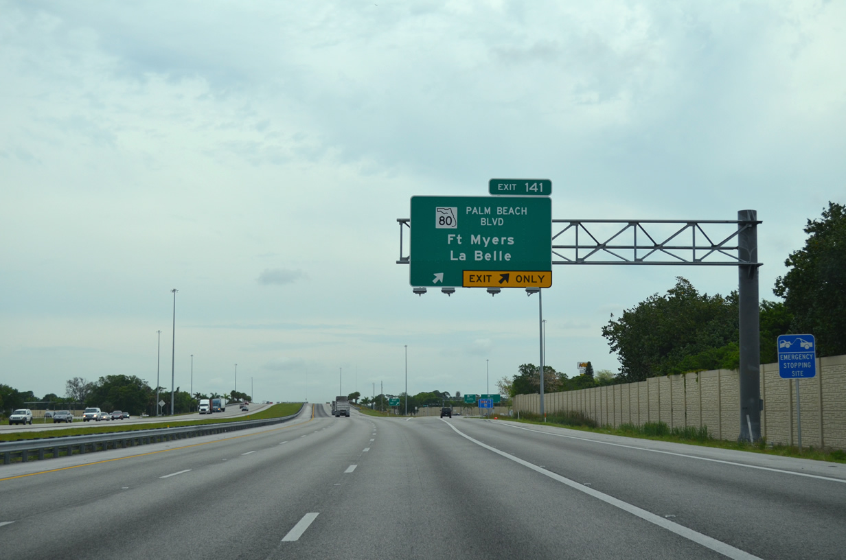
| SR 80 (Palm Beach Boulevard) converges with Interstate 75 north at Exit 141 in 1.25 miles. State Road 80 stretches across the Florida peninsula 123.5 miles from Downtown Fort Myers to SR A1A at Palm Beach. 04/15/16 |
|
| I-75 north gains an auxiliary lane from the Luckett Road entrance ramp to Exit 141. 04/15/16 |
|
| SR 80 travels east to Fort Myers Shores and rural areas ahead of the Hendry County seat of LaBelle. Palm Beach Boulevard derives its name from the continuation of SR 80 east to SR A1A in the city of Palm Beach along the Atlantic Ocean. 04/15/16 |
|
| La Belle lies 22 miles to the east of Exit 141 along SR 80 at SR 29. Palm Beach Boulevard leads SR 80 west 3.8 miles to Allen Street; the remainder of the state road toward the Fort Myers central business district was turned over to local maintenance. 04/15/16 |
|
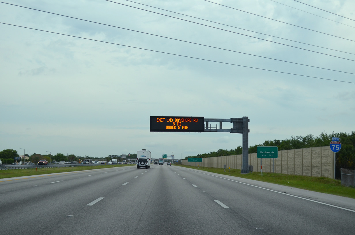
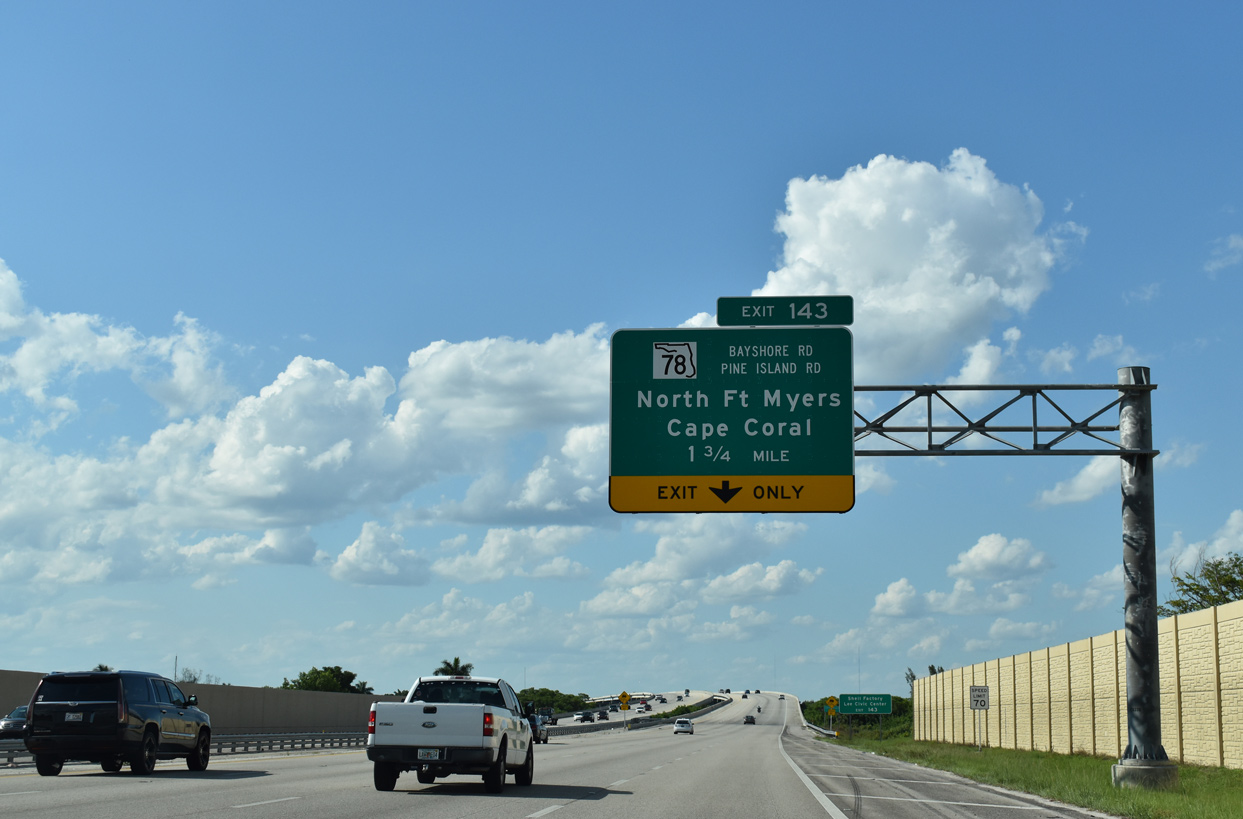
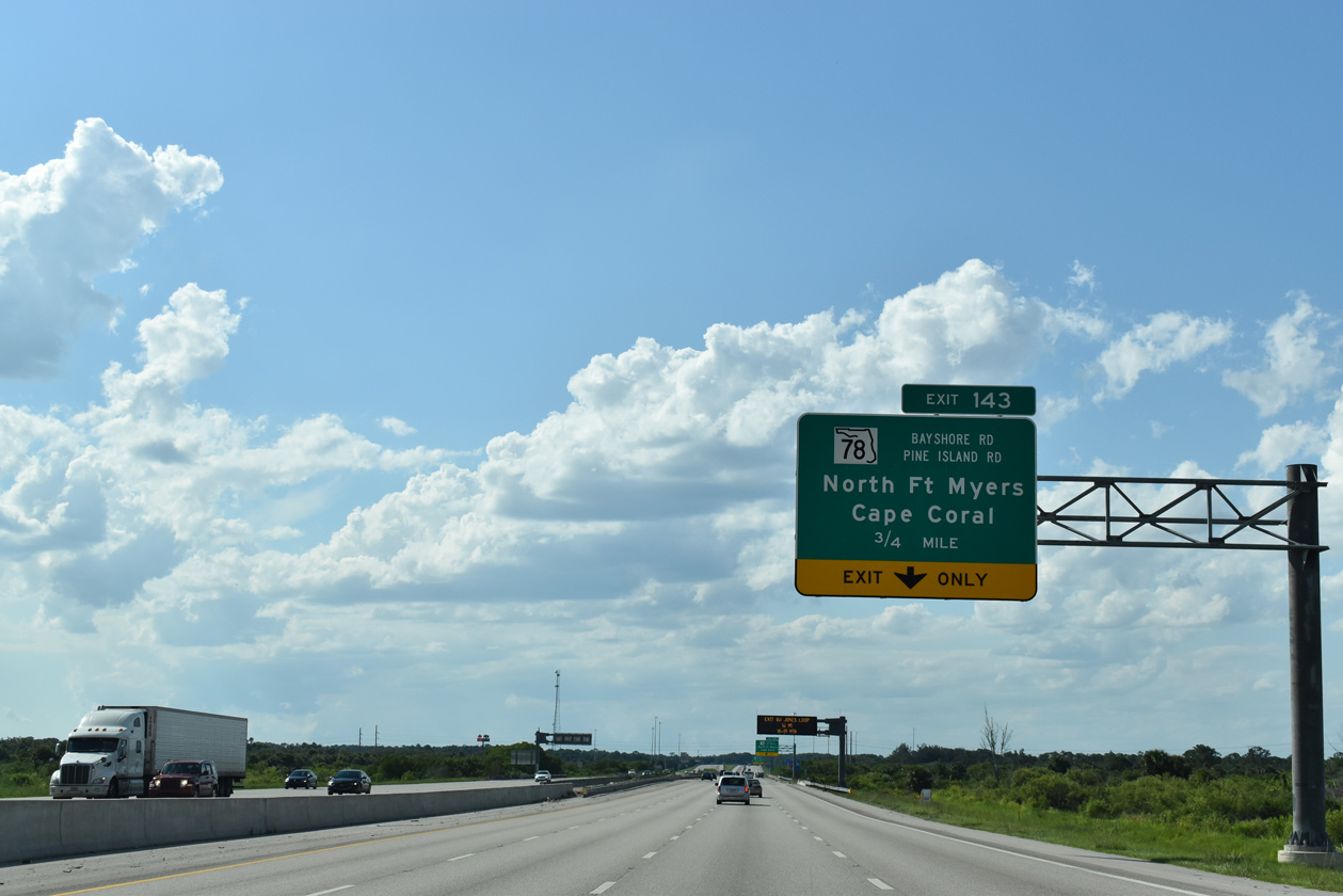
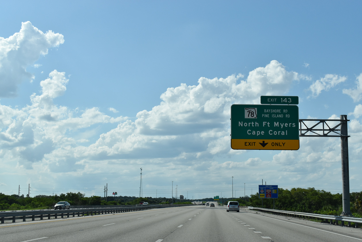
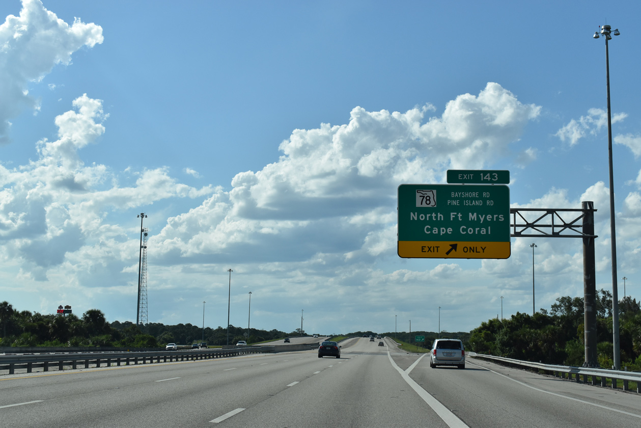
| I-75 crosses the Caloosahatchee River en route to Exit 143 for SR 78 in 1.75 miles. Westward SR 78 (Bayshore Road) connects the freeway with North Fort Myers and Cape Coral. 05/19/19 |
|
| Flowing nearly 67 miles from its man-made connection with Lake Okeechobee, the Caloosahatchee River meanders westward through Glades, Hendry, and eastern Lee Counties before widening to nearly one mile in width as it separates Fort Myers and Cape Coral. The river empties into Punta Rassa just north of Sanibel Island. 05/19/19 |
|
| The Caloosahatchee River bridges along Interstate 75 are among the highest in Lee County, providing nearly 55 feet of vertical clearance. 04/15/16 |
|
| SR 78 (Bayshore Road) travels westward from I-75 to North Fort Myers and U.S. 41 Business (Tamiami Trail). Pine Island Road continues the state road west and southwest toward Cape Coral. 05/19/19 |
|
| I-75 traverses Caloosahatchee Creek Preserve ahead of Exit 143 / SR 78 (Bayshore Road). The preserve is broken into a western and eastern component, each accessible via Bayshore Road. 05/19/19 |
|
| Entering the diamond interchange with SR 78 at Exit 143. SR 78 concludes 3.2 miles to the east at SR 31 near the Lee County Civic Center. 05/19/19 |
|
| Interstate 75 angles northwest along a rural stretch extending into Charlotte County. $17.3 million in construction from August 2012 to October 2014 expanded I-75 to six lanes between SR 78 and the county line.2 05/19/19 |
|
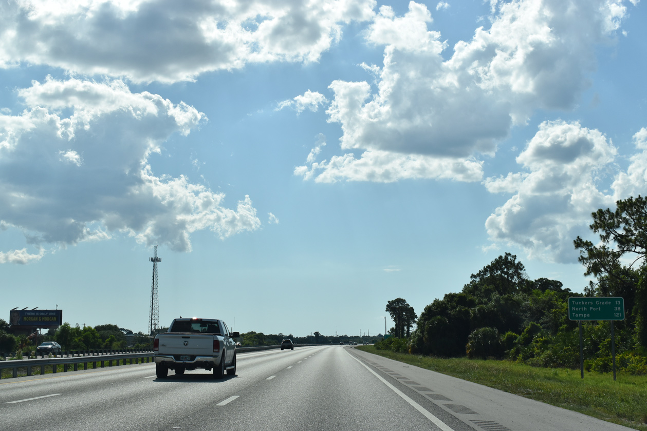
| The ensuing exit lies 13 miles ahead with Charlotte County Road 762 (Tuckers Grade). North Port follows in 38 miles within south Sarasota County. 05/19/19 |
|
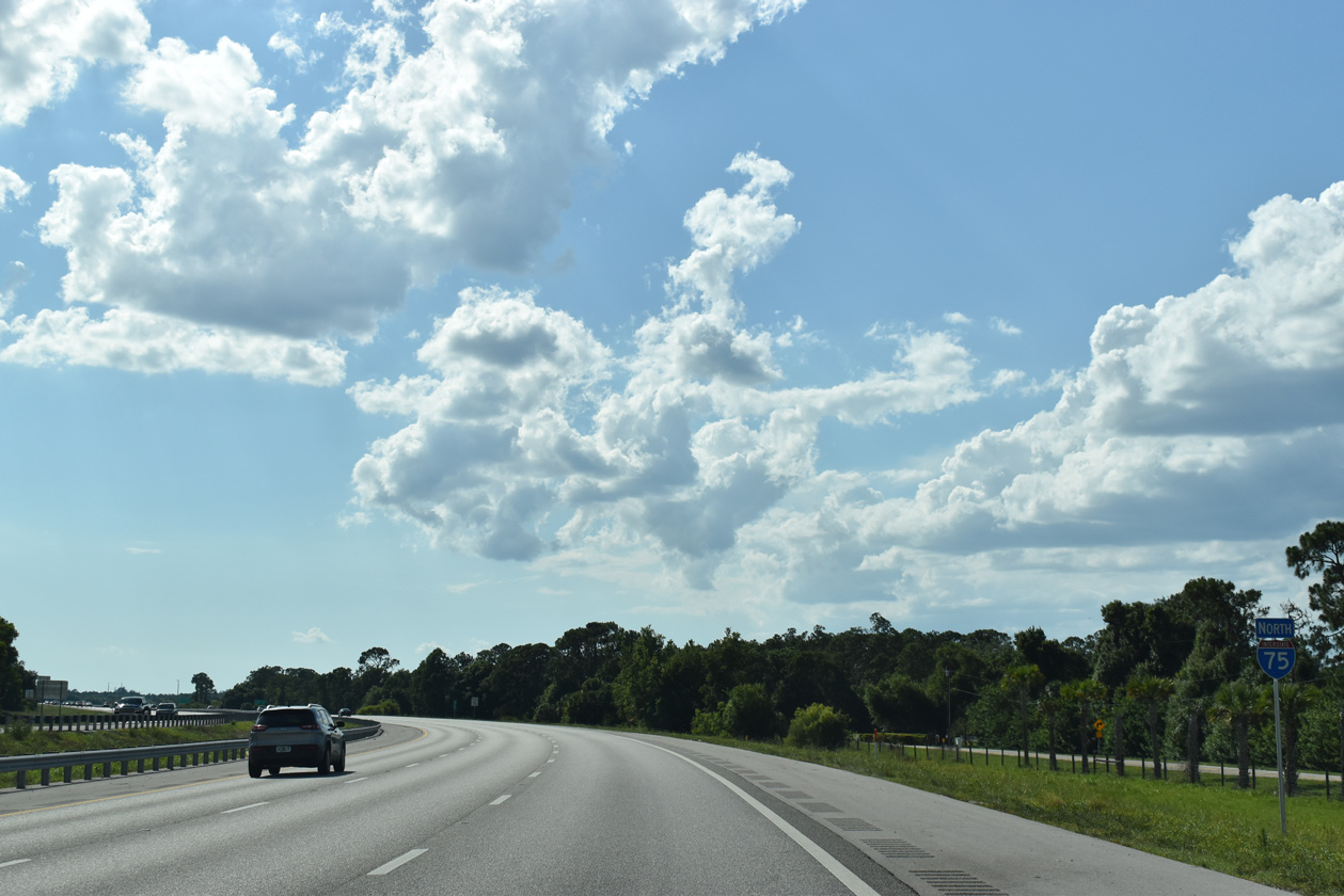
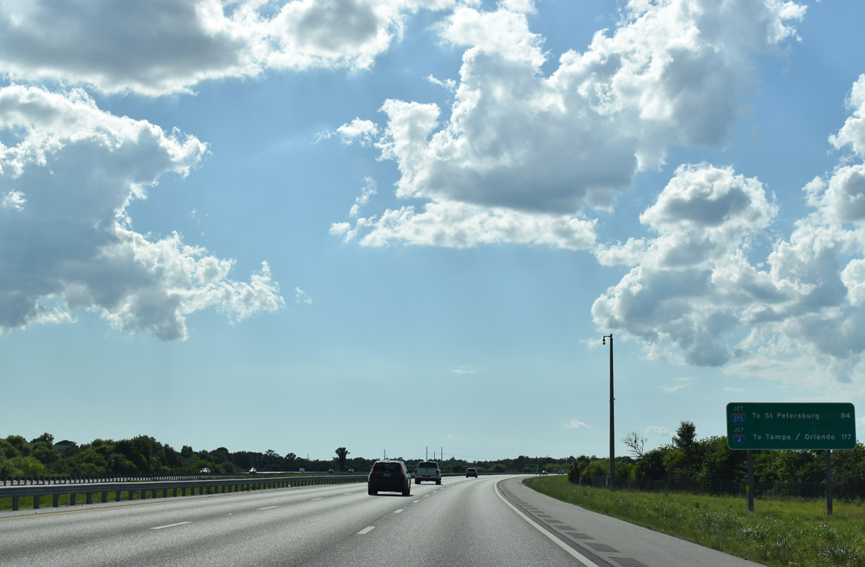
| Heading north from Southwest Florida, I-75 meets I-275 in 84 miles in northern Manatee County and I-4 to Tampa and Orlando near Mango in 117 miles. 05/19/19 |
|
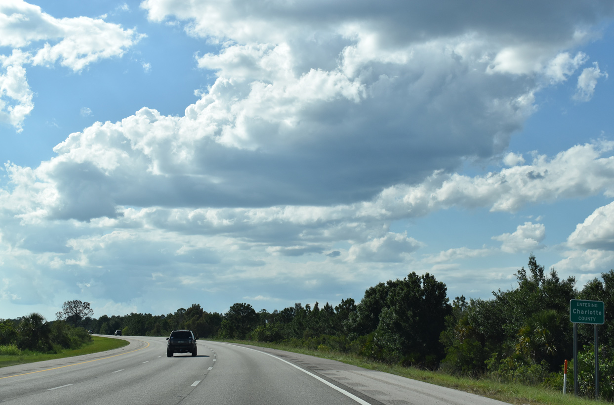
| I-75 north enters Charlotte County Road 5.8 miles north of SR 78. Subsequent widening of Interstate 75 from 2015 to 2017 continued the six lane section northward 11 miles to N Jones Loop Road.4 05/19/19 |
|
| North from the Lee County line, I-75 traverses undeveloped ranch land and wetlands adjacent to the Seminole Gulf Railway. 05/19/19 |
|
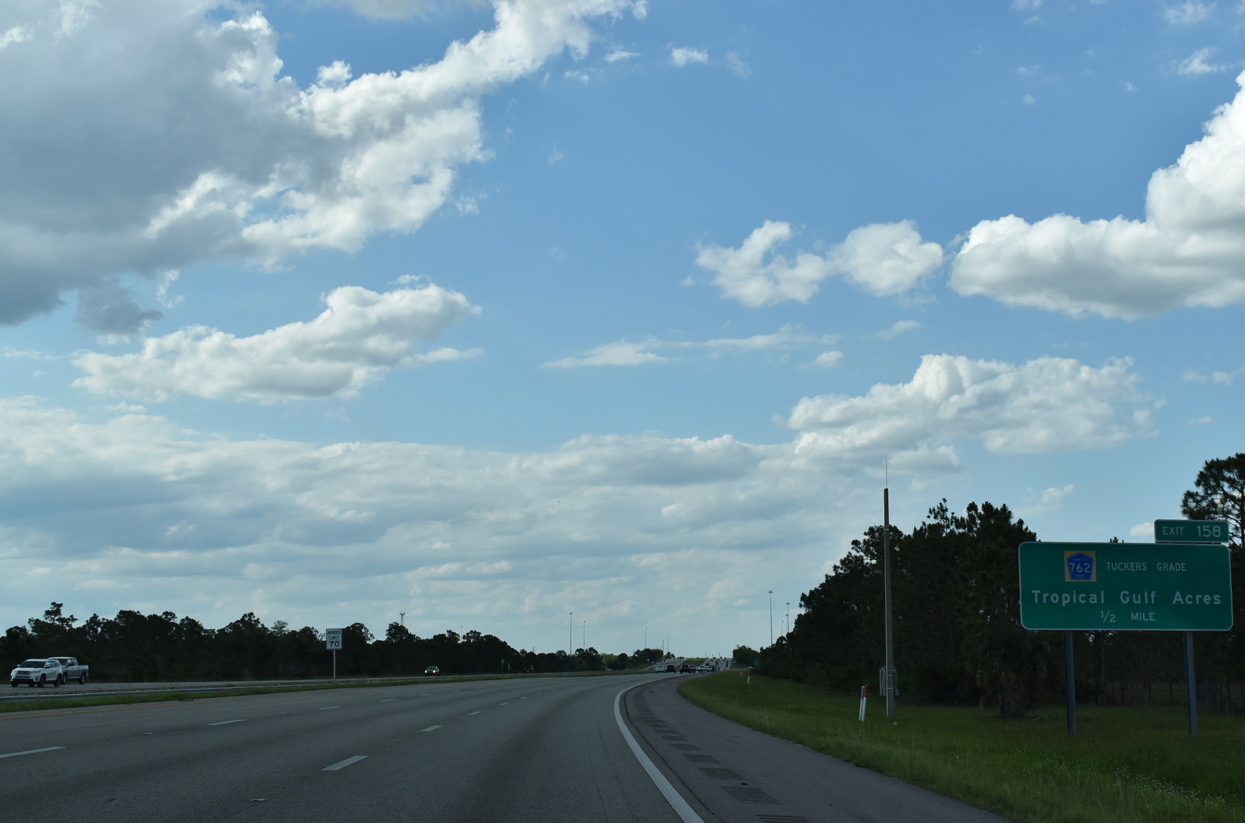
| Seven miles into Charlotte County, Interstate 75 north meets Tuckers Grade (CR 762) at a diamond interchange (Exit 158). 05/19/19 |
|
| Tuckers Grade is a 1.18 mile long arterial between I-75 and U.S. 41 near Tropical Gulf Acres. CR 762 represents the closest connection between the two highways in southwest Florida. U.S. 41 and I-75 formally cross each north of High Springs at Exit 414. 05/19/19 |
|
| Exit 158 departs I-75 north to Tuckers Grade (CR 762). Tuckers Grade continues a short distance east into the Fred C Babcock-Cecil M. Webb State Wildlife Management Area. Home to hunting, fishing, and camping, the management area covers 65,758 acres. 05/19/19 |
|
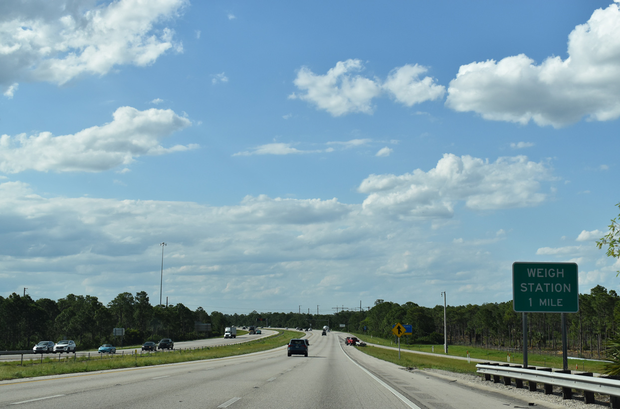
| Weigh stations line both sides of Interstate 75 to the east of South Punta Gorda Heights. 05/19/19 |
|
| Road work in 2012-13 expanded Interstate 75 from four to six lanes north between Tuckers Grade and Exit 161 / Jones Loop Road. 02/03/19 |
|
| The weigh station at milepost 159 is the first for I-75 northbound overall. 02/03/19 |
|
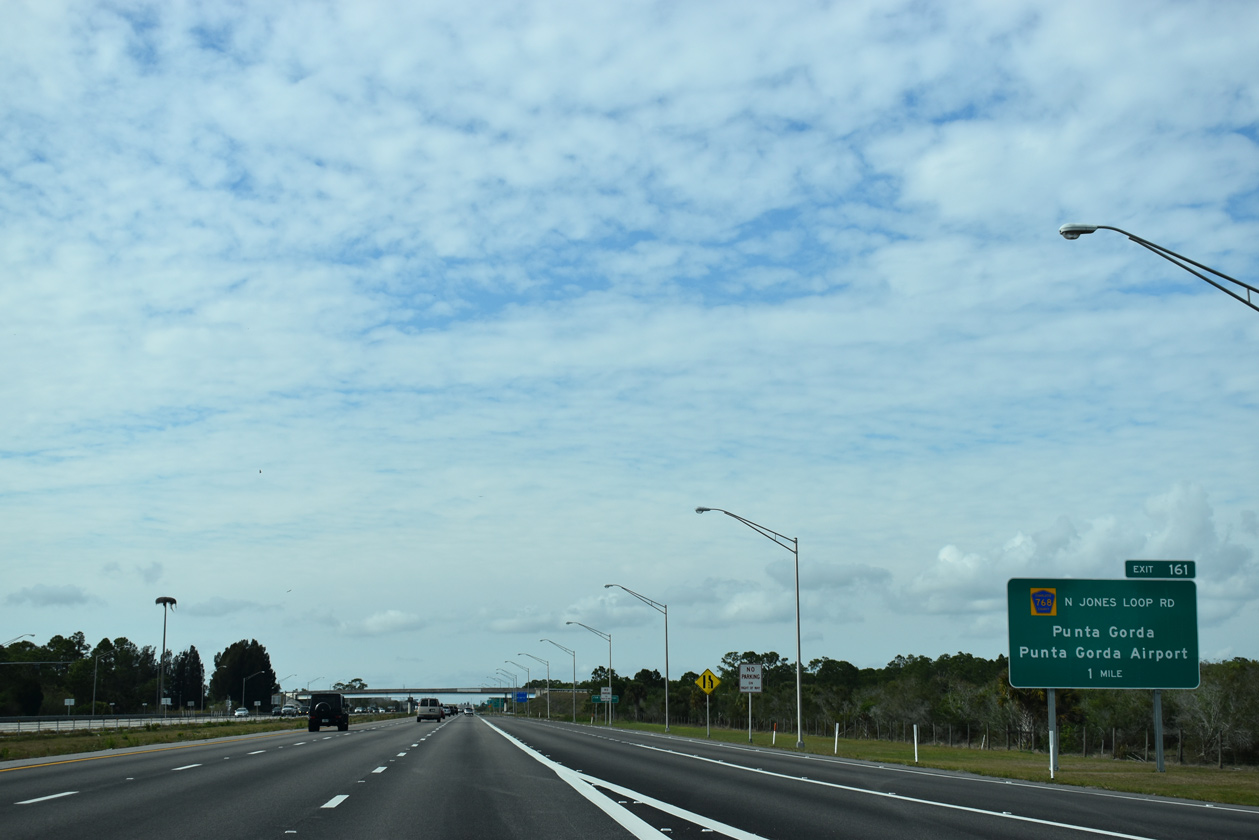
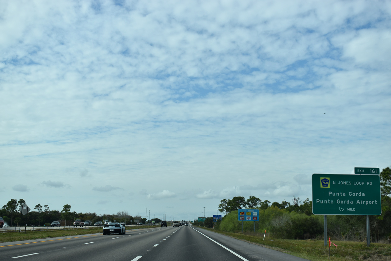
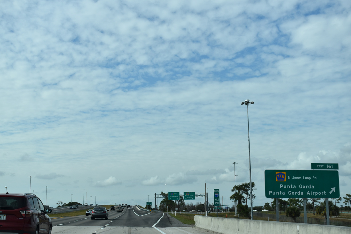
| Meeting I-75 at Exit 161 in 1.25 miles is the northern component of Charlotte County Road 768 (N Jones Loop Road). Jones Loop Road forms an elongated loop east from CR 765 (Burnt Store Road) near U.S. 41. 02/03/19 |
|
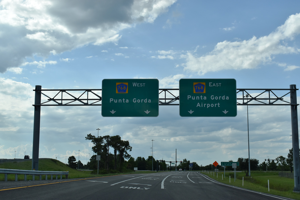
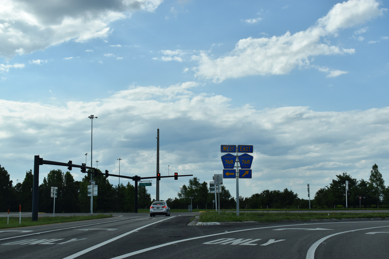
| CR 768 follows S Jones Loop Road east from Acline Road and CR 765A (Taylor Road) across Interstate 75, 0.7 miles from Exit 161. N Jones Loop Road returns CR 768 west to a diamond interchange with I-75. 02/03/19 |
|
| Permanently closing in April 2015, an off freeway rest area was located to the southeast of Exit 161 along CR 768 (N Jones Loop Road). The next rest area along I-75 precedes Exit 240 for SR 674, 78 miles to the north in Hillsborough County. 02/03/19 |
|
| Several commercial services populate the western quadrants of the exchange with CR 768. Punta Gorda (former Charlotte County) Airport (PGD) sits northeast of Exit 161 via CR 768 east and Piper Road north. 05/19/19 |
|
| N Jones Loop Road west extends 1.4 miles from I-75 to U.S. 41 at the north end of Burnt Store Road (CR 765). CR 765 leads south back to Cape Coral. 05/19/19 |
|
| I-75 bends westward from CR 768 along an industrial park west of Punta Gorda Airport (PGD). The last four lane section of I-75 in Florida outside of Alligator Alley extended north from Exit 158 to U.S. 17. Costing $28.7 million, widening of this segment got underway at the end of November 2017 and wrapped up in early 2019.1 02/03/19 |
|
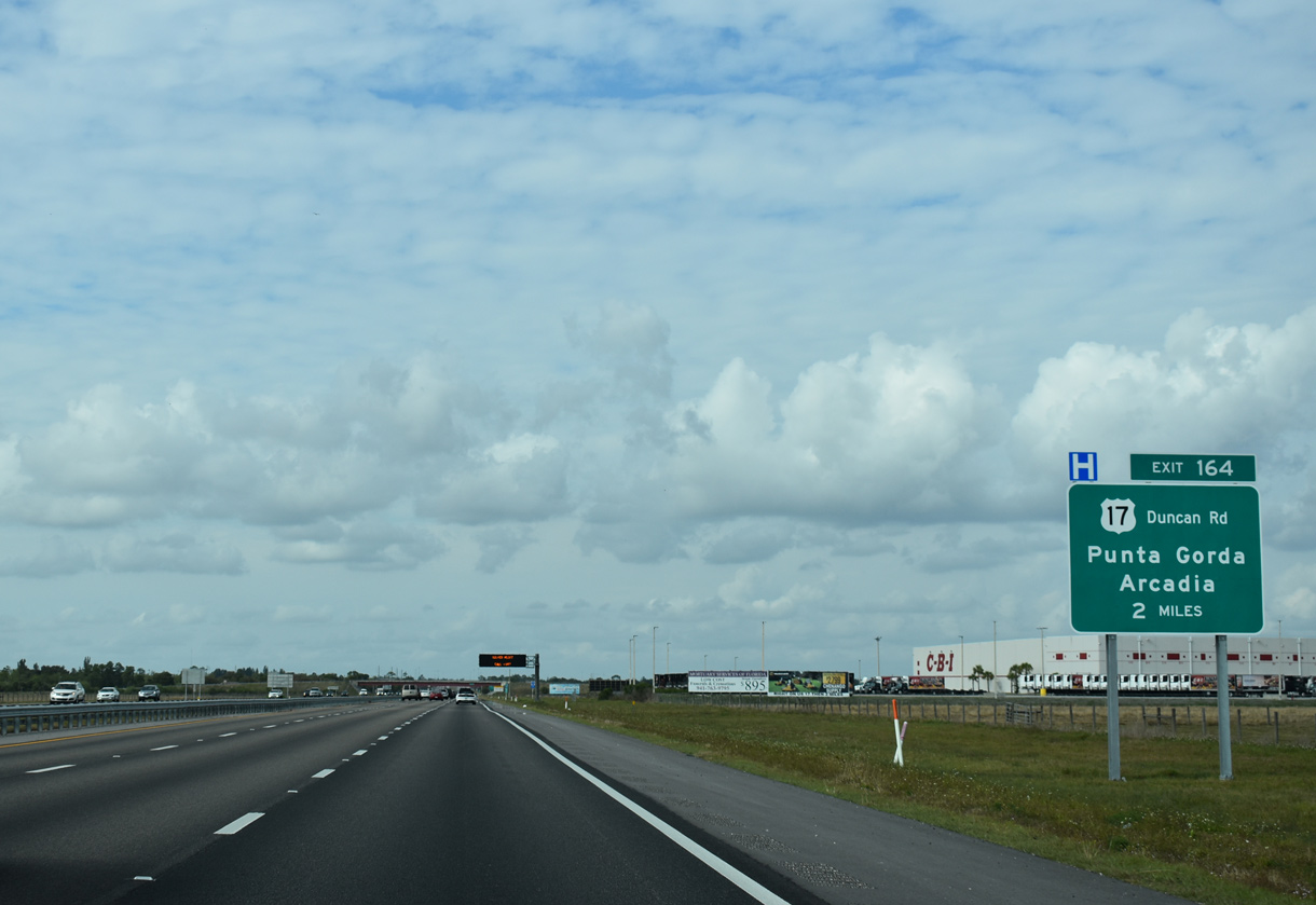
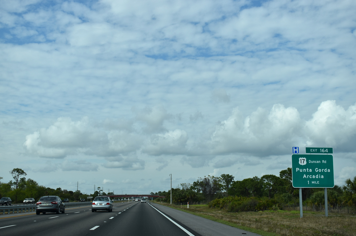
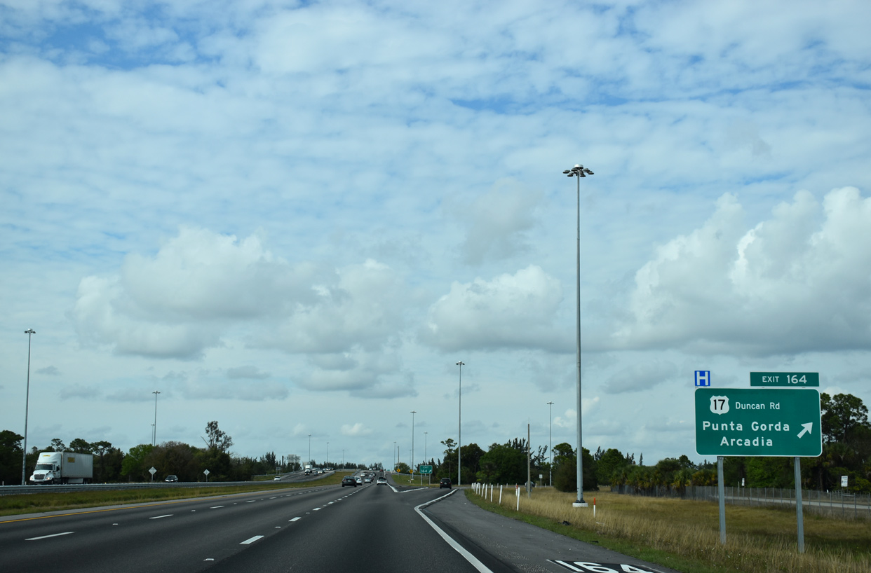
| The succeeding two exits join I-75 north with the city of Port Charlotte. Port Charlotte centers along the U.S. 41 corridor north of the Peace River. Forthcoming U.S. 17 (Duncan Road) connects I-75 to nearby Punta Gorda and Arcadia in adjacent DeSoto County. 02/03/19 |
|
| A rare button copy sign identifies Airport Road along the overpass above Interstate 75. 02/03/19 |
|
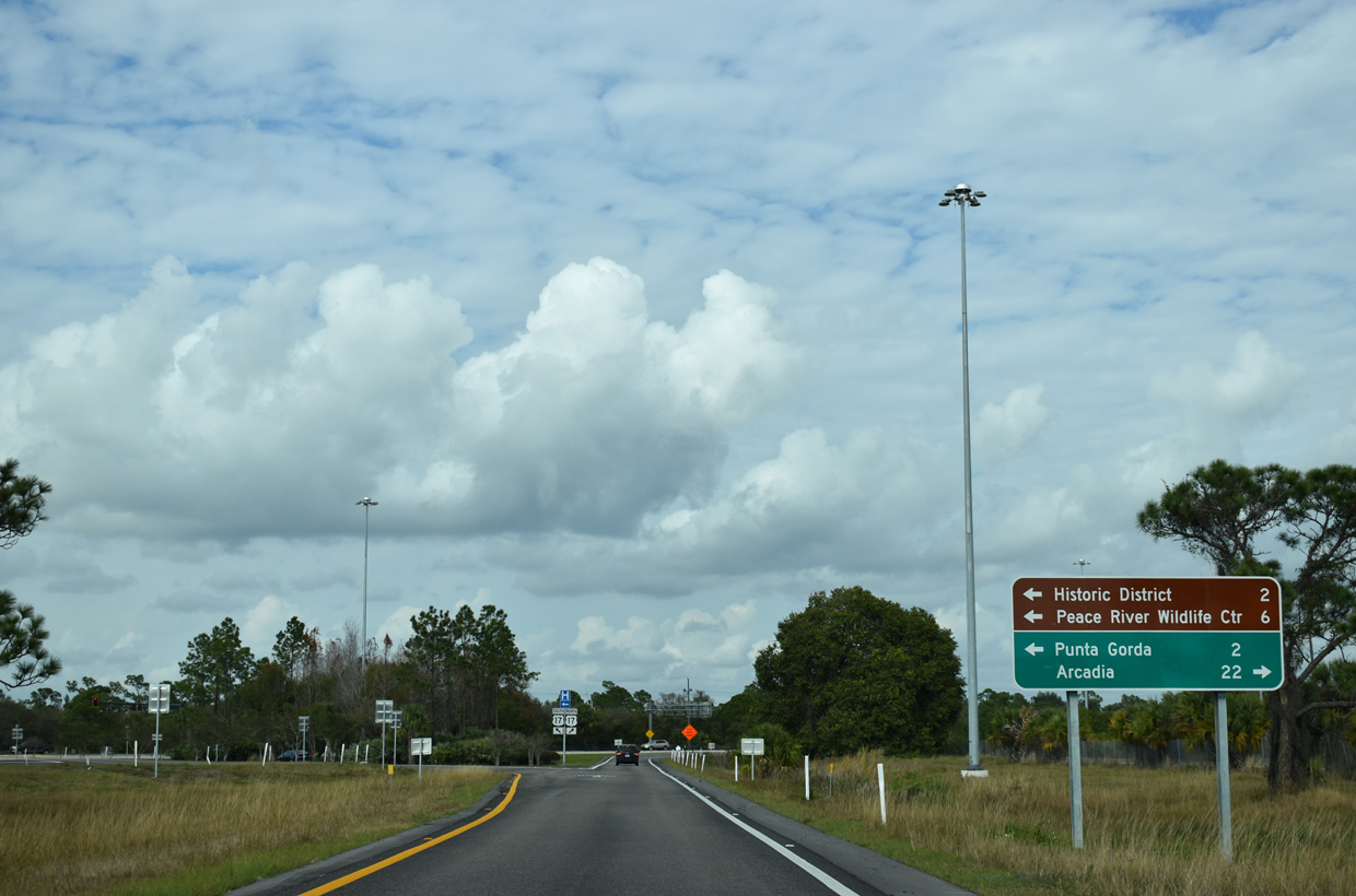
| U.S. 17 (Duncan Road) west of I-75 splits into a one way couplet 0.7 miles from Exit 164. U.S. 17 south follows Marion Avenue to end at U.S. 41 south (Cross Street) in Downtown Punta Gorda while U.S. 17 north follows Olympia Avenue. 02/03/19 |
|
| A folded diamond interchange (Exit 164) joins I-75 with U.S. 17 south of the Seminole Gulf Railway and Marion Avenue / Riverside Drive (old U.S. 17). 02/03/19 |
|
| North from Exit 164, U.S. 17 constitutes a four lane, divided highway 22 miles to the city of Arcadia, seat of DeSoto County. 02/03/19 |
|
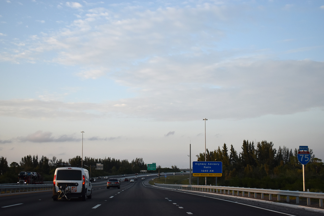
| Highway advisory signs were erected to warn motorists of delays or other traffic advisories after the brutal 2004 hurricane season. The Punta Gorda area was devastated by Hurricane Charley, which roared ashore on August 13, 2004 with 145 MPH winds. 02/03/19 |
|
| Shifting eastward alongside Broad Creek, Interstate 75 continues north to the Peace River. 02/03/19 |
|
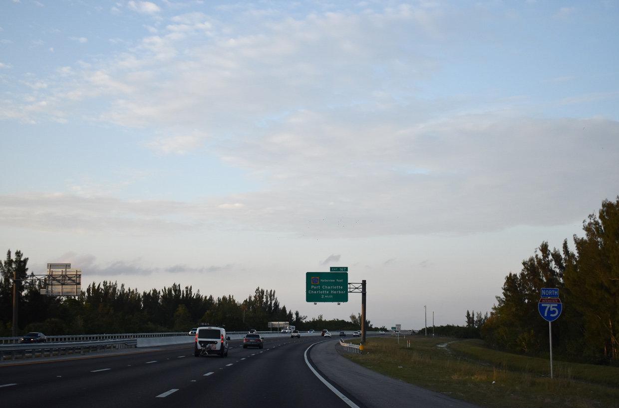
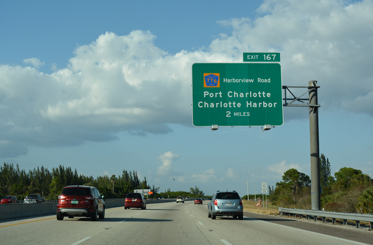
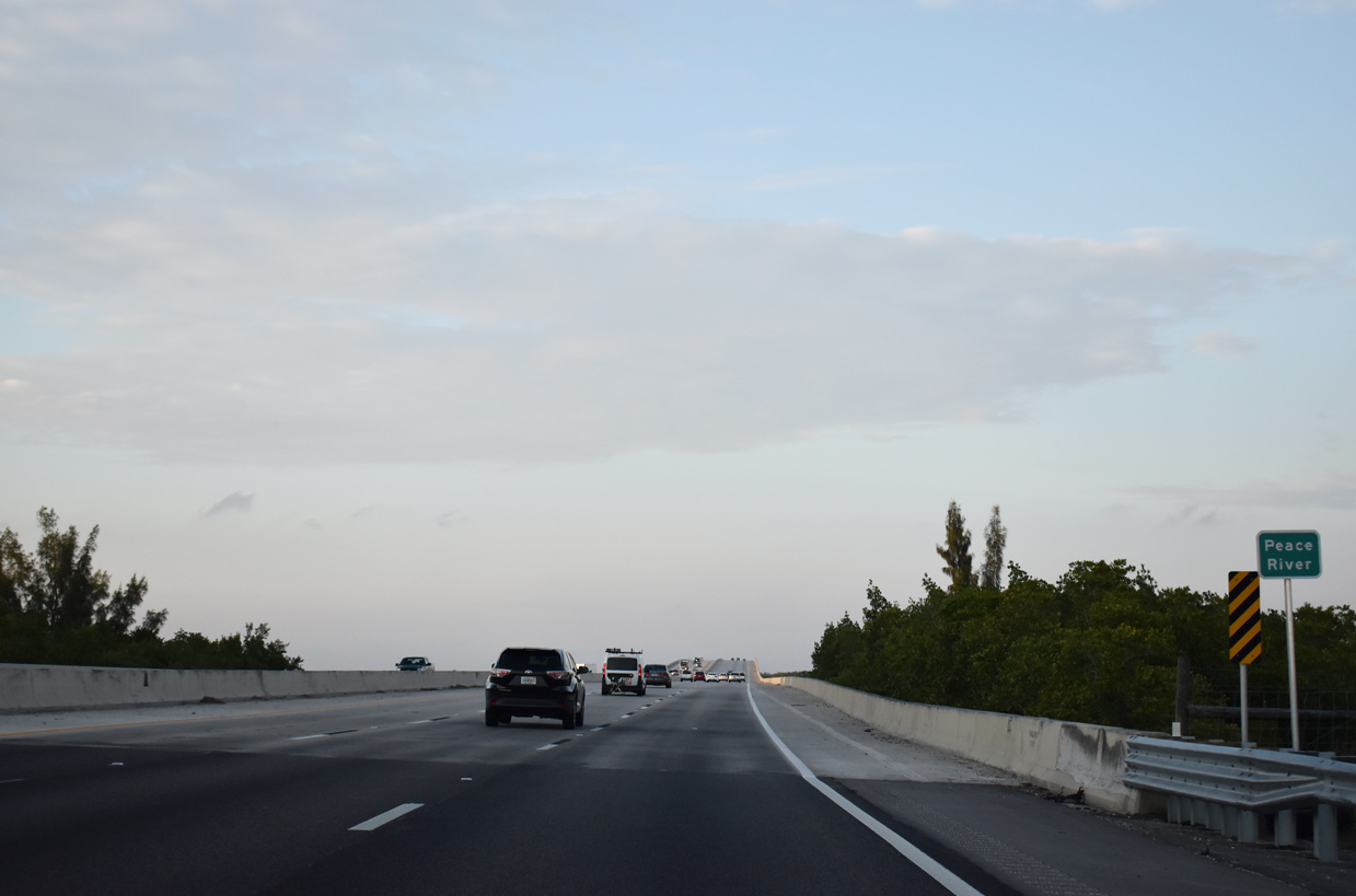
| CR 776 (Harborview Boulevard) converges with I-75 just beyond the Peace River. A lane drop occurred at Exit 182 prior to completion of six lane expansion from Exit 167 northwest to Exit 182 / Sumter Boulevard. 11/27/16 |
|
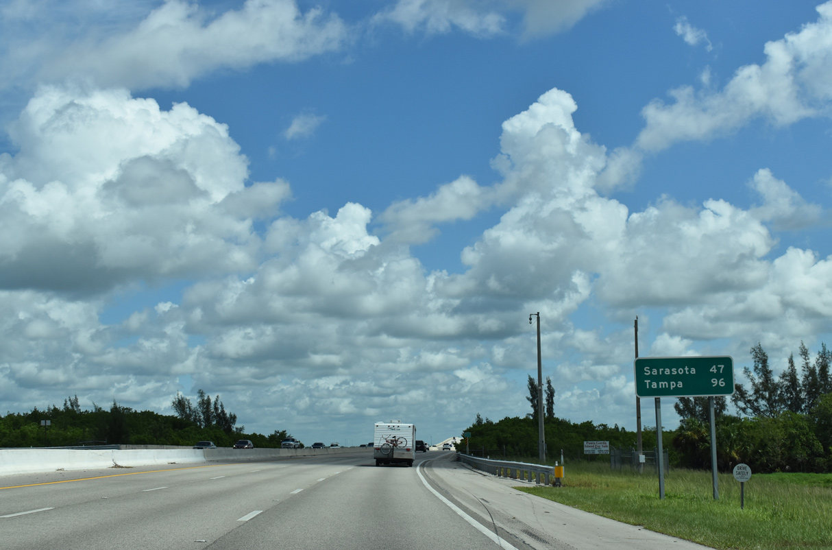
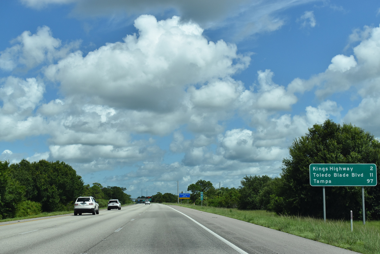
| Interstate 75 north passes the Sarasota area in 40 miles. Downtown Sarasota lies to the west of I-75 along SR 780 (Fruitville Road) at U.S. 41 and U.S. 301. The distance listed for Tampa is four to five miles short; the succeeding sign references the city at 97 miles out. 07/26/20 |
|
| The Peace River originates northeast of Bartow and parallels U.S. 17 for the majority of its 106 mile long course into Charlotte Harbor. 02/03/19 |
|
| I-75 spans the Peace River between mileposts 165 and 167 on a single span structure. The original twin span bridges crossing the river were modified in the early 2000s, with a new southbound span constructed and combined with the existing northbound span. The overall construction also included an additional lane per direction. 02/03/19 |
|
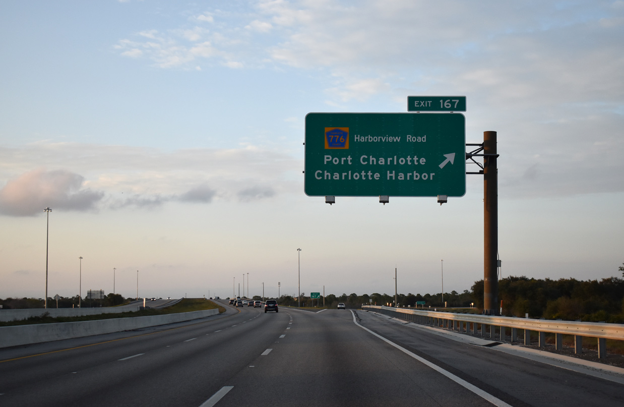
| Turning northwest, I-75 reaches the north shore of the Peace River one quarter mile ahead of CR 776 (Harborview Road). CR 776 follows Harborview Road for 4.46 miles west to U.S. 41 in Charlotte Harbor and east to the community of Harbour Heights. 02/03/19 |
|
| A diamond interchange joins I-75 with Haborview Road at Exit 167. The $73 million widening of I-75 northwest to Sumter Boulevard ran from January 2016 to the end of 2017. The 15.6 mile long project added a 12 foot travel lane per direction and 10 foot inside shoulders along both roadways.5 02/03/19 |
|
| A wider median separates the I-75 roadways northward from Harborview Boulevard. 57,000 vehicles per day (vpd) were recorded by FDOT on the ensuing stretch in 2018 and 61,000 vpd in 2021. 02/03/19 |
|
| Toledo Blade Boulevard, located in adjacent Sarasota County, services the city of North Port. The arterial converges with Interstate 75 at Exit 179. Tampa is within 100 miles. 07/26/20 |
|
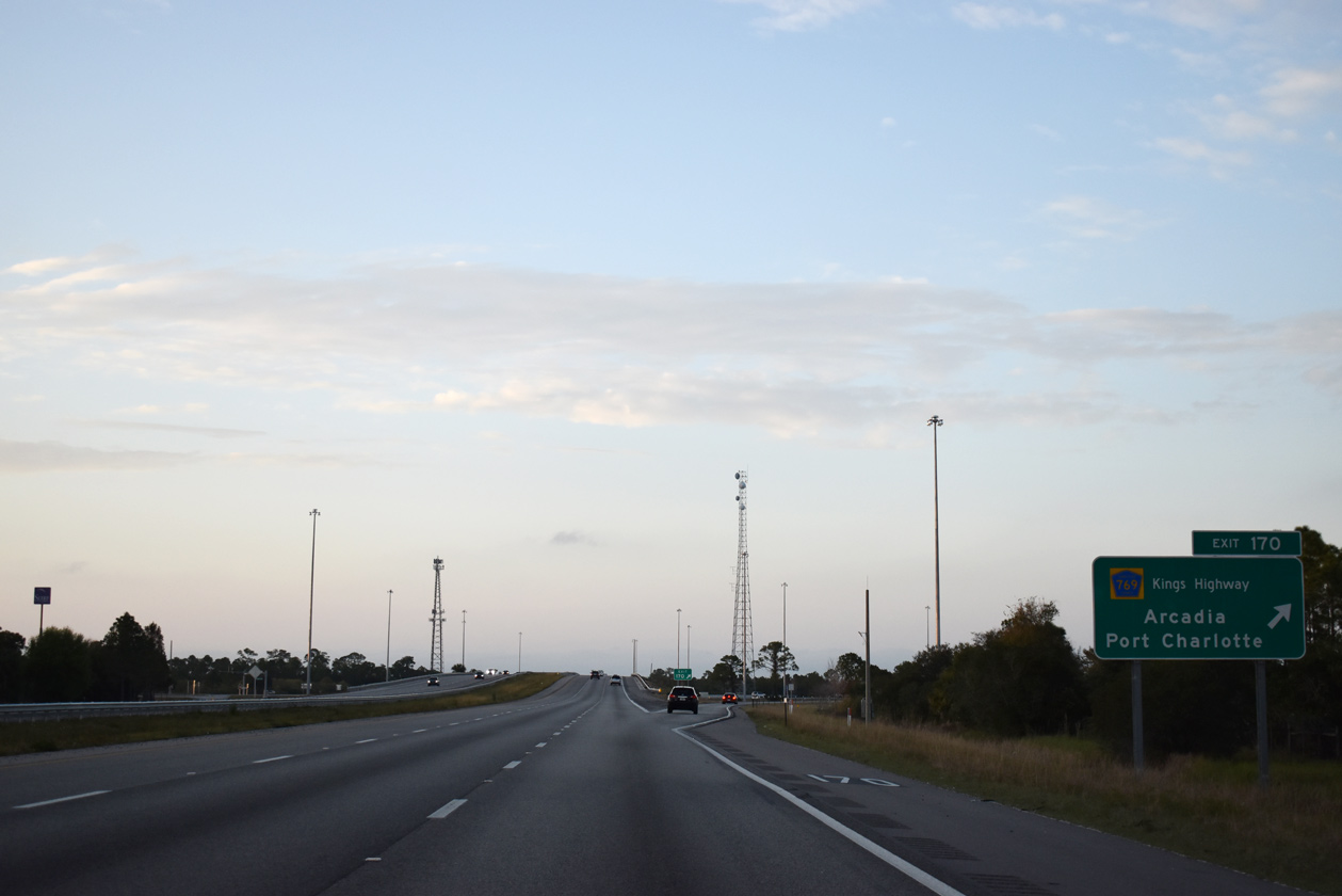
| Rampart Boulevard spans Interstate 75 a mile and a quarter southeast of Exit 170 for Kings Highway (CR 769). Rampart Boulevard connects Kings Highway with Rio De Janeiro Avenue in the Deep Creek subdivision east of I-75. 02/03/19 |
|
| Kings Highway runs 4.3 miles southwest from Interstate 75 to U.S. 41 at Parmely Street in Charlotte Harbor. 02/03/19 |
|
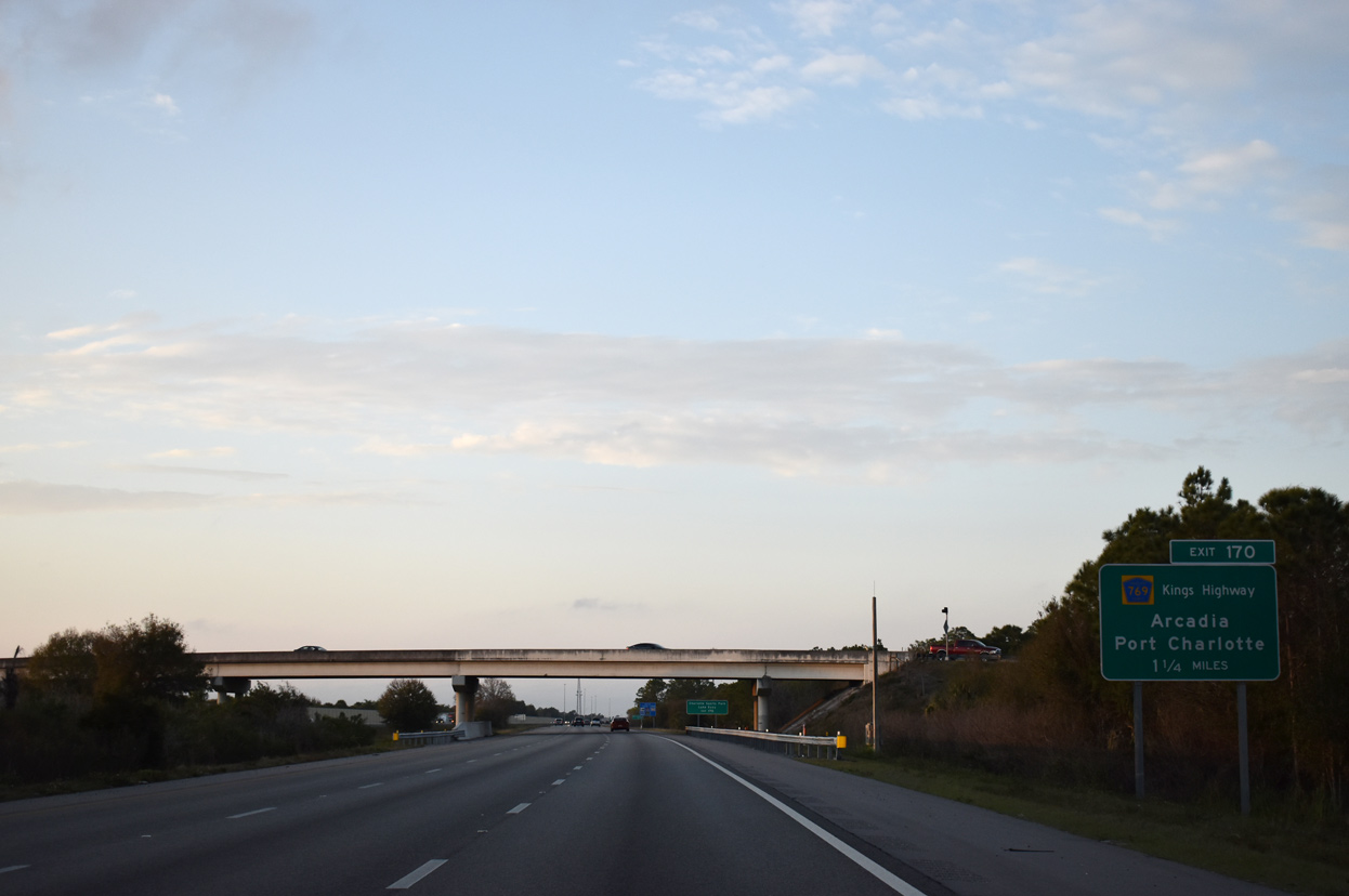
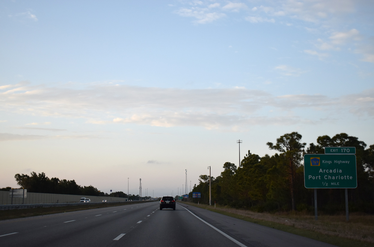
| Northeast into DeSoto County, CR 769 (Kings Highway) extends northward 13.36 miles to SR 72 west of Arcadia. Exit 170 is the first of three routes leading from I-75 toward Arcadia; SR 72 east and SR 70 east are the others. 02/03/19 |
|
| Following the opening of the diamond interchange at Exit 170 in the early 1980s, subsequent growth took place in the form of retail centers, restaurant and hotel out parcels. 12/06/19 |
Page Updated 09-09-2022.

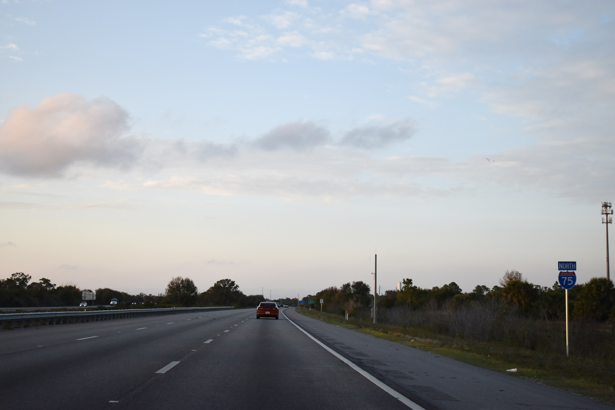
 North
North