|
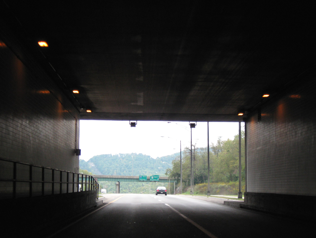
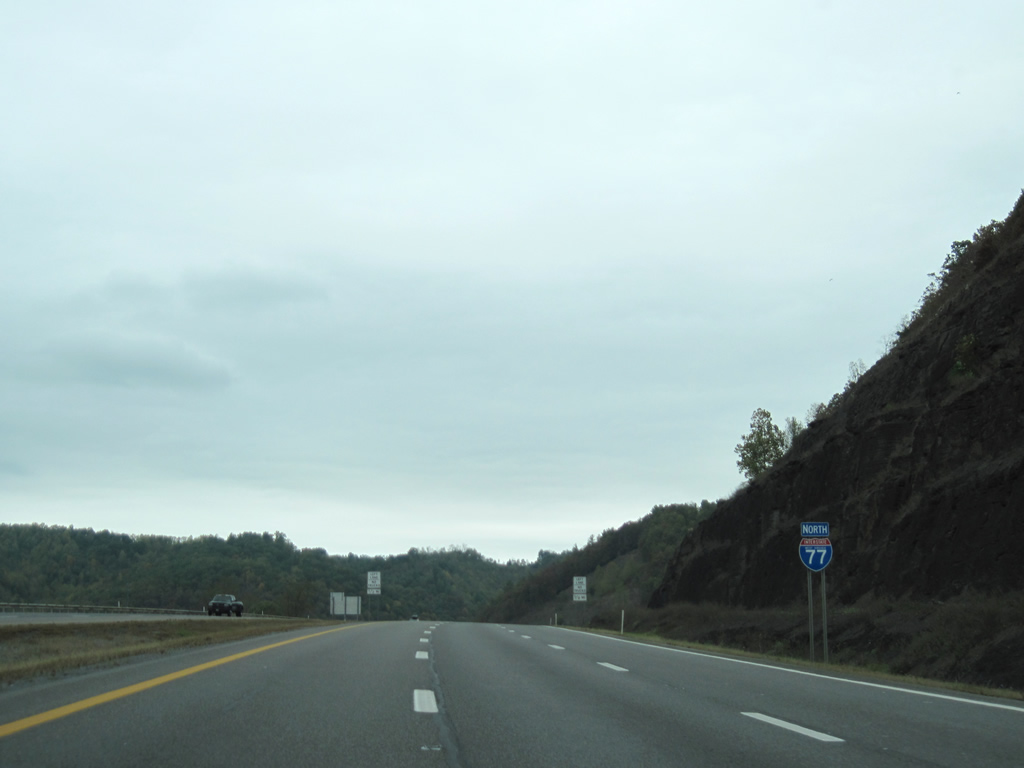
| Interstate 77 & U.S. 52 north emerge from the East River Mountain Tunnel just inside the West Virginia state line. The interstate extends a little over 187 miles through the Mountain State, passing by Beckley and Charleston en route to Ohio. U.S. 52 skirts the western side of the state exiting in Huntington near Interstate 64. 09/29/10 |
|
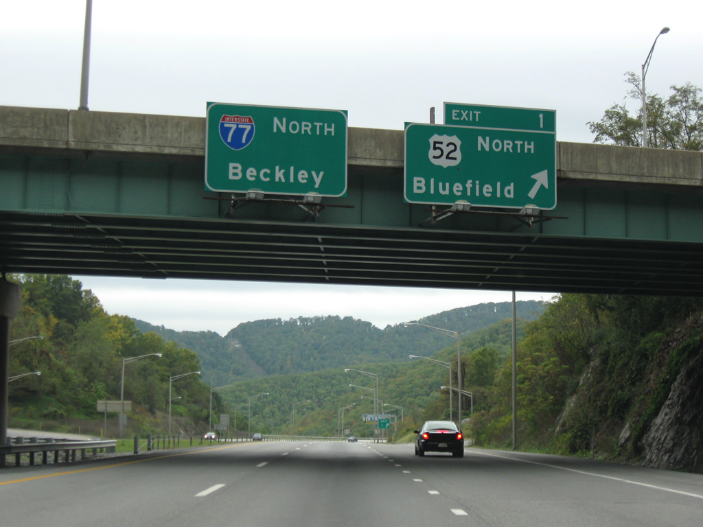
| U.S. 52 northbound departs a 1.75 mile overlap with Interstate 77 from the Exit 66 in Virginia through the East River Mountain Tunnel. A folded diamond interchange carries U.S. 52 onto Cumberland Road from Interstate 77 at Exit 1. Cumberland Road merges with U.S. 460 on the route to Bluefield in 2.5 miles. 09/29/10 |
|
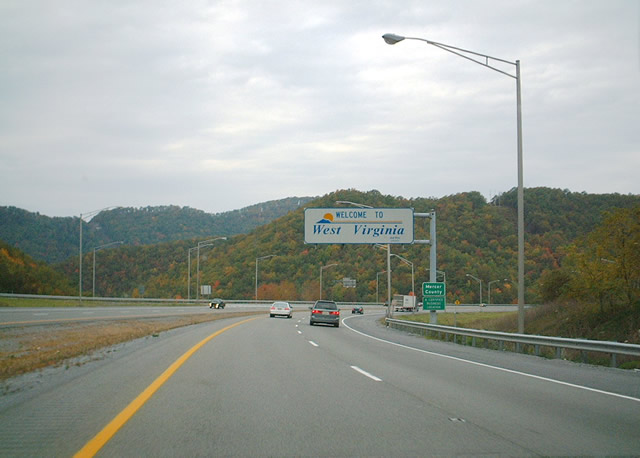
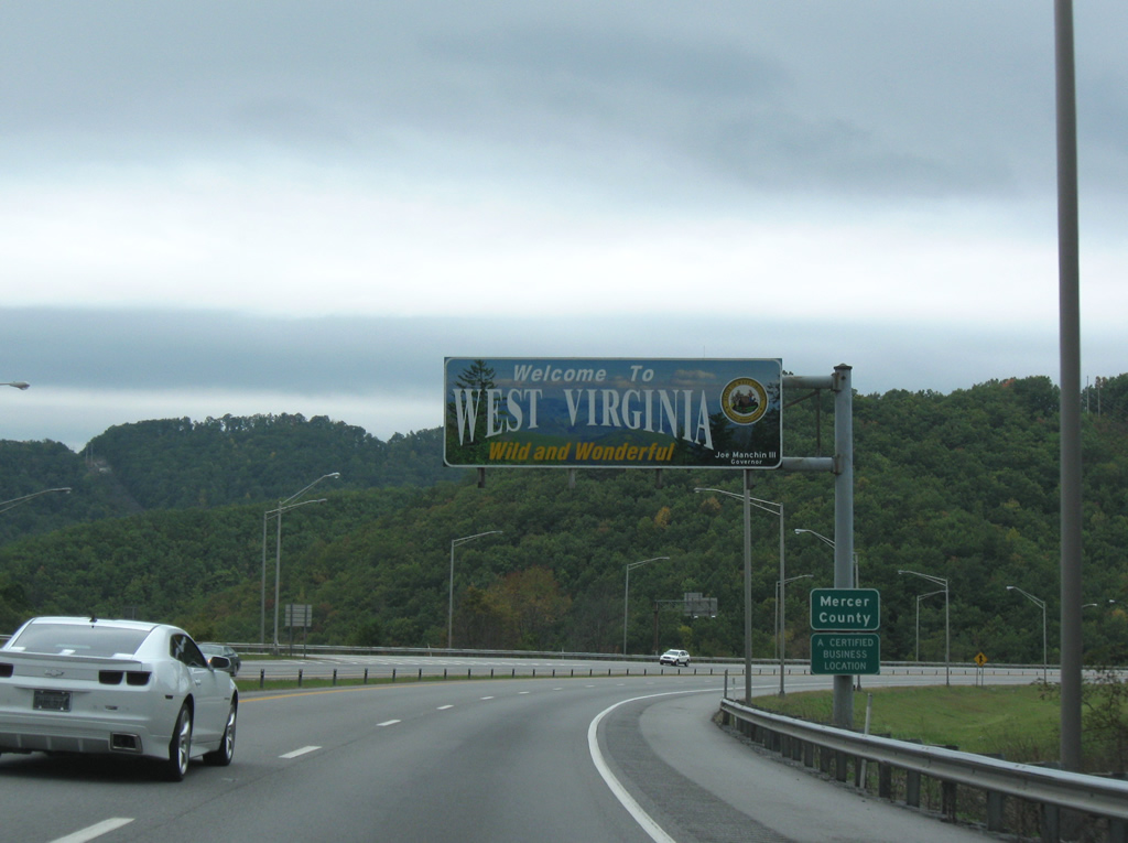
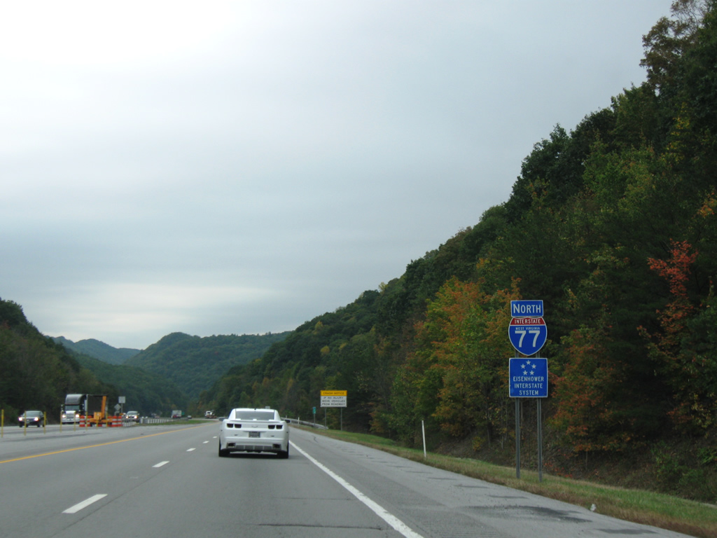
| Welcome To West Virginia overhead posted on Interstate 77 past Exit 1. Interstate 77 turns eastward between U.S. 52 and the southbound only Exit 5 (WV 112). By 2008, an updated welcome sign replaced the existing one. 10/05/01, 09/29/10 |
|
| The first West Virginia reassurance marker for Interstate 77 north of the split with U.S. 52 (Exit 1). 09/29/10 |
|
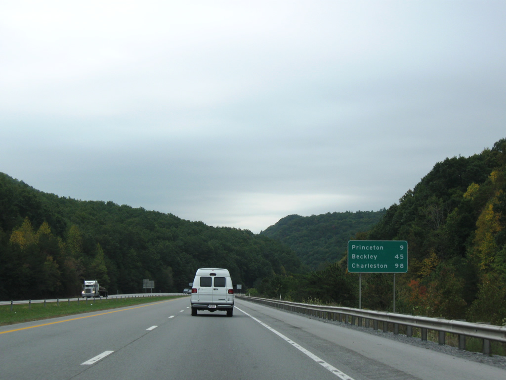
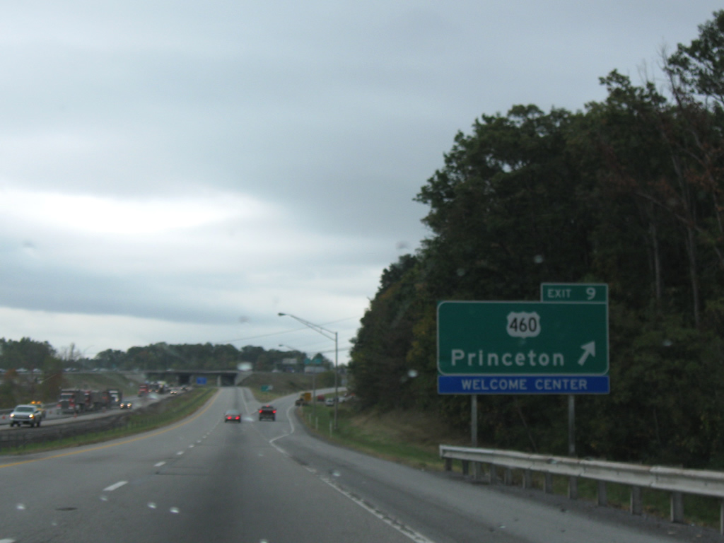
| Princeton lies to the west of the interstate along the U.S. 19 & 460 corridors near Exit 9. Interstate 64 and Beckley are still 45 miles out with Charleston now under the 100 mile mark. 09/29/10 |
|
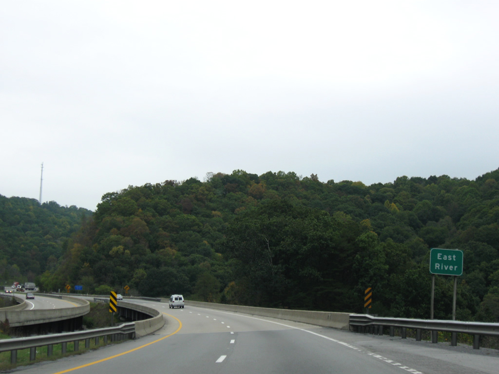
| I-77 crosses over the East River half-way between Exit 1 and Exit 7 (Mercer County 27). The river begins at Horton Lake east of Bluefield and flows generally parallel to WV 112 and U.S. 460 to the New River just inside Virginia west of Rich Creek. 09/29/10 |
|
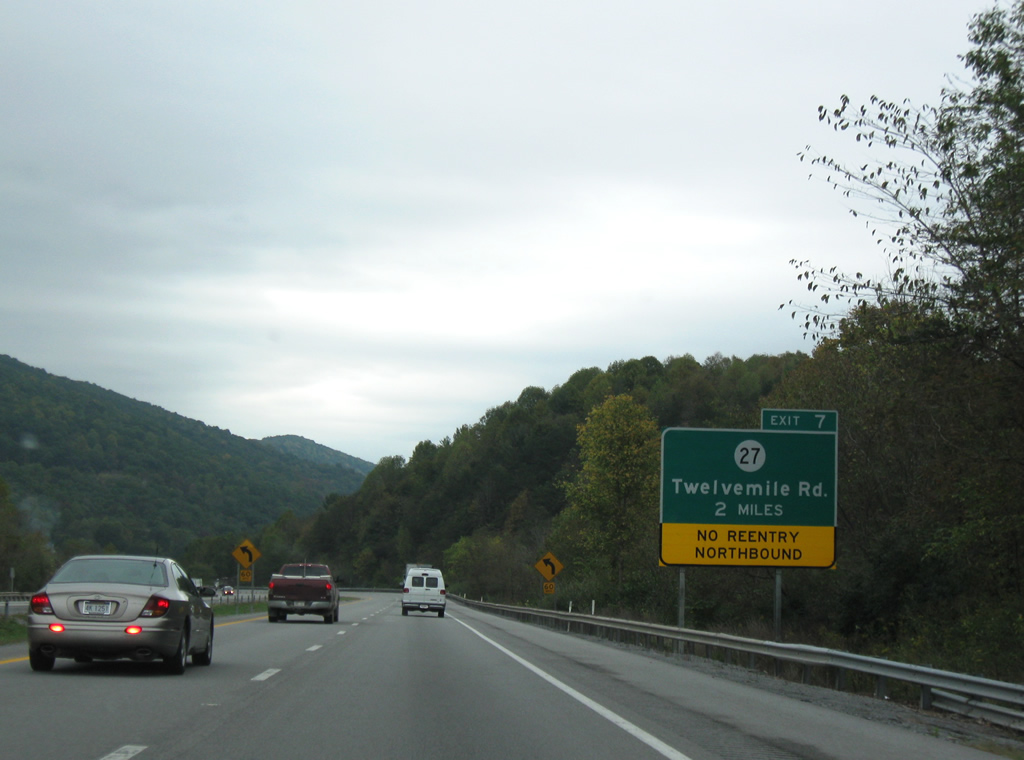
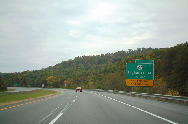
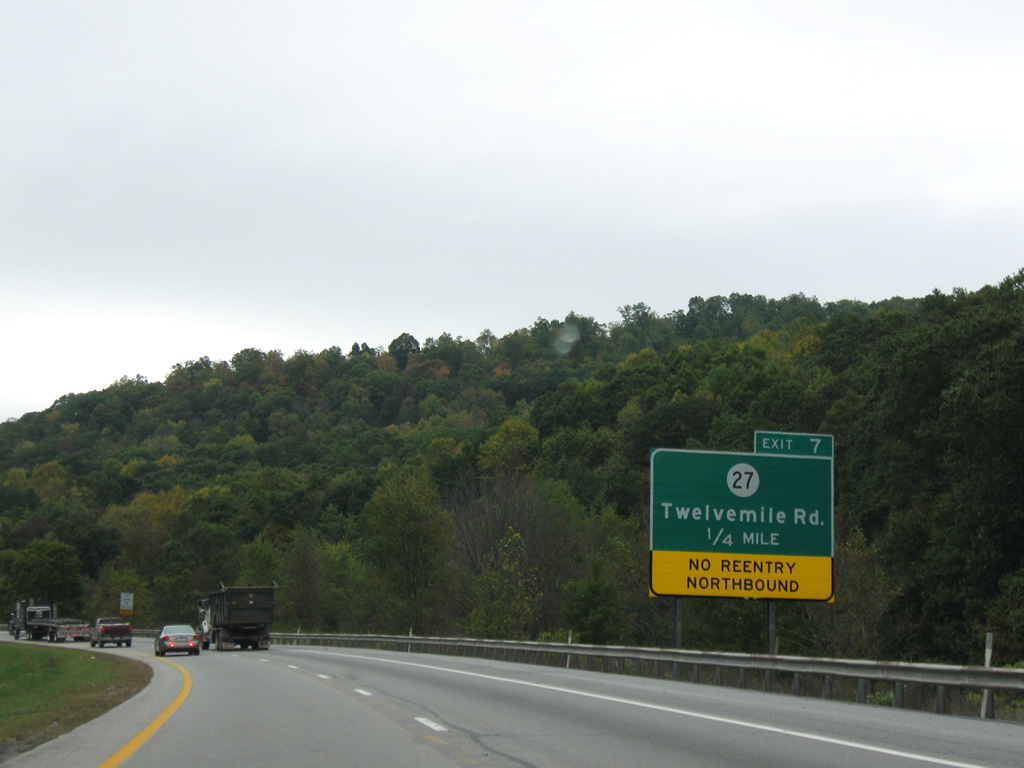
| Two mile guide sign for Mercer County 27 (Exit 7). Prior to its current name of Twelvemile Road, the county road formally carried the name of Ingleside Road, for the community situated along WV 112 east of Interstate 77 southbound at Exit 5. As indicated, no ramp exists for reentry to the interstate northbound. 09/29/10 |
|
| Another distance sign for Princeton, Beckley, and Charleston is posted after the on-ramp from WV 112 (Exit 5 southbound only). 09/29/10 |
|
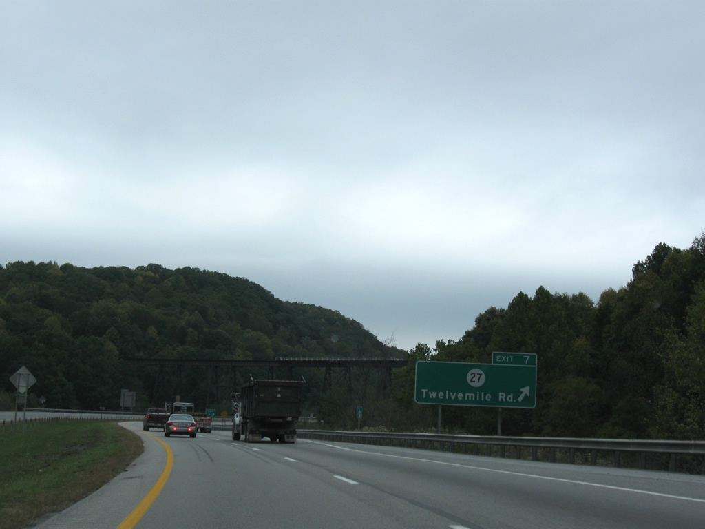
| Mercer County 27 departs Interstate 77 via Twelvemile Road (former Princeton-Ingleside Road) at Exit 7. The county road travels northward into the city of Princeton, ending at U.S. 460 in three miles. Exit 7 consists of a wye interchange. 10/05/01, 09/29/10 |
|
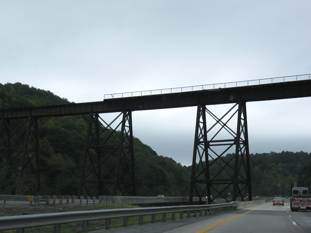
| The Exit 7 off-ramp to Twelvemile Road (former Ingleside Road) sinks underneath Interstate 77. A Norfolk Southern (former Norfolk & Western) railroad line crosses high overhead, traveling south out of Princeton. 10/05/01, 09/29/10 |
|
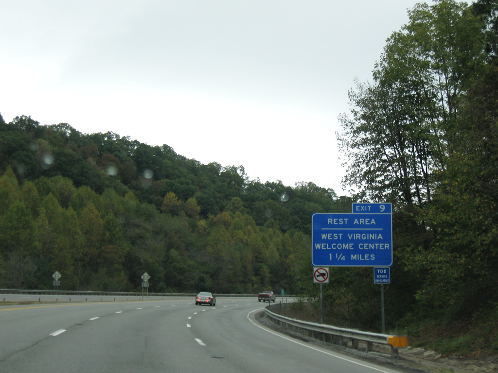
| An official West Virginia Welcome Center is located immediately east of the departure ramp for the forthcoming Exit 9 (U.S. 460). The welcome center and rest area facility is operated by the WV Turnpike Authority. 09/29/10 |
|
| The primary exit for Princeton, U.S. 460 (Exit 9) approaches in one mile. 09/29/10 |
|
| Prior to its current alignment, U.S. 460 followed Oakvale Road (current WV 104) and Thorn Street (current WV 20) west into Princeton. 09/29/10 |
|
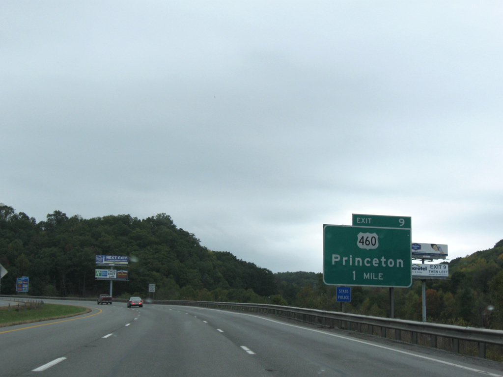
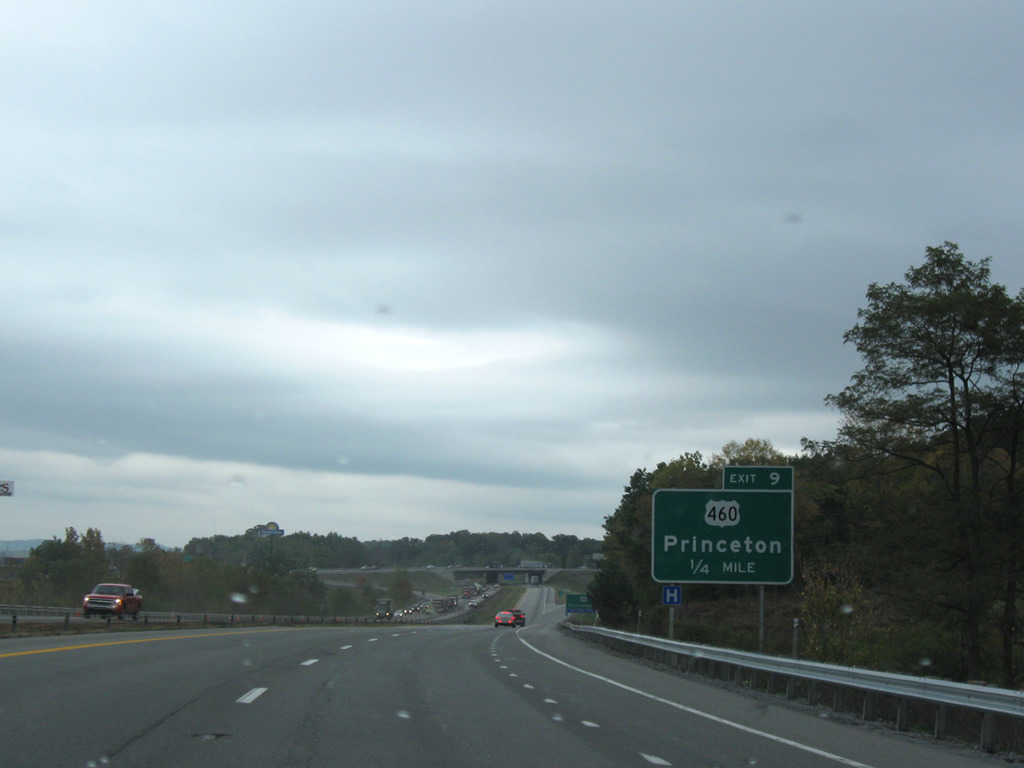
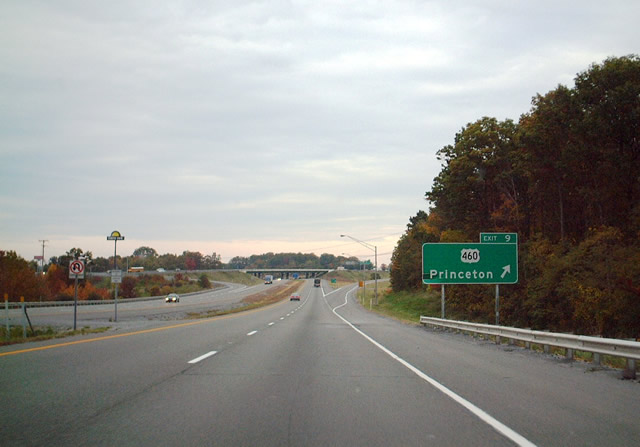
| U.S. 460 intersects Interstate 77 at the Exit 9 diamond interchange east of Princeton. The West Virginia Turnpike portion of Interstate 77 commences from this junction northward to Charleston. U.S. 460 provides the main highway between U.S. 19 and Princeton eastward to Blacksburg and Christiansburg, Virginia. Instead of replacing the signage, a Welcome Center service placard was instead added under the final guide sign for the interchange with U.S. 460. 10/05/01, 09/29/10 |
|
| North of U.S. 460 (Exit 9), Interstate 77 and the West Virginia Turnpike continues toward Beckley and Charleston. CR 7 (Exit 14) to WV 20 occurs next. 09/29/10 |
|
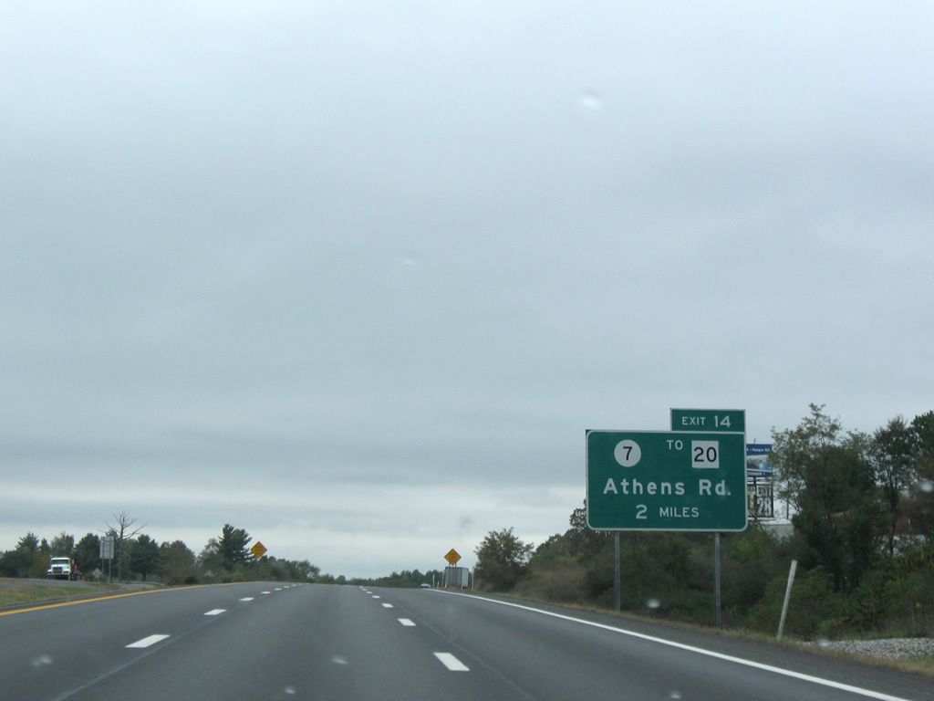
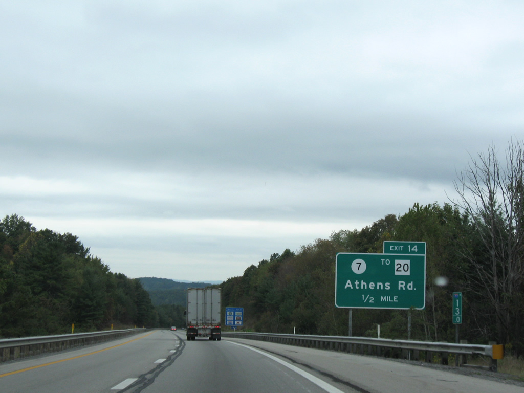
| Interstate 77 north begins its approach to County Route 7 (Exit 14) in two miles. 09/29/10 |
|
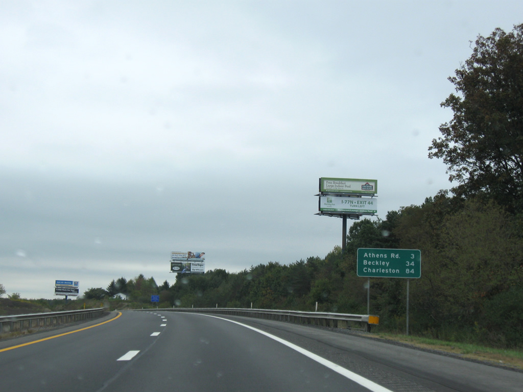
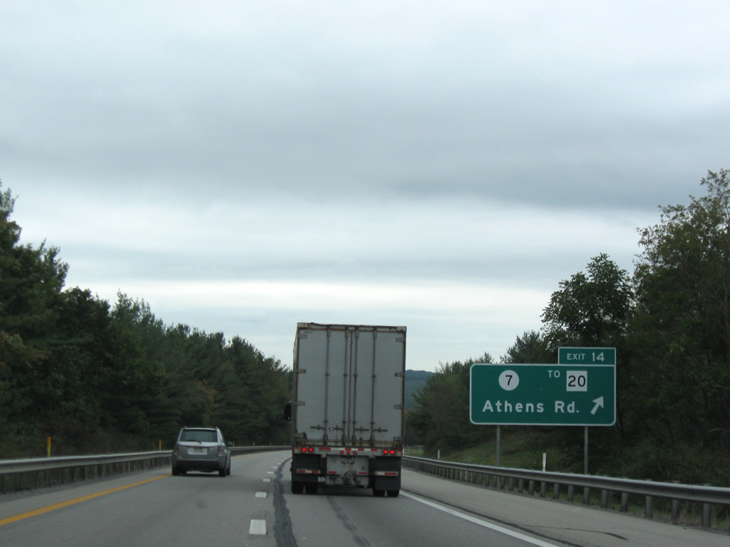
| CR 7 (Mercer Springs Road) stretches from U.S. 19 south of Spanishburg to WV 20 (Athens Road) 2.6 miles from the turnpike. 09/29/10 |
|
| WV 20 is a north-south state highway extending over 256 miles through the state, beginning at U.S. 52 near Bluefield and ending at WV 7 east of New Martinsville. 09/29/10 |
|
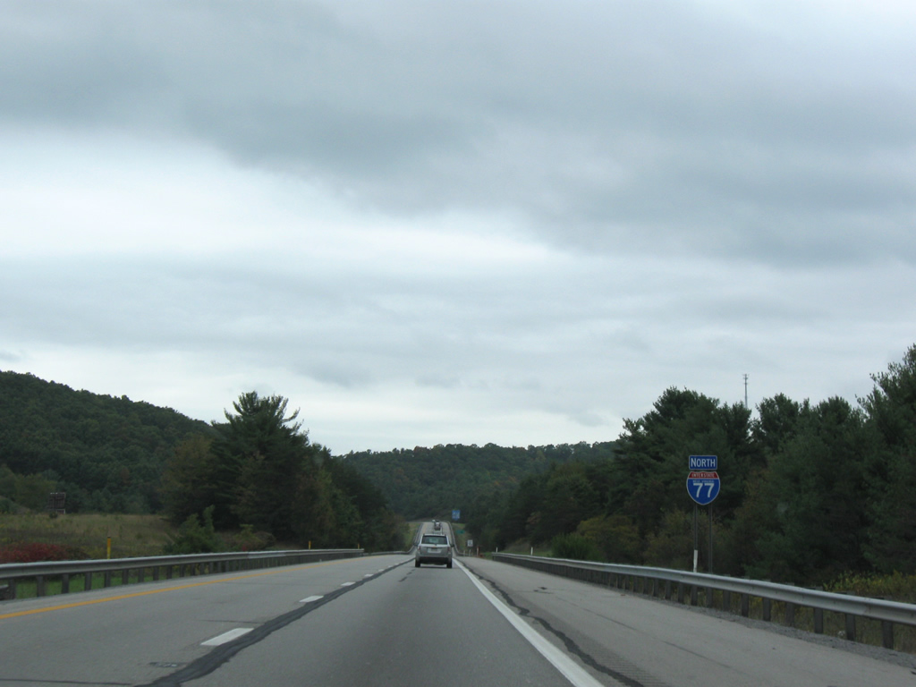
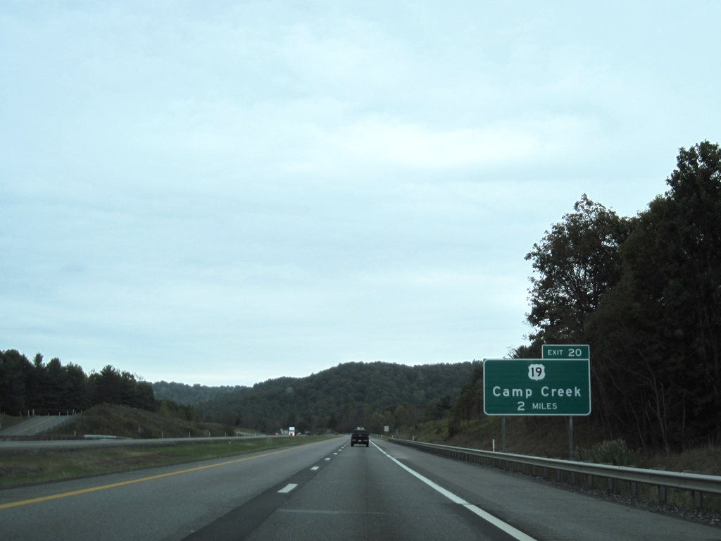
| Interstate 77 north will next encounter U.S. 19 (Exit 20) in five miles near Camp Creek. Beckley is now only 30 miles away with the capital city still 80 miles ahead. The Bluestone Travel Plaza occurs near the 18 mile marker. 09/29/10 |
|
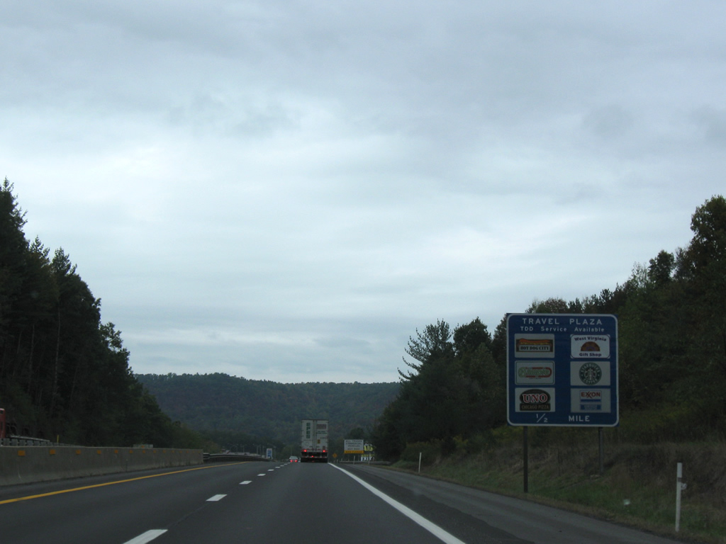
| Now within one half mile of the Bluestone Travel Plaza. The travel plaza accommodates northbound motorists only and features fuel, food, and other travel services. 09/29/10 |
|
| Beyond the travel plaza motorists are advised of the upcoming interchange with U.S. 19 (Exit 20) in two miles. U.S. 19 begins in Palmetto, Florida at U.S. 41 and ends in Erie, Pennsylvania at U.S. 20. 09/29/10 |
|
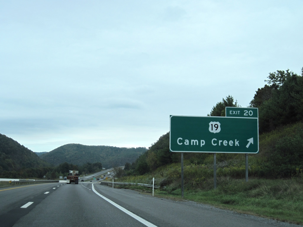
| U.S. 19 parallels Interstate 77 from Princeton north to Prosperity where the two corridors depart for other areas of the state. The U.S. highway will criss-cross the turnpike between Exits 20 & 28 before remaining east for the remainder of its journey to Beckley and beyond. 09/29/10 |
|
| U.S. 19 (Exit 20) connects the interstate with Camp Creek and nearby Camp Creek State Forest. The small community of Spanishburg lies 6.6 miles to the south. 09/29/10 |
|
| North of Exit 20, Interstate 77 continues toward Beckley and Charleston. Ghent, situated inside Raleigh County, lies eight miles ahead. 09/29/10 |
|
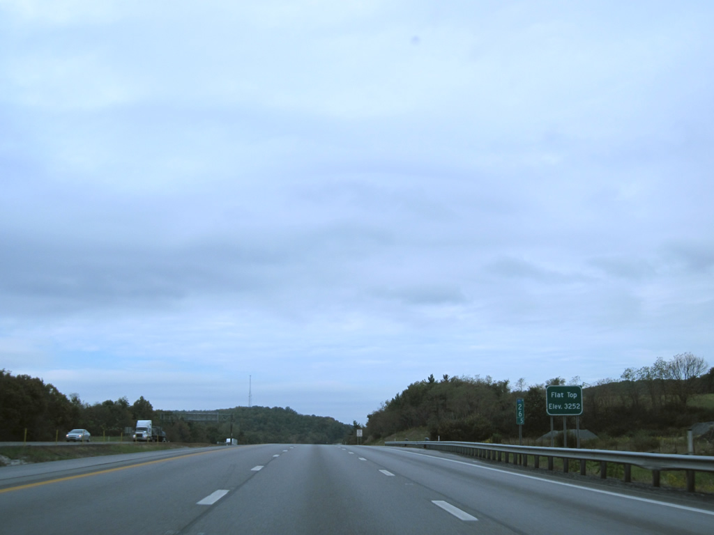
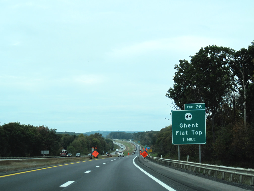
| The six lane turnpike closely follows U.S. 19 between Camp Creek and Ghent. 2.5 miles from CR 48 (Exit 28) Interstate 77 passes over Flat Top (elev. 3,252 feet). 09/29/10 |
|
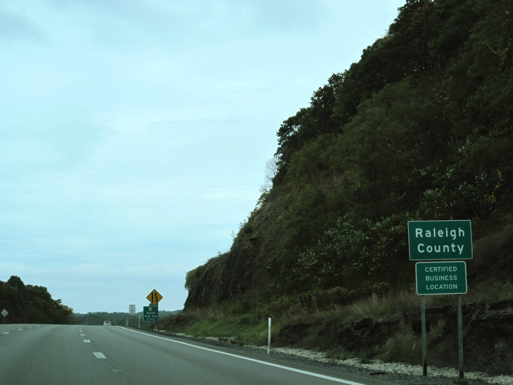
| I-77 north enters Raleigh County prior to the diamond interchange of Exit 28. The county was founded in 1850, with Beckley serving as the county seat. 09/29/10 |
|
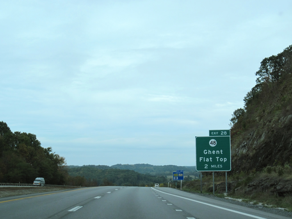
| The West Virginia Turnpike will meet County Route 48 (Odd-Ghent Road) west of its end with U.S. 19 near Flat Top Lake in two miles. 09/29/10 |
|
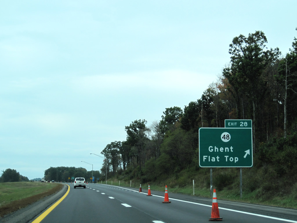
| The mainline toll plaza lies immediately after the diamond interchange with Odd-Ghent Road (Exit 28). 09/29/10 |
|
| Ghent, a small community along parallel U.S. 19, is situated just east of the forthcoming interchange. 09/29/10 |
|
| CR 48 meanders five miles west from U.S. 19 and I-77 to meet with County Route 33 (Amigo-Odd Road) in the adjacent mountains. The mainline Ghent Toll Plaza is now within a mile. 09/29/10 |
|
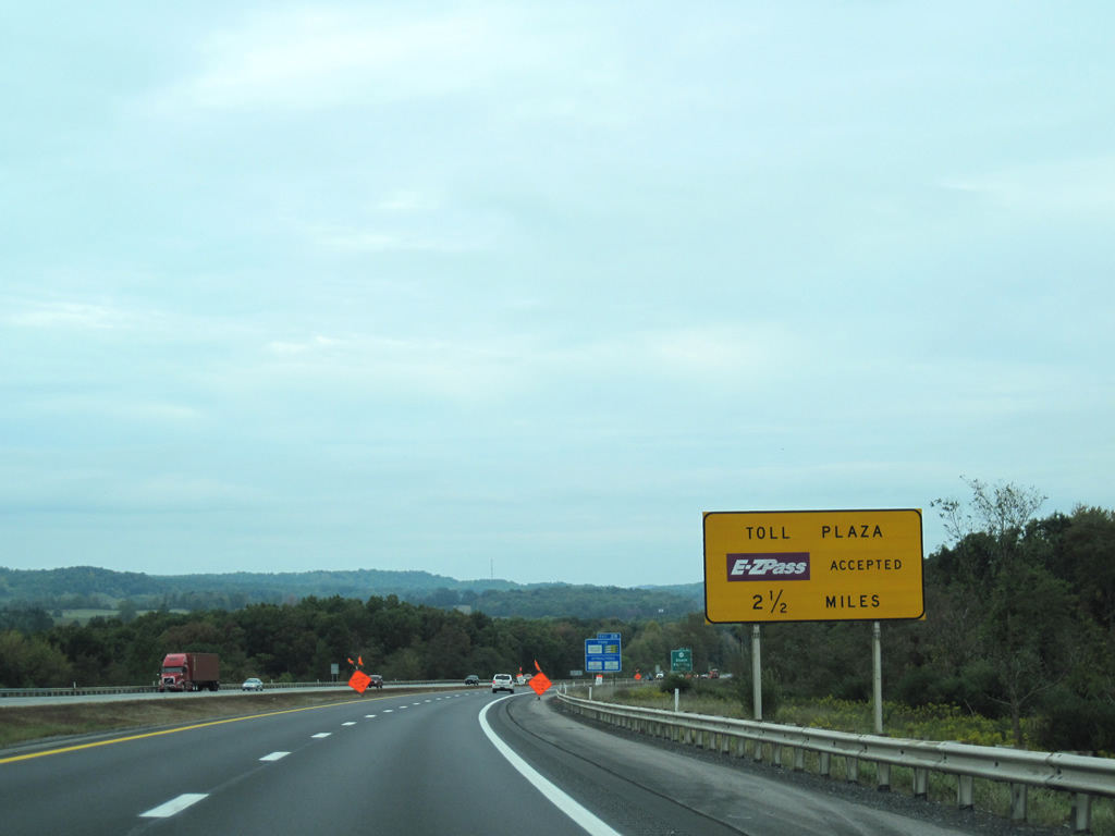
| Motorists begin their approach to the toll plaza north of Odd-Ghent Road. 09/29/10 |
|
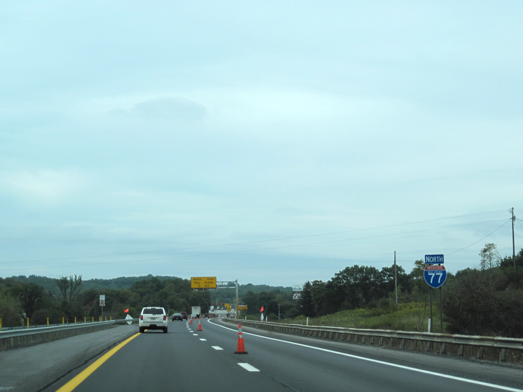
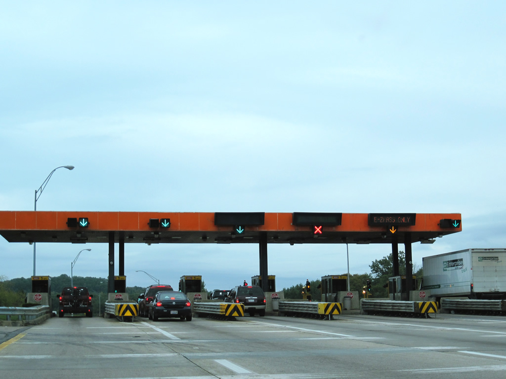
| Currently, a $2.00 toll is collected at the Ghent Toll Plaza. Additional toll rates can be found here. E-ZPass is accepted at all mainline toll plazas along the West Virginia Turnpike. Seven miles separate the Ghent Toll Plaza and Interstate 64 (Exit 40). Beckley lies just to the northeast of the upcoming interstate connection. 09/29/10 |
|
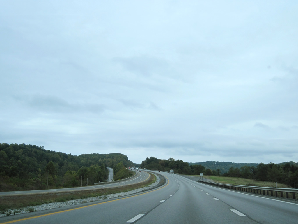
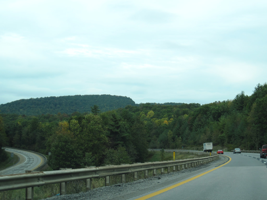
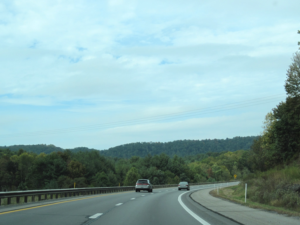
| Large medians separate the roadways of Interstate 77 between Exit 28 and Interstate 64, wide enough so that the opposite side is not in view at times. 09/29/10 |
|
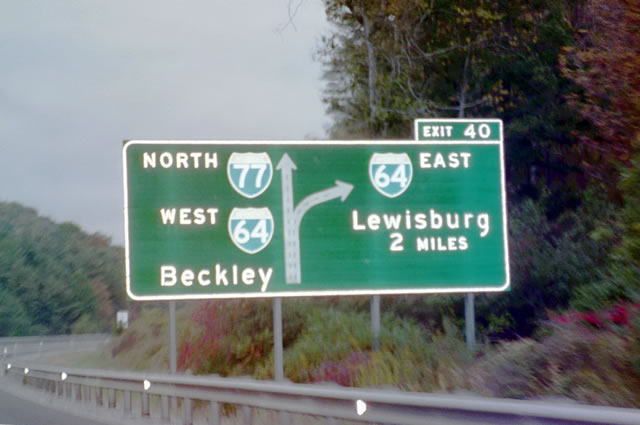
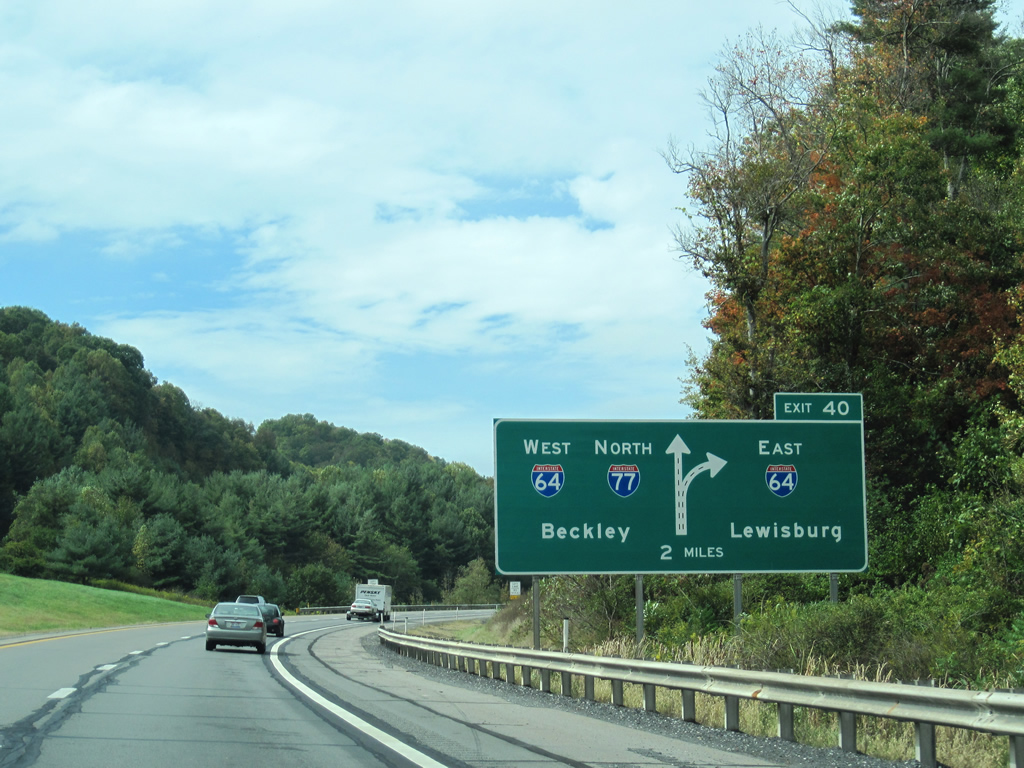
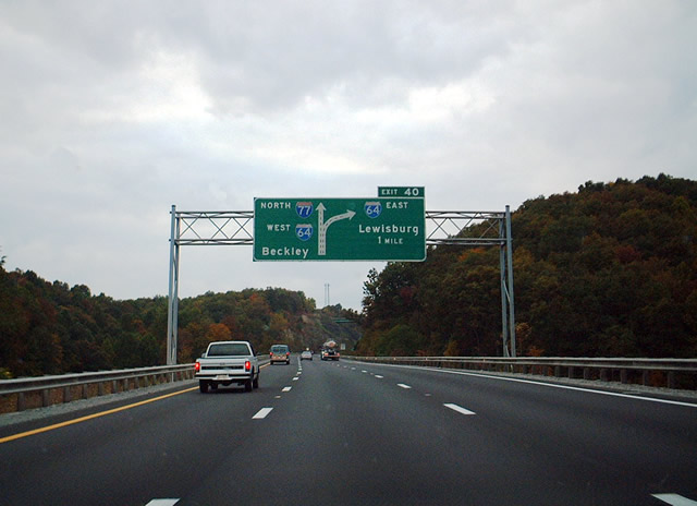
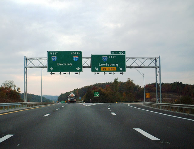
| Northward near the city of Beckley, Interstate 77 and the West Virginia Turnpike add Interstate 64 westbound to the fold. An unstacked directional interchange provides the junction between the tolled turnpike and free Interstate 64 east at Exit 40. 10/05/01, 09/29/10 |
|
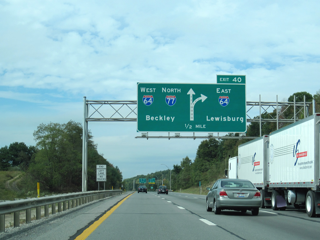
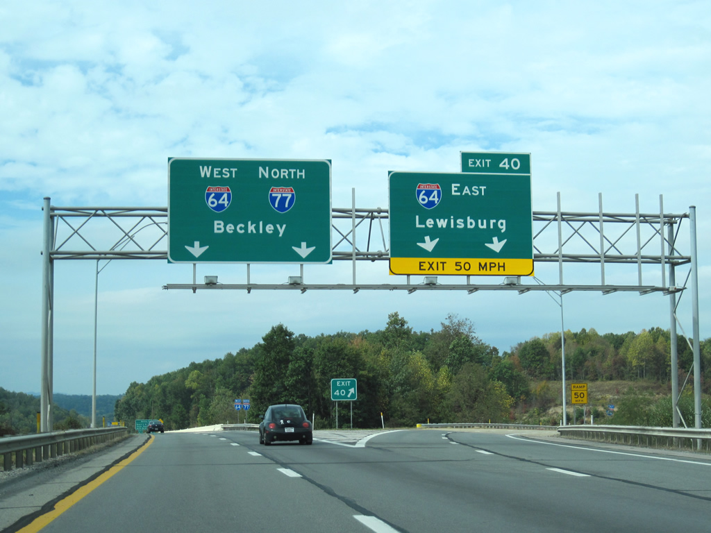
| Interstate 77 northbound expands to three lanes in anticipation of the Interstate 64 interchange (Exit 40). Interstate 64 east sees two interchanges for Beckley on the 50 mile drive to the control point of Lewisburg. Lewisburg represents the crossroads of U.S. 60 and 219 in mountainous Greenbrier County. 10/05/01, 09/29/10 |
|
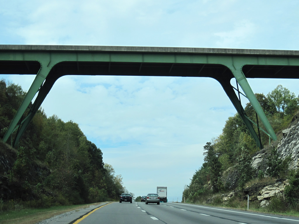
| Sullivan Road spans high over the West Virginia Turnpike less than a mile south of the merge with Interstate 64 west. The median is wide enough that a few residential dwellings are located along Sullivan Road between the north and south roadways. 09/29/10 |
|
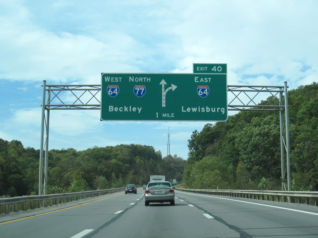
| A third diagrammatic overhead for Exit 40 prepares motorists for the merge of Interstate 64 west onto Interstate 77 north. Interstate 64 travels 120 miles east to Lexington, Virginia where the Interstate begins a 30 mile overlap with Interstate 81. 10/05/01, 09/29/10 |
|
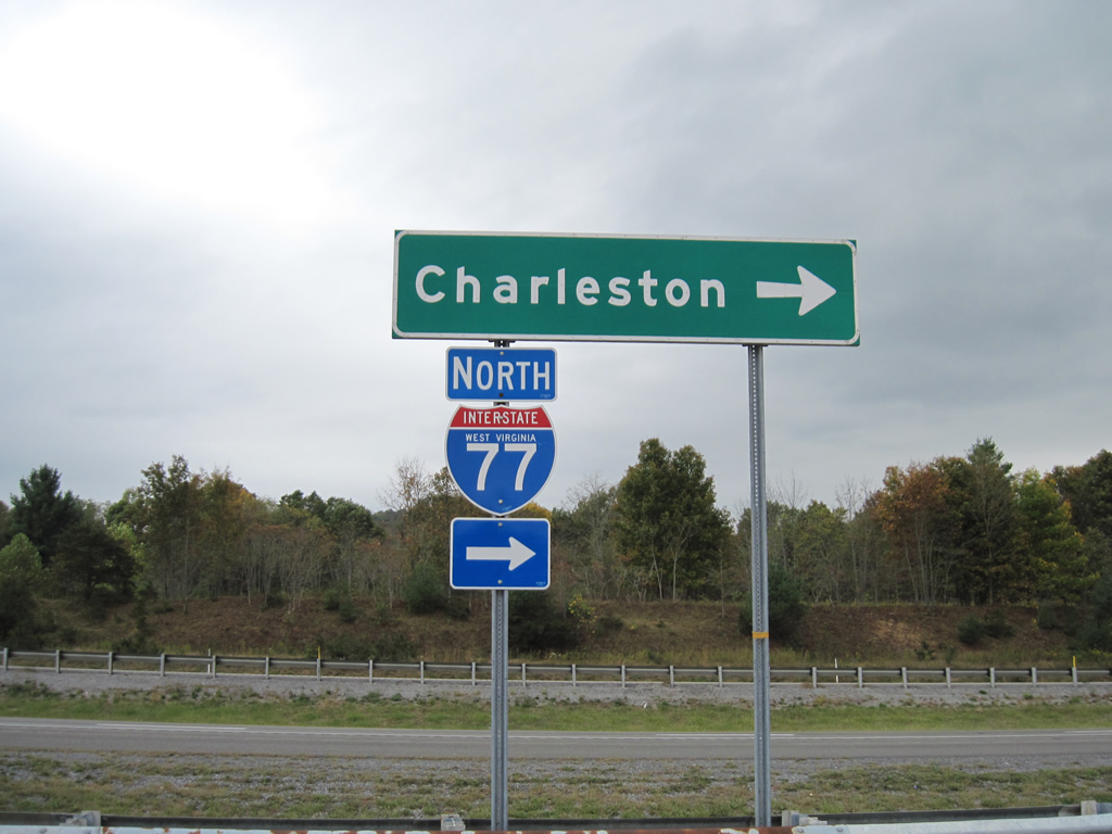
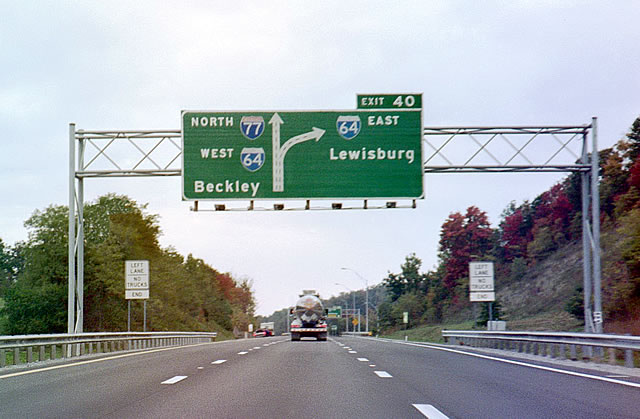
| The West Virginia Turnpike northbound at Exit 40 (Interstate 64 east). I-64/77 share pavement from here northward into the capital city of Charleston, a distance of 61 miles. The paired highways see two interchanges for the city of Beckley. Exit 42 serves the southern part of the city via WV 16 (Robert C. Byrd Drive) in two miles. 10/05/01, 09/29/10 |
Page Updated 02-10-2013.

 North
North