|
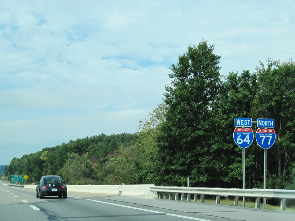
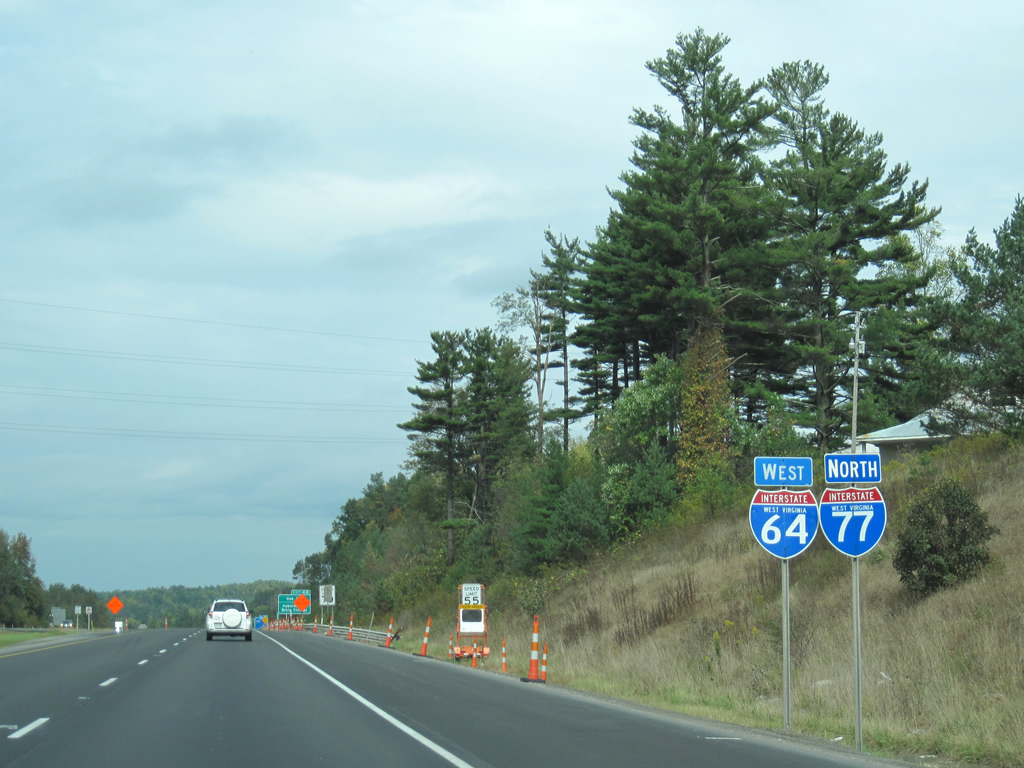
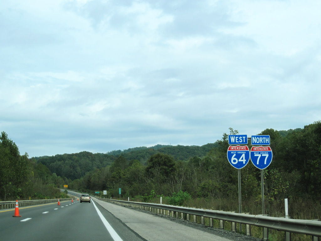
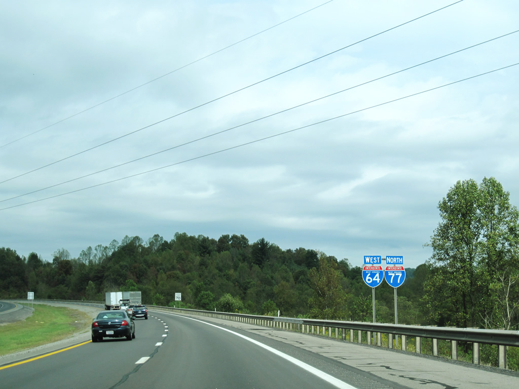
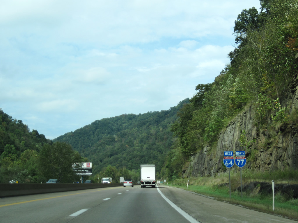
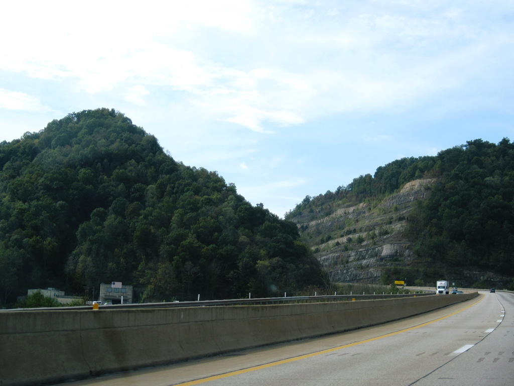
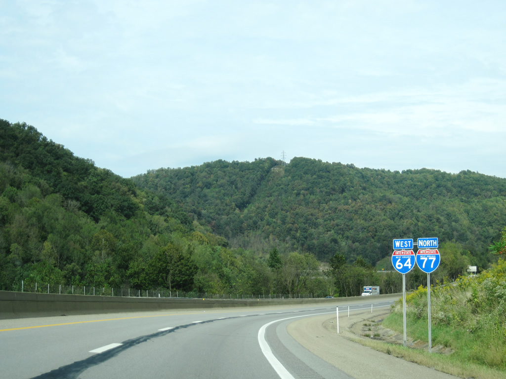
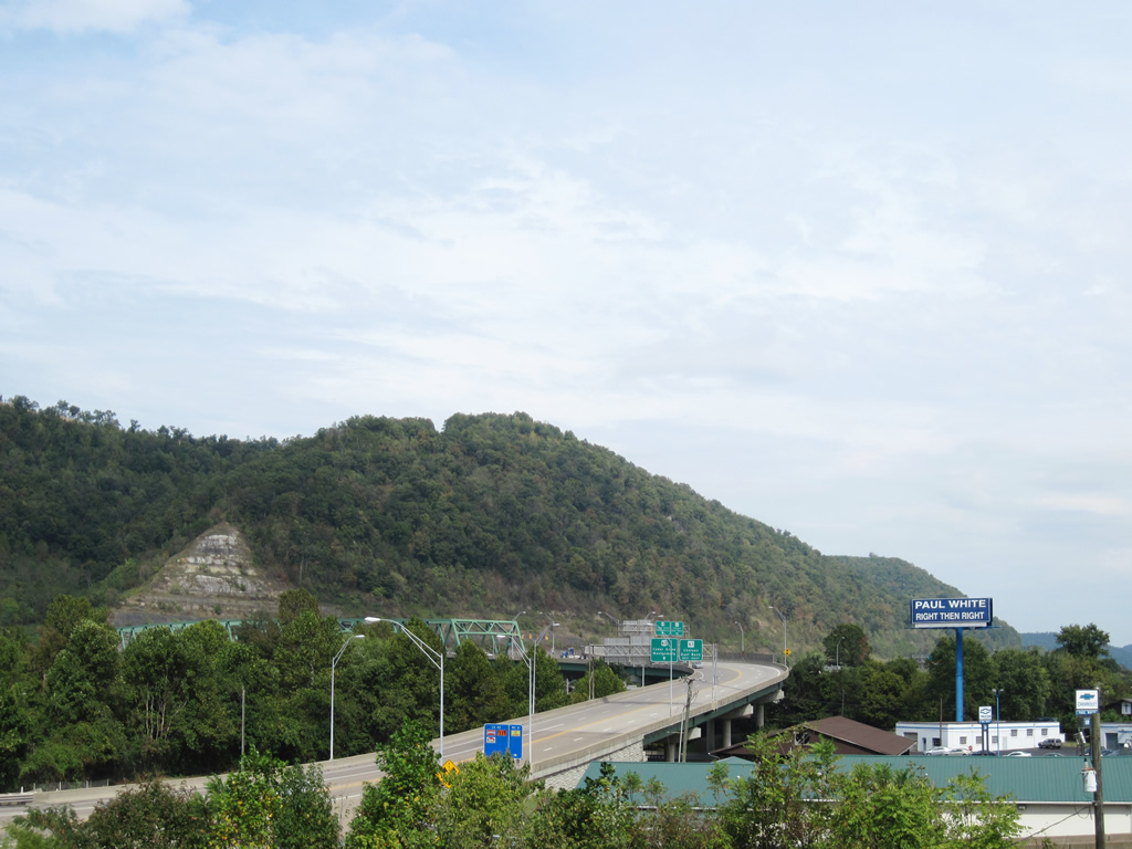
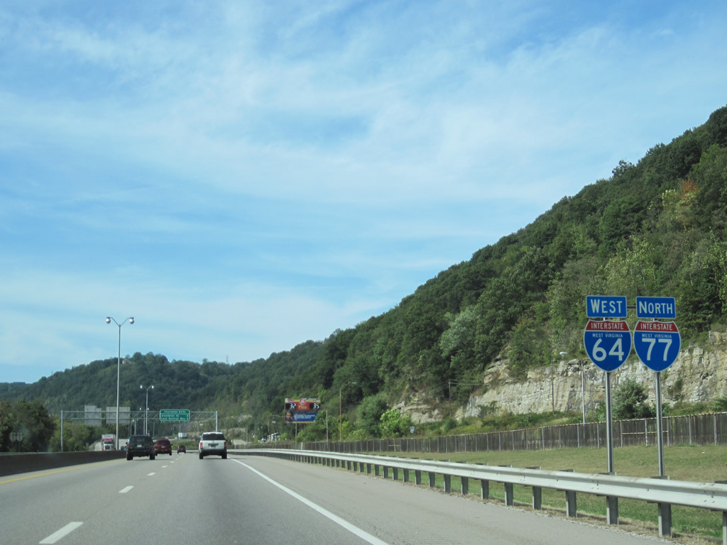
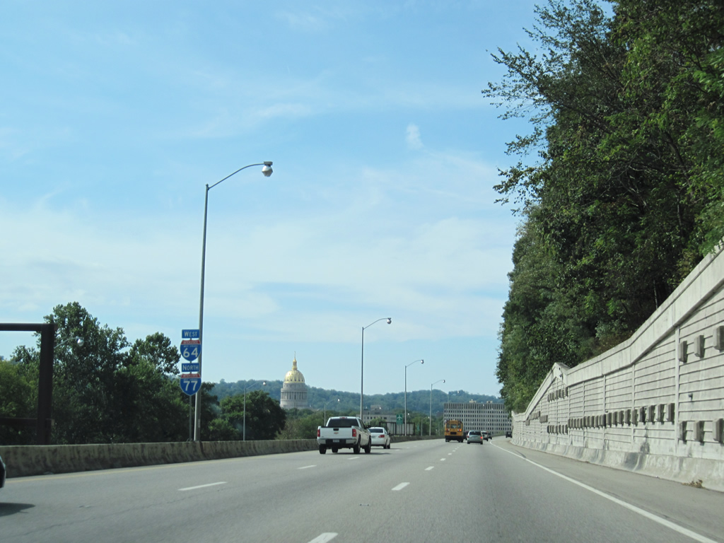
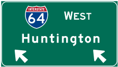
| I-64 west and I-77 north confirming markers posted after they combine near Beckley. 09/29/10 |
|
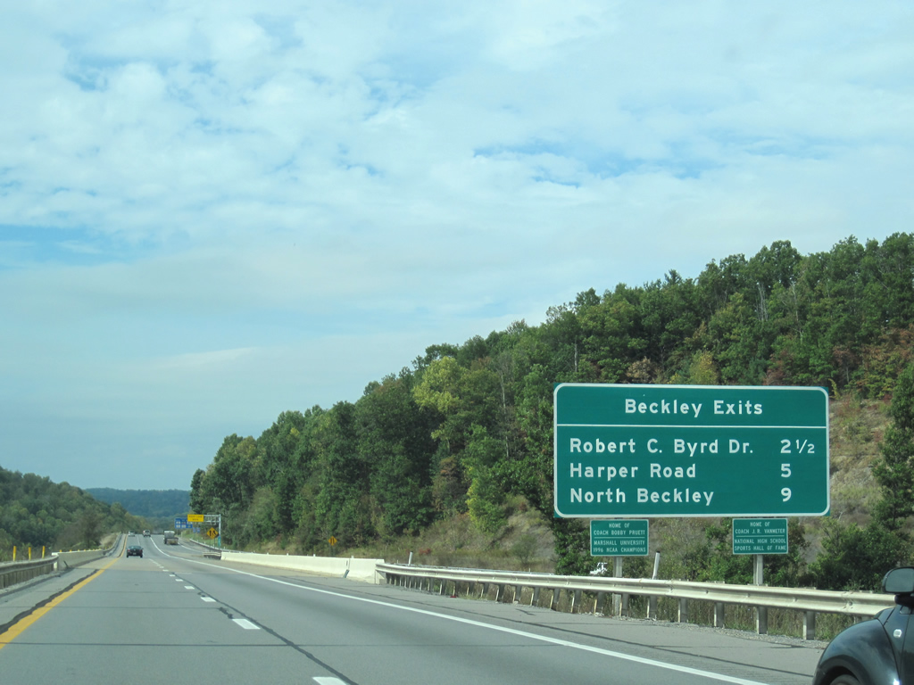
| Three interchanges along the West Virginia Turnpike serve the city of Beckley as it continues toward Charleston, still 58 miles away. The North Beckley exit (Exit 48) connects I-64/77 north with U.S. 19 in Prosperity before the U.S. highway departs for Fayetteville and points north. Harper Road (WV 3) enters Beckley from the northwest while the upcoming Robert C. Byrd Drive (WV 16/97) penetrates Beckley from the southwest. 09/29/10 |
|
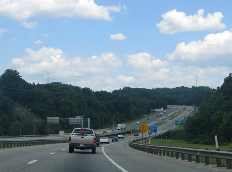
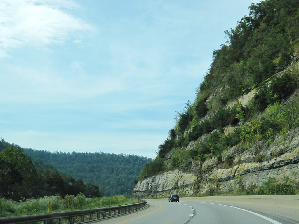
| Curving northwest, the West Virginia Turnpike spans Piney Creek and the parallel Norfolk-Southern Railroad crossing on the drive to Mabscott and west Beckley. 06/17/05 |
|
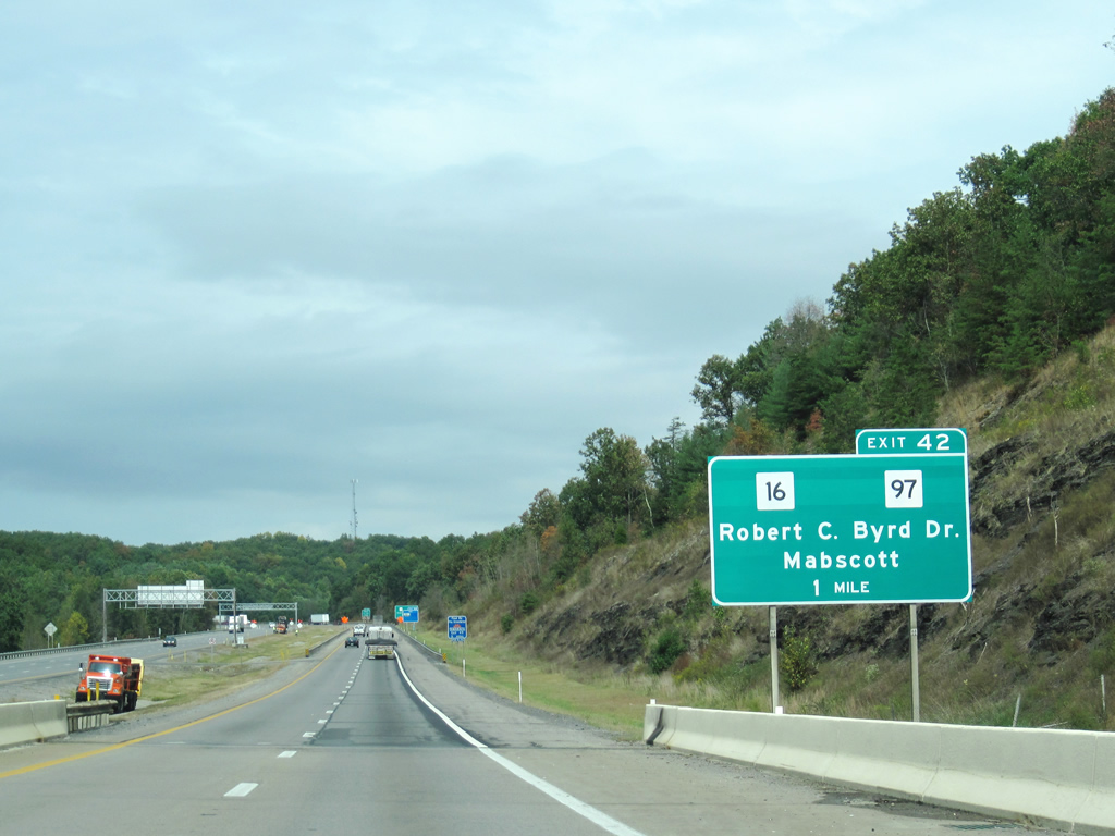
| WV 16/97 (Robert C. Byrd Drive) meet I-64/77 at the town of Mabscott southwest of Beckley. The pair follow a four lane divided highway northeast from Sophia four miles to the trumpet interchange at Exit 40. WV 16 southwest from Beckley to WV 83 in McDowell County represents the rough routing of the planned Coalfields Expressway (U.S. 121), a controlled access four lane roadway that will link I-64/77 with southwest Virginia. 09/29/10 |
|
| WV 97 runs for 49 miles from U.S. 52/WV 80 near Hanover northeast. Weaving along the southwest mountain chains of the state, WV 97 ties into I-64/77 at a trumpet interchange near Mabscott. 09/29/10 |
|
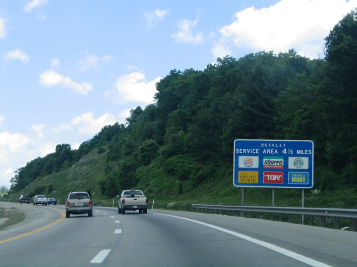
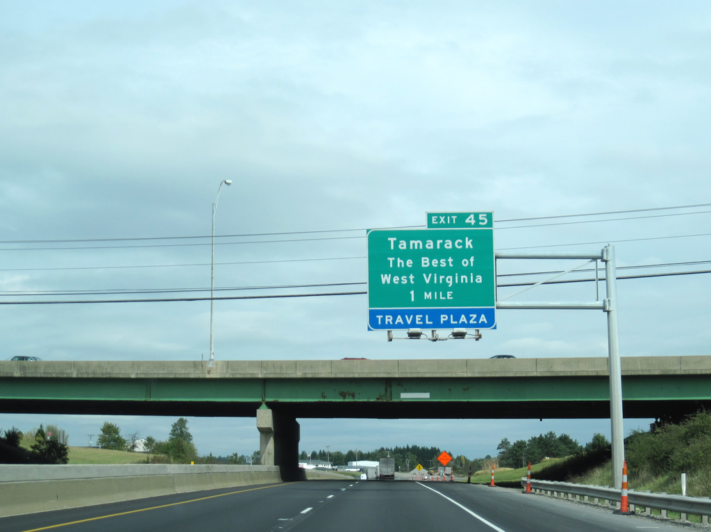
| The Beckley Service Area, home of Tamarack, lies 4.5 miles north of the Piney Creek crossing of I-64/77 north at Exit 45. 06/17/05 |
|
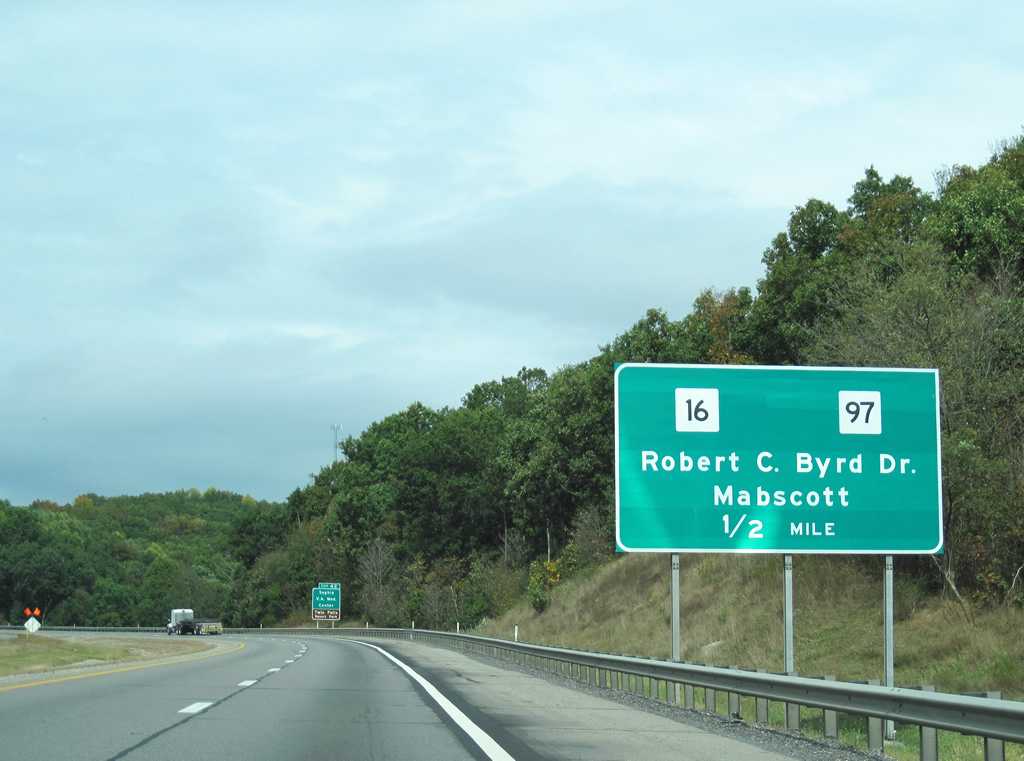
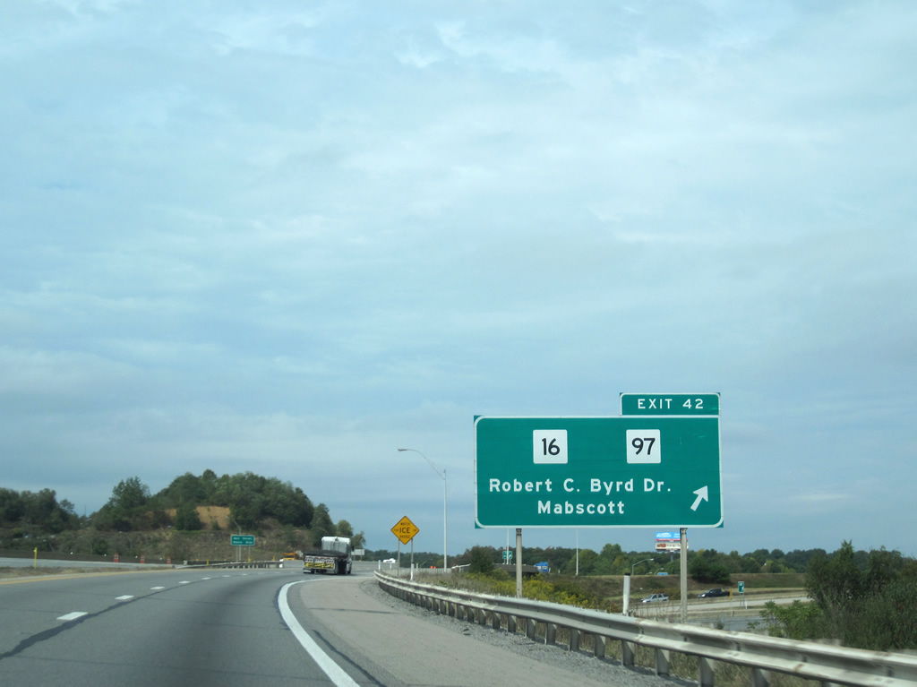
| Exit 42 departs I-64/77 north for WV 16/97 (Robert C. Byrd Drive) west. WV 16 north leads directly into Mabscott and downtown Beckley. Southbound leads to Crab Orchard and the split with WV 97 north of Sophia. WV 97 parts ways with Robert C. Byrd Drive in 3.7 miles for Glen White and Lester. 09/29/10 |
|
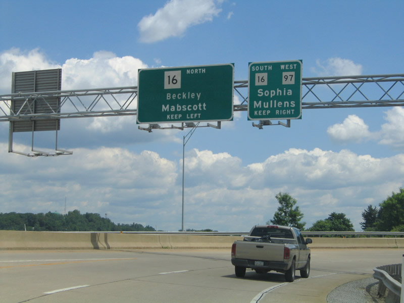
| Exit 42 partitions into WV 16 north to Mabscott and WV 16/97 south toward Sophia. WV 16 follows Winding Gulf Creek southward from Helen and westward from Stephenson to Mullens and Pineville. WV 97 takes a northerly route to Pineville by way of Slab Fork, Maben, and the Twin Falls Resort State Park area. 06/17/05 |
|
| A second trumpet interchange carries drivers onto Robert C. Byrd Drive at the end of Exit 40. WV 16 travels 84 miles southward from Mabscott to the Virginia state line at Bishop. Mullens lies 24 miles south along the state highway. Downtown Beckley meanwhile is a short 2.2 mile drive to the northeast. 06/17/05 |
|
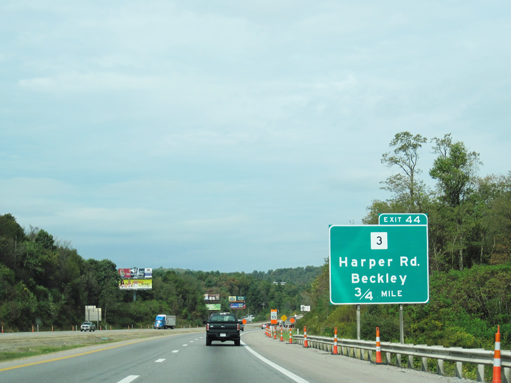
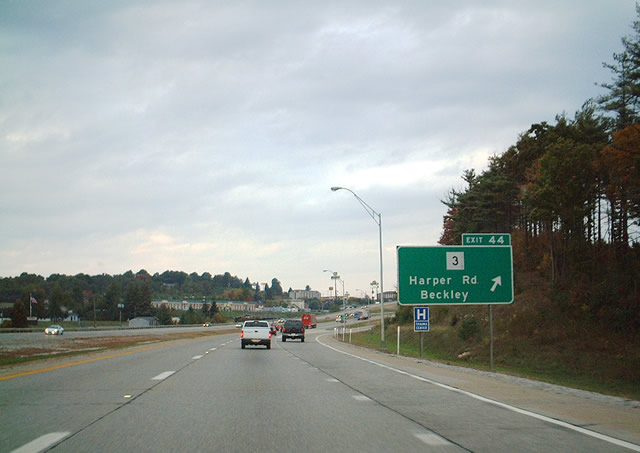
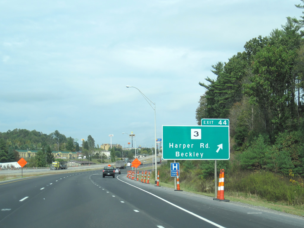
| WV 3 (Harper Road) represents the second interchange of the West Virginia Turnpike for the city of Beckley. The state highway stretches 186 miles across the West Virginia landscape between West Hamlin and Sweet Springs. 09/29/10 |
|
| I-64/77 north reach the diamond interchange with WV 3 (Exit 44). The state highway travels via Neville Street into downtown where it intersects WV 16 (Robert C. Byrd Drive). It will join U.S. 19 in the southeast reaches of Beckley for a tandem run to Shady Springs before splitting for Hinton and beyond. 10/05/01, 09/29/10 |
|
| Exit 45 links to Tamarack, the West Virginia Turnpike service area and crafts center. The "best" artisans from the state show off and sell some of their wares at this attraction. At least, that is what the turnpike people and brochures convey to motorists. 09/29/10 |
|
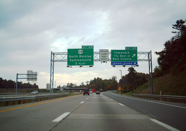
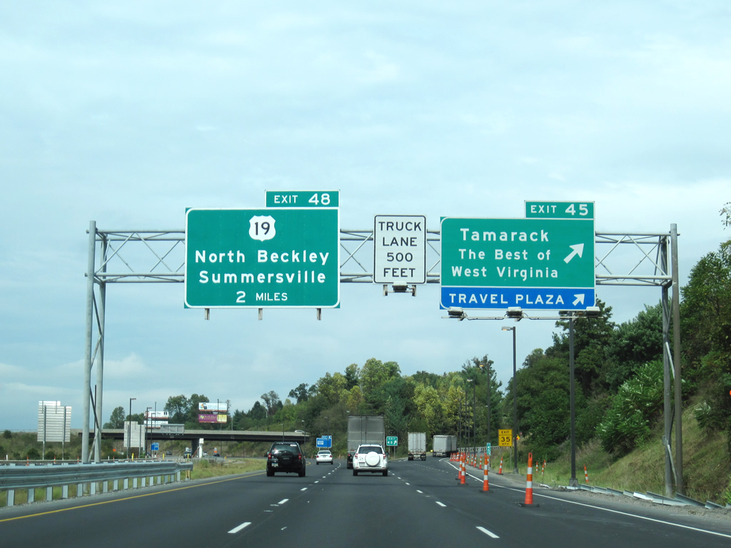
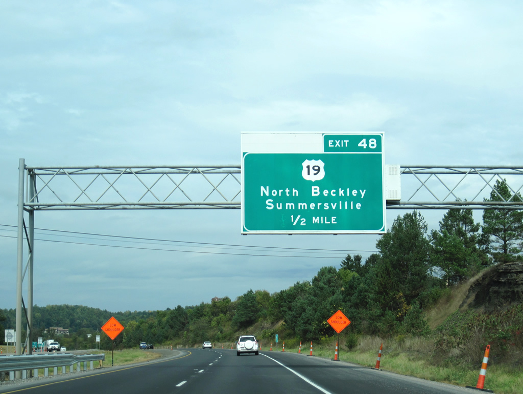
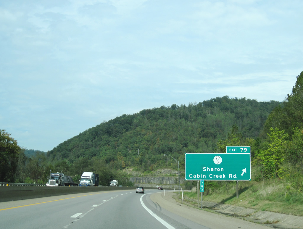
| Sign bridge at the interchange for Tamarack and the West Virginia Turnpike travel plaza. The next interchange to the north is of significance, as it links with U.S. 19. U.S. 19 beelines between Beckley and Interstate 79 north of Summersville. This routing cuts a substantial amount of mileage over the Interstate route through Charleston. 10/05/01, 09/29/10 |
|
| Leaving the Tamarack interchange of the West Virginia Turnpike northbound, 1.25 miles south of Exit 48. The connection links I-64/77 with nearby U.S. 19 near the town of Prosperity. U.S. 19/WV 16 travel Robert C. Byrd Boulevard northward out of downtown Beckley 1.50 miles to the east of Exit 48. 09/29/10 |
|
| Motorists returning to the Turnpike northbound from the Tamarack are greeted by reassurance shields prior to the split for U.S. 19 (Exit 48). 09/29/10 |
|
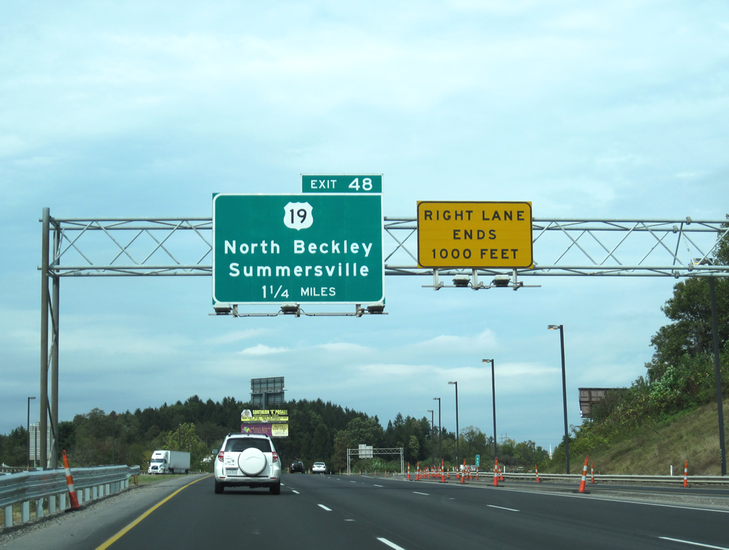
| The West Virginia Turnpike comes to within one half mile of the pivotal split for U.S. 19. This guide sign appears to illuminate at night to alert motorists of the upcoming departure. 09/29/10 |
|
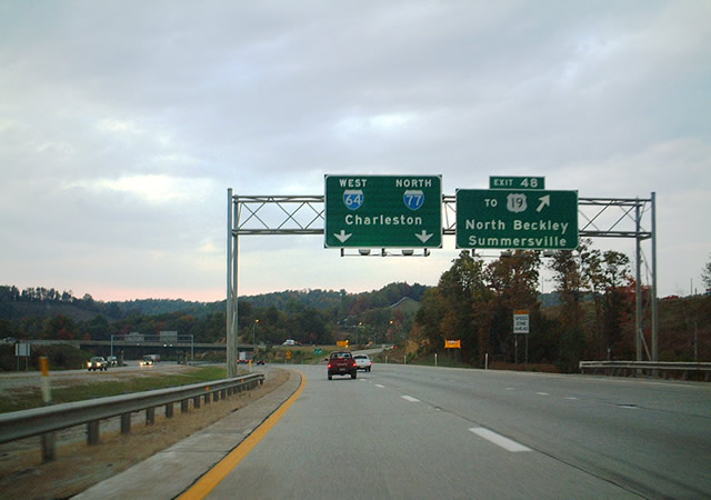
| I-64/77 north at the Exit 48 trumpet interchange with the U.S. 19 connection. U.S. 19 travels 12 miles to the town of Oak Hill, 20 miles to New River Gorge, 41 miles to Summersville, and 70 miles to Exit 57 of Interstate 79. Button copy overheads were replaced between 2001 and 2010. 10/05/01, 09/29/10 |
|
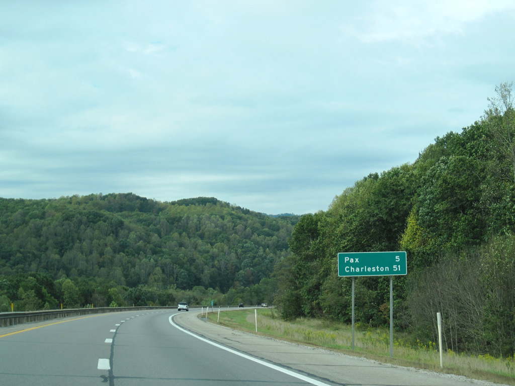
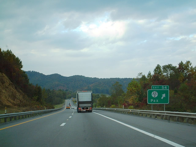
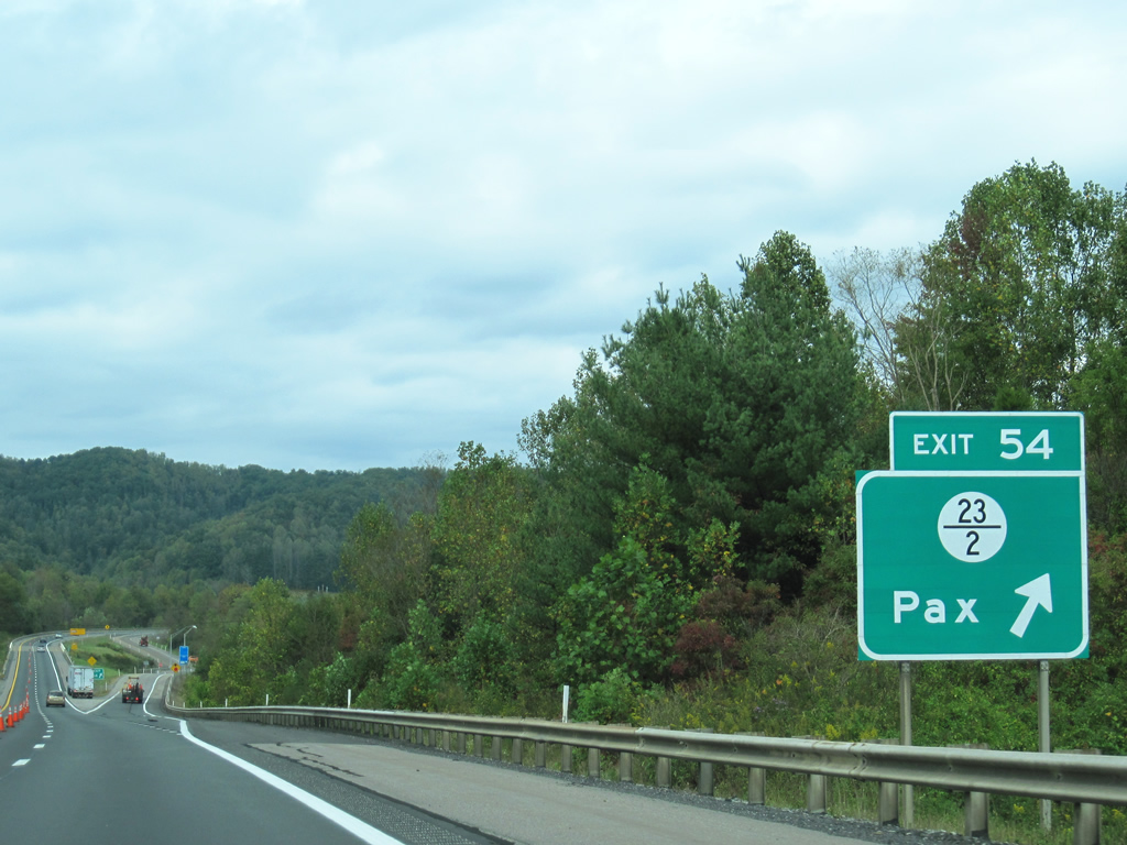
| Leaving the Beckley area, I-64/77 north continue northwesterly towards Charleston. The toll road crosses into Fayette County near the community of Pax. A diamond interchange joins the Turnpike with CR 23/ 12 just north of Pax. 09/29/10 |
|
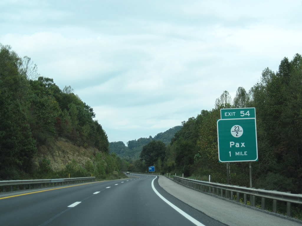
| Now within Fayette County the Turnpike prepares to encounter County Route 23/Branch 12 in one mile. 09/29/10 |
|
| I-64/77 north reach the departure ramp for County Route 23/Branch 12 (Exit 54). Pax is situated immediately to the south of the interchange. 10/05/01, 09/29/10 |
|
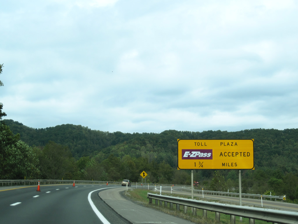
| Still within the confines of Exit 54, the West Virginia Turnpike begins its approach to the second of three toll plazas along the toll highway. 09/29/10 |
|
| Exit 60 for Mossy is five miles beyond these confirming markers. The capital city is 42 miles away. 09/29/10 |
|
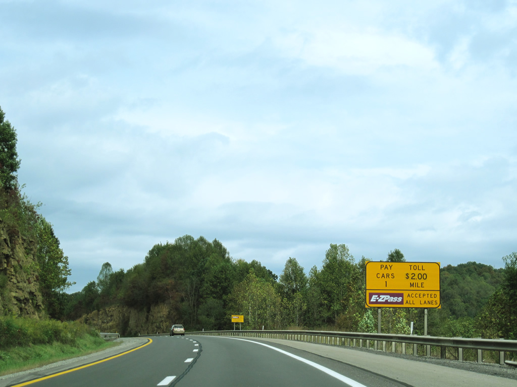
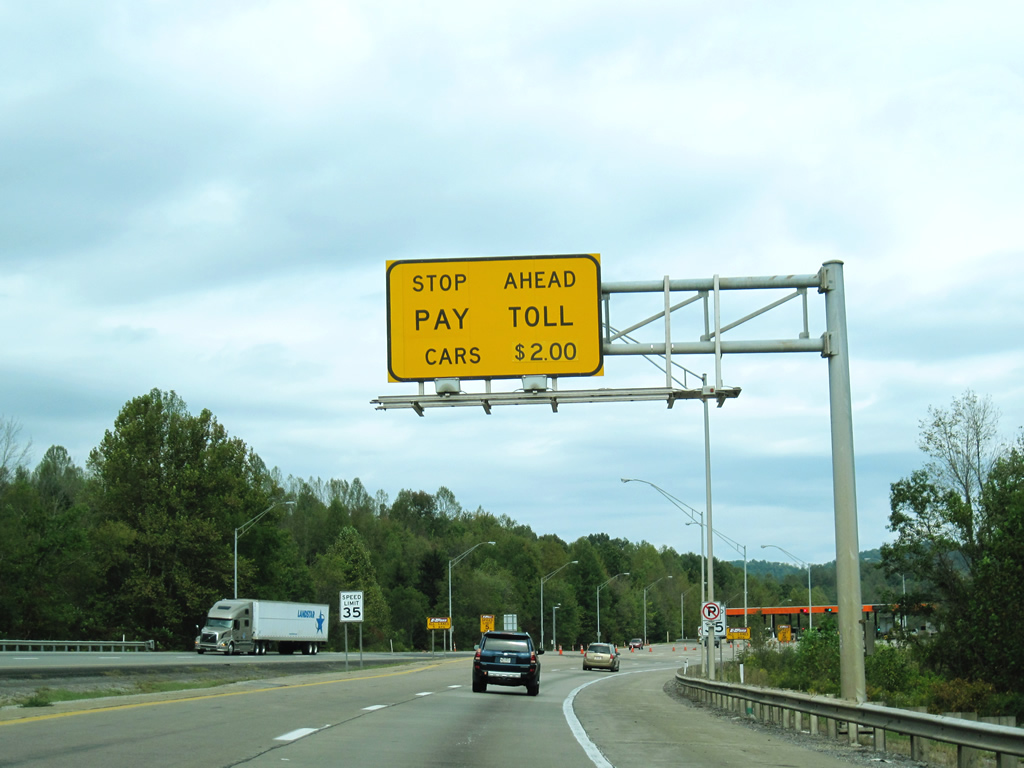
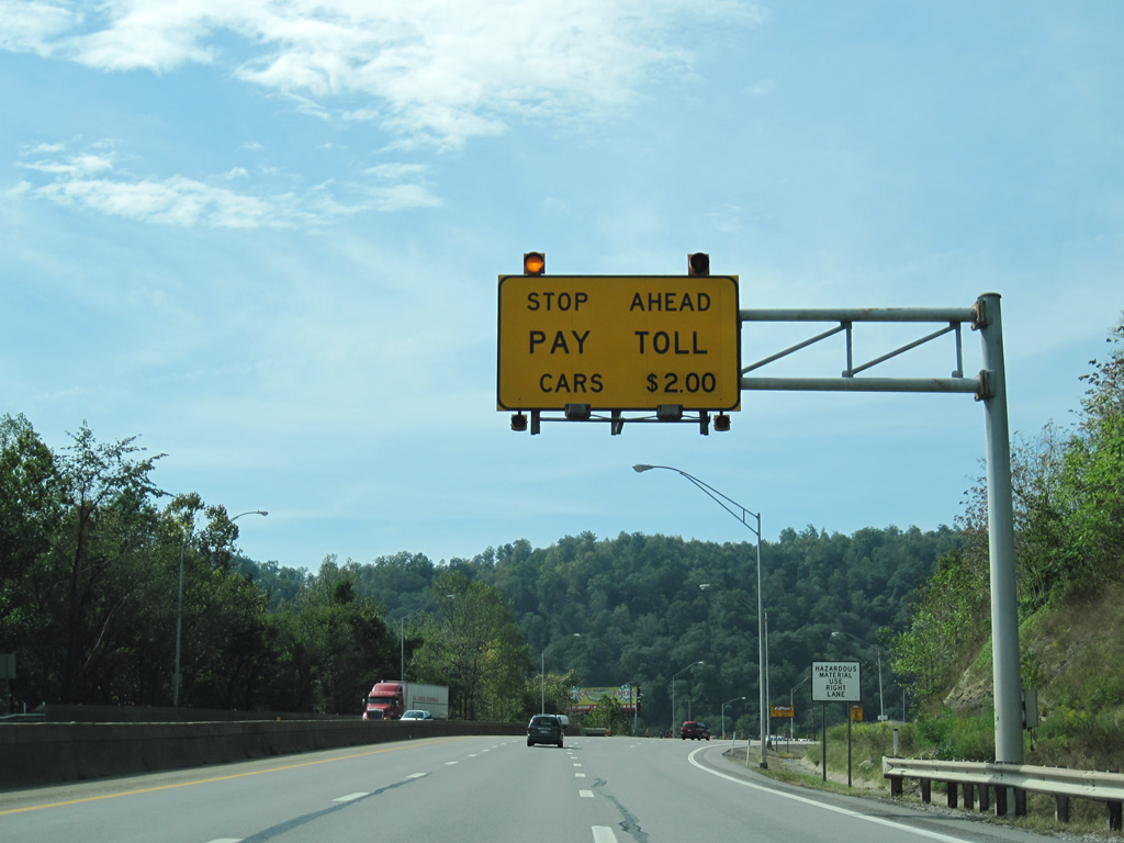
| Like the preceding toll plaza north of Exit 28, a $2.00 toll is collected to pass through and continue forward. 09/29/10 |
|
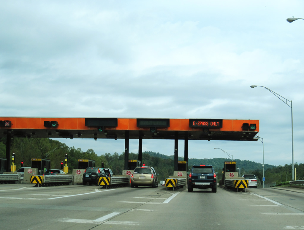
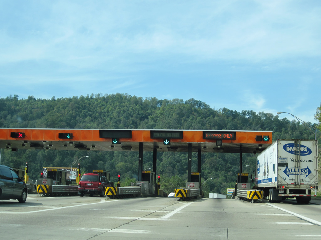
| The dual interstates reach the toll plaza. Those with E-ZPass may proceed through the plaza at a reduced speed while those without the electronic tolling device must stop and pay at a toll collection booth. 09/29/10 |
|
| Leaving the toll plaza, I-64 west and I-77 north resume a 70-mph speed limit as they continue toward Mossy (Exit 60). 09/29/10 |
|
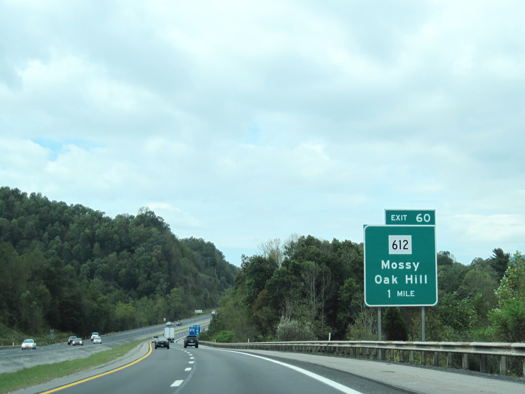
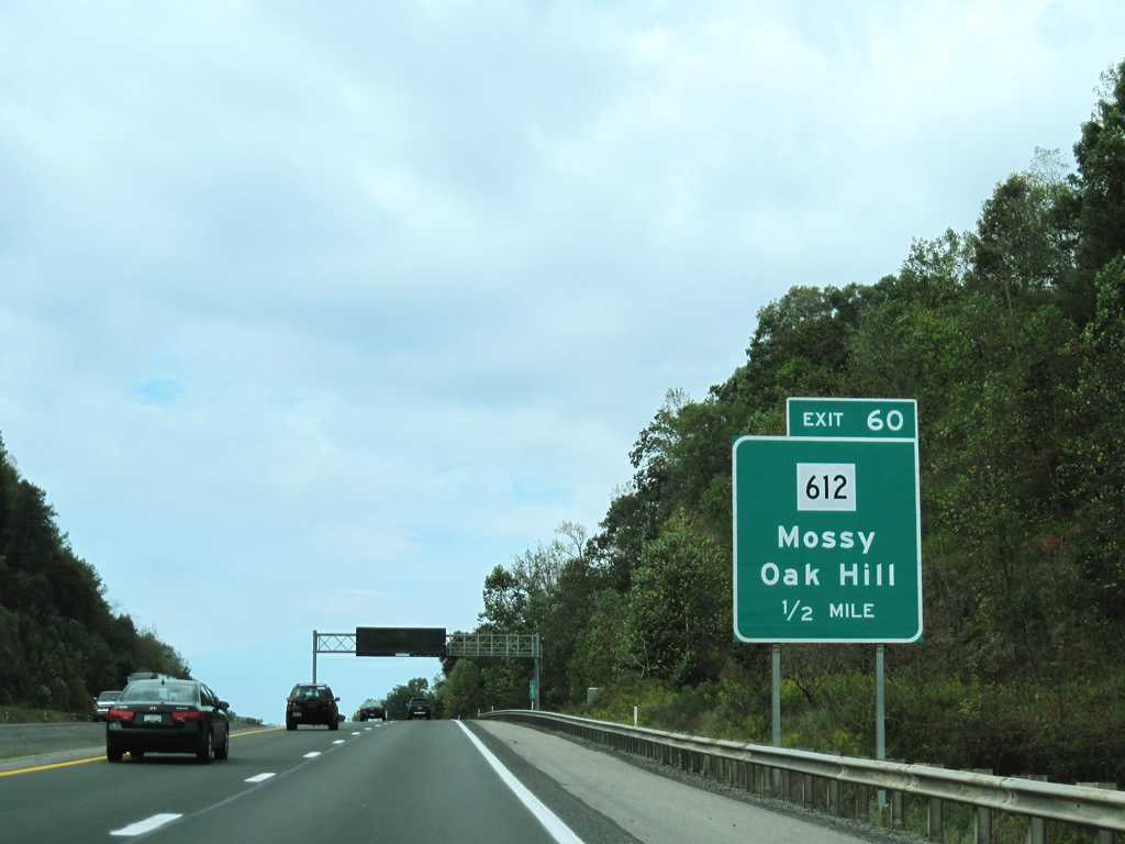
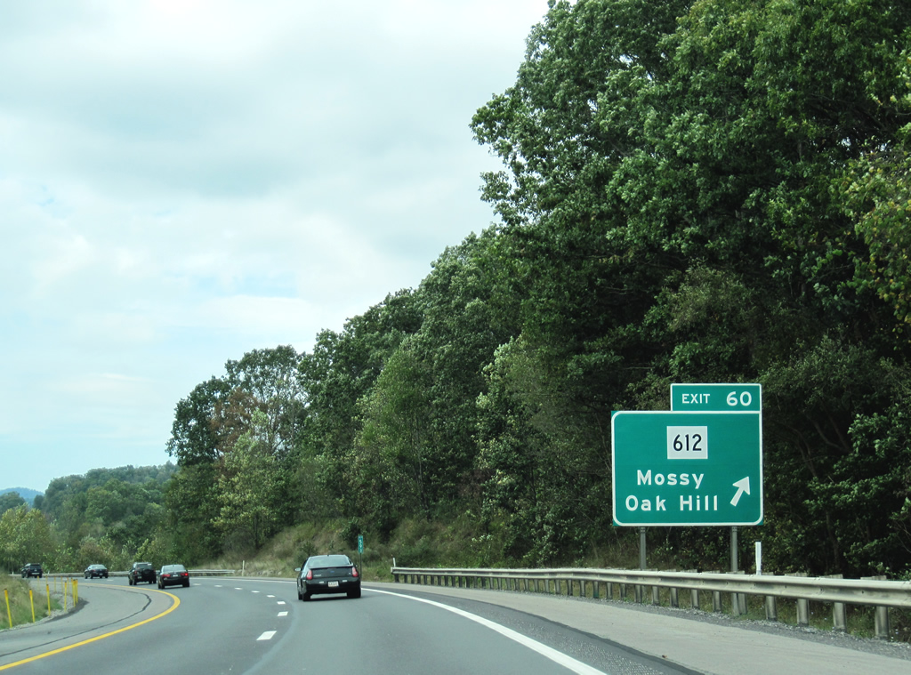
| The West Virginia Turnpike will next encounter WV 612 at a diamond interchange (Exit 60) in one mile. 09/29/10 |
|
| WV 612 begins at the community of Mossy from the Exit 60 interchange of the West Virginia Turnpike. The state highway travels 9.5 miles eastward to U.S. 19 just south of Oak Hill. 09/29/10 |
|
| The Turnpike reaches WV 162 (Exit 60). County 15 enters the interchange from the south. At WV 612, County Route (County) 15 turns northward to parallel I-64/77 northward to the Kanawha County line. 09/29/10 |
|
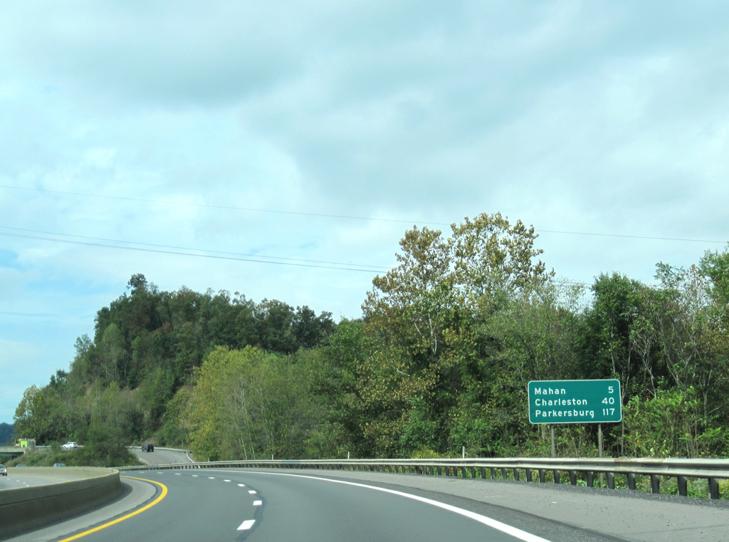
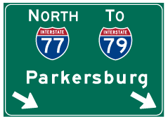
| Still meandering northwest, I-64/77 north move on from Exit 60 toward Kanawha County and Charleston. County Route 15 prepares to cross over the Turnpike beyond the curve. The county route will actually cross the Turnpike multiple times before encountering the pike from the west in five miles. The interstates will depart in Charleston (40 miles). Parkersburg makes its debut and lies along the I-77 corridor in the northwestern part of West Virginia. 09/29/10 |
|
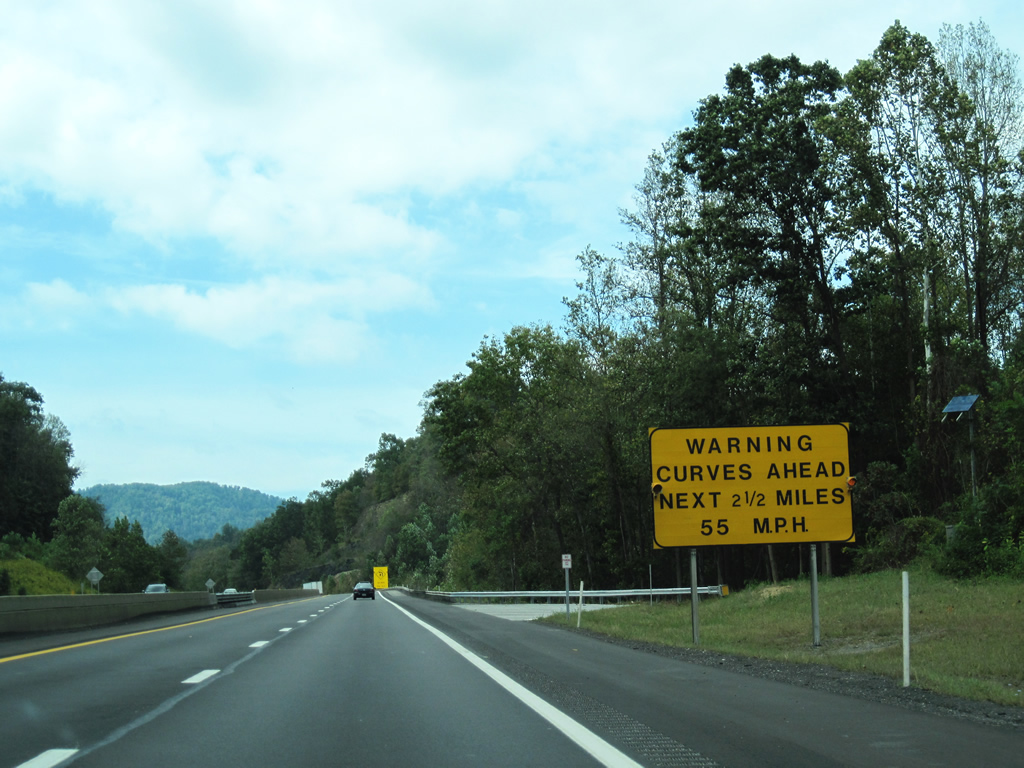
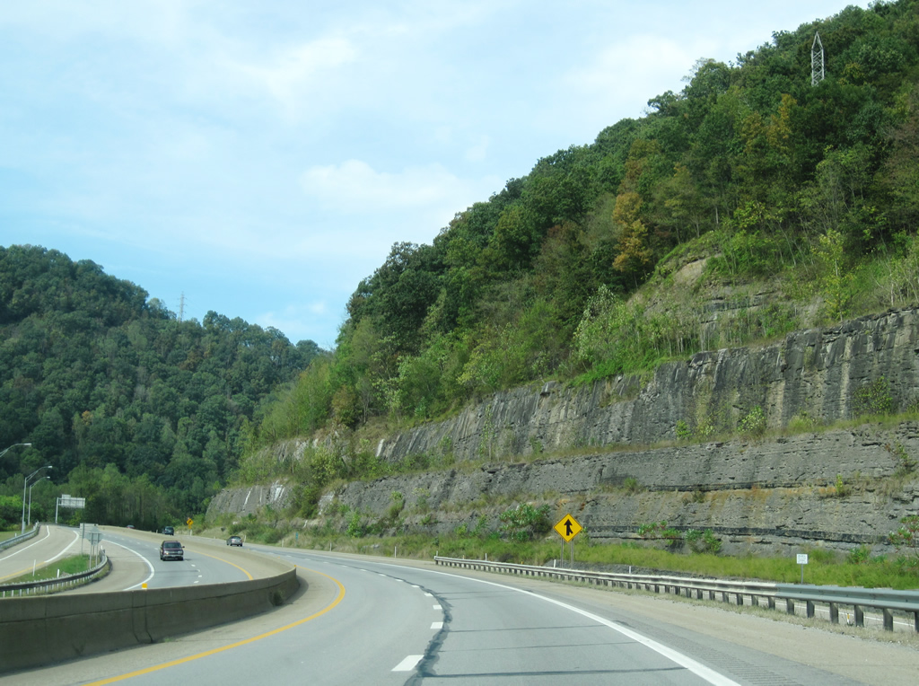
| Motorists are advised of the impending curves on the approach to County Route 15 (Exit 66). The stretch from here to Charleston provides scenic views as the turnpike cuts its way between the mountains and creeks of central West Virginia. 09/29/10 |
|
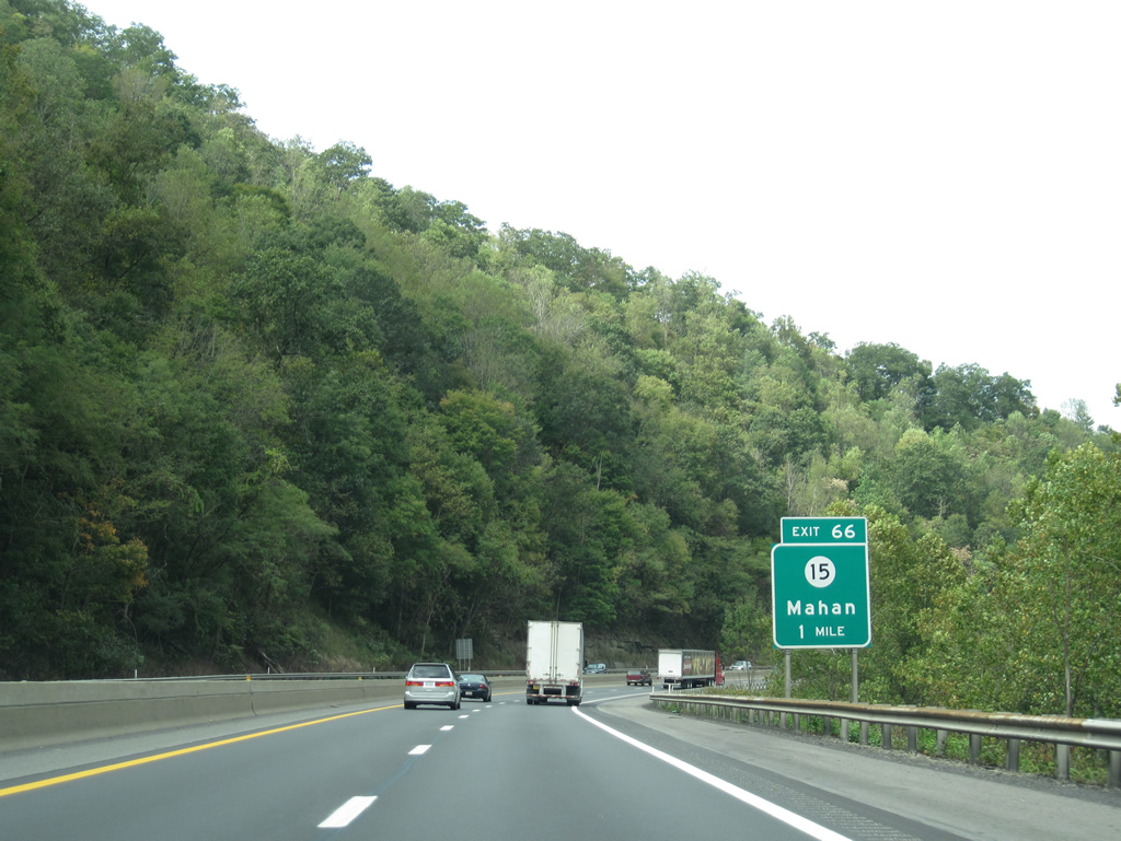
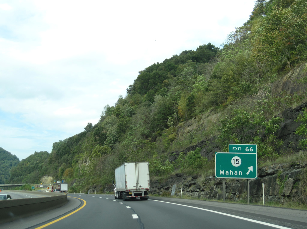
| One mile guide sign for County Route 15 (Fayette County 15) on I-64/77 north. The county highway passes underneath the Turnpike at the community of Mahan. A short access road intersects the Turnpike via a diamond interchange to the east of CR 15. 09/29/10 |
|
| Motorists are advised of the impending curves on the approach to County Route 15 (Exit 66). The stretch from here to Charleston provides scenic views as the turnpike cuts its way between the mountains and creeks of central West Virginia. 09/29/10 |
|
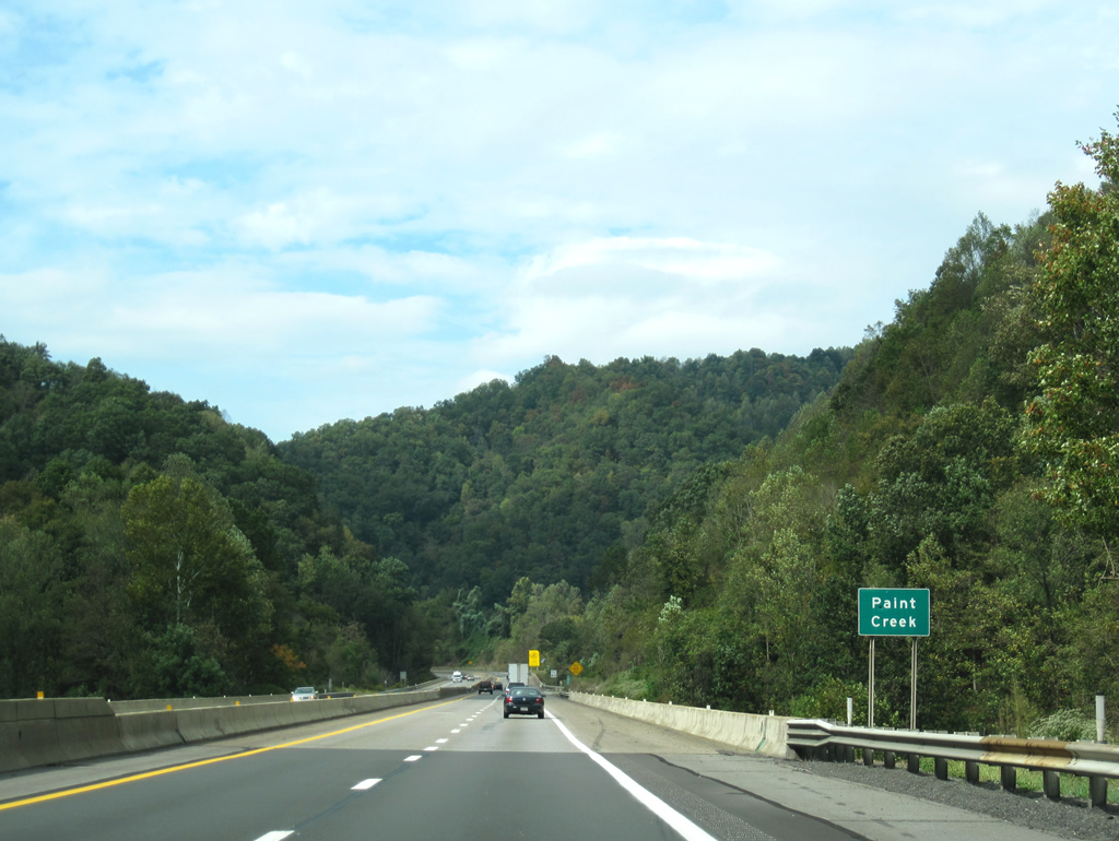
| The Turnpike crosses over Paint Creek once more en route to County Route 15 (Exit 66). 09/29/10 |
|
| I-64/77 reach Exit 66. County Route 15 (Paint Creek Road) will continue to parallel the Turnpike into Kanawha County before parting ways north of Exit 74. Paint Creek Road eventually ends at WV 61 in Hansford along the Kanawha River. 09/29/10 |
|
| The two interstates continue northerly winding their way toward Exit 74 (Paint Creek Road) and points beyond. The capital city is now within 33 miles. 09/29/10 |
|
| Travelers will pass the Morton Travel Plaza in one mile. The northbound-only plaza offers fuel and food services. 09/29/10 |
|
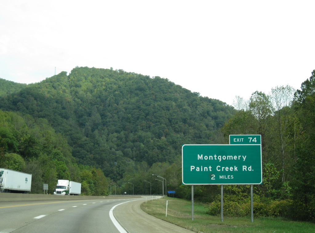
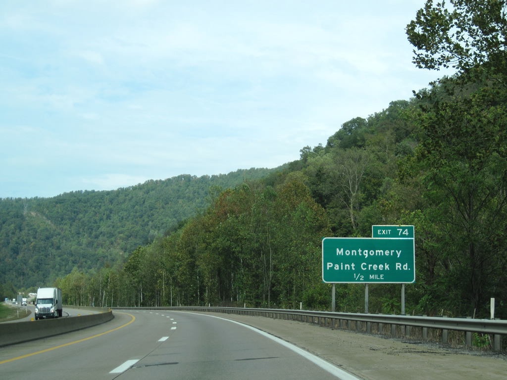
| Two mile guide sign for Paint Creek Road (Exit 74). The entrance to the Morton Travel Plaza lies beyond the S-curve. 09/29/10 |
|
| Montgomery lies along the Kanawha River northeast of the upcoming diamond interchange and is reached via Paint Creek Road north and WV 61 south. 09/29/10 |
|
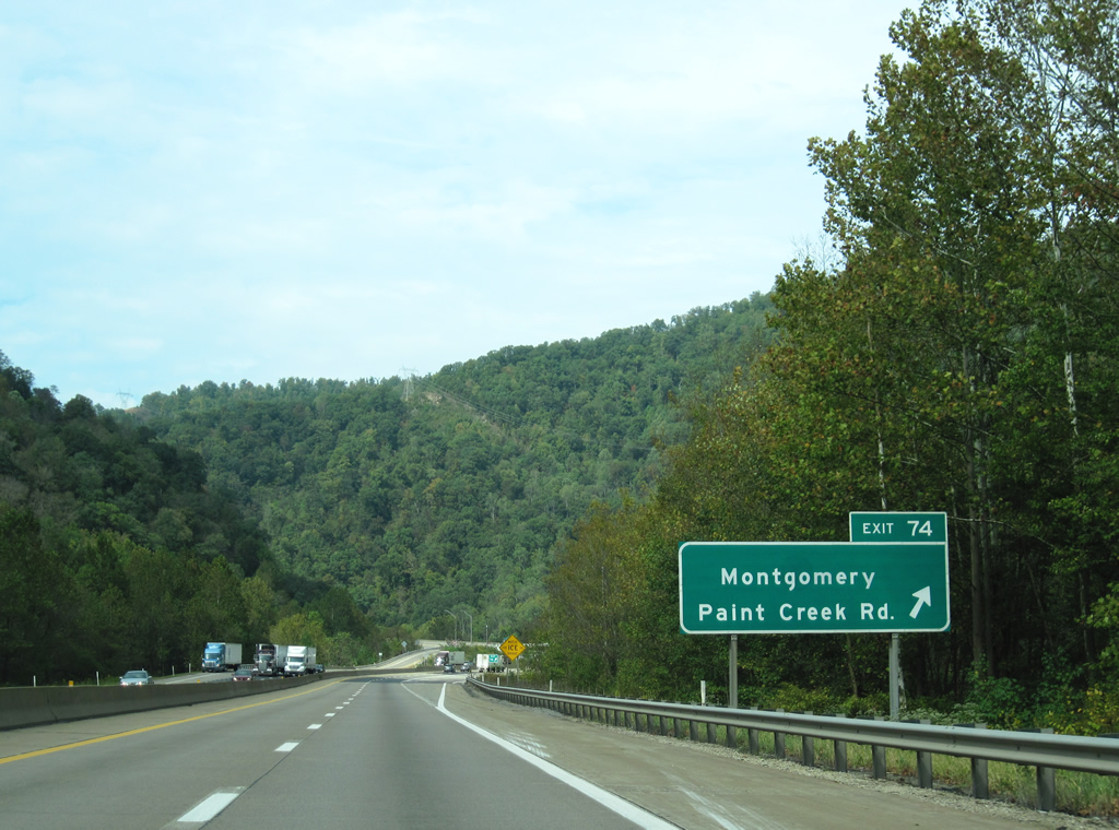
| The West Virginia Turnpike reaches Paint Creek Road (Exit 74). North of the interchange the interstates curve westward toward Dawes and Sharon along Cabin Creek. 09/29/10 |
|
| Departing Paint Creek Road, I-64/77 snakes its way westward to Sharon and Charleston. The Turnpike in this section was realigned 1.7 miles around the Memorial Tunnel, which closed in 1987 when the new segment opened. 09/29/10 |
|
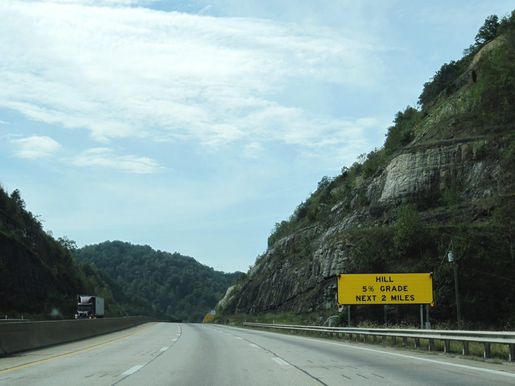
| An advisory sign alerts motorists, including commercial truckers, of a 5%-grade in the next two miles. Truckers must use a lower gear to navigate the upcoming hills. 09/29/10 |
|
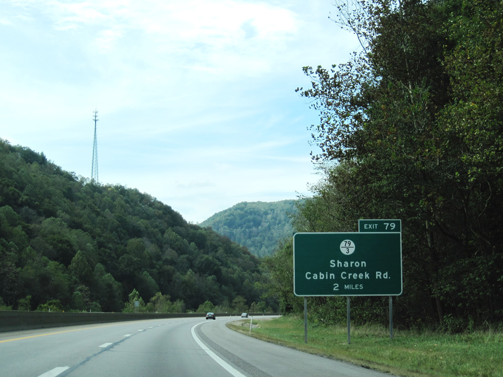
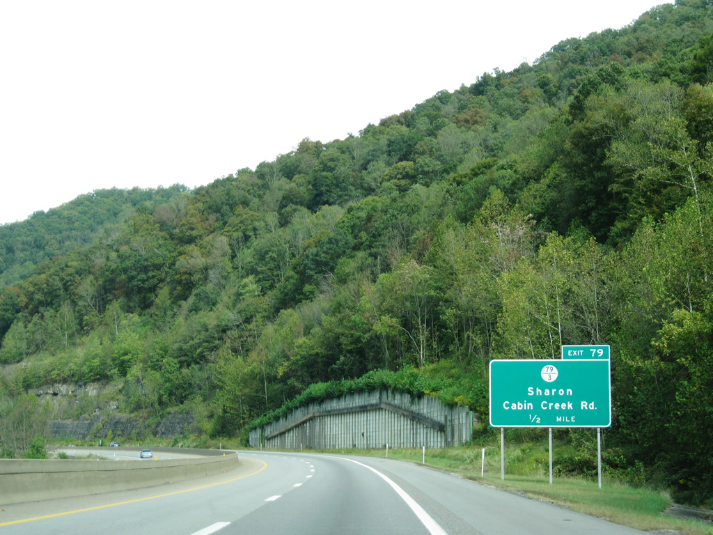
| The WV Turnpike approaches County Route 79/Branch 3 (Exit 79) and the community of Sharon. 09/29/10 |
|
| County Route 79/Branch 3 (Cabin Creek Road) begins in the small community of Leewood and winds its way north toward Dawes and Sharon. Cabin Creek Road will parallel the tolled interstate to Cabin Creek where the local road ends at WV 61. 09/29/10 |
|
| I-64 west and I-77 north reach CR 79/Branch 3 at the 79 mile-marker. Both community and road are located immediately to the west of the diamond interchange. 09/29/10 |
|
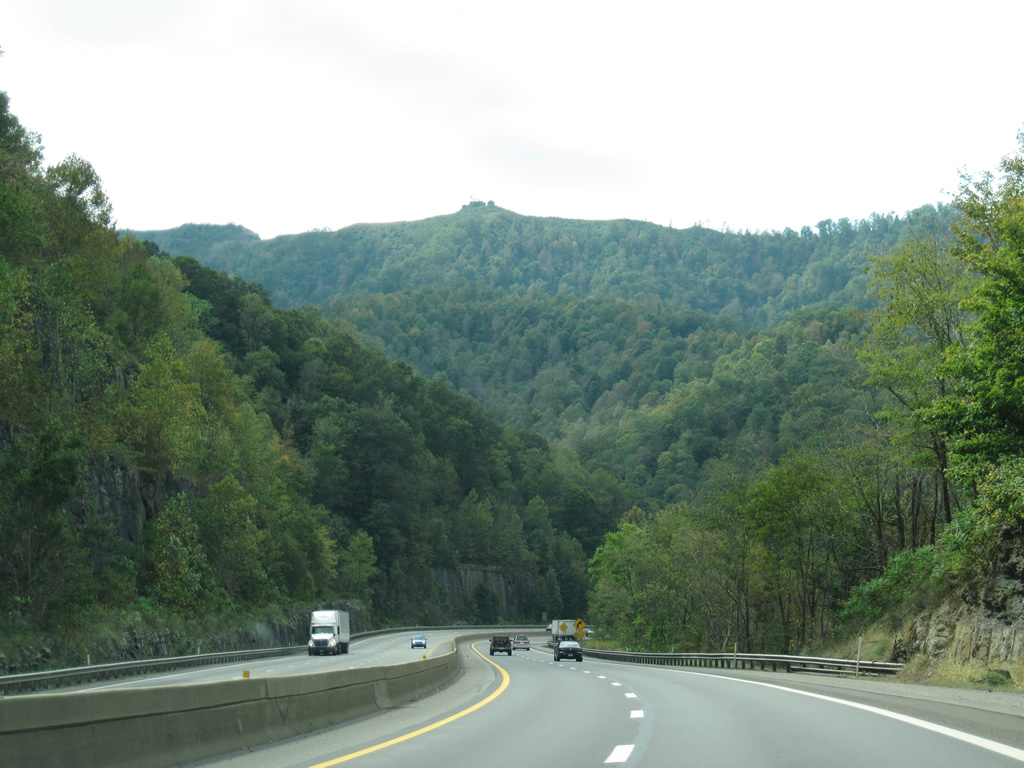
| The Turnpike cuts into the bedrock of adjoining mountains as it continues northward from Exit 79. The unincorporated community of Chelyan occurs in four miles. Twenty-one miles now remain before the two interstates depart in Charleston. Parkersburg is now under 100 miles away. 09/29/10 |
|
| Still traversing between mountains south of Chelyan, the northbound lanes terrace over the southbound lanes as it approaches the final toll plaza along the Turnpike. 09/29/10 |
|
| Motorists must pay another $2.00 toll to complete the trek along the West Virginia Turnpike. The connection to WV 61 and U.S. 60 will occur in approximately two miles. 09/29/10 |
|
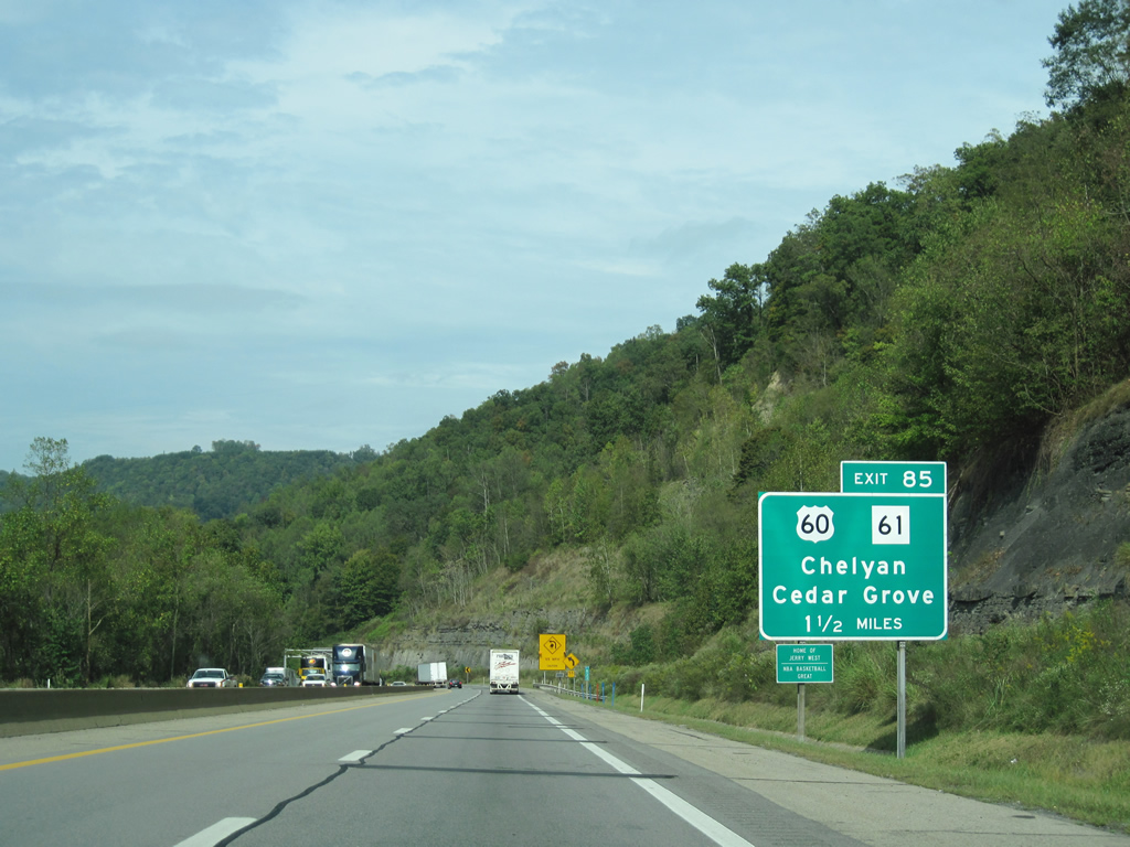
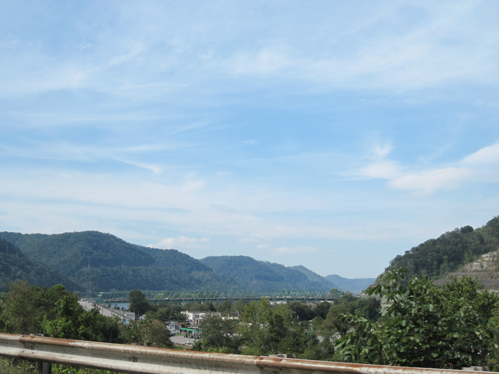
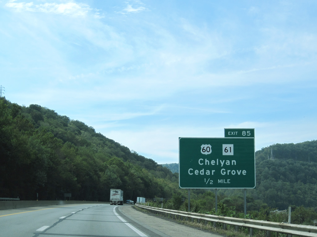
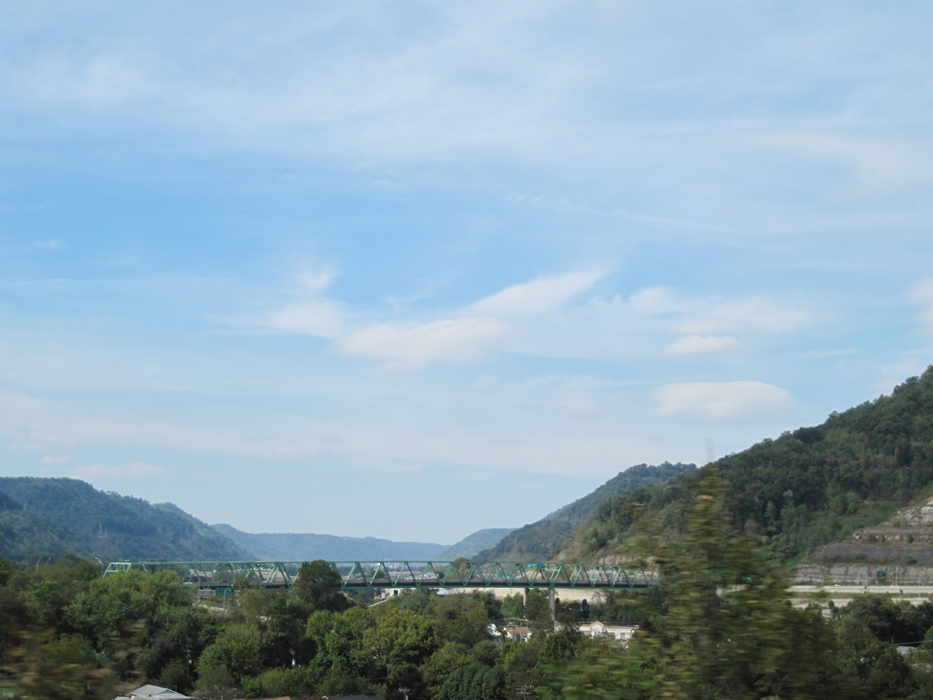
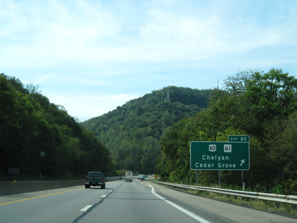
| A trumpet interchange comprises the upcoming connection to WV 61 and U.S. 60 (Exit 85). Chelyan is situated between the Turnpike and the Kanawha River. U.S. 60 lies on the north side of the river and runs parallel until Charleston. The Kanawha River flows about 97 miles from Gauley Bridge and meanders generally northwest through Charleston and St. Albans before joining the Ohio River near Point Pleasant. 09/29/10 |
|
| Views of the Admiral T. Joseph Lopez Bridge (Chelyan Bridge) can be seen one half mile from Exit 85. The continuous truss bridge opened to traffic in 1997, replacing a similar structure previously located about one mile further north. 09/29/10 |
|
| I-64/77 reach the departure ramp for the connection between WV 61 and U.S. 60. A grade-separated connection links with WV 61 before crossing the Kanawha River. The connection ties in with U.S. 60 immediately on the north side of the Chelyan Bridge. 09/29/10 |
|
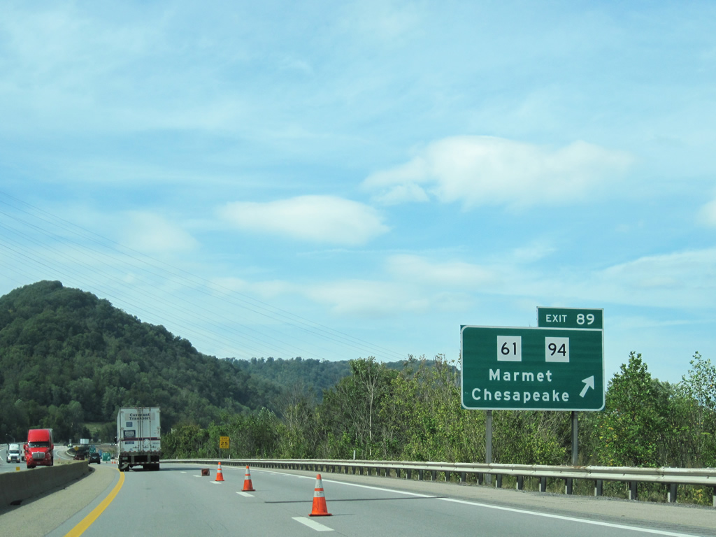
| Northwest of Exit 85 at Chelyan, the West Virginia Turnpike sets its sights on Charleston in 14 miles. WV 94 and Marmet will meet the dual interstates in three miles. 09/29/10 |
|
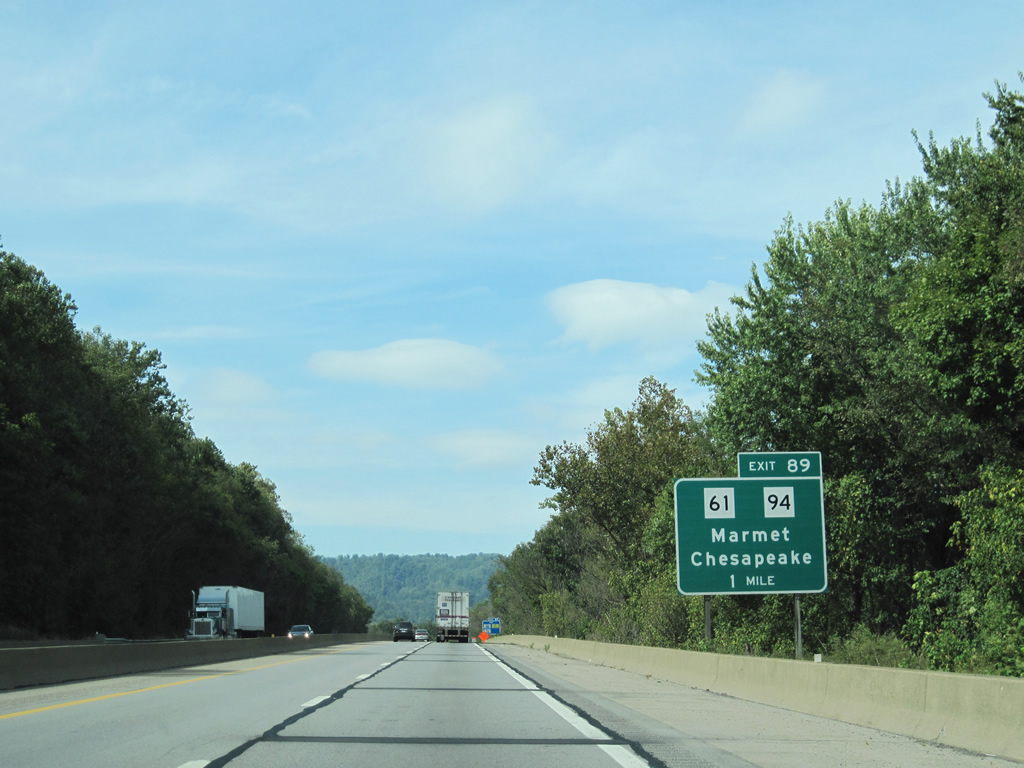
| One mile guide sign alerts travelers to the forthcoming diamond interchange with WV 94 (Exit 89). WV 61 sits on the east side of the treeline as the Turnpike approaches the exit. 09/29/10 |
|
| Chesapeake lies along the WV 61 corridor between Marmet and Chelyan. WV 94 exists for 10 miles, linking Marmet with Racine. The state route was once a part of U.S. 119 before the U.S. highway was redirected to its current alignment southwest from Charleston. U.S. 119 followed WV 61 north from Marmet to Charleston. 09/29/10 |
|
| Reaching WV 94 and Exit 89, I-64/77 skirt the city of Marmet. WV 94 ends immediately east of the interchange at WV 61. WV 61 will cross under and follow alongside the Turnpike north from Marmet to the south side of Kanawha City. 09/29/10 |
|
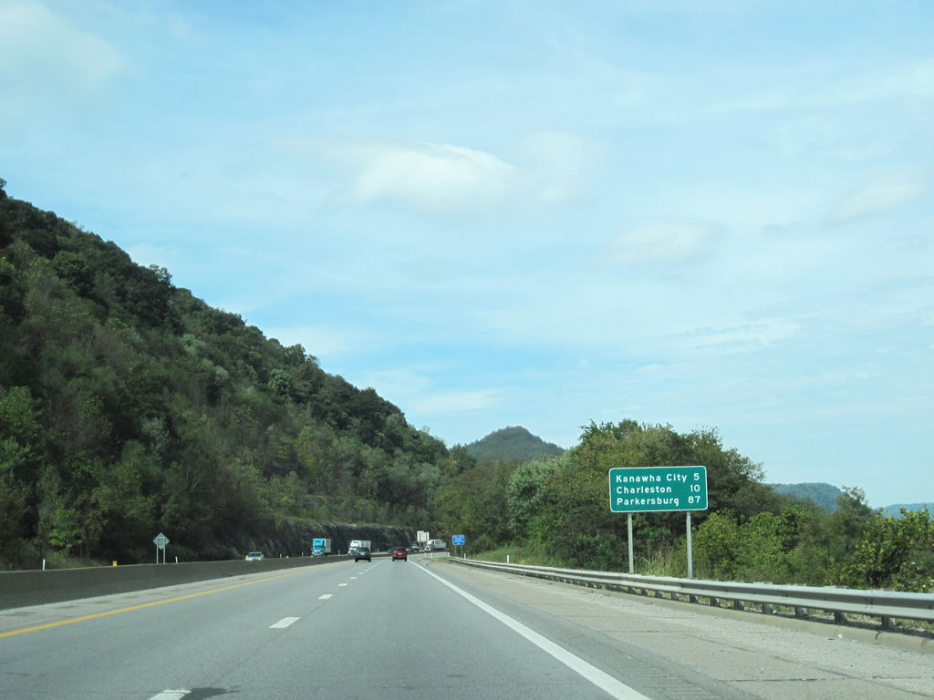
| Kanawha City lies along the west banks of the Kanawha River in five miles. The Turnpike and WV 61 will interact before crossing the river south of the city. The capital is now only 10 miles ahead with the I-77 control city of Parkersburg still at a distance of 87 miles. 09/29/10 |
|
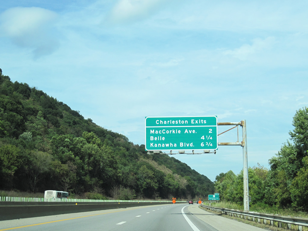
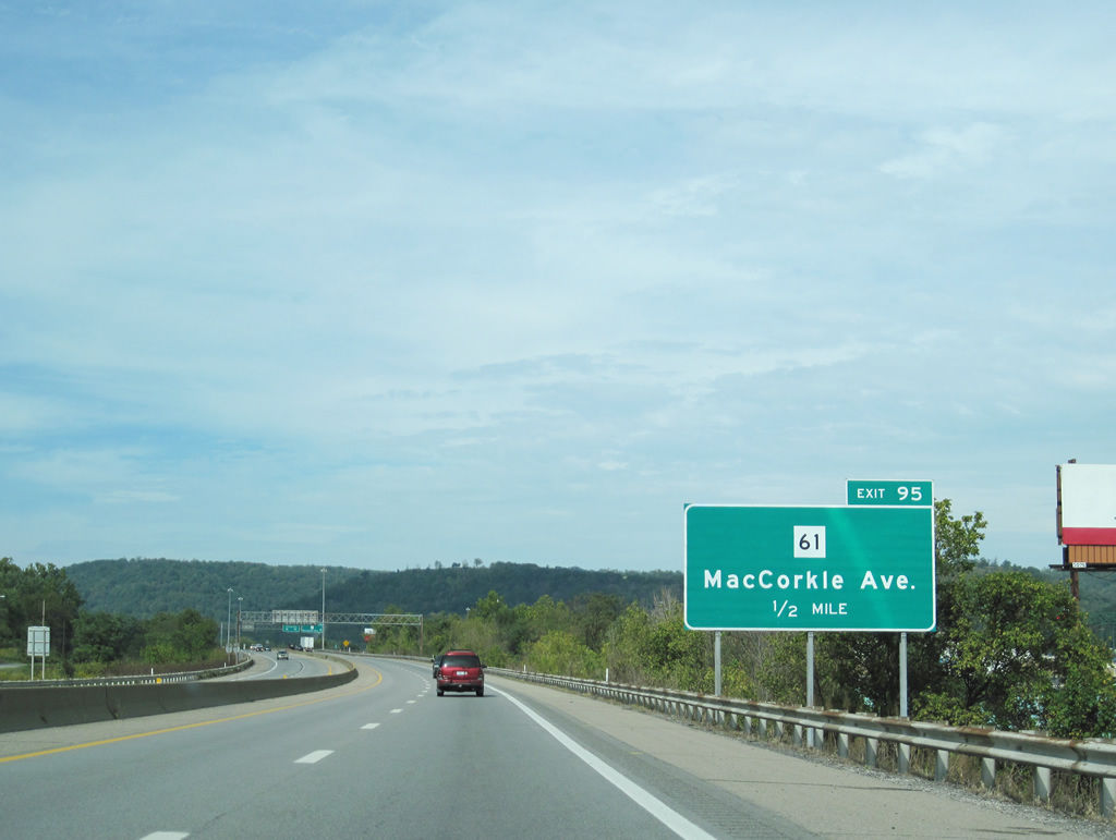
| The first of Charleston area exits, MacCorkle Avenue (WV 61) serves as the main thoroughfare for Kanawha City. WV 61 stays on the south side of the Kanawha River as it passes through the southern reaches of Charleston. Belle is a small community set along the U.S. 60 corridor southeast of Marmet. Kanawha Boulevard is the local name for U.S. 60 as it enters the capital of West Virginia. 09/29/10 |
|
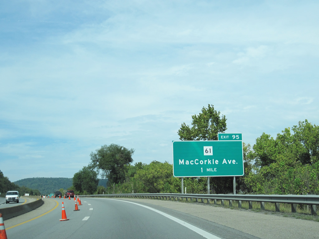
| Approaching the one mile guide sign for WV 61 (MacCorkle Avenue). WV 61 measures a little over 63 miles in length, beginning in Piney View and ending in Charleston at U.S. 60. 09/29/10 |
|
| Prior to its current alignment through southwest West Virginia, U.S. 119 followed WV 61 through Kanawha City and a portion of Charleston. By 1997 the U.S. highway was completely rooted from this routing leaving a solo WV 61 as the only numbered route through the southern suburb of Charleston. 09/29/10 |
|
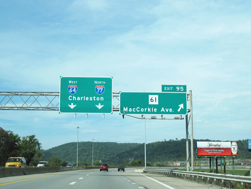
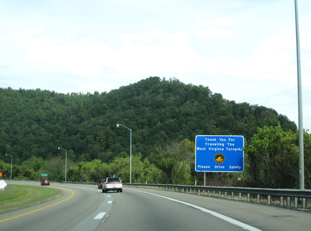
| Motorists depart for the double trumpet interchange with WV 61 (Exit 95). The connection between the two systems originally included a toll plaza but has since been removed. I-64/77 curve eastward to cross the Kanawha River immediately following the exchange. The tolled West Virginia Turnpike will end at U.S. 60 (Exit 96) in 1.25 miles, with its designations continuing into Charleston and beyond. 09/29/10 |
|
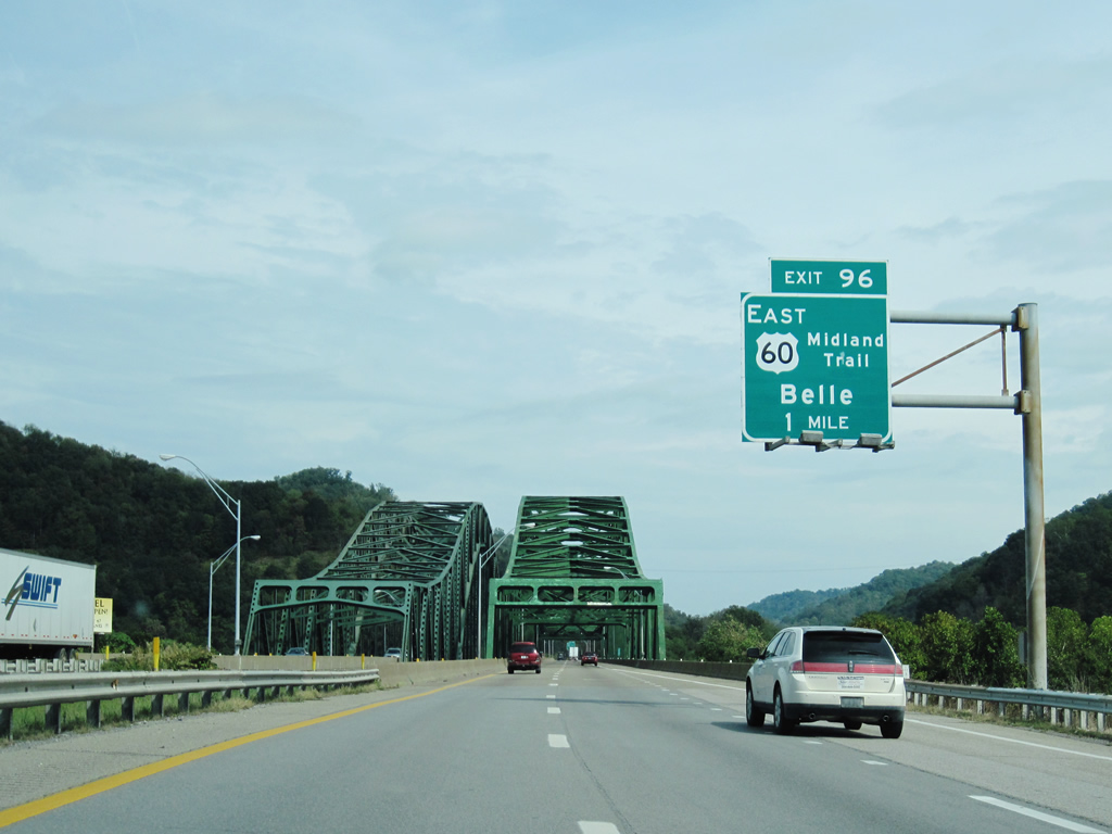
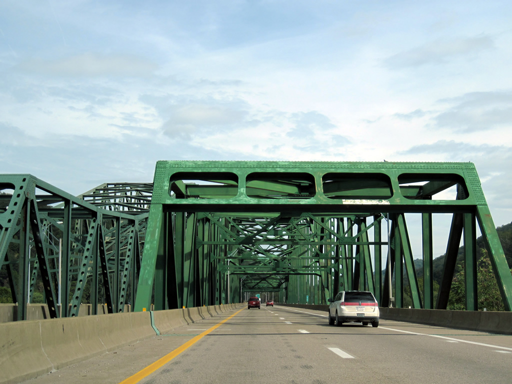
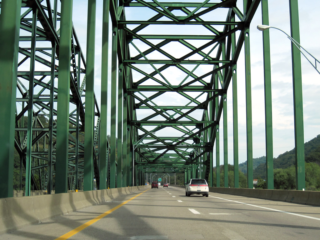
| The West Virginia Turnpike crosses over the Kanawha River via the Chuck Yeager Bridge, named after the first pilot to travel faster than the speed of sound. Originally opened to two lane traffic in 1954, the truss bridge saw expansion by 1986 to carry the current northbound lanes over the river. The Turnpike portion of I-64 and I-77 will end in one mile at the interchange with U.S. 60 East (Exit 96). From there, the two interstates continue into Charleston and beyond as freeways. 09/29/10 |
|
| Now east of the Kanawha River, the Turnpike makes an almost 180-degree turn on its quarter mile approach to U.S. 60 East. U.S. 60 East generally parallels the Kanawha River from St. Albans (west of Charleston) to Gauley Bridge where it follows the New River to Hawks Nest. The U.S. highway will travel through Belle 6.5 miles to the south of its exchange with I-64/77. A final gesture from the Turnpike Authority greets motorists prior to the departure ramp for Exit 96. 09/29/10 |
|
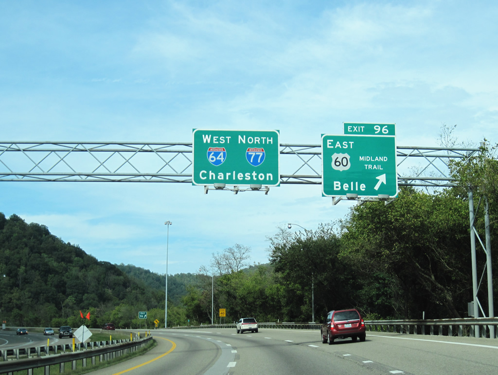
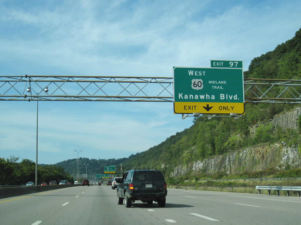
| Exit 96 leaves for U.S. 60 East and Belle. U.S. 60 is also known as the Midland Trail (National Scenic Byway) as it crosses this part of West Virginia. Extending back to Colonial times, the trail extends from Charleston and Sam Black Church and was once part of the transcontinental Midland Trail. I-64/77 north continue as a freeway into Charleston. 09/29/10 |
|
| U.S. 60 West will briefly join the interstates before departing for downtown Charleston via Kanawha Boulevard. 09/29/10 |
|
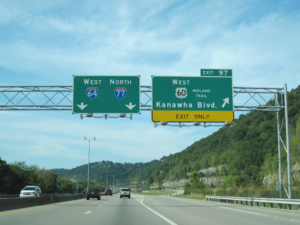
| With Exits 96 and 97 in such close proximity, through motorists must contend with merging and departing traffic bound for U.S. 60 West. 09/29/10 |
|
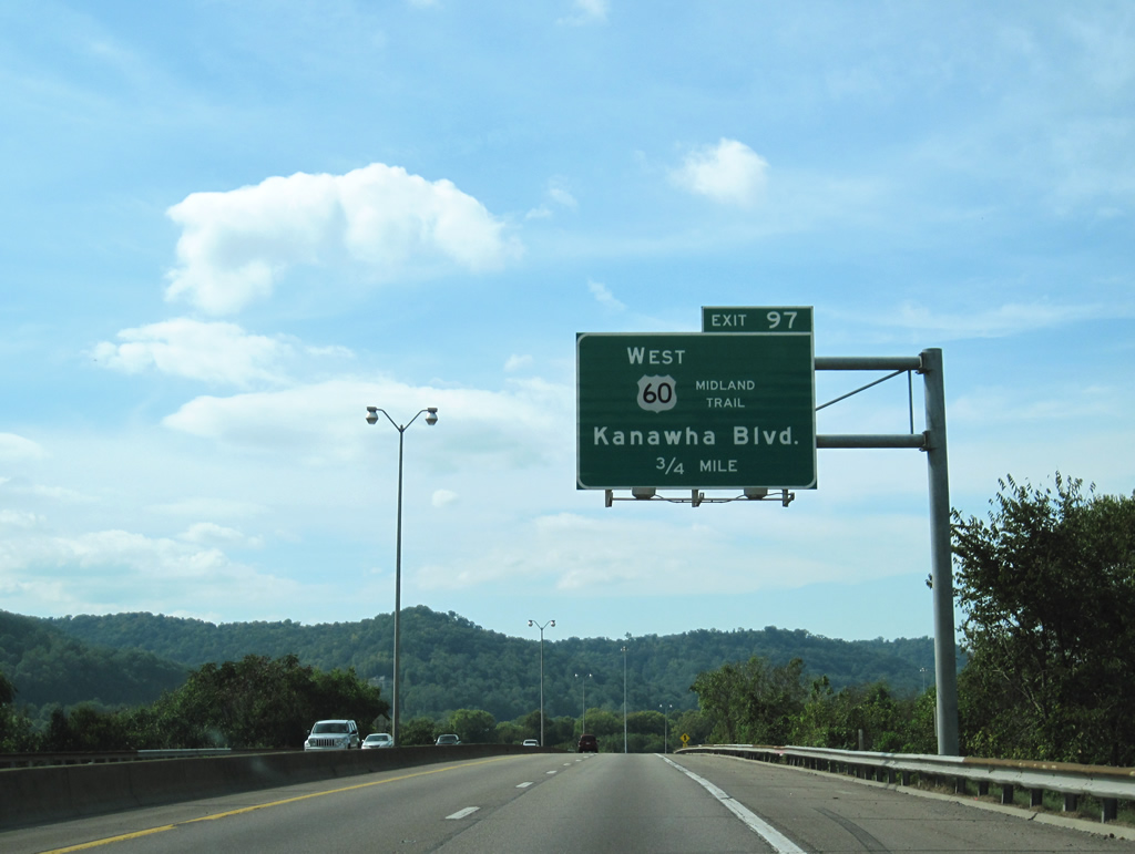
| U.S. 60 West (Kanawha Boulevard) leaves for Exit 97 and downtown Charleston. The U.S. highway will follow Kanawha Boulevard past the State Capitol, turning onto Greenbrier Street then Washington Street. Kanawha Boulevard runs along the Kanawha River through central Charleston before ending at U.S. 60 (Patrick Street) in the western parts of the city. 09/29/10 |
|
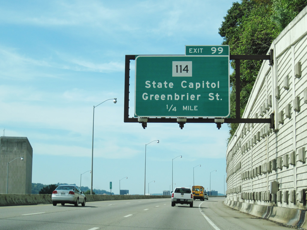
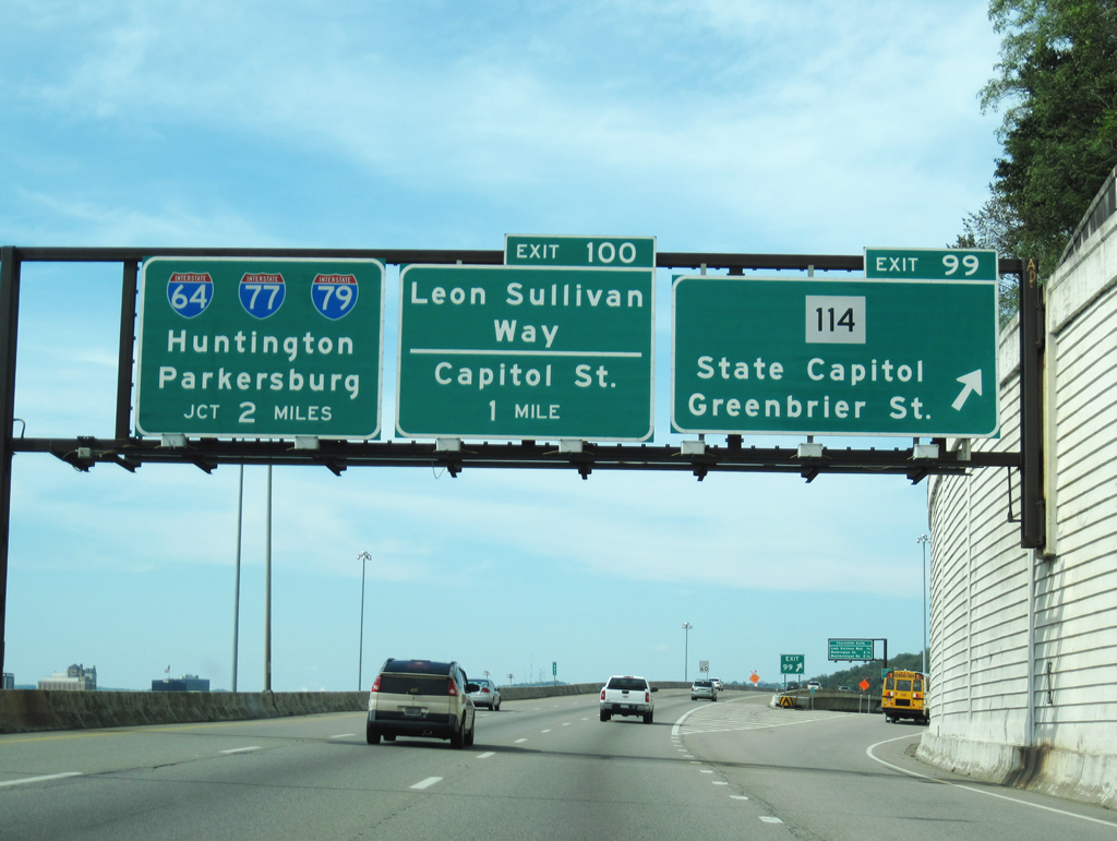
| First reassurance shields for the interstates since leaving the West Virginia Turnpike and Exit 96. The two will split at the upcoming interchange at Exit 101 in about four miles. Greenbrier Street (Exit 99) serves the State Capitol while Leon Sullivan Way (Exit 100) deposits onto downtown Charleston. 09/29/10 |
|
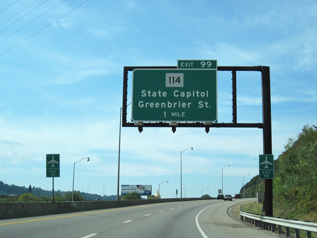
| The freeway comes to within one mile of WV 114 (Greenbrier Street). The state route stems 7.5 miles between U.S. 60 (Kanawha Boulevard) near the State Capitol and Interstate 79 at Exit 5 near Big Chimney. Northbound traffic from 36th Street Bridge also merges with the interstate near this vicinity. 09/29/10 |
|
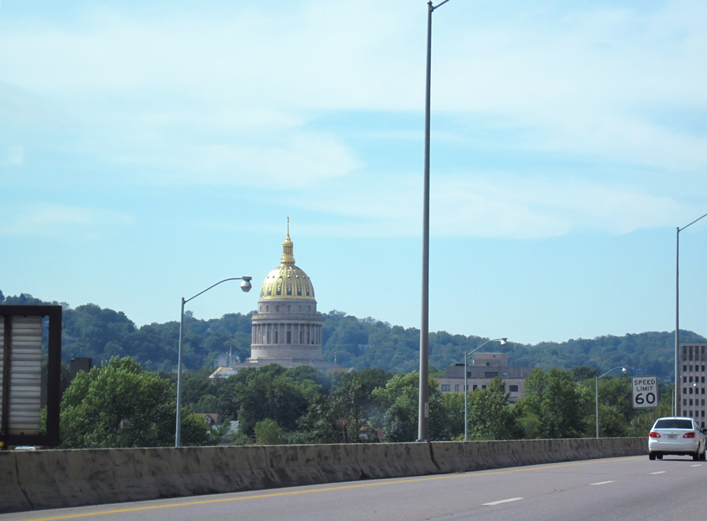
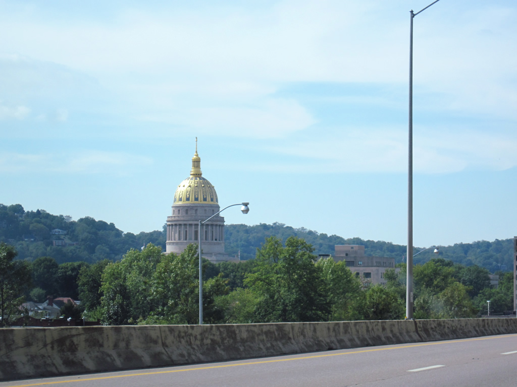
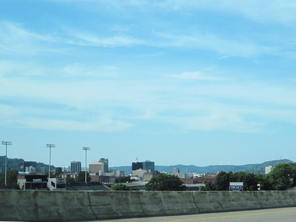
| The State Capitol comes into view on the approach to WV 114 (Exit 99). Built in stages, with a dedication in 1932, the capitol building includes a 23.5 karat gold leaf dome that tops out at 293 feet. The State Capitol Complex also houses the Governors Mansion and Cultural Center. 09/29/10 |
|
| As well as the State Capitol Complex, WV 114 also provides access to Yeager Airport (CRW) and the State Museum. The airport is located northeast of the diamond interchange. 09/29/10 |
|
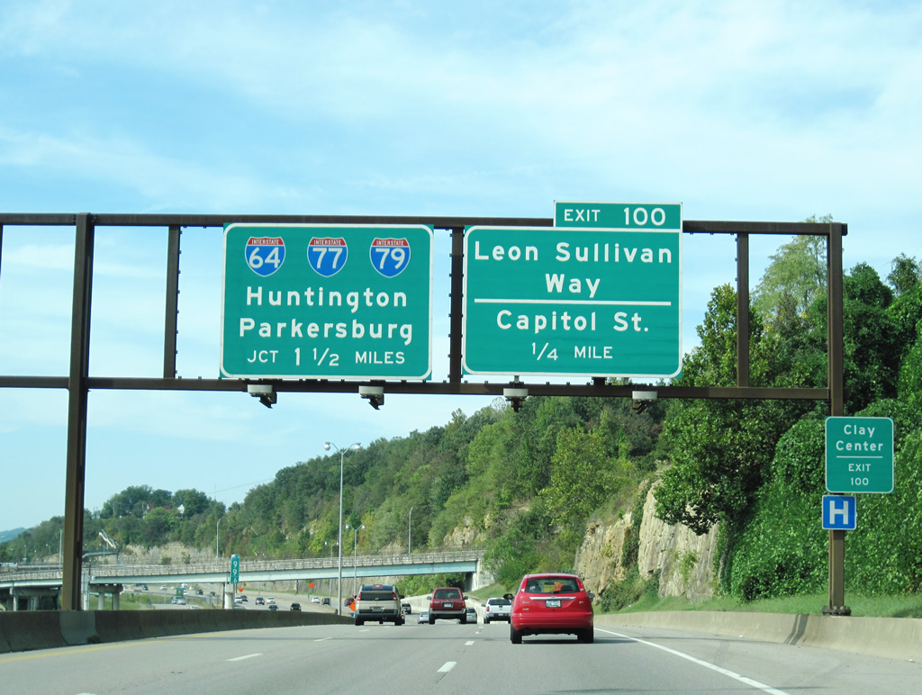
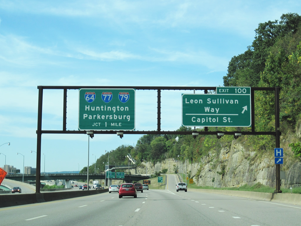
| I-64/77 separate two miles beyond WV 114 (Greenbrier Street). Interstate 79 commences two miles further north. Exit 100 for Leon Sullivan Way leads motorists into Downtown Charleston with another ramp branching off to reach Capitol Street. 09/29/10 |
|
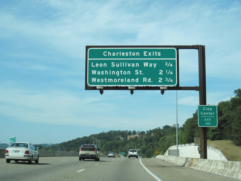
| Leon Sullivan Way quickly approaches in 0.75 miles. Washington Street is accessed via Interstate 64 west while Westmoreland Road is reached via Interstate 77 north. Downtown Charleston begins to show itself as the dual interstates continue northwest toward their split. 09/29/10 |
|
| Access to Capitol Street is gained via the departure ramp for Leon Sullivan Way and Christopher Street. Leon Sullivan Way is one way its entire run from the freeway to Kanawha Boulevard. 09/29/10 |
|
| I-64/77 reach the exit for downtown Charleston. The multi-level interchange in one mile will direct both interstates toward other destinations. Huntington lies along the I-64 and Ohio River corridors while I-77 presses on toward Parkersburg. Interstate 79 north will lead motorists to Morgantown before entering into Pennsylvania. 09/29/10 |
|
| Passing under the Brooks Street on-ramp, Interstate 64 west will depart Interstate 77 north in 0.7 miles. Downtown Charleston lies immediately to the southwest of the freeway as it transitions into a viaduct crossing over Smith and Court Streets, as well as the Elk River immediately preceding Exit 101. Interstate 64 turns southwest crossing over the Kanawha River as it makes its way toward South Charleston and beyond. Interstate 77 turns northeast, allowing one interchange (Exit 102) to occur before encountering Interstate 79 north at Exit 104. 09/29/10 |
|
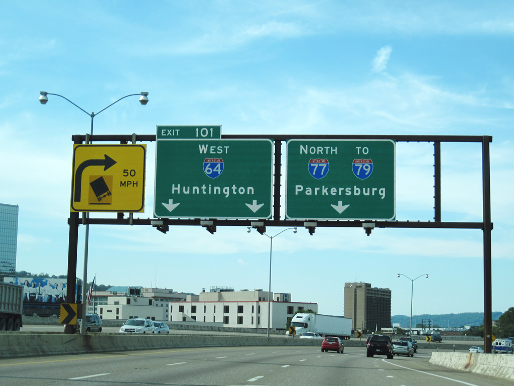
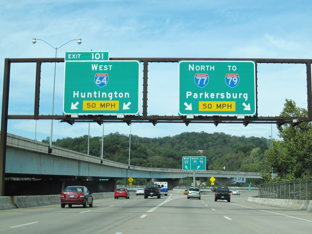
| The freeway makes a sharp turn north, inducing a lower speed limit, as it approaches the Elk River and the split. Motorists wanting to continue along Interstate 64 west must utilize the two left lanes while Interstate 77 north continues onward toward I-79. 09/29/10 |
|
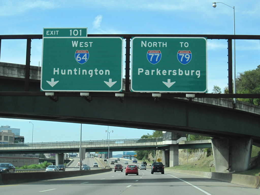
| I-64 west and I-77 north depart ways for their ultimate destinations at Exit 101. In the short term, Interstate 64 west will cross over the Kanawha River once more into South Charleston. Huntington lies about 50 miles further near the Kentucky/Ohio borders along the Ohio River. St. Louis, I-64's final metropolitan destination is 504 miles and four states from the split. Interstate 77 will continue northward to Parkersburg before reaching Ohio. The interstate will terminate near downtown Cleveland in 249 miles at Interstate 90. The 343 mile Interstate 79 passes near Morgantown and the greater Pittsburgh area before succumbing in Erie near its downtown. 09/29/10 |
Page Updated 11-12-2007.

 West
West  North
North