|
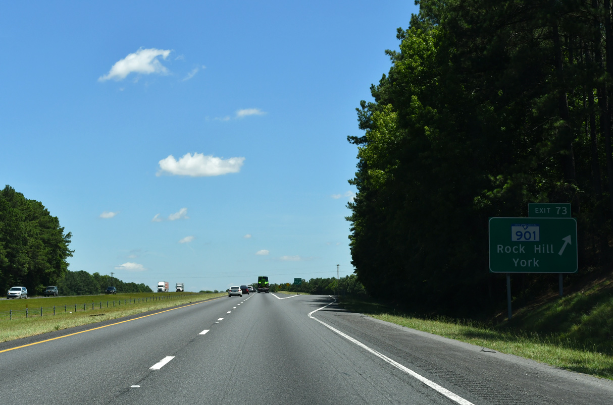
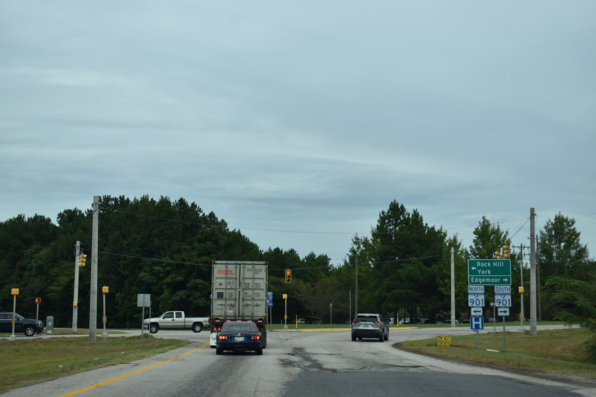
| S.C. 901 (Mt. Holly Road) winds northward from Lando and Edgemoor to the diamond interchange at Exit 73. 09/16/21 |
|
| S.C. 901 (Mt. Holly Road) enters the city of Rock Hill ahead of S.C. 72/121 (Saluda Street / Albright Road). 09/16/21 |
|
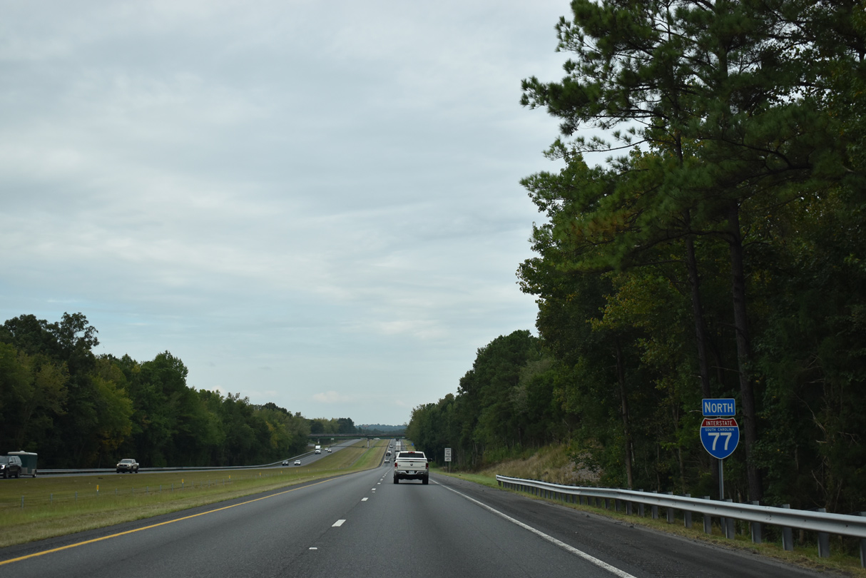
| S.C. 901 follows the Heckle Bypass around the west side of Rock Hill to S.C. 161/274. The bypass originated in the 1965 Rock Hill Area Transportation Study1 and its first section opened in Summer 1976 between Albright Road (S.C. 121) and S.C. 322. The 3.6 mile section between Main Street (S.C. 5) and S.C. 161 opened to traffic on January 29, 1990 after two years of construction.2 09/16/21 |
|
| Confirming marker posted ahead of the Long Meadow Road (Road 714) overpass. 09/16/21 |
|
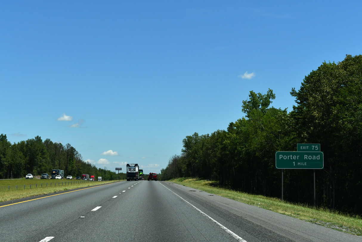
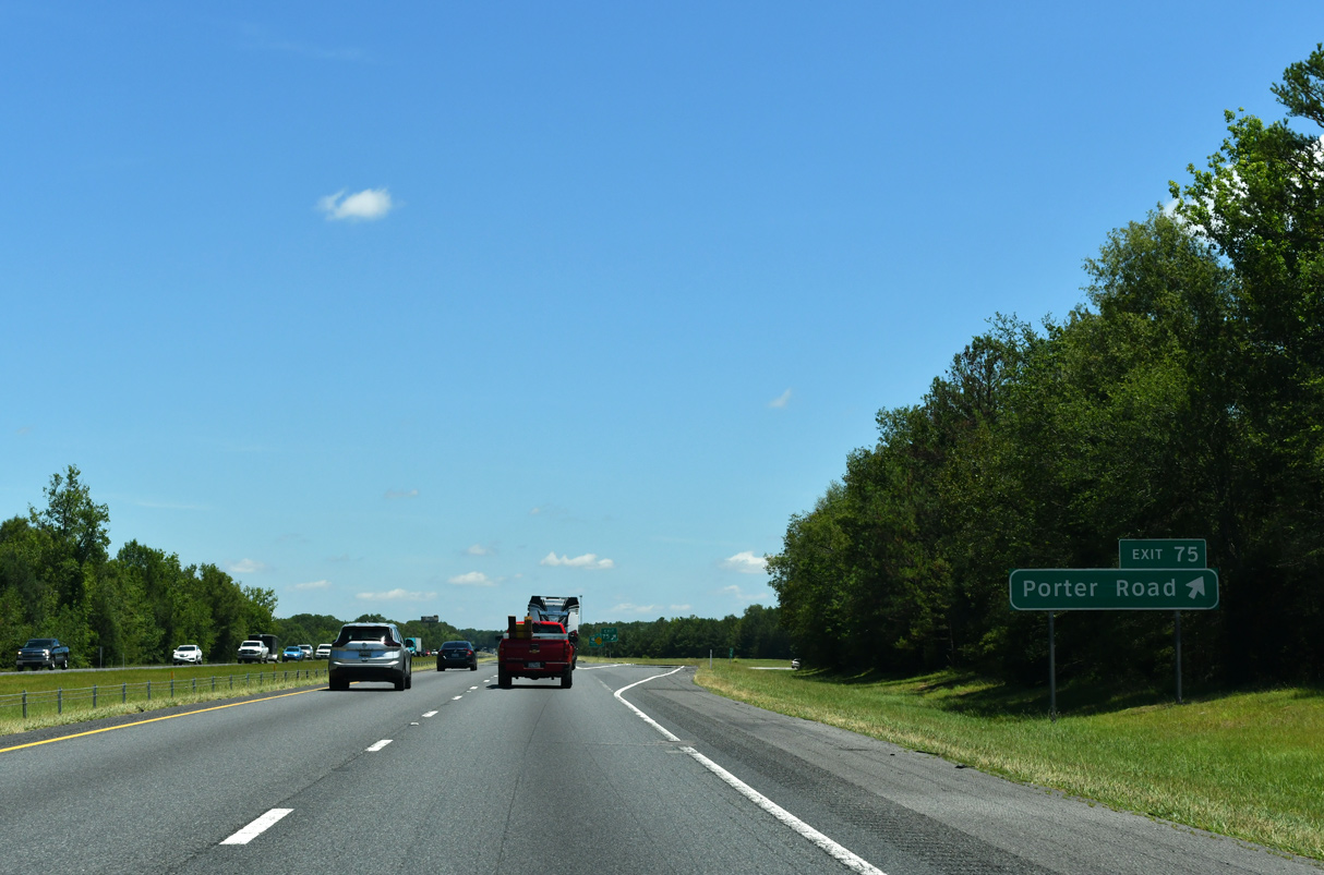
| Porter Road (Road 245) branches 2.69 miles northwest from Neelys Creek Road (Road 31) to a diamond interchange with Interstate 77 at Exit 75. 06/01/12 |
|
| Porter Road (Road 245) leads 1.55 miles north from Exit 75 to Firetower Road in an industrial area in Rock Hill, just east of S.C. 5/121 (E Main Street). 09/16/21 |
|
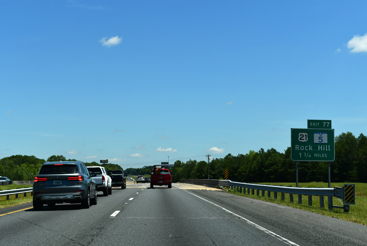
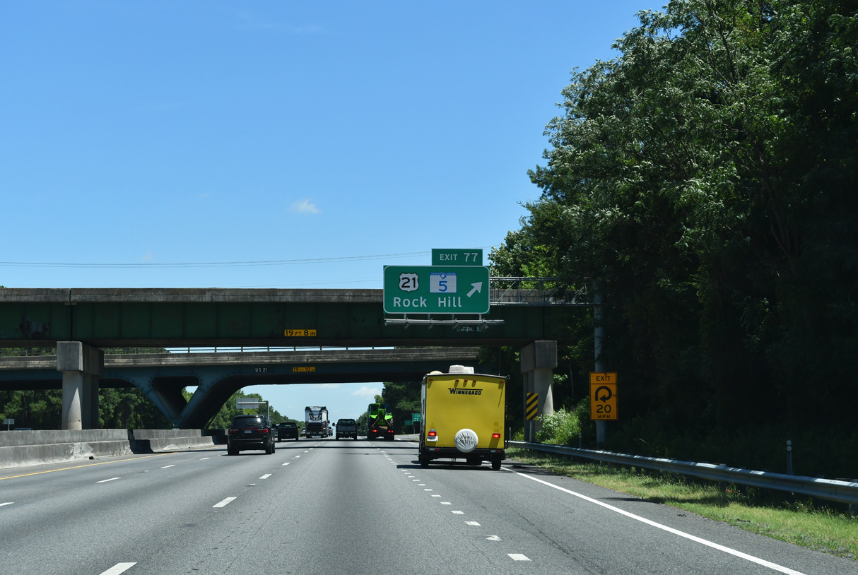
| U.S. 21/S.C. 5 combine for 5.17 miles from Lesslie northwest to a folded diamond interchange (Exit 77) with I-77 and S.C. 121 at Anderson Road S in Rock Hill. 09/16/21 |
|
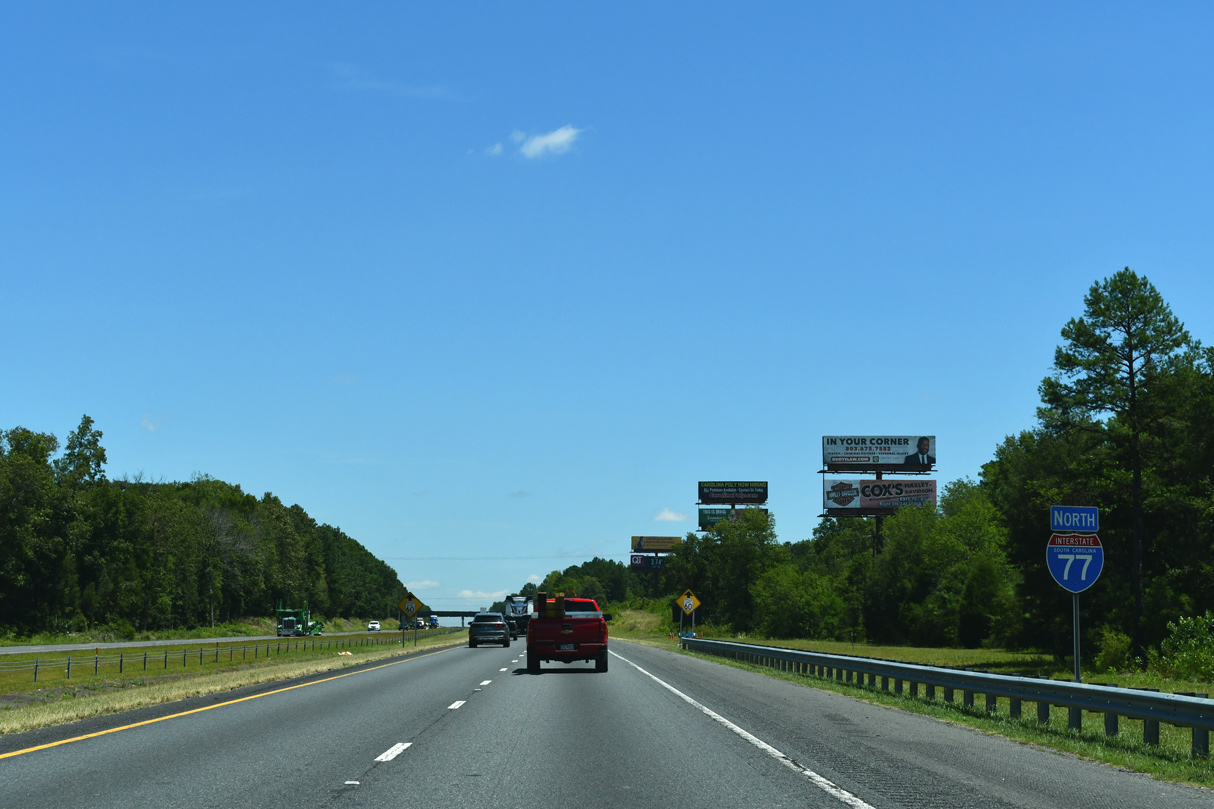
| Interstate 77 expands to a six lane urban freeway just north of Firetower Road (Road 710). 09/16/21 |
|
| Beyond the overlap with U.S. 21, S.C. 5 extends 8.12 miles east to U.S. 521 (Charlotte Highway) at Andrew Jackson State Park. 09/16/21 |
|
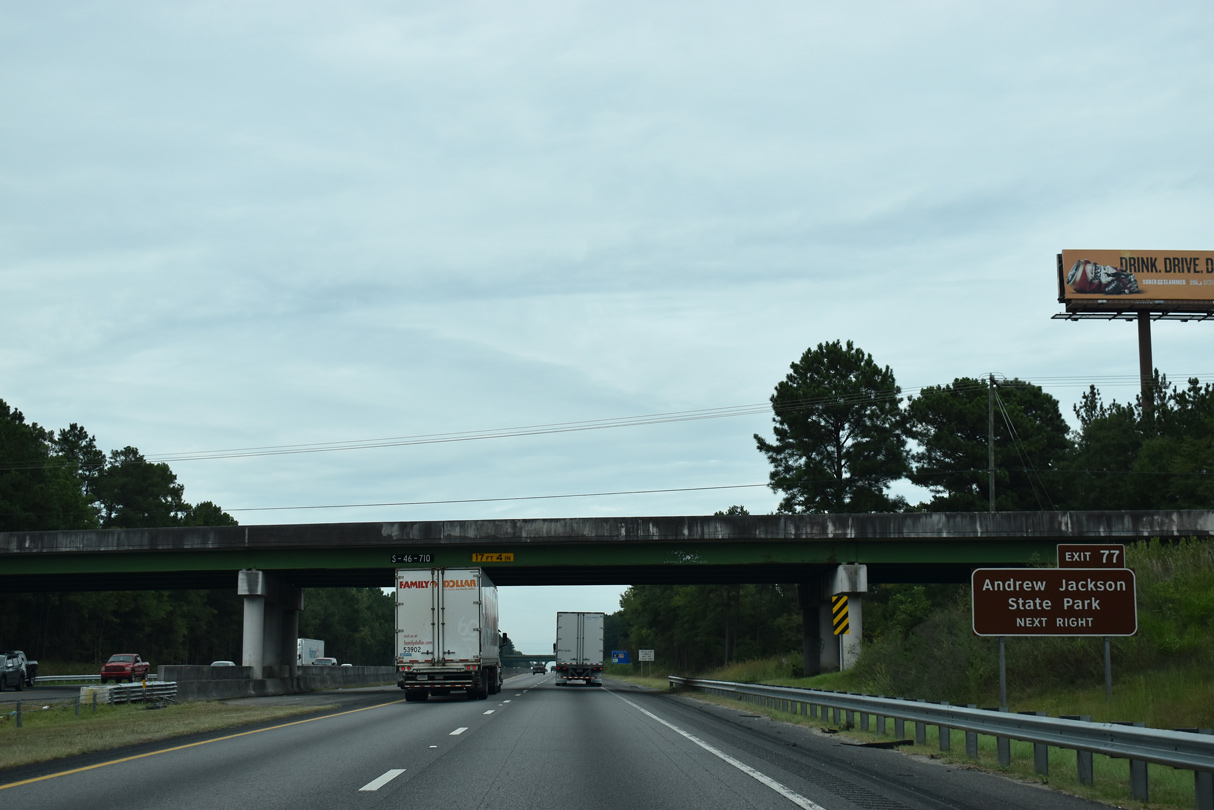
| Exit 77 departs below a Norfolk Southern Railroad to U.S. 21/S.C. 5 (Anderson Road S). U.S. 21/S.C. 121 run along the east side of Rock Hill and S.C. 5/121 along the south side. 06/01/12 |
|
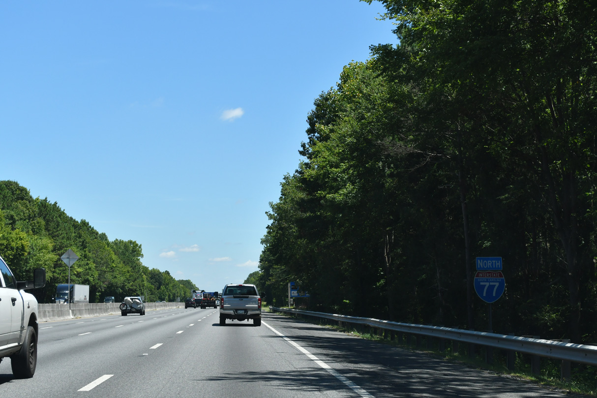
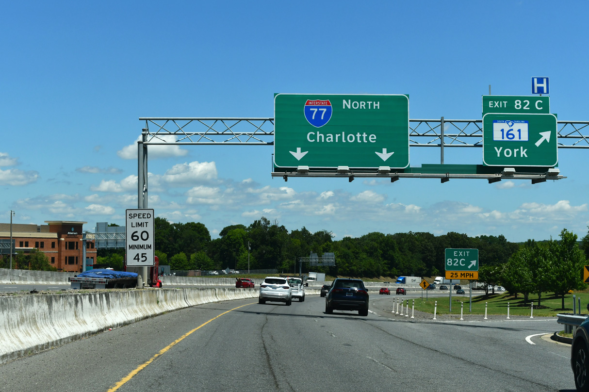
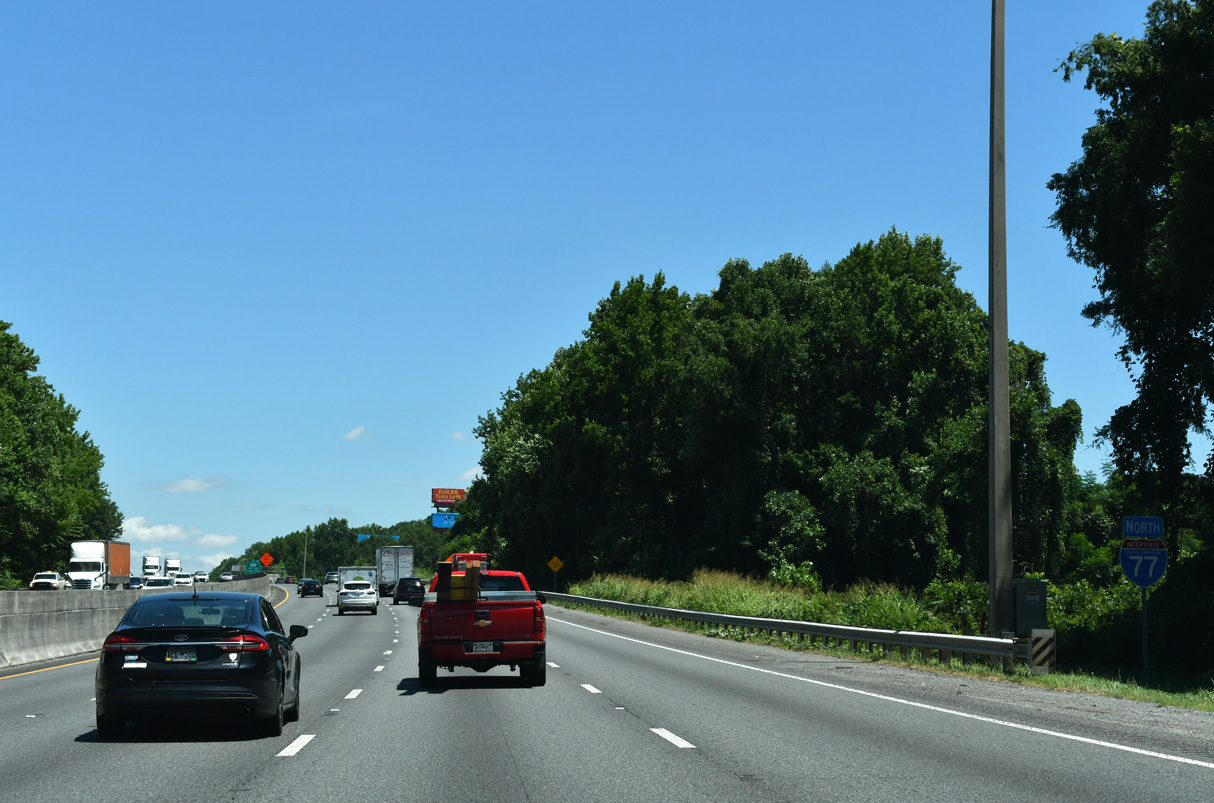
| The speed limit reduces to 60 miles per hour along Interstate 77 within the vicinity of Rock Hill. 09/16/21 |
|
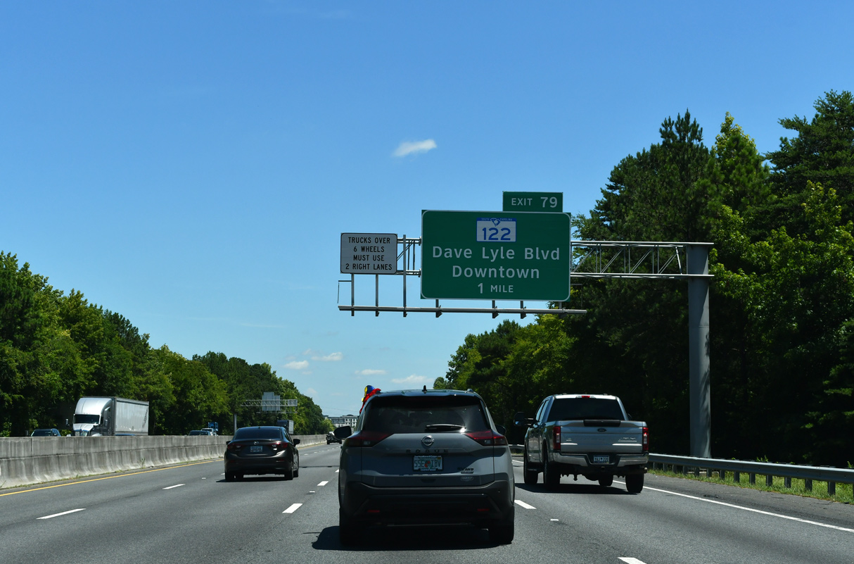
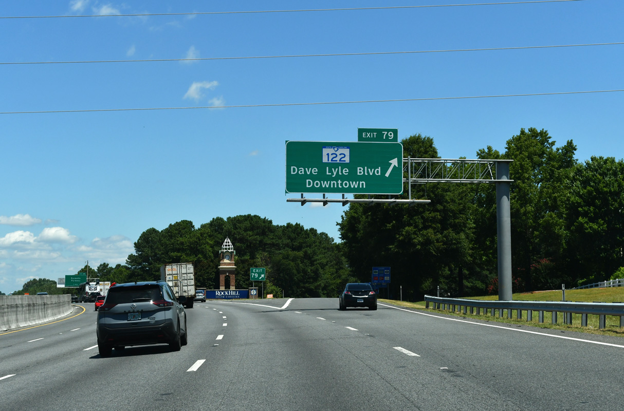
| A 5.74 mile long route, S.C. 122 (Dave Lyle Boulevard) stems west from Waterford Park Drive to Exit 79, a diamond interchange with U.S. 21/S.C. 121 (Anderson Road) and S.C. 72 south of Downtown Rock Hill. 05/24/19 |
|
| Rock Hill Galleria mall and Manchester Village shopping center anchor a sprawling commercial area spreading along both directions of S.C. 122 (Dave Lyle Boulevard) from Exit 79. The controlled access arterial portion of S.C. 122 is named after the former mayor of Rock Hill who served from 1960 to 1974. 09/16/21 |
|
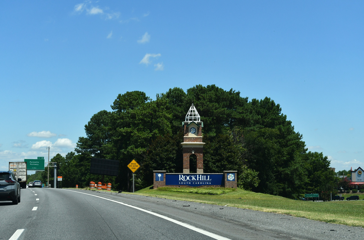
| A decorative welcome sign for the city of Rock Hill stands within the diamond interchange at Exit 79. 09/16/21 |
|
| Interstate 77 expands to eight lanes from north of Exit 77 to the North Carolina state line. This confirming marker precedes a Norfolk Southern Railroad overpass. 05/24/19 |
|
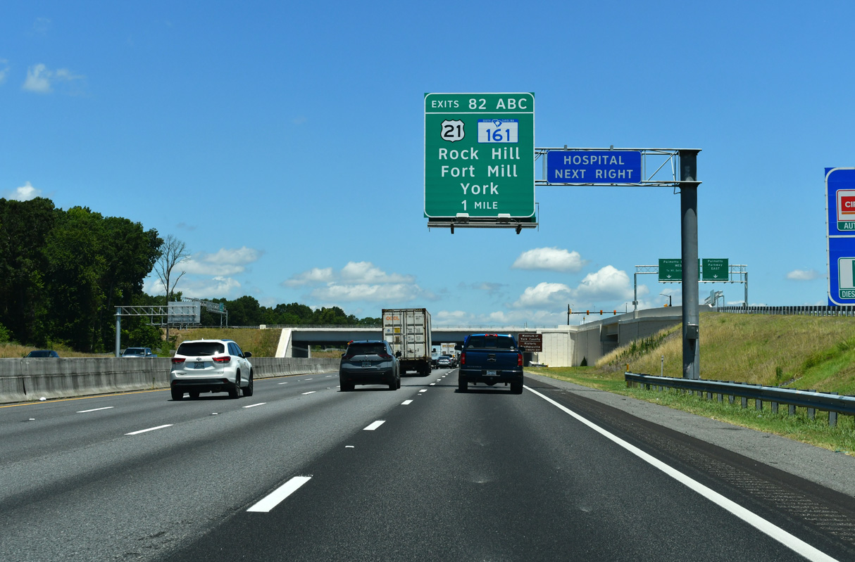
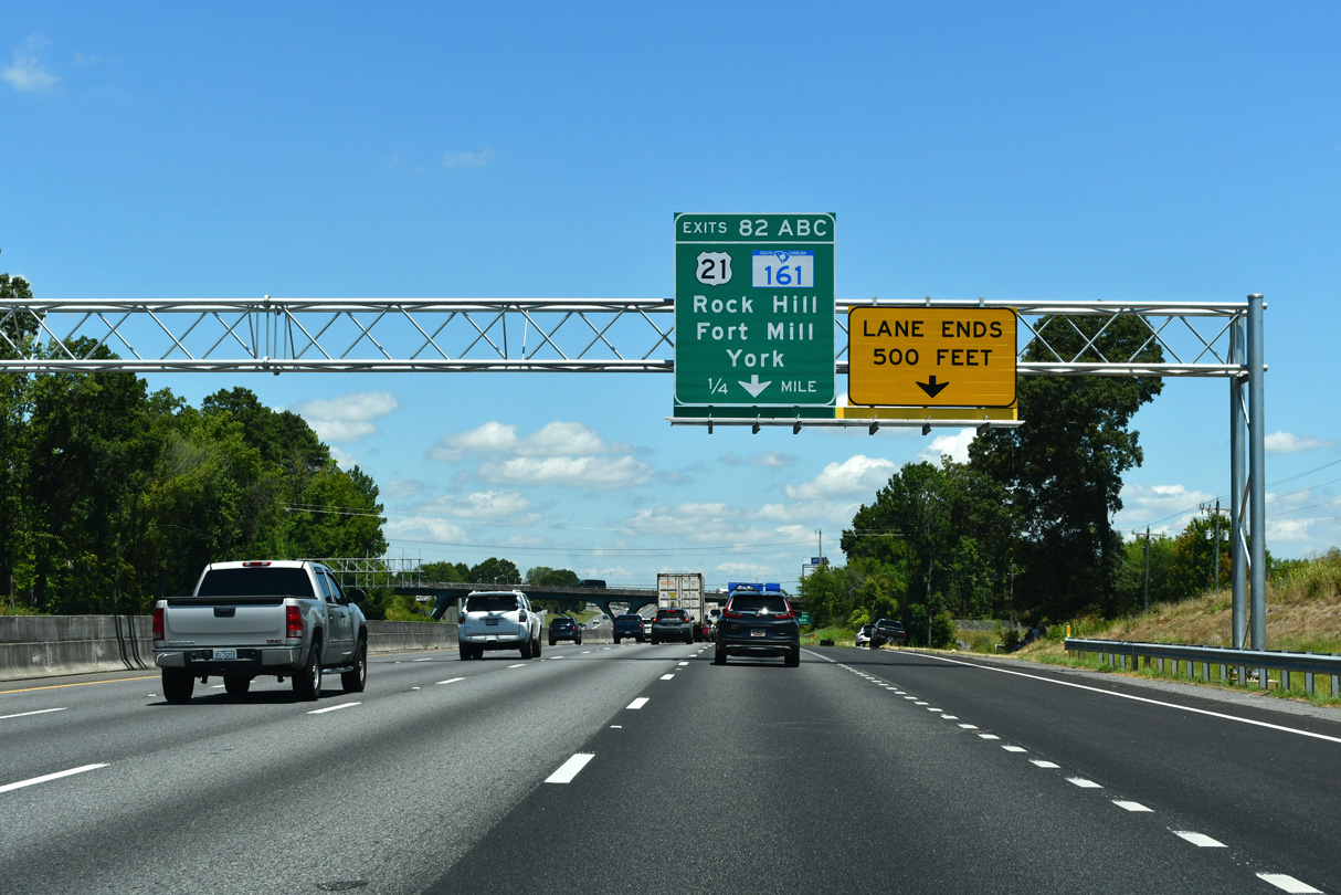
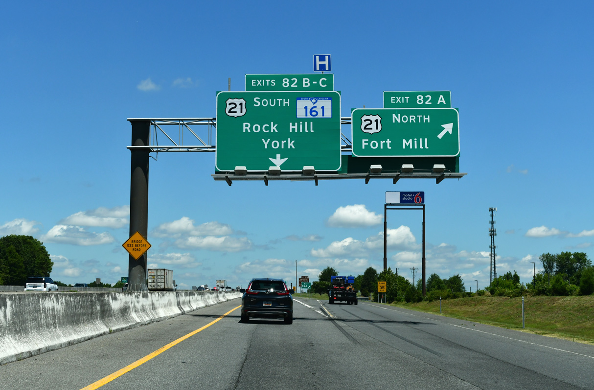
| U.S. 21 returns from Rock Hill along Cherry Road to meet Interstate 77 in 1.5 miles at Exits 82A/B. 09/16/21 |
|
| S.C. 161 (Celanese Road) stems west from U.S. 21 (Cherry Road) adjacent to Exit 82C to Rock Hill / York County Airport (UZA). Succeeding parclo interchanges join Interstate 77 with the two arterials. 11/20/21 |
|
| Construction started in 2021 adds a parclo A2 interchange (Exit 81) with One Carolina Drive. 11/20/21 |
|
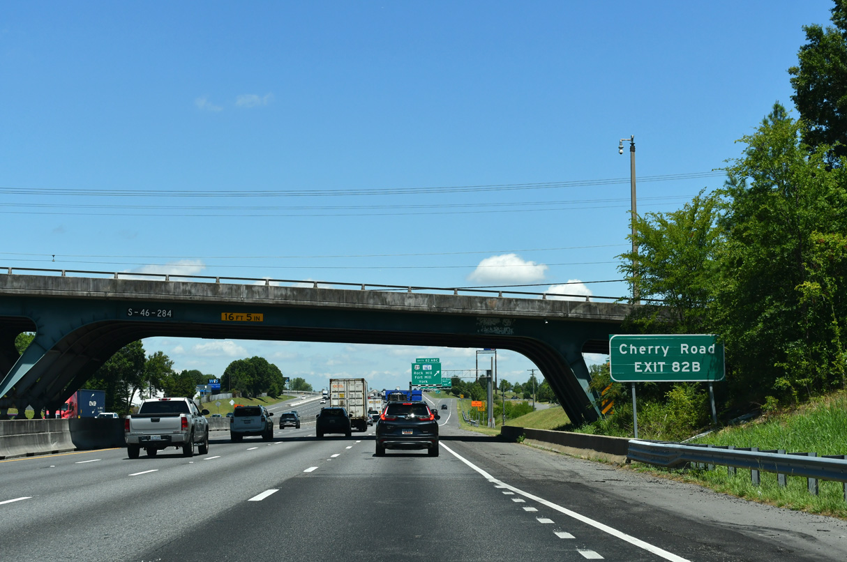
| Cherry Road (S.C. 322) angles southwest across the north side of Rock Hill 4.76 miles from U.S. 21 to S.C. 901 (Heckle Boulevard). 09/16/21 |
|
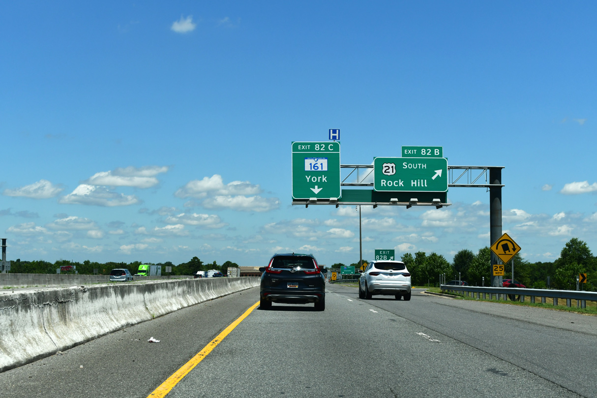
| A collector distributor roadway separates at Exit 82 for U.S. 21 (Cherry Road) and S.C. 161 (Celanese Road). 11/20/21 |
|
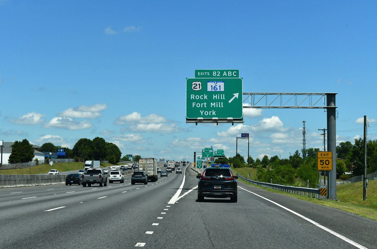
| Exit 82A joins U.S. 21 (Cherry Road) north ahead of the east end of S.C. 161 and Cel-River Road (Road 50) south to Red River. U.S. 21 parallels I-77 across the Catawba River through Fort Mill. 11/20/21 |
|
| U.S. 21 turns south from Cherry Road at S.C. 322 and the north end of S.C. 121 nearby. U.S. 21/S.C. 121 bypass Rock Hill to the east along Anderson Road. S.C. 121 is part of a multi state route stretching south to Lebanon Station, Florida. 11/20/21 |
|
| The c/d roadway returns to Interstate 77 north with two lanes as Exit 82C loops to S.C. 161 (Celanese Road). Forming a 28.91 mile long loop, S.C. 161 joins the north side of Rock Hill with York and NC 161 north to Kings Mountain, North Carolina. 11/20/21 |
|
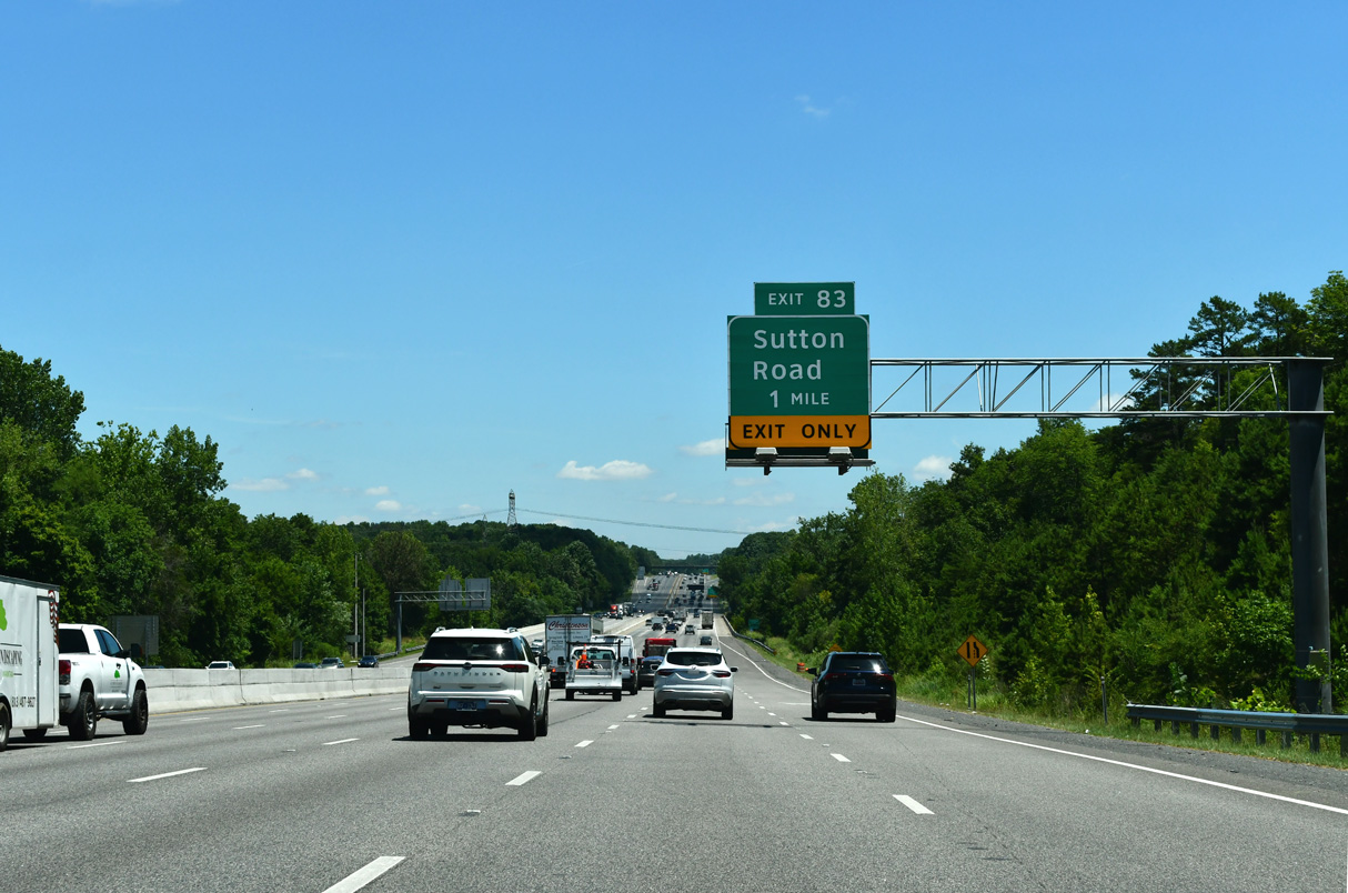
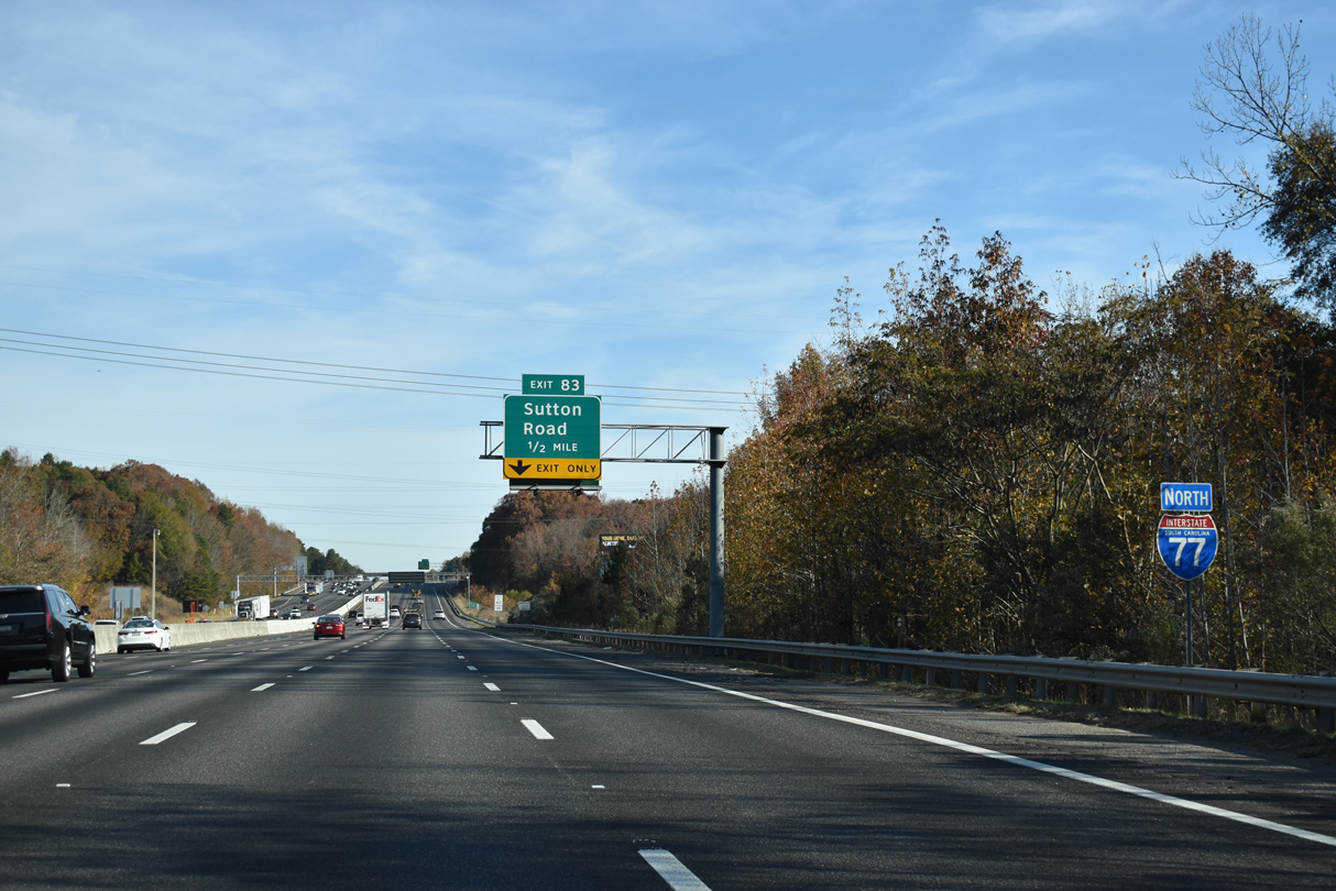
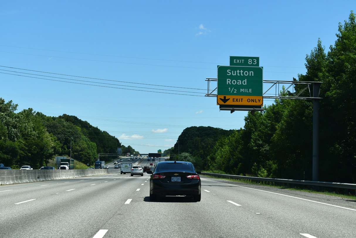
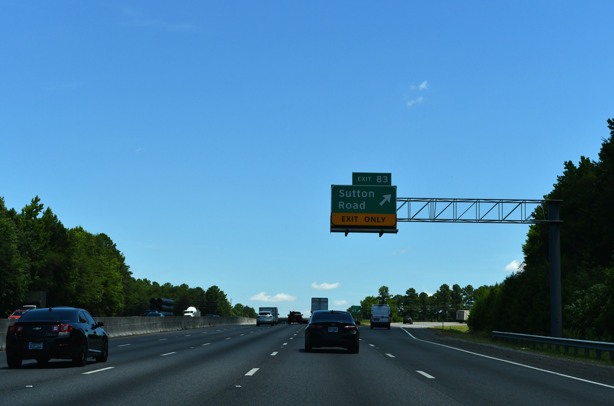
| Sutton Road (Road 49) links Interstate 77 with U.S. 21 at U.S. 21 Business (Spratt Street) north 0.48 miles southeast of Exit 83. U.S. 21 Business comprises a 7.06 mile long loop through the town of Fort Mill. 11/20/21 |
|
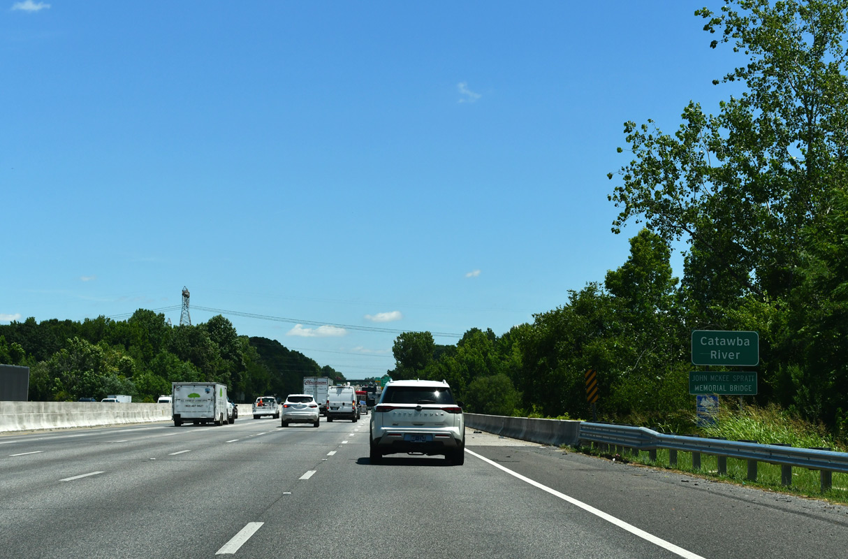
| Interstate 77 north spans the Catawba River ahead of this confirming marker. 11/20/21 |
|
| I-77 advances a half mile to a diamond interchange (Exit 83) with Sutton Road (Road 49). 11/20/21 |
|
| Sutton Road arcs 2.83 miles north from Exit 83 through the community of Riverview and a number of subdivisions to S.C. 160 (Steele Creek Road). 11/20/21 |
|
| Interstate 77 north runs between Riverview and Fort Mill along the ensuing stretch. 11/20/21 |
|
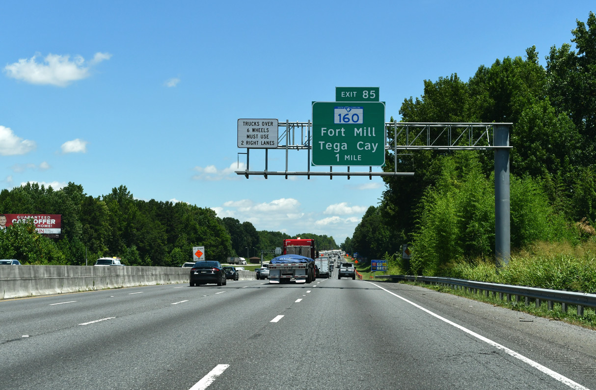
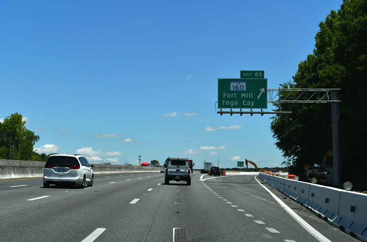
| S.C. 160, an 11.04 mile long route between the North Carolina state line and U.S. 521 at Indian Land, meets Interstate 77 at Exit 85. The multi state highway extends 14.8 miles northeast to NC 49 at the South End neighborhood in Charlotte. 11/20/21 |
|
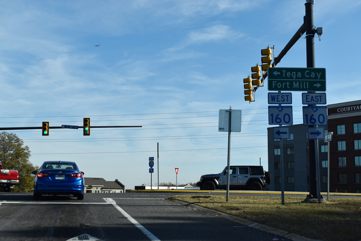
| S.C. 160 leads southeast to Downtown Fort Mill, where it overlaps with U.S. 21 Business, and northward to the city of Tega Cay. 11/20/21 |
|
| Originating as a gated community built in 1970, Tega Cay lies along Lake Wylie just west of S.C. 160. Financial issues with the developer led to incorporation of the community in the early 1980s.3 11/20/21 |
|
| A wooded area surrounding Lake Patricia separates Interstate 77 and U.S. 21 to the east near mile marker 86. 09/16/21 |
|
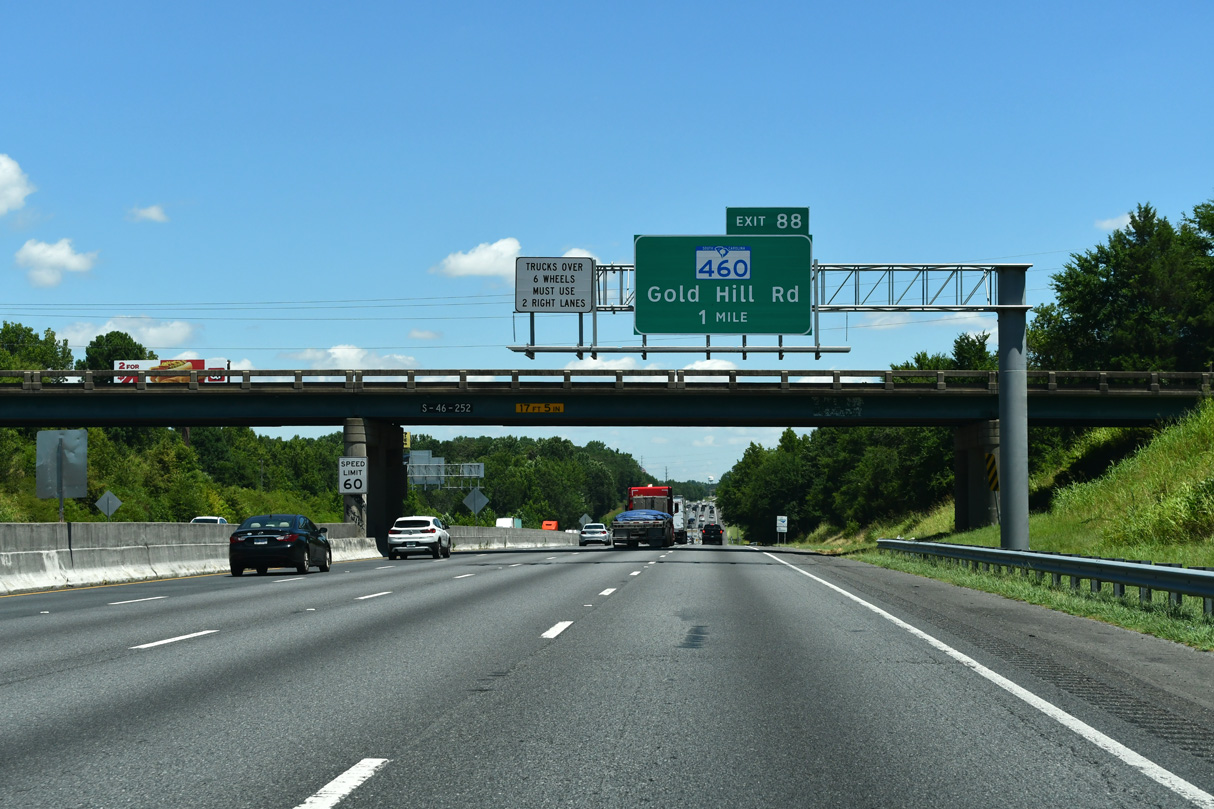
| Designated in 2012, S.C. 460 initially looped 7.51 miles north from S.C. 160 (Tom Hall Road) along Springfield Parkway in east Fort Mill to S.C. 160 (Steele Creek Road) near Tega Cay along Gold Hill Road west. 09/16/21 |
|
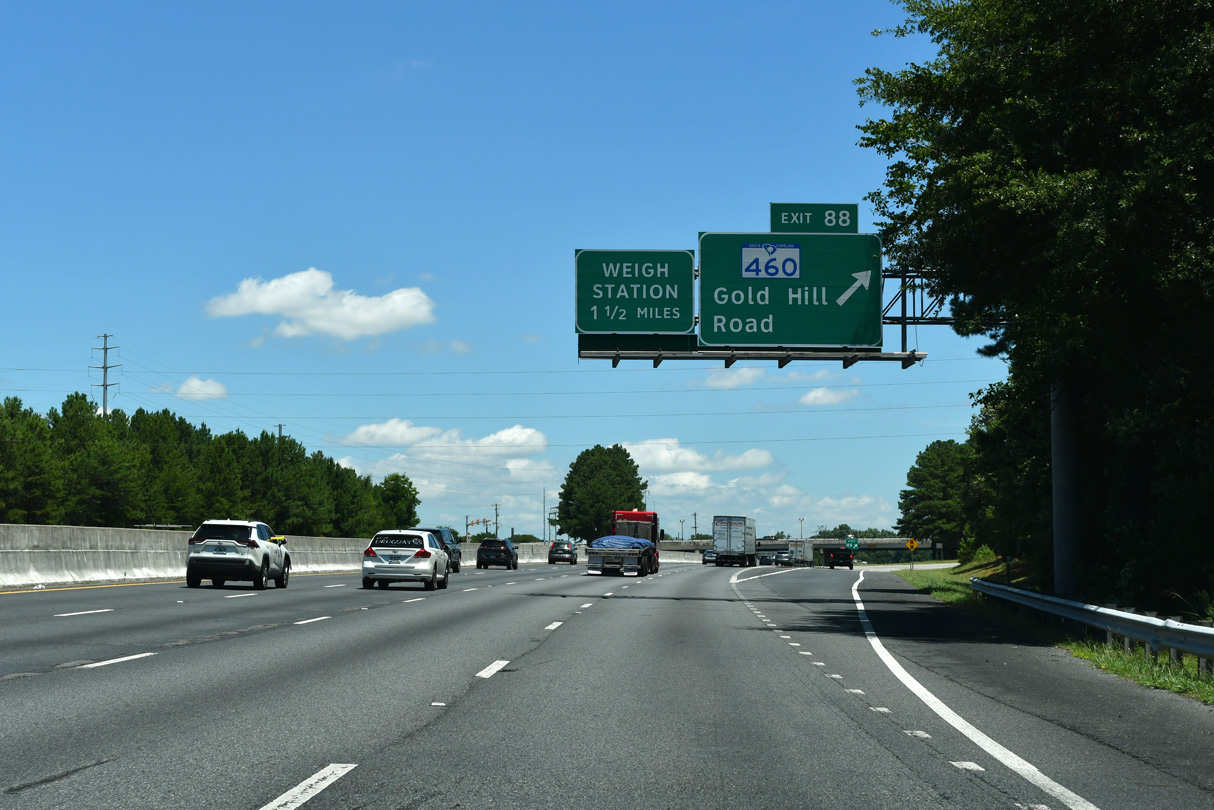
| Entering the diverging diamond interchange (Exit 88) with S.C. 460 (Gold Hill Road) on I-77 north. The stadium formerly hosting the Charlotte Knights (AAA Baseball) was located just south of S.C. 460 along Deerfield Drive. 09/16/21 |
|
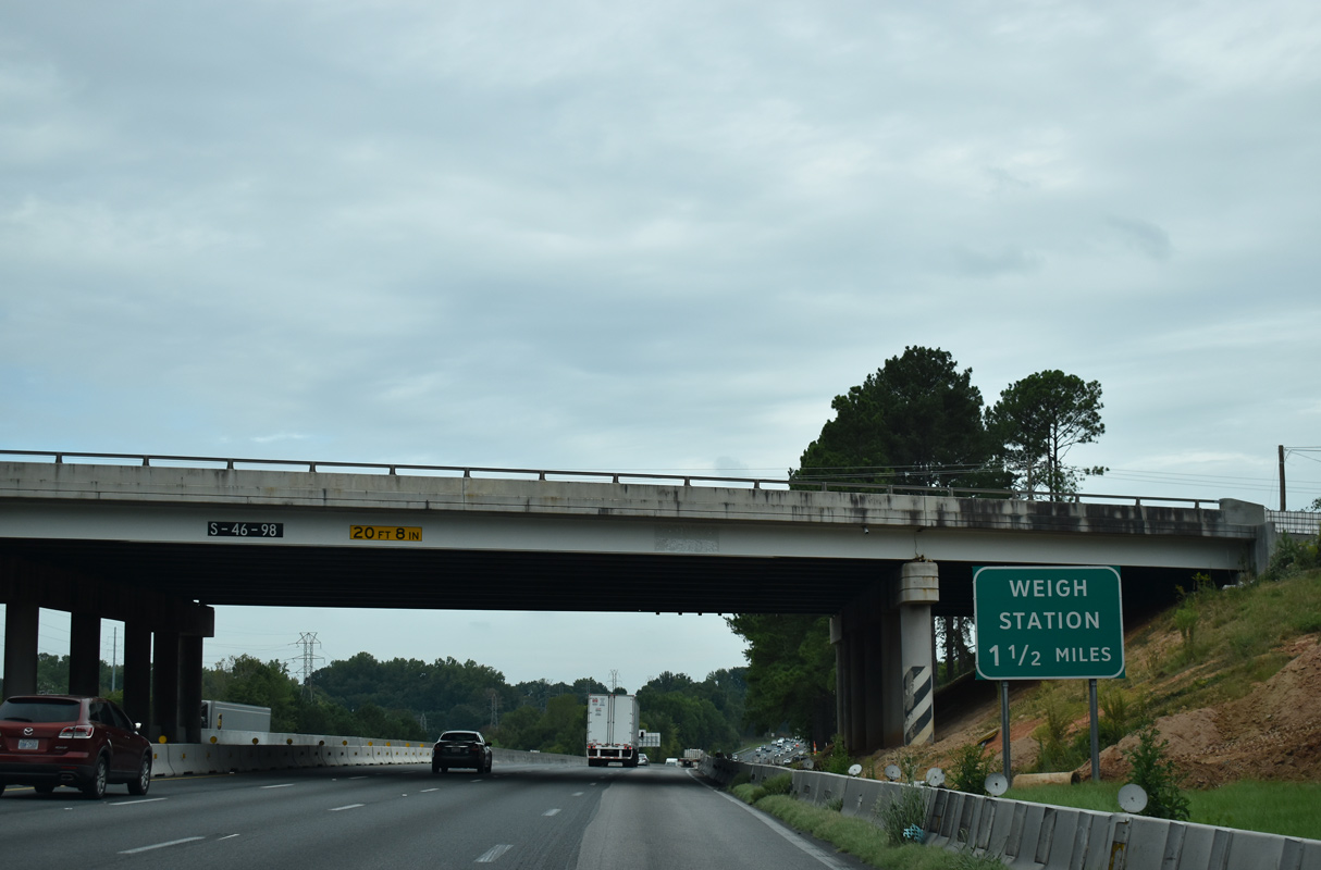
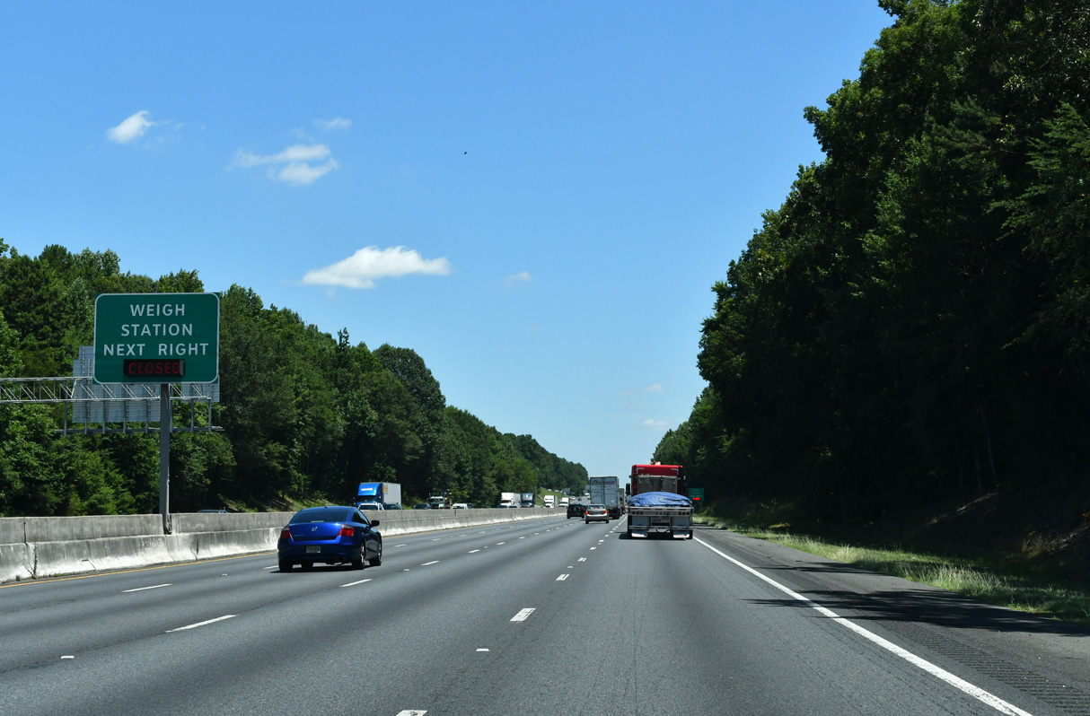
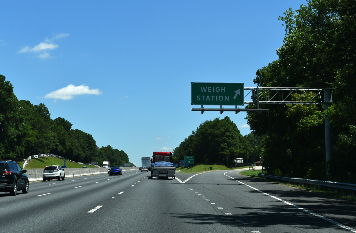
| A northbound weigh station lies opposite the southbound welcome center between Exits 88 and 90. 09/16/21 |
|
| I-77 arrives at the northbound weigh station within one mile of the parclo interchange (Exit 90) with U.S. 21. 09/16/21 |
|
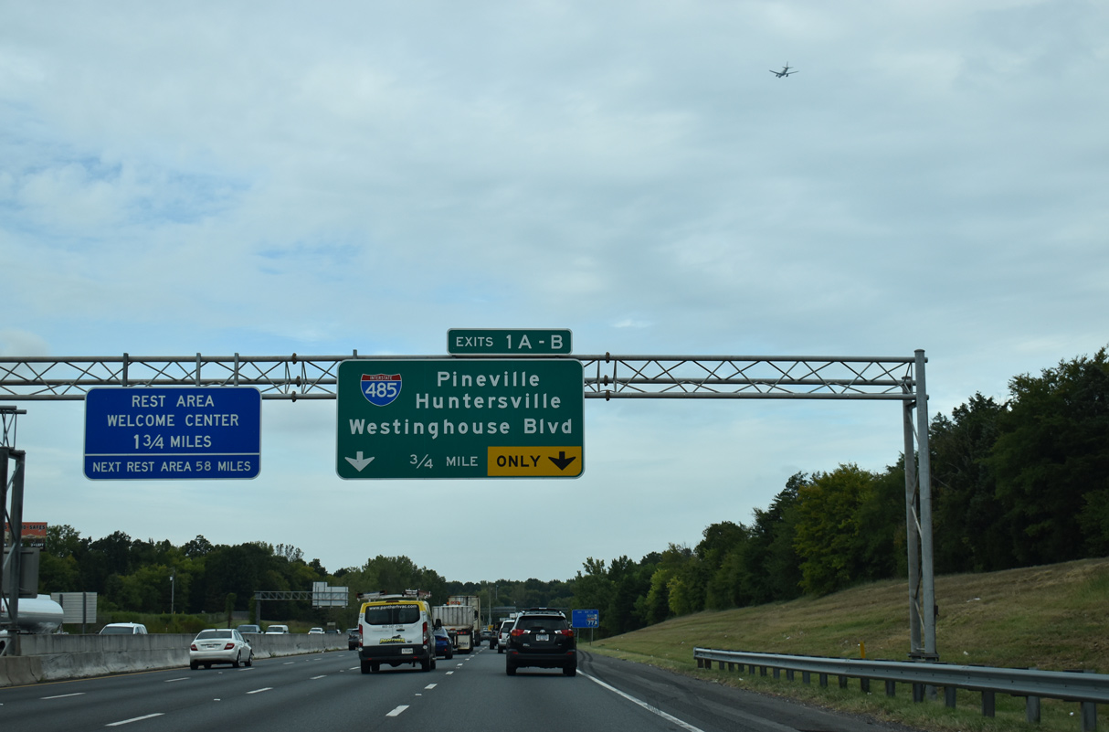
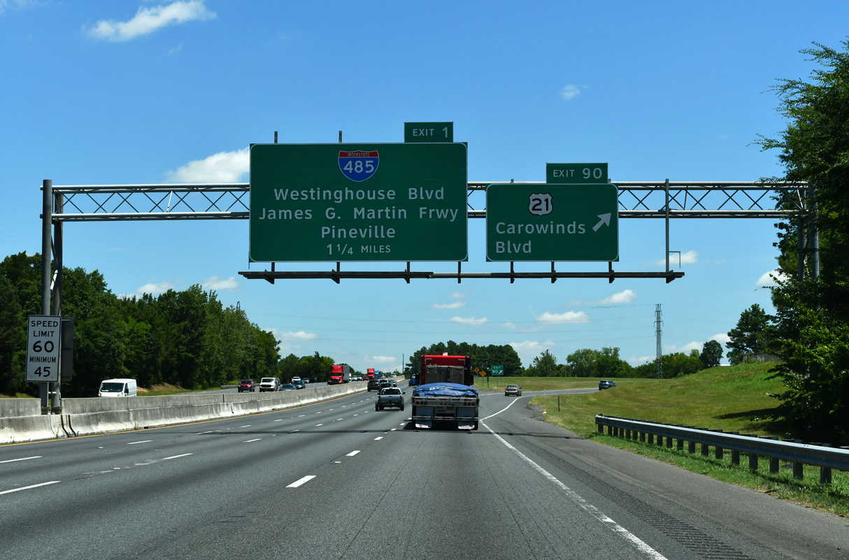
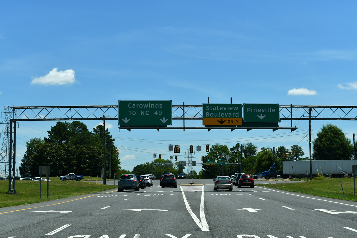
| U.S. 21 north combines with I-77 ahead of the four level interchange (Exit 1) with Interstate 485. Carowinds Boulevard extends from U.S. 21 at Exit 90 northwest to the Carowinds theme park and NC 49 (Tryon Street). 09/16/21 |
|
| Carowinds lies north of Carowinds Boulevard and west of I-77/U.S. 21 across the Carolina border. 09/16/21 |
|
| Springhill Farm Road (Road 48) leads east from the ramps at Exit 90 to MSR 51 (Pineville-Rock Hill Road), the former alignment of U.S. 21 to Pineville, North Carolina. U.S. 21 turned north from the previous end of U.S. 521 in Pineville onto Polk Street to South Boulevard in Charlotte. 05/24/19 |
|
| Generally serving commuter traffic, Interstate 485 encircles Charlotte along a 67 mile long course. The southeastern quadrant connects I-77 with Pineville and Matthews. The western third of the beltway provides a bypass route for I-77 north to Huntersville. 09/16/21 |
|
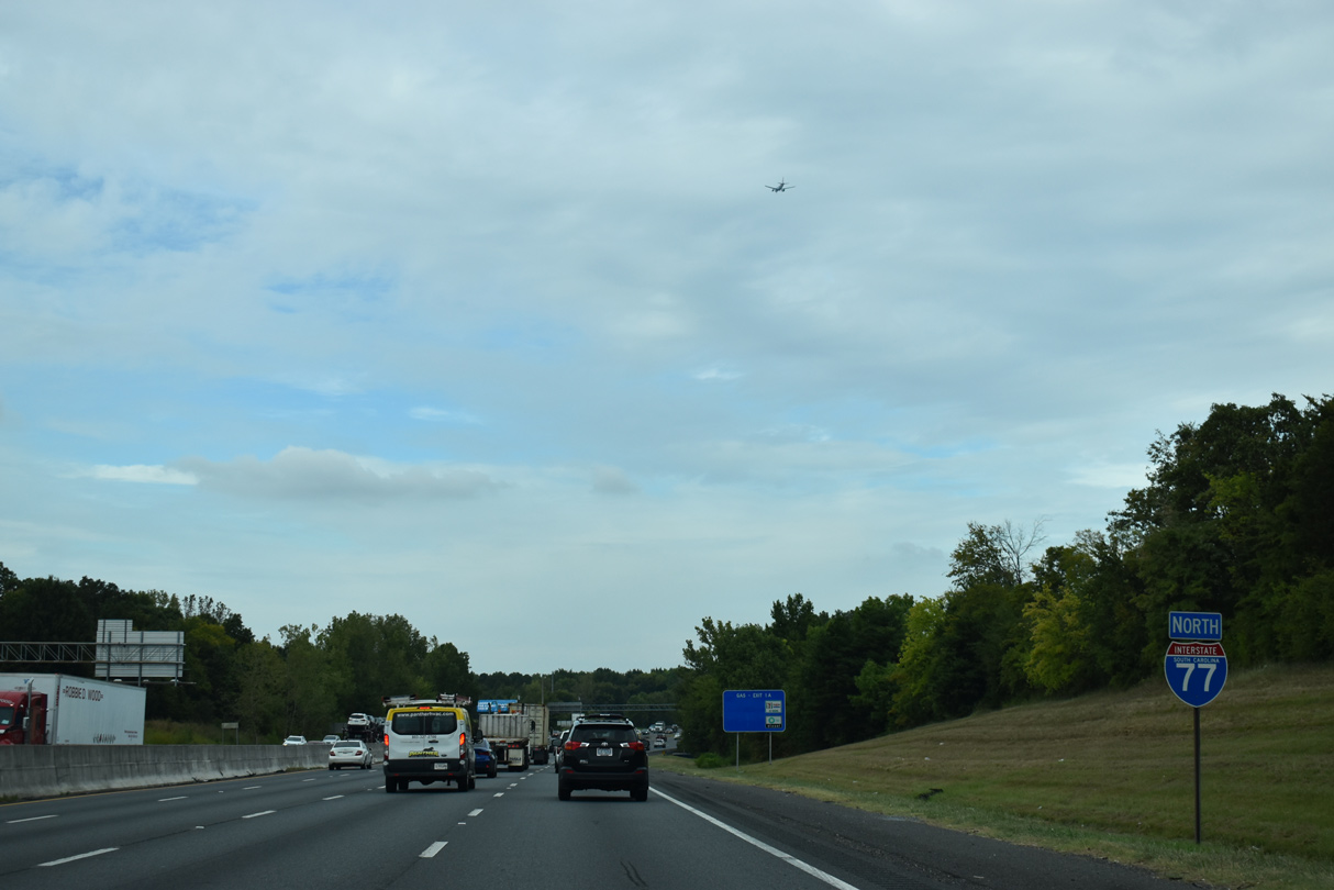
| The final confirming marker for I-77 north in the Palmetto State omits U.S. 21. U.S. 21 combines with I-77 northward through the city of Charlotte, North Carolina. 09/16/21 |
|
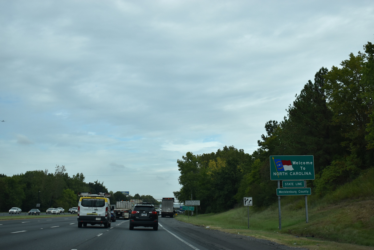
| The 91.05 mile long stretch of Interstate 77 in the Palmetto State concludes as the freeway enters Mecklenburg County, North Carolina. 09/16/21 |
Page Updated 12-30-2021.

 North
North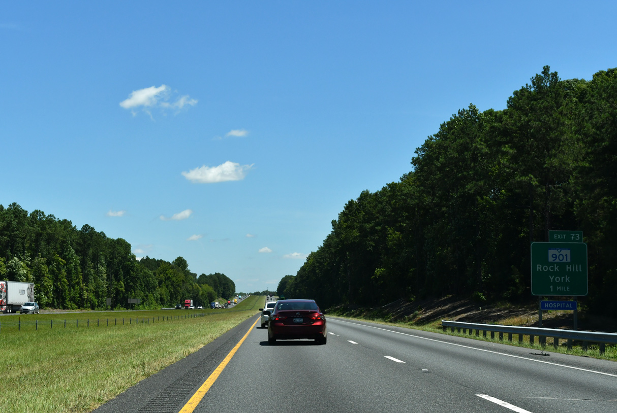


 North
North