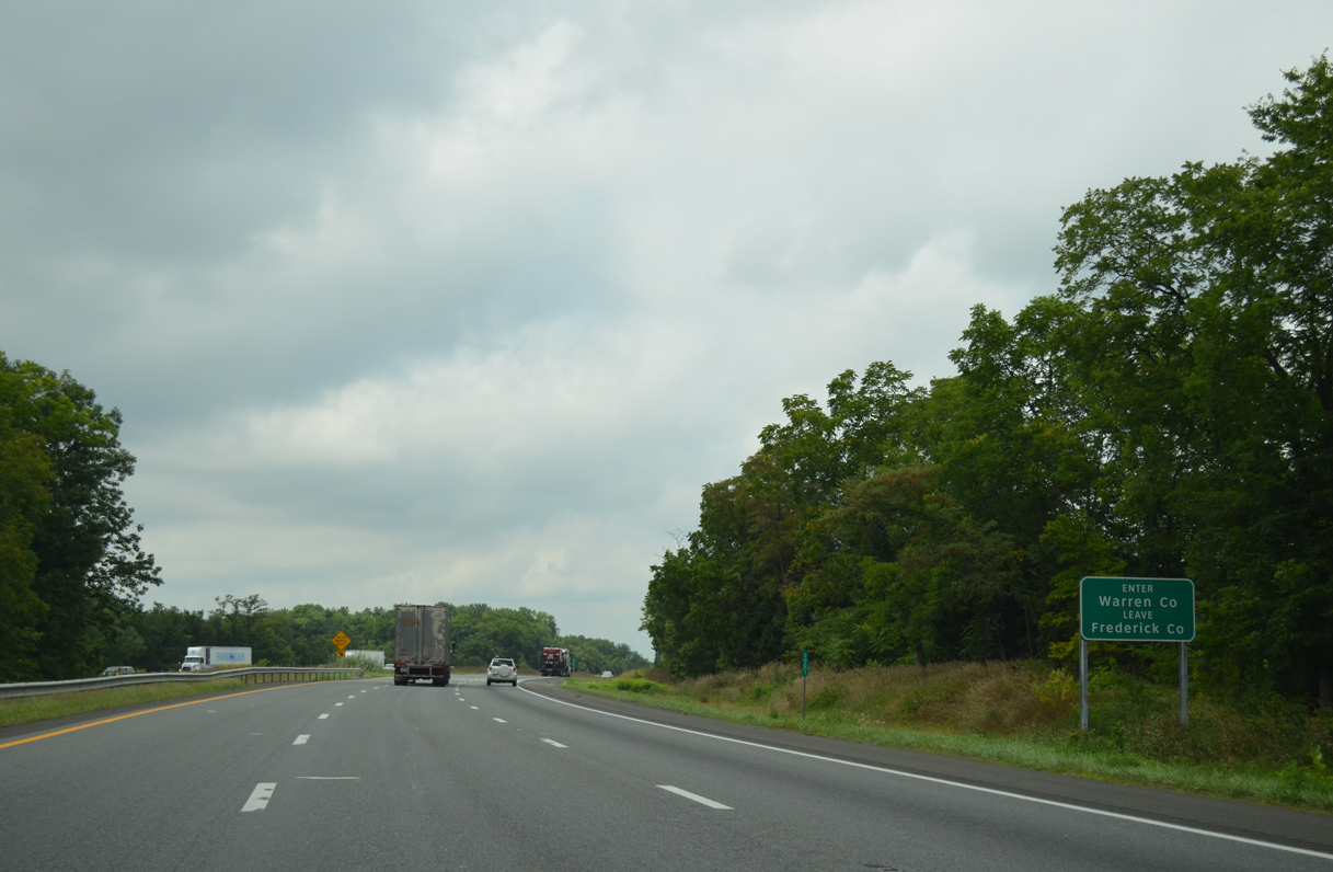
Situated at the northern end of the Shenandoah Valley, the city of Winchester was founded in 1744 and was home to 28,310 in 2020. Like many others in Virginia, the Winchester area is rich in history. It is home to a Civil War-era attraction: General Stonewall Jackson's Headquarters, which was occupied by during the Winter of 1861-62. Even President George Washington spent time in Winchester.
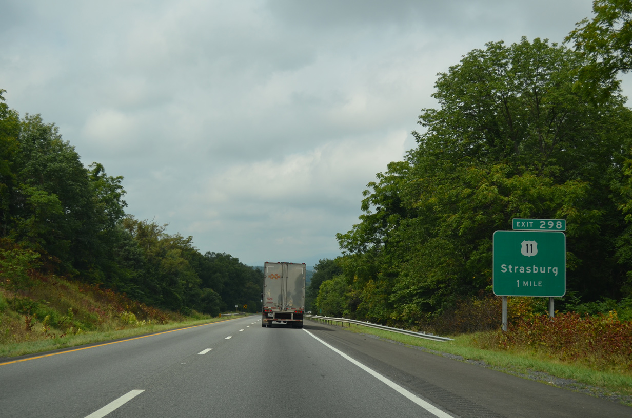
Interstate 81 connects with Strasburg at Exit 296 and 298. The town was founded in 1761 and incorporated in 1922. Located in the Shenandoah Valley, Strasburg played a role in the Civil War era, when Stonewall Jackson made Strasburg "the fountainhead of rail traffic for the South" by bringing railroad cars from the North to the South.
|
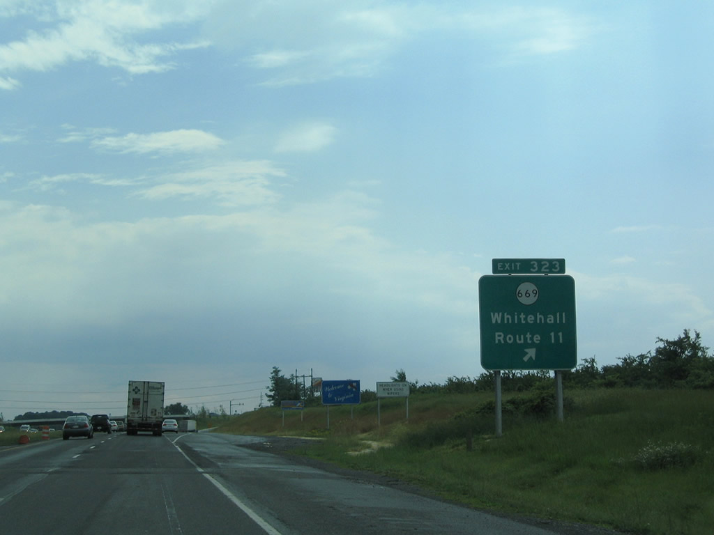
| Exit 323 leaves I-81 south just beyond the Virginia state line for SR 669 (Rest Church Road). White Hall lies at the cross roads of SR 671 (Green Spring Road) and SR 739 (Apple Pie Ridge Road) on Apple Pie Ridge. 06/01/04 |
|
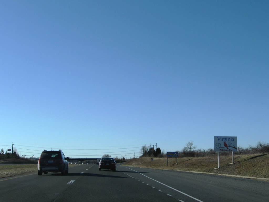
| The Virginia welcome sign stands ahead of the gore point for Exit 323 at Rest. 12/30/08 |
|
| Interstate 81 south enters the Shenandoah Battlefields National Historic District in Clarke County. 12/30/08 |
|
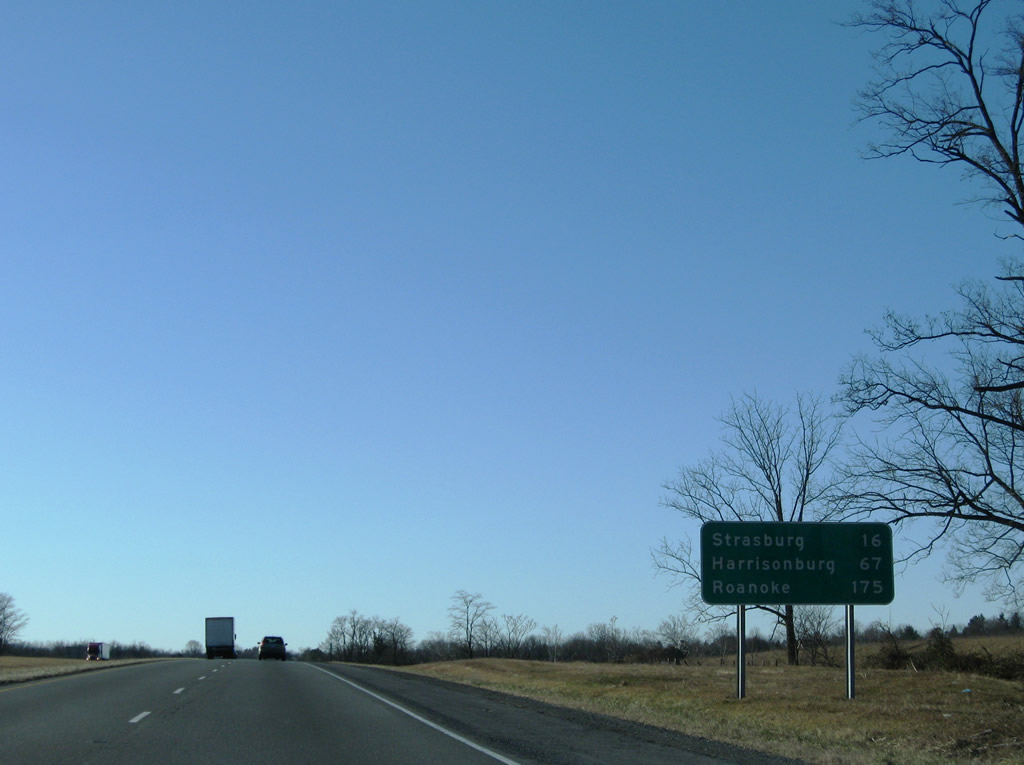
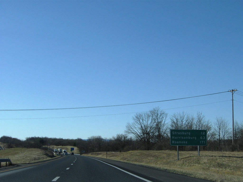
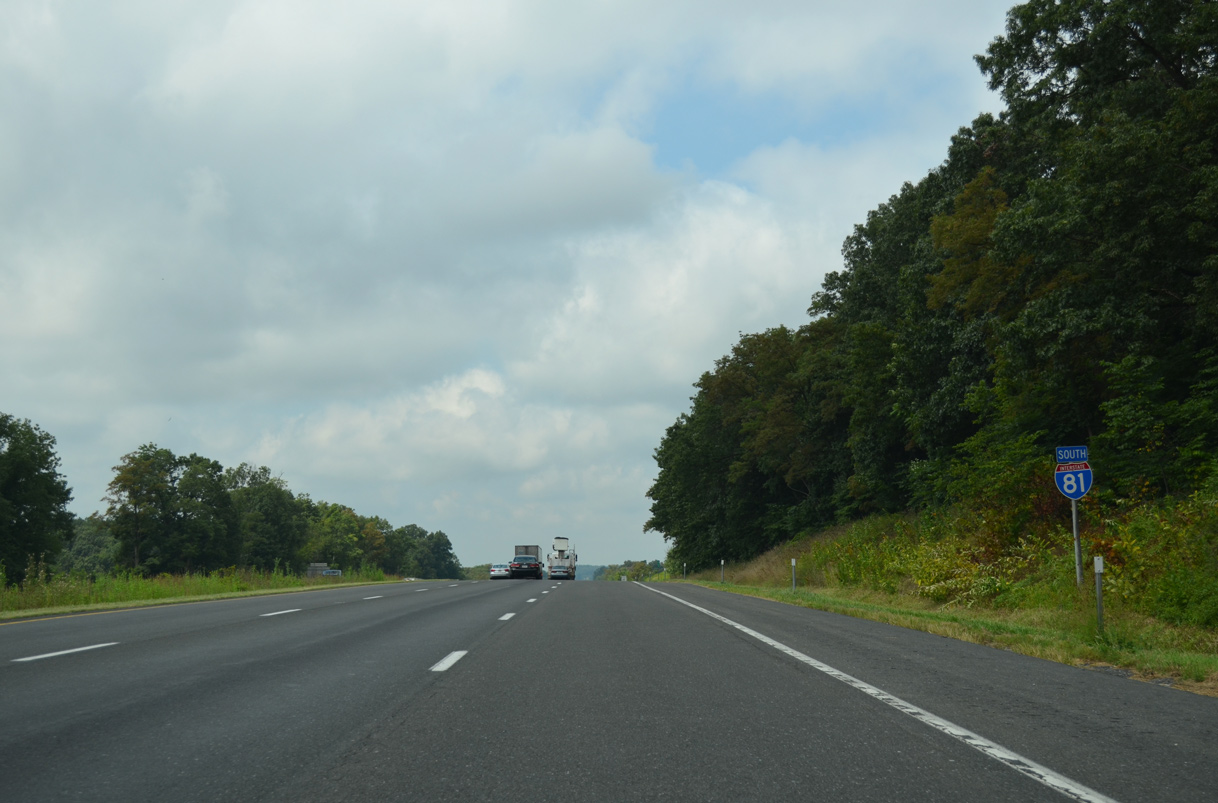
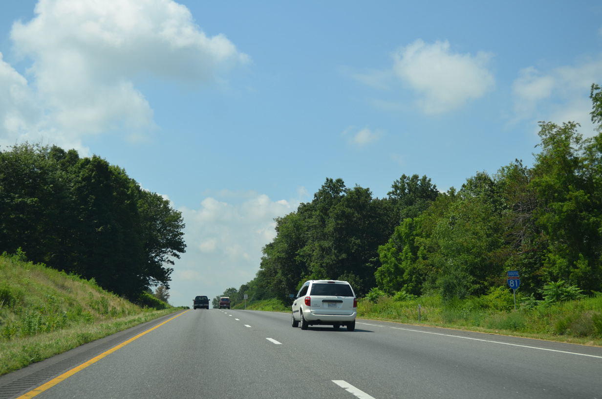
| I-81 advances nine miles south to the city of Winchester and 26 miles to the town of Strasburg. 12/30/08 |
|
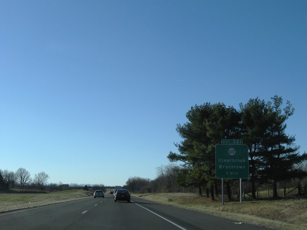
| A diamond interchange (Exit 321) joins Interstate 81 south with SR 672 (Hopewell Road) at Clear Brook in one mile. West of Exit 321, SR 672 runs 5.20 miles to Pumpkin Ridge, Welltown and Cedar Grove. 12/30/08 |
|
| SR 672 (Hopewell Road) ties into U.S. 11 (Martinsburg Pike) at Clear Brook 0.34 miles to the east. SR 672 continues from there along Brucetown Road to to Brucetown and Wadesville. 12/30/08 |
|
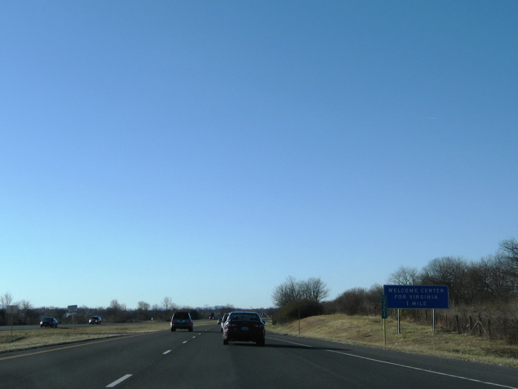
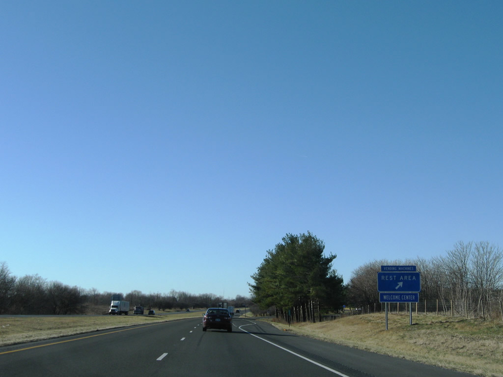
| The Virginia Welcome Center lies midway between Exit 321 and 317 along Interstate 81 southbound. 12/30/08 |
|
| The succeeding four interchanges serve the city of Winchester. Downtown is six miles from I-81 at Clear Brook. 12/30/08 |
|
| The Virginia welcome center and rest area is located near mile marker 320, west of Stephenson. 12/30/08 |
|
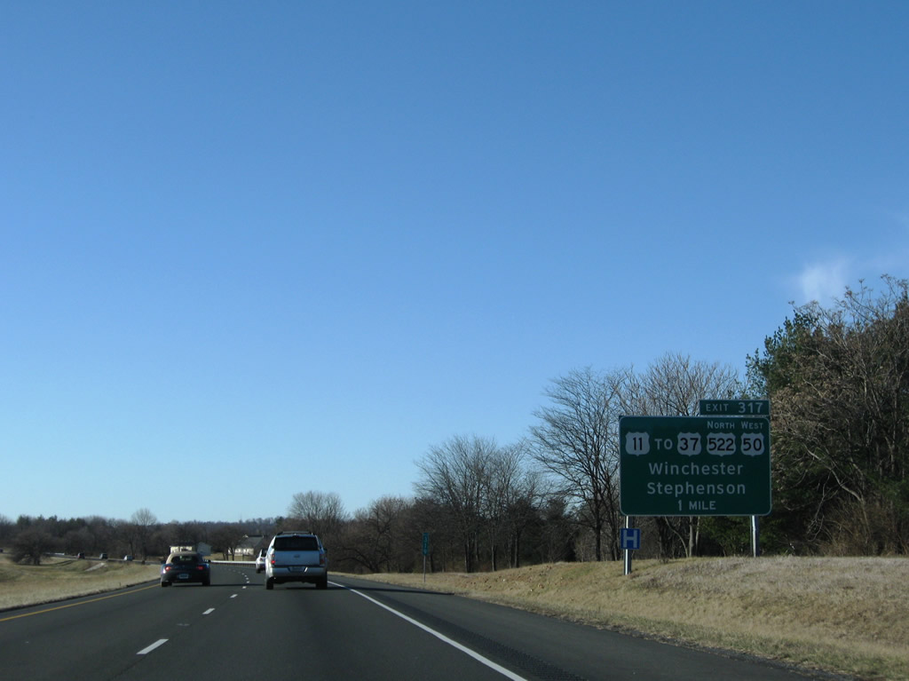
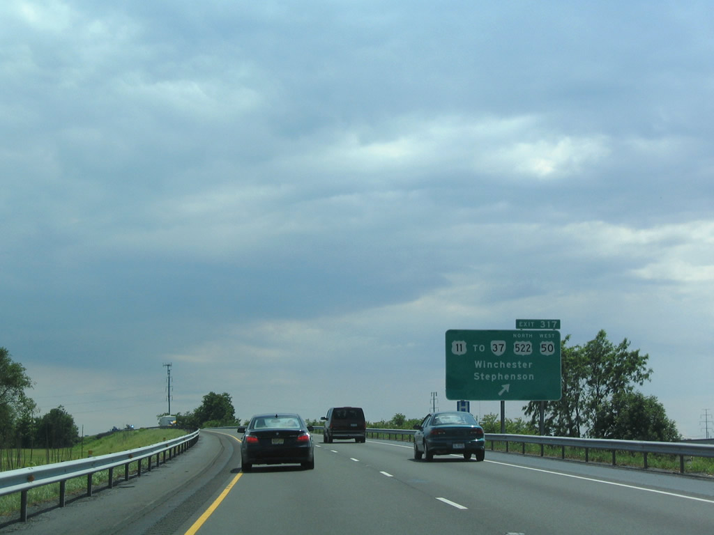
| Interstate 81 converges with U.S. 11 (Martinsburg Pike) on the industrial north side of Winchester at Exit 317. U.S. 11 is expands from a three lane boulevard to a four lane highway west through the exchange to the adjacent wye interchange with SR 37. 12/30/08 |
|
| SR 37 encircles Winchester to the west along a 9.10 mile long expressway from U.S. 11 (Martinsburg Pike) by Exit 317 to I-81 at Exit 310. SR 37 south links with U.S. 522 north to Gainesboro and Cross Junction and U.S. 50 west to Hayfield and Gore. 06/01/04 |
|
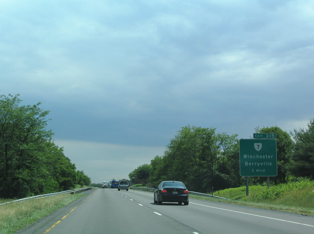
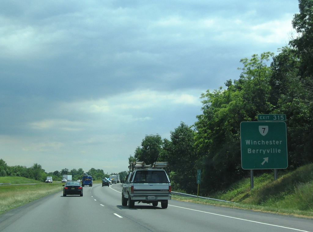
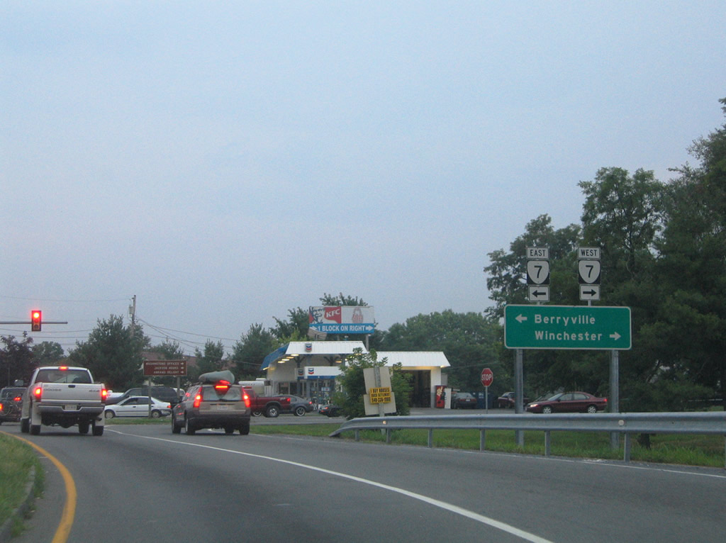
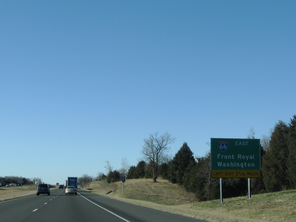
| SR 7 is a major corridor connecting Winchester with the Washington, D.C. metropolitan area, heads east from Exit 315 to Berryville. The four lane highway upgrades to a freeway between Round Hill and Leesburg. 06/01/04 |
|
| The folded diamond interchange (Exit 315) with SR 7 lies at the eastern corner of the Winchester city limits, where SR 7 transitions from Berryville Pike to Berryville Avenue west en route to National Avenue and Downtown Winchester. 06/01/04 |
|
| An array of traveler related services line SR 7 along both Berryville Pike and Avenue by the exchange with Interstate 81. SR 7 travels 72.40 miles overall from U.S. 11/522 (N Cameron Street) in Winchester to SR 400 (Washington Street) in Alexandria. 07/16/05 |
|
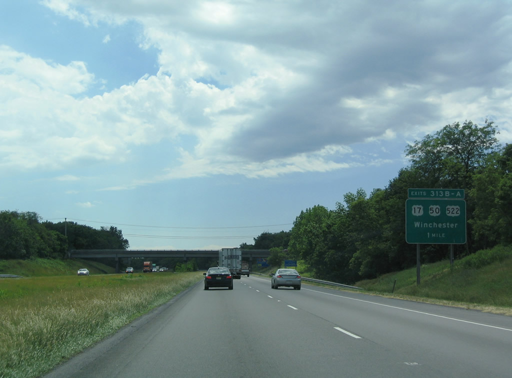
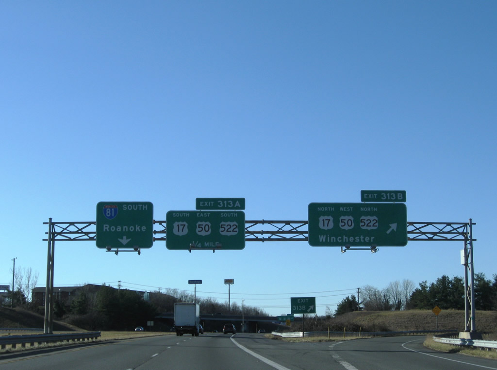
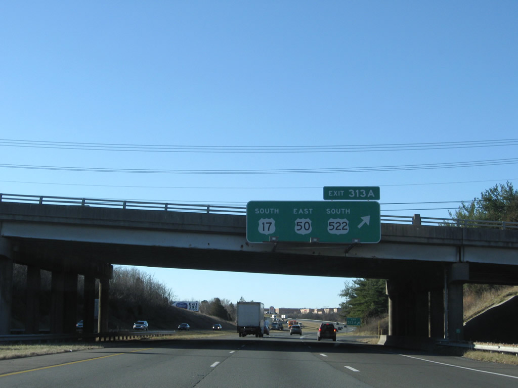
| U.S. 17/50/522 branch 1.20 miles southeast from an overlap with U.S. 11 (S Cameron Street) along Millwood Avenue to a parclo interchange (Exit 313) with I-81 at Front Royal Pike. 06/01/04 |
|
| Exit 313B leaves I-81 south for U.S. 17/50/522 (Millwood Avenue) west between Shenandoah University and Apple Blossom Mall. U.S. 17 concludes in Downtown Winchester where U.S. 50 partitions with U.S. 11/522 (S Cameron Street) at E Cork Street. 12/30/08 |
|
| U.S. 522 turns south from U.S. 17/50 along Front Royal Pike to Winchester Regional Airport (OKV) and Front Royal. U.S. 17/50 (Millwood Pike) continue to Paris, where U.S. 17 turns south to I-66 near Delaplane. U.S. 50 proceeds east from the Blue Ridge Mountains to Middleburg and Chantilly. 12/30/08 |
|
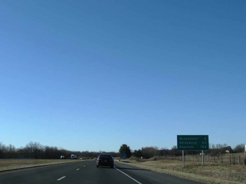
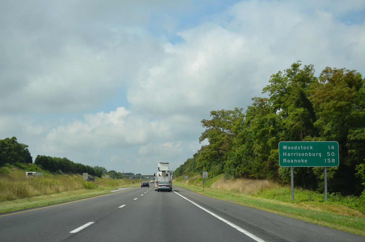
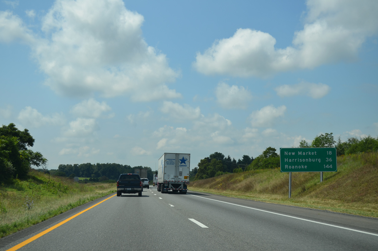
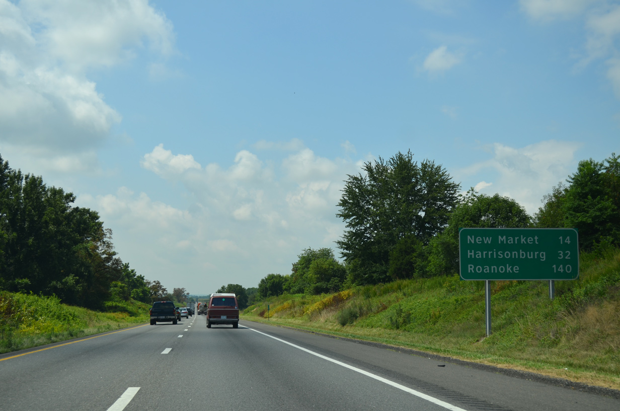
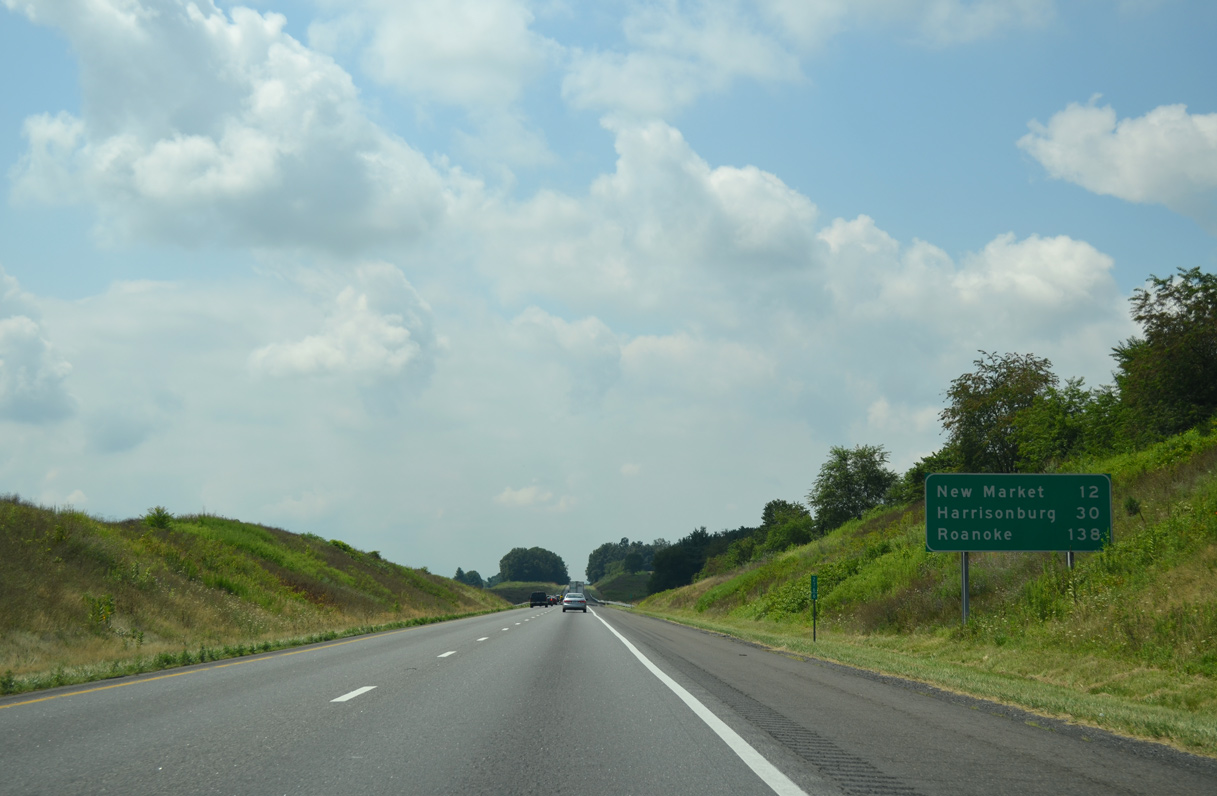
| Located 51 miles beyond Strasburg, the city of Harrisonburg debuts on distance signs for Interstate 81 south. 12/30/08 |
|
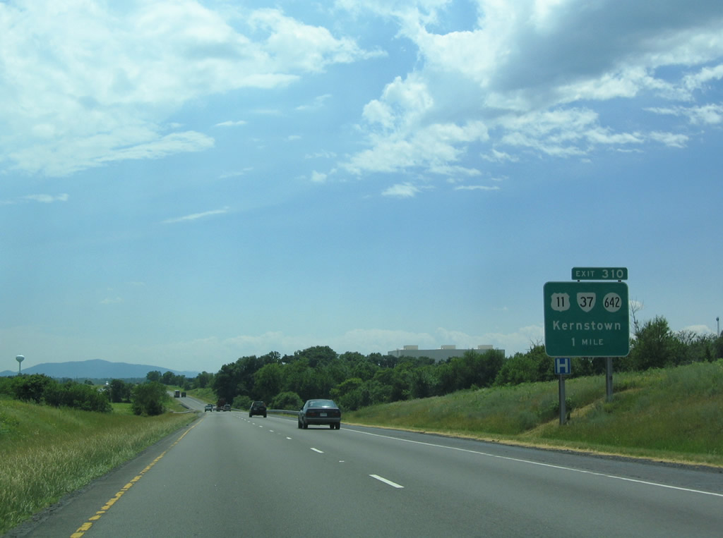
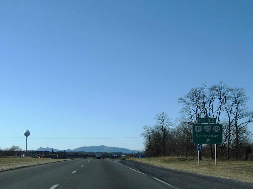
| SR 37 arcs southward around Kernstown to U.S. 11 (Valley Pike), I-81 at Exit 310 and SR 642 (Tasker Road). Previous plans outlined extending the expressway east to U.S. 522 (Front Royal Pike). 06/01/04 |
|
| The diamond interchange (Exit 310) with SR 37 was reconstructed in 2015/16 outward with longer ramps. U.S. 11 (Valley Pike) parallels I-81 to the west while SR 642 (Tasker Road) runs along the east side of the freeway ahead of suburban development. 12/30/08 |
|
| Continuing across Opequon Creek east of Bartonsville, Interstate 81 advances 12 miles south to the town of Strasburg. 12/30/08 |
|
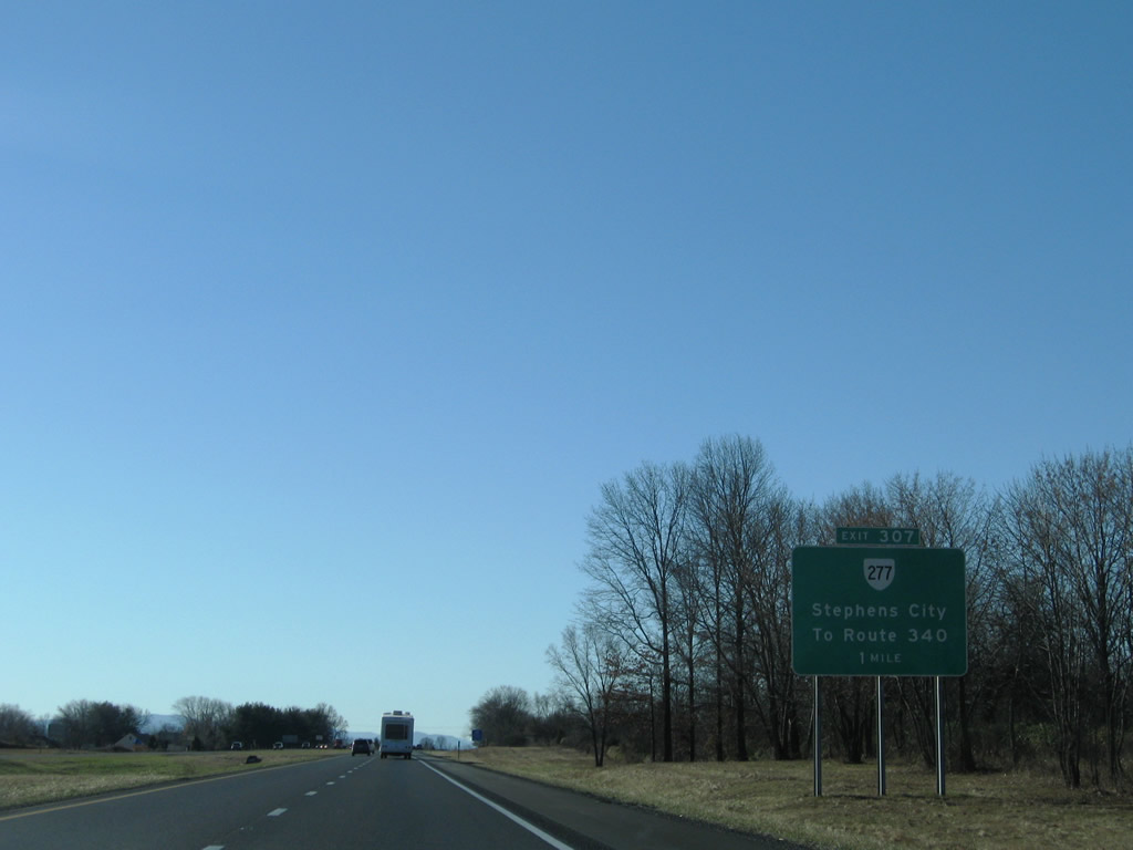
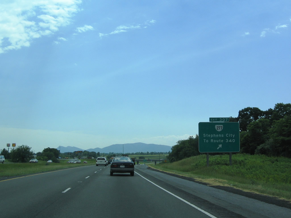
| SR 277 (Fairfax Street) meets I-81 at a diamond interchange (Exit 307) on the east side of Stephens City. 12/30/08 |
|
| SR 277 (Fairfax Pike) runs 4.72 miles east from U.S. 11 (Main Street) in Stephens City to the north split of U.S. 340/522 at Double Tollgate. SR 631 extends west from SR 277 (Fairfax Street) 3.77 miles to SR 628 (Middle Road) near Poplar Ridge. 06/01/04 |
|
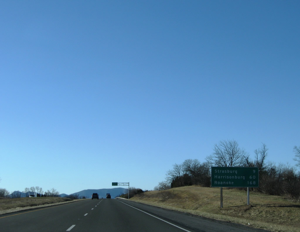
| Roanoke, the main control city of Interstate 81 in Virginia, lies 168 miles southwest of Stephens City. 12/30/08 |
|
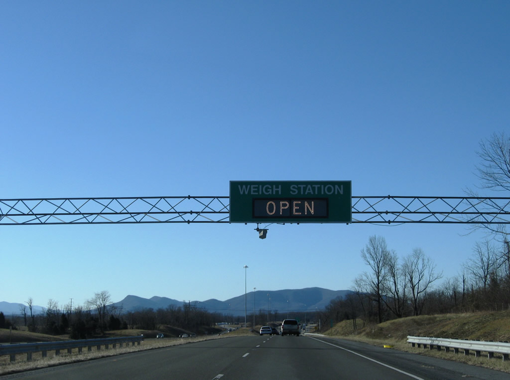
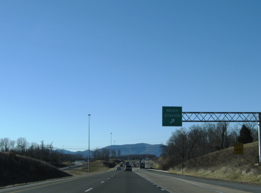
| Truck weigh stations operate along on both sides of Interstate 81 beyond West Run near Klines Mill. 12/30/08 |
|
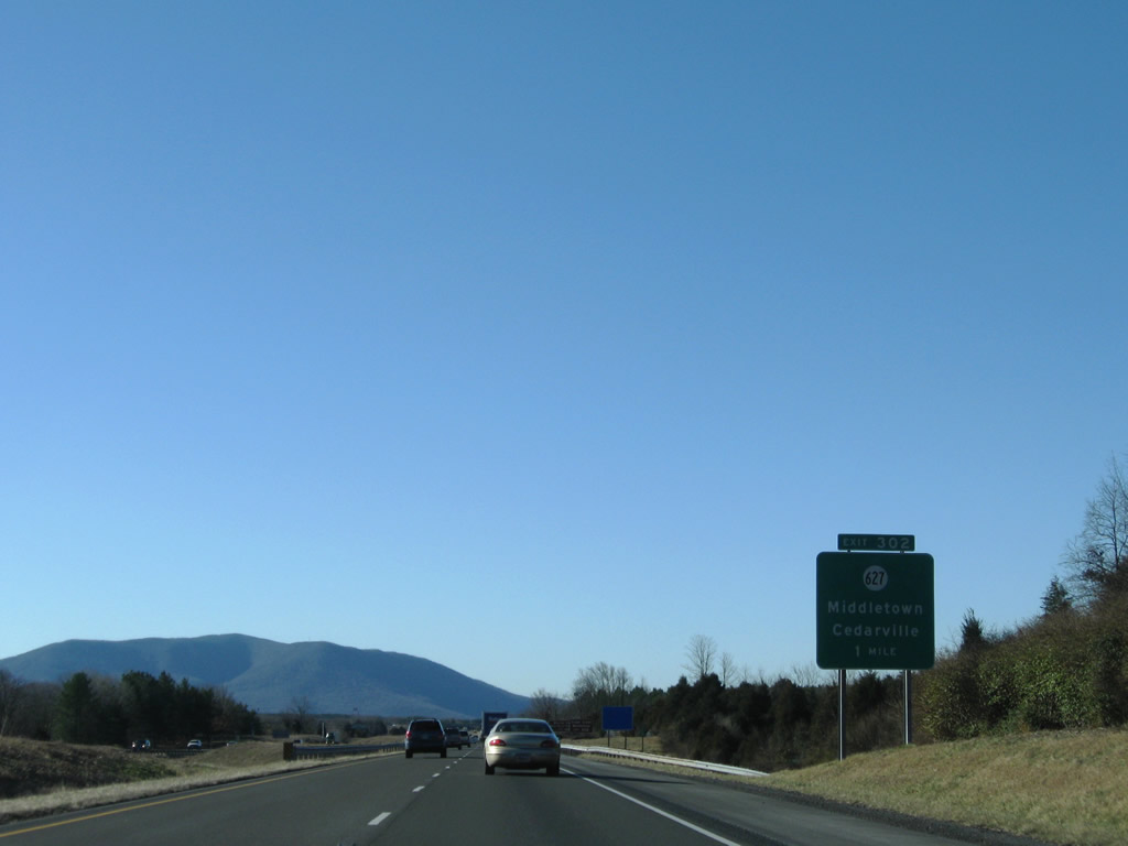
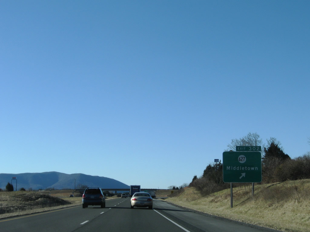
| Exit 302 connects Interstate 81 with SR 627 (Reliance Road) on the east side of Middletown. 12/30/08 |
|
| SR 627 (Reliance Road) measures 6.43 miles in length from U.S. 11 (Main Street / Valley Pike) near Lord Fairfax Community College in Middletown east to U.S. 340-522 (Winchester Road) at Cedarville. 12/30/08 |
|
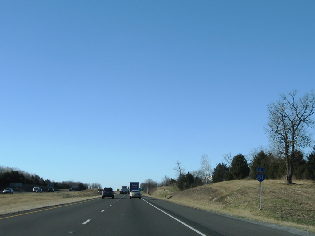
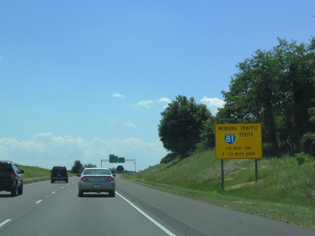
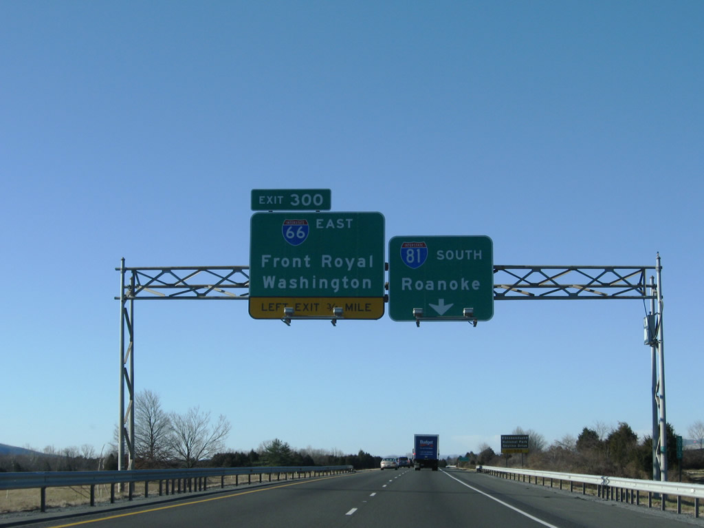
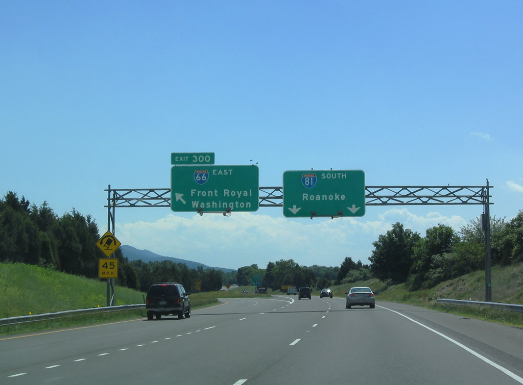
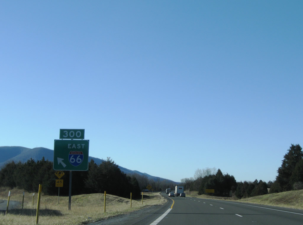
| I-81 south enters a three-wye interchange (Exit 300) with Interstate 66 east to Washington, D.C. in 1.25 miles. 12/30/08 |
|
| Interstate 81 straddles the southern town limits of Middletown ahead of Cedar Creek Battlefield. 12/30/08 |
|
| Interstate 81 turns west across northern Warren County for 1.29 miles leading to Strasburg. 12/30/08 |
|
| The entrance ramp from I-66 west at Exit 300 merges onto the left side Interstate 81 south. 06/01/04 |
|
| Interstate 66 travels 75.16 miles across Northern Virginia from Left Exit 300 to the Theodore Roosevelt Bridge spanning the Potomac River into Washington, DC. 12/30/08 |
|
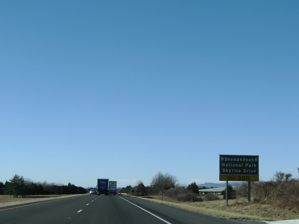
| I-66 east to U.S. 340/522 south through Front Royal represents first of several connections from I-81 to Shenandoah National Park and the scenic Skyline Drive. 12/30/08 |
|
| Interstate 66 heads six miles east from I-81 to U.S. 340/522 near Front Royal and the Virginia Inland Port, and 64 miles to the Capital Beltway (I-495). 06/01/04, 12/30/08 |
|
| Interstate 81 through northern Warren County passes between sections of Cedar Creek & Belle Grove National Historical Park. 08/06/13 |
|
| U.S. 11 (Old Valley Pike) and I-81 cross paths again at a diamond interchange (Exit 298) along the Strasburg town line. 08/06/13 |
|
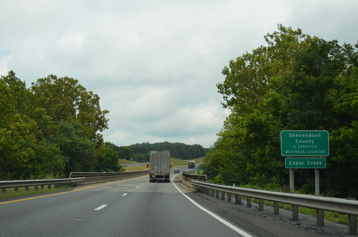
| Crossing Cedar Creek, Interstate 81 south enters Shenandoah County. 08/06/13 |
|
| U.S. 11 (Old Valley Pike) angles southwest across Hupp Hill to N Massanutten Street and an overlap with SR 55 into Downtown Strasburg. 08/06/13 |
|
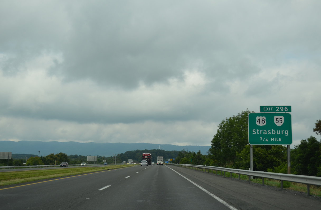
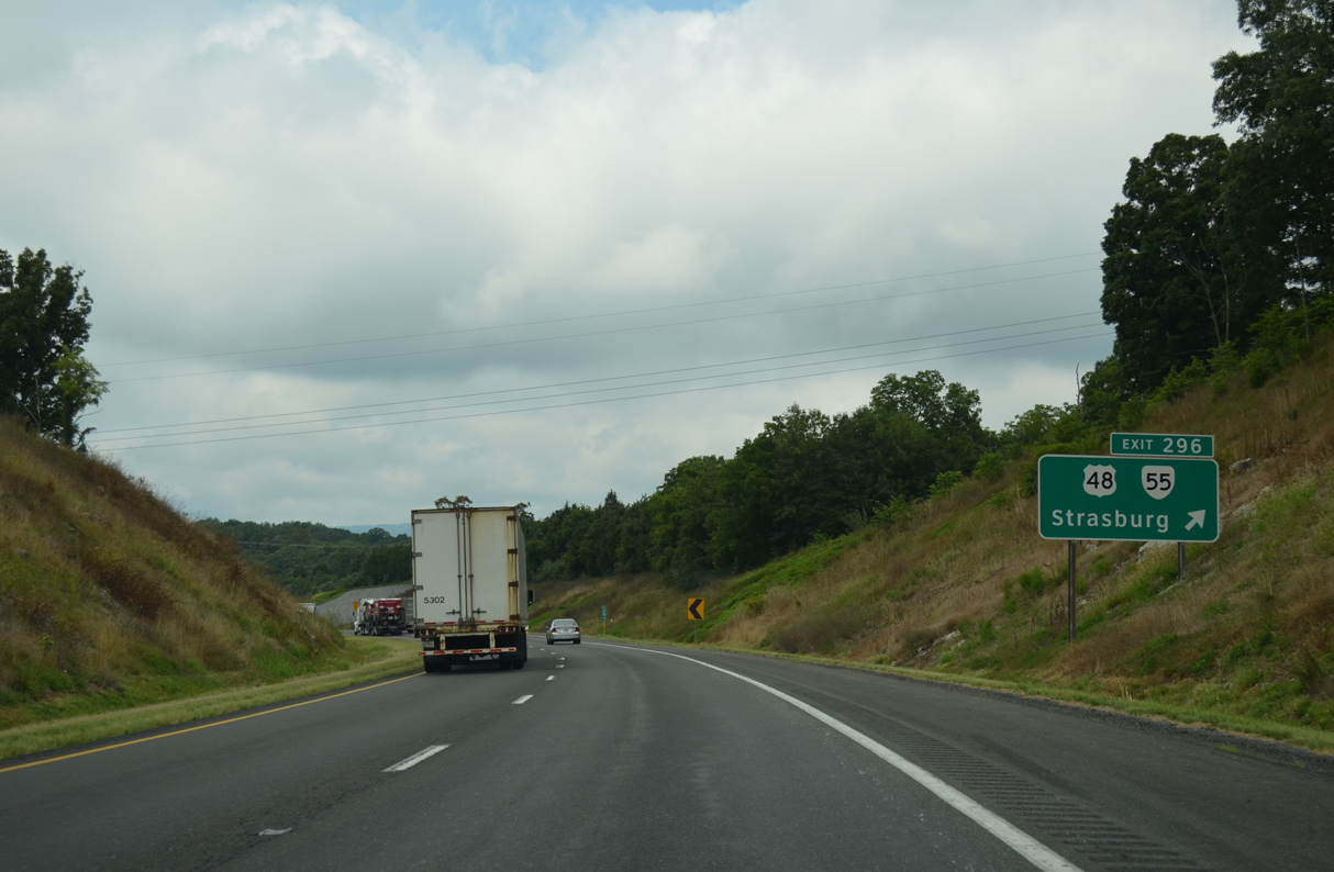
| U.S. 48 and SR 55 meet I-81 south at the succeeding exit. Designated in 2003 and developed as part of Appalachian Regional Development Corridor H, U.S. 48 forms an expressway west from the West Virginia state line toward Elkins. 08/06/13 |
|
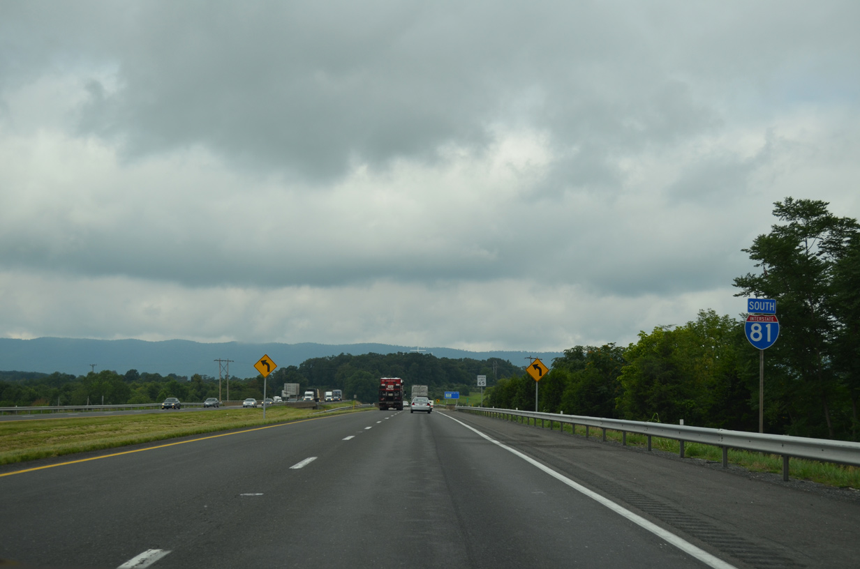
| Interstate 81 curves westward along the Strasburg town line to the diamond interchange (Exit 296) with U.S. 48 west and SR 55 (John Marshall Highway). 08/06/13 |
|
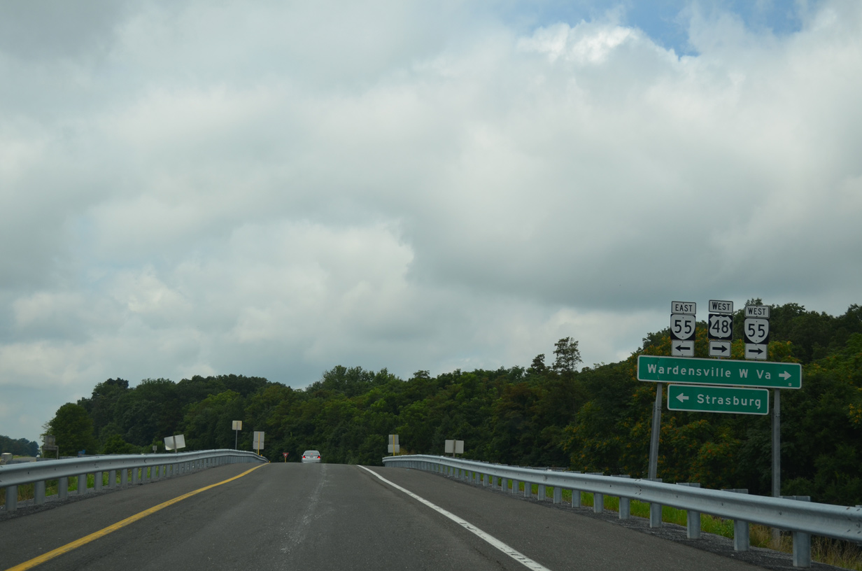
| U.S. 48/SR 55 wind 14.42 miles northwest from Exit 296 across Little North Mountain to the West Virgini line on Great North Mountain. Continuing west to Wardensville, U.S. 48 upgrades to a four lane expressway built for Corridor H. 08/06/13 |
|
| SR 55 forms a multi state highway with West Virginia Route 55 alongside U.S. 48. East beyond Strasburg, SR 55 parallels Interstate 66 from Front Royal to U.S. 29 at Gainesville. 08/06/13 |
|
| The Cedar Spring subdivision in Strasburg was constructed along the south side of I-81 and west of SR 55 (John Marshall Highway) in 2019/20. 08/06/13 |
|
| Interstate 81 and U.S. 11 parallel the Shenandoah River North Fork southwest 14 miles to the town of Woodstock. 08/06/13 |
|
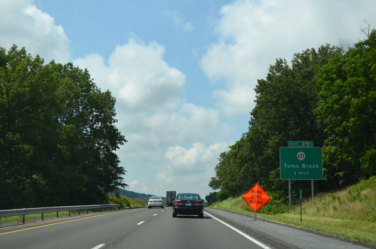
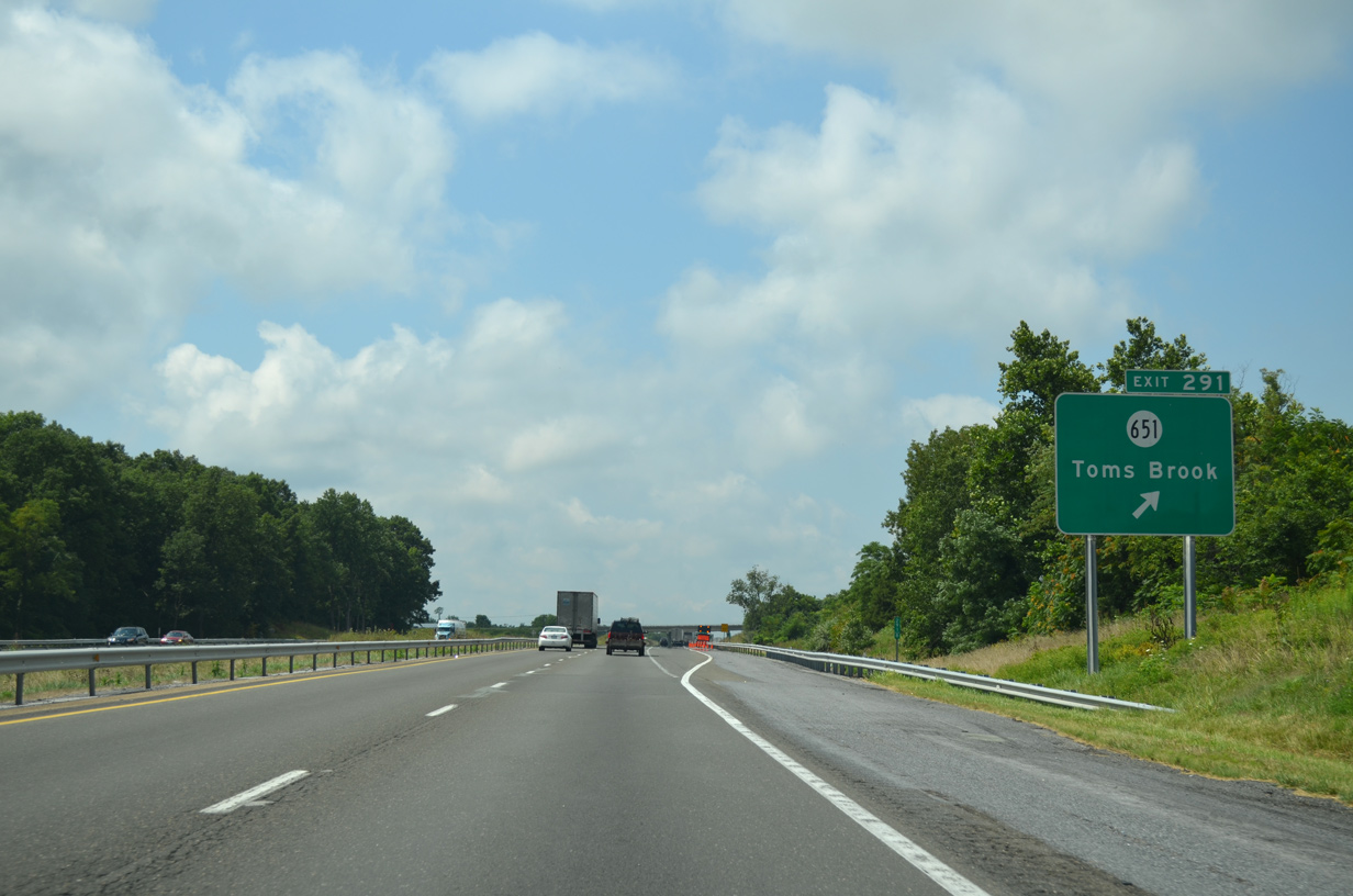
| I-81 south next meets SR 651 (Mount Olive Road) west 1.35 miles to Mount Olive and east 0.97 miles to U.S. 11 near Toms Brook in one mile. 08/06/13 |
|
| The diamond interchange (Exit 291) with SR 651 (Mount Olive Road) is adjacent to Round Hill and north of the town of Toms Brook. 08/06/13 |
|
| Passing below the SR 653 (Brook Creek Road) overpass, Interstate 81 continues southwest between Harrisville and Toms Brook. 08/06/13 |
|
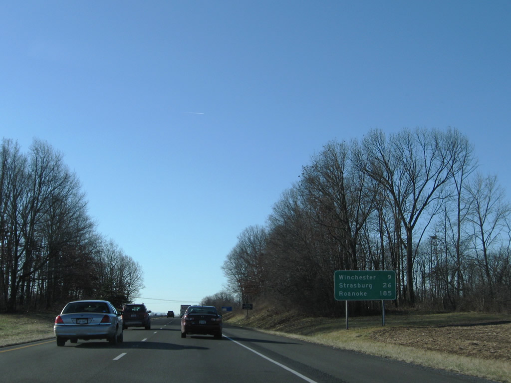
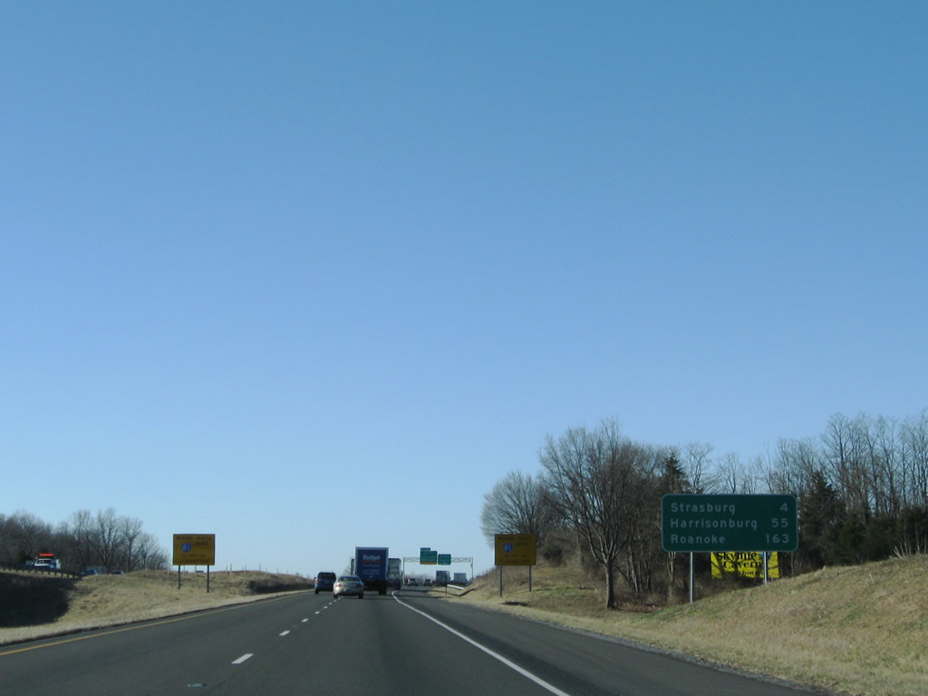
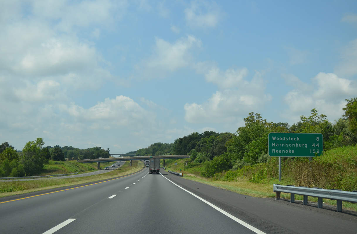
| Woodstock, the Shenandoah County seat, follows in eight miles. Roanoke is 146 miles further. 08/06/13 |
|
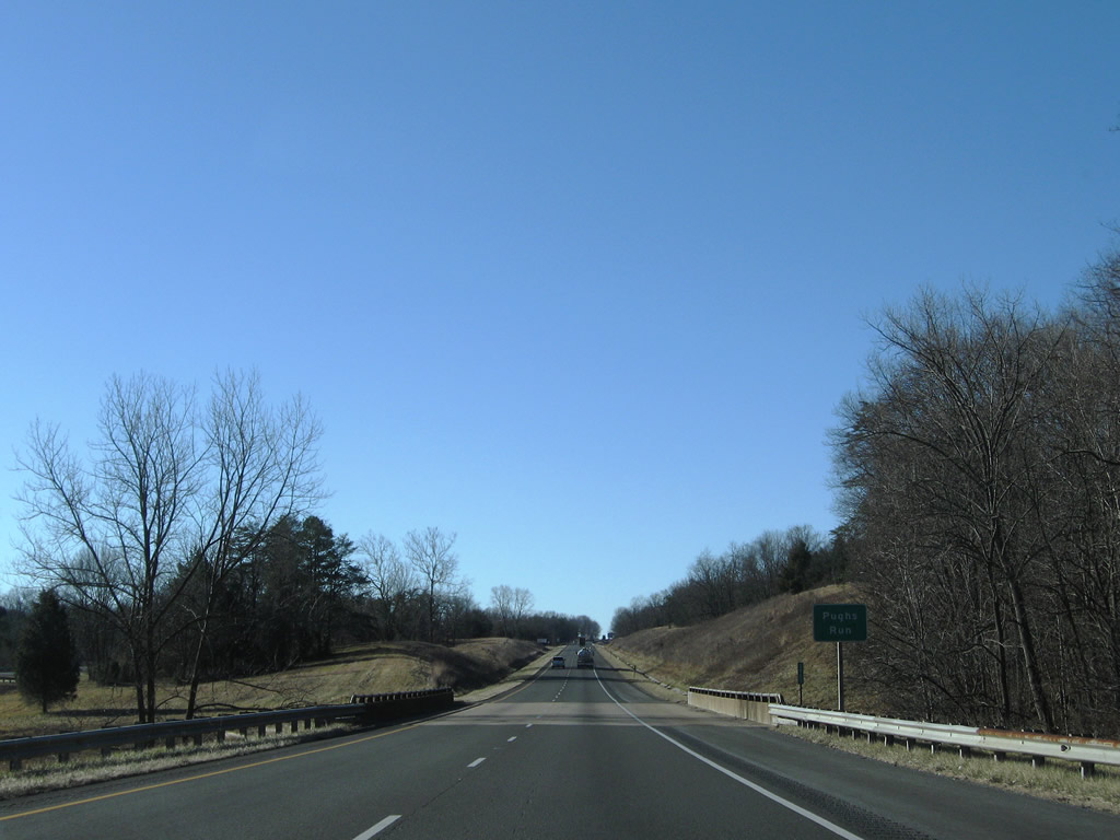
| Interstate 81 expands with a wide median at Pughs Run, northwest of Cox Ridge and the Seven Bends along the North Fork of the Shenandoah River. 12/30/08 |
|
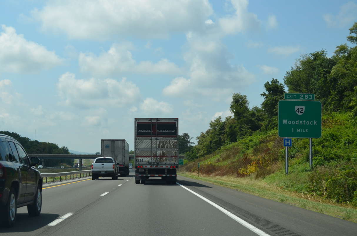
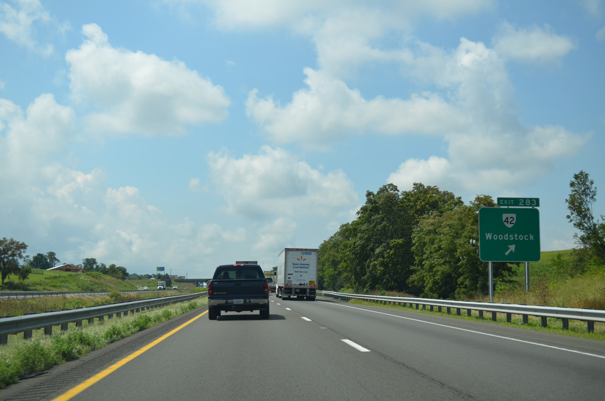
| Originating from U.S. 11 (Main Street), 0.70 miles to the east in Woodstock, SR 42 (Reservoir Road) loops west to Columbia Furnace near Threemile Mountain and south to Forestville. 08/06/13 |
|
| Split into four sections, SR 42 collectively measures 271.63 miles from Woodstock south to SR 91 at Broadford. The northern leg stretches 119.16 miles southwest to Harrisonburg, Bridgewater and I-64/U.S. 60 at SR 269 (Exit 29) near Clifton Forge. 08/06/13 |
|
| Interstate 81 leaves the town of Woodstock at the Hoover Road (SR 605) overpass. Massanutten Mountain rises along the eastern horizon. 12/30/08 |
|
| 18 miles from Woodstock, New Market lies in the southeastern corner of Shenandoah County, west of Massanutten Mountain. 08/06/13 |
|
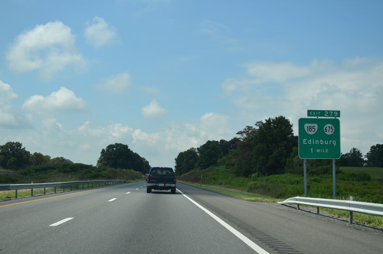
| A 1.00 mile long major collector, SR 185 (Stoney Creek Road) connects I-81 at Exit 279 with U.S. 11 (Main Street) in the town of Edinburg. 08/06/13 |
|
| SR 675 (Stony Creek Road) runs 4.63 miles north of the diamond interchange at Exit 279 to Lantz Mills and SR 42 (Sendo Road) at Columbia Furnace. SR 675 extends east from U.S. 11 to Edinburg Gap between Short and Powell Mountains. 08/06/13 |
|
| Confirming marker posted south of Stoney Creek and the entrance ramp from SR 185/SR 675 (Stoney Creek Road). 08/06/13 |
|
| Harrisonburg lies midway between New Market and Staunton along Interstate 81 south within Rockingham County. 08/06/13 |
|
| A half diamond interchange (Exit 277) links SR 614 (S Middle Road) with I-81 south from U.S. 11 (Old Valley Pike) at Bowmans Crossing. I-81 proceeds 12 miles from the entrance ramp to New Market. 08/06/13 |
|
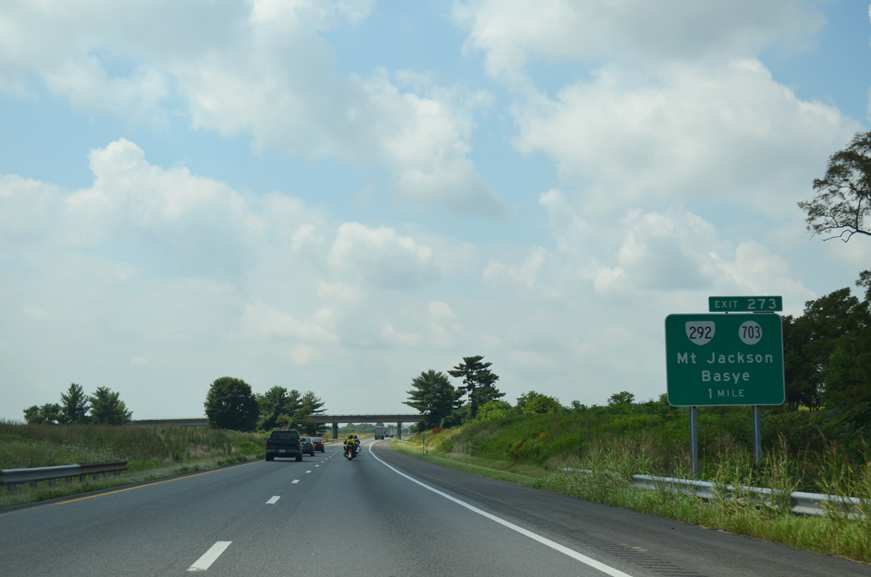
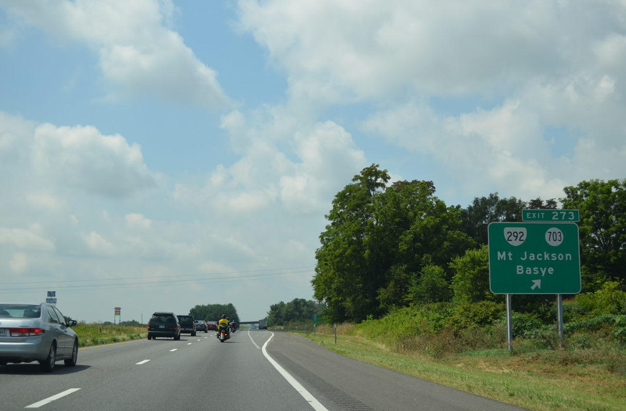
| Interstate 81 next meets SR 292 (Conicville Road) east and SR 703 (Mount Jackson Road) west at a diamond interchange (Exit 273). 08/06/13 |
|
| SR 292 (Conicville Boulevard) comprises a 0.39 mile long collector from Exit 273 east to parallel U.S. 11 (Old Valley Pike) in the town of Mount Jackson. SR 703 (Mount Jackson Road) heads 1.28 miles west to SR 614 (S Middle Road), north of SR 263 at Rinkerton. 08/06/13 |
|
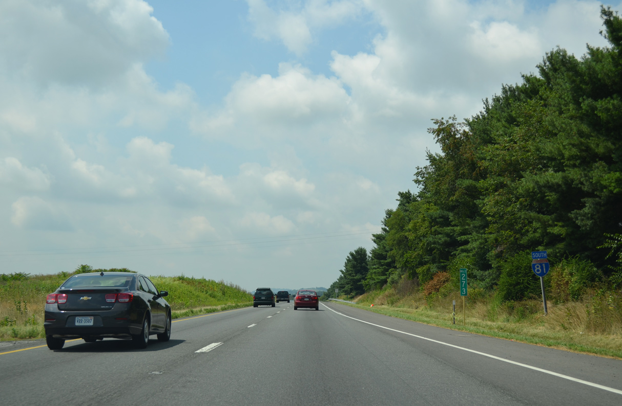
| Interstate 81 curves around the west side of Mt. Jackson, spanning Mill Creek and SR 263 (Orkney Grade / Bryce Boulevard) eight miles from New Market. 08/06/13 |
|
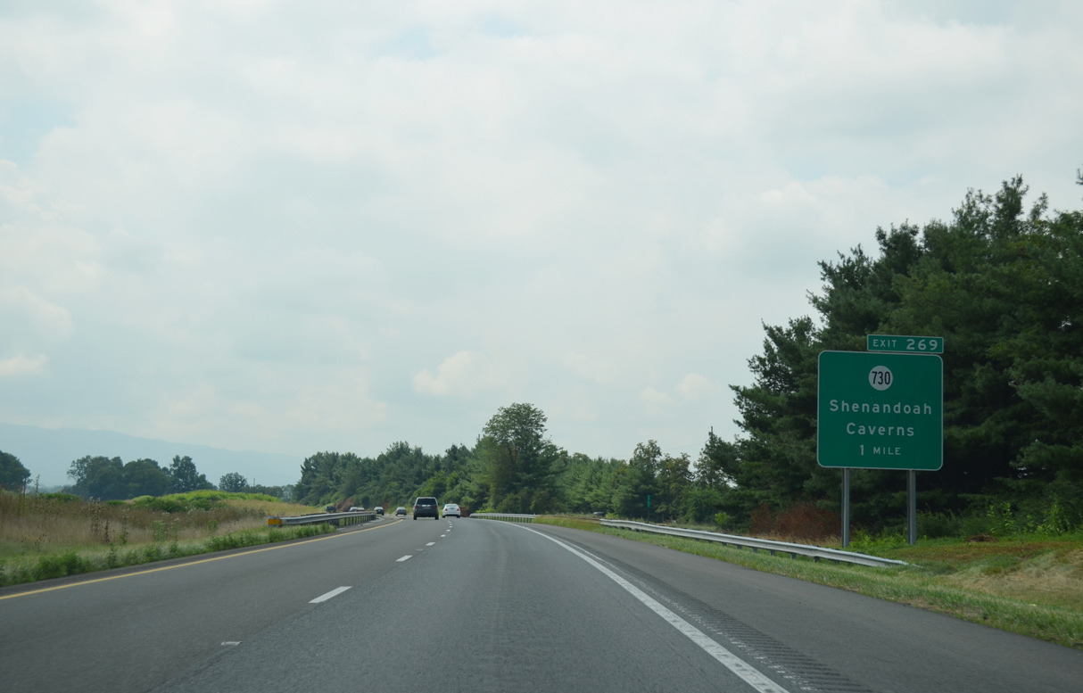
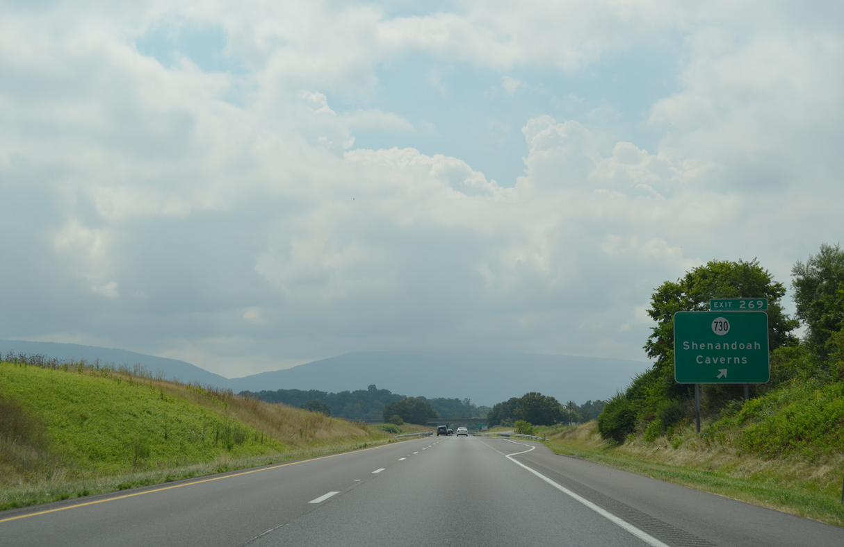
| A series of S-curves lead I-81 south from South Jackson between Shenandoah Caverns and the Shenandoah River North Fork to a diamond interchange (Exit 269) with SR 730 (Caverns Road). 08/06/13 |
|
| SR 730 crosses the Shenandoah River North Fork east 0.56 miles to U.S. 11 (Old Valley Pike) between Rudes Hill and Locust Grove. SR 730 (Caverns Road) continues northwest 1.38 miles to Shenandoah Caverns and SR 698 (Turkey Knob Road) near Williamsville. 08/06/13 |
Photo Credits:06/01/04, 07/16/05, 12/30/08, 08/06/13 by AARoads
Connect with:
Interstate 66
U.S. 11
U.S. 17
U.S. 48
U.S. 522
State Route 7
State Route 37
Page Updated 04-30-2021.

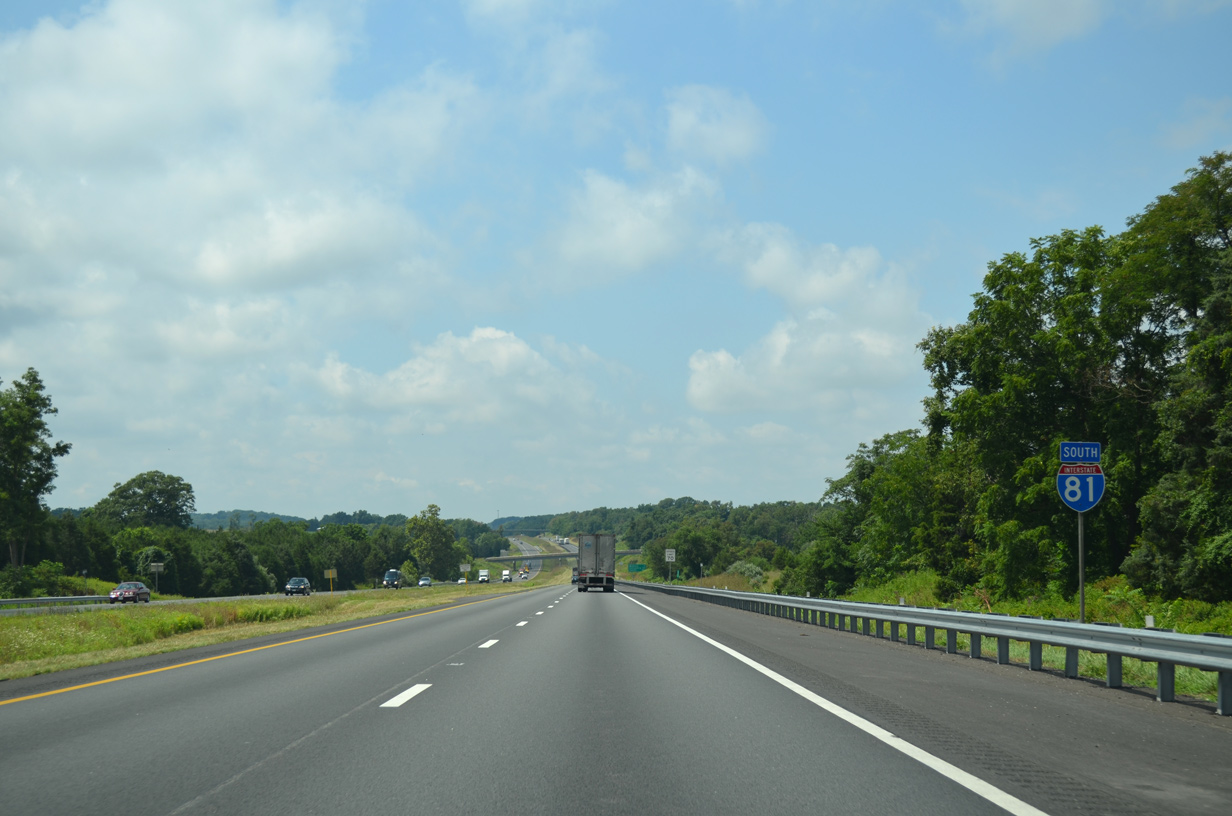
 South
South