|
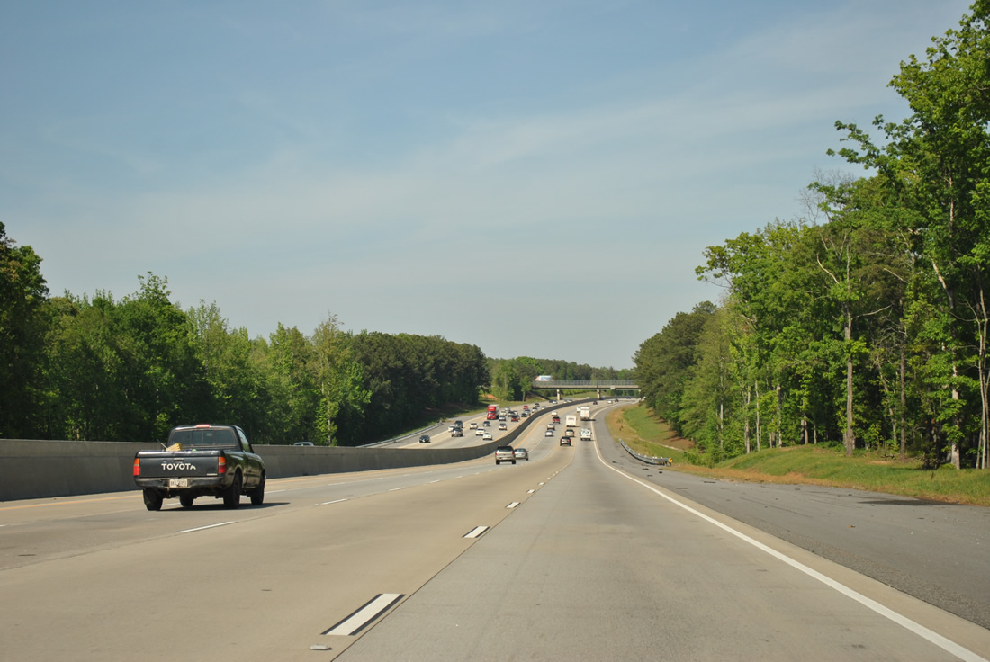
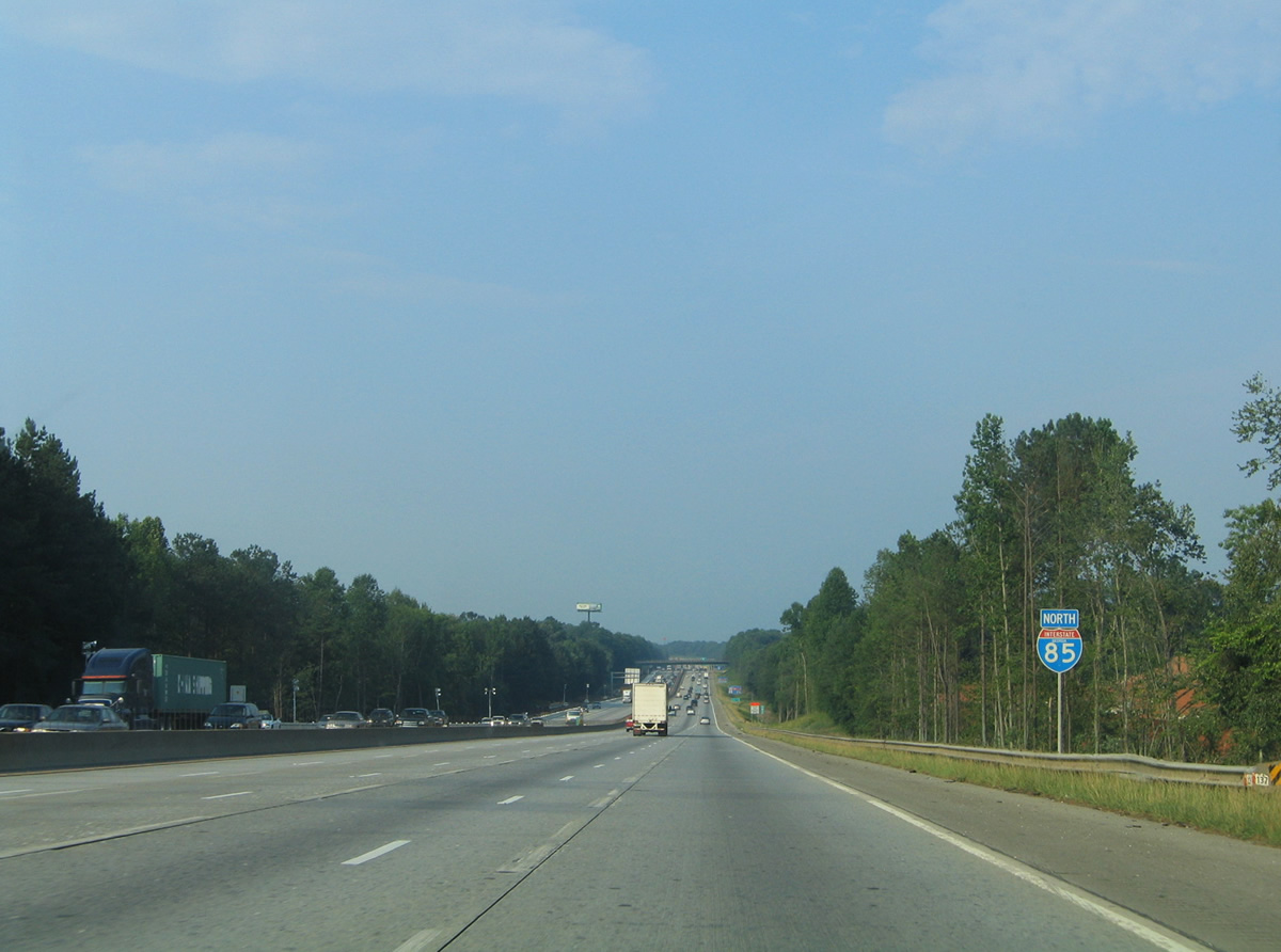
| Interstate 85 straddles the Fairburn and Palmetto city line to the Johnson Road overpass. 04/13/12 |
|
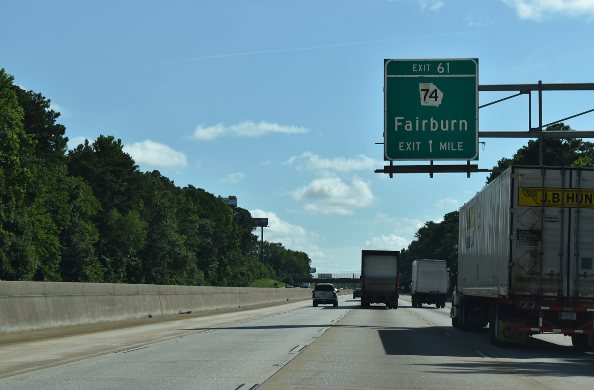
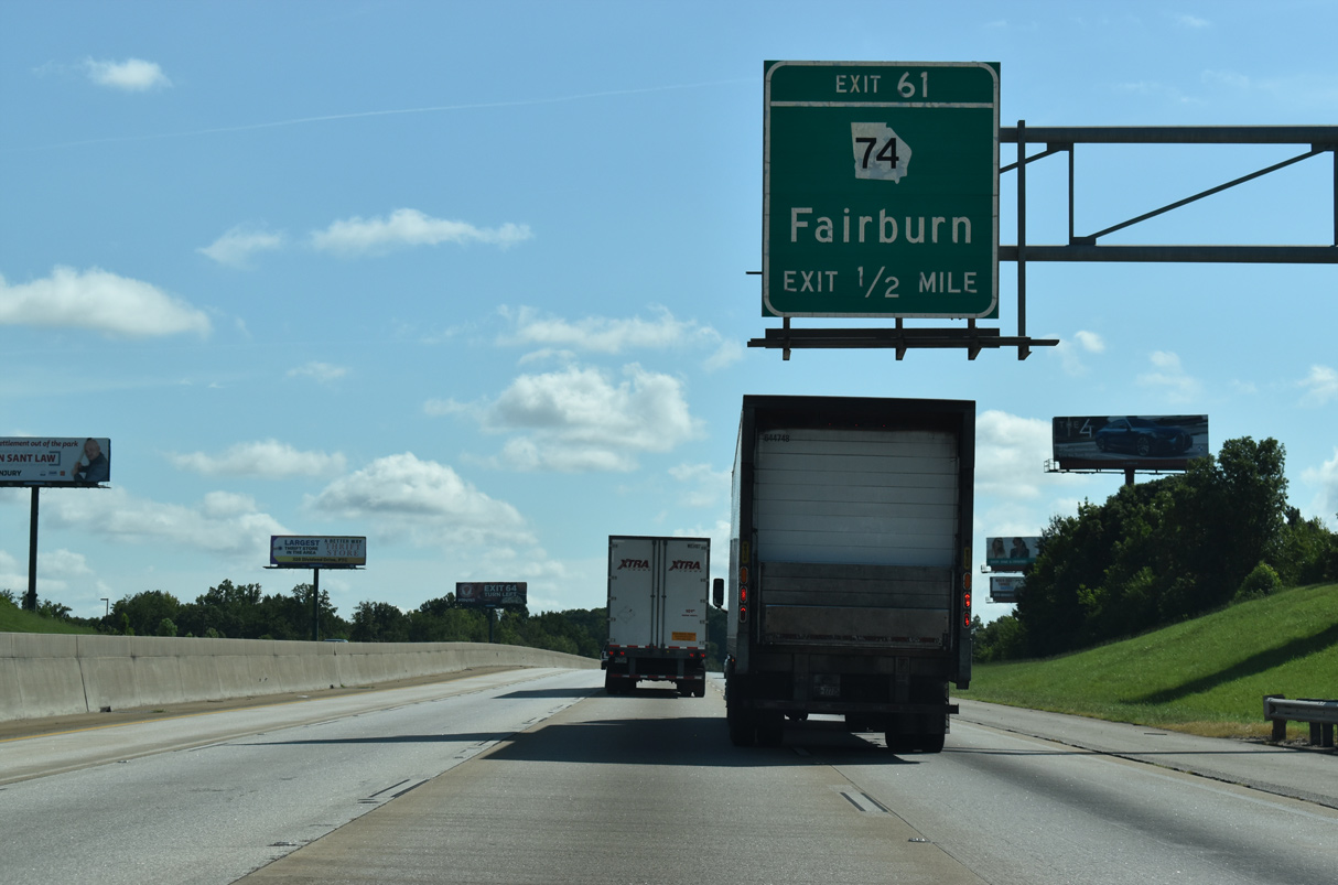
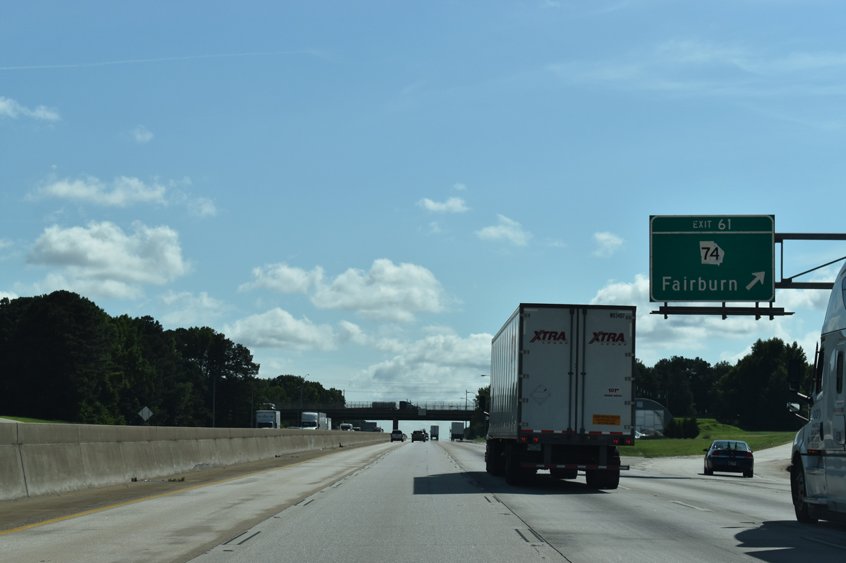
| A diamond interchange (Exit 61) joins Interstate 85 with SR 74 (Senoia Road) in one mile. A four lane highway, SR 74 is the main route between Fairburn, Tyrone and Peachtree City. 07/26/22 |
|
| SR 74 concludes just 1.25 miles north of Exit 61 at a grade separated intersection with U.S. 29/SR 14 (Roosevelt Highway) and Virlyn B. Smith Road in Fairburn. The east end of the state route is at I-75 (Exit 163) within the city limits of Macon. 07/26/22 |
|
| Senoia Road splits with SR 74 at Fairburn Industrial Boulevard just north of Exit 61. Southward SR 74 runs 4.5 miles to Tyrone. 07/26/22 |
|
| Reassurance shield that was posted after the SR 92 (Spence Road) over crossing on Interstate 85 north. There is no direct access to SR 92 from the freeway. 06/21/05 |
|
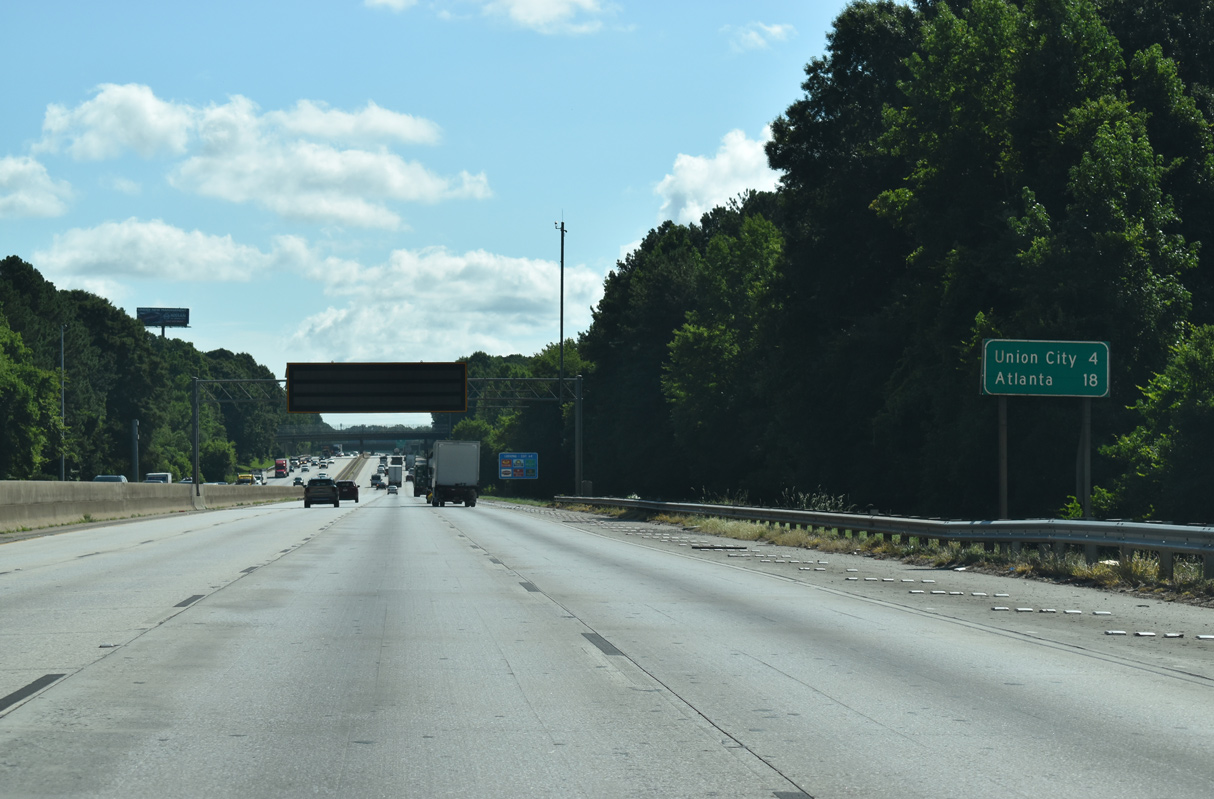
| Northbound travelers on I-85 next reach Union City in four miles, followed by Downtown Atlanta in 18 miles. Dynamic message boards provide travel times to I-285. 07/26/22 |
|
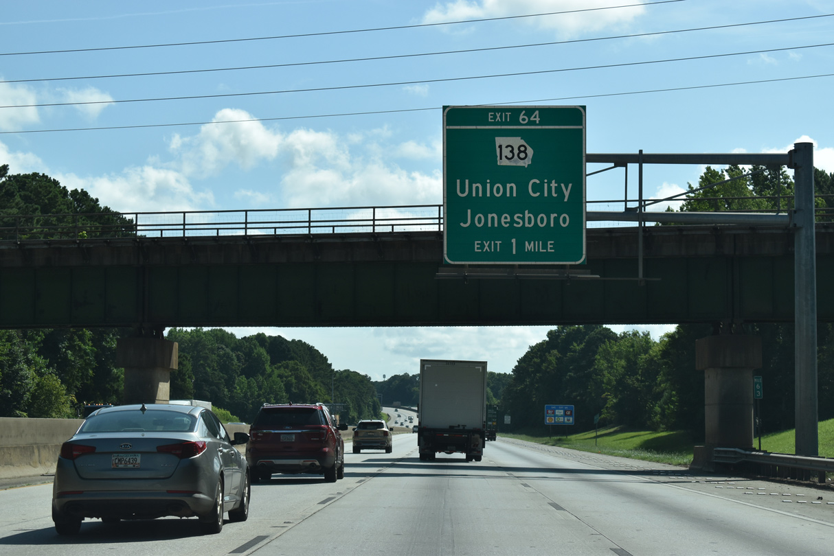
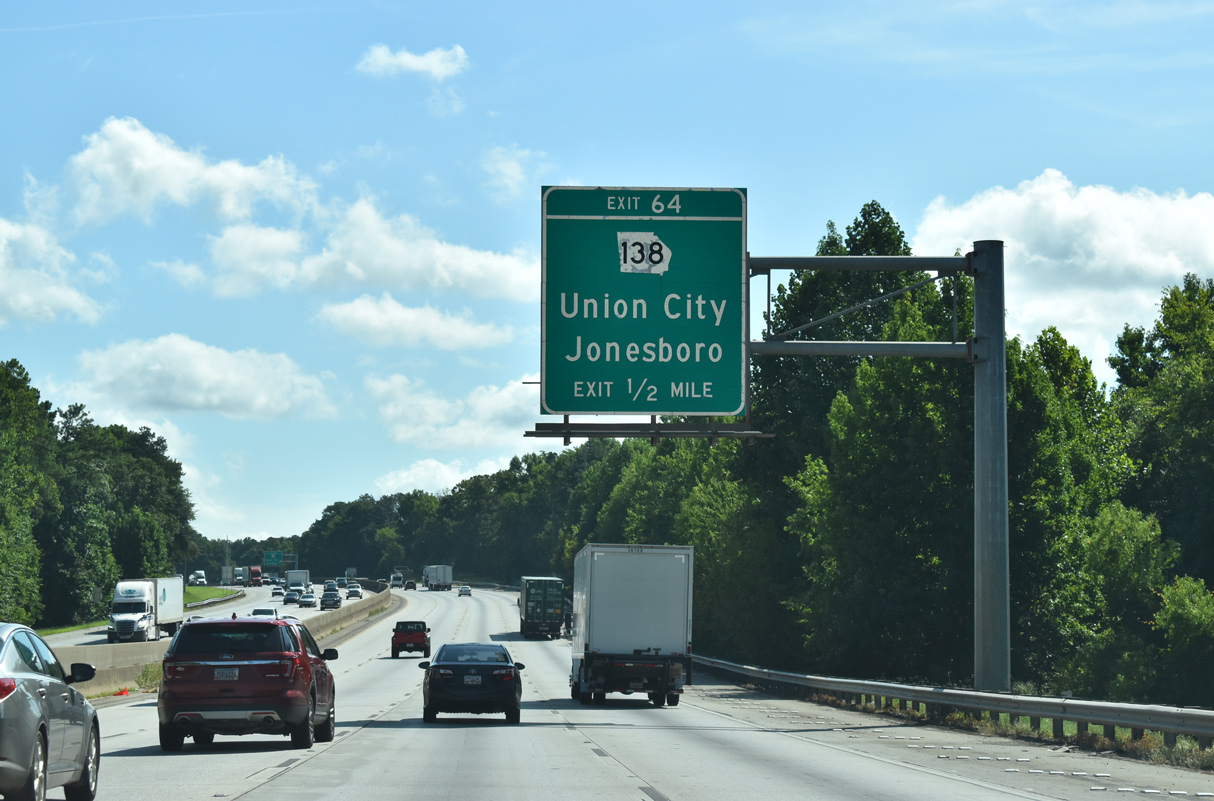
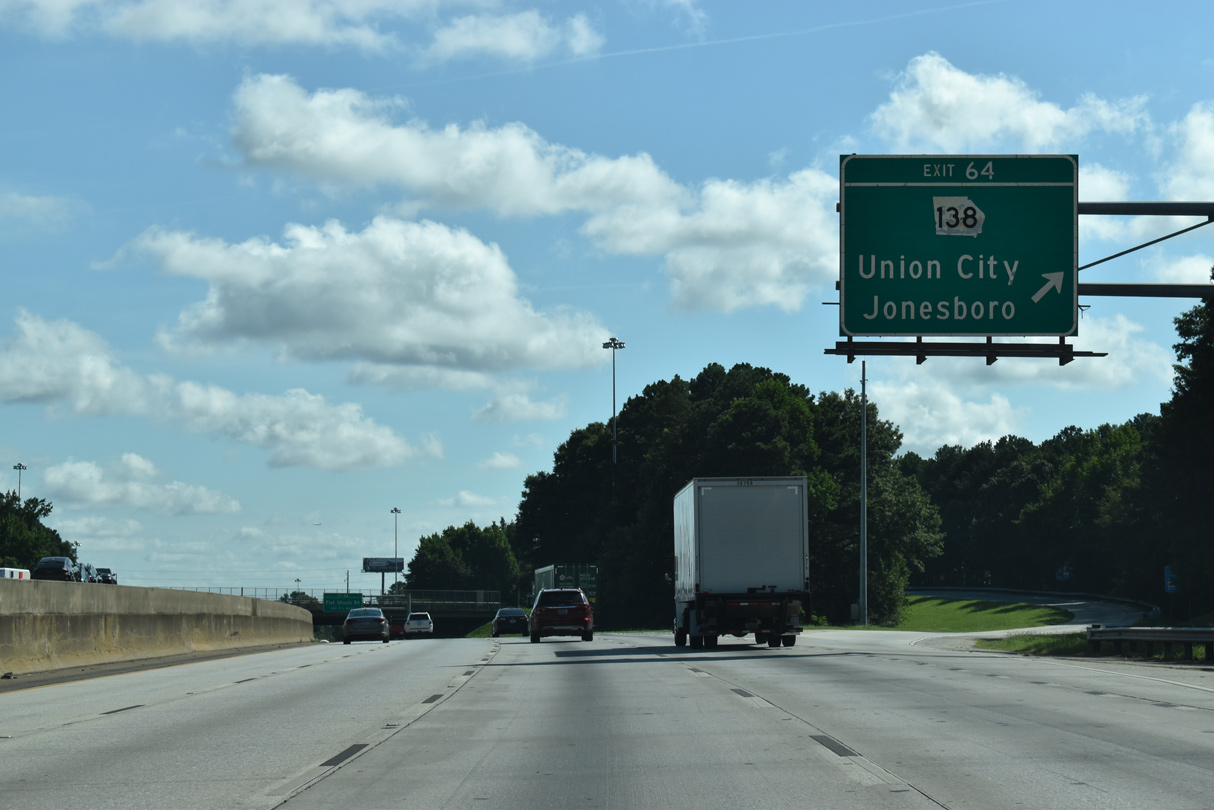
| I-85 advances one mile from a CSX Railroad overpass to Exit 64 with SR 138 (Jonesboro Road), an arterial between the suburban Union City and Jonesboro. Union Station Mall, formerly Shannon South Park Mall, lies northwest of the forthcoming exchange. The retail center changed owners in 2006 and names in 2007, but ultimately succumbed to economic woes and closed on November 3, 2010.1 07/26/22 |
|
| SR 138 begins 3.7 miles to the west at SR 92 (Campbellton-Fairburn Road) in north Fairburn. Beverly Ingram Parkway carries the state route east between Fairburn and Union City onto the retail strip of Jonesboro Road leading to Interstate 85. 07/26/22 |
|
| Jonesboro Road carries SR 138 east five miles from Exit 64 to SR 279 (Old National Highway), eight miles to SR 85 near Riverdale, and 12 miles to U.S. 19/41 at Jonesboro. 07/26/22 |
|
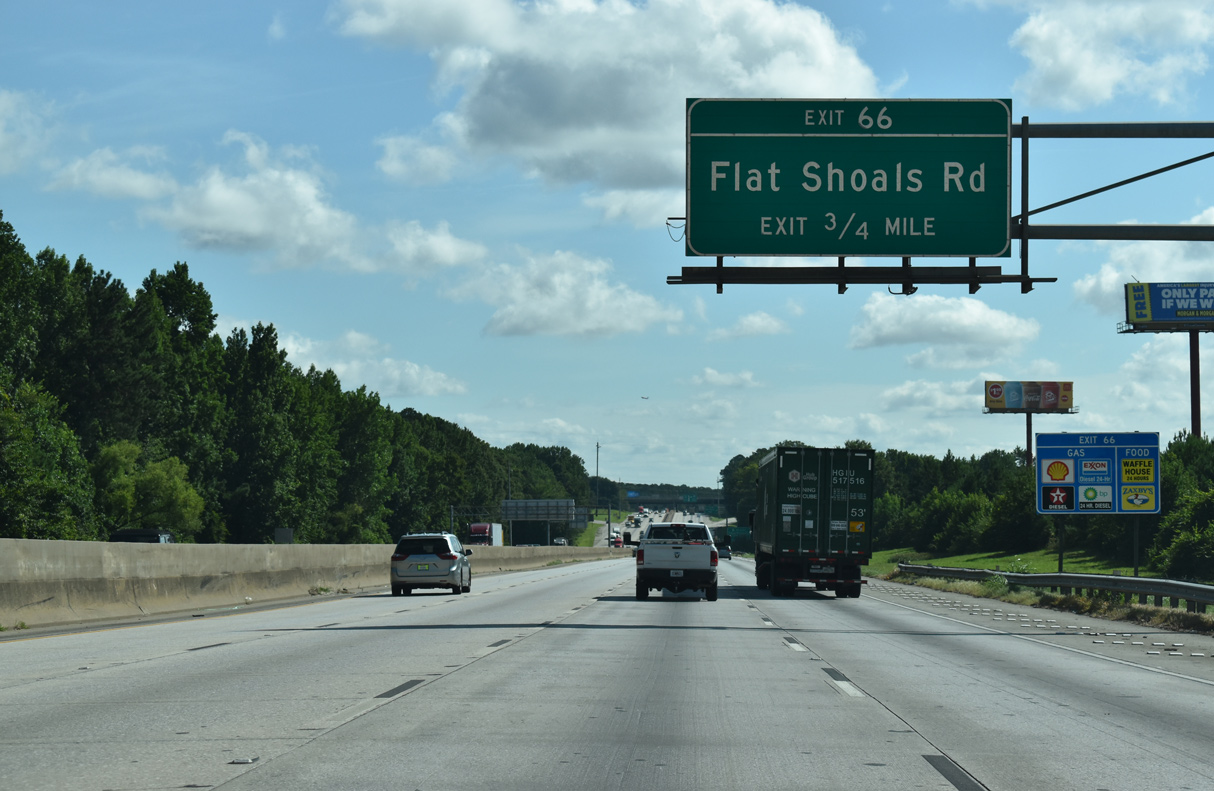
| The final exit outside of the Atlanta Perimeter Highway (Interstate 285) joins I-85 with Flat Schoals Road 1.5 miles north of SR 138. 07/26/22 |
|
| Flat Schoals Road leads east from Westbrook Avenue, adjacent to U.S. 29/SR 14 at Union City, to SR 279 (Old National Highway) and SR 314 (Fayetteville Road) as Creel Road. 07/26/22 |
|
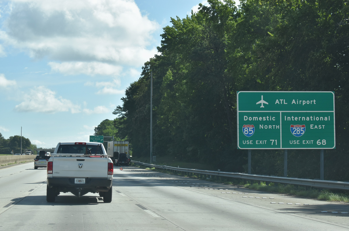
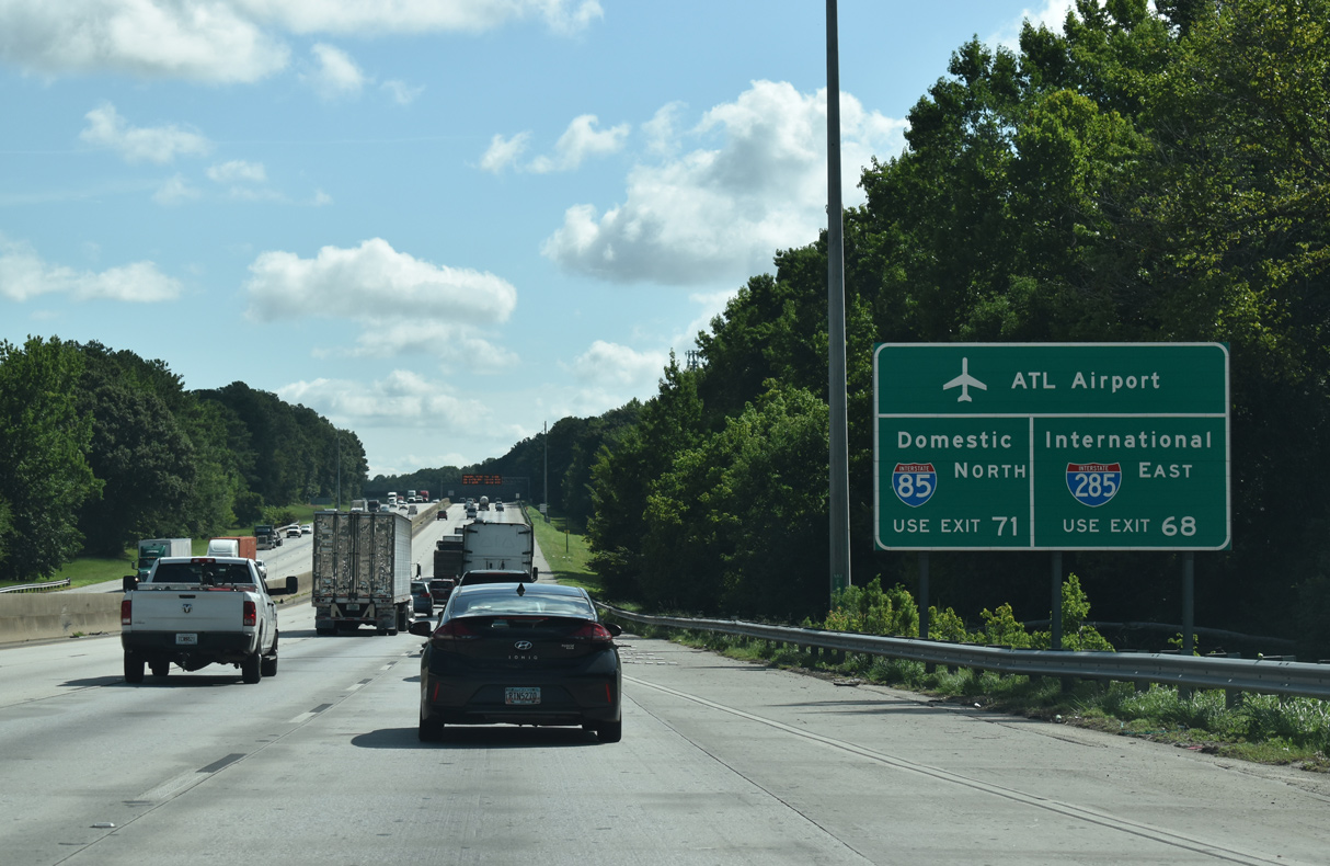
| Located on the east side of Hartsfield-Jackson International Airport (ATL), the 1.2 million square feet international terminal opened opened on May 16, 2012. Over 100 signs were installed throughout the Atlanta metropolitan area to redirect travelers bound for the Maynard H. Jackson International Terminal to I-75, including this panel ahead of Flat Schoals Road.2 07/26/22 |
|
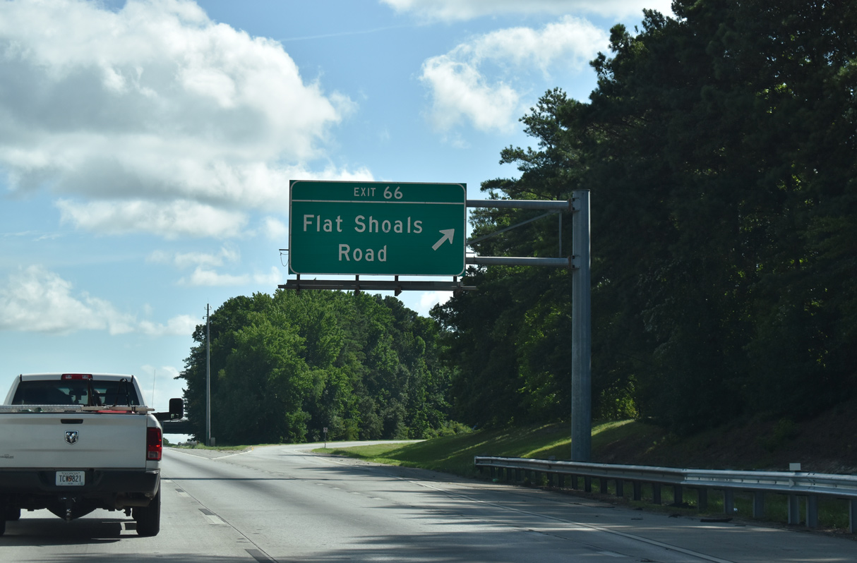
| Exit 66 leaves Interstate 85 northbound for Flat Schoals Road. Connections with Feldwood Road links Flat Schoals Road with Red Oak along U.S. 29/SR 14 to the north. 07/26/22 |
|
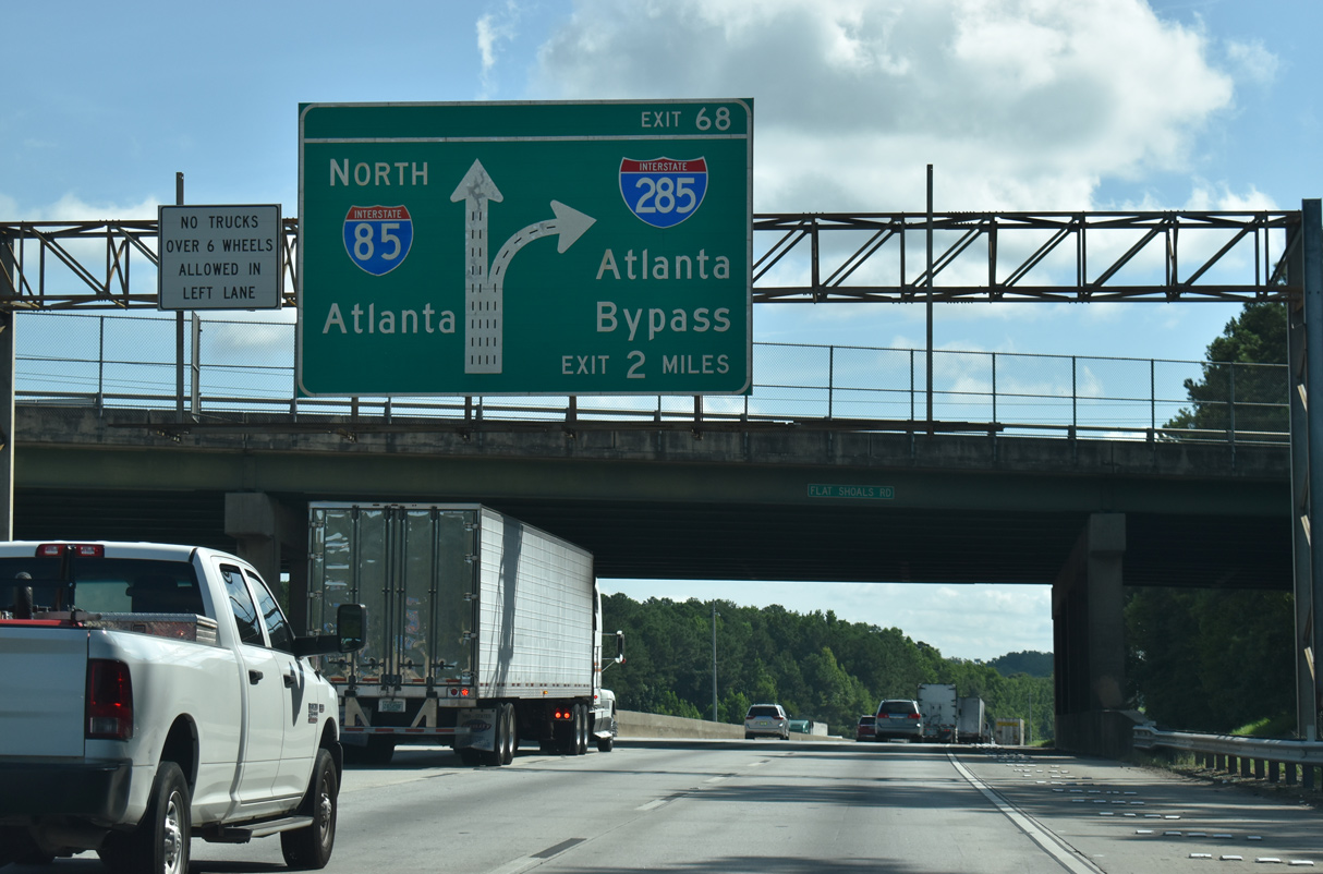
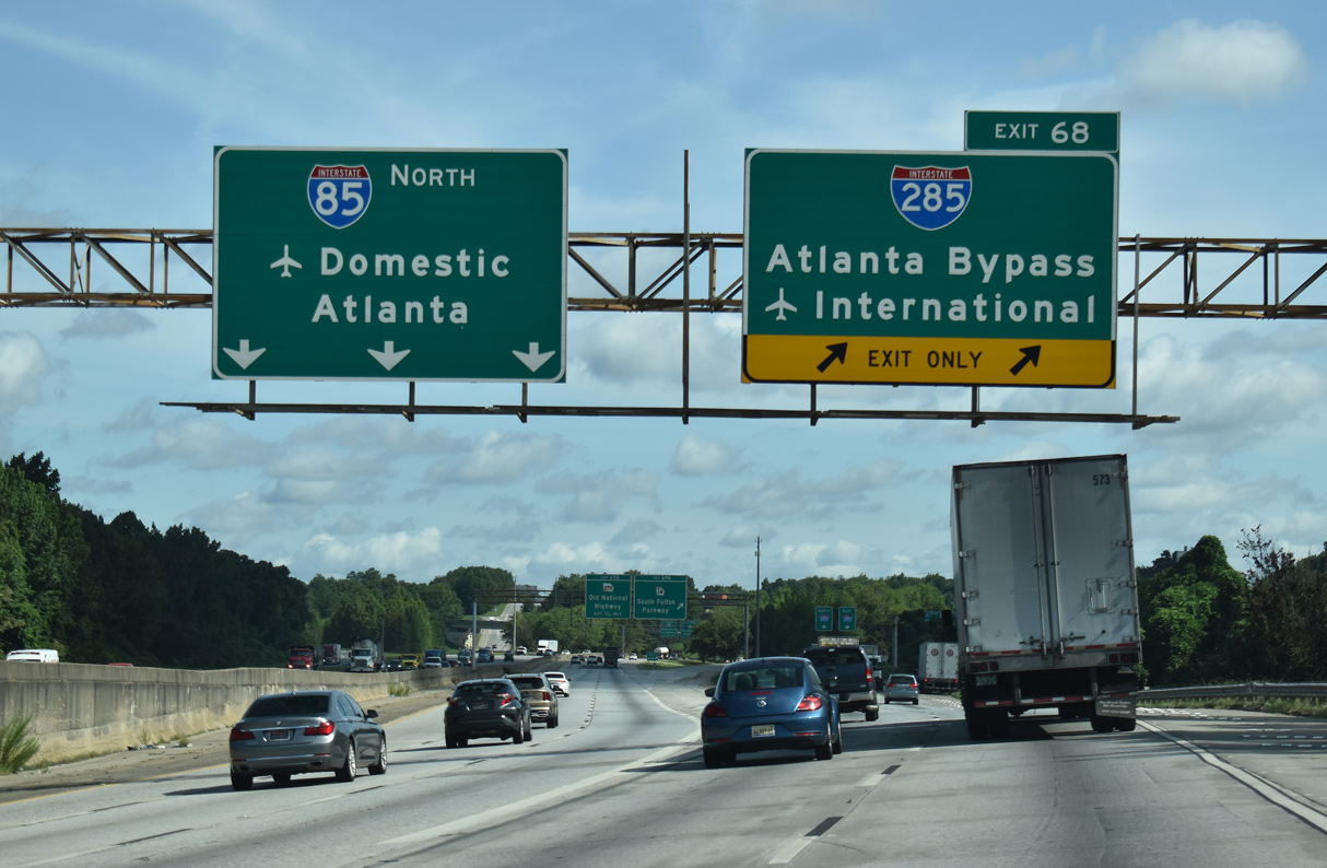
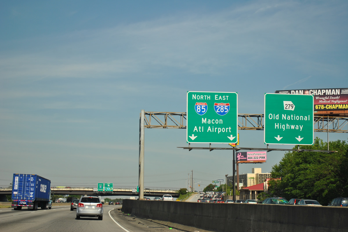
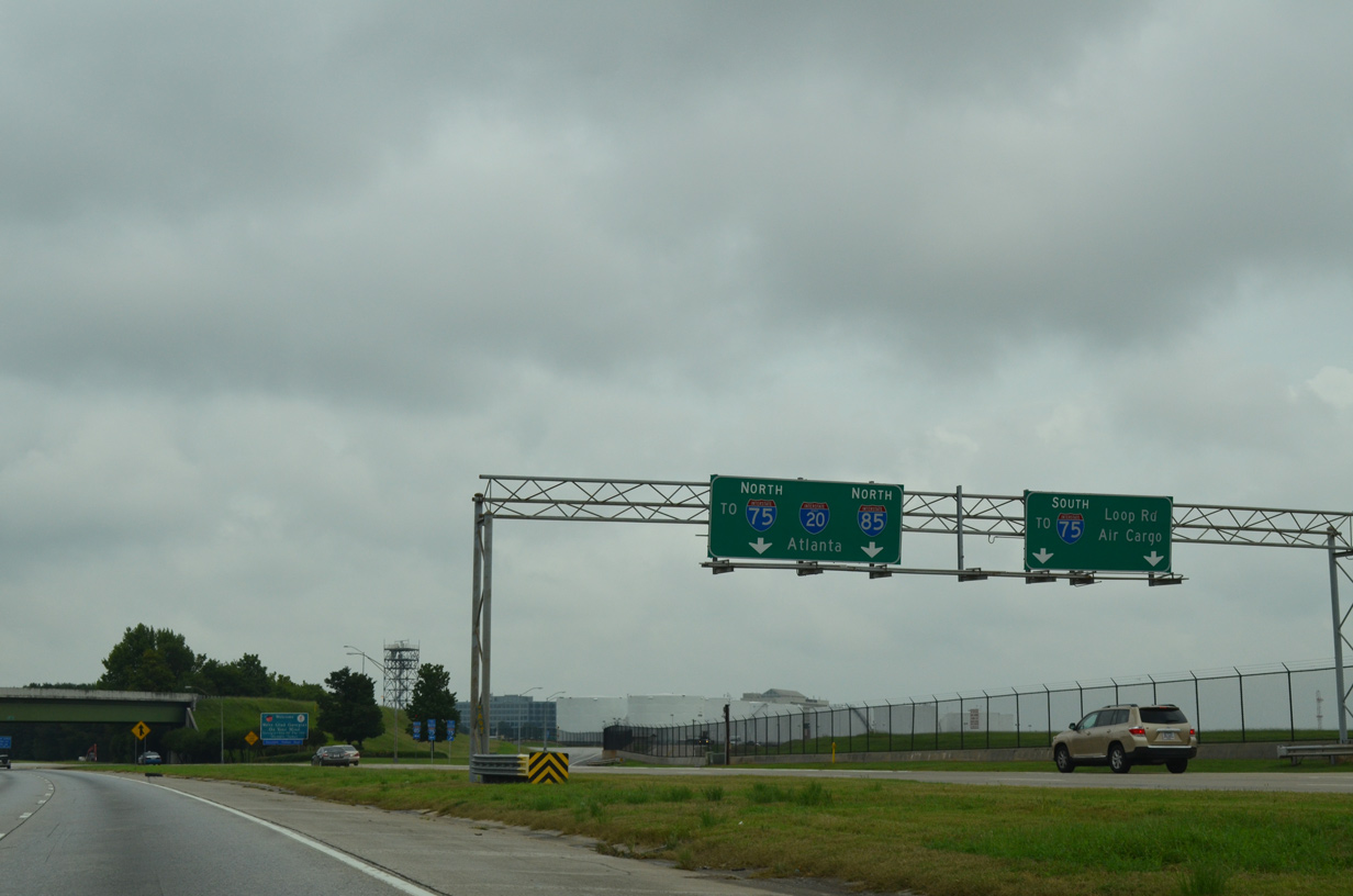
| I-85 meets Interstate 285 at the southwestern corner of the Perimeter Highway in two miles. A sprawling cloverstack interchange joins the two freeways while also providing access to SR 14CO (S Fulton Parkway) to the west. 07/26/22 |
|
| Motorists head to the international terminal at ATL Airport are directed onto I-285 east to Interstate 75 north. 07/26/22 |
|
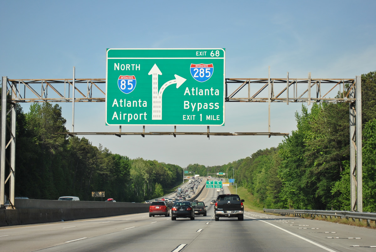
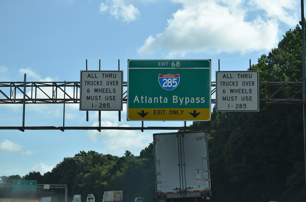
| Interstate 85 north expands to five lanes ahead of Exit 68. I-285, also known as the Atlanta Perimeter Highway, comprises a nearly 64 mile long beltway through western and northern Atlanta, and the eastern and southern suburbs of the city. 04/13/12 |
|
| SR 14CO leads west from Exit 69 A to U.S. 29/SR 14 (Roosevelt Highway). S Fulton Parkway extends west from there as an at-grade expressway around Union City and Fairburn. 07/26/22 |
|
| Through truck traffic is required to circumvent Atlanta along Interstate 285. 07/26/22 |
|
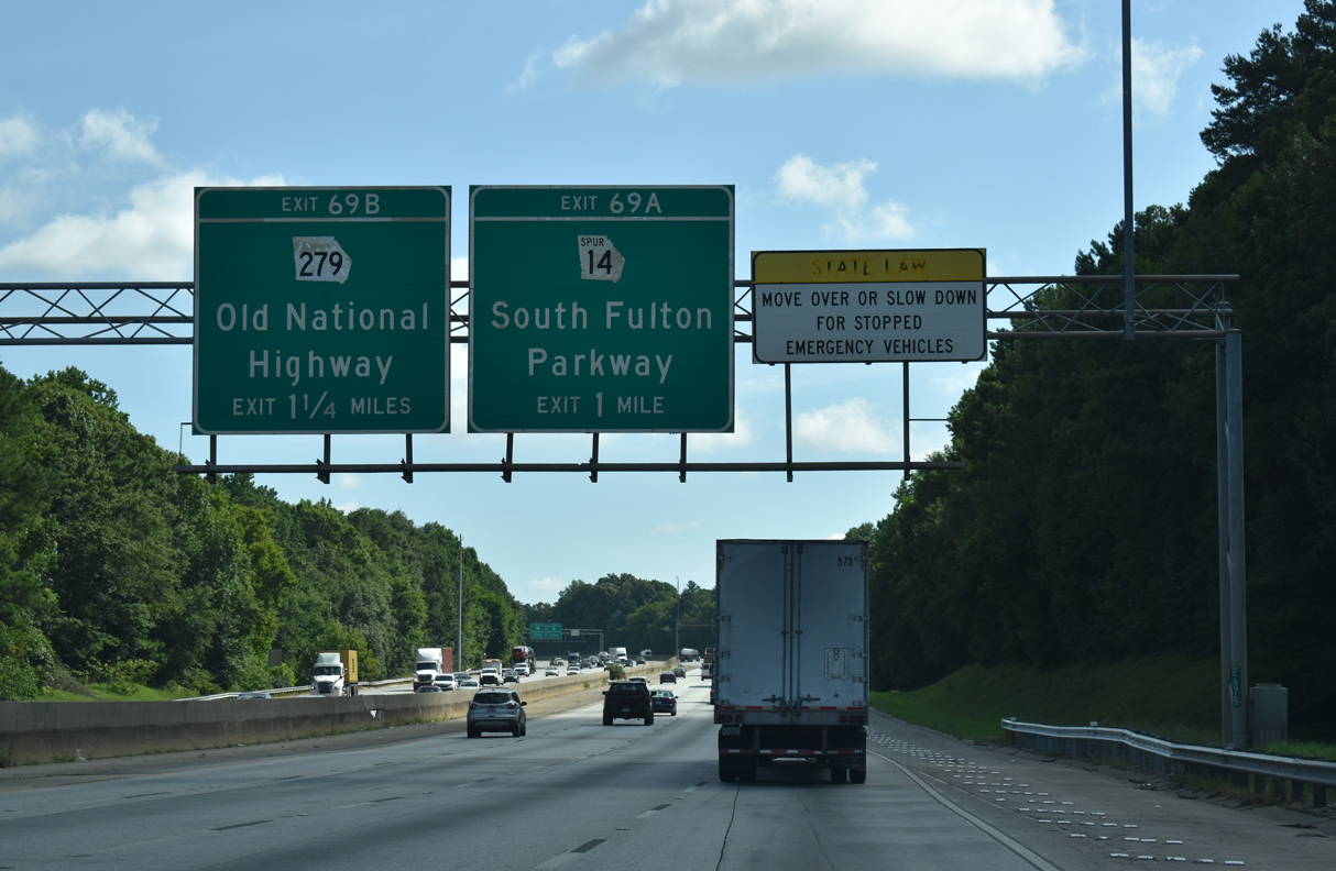
| Exit 69 A joins SR 14CO (S Fulton Parkway) just beyond the Exit 68 gore point. SR 14 Spur has interchanges with Buffington Road and U.S. 29/SR 14 (Roosevelt Highway) over the ensuing two miles west. S Fulton Parkway continues to SR 70 and SR 154. 07/26/22 |
|
| Entering the systems interchange with Interstate 285 and SR 14 Connector. Two lanes join the Atlanta Beltway and three carry the Interstate 85 mainline toward Downtown Atlanta and the domestic flight terminal of Hartsfield-Jackson International Airport (ATL). 07/26/22 |
|
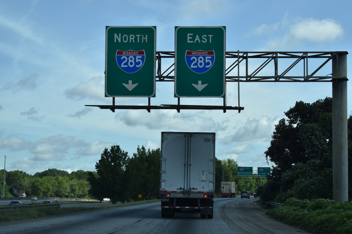
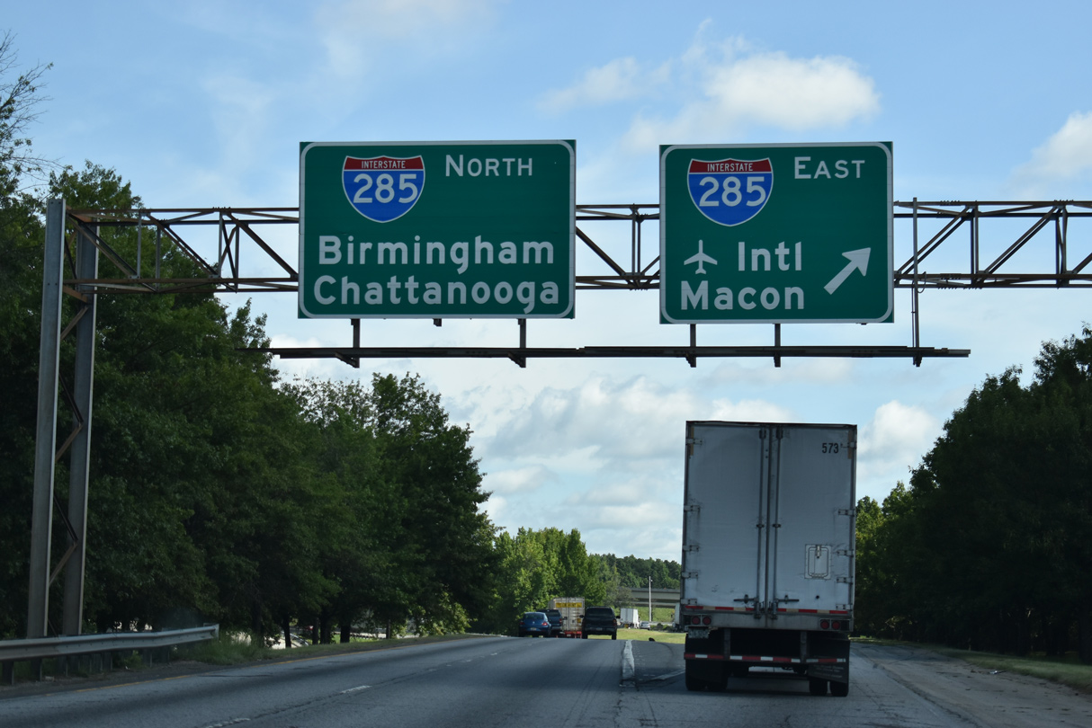
| Overheads partition traffic along Exit 68 into single lanes for Interstate 285 east to Riverdale, Forest Park and Clarkston and north to East Point, College Park and Ben Hill in Atlanta. 07/26/22 |
|
| The Atlanta Beltway uses control cities for the respective connecting Interstate highways. Northward I-285 meets I-20 in nine miles and I-75 in 18 miles.
07/26/22 |
|
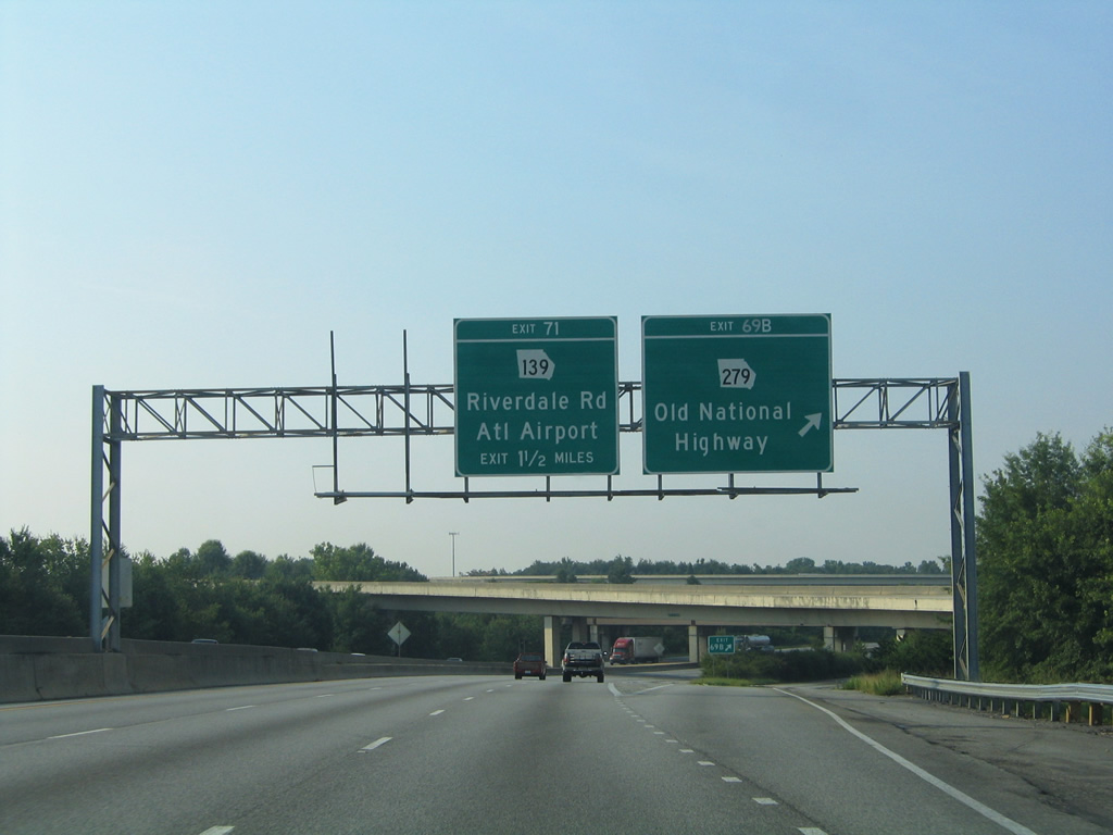
| Exit 69 A departs the I-85 northbound mainline for a flyover ramp leading west to SR 14CO. A collector distributor roadway follows for Exit 69 B to SR 279 (Old National Highway). 07/26/22 |
|
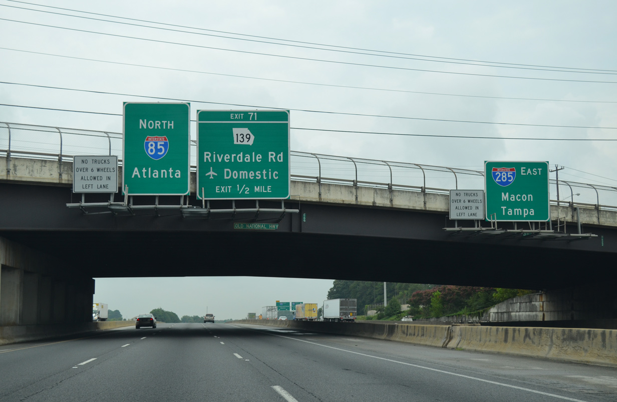
| Turning east under the ramps to SR 14CO and I-285 north, Interstate 85 parallels the Atlanta Beltway eastward through the diamond interchange with SR 279 (Old National Highway). Exit 71 with SR 139 (Riverdale Road) is north of I-285 near ATL Airport. 06/21/05 |
|
| Traffic from SR 14 Connector joins the c/d roadway ahead of Exit 69 B to Old National Highway. SR 279 heads 0.7 miles north of I-85/285 to U.S. 29/SR 14 (Roosevelt Highway) and south to SR 85 at Kenwood. 04/13/12 |
|
| I-85 north and Interstate 285 eastbound parallel one another on separate roadways under Old National Highway. Originally the two overlapped east to a trumpet interchange. 08/07/13 |
|
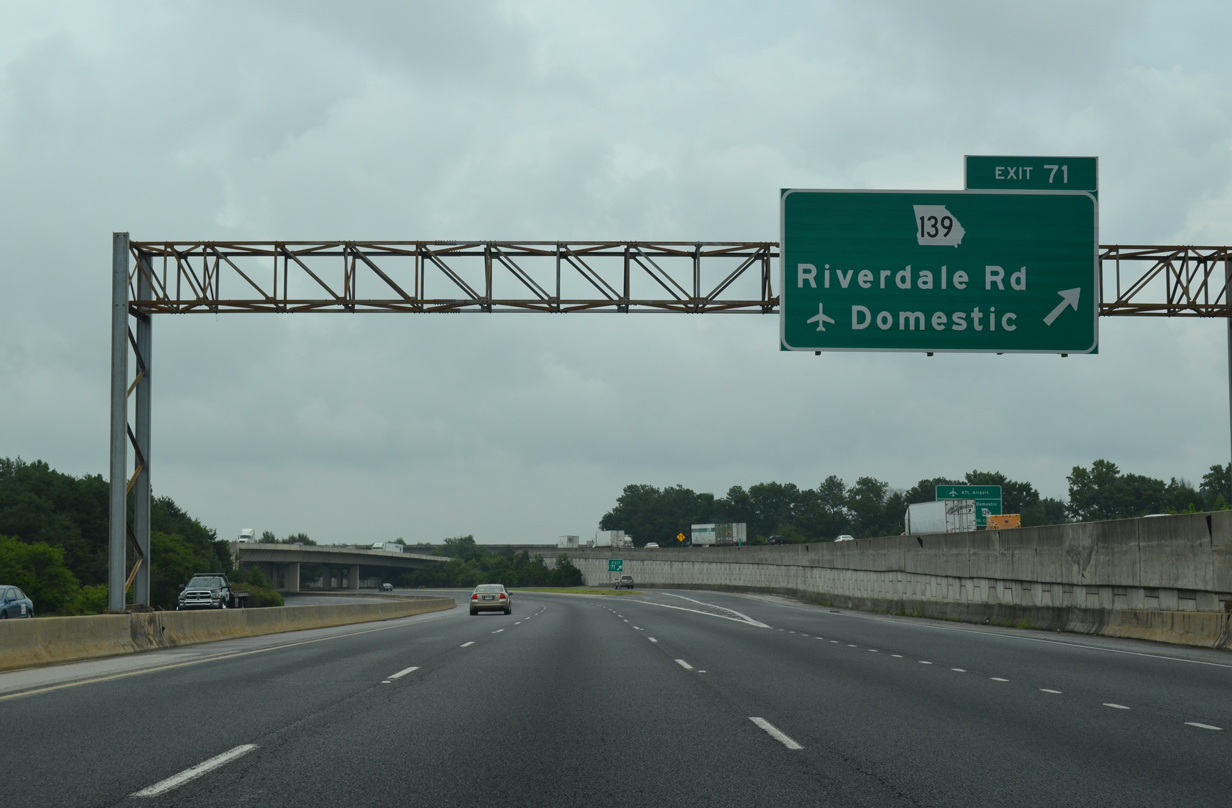
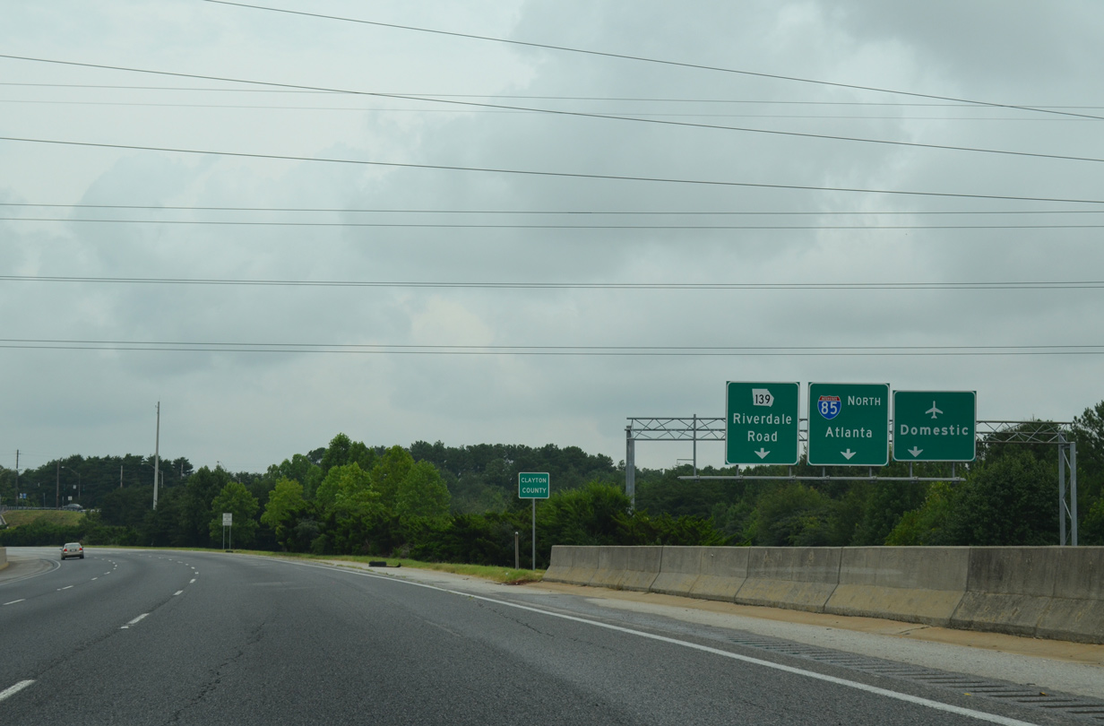
| Interstate 85 turns northward from the Perimeter Highway to a parclo interchange (Exit 71) with SR 139 (Riverdale Road). SR 139 constitutes a 29 mile long route between Riverdale, Atlanta and Mableton. 08/07/13 |
|
| Riverdale Road (SR 139) links with Herschel Road north and Camp Creek Parkway east. Eastward SR 139 winds around the periphery of ATL Airport to I-285 at Exit 60. A second ramp at Exit 71 connects the c/d roadway with Terminal Parkway at the domestic terminal of ATL Airport. 08/07/13 |
|
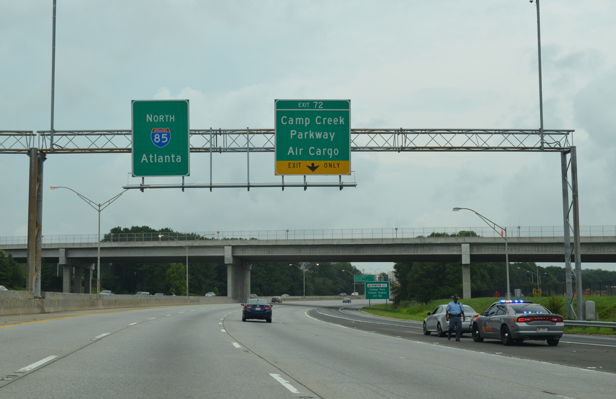
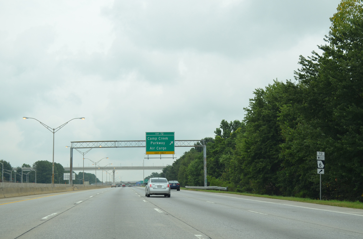
| A collector distributor roadway separates at Exit 72 next for Camp Creek Parkway (SR 6) west and Airport Loop Road to the Air Cargo facilities of ATL Airport. 08/07/13 |
|
| Entrance ramps from SR 139 (Riverdale Road) and SR 279 (Old National Highway) form an auxiliary lane northward to Exit 72. Part of SR 6, Camp Creek Parkway heads west from Airport Boulevard and I-85 to College Park, Fulton County Industrial Park and as Thornton Road across the Douglas County line. 08/07/13 |
|
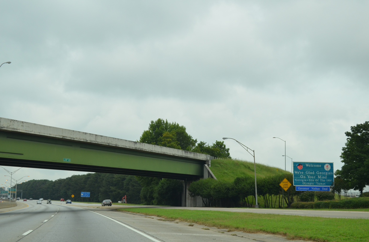
| The frontage alongside Interstate 85 becomes more urban as the freeway pushes northeast from College Park to East Point and Hapesville. The next three exits serve the three cities. 08/07/13 |
|
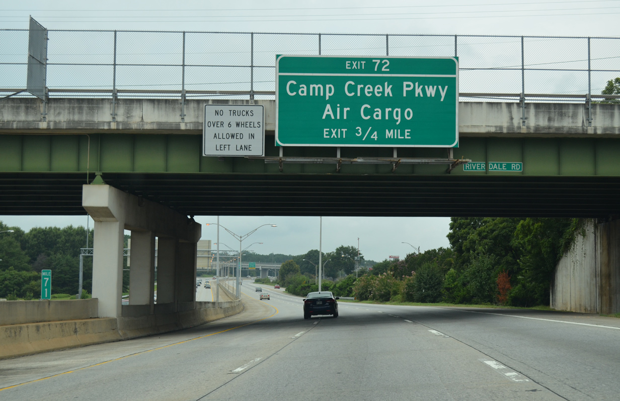
| A SR 6 trailblazer precedes the parclo interchange (Exit 72) with Camp Creek Parkway along Interstate 85 north. SR 6 stretches 72 miles west from College Park to the Alabama state line west of Cedartown as U.S. 278's counter part. 08/07/13 |
|
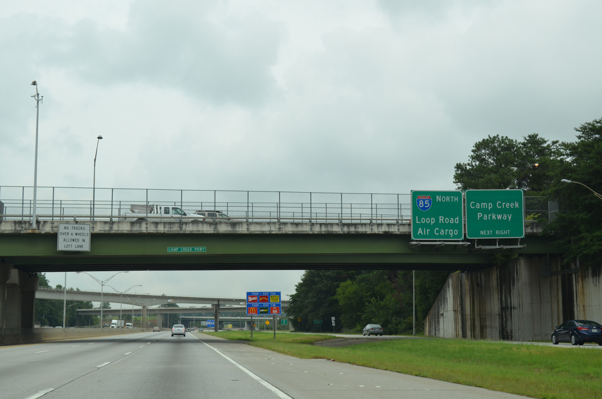
| Exit 72 leaves Interstate 85 north. Beyond the Camp Creek Parkway (SR 6) westbound loop ramp, the c/d roadway continues directly to Airport Loop Road along the north side of Atlanta Hartsfield-Jackson International Airport (ATL). 08/07/13 |
|
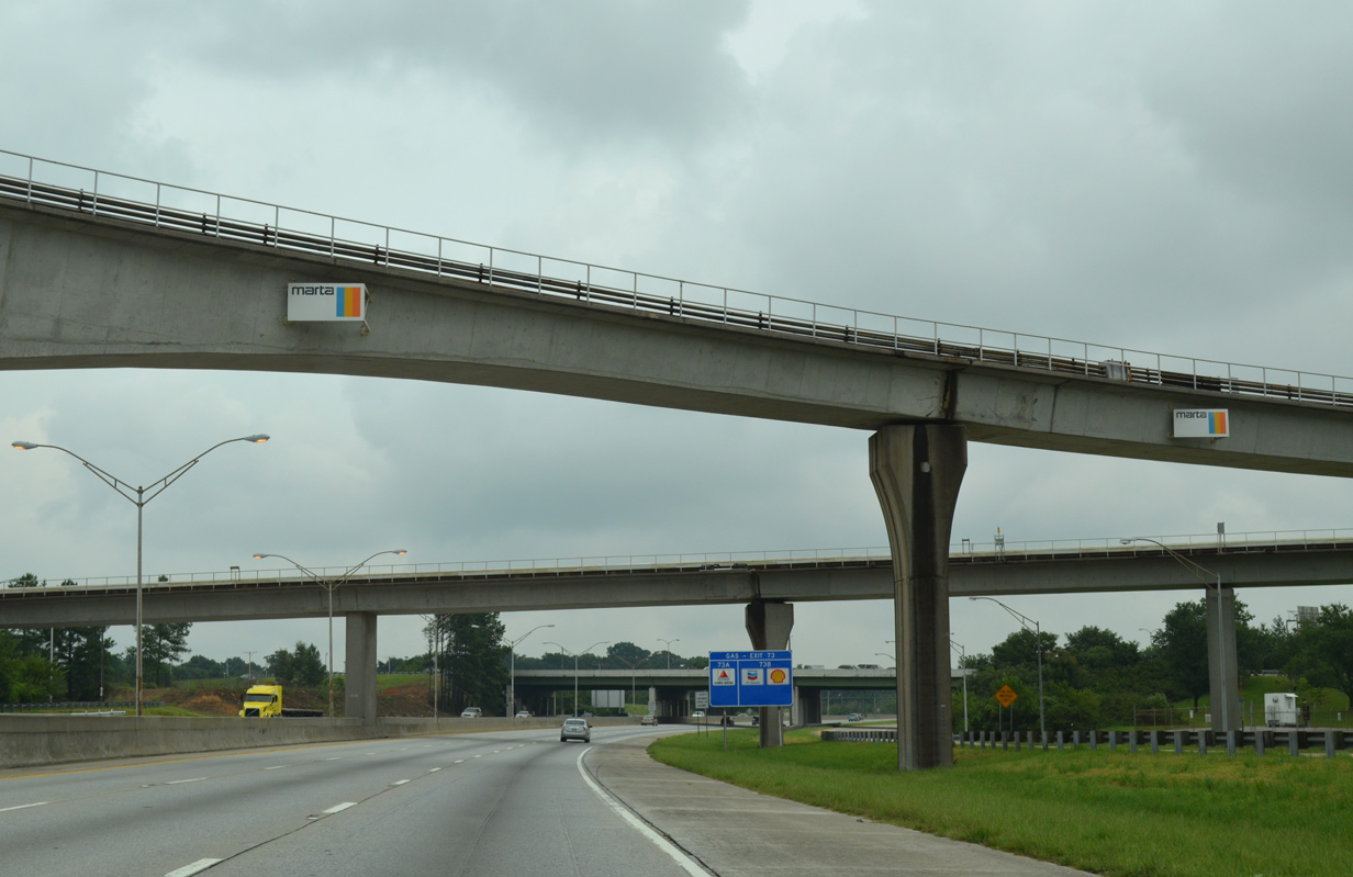
| Several ramps and MARTA transit lines pass over Interstate 85 by the airport. A trumpet interchange joins Airport Boulevard with the freeway ahead. 08/07/13 |
|
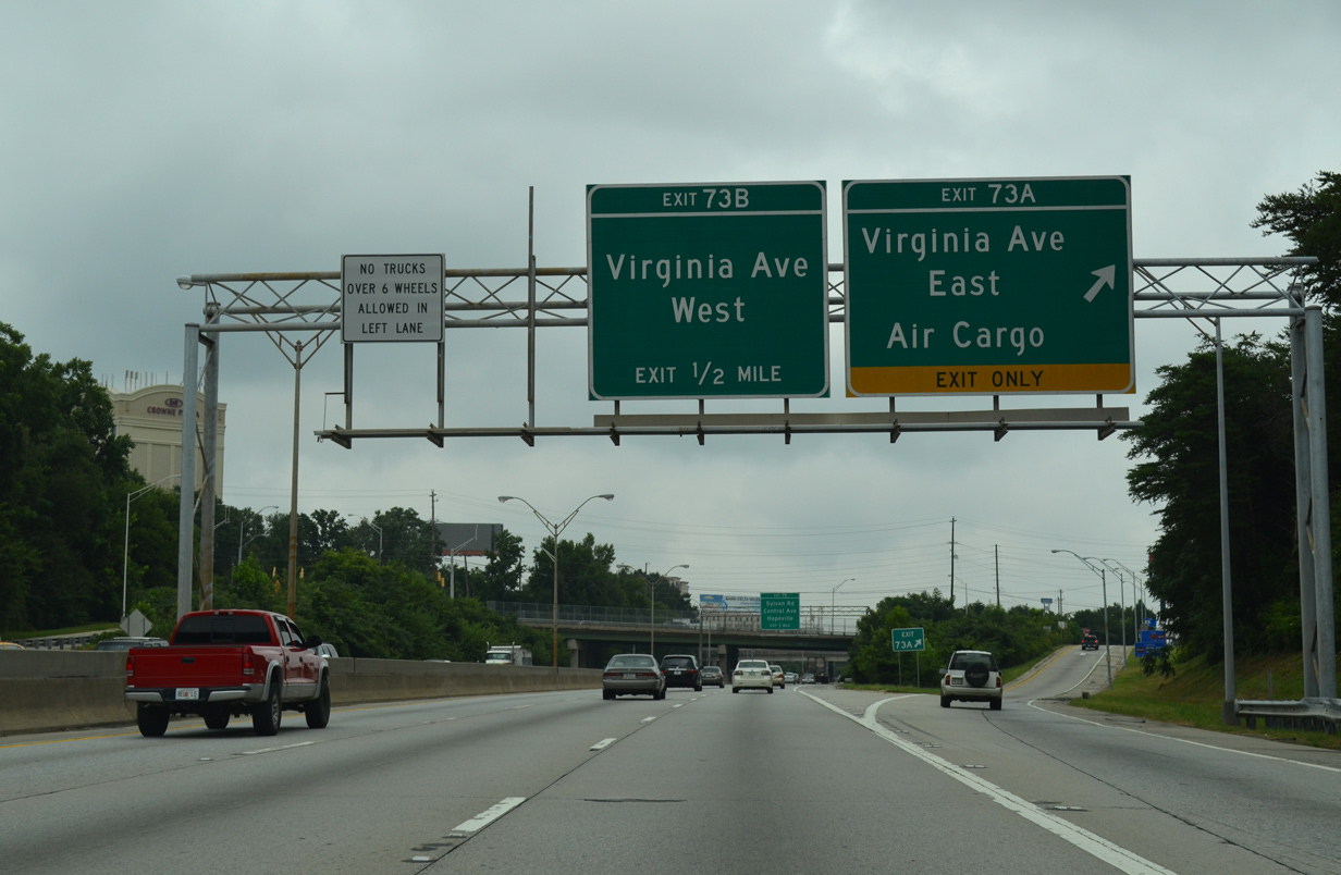
| The succeeding exit from I-85 north is with Virginia Avenue to U.S. 29/SR 14 (Main Street) in College Park and Central Avenue in Hapeville. 08/07/13 |
|
| Traffic on the adjacent Exit 72 c/d roadway splits into the northbound on-ramp to Interstate 85 and Airport Loop Road east to the Air Cargo facilities. 08/07/13 |
|
| A welcome sign stands at the end of the c/d roadway for passengers that arrived via ATL Airport. Passing above is the west end of Airport Loop Road as it ties into a c/d roadway along I-85 south. 08/07/13 |
|
| Virginia Avenue used to provide the main route to the Air Cargo facilities of ATL Airport. That changed with the construction of Airport Loop Road on a parallel course to the south. An interchange also used to link Virginia Avenue with Hartsfield Drive, but that was eliminated during redevelopment of the area north of the airport. 08/07/13 |
|
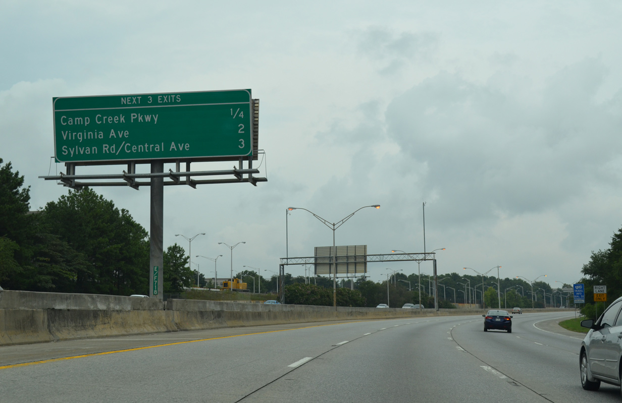
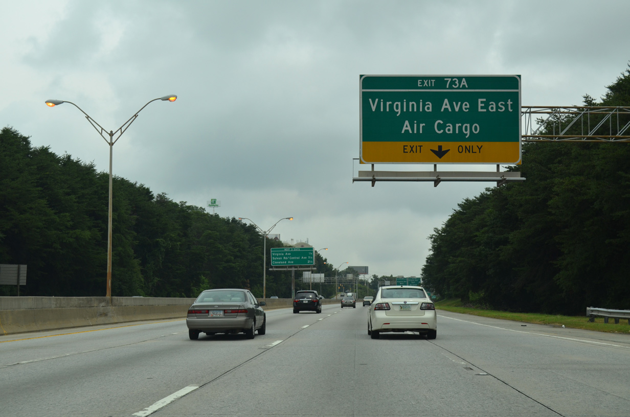
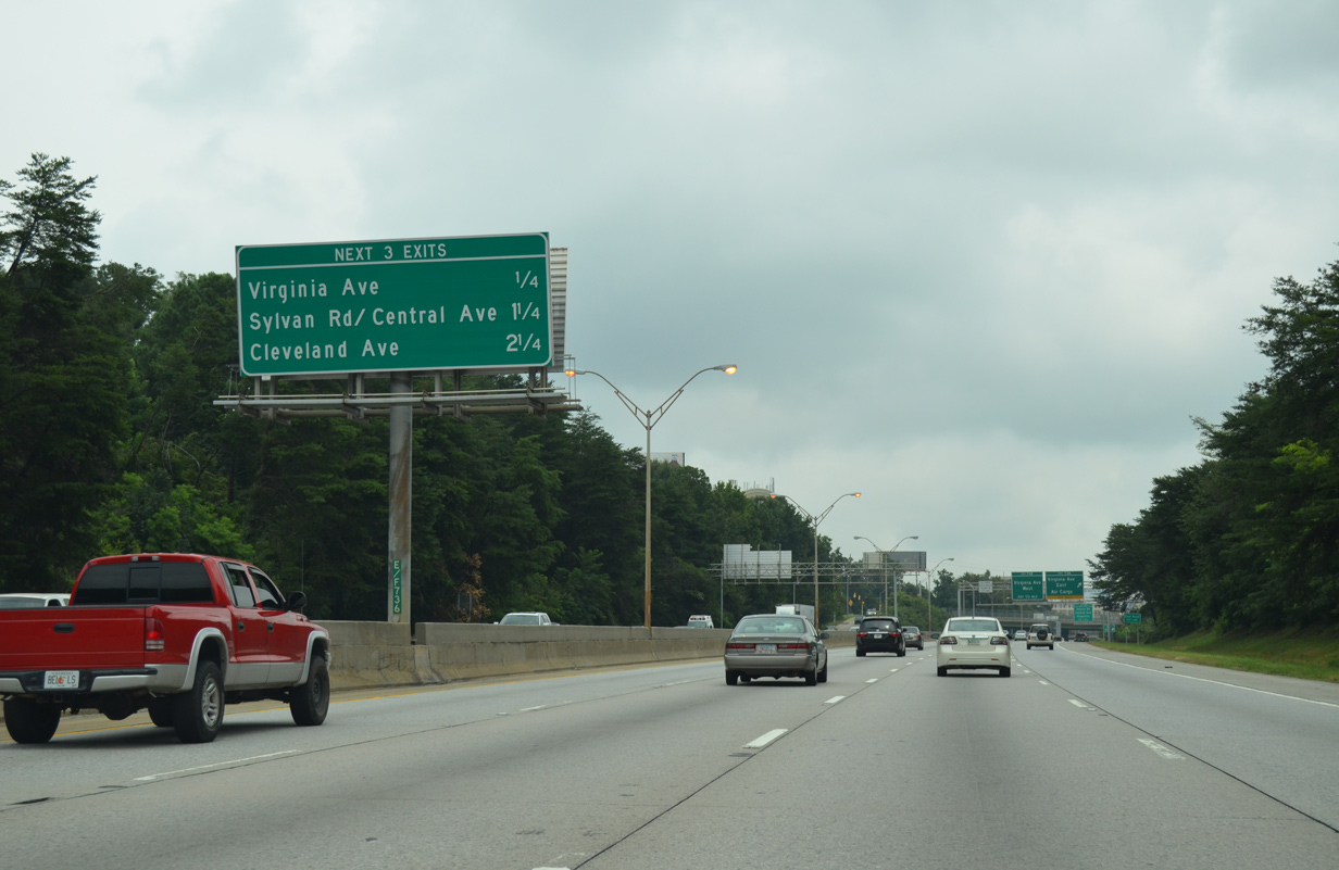
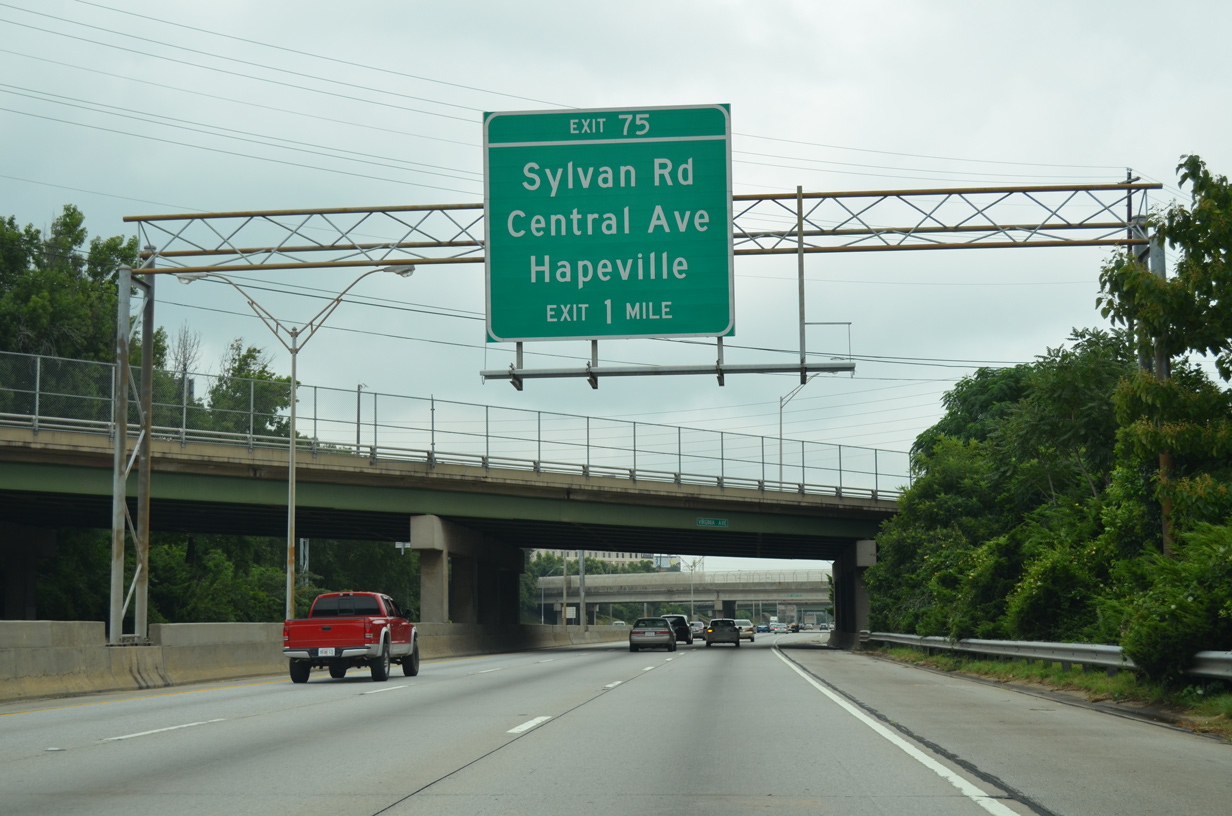
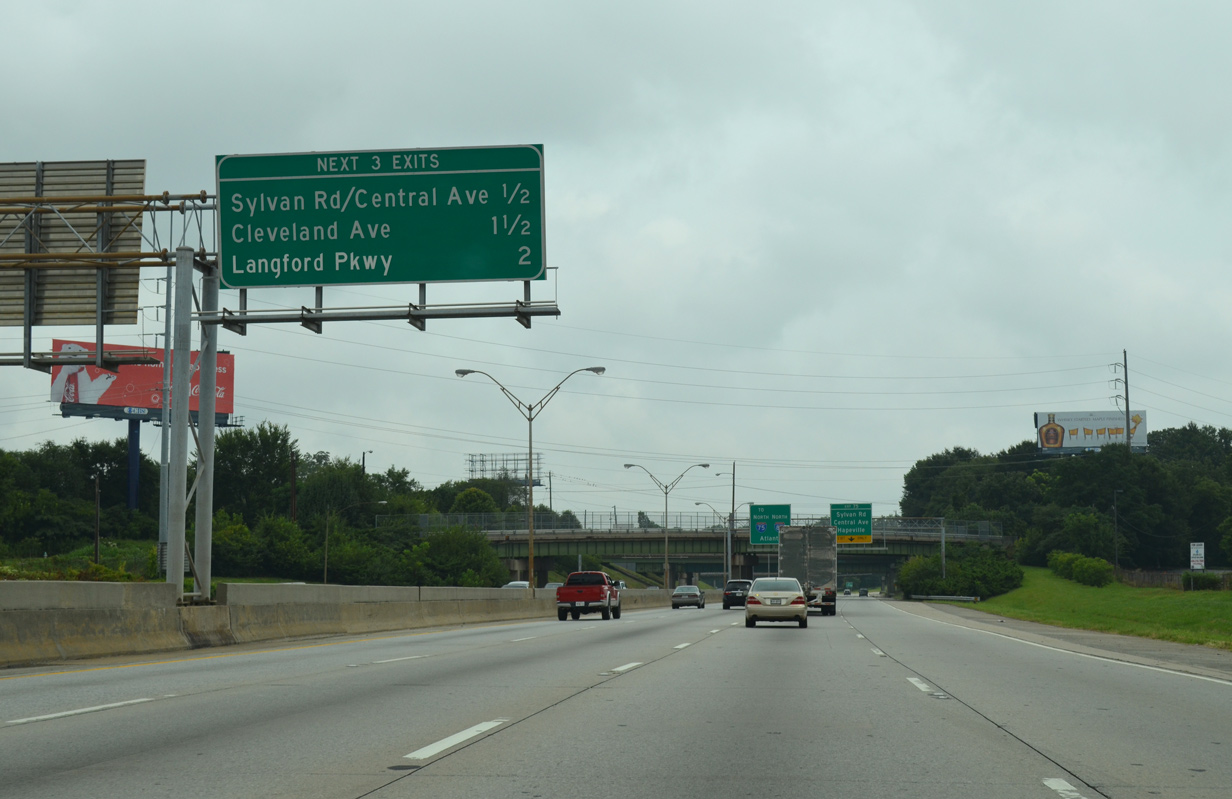
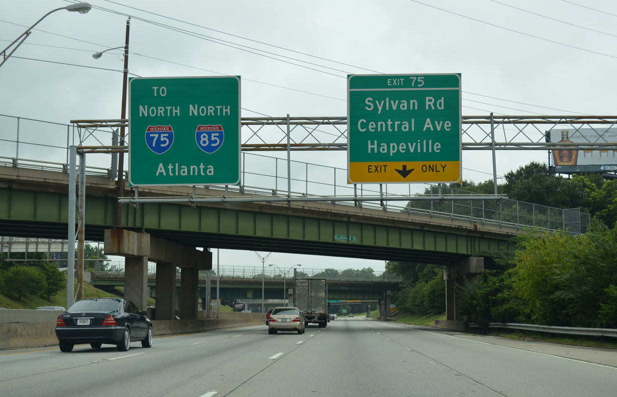
| The exit to Cleveland Avenue precedes the merge with Interstate 75 in 2.25 miles. Sylvan Road and Central Avenue come together just south of Exit 75 in 1.25 miles. 08/07/13 |
|
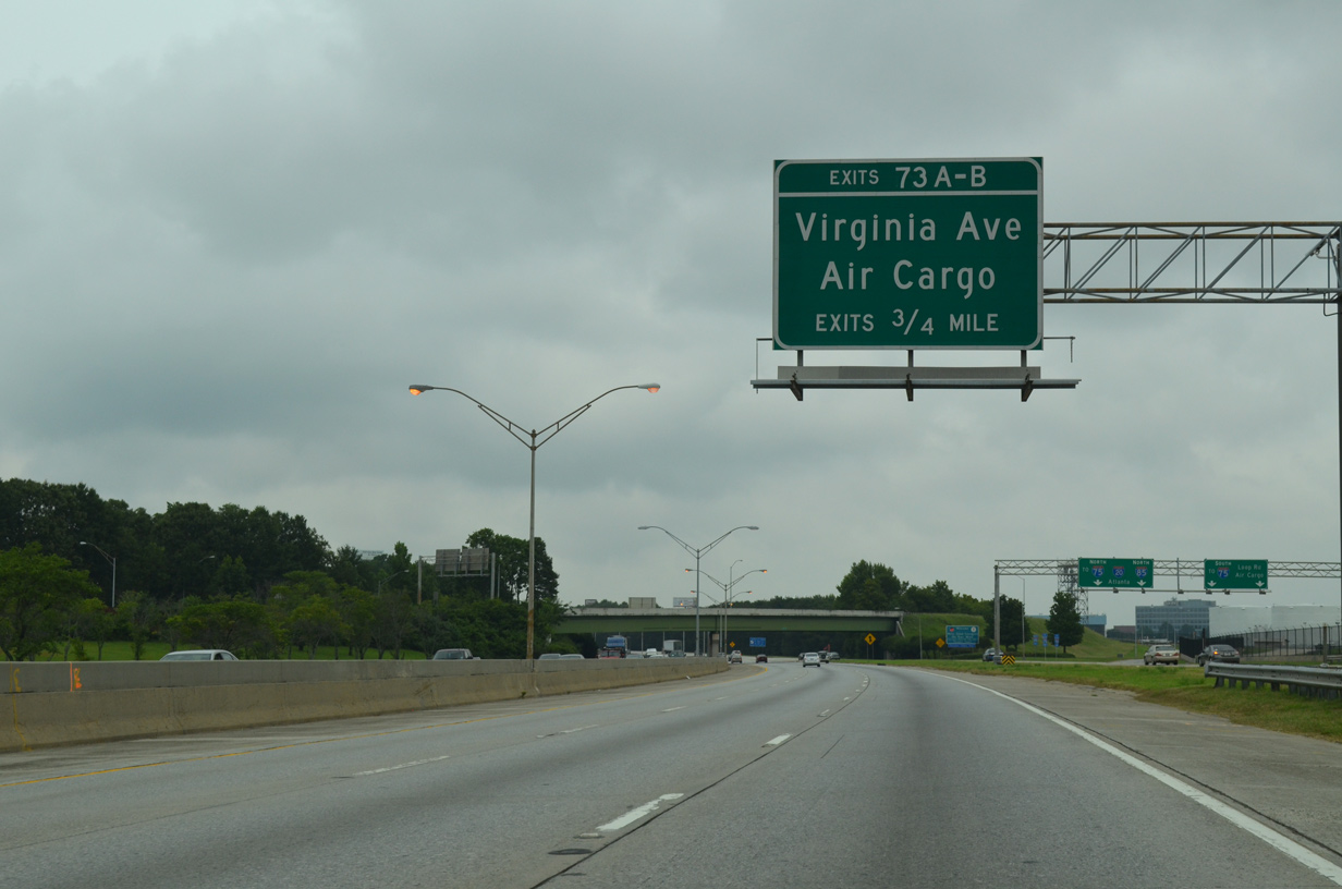
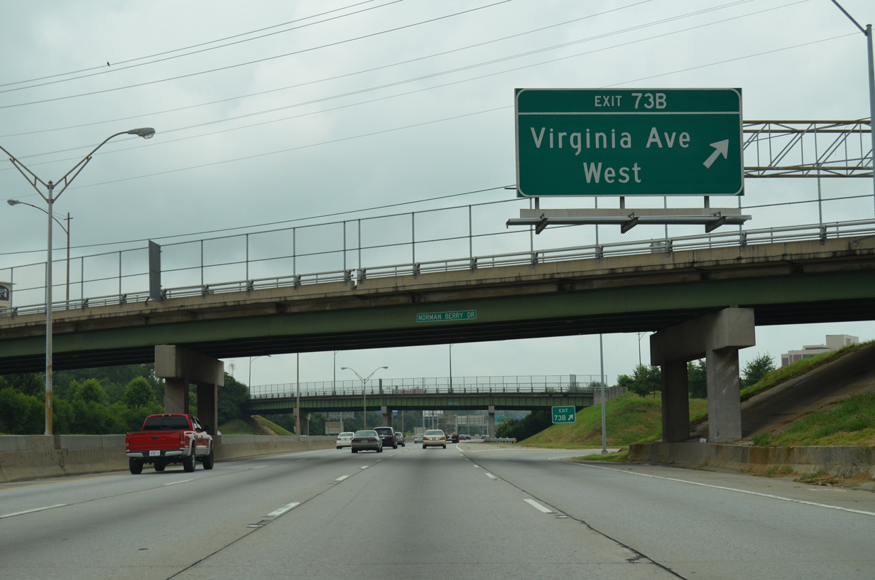
| Exit 73A parts ways with Interstate 85 north for Virginia Avenue east to Air Cargo and Central Avenue in Hapeville. 08/07/13 |
|
| Forthcoming Central Avenue leads northwest from Hapeville to Irene Kidd Parkway in College Park. Sylvan Road runs north from Central Avenue and I-85 to the Sylvan Hills community in Atlanta. 08/07/13 |
|
| Originally a diamond interchange connected I-85 with Virginia Avenue. The northbound entrance ramp was replaced with a loop ramp onto Virginia Avenue west ahead of Bobby Brown Parkway. 08/07/13 |
|
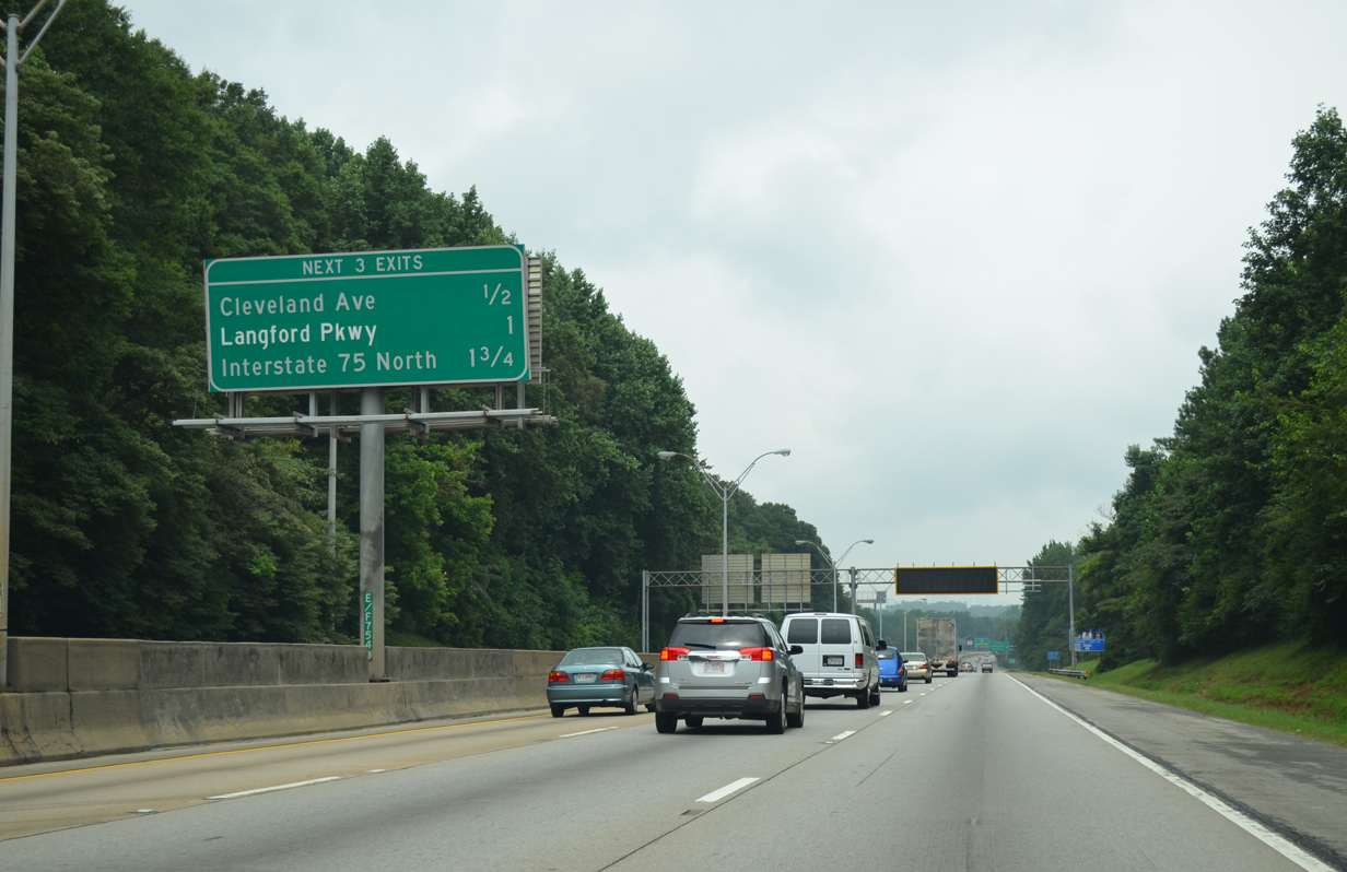
| I-75/85 combine along the Downtown Connector through the exchange with Langford Parkway (SR 166) in two miles. 08/07/13 |
|
| A wye interchange brings traffic from Airport Loop Road and Hartsfield Drive onto I-85 north ahead of the folded diamond interchange (Exit 75) with Sylvan Road and Central Avenue. 08/07/13 |
|
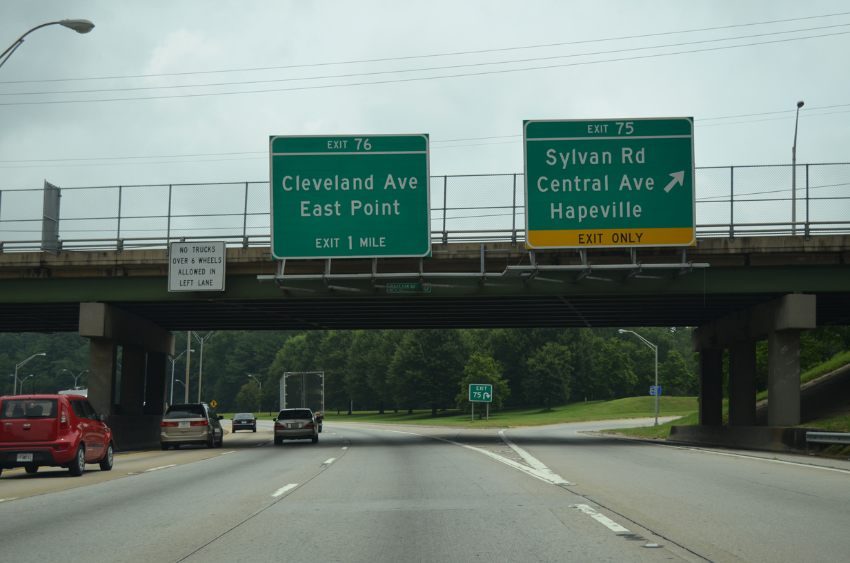
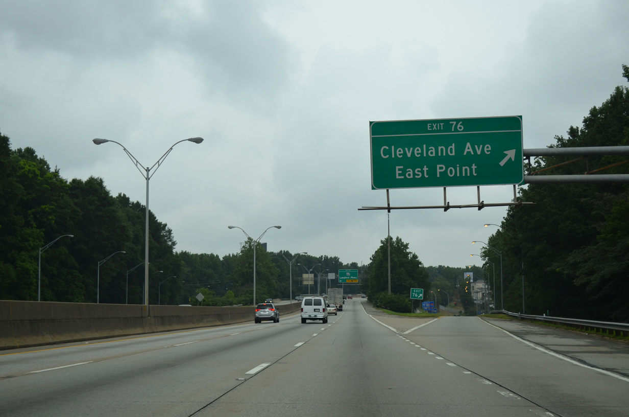
| Northbound Interstate 85 at Exit 75. Cleveland Avenue, a multi lane boulevard between East Point and Lakewood in Atlanta, meets the freeway in one mile at Exit 76. 08/07/13 |
|
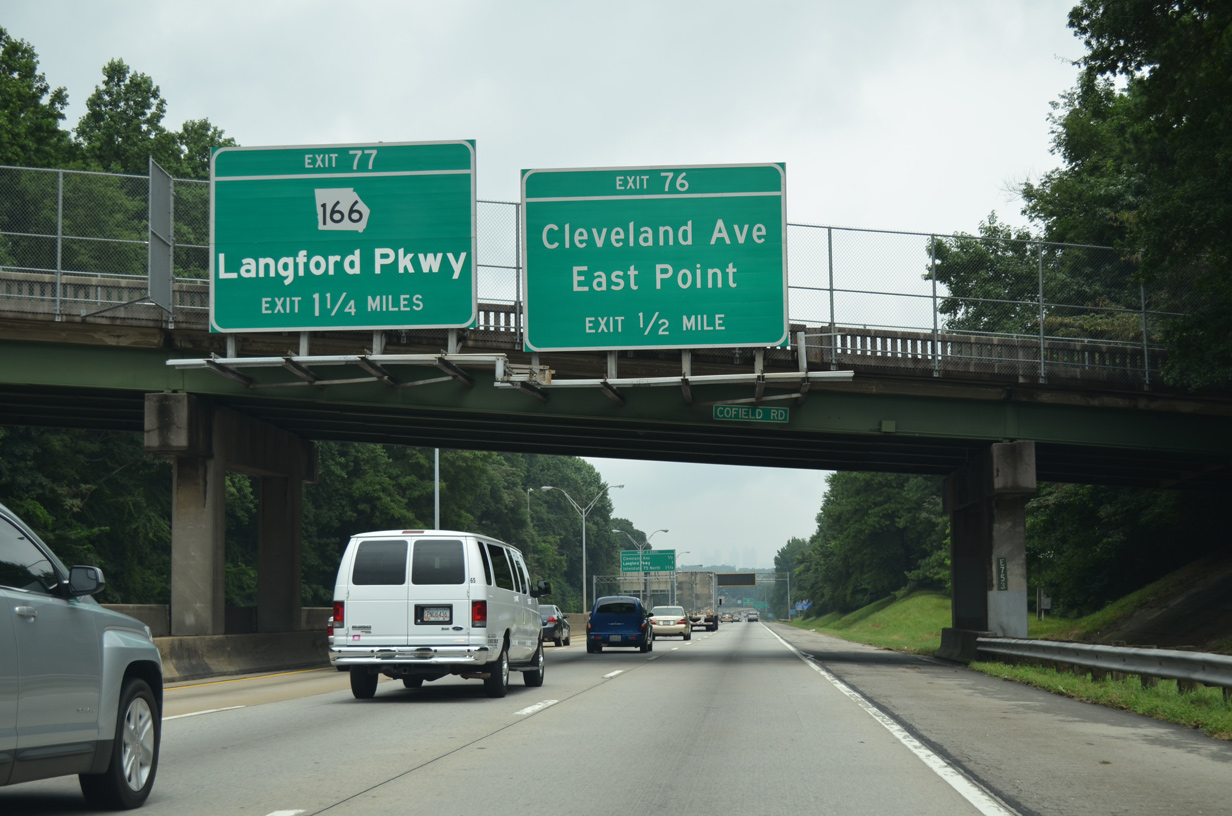
| Downtown Atlanta appears along the northern horizon leading north to Exit 76 for Cleveland Avenue. Exit 77 follows to SR 166 (Langford Parkway), a freeway between Lakewood Avenue to the east and Interstate 285 to the west. 08/07/13 |
|
| Interstate 85 turns east from Cleveland Avenue 1.25 miles to I-75 north. There is no access to I-75 south, but Cleveland Avenue does connect the two freeways. 08/07/13 |
|
| Entering the diamond interchange (Exit 76) with Cleveland Avenue on I-85 north. U.S. 19/41 (Metropolitan Parkway) intersect Cleveland Avenue nearby. Metropolitan Parkway carries the two north from Hapeville through the Perkerson community just west of I-75/85. 08/07/13 |
|
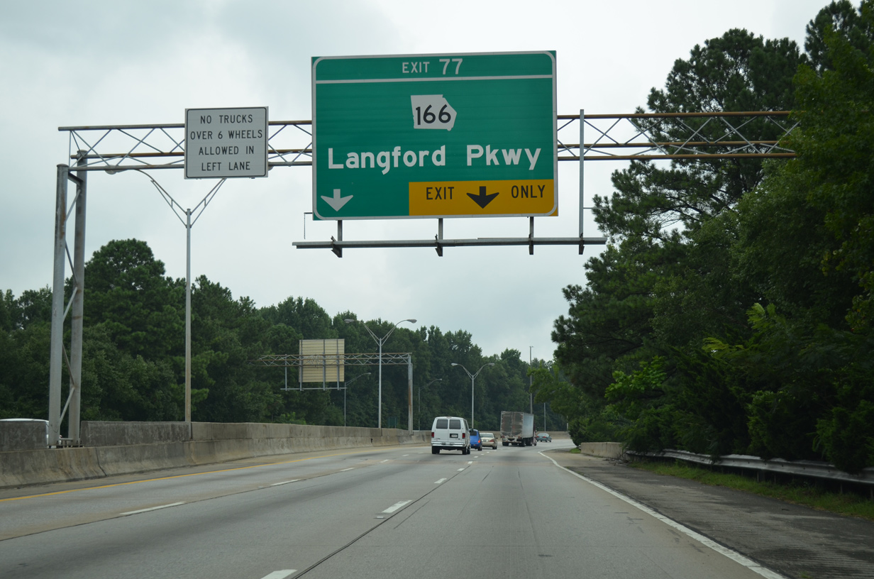
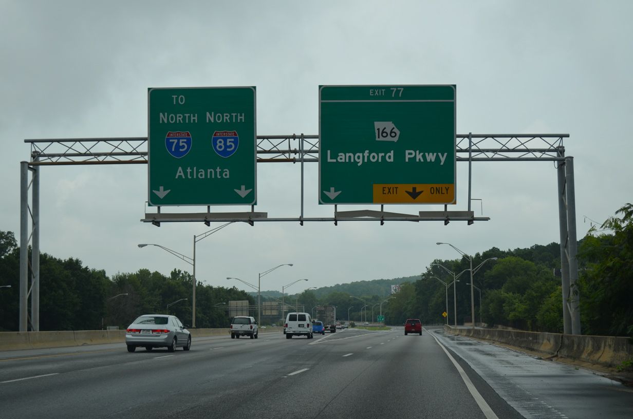
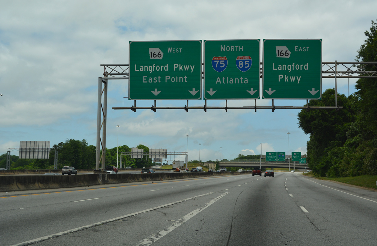
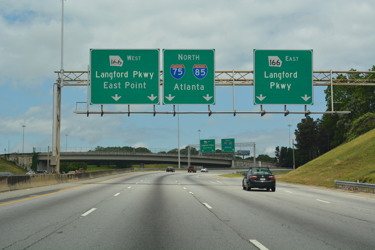
| A lane drop occurs at Exit 77 for a c/d roadway to SR 166 (Langford Parkway). SR 166 represents the only segment of proposed Interstate 420, a loop leading west from I-20 near East Atlanta by Exit 63, to I-285 at Greenbriar. Earlier plans for the route included a westward extension to I-20 near Douglasville. 08/07/13 |
|
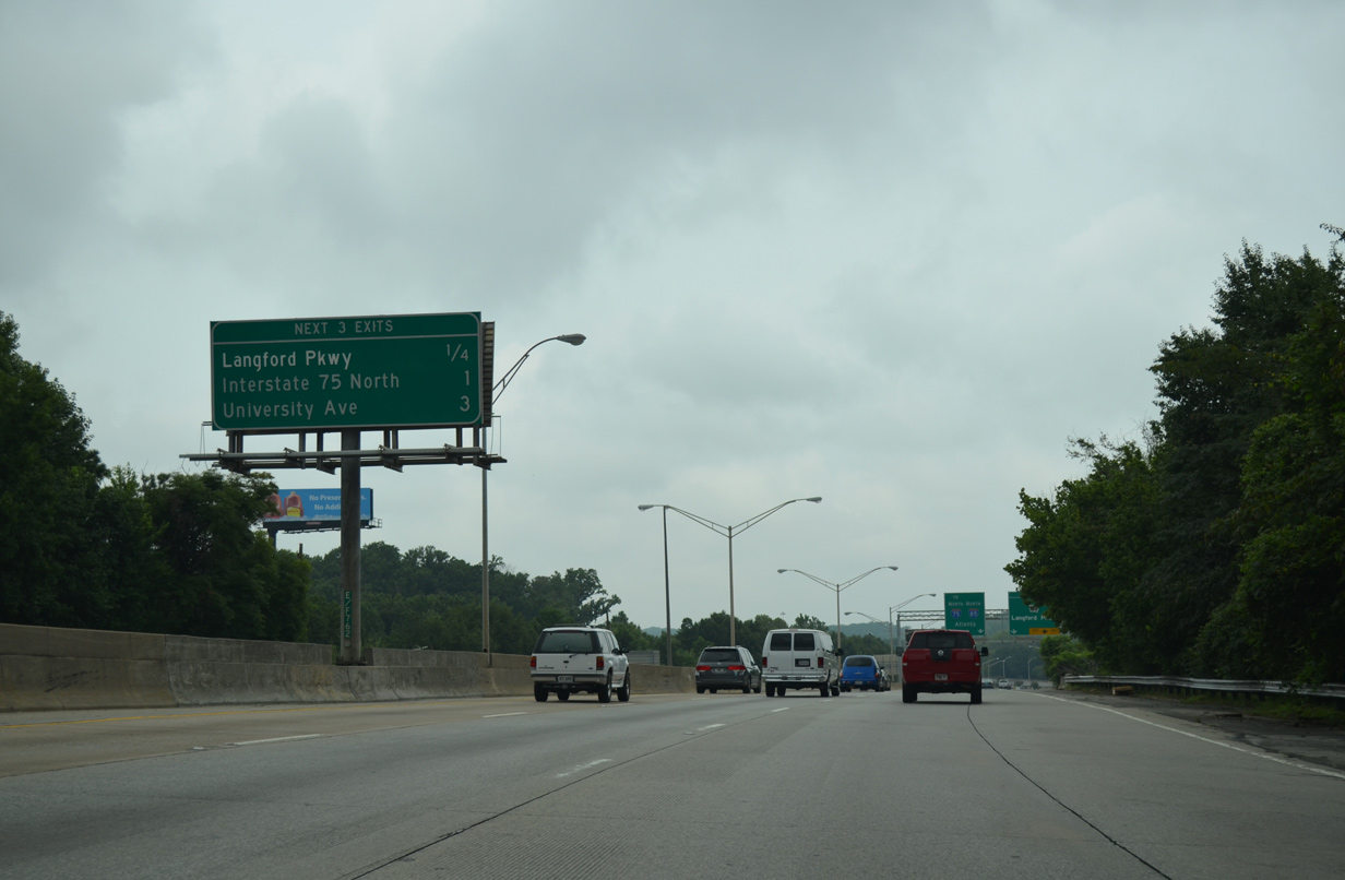
| University Avenue is the succeeding exit along I-75/85 (Downtown Connector) northbound. 08/07/13 |
|
| A half diamond interchange adds traffic from U.S. 19/41 (Metropolitan Parkway) onto the c/d roadway for Exit 77. There is no direct access to the parkway from I-85 north. 08/07/13 |
|
| Arriving alongside Interstate 75, I-85 expands the Downtown Connector northbound to five lanes. Exit 243 from I-75 north combines with the c/d roadway for Exit 77 leading into a cloverstack interchange with SR 166 (Langford Parkway). 10/22/15 |
|
| Ramps to Langford Parkway depart from both sides of the c/d roadway before it returns to I-75/85 north. SR 166 was originally named the Lakewood Freeway, for the neighborhood in which it connects to the east. It was renamed in 1995 after Arthur Langford, Jr., a former Atlanta city councilman and Georgia state senator. 10/22/15 |
Page Updated 10-30-2015.

 North
North