|
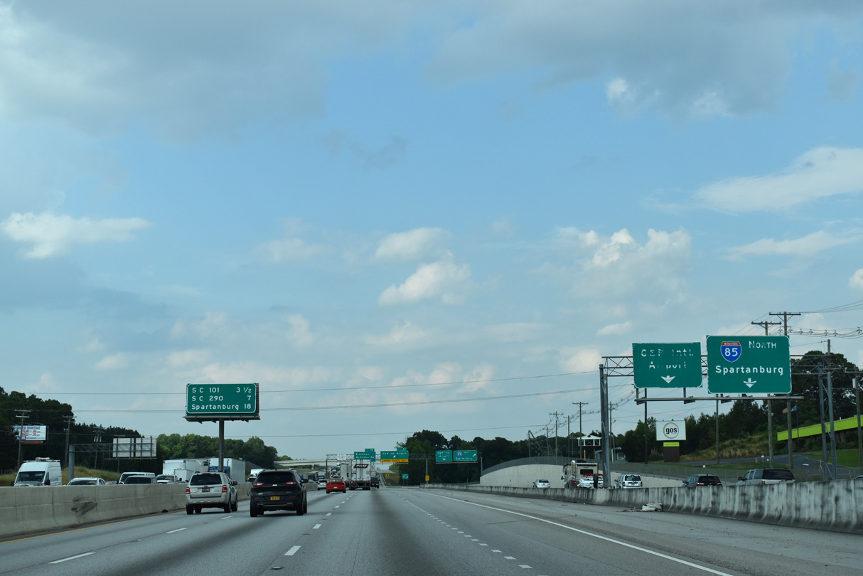
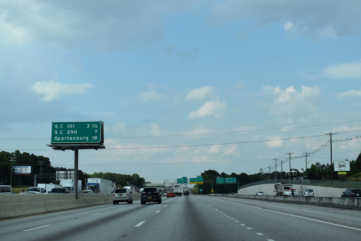
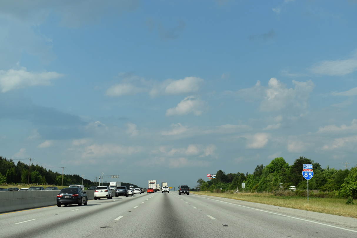
| The 2004-06 "I-85 Access Project" constructed a distributor roadway leading east from the SPUI with S.C. 14 to the trumpet interchange (Exit 57) with Aviation Parkway. 05/25/21 |
|
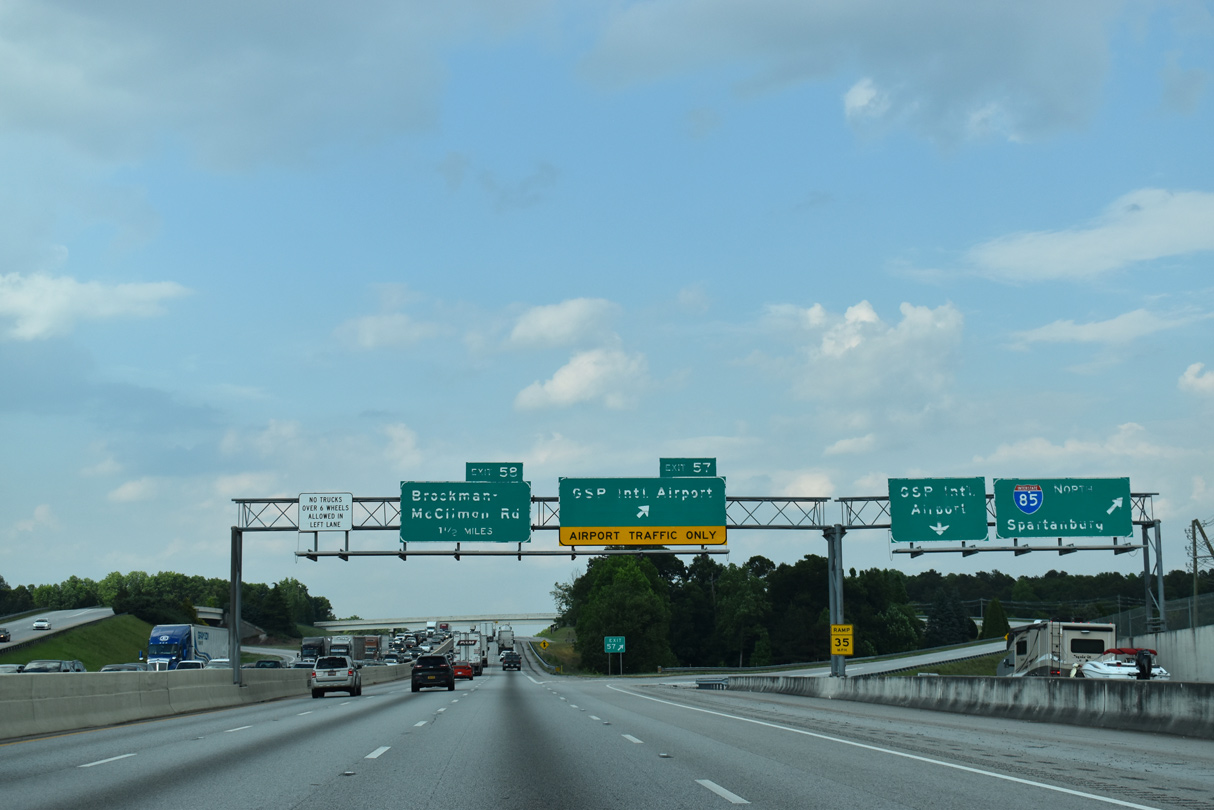
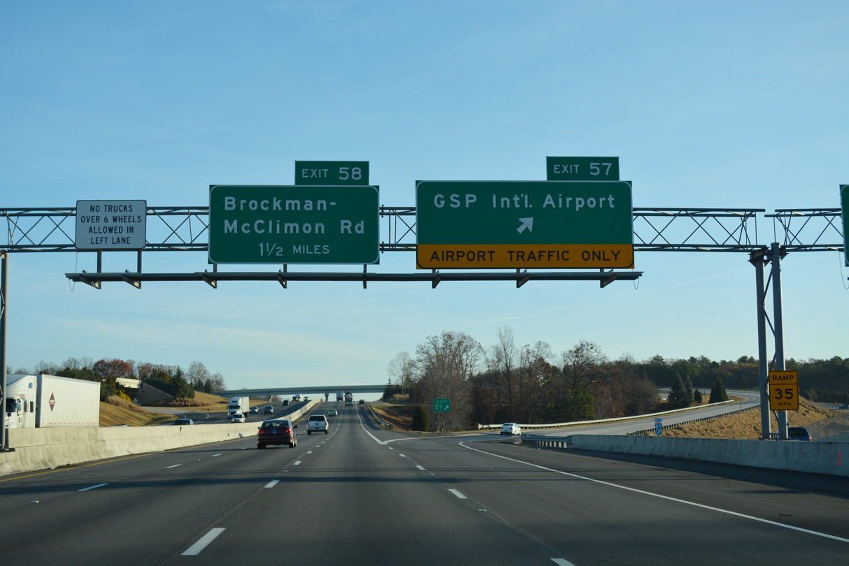
| The interchange sequence sign preceding Aviation Parkway omits Exit 60 to Brockman-McClimon Road (Road 12). The exchange at Exit 60 was added during the "I-85 Access Project". 05/25/21 |
|
| The distributor roadway to Aviation Parkway opened to traffic in November 2005. 05/25/21 |
|
| Aviation Parkway links Interstate 85 with the passenger terminal of Greenville-Spartanburg International Airport (GSP). 12/15/16 |
|
| An auxiliary lane accompanies I-85 northbound from Exit 57 beyond Dillard Creek. 05/25/21 |
|
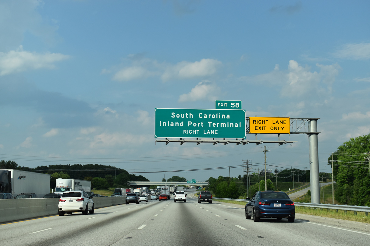
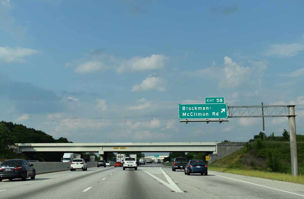
| The two-wye interchange with Brockman-McClimon Road (Road 12) was built to serve the nearby BMW Spartanburg plant and the South Carolina Inland Port Terminal. 05/25/21 |
|
| Brockman-McClimon Road heads 0.99 miles north from the ramps at Exit 58 to S.C. 101. 05/25/21 |
|
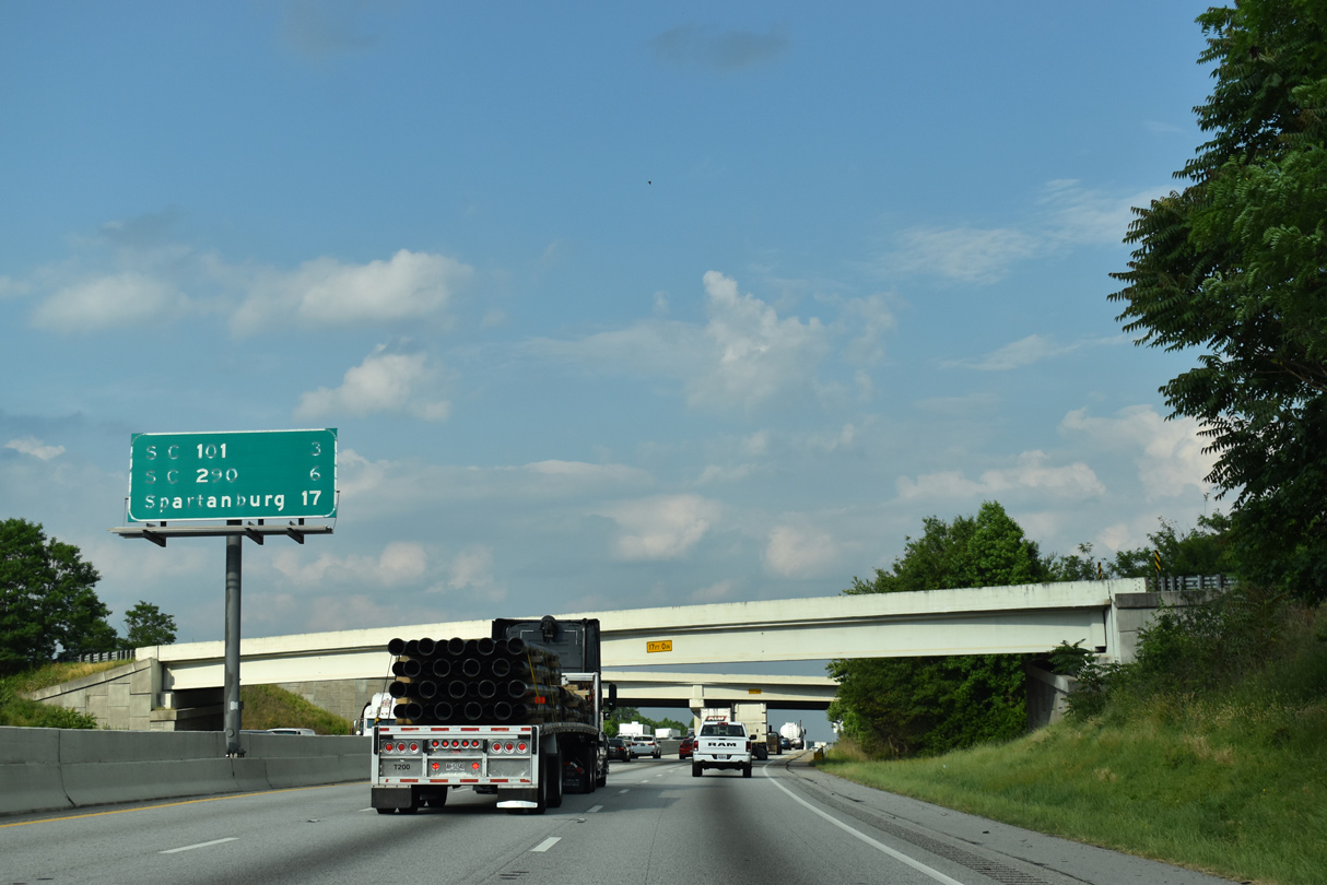
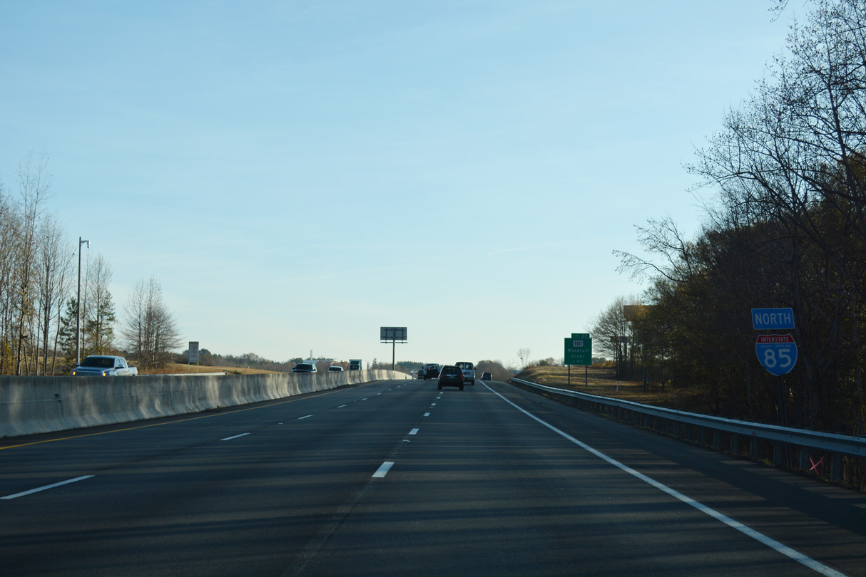
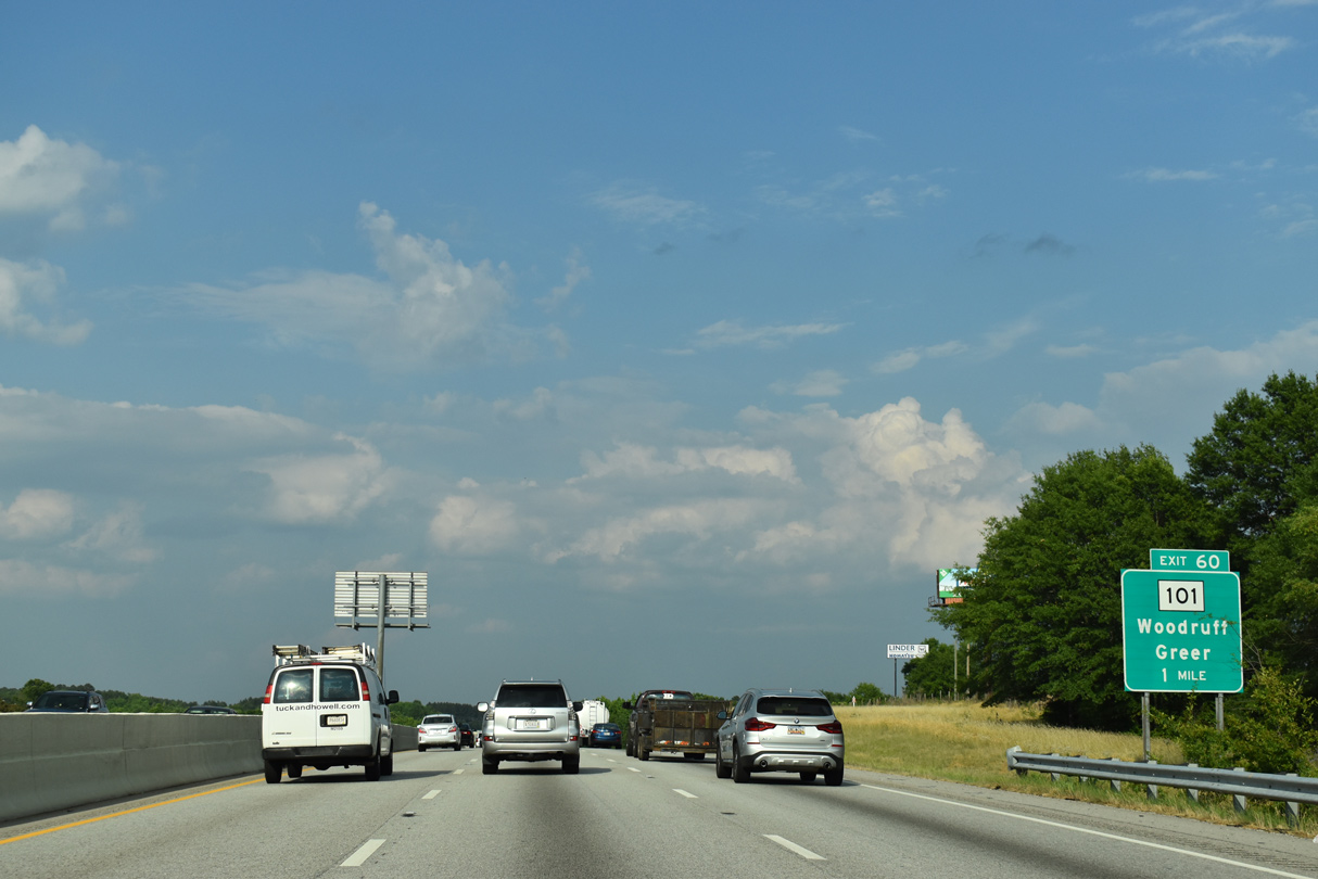
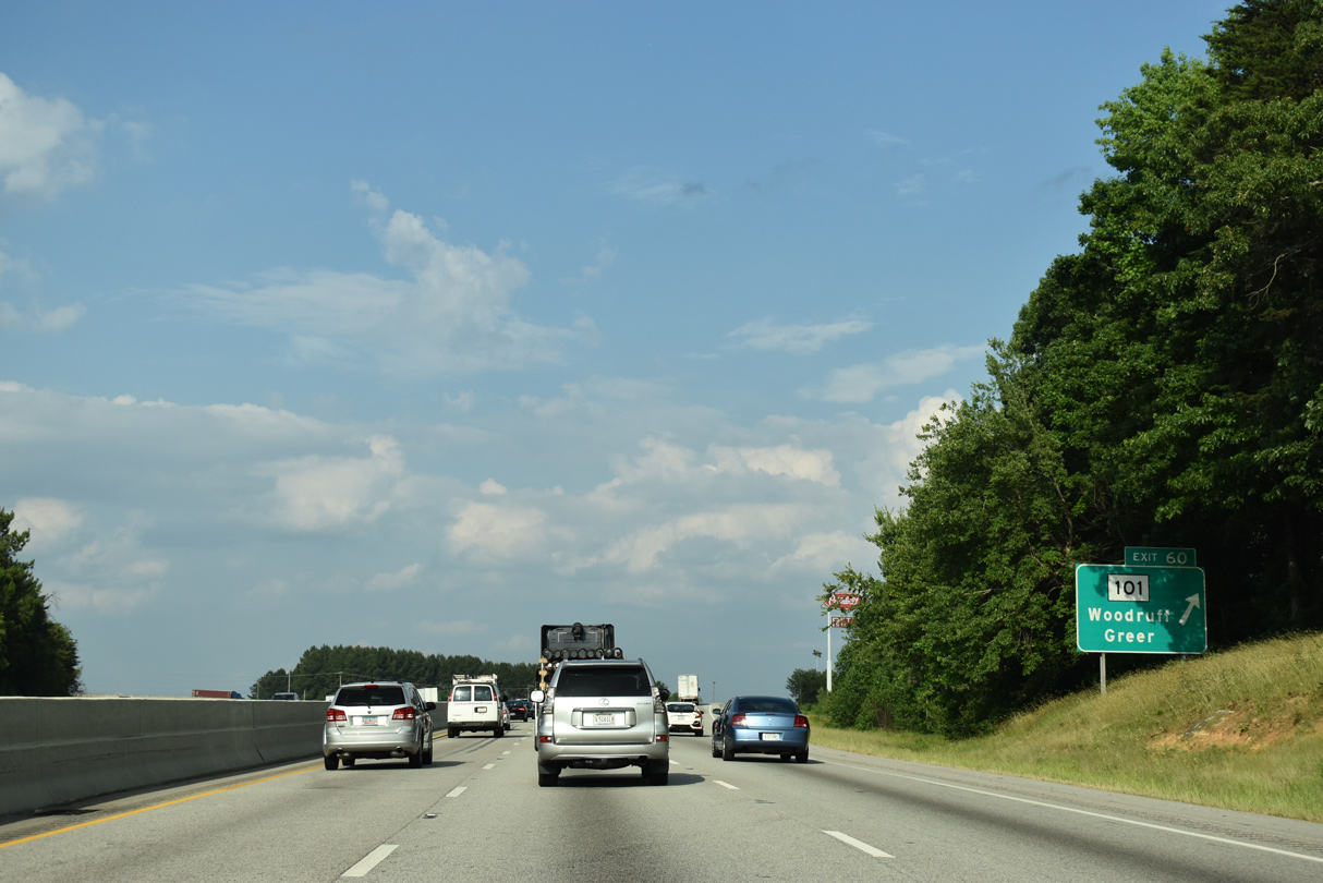
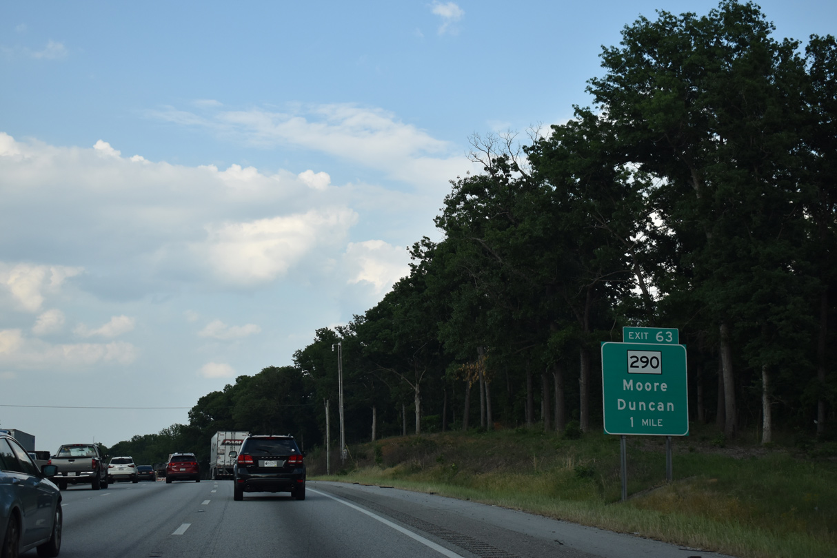
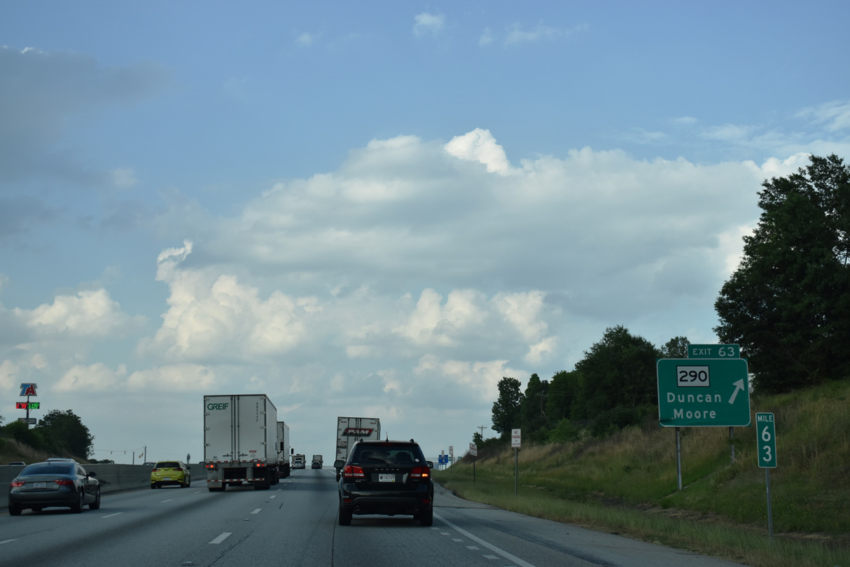
| S.C. 101 branches south from S.C. 290 in Greer to meet I-85 at Exit 60. S.C. 290 converges with I-85 at Exit 63. 05/25/21 |
|
| Interstate 85 continues east by the BMW Spartanburg plant to Exit 60. 12/15/16 |
|
| S.C. 101 heads 5.3 miles northwest to Downtown Greer and south 12.8 miles to U.S. 221 in the city of Woodruff. 05/25/21 |
|
| A six-ramp parclo interchange joins I-85 with S.C. 101 at Exit 60. S.C. 101 travels 56.52 miles overall between U.S. 76 in Hickory Tavern and S.C. 11 near Gowensville. 05/25/21 |
|
| Duncaon-Reidville Road (Road 62) spans Interstate 85 by this confirming marker. 05/25/21 |
|
| S.C. 290 (Main Street) arcs 2.8 miles southeast from the Duncan town center to the diamond interchange at Exit 63. 05/25/21 |
|
| A 30.58 mile long highway, S.C. 290 heads south from I-85 to U.S. 221 at Moore and from Duncan west to Greer and U.S. 25 beyond Locust Hill. 05/25/21 |
|
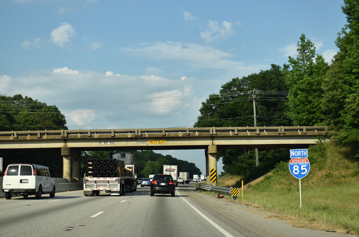
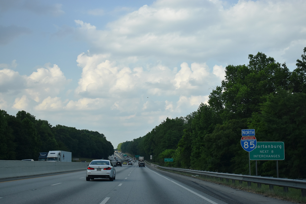
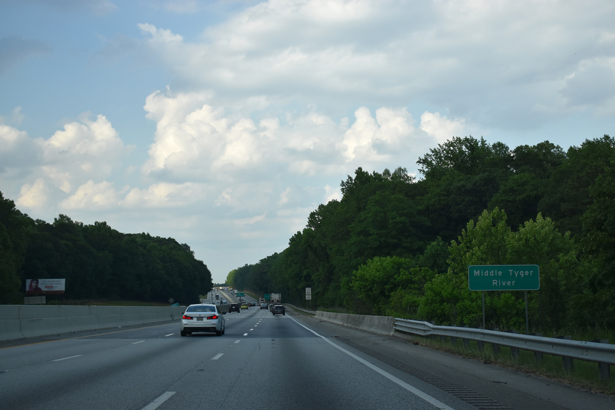
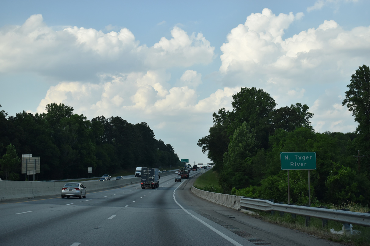
| Interstate 85 proceeds north across the Middle Tyger River toward the Spartanburg area. 05/25/21 |
|
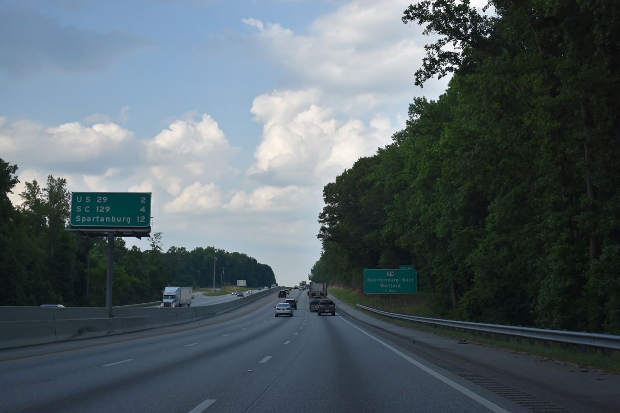
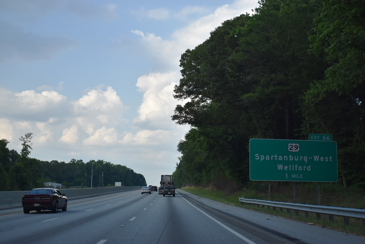
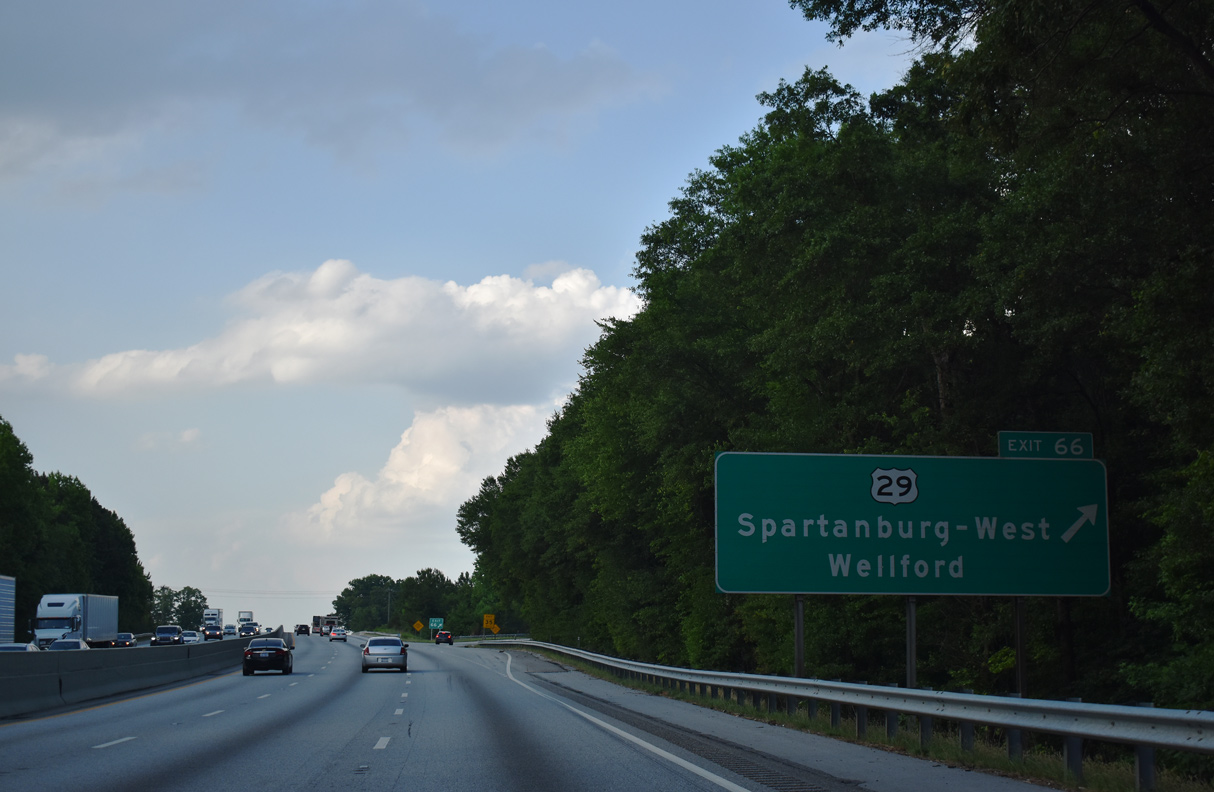
| U.S. 29 returns to Interstate 85 from Greenville through Greer and Duncan at Exit 66. This interchange sequence sign references the succeeding exit at two miles despite the nearby guide sign listing one mile. 05/25/21 |
|
| U.S. 29 (Greenville Highway) meets Interstate 85 at a parclo interchange (Exit 66) just east of the Wellford city limits. 05/25/21 |
|
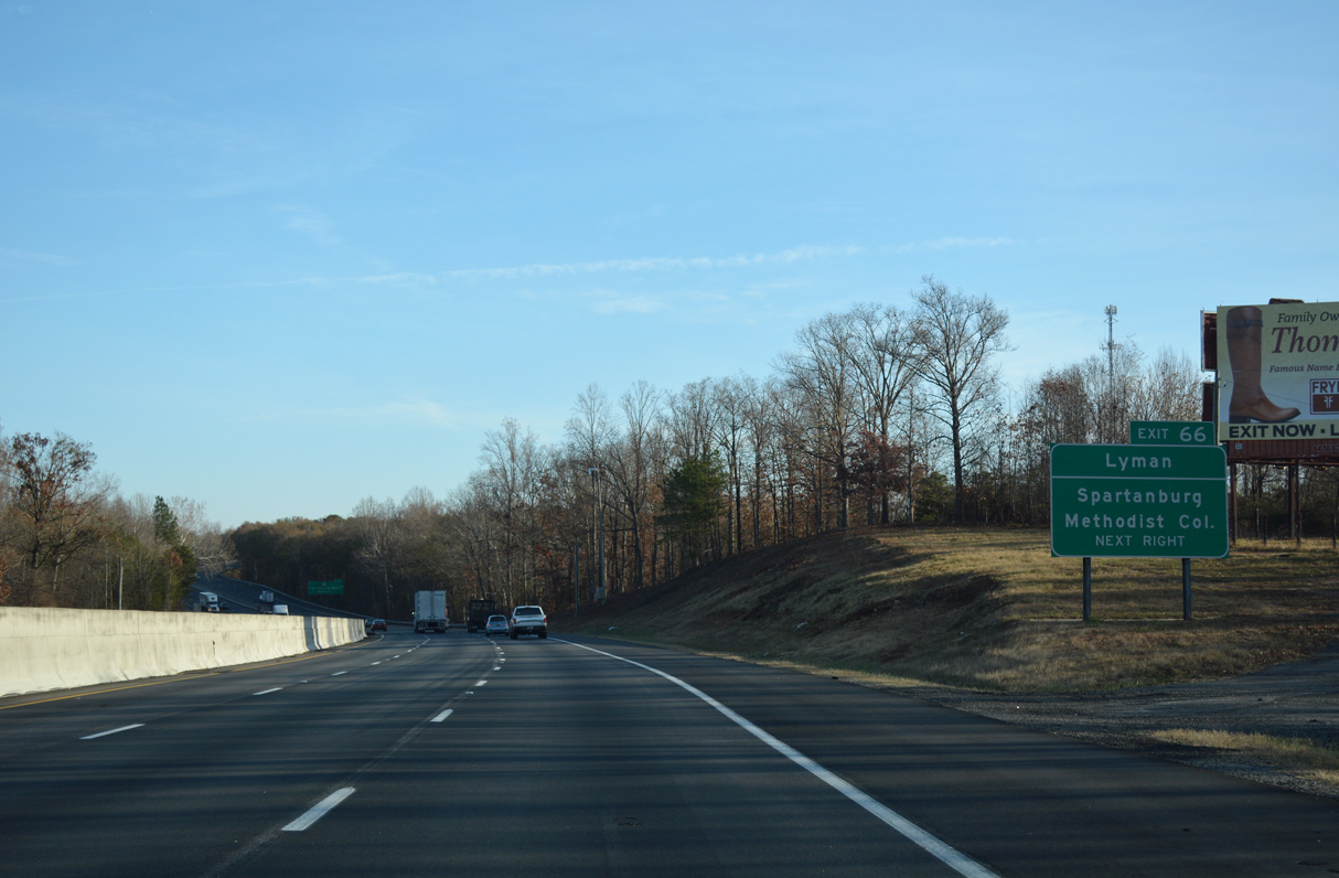
| The town of Lyman lies west of Wellford along U.S. 29 (Greenville Highway). 05/25/21 |
|
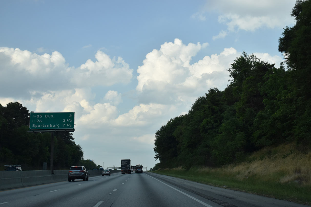
| U.S. 29 (Warren H. Abernathy Highway) continues 8.3 miles east from Interstate 85 to Downtown Spartanburg. U.S. 29 and I-85 converge again at Exit 106 by the North Carolina state line. 05/25/21 |
|
| Interstate 85 curves northeast from U.S. 29 between the Jackson Mill community and Tyger Lake. 12/15/16 |
|
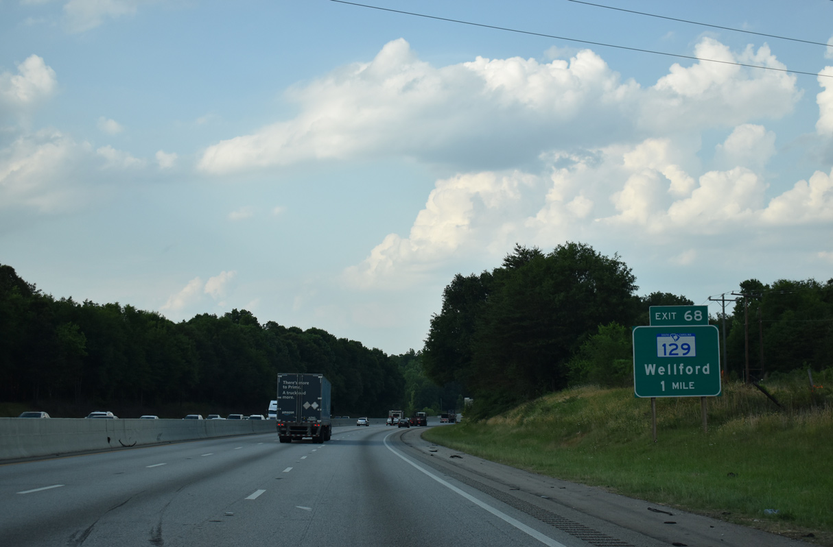
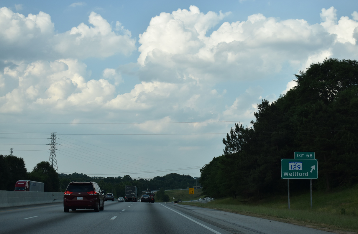
| Interstate 85 advances one mile northeast across the North Tyger River to a parclo interchange (Exit 68) with S.C. 129 (Fort Prince Boulevard). 05/25/21, 12/15/16 |
|
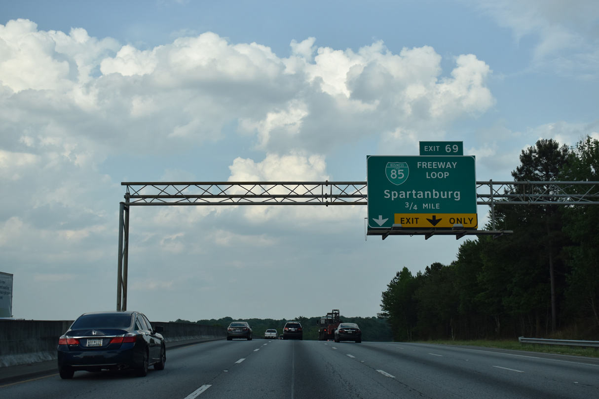
| Business Loop I-85 north, which separates from I-85 at the succeeding exit beyond S.C. 129 (Fort Prince Boulevard), to S.C. 56 (Asheville Highway) leads 7.5 miles to the Spartanburg city limits. 05/25/21 |
|
| S.C. 129 (Fort Prince Boulevard) runs 4.97 miles east from U.S. 29 in Lyman across northern reaches of Wellford to Exit 68 and Falling Creek Road. Falling Creek Road parallels I-85 and Business Loop I-85 east 1.83 miles to Blackstock Road (Road 41). 05/25/21 |
|
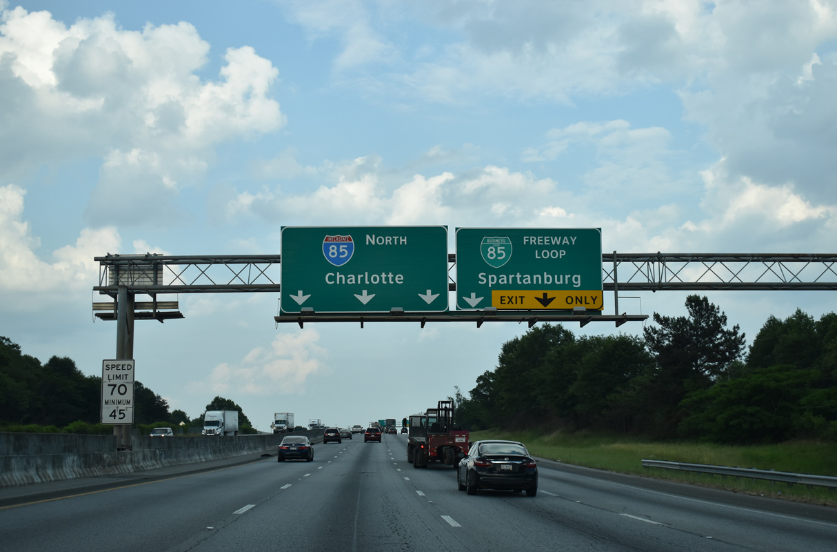
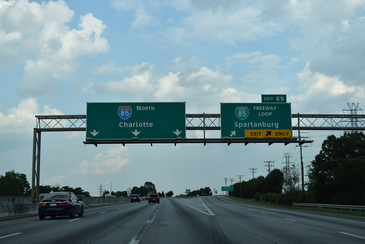
| I-85 shifts onto a bypass north of Spartanburg from the wye interchange (Exit 69) with Business Loop I-85. Completed in September 1995, the bypass replaced the 1958-60 built freeway through the Fairforest, Johnson City and Lone Oak communities by the city of Spartanburg. 05/25/21 |
|
| Interstate 85 maintains six overall lanes around Spartanburg. 8.77 miles in length, Business Loop I-85 heads east with four lanes through eight area interchanges. 05/25/21 |
|
| Sign changes made by 2000 for Business Loop I-85 added Freeway Loop in an effort to promote the route as a viable alternative to Interstate 85. 05/25/21 |
|
| I-85 proceeds north across Blackstock Road (Road 41) by the Southwest Park industrial center. 05/25/21 |
|
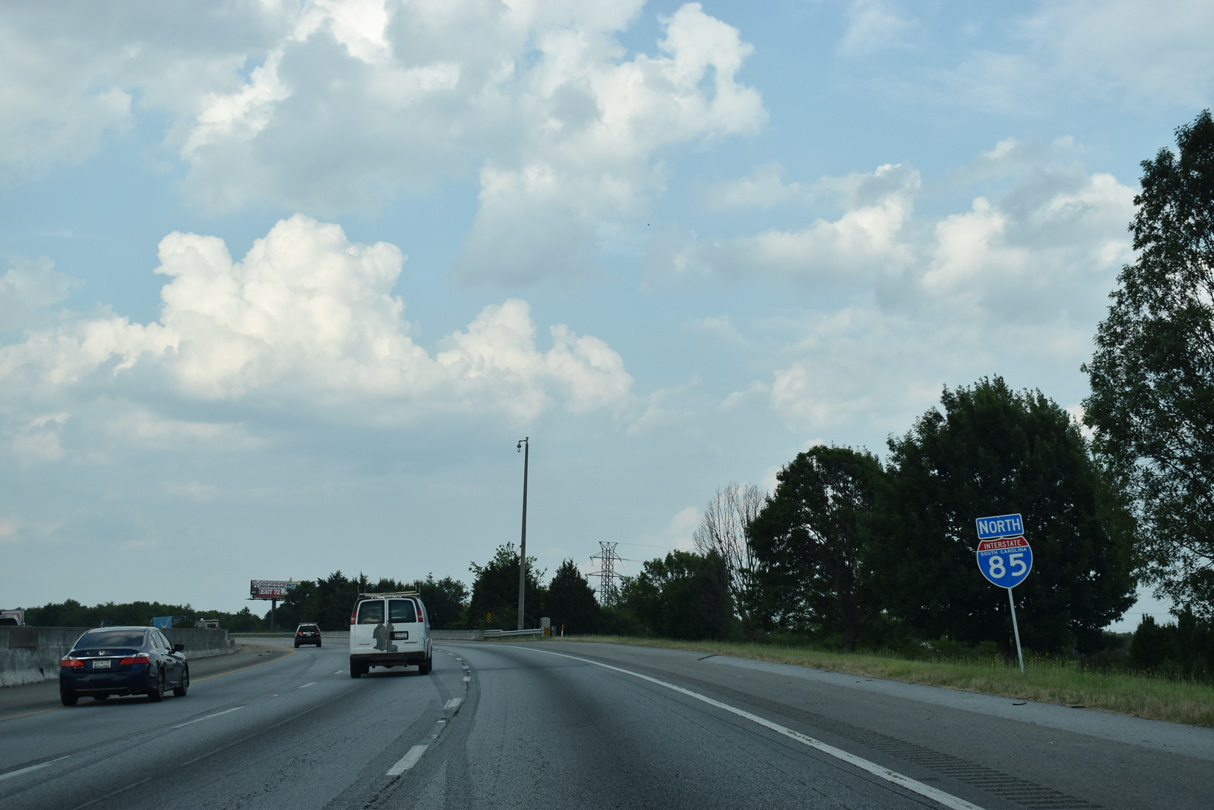
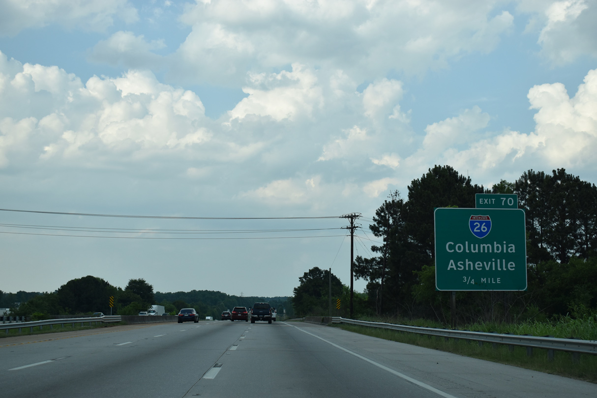
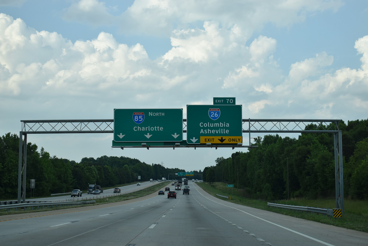
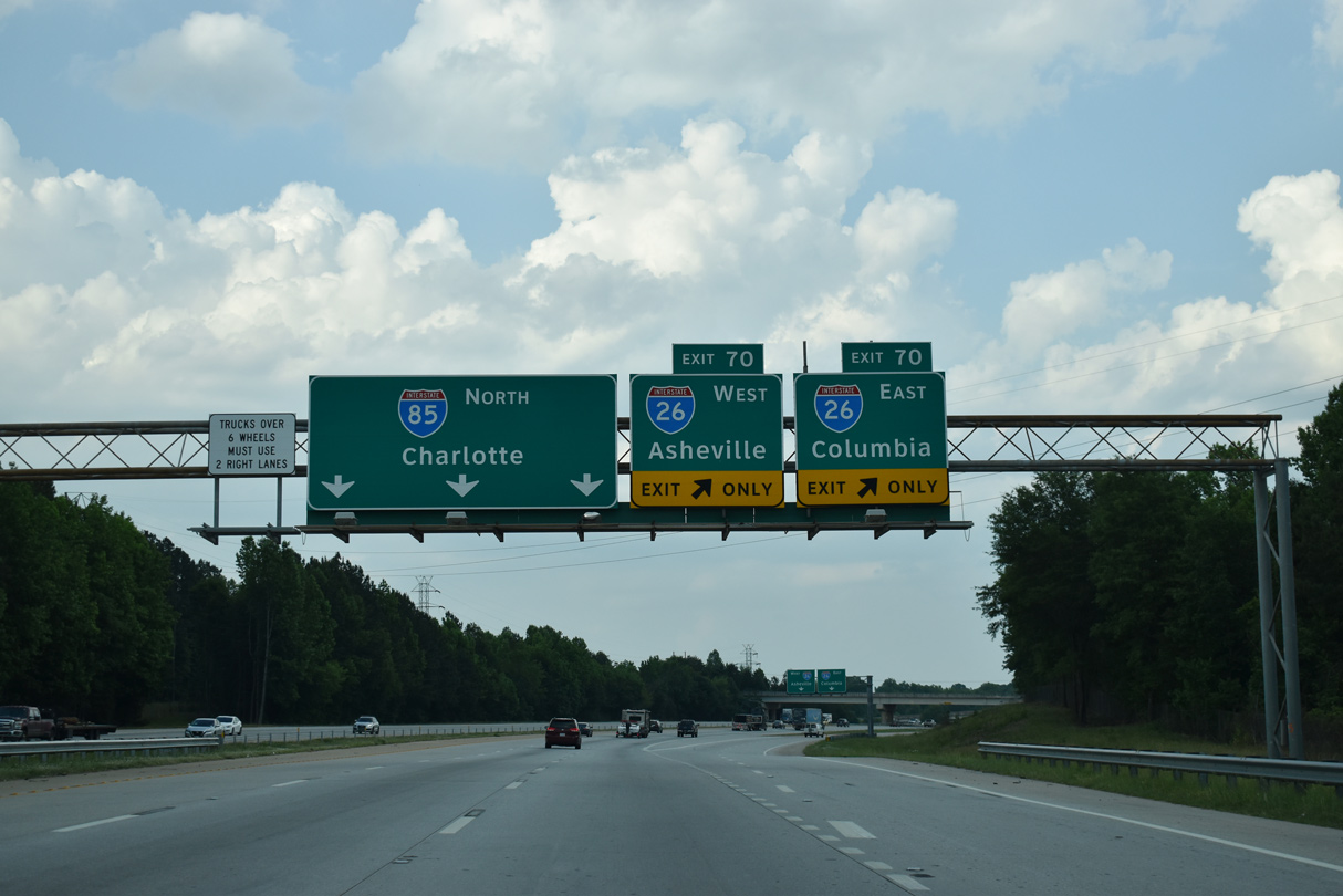
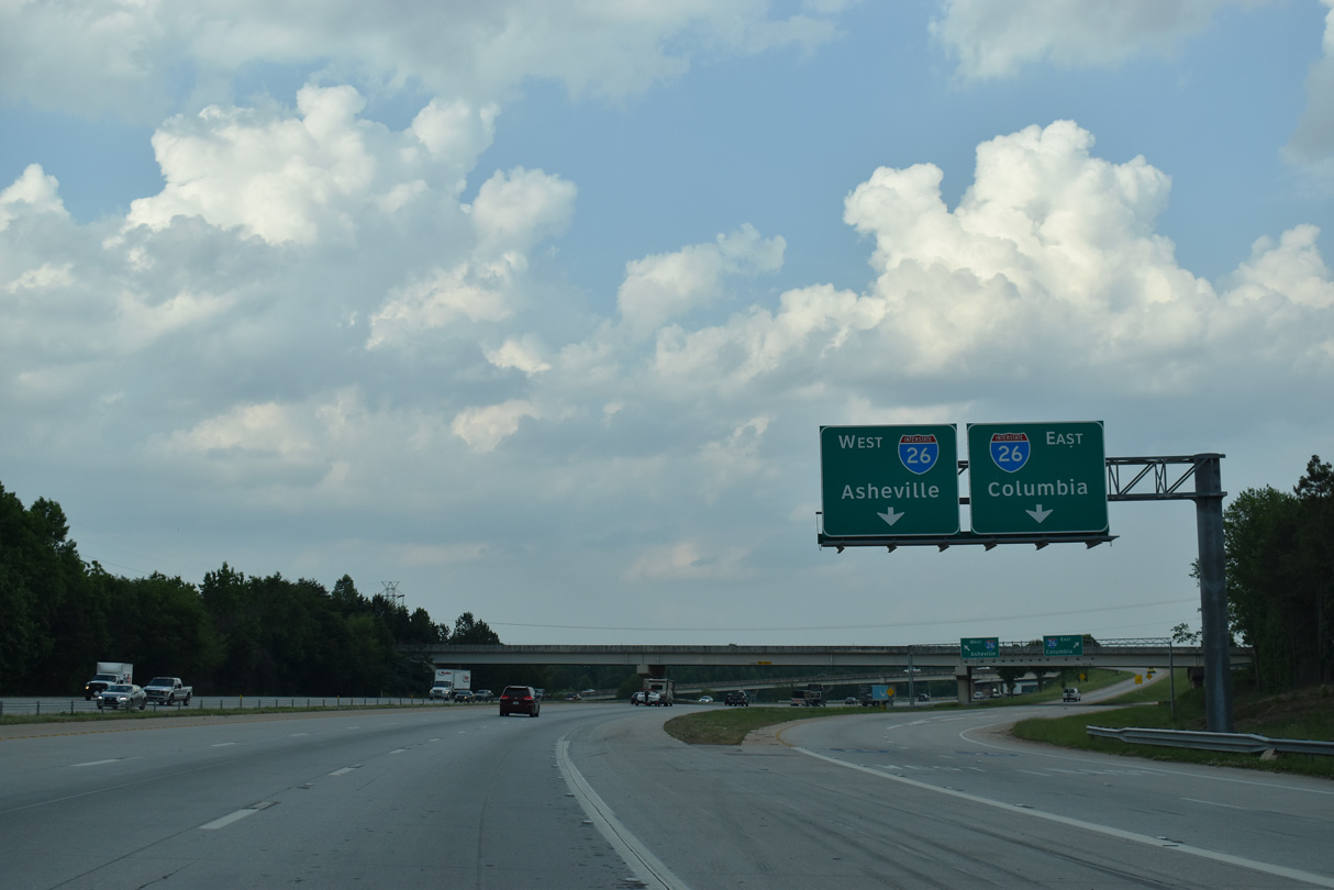
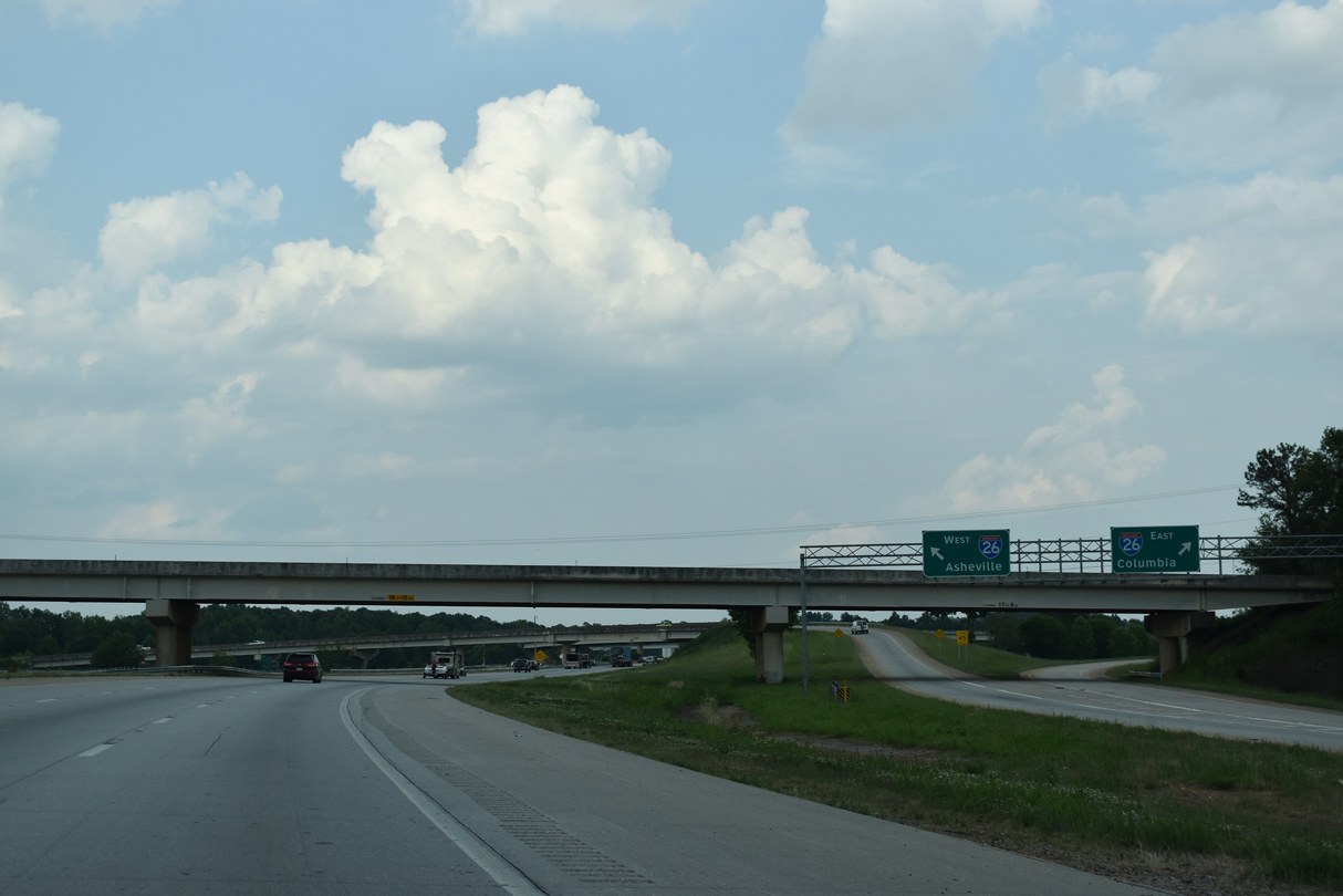
| Interstate 85 converges with I-26 at a cloverstack interchange (Exit 70) by the North Woodfield Heights and Woodfield subdivisions. 05/25/21 |
|
| Originating in Charleston, Interstate 26 travels 220.95 miles northwest in South Carolina from the Low Country to Orangeburg, Columbia and Landrum. 05/25/21 |
|
| A high speed flyover links I-85 north with Interstate 26 west to Hendersonville and Asheville, North Carolina. South from Exit 70 to S.C. 296, I-26 continues 4.3 miles through western reaches of the Spartanburg area. 05/25/21 |
|
| Interstate 26 overall travels 349 miles between Kingsport, Tennessee and Charleston. Prior to 2003, when the section over Sams Gap into Tennessee opened, I-26 ended at Asheville, North Carolina. 05/25/21 |
|
| Passing overhead, Zimmerman Road was realigned to accommodate construction of the systems exchange with I-26. Northwest from Exit 70, I-26 passes Inman to Columbus, North Carolina in 23 miles where it turns across the Saluda Mountains. 05/25/21 |
|
| Interstate 85 navigates northeast through an S-curve below New Cut Road (Road 65) and a Norfolk Southern Railroad line by the community of Southern Shops. 05/25/21 |
|
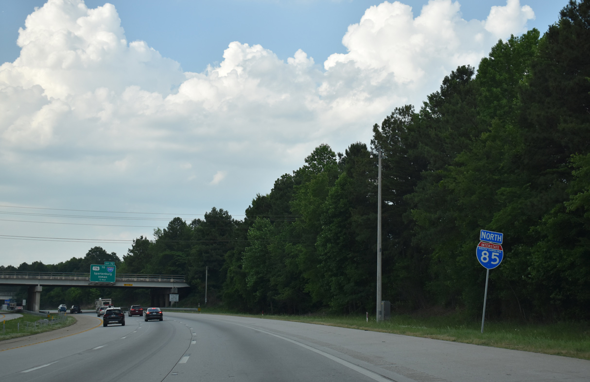
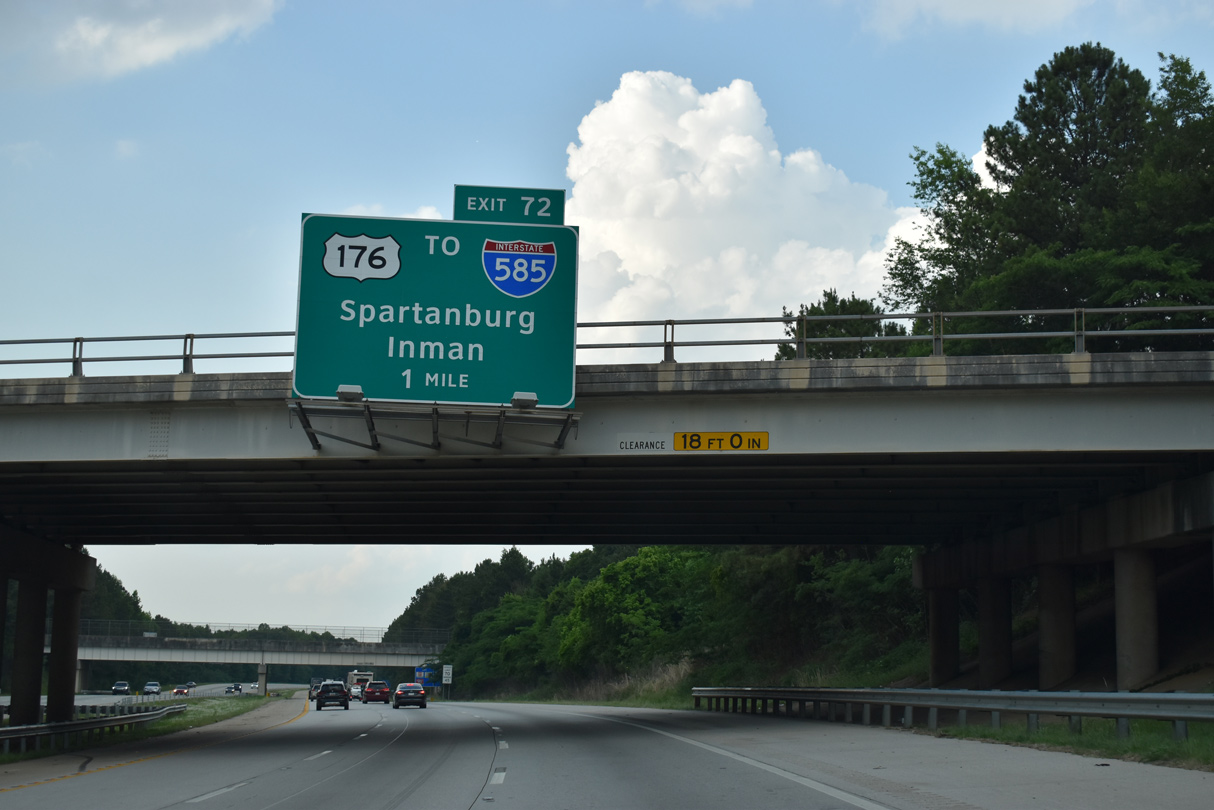
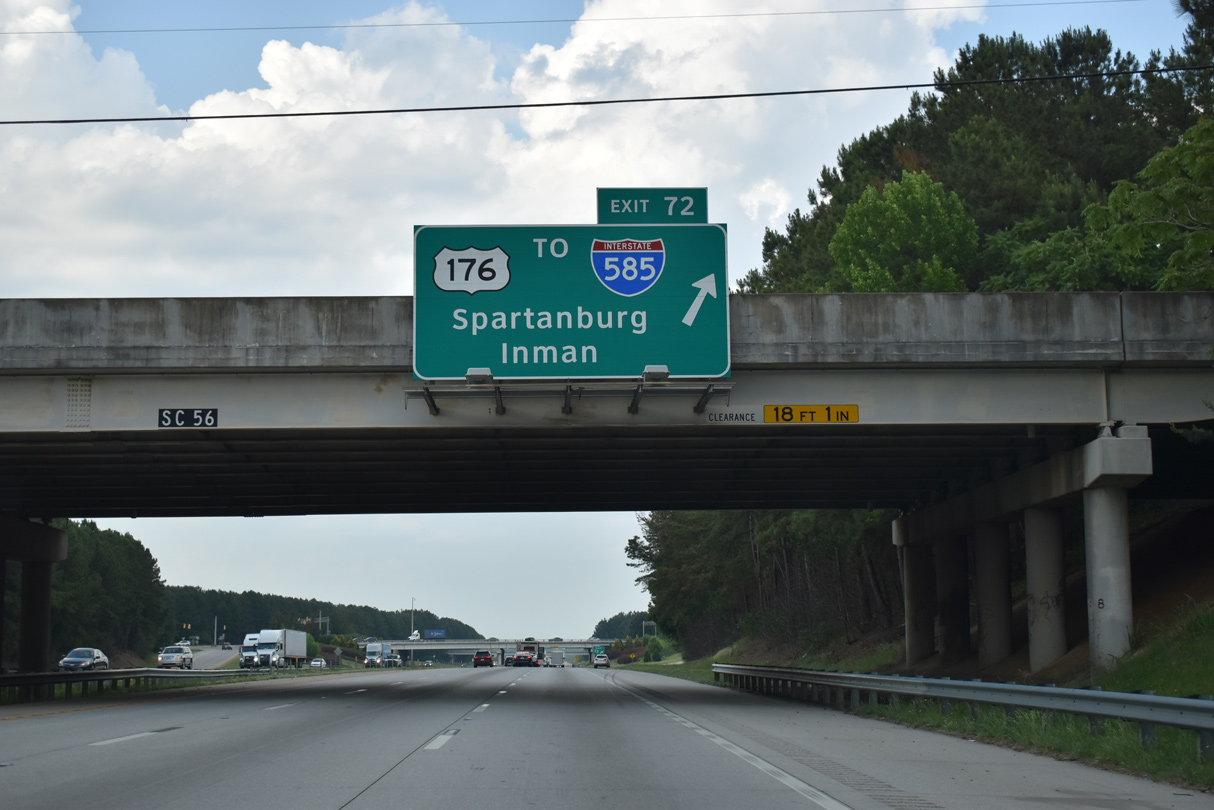
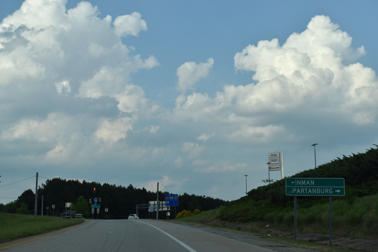
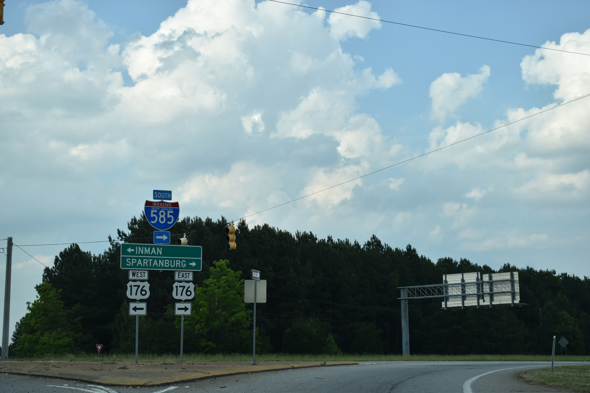
| Continuing north, I-85 meets U.S. 176 (N Pine Street) at a diamond interchange (Exit 72) near Lone Oak. U.S. 176 branches east from Asheville Highway (S.C. 56) along a controlled access expressway to become a part of I-585 ahead of USC Upstate and the city of Spartanburg. 05/25/21 |
|
| Exit 72 departs I-85 north below S.C. 56 (Asheville Highway). U.S. 176 follows Asheville Highway northwest to Inman, Campobello, Landrum and Tryon, North Carolina. 05/25/21 |
|
| 2003-06 construction upgraded U.S. 176 to limited access standards east from adjacent Fairforest Road to the USC Upstate campus and Business Loop I-85. 05/25/21 |
|
| Per SCDOT GIS Data, Interstate 585 overlays U.S. 176, 2.25 miles southeast from Business Loop I-85 by the Milliken Arboretum to U.S. 221 (Whitney Road) and N Pine Street by Pinewood Shopping Center. 05/25/21 |
|
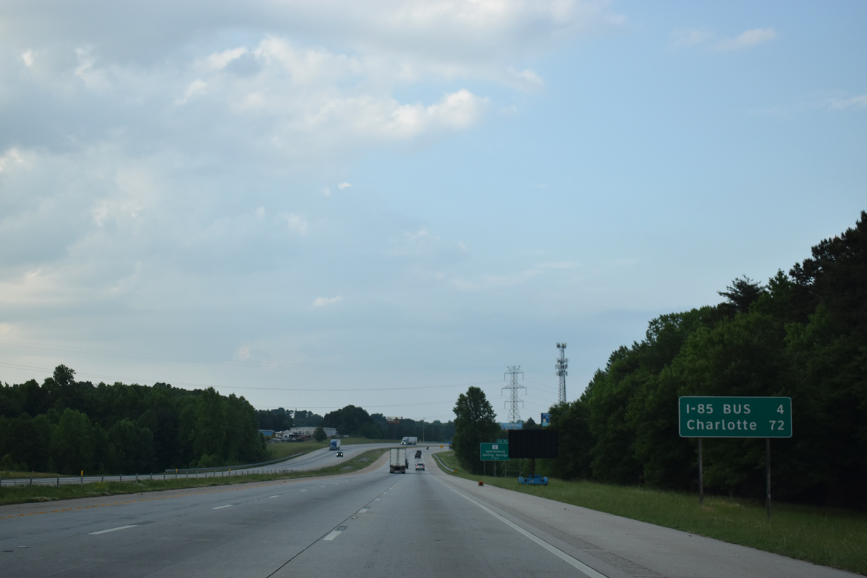
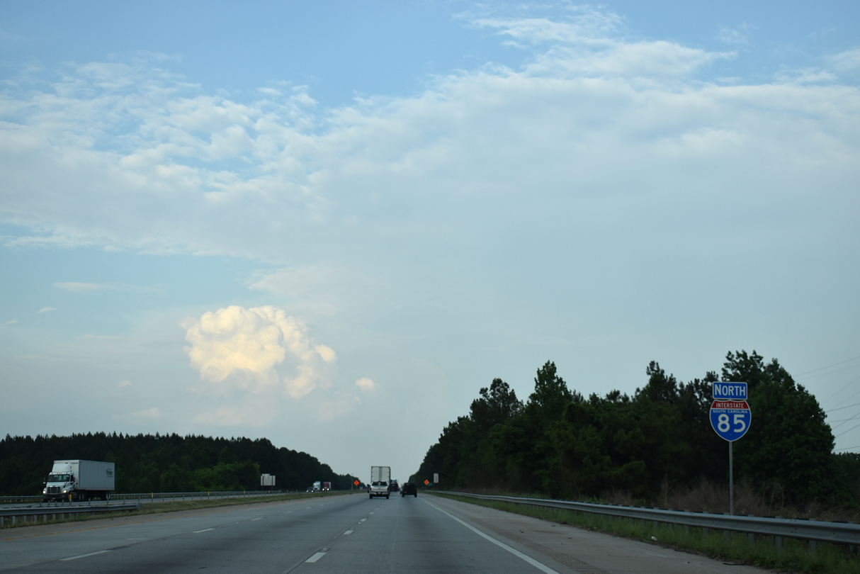
| Interstate 85 and Business Loop I-85 reconvene in four miles. Charlotte lies 72 miles to the northeast. 05/25/21 |
|
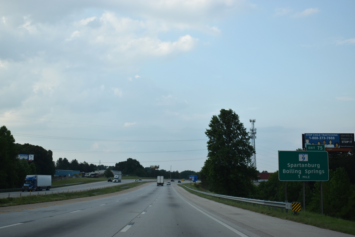
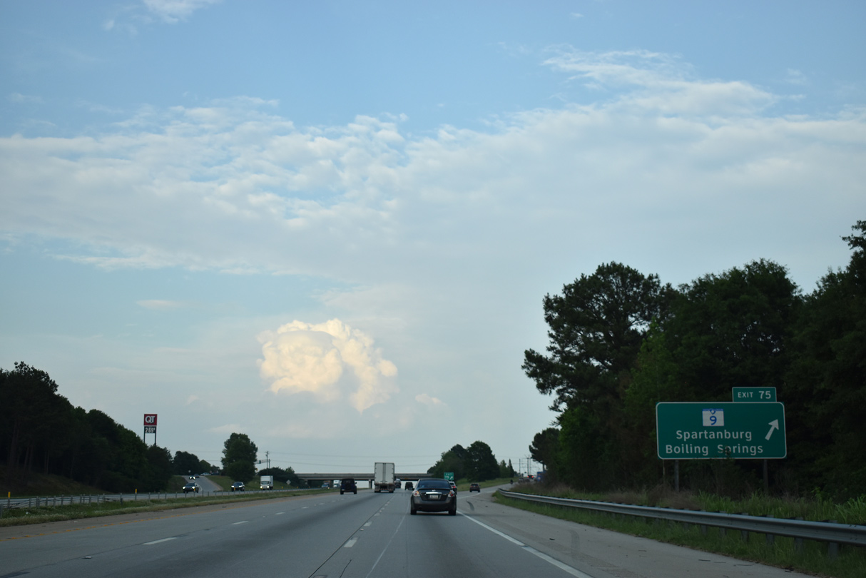
| Turning eastward through the community of Valley Falls, I-85 advances to a diamond interchange (Exit 75) with S.C. 9 (Boiling Springs Road). S.C. 9 extends 2.79 miles north from I-585 and U.S. 176 Connector (N Church Street) in Spartanburg to Exit 75 by Boiling Springs. 05/25/21 |
|
| S.C. 9 constitutes a 259.6 mile long highway southeast from NC 9, north of New Prospect, to Cherry Grove Beach on the Atlantic Ocean. S.C. 9 combines with U.S. 176 along Pine Street through Spartanburg. 05/25/21 |
|
| Interstate 85 north crosses Big Shoally Creek and Parris Bridge Road (Road 43) ahead of this confirming marker. 05/25/21 |
|
| The Cherokee County seat of Gaffney lies 16 miles to the east. North Carolina's largest city is 69 miles away. 05/25/21 |
|
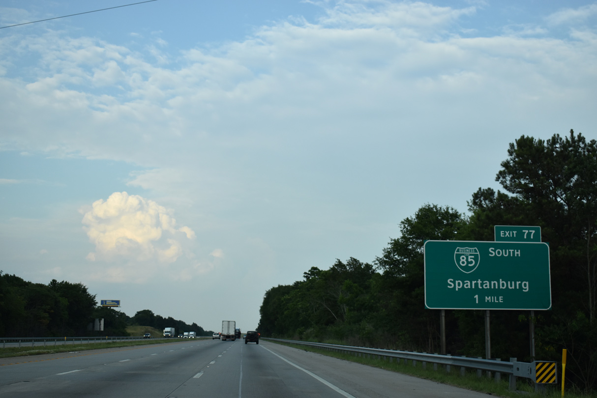
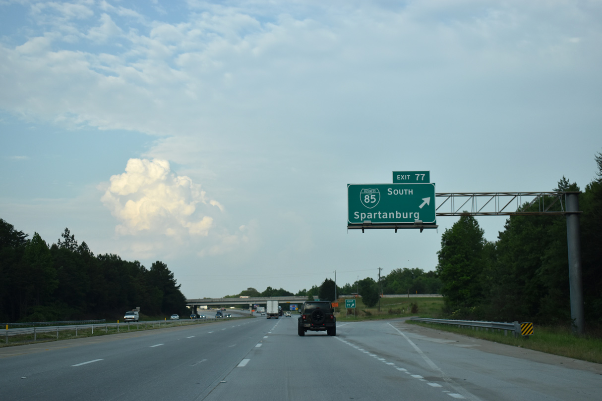
| Business Loop I-85 and Interstate 85 converge at a trumpet interchange (Exit 77) north of Whitney and Spartanburg. 05/25/21 |
|
| Exit 77 leads south onto Business Loop I-85 back to Spartanburg. A second business loop for I-85 was designated between Lexington and Greensboro, North Carolina. 05/25/21 |
|
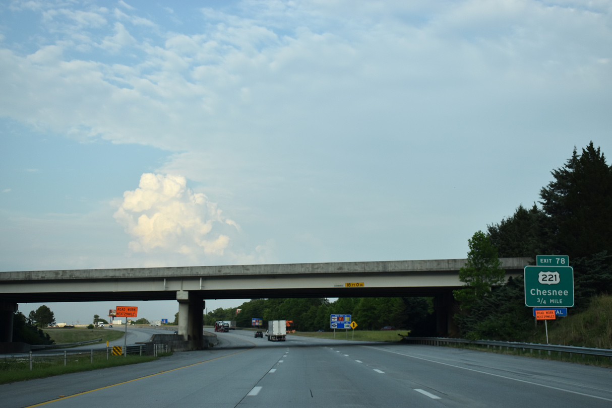
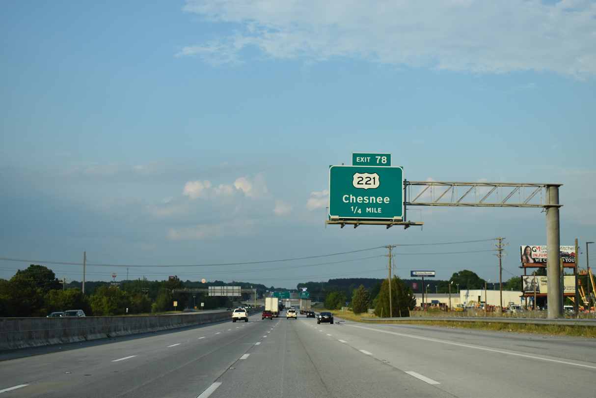
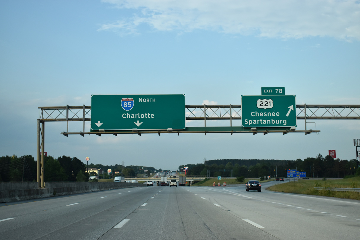
| I-85 meets U.S. 221 at a diamond interchange (Exit 78) a half mile east of Business Loop I-85. 05/25/21 |
|
| U.S. 221 heads 9.96 miles north from I-85 to U.S. 221 ALT in the city of Chesnee. 734 miles overall, U.S. 221 travels through five states from Perry, Florida north to Lynchburg, Virginia. 05/25/21 |
|
| Exit 78 leaves I-85 north for U.S. 221 southwest to Whitney and Spartanburg and north to Cherokee Springs and Chesnee. U.S. 221 ALT separates from U.S. 221 northward to Rutherfordton, North Carolina. 05/25/21 |
|
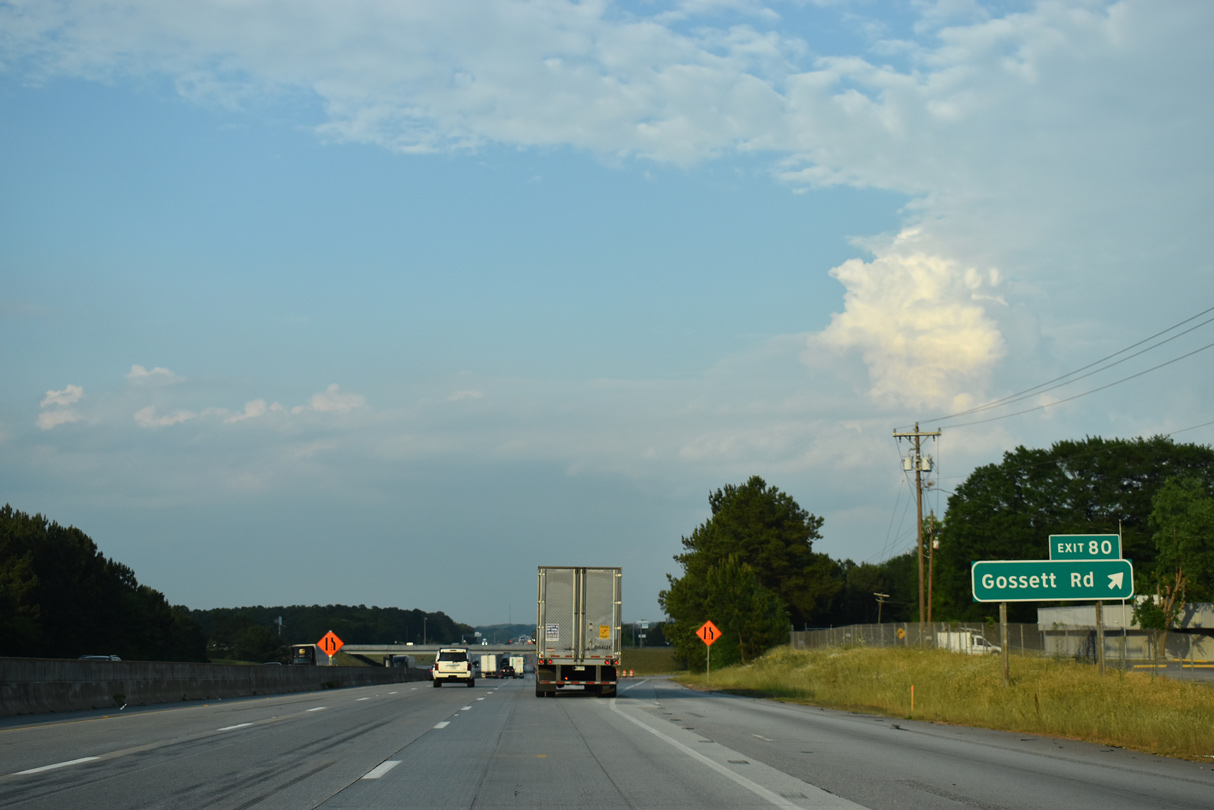
| A parclo interchange joins Interstate 85 with Gossett Road (Road 57) at Exit 80. 05/25/21 |
|
| Gossett Road runs 1.43 miles south from Exit 80 to Cannon Campgrounds Road (Road 31) at Enola and 1.77 miles north to U.S. 221 at Cherokee Springs. 05/25/21 |
|
| A $435.58 million contract was awarded by SCDOT on October 4, 2016 for reconstruction and widening of I-85 from mile marker (MM) 77 to 98. Work rehabilitates the six lane section from MM 76.4 to MM 80 and expands the four lane section northeast to near the Broad River Bridge beyond Exit 96.1 12/15/16 |
|
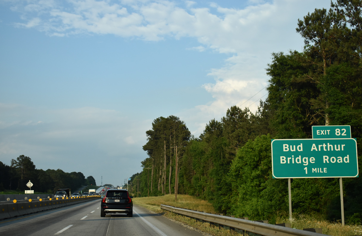
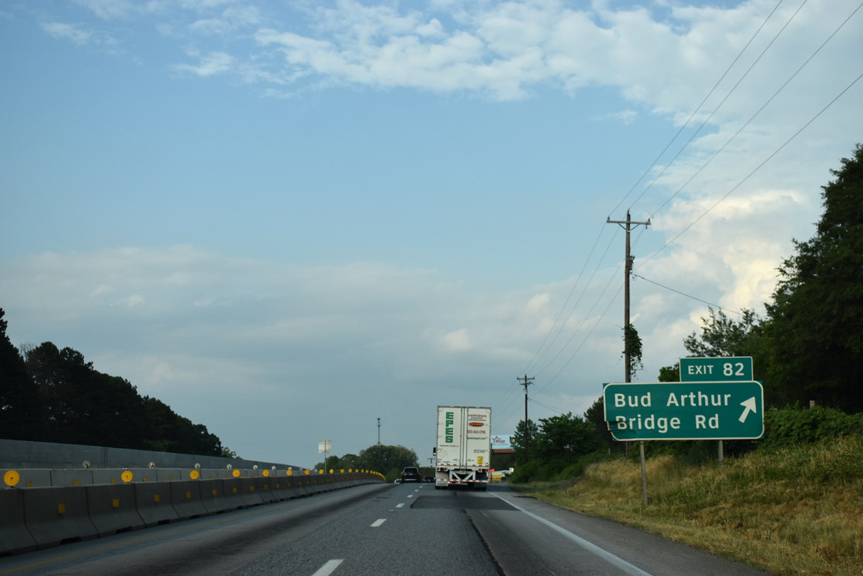
| Interstate 85 spans the Pacolet River ahead of the off-ramp (Exit 82) onto Buds Drive to Bud Arthur Bridge Road. Plans for six lane expansion remove Exit 82 from northbound. 05/25/21 |
|
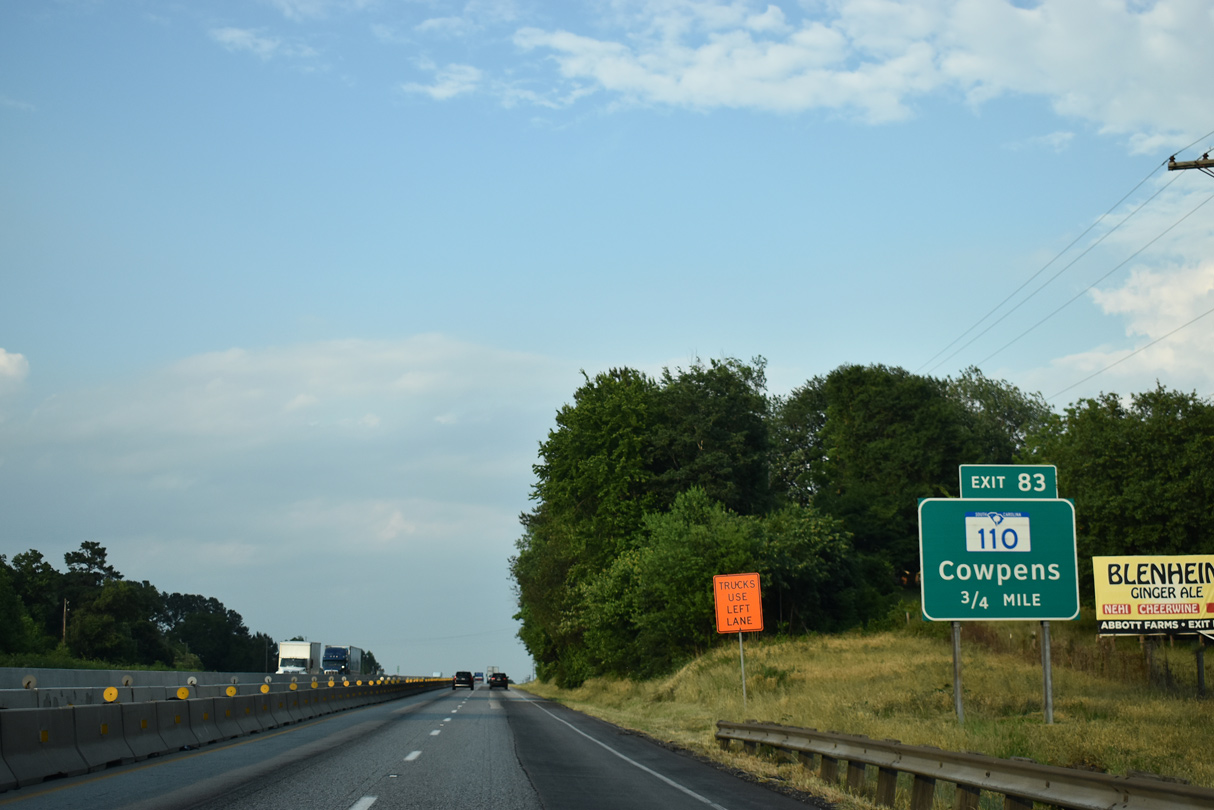
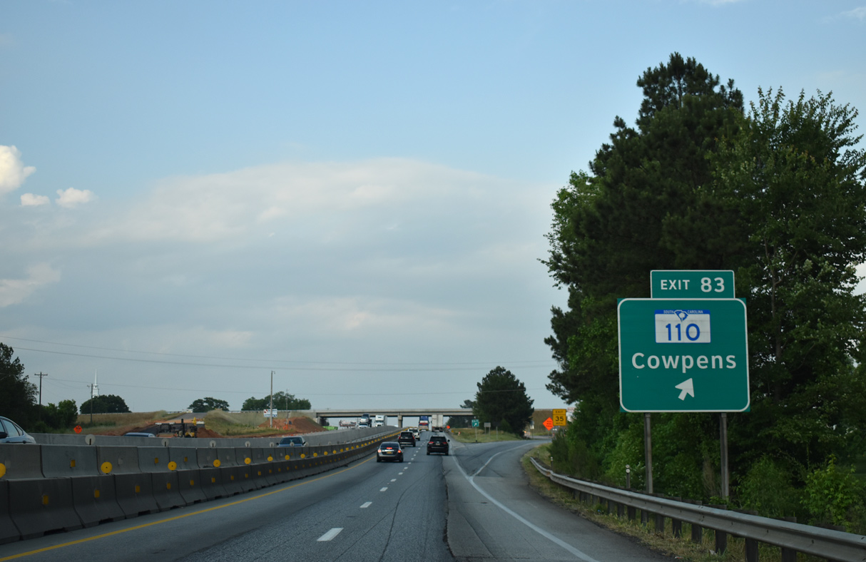
| Bud Arthur Bridge Road meanders northeast from Cannons Campground Road near Enola to become a south side frontage road east to S.C. 110 (Battleground Road) at Exit 83. 05/25/21 |
|
| Expansion of I-85 reconfigures Exit 83 into a parclo interchange. The previous off-ramp joined Bud Arthur Bridge Road ahead of S.C. 110 (Battleground Road). S.C. 110 runs 1.73 miles south from Bud Arthur Bridge Road to U.S. 29 (Main Street) in the town of Cowpens. 05/25/21 |
|
| A 9.28 mile long highway, S.C. 110 continues north from Interstate 85 to U.S. 221 ALT/S.C. 11 by Cowpens National Battlefield. 05/25/21 |
|
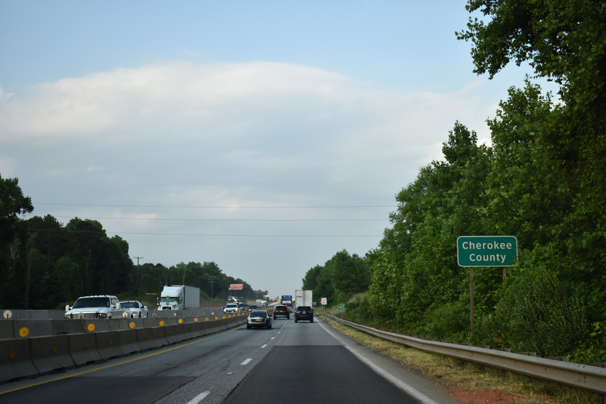
| Crossing Little Thicketty Creek, northbound Interstate 85 enters Cherokee County. 05/25/21 |
Page Updated 06-18-2021.

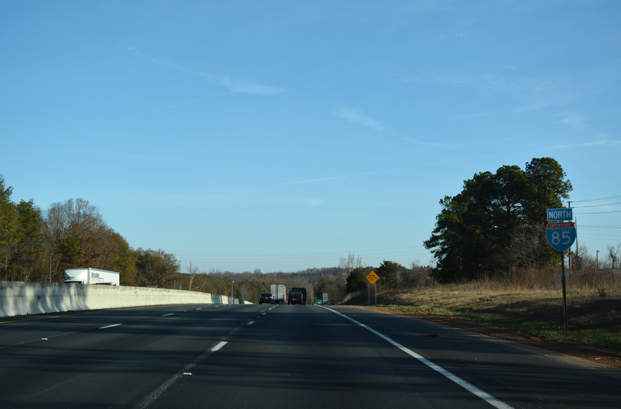
 North
North