|
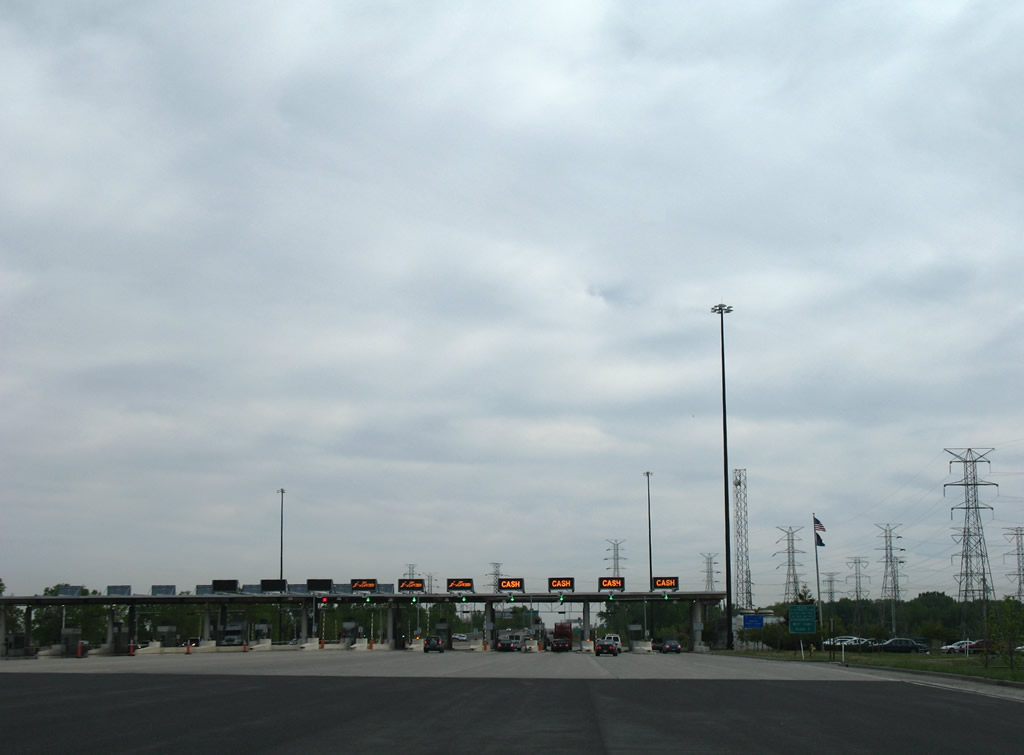
| The Indiana Toll Road extends south from a half diamond interchange with U.S. 12-20-41 (Indianapolis Boulevard) through northern Hammond. The West Point Toll Plaza follows beyond 112th Street. 05/24/08 |
|
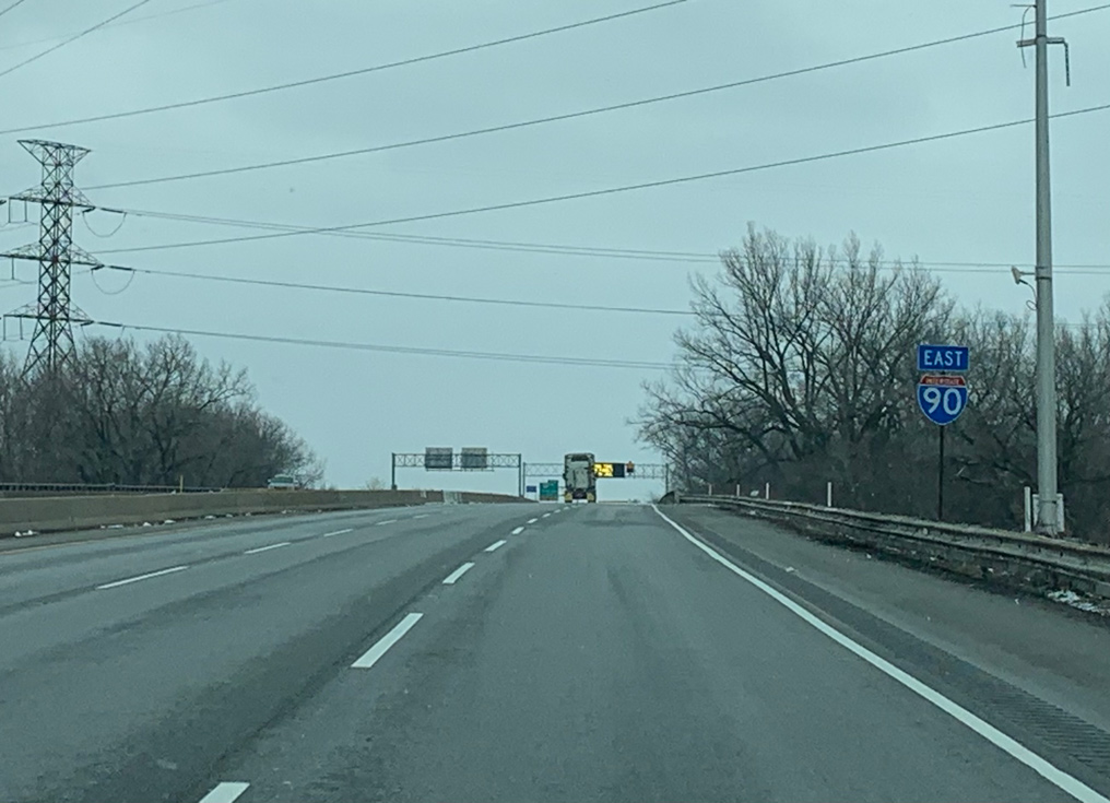
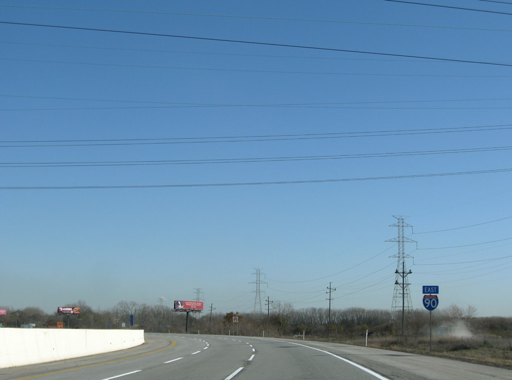
| An I-90 confirming marker stands beyond the entrance ramp from U.S. 12/20/41 (Indianpolis Boulevard) and the East Side neighborhood in Chicago. 05/24/08 |
|
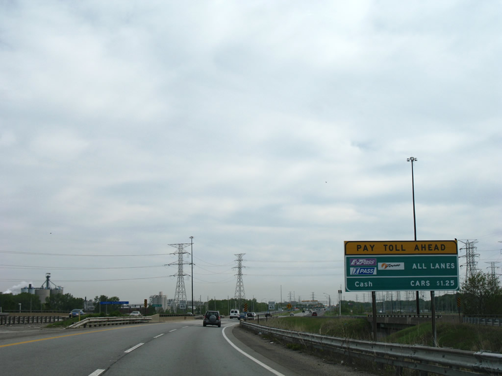
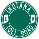
| Indiana implemented the IZoom electronic toll collection system in the late 2000s. The IZoom system was part of the E-ZPass network. 05/24/08 |
|
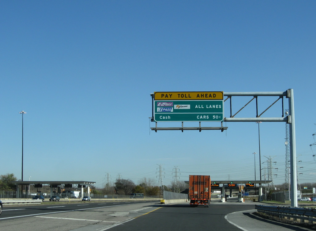
| The West Point Toll Plaza has 16 booths and no open road tolling. 05/24/08 |
|
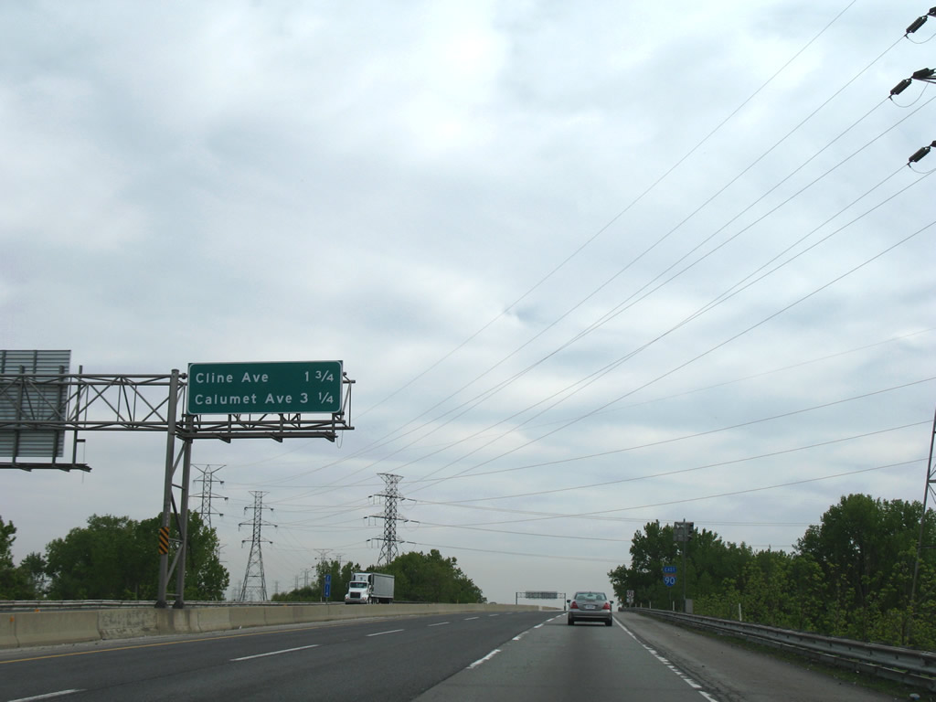
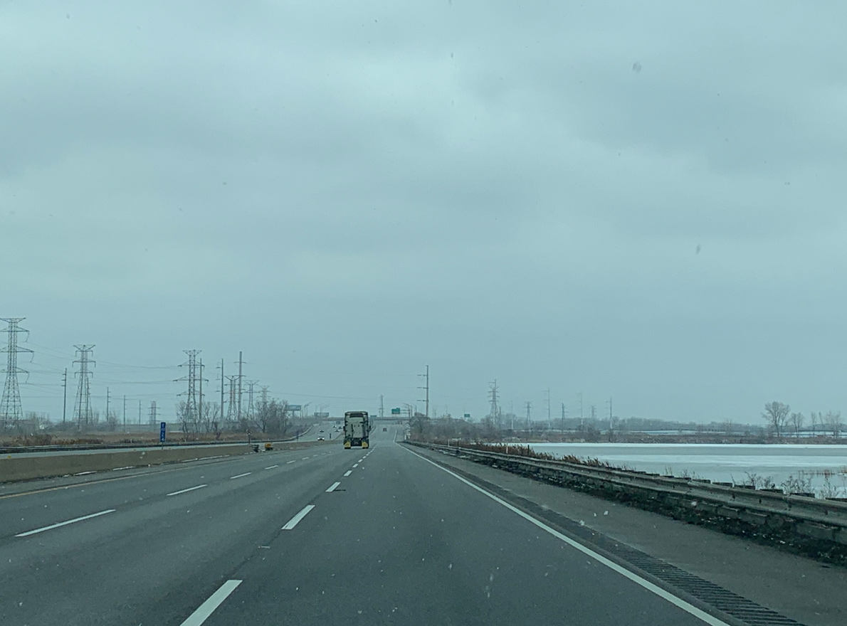
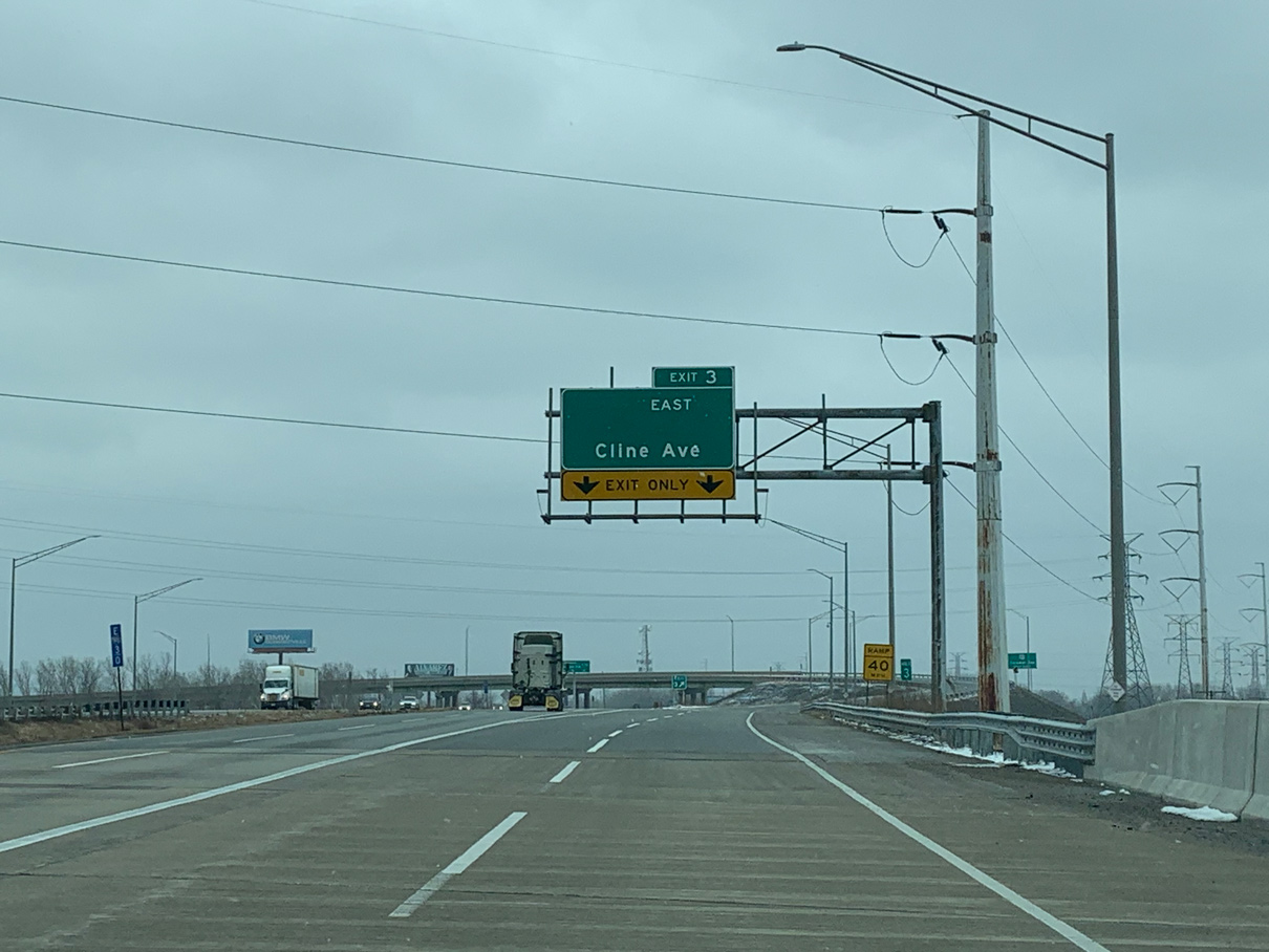
| The succeeding two exits along I-90 (Indiana Toll Road) eastbound connect with SR 912 (Cline Avenue) and U.S. 41 (Calumet Avenue) in the city of Hammond. 05/24/08 |
|
| Interstate 90 shifts eastward across a Norfolk Southern Railroad line and Wolf Lake. 01/18/21 |
|
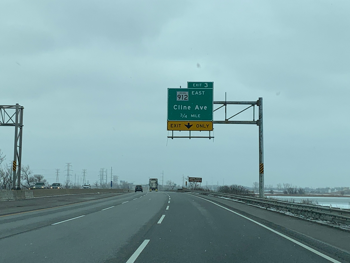
| SR 912 (Cline Avenue) stems east from the Exit 3 to East Chicago and south to I-80-94/U.S. 6 along the Hammond and Gary city line. SR 912 was a discontinuous route from 2009 to 2020 due to the removal of the bridge system into East Chicago. 05/24/08 |
|
| SR 912 crosses the Indiana Harbor Tunnel and adjacent industrial areas along the Cline Avenue Toll Bridge, a high level span completed on December 23, 2020. SR 912 travels 11.5 miles overall southeast to Ridge Road (U.S. 6 Business) at Highland. 01/18/21 |
|
| Interstate 90 crosses Wolf Lake on a six lane causeway south to the wye interchange (Exit 3) with SR 912 (Cline Avenue) east. 01/18/21 |
|
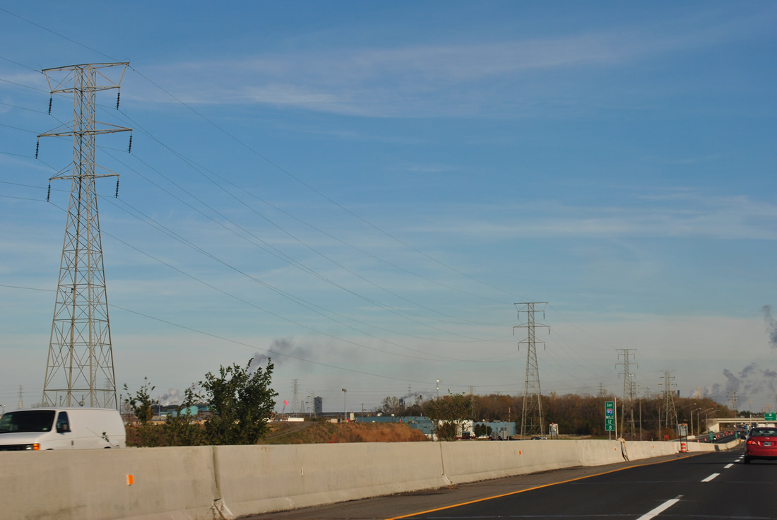
| Much of the industrial lake shore between Illinois and Porter is populated by steel plants and oil refineries. SR 912 provides access to the Whiting and East Chicago industrial areas at Indiana Harbor and Gary/Chicago International Airport (GYY). 01/18/21 |
|
| A long viaduct carries Interstate 90 east over the Great Calumet River, two Norfolk Southern Railroads, and Industrial Highway (former U.S. 12). Transmission lines continue alongside Interstate 90 (Indiana Toll Road) to Downtown Gary. 11/04/11 |
|
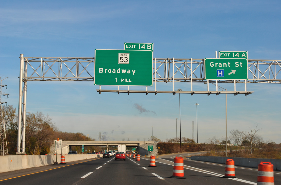
| Exit 14A consists of a trumpet interchange and access road joining Interstate 90 with Buchanan Street. Grant Street parallels Buchanan Street three blocks to the west as the main route south to Tolleston and the Borman Expressway. 11/04/11 |
|
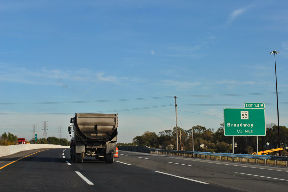
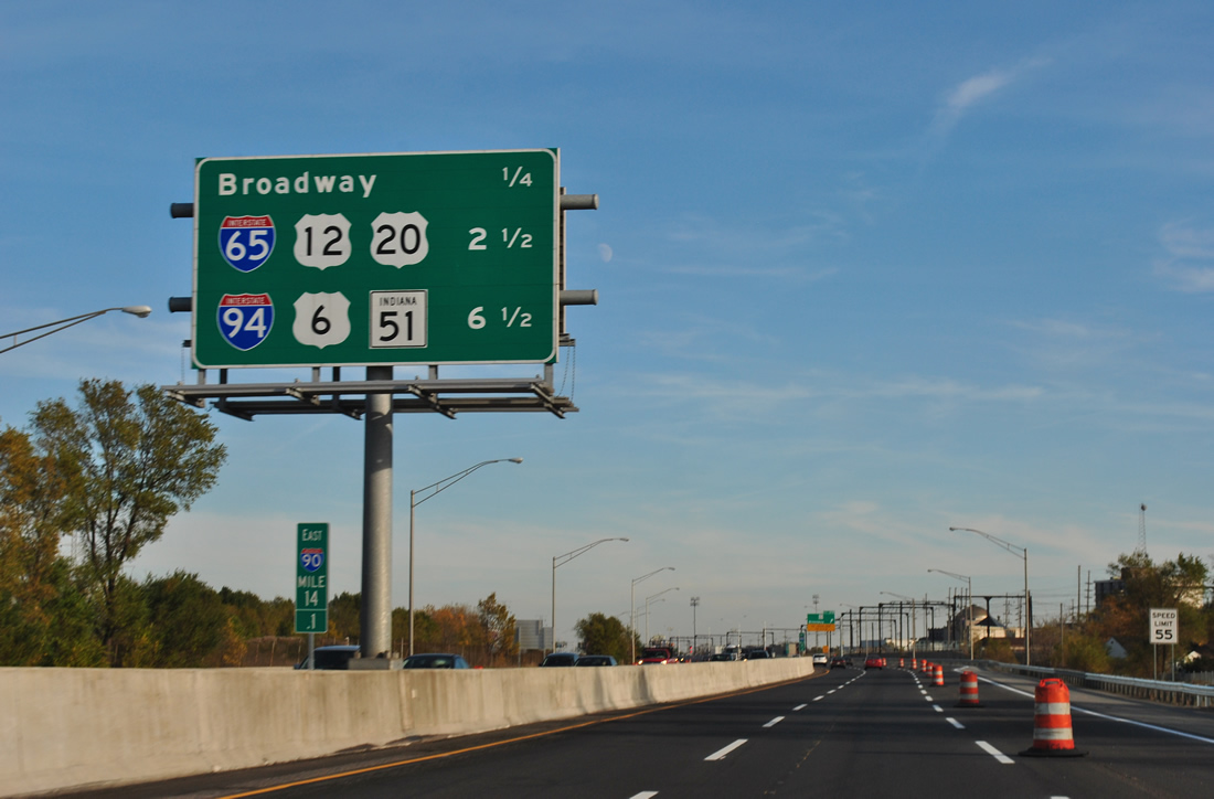
| Five railroad lines parallel Interstate 90 on the half mile preceding Exit 14 B with the southbound beginning of SR 53 (Broadway). Broadway joins the Toll Road with Downtown Gary and the US Steel Plant north of the Grand Calumet River. 11/04/11 |
|
| Interstate 65 follows as the next eastbound interchange in 2.5 miles. Interstate 80 joins the toll road in 6.5 miles. 11/04/11 |
|
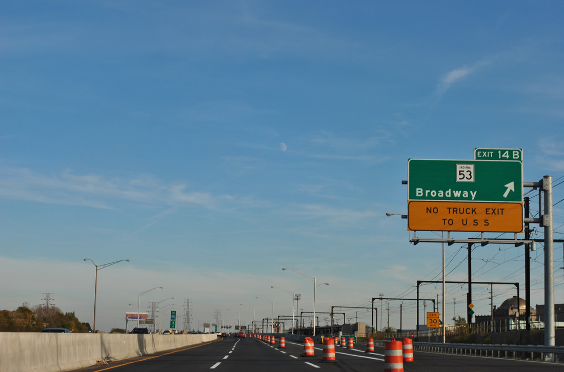
| Interstate 90 eastbound at Exit 14 B to SR 53 (Broadway) south into Downtown. Trucks are prohibited from using the off-ramp onto Broadway north to the adjacent steel plant. SR 53 travels 14.1 miles south to Merrillville from I-90 in Gary. 11/04/11 |
|
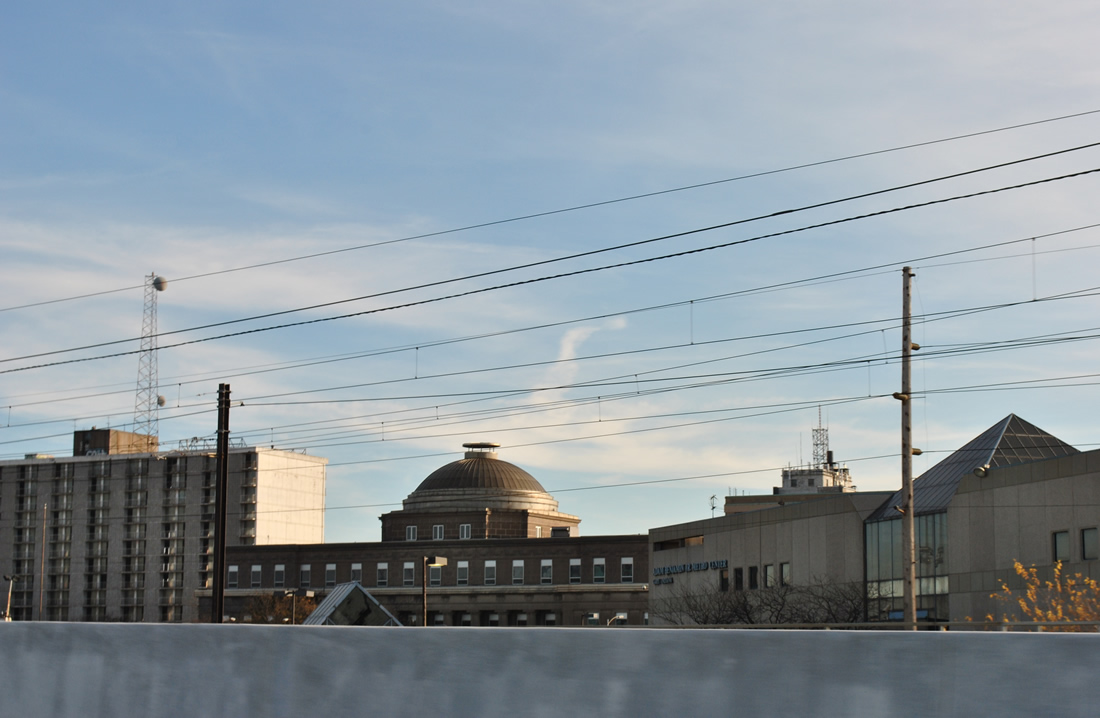
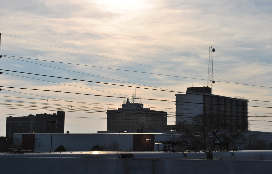
| The Adam Benjamin, Jr. Metro Center and county court house appear as part of the downtown core of buildings for Gary adjacent to Interstate 90 at Exit 14B. 11/04/11 |
|
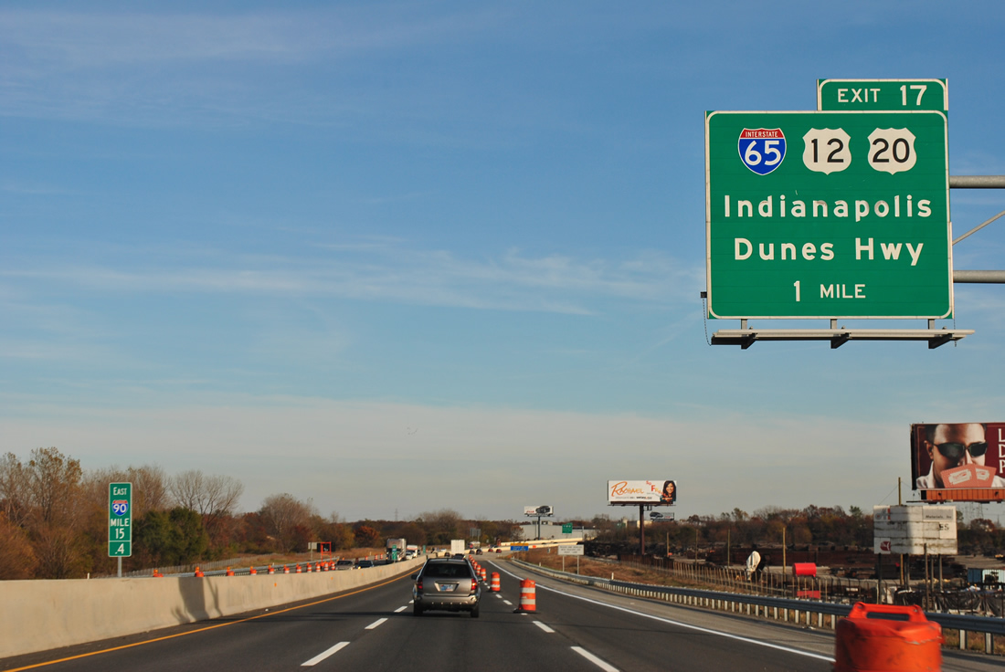
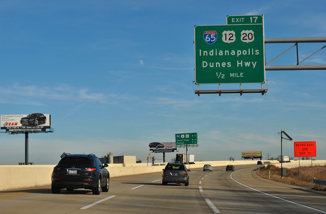
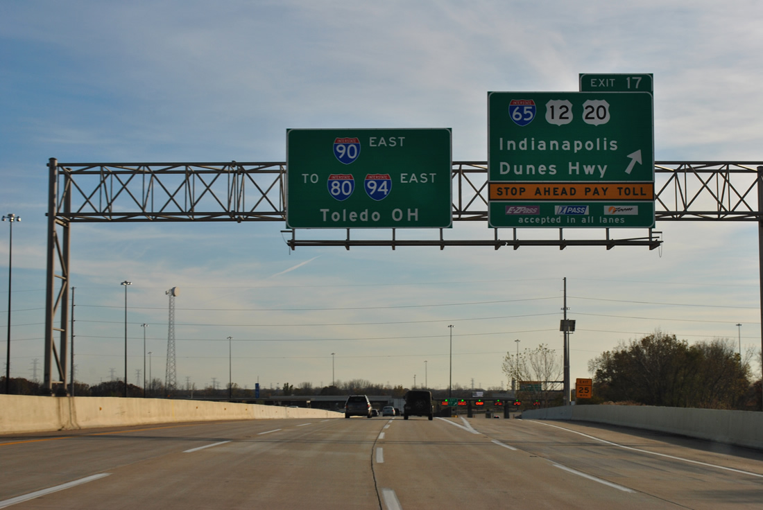
| Interstate 65 begins in one mile from U.S. 12/20 (E Dunes Highway) adjacent to Exit 17. I-65 leads south 887 miles to I-10 in Mobile, Alabama. 11/04/11 |
|
| U.S. 12/20 follow East Dunes Highway from a one way couplet (4th/5th Streets) at Downtown Gary. The pair continue east from a traffic light with Interstate 65 to split at the Aetna community of east Gary. 11/04/11 |
|
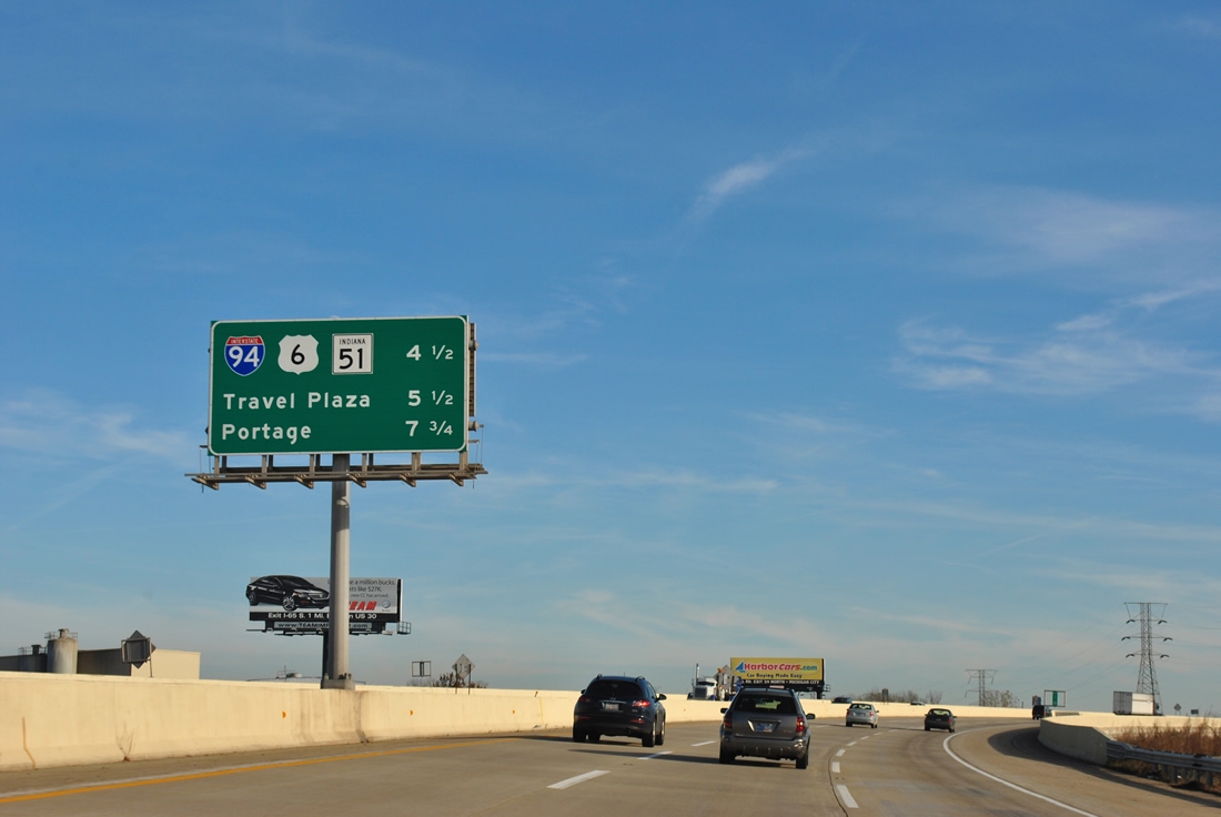
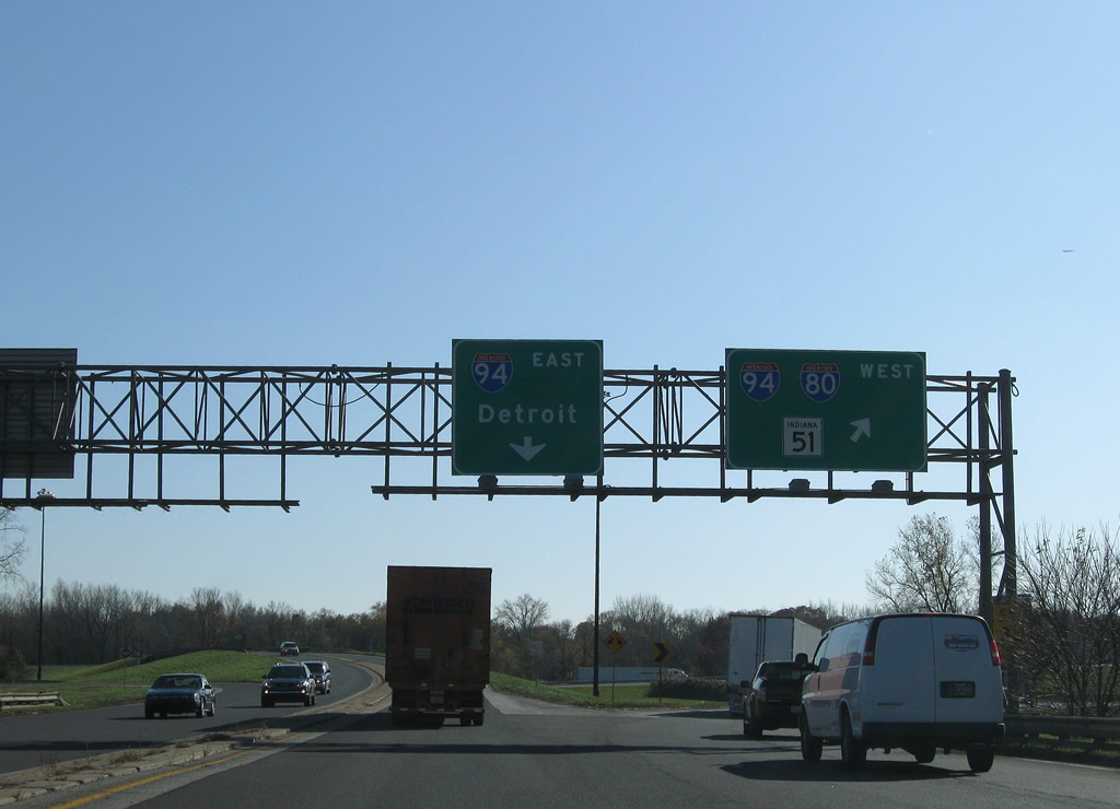
| I-90 proceeds east 4.5 miles from I-65 to meet Interstate 94, U.S. 6, and SR 51 at Lake Station. I-80 shifts from an overlap with I-94 (Borman Expressway) onto a 278.4 mile long overlap with I-90 at Exit 21. 11/04/11 |
|
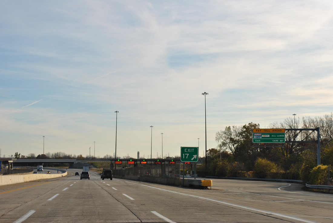
| Exit 17 departs Interstate 90 (Indiana Toll Road) east for Interstate 65 south to Indianapolis and U.S. 12/20 (East Dunes Highway). I-65 continues south 87 miles to Lafayette and 261 miles overall within Indiana. 11/04/11 |
|
| Until 2004, the connection to Interstate 65 south from I-90 utilized a portion of U.S. 12/20 (E Dunes Highway) west to an intersection with the freeway at Taylor Road. A directional ramp was constructed between the two adjacent routes. 11/04/11 |
|
| Leaving the junction with Interstate 65 and the 15th Avenue overpass on I-90 in east Gary. 11/05/09 |
|
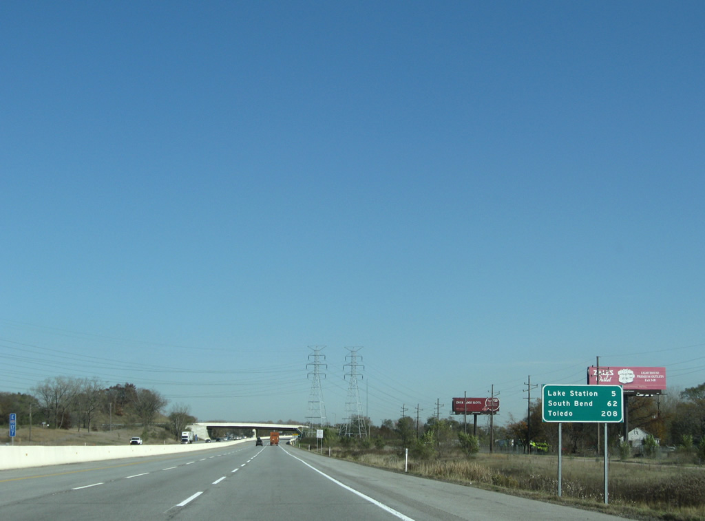
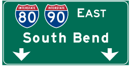
| Interstate 90 reaches Lake Station in five miles and South Bend in 62 miles. Toledo, Ohio follows in 208 miles. 11/05/09 |
|
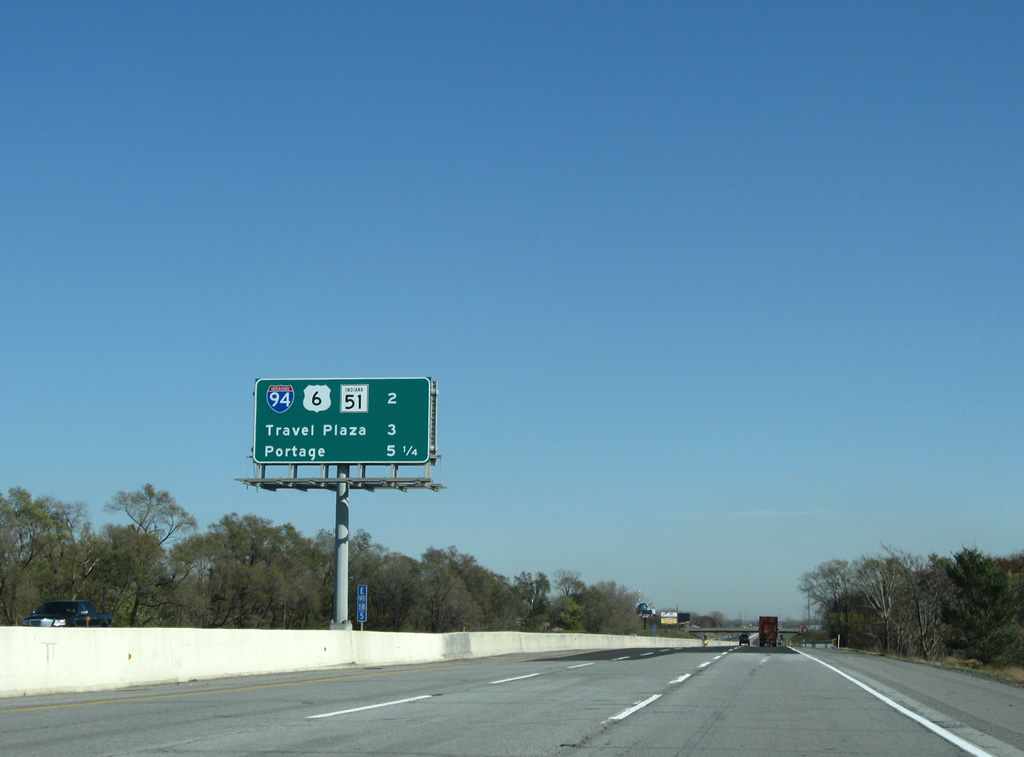
| Interchange sequence sign posted two miles west of the directional interchange (Exit 21) with the access road to I-80/94 (Frank Borman Expressway). The city of Portage follows, which includes a travel plaza and Exit 23 with Willow Creek Road. 11/05/09 |
|
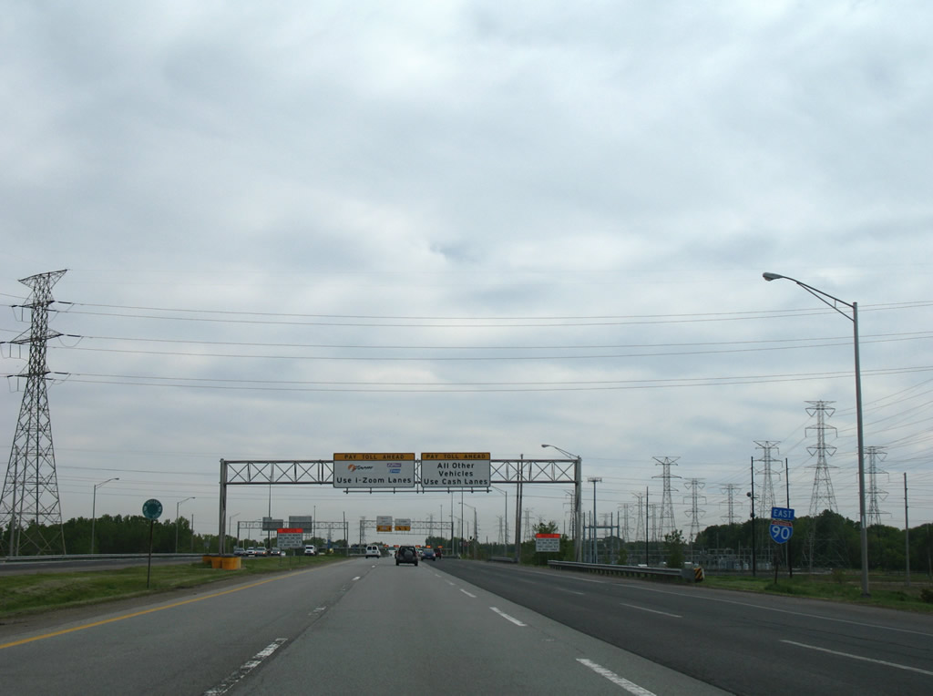
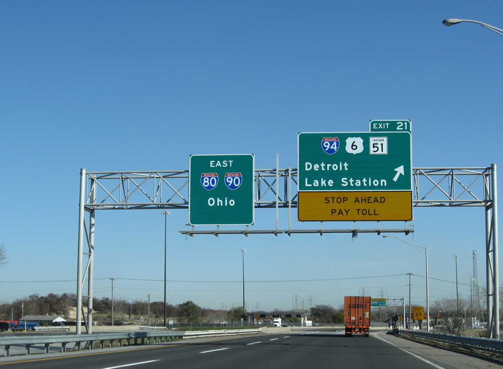
| I-90 straddles the Gary and Lake Station city line to Exit 21. Exit 21 connects the Indiana East West Toll Road with the east end of the I-80/94 overlap along the Frank Borman Expressway. I-80/90 combine east to Elyria, Ohio while I-94 continues northeast to Michigan City and St. Joseph, Michigan. 11/04/11 |
|
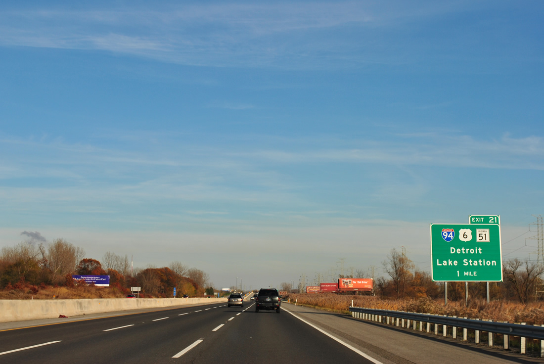
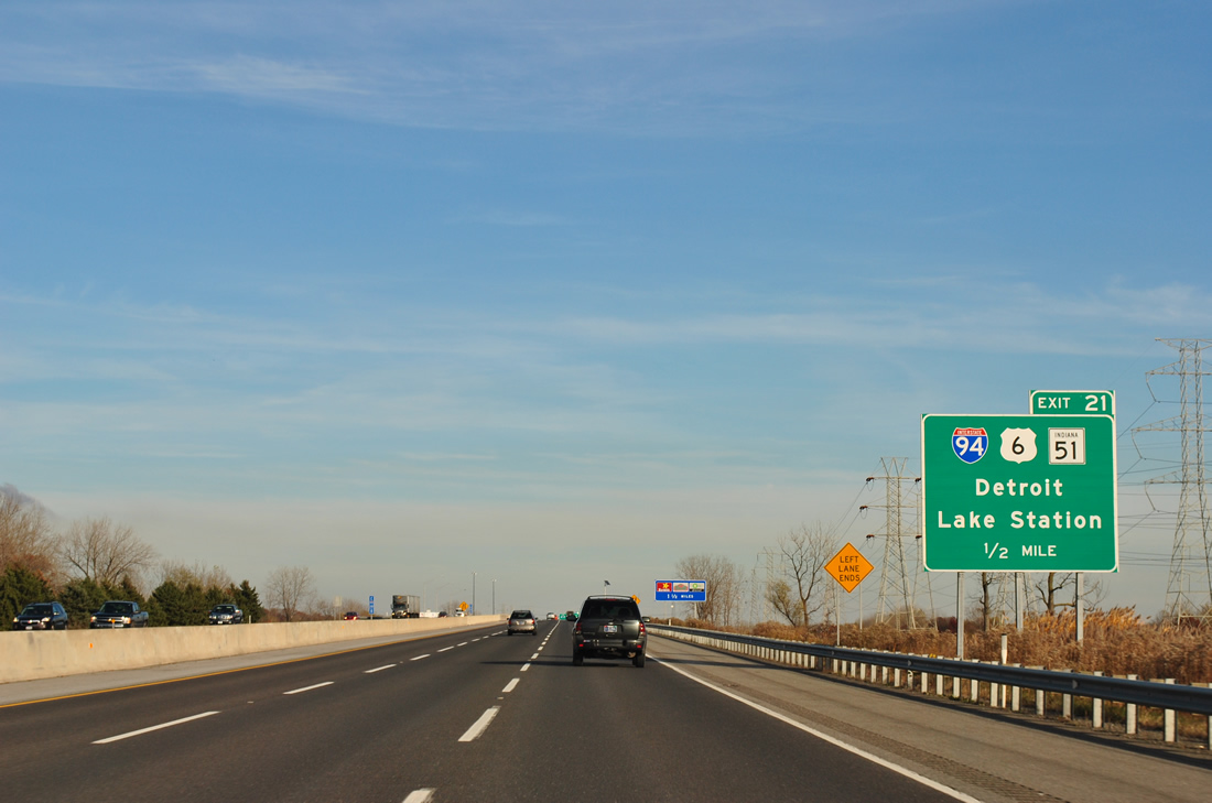
| Exit 21 departs in a half mile for I-80 west, Interstate 94, U.S. 6 and SR 51 (Ripley Street). Eastbound I-90 reduces from three to two lanes at Lake Station. 11/04/11 |
|
| Passing over SR 51 (Ripley Street), Exit 21 partitions from the Indiana East West Toll Road mainline. The south leading access road includes ramps to Ripley Street north to the end of SR 51 at U.S. 20 (Melton Road) in east Gary and U.S. 6 east / SR 51 south to Hobart. 11/05/09 |
|
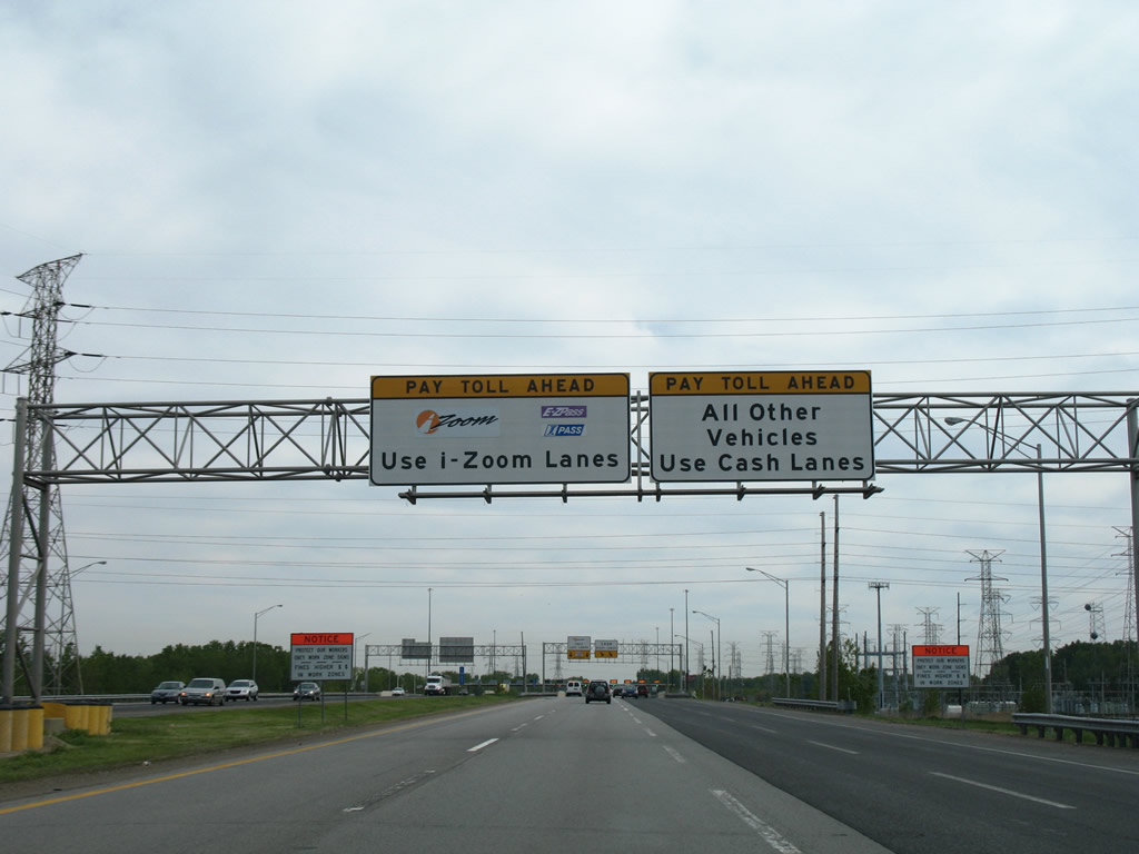
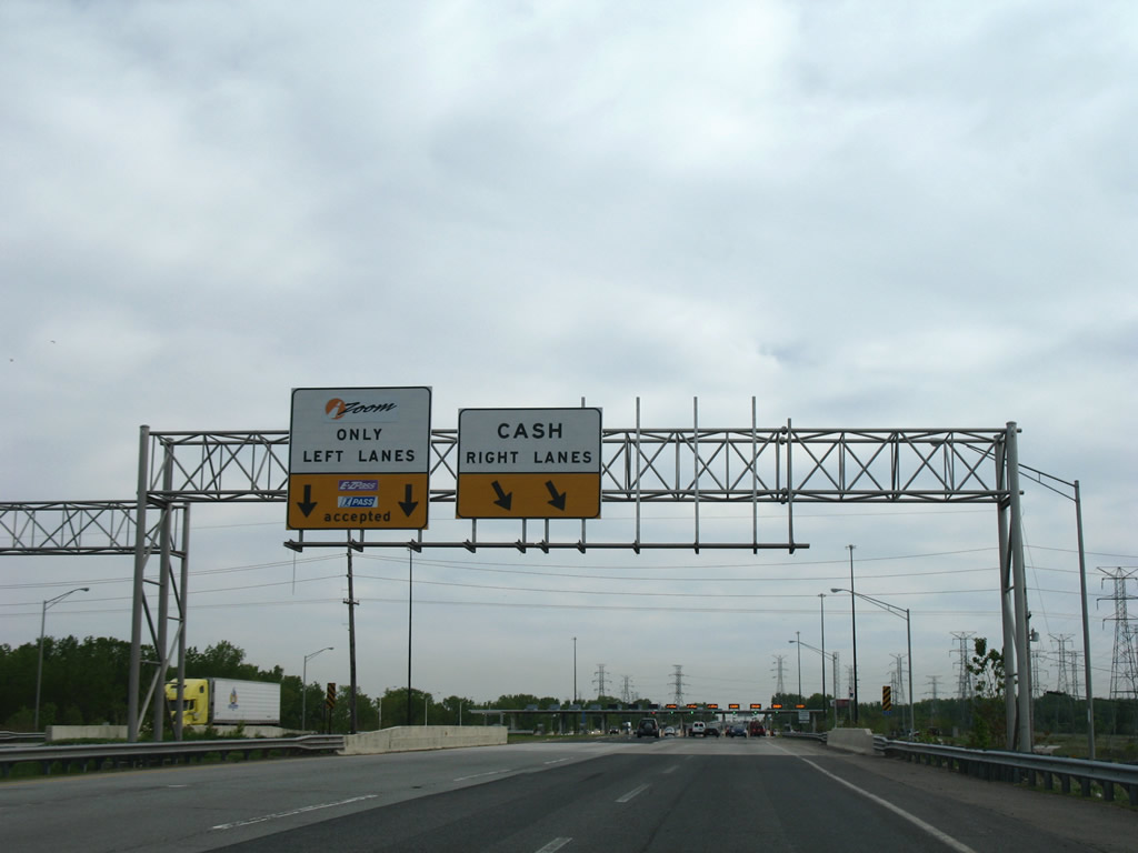
| Side toll plazas collect fees only for motorists departing Interstate 90 east for I-80/94 or for those entering the Toll Road westbound. A mainline collection facility lies east of Exit 23. 11/05/09 |
|
| Travelers bound for Interstate 80 west leave the Toll Road and join the access road connecting I-90 with I-94. 11/05/09 |
|
| Heading south along the Exit 21 access road to the trumpet interchange with Frank Borman Expressway. A set of toll booths was located here until 1985, when the new mainline plaza was constructed east of Willow Creek Road. I-94 continues northeast along the periphery of Lake Michigan to I-196 at St. Joseph and an eastward course to Lansing, Kalamazoo, Battle Creek, Ann Arbor and Detroit. I-80/94 west continue from Lake Station to Gary, Hammond and Lansing, Illinois. 11/05/09 |
|
| An accident involving a truck damaging a bridge parapet in November 2010 resulted in the closure of the westbound off ramp at this interchange. The ramp was closed shortly after temporary repairs were deemed unsafe, resulting in a short term detour of I-80 west to I-65 south at Exit 17. The Portage Service Area follows in 0.75 miles. 11/04/11 |
Page Updated 07-16-2021.

 east
east