|
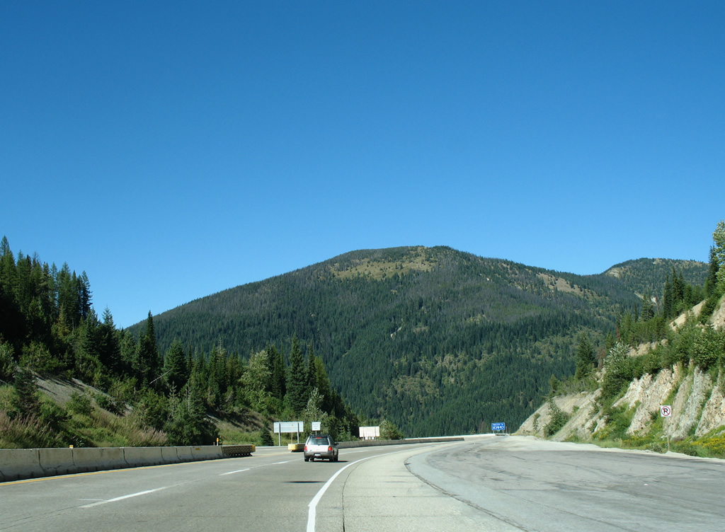
| Interstate 90 enters Idaho at Lookout Pass (elevation 4,680 feet), facing north briefly before turning west to parallel the South Fork Coeur d'Alene River. A truck brake check area lies along the eastbound lanes beyond the Exit 0 on-ramp from Montana. 09/01/06 |
|
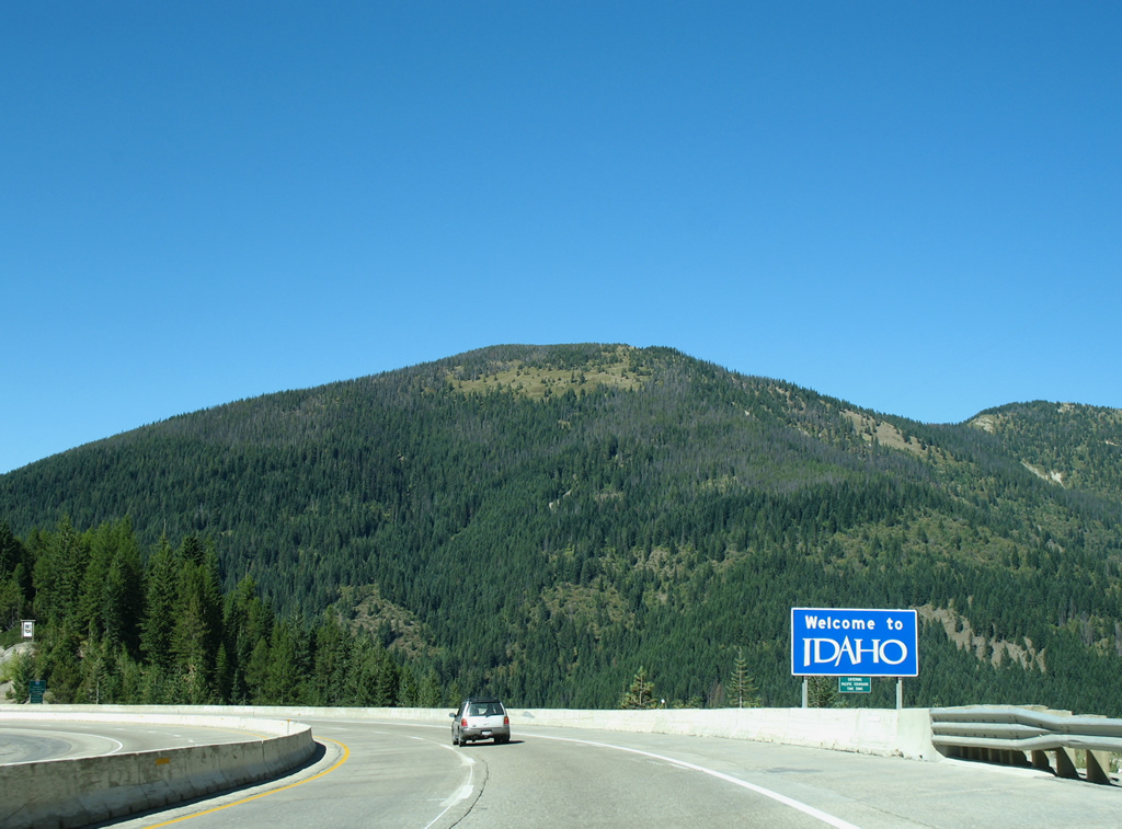
| Interstate 90 hugs the hillside of Runt Mountain on its westerly curve toward Mullan. The welcome sign for Idaho coincides with a sign advising motorists of Pacific Standard Time Zone. 09/01/06 |
|
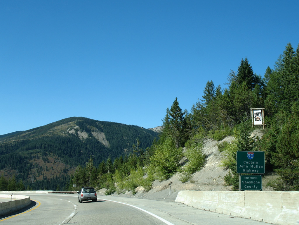
| Within Idaho, Interstate 90 is designated the Caption John Mullan Highway. Mullan directed a crew of 230 soldiers and civilians that built the Mullan Road, a military and supply route, from Fort Walla Walla to Fort Benton between spring 1859 and August 1, 1860.1 I-90 today parallels much of the original course of the Mullan Road. 09/01/06 |
|
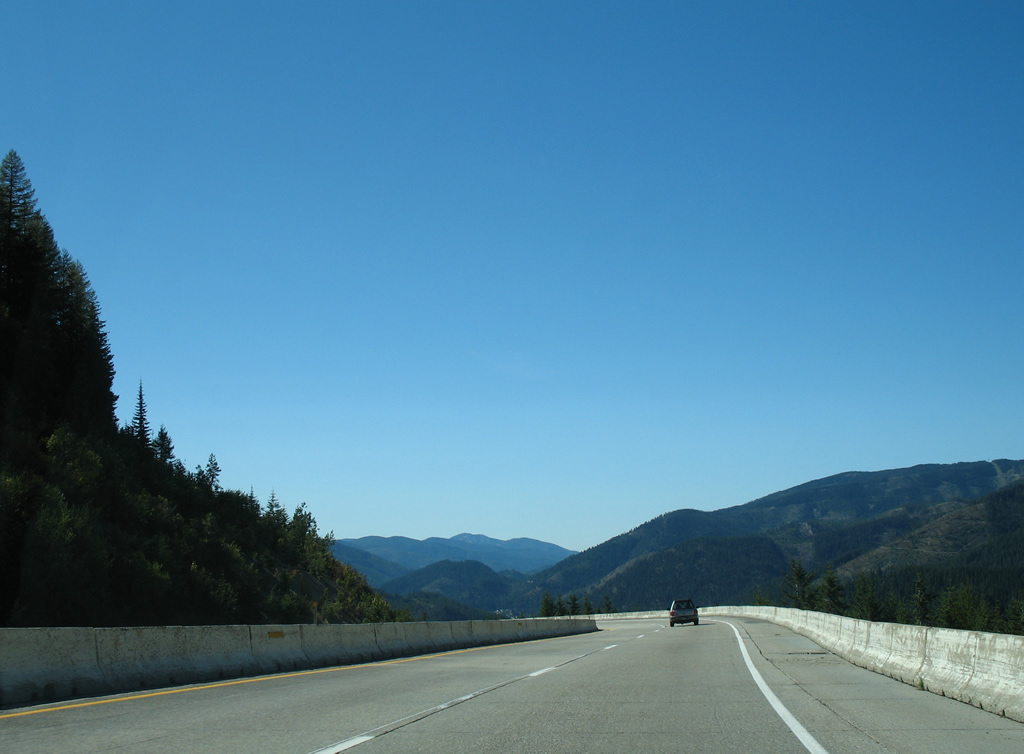
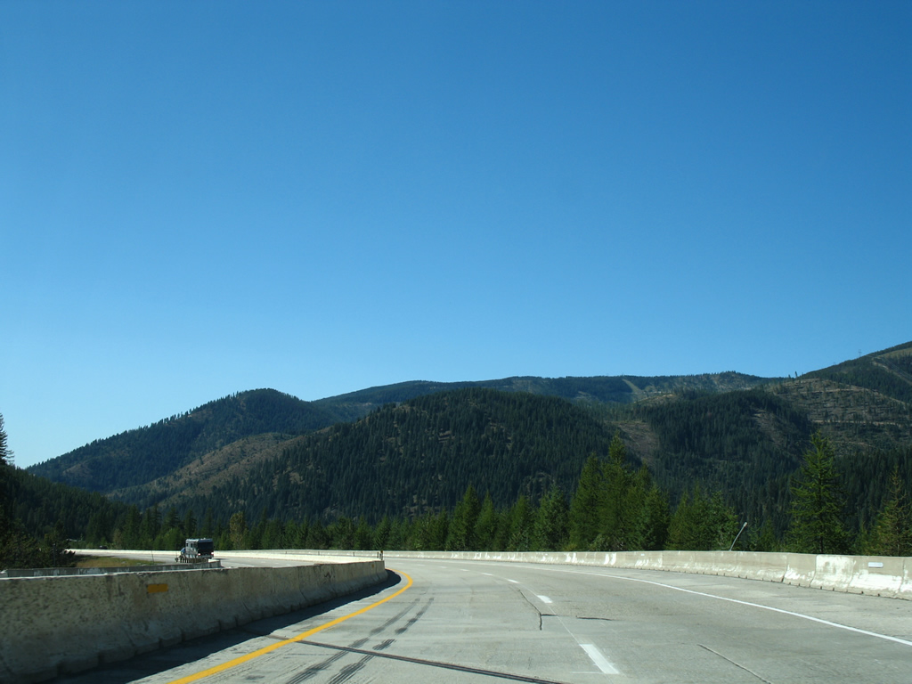
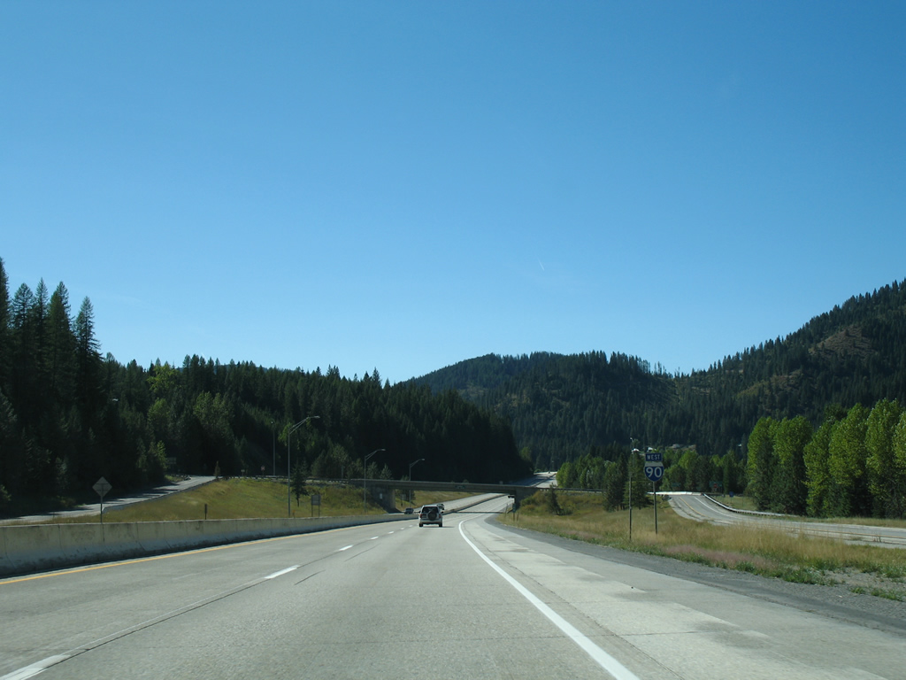
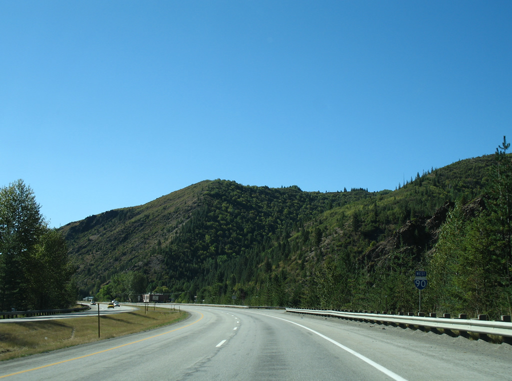
| Winding westward, south of Snowstorm Peak, Interstate 90 straddles the hillside north of the South Fork Coeur d'Alene on the five mile trek to Mullan. Wallace and Coeur d'Alene lie ahead over the next 59 miles. 09/01/06 |
|
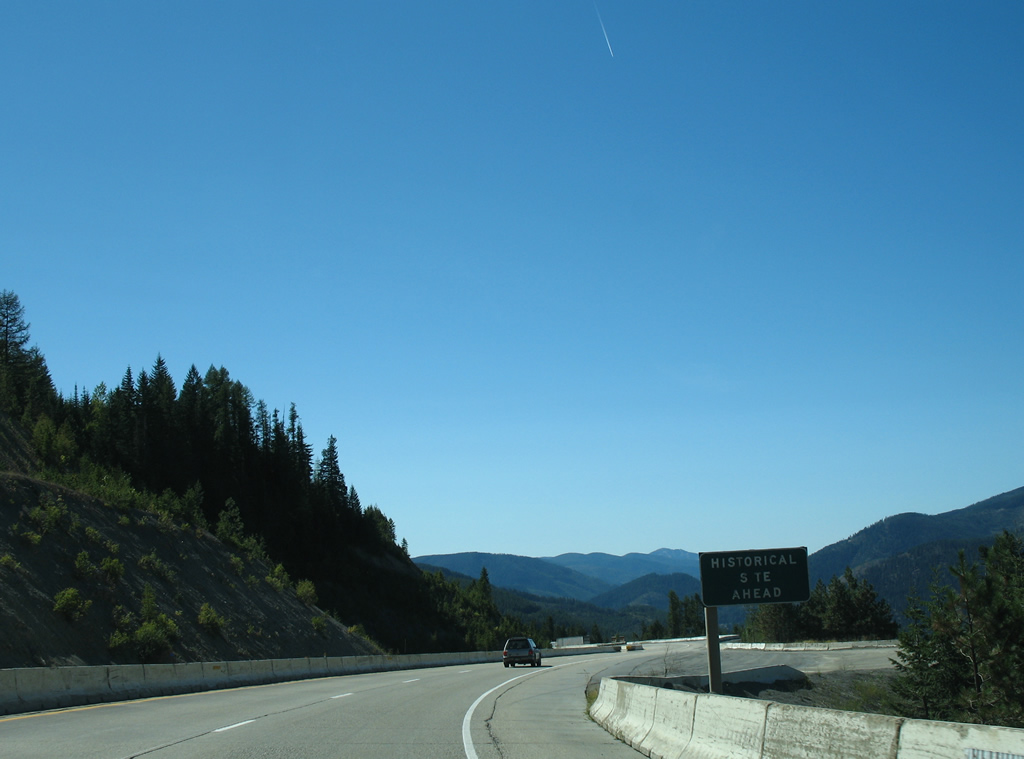
| A westbound wayside follows, allowing drivers a place to stop and read about the Murray Gold Fields and the 1910 Fire. The 1910 fire consumed more than 3,000,000 acres of timberland during the drought-ridden summer of 1910. Murray began as a permanent camp established on January 22, 1884 for the many gold miners that flocked to the area. The settlement was the Shoshone County seat between 1885 and 1898. 09/01/06 |
|
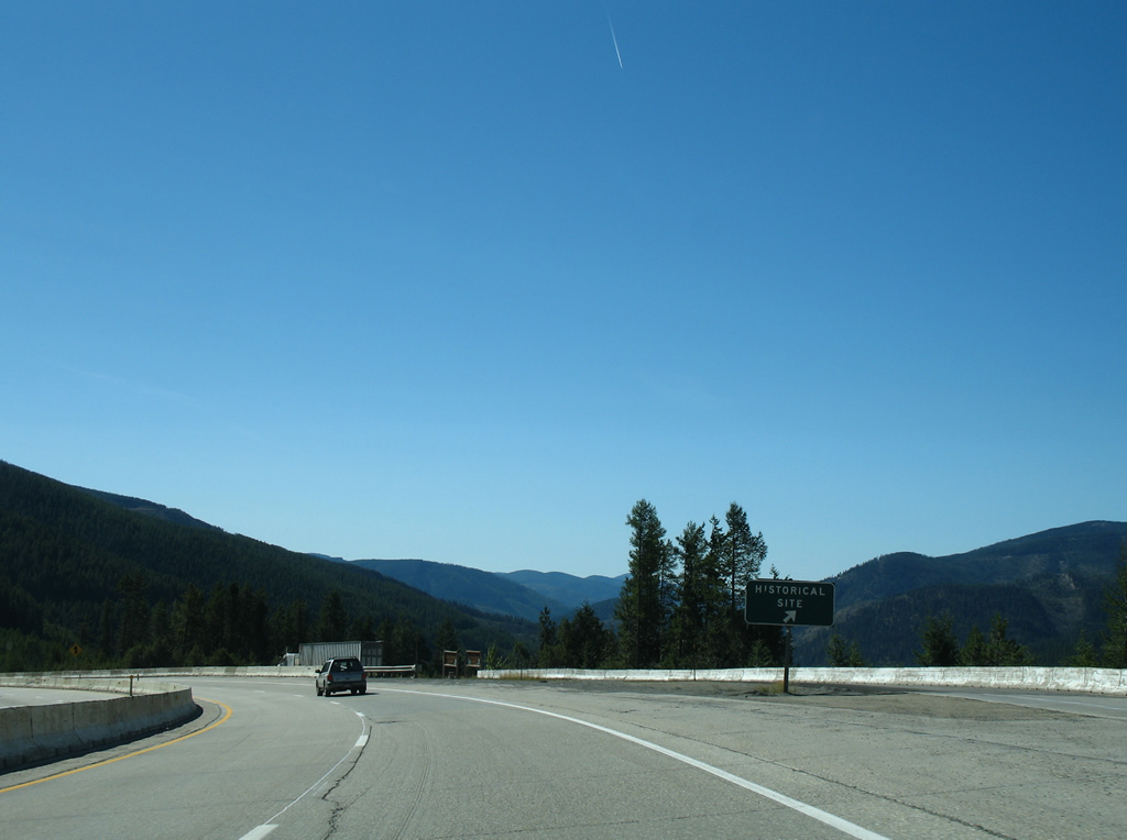
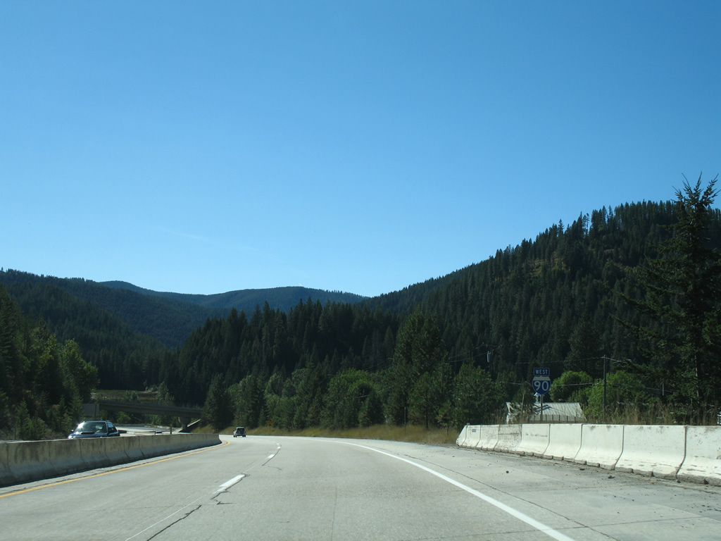
| Six more S-curves await westbound motorists from the historic site pull-off to the first Idaho exit at Mullan. 09/01/06 |
|
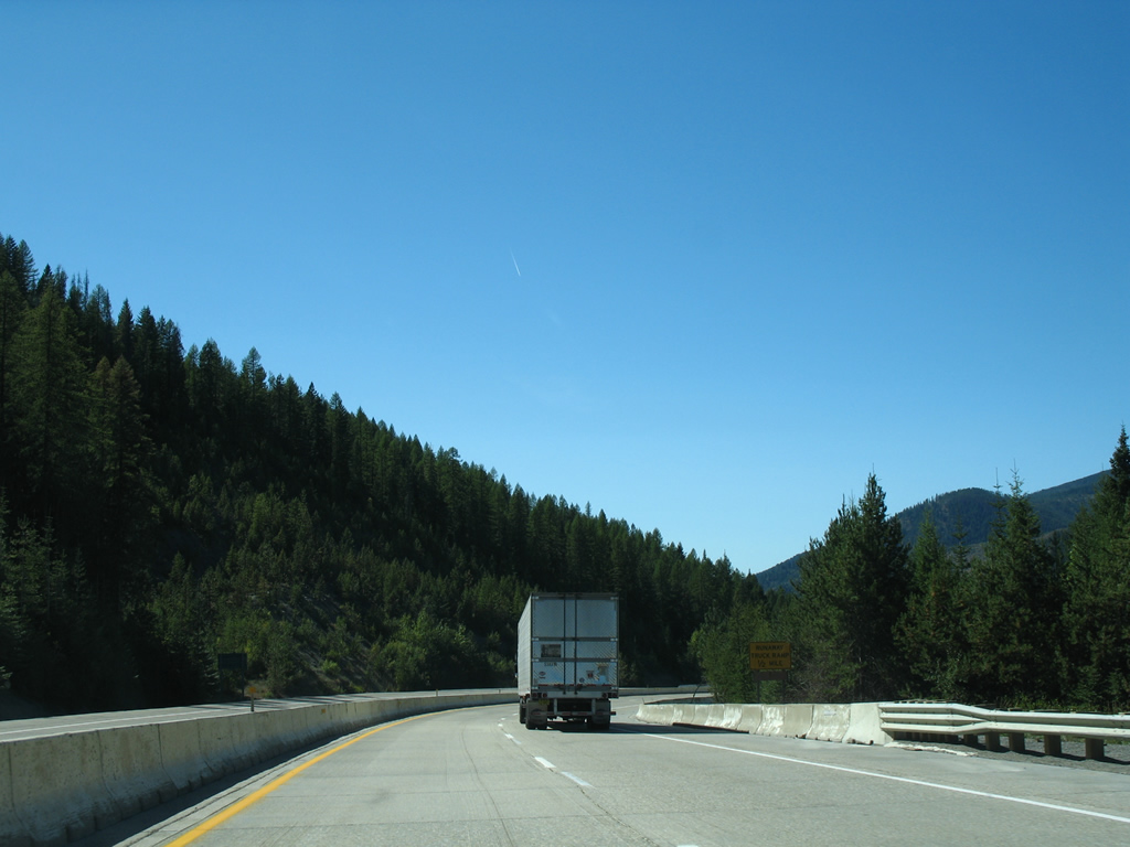
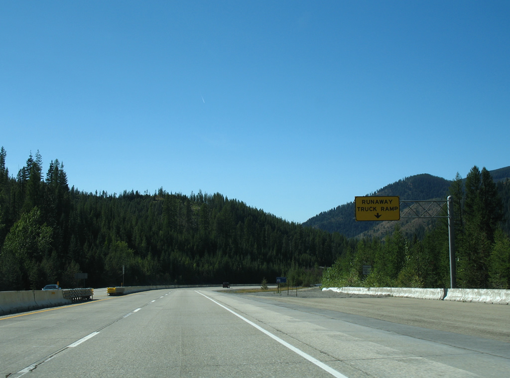
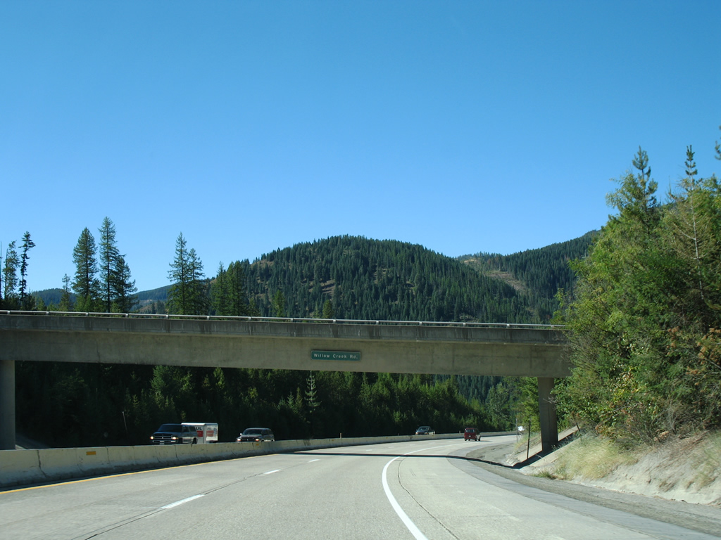
| The last S-curve includes a runaway truck ramp situated just east of the Willow Creek Road overpass. Interstate 90 lowers over 1,300 feet in elevation from Lookout Pass to the city of Mullan. 09/01/06 |
|
| Willow Creek Road originates from within Coeur d'Alene National Forest as National Forest Road 8008 to the south of Interstate 90. The local road parallels I-90 westward to become Friday Avenue, following a stretch of old U.S. 10 from this overpass into Mullan. 09/01/06 |
|
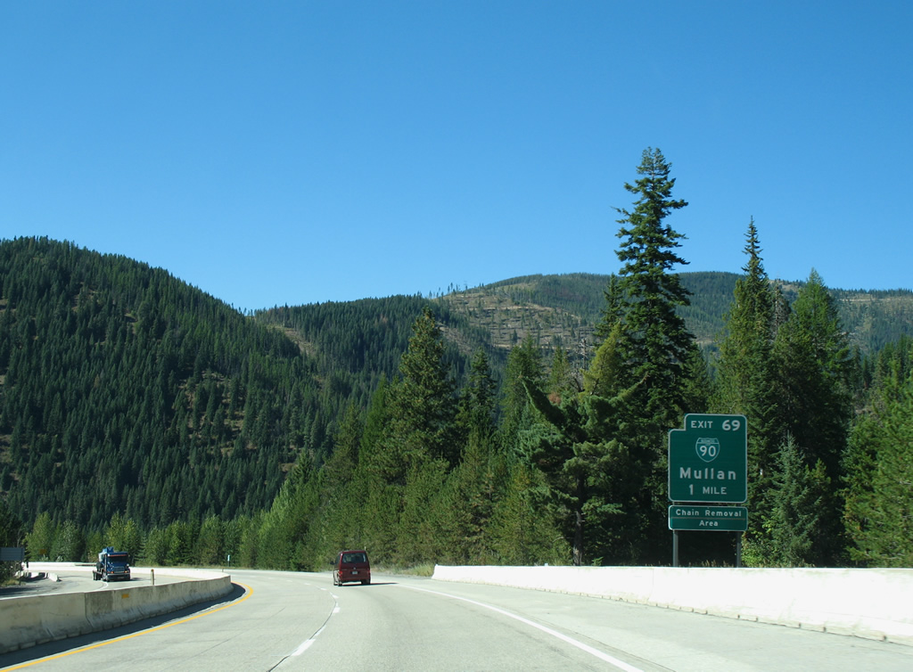
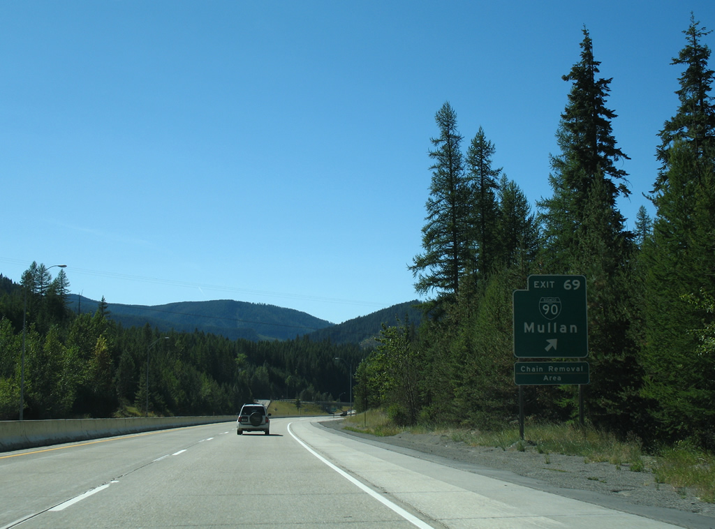
| Interstate 90 west reaches Exit 69 in one mile, where Business Loop I-90 begins a 1.00 mile trek through Mullan. 09/01/06 |
|
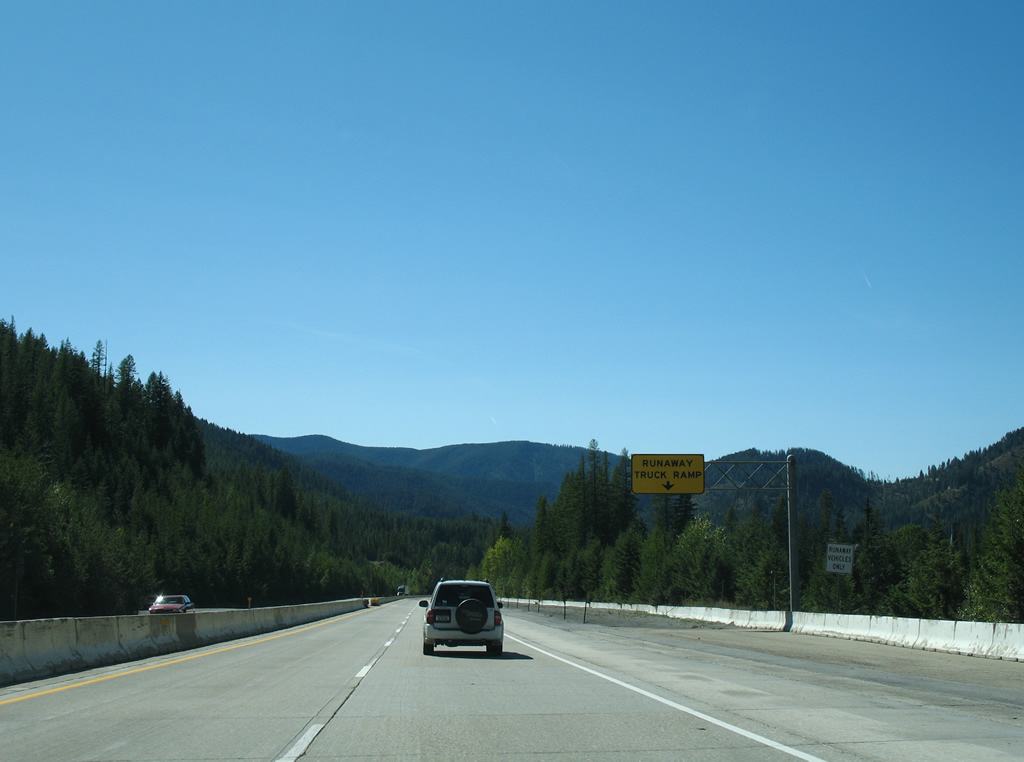
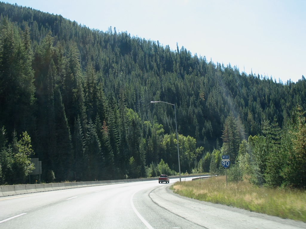
| A second truck escape ramp lines the westbound lanes of Interstate 90 leading toward the diamond interchange with Atlas Road and Business Loop I-90 west. 09/01/06 |
|
| Exit 69 departs Interstate 90 west for Atlas Road north and Business Loop I-90 west to River Street and the city center. 09/01/06 |
|
| A reassurance marker resides just after the Exit 69 gore point as Interstate 90 formally enters Silver Valley. 09/01/06 |
|
| Now within the city limits of Mullan, Interstate 90 passes over Copper Street ahead of the next reassurance shield. 3rd Street passes over the freeway in the background. 09/01/06 |
|
| A wye interchange (Exit 68 on I-90 east) brings Business Loop I-90 west back onto Interstate 90 from River Street. 09/01/06 |
|
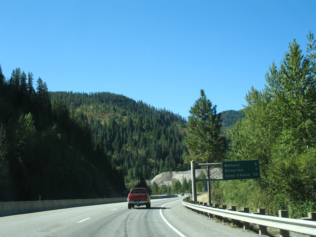
| Wallace, the seat of Shoshone County, is the next city along Interstate 90 in six miles while Coeur d'Alene is 53 miles away. 09/01/06 |
|
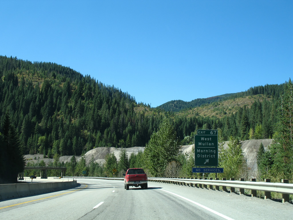
| Exit 67 consists of a diamond interchange with Mill Road at West Mullan. Mill Road meanders through the Morning District, named after the 1884-established Morning Mine, and connects with the Mullan street grid at Hunter Street. 09/01/06 |
|
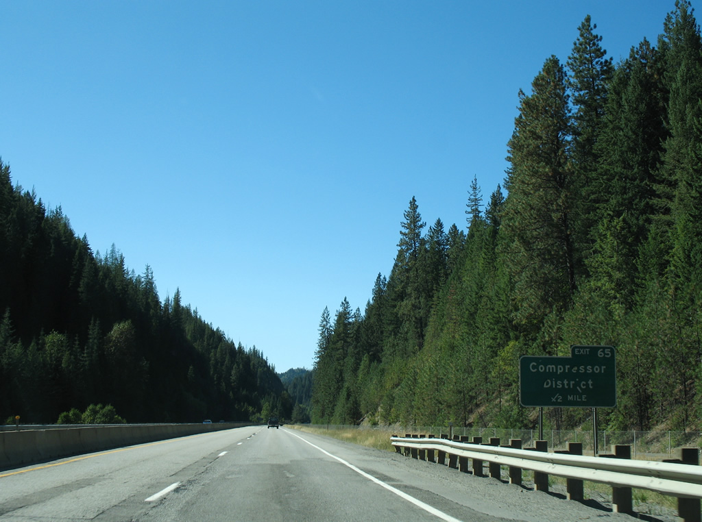
| Continuing west along the South Fork Coeur d'Alene River, Interstate 90 sees a diamond interchange with Grouse Creek Road at the Compressor District in one half mile. 09/01/06 |
|
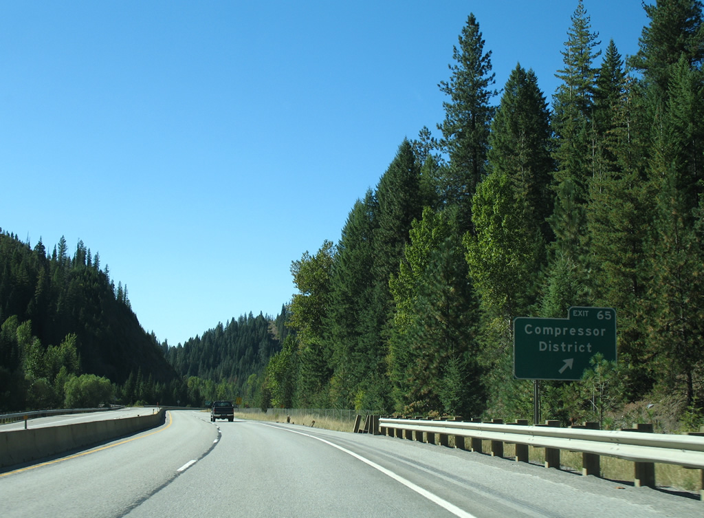
| Westbound Interstate 90 at the Compressor District off-ramp (Exit 65). Grouse Creek Road spurs north alongside Grouse Gulch while a handful of 4-wheel drive trails tie into the interchange otherwise. 09/01/06 |
|
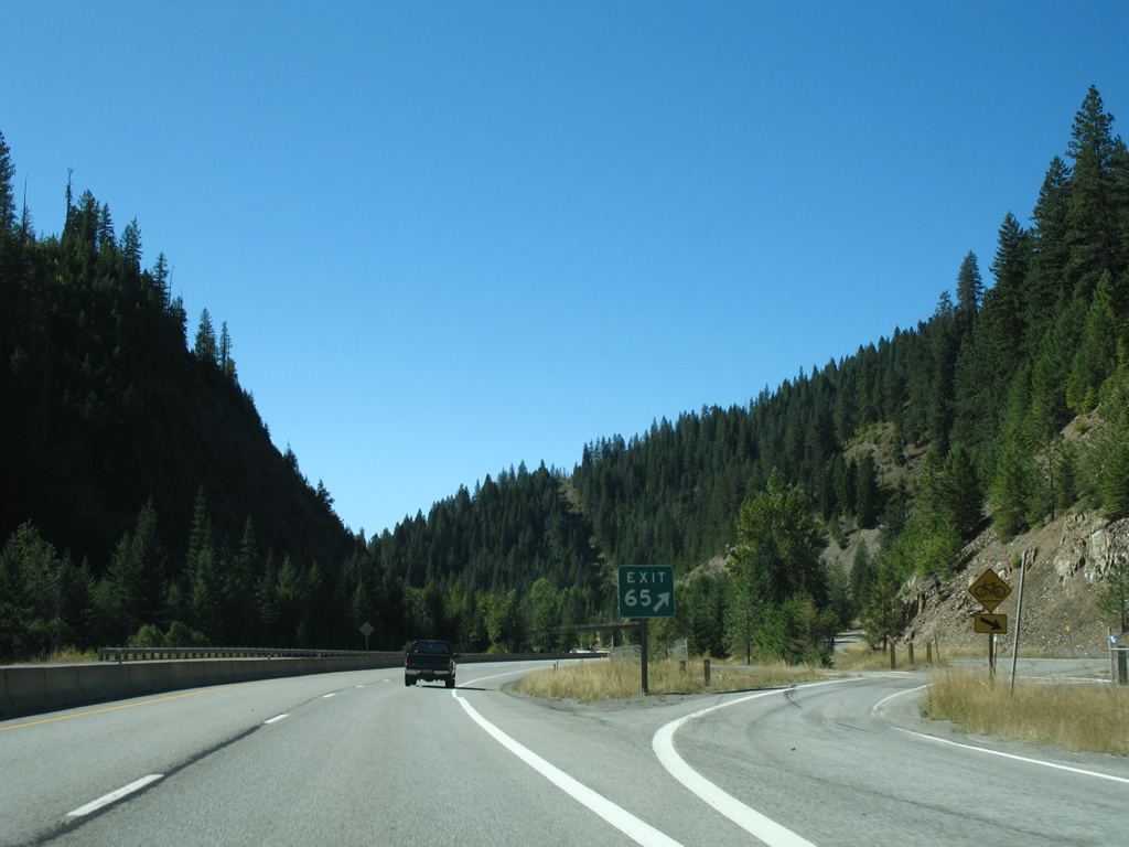
| Exit 65 consists of a slip ramp onto parallel Grouse Creek Road. The off-ramp crosses the Trail of the Coeur d'Alenes bike path, which utilizes former Union Pacific Railroad right of way from Mullan to Plummer. 09/01/06 |
|
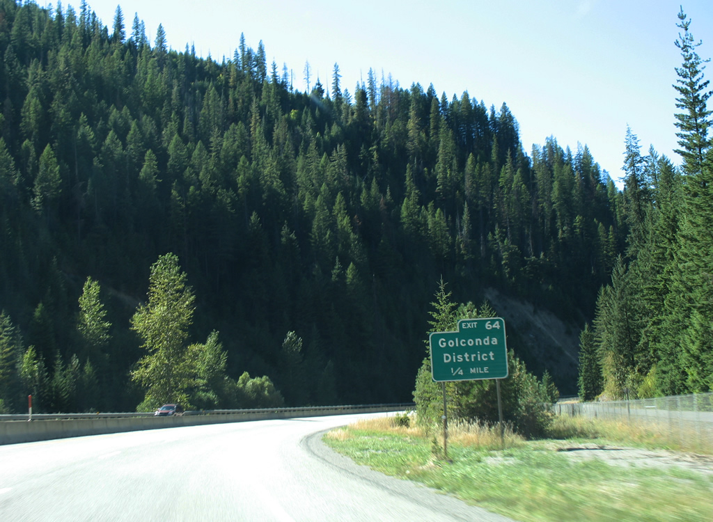
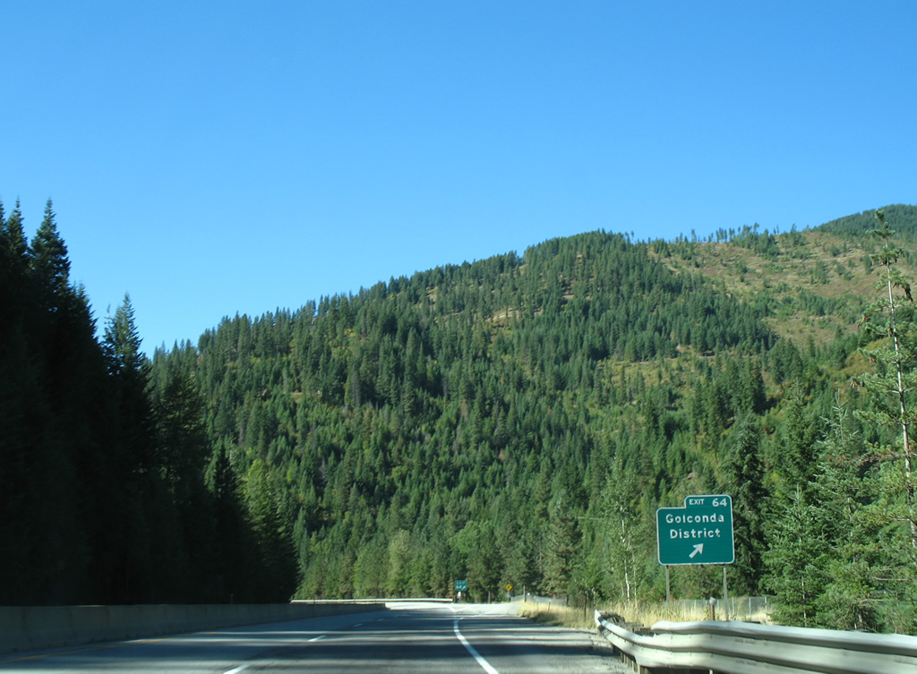
| The Golconda District is another settlement along former U.S. 10 that is not accessible from any other road outside of Exit 64 of Interstate 90 and four wheel drive trails. 09/01/06 |
|
| Ramps for Exit 64 form the start and end of a westbound side frontage road through the Golconda District. Golconda Mine lies northwest of the diamond interchange. 09/01/06 |
|
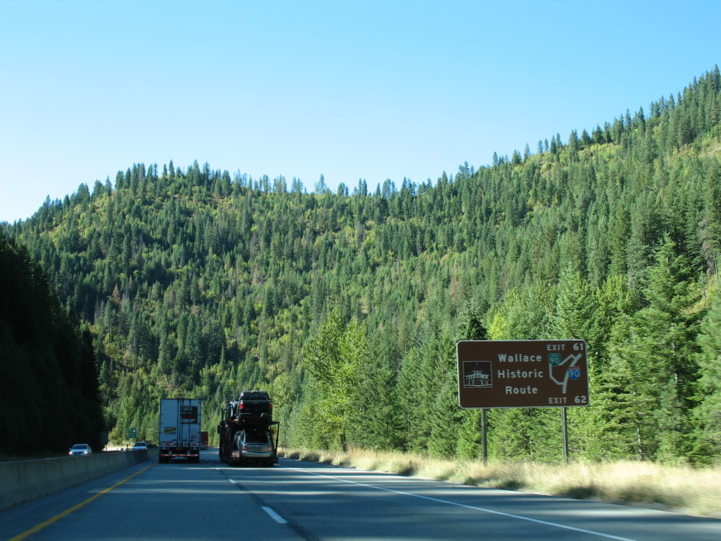
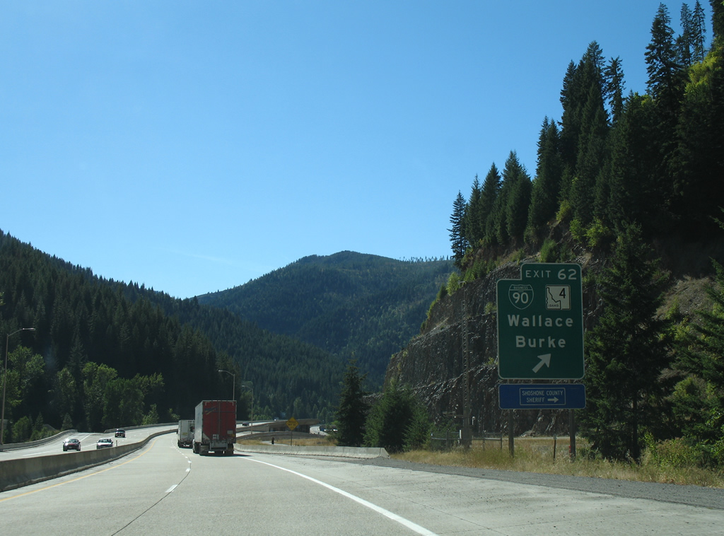
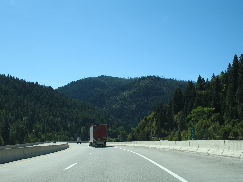
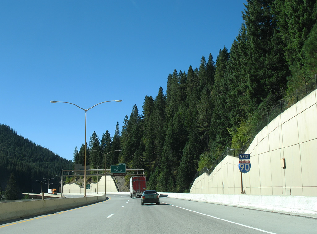
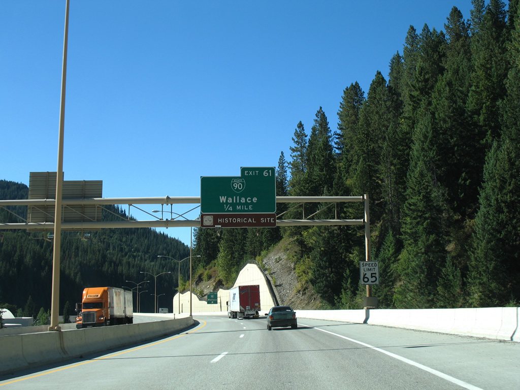
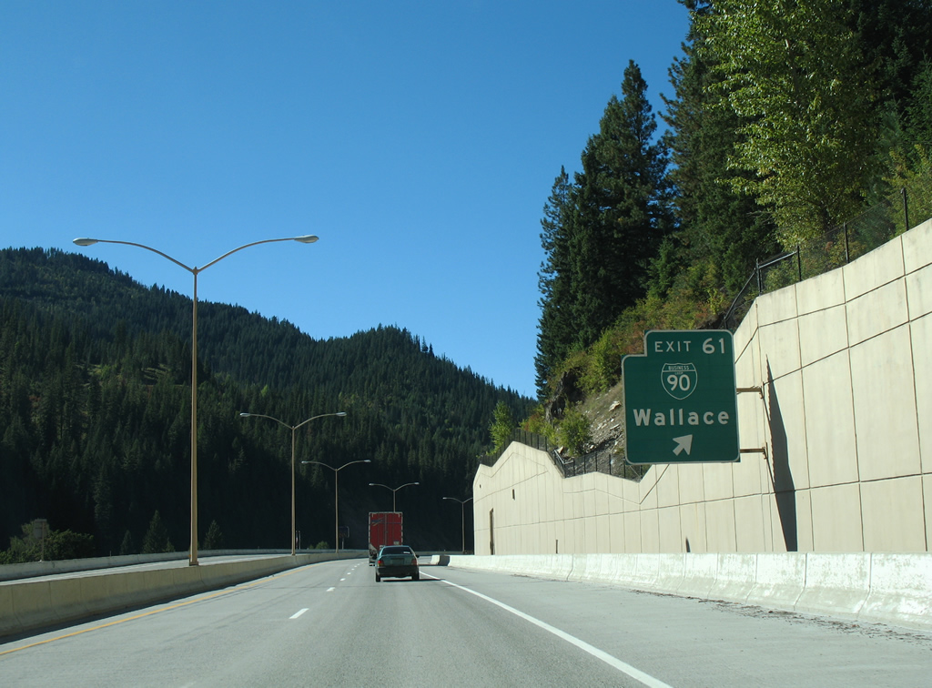
| Interstate 90 travels two miles west to Wallace, with its second Idaho business route looping through the Wallace Historic District between Exits 62 and 61. 09/01/06 |
|
| Old U.S. 10 separates from the path of Interstate 90 at Gentry, a former Union Pacific siding, to Wallace and Silverton. Business Loop I-90 coincides with the route through the Wallace city center, doubling as the last stretch of Interstate 90 before its completion through Idaho. 09/01/06 |
|
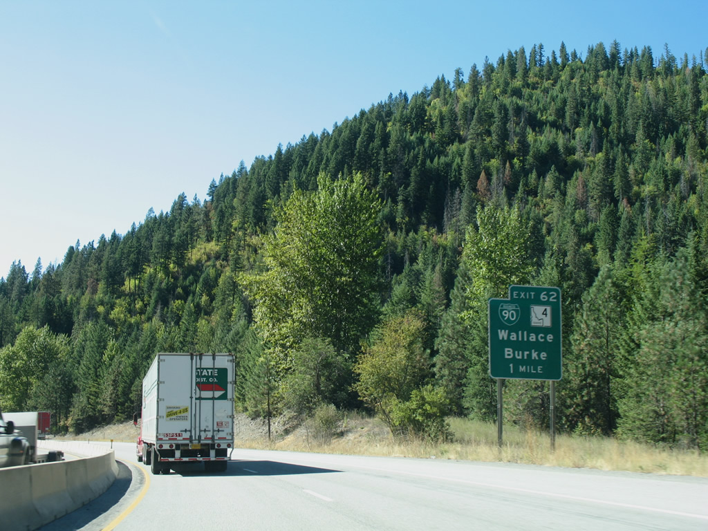
| Exit 62 leaves Interstate 90 west for Business Loop I-90 through Wallace and SH-4 east to Woodland Park and Burke. 09/01/06 |
|
| Interstate 90 elevates onto a viaduct through Wallace between Exits 62 and 61. The 1991-completed viaduct was constructed as a result of a preservation movement in Wallace that shifted the planned routing from town. 09/01/06 |
|
| Skirting the northern edge of the Wallace street grid, Interstate 90 travels at a height of 30 feet along the 4,400-foot viaduct. 09/01/06 |
|
| Business Loop I-90 exits Wallace along Front Street (old U.S. 10) before turning northward across the South Fork Coeur d'Alene River to the diamond interchange at Exit 61. 09/01/06 |
|
| The Wallace viaduct of Interstate 90 west ends just ahead of the Exit 61 ramp departure for Business Loop I-90 east. 09/01/06 |
|
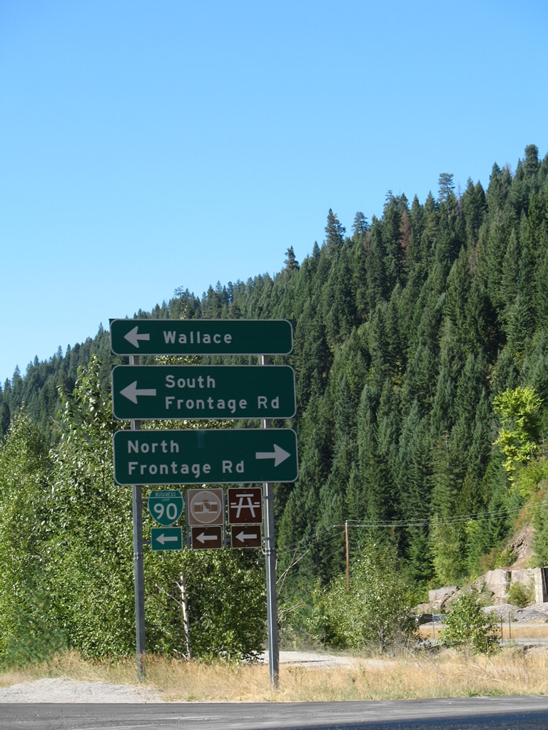
| Frontage roads, including former U.S. 10, accompany Interstate 90 west from Exit 61 to Silverton while Business Loop I-90 provides return access to Wallace via Front Street east to Fifth Street. 09/01/06 |
|
| Interstate 90, Silver Valley Road (old U.S. 10), North Frontage Road and the South Fork Coeur d'Alene River parallel one another into the unincorporated community of Silverton. 09/01/06 |
|
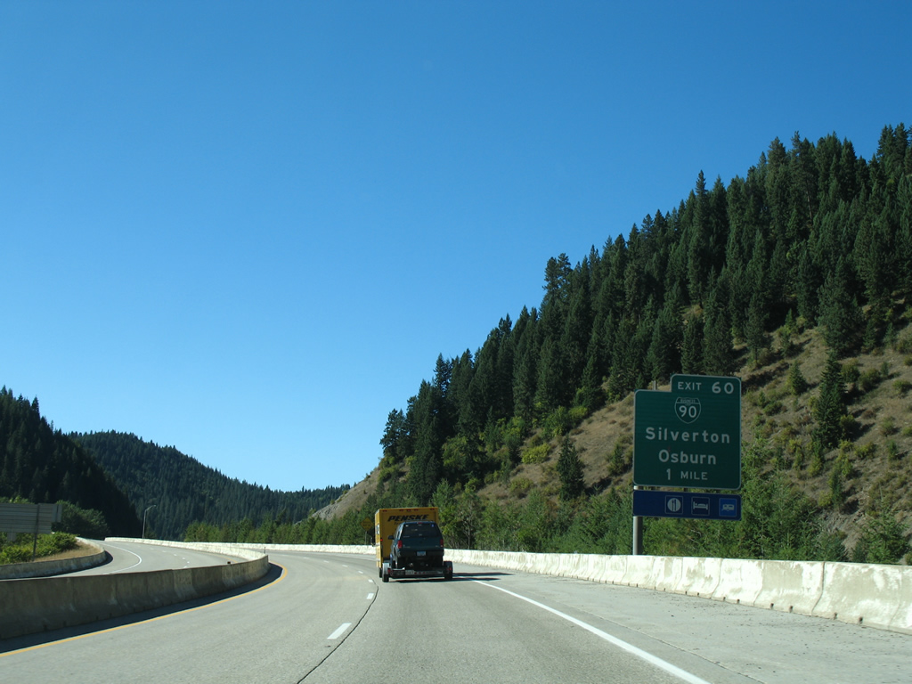
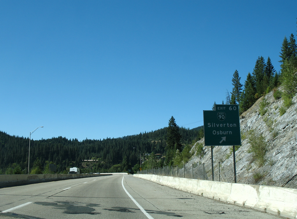
| One mile southeast of the diamond interchange (Exit 60) with Business Spur I-90 (Markwell Avenue) north into Silverton. The spur is a remnant of a longer loop linking Silverton and Osburn. 09/01/06 |
|
| Business Spur I-90 entails just 0.11 miles of Markwell Avenue between the Exit 60 ramps and parallel Yellowstone Avenue in Silverton. Silver Valley Road west from Markwell Avenue continues old U.S. 10 west to Osburn. 09/01/06 |
|
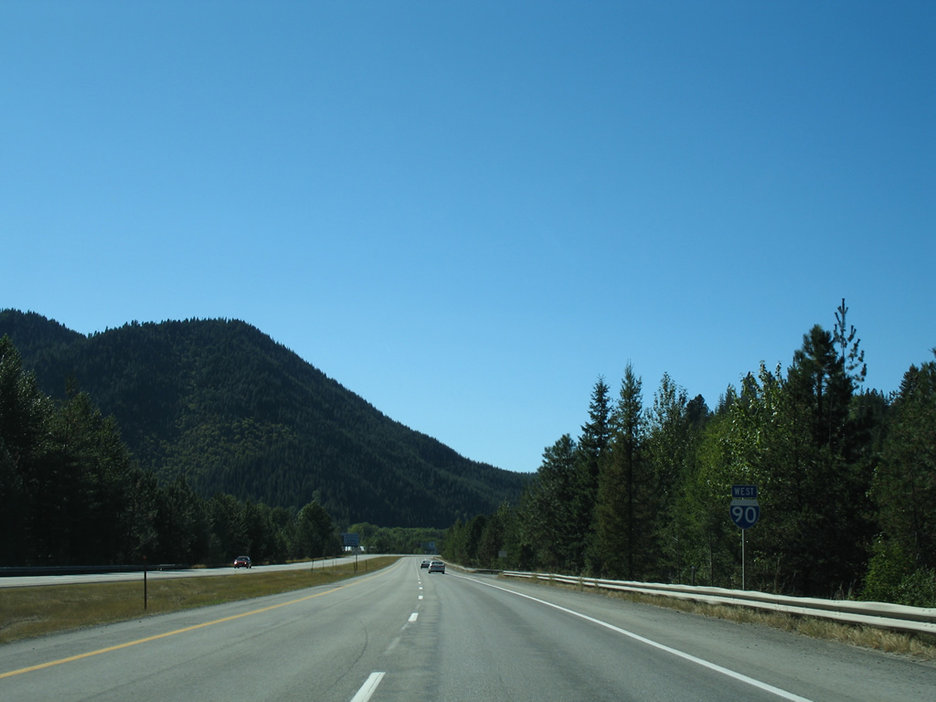
| Interstate 90 winds westward from Silverton directly into the city of Osburn. Speed limits along this stretch are set at 75 miles per hour. 09/01/06 |
|
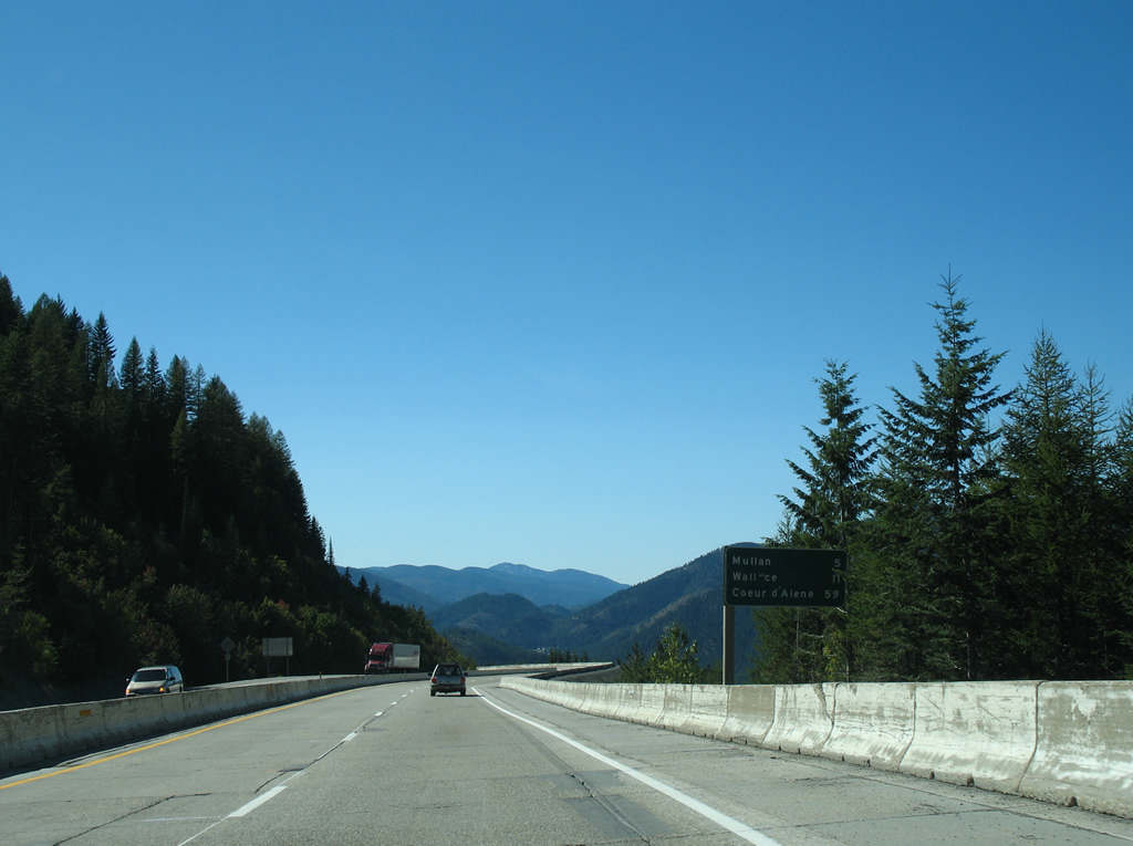
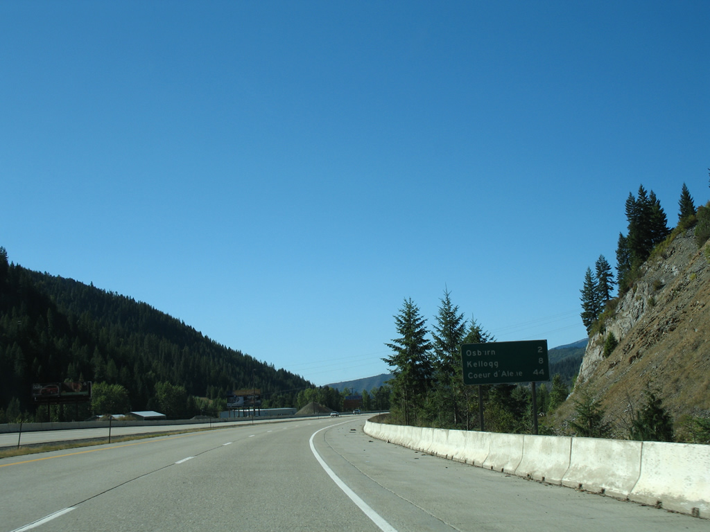
| Kellogg is next along Interstate 90, six miles beyond Osburn. Coeur d'Alene is now 44 miles to the west. 09/01/06 |
|
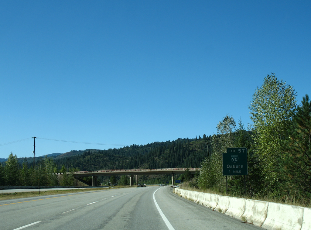
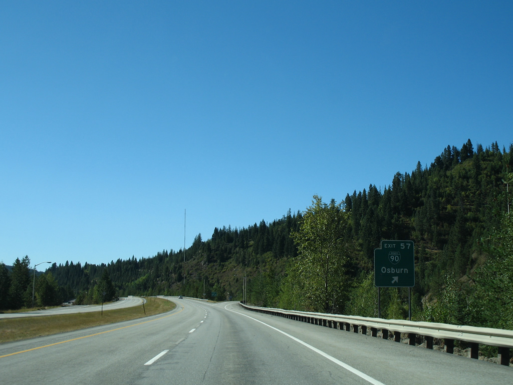
| Osburn is served by a diamond interchange (Exit 57) from Interstate 90 in one mile. Ramps connect the freeway with 3rd Street, which doubles as Business Spur I-90 south to Silver Valley Road (old U.S. 10). 09/01/06 |
|
| Business Loop I-90 along Silver Valley Road between Silverton and Osburn was decommissioned sometime after 2006. 1.52 miles of the loop remains as a spur from I-90 through the Osburn city center and east along Mullan Avenue to the split with Silver Valley Road. 09/01/06 |
|
| Northern slopes of Polaris Peak (elevation 5,577 feet) front the southern reaches of Osburn. 09/01/06 |
|
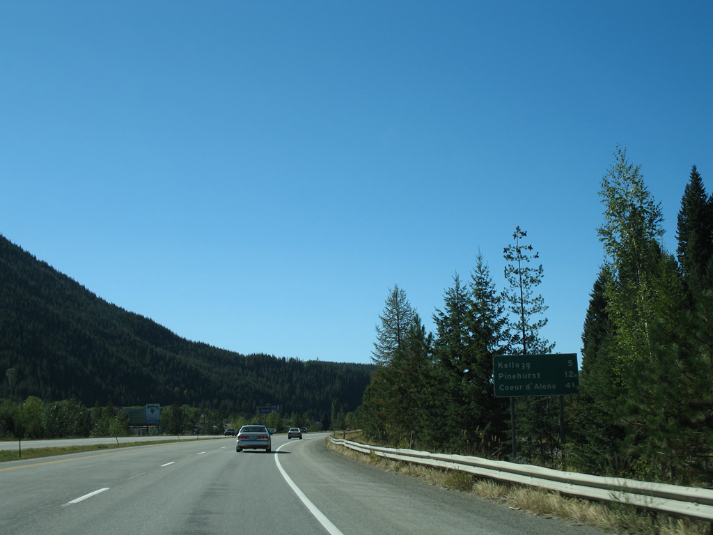
| The next Silver Valley city along Interstate 90 west is Kellogg in five miles. Pinehurst rounds out the Silver Valley mining region for I-90 travelers in 12 miles. 09/01/06 |
|
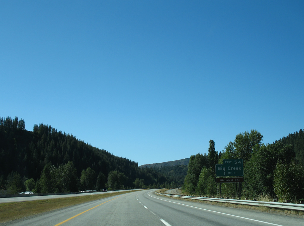
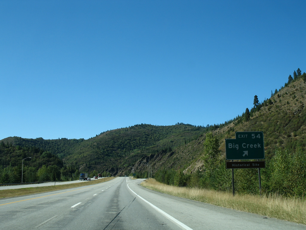
| Big Creek Road ties into Interstate 90 at the Exit 54 diamond interchange in one mile. 09/01/06 |
|
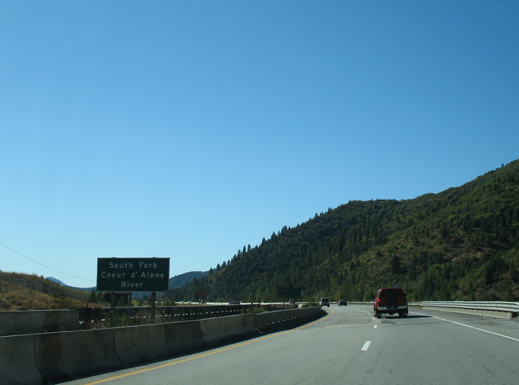
| Interstate 90 and parallel Silver Valley Road (former U.S. 10) span the South Fork Coeur d'Alene River at the Osburn city line. The waterway and freeway cross paths again at Kellogg. 09/01/06 |
|
| Big Creek Road stems southwest from Silver Valley Road and Exit 54 near Elk Creek to the community of Big Creek as National Forest Road 264. 09/01/06 |
|
| Curving more westerly, Interstate 90 passes by Elk Creek and the southern slopes of Montgomery Ridge. 09/01/06 |
|
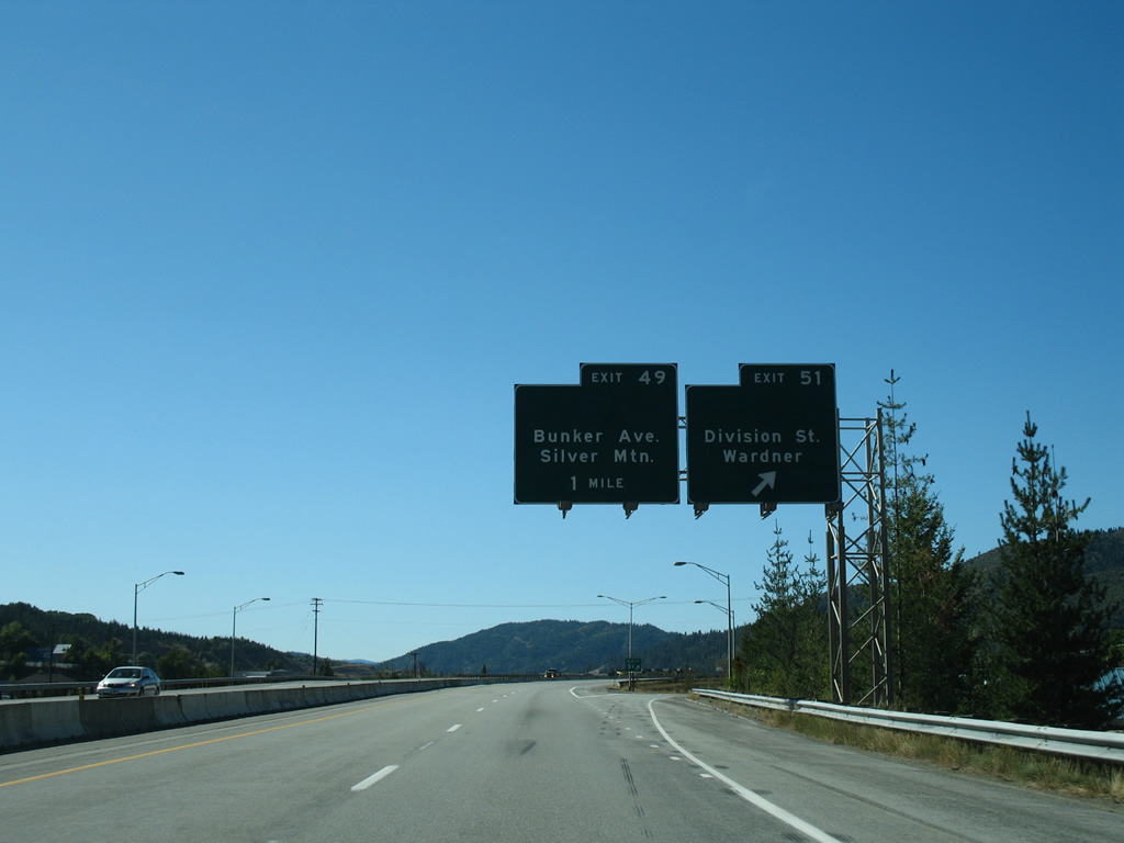
| The first of two Kellogg exits joins Interstate 90 with both Division Street at Exit 51. Division Street north to Cameron Avenue west to Bunker Avenue south and Exit 49 represents the route of a former Business Loop I-90. As such, this guide sign was replaced by 2012 with a new shorter panel devoid of space for the decommissioned route. 09/01/06 |
|
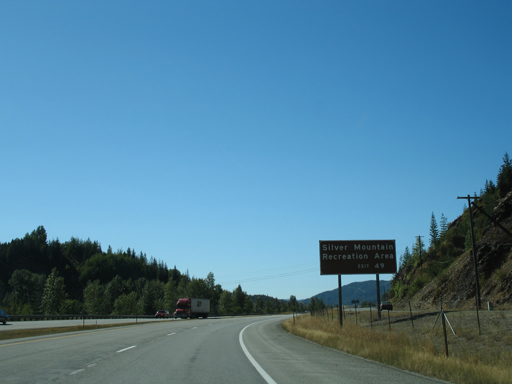
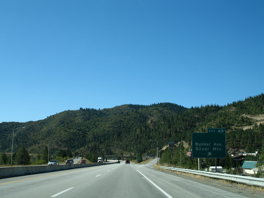
| Exit 51 connects Interstate 90 with the community of Wardner via Division Street south. Exit 49 joins Interstate 90 with Silver Mountain Recreation Area, which offers an indoor water park, skiing, tubing and hiking among other activities. 09/01/06 |
|
| Former button copy guide signs that were posted for Business Loop I-90 and Exits 51 and 49. Replaced by 2012, these panels directed travelers to the split diamond interchange with Division and Hill Streets. Hill Streets leads northeast to Italian Gulch and southwest to Bunker and McKinley Avenues. Bunker Avenue arcs northwest to the Silver Mountain Resort, which connects to its ski area via a lengthy ski lift, and the Exit 49 diamond interchange. 09/01/06 |
|
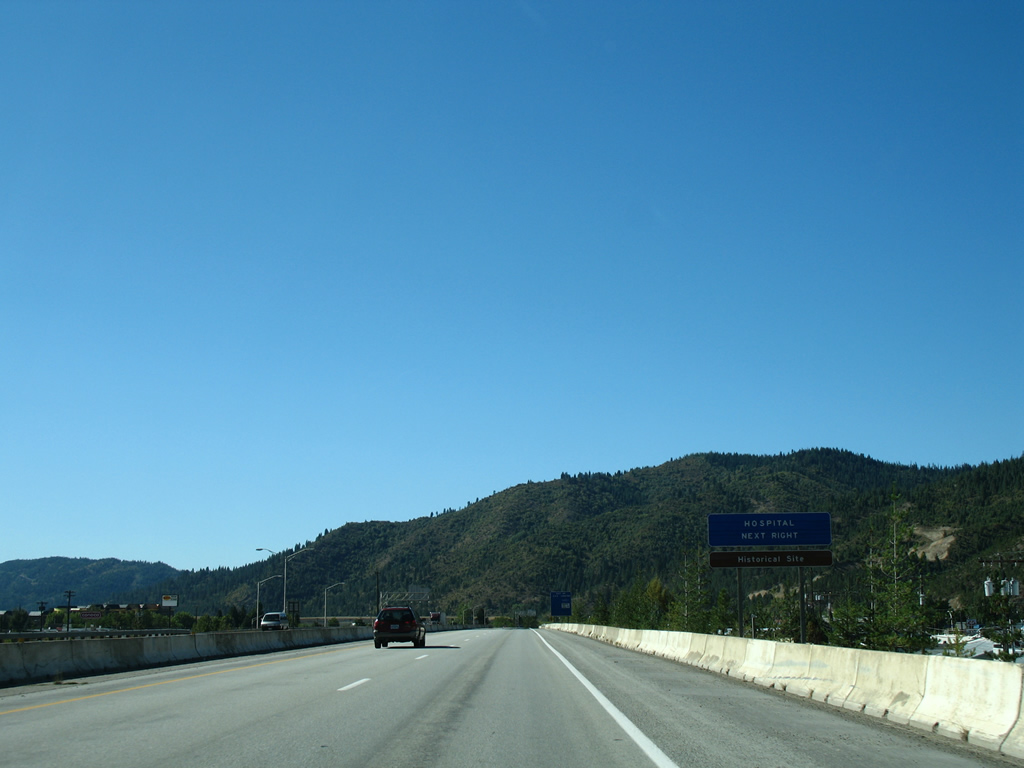
| Separate ramps connect Interstate 90 east with both Hill and Division Street as the freeway travels above the Kellogg street grid to Shoshone Medical Center. 09/01/06 |
|
| Bunker Avenue returned Business Loop I-90 to Interstate 90 (Exit 49) via adjacent Cameron Avenue. The avenue becomes Jacobs Gulch Road to Kellogg High School to the north and otherwise reaches Silver Mountain Resort just to the south. 09/01/06 |
|
| Interstate 90 crosses the South Fork Coeur d'Alene River just beyond the Bunker Avenue on-ramp. The river remains north of the freeway to the Kootenai County line. 09/01/06 |
|
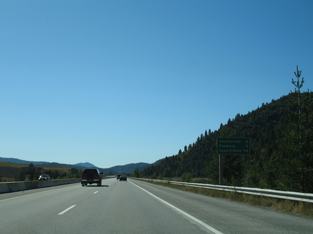
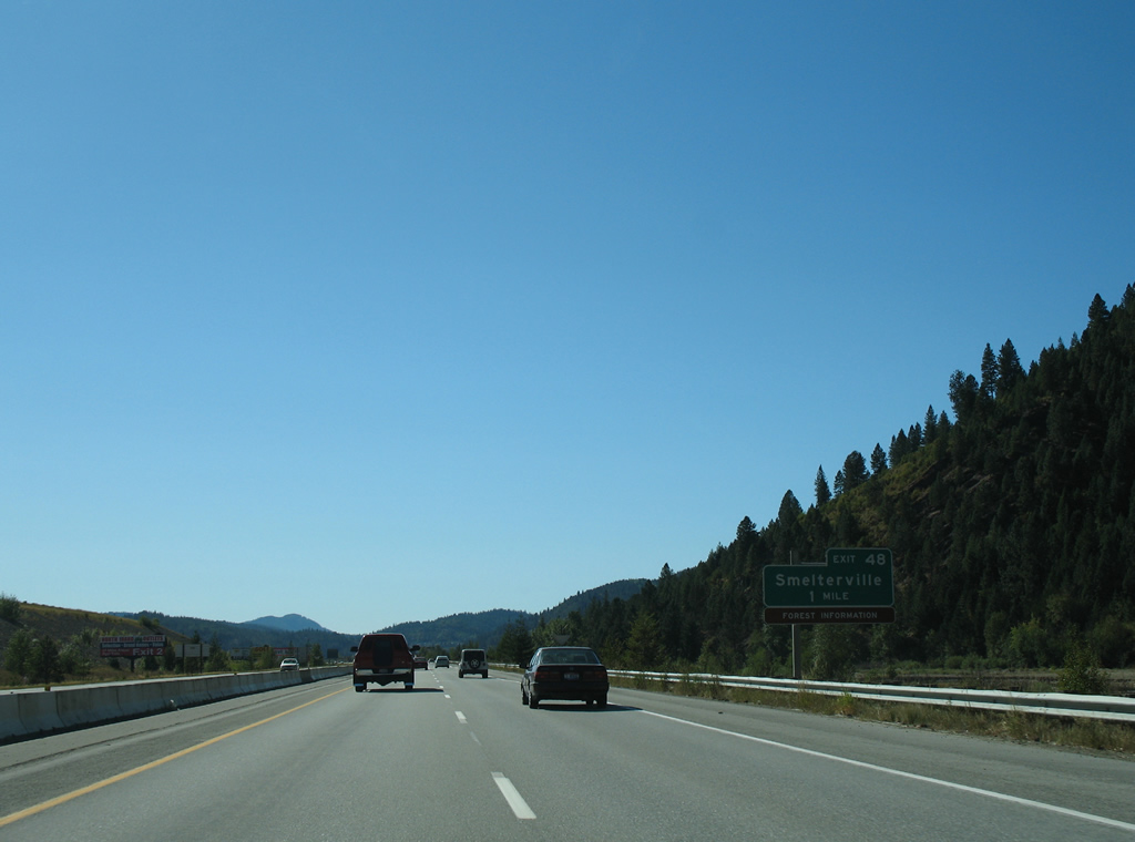
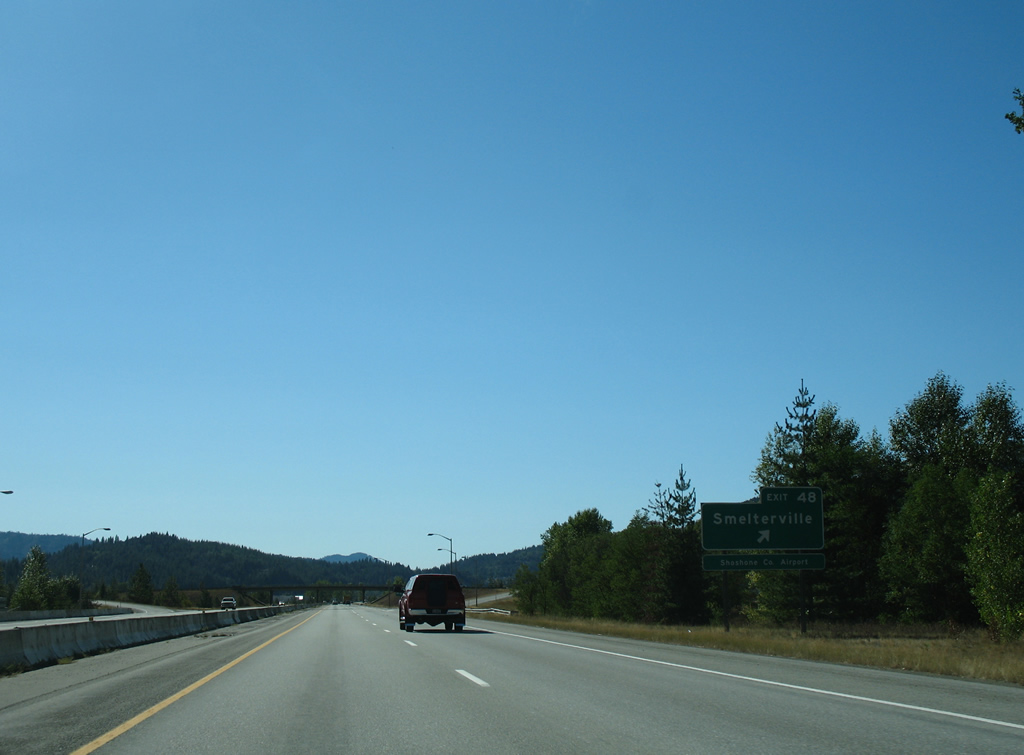
| Smelterville, a city of 627 per the 2010 census, lies immediately to the west of Kellogg at Exit 48 in two miles. Coeur d'Alene is now just a half hour away. 09/01/06 |
|
| Exit 48 consists of a diamond interchange with Airport Road at Smelterville in one mile. 09/01/06 |
|
| Airport Road leads north from parallel Main Street (old U.S. 10) and Smelterville to Exit 48 of I-90 and Shoshone County Airport. 09/01/06 |
|
| Interstate 90 travels by Shoshone County Airport and a number of tailing ponds south of McLeod Hill and north of Blue Star Ridge. 09/01/06 |
|
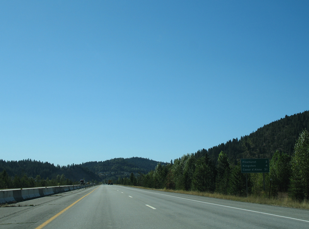
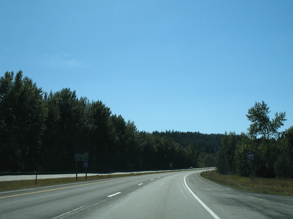
| Pinehurst is two miles ahead while Kingston represents the following exit in four miles. 09/01/06 |
|
| Old Highway 10 winds underneath Interstate 90 between Blue Star and Kingston Ridges to become Division Street south of the forthcoming diamond interchange (Exit 45). 09/01/06 |
|
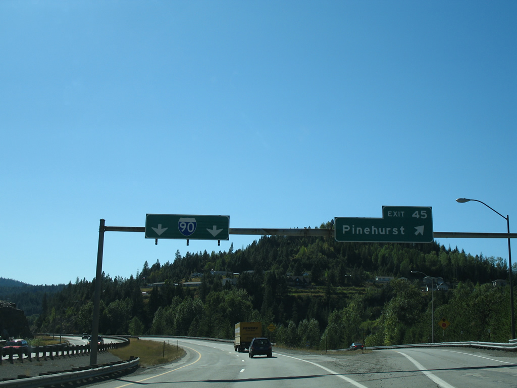
| Overheads, replaced by 2012, direct motorists along Interstate 90 west at the Exit 45 off-ramp to Old Highway 10. Division Street angles southwest from I-90 through the Pinehurst city center at Main Street, eventually becoming reaching Pine Creek as Pine Creek Road. 09/01/06 |
|
| Interstate 90 motorists briefly enter the northwestern corner of Pinehurst as the freeway parallels both Silver Valley Road and Pine Creek. 09/01/06 |
|
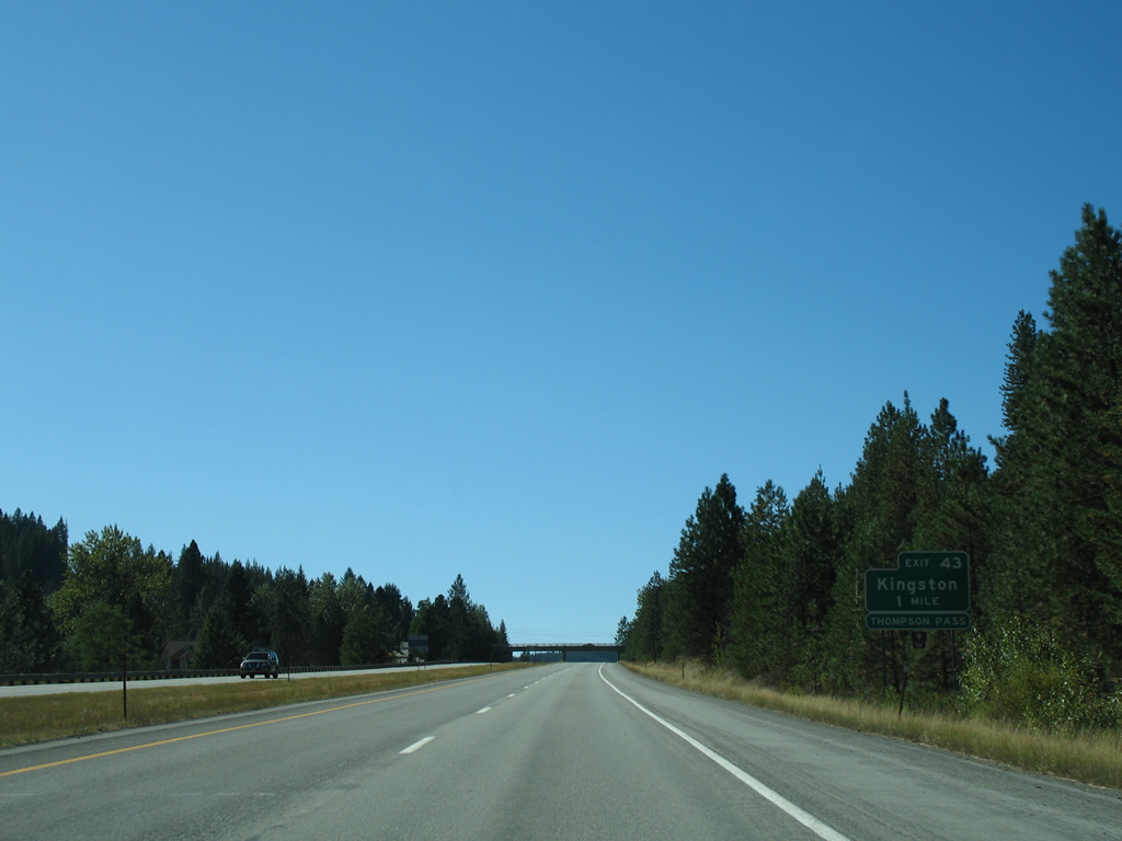
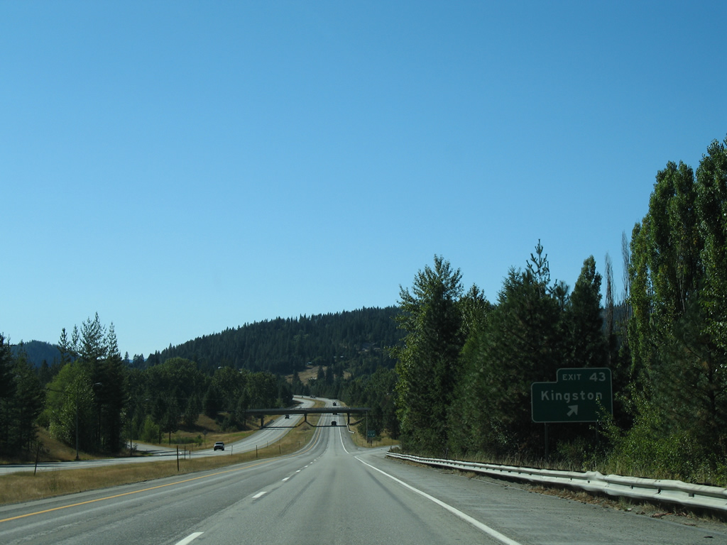
| Frontage roads, Riverview Drive to the north and Silver Valley Road (old U.S. 10) to the south, parallel I-90 leading to Kingston (Exit 43). The Shiplett Overpass joins the service roads beyond the one mile guide sign for Exit 43. 09/01/06 |
|
| Crossing paths at Exit 43 is National Forest Road 9 (Coeur d'Alene River Road), which ventures north from Kingston along the Coeur d'Alene River North Fork to Prichard. East from there, NF-9 follows Prichard Creek to Murray and Thompson Pass (elevation 4,859 feet) into Montana. 09/01/06 |
|
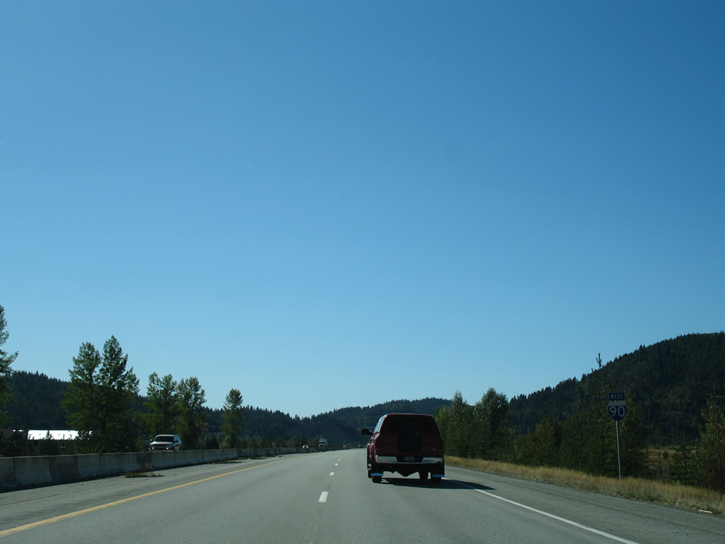
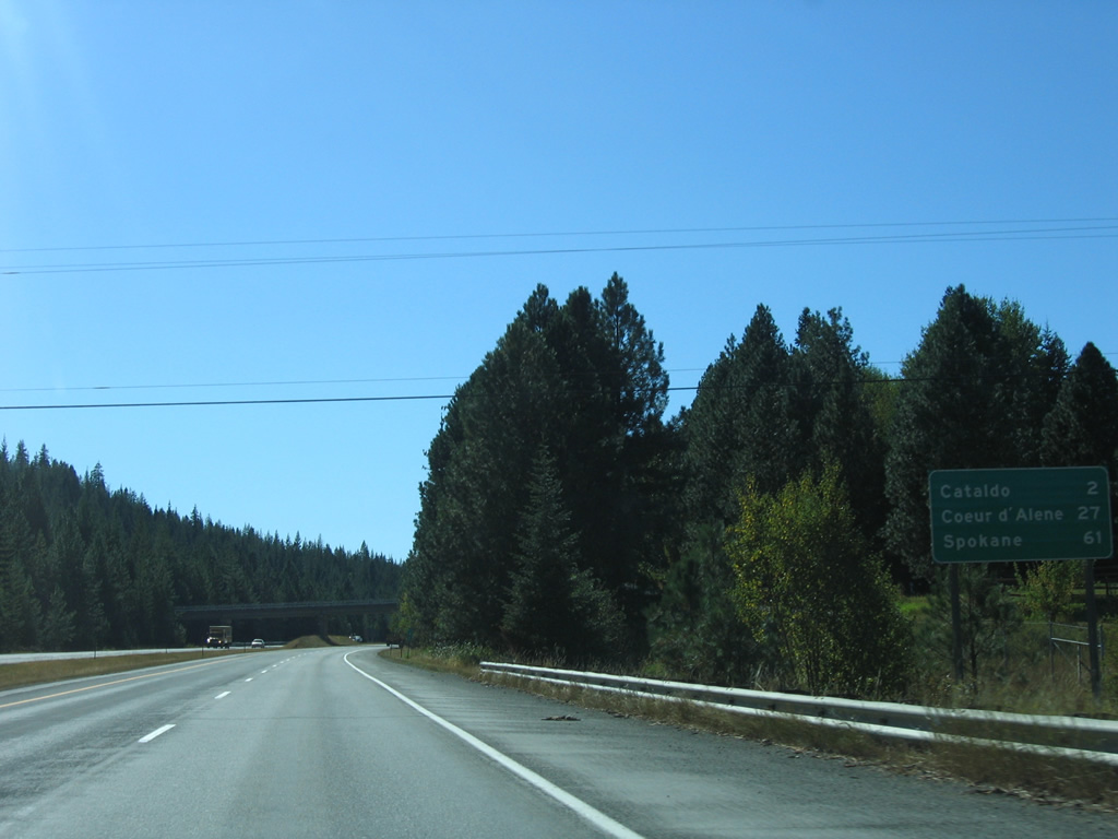
| Spokane debuts on Interstate 90 westbound distance signs at 61 miles out. Cataldo is next in two miles, followed by Coeur d'Alene at 27 miles. 09/01/06 |
|
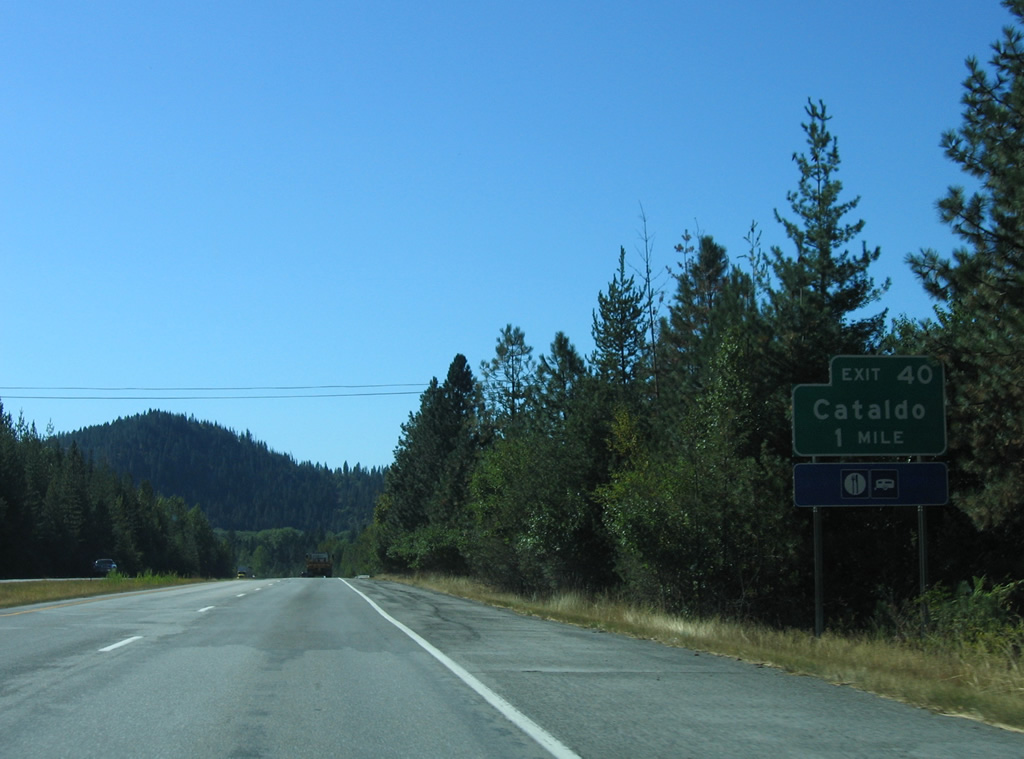
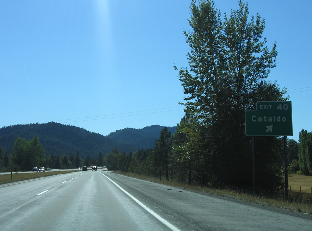
| Riverview Drive remains parallel to I-90 west from National Forest Road 9 to become Canyon Road beyond the Kootenai County line. Forthcoming Exit 40 connects Interstate 90 with Canyon Road via Latour Creek Road at Cataldo. 09/01/06 |
|
| Entering the folded diamond interchange (Exit 40) with Latour Creek Road on Interstate 90 west. Latour Creek Road winds southwest from Cataldo to Kootenai Peak and the St. Joe Mountains. Canyon Road follows the course of former U.S. 10 to Exit 34. 09/01/06 |
|
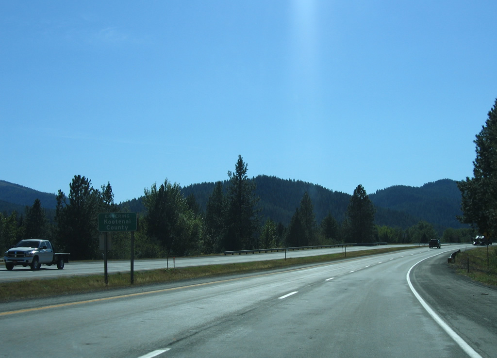
| The Kootenai County line crosses Interstate 90 just beyond the Exit 40 gore point. 40.39 miles of I-90 in the Gem State remain. 09/01/06 |
Page Updated 07-10-2013.

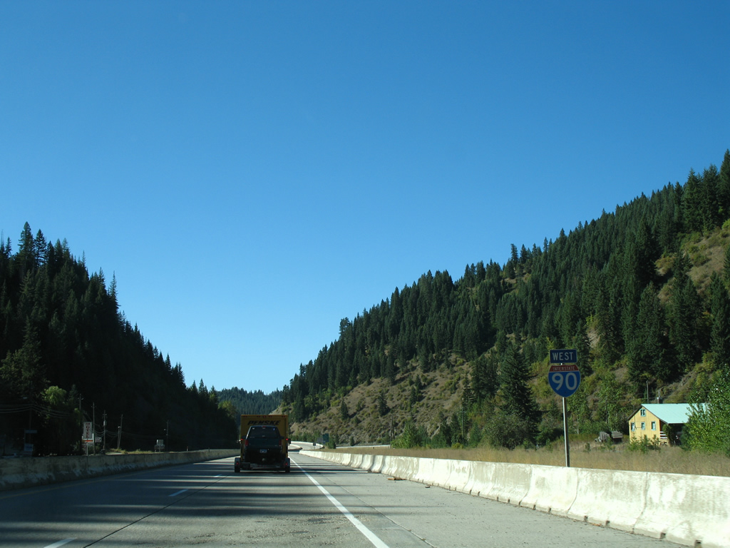
 West
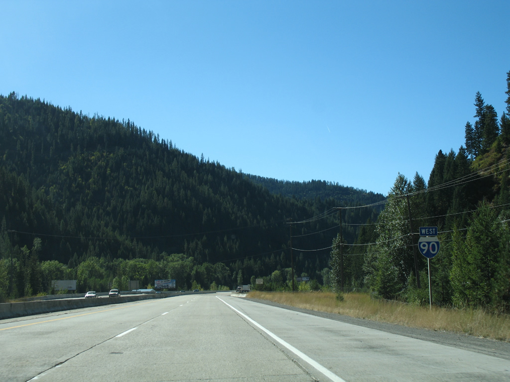
West