|
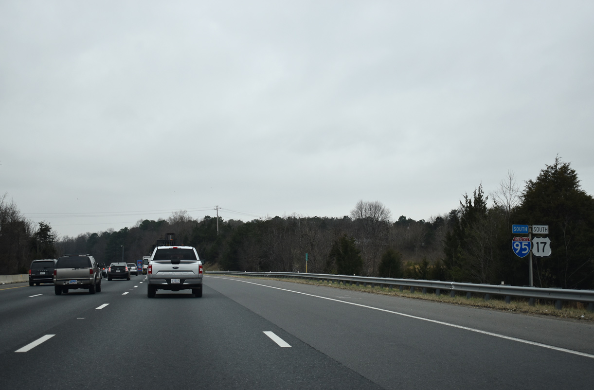
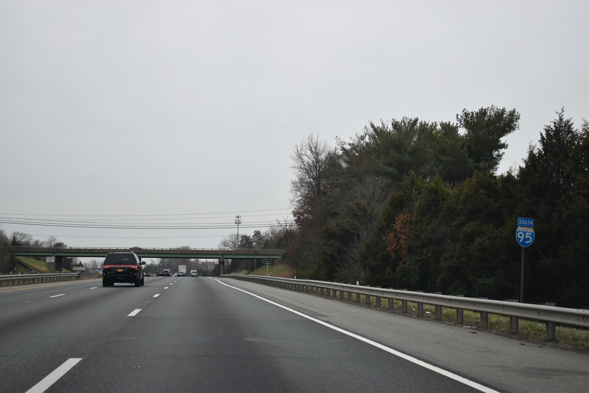
| The I-95/U.S. 17 overlap at Fredericksburg is the first of three between the two routes. The other concurrencies are in the LowCountry of South Carolina and at Jacksonville, Florida. 01/04/19 |
|
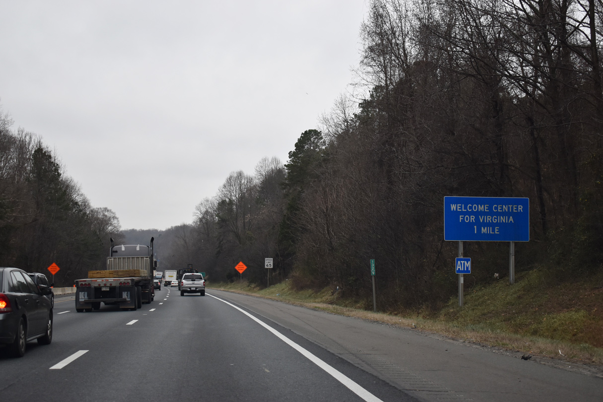
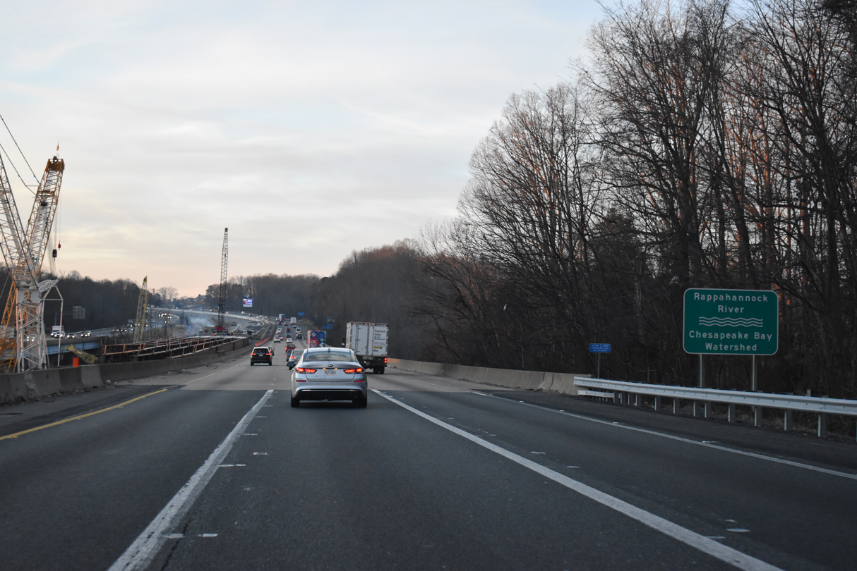
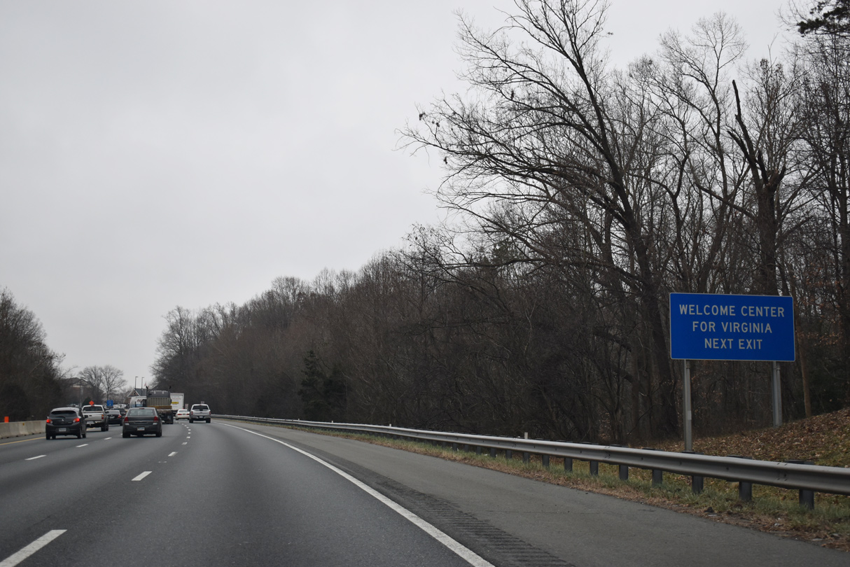
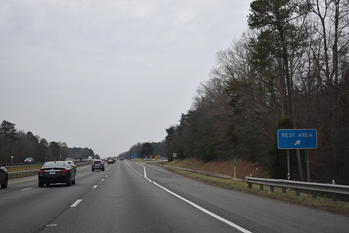
| A Virginia welcome center and rest area are located along I-95/U.S. 17 beyond the Rappahannock River in one mile. 01/04/19 |
|
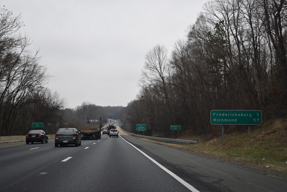
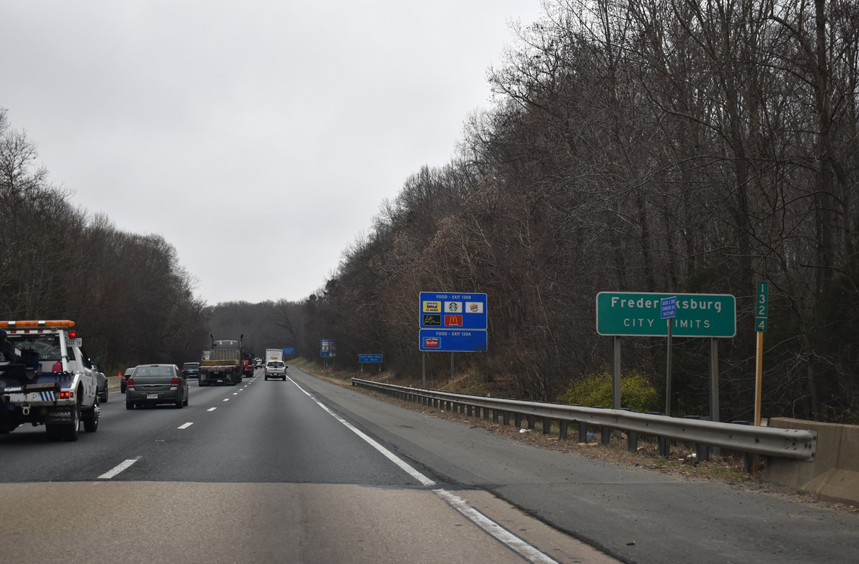
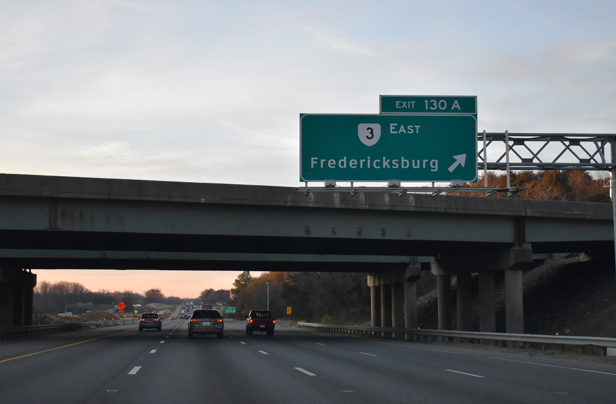
| Spanning the Rappahannock River, I-95/U.S. 17 enter the independent city of Fredericksburg. Downtown lies five miles to the east via Exit 130. 01/04/19, 12/30/20 |
|
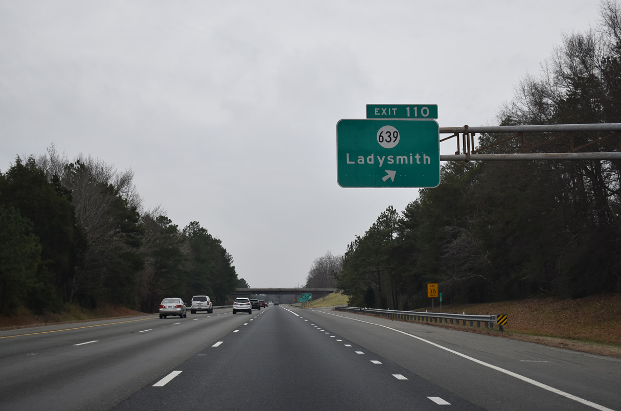
| The Virginia Welcome Center precedes the Fall Hill Avenue overpass (SR 639). 01/04/19 |
|
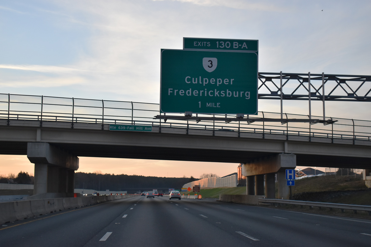
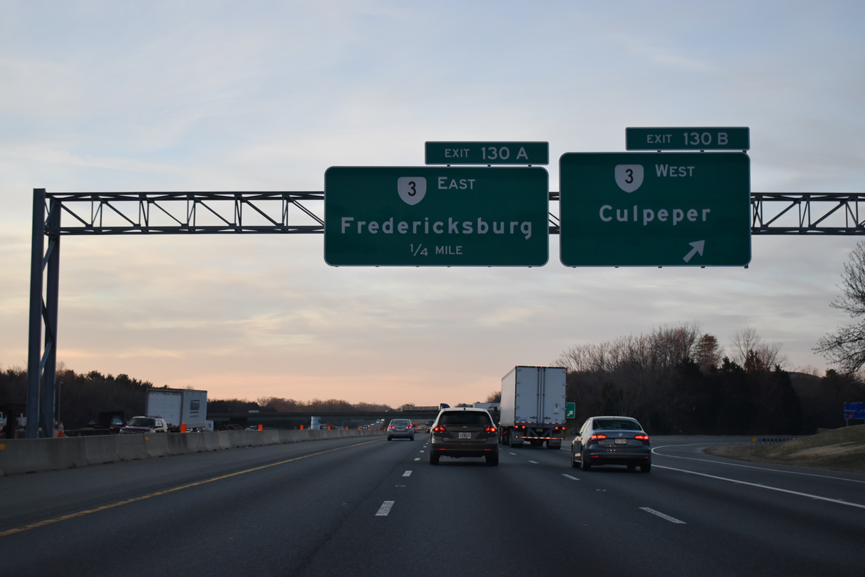
| SR 3 (Plank Road) and I-95/U.S. 17 meet along the east side of the heavily commercialized area anchored by Spotsylvania Town Centre. Points of interest for Exit 130 include Kenmore Plantation, James Monroe Museum and Fredicksburg Battlefield. 12/30/20 |
|
| Beyond the commercialized stretch west from I-95, SR 3 continues to Waverly Village and U.S. 15/29/522 at Culpeper. East from Fredericksburg, SR 3 travels to King George, Warsaw and Gloucester. 12/30/20 |
|
| $21 million in construction from June 2017 to December 2018 made safety improvements at the cloverleaf interchange with SR 3 (Plank Road). The loop ramp from SR 3 east to I-95 north was removed and the I-95 south ramp to SR 3 west was realigned into a signalized intersection. A bypass lane was added from Exit 130B to Carl D. Silver Parkway as well.1 12/30/20 |
|
| Confirming markers posted southbound by Spotsylvania Town Centre. 01/04/19 |
|
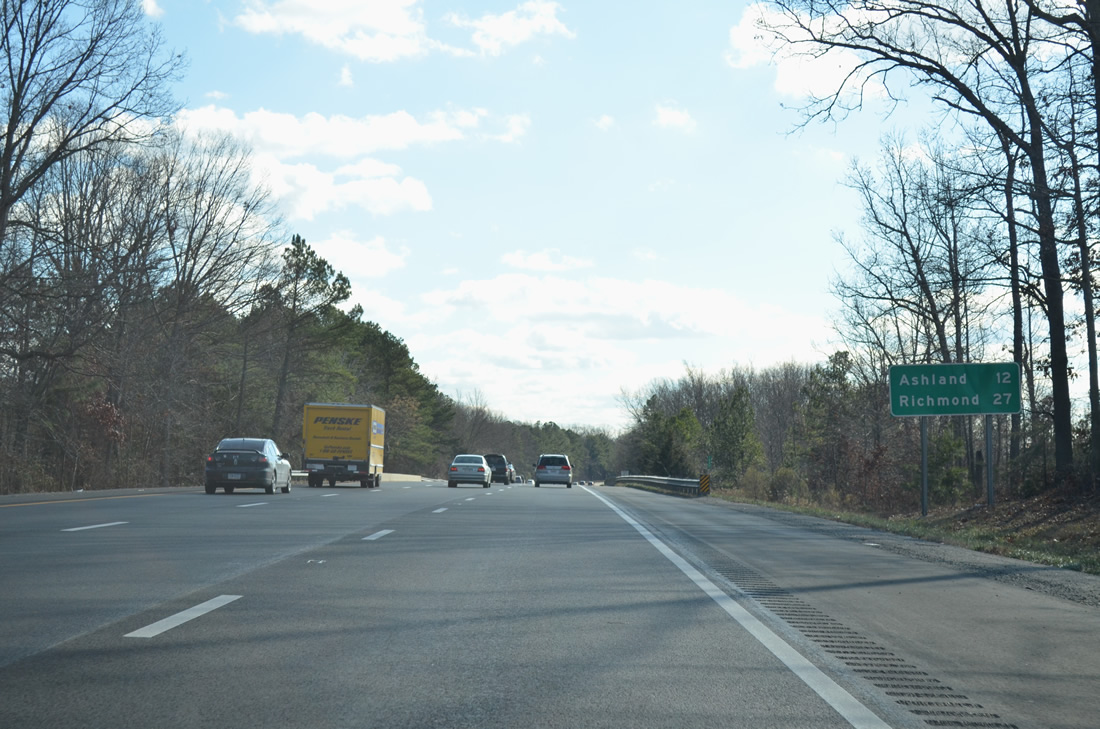
| Ashland replaces Fredericksburg as the next control city along southbound distance signs. 01/04/19 |
|
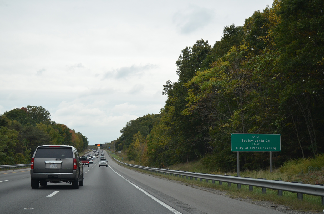
| I-95/U.S. 17 leave the Fredericksburg city limits and enter Spotsylvania County at Hazel Run. 10/12/14 |
|
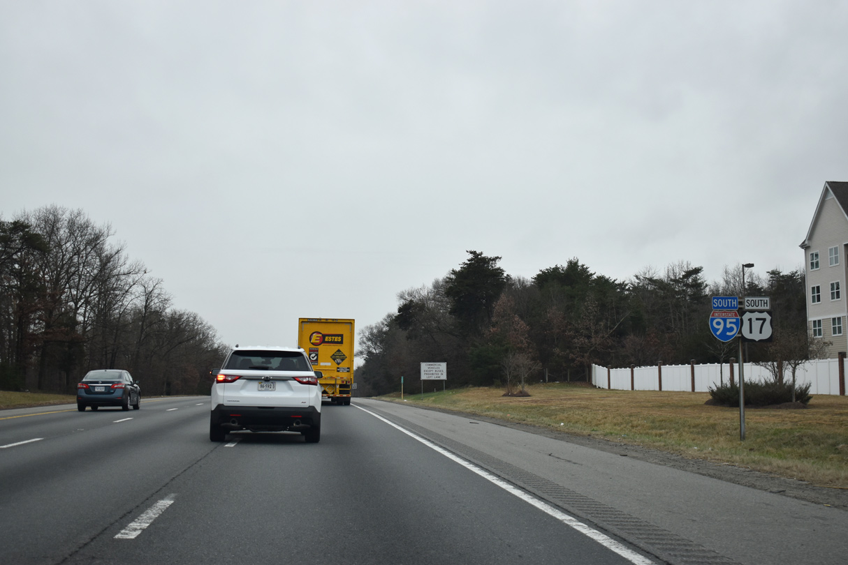
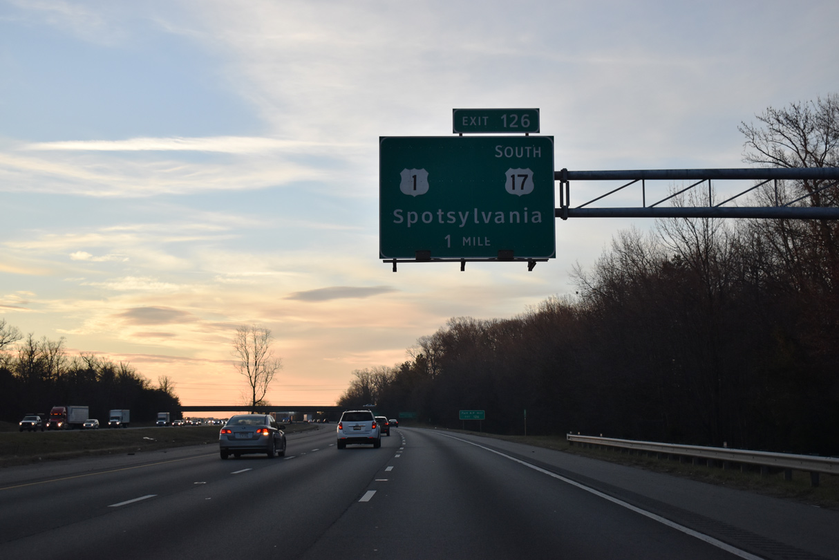
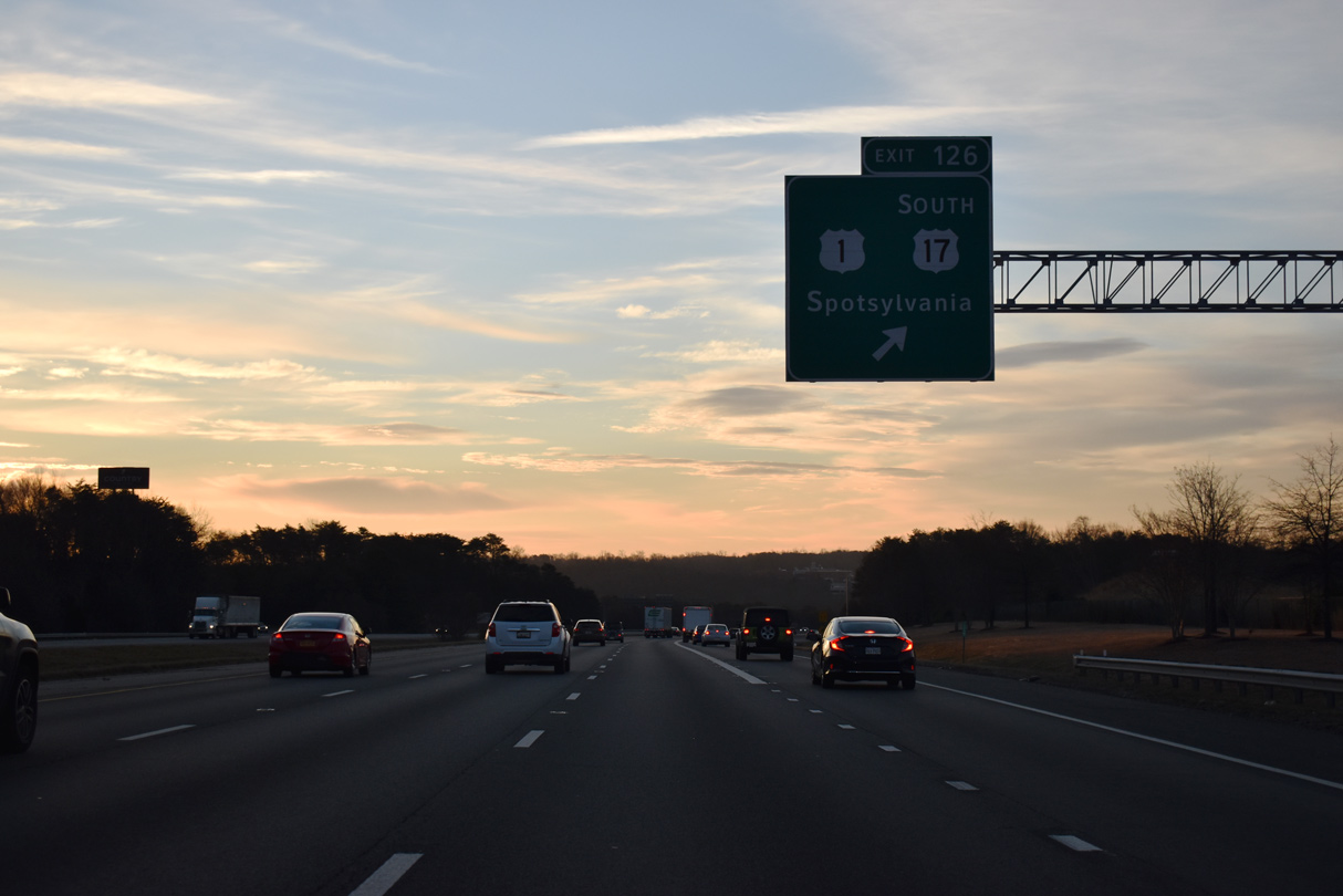
| U.S. 17 splits with I-95 south at a parclo interchange (Exit 126) with U.S. 1 (Jefferson Davis Highway). U.S. 1/17 combine south 0.93 miles to Mills Drive east. Spotsylvania lies west along SR 208. 12/30/20 |
|
| Exit 126 leaves I-95 south for U.S. 1, U.S. 17 south and Spotsylvania. Spotsylvania Parkway west to Smith Station Road (SR 628) north connects U.S. 1 with SR 208 (Courthouse Road) west to the county seat. 12/30/20 |
|
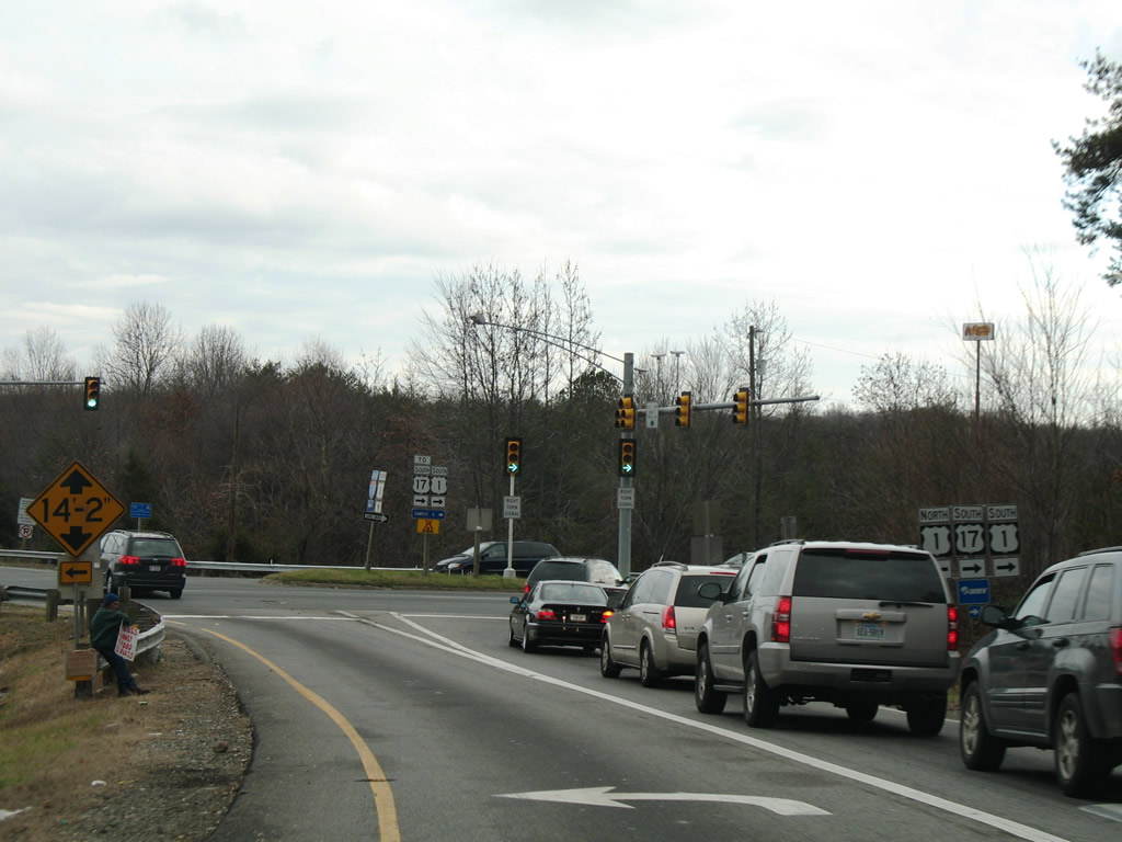
| Suburban development, including Southpoint Shoppes, Cosner's Corner among other retail centers, extends south along parallel U.S. 1/17. 12/26/06 |
|
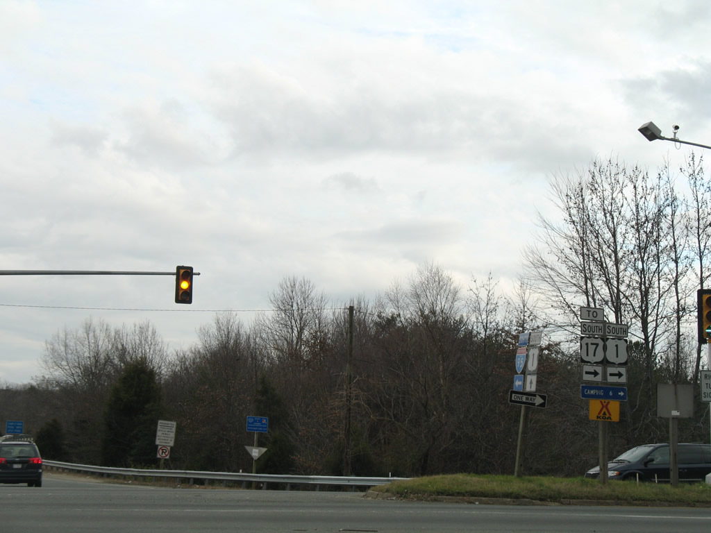
| Following Mills Drive east from U.S. 1 at Cosner's Corner, U.S. 17 continues to SR 2 and U.S. 17 Business (Tidewater Trail) at New Post. The US highway leaves the Fredericksburg area southeast to Tappahannock and Hampton Roads. 12/26/06 |
|
| U.S. 17 (Mills Drive) passes over Interstate 95 east beyond this confirming marker. 01/04/19 |
|
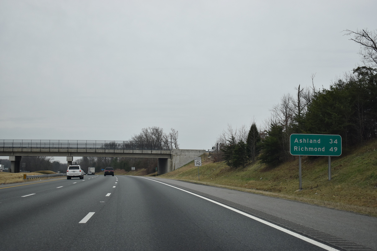
| I-95 advances 34 miles south from the Spotsylvania Parkway overpass to Ashland. 01/04/19 |
|
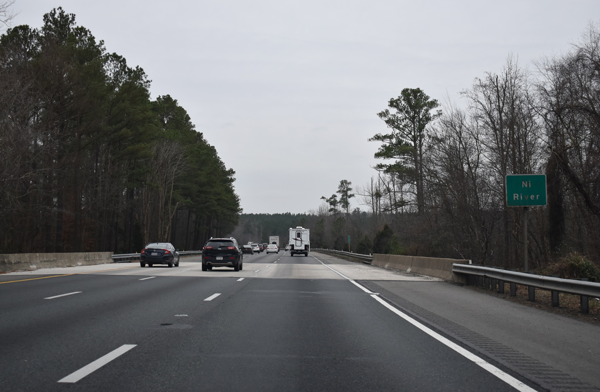
| Interstate 95 transitions into a rural area ahead of the Ni River. 01/04/19 |
|
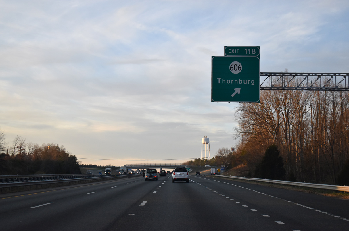
| Interstate 95 meets SR 606 (Mudd Tavern Road) at Exit 118 in one mile. Totaling $22.4 million, construction from October 2017 to September 2019 replaced the two lane overpass with SR 606 with a four lane bridge that can accommodate bicyclists and pedestrians. New ramps were built between I-95 north and SR 618 as well.2 01/04/19 |
|
| Thornburg lies just west of Exit 118 at the cross roads of SR 606 (Mudd Tavern Road / Morris Road) and U.S. 1 (Jefferson Davis Highway). SR 606 leads west from Thornburg to SR 208 at Snell and east to Dominion Raceway, Guinea and the Jackson Shrine at Fredericksburg & Spotsylvania National Military Park. 12/30/20 |
|
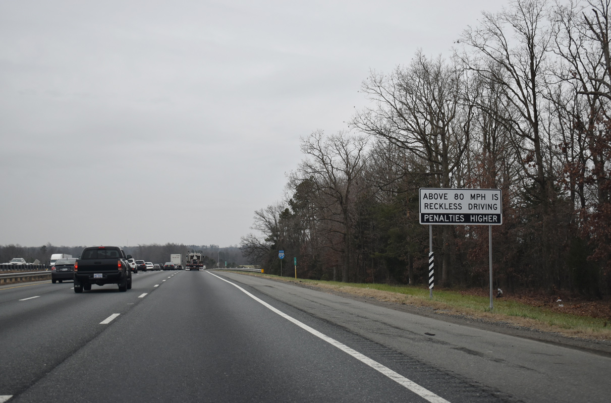
| Drivers caught speeding over 80 miles per hour in Virginia are arrested for reckless driving. 01/04/19 |
|
| A remaining agricultural field separates I-95 from parallel U.S. 1 (Jefferson Davis Highway) south of Thornburg. 12/30/20 |
|
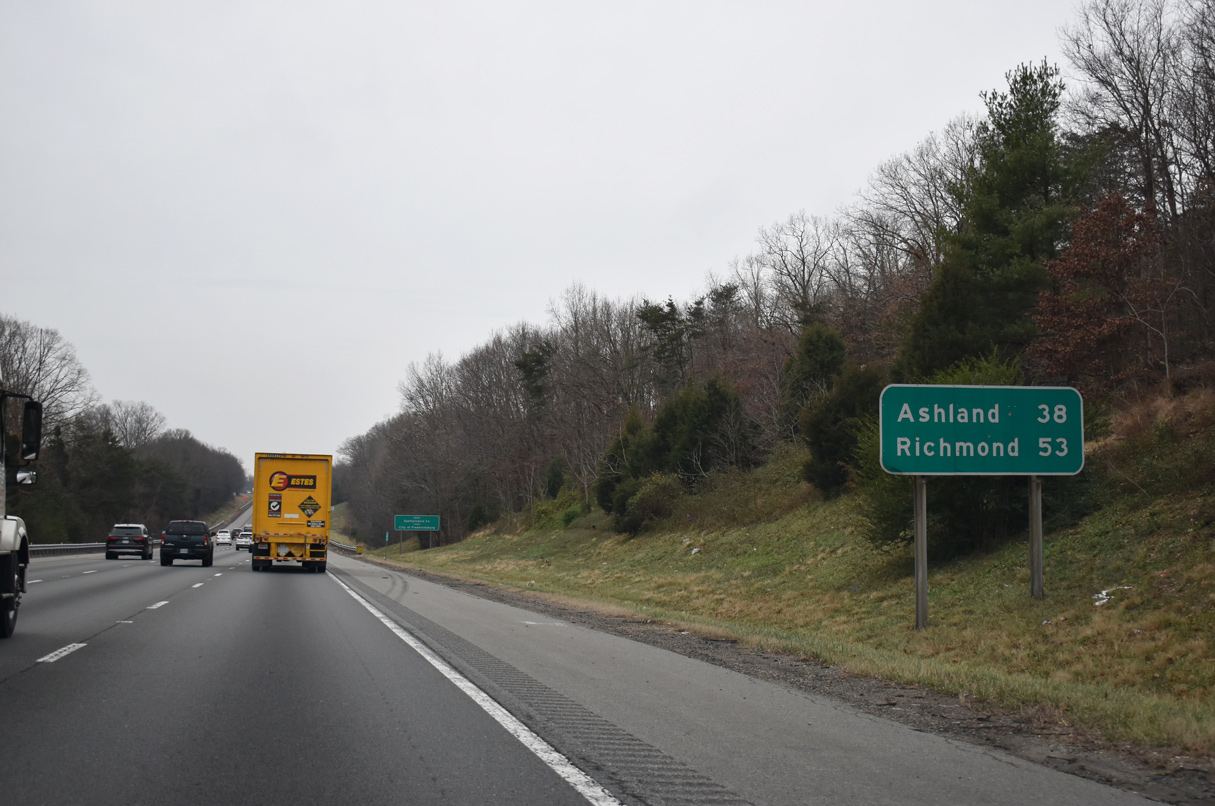
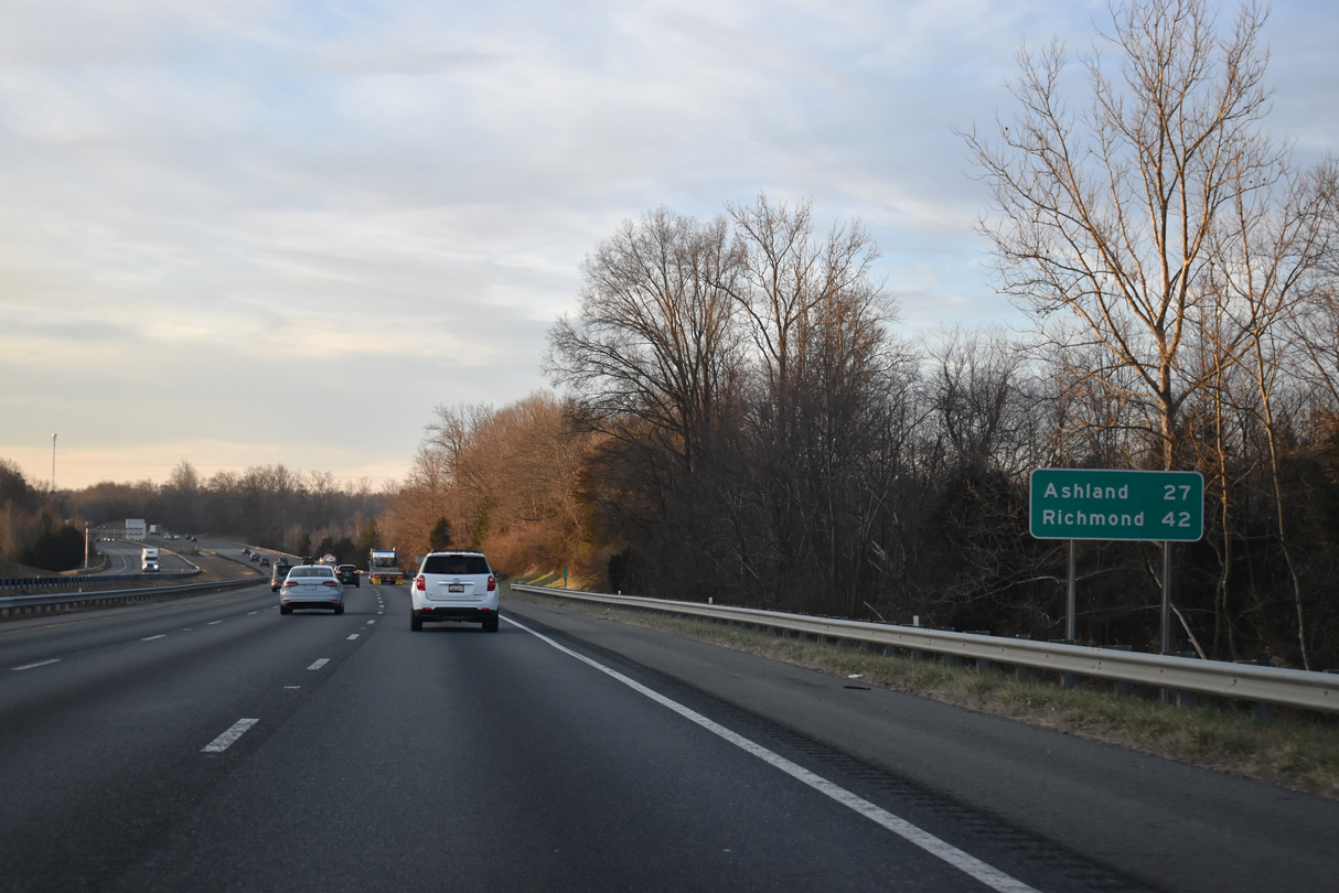
| Curving southward toward the Matta River, I-95 progresses south toward Ashland (27 miles) and Richmond (42 miles). 12/30/20 |
|
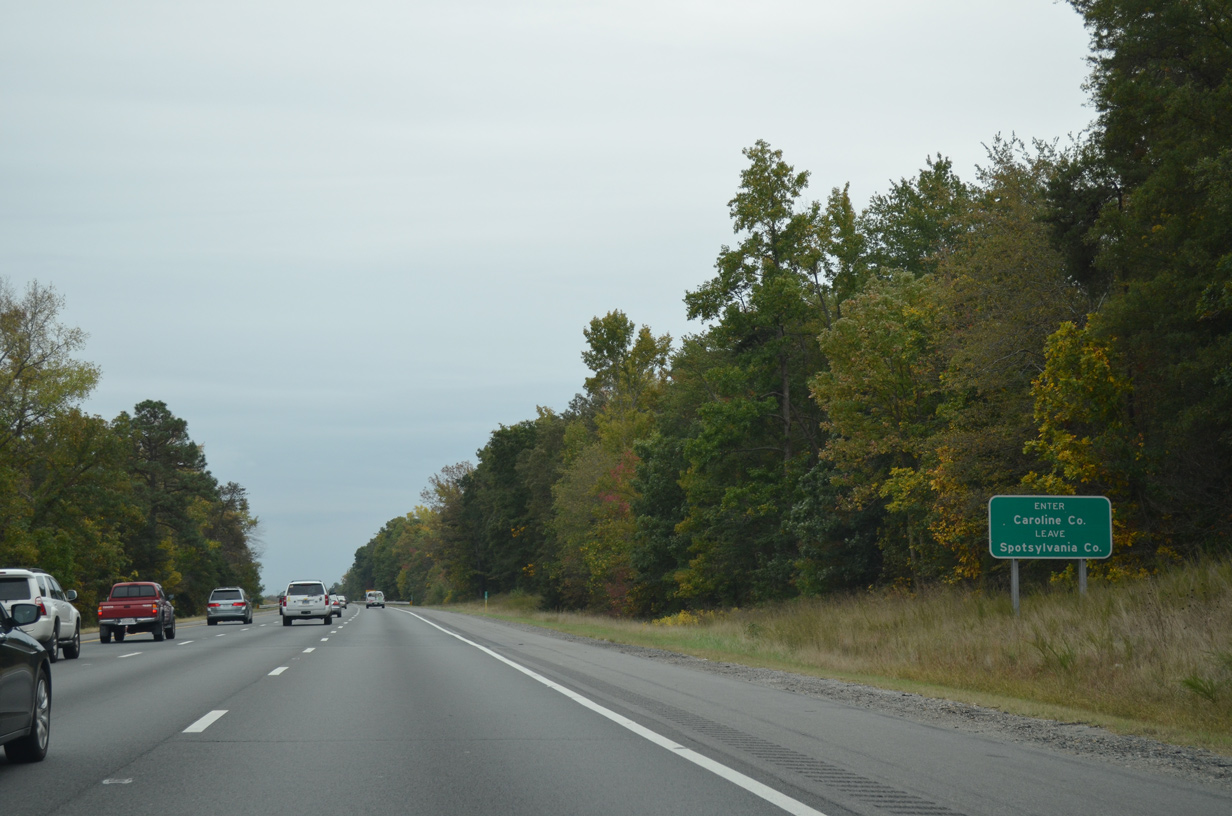
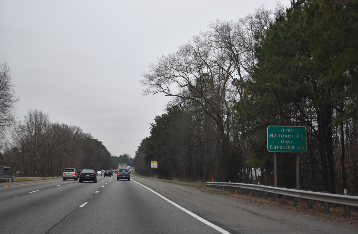
| Interstate 95 enters Caroline County south of the Matta River. 10/12/14 |
|
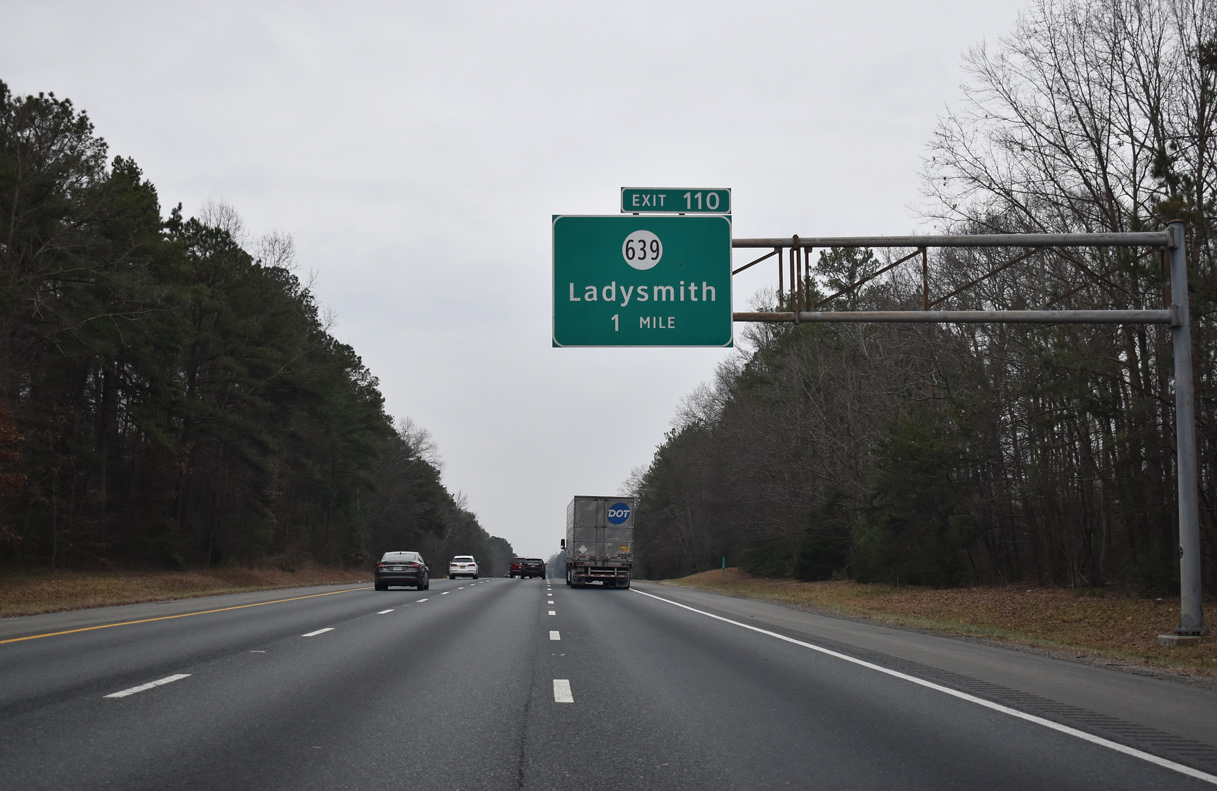
| SR 639 (Ladysmith Road) links I-95 at Exit 110 with the nearby community of Ladysmith to the west at U.S. 1 (Jefferson Davis Highway). 01/04/19 |
|
| Entering the diamond interchange (Exit 110) with SR 639 (Ladysmith Road) on I-95 south. SR 639 travels seven miles east to SR 207 outside Bowling Green and five miles west from U.S. 1 to Chilesburg. 01/04/19 |
|
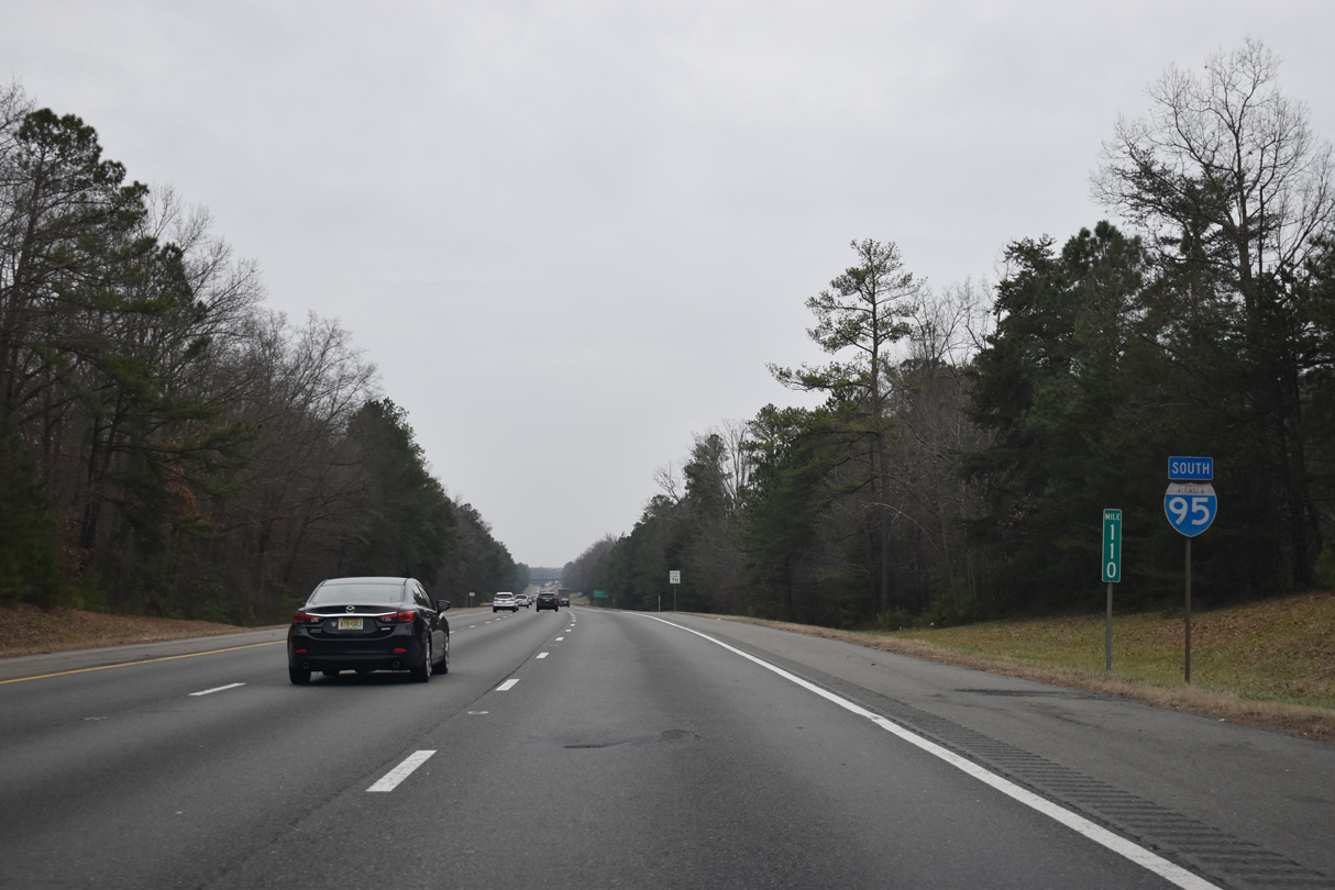
| Reassurance marker posted at mile marker 110 beyond the SR 639 entrance ramp. 01/04/19 |
|
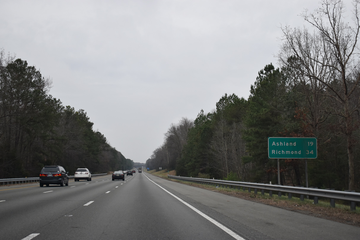
| 19 miles away, Ashland is the third exit south from Ladysmith. 01/04/19 |
|
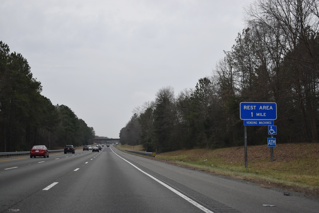
| The Ladysmith Safety Rest Areas line both sides of Interstate 95 east of Golansville and Lake Caroline. 01/04/19 |
|
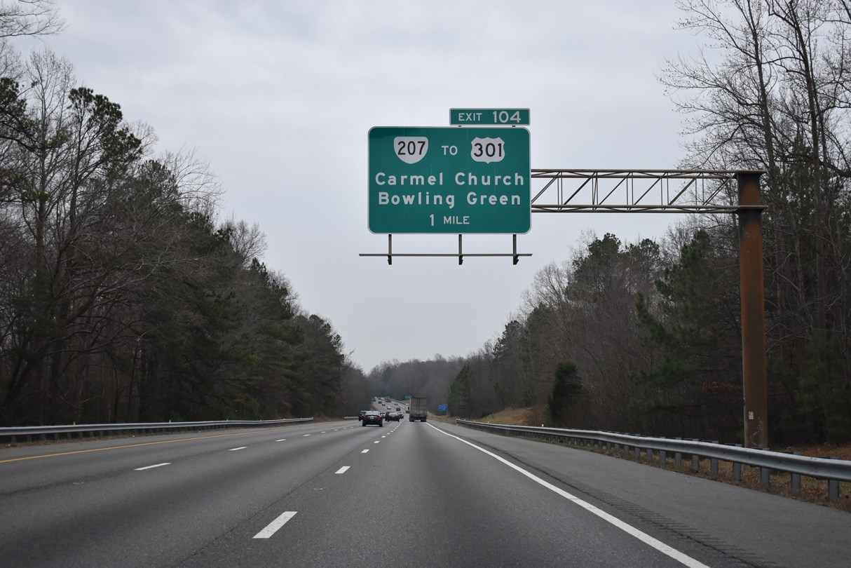
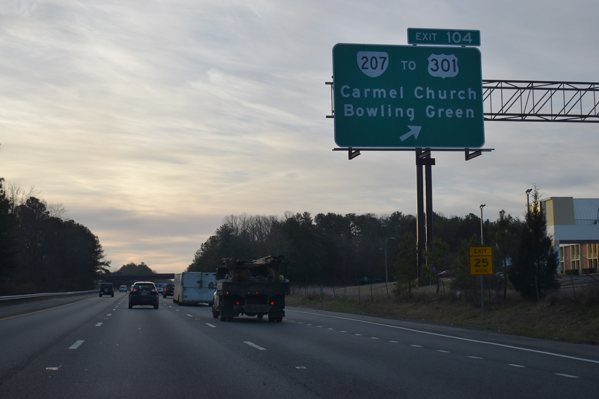
| SR 207 (Rogers Clark Boulevard) constitutes a 11.93 mile route from U.S. 1 at Carmel Church northeast to U.S. 301, U.S. 301 Business, SR 2 and SR 207 Business at Bowling Green. 01/04/19 |
|
| SR 207 provides a direct route from the U.S. 301 corridor leading south from the Governor Nice Bridge and southern Maryland to I-95 south for Ashland and Richmond. The state route ends 0.46 miles at U.S. 1 (Jefferson Davis Highway) and SR 658 (Jericho Road) west. 12/30/20 |
|
| I-95 passes west of the unincorporated community of Ruther Glen along the ensuing stretch south of SR 207. 01/04/19 |
|
| The distance sign preceding the CSX Railroad underpass was damaged between September and October 2014 and subsequently removed. 12/30/12 |
|
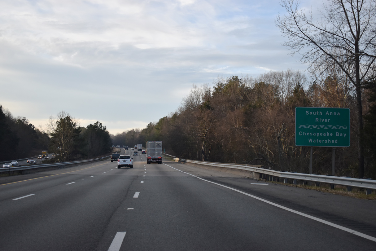
| Crossing the North Anna River, southbound I-95 enters Hanover County at mile 101.33. 01/04/19 |
|
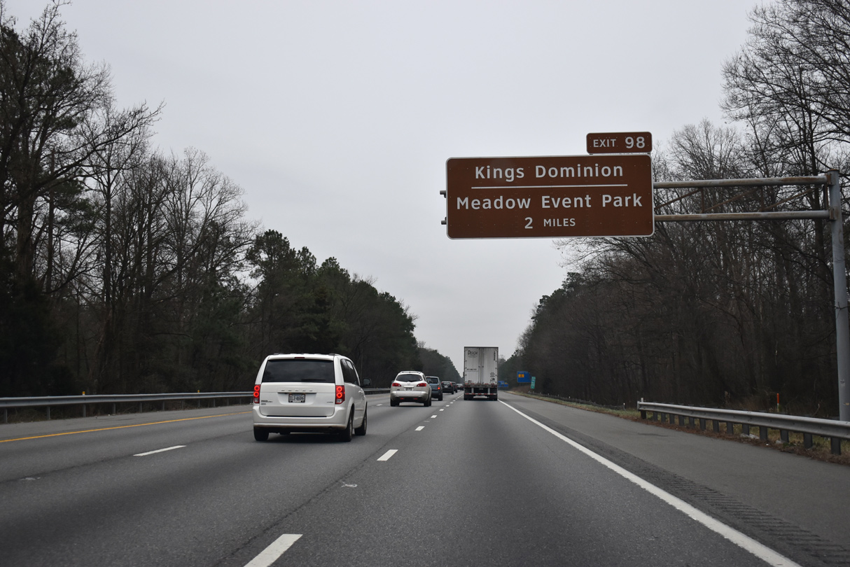
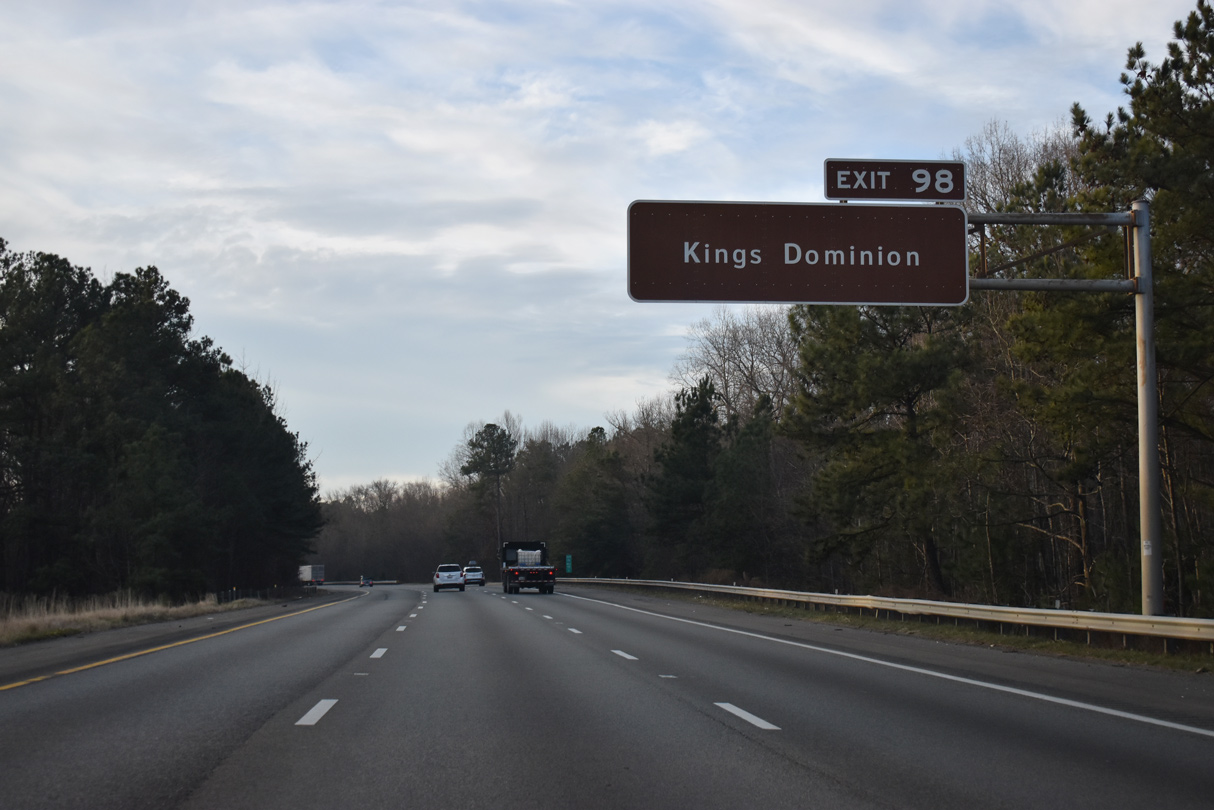
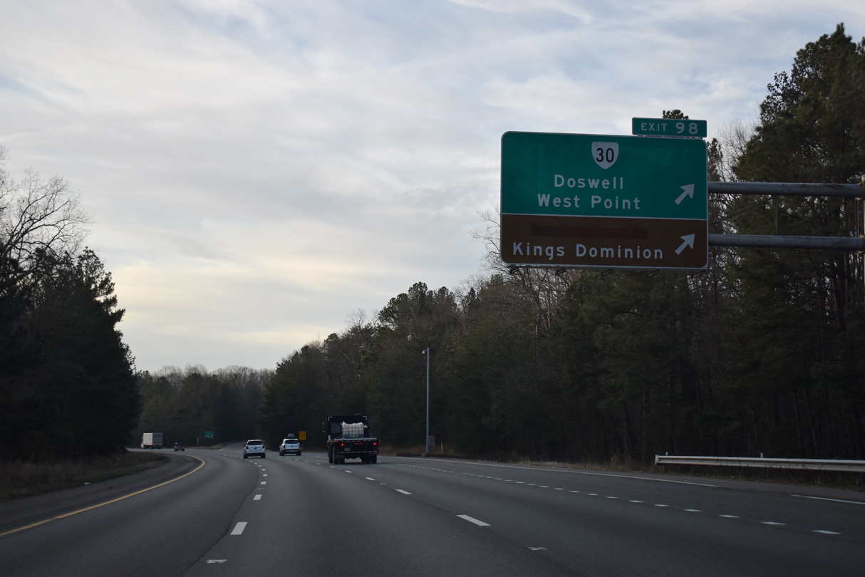
| Forthcoming Exit 98 connects Interstate 95 with the adjacent Kings Dominion theme park and The Meadow Event Park via SR 30 (Kings Dominion Boulevard) east. 01/04/19 |
|
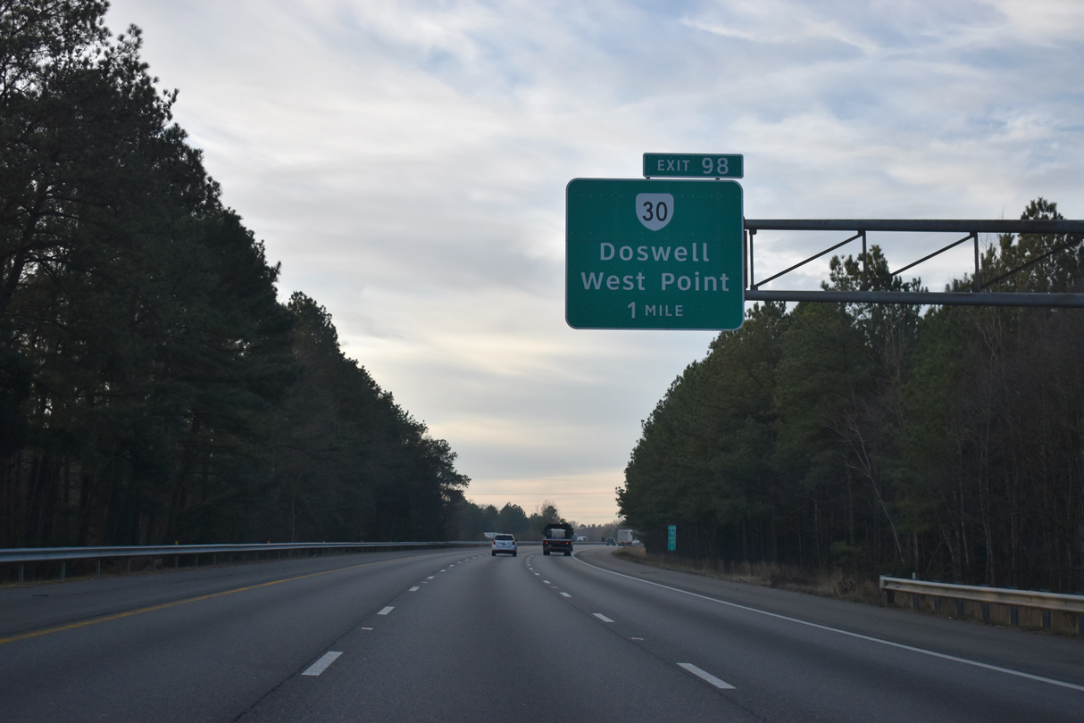
| SR 30 (Kings Dominion) begins at U.S. 1 near Doswell and heads east 0.63 miles to a parclo interchange (Exit 98) with Interstate 95. 12/30/20 |
|
| Kings Dominion, which has attractions similar to Six Flags Great America or Six Flags Magic Mountain, lies just southeast of Exit 98. A separate ramp at Exit 98 links I-95 south directly with the theme park parking area and the east side service road. 12/30/20 |
|
| Exit 98 departs I-95 south for SR 30 west to Doswell and east to King William and West Point. SR 30 constitutes a 61.87 mile long route southeast to Interstate 64 (Exit 231) outside Williamsburg. 12/30/20 |
|
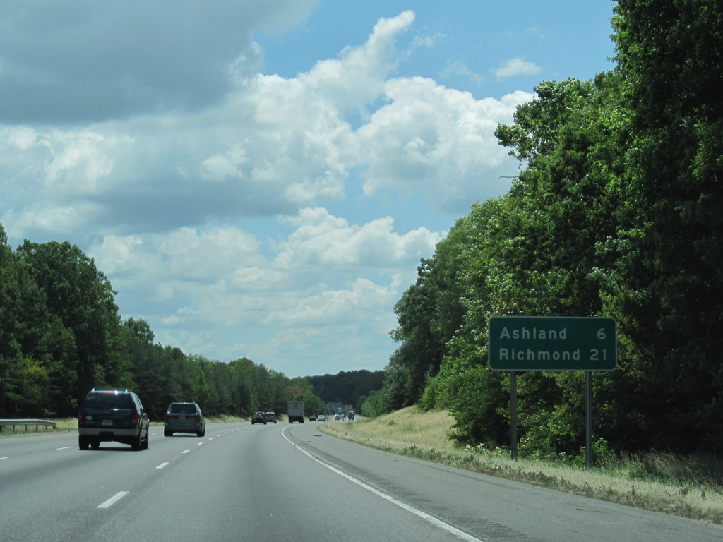
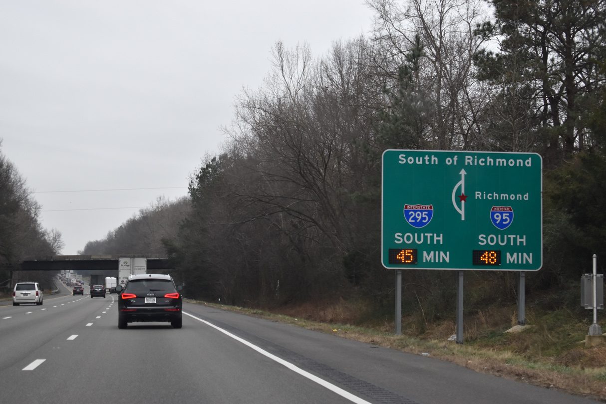
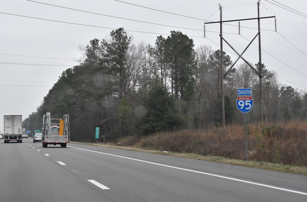
| Interstate 95 advances six miles south to Ashland and 21 miles to the capital city. 01/04/19, 07/09/10, 12/30/20 |
|
| Travel times are provided for long distance travelers headed south beyond the Richmond metropolitan area. 01/04/19 |
|
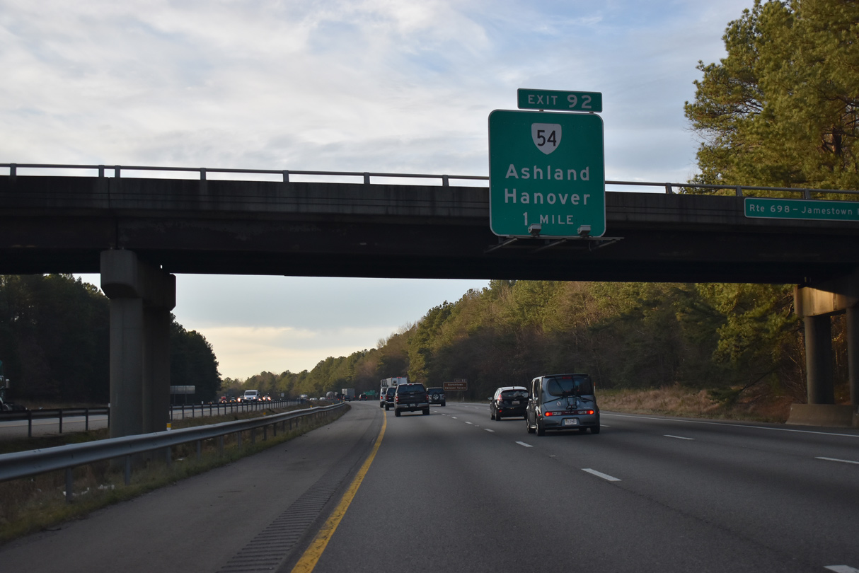
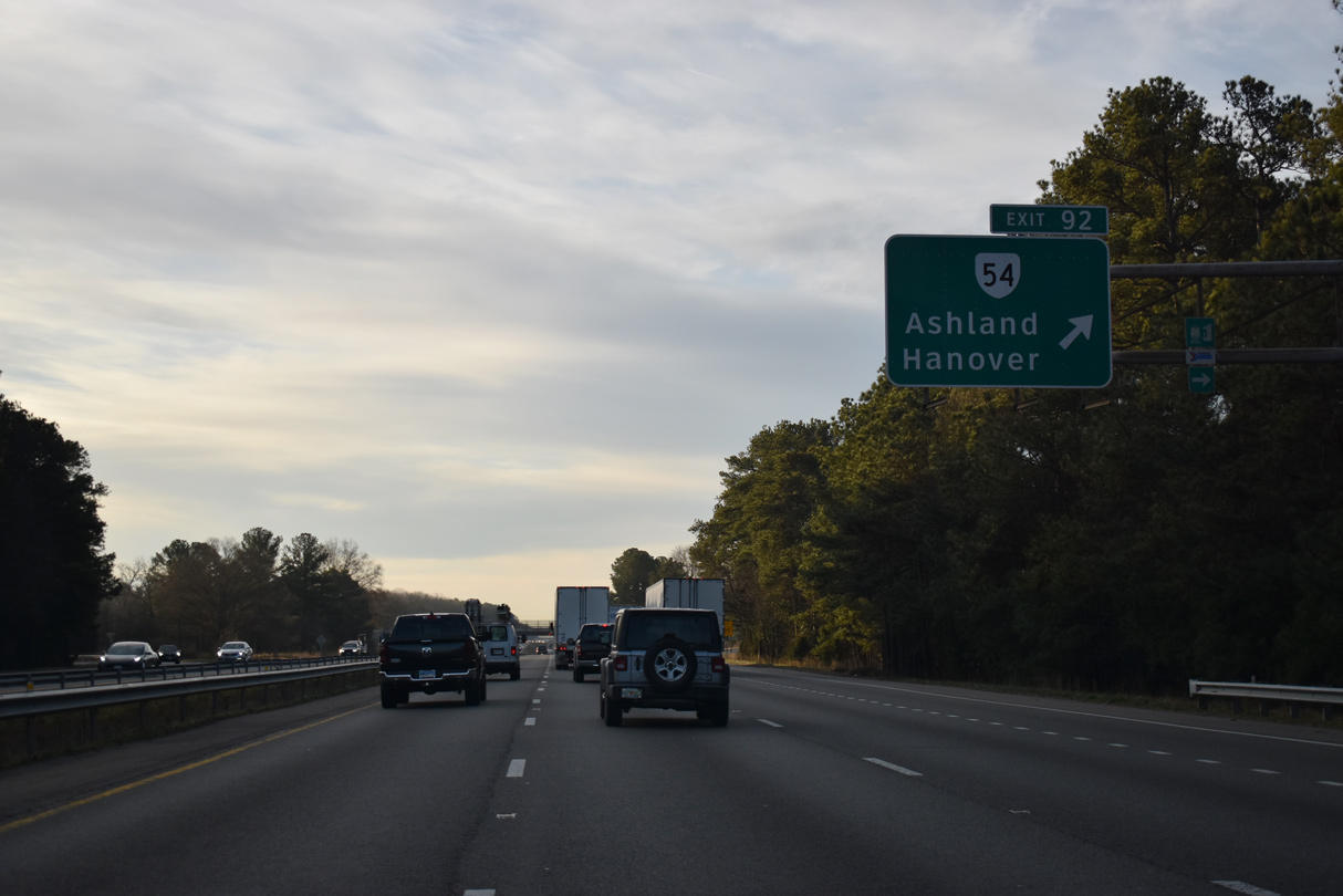
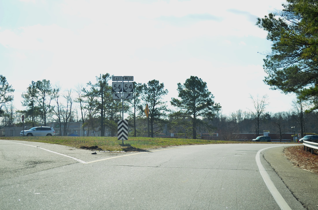
| The succeeding exit along I-95 south is with SR 54 (England Street) west to Ashland and (Courthouse Road) east to Hanover. 12/30/20 |
|
| SR 54 extends west to U.S. 1 in Ashland and U.S. 33 near Montpelier. SR 54 concludes east from Exit 92 at U.S. 301/SR 2 in Hanover. 12/30/20, 12/30/12 |
|
| Confirming marker posted south of Mechumps Creek at the Ashland town line. 01/04/19 |
|
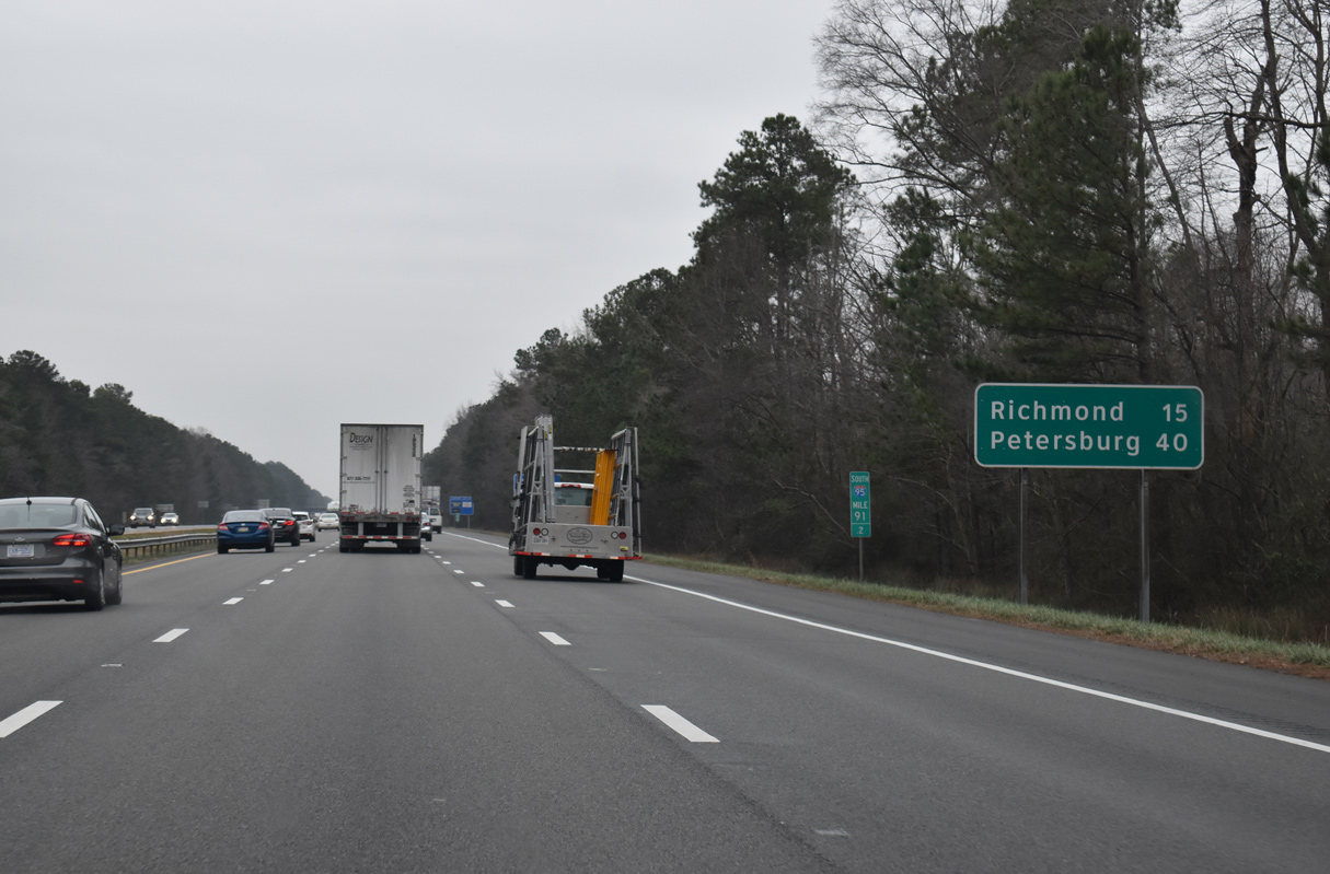
| Petersburg appears for the first time on an Interstate 95 distance sign, 15 miles north of Richmond. 01/04/19 |
|
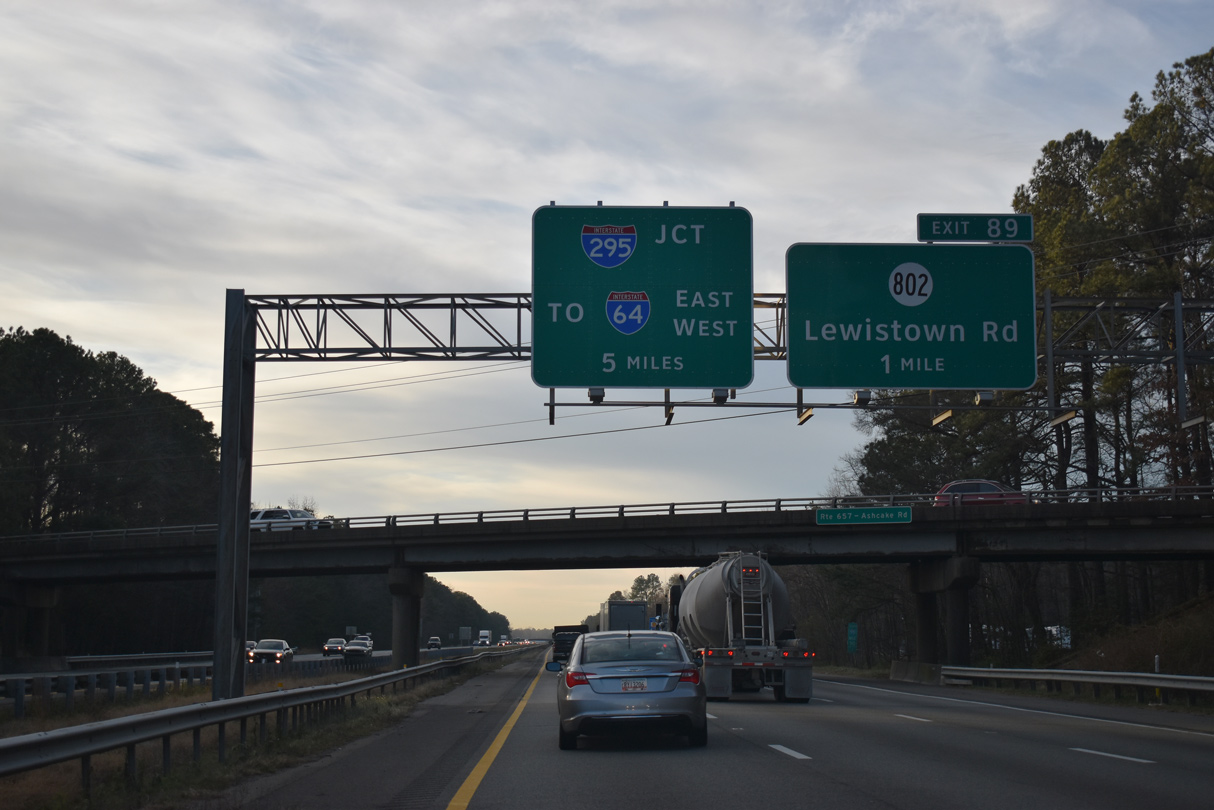
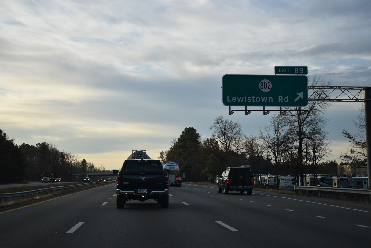
| The ensuing exit lies one mile south of the Ashcake Road (SR 657) overpass at SR 802 (Lewistown Road). The separation of traffic for I-64 beyond Richmond and Petersburg follows in five miles at Interstate 295. 12/30/20 |
|
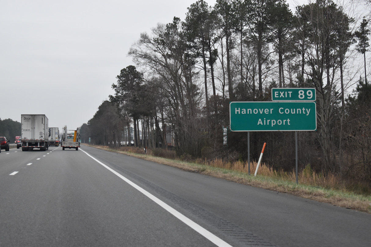
| Hanover County Municipal Airport (OFP) lies just east of Interstate 95 between Exit 89 and 86. 01/04/19 |
|
| The diamond interchange at Exit 89 was modified with a new northbound off-ramp and a five lane wide overpass for SR 802 (Lewistown Road) during a $30 million project underway from Spring 2015 to Winter 2017. 12/30/20 |
|
| A four lane commercial boulevard, Lakeridge Parkway (SR 782) winds along the west side of the freeway to Sliding Hill Road (SR 656) adjacent to this confirming marker. 10/12/14 |
|
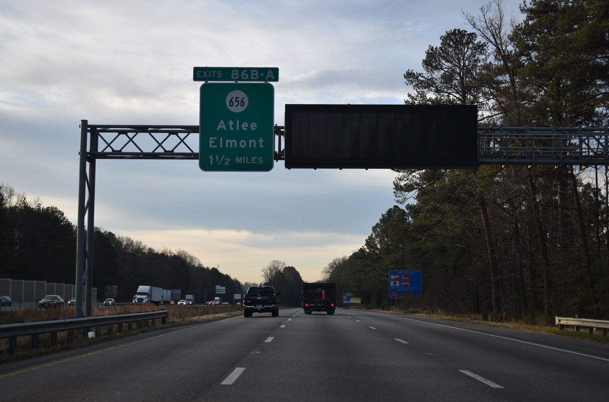
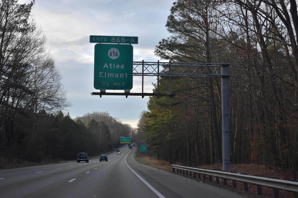
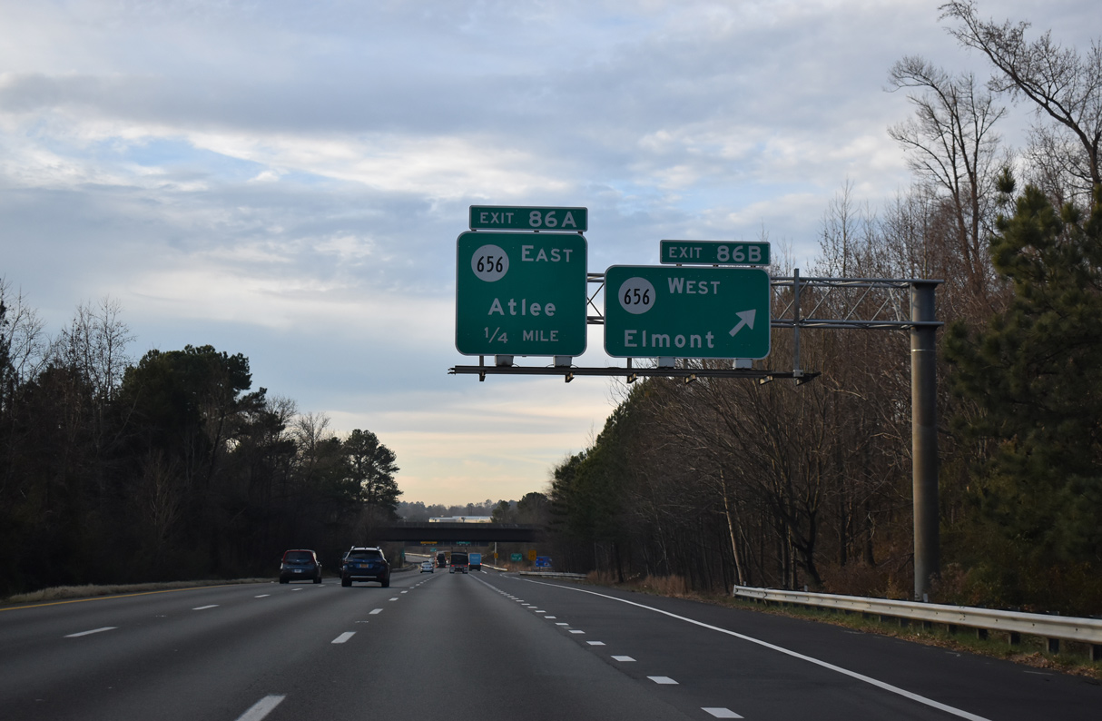
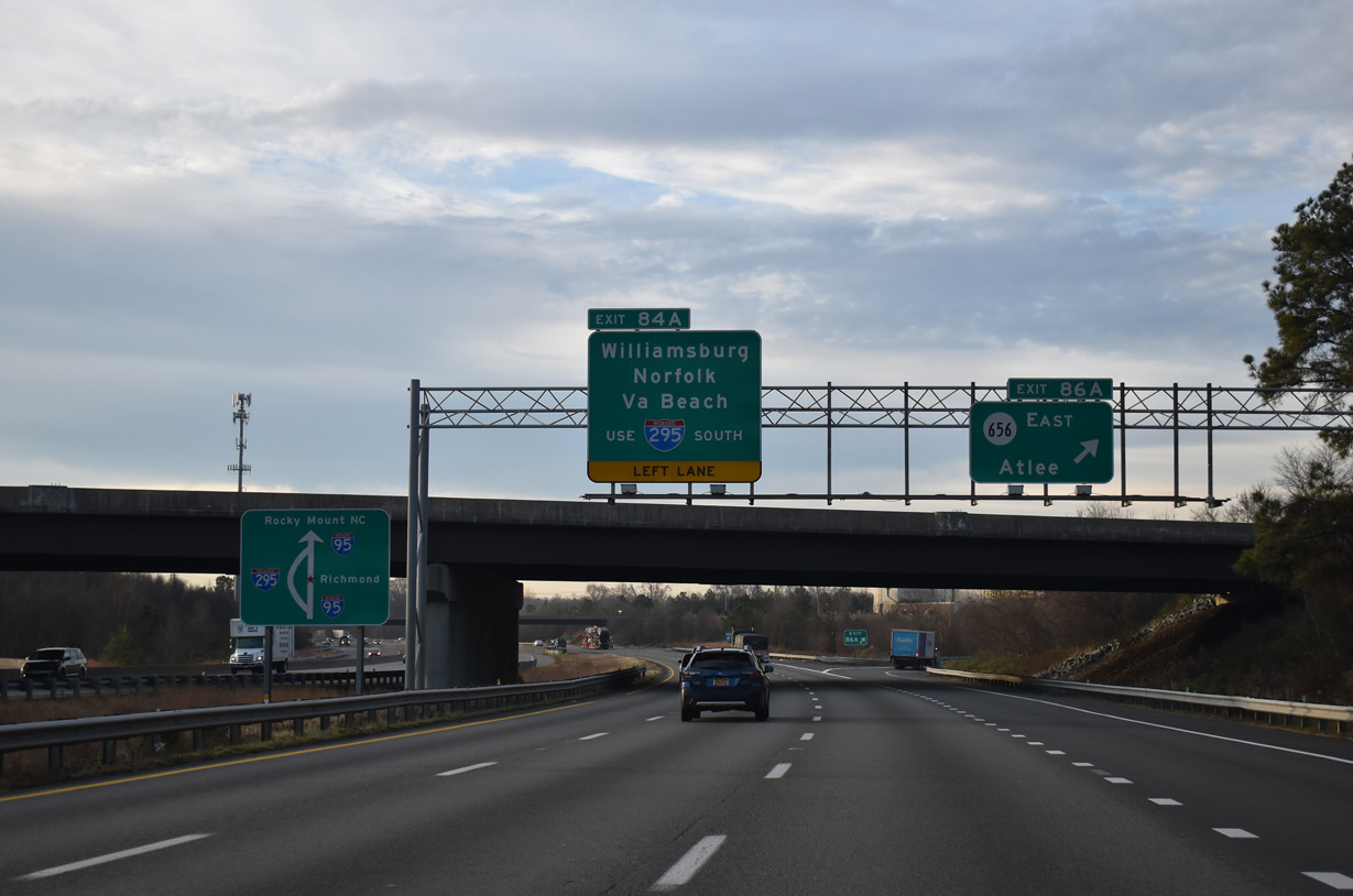
| A directional cloverleaf interchange (Exit 86) joins I-95 with SR 656 (Sliding Hill Road) to Atlee and Elmont in 1.50 miles. 12/30/20 |
|
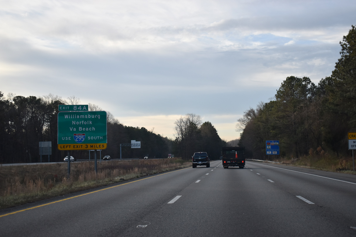
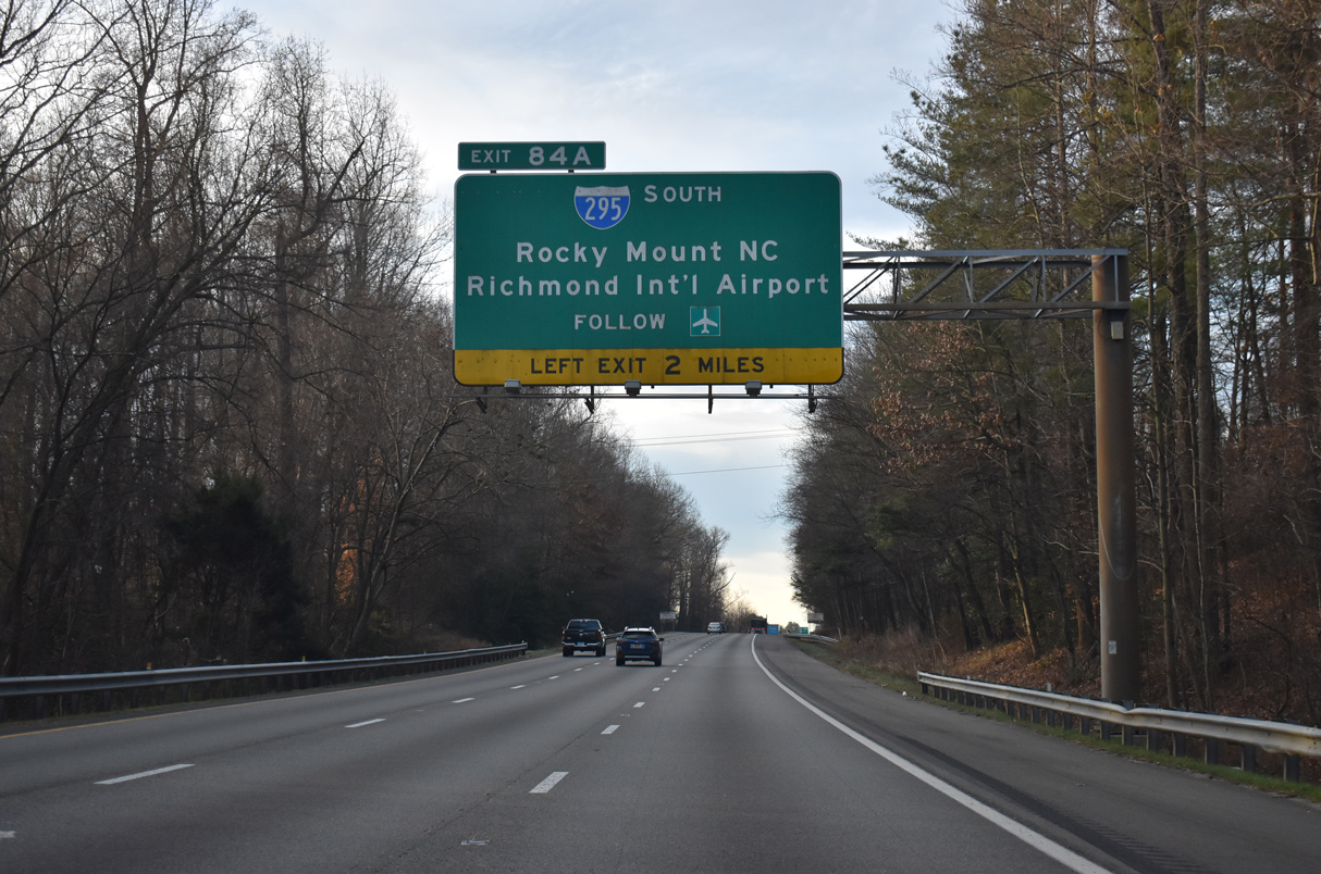
| Left Exit 84A separates from I-95 south in three miles for Interstate 295 to I-64 east for Hampton Roads. 12/30/20 |
|
| SR 656 (Sliding Hill Road) extends west from Exit 86B to U.S. 1 (Brook Road) and northeast form Exit 86A to Atlee and Hanover County Municipal Airport (OFP). 12/30/20 |
|
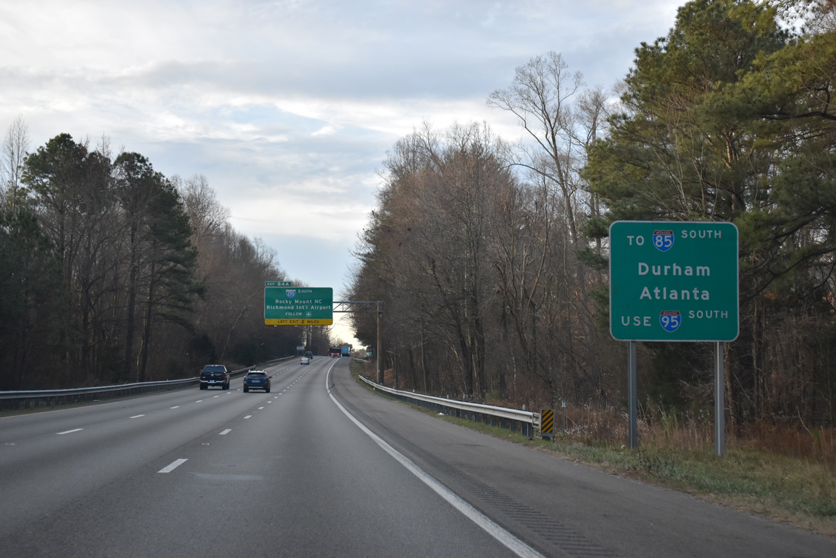
| Interstate 85 branches southwest from I-95 in 36 miles at Petersburg. I-295 bypasses Petersburg to the east without a direct connection to I-85. 12/30/20 |
|
| Left Exit 84A constitutes a 1.42 mile long ramp from I-95 south to I-295 south. The ramp was built in anticipation of the 1980s proposal to realign I-95 onto the bypass of Richmond and Petersburg. 12/30/20 |
|
| Construction in the mid 2000s realigned Sliding Hill Road to the north and replaced the original diamond interchange at Exit 86. SR 656 west connects with Lakeridge Parkway south to Virginia Center Commons. Sliding Hill rises southeast of the exchange. 12/30/20 |
|
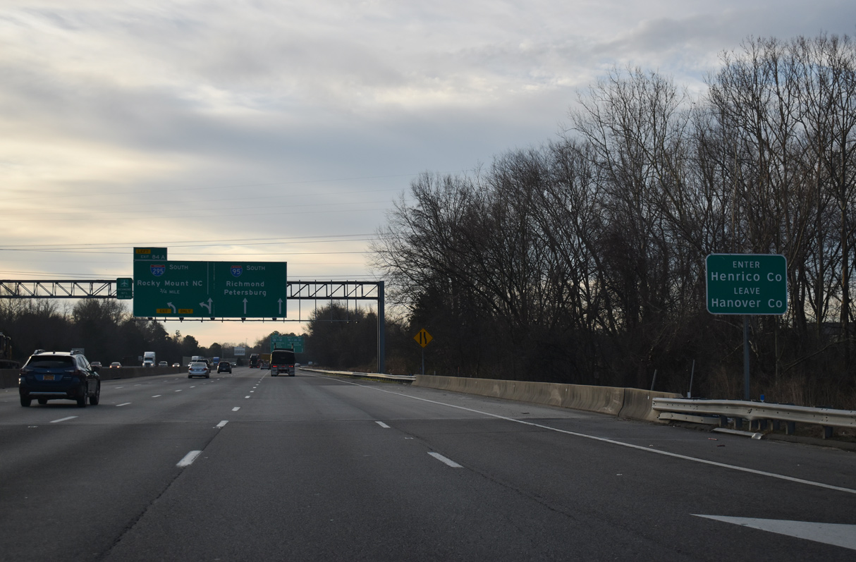
| Three lanes advance south from Exit 86A to Interstate 295 (Exit 84). 12/30/20 |
|
| Interstate 295 south also connects to Richmond International Airport (via Exit 28) and provides a more direct route to the southern Virginia cities of Hopewell and Emporia. 12/30/20 |
|
| Crossing the Chickahominy River, southbound Interstate 95 enters Henrico County. 12/30/20 |
Page Updated 04-07-2021.


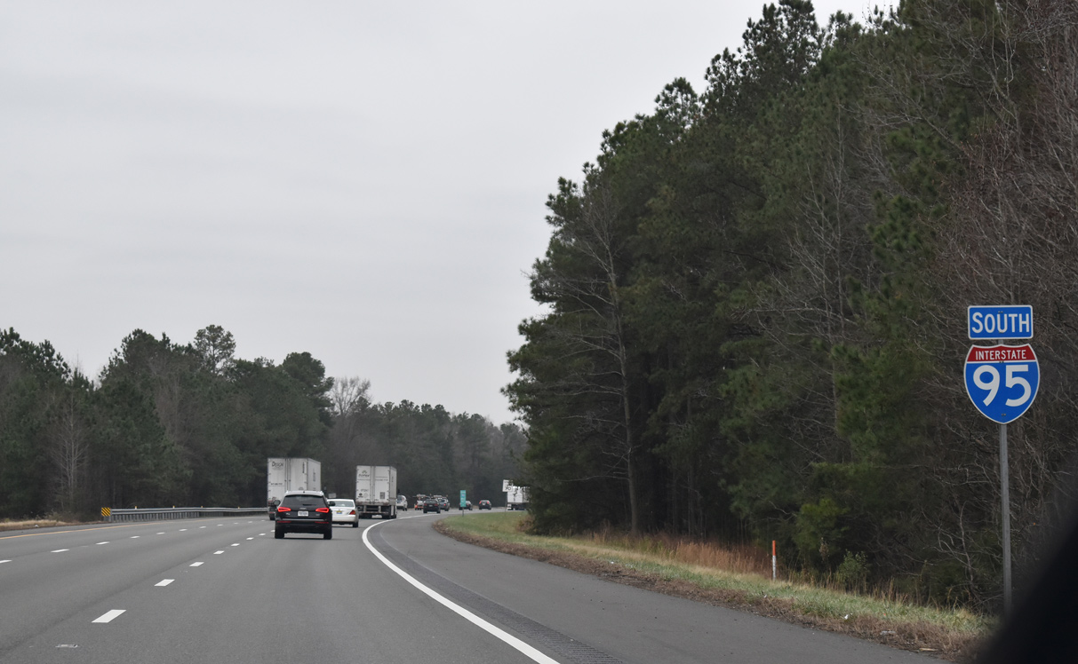
 South
South