|
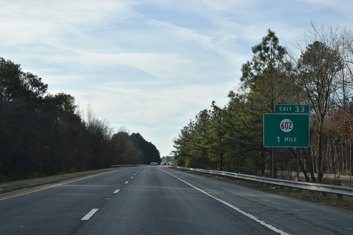
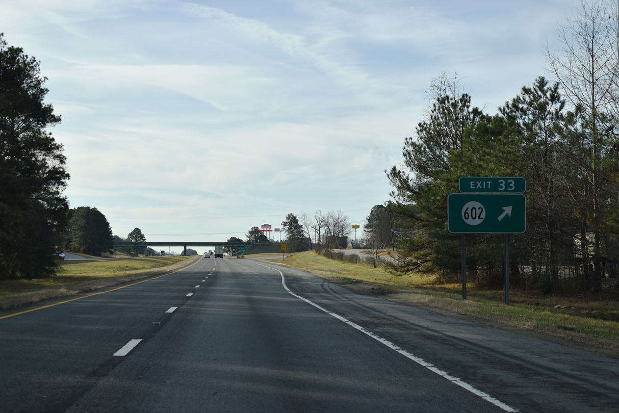
| Exit 33 joins the freeway with SR 602 (Cabin Point Road) in a rural area south of Rowanty Creek. 12/30/20 |
|
| SR 602 is a 19.62 mile route west 1.50 miles to SR 618 (Halifax Road) and northeast along Cabin Point Road to SR 35 and U.S. 460 in northeastern Sussex County. 12/30/20 |
|
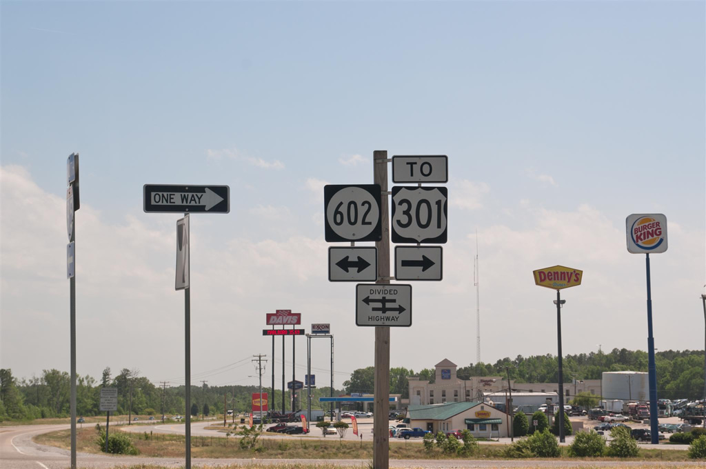
| SR 602 (Cabin Point Road) links Interstate 95 at Exit 33 with parallel U.S. 301 by an array of traveler services. 05/08/10 |
|
| U.S. 301 (Blue Star Memorial Highway) and Slagle Road as frontage roads for Interstate 95 south from Exit 33 to Setzer Road. 12/30/20 |
|
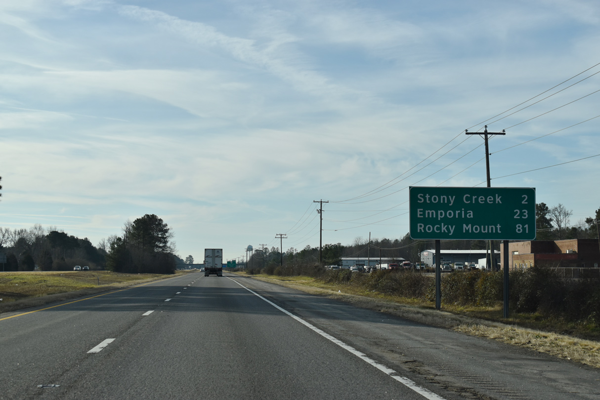
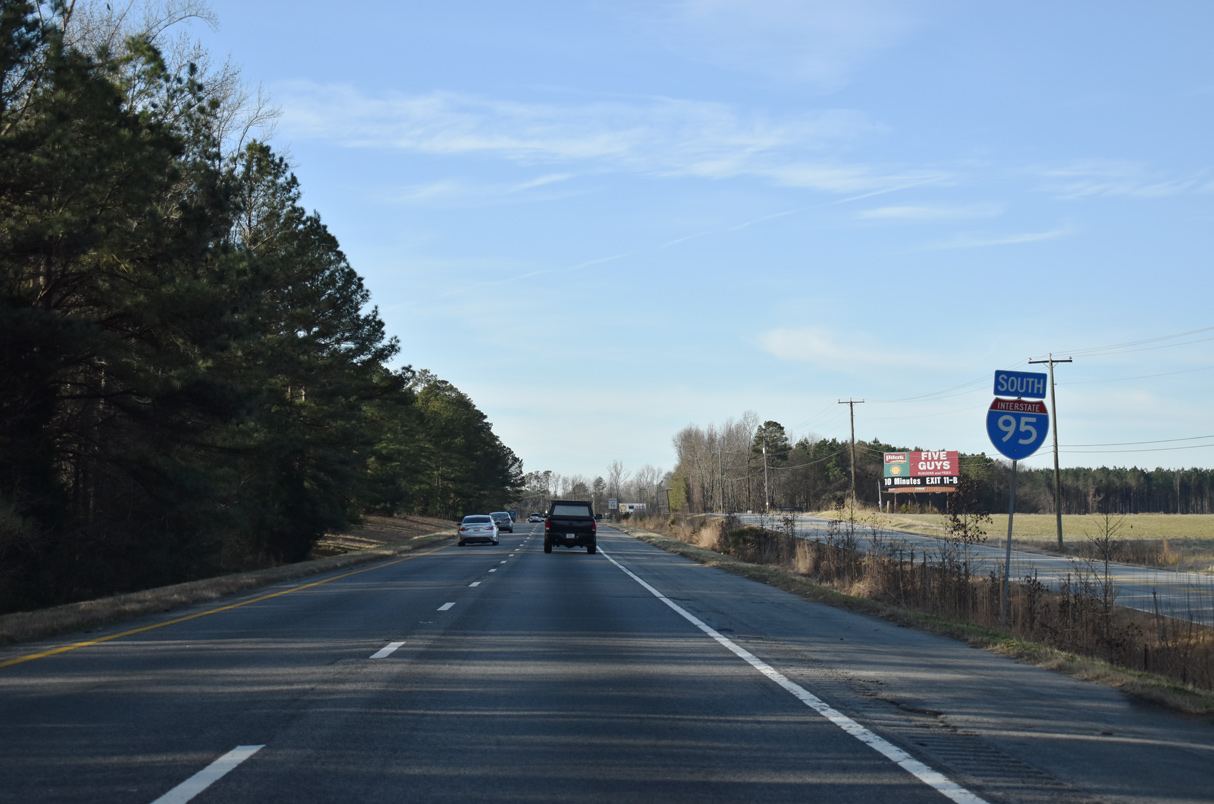
| The succeeding exit is at Stony Creek in two miles. The independent city of Emporia follows in another 21 miles. 12/30/20 |
|
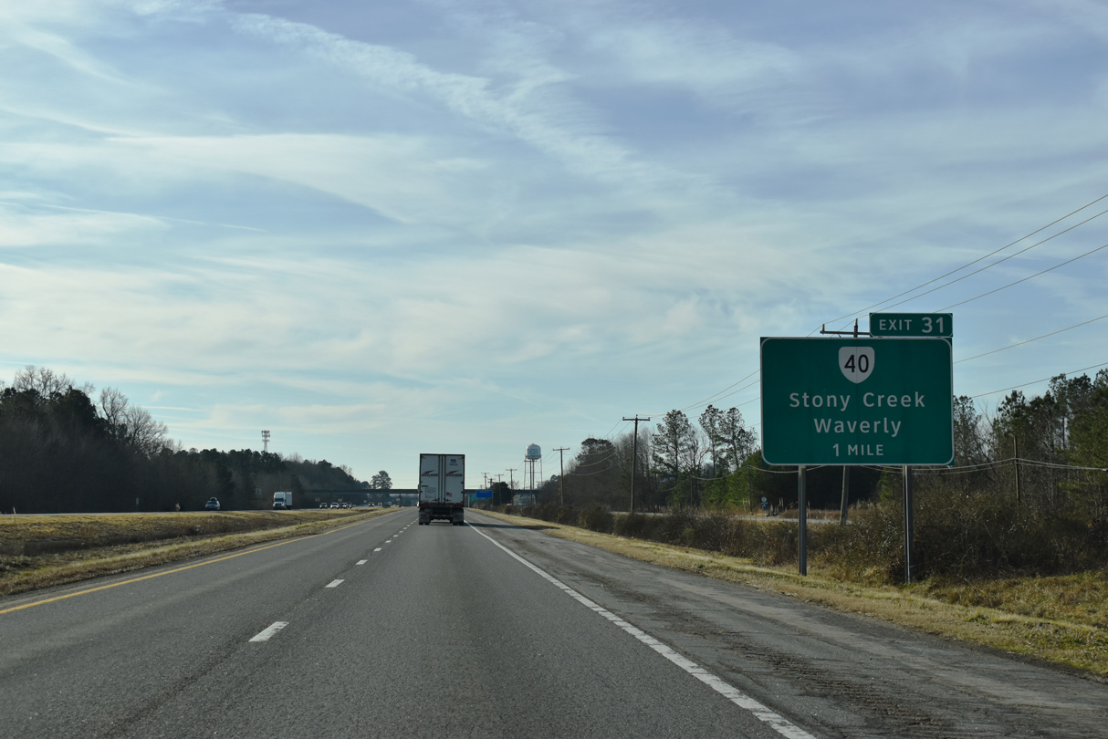
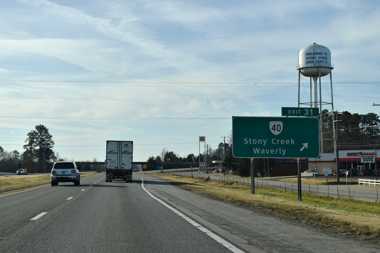
| A diamond interchange (Exit 31) connects I-95 with SR 40 (Sussex Drive) on the east side of Stony Creek. SR 40 bypasses Stony Creek to the south, while SR 40 Business lines Lee Avenue west from U.S. 301 into the town business district. 12/30/20 |
|
| SR 40 constitutes a 229.69 mile route east to Sussex, Waverly and SR 10 at Spring Grove and west to Blackstone and SR 8 at Woolwine. 12/30/20 |
|
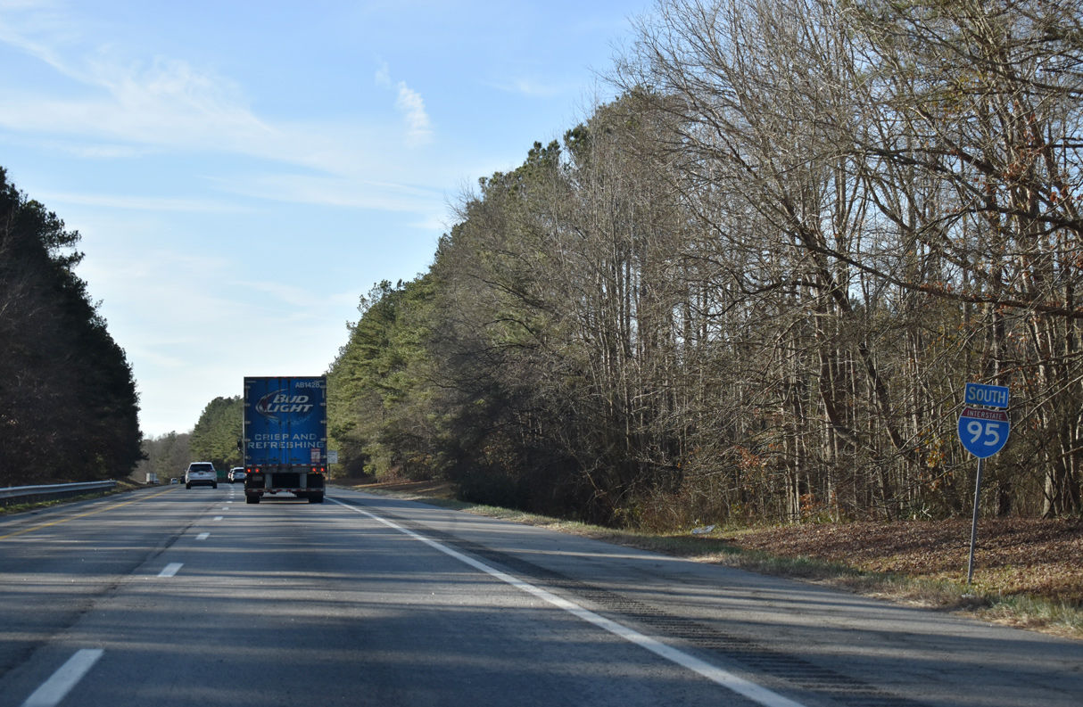
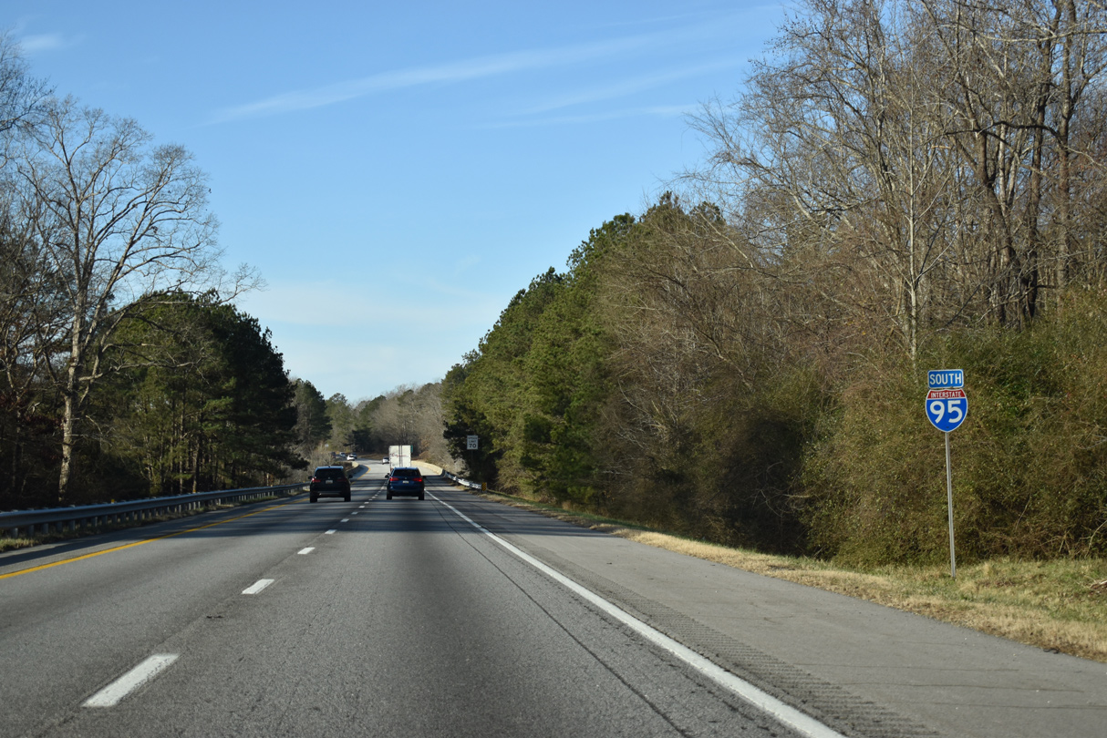
| The final section of Interstate 95 completed in Virginia was the stretch between Exit 41 and 17. It opened to traffic in 1981-82.1 12/30/20 |
|
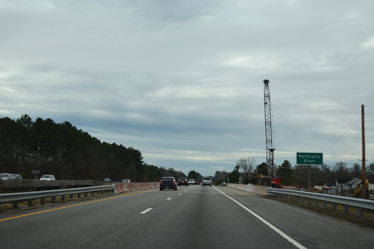
| I-95 and adjacent U.S. 301 travel through agricultural areas, timberland and wetlands associated with the Nottaway River over the ensuing 11 miles to Jarratt. 12/30/20, 01/01/17 |
|
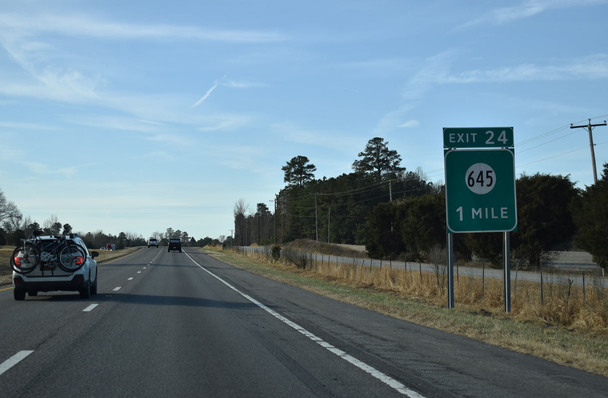
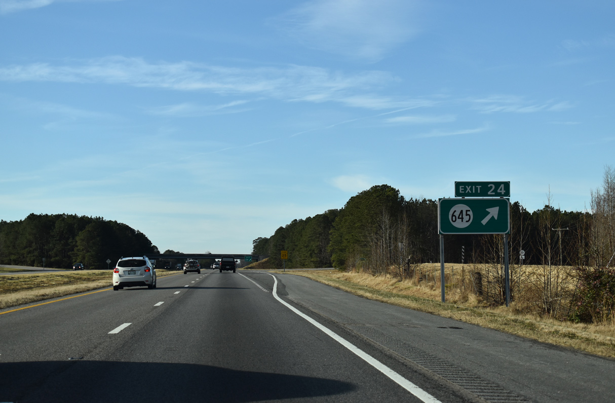
| A rural diamond interchange (Exit 24) joins Interstate 95 with SR 645 (Green Church Road) at Owens in one mile. 12/30/20 |
|
| SR 645 (Owen Road) leads southeast from U.S. 301 and Exit 24 to Henry and SR 609 (Gray Road) near Poplar Swamp. 12/30/20 |
|
| U.S. 301 remains along the west side of Interstate 95 three miles south into Jarratt. 12/30/20 |
|
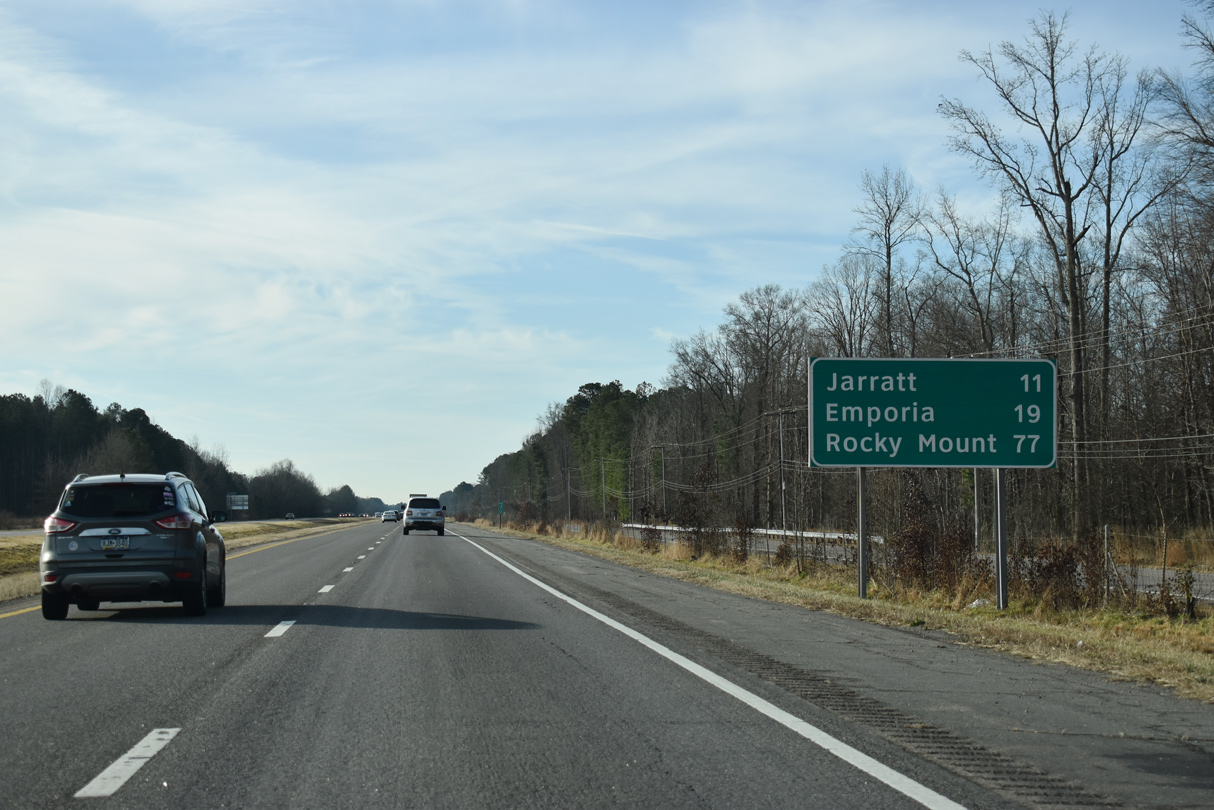
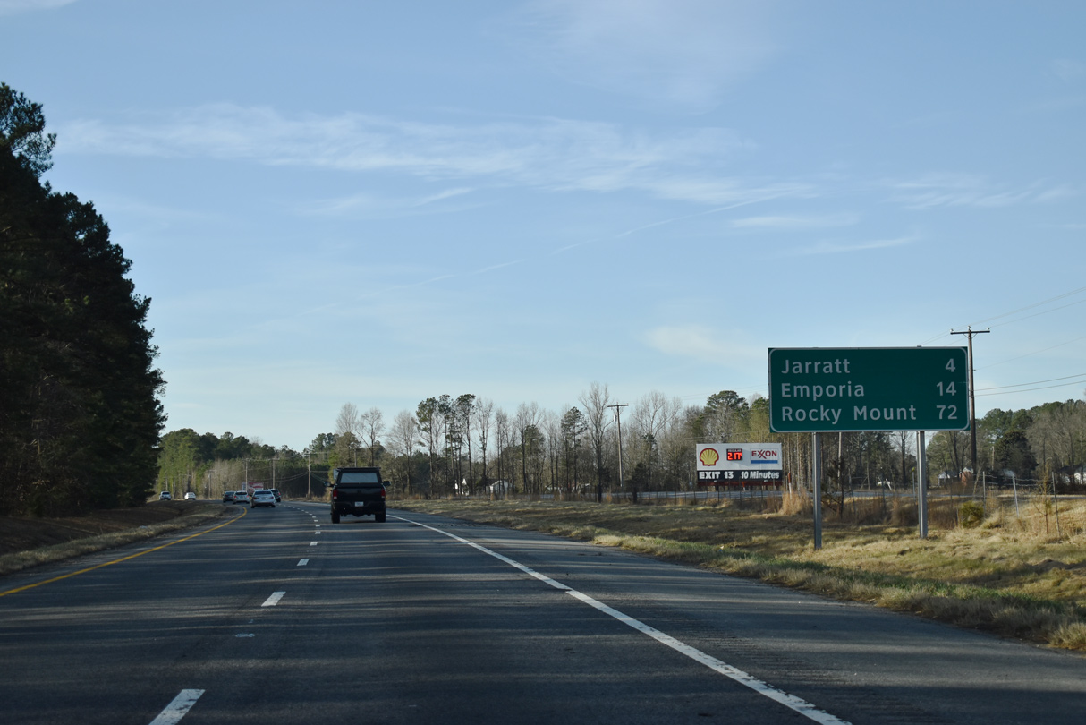
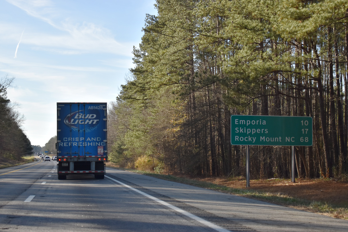
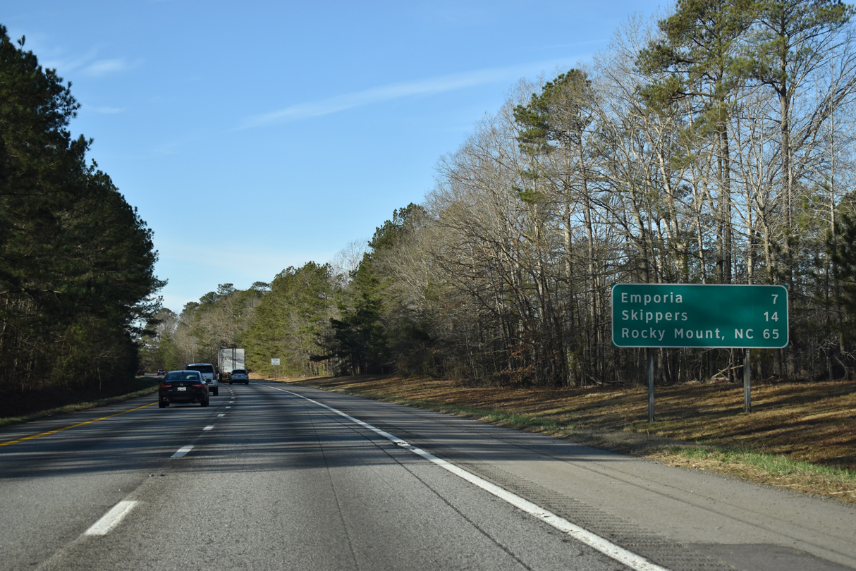
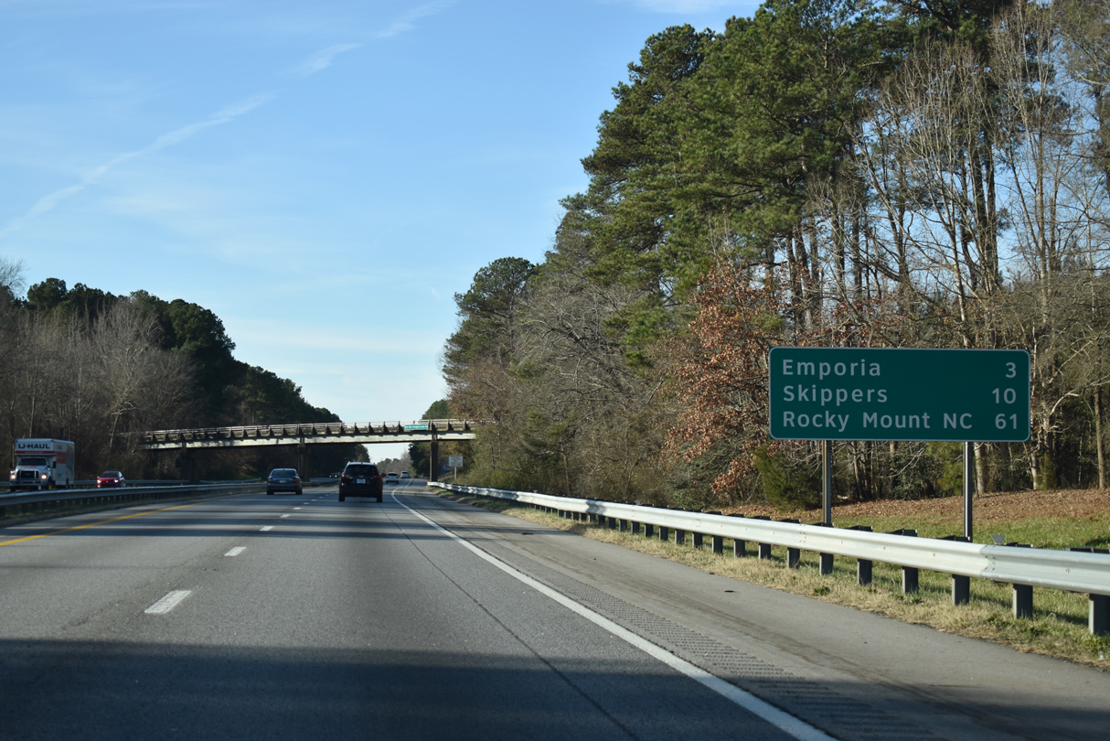
| Emporia lies ten miles beyond the exchange (Exit 20) for Jarrtt. Rocky Mount is an hour's drive. 12/30/20 |
|
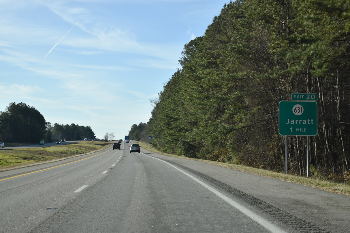
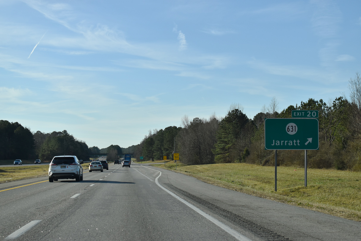
| SR 631 (Henry Road) links I-95 with U.S. 301 (Blue Star Memorial Highway) and SR 139 (Jarratt Avenue) to the immediate west of Exit 20 at the town of Jarratt. 12/30/20 |
|
| SR 139 extends 1.48 miles northwest from SR 631 and U.S. 301 to SR 610 (Allen Road) at Grigg Avenue in Jarratt. U.S. 301 constitutes a four lane divided highway from Jarratt south into Emporia. 12/30/20 |
|
| Interstate 95 advances ten miles south from Jarratt into Emporia. Located 17 miles away, Skippers is the last community along I-95 south. 12/30/20 |
|
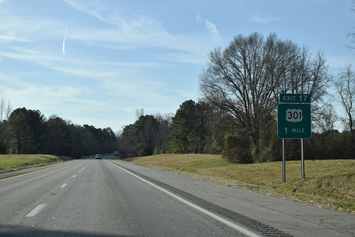
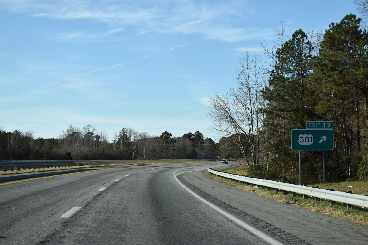
| U.S. 301 (Blue Star Memorial Highway) converges with Interstate 95 again at Exit 17 south of Jarratt. 12/30/20 |
|
| Interstate 95 angles southwest across the diamond interchange (Exit 17) with U.S. 301 and a parallel CSX Railroad line. 12/30/20 |
|
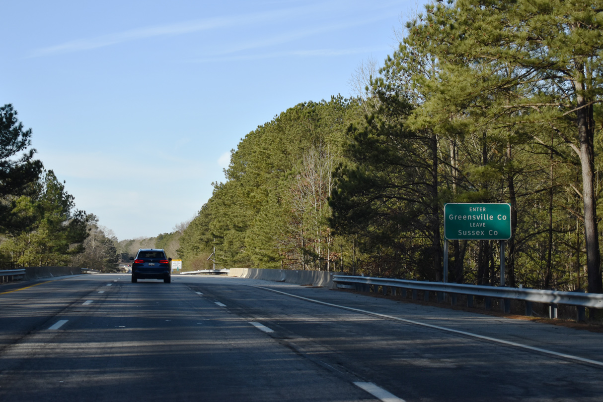
| Crossing the CSX Railroad on a bridge built in 1981, Interstate 95 enters Greensville County. 12/30/20 |
|
| Making a gradual southern turn toward Emporia, Interstate 95 next spans Otterdam Swamp. 12/30/20 |
|
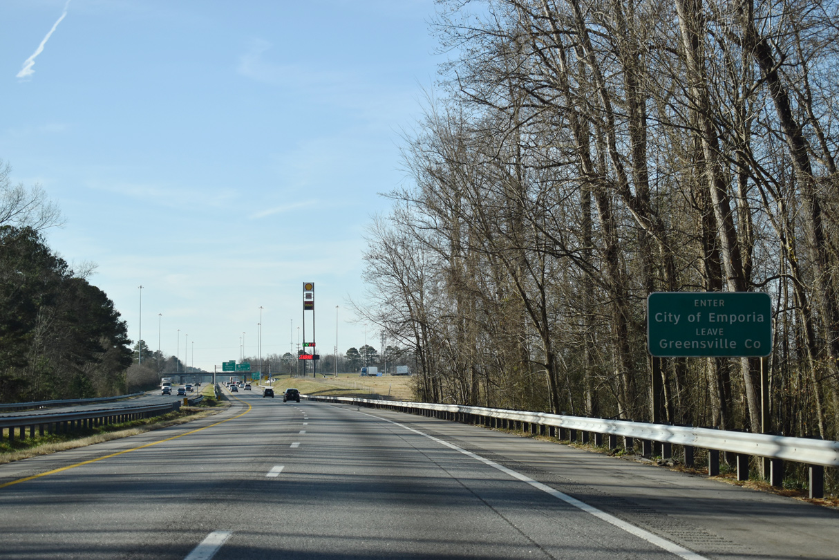
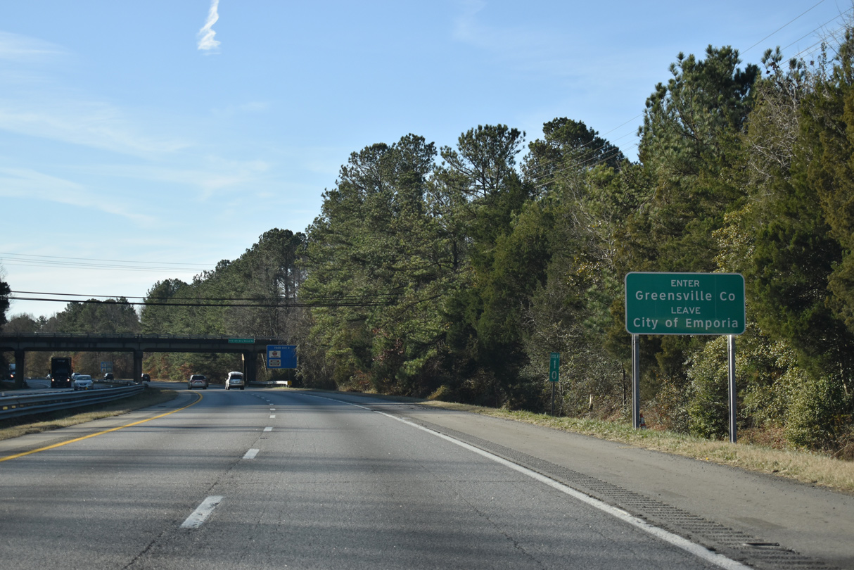
| Emporia, at the cross roads of U.S. 58 and U.S. 301, lies seven miles to the south. Interstate 95 stays west through the city, utilizing the original bypass of U.S. 301. 12/30/20 |
|
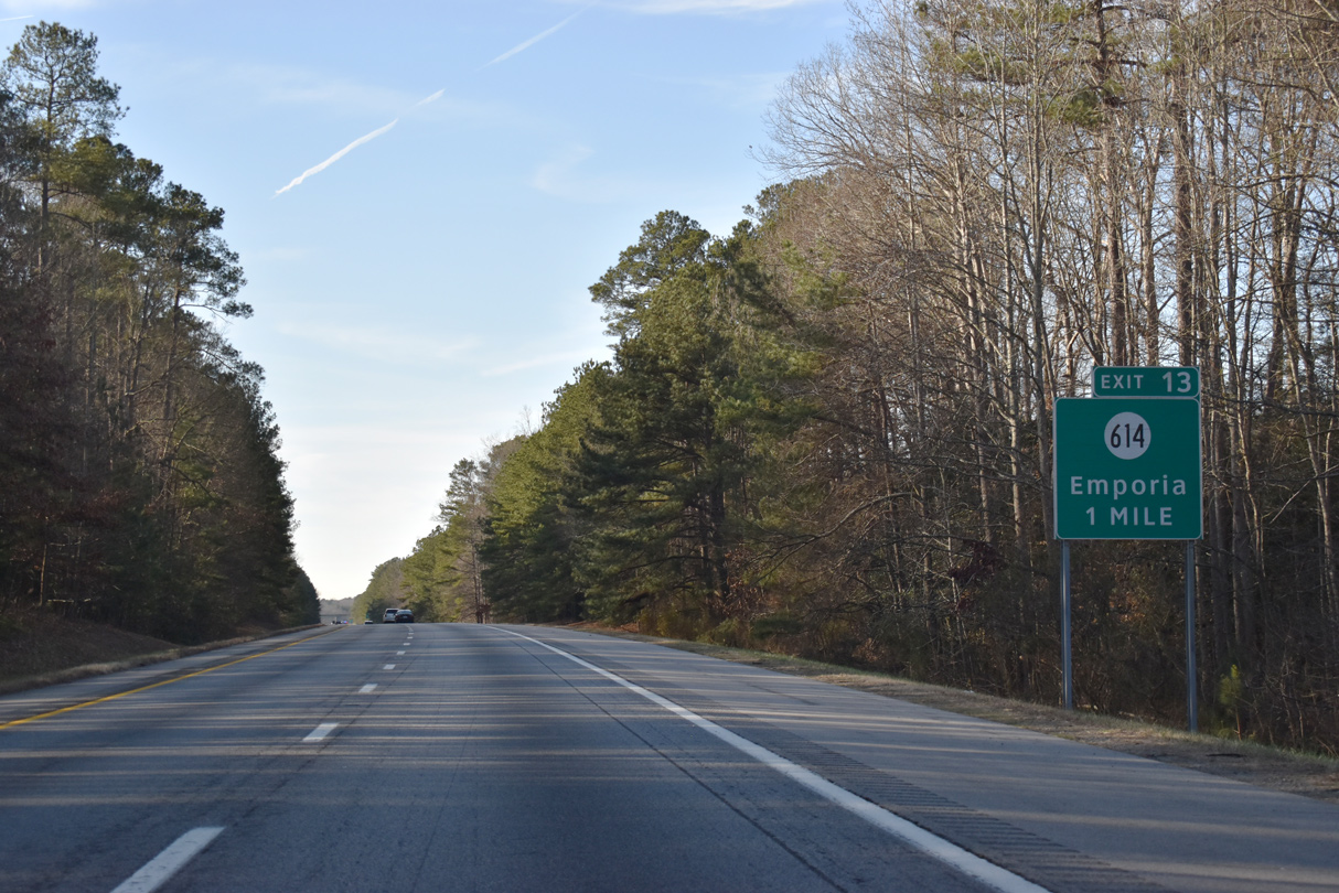
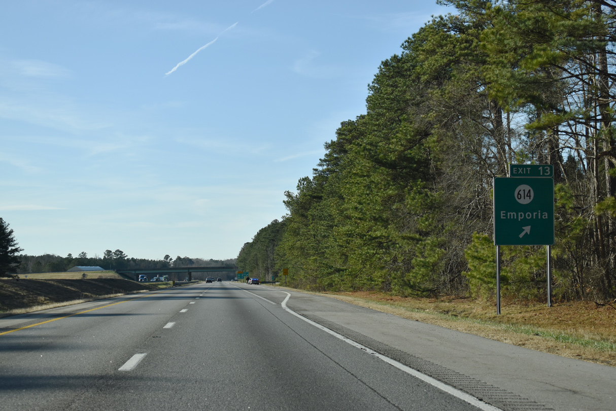
| SR 614 (Otterdam Road) links Interstate 95 with U.S. 301 (Sussex Drive) ahead of its transition onto N Main Street through Emporia. 12/30/20 |
|
| Supporting economic development, SR 614 (Otterdam Road) was expanded 3.9 miles north from the diamond interchange at Exit 13 into a four lane highway from Fall 2015 to May 2017. Otterdam Road extends southeast to Moonlight Road, the original alignment of U.S. 301. 12/30/20 |
|
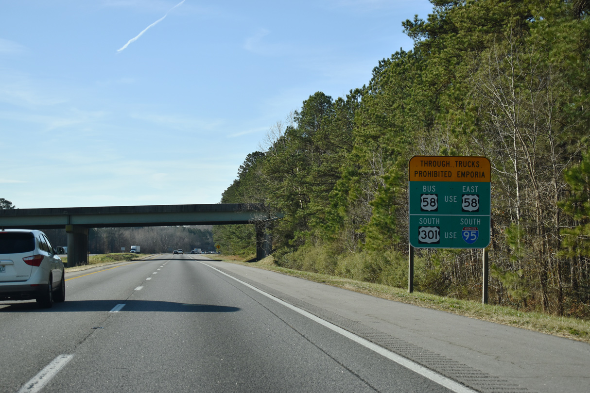
| Truck restrictions are in place along both U.S. 58 Business (Atlantic Street) and U.S. 301 (Main Street) through the city of Emporia. 12/30/20 |
|
| Interstate 95 diverges from parallel U.S. 301 (Sussex Drive) westward around Emporia. This stretch of freeway opened as a bypass for U.S. 301 in 1959. 12/30/20 |
|
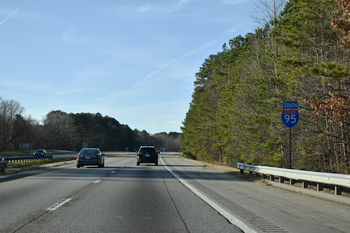
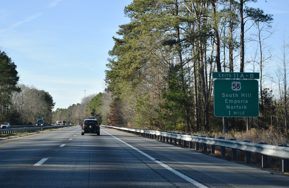
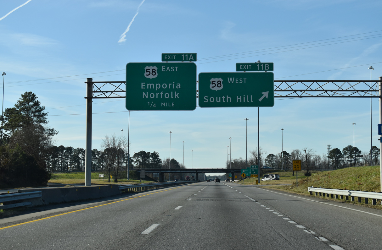
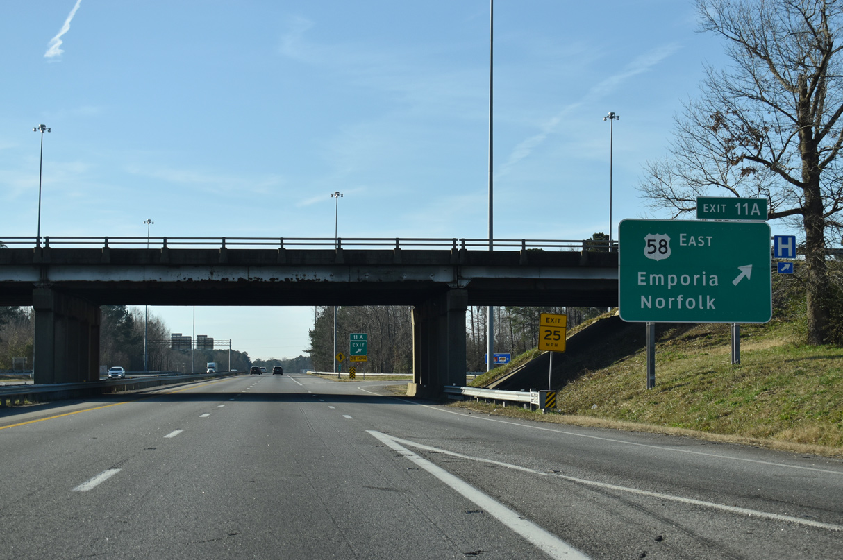
| U.S. 58 and I-95 come together at a cloverleaf interchange (Exits 11B/A) in one mile. 12/30/20 |
|
| The city limits of Emporia extend west over three miles of Interstate 95. Speed limits along this stretch were increased to 70 miles per hour in 2010. 12/30/20 |
|
| Exit 11B joins U.S. 58 (Atlantic Street) west to Kingsberry, Lawrenceville and South Hill. Traveling 509 miles from Tennessee near Cumberland Gap to the oceanfront in Virginia Beach, U.S. 58 runs almost wholly within Virginia. 12/30/20 |
|
| U.S. 58 splits with U.S. 58 Business (Atlantic Street) nearby as the mainline utilizes a 1987-completed expressway bypass to the north. The four lane highway continues east from Emporia to Franklin, Suffolk and Norfolk. 12/30/20 |
|
| Road work underway from January 2016 to Fall 2019 replaced the Interstate 95 bridges across the Meherrin River. The previous spans were built in 1959. 12/30/20 |
|
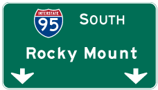
| I-95 progresses south of the Meherrin River eight miles to Skippers and 59 miles to Rocky Mount, North Carolina. 12/30/20 |
|
| I-95 straddles the Emporia and Greensville County line 0.98 miles south from the SR 611 (Dry Bread Road) / SR 915 (Church Street) overpass to Falling Run. 12/30/20 |
|
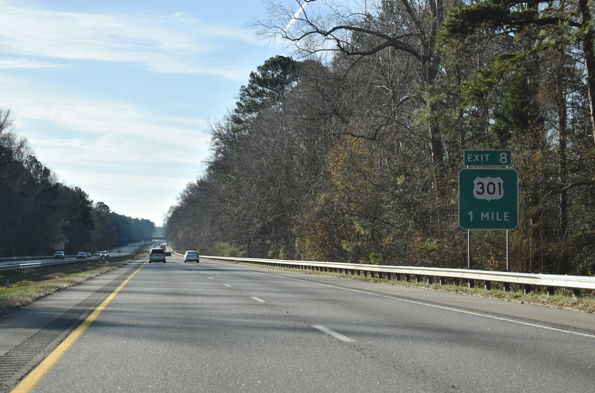
| U.S. 301 vacates Emporia along Skippers Road south from Main Street. A trumpet interchange and access road link the US highway with parallel Interstate 95 at Exit 8. 12/30/20 |
|
| Paralleling a CSX Railroad south to Pleasant Hill, North Carolina, U.S. 301 trends eastward from Exit 8 to Skippers. 12/30/20 |
|
| U.S. 301 shifts several miles east of Interstate 95 from Emporia south to Rocky Mount and Wilson. The two next meet at Kenly, North Carolina. 12/30/20 |
|
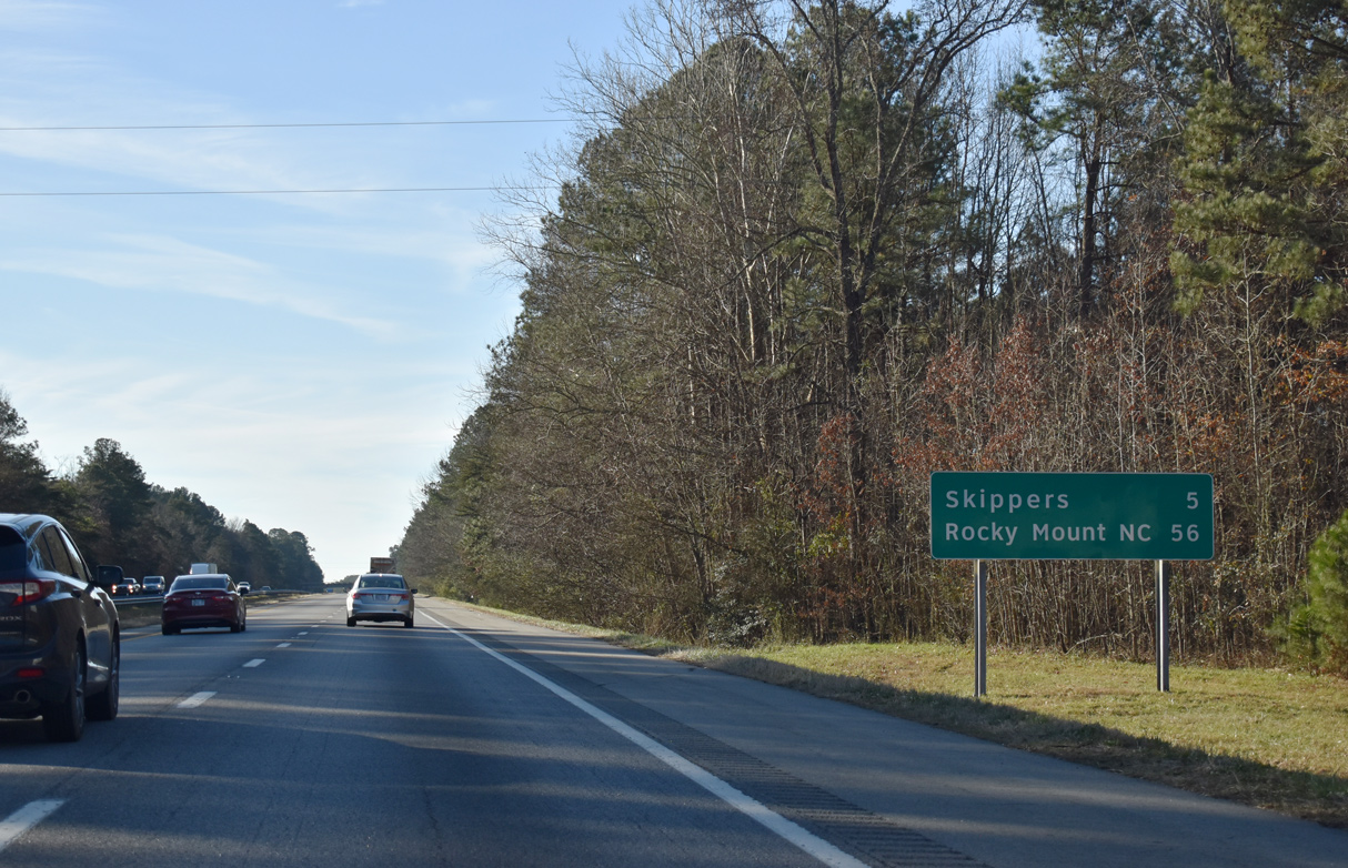
| Skippers, located at U.S. 301 (Skippers Road) and SR 629 (Moores Ferry Road), is five miles southeast. Rocky Mount, 56 miles away, follows Roanoke Rapids in North Carolina. 12/30/20 |
|
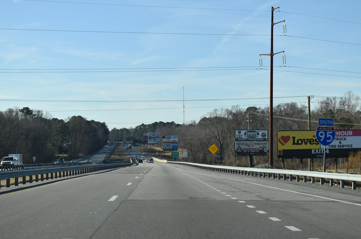
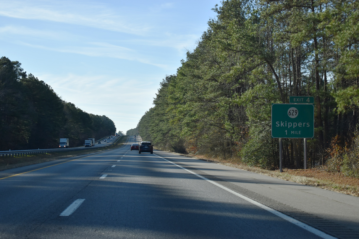
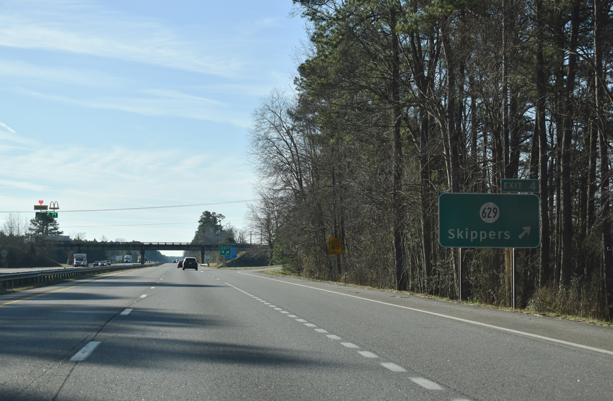
| SR 629 heads west 1.19 miles from U.S. 301 at unincorporated Skippers to a diamond interchange (Exit 4) with Interstate 95. 12/30/20 |
|
| Southward from Exit 4, SR 629 (Moores Ferry Road) zigzags from Mitchells Mill at Fontaine Creek nearby to Turners Crossroads and James Jones Road in Northampton County, North Carolina. 12/30/20 |
|
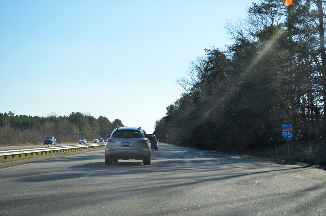
| The last confirming marker for Interstate 95 in Virginia was posted between mile marker 4 and Fontaine Creek. It was missing in 2017 and 2020. 12/30/12 |
|
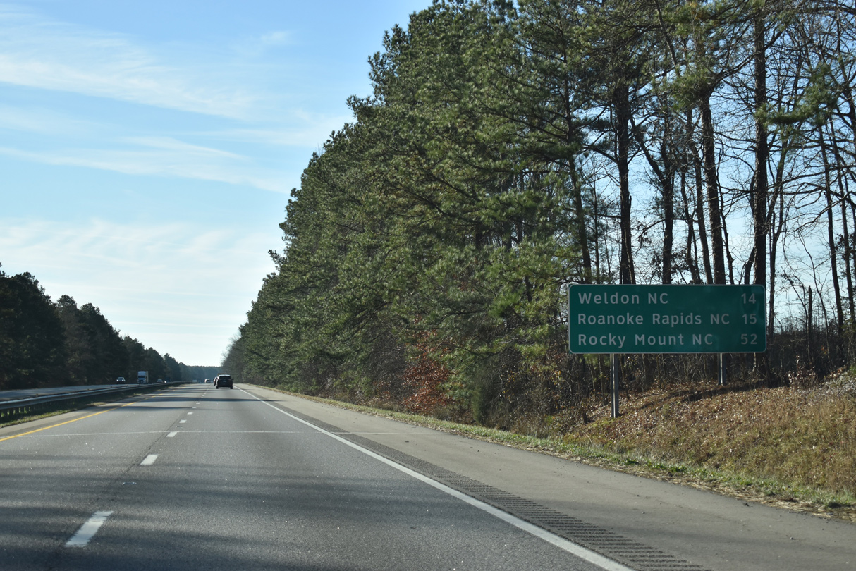
| The succeeding destinations along Interstate 95 south are Weldon and Roanoke Rapids via U.S. 158 in 12 miles. 12/30/20 |
|
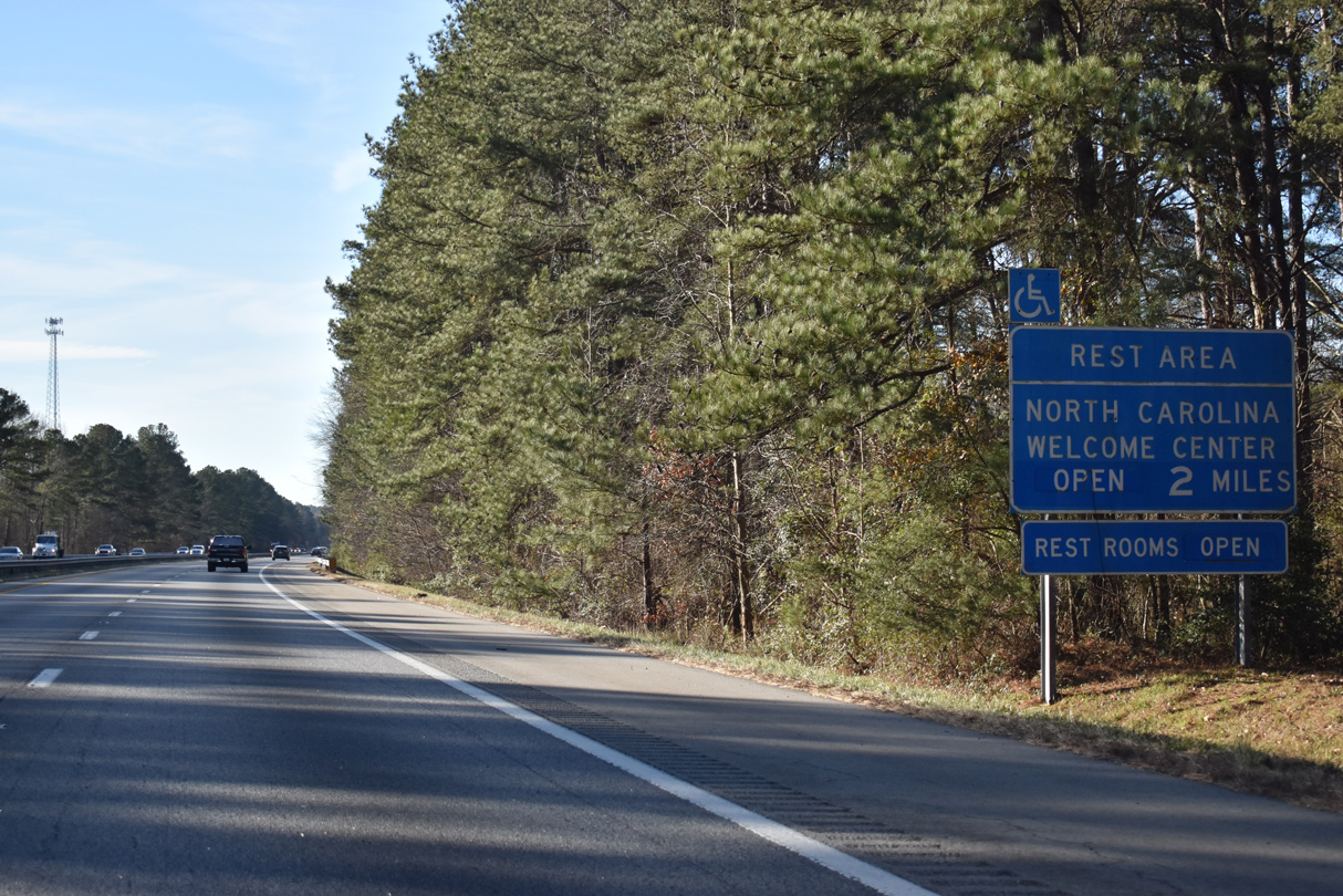
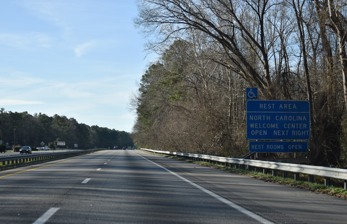
| The North Carolina welcome center lies just south of the state line. 12/30/20 |
|
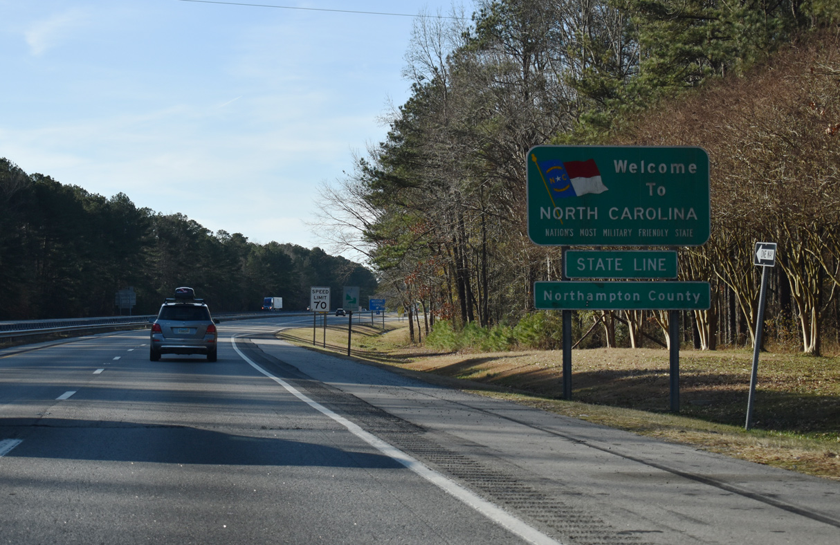
| Interstate 95 enters the Tar Heel State 178.56 miles south of the D.C. line across the Woodrow Wilson Bridge. The majority of the 181 miles of I-95 in North Carolina remain rural, as the freeway bypasses most cities along parallel U.S. 301. 12/30/20 |
Page Updated 04-27-2021.

 South
South