|
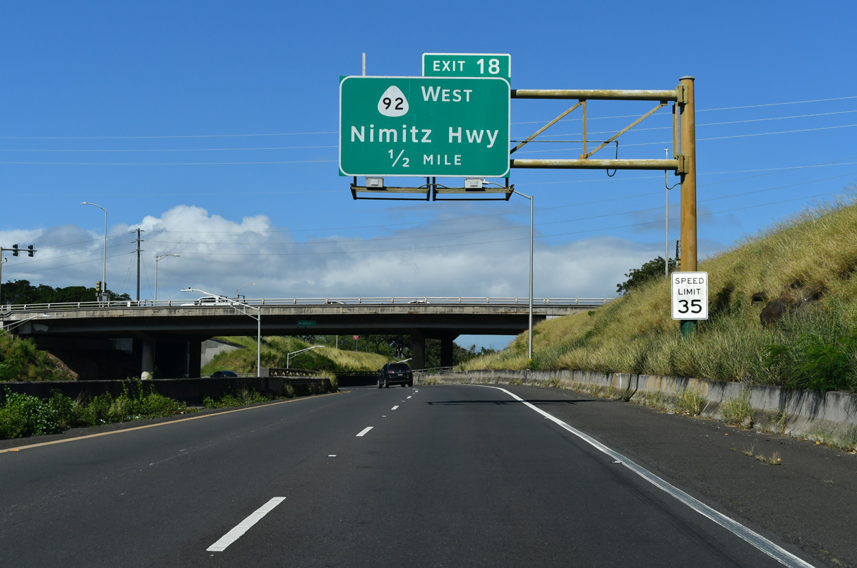
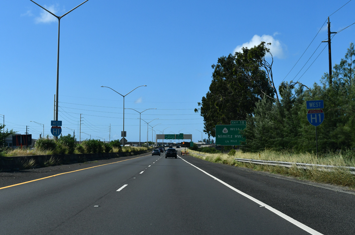
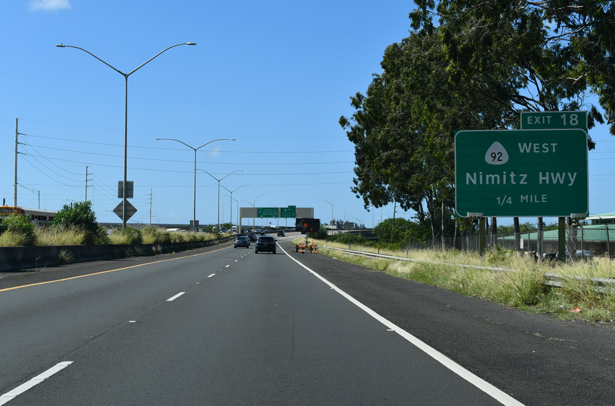
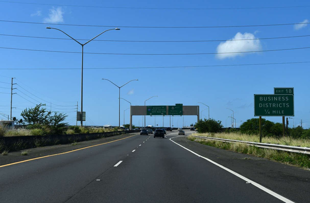
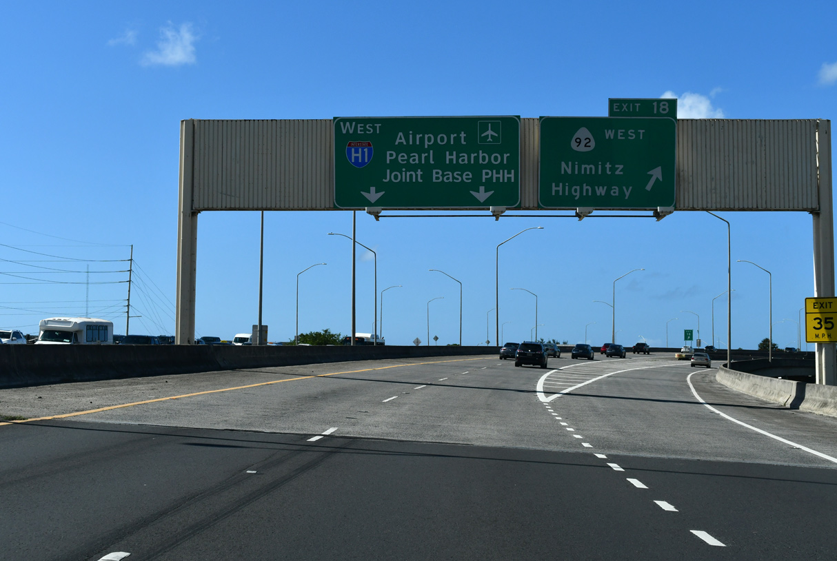
| I-H1 continues a half mile from the Kahauiki Interchange to a series of wye interchanges that bring traffic from Dillingham Boulevard and Route 92 (Nimitz Highway) westbound onto the freeway. Exit 18 follows for Route 92 by Honolulu International Airport (HNL). 02/07/24 |
|
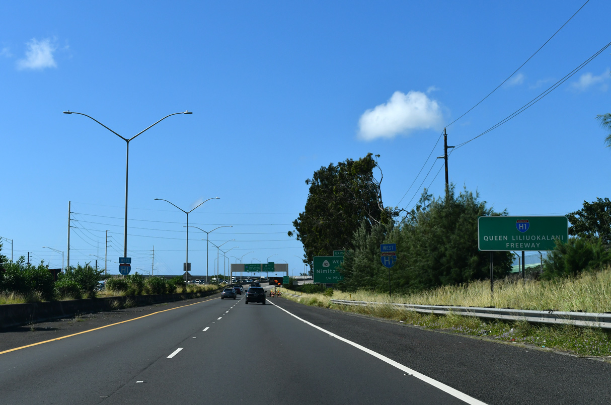
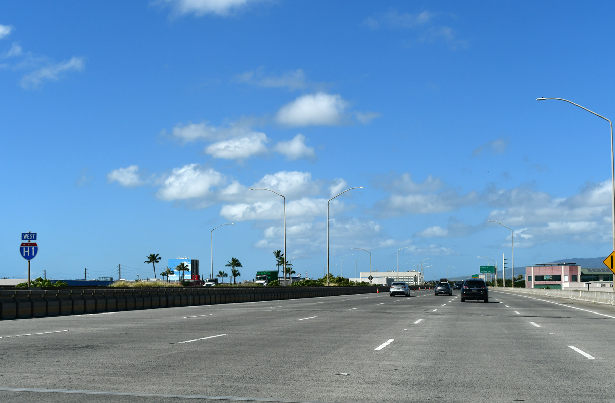
| Four lanes of Interstate H1 join the Lunalilo Freeway with Nimitz Highway at the airport. Representing the beginning of the Queen Liliuokalani Freeway, this stretch of freeway opened in 1986. 02/07/24 |
|
| Route 92 links Waikiki and Downtown Honolulu with Interstate H1 from the east as part of a 9.28 mile long route to Joint Base Pearl Harbor-Hickam (PHH). 02/07/24 |
|
| Elevating onto the Airport Viaduct from the end of the I-H1 section completed in 1986, the Keehi Interchange links with Route 92 to industrial areas outside the airport and Puuloa Road (Route 7310) north to Salt Lake. 02/07/24 |
|
| The Airport Viaduct, the longest bridge in Hawaii, runs directly above the Nimitz and Kamehameha highways beside Honolulu International Airport (HNL). 02/07/24 |
|
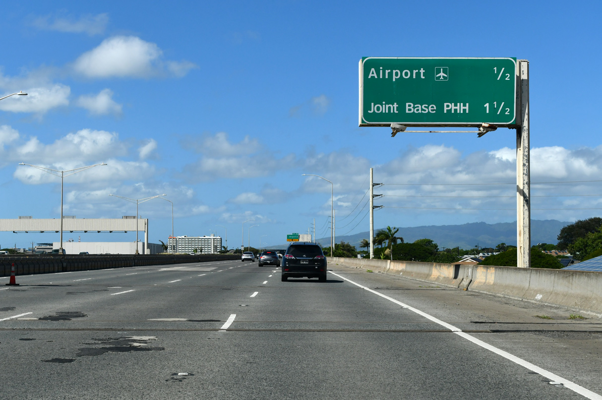
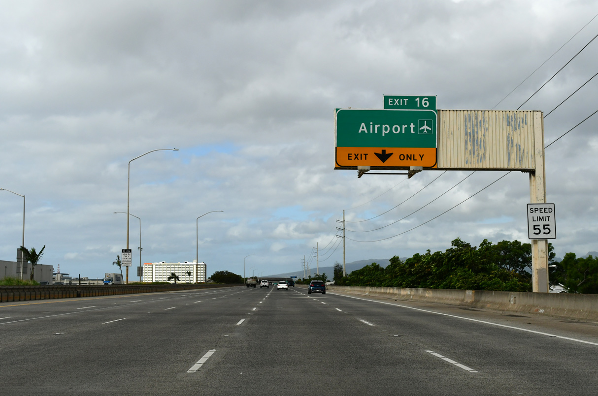
| Preceding Exit 16 to the passenger terminal at HNL Airport, the blank space on this interchange sequence sign is the result of carbon copying the previous assembly that showed Hickam AFB and Pearl Harbor. The two military installations were consolidated as Joint Base PHH. 02/07/24 |
|
| Entrance ramps join Interstate H1 west from both Dillingham Boulevard and Route 92 (Nimitz Highway) ahead of the directional ramps at Exit 16 to Honolulu International Airport (HNL). 02/04/24 |
|
| A lane drop occurs at Exit 16 along Interstate H1 (Queen Lilioukanai Freeway) west for Honolulu International Airport (HNL). Route 92 west emerges from the viaduct in one mile. 08/18/19 |
|
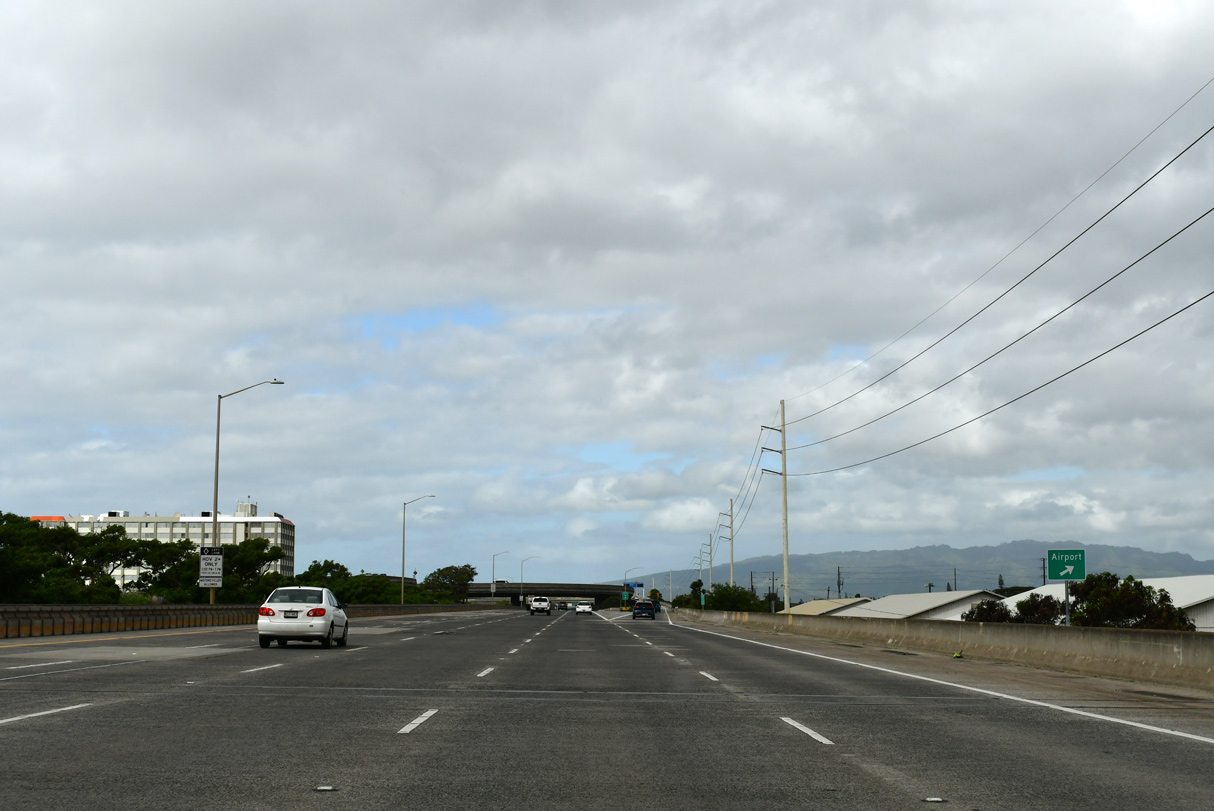
| As of Winter 2024, the overhead preceding Exit 16 had been replaced by a simple sign for HNL Airport. 02/04/24 |
|
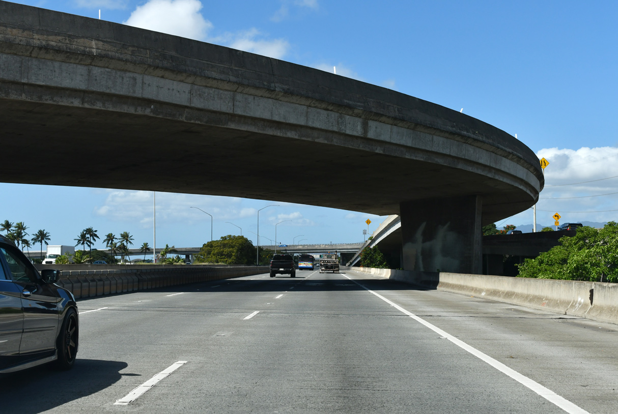
| A 1.088 mile long flyover links Aoolele Street at Honolulu International Airport (HNL) with westbound Interstate H1. 02/07/24 |
|
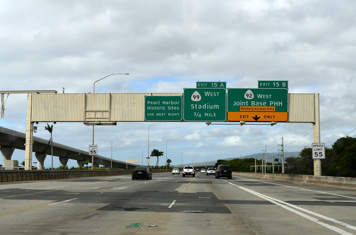
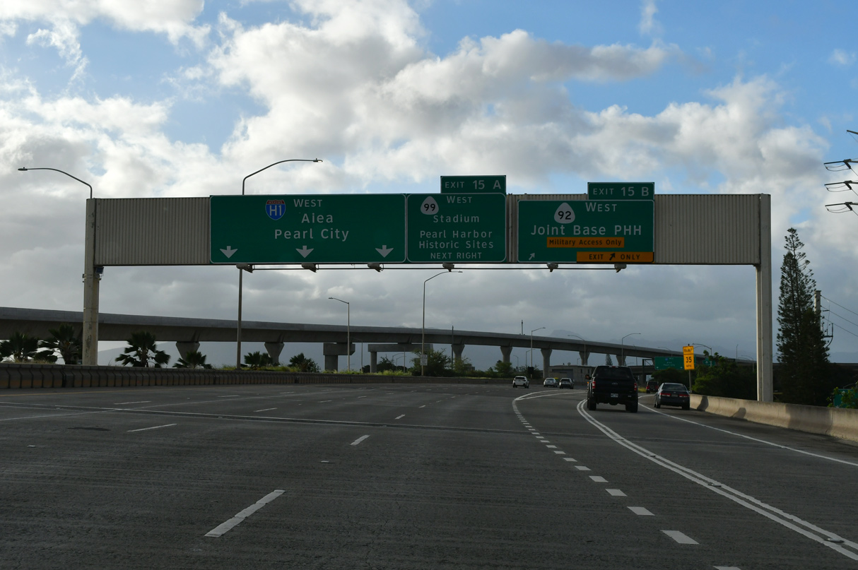
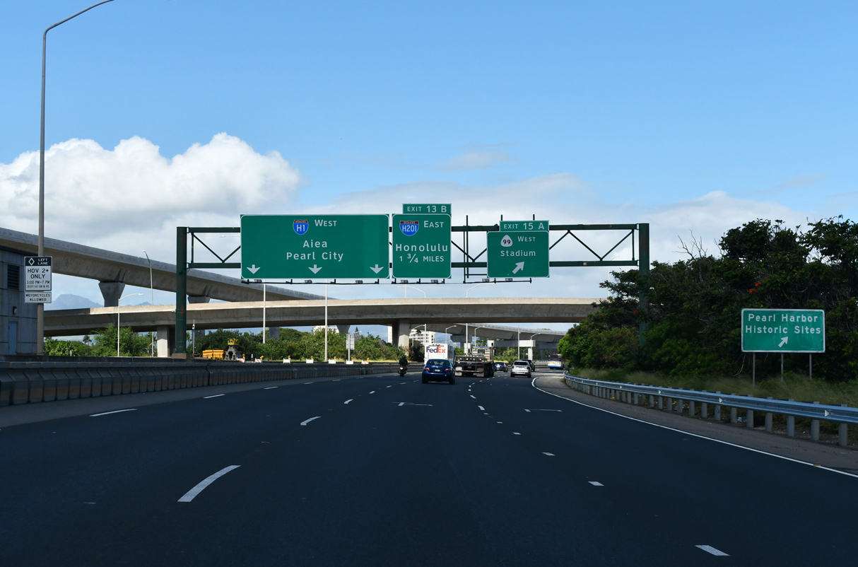
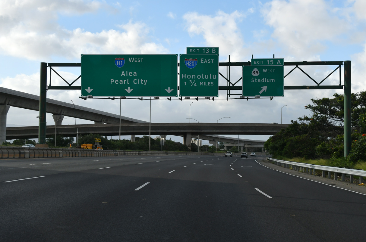
| Continuing along the Airport Viaduct, I-H1 next enters the Pearl Harbor Interchange at Exits 15 A/B. Route 99 (Kamehameha Highway) branches north from the upcoming exit to the USS Arizona Memorial and Aloha Stadium. 02/04/24 |
|
| Exit 15 B departs I-H1 west for Route 92 (Nimitz Highway) west to Joint Base Pearl Harbor-Hickam (PHH). Route 99 replaced what was Route 90 along Kamehameha Highway west to Pearl City and Farrington Highway southwest through Waipahu. Route 90 historically continued northwest along Route 93 through Waianae. 02/04/24 |
|
| Route 99 (Kamehameha Highway) commences north from Exit 15 A to the USS Arizona Memorial, Aloha Stadium and Aiea. Route 78 links I-H1 with Route 99 just west of the Halawa Interchange with I-H201 (Moanalua Freeway). 02/07/24, 02/04/24 |
|
| Turning north, I-H1 continues with four westbound lanes and a carpool lane operating during peak hours. The carpool lane and adjacent lane are converted into the eastbound Zip lane for HOV traffic during weekday mornings. 02/07/24 |
|
| A pedestrian bridge spans Interstate H1 at Radford High School. 08/18/19 |
|
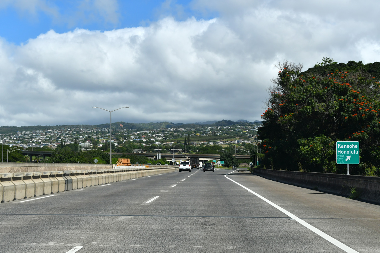
| Located east of Pearl Harbor, the Halawa Interchange joins I-H1 with I-H201 east, Route 78 west to Aiea and I-H3 east to Kanehoe. 08/18/19 |
|
| This directional sign is the only indication of the ramp for Exit 13 to I-H3, I-H201, and Route 78 along I-H1 as of February 2024. 02/07/24 |
|
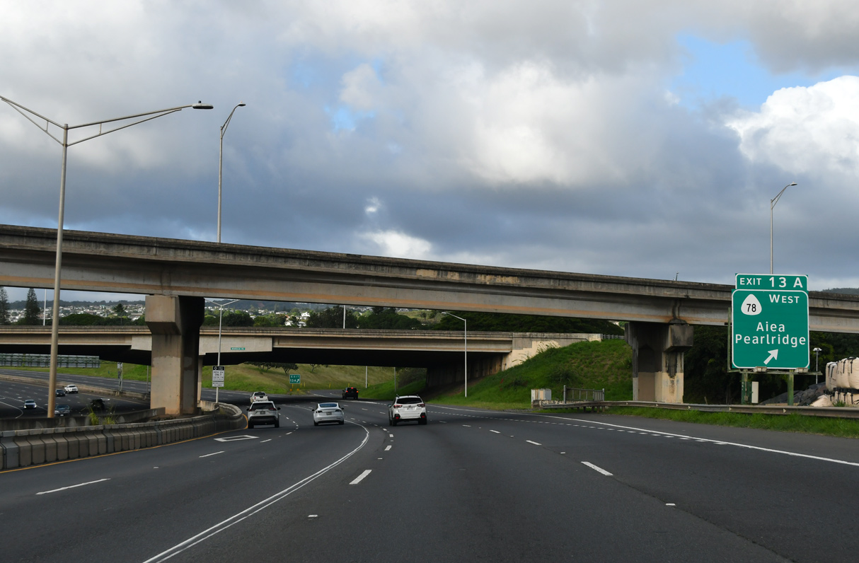
| Exit 13 A loops onto Route 78 (Moanalua Freeway) west. Route 78 spurs 0.74 miles from the end of I-H201 at I-H1 to Route 99 (Kamehameha Highway) northbound at Aiea. 02/04/24 |
|
| Interstate H1 is 12 lanes wide at the Aiea Heights Drive overpass. 08/15/19 |
|
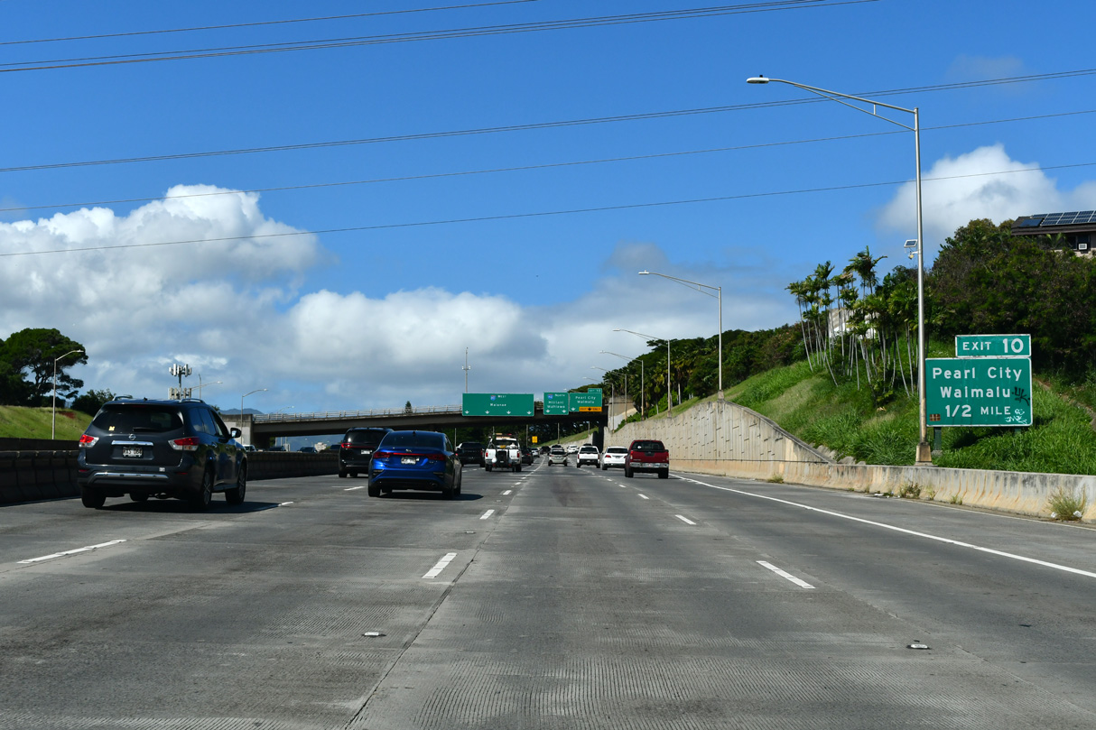
| Curving west at Kalauao Stream, Interstate H1 parallels Route 99 and the East Loch of Pearl Harbor ahead of a parclo A2 interchange (Exit 10) with Moanalua Road (Route 7210). 02/05/24 |
|
| Interstate H1 westbound with six lanes near the Moanalua community and the Kaonohi Street over crossing. 01/17/11 |
|
| Interstate H1 lowers to cross Waimalu Stream ahead of Exit 10 to Moanalua Road at Waiau. 02/07/24 |
|
| The Waianae Range comes into view in this scene along Interstate H1 ahead of Waimalu Stream. The Express (Zip) lane remains in use west to the exchange with I-H2. 08/15/19 |
|
| Moanalua Road meanders west from I-H201 and Aiea to Kaahele Street south of Waimalu. West of Exit 10, Moanalua Road (Route 7210) continues 0.95 miles to Waimano Home Road (Route 7211) at Kuala Street (Route 7212). 02/07/24 |
|
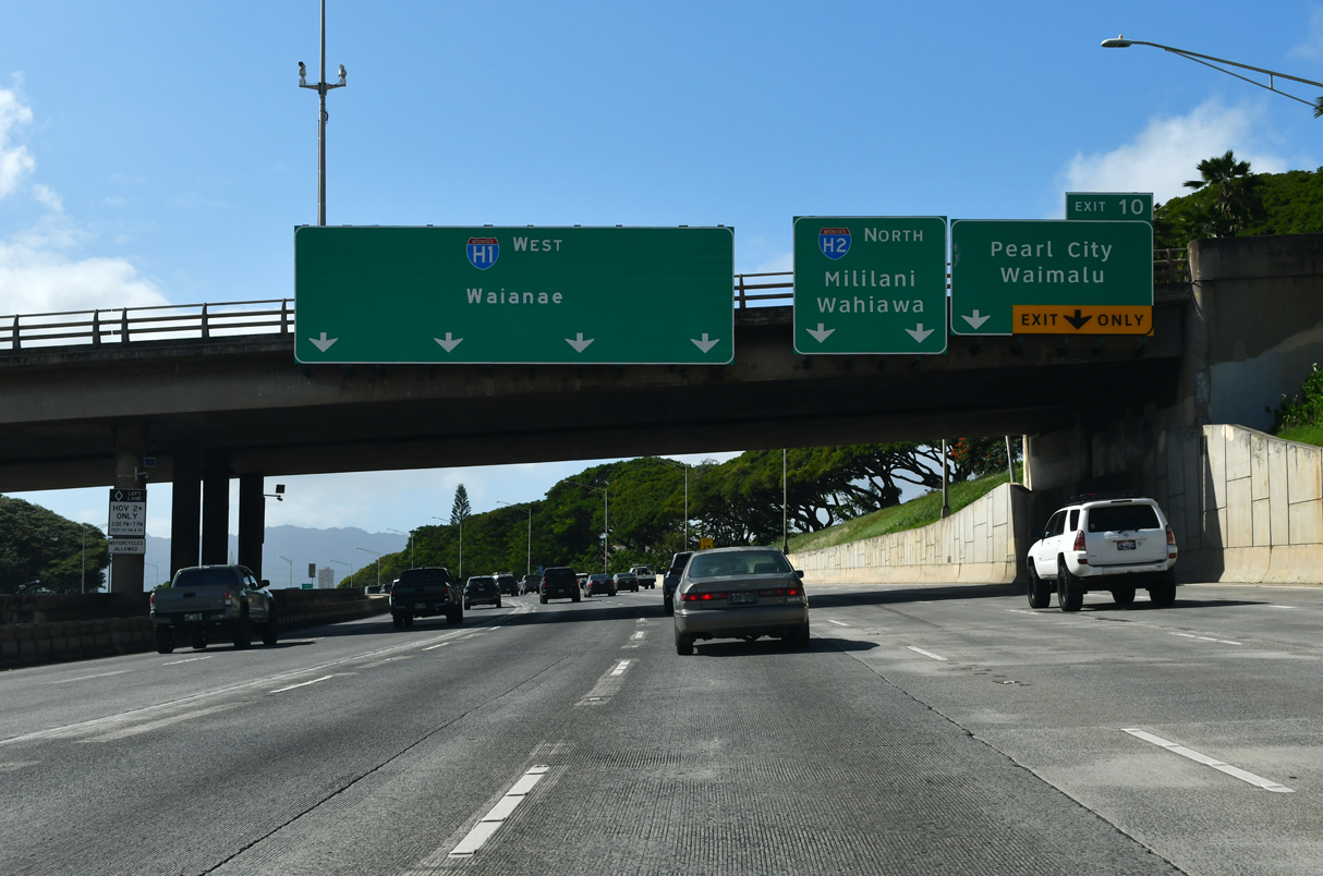
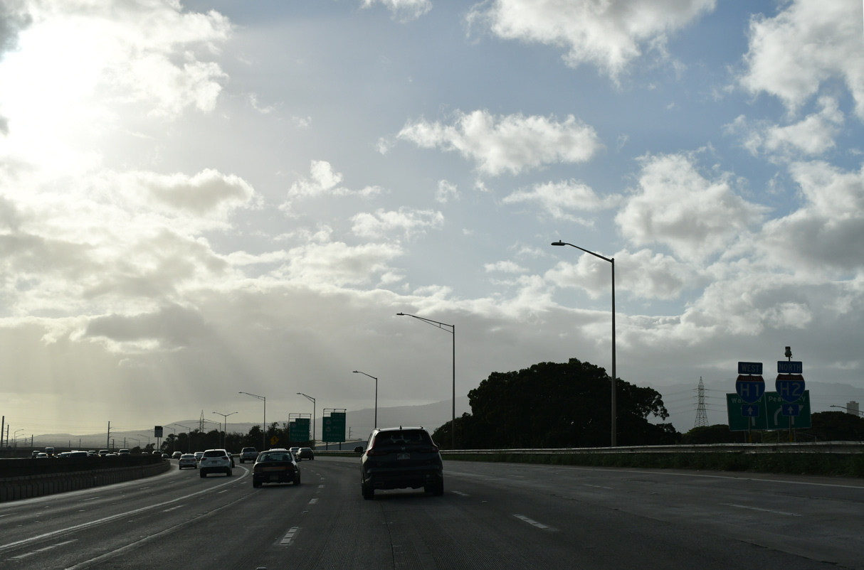
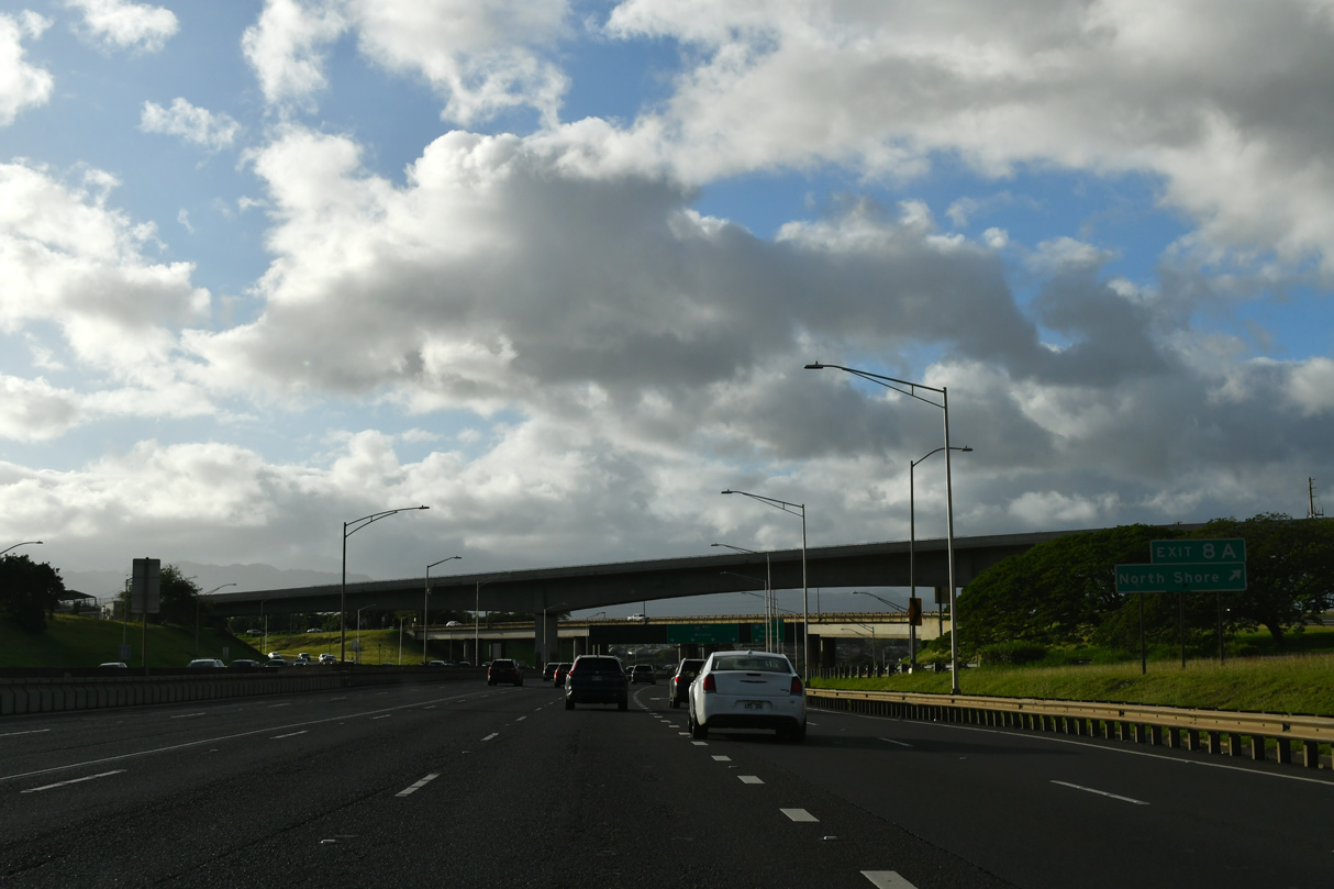
| I-H1 navigates through an S-curve west from the Kaahumanu Street overpass to Interstate H2 (Veterans Memorial Freeway) at Exit 8 A. Exit 10 departs with two lanes for Moanalua Road east to Waiau and west to Pearl City. 02/05/24 |
|
| Trailblazers for I-H1 and I-H2 stand just beside the ramp to Moanalua Road. 02/04/24 |
|
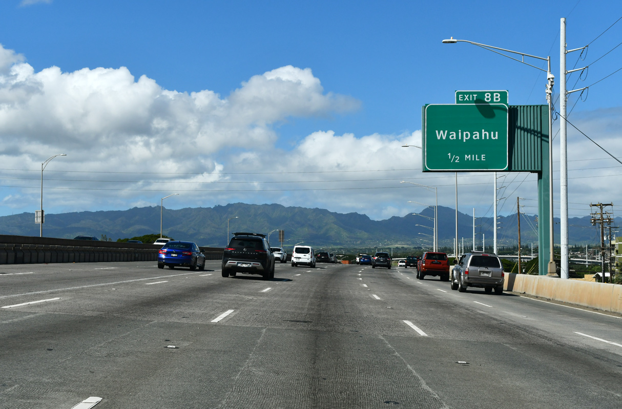
| Exit 8 B links with Route 99 (Farrington Highway) between discontinuous sections of Kamehameha Highway. Route 99 turns north nearby, paralleling I-H2 from Farrington Highway (Route 7101) at Waipahu. 02/07/24 |
|
| Advancing one mile to I-H2 (Veterans Memorial Freeway) north, Interstate H1 elevates along a viaduct from Route 99 (Kamehameha Highway) west to Waiawa Stream. 02/07/24 |
|
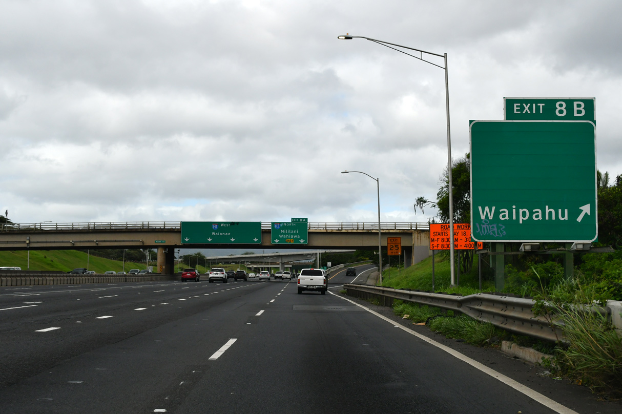
| Exit 8 B connects I-H1 west with Route 99 (Kamehameha Highway) northbound ahead of Route 7101 (Farrington Highway). Route 7101 is one of the few rarely signed four digit state routes in Hawaii. 02/07/24 |
|
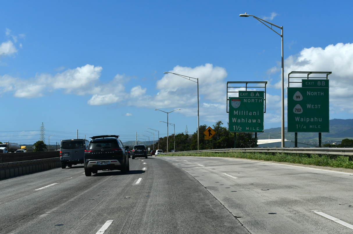
| Exit 8 B departs I-H1 west for Route 99 north to Waipio and Mililani Town and Route 7101 (Farrington Highway). Route 7101 runs 3.00 miles west through Waipahu to Route 76 (Fort Weaver Road) at Route 7110. 02/04/24 |
|
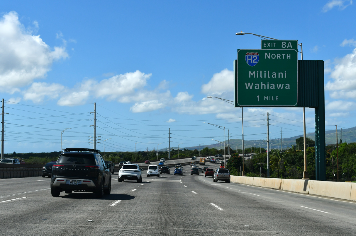
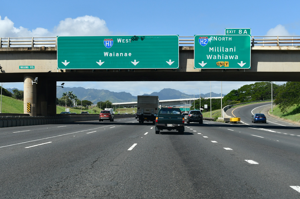
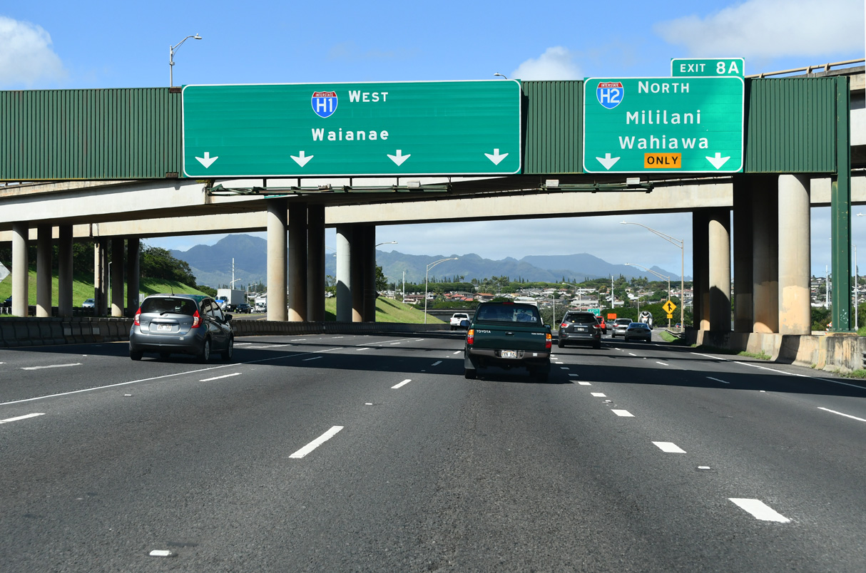
| Interstate H1 leading west to the three-wye interchange (Exit 8 A) with I-H2 was constructed in 1967. I-H2 heads 8.32 miles northwest to Wahiawa, Wheeler Army Airfield and Schofield Barracks Military Reservation. 02/07/24 |
|
| Interstate H2, in conjunction with Route 80 and Route 99, leads to the North Shore of Oahu. 02/04/24 |
|
| Interstate H2 stays east of the suburban areas at Mililani Town and Waipio Acres before turning west to the junction of Route 80 and Route 99 at Wahiawa. 02/07/24 |
|
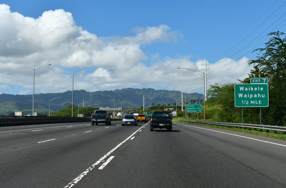
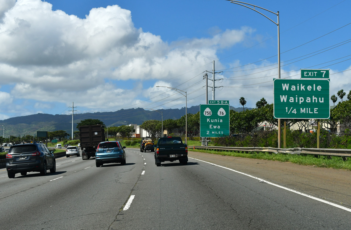
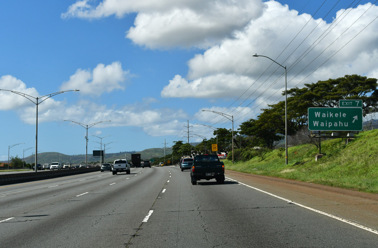
| The diamond interchange at Exit 7 joins Interstate H1 with Paiwa Street north of Waipahu and Waikele. 02/07/24 |
|
| Following the closure of Barbers Point NAS and the need for new housing, rapid residential growth took place on the Ewa side of Oahu. Forthcoming exits for Kuna Road and Kapolei serve suburban areas built on former plantations. 02/07/24 |
|
| Paiwa Street (Route 7170) angles 1.12 miles southeast to Route 7101 (Farrington Highway). Paiwa Street extends north to Central Oahu Regional Park. 02/07/24 |
|
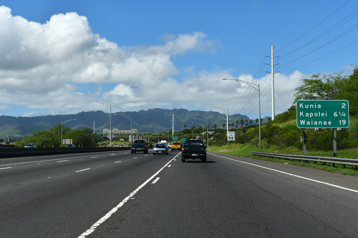
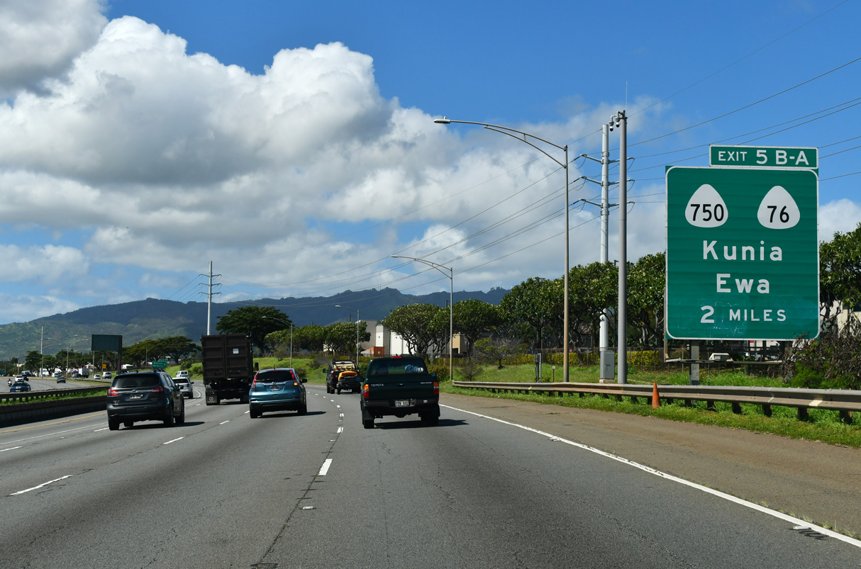
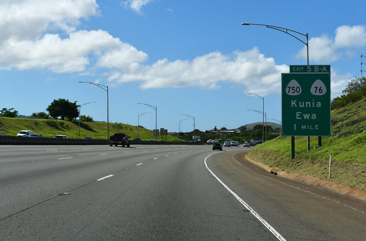
| Exits 5 B/A follow in two miles with Route 750 (Kunia Road) north and Route 76 (Fort Weaver Road) south. 02/07/24 |
|
| Exit 7 leaves Interstate H1 (Queen Liliuokalani Freeway) west for Paiwa Street. 02/07/24 |
|
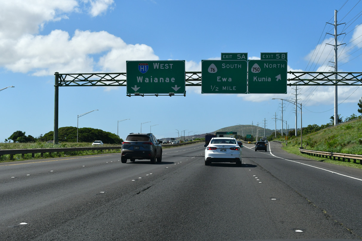
| Route 750 (Kunia Road) south from Royal Kunia and Route 76 (Fort Weaver Road) north from west Waipahu conclude at a parclo interchange (Exit 5) with Interstate H1. 02/07/24 |
|
| Route 750 travels north to Kunia and Wheeler Army Airfield. Route 76 extends the arterial south to Honouliuli, Ewa, and Ewa Beach. 02/07/24 |
|
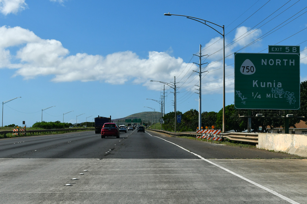
| Route 750 constitutes an 8.02 mile long highway north from Exit 5 B to Route 99 (Wilikina Drive) at Wheeler Army Airfield. Most of the route is rural outside of Kunia and the military bases near Wahiawa. 02/07/24 |
|
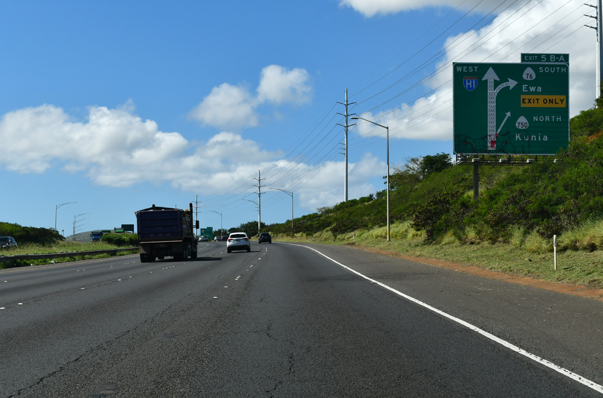
| Exit 5 B leaves I-H1 west for Route 750 (Kunia Road) north. Historically Route 76 continued north along Kunia Road. 02/07/24 |
|
| Route 76 spurs 6.62 miles south from I-H1 at Exit 5 A to the NOAA Pacific Tsunami Warning Center and Ewa Beach Park along Mamala Bay. The arterial serves the Lower Village, Fernandez Village and Renton Village communities. 02/07/24 |
|
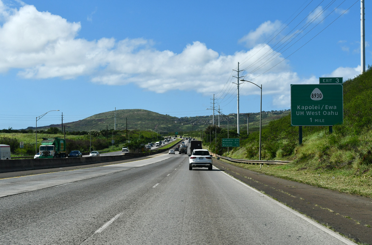
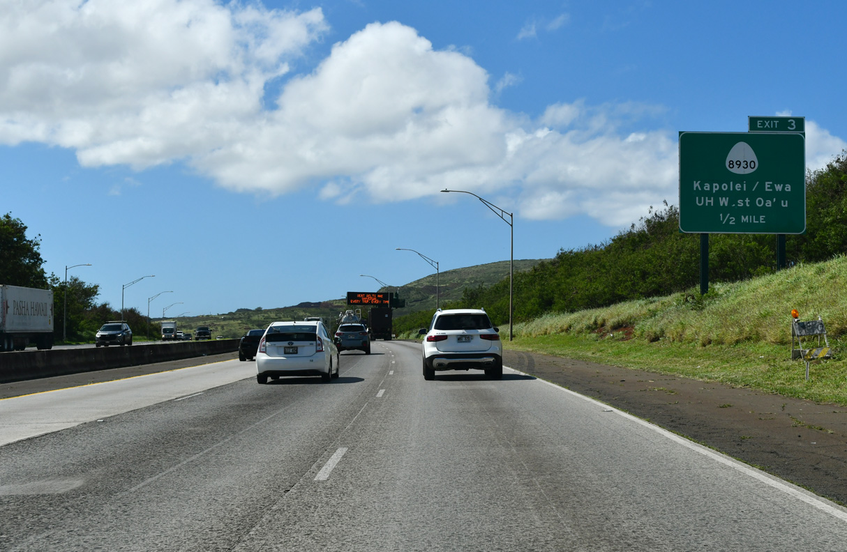
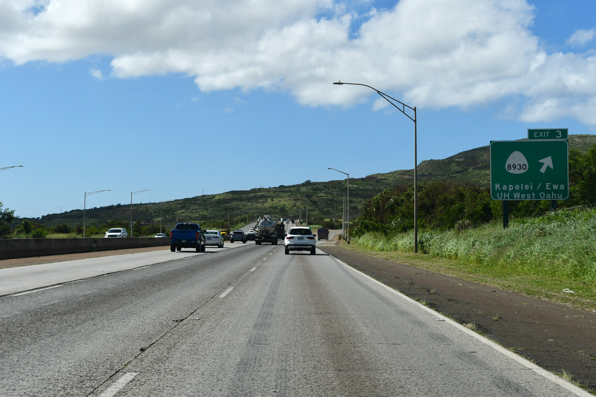
| Route 8930 (Kualaka'i Parkway) links Interstate H1 with the Kapolei community at a diamond interchange (Exit 3) in one mile. 02/07/24 |
|
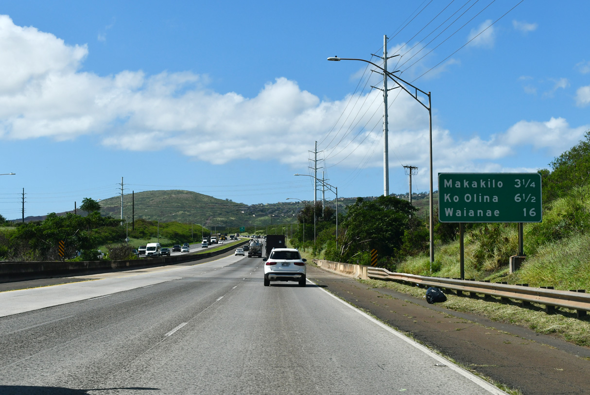
| 16 miles away, Waianae lies beyond the west end of I-H1 along Route 93 (Farrington Highway) on the western shore of Oahu. The Queen Liliuokanai freeway traverses open ranges and hills on the way to Makakilo. 08/15/19 |
|
| Kualaka'i Parkway (Route 8930) opened along with the exchange at Exit 3 in February 2010. 08/15/19 |
|
| Kualaka'i Parkway arcs 2.46 miles southwest from I-H1 to Kapolei Parkway. Palehua Road ties into Exit 3 from the north as a private road. 08/15/19 |
|
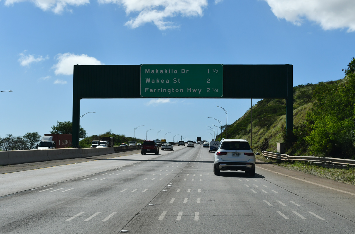
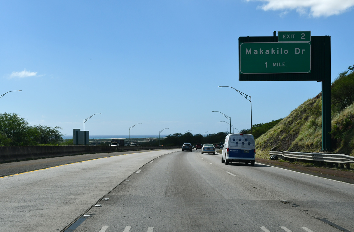
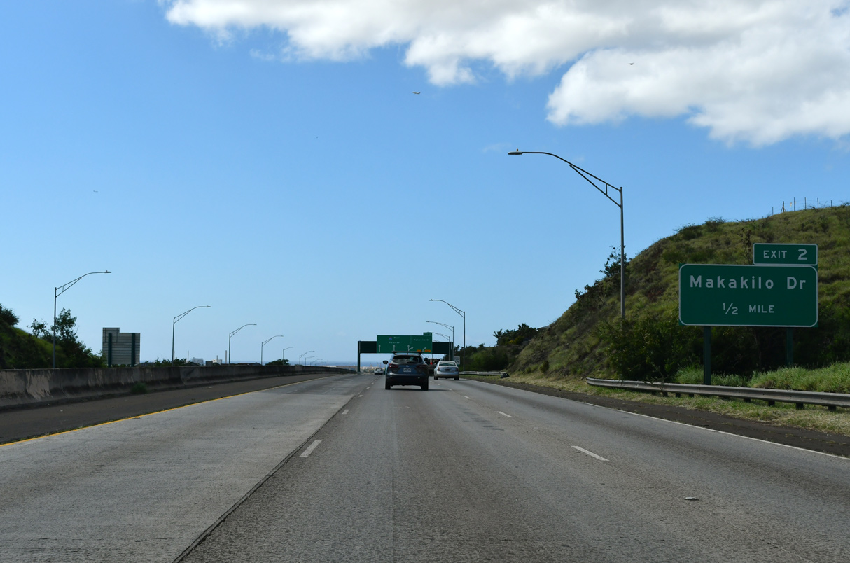
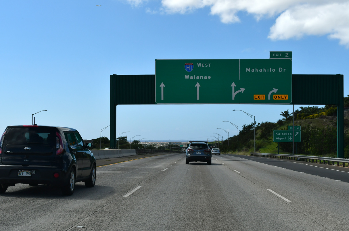
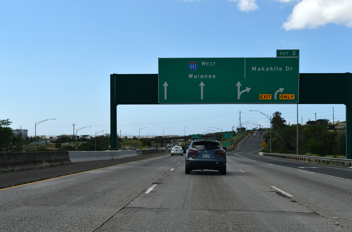
| The Makakilo Interchange connects I-H1 with Makakilo Drive (Route 8810) north and Route 901 (Fort Barrette Road) south at the succeeding exit. 02/07/24 |
|
| Enterprise Street (Route 8945) extends 0.97 miles south from Route 901 (Fort Barrette Road) to Kalaeloa Airport (JRF). Kapolei spreads west of Fort Barrette Road. 02/07/24 |
|
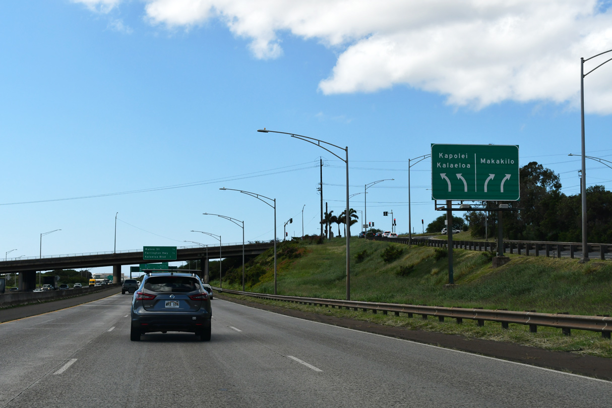
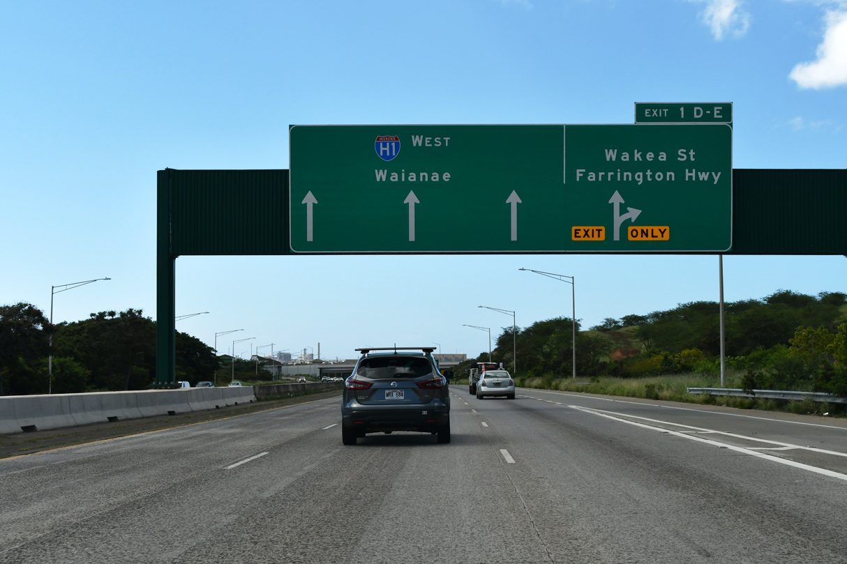
| Interstate H1 advances with three westbound lanes from Exit 2 to the Kapolei Interchange (Exits 1 E/D) with Wakea Street (Route 8918) south and Farrington Highway west. 02/07/24 |
|
| Makakilo Drive (Route 8810) spurs 3.16 miles north from I-H1 into the Makakilo community. 02/07/24 |
|
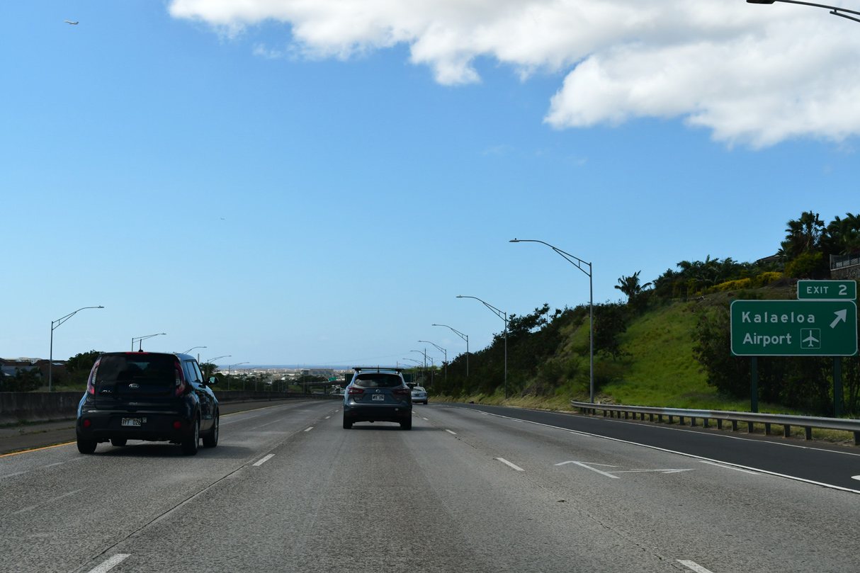
| Kalaeloa Airport (JRF) is located 2.5 miles south of Interstate H1 and Exit 2. 02/07/24 |
|
| Route 901 runs 1.38 miles south from Makakilo Drive along Fort Barette Avenue to F.D. Roosevelt Road (Route 8940) east of Kalaeloa. 02/07/24 |
|
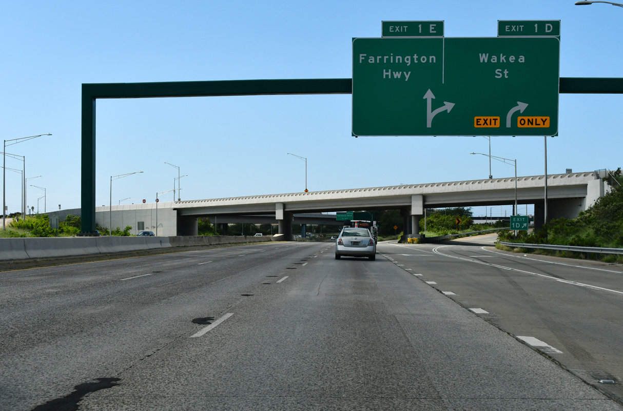
| Exit 1 D leads away from Interstate H1 west in one quarter mile to Wākea Street south, followed by Exit 1 E to Farrington Highway west. 02/07/24 |
|
| APL overheads were installed for the upcoming exchange by the end of January 2024. 02/07/24 |
|
| Work between mid 2016 and March 2020 completed the interchange between I-H1 and Wakea Street as part of the Kapolei Interchange Complex project. 02/07/24 |
|
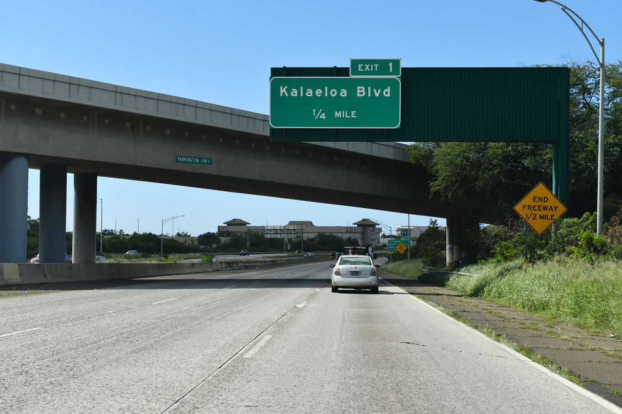
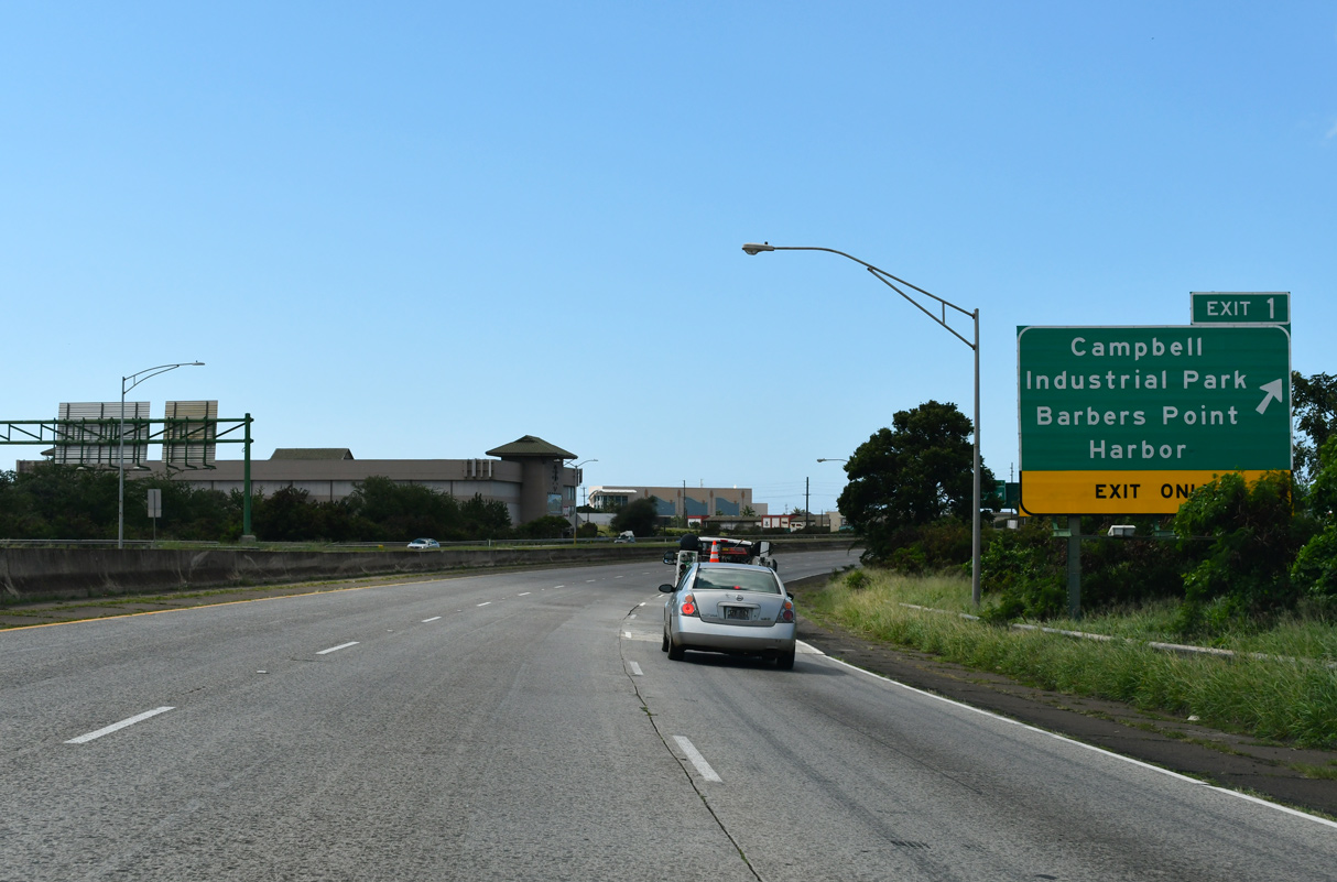
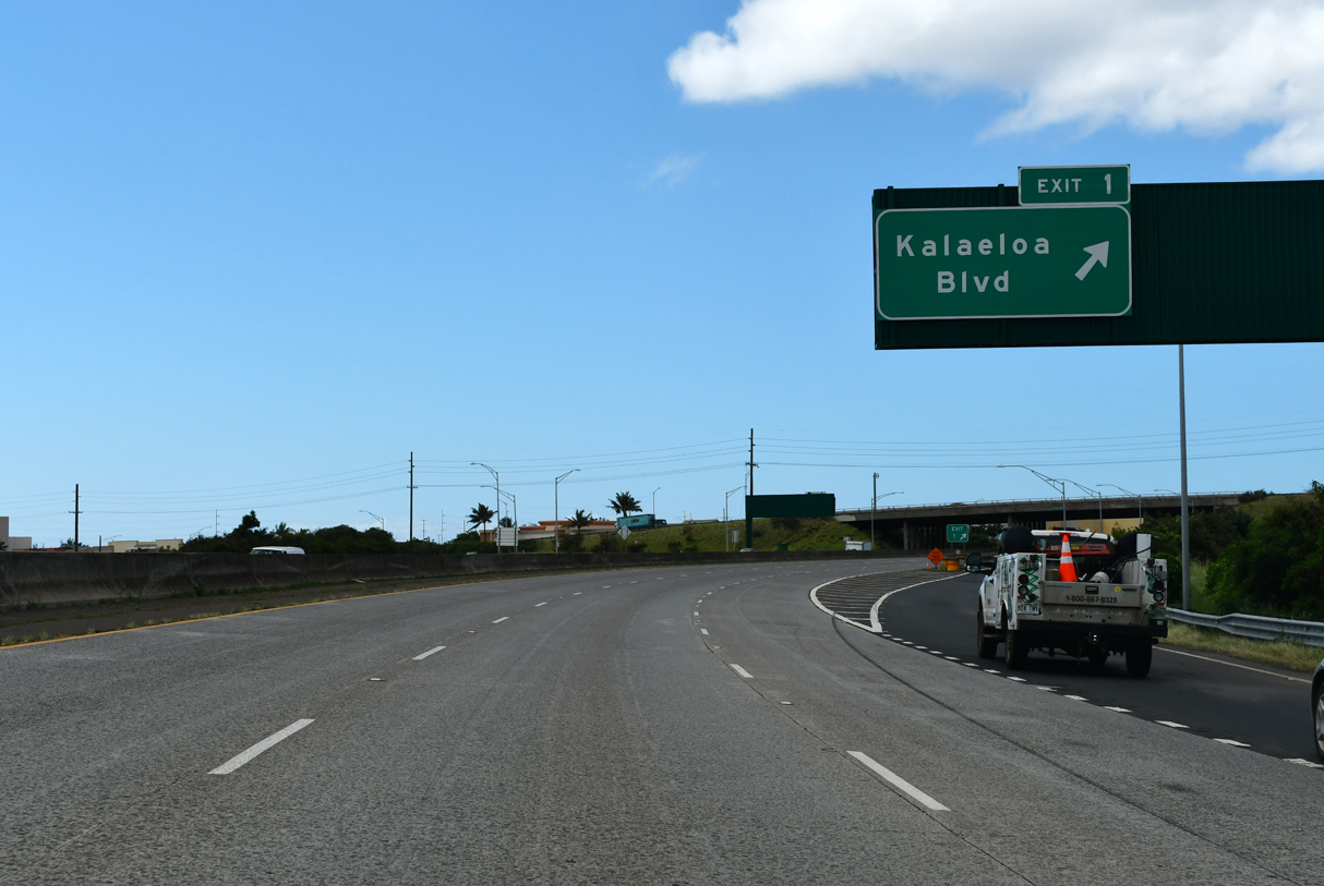
| Unsigned Route 95 (Kalaeloa Boulevard) spurs southwest from the Palalai Interchange (Exit 1) to Barbers Point Harbor and Campbell Industrial Park. 02/07/24 |
|
| Exit 1 loops onto Route 95 (Kalaeloa Boulevard) south just ahead of the freeway transition into Route 93 (Farrington Highway). 02/07/24 |
|
| Route 95 travels 2.70 miles west from the Palalai Interchange to Barbers Point Harbor. 02/07/24 |
|
| Kalaeloa Boulevard continues south beyond Route 95 on Malakole Street to Olai Street east of Barbers Point Beach Park. 02/07/24 |
|
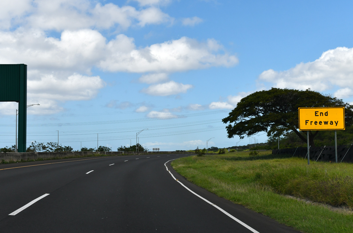
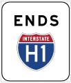
| Interstate H1 ends as Route 93 commences north along Farrington Highway. 02/07/24 |
Page Updated 02-24-2024.

 West
West