|
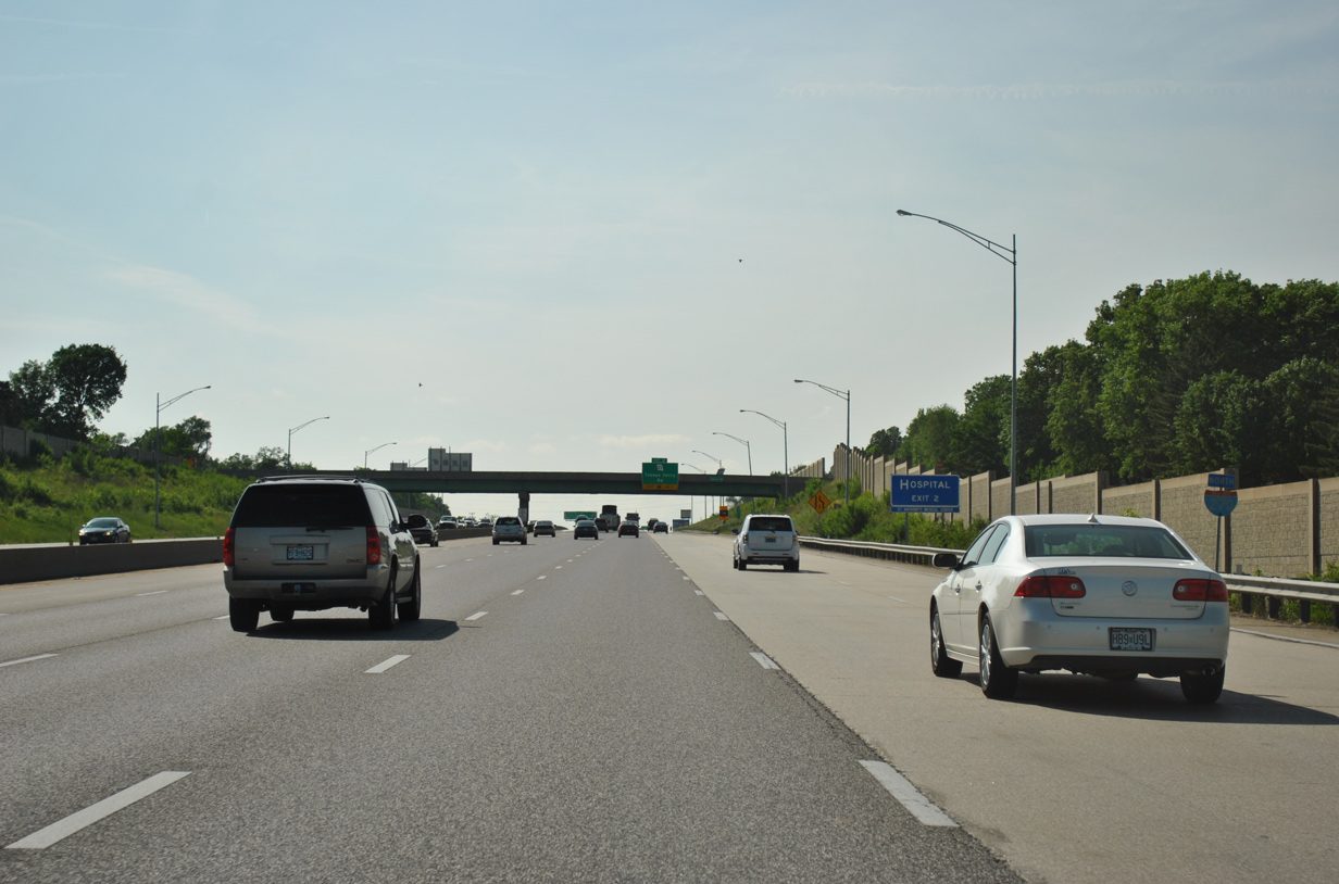
| Interstate 270 begins and rises onto a hill north of Mattese Creek through an unincorporated suburban area of leafy subdivisions. The first shield appears ahead of an overpass linking Theiss and Thiesscord Roads. 05/03/12 |
|
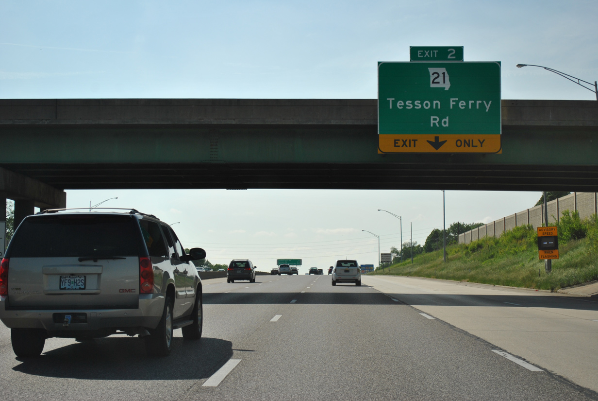
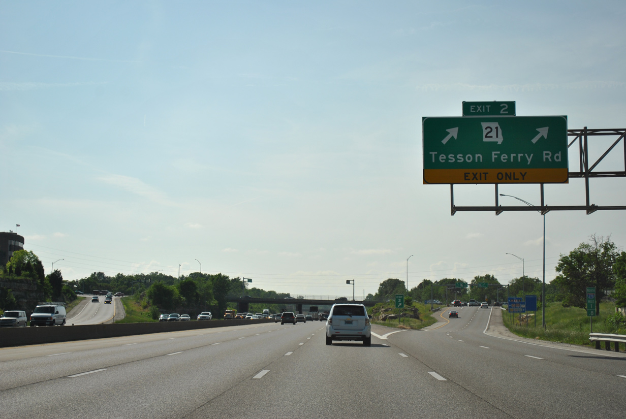
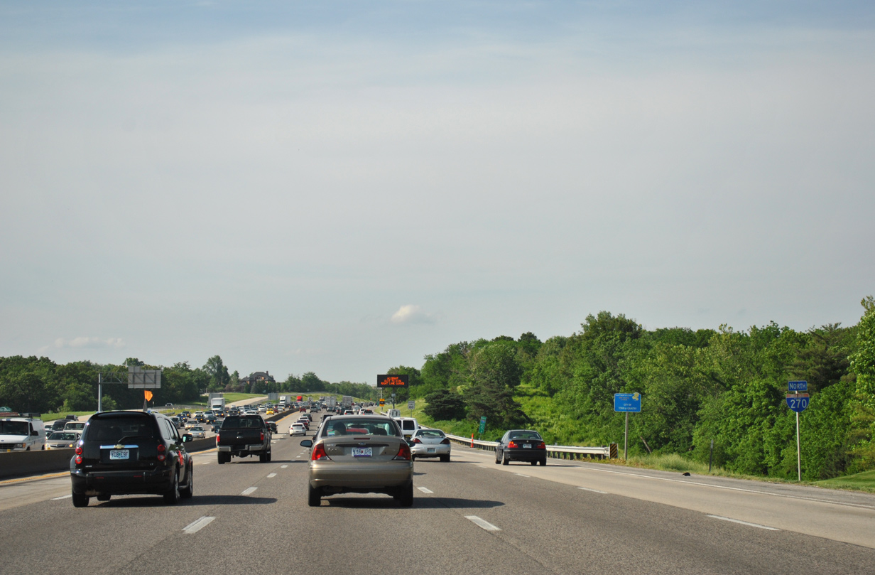
| Initially traveling west with five lanes, a lane drop occurs at Exit 2 for Missouri 21 (Tesson Ferry Road). 05/03/12 |
|
| Interstate 270 angles northwest 4.75 miles to Interstate 44 near the Sunset Hills and Kirkwood city line. 05/03/12 |
|
| Missouri 21 follows Tesson Ferry Road north to Green Park, Clydedale and Lakeshire to end at Affton with Missouri 30 (Gravois Road). 05/03/12 |
|
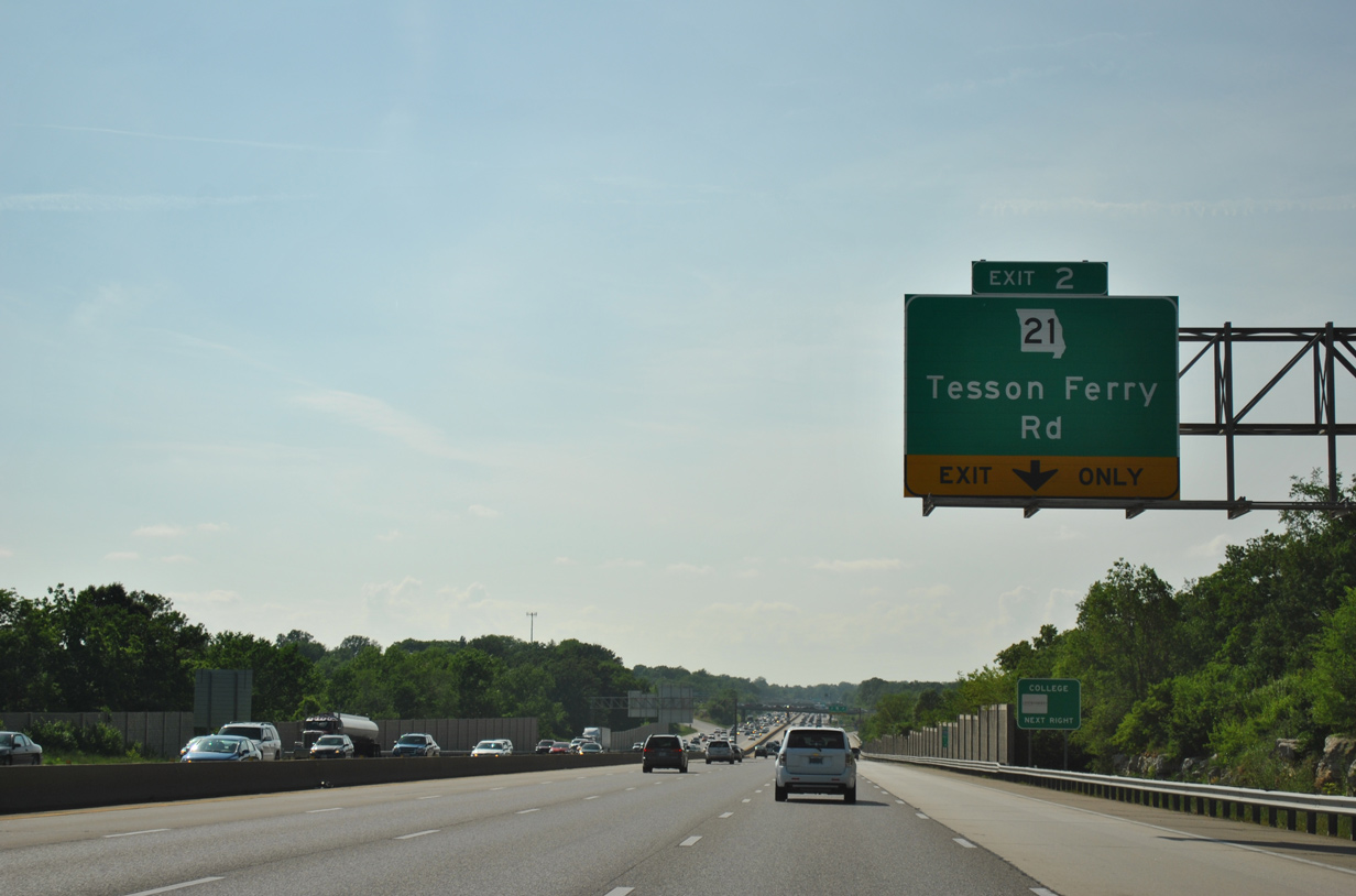
| Two lanes peel away from I-270 north at the diamond interchange (Exit 2) with Missouri 21 (Tesson Ferry Road). A 194.13 mile route to the Arkansas state line south of Doniphan, the state highway initially travels a commercialized stretch southward from Exit 2 to eventually become a freeway through Jefferson County. 05/03/12 |
|
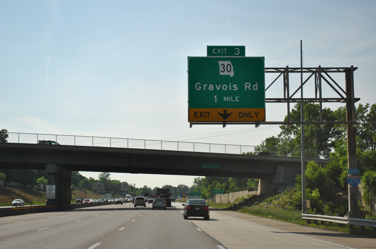
| An auxiliary lane accompanies I-270 north between Exits 2 and 3 with Missouri 30 (Gravois Road) as the freeway enters the city of Sunset Hills. 05/03/12 |
|
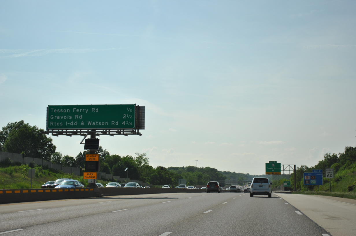
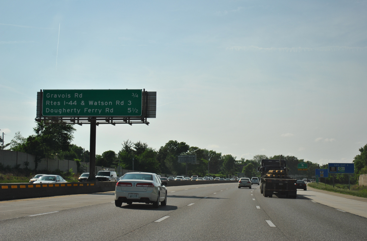
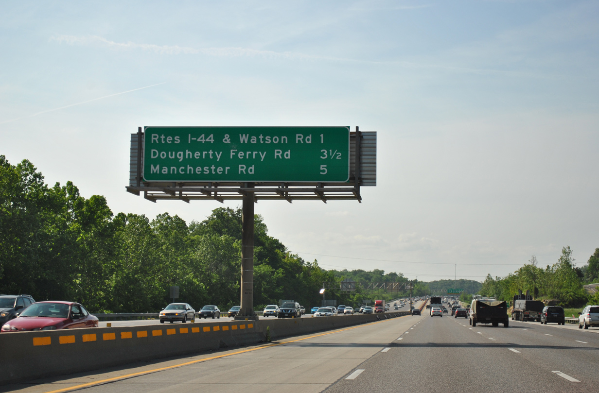
| Interchange sequence sign posted 0.75 miles south of the Gravois Road (MO 30) off-ramp. Interstate 44 and Watson Road (historic U.S. 50 & 66) follow in three miles. 05/03/12 |
|
| Missouri 30 takes Gravois Road northeast from Sunset Hills to Grantwood Village and the city of St. Louis. The state highway represents the former alignment of U.S. 67 between Lindbergh Boulevard and Kingshighway, and U.S. 50 & 66 from Chippewa Street to its terminus at I-44/55. 05/03/12 |
|
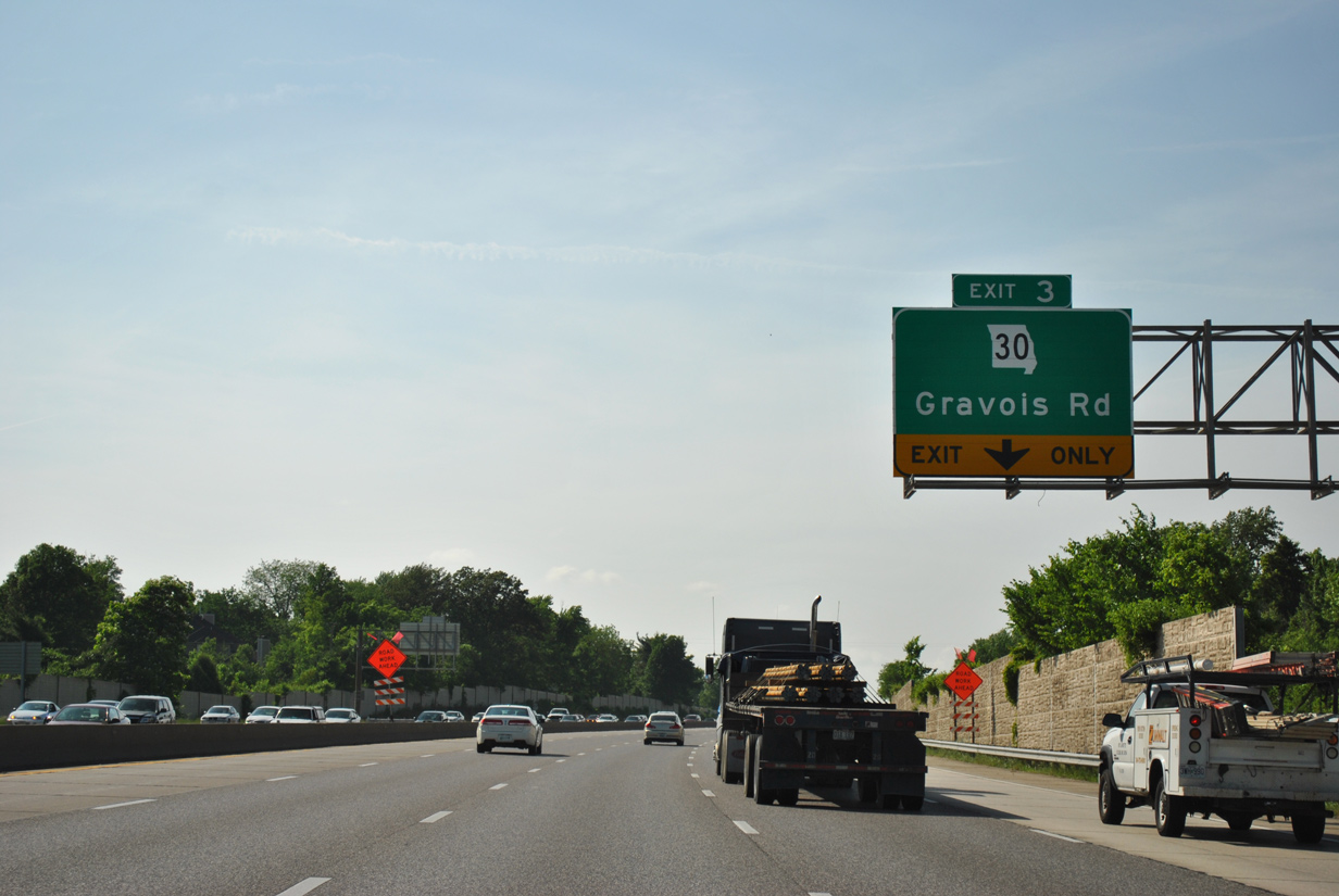
| Exit 3 departs as a two lane off-ramp for Missouri 30 (Gravois Road). Overall MO 30 totals 52.72 miles from St. Louis west to Interstate 44 (Exit 239) in St. Clair. 05/03/12 |
|
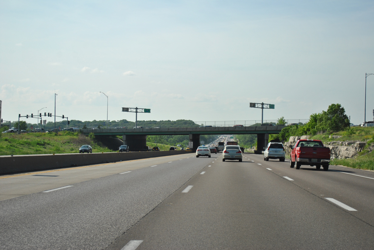
| Rock outcrops appear as Interstate 270 passes through the diamond interchange (Exit 3) with Missouri 30 (Gravois Road). 05/03/12 |
|
| Interstate 270 again expands to ten overall lanes beyond Exit 3 northwest through Sunset Hills. 05/03/12 |
|
| Larger rock outcrops line I-270 by this reassurance marker posted after MO 30. 05/03/12 |
|
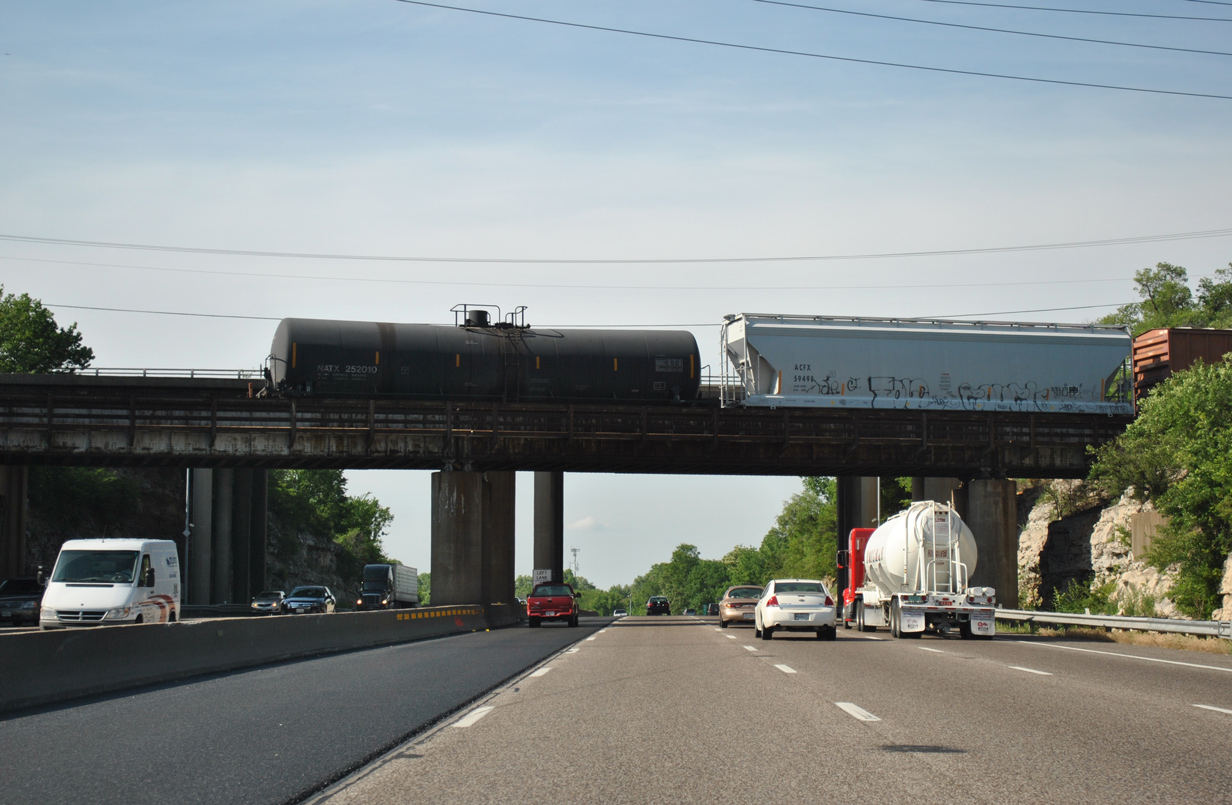
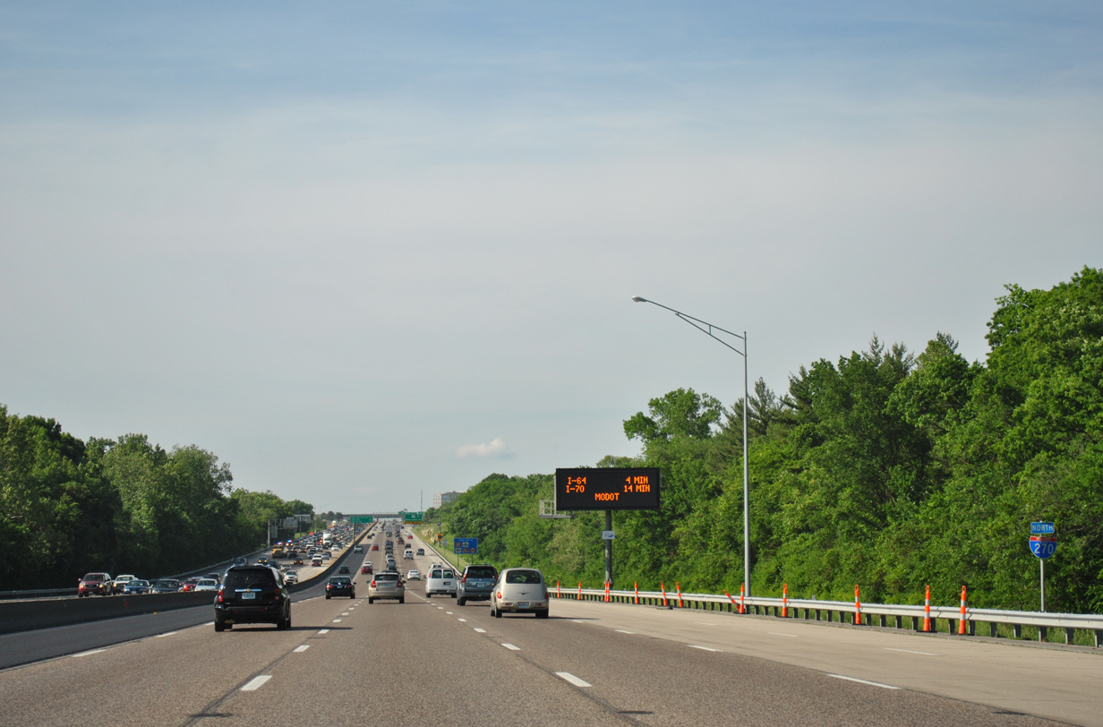
| Interstate 44 represents the first of seven freeways I-270 meets in Missouri. The freeway stretches 293.18 miles across the Show Me State, ending at the west end of the Stan Musial Veterans Memorial Bridge (I-70) in St. Louis and exiting the state west of Joplin. 05/03/12 |
|
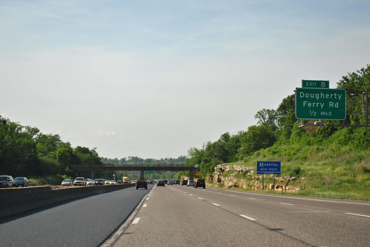
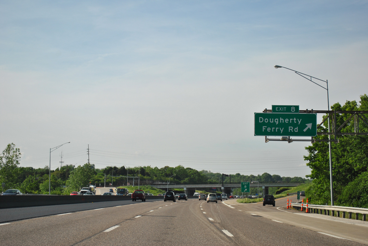
| Beyond I-44 and MO 360 (Watson Road), I-270 north passes through city of Kirkwood to Dougherty Ferry Road (Exit 8) at Des Peres. 05/03/12 |
|
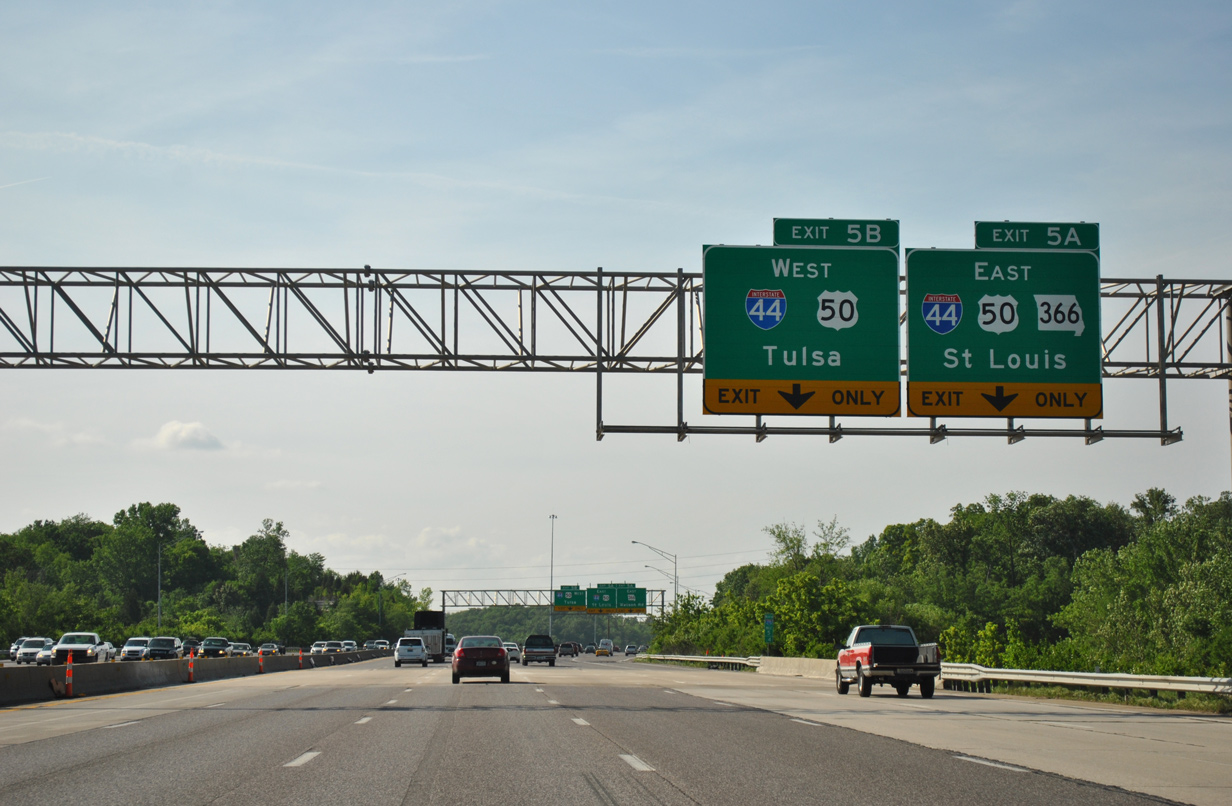
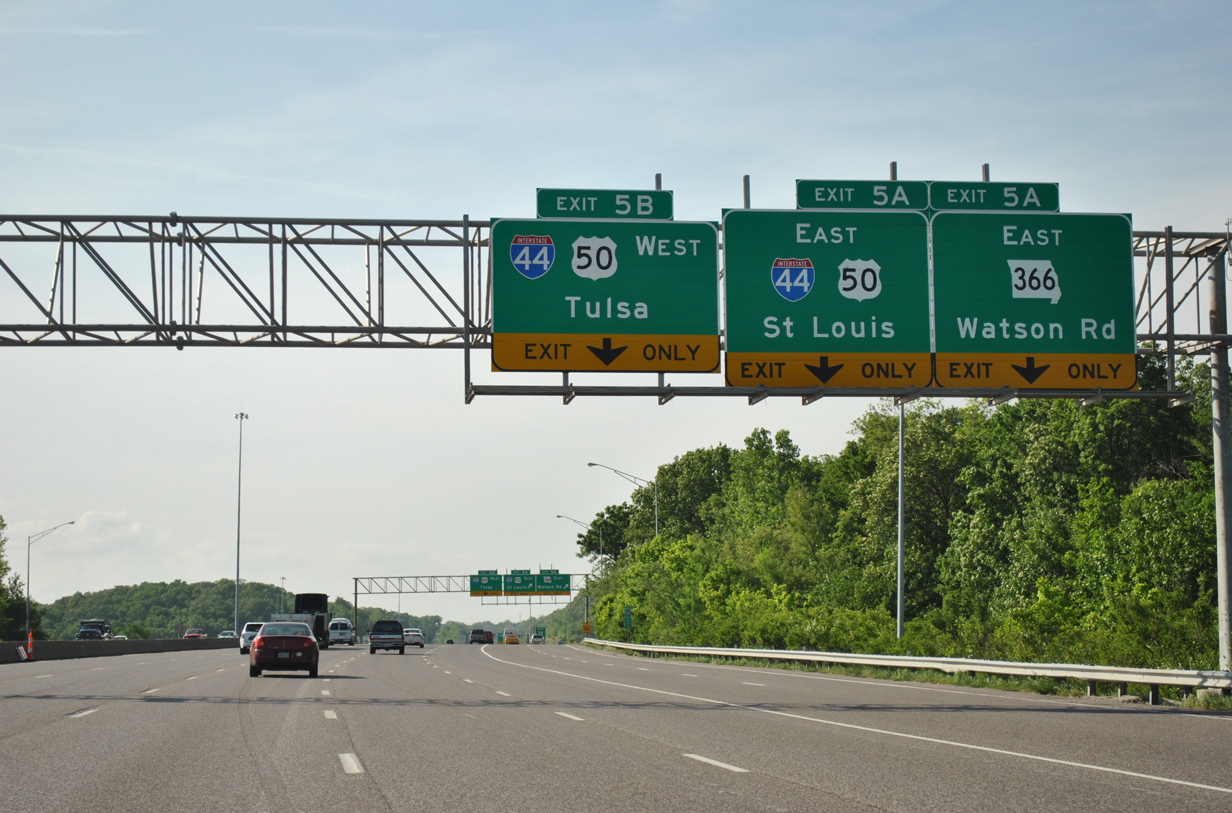
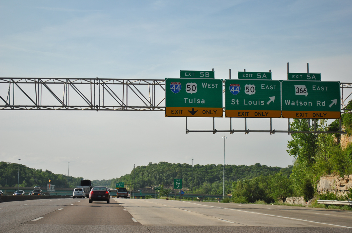
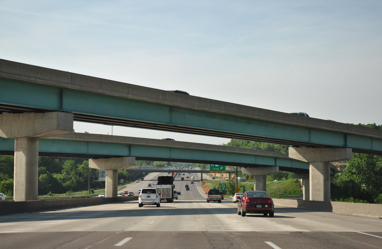
| Crossing over Rott Road, I-270 expands to six lanes ahead of the cloverstack interchange (Exits 5A/B) with Interstate 44 & U.S. 50 and Missouri 366 (Watson Road) east. 05/03/12 |
|
| Exit 5A separates from the freeway mainline with two lanes. The ramp splits at the wye interchange between Interstate 44 and the beginning of MO 366 (Watson Road) east. MO 366 is the former alignment of U.S. 50 and 66 leading east through Crestwood, Webster Groves and Gravois Avenue at the Tower Grove South and Dutchtown neighborhoods in St. Louis. 05/03/12 |
|
| Interstate 44 winds east through Webster Groves, Shrewsberry and St. Louis to combine with I-55 north at the Soulard neighborhood of the city. The route ended at the Poplar Street Bridge until February 2014, when the new I-70 Mississippi River bridge opened. That led to an extension of I-44 north over former I-70 through Downtown. 05/03/12 |
|
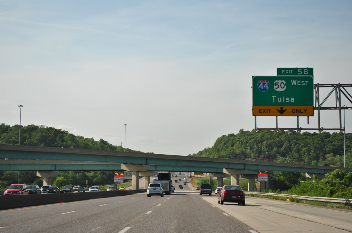
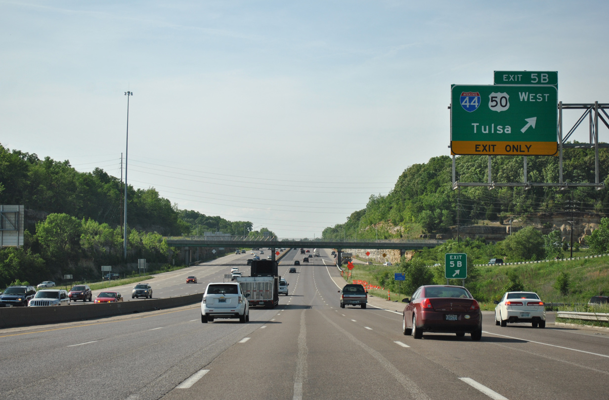
| Exit 5B consists of a loop ramp from I-270 north to I-44 & U.S. 50 west. The two routes overlap west for another 30 miles west near Union. I-44 otherwise meanders southwest to Rolla and Springfield. 05/03/12 |
|
| Flyover ramps were constructed from I-44 east to I-270 north and I-44 west to I-270 south in place of cloverleaf ramps. 05/03/12 |
|
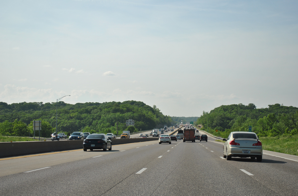
| Interstate 44 travels 378 miles west to Tulsa, Oklahoma. The freeway winds through the St. Louis County cities of Fenton, Valley Park and Eureka over the next 15 miles. 05/03/12 |
|
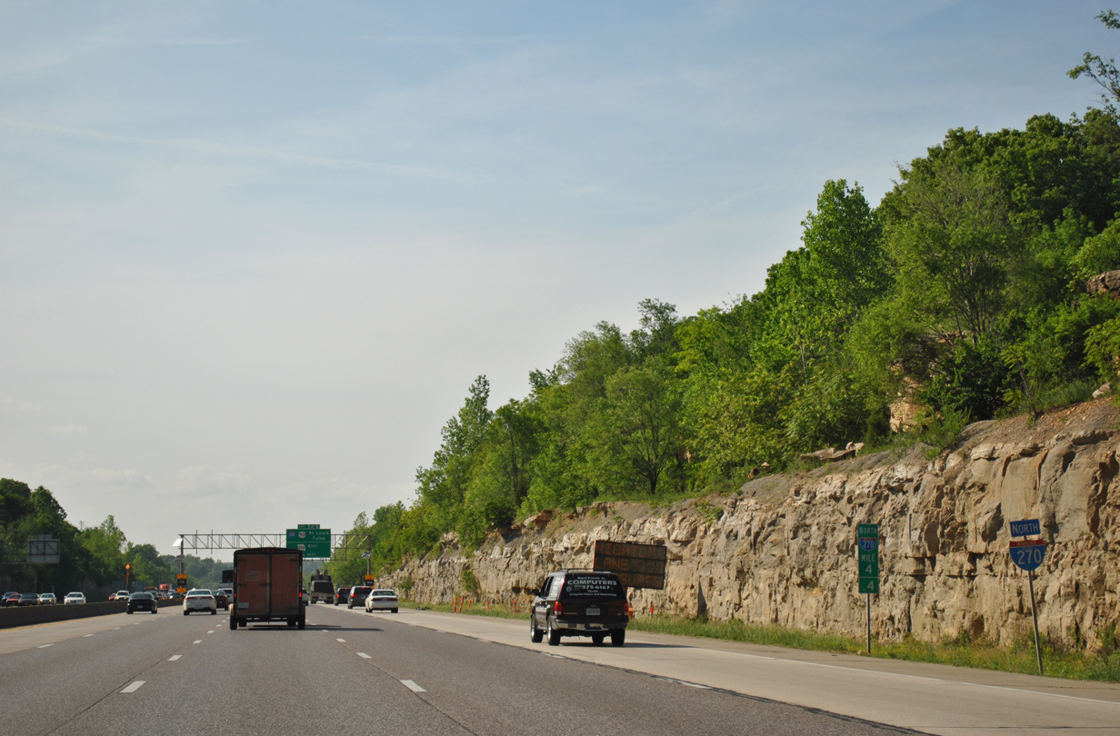
| Forested hills rise alongside Interstate 270 north from the adjacent Emmenegger Nature Park and Power Valley Conservation Nature Center. 05/03/12 |
|
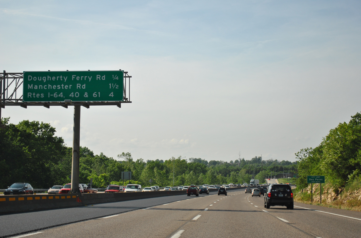
| The next exit departs in 1.25 miles at the city of Des Peres. I-64/U.S. 40-61 follow at Exit 12 in 5.5 miles. 05/03/12 |
|
| A half diamond interchange (Exit 7) joins I-270 south with Big Bend Boulevard opposite the St. Louis and San Francisco Railroad bridge here. 05/03/12 |
|
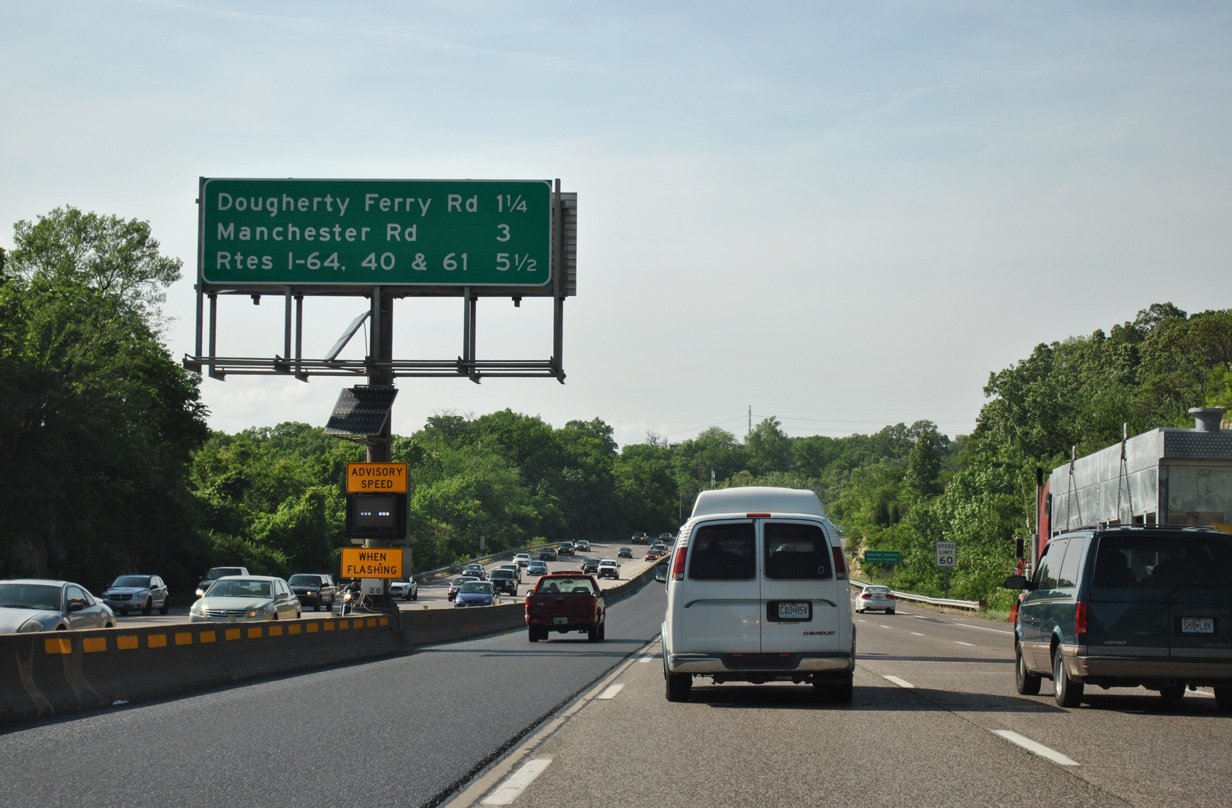
| Dougherty Ferry Road meanders southwest from Geyer Road in the city of Kirkwood to a diamond interchange (Exit 8) with Interstate 44 in a half mile. 05/03/12 |
|
| Manchester Road (MO 100) represents the second Des Peres exit in 1.5 miles. I-64 is now four miles away. 05/03/12 |
|
| West from Exit 8, Dougherty Ferry Road arcs southward to Big Bend Road and Forest Avenue in the city of Valley Park. 05/03/12 |
|
| Interstate 270 travels north through Des Peries with ten overall lanes between Exits 8 and 9. 05/03/12 |
|
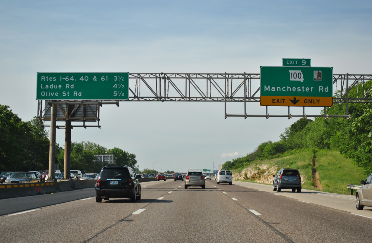
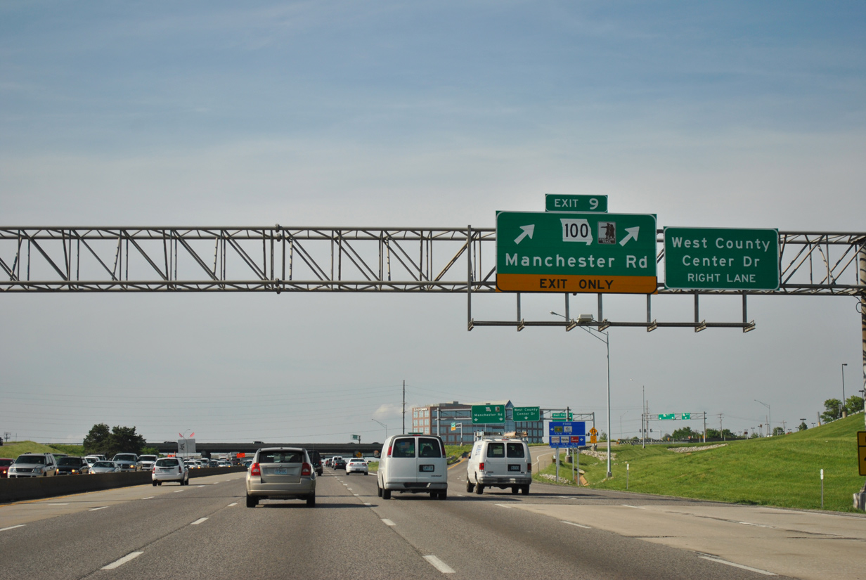
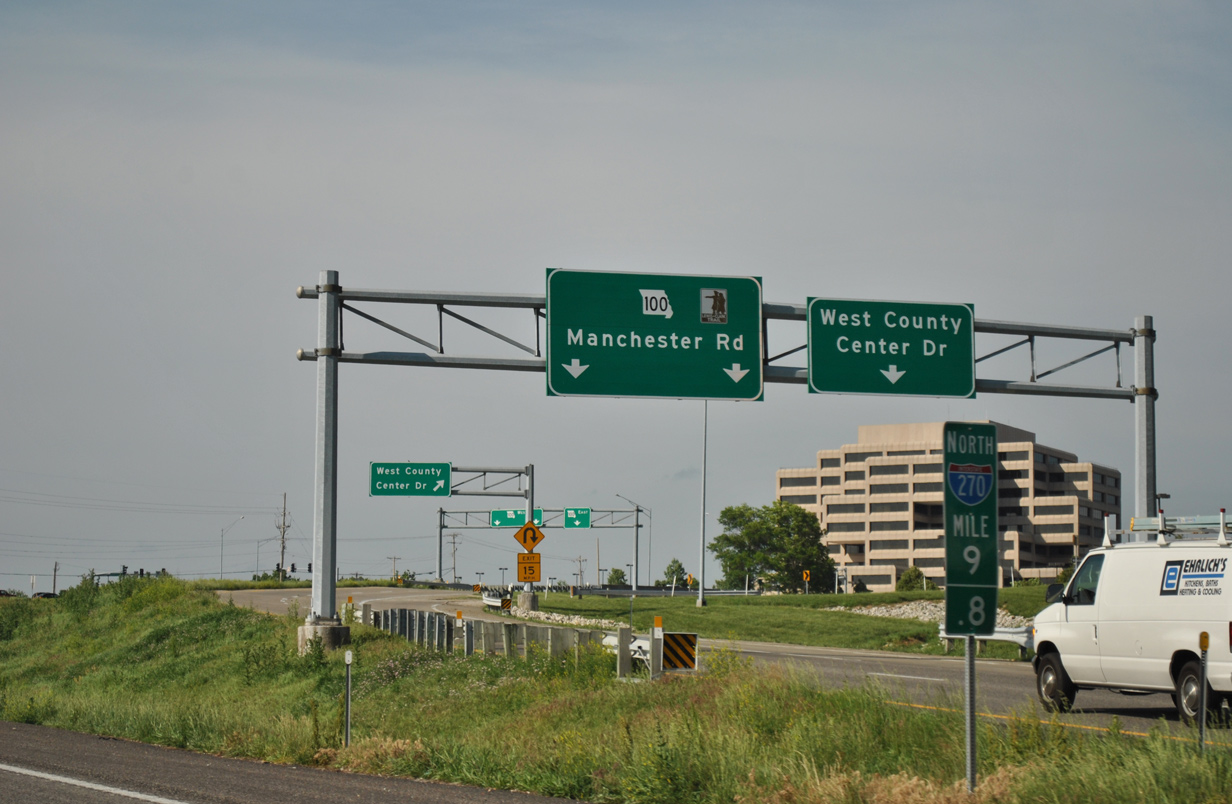
| Missouri 100, a 121.15 mile highway from U.S. 50 in Linn to I-55 by LaSalle Park and Downtown St. Louis, sees a six-ramp parclo interchange (Exit 9) with I-270 in Des Peres. 05/03/12 |
|
| Two lanes leave I-270 north for Missouri 100 (Manchester Road) by West County Center mall. MO 100 partitions into a one way couplet from I-270 west to near Barrett Station Road. The eastbound roadway originally carried two-way traffic. 05/03/12 |
|
| Exit 9 splits with a separate ramp directly to West County Center Drive for the adjacent shopping mall. Missouri 100 (Manchester Road) otherwise leads east to Kirkwood and Glendale and west to Manchester and Ballwin. 05/03/12 |
|
| Northbound motorists along Interstate 270 next enter the city of Town And Country. 05/03/12 |
|
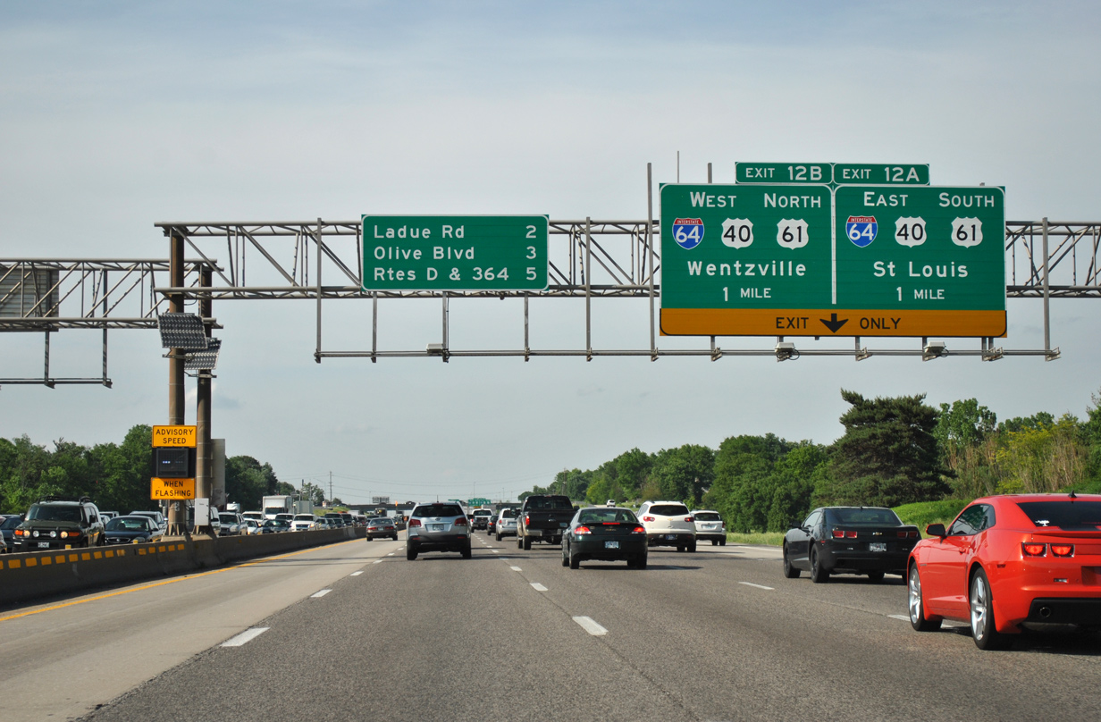
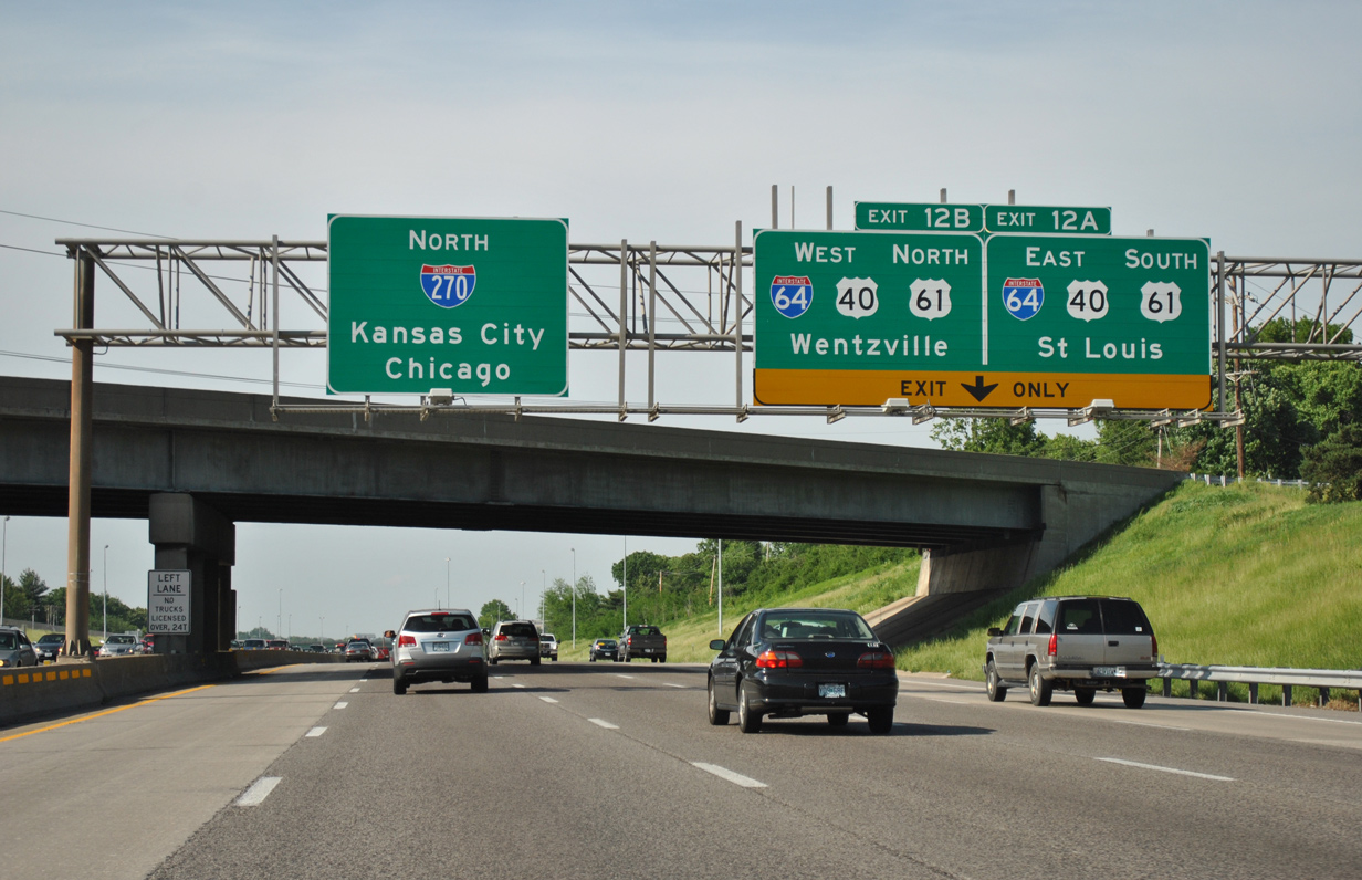
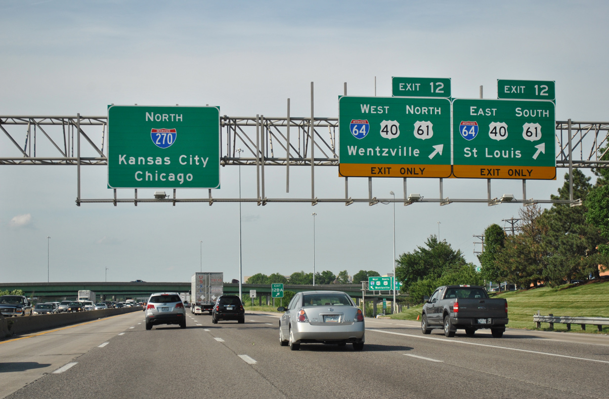
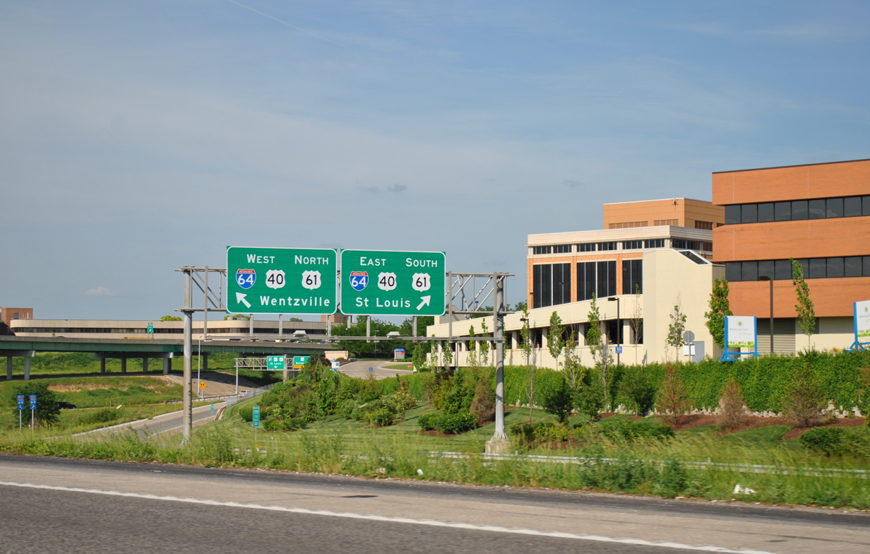
| A multi-level interchange (Exits 12A/B) joins Interstates 270 and 64 in one mile at the city line with Creve Coeur. Interstate 64 overlays U.S. 40 east through Frontenac, Ladue and central St. Louis. The route was extended west from the Poplar Street Bridge to I-270 in 1987. 05/03/12 |
|
| Clayton Road passes overhead on the half mile approach to Exits 12A/B. I-64/U.S. 40 continue west another 25 miles to Wentzville. The I-64 designation was extended west to I-70 in stages between 1997 and 2009. 05/03/12 |
|
| All traffic departs in unison for Interstate 64 and U.S. 40-61. U.S. 61 combines with the freeway west from Lindbergh Boulevard at Frontenac to Wentzville. The highway extends north from there along the Avenue of the Saints corridor to Hannibal. 05/03/12 |
|
| Exit 12 separates for I-64/U.S. 40-61 east toward St. Louis and west to Chesterfield. The cloverleaf interchange between the two freeways was upgraded over a five-year period between 1988 and 1993. 05/03/12 |
|
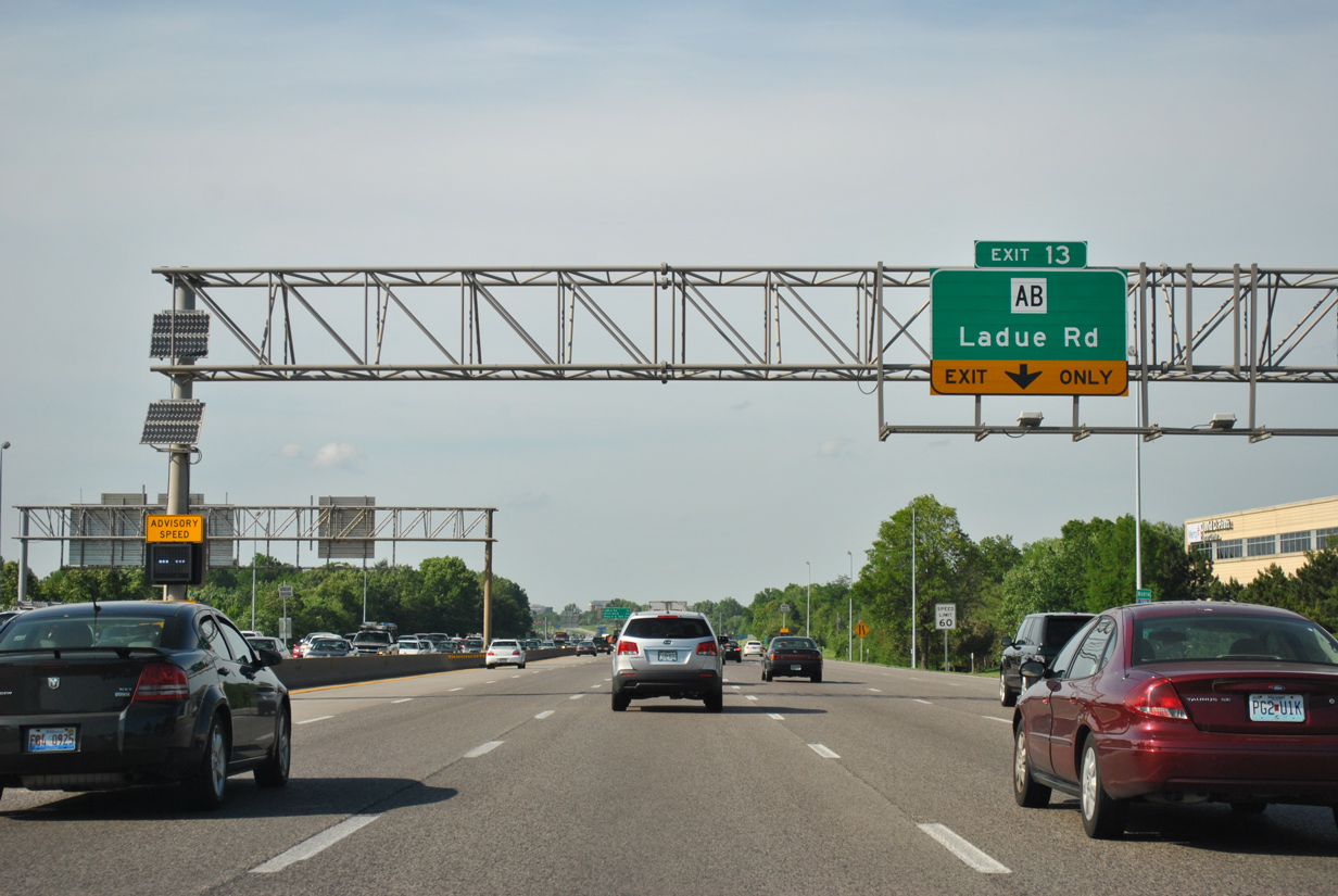
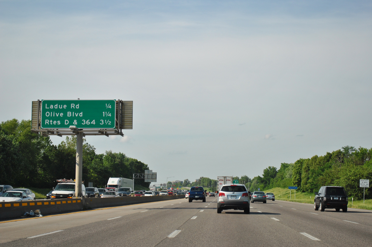
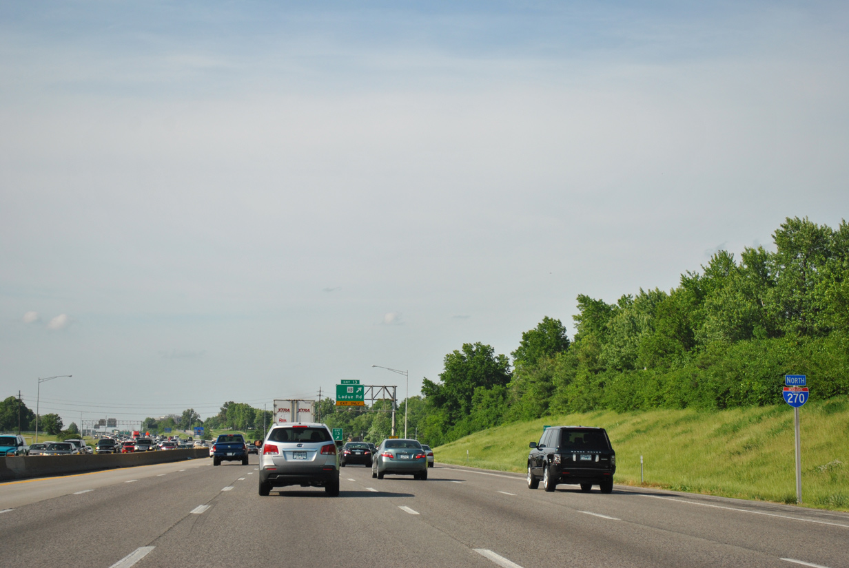
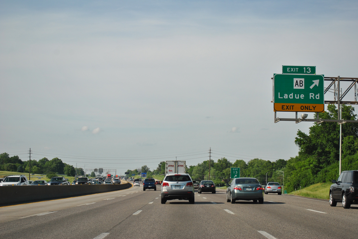
| Two exits serve the city of Creve Coeur from Interstate 270. The first is a diamond interchange with Ladue Road, which doubles as Highway AB west. 05/03/12 |
|
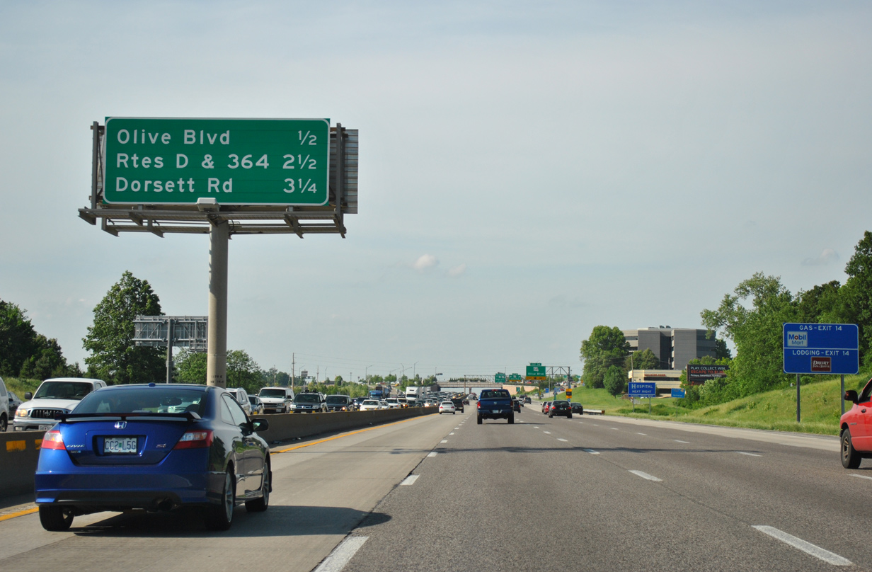
| Olive Road (MO 340) straddles northern reaches of Creve Coeur to meet I-270 at Exit 14 in 1.25 miles. The Missouri 364 freeway follows in 3.5 miles. 05/03/12 |
|
| Reassurance marker posted as Interstate 270 parallels New Ballas Road to the west. 05/03/12 |
|
| Highway AB spurs 3.25 miles west to the Missouri 141 expressway at Chesterfield. Ladue Road otherwise serves a number of residential areas west through Town And Country and east to Ladue. 05/03/12 |
|
| Frontage roads out of view accompany Interstate 270 northward through an unincorporated area of St. Louis County. 05/03/12 |
|
| Forthcoming Exits 14, 15 and 16 all lie within the city of Maryland Heights. 05/03/12 |
|
| Missouri 340 (Olive Boulevard) runs 19.28 miles overall between Ferguson Avenue in University City west to Missouri 100 in Ellisville. 05/03/12 |
|
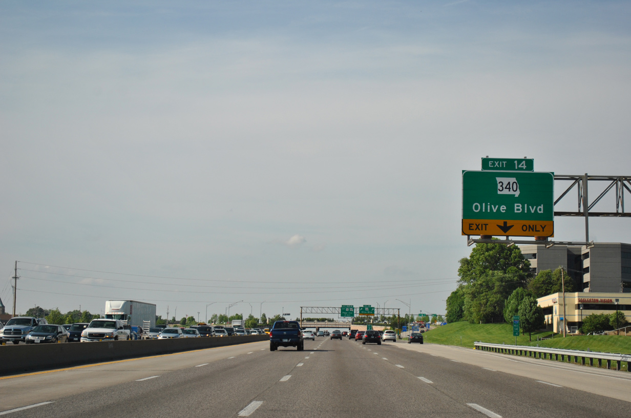
| Two lanes leave I-270 north for Missouri 340 (Olive Boulevard) at Exit 14. A number of business parks and retail surround the area of the interchange as MO 340 expands into a six lane arterial. 05/03/12 |
|
| The single point urban interchange between Interstate 270 and Missouri 340 was upgraded from a diamond interchange. 05/03/12 |
|
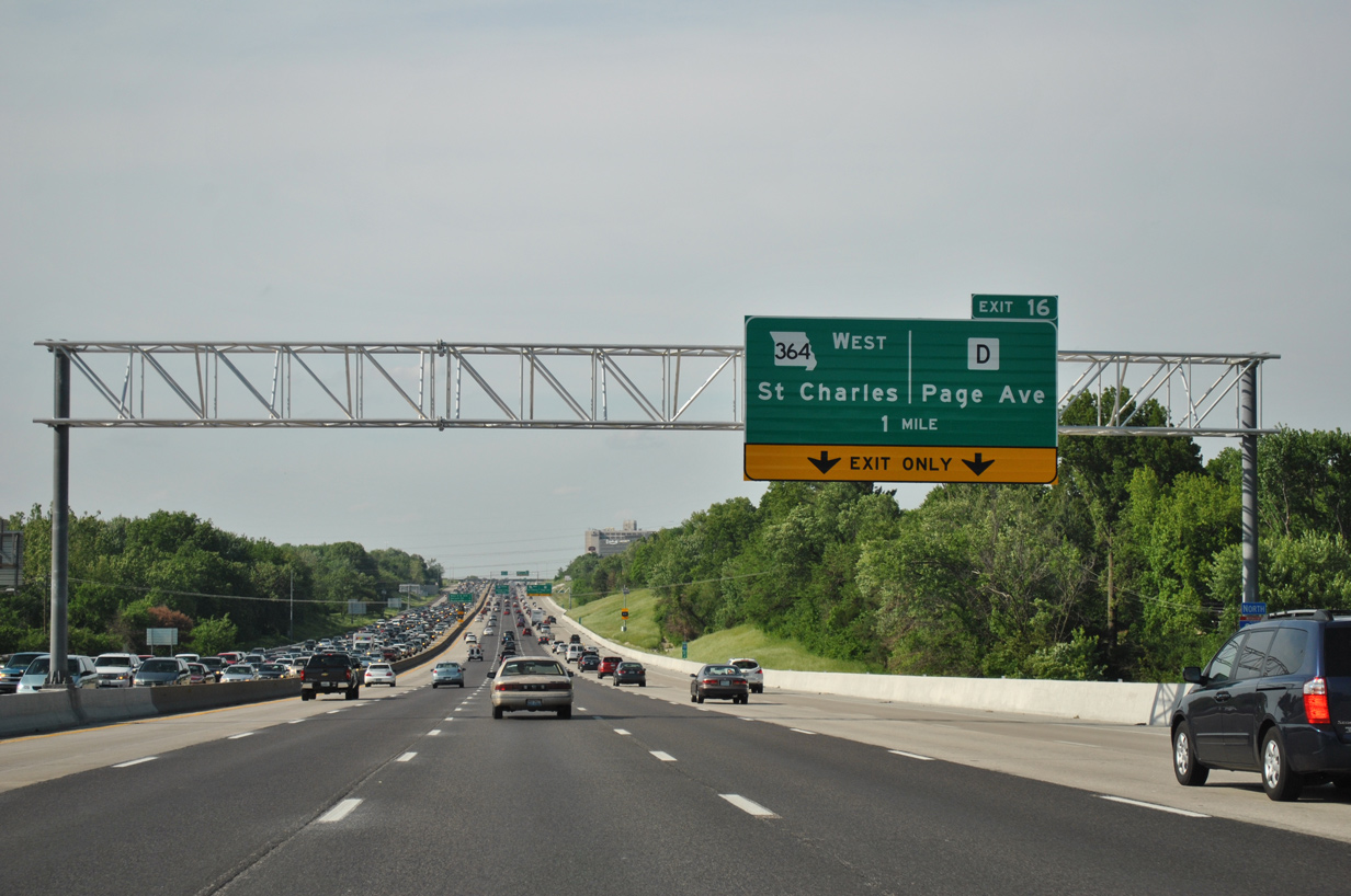
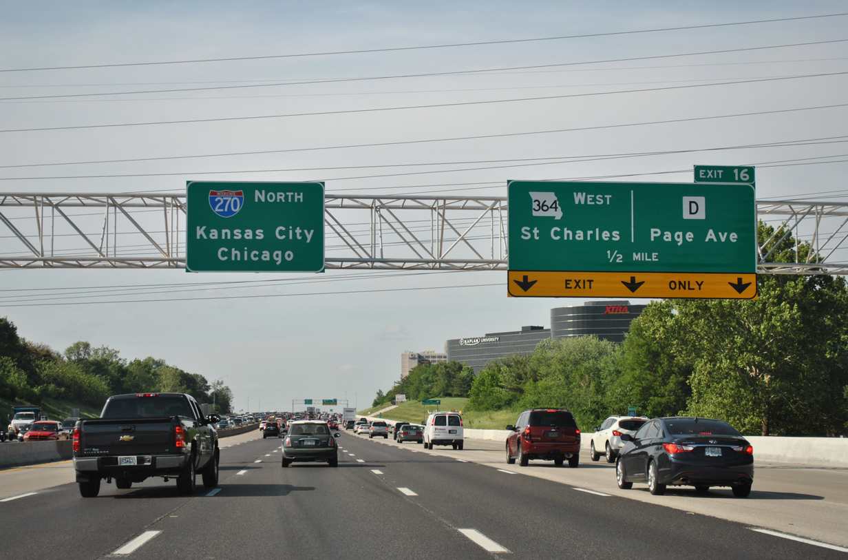
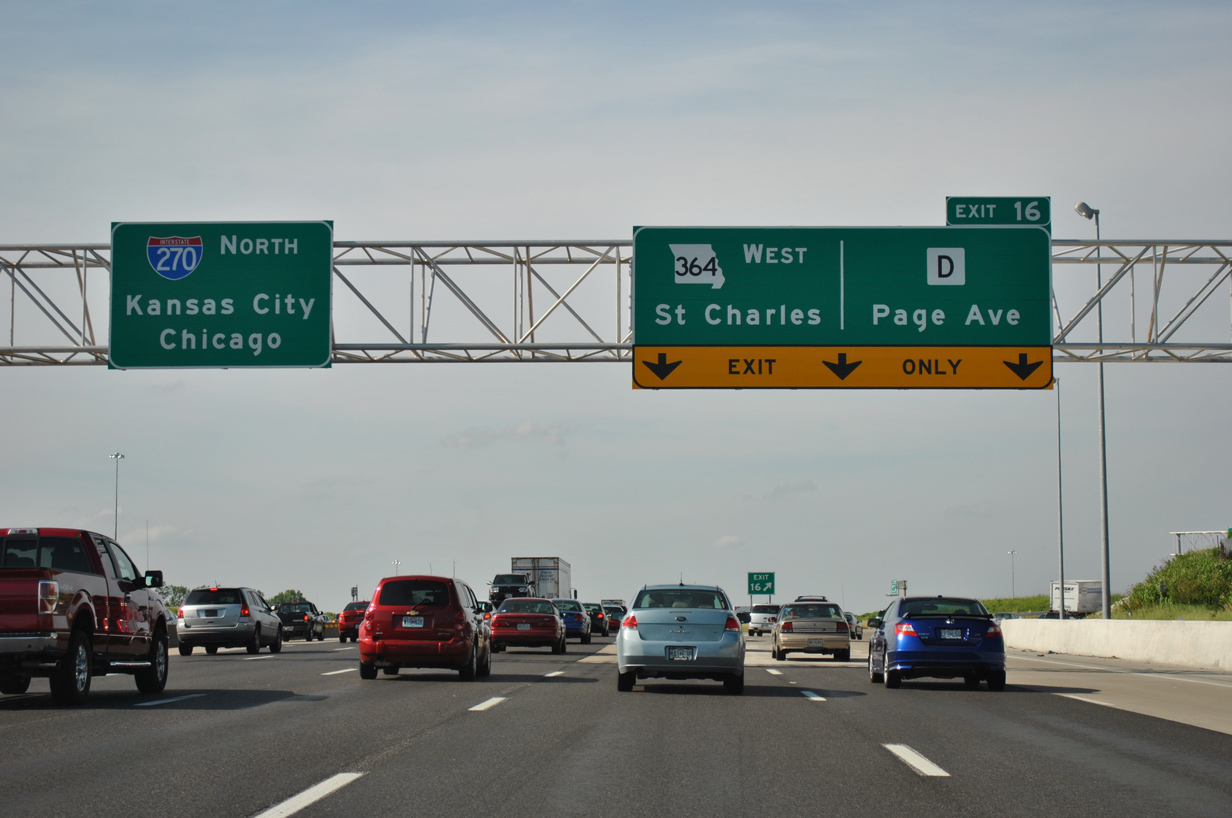
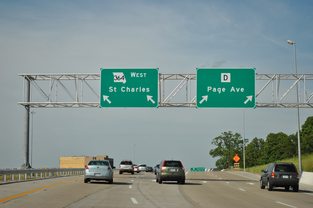
| Six lanes of Interstate 270 lead north from MO 340 to Exit 16, where Missouri 364 west and Highway D (Page Avenue) west come together. MO 364 constitutes a 21.38 mile route from I-270 west to I-64 (Exit 4) near Lake St. Louis. 05/03/12 |
|
| Four miles remain until I-270 meets its parent at the city of Bridgeton. 05/03/12 |
|
| Exit 16 expands to three lanes to handle commuter traffic bound for Missouri 364 (Page Avenue Extension) west. A $22 million project replaced a cloverleaf ramp for MO 364 with a new two lane flyover while adding a second auxiliary lane to I-270 north between Exits 14 and 16. The new ramp opened on July 23, 2011.1 05/03/12 |
|
| Missouri 364 opened initially between I-270 (Exit 16) and St. Charles (Jungs Station Road) in December 2003. The freeway was completed west to Interstate 64 on November 1, 2014. The highway provides an alternate to I-70 for Saint Peters and O'Fallon. 05/03/12 |
|
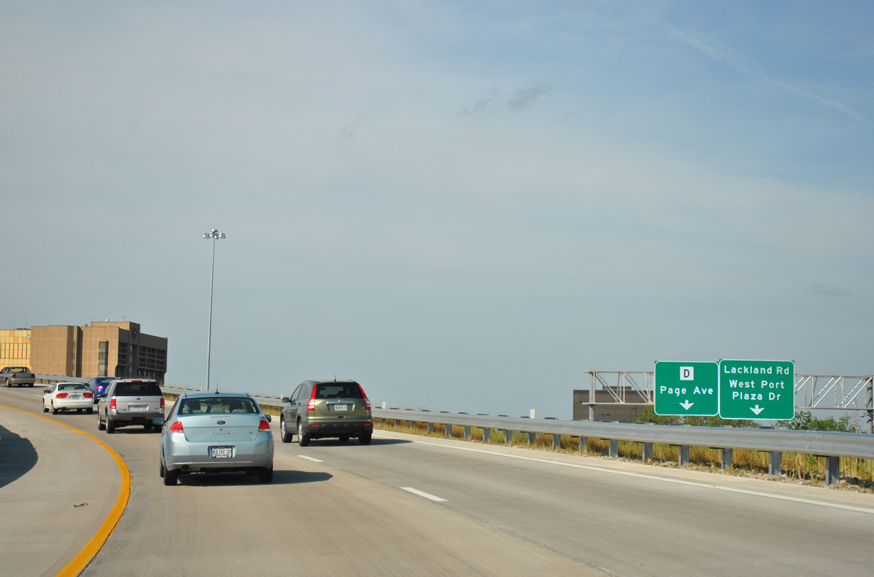
| Two lanes split for Highway D (Page Avenue) east as the expressway bisects a sprawling business park and warehouse district through east Maryland Heights to Overland. 05/03/12 |
|
| A folded diamond interchange lies east of I-270 along Highway D with Lackland Road and Westline Industrial Drive. The state highway otherwise goes for 15.72 miles east to St. Louis, ending at Broadway by Interstate 44. 05/03/12 |
|
| The on-ramp from Page Avenue forms an auxiliary lane to Exit 17 with Dorsett Road. 05/03/12 |
|
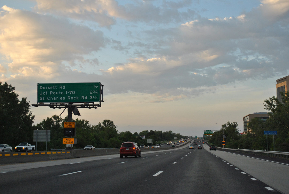
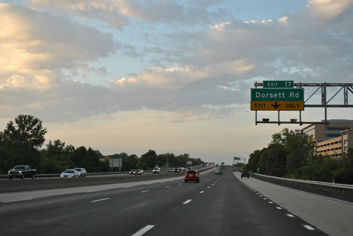
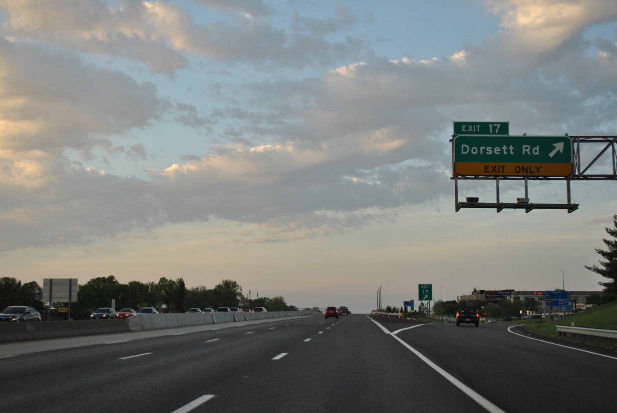
| Dorsett Road serves retail and commercial areas west of Exit 17. The road ends at Marine Avenue near Creve Coeur Lake. 05/03/12 |
|
| $10 million in construction upgraded Exit 17 to a diverging diamond interchange (DDI). The new ramps to Dorsett Road opened on October 18, 2010.2
Dorsett Road extends east as a five lane arterial through Maryland Heights to become Midlands Boulevard at U.S. 67 (Lindbergh Boulevard). 05/03/12 |
|
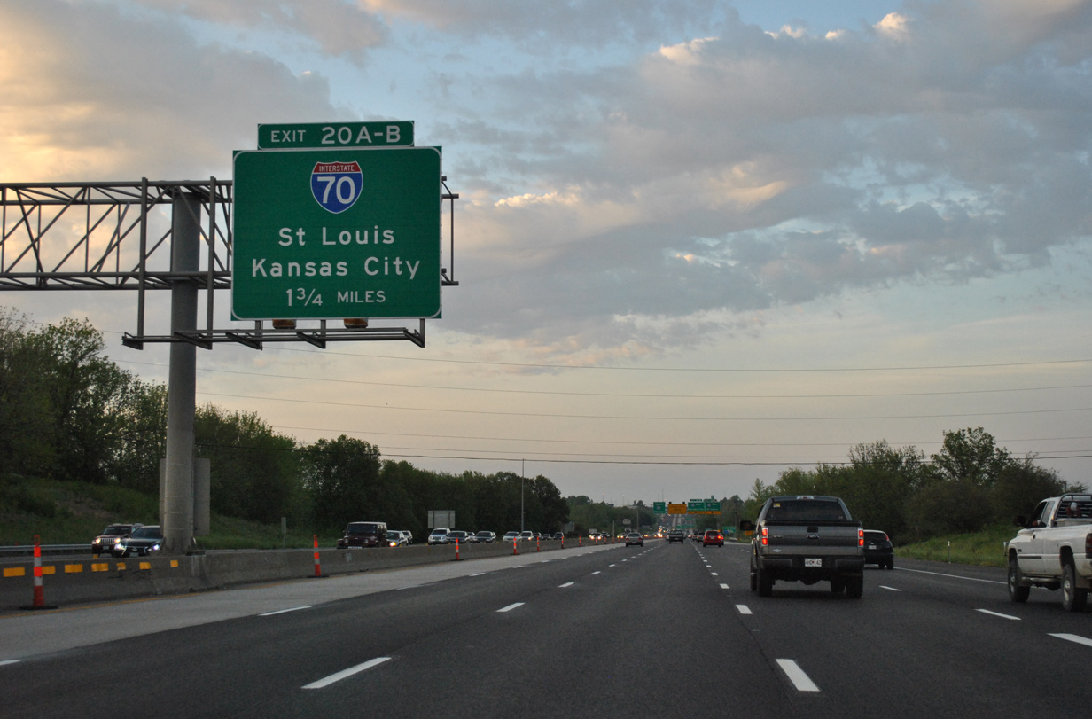
| Interstate 270 lowers to cross Fee Fee Creek on the 1.75 mile approach to Exits 20A/B with Interstate 70. 05/03/12 |
|
| Three lanes continue through the junction with I-70 along I-270 north to Bridgeton and Hazelwood. Exit 20A departs next for I-70 east to St. Louis Lambert International Airport (STL) and St. Ann. 05/03/12 |
|
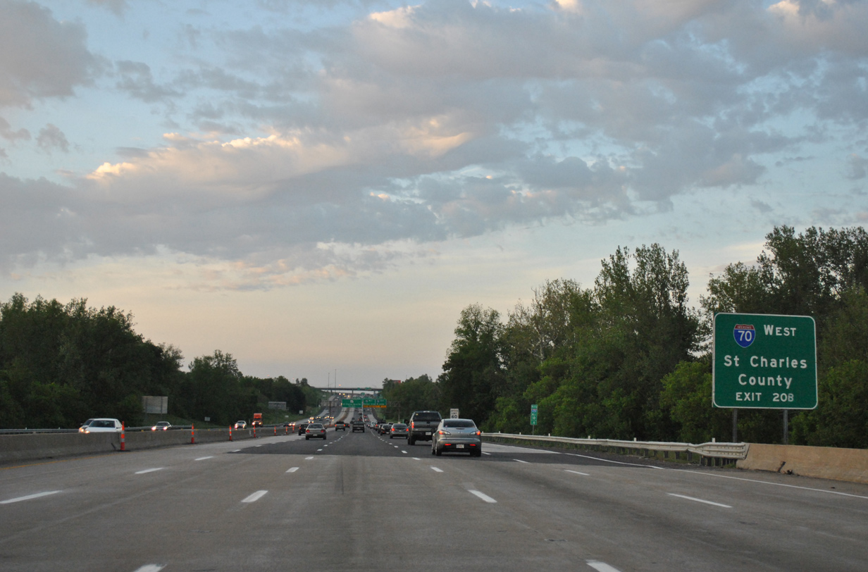
| Crossing Fee Fee Creek, a ground level sign references St. Charles County for I-70 west. Interstate 70 crosses the Missouri River into Saint Charles, one of several suburban cities along the freeway west to Wentzville. 05/03/12 |
|
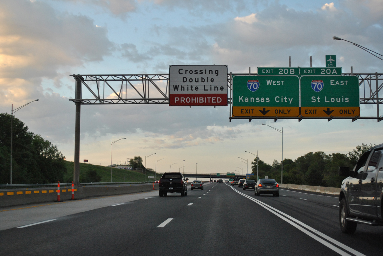
| Traffic separates between the I-270 mainline and Exits 20A/B one mile south of the turbine interchange between the two freeways. Beyond this sign bridge, lane changes between the number 3 and 4 lanes are prohibited. 05/03/12 |
|
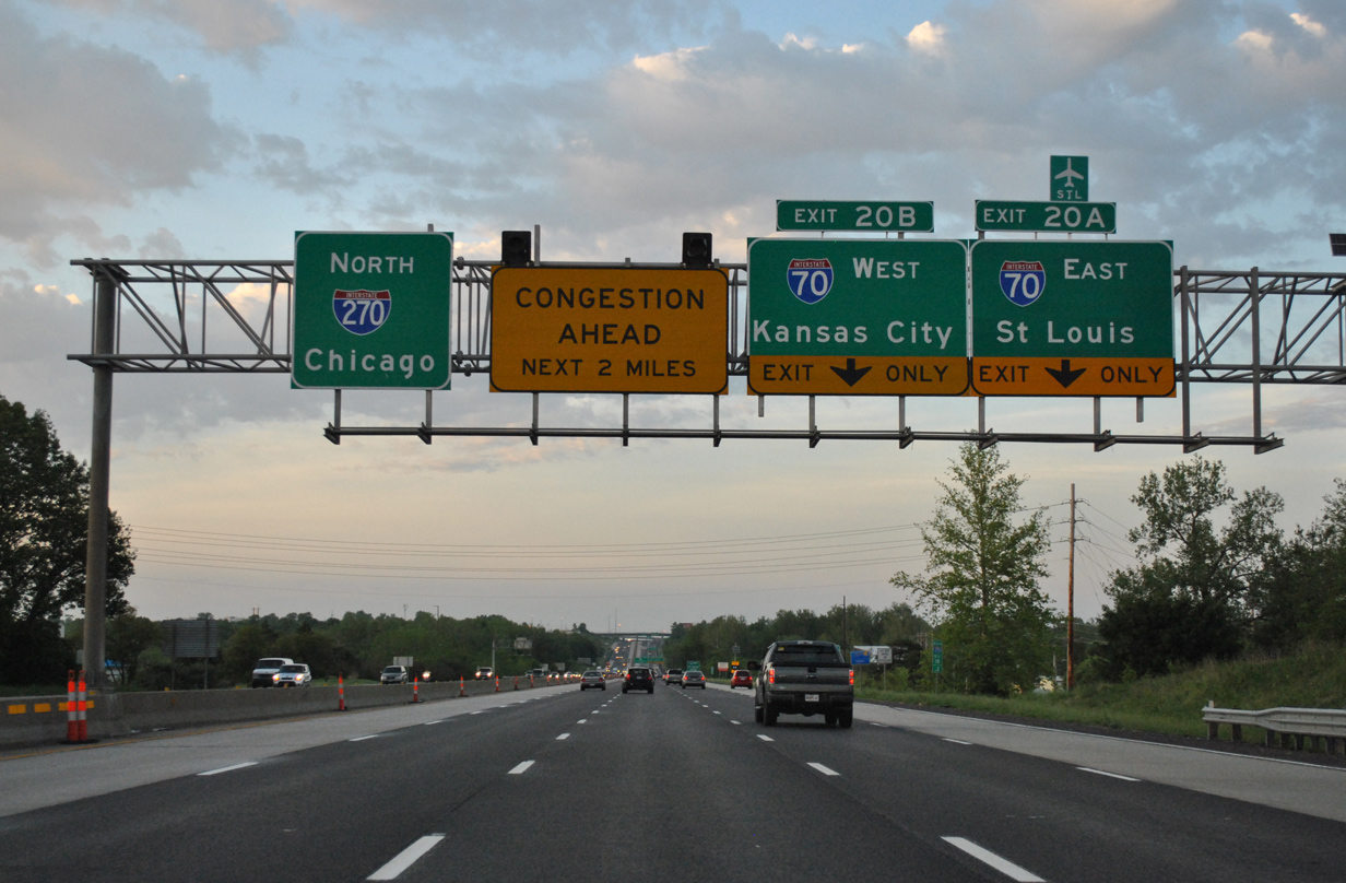
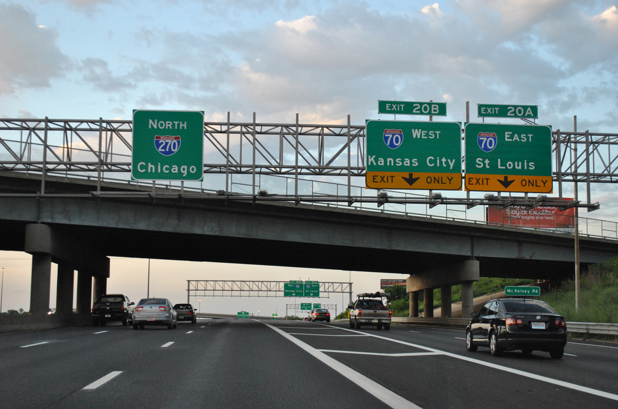
| Exit 20B consists of a high flyover onto Interstate 70 west to St. Charles, St. Peters, O'Fallon, Columbia and Kansas City. 05/03/12 |
|
| McKelvey Road spans I-270 north at the Exit 20 gore point by the village of Champ. I-70 travels 249.83 miles across Missouri, entering Illinois via the Stan Musial Veterans Memorial Bridge. 05/03/12 |
|
| Exits 20A/B split for Interstate 70. I-70 heads east through south Bridgeton to STL Airport, Berkeley, Jennings and other small cities before entering St. Louis at Walnut Park West. 05/03/12 |
|
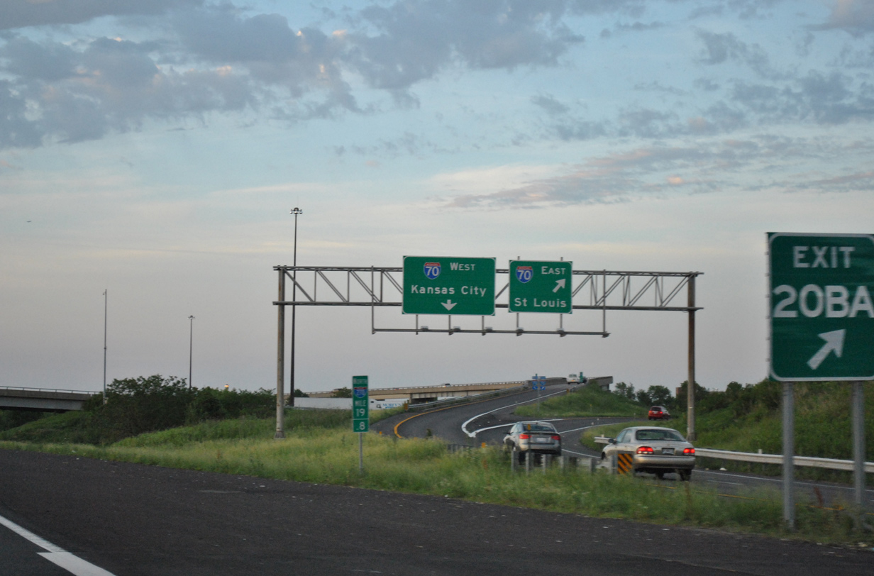
| A single lane flyover carries motorists onto I-70 west ahead of Earth City and the Blanchette Bridge over the Missouri River. 05/03/12 |
|
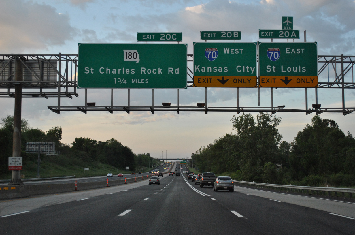
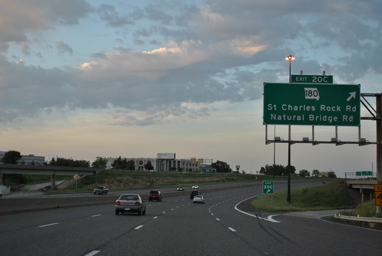
| Exit 20C to Missouri 180 (St. Charles Rock Road) east departs I-270 north within the stack at I-70. 05/03/12 |
|
| Missouri 180 (St. Charles Rock Road) begins here and leads southeast 9.96 miles to the St. Louis city line at Hamilton Heights. The state highway ends a 15.72 mile route at Martin Luther King, Jr. Drive and Tucker Boulevard in Downtown. 05/03/12 |
Page Updated 12-11-2014.


 North
North