|
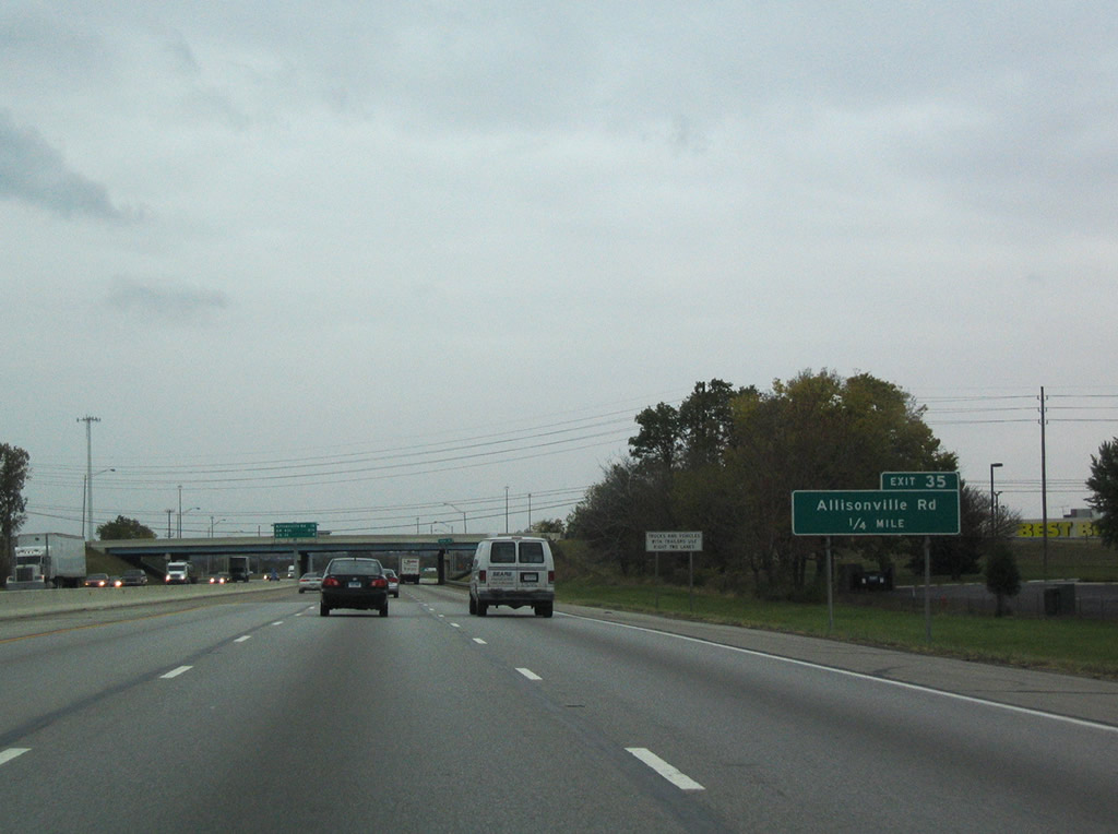
| Turning northwest, Interstate 465 enters the Castleton and Allisonville area at Exit 35 with Allisonville Road. Exit 35 is buffeted by commercial development centering around Castleton Square mall. The north-south road represents a former alignment of SR 37A from Binford Boulevard north to Noblesville. SR 37A existed in the late 1960s and early 1970s.1 10/16/04 |
|
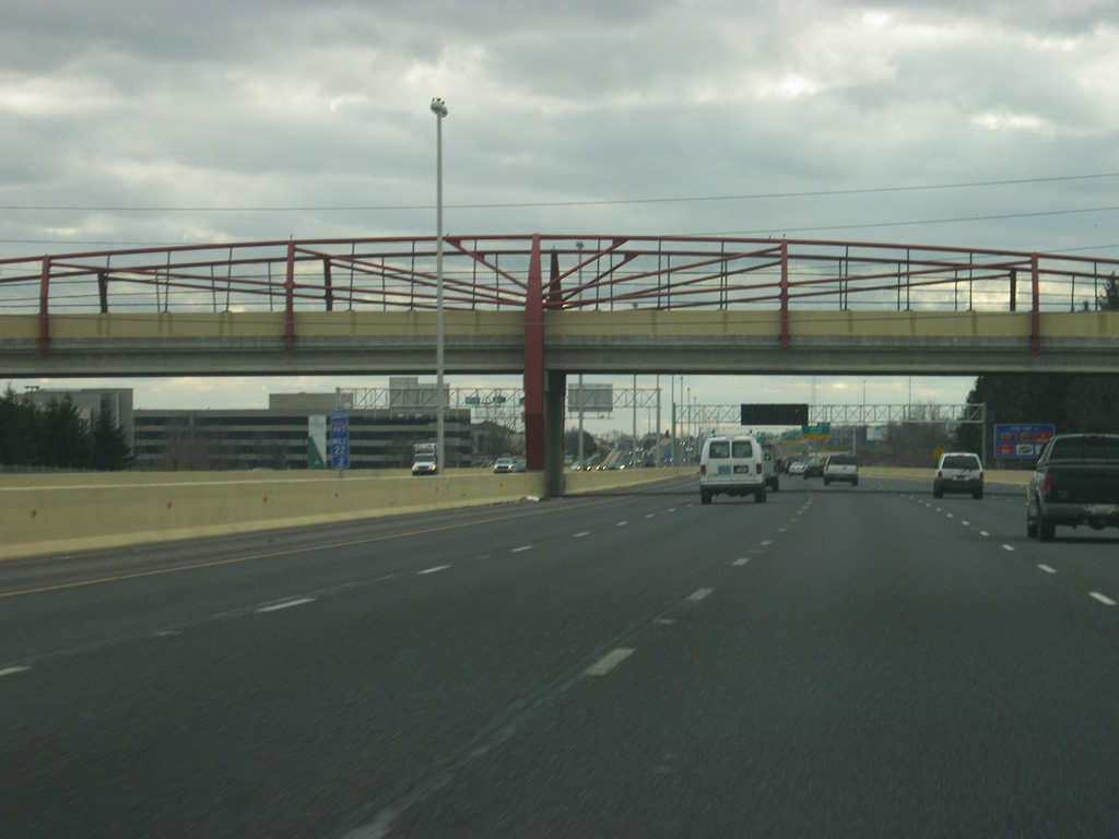
| 82nd Street passes over Interstate 465 one-quarter mile southeast of the Exit 35 diamond interchange at Allisonville Road. Allisonville Road continues north from Castleton to Indianapolis Metropolitan Airport and Fishers. 10/16/04 |
|
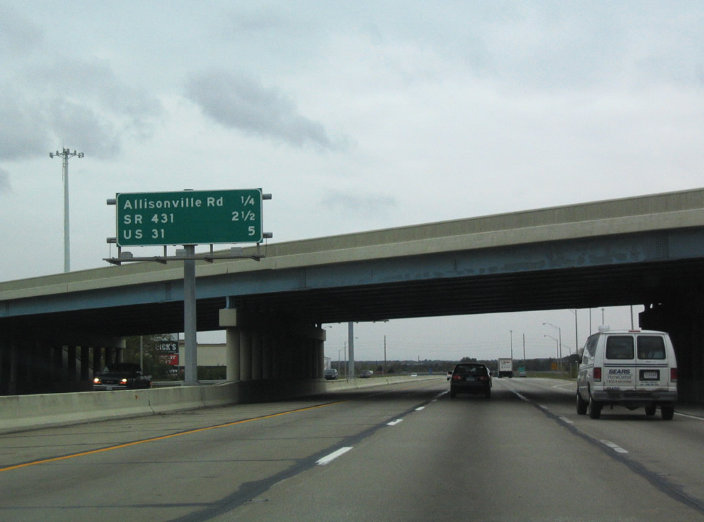
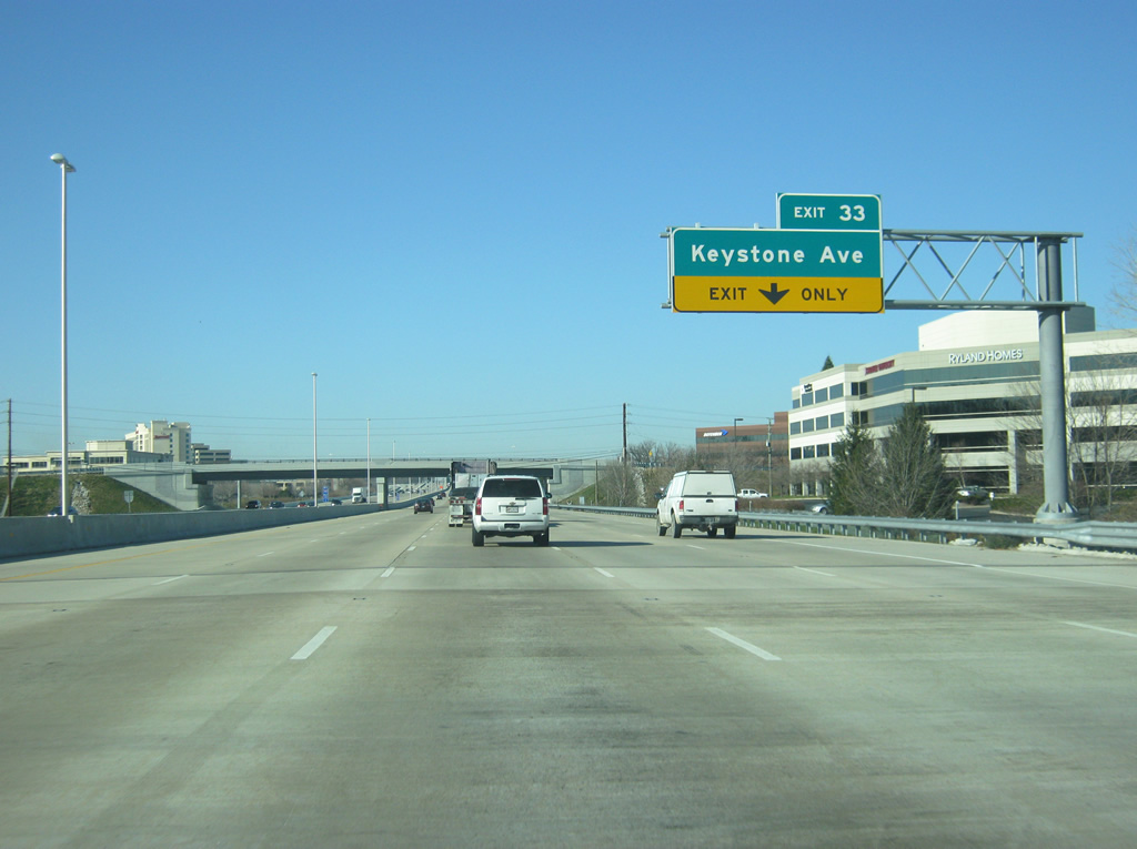
| West of Allisonville Road (Exit 35), Interstate 465 has been widened to five lanes. The newly expanded interstate crosses the White River on the one mile approach to Keystone Avenue (Exit 33). Keystone Avenue travels north to Carmel and represents a recently decommissioned stretch of SR 431. Now owned by the city of Carmel, the road was renamed Keystone Parkway and turned into a freeway-like highway with roundabout interchanges at 106th Street, 116th Street, Carmel Drive, 126th Street, Main Street and 131st Street.2 10/16/04, 12/11/11 |
|
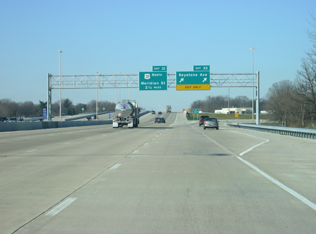
| Interchange sequence sign, since removed, that highlighted the distances to Keystone Avenue (Exit 33), the split with U.S. 31 north (Exit 31) and the split with U.S. 421 north (Exit 27). 10/16/04 |
|
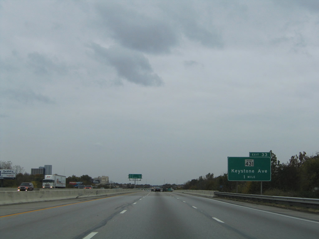
| Keystone Avenue (former SR 431) crosses paths with the Indianapolis beltway amid a pervasive area of business parks and retail, including The Fashion Mall at Keystone. Keystone Avenue carried SR 431 signage southward to Binford Boulevard (former SR 37). 10/16/04, 12/11/11 |
|
| Exit 33 departs Interstate 465 west for Keystone Avenue. Keystone Avenue carried SR 431 north 5.7 miles to a wye interchange with U.S. 31 until October 19, 2007.3 In 2011, the interchange was redesigned from a diamond to a partial diamond interchange with wider ramps to handle the traffic that goes through this area. The area around the interchange is known as Keystone at the Crossings and is home to the upscale Fashion Mall. 10/16/04, 12/11/11 |
|
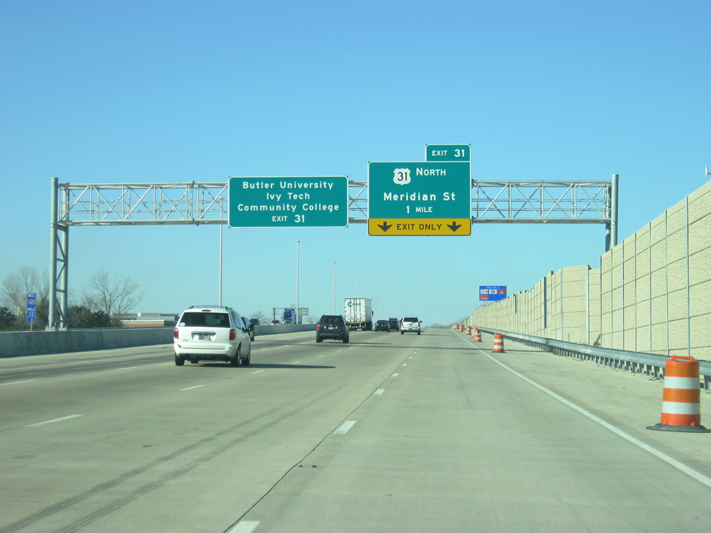
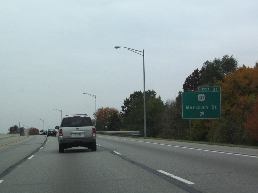
| West of Keystone Avenue (Exit 33), Interstate 465 briefly enters Hamilton County, as it nears the interchange with U.S. 31. U.S. 31 follows Meridian Street north from Interstate 465 (Exit 31) in southern Hamilton County. Butler University and Ivy Tech Community College can both be reached along Meridian Street several miles to the south. 10/16/04, 12/11/11 |
|
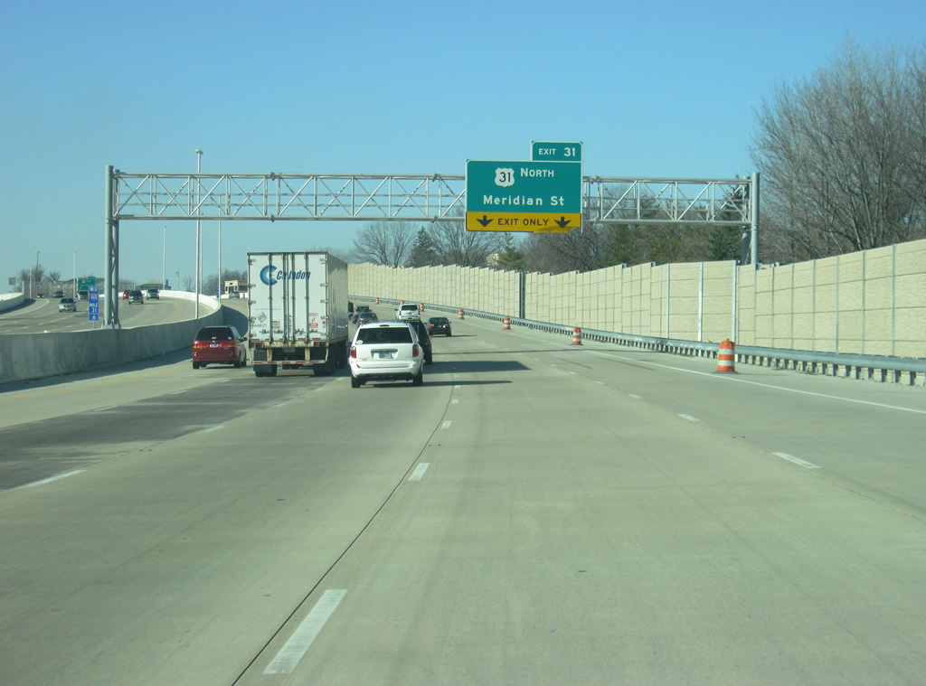
| One half mile east of the Exit 31 six-ramp parclo interchange with U.S. 31 (Meridian Street) north. Meridian Street represents historic U.S. 31 southward through Williams Creek, Meridian Hills, Meridian-Kessler, and downtown Indianapolis. 10/16/04, 12/11/11 |
|
| Interchange sequence sign (since removed) that was posted at the College Avenue under crossing of Interstate 465 west for U.S. 31 north (Exit 31), U.S. 421 north (Exit 27), and Interstate 865 (signed for I-465 south, from when I-865 was numbered I-465 west). 10/16/04 |
|
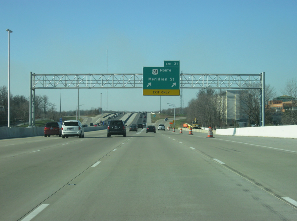
| U.S. 31 joins the Indianapolis beltway at Exit 2 near Edgewood. The US highway continues north along Meridian Street by Home Place to north Carmel. U.S. 31 represents a major corridor north from the capital city to Kokomo and South Bend. Because of this, three segments of the highway are being upgraded to freeways in the areas of Carmel and Westfield, Kokomo, and Plymouth to South Bend. With that, the current interchange with U.S. 31 is going to be changed to allow for free flowing traffic between the new U.S. 31 freeway and Interstate 465. 10/16/04, 12/11/11 |
|
| Interstate 465 kinks southwest back into Marion County from Exit 31 west to the West 96th Street overpass. 10/16/04 |
|
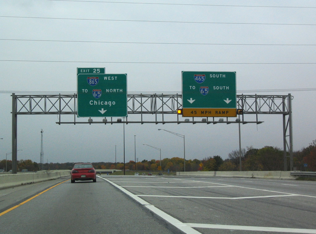
| U.S. 52, overlapped with Interstate 465 since Brooksville Road (Exit 47), receives a mention for its departure of the Indianapolis beltway via Interstate 865 west at Exit 25. Interstate 865 defaults onto Interstate 65 north without much fanfare. There are no Exit 0 signs posted... 10/16/04 |
|
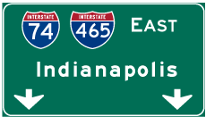
| U.S. 421 emerges at a diamond interchange (Exit 27) with Michigan Road north of the Augusta neighborhood of Indianapolis. The US route joins Interstate 74 at Greensburg (Exit 132) and continues with the beltway north at Exit 49. 10/16/04 |
|
| Continuing north, U.S. 421 follows Michigan Road to Eagle Village and Northfield. Traveling 232 miles in the state, U.S. 421 ends at Michigan City (U.S. 20) and enters Indiana at Madison from Kentucky. 10/16/04 |
|
| Exit 27 leaves Interstate 465 west with U.S. 421 north. Michigan Road continues south along the former route of U.S. 421 to Grandview, Wynnedale, and downtown as Dr. Martin Luther King Jr. Street. 10/16/04 |
|
| Westbound reassurance marker posted one mile ahead of the split with Interstate 865 west (Exit 25). 10/16/04 |
|
| Interstate 865 was designated in May 2002 over the "dogleg" portion of Interstate 465 linking the beltway with Interstate 65 near Royalton. The spur simply carries drivers onto Interstate 65 north to Lafayette, Gary, and Chicago. U.S. 52 follows the route to Interstate 65 north and Lebanon (Exit 141). 10/16/04 |
|
| Interstate 465 nips the southeast corner of Boone County ahead of the directional interchange with Interstate 865 west & U.S. 52 north (Exit 25). Interstate 465 turns south from this exchange to New Augusta and Speedway. 10/16/04 |
|
| Use Interstate 465 south to Interstate 65 south for downtown Indianapolis and Interstate 865 west to Interstate 65 north for Royalton. Interstate 865 bee lines west 4.7 miles without any interchanges. 10/16/04 |
|
| Interstate 465 is reduced to two lanes in each direction in the vicinity of Exit 25, the only place where it is only four lanes. Traffic turns toward the south as it heads south across the west side of Indianapolis. 12/17/11 |
|
| Exit 23 for 86th Street is one mile away as the mainline for Interstate 465 turns toward the south. 12/17/11 |
|
| Interstate 465 returns to six lanes as it picks up the entrance ramp from Interstate 865 eastbound. Exit 23 (86th Street) is now a half mile away. 12/17/11 |
|
| A distance sign in the median announces the distances to the next three exits, for 86th Street (1/4 mile), 71st Street (2 1/2 miles), and Interstate 65 South (four miles). In the Indianapolis area, these signs can only be found along Interstate 465 on the Northwest side and along Interstate 70 from the Indianapolis International Airport to Downtown Indianapolis. 12/17/11 |
|
| Interstate 465 reaches Exit 23 (86th Street), via a parclo interchange. 86th Street ventures west from Exit 20 to Trader's Point and Hendricks County and east through Park 100 and College Park. 86th Street is a four to six lane road that heads across the north side of Indianapolis from Traders Point through College Park, Nora, Keystone at the Crossings and Castleton, ending in the Geist neighborhood on the northeast side. 12/17/11 |
|
| The Beltway southbound briefly swells to six overall lanes between Exits 23 and 21. In the mid-2000s, the interstate was widened with both exits reconstructed with loop ramps for the westbound to southbound traffic. 12/17/11 |
|
| 79th Street bisects Park 100 east from this decorative overpass and the Trader's Point neighborhood of the city. 12/17/11 |
|
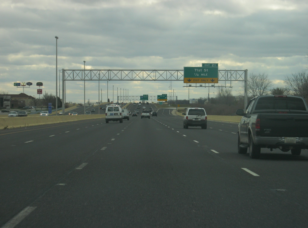
| Now 1/4 of a mile from Exit 21 (71st Street). From between 86th and 71st Streets on the east side of Interstate 465 is the sprawling Park 100 business park. The added commuters to the Park 100 area were the primary reason for the expansion of Interstate 465 on the northwest side. 12/17/11 |
|
| The rightmost two lanes of Interstate 465 exit off at Exit 21, a parclo interchange with 71st Street. The road connects with Eagle Creek Park and Interstate 65 one mile to the west and New Augusta and Michigan Road a couple of miles to the east. Exit 20 for Interstate 65 South is 1 3/4 miles away. Traffic wanting to take Interstate 65 north should exit onto 71st Street west. 12/17/11 |
|
| South of Exit 21 (71st Street), the interstate retains five lanes in each direction with the rightmost lane dropped prior to Exit 20 (Interstate 65 South). 12/17/11 |
|
| Interstate 465 is now one fourth of a mile from Interstate 65 southbound. The interstate is ten miles from Downtown Indianapolis and continues south toward Columbus and Louisville on its way to Nashville, Birmingham and Mobile, Alabama. 12/17/11 |
|
| The rightmost lane exits off of Interstate 465 as part of a loop ramp onto Interstate 65 southbound. The left three lanes continue south on Interstate 465. 12/17/11 |
|
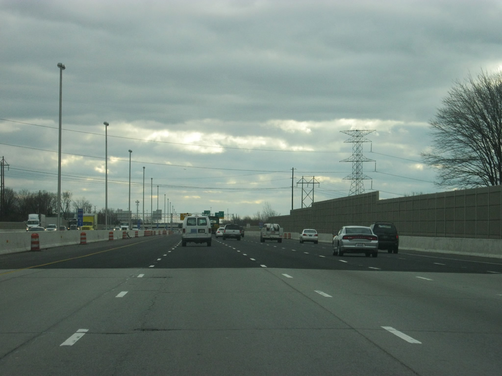
| Now south of 56th Street, which is a half diamond interchange serving Interstate 465 to the south. The entrance ramp from both Interstate 65 south and 56th Street swells Interstate 465 to five lanes southbound as it approaches the next interchange at 38th Street (Exit 17). Expansion and reconstruction of Interstate 465 from Interstate 65 south to Mann Road took place as a part of the Accelerate 465 project aimed to expand the beltway and redesign antiquated interchanges. Widening expanded portions of the road to eight and ten lanes along this stretch. 12/17/11 |
|
| Interstate 465 is now one mile away from the 38th Street interchange (Exit 17). Exit 16 for Interstate 74 west is two miles away. 12/06/12 |
|
| Now a half mile away from Exit 17. Work at Exit 17 (38th Street) added a loop ramp from 38th Street eastbound onto the Beltway northbound and reconfigured the remaining ramps to turn Exit 17 into a parclo interchange. Exit 17, along with upcoming Exit 16; provide the best routes for southbound traffic to the Indianapolis Motor Speedway on Race day. 12/06/12 |
|
| 38th Street ventures west to Eagle Creek Airport and Eagle Creek Reservoir and east to Exit 119 off Interstate 65. From there, the road continues eastward as a major arterial that at one time carried SR 37 and SR 67. The new interchange complex of Exit 16 looms ahead in one mile. 12/06/12 |
|
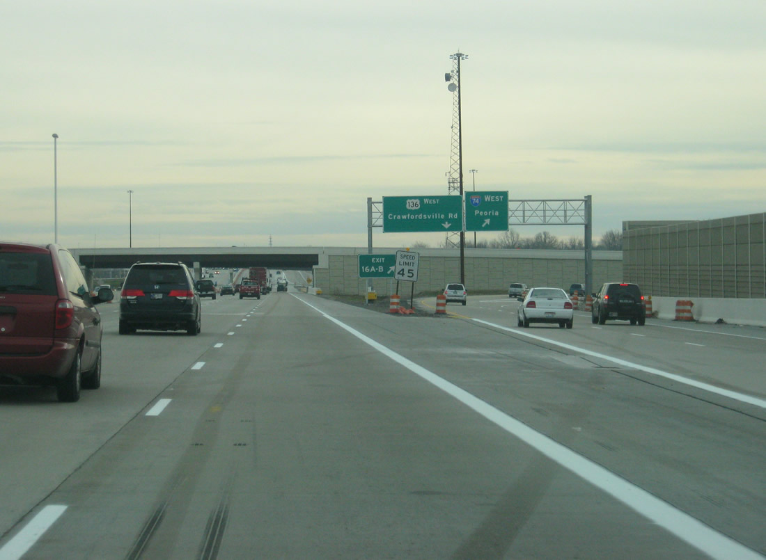
| South of 38th Street (Exit 17), Interstate 465 expands to six lanes as the right two prepare to turn off for Exit 16A with Interstate 74 west and Crawfordsville Road (U.S. 136 west). The original mainline of Interstate 74 stretches from the Quad Cities of Iowa and Illinois southeast to Indianapolis and Cincinnati. In Indianapolis, Interstate 74 will follow Interstate 465 around the west and south sides. 12/06/12 |
|
| An older sign directs traffic for Crawfordsville to use Interstate 74 via Exit 16B and Speedway and Clermont to use Crawfordsville Road/U.S. 136 via Exit 16A. The sign dates from the former cloverleaf interchange that was Exit 16, but the designations are still true. 12/06/12 |
|
| The original configuration of Interstates 74 and 465 saw a cloverleaf interchange with a freeway spur east to Crawfordsville Road (U.S. 136) and Speedway. Accelerate 465 road work removed the freeway stub and added a new direct connection to U.S. 136 west from the Beltway. Until the interchange was complete, U.S. 136, due to a quirk in the highway, was the last non-interstate highway to exist inside the Indianapolis beltway. New Exit 16 combines all movements into a new distributor roadway. 12/06/12 |
|
| A view of the ramp onto Interstate 74 west to Crawfordsville, Danville and Champaign-Urbana, Illinois. U.S. 136 parallels the freeway along the same course, joining Indianapolis with Clermont and Brownsburg in the western suburbs. Crawfordsville Road into Speedway provides the most patrolled route for Race day traffic to the Indianapolis Motor Speedway. 12/06/12 |
|
| Now traveling in the middle of the interchange complex at Interstate 465 and Interstate 74/U.S. 136 west/Crawfordsville Road, the flyover ramp from eastbound Interstate 74 to northbound Interstate 465 north can be seen. Through the interchange Interstate 465 carries eight lanes of traffic. 12/06/12 |
Page Updated 02-26-2013.

 West
West