

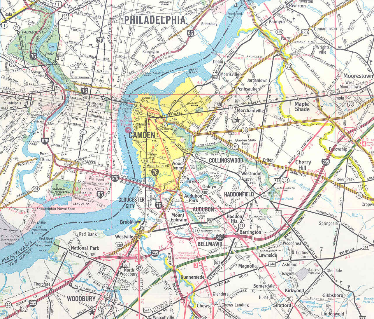
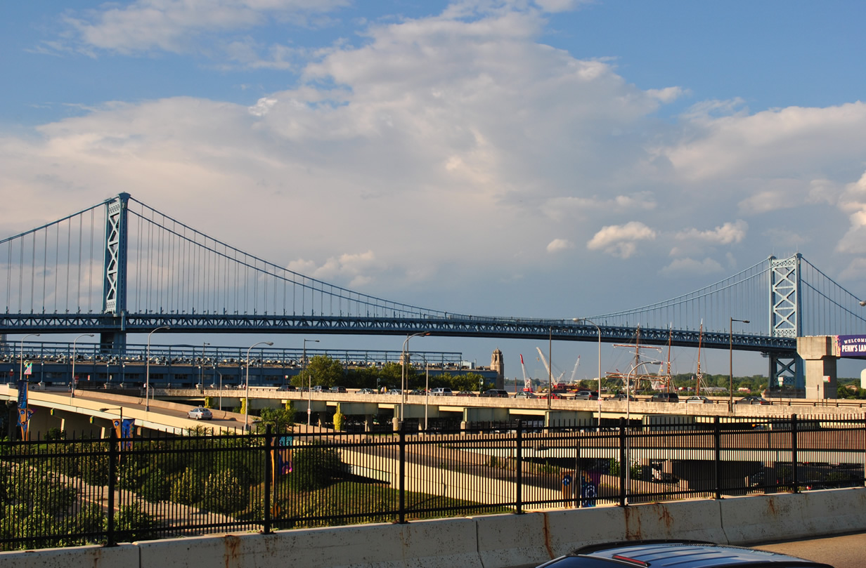
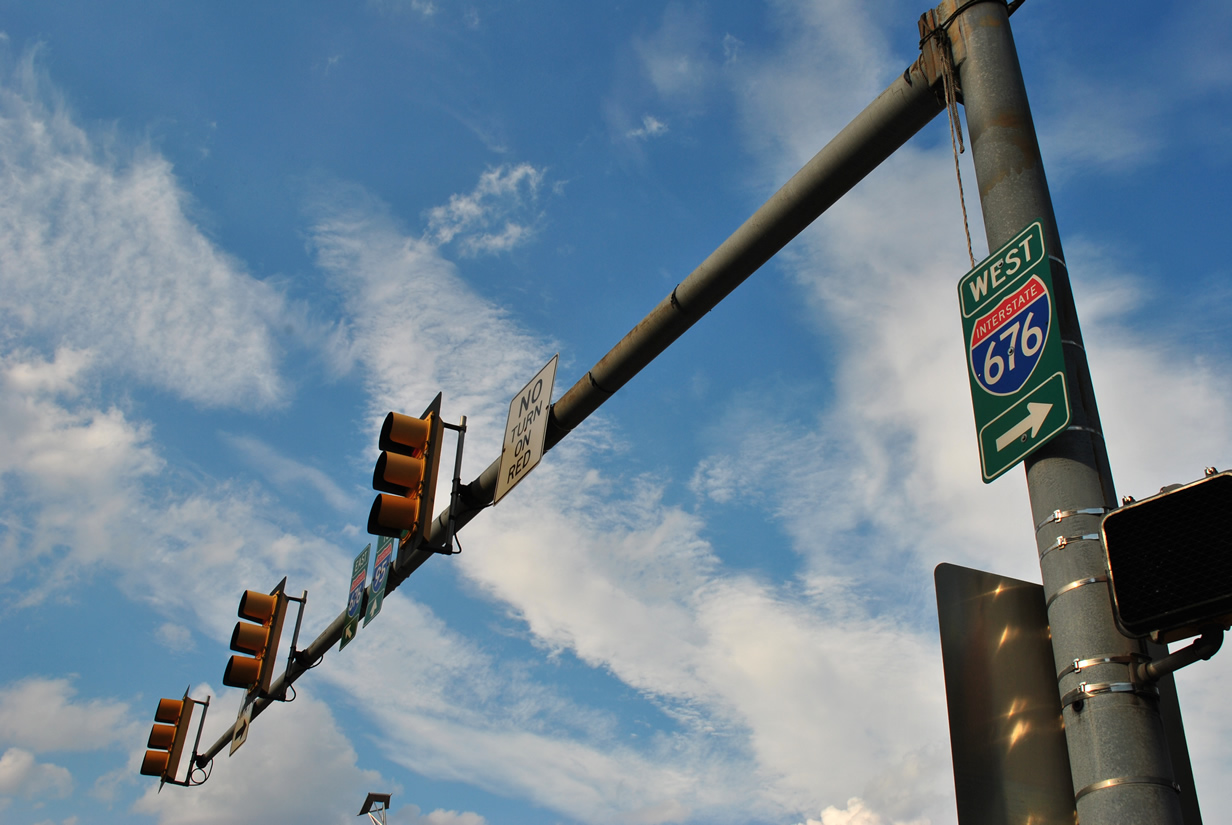
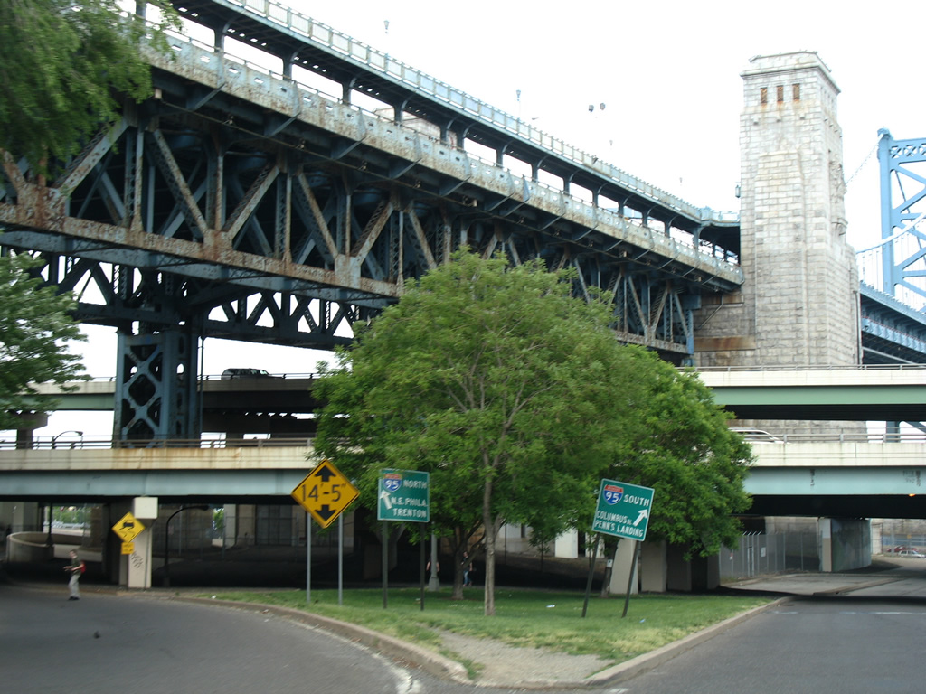
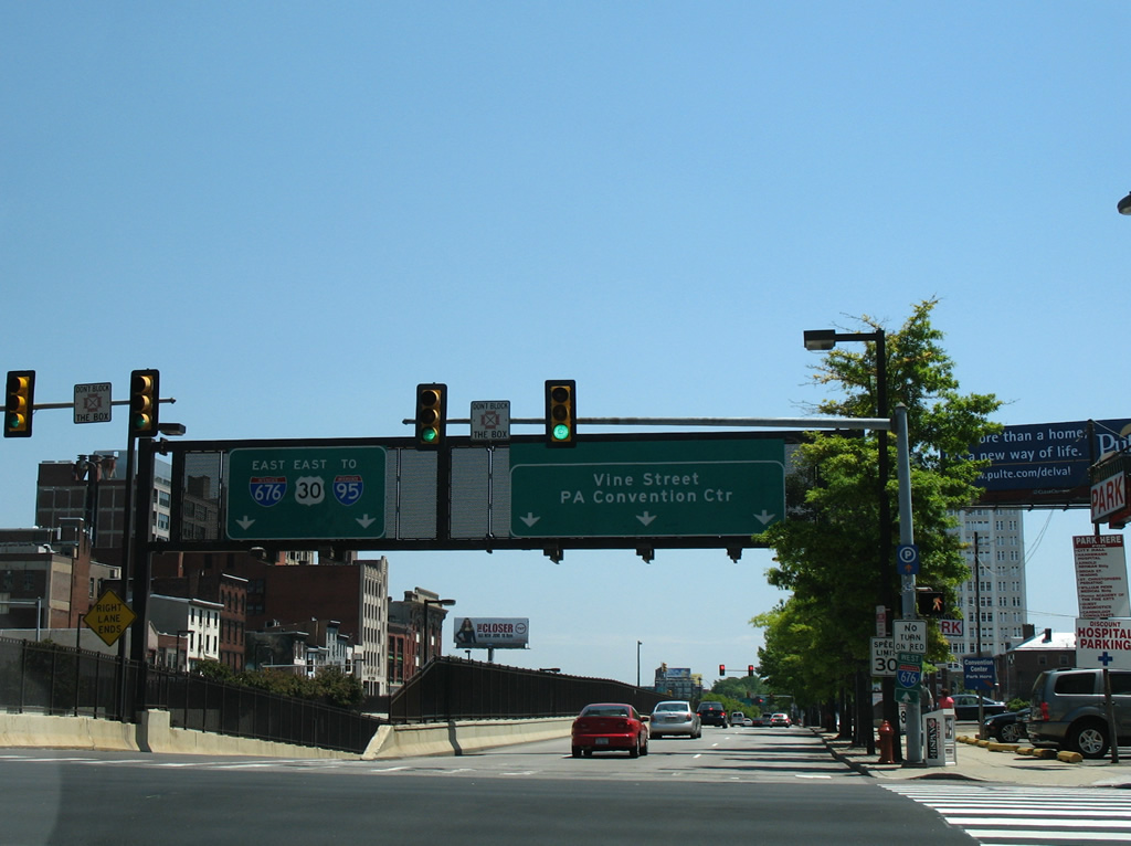
Interstate 676 is a 6.90 mile long urban loop of I-76 through Downtown Philadelphia, Pennsylvania and Camden, New Jersey. The freeway takes the Vine Street Expressway between I-76 (Schuylkill Expressway) and the Benjamin Franklin Bridge. An at-grade connection joins the bridge and freeway, including traffic lights along westbound at Franklin and 8th Streets and eastbound at 6th Street by Franklin Square in Philadelphia.
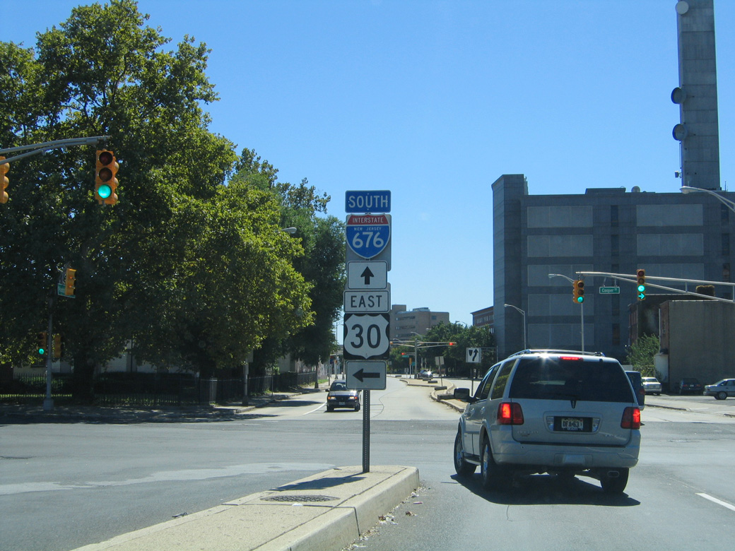
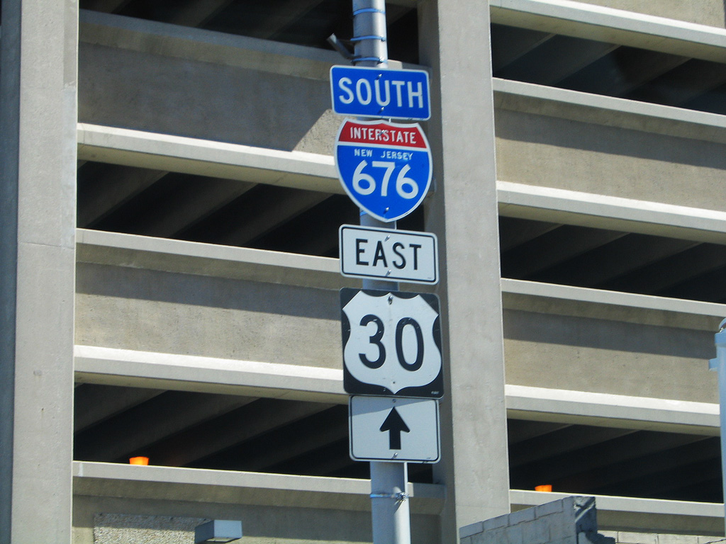
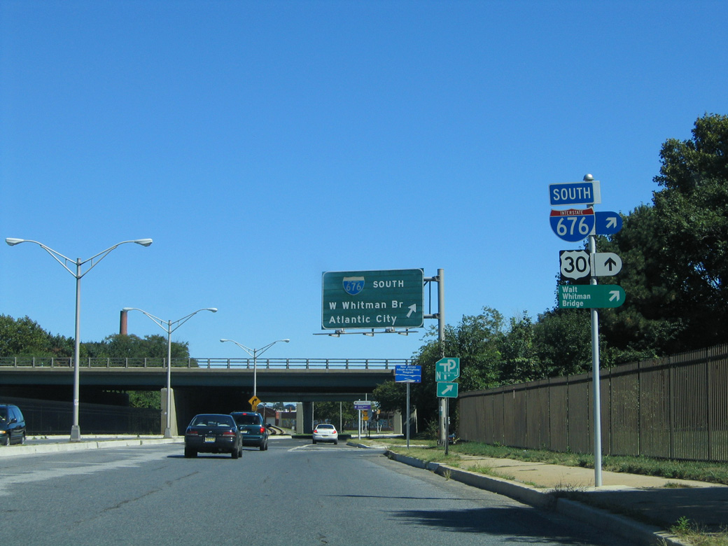
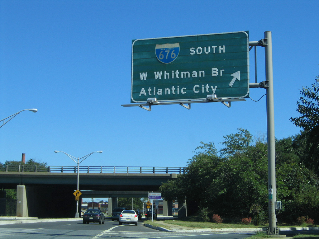
Interstate 676 overlaps with U.S. 30 from I-76 east to a wye interchange with Admiral Wilson Boulevard in Camden. A toll plaza east of the Ben Franklin Bridge collects fares for the westbound direction. I-676 turns south from there, remaining within the city of Camden to the east end of the Walt Whitman Bridge. Interstate 676 travels 4.75 miles in the Garden State.
Interstate 676 Guides
The first section of I-676 in Pennsylvania opened between the Schuylkill Expressway and 18th Street on June 30, 1959. Completion of the Vine Street Expressway would remain decades away, with the portion east to the Ben Franklin Bridge approach at Franklin Square opened on January 10, 1991, and the ramps to I-95 by July 1991.1 Tolls for the Ben Franklin Bridge eastbound were removed in 1992.
Originally designated Interstate 80S, and later as the I-76 mainline, the first portion of I-676 completed was the section leading north from the Walt Whitman Bridge approach to Morgan Boulevard (Exit 3) in 1957. The urban freeway opened from the Ben Franklin Bridge (U.S. 30) to Exit 5 (County Route 531) in 1972 and was completed in New Jersey, between Exit 3 and Exit 5, in 1980.1

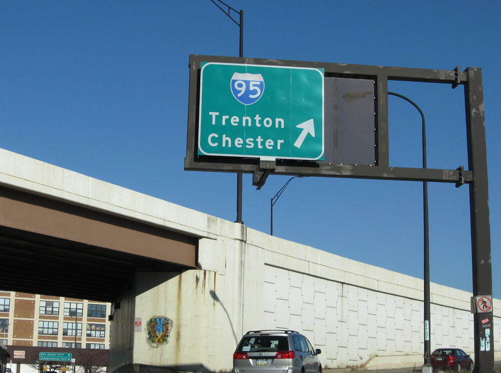
A two-wye interchange joins the Vine Street Expressway east end with Interstate 95 (Delaware Expressway) just north of the Ben Franklin Bridge. There is no direct access to I-676 east to New Jersey from Interstate 95.
Until 1973, the routes of I-76 and I-676 were opposite of what they are today. This 1969 Gousha map of New Jersey shows the configuration in place between 1964 and 1973.
The I-676 loop through Central Philadelphia and Camden, New Jersey was designated as Interstate 80S in 1958 while the the Schuylkill Expressway through South Philadelphia and the Walt Whitman Bridge were a part of Interstate 680. I-80S and I-680 were renumbered as I-76 and I-676 respectively in 1964. Interstate 676 was the main route of I-76 until 1973, when the designations were swapped.1
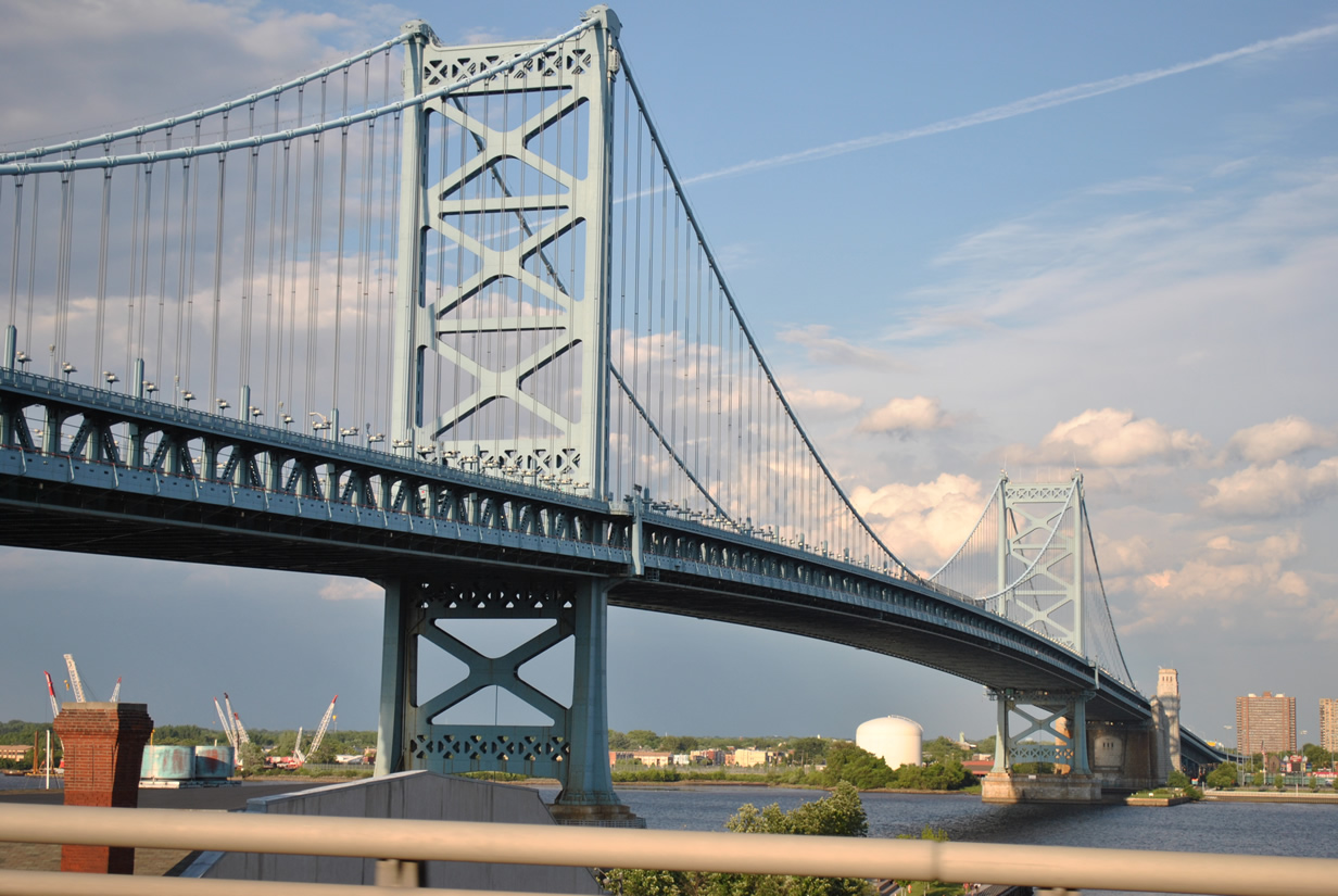
Benjamin Franklin Bridge
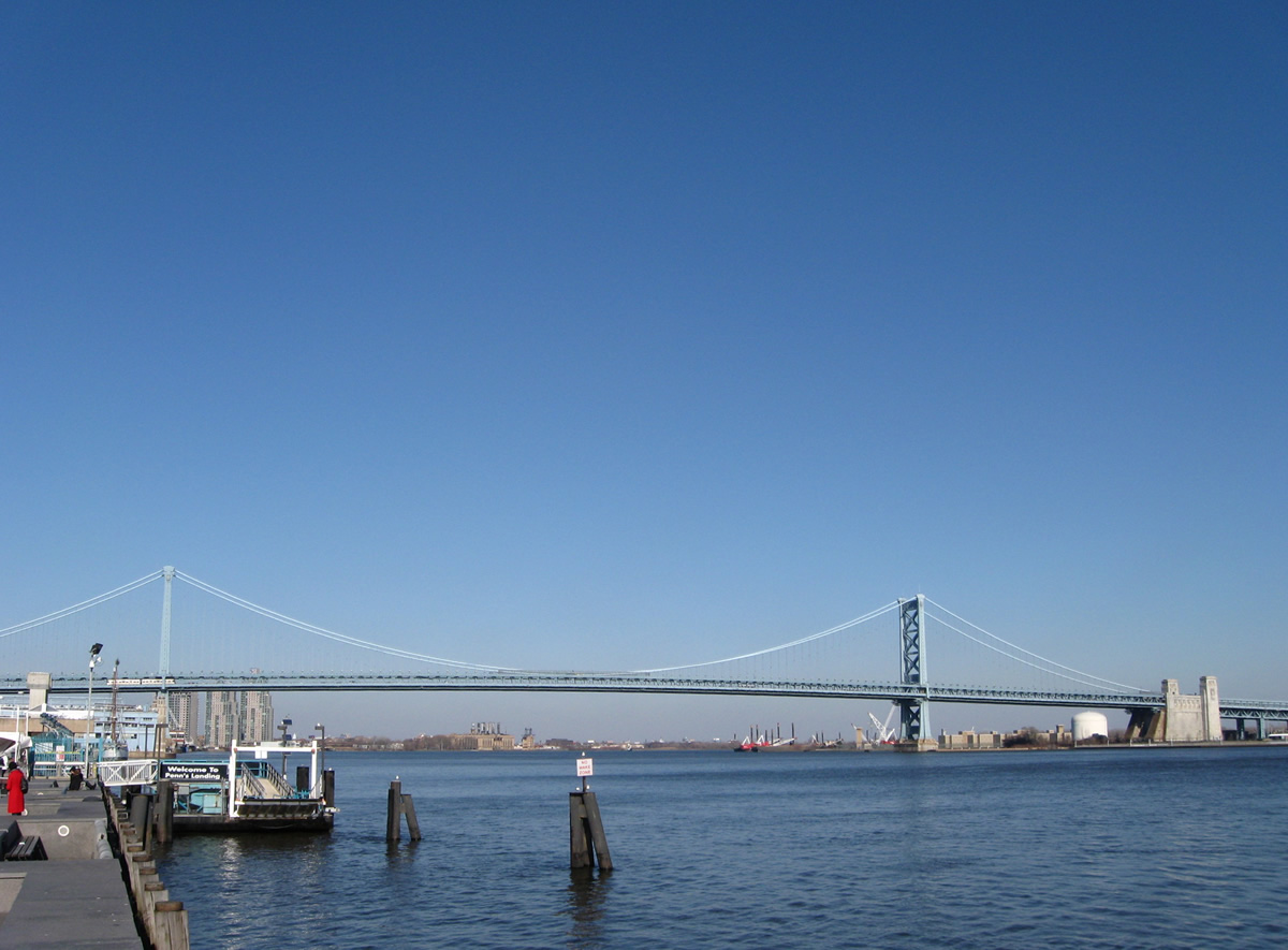
Originally known as the Delaware River Bridge, the Benjamin Franklin Bridge opened to traffic at midnight July 1, 1926. Four days later on July 5, President Calvin Coolidge officially dedicated the world's longest suspension bridge, a distinction the span would hold for three years until the opening of the Ambassador Bridge between Detroit, Michigan and Windsor, Ontario.2
Origins of the bridge date back to the 1800s when a narrow mile-long island on the Delaware River was removed to allow for uninterrupted ferry crossings and an eventual bridge between the cities of Camden and Philadelphia. In 1919, the Delaware River Bridge Joint Commission was created by the respective state legislatures to share the costs of the future crossing. It was thought that the suspension bridge would cost $29 million to build. However actual construction totaled $37,103,765.42.2
Concessions were made to the area neighborhoods that were in the path of the new span. The St. Georges Church on Fourth Street was one of the structures spared demolition. Angry protesters demanded the 1769-built church be spared and eventually persuaded the Bridge Commission to move the bridge slightly southward by 14 feet. By September 29, 1921 all land was approved by the Army Corps of Engineers and the Secretary of War for bridge construction. Work commenced on January 6, 1922.2
The suspension bridge is supported by two concrete piers resting in bedrock on each side of the Delaware River. The uppermost third of the supports are built with granite blocks. On the Philadelphia side of the river the pier extends 80 feet from the bedrock below. The Camden side support is 113 feet in height due to the deeper nature of the river there. Flexible silicon steel comprises the material used for each of the 350 foot towers of the Ben Franklin Bridge. 3550 foot long cables stretch across the river to support the bridge deck itself. Six toll houses including ten booths were constructed on the east side of the span. From start to finish, including the toll barrier, the bridge is 9,620 feet in length.2
On January 17, 1956 the bridge was rededicated the Benjamin Franklin Bridge.2 A lighting system along the bridge highlights not only the bridge deck but the towers, cables, and pier supports. The lights are changeable and sometimes feature a red-white-blue motif based upon time of year. Additionally the suspension bridge carries two bicycle/pedestrian walkways and two PATCO light rail lines. The 128 foot wide bridge deck carries seven overall lanes with a movable barrier between the directions of travel.
| Callowhill Street - West |
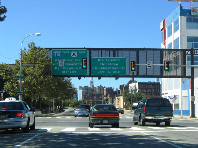 | Callowhill Street flows west from 2nd Street, carrying traffic from Interstate 95 (Exit 22) to the Ben Franklin Bridge east (via 6th Street south), Independence Mall and Chinatown (via 8th Street south) and the Pennsylvania Convention Center (via Vine Street west from 8th Street). 09/19/04 |
| 6th Street - South |
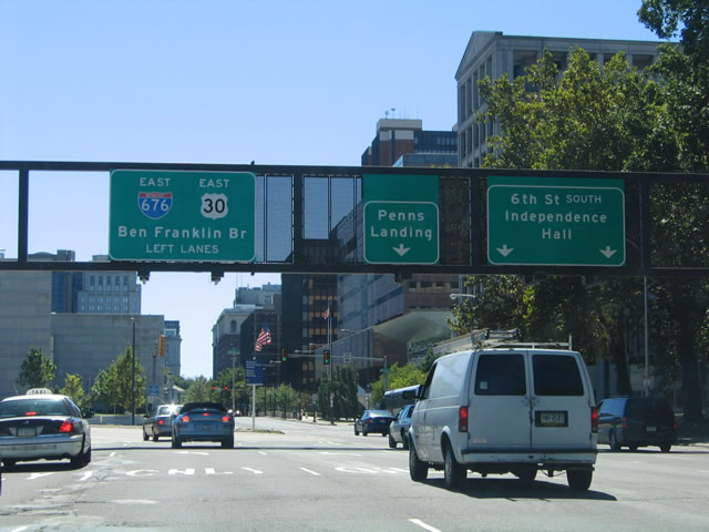 | 6th Street flows south from the Vine Street Expressway and Callowhill Street to Franklin Square, where I-676/U.S. 30 east tie in ahead of the Ben Franklin Bridge to New Jersey. 09/19/04 |
| 8th Street - South |
 | 8th Street flows south from Vine Street and Interstate 676/U.S. 30 to next intersect Race Street. Race Street provides a direct route to Independence Mall and the Ben Franklin Bridge, two blocks to the east, while 8th Street continues southward into Chinatown. 06/03/12 |
| Race Street - East |
 | Race Street east at 8th Street south. Interstate 95 trailblazers direct motorists onto Franklin Street north in a half block. 06/03/12 |
 | Race Street east at Franklin Street north. Franklin Street combines with 7th Street at Franklin Square before intersecting Vine Street at the eastbound ramp to Interstate 95 (Delaware Expressway). 06/03/12 |
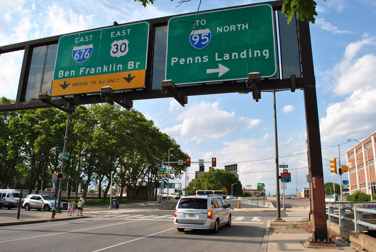
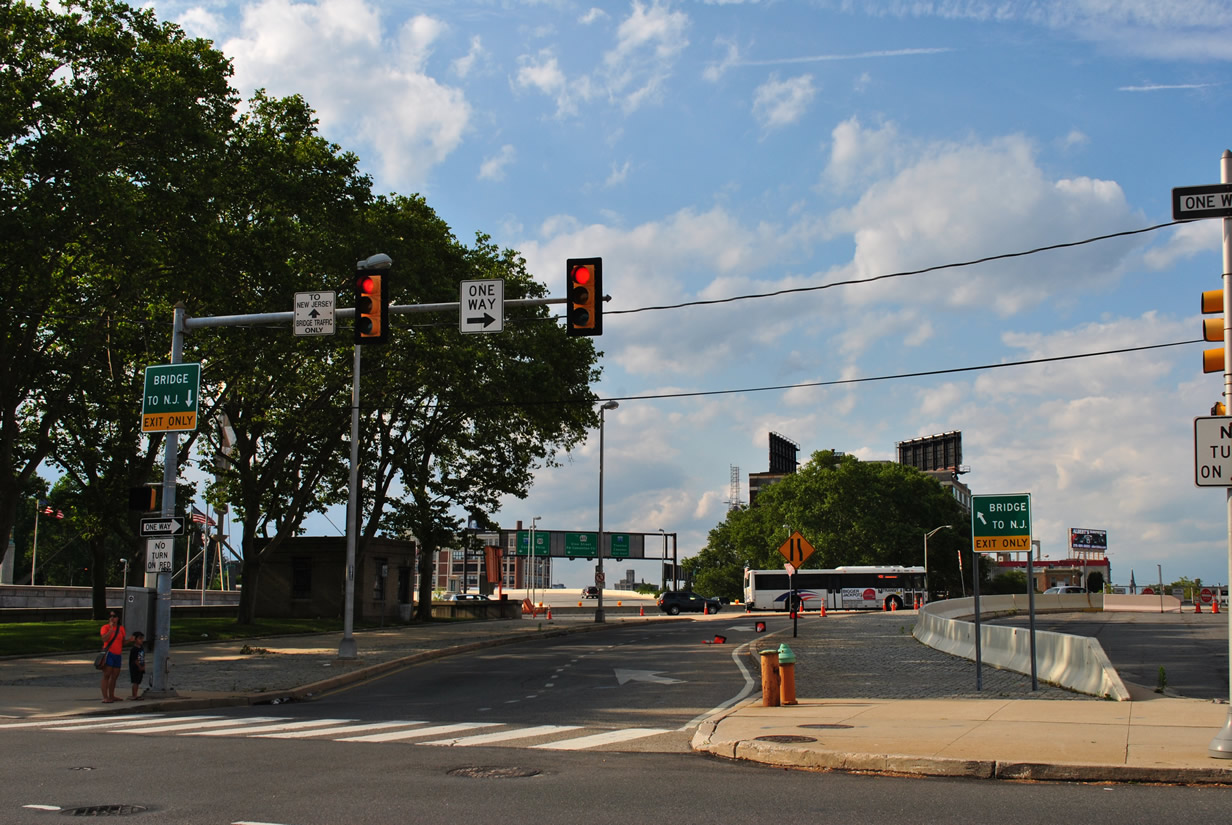
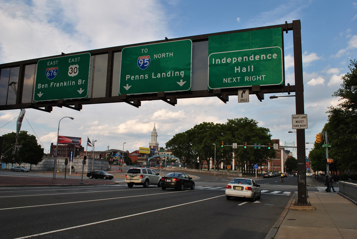  | Passing by Franklin Square, Race Street proceeds one block east to Sixth Street and the ramp for the Ben Franklin Bridge. Sixth Street flows south to Independence Mall while Race Street east continues to Penns Landing and a northbound on-ramp to Interstate 95. 06/03/12 |
 | The ramp to Interstate 676/U.S. 30 east to Camden combines with traffic from 6th Street south by a monument at Franklin Square. 06/03/12 |
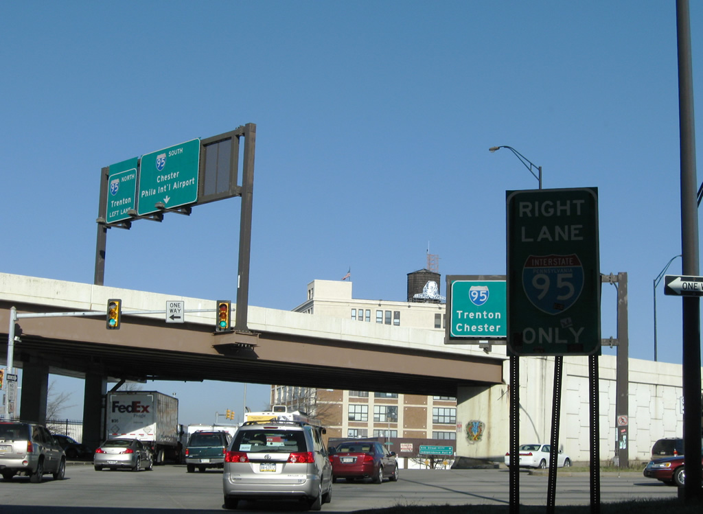
 | Race Street continues another four blocks east by Old Town to split with the northbound on-ramp to Interstate 95 for Northeast Philadelphia. 05/20/07 |
 | Race Street partitions with the direct ramp to I-95 north. Motorists headed to I-95 south are directed east to Columbus Boulevard south and the on-ramp from Penns Landing. 05/20/07 |
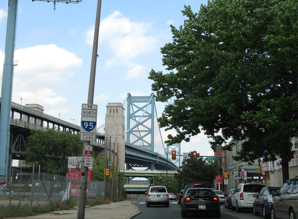
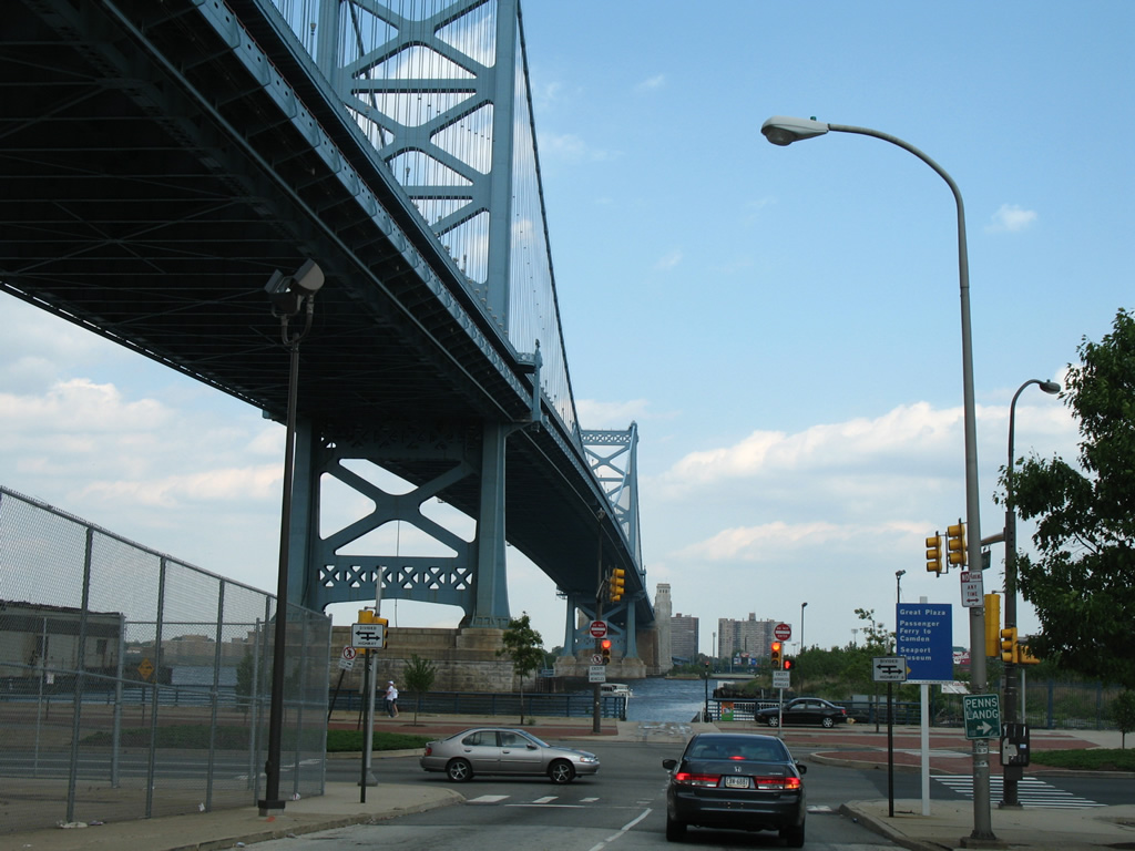 | Race Street intersects Columbus Boulevard at the foot of the Ben Franklin Bridge. The four to six lane boulevard straddles the Delaware River through Penns Landing. Penns Landing is a hearth of cultural and entertainment for locals and visitors alike. 05/20/07 |
| 5th Street - North |
 | 5th Street lines the east side of Independence Mall from Chestnut Street north to Race Street and the Ben Franklin Bridge approach. Traffic bound for I-676 west is directed onto Arch Street west to 7th Street. 06/03/12 |
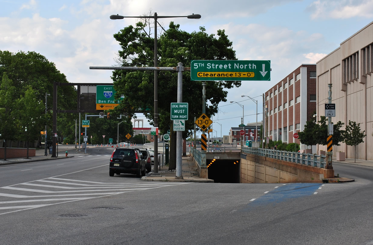 | Fifth Street northbound splits between a tunnel to Callowhill Street and a ramp at Race Street for the Ben Franklin Bridge. 06/03/12 |
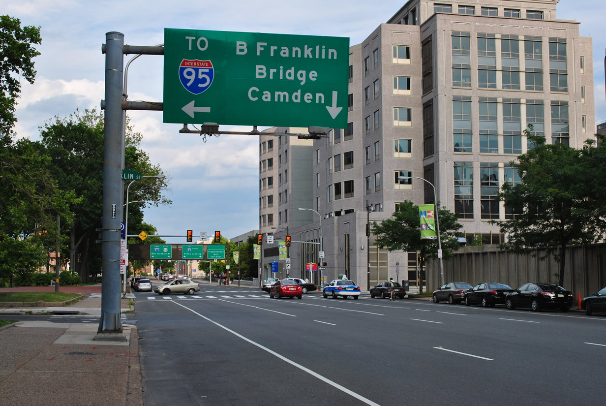
  | Taking Fifth Street north to Race Street, a two lane ramp joins Interstate 676/U.S. 30 east to Camden, New Jersey while Race Street flows east to both a northbound ramp for I-95 (Delaware Expressway) and Christopher Columbus Boulevard at Penns Landing. 06/03/12 |
| 15th Street - South |
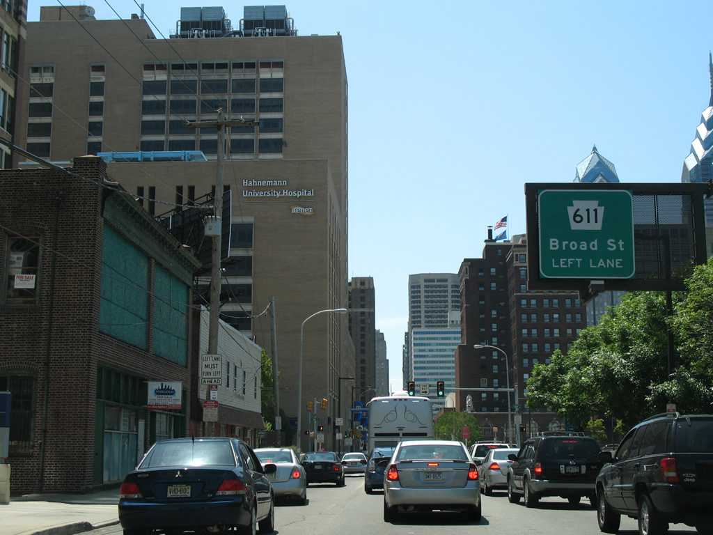 | A loop ramp joins 15th Street south at Wood Street, carrying drivers from I-676/U.S. 30 west toward PA 611. PA 611 travels one block to the east along Broad Street. 05/20/07 |
 | A second loop ramp provides access to Interstate 676/U.S. 30 west from Vine Street west between 15th and 16th Streets. Vine Street east connects the off-ramp with PA 611 (Broad Street) south to City Hall. 05/20/07 |
| Vine Street - East |
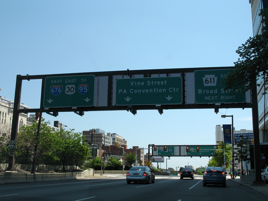 | Vine Street flows east with five lanes above I-676/U.S. 30 through Central Philadelphia. The frontage street provides provides part of the movement between the freeway off-ramps and PA 611, a north-south route along Broad Street throughout the city. 05/20/07 |
 | PA 611 (Broad Street) travels four blocks south to Philadelphia City Hall. Vine Street continues east to 13th and 12th Streets, north of the Pennsylvania Convention Center while an on-ramp joins I-676 east ahead of the Ben Franklin Bridge. 05/20/07 |
 | Vine Street partitions with two lanes to Franklin Street north to both the Vine Street Expressway east to Interstate 95 and Callowhill Street and 8th Street south to Race Street east and its ramp for the Ben Franklin Bridge east. 12/28/08 |
| Franklin Street - North |
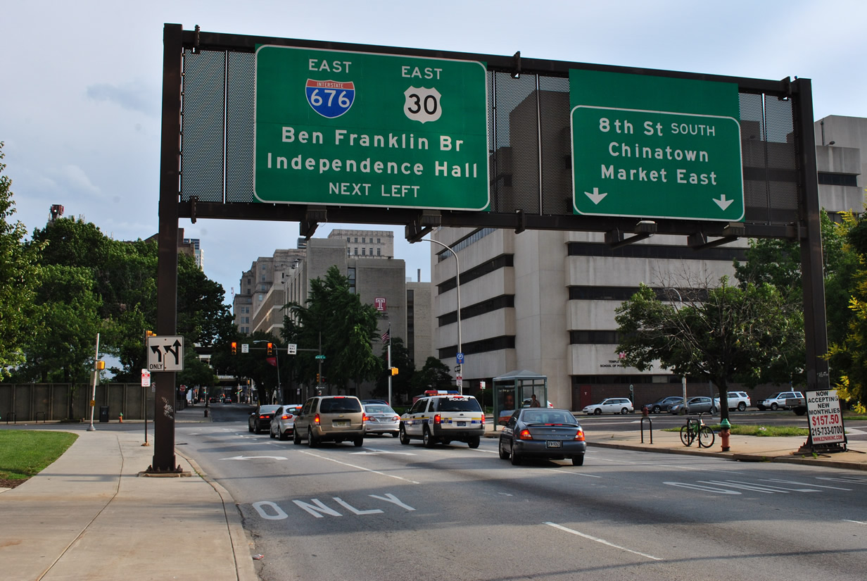
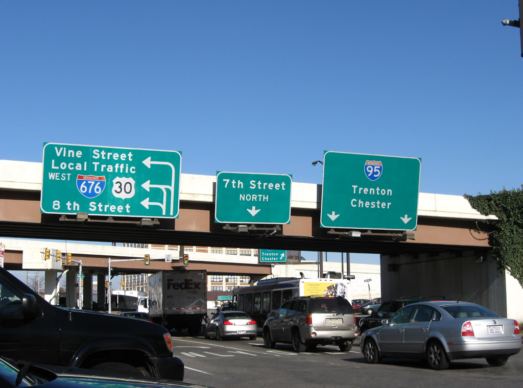 | 7th Street combines with Frankin Street by Franklin Square ahead of Vine Street. I-676/U.S. 30 west travel at-grade between Franklin and 8th Streets before merging onto the Vine Street Expressway west. A two lane ramp rises onto the Vine Street Expressway to the right for Interstate 95 as well. 12/28/08 |
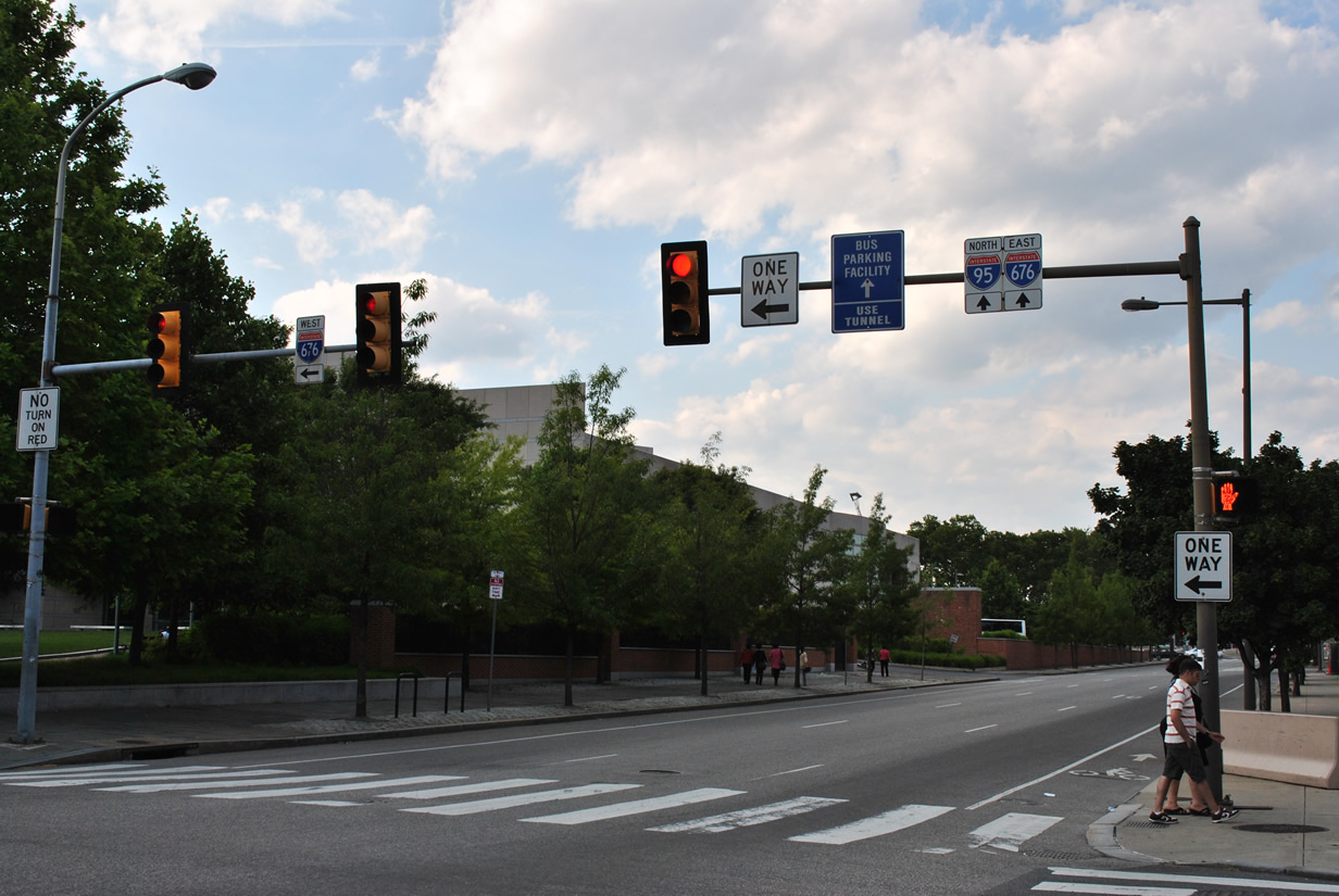
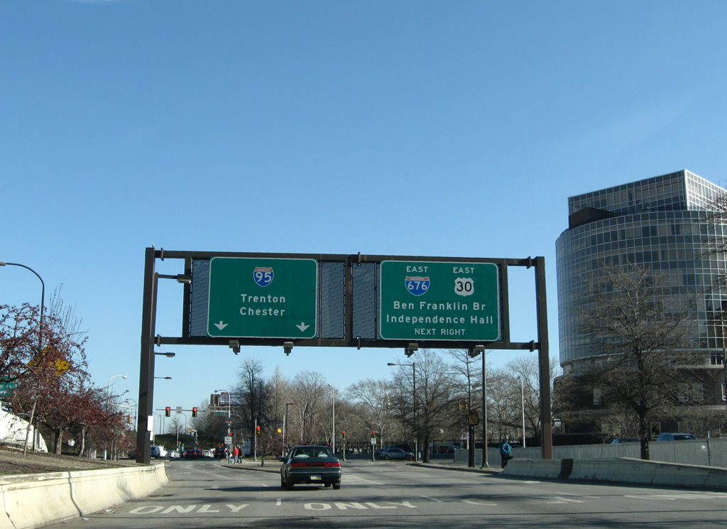
 | The Vine Street Expressway eastbound splits with I-676/U.S. 30 east for a high-speed connection to Interstate 95. 12/28/08 |
 | Ramps from Franklin Street north and I-676/U.S. 30 west merge onto the Vine Street Expressway east ahead of a directional T interchange with the Delaware Expressway (I-95). 12/28/08 |
 scenes - Camden, NJ scenes - Camden, NJ |
 | Linden Street west at N 10th Street near the merge of Interstate 676 and U.S. 30 by the Pyne Point neighborhood of Camden. An off-ramp links U.S. 30 (Admiral Wilson Boulevard) west with Linden Street ahead. 09/19/04 |
 | Linden Street defaults into the Ben Franklin Bridge toll plaza beyond the intersection with 7th Street while 7th Street south carries Exit 5C traffic from I-676 west into Downtown Camden. 09/19/04 |
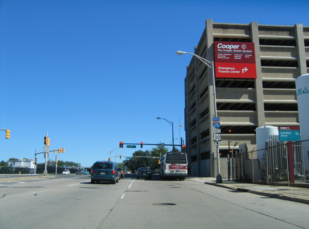
 | Seventh Street passes over I-676/U.S. 30 to Cooper Street, which forms an entrance ramp for Admiral Wilson Boulevard east. Interests to I-676 are directed southward to Martin Luther King Boulevard east. 09/19/04 |
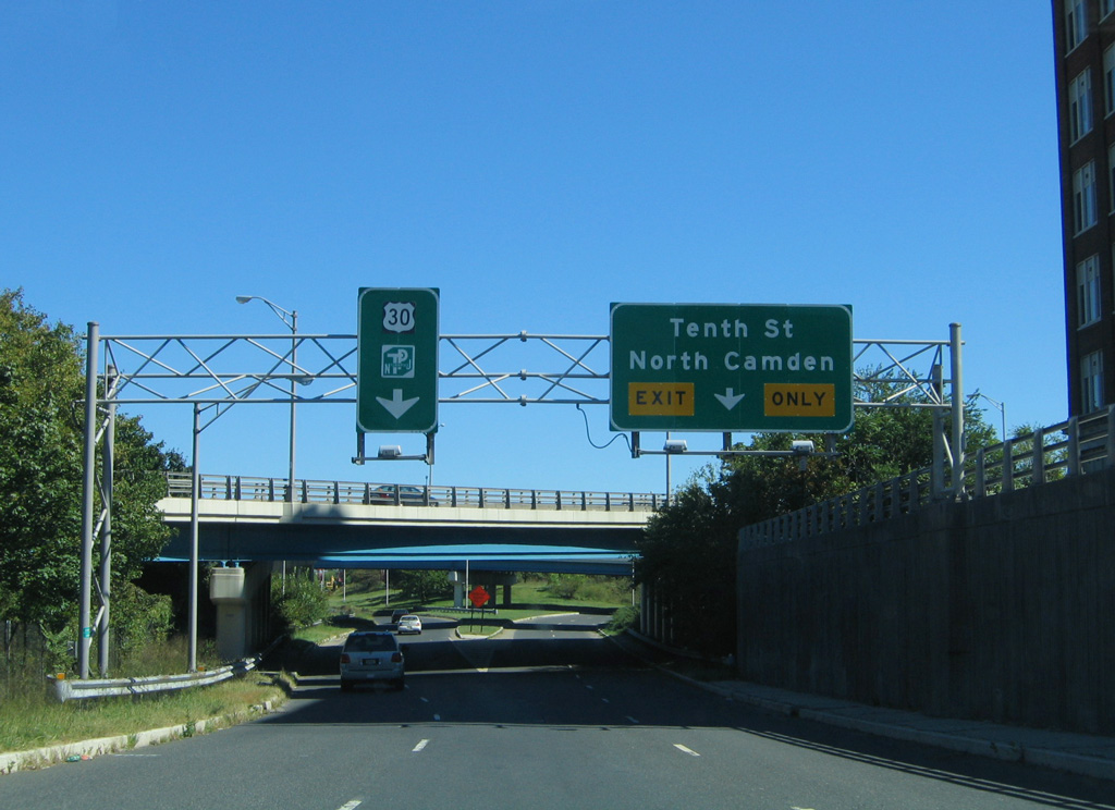 | Cooper Street east of 7th Street partitions into ramps for 10th Street to North Camden and U.S. 30 (Admiral Wilson Boulevard) east to Pennsauken. 09/19/04 |
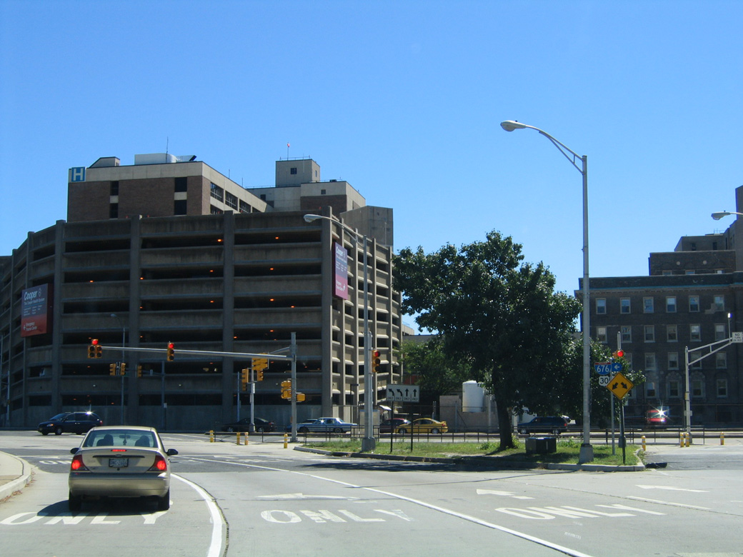  | 7th Street curves southeast to become CR 561 and Haddon Avenue at the intersection with Martin Luther King Boulevard (formerly Mickle Boulevard). MLK Boulevard links Cooper University Hospital with I-676 south nearby. 09/19/04 |
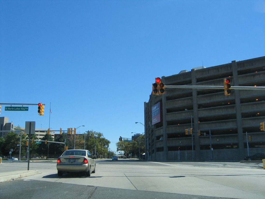
  | Martin Luther King Boulevard east at Haddon Avenue (CR 561) south and 7th Street north. This scene is drastically different now with expansion of Cooper University Hospital. 09/19/04 |
  | Martin Luther King Boulevard proceeds east from CR 561 to the southbound on-ramp for Interstate 676. This button copy sign was replaced by 2008. 09/19/04 |
- Vine Street Expressway (I-676 and US 30), NYCRoads.com.
- Ben Franklin Bridge.
http://www.whyy.org/tv12/ secrets/bfb.htmlWHYY-TV Philadelphia.
Photo Credits:
- 09/19/04 by AARoads and Carter Buchanan.
- 05/20/07 by AARoads.
- 12/28/08 by AARoads.
- 06/03/12 by AARoads.
Connect with:
Interstate 76
Interstate 95
U.S. 30
Route 611
Page Updated 01-08-2020.