|
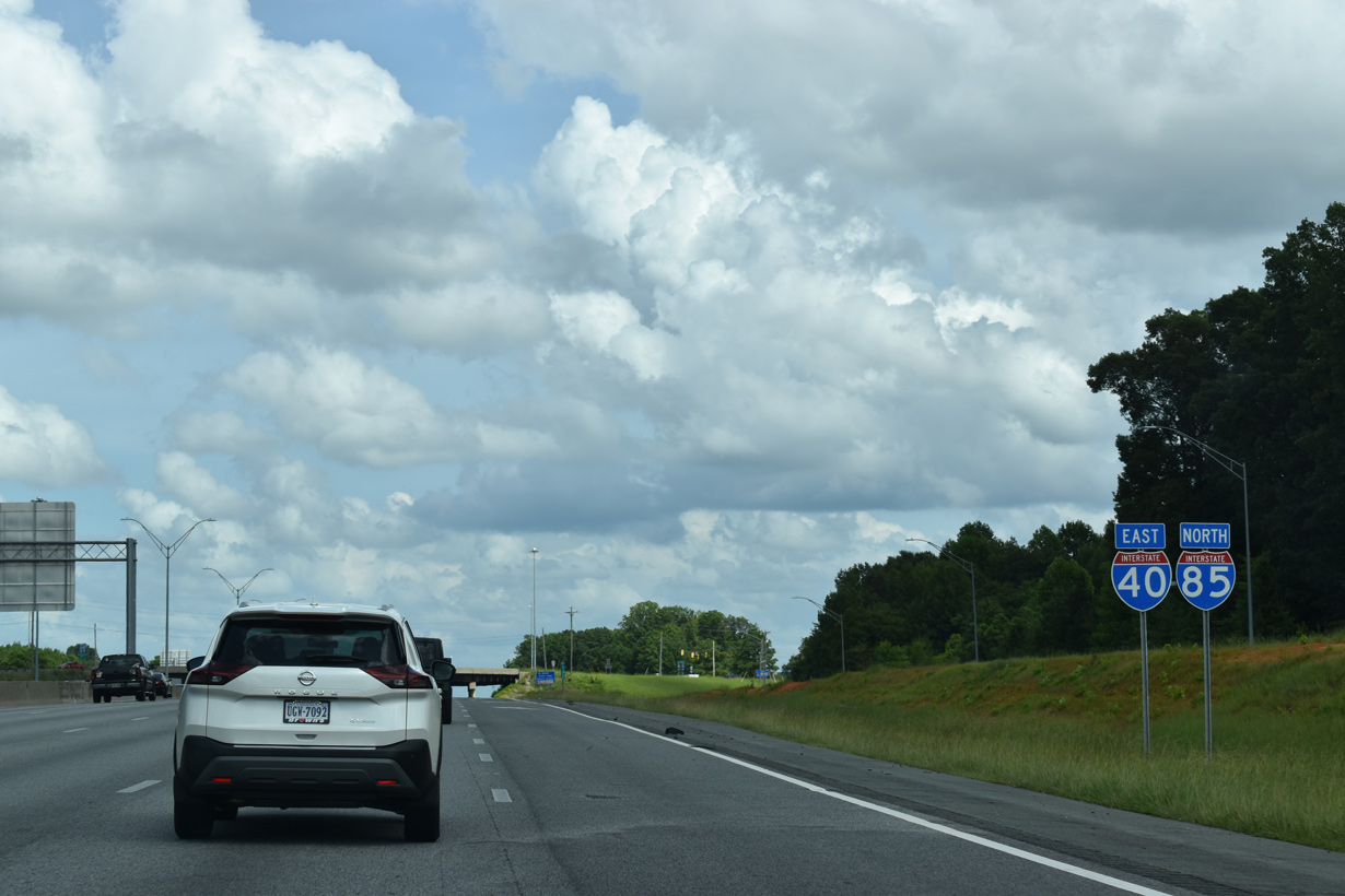
| Three lanes from both I-40 east and I-85 north combine just ahead of the parclo interchange (Exit 132) with Mt. Hope Church Road. 08/16/21 |
|
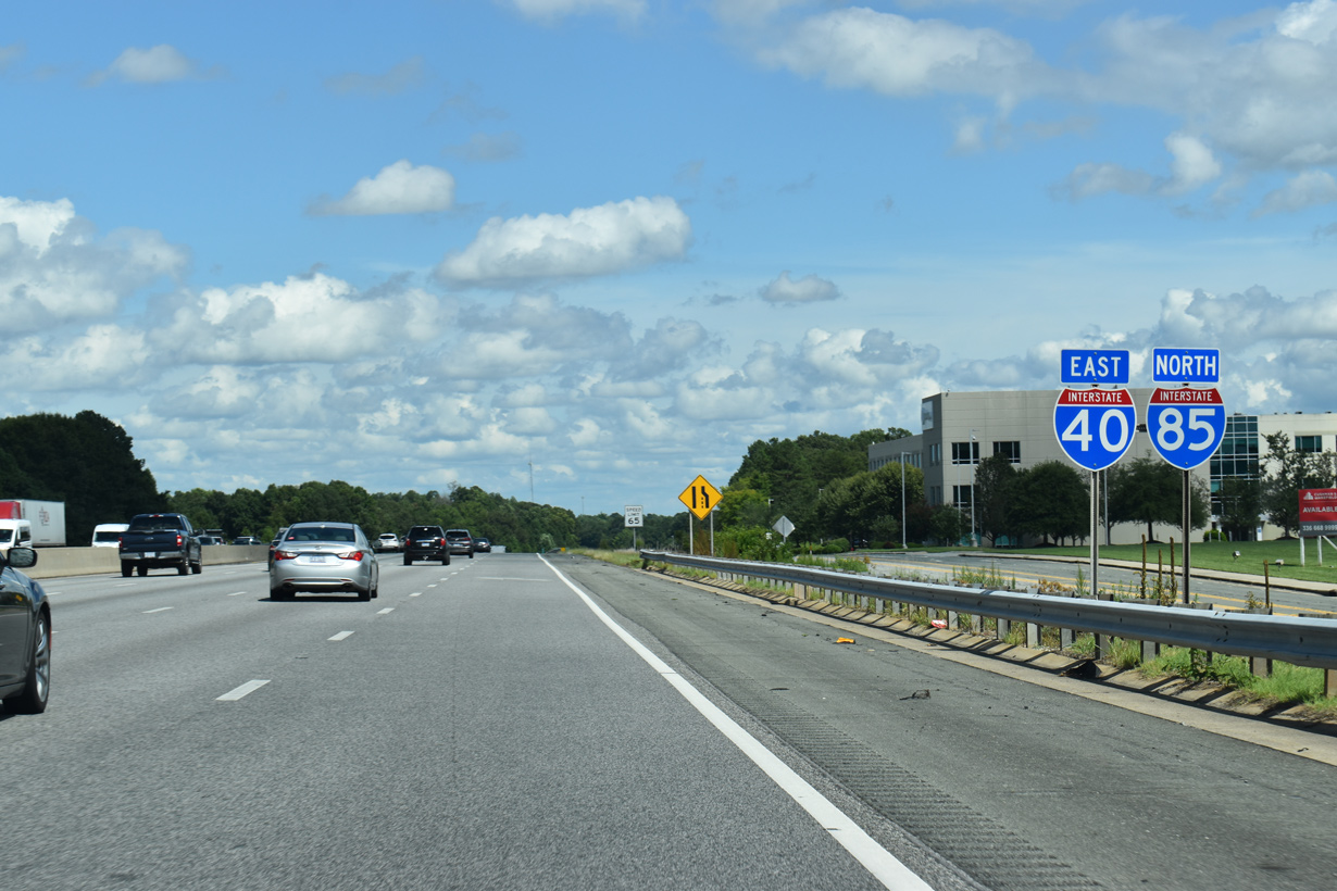
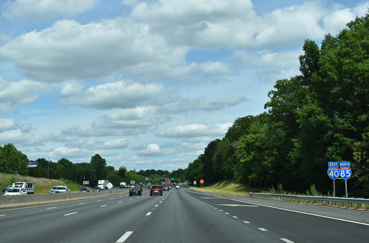
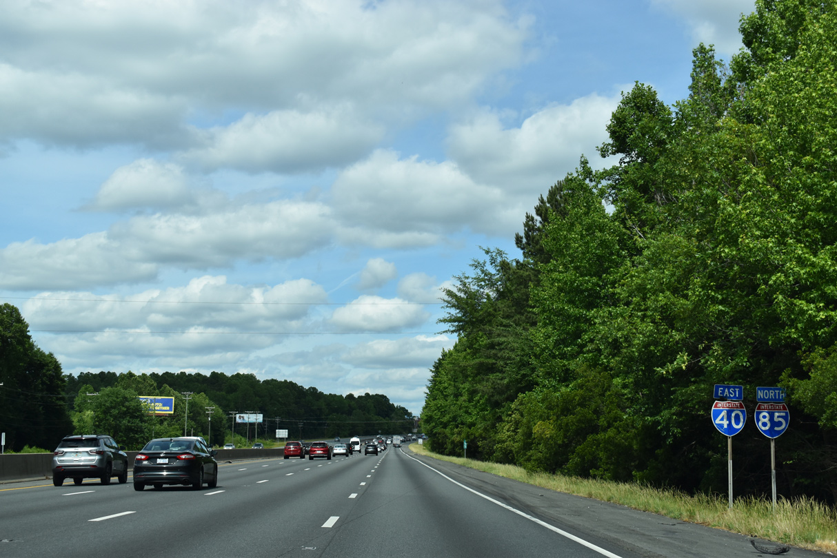
| Continuing east from Exit 132, I-40/85 consist of an eight lane freeway to their split near Hillsborough. Truck traffic is prohibited from the left lane along the overlap. 08/18/21 |
|
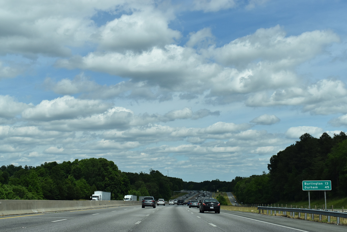
| Burlington lies midway along the 30.9 mile overlap of I-40/85. Durham is 45 minutes away. 05/31/21 |
|
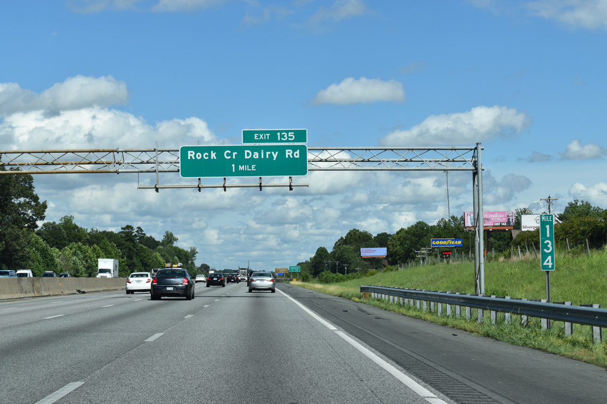
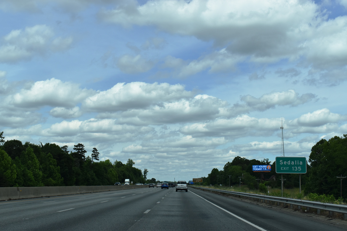
| The most rural segment of I-40/85 precedes the diamond interchange (Exit 135) with Rock Creek Dairy Road (SR 3056). 08/18/21 |
|
| The town of Sedalia lies just north of I-40/85 along U.S. 70 (Burlington Road), west of Rock Creek Dairy Road (SR 3056). 05/31/21 |
|
| Rock Creek Dairy Road (SR 3056) angles southeast from nearby U.S. 70 (Burlington Road) 4.9 miles to Mount Hope Church Road (SR 3045) in southeast Guilford County. U.S. 70 east turns northward from near Exit 135 en route to the town of Whitsett. 08/18/21 |
|
| Reassurance shield assembly preceding a valley where I-40/85 drops from 640 to 580 feet in elevation north of Little Alamance Creek. 05/31/21 |
|
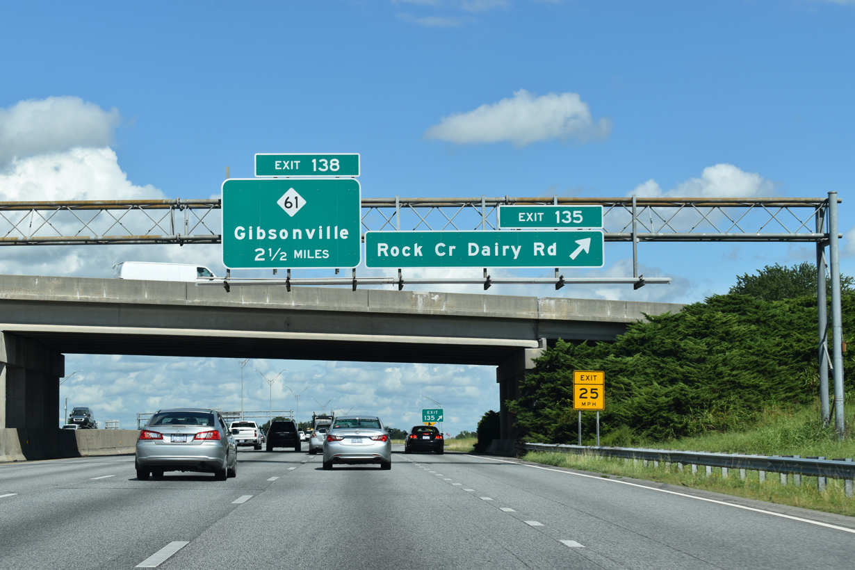
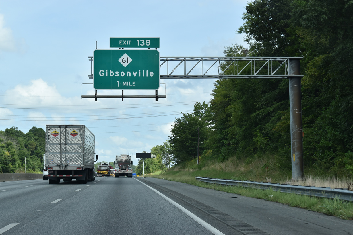
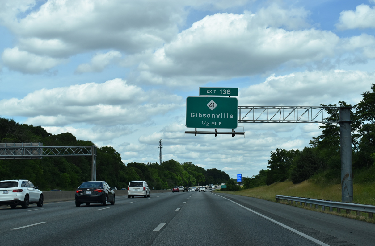
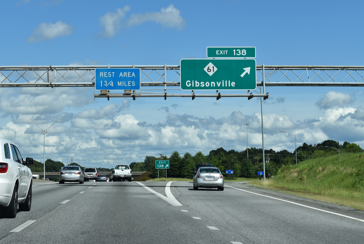
| The freeway next meets NC 61 at Exit 138 just south of the Whitsett town line. 08/16/21 |
|
| A diamond interchange connects I-40/85 with NC 61 at Exit 138. 05/31/21 |
|
| NC 61 joins NC 100 (Whitsett Street) from Whitsett to Downtown Gibsonville, four miles to the north. 08/16/21 |
|
| NC 61 travels a mostly rural 19.75 mile long route between NC 150 at Osceola to the north and NC 62 to the south. 08/18/21 |
|
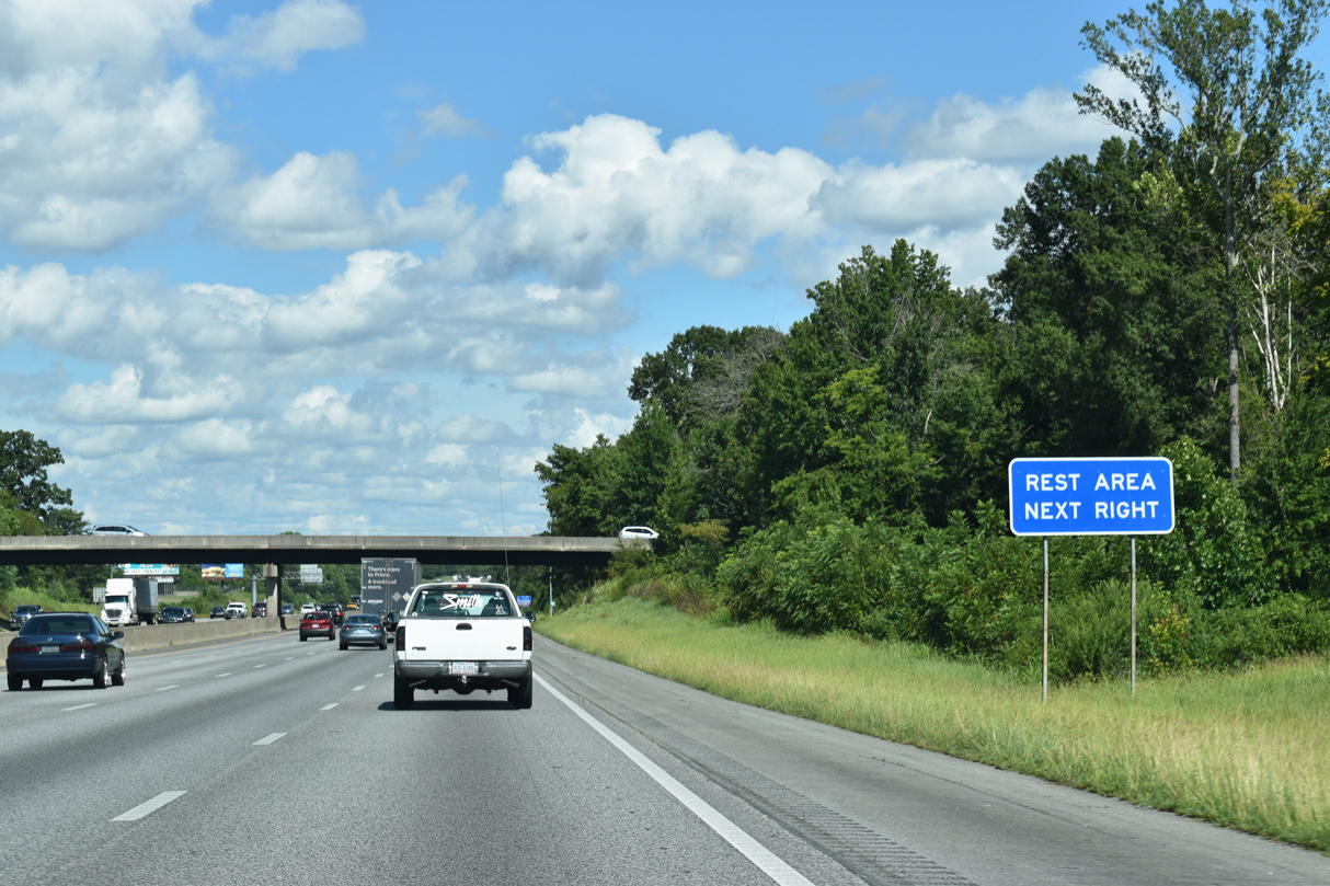
| Springwood Church Road (SR 2748) spans I-40 east / I-85 north, just west of a pair of rest areas along both directions of the freeway. SR 2748 leads north by a number of subdivisions and an apartment complex to U.S. 70 in western reaches of the Burlington city limits. 05/31/21, 08/18/21 |
|
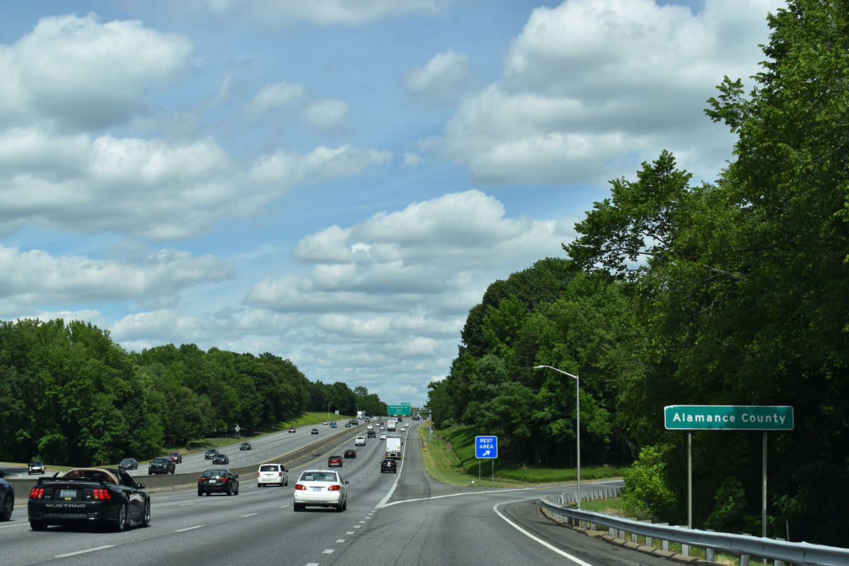
| I-40/85 cross the Alamance County line just east of Back Creek and ahead of the rest area off-ramp. 05/31/21 |
|
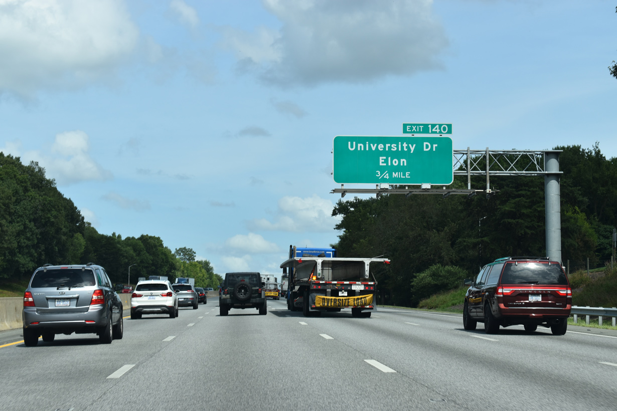
| University Drive (SR 1226), along with Grand Oaks Boulevard (SR 1213), forms part of an arterial beltway around Burlington and Elon. The four lane parkway leads north from Exit 140 to become NC 100, west of Elon University and east of Gibsonville. NC 100 follows the route east to combine with NC 87 south to Downtown Burlington. 08/16/21 |
|
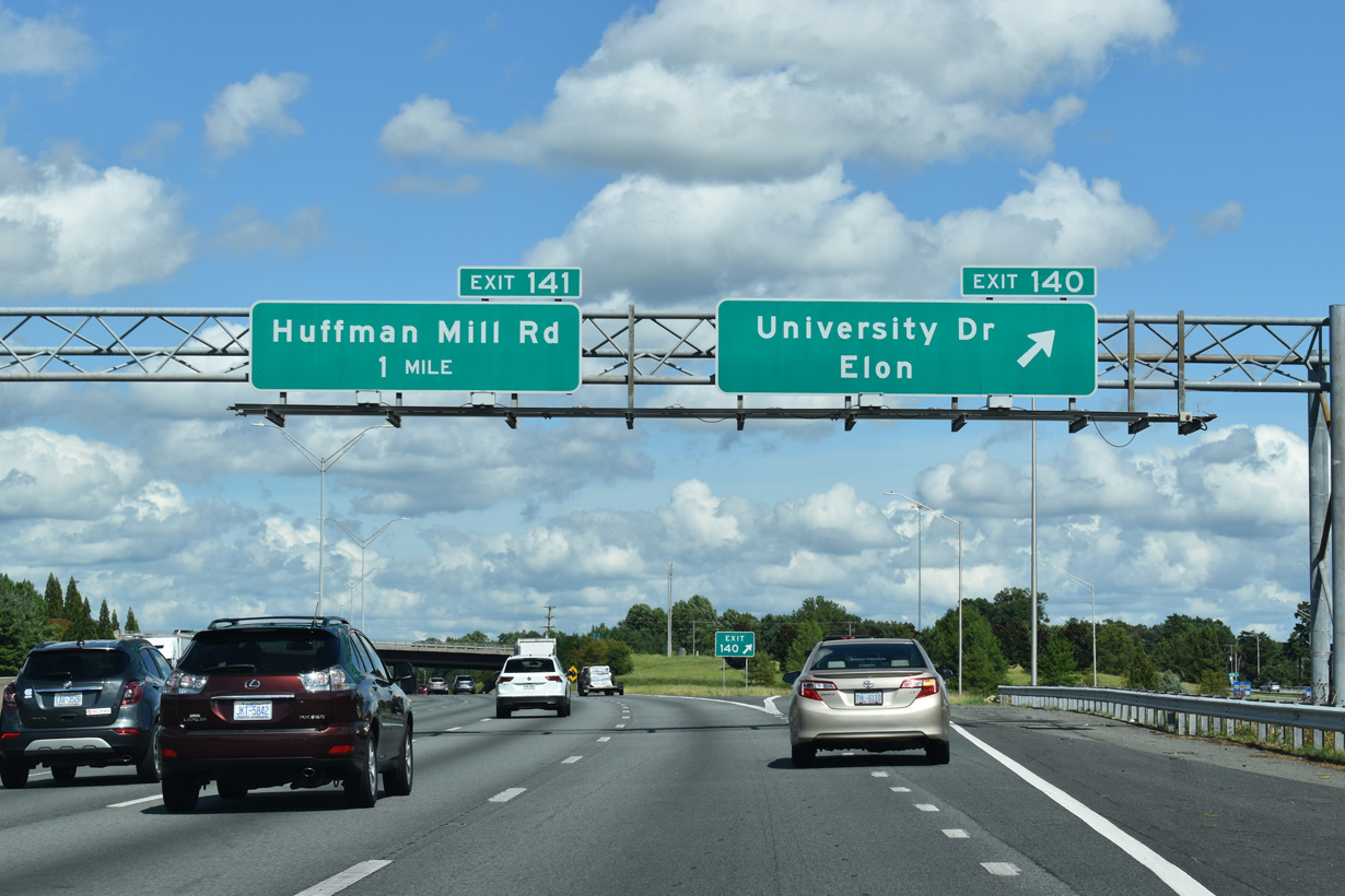
| A six-ramp parclo interchange joins I-40/85 with University Drive (SR 1226) at Exit 140. 08/18/21 |
|
| University Drive serves a growing retail area to the north while connecting the freeway with Alamance Regional Medical Center and NC 62 (Alamance Road) to the east via Grand Oaks Boulevard. 08/18/21 |
|
| I-40 east / I-85 north shield assembly posted just ahead of the diamond interchange (Exit 141) with Huffman Mill Road (SR 1158). 08/16/21 |
|
| Huffman Mill Road (SR 1158) traverses Lake Mackintosh along a rural course to southern reaches of Burlington. Just south of Exit 141, the road transitions into a commercial arterial en route to U.S. 70 (Church Street) at Holly Hill Mall. 05/31/21 |
|
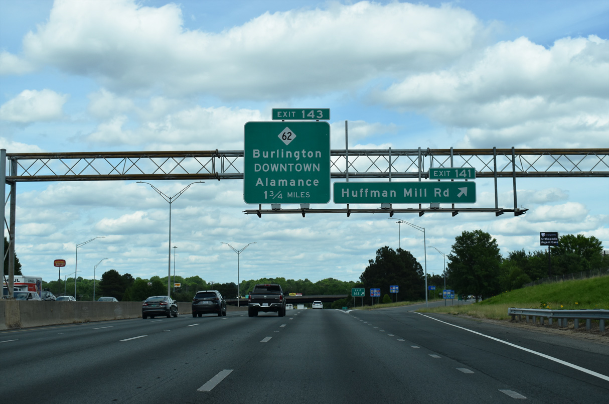
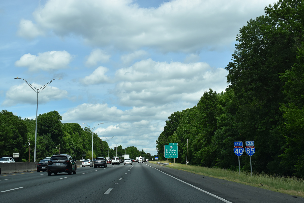
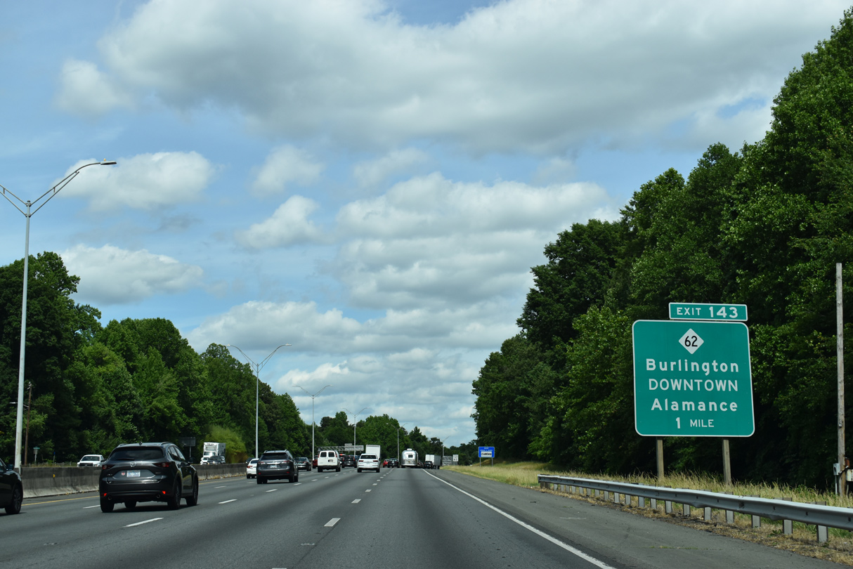
| NC 62 returns to I-85 at Exit 143. The state route and I-85 previously met outside of Archdale in the Piedmont Triad. 05/31/21 |
|
| NC 62 follows Alamance Road northward from the village of Alamance into Downtown Burlington alongside U.S. 70 (Church Street). 05/31/21 |
|
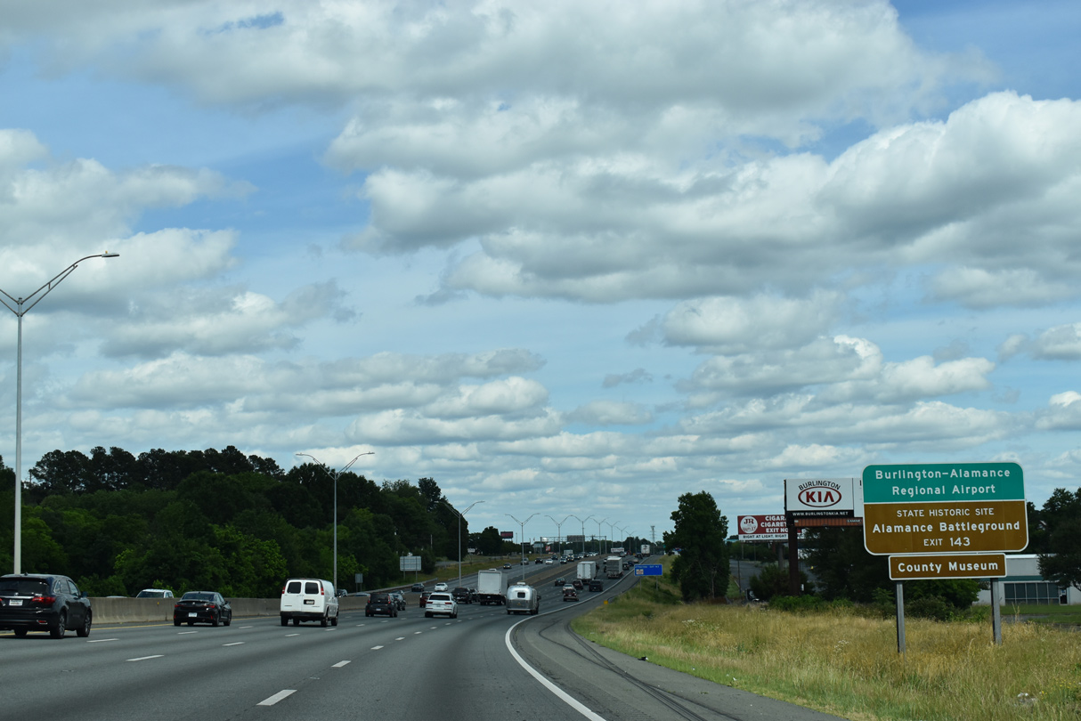
| NC 62 (Alamance Road) serves Burlington-Alamance Regional Airport (BUY) 1.1 miles to the south and Alamance Battleground state historic site. 05/31/21 |
|
| 1.27 miles north of Exit 143, NC 62 ties into U.S. 70 adjacent to the west end of NC 54 (Chapel Hill Road). 05/31/21 |
|
| I-40/85 advance east through the Burlington city limits to Bowden Branch. 05/31/21 |
|
| The city of Graham, adjacent to Burlington, is four miles ahead while Durham is still a half hour away. 05/31/21 |
|
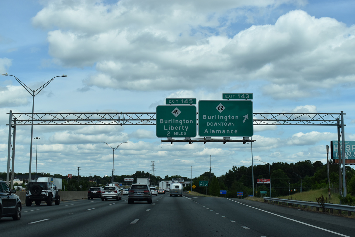
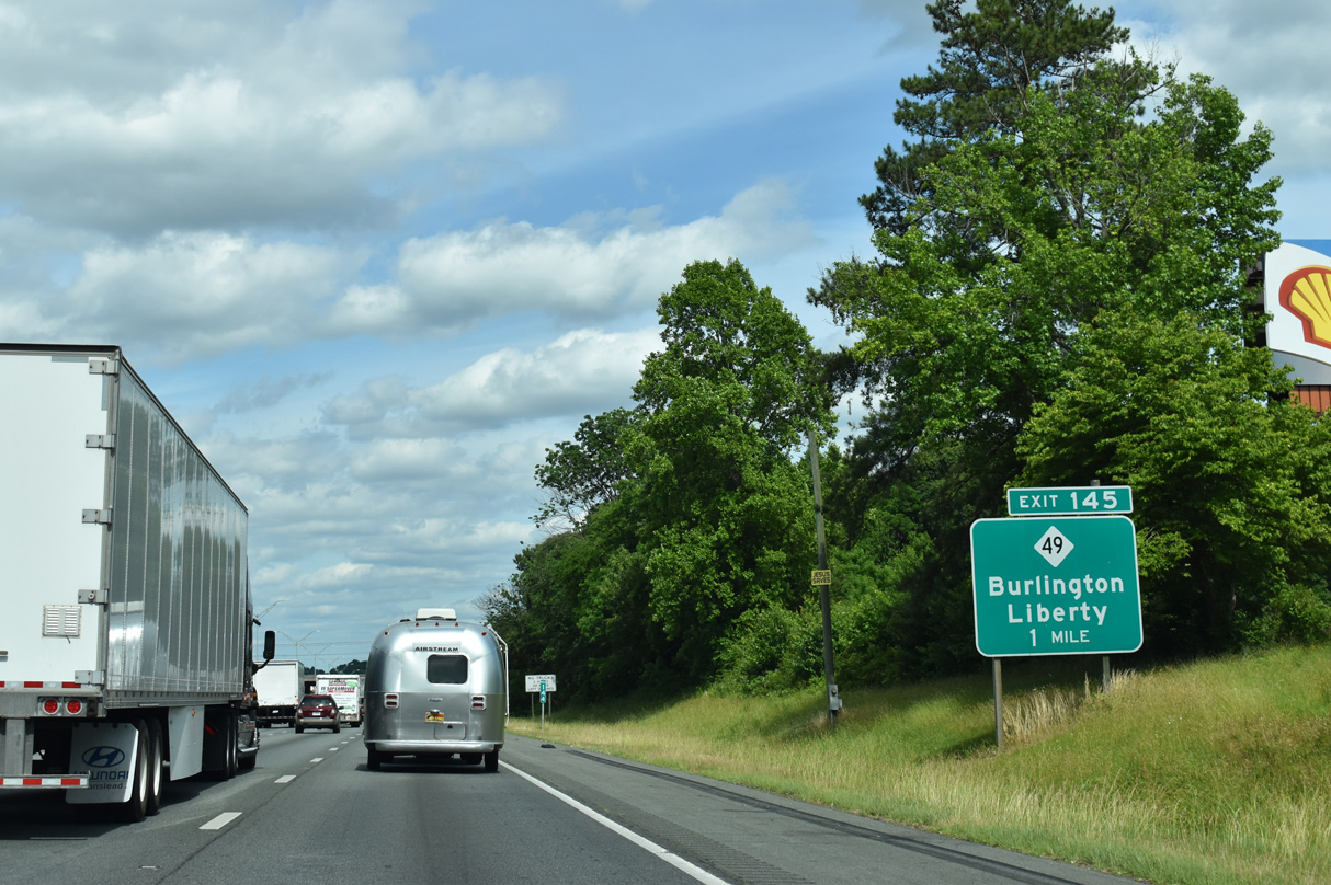
| Exit 145 joins I-40/85 with NC 49 one mile beyond the Tucker Street overpass. NC 49 (Maple Avenue) leads south from Burlington 18 miles to Liberty in northeast Randolph County.
This sign was previously posted on an overhead sign assembly. 05/31/21 |
|
| North from Exit 145, Maple Avenue provides the most direct route from I-40/85 to Downtown Burlington. NC 49 combines with NC 54 (Harden Street) east into Graham. NC 100 overtakes Maple Avenue north from NC 49 to Anthony Street east and Webb Avenue (NC 87) north. 05/31/21 |
|
| W Interstate Service Road (SR 2389) runs along the south side of I-40/85 on the ensuing stretch. 05/31/21 |
|
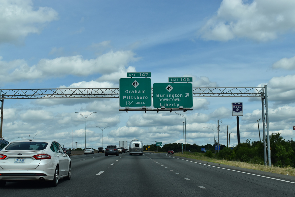
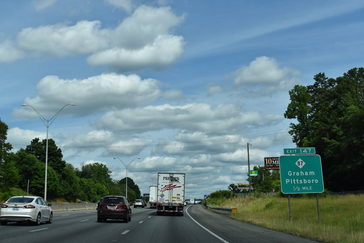
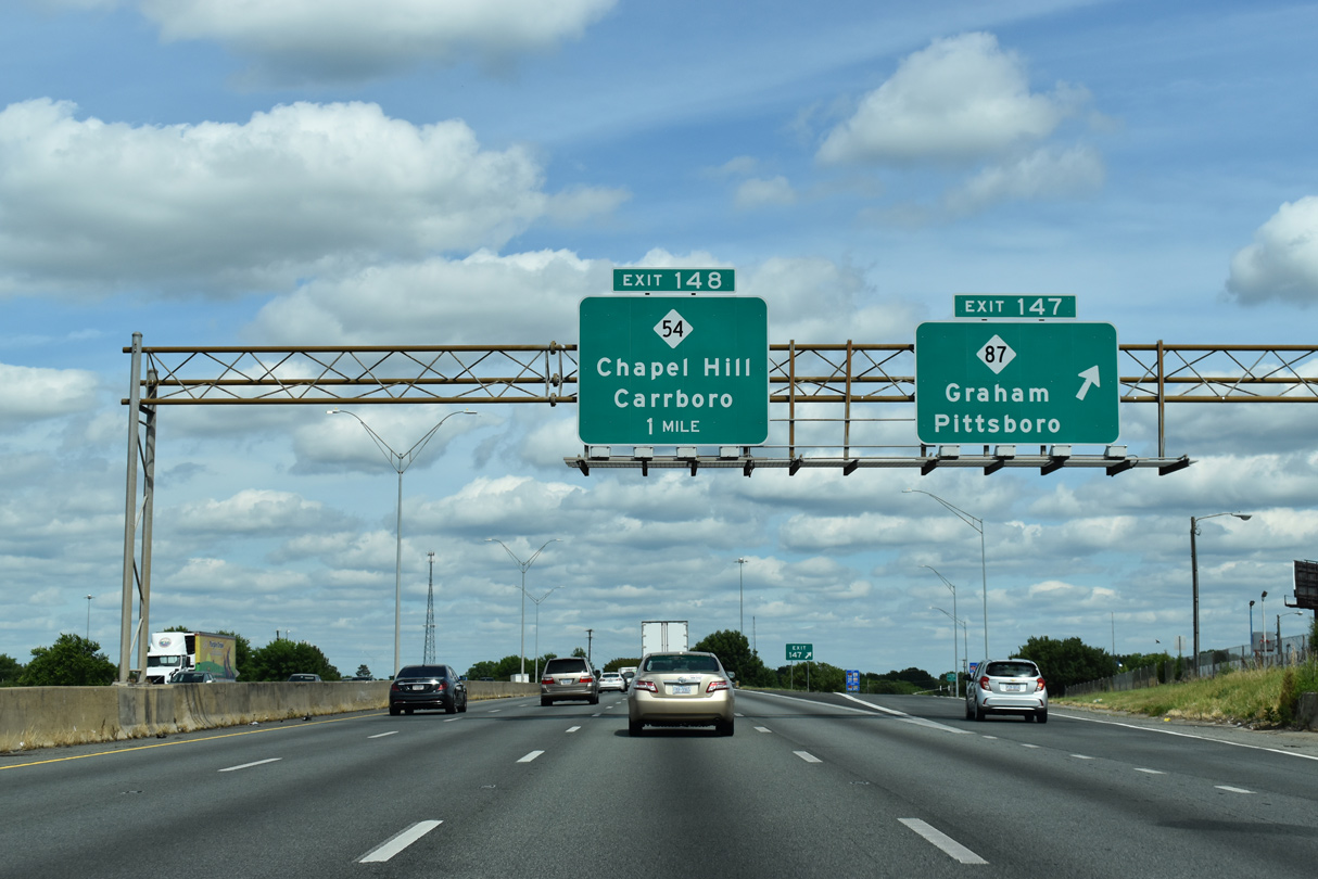
| NC 87 leaves Burlington for a 0.51 mile overlap with NC 49/54 along Harden Street to Downtown Graham. There NC 87 turns south onto Main Street 0.77 miles to a parclo interchange (Exit 147) with I-40/85. 05/31/21 |
|
| Heading south from Exit 147 along a commercial arterial, NC 87 continues 12 miles to Eli Whitney and 27 miles to Pittsboro. Forming a multi state route with SR 87 north to Ridgeway, Virginia. NC 87 measures 237 miles in length to Reidsville, Fayetteville and Southport near the mouth of the Cape Fear River. 05/31/21 |
|
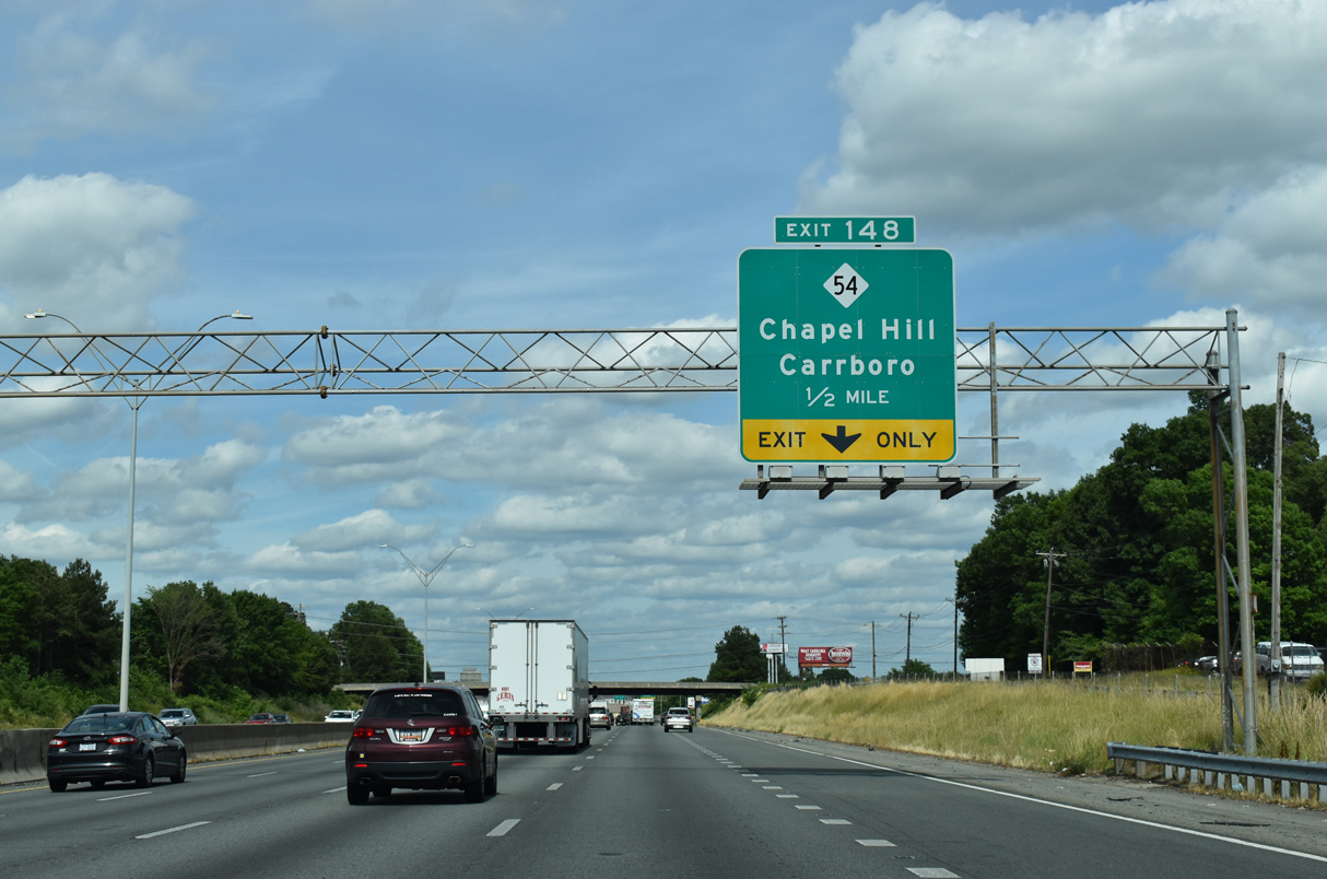
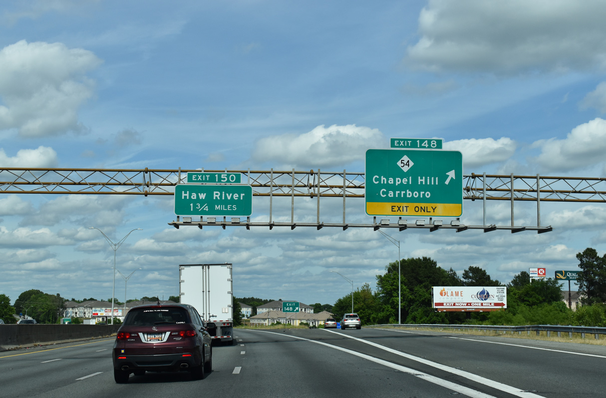
| Forthcoming NC 54 (Harden Street) branches 0.77 miles southeast from NC 49 (Elm Street) outside Downtown Graham to a diamond interchange (Exit 148) with I-40/85 ahead of Swepsonville. 05/31/21 |
|
| NC 54 provides an alternate route from Burlington southeast to Chapel Hill by way of Carrboro in 24 miles. NC 54 meets I-40 again at Exit 273. NC 49 splits with NC 54 northeast for the town of Haw River, which is also served from I-40/85 via Jimmie Kerr Road north at Exit 150. 05/31/21 |
|
| Staying in Graham, I-40 east / I-85 north continue to the diamond interchange (Exit 150) with Jimmie Kerr Road (SR 1928) by the campus of Alamance Community College. 05/31/21 |
|
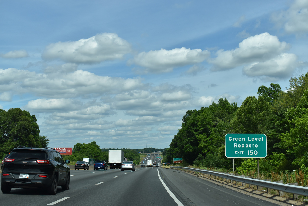
| Together with Trollingwood and Wilkins Roads, Jimmie Kerr Road (SR 1928) provides a direct route from Exit 150 to NC 49. NC 49 leads north from Haw River to the nearby town of Green Level. 05/31/21 |
|
| NC 49 constitutes 178 mile route through North Carolina, from Charlotte to Concord, Asheboro, Burlington, Roxboro and the state line at Virgilina. SR 96 continues the multi-state route to Clarksville, Chase City and Crewe, Virginia. 05/31/21 |
|
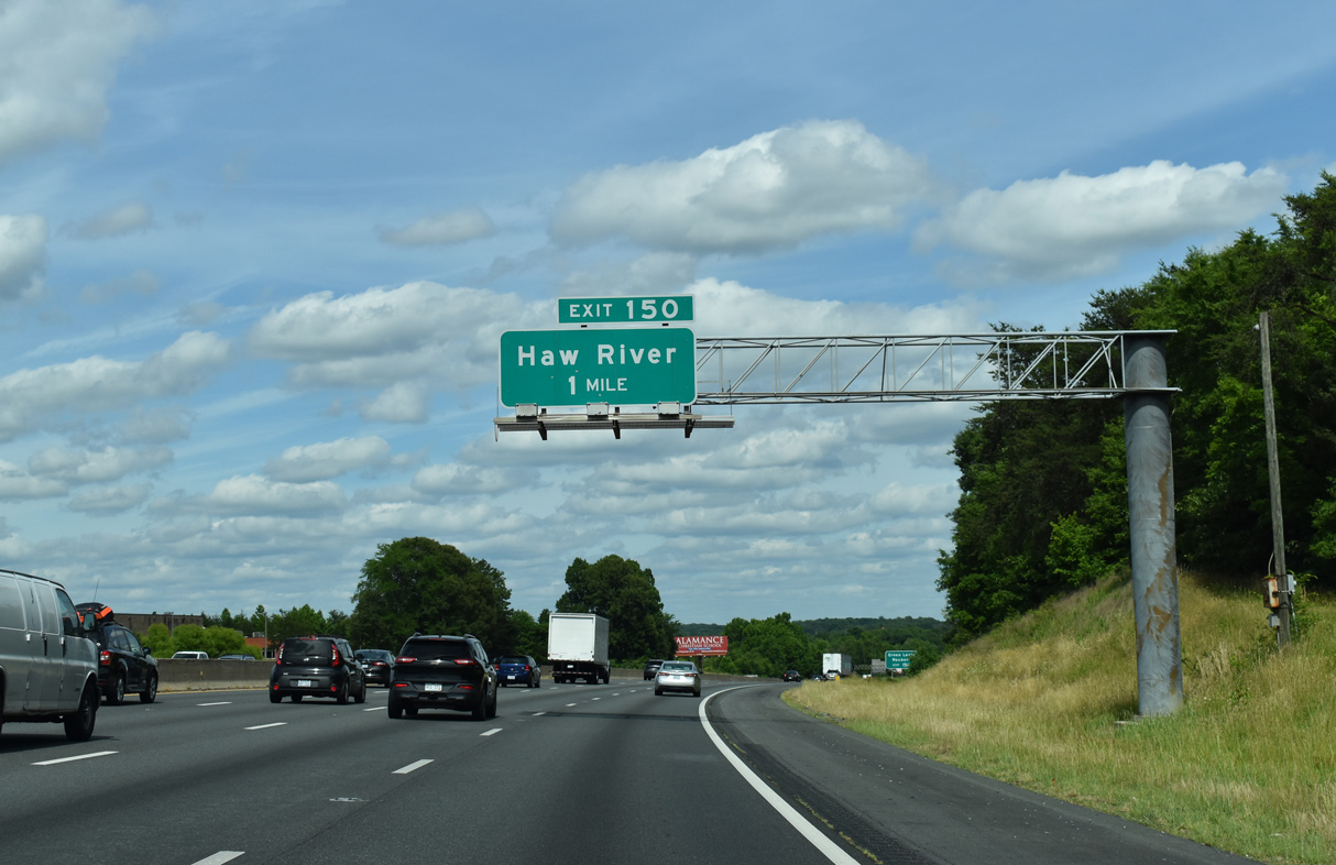
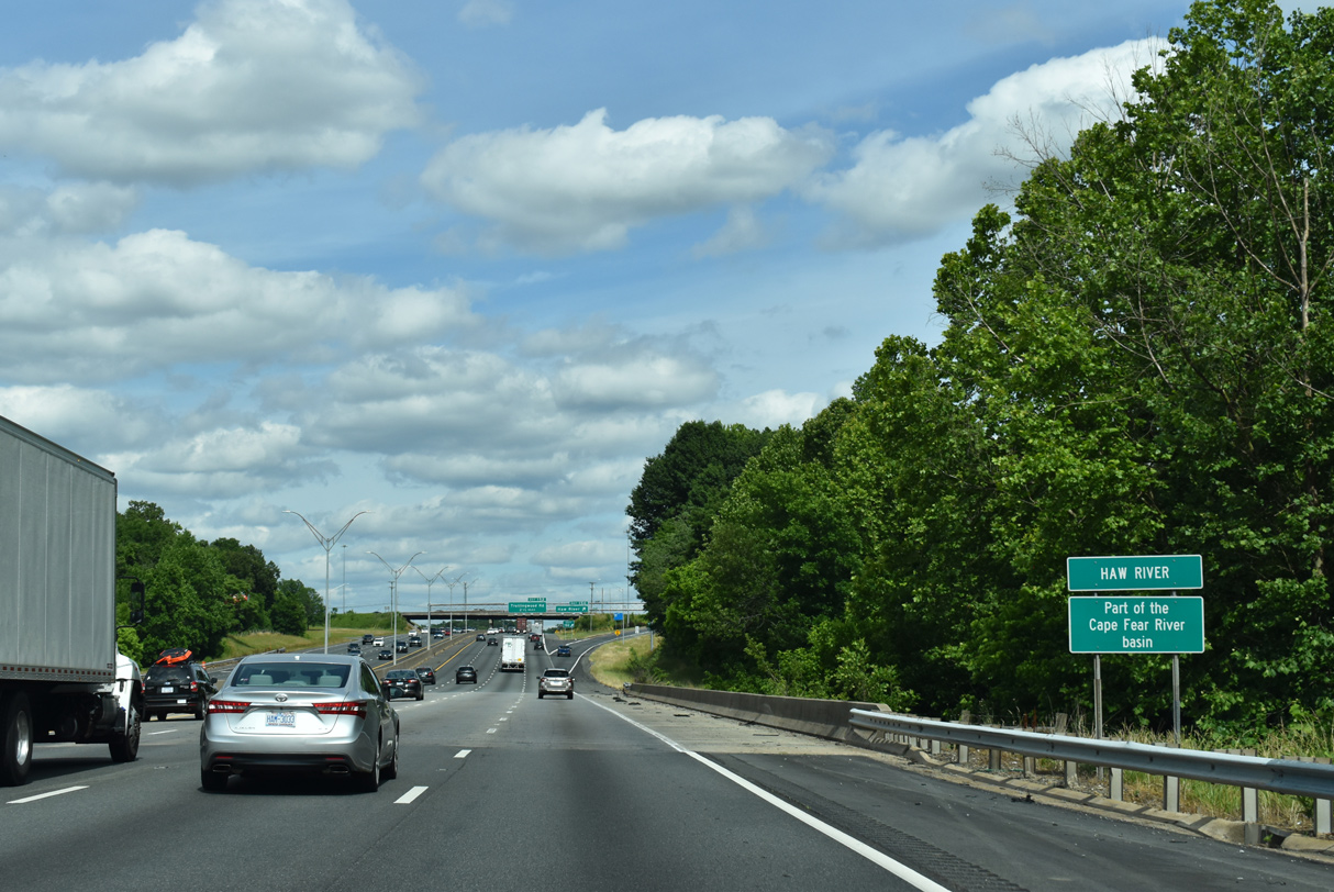
| I-40/85 span the Haw River ahead of Exit 150 to Jimmie Kerr Road. 05/31/21 |
|
| The town of Haw River lies 1.8 miles to the north of Exit 150 at U.S. 70 (Main Street). 05/31/21 |
|
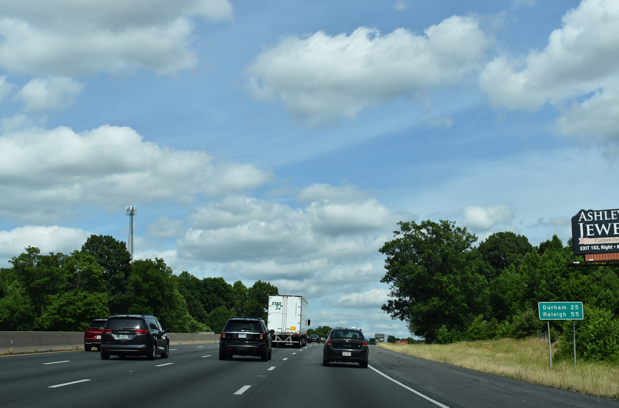
| I-40/85 leave the city of Graham east across Back Creek, 25 miles from Durham and 55 miles from Raleigh. 05/31/21 |
|
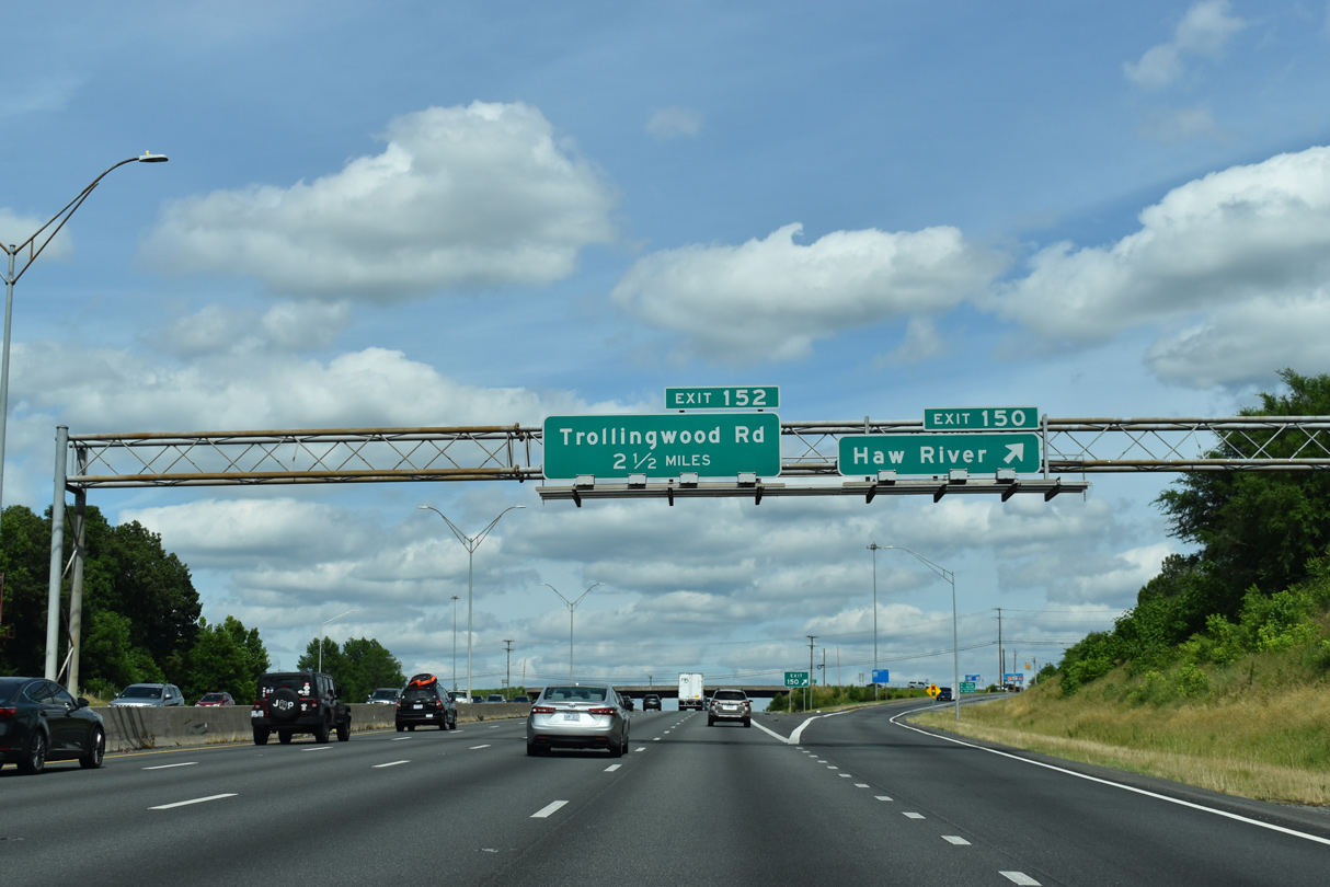
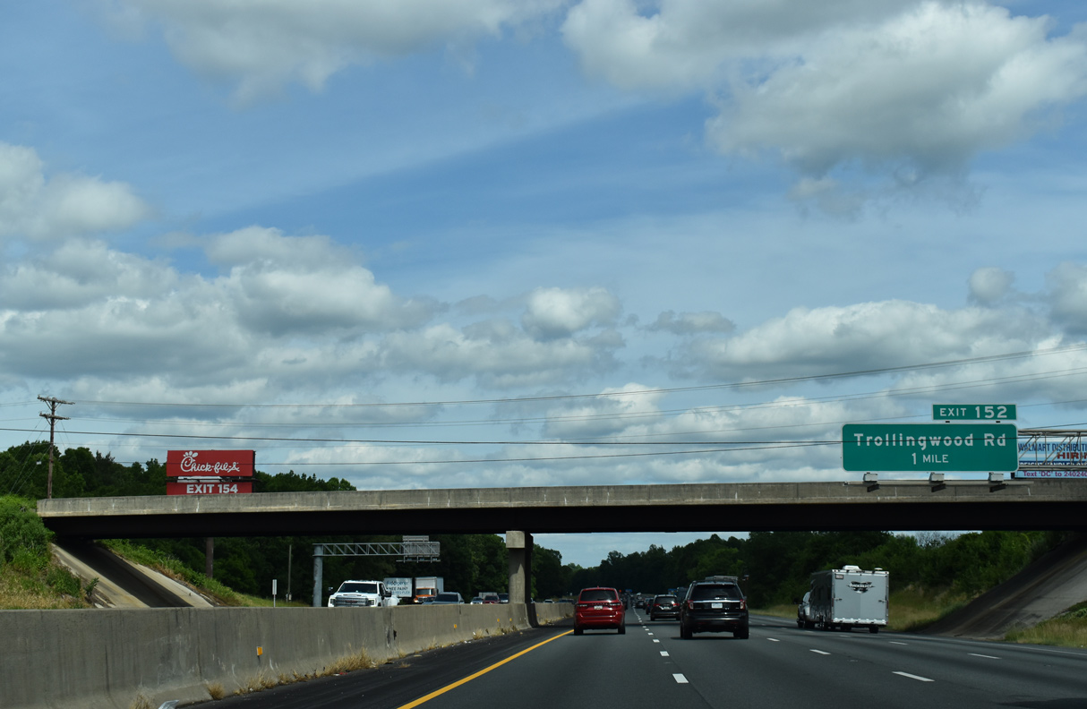
| Trollingwood Road (SR 1198) meets I-40/85 at a diamond interchange (Exit 152) one mile east of the Cherry Lane (SR 2123) overpass. 05/31/21 |
|
| Trollingwood Road (SR 1198) straddles the outskirts of Mebane east to NC 119 at Hawfields. 05/31/21 |
|
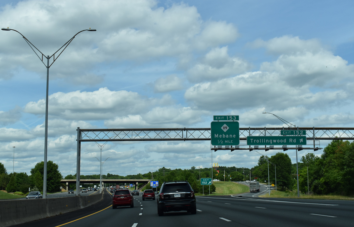
| NC 119 (5th Street) angles northeast from Hawfields to a DDI (Exit 153) with I-40/85. Traveling northward to Downtown Mebane and Virginia Route 119 near Semora, the 43 mile route originates from NC 54 at Swepsonville.
A two-stage project underway from August 2017 to Summer 2022 relocated NC 119 onto an at-grade bypass west of Mebane.1 05/31/21 |
|
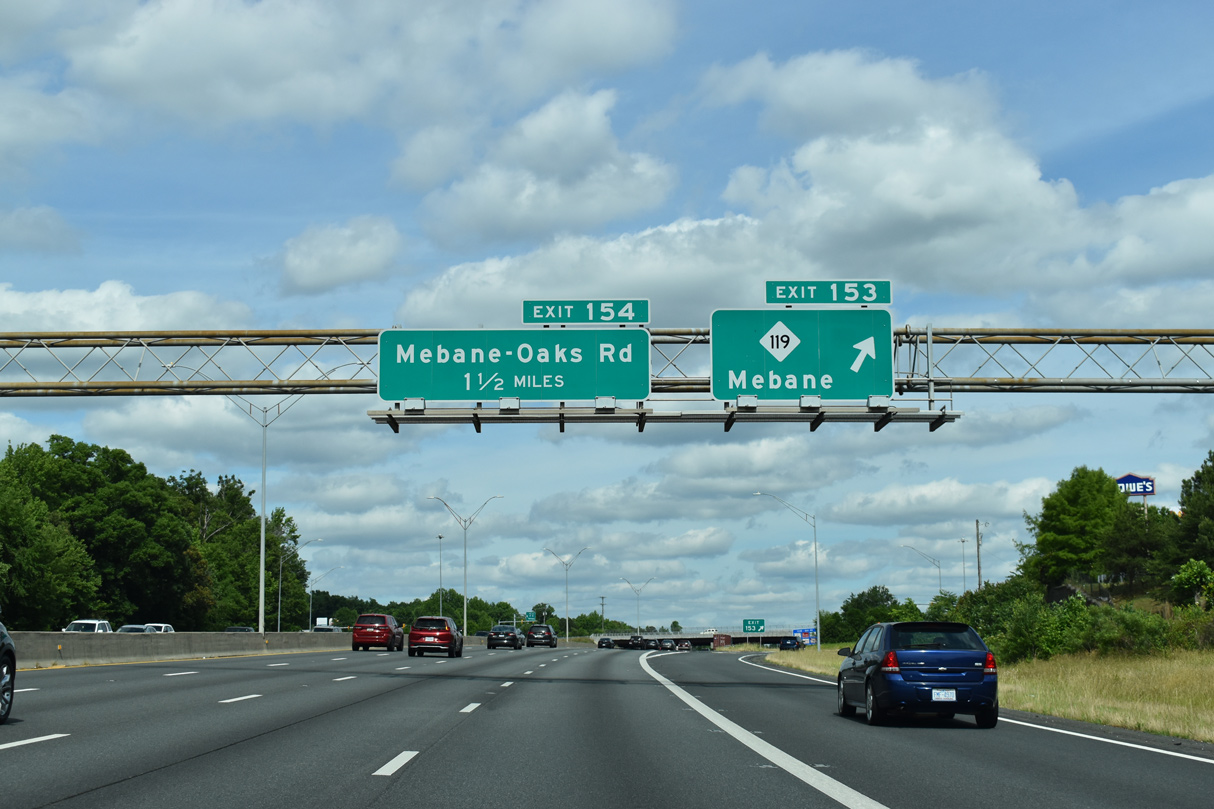
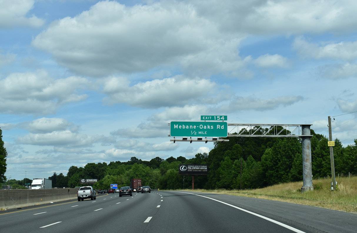
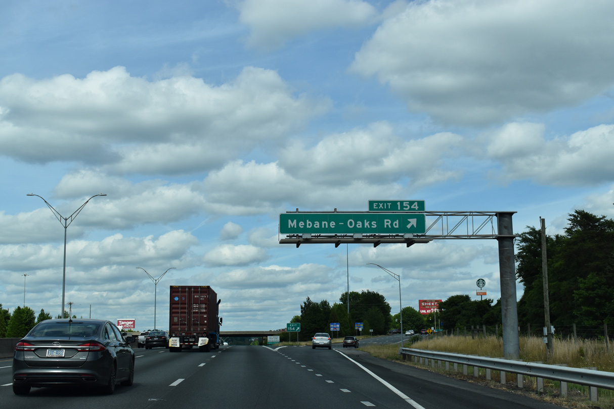
| I-40/85 next meet Mebane-Oaks Road (SR 1007) at a commercialized diamond interchange (Exit 154) adjacent to a Tanger Outlets center and big box retail. 05/31/21 |
|
| Mebane-Oaks Road (SR 1007) ties into NC 119 (5th Street), 0.47 miles north of Exit 154 in Mebane (pronounced Meh-bin). 05/31/21 |
|
| Southward from I-40/85, Mebane-Oaks Road (SR 1007) extends 8.4 miles along the Alamance and Orange County line to NC 54 at Oaks. 05/31/21 |
|
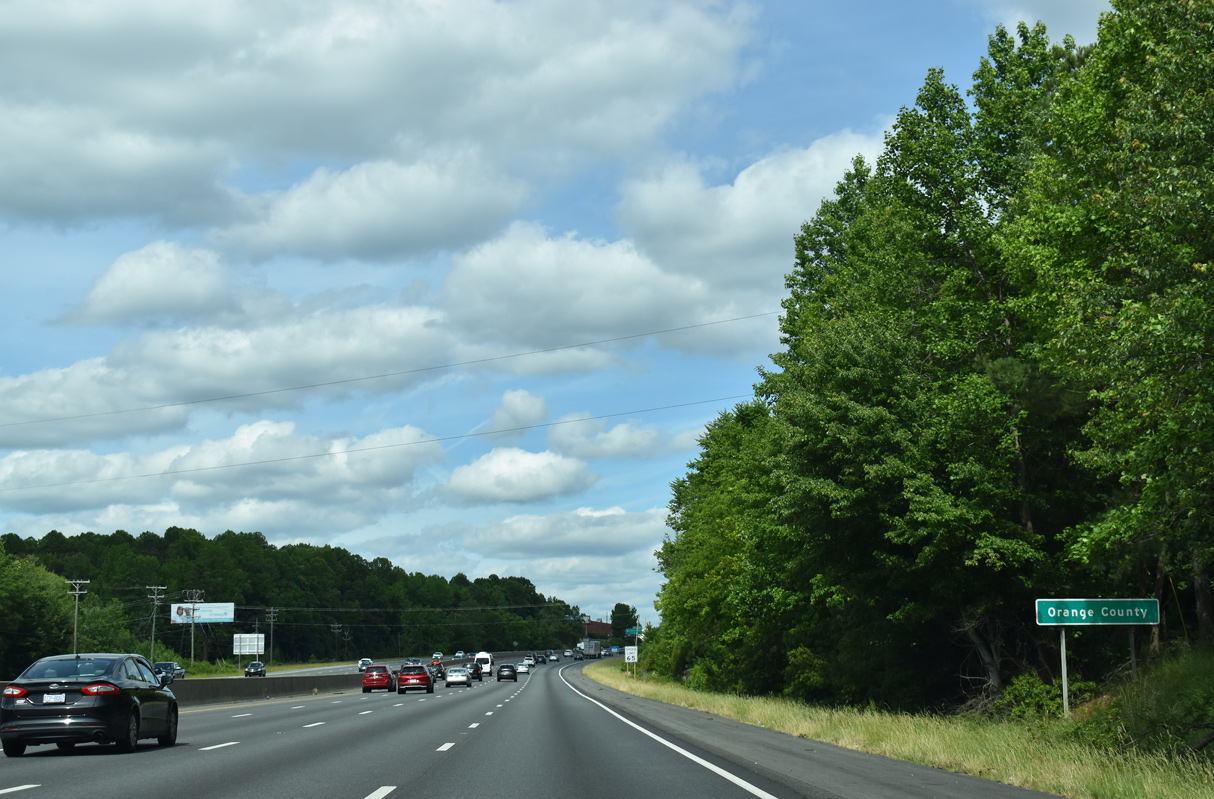
| I-40 east / I-85 north cross the Orange County line just ahead of milepost 155. 05/31/21 |
|
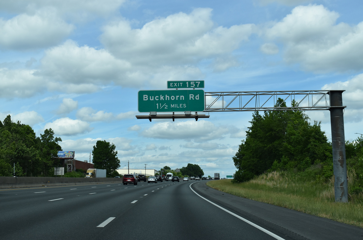
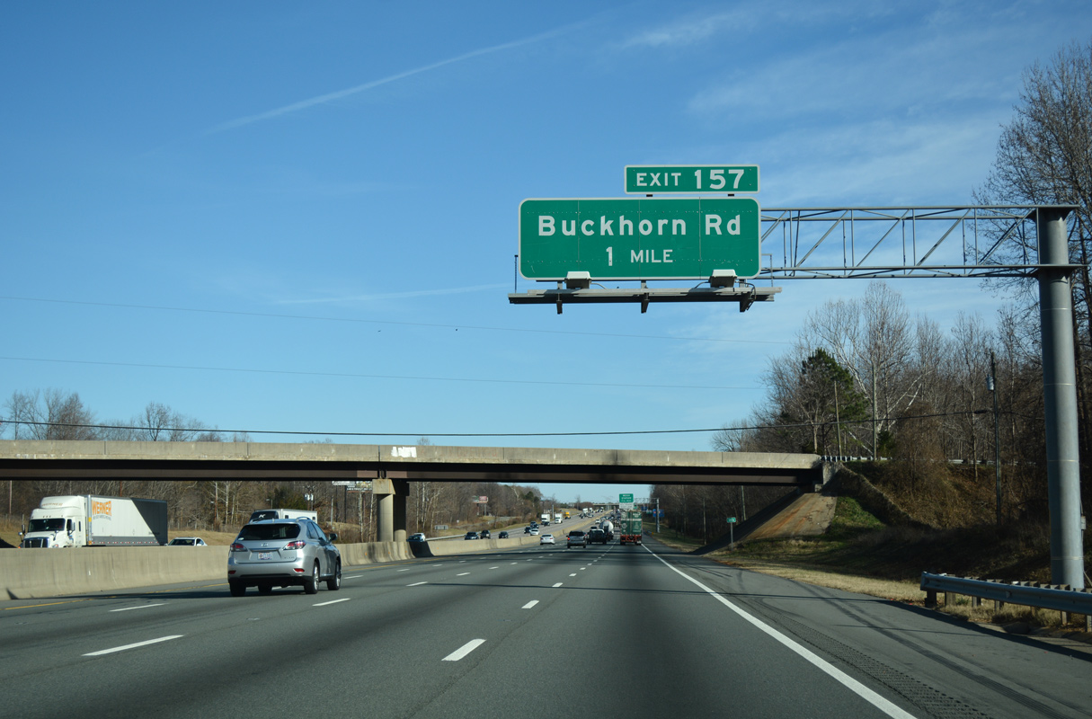
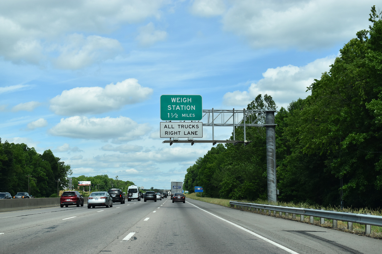
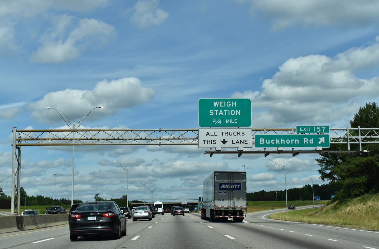
| I-40/85 proceed 1.5 miles east to Exit 157 with Buckhorn Road (SR 1114) between Miles and Cheeks Crossroads. 05/31/21 |
|
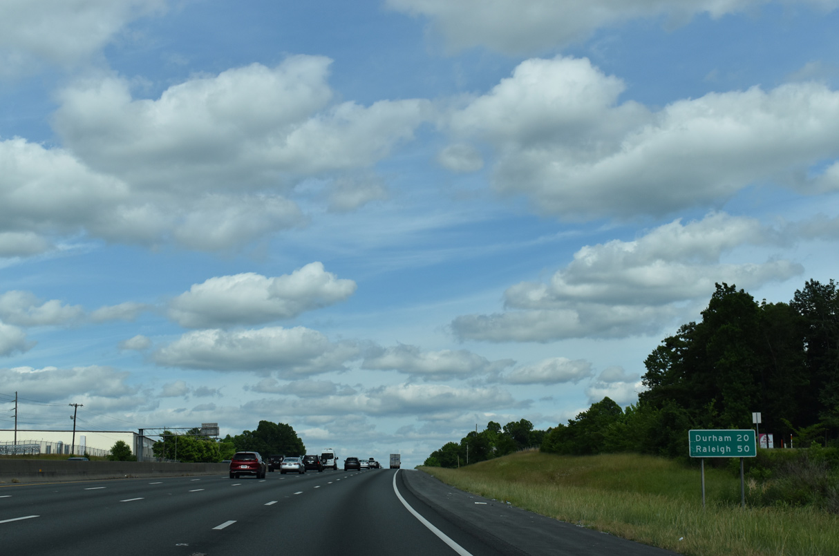
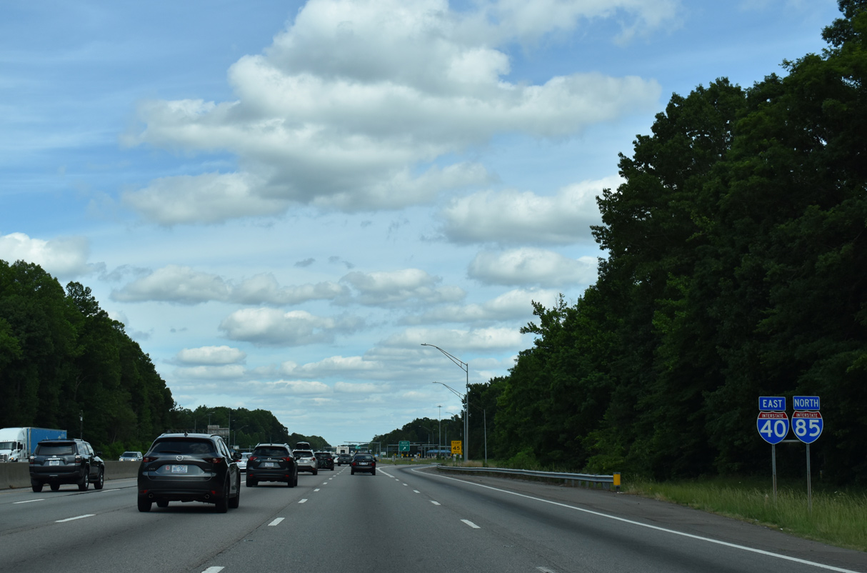
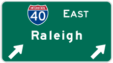
| Durham is 20 miles to the east via I-85 north and the capital city is 50 miles to the southeast along I-40. 05/31/21 |
|
| A diamond interchange (Exit 157) joins I-40/85 with Buckhorn Road (SR 1114). Buckhorn Road connects the freeway with parallel U.S. 70 at Miles. 12/15/16 |
|
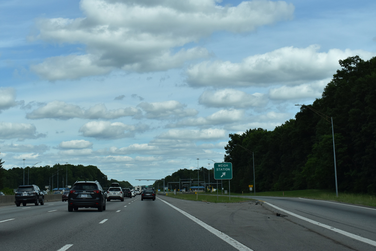
| Weigh stations line both sides of I-40/85 beyond Exit 157. 05/31/21 |
|
| Buckhorn Road continues 7.63 miles south from Exit 175 along a rural course to Orange Grove Road (SR 1006). 05/31/21 |
|
| Continuing east along I-40/85 toward Efland and Hillsborough. 05/31/21 |
|
| The weigh stations east of Exit 157 were built in place of original rest areas. 05/31/21 |
|
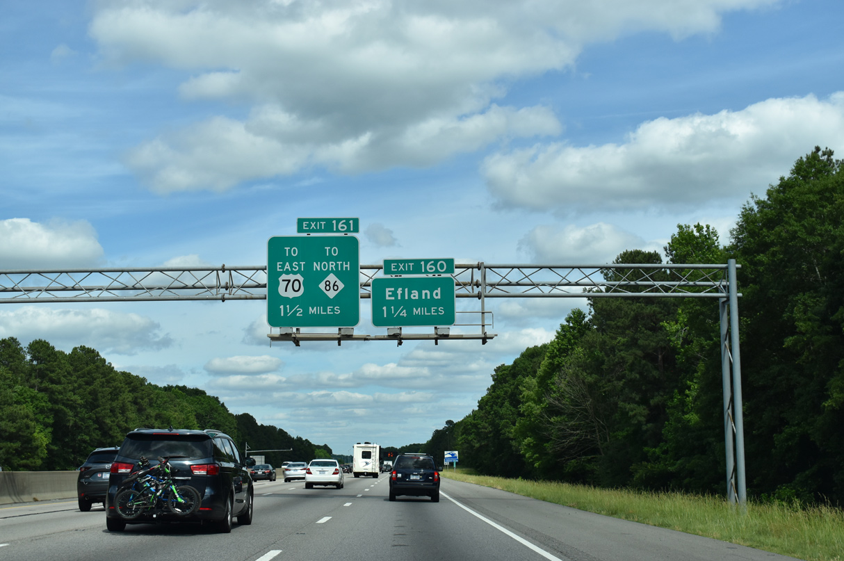
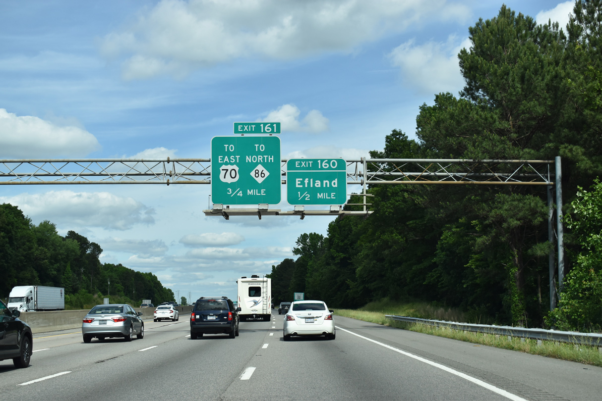
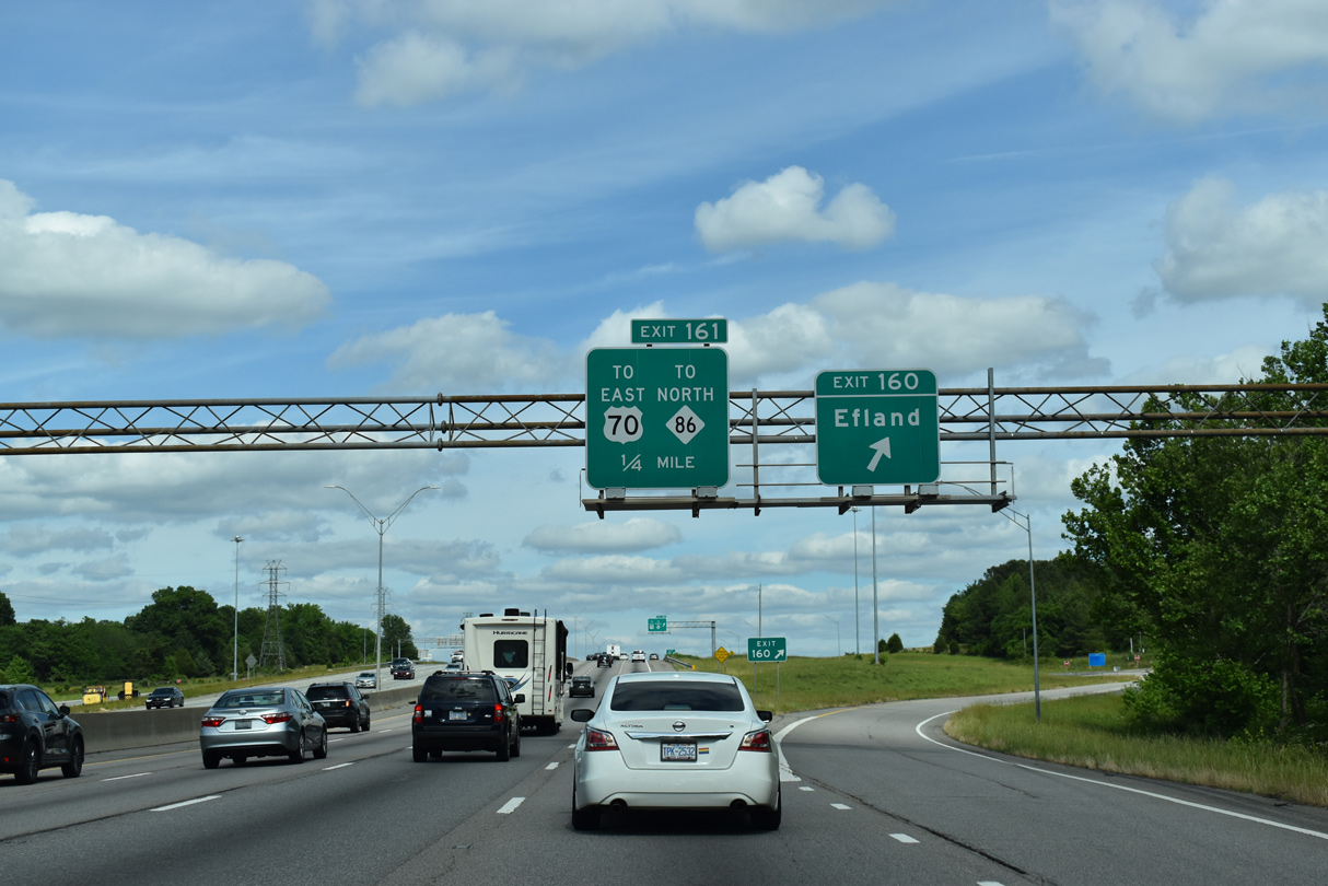
| Mt. Willing Road (SR 1220) converges with the freeway at a diamond interchange (Exit 160) 1.25 miles ahead. 05/31/21 |
|
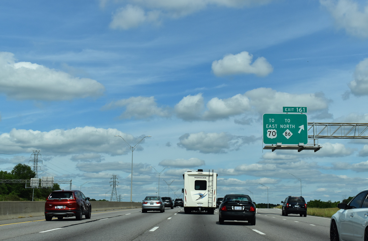
| One half mile west of Exit 160 to Mt. Willing Road (SR 1120) and Efland. A second diamond interchange (Exit 161) follows with I-85 US 70 Connector (SR 1239) north onto U.S. 70 east into the town of Hillsborough. 05/31/21 |
|
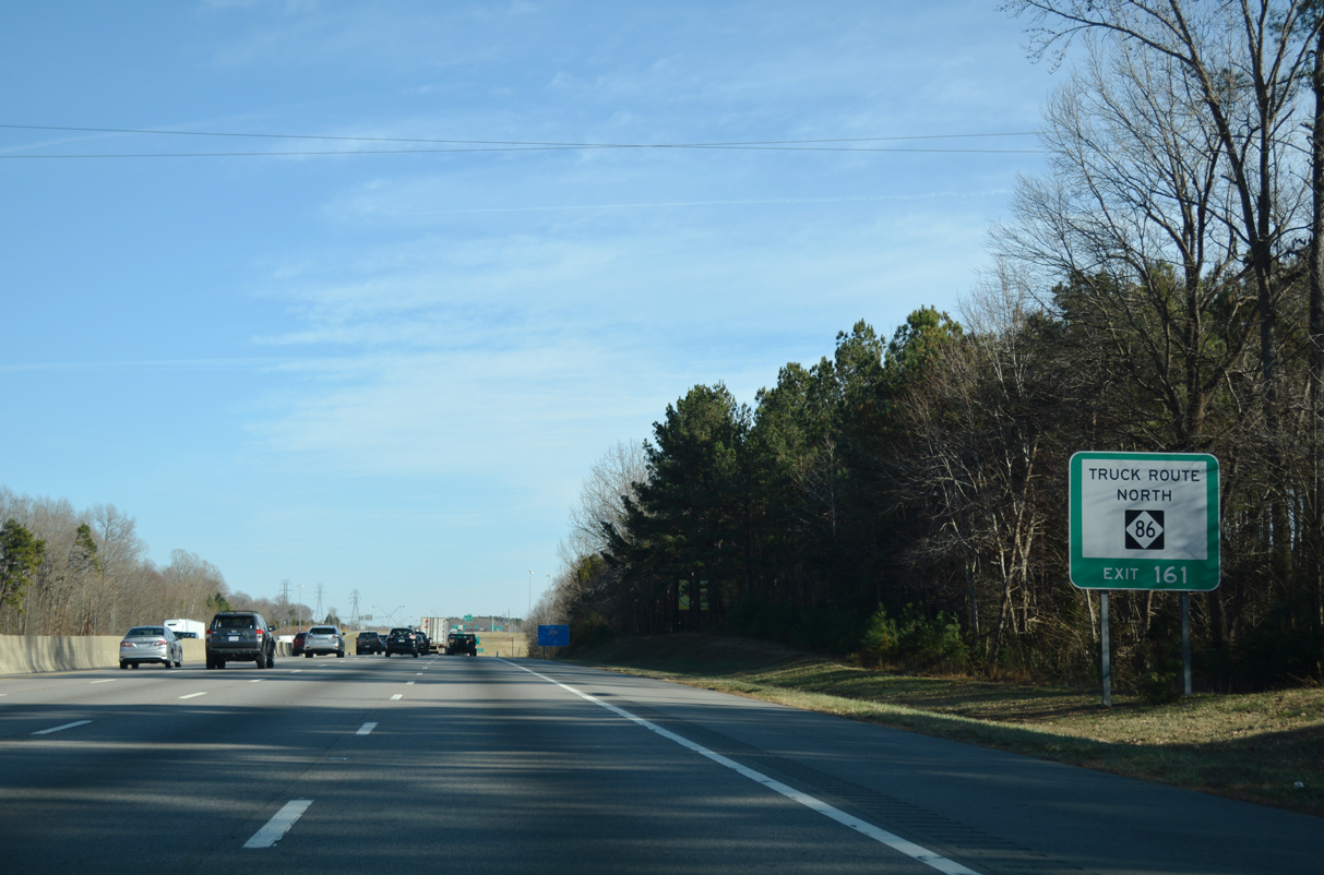
| Exit 161 provides part of a truck route for NC 86 north to Yanceyville and other points beyond Hillsborough. The truck route follows U.S. 70 (Cornelius Street) east from SR 1239 to NC 86 north at Churton Street. 12/15/16 |
|
| Mt. Willing Road loops 4.2 miles northeast from Buckhorn to Forrest Avenue (SR 1317) in Efland. Originally Exit 160 linked with adjacent Ten Road while Exit 161 departed from the left side of I-40/85 east at a wye interchange. 05/31/21 |
|
| A slip ramp (Exit 161) connects I-40/85 east with an access road linking Mt. Whiling Road and SR 1239. 05/31/21 |
|
| The I-85 US 70 Connector branches northeast 1.13 miles to a wye interchange with U.S. 70 ahead of the Eno River. U.S. 70 proceeds east from there 1.99 miles to split with U.S. 70 Business at Revere Road. 12/15/16 |
|
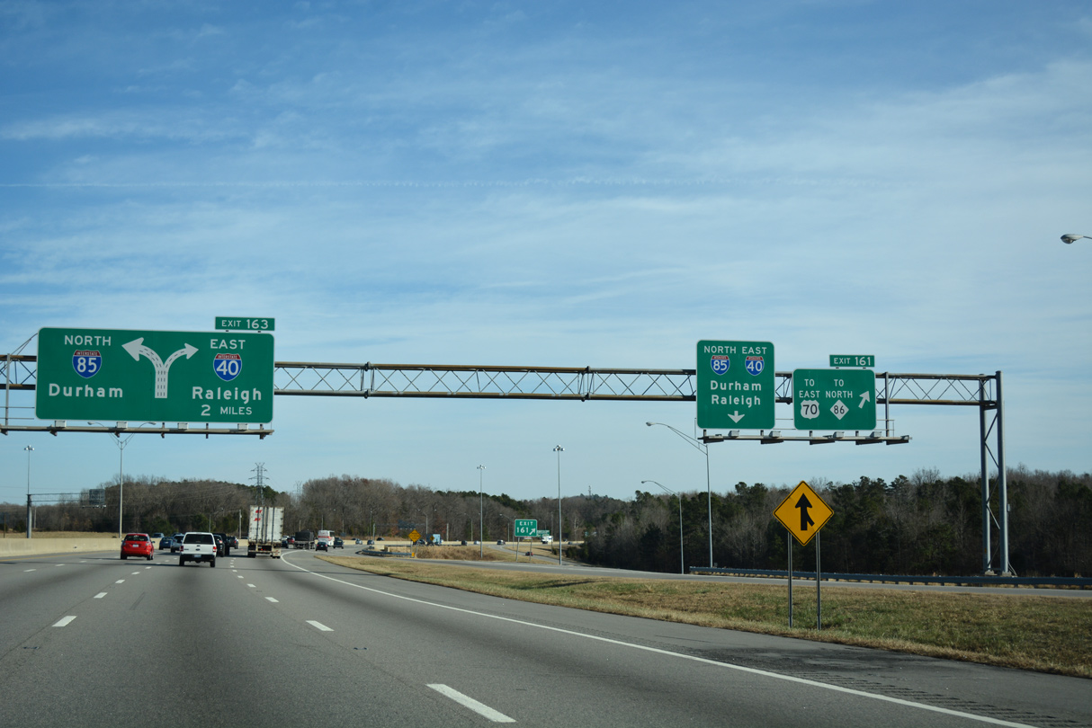
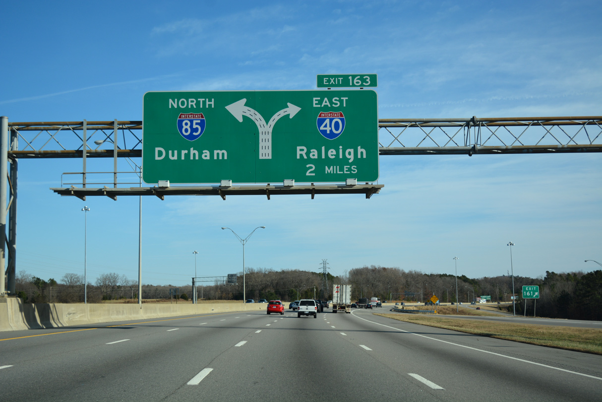
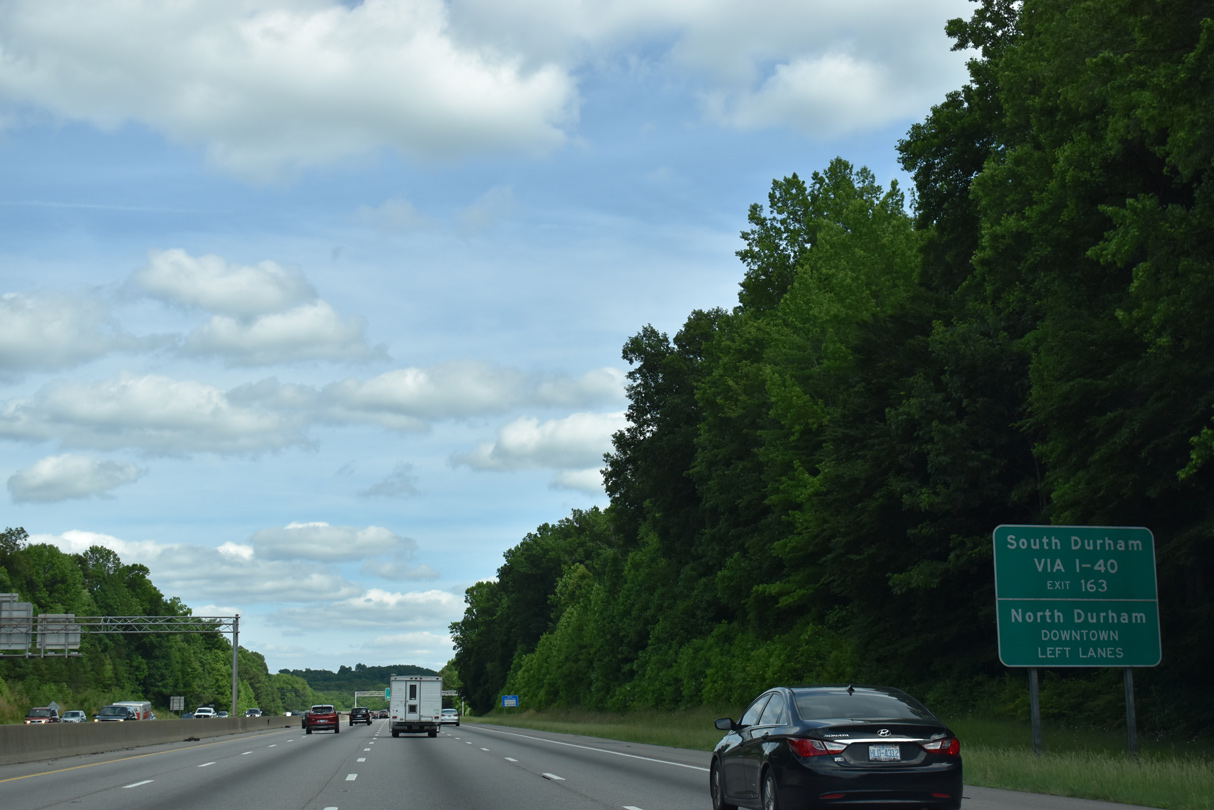
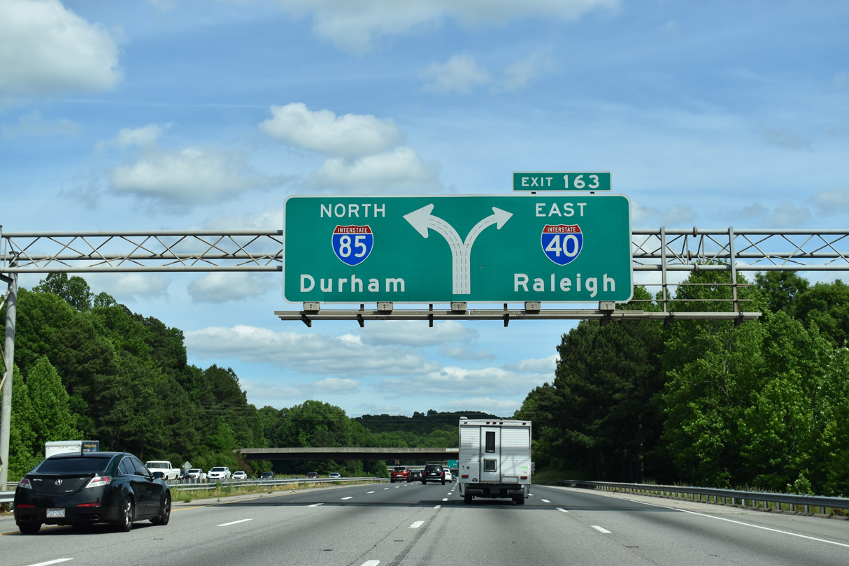
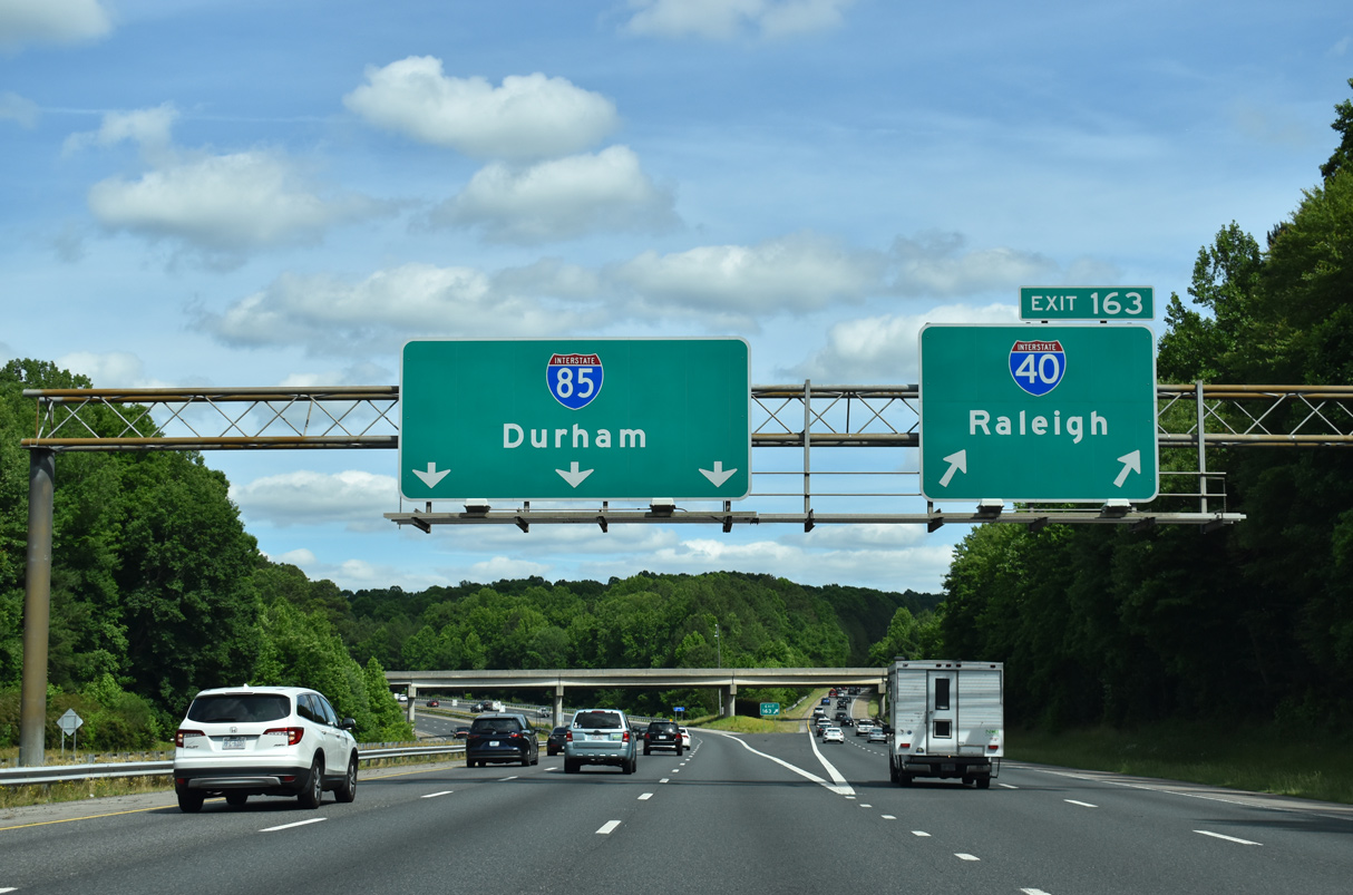
| I-40 and I-85 split at a modified trumpet interchange (Exit 163) outside of Hillsborough. 12/15/16 |
|
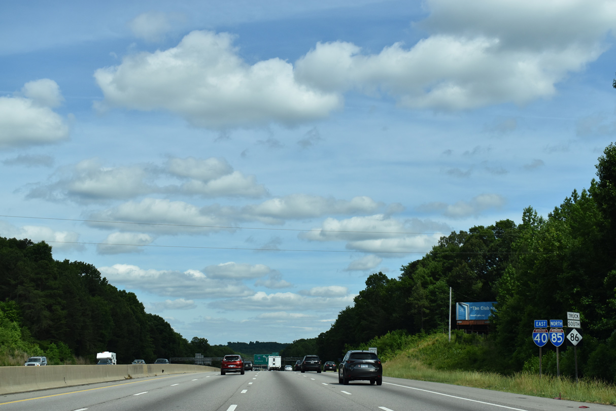
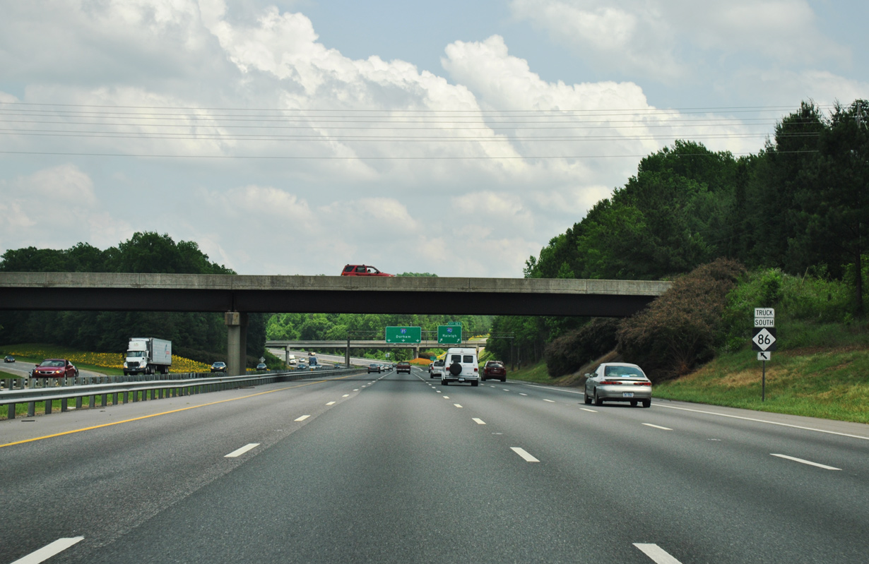
| The last shield assembly for I-40 east / I-85 north appears alongside NC 86 Truck south. The truck route for NC 86 coincides with Interstate 85 north between Exit 161 and 165. 05/31/21 |
|
| Interstate 40 turns southeast from I-85 eight miles to Chapel Hill and 12 miles to southwest Durham. NC 147 (Durham Freeway) branches south from I-85 in 9.3 miles to Downtown Durham. 05/31/21 |
|
| The Durham bypass along I-40, between I-85 and NC 147 (Durham Freeway) at Research Triangle Park (RTP) was completed in 1988. I-40 temporarily followed the Durham Freeway southeast from I-85 to RTP prior to that time. 05/31/21 |
|
| The three left lanes at Exit 163 default onto Interstate 85 northbound for Downtown Durham and Petersburg, Virginia. Interstate 40 constitutes a four lane freeway to Chapel Hill and south Durham. 05/31/21 |
|
| A NC 86 Truck trailblazer posted at the Dimmocks Mill Road (SR 1134) overpass directs traffic onto Interstate 85 north. 06/01/12 |
|
| I-40 ends 161 miles southeast from Exit 163 at Wilmington. I-85 continues another 70 miles to the Virginia state line and 139 miles to I-95 in Petersburg. 05/31/21 |
Page Updated 01-18-2023.

 East
East  North
North