|
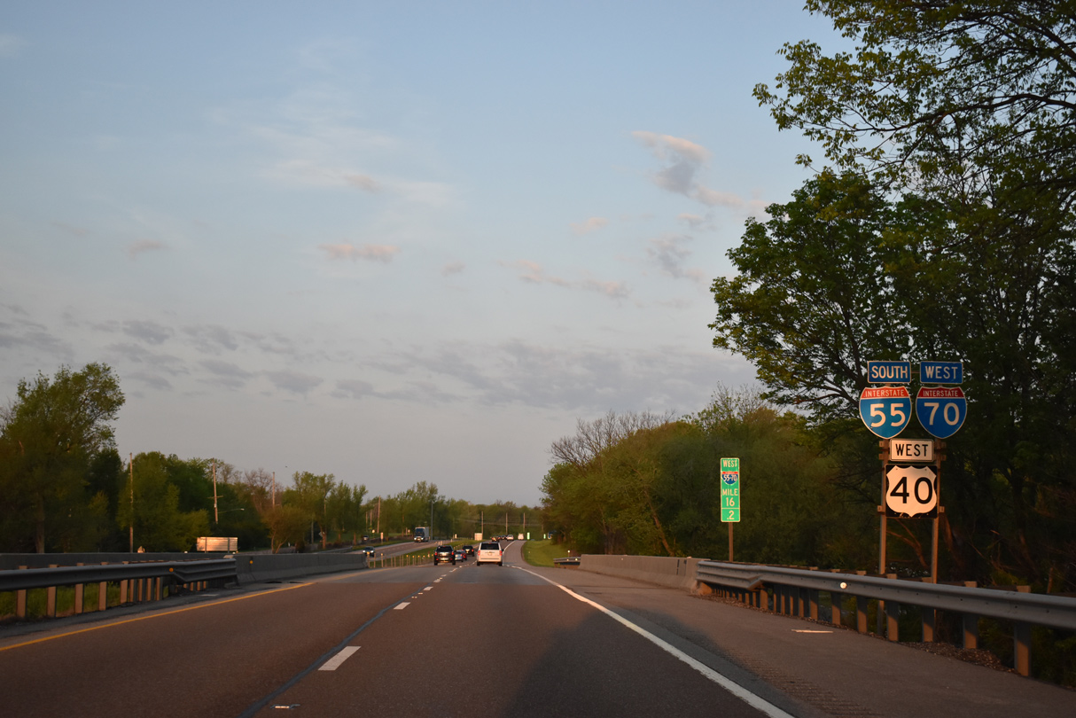
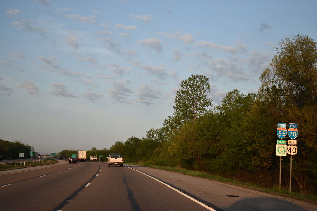
| I-55/70 directly overlaid a four lane portion of U.S. 66 southward to the west of Troy. The two routes first meet IL 162 (Edwardsville Road) at Exit 18 in one mile. 05/06/18 |
|
| IL 162 travels 15 miles overall on a route between Troy to the east and Granite City to the west. A $23.5 million American Recovery and Reinvestment Act (ARRA) project commenced August 2009 to redesign the diamond interchange at Exit 18 into a single point urban interchange (SPUI).1 06/01/11 |
|
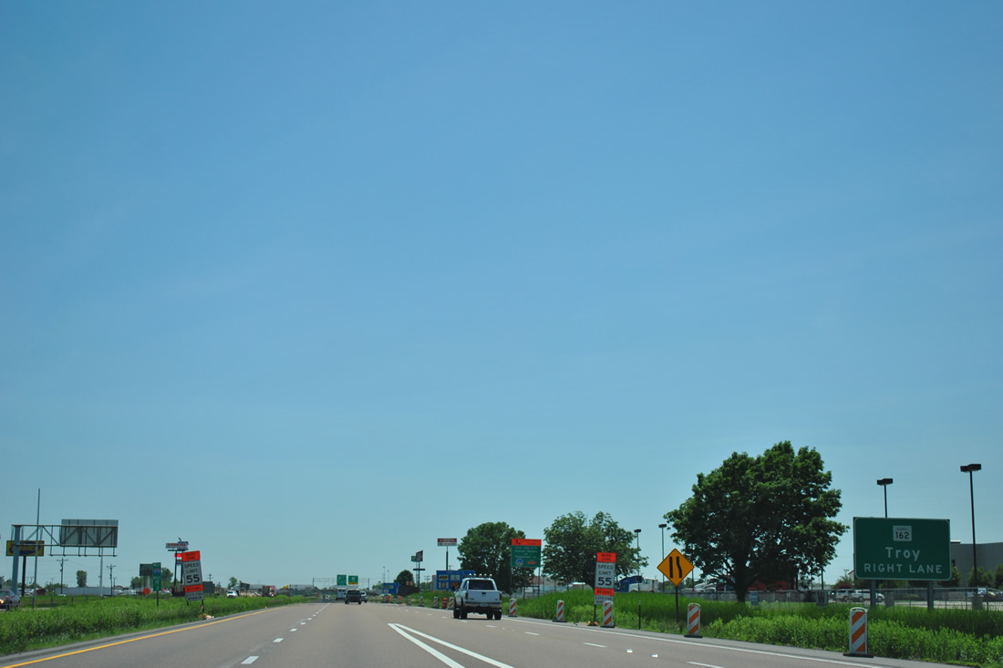
| IL 162 replaced U.S. 40 Bypass as the designation between Troy and IL 157 at Glen Carbon. The state route travels Edwardsville Road to Market Street into Downtown Troy. 05/06/18 |
|
| Troy Road lines the west side of I-55/70 to serve an adjacent subdivision between IL 162 (Edwardsville Road) and the exchange with U.S. 40. Beyond the westward turn at Exit 17, the frontage road represents the original westbound lanes of U.S. 40/66. 05/07/18 |
|
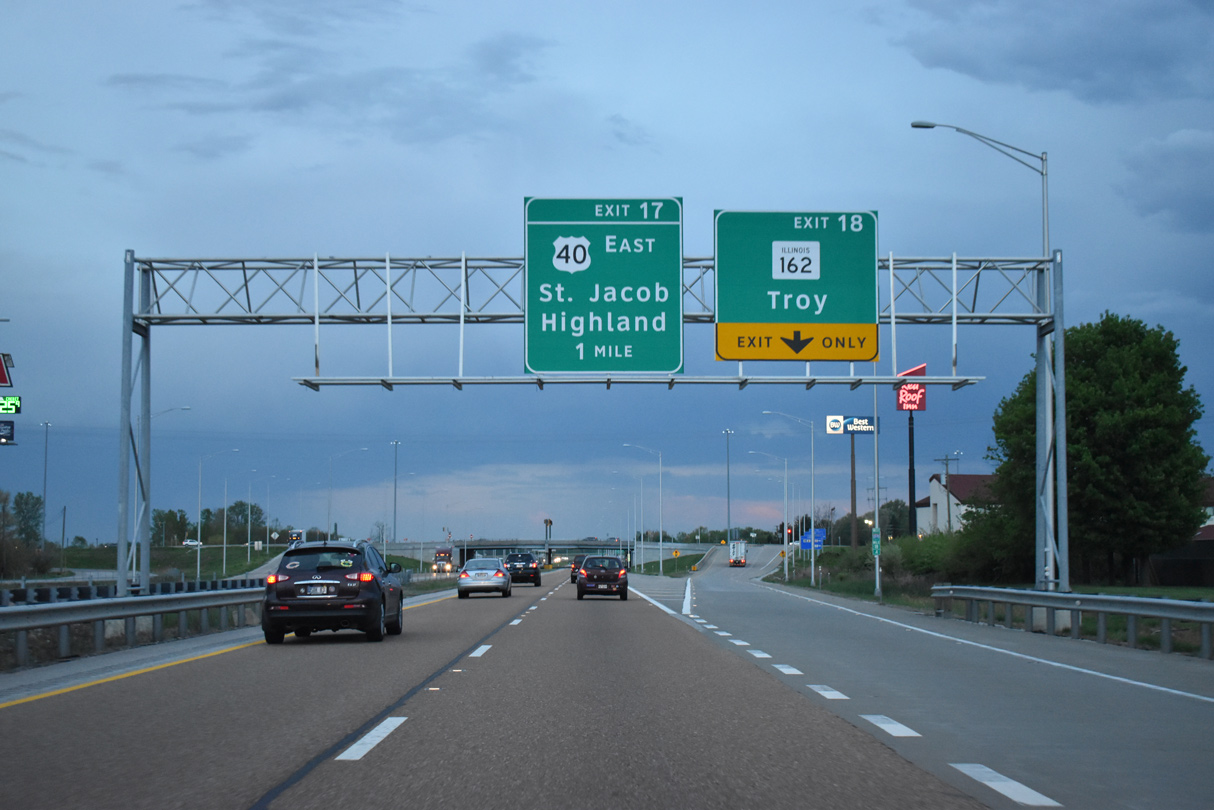
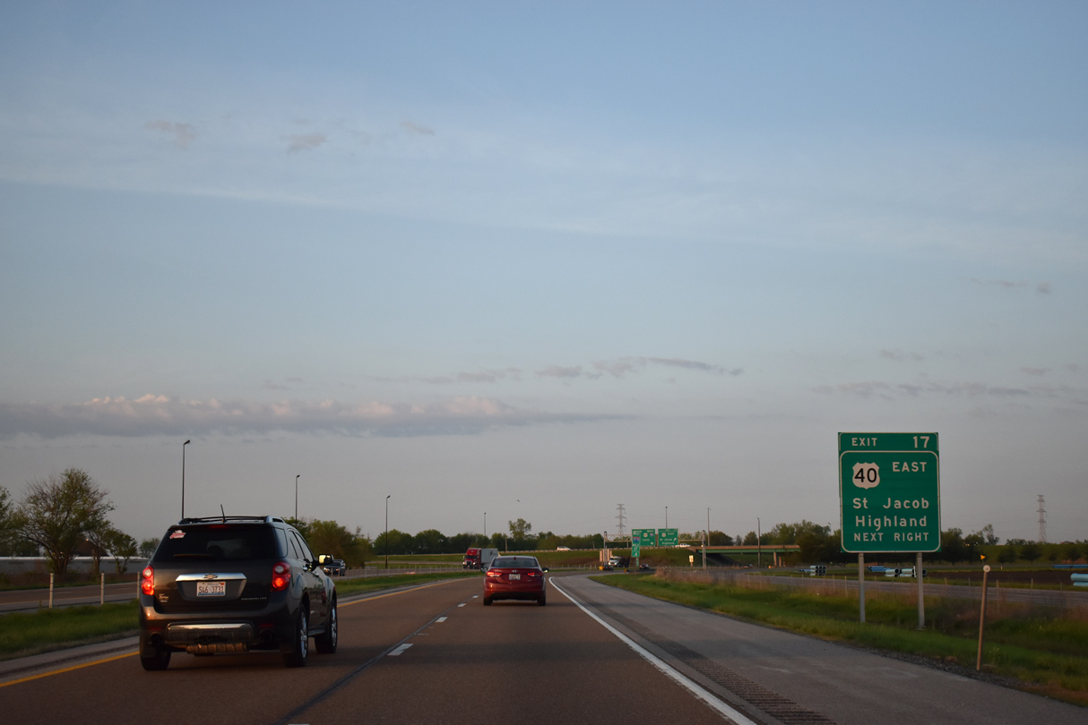
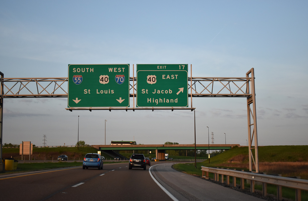
| U.S. 40 shifts onto the I-55/70 westbound overlap from the suburban south side of Troy at a trumpet interchange (Exit 17). 05/07/18 |
|
| U.S. 40 east accompanies Interstate 70 throughout Illinois and acts as a local route through St. Jacob and Highland before combining with the eastbound freeway at Exit 30. 05/07/18 |
|
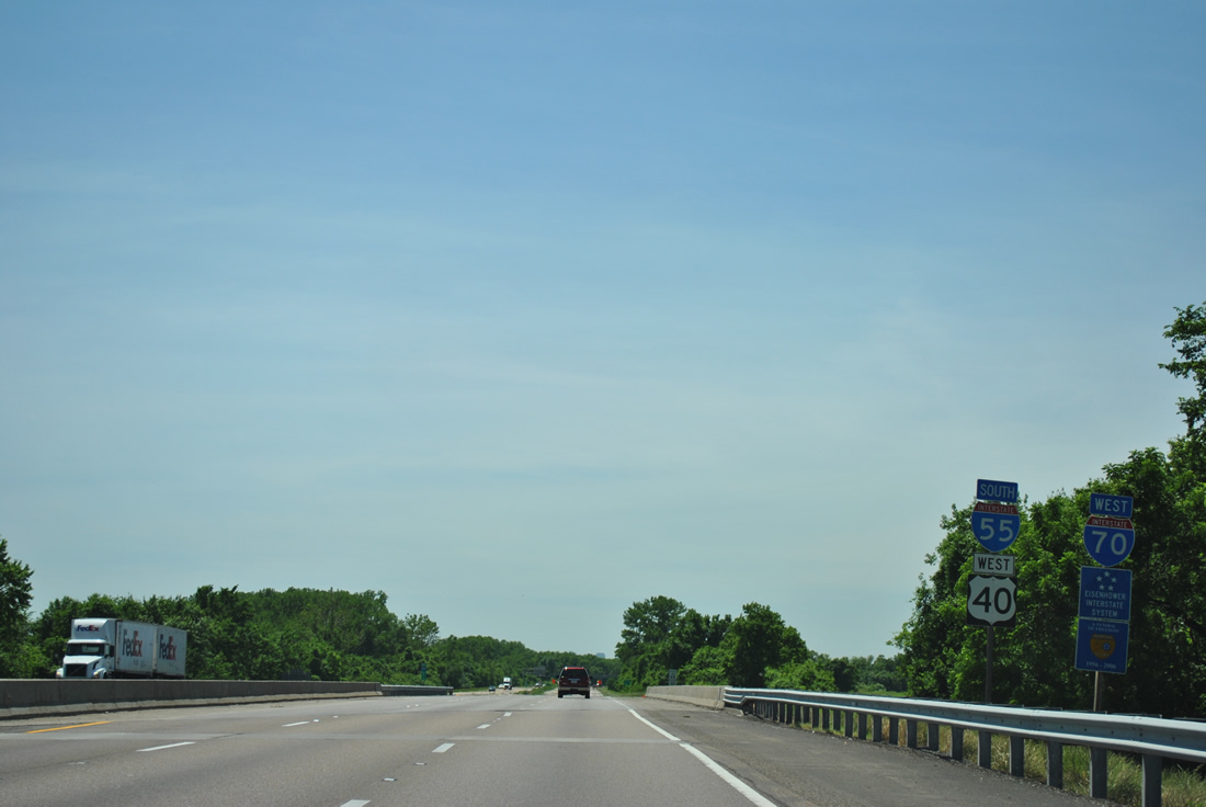
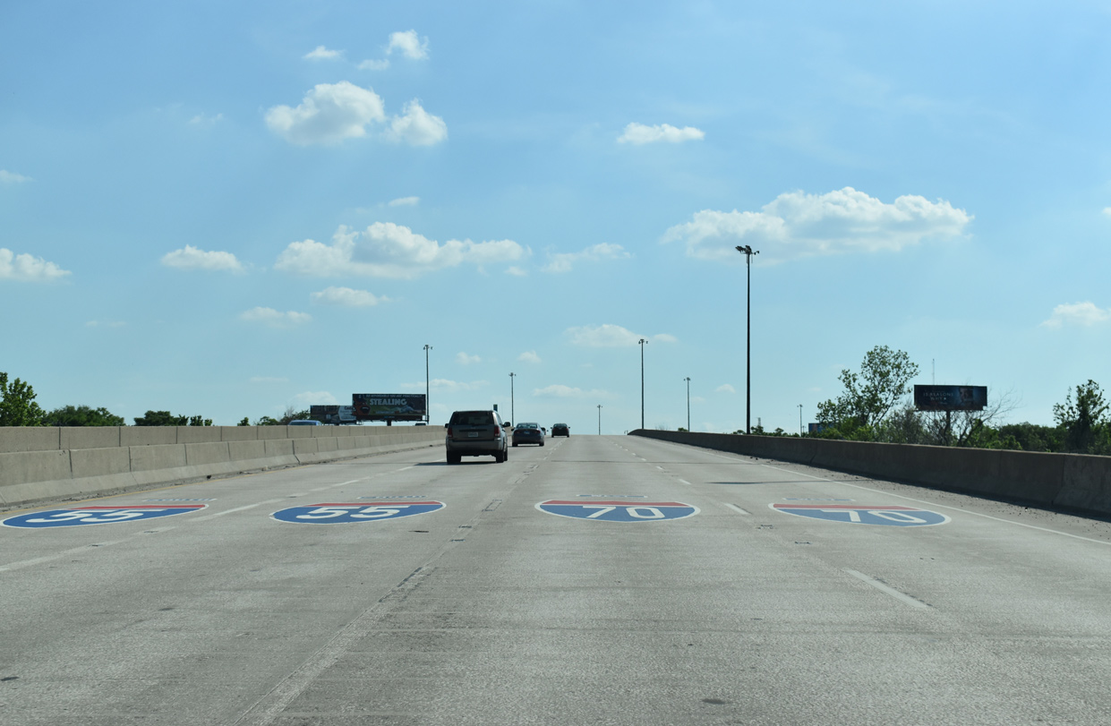
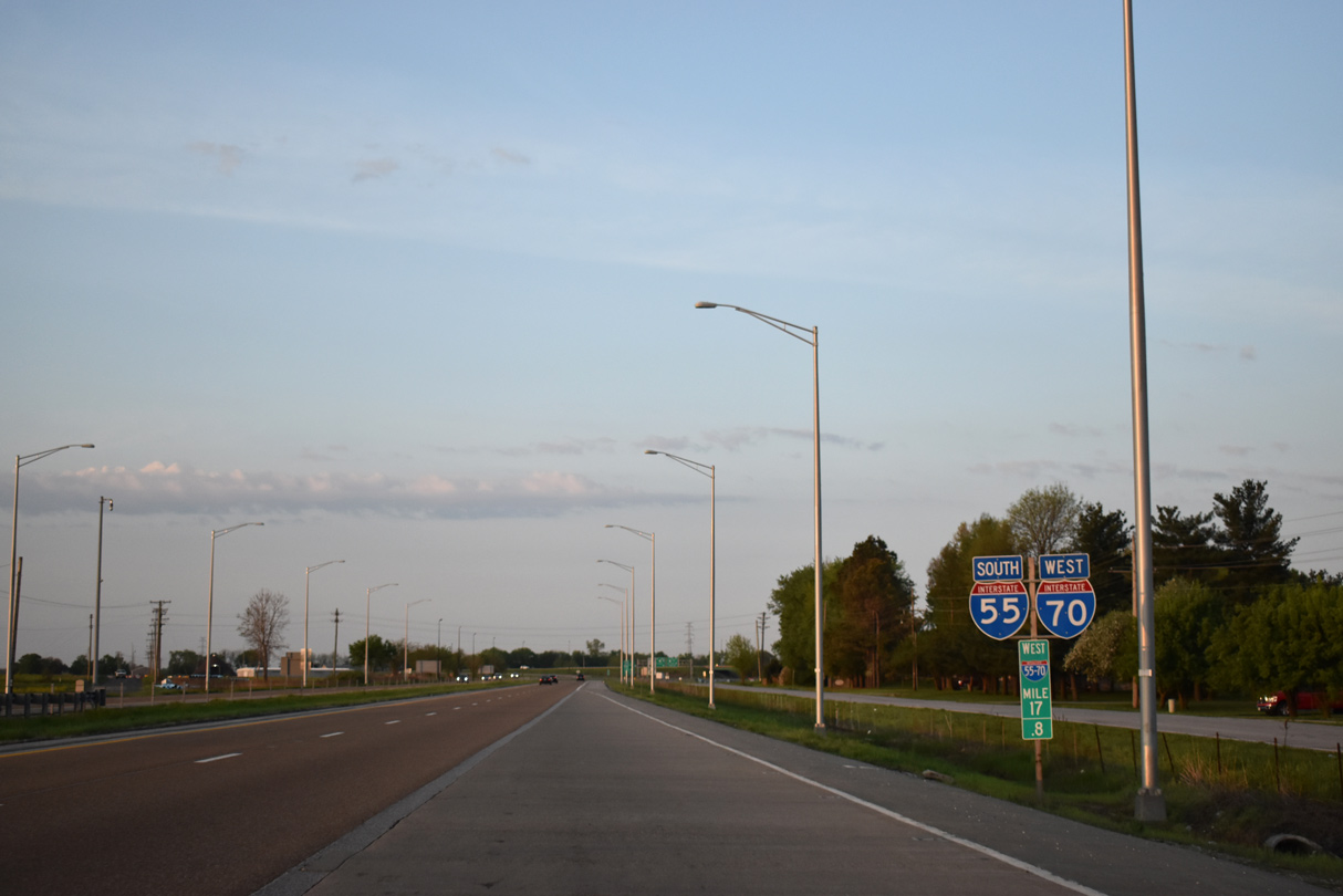
| Traveling 171 miles across the state, the final westbound stretch of U.S. 40, from Troy to St. Louis, coincides with I-55 south and I-70 west. 05/07/18 |
|
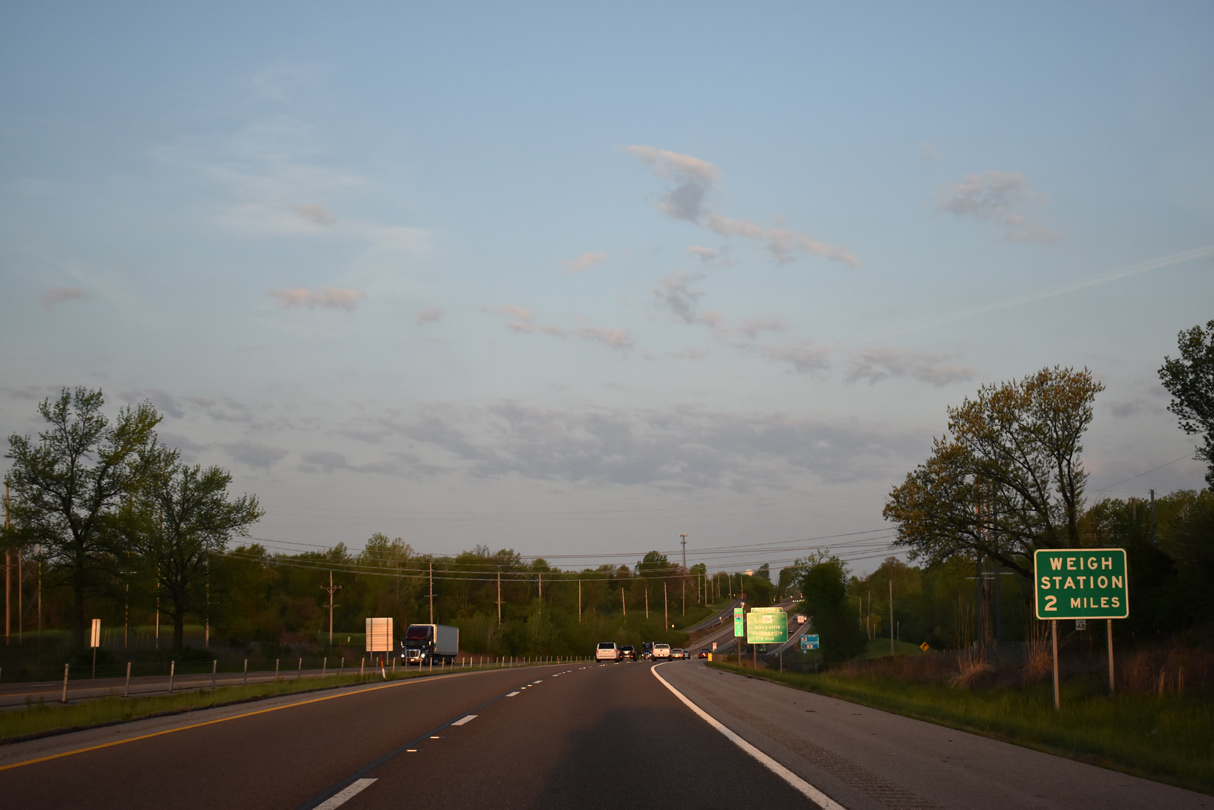
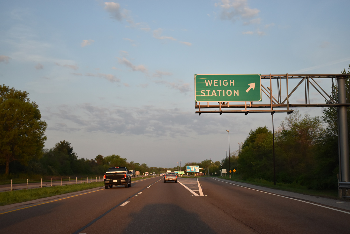
| I-55/70-U.S. 40 cross Canteen Creek beyond the initial sign for a weigh station past Exit 15. 05/07/18 |
|
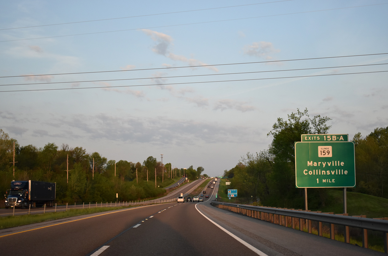
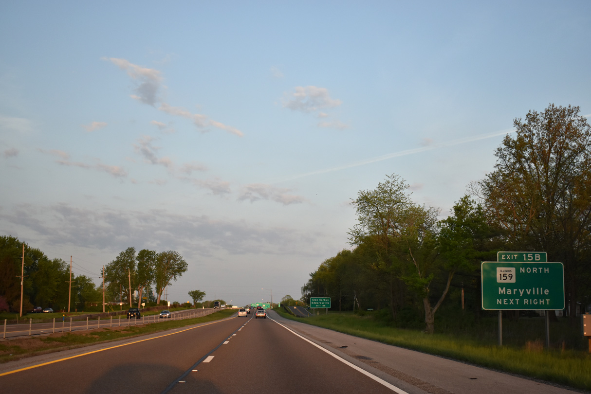
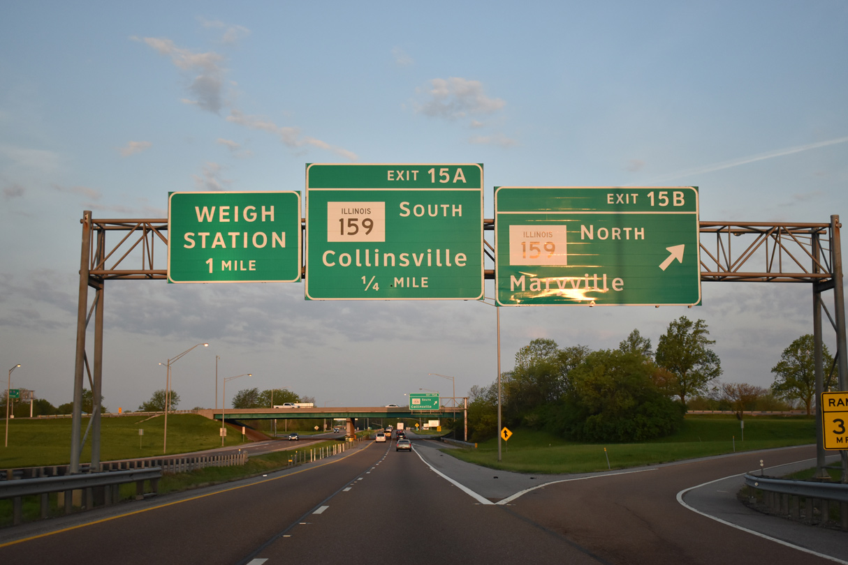
| IL 159, a 62 mile long highway between Red Bud and Bunker Hill in western Illinois, meets I-55/70 and U.S. 40 at a cloverleaf interchange (Exit 15) in one mile. 05/07/18 |
|
| IL 159 (Maryville Road) travels north from Exit 15 B to Center Street in Maryville ahead of adjacent Glen Carbon and Edwardsville. 05/07/18 |
|
| The cloverleaf interchange with IL 159 at Troy Crossing replaced an original at-grade intersection where U.S. 40/66 west turned southward onto Vandalia Street into Collinsville. 05/07/18 |
|
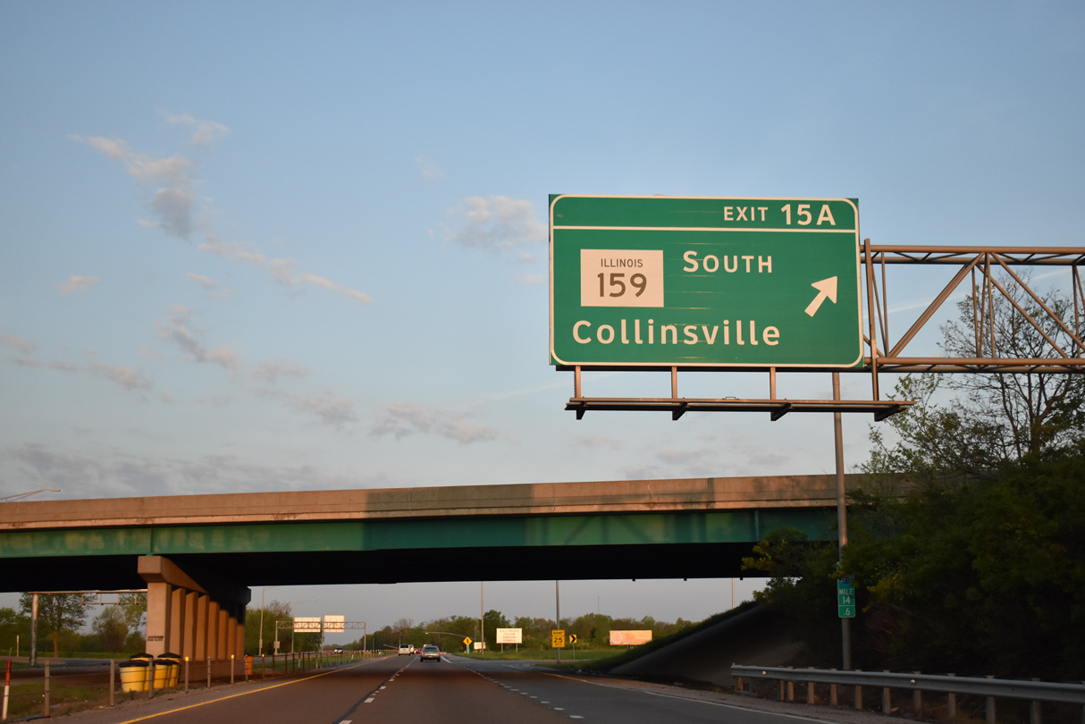
| Exit 15A loops onto IL 159 (Vandalia Street) south into Collinsville. U.S. 40/66 followed Vandalia Street south to Belt Line Road west, with City U.S. 40 continuing southwest to Main Street. 05/07/18 |
|
| Continuing west, I-55/70-U.S. 40 skim the northwestern city limits of Collinsville. 05/07/18 |
|
| A westbound side weigh station follows between the Pleasant Ridge Road overpass and Keebler Road under crossing. A subdivision fronts the southbound side at the same location. 05/07/18 |
|
| IL 157 (Bluff Road) is the next westbound exit in two miles. Downtown East St. Louis lies 12 miles to the west. 05/07/18 |
|
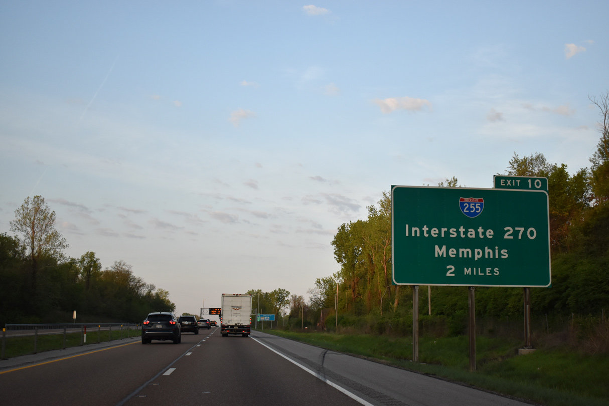
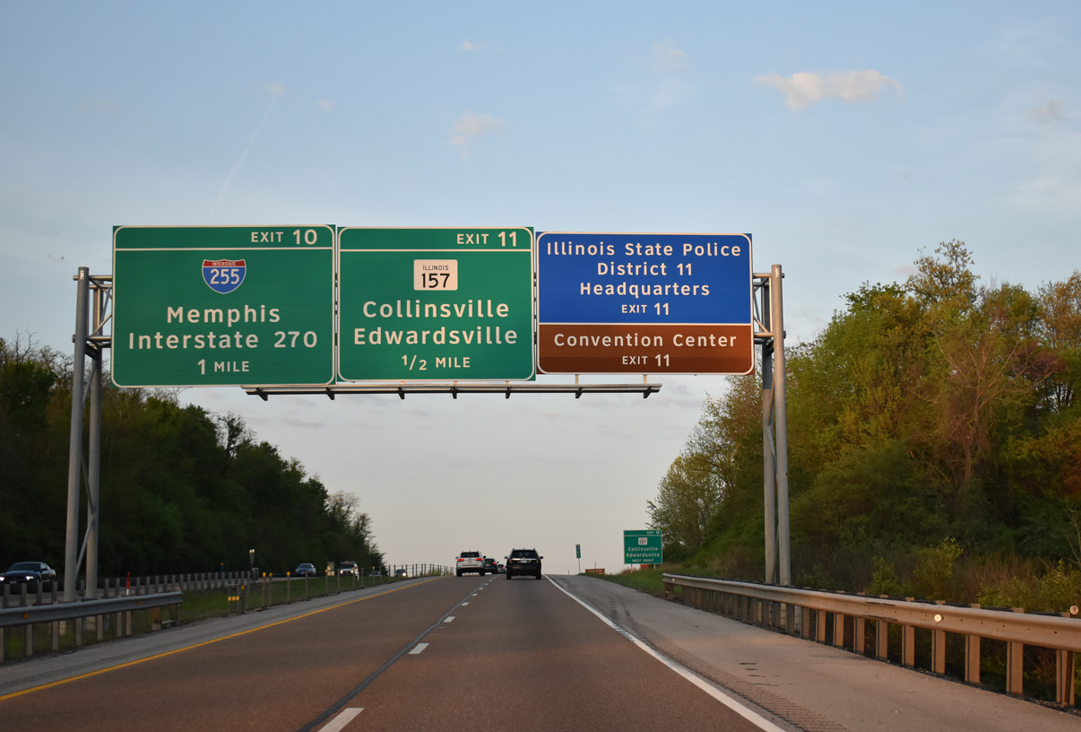
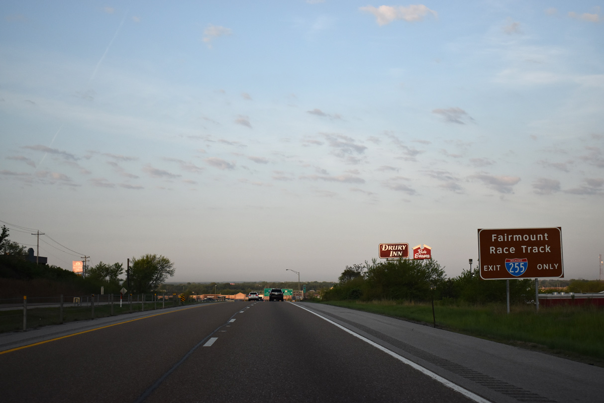
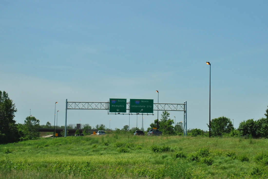
| The first sign for Exit 10 to I-255 precedes the folded diamond interchange with IL 157. I-255 provides a long distance bypass for I-55 travelers headed south to Cape Girardeau, Sikeston and Memphis. 05/07/18 |
|
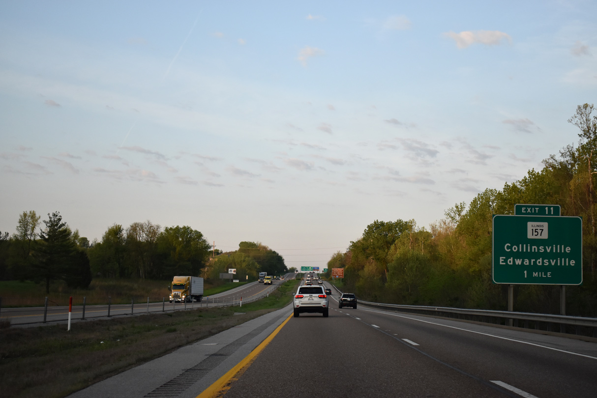
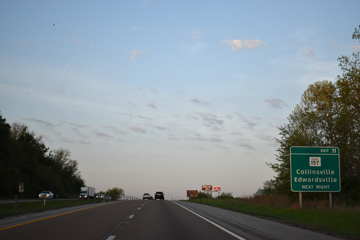
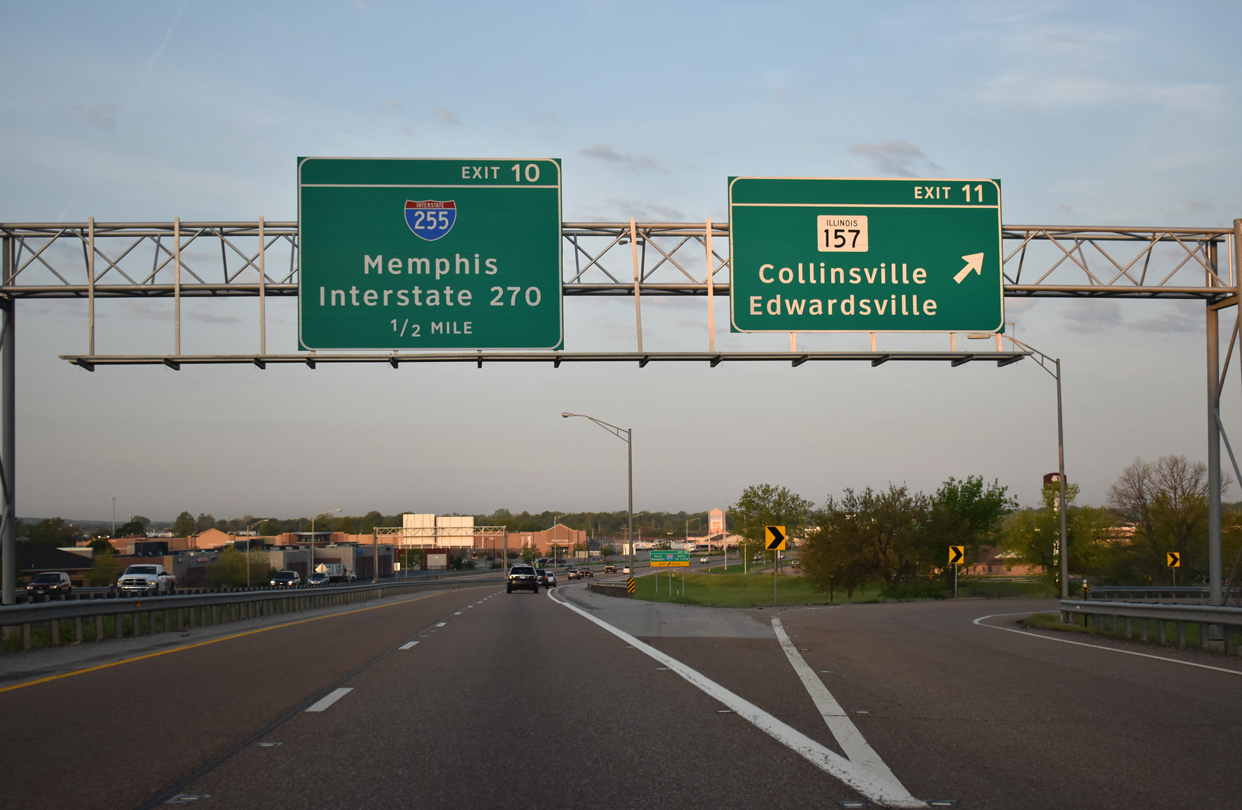
| One mile east of Exit 11 to IL 157. 40 miles in length, IL 157 forms a fish hook shaped route from Cahokia east to Fairview Heights, and north from there to Collinsville, Edwardsville and Hamel. 05/07/18 |
|
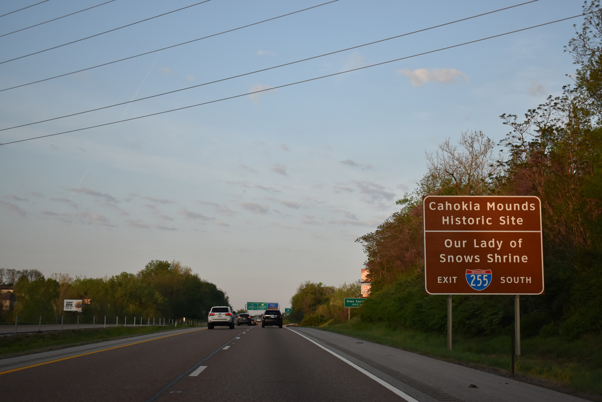
| Forthcoming Interstate 255 south provides the fastest route to Cahokia Mounds Historic Site, located along Collinsville Road west from Exit 24, and Our Lady of Snows Shrine, located east of Exit 17A along IL 15 at Belleville. 05/07/18 |
|
| IL 157 (Bluff Road) meets I-55/70-U.S. 40 along a retail corridor in west Collinsville. The directional cloverleaf interchange (Exit 10) with I-255 lies one half mile to the west. 05/07/18 |
|
| IL 157 (Bluff Road) doubles as historic U.S. 40/66 between nearby Belt Line Road east and Collinsville Road west. 05/07/18 |
|
| Historic U.S. 40/66 part ways with IL 157 via Collinsville Road west to Fairmount Park. There an interchange connects with I-255, and motorists along I-55/70 are advised to use I-255 instead of the arterial route for the horse racing venue. 05/07/18 |
|
| IL 157 generally parallels Interstate 255 south to Centreville and Cahokia, with the two meeting at Exit 13. I-255 continues from there to Dupo and Columbia. 05/07/18 |
|
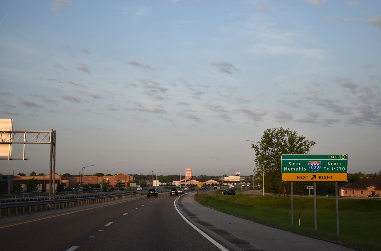
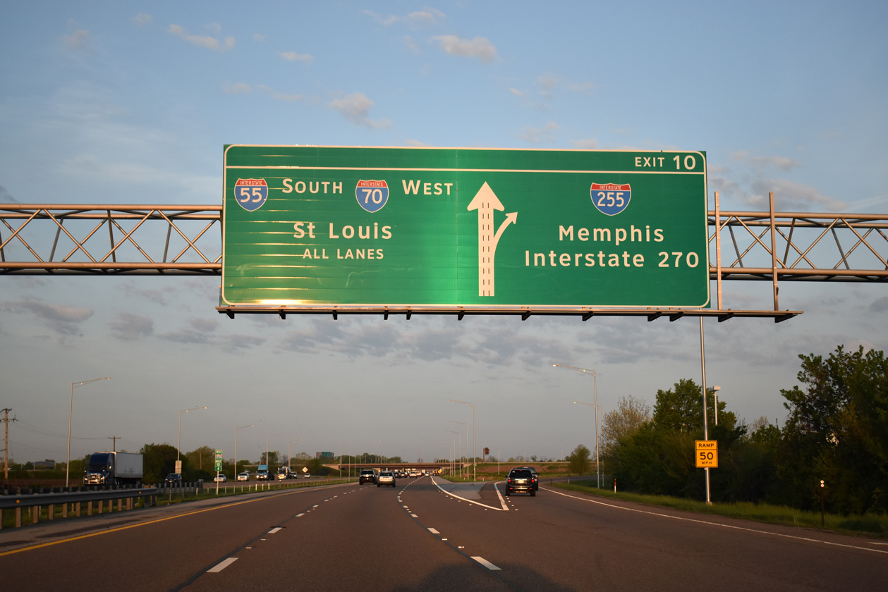
| Exit 10 carries all traffic in unison from I-55/70-U.S. 40 west to I-255. Completed in July 1988, Interstate 255 constitutes a 30.82 mile freeway from I-270 and IL 255 near Pontoon Beach, southward to the Jefferson Barracks Bridge across the Mississippi River. 05/07/18 |
|
| Three lanes continue west as Exit 10 leaves I-55/70 south for Interstate 255. I-255 ends at I-55/270 west in the southern St. Louis suburbs at Mehlville. U.S. 40 is absent on this diagrammatic sign, added by 2011. 05/07/18 |
|
| Exit 10 partitions into ramps for Interstate 255 north to I-270 and Alton via the freeway continuation of IL 255 north, and I-255 south to Cahokia. 06/01/11 |
|
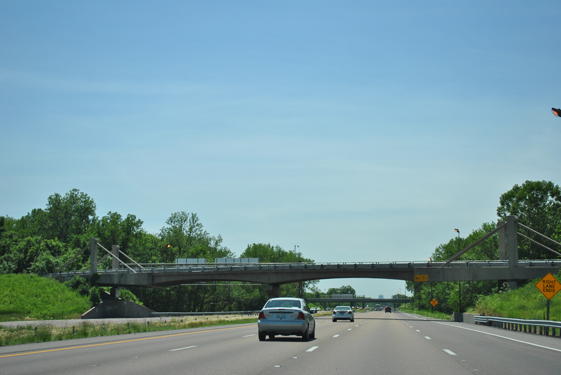
| Just west of I-255, I-55/70-U.S. 40 west travel under an overpass (Fairmont Avenue) resembling a cable-stayed bridge. 06/01/11 |
|
| A wye interchange adds traffic from Fairmont Avenue north onto I-55/70-U.S. 40 west ahead Canteen Creek. Pictured here is the shield assembly posted after the on-ramp. 06/01/11 |
|
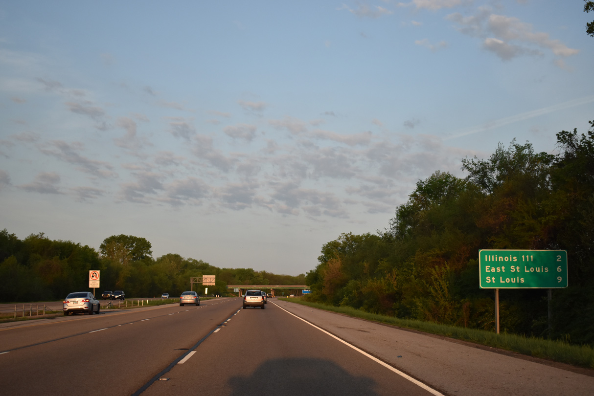
| Nine miles remain before I-55 combines with Interstate 44 at Downtown St. Louis. IL 111 and Fairmont City is next in three miles. 05/07/18 |
|
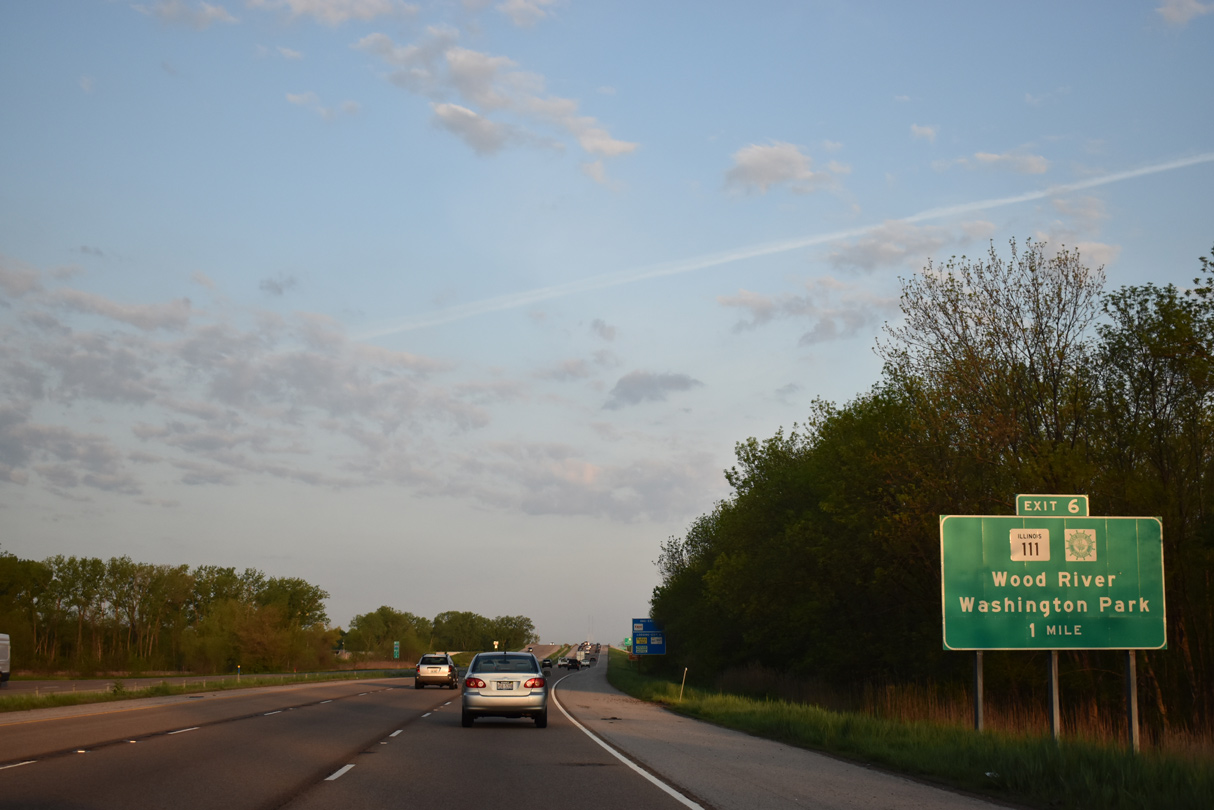
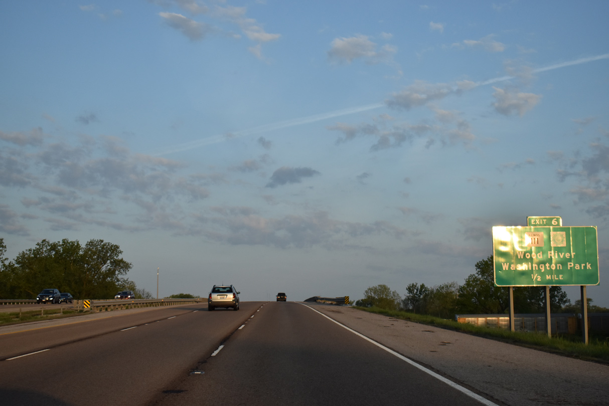
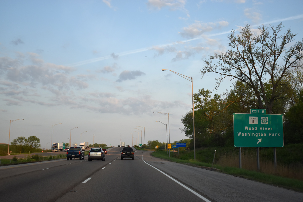
| IL 111 and the Great River Road travel southwest from Pontoon Beach and Horseshoe Lake to meet I-55/70-U.S. 40 at a diamond interchange (Exit 6) in one mile. 05/07/18 |
|
| A 78 mile long highway, IL 111 travels north from Centreville to Washington Park and Fairmont City to I-55/70. The state route continues from Interstate 270 to Wood River and overall to Waverly. 05/07/18 |
|
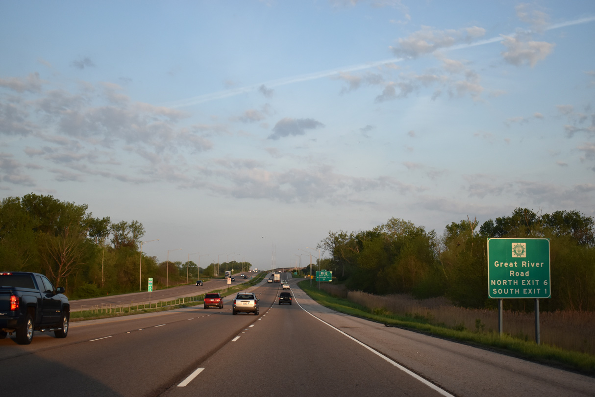
| The Great River Road follows IL 111 north to I-270 west and IL 3 at Granite City. Southward, the Great River Road continues with Interstate 55 to IL 3 at East St. Louis. 05/07/18 |
|
| IL 111 commingles with adjacent Collinsville Road (old U.S. 40/66) nearby to make the connection with Kingshighway south. Collinsville Road continues westward as old U.S. 40/66 to 9th Street in East St. Louis. 05/07/18 |
|
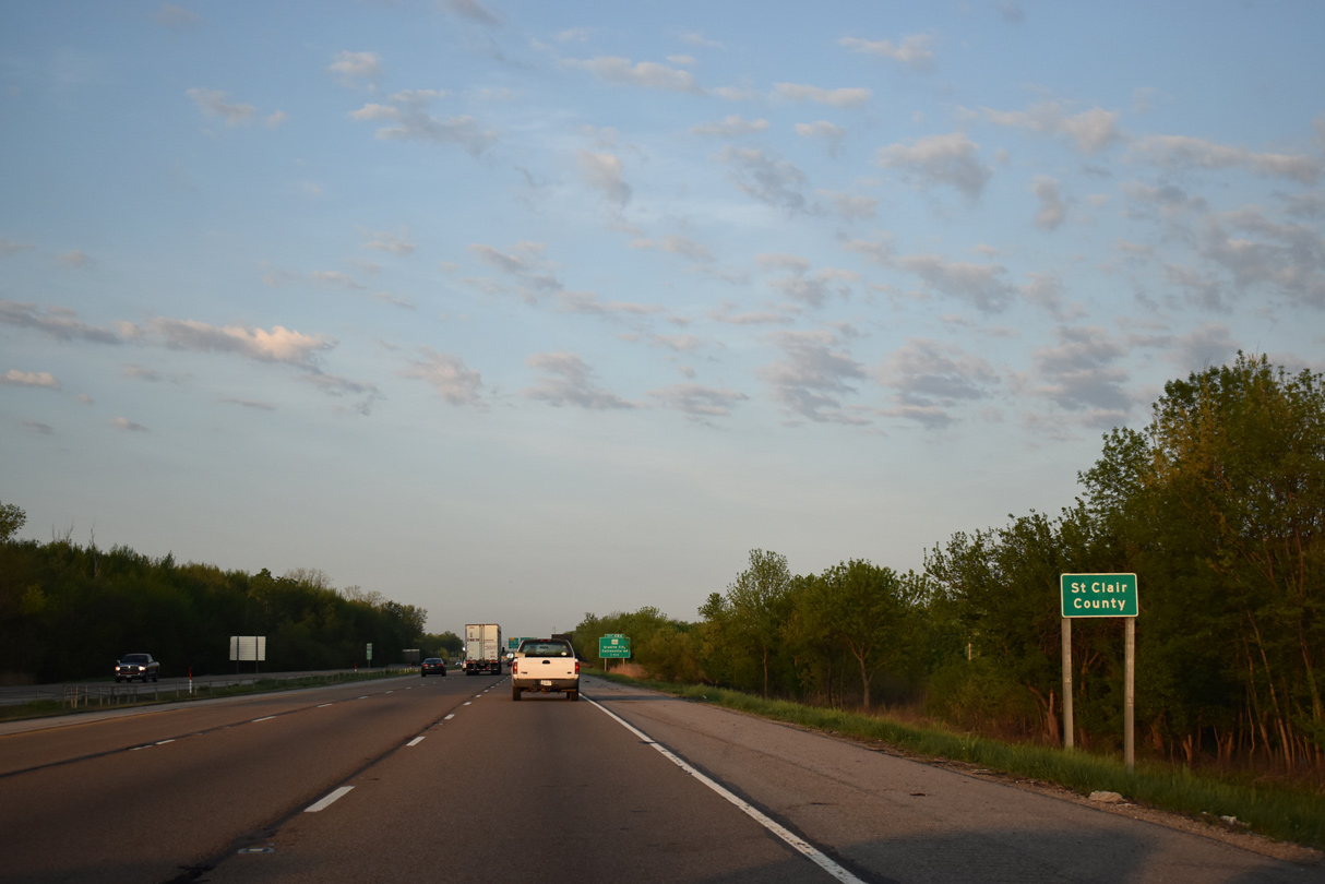
| I-55/70-U.S. 40 west advance from Exit 6 into the northwest corner of St. Clair County. 05/07/18 |
|
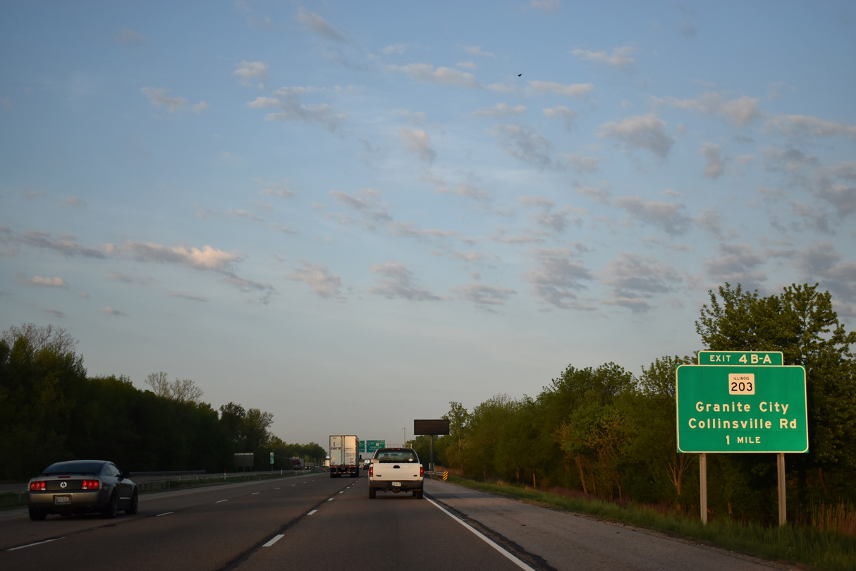
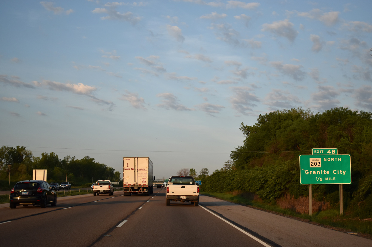
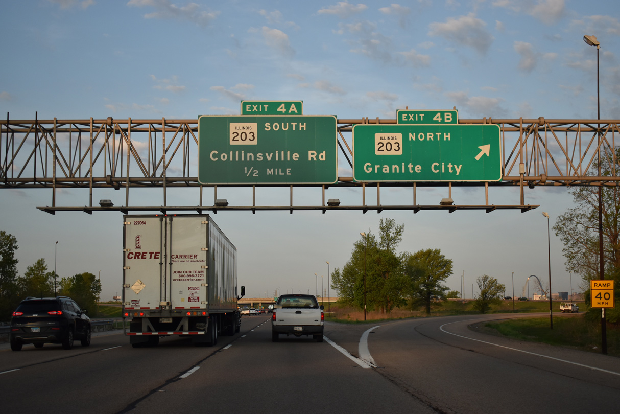
| IL 203 commences a 9.7 mile route northward to I-270 from just south of the directional cloverleaf interchange with I-55/70 at Exit 4. 05/07/18 |
|
| Exit 4 B departs in a half mile for IL 203 north to World Wide Technology Raceway and Madison. May 2011 |
|
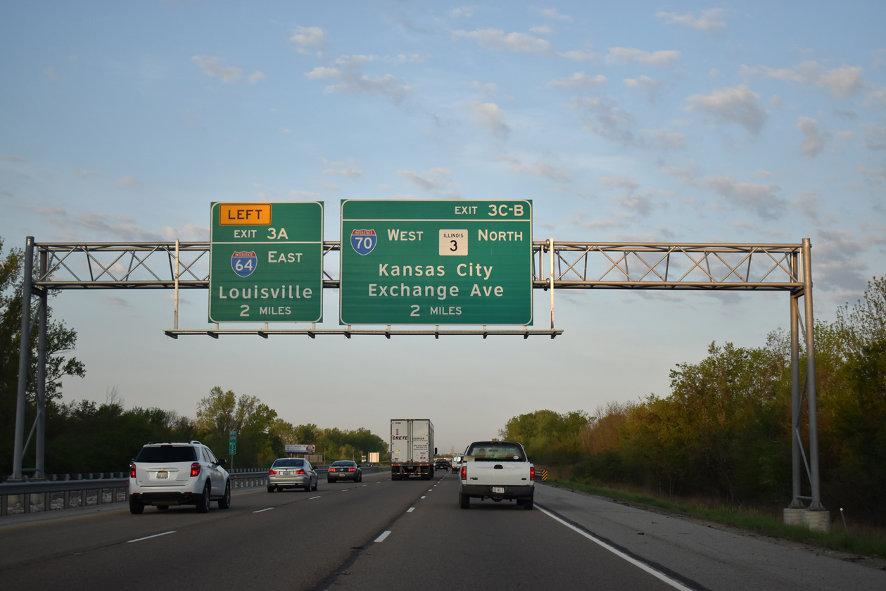
| Interstate 70 splits with I-55 south in two miles as I-64 west ties from Washington Park to the east. 05/07/18 |
|
| Westbound traffic to IL 203 departs as I-55/70 advance 1.5 miles west to I-64. 05/07/18 |
|
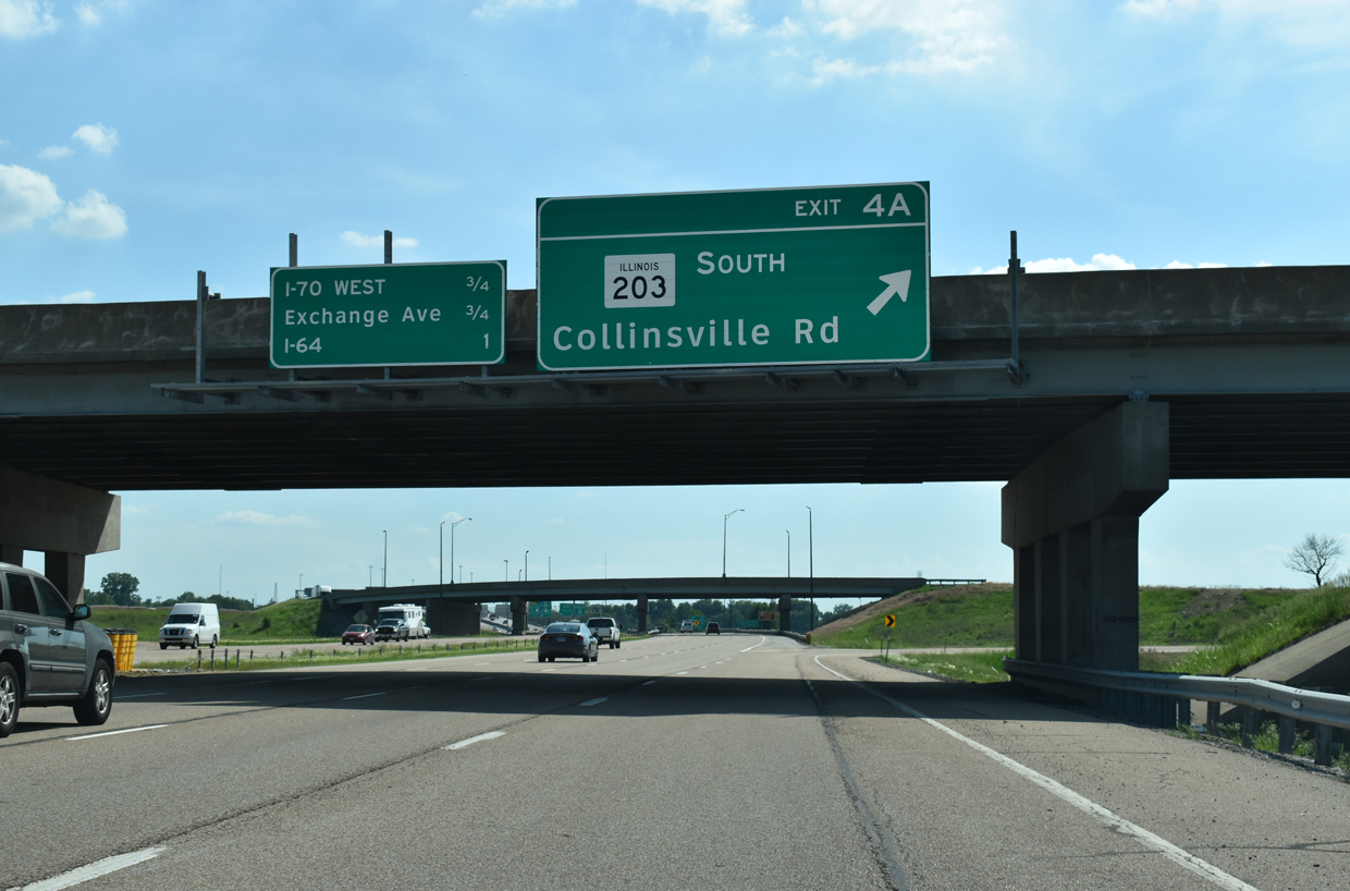
| Exit 4 A loops onto IL 203 south to adjacent Collinsville Road (old U.S. 40/66). Madison Road nearby represents the former alignment of U.S. 67 Alternate, which IL 203 replaced leading north into Madison. U.S. 67 Alternate combined with U.S. 40-66 southwest to 10th Street in East St. Louis. 05/24/18 |
|
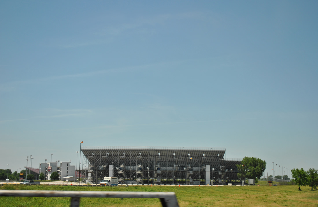
| Looking north at World Wide Technology Raceway (formerly Gateway Motorsports Park) from a viaduct along I-55/70-U.S. 40. The track started in 1967 as a one-eighth of a mile drag strip named St. Louis Raceway Park. Expansion occurred in 1971 and 1985, when a 2.6 mile track was added. Problems plagued the park over the years and NASCAR pulled out of the venue in 2010. However NHRA returned to the raceway in 2012 and the NASCAR Camping World Truck Series followed in 2014. 06/01/11 |
|
| Elevating to cross three railroad lines, including a CSX mainline, I-55/70 continue to the original Tri-Level Interchange with Interstate 64. 05/24/18 |
|
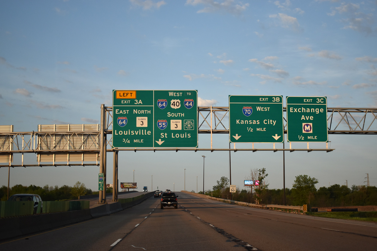
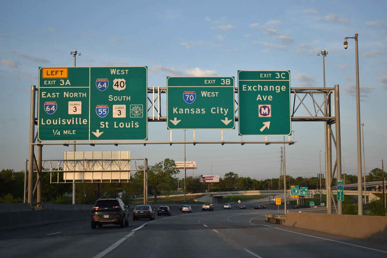
| The exchange with I-64 was redesigned into a systems interchange to accommodate the realignment of I-70 arcing northwest to the Stan Musial Veterans Memorial Bridge across the Mississippi River. Work in 2011 closed then-Exit 3 to Exchange Avenue at 8th Street, as that ramp (Exit 3C) was relocated to Exchange at 7th Street. 05/07/18, 05/24/18 |
|
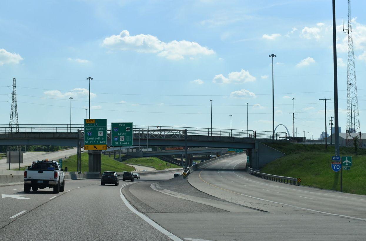
| Exit 3C to Exchange Avenue in East St. Louis remained as a half diamond interchange with Interstate 70 shifted to the February 9, 2014 opened Stan Musual Veterans Memorial Bridge.
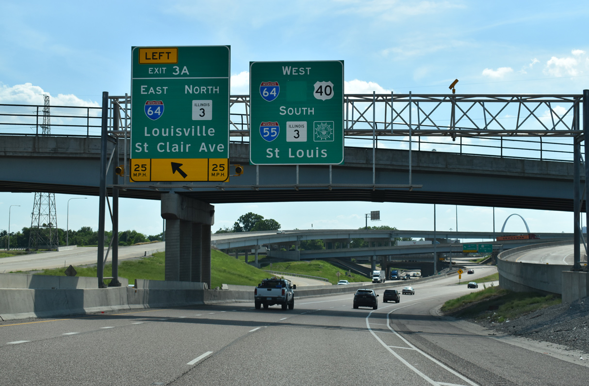
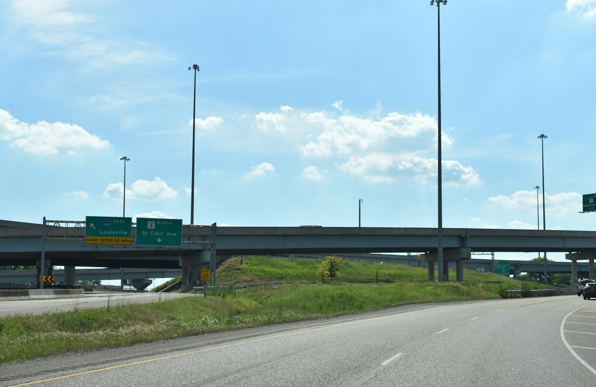
A left exit departs in a quarter mile for Interstate 64 east and Route 3 (St. Clair Avenue) north. I-64 ventures east to Fairview Heights, O'Fallon and Mt. Vernon while Route 3 leaves I-55/70 east for Brooklyn and Venice. 05/07/18 |
|
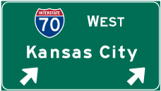
| A flyover departs from I-55/U.S. 40 west, taking Interstate 70 west on an arc northwest to the Stan Musial Veterans Memorial Bridge opposite Tucker Boulevard in St. Louis. 05/24/18 |
|
| Left Exit 3 A leaves I-55/U.S. 40 west immediately after the split with I-70 west for I-64 east and IL 3 north. Exit 2 C follows for the Dr. Martin Luther King, Jr. Memorial Bridge. 05/24/18 |
|
| Construction for the new alignment of Interstate 70 expanded the original Tri Level Interchange joining I-55, I-64 and I-70 into a multi level systems exchange. 05/24/18 |
|
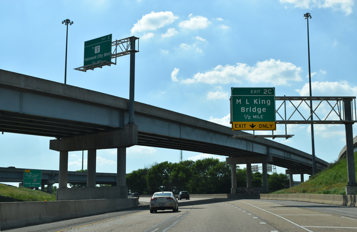
| Exit 3 A splits into ramps for Interstate 64 east to Louisville, Kentucky and IL 3 (St. Clair Avenue) north. The new alignment of I-70 included a parclo interchange connecting with IL 3 via IL 3 Spur along Fairmont City Boulevard and Packers Avenue. 05/24/18 |
|
| The Martin Luther King Bridge branches 1.08 miles west from I-55/64-U.S. 40 to the Missouri state line. 05/24/18 |
|
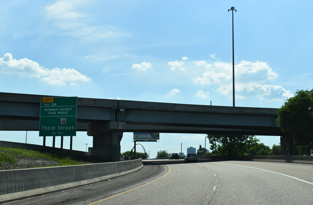
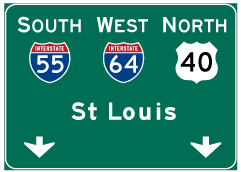
| Interstate 64 west and IL 3 combine with I-55/U.S. 40 west at this guide sign directing traffic to the East St. Louis business district and the Eads Bridge via 3rd Street west. The Eads Bridge was the first bridge to span the Mississippi River when it opened in 1874. 05/24/18 |
Page Updated 01-10-2024.


 South
South  West
West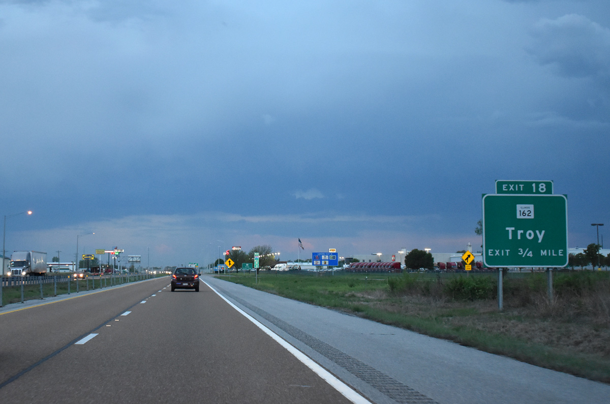
 West
West