|
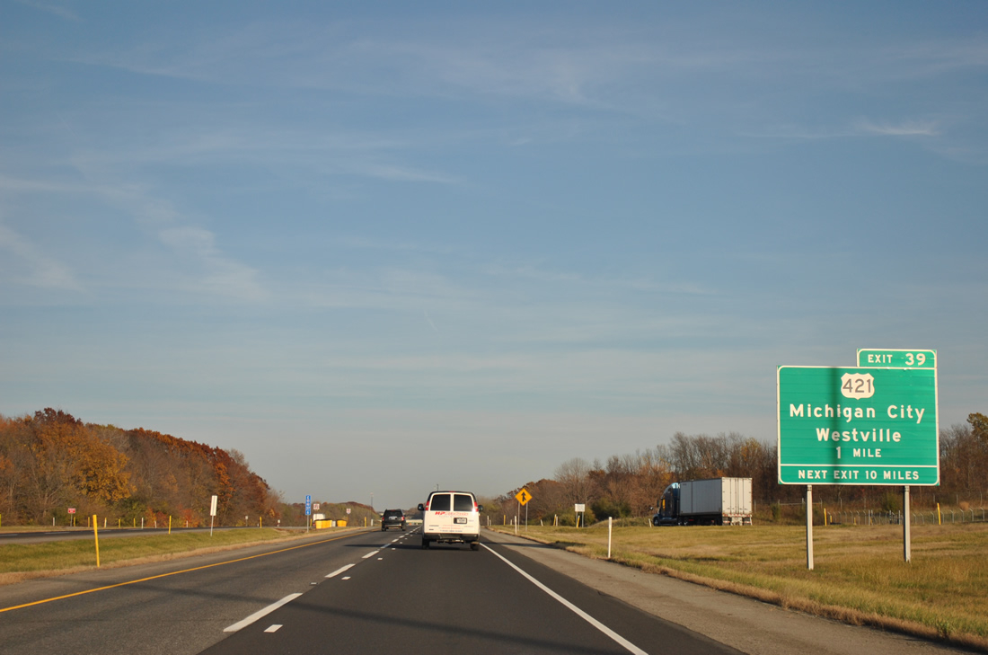
| One mile east of the truck rest areas and Porter County line is Exit 39 to U.S. 421. U.S. 421 stretches 232 miles southward from its terminus at U.S. 20, in south Michigan City, to Frankfort, Zionsville, Indianapolis, Shelbyville (with Interstate 74), Greensburg and the Ohio River at Madison. The route ended at U.S. 12 in Michigan City originally. 11/04/11 |
|
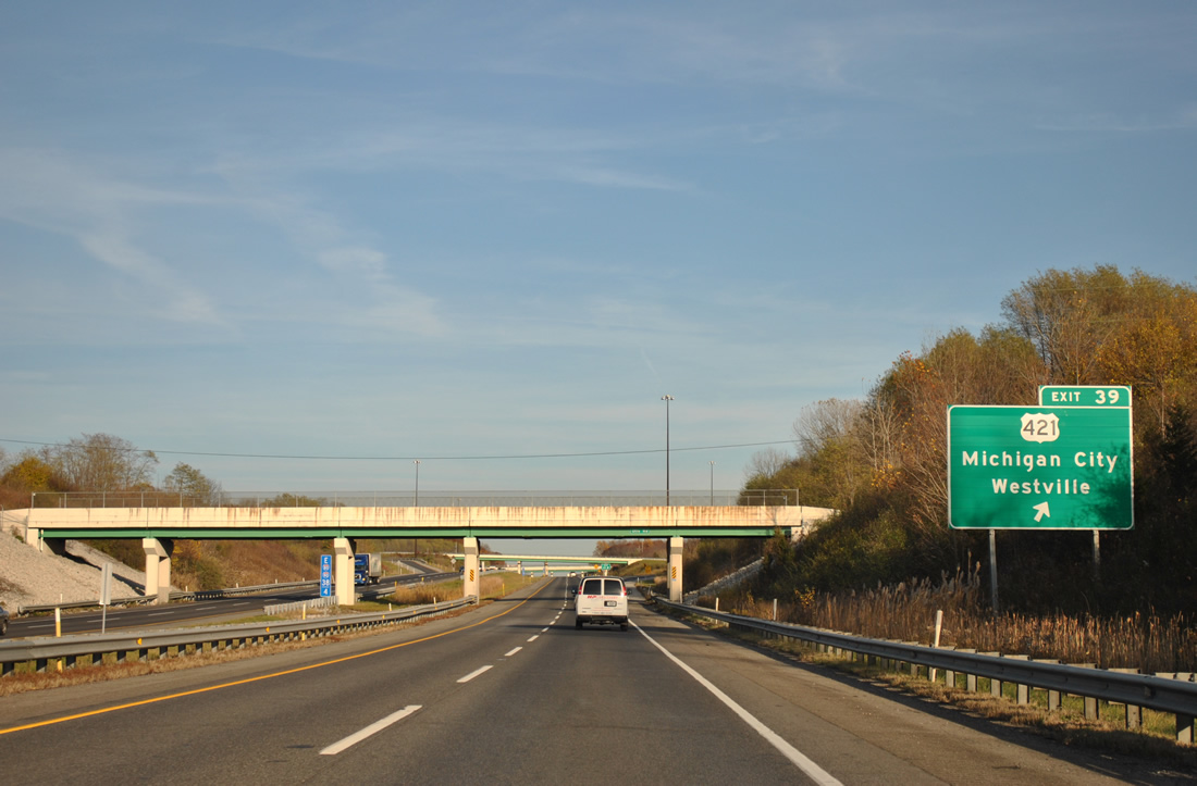
| Exit 39 parts ways with I-80/90 east beyond the Otis Road overpass. Westville is a two mile drive to the south, where SR 2 combines with U.S. 421 ahead of Flynn Street. Northward, U.S. 421 meets Interstate 94 in 6.2 miles. Overall U.S. 421 travels 941 miles from Indiana south to Fort Fisher, North Carolina along the Atlantic coast. 11/04/11 |
|
| Leaving U.S. 421, I-80/90 cut a swath between Michigan City to the northwest and LaPorte to the southeast. South Bend is now 40 miles to the east. 11/04/11 |
|
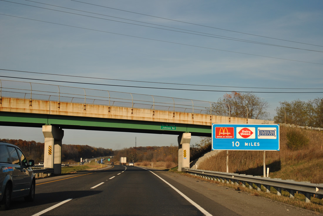
| Traveling west of Pine Lake, I-80/90 draw to within ten miles of the Knute Rockne Travel Plaza. 11/04/11 |
|
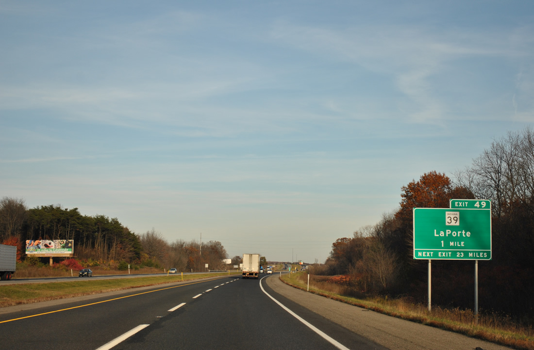
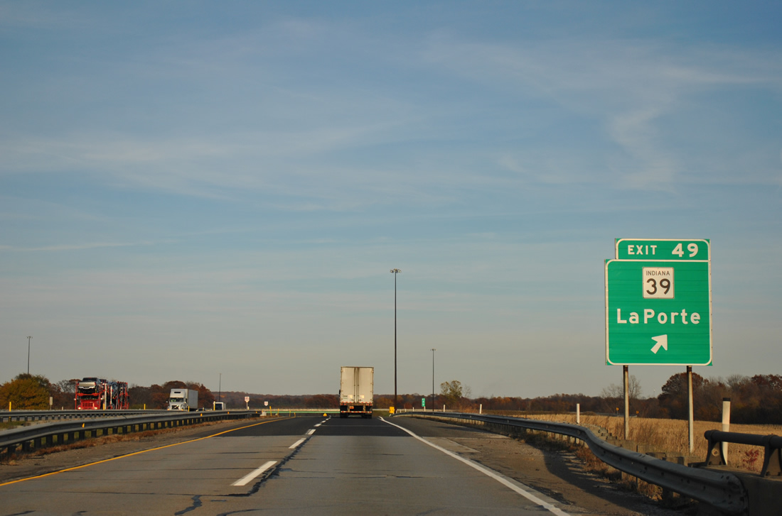
| SR 39 crosses paths with the Indiana Toll Road at the Exit 49 trumpet interchange and access road in two miles. 11/04/11 |
|
| I-80/90 pass over U.S. 35 without direct access on the approach to Exit 49. U.S. 35 links LaPorte with U.S. 20 near Michigan City, west of SR 39. SR 39 travels north from LaPorte to U.S. 20 near Springville, and to Exit 1 of Interstate 94 in Michigan as M-239. 11/04/11 |
|
| Continuing south, SR 39 leaves the Exit 49 access road and merges with U.S. 35 south in 2.2 miles along Pine Lake Avenue to downtown LaPorte. South from the city, SR 39 continues to Monticello, Frankfort and Lebanon as U.S. 35 sinks southeasterly to Logansport and Kokomo. 11/04/11 |
|
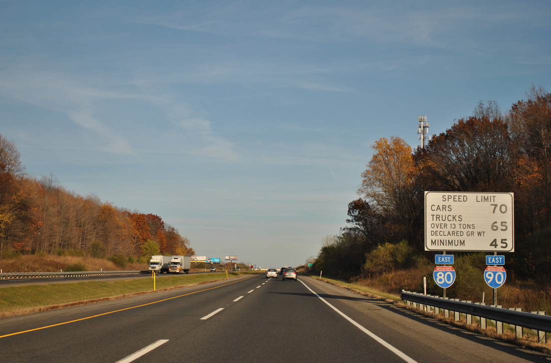
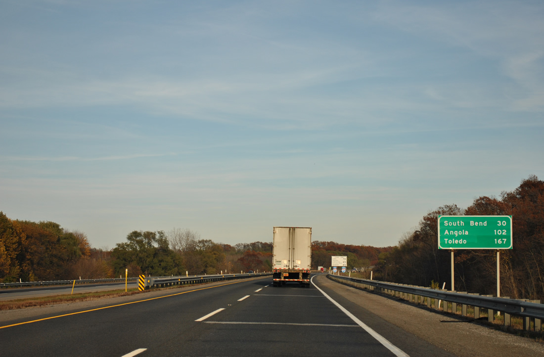
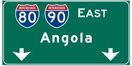
| Since South Bend is served by the next series of exits, Angola debuts on eastbound distance signs for the final Indiana interchange, at 102 miles to the east. Toledo, Ohio is now 167 miles out. 11/04/11 |
|
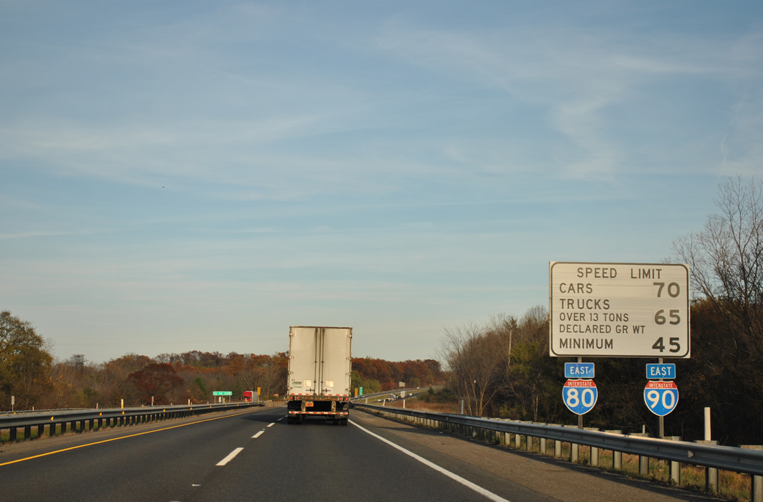
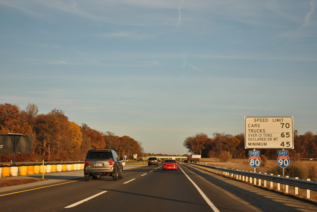
| Curving eastward by the next Interstates 80-90 and speed limit sign assembly. U.S. 20 passes over the Toll Road ahead en route to Rolling Prairie and SR 2. There is no direct access between the two highways. 11/04/11 |
|
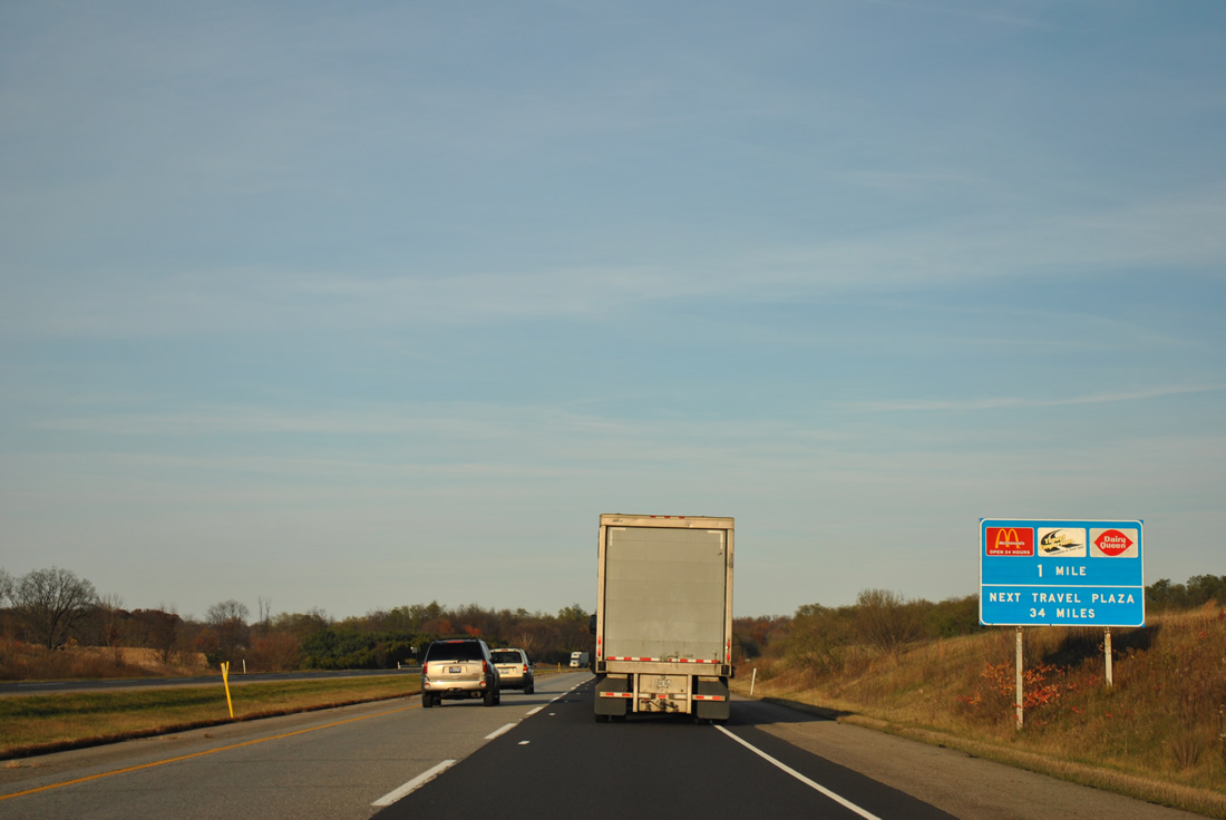
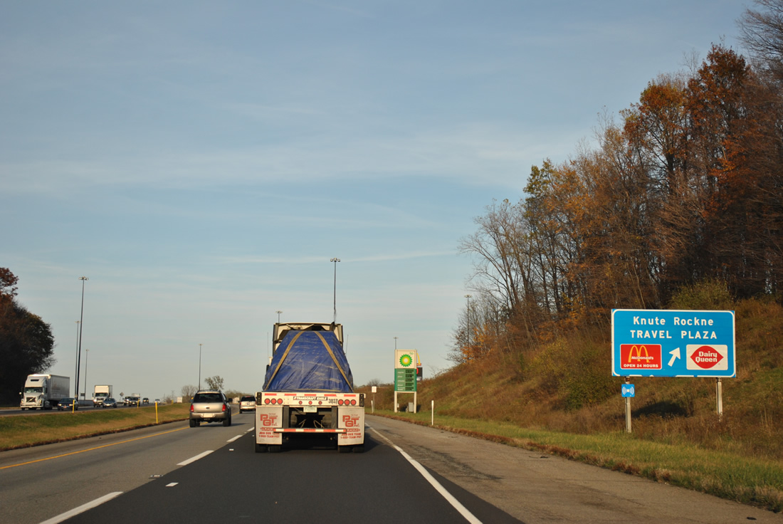
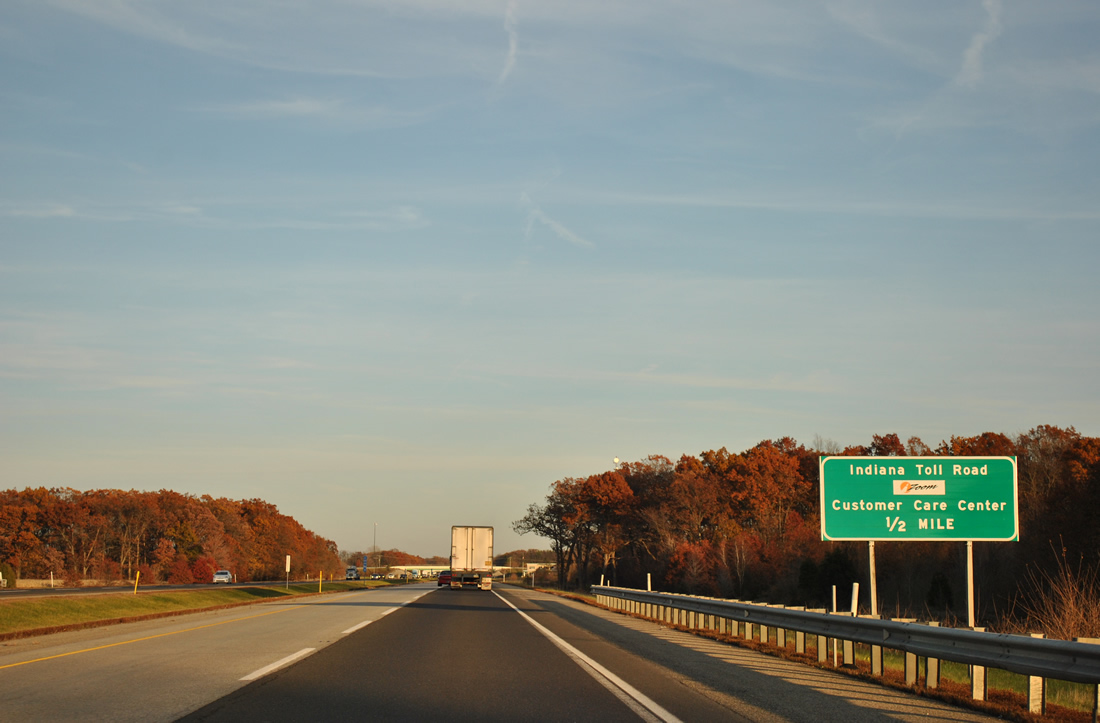
| A visitor center is included at the Knute Rockne Travel Plaza in two miles. 11/04/11 |
|
| One mile southwest of the Knute Rockne Travel Plaza by Hog Lake. The third service area resides in western Elkhart County, 34 miles to the east. 11/04/11 |
|
| Gas, food and tourist information are available in either direction. The westbound facility is named the Wilber Shaw Travel Plaza. 11/04/11 |
|
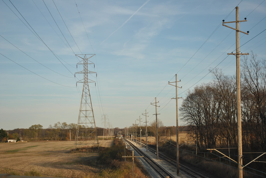
| I-80/90 span the Chicago, South Shore & South Bend Railroad line beyond the service plaza. A transmission line follows the railroad line west to Michigan City and east to Saugany Lake, where it branches northward to a substation near Hudson Lake. 11/04/11 |
|
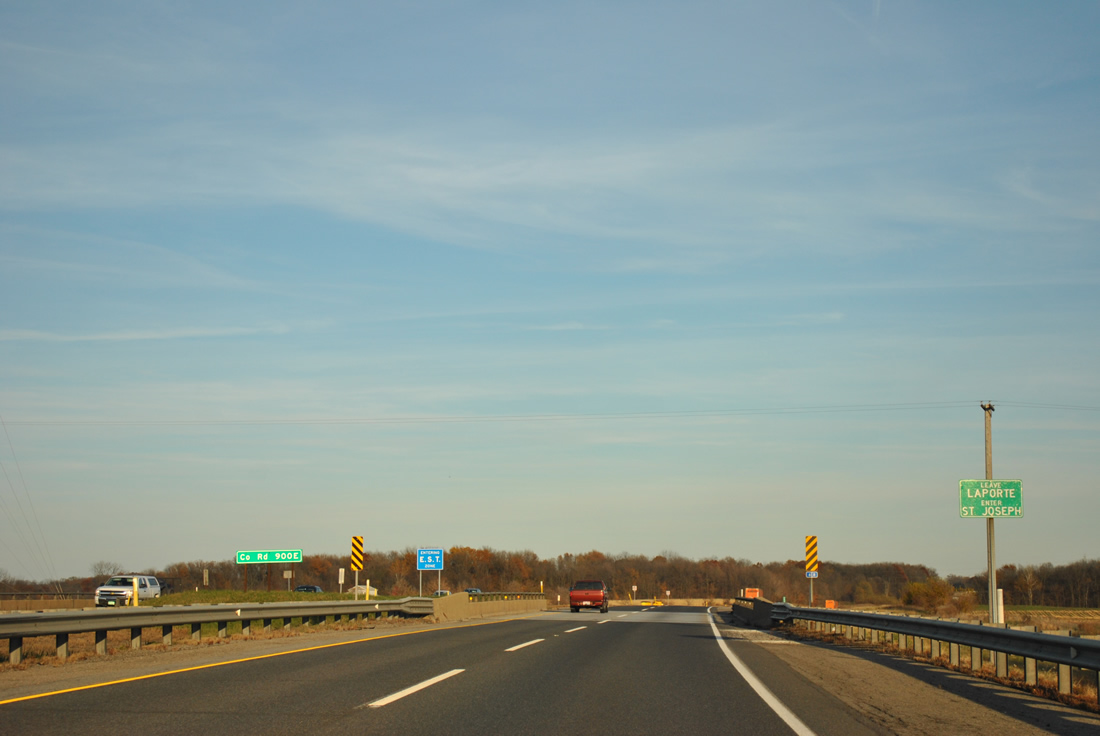
| Arcing north, I-80/90 pass by Saugany Lake directly and then proceed east to enter St. Joseph County at the County Road 900 East underpass. 11/04/11 |
|
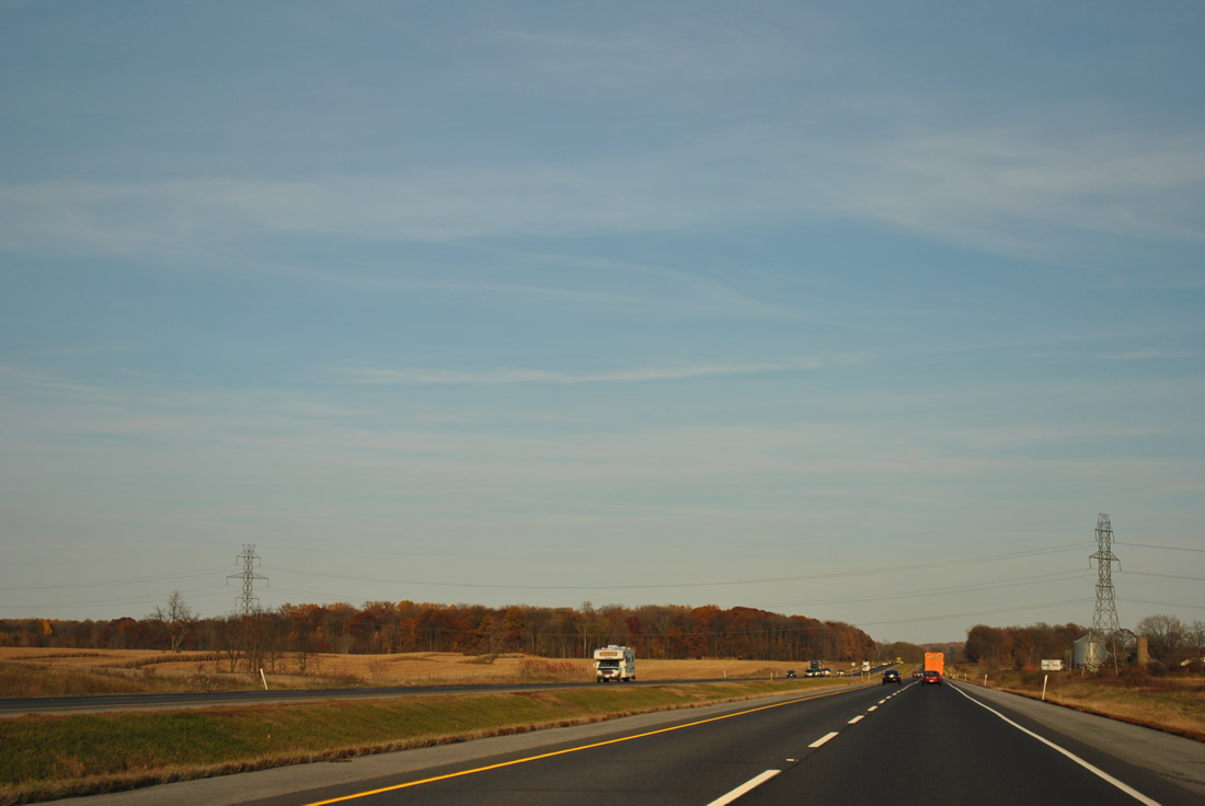
| I-80/90 make their closest approach to the Michigan state line in this scene where the toll road curves northward near Chicago Trail. 11/04/11 |
|
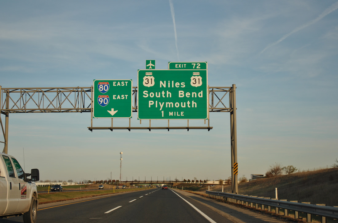
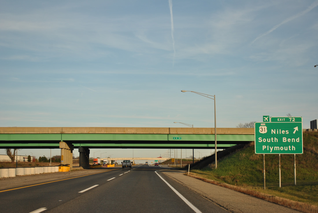
| Winding southeast, I-80/90 circumvent Mud Lake and approach the St. Joseph Valley Parkway (Exit 72). U.S. 31, signed here as U.S. 31 Bypass, utilizes a freeway bypass of South Bend from Michigan Street northwest to the Michigan state line. 11/04/11 |
|
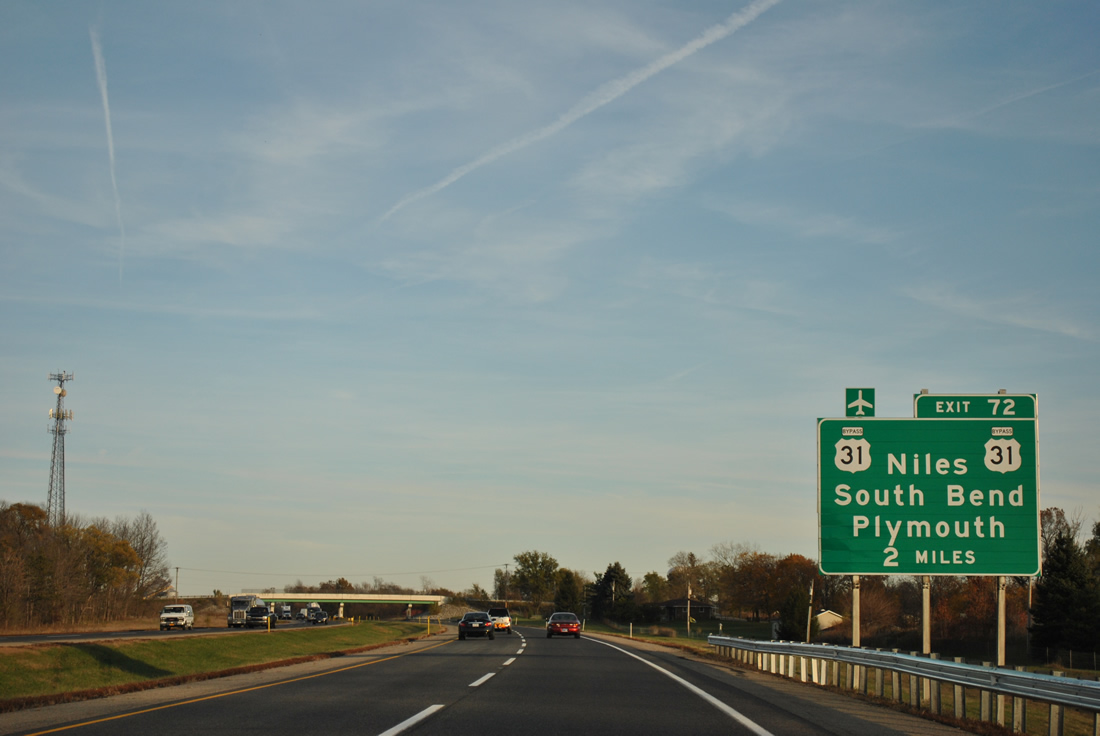
| One mile from the trumpet interchange (Exit 72) and access road to U.S. 31 (St. Joseph Valley Parkway) on I-80/90 east. U.S. 31 constitutes a freeway northward to Niles, Michigan and I-94/196 in the Benton Harbor area. Southward U.S. 31 combines with U.S. 20 at the Lincolnway West cloverleaf interchange by South Bend Regional Airport (SBN). 11/04/11 |
|
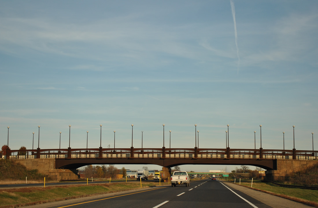
| Olive Road passes over I-80/90 with decorative light fixtures as it links industrial parks between parallel Brick Road and Nimtz Parkway. 11/04/11 |
|
| Drivers taking Exit 72 from I-80/90 pass through a toll plaza and then enter an interchange complex linking with both U.S. 31 (St. Joseph Valley Parkway) and adjacent Nimtz Parkway. Nimtz Parkway parallels the toll road west to Old Cleveland Road and east to Bendi Drive, serving industrial businesses and Blackthorn Golf Club. 11/04/11 |
|
| I-80/90 travel by toll road maintenance facilities at a former service plaza ahead of the next set of reassurance markers. 11/04/11 |
|
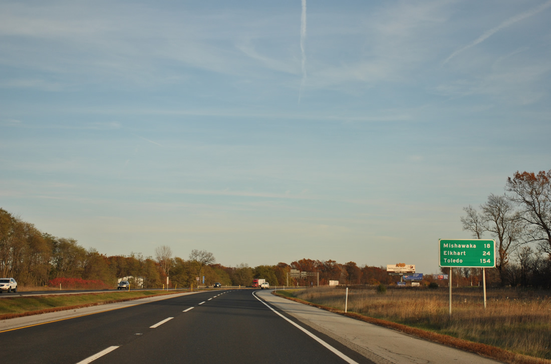
| Mishawaka continues the South Bend urban area east along I-80/90 and lie 18 miles to the southeast. Elkhart, south of Exit 92, is 24 miles away. 11/04/11 |
|
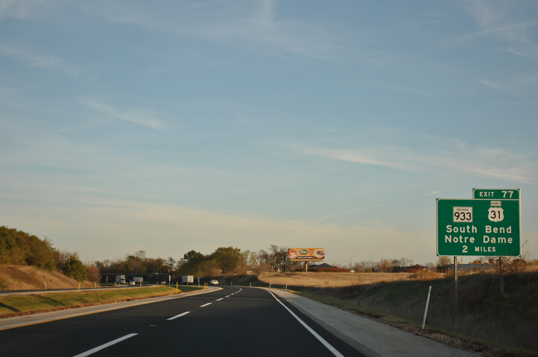
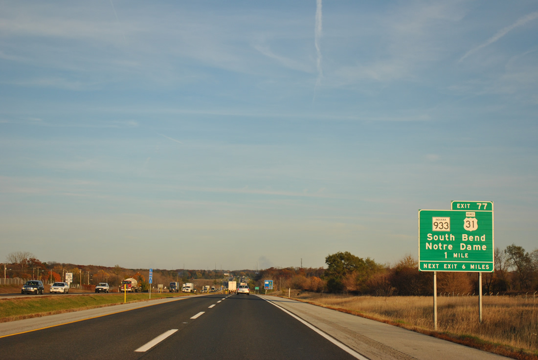
| SR 933 and U.S. 31 Business (Dixie Way) are served by the Exit 77 trumpet interchange and south leading access road from the Indiana East West Toll Road in two miles. The tandem provide a direct route from I-80 & 90 to the University of Notre Dame campus and downtown South Bend. 11/04/11 |
|
| Travelers bound for the College Football of Hall of Fame should use Exit 77 to SR 933 (Michigan Street) south to the St. Joseph Street tourist attraction. 11/04/11 |
|
| One mile ahead of Exit 77 for SR 933 & U.S. 31 Business (Dixie Way) on I-80/90 east. SR 933 follows an "L" shape route between M-51 and Osceola. The 17 mile route represents the pre-1988 route of U.S. 33 on its east-west portion and the pre-1982 route of U.S. 31 on its north-south path. 11/04/11 |
|
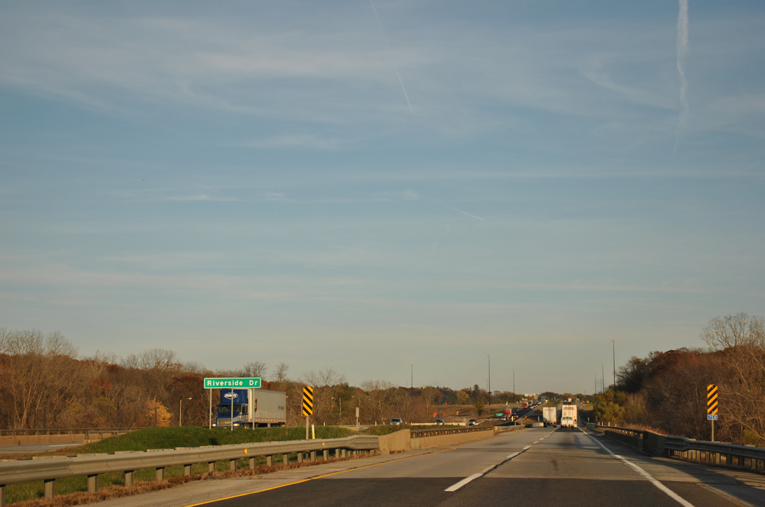
| Back to back spans carry I-80/90 over Riverside Drive and across the St. Joseph River ahead of unincorporated Roseland. 11/04/11 |
|
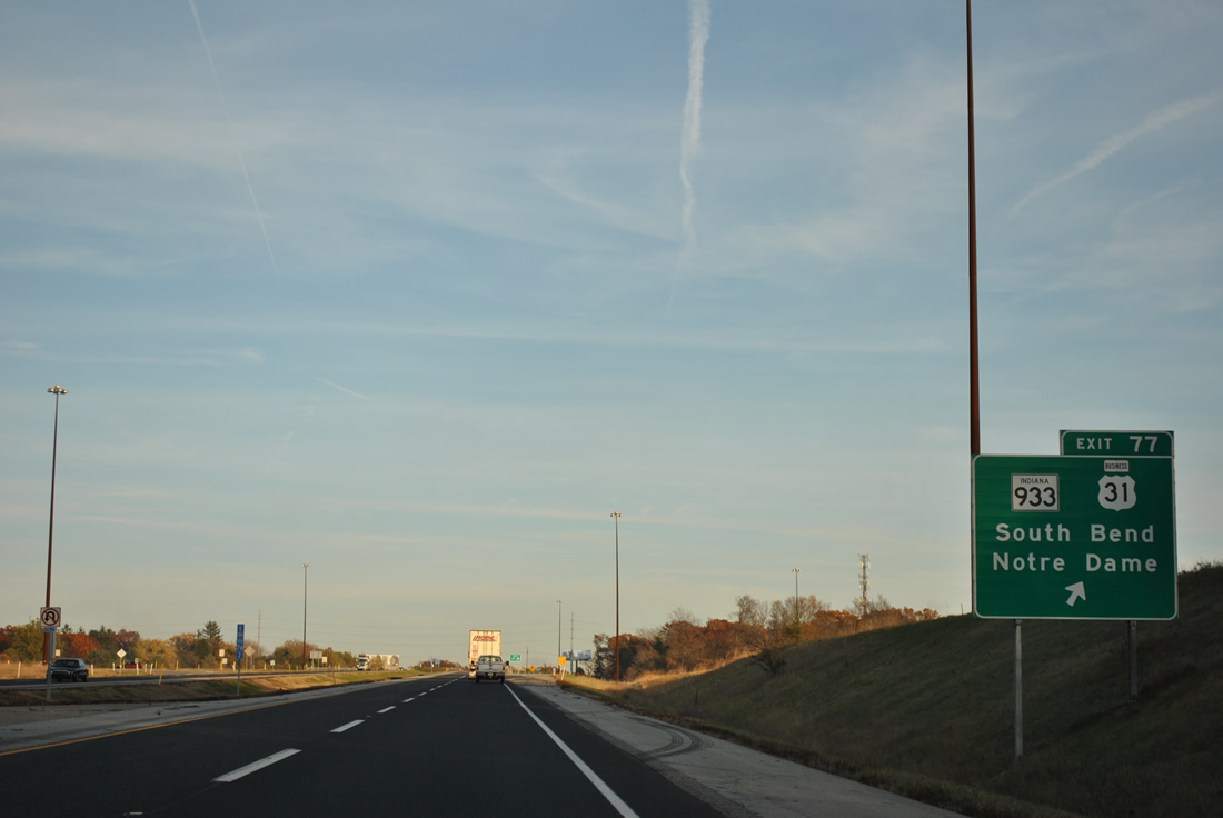
| Eastbound at the Exit 77 ramp departure for Dixie Way. U.S. 31 Business follows SR 933 southward from adjacent Cleveland Road to Michigan Street and downtown where the route partitions into a one way street couplet entailing Main Street south. The route is under local control outside of the SR 933 overlap and somewhat signed. Northward, the SR 933 (Dixie Highway) transition to M-51 occurs at State Line and Bertrand, Michigan. M-51 continues through Niles on its 40.33 mile route to Exit 56 of Interstate 94. 11/04/11 |
|
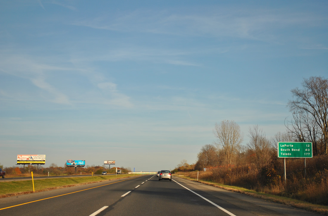
| Toledo is 149 miles to the east of South Bend. Exits to Mishawaka and Elkhart fall within the next 15 miles of I-80/90 east. 11/04/11 |
|
| I-80/90 angles southeast from Cleveland Road by Indian Village to the University Park Mall, where SR 23 passes by without direct access. 11/04/11 |
|
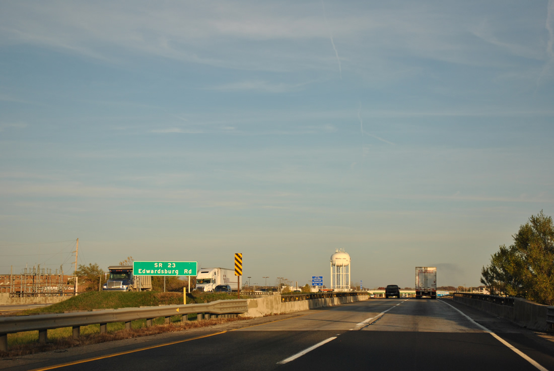
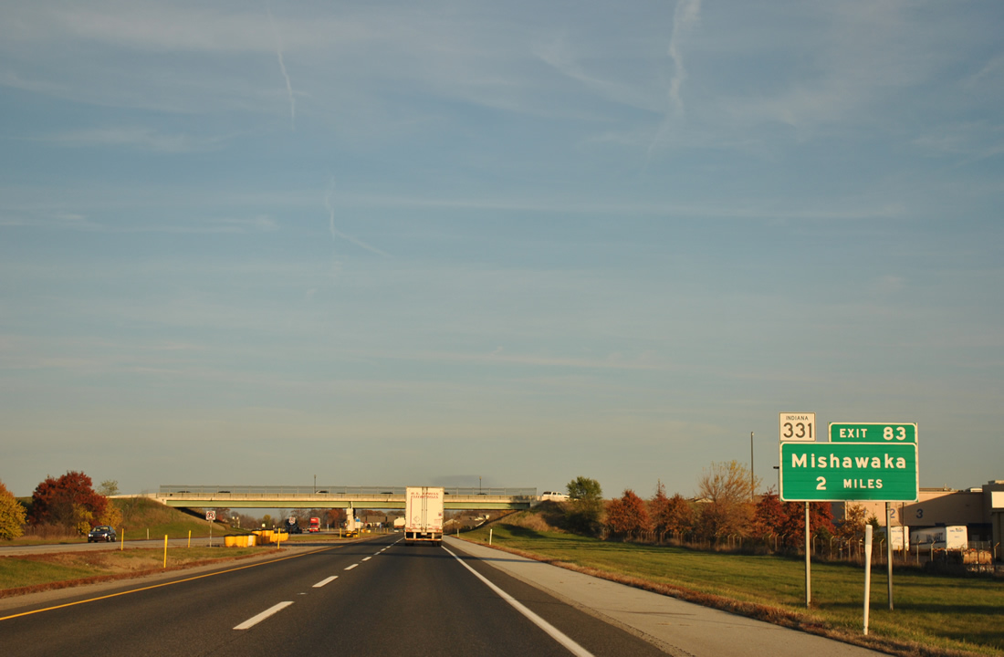
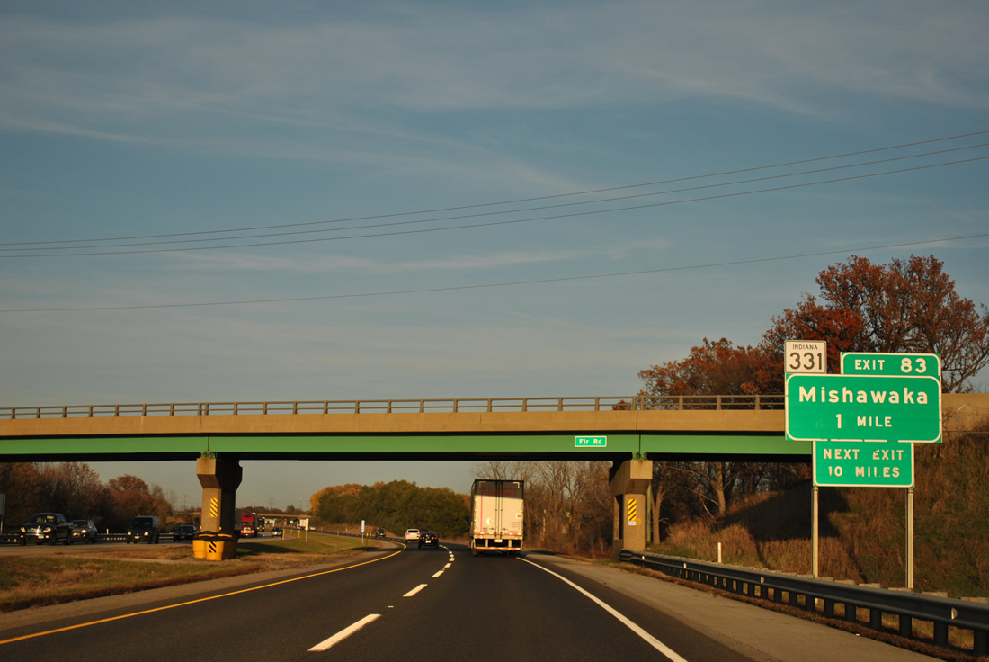
| Meeting the Toll Road next is SR 331 (Capital Avenue) at a trumpet interchange (Exit 83) and access road. SR 331 north provides the connection to SR 23 (Edwardsburg Highway) midway between Granger and Indian Village. SR 23 angles southwest from the Michigan state line through South Bend to SR 10, south of Ober. 11/04/11 |
|
| One mile west of the Exit 83 off-ramp to SR 331 at the Fir Road overpass. SR 331 (Capital Avenue) south comprises a four lane route to SR 933 (Lincoln Way / old U.S. 33) on the east side of Mishawaka. 11/04/11 |
|
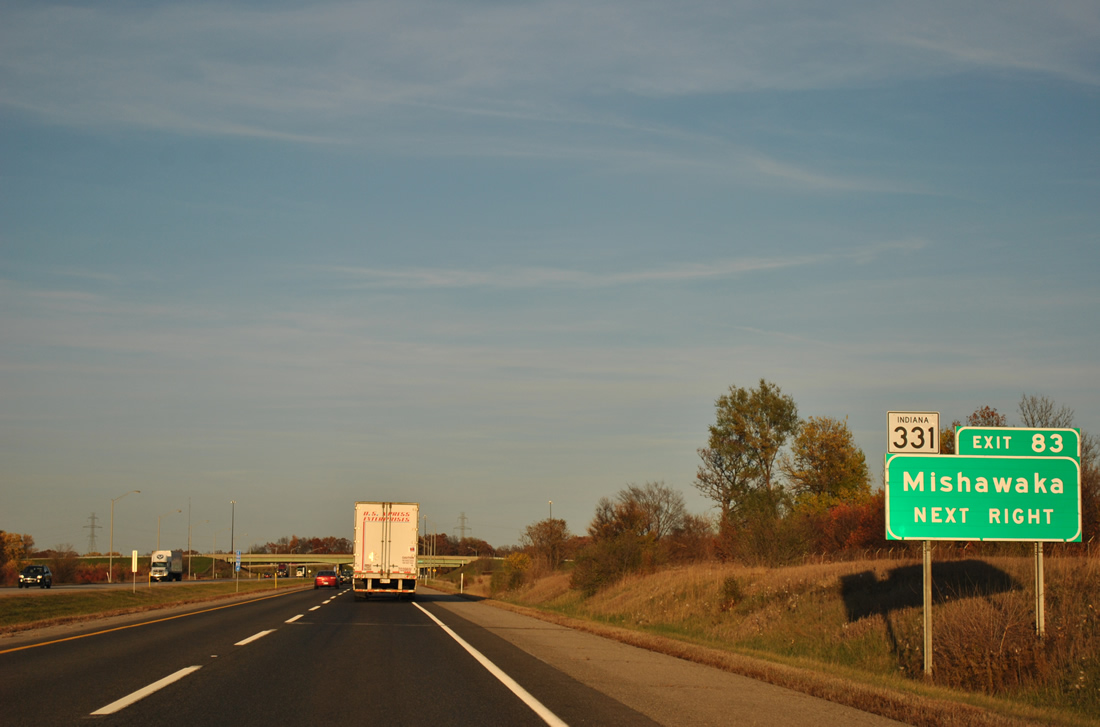
| Exit 83 departs I-80/90 east for SR 331. SR 23 east from SR 331 and Granger becomes M-62, a 28.28 mile loop north to Cassopolis and west to Eau Claire. 11/04/11 |
|
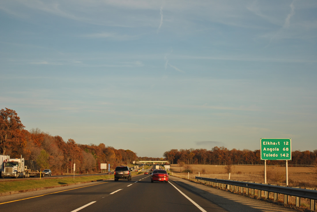
| Passing by Granger to the south, I-80/90 continues east to Elkhart (12 miles to the south via SR 19), Angola (68 miles to the south via I-69) and 142 miles to Toledo. 11/04/11 |
|
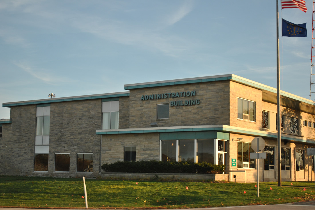
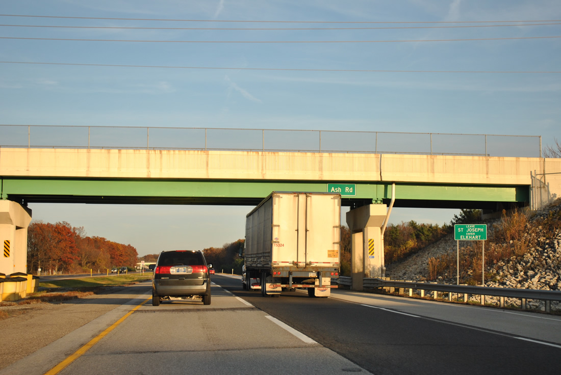
| The Indiana Toll Road Customer Care Center and Administration Building lies along the south side of I-80/90 by the Ash Road overpass. 11/04/11 |
|
| Ash Road straddles the Elkhart County line across I-80/90 east. 11/04/11 |
Page Updated 01-20-2012.


 East
East