|
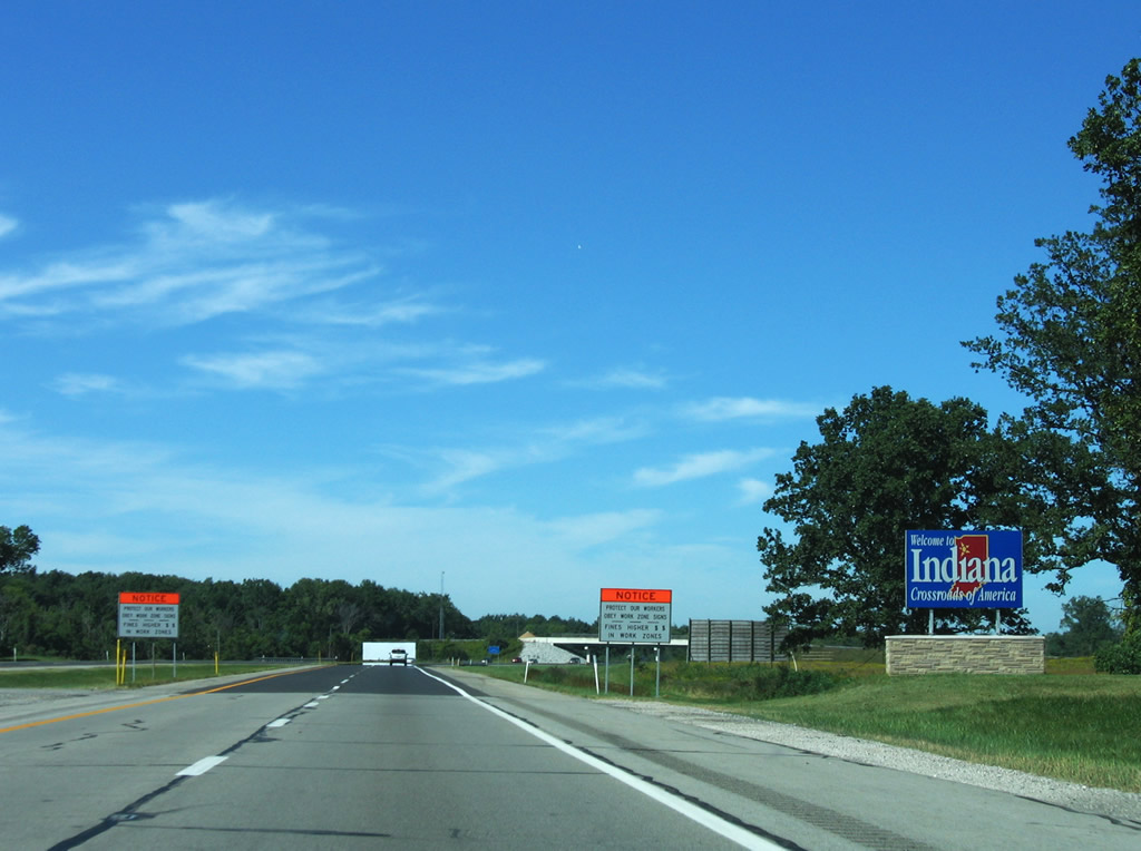
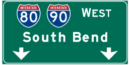
| I-80/90 transition from the Ohio Turnpike onto the Indiana Toll Road at the state line. Travelers enter Steuben County and turn northwest and pass over U.S. 20 within the first mile. 09/02/05 |
|
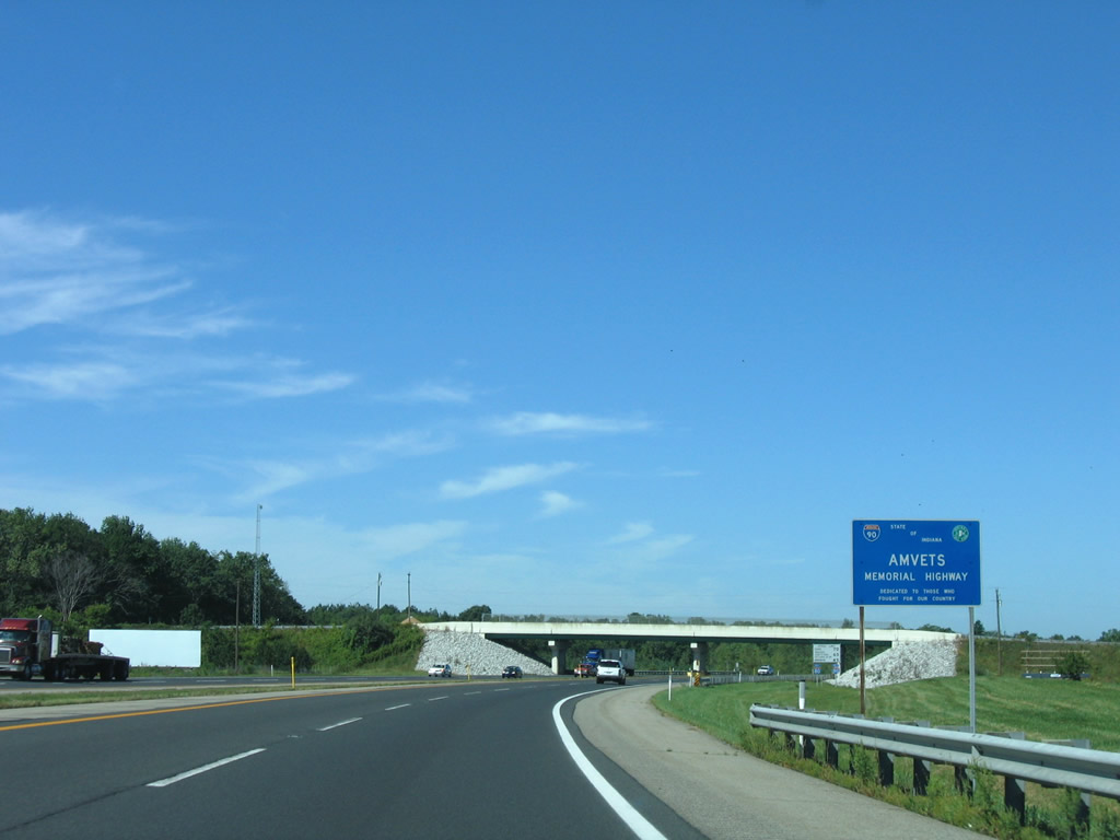
| Posted ahead of the County Road 935 East overpass is a sign referencing the Indiana East West Toll Road as the AMVETS Memorial Highway. 09/02/05 |
|
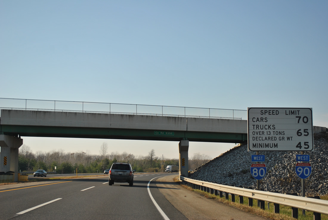
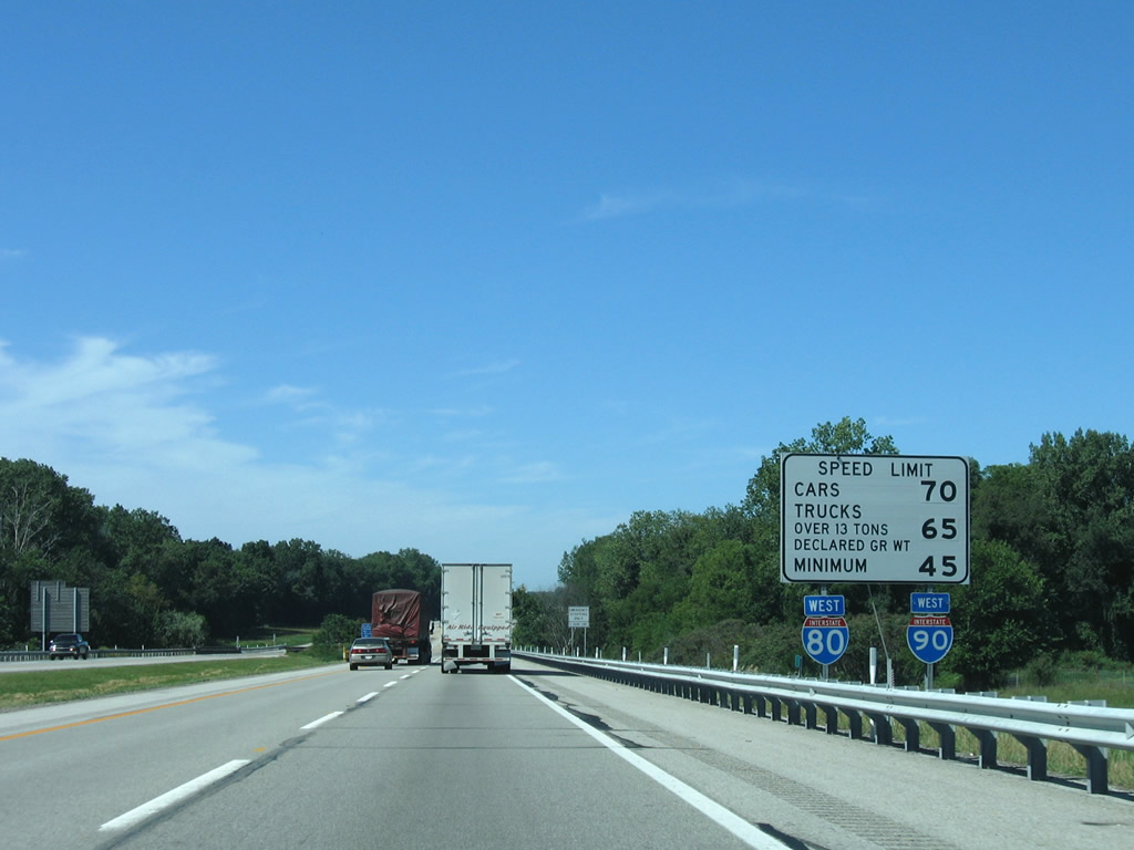
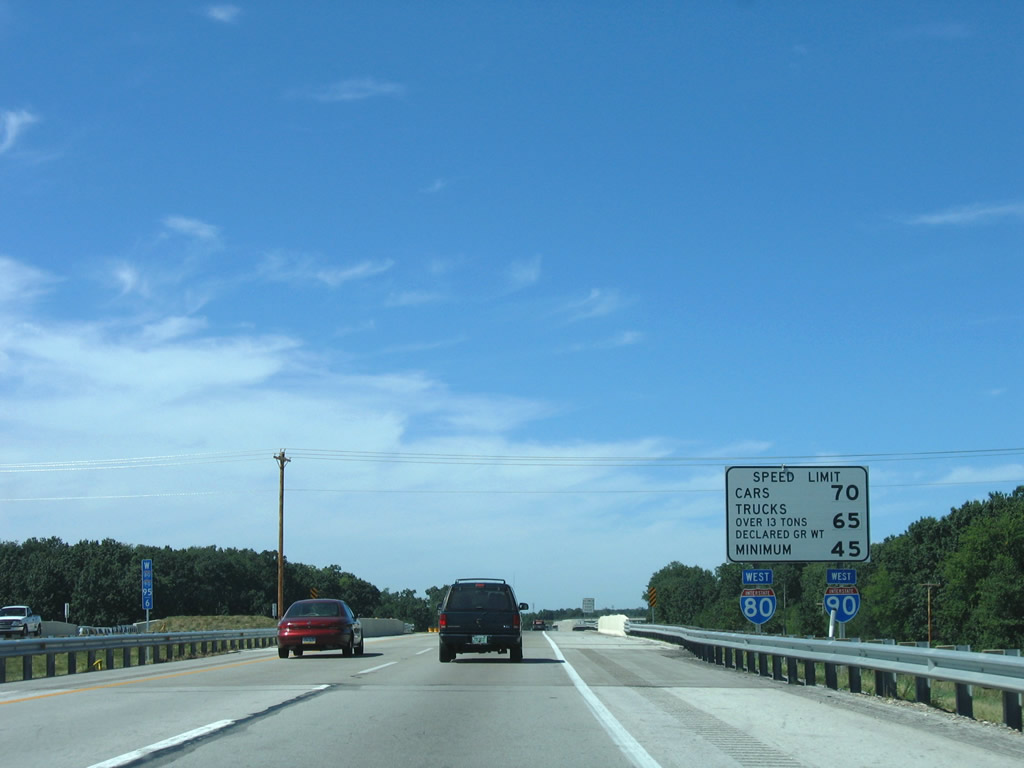
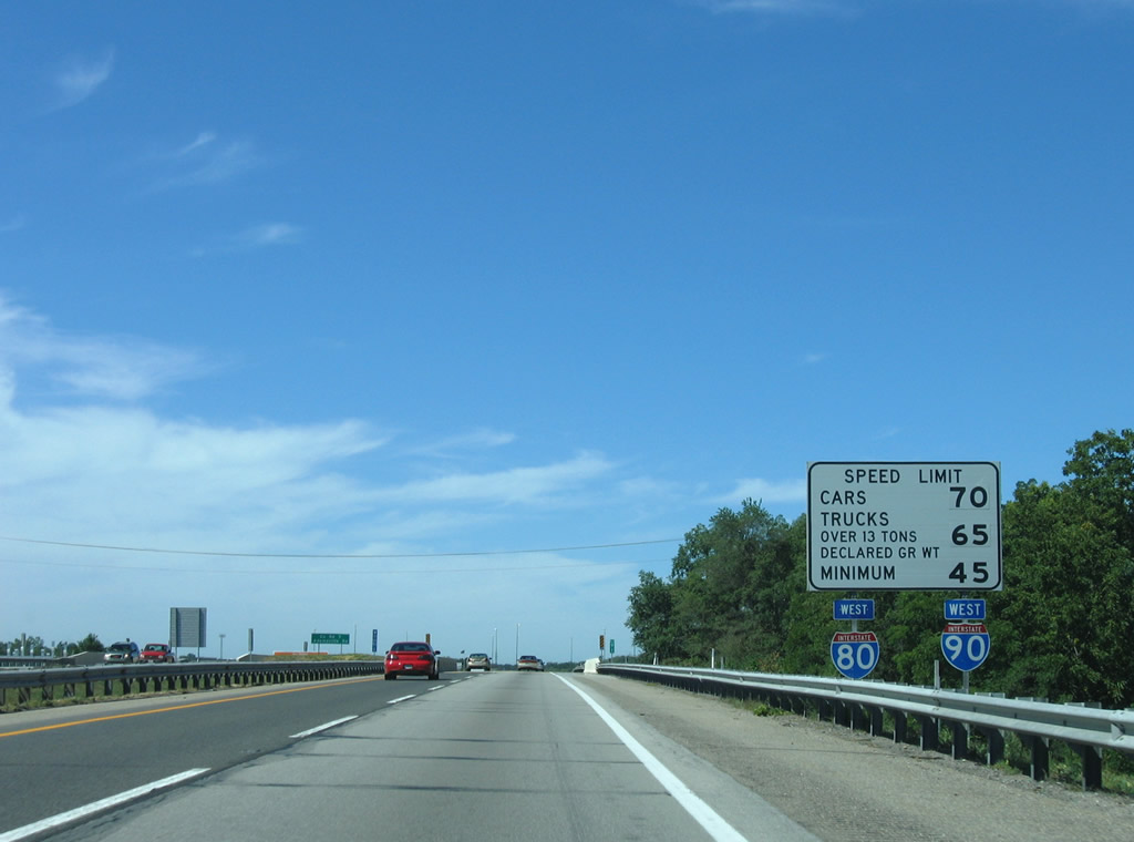
| Typical reassurance shield assemblies for I-80/90 coincide with speed limit signs. 11/06/11 |
|
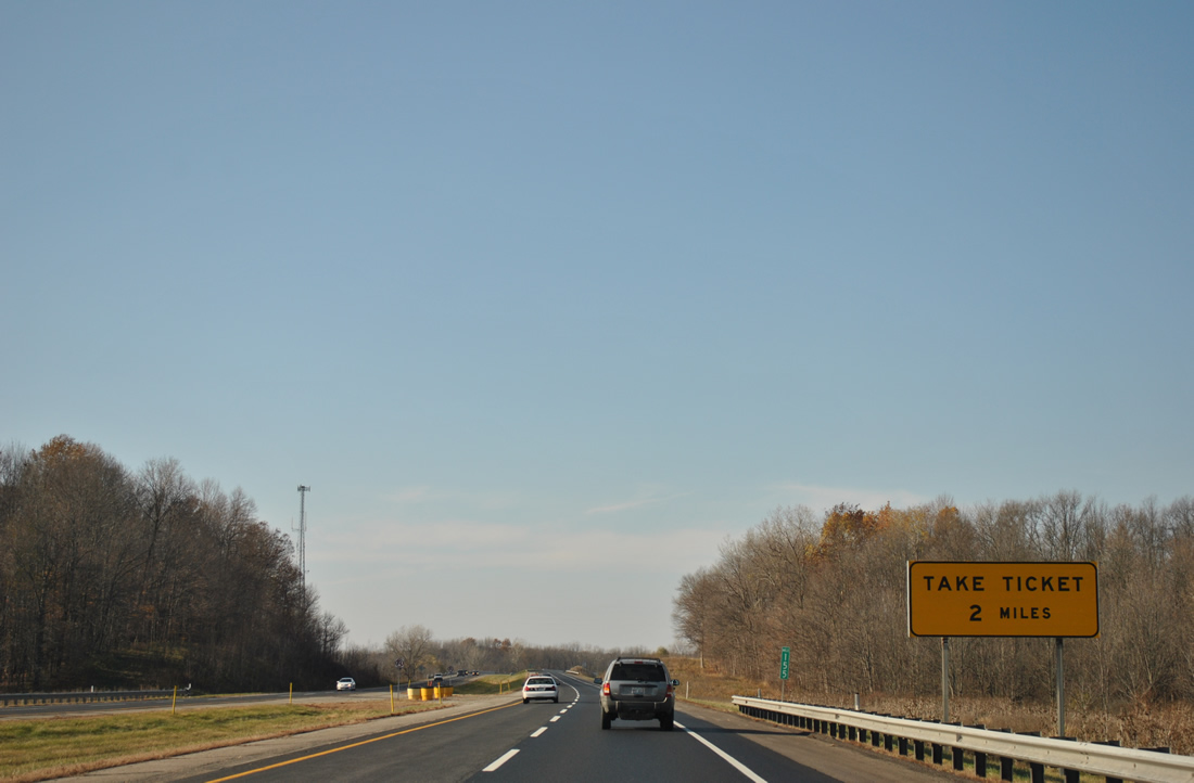
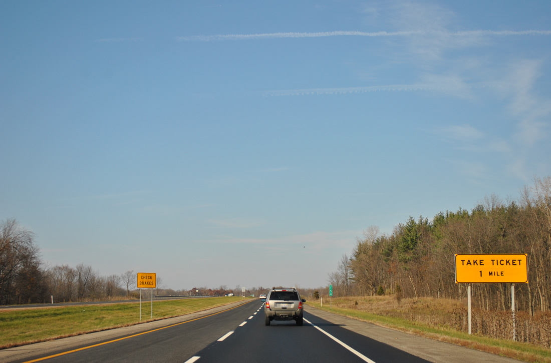
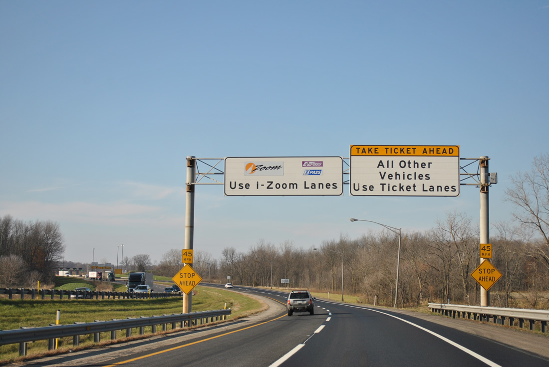
| Angling northwest, I-80/90 advances to the Indiana Toll Road Eastpoint Terminal. The toll road utilizes a ticketed system where cash rates are based upon the miles traveled. Electronic tolling uses E-ZPass transponders. 11/06/11 |
|
| Sign changes made between 2005 and 2011 replaced "Get Ticket" with "Take Ticket." 11/06/11 |
|
| The Eastpoint Terminal between the E 100 North underpass and N 700 East overpass by Barnes Swamp. 11/06/11 |
|
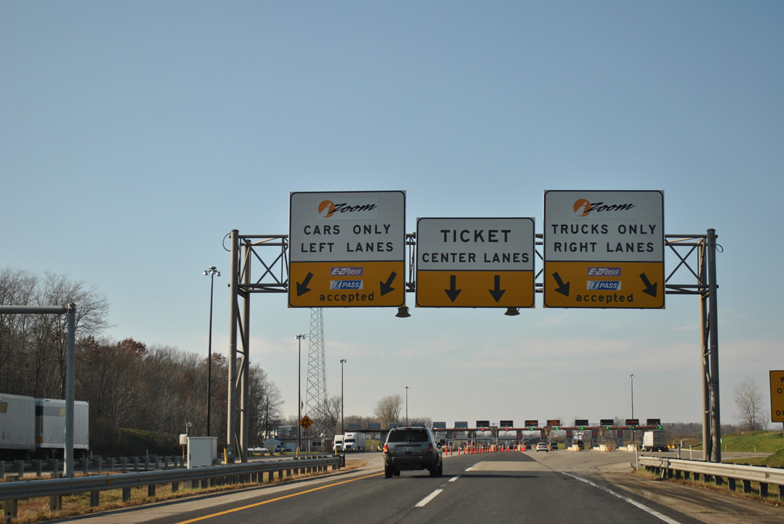
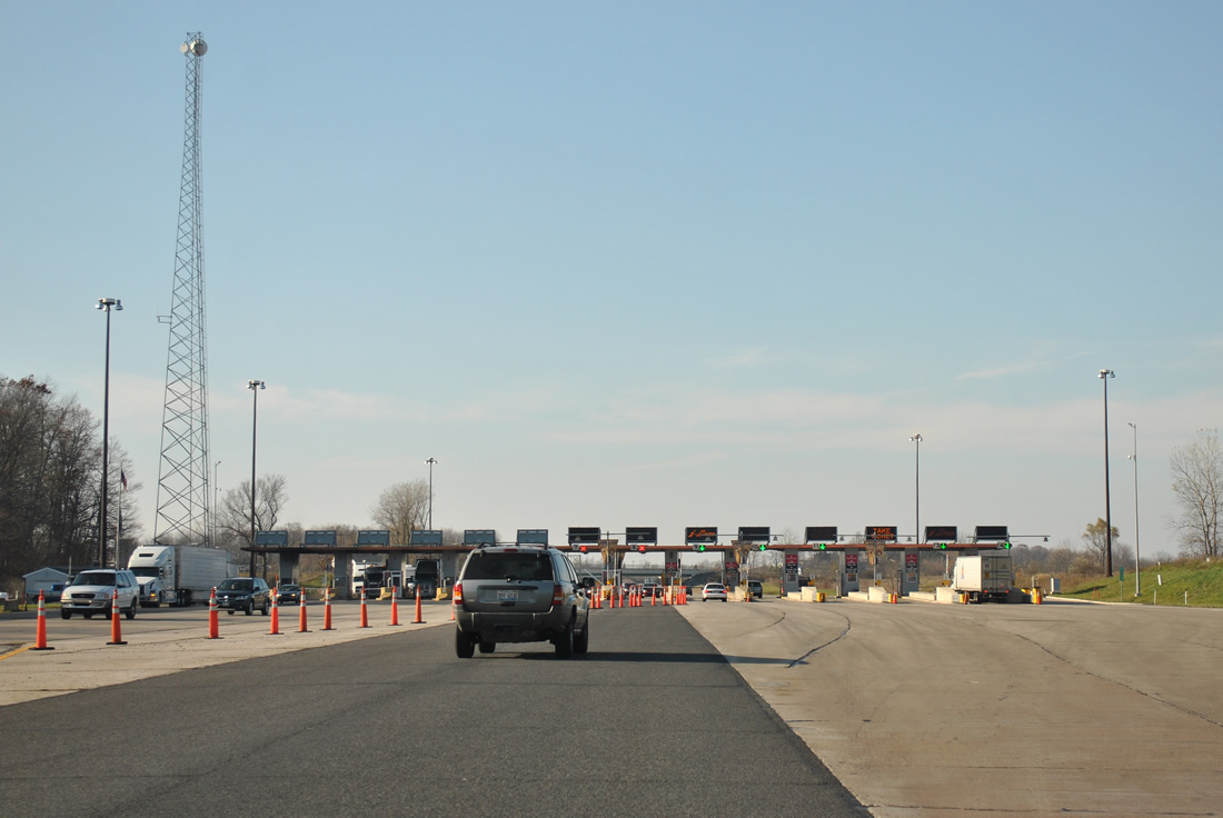
| Electronic Toll Collection (ETC) utilizes the inside and outside lanes while cash paying motorists use the middle toll booths. 11/06/11 |
|
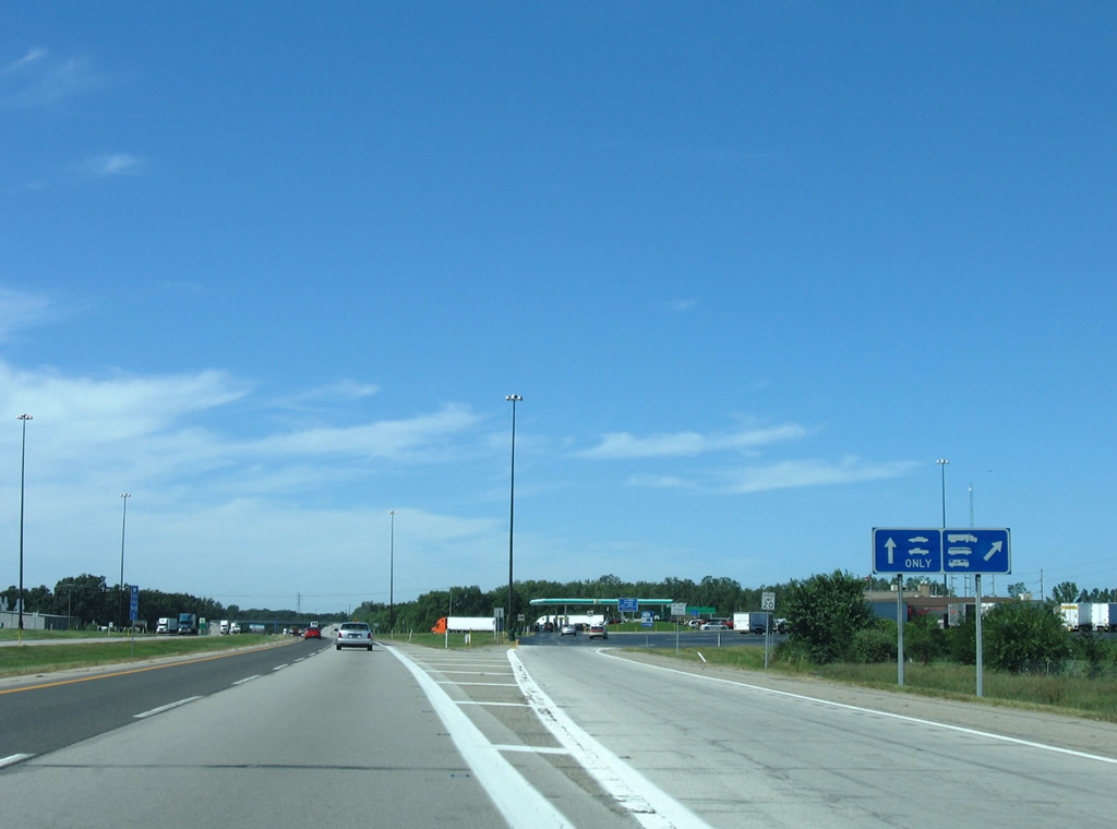
| Indiana Toll Road's Eastpoint Terminal was expanded from ten lanes in 2005 to 13 lanes by 2011. The route mainly carries through travelers along its 157 mile course between Ohio and the Chicago Skyway. As of June 29, 2006, the toll road is operated and maintained by the ITR Concession Company LLC (ITRCC). The private company purchased a 75-year lease to operate the toll road.1 11/06/11 |
|
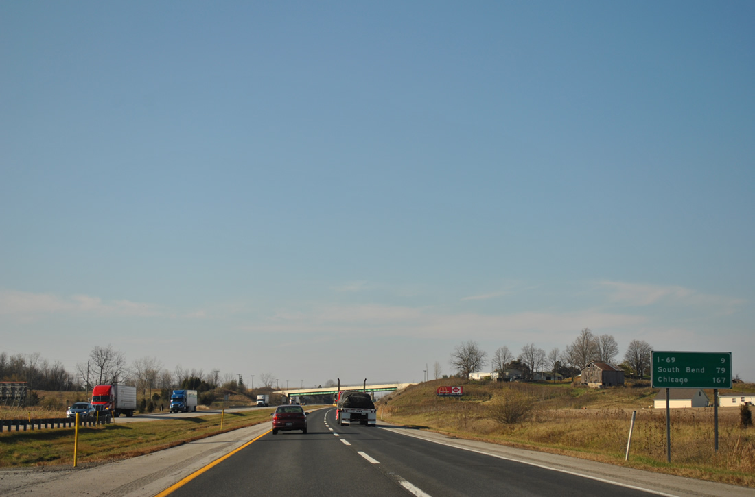
| I-80/90 (Indiana Toll Road) proceeds nine miles west to Interstate 69 near Jamestown. Chicago is 167 miles from the Eastpoint Toll Plaza. 11/06/11 |
|
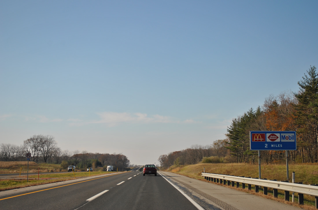
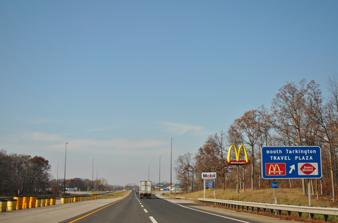
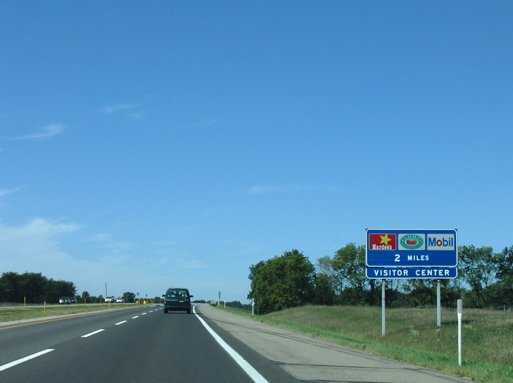
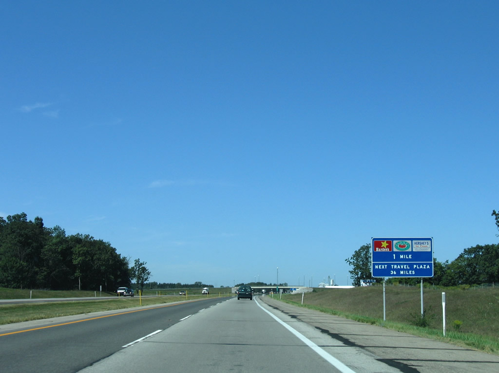
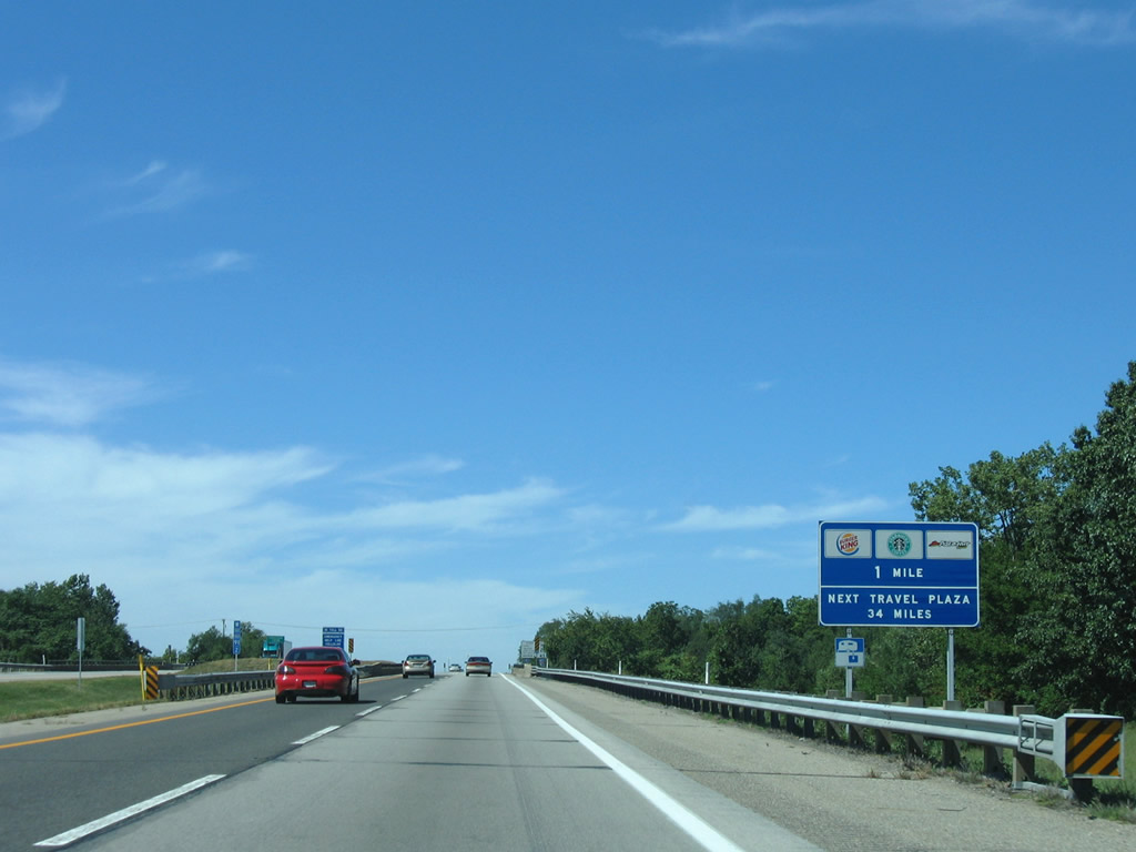
| Like many other turnpikes and toll roads, Indiana East West Road includes main line service plazas to provide travelers with services such as food, fuel, and tourist information. 11/06/11 |
|
| The first set of travel plazas along the Indiana Toll Road west were located near Brairwood around milepost 142. 11/06/11 |
|
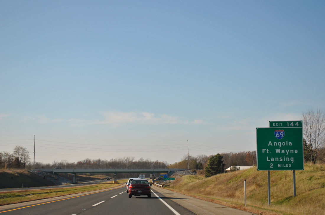
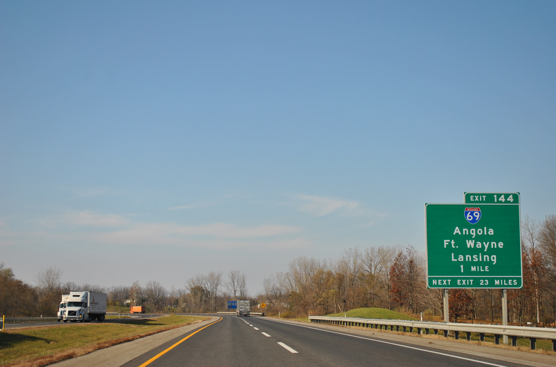
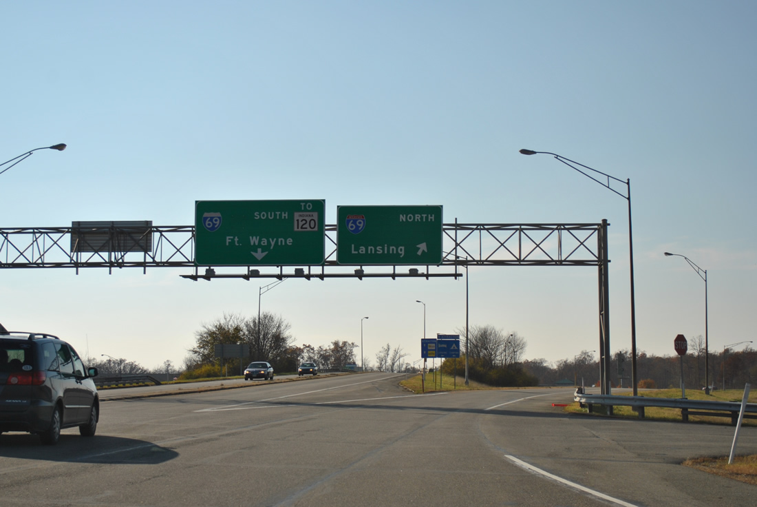
| Exit 144 joins I-80/90 with Interstate 69 north to Lansing, Michigan and south to Fort Wayne in two miles. 11/06/11 |
|
| The Booth Tarkington Service Plaza along I-80/90 west permanently closed by October 2015. 11/06/11 |
|
| Interstate 69 travels north from Exit 144 to Jamestown before exiting Indiana for Coldwater, Michigan. Pokagon State Park and the Steuben County seat of Angola are within eight miles of I-80/90 via I-69 south. 11/06/11 |
|
| Exit 144 departs I-80/90 west for Interstate 69. Interstate 69 replaced U.S. 27 from Fort Wayne northward to Lansing, with signage for the US route coming down in 2002. 11/06/11 |
|
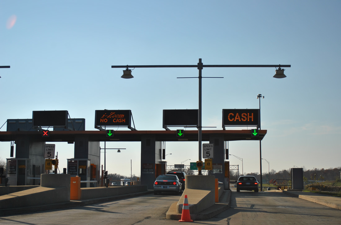
| The toll plaza for Exit 144 to Interstate 69. 11/06/11 |
|
| Exit 144 also includes ramps to adjacent Old U.S. 27 / SR 127 and SR 120 nearby. SR 120 travels east to Fremont and west to Orland. The state road runs 59 miles from Elkhart to Ohio, paralleling I-80/90 for much of the way. SR 127 leads south 5.2 miles from SR 120 to Angola. 11/06/11 |
|
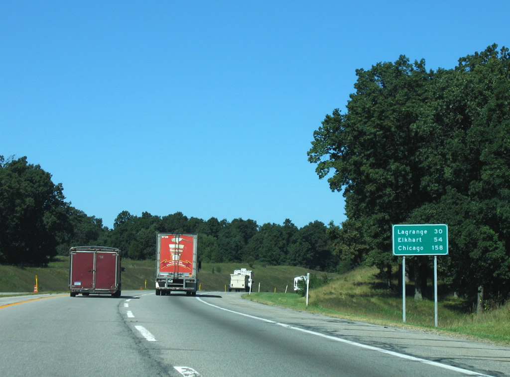
| Westbound reassurance shields and distance sign posted for I-80/90 after the Interstate 69 under crossing. The next exit lies 23 miles ahead serving the Lagrange County seat by the same name. 09/02/05 |
|
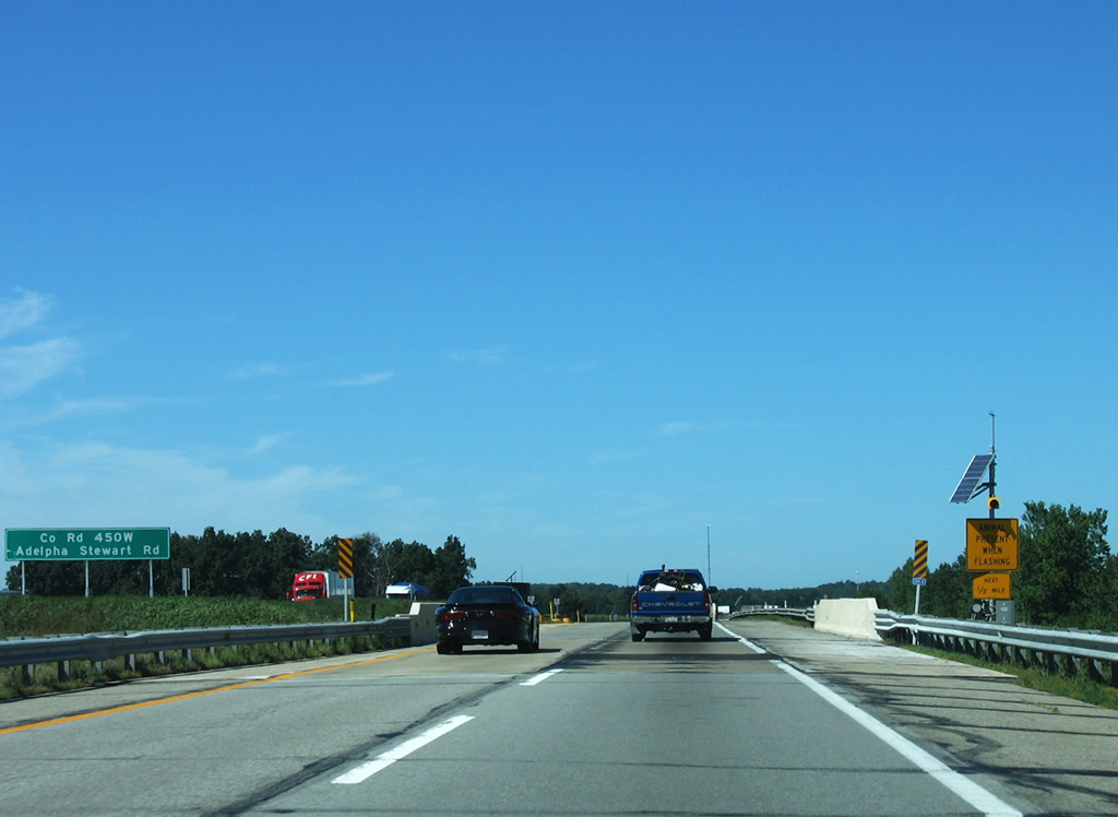
| Rural areas of the Indiana East West Toll Road feature animal detectors to warn motorists of potential road hazards with wild animals. Signs and warning beacons such as the one pictured here at Adelpha Stewart Road are found along I-80/90 on these stretches with the detection equipment. 09/02/05 |
|
| Now within Lagrange County, I-80/90 see the second in a series of turnpike service plazas. 09/02/05 |
|
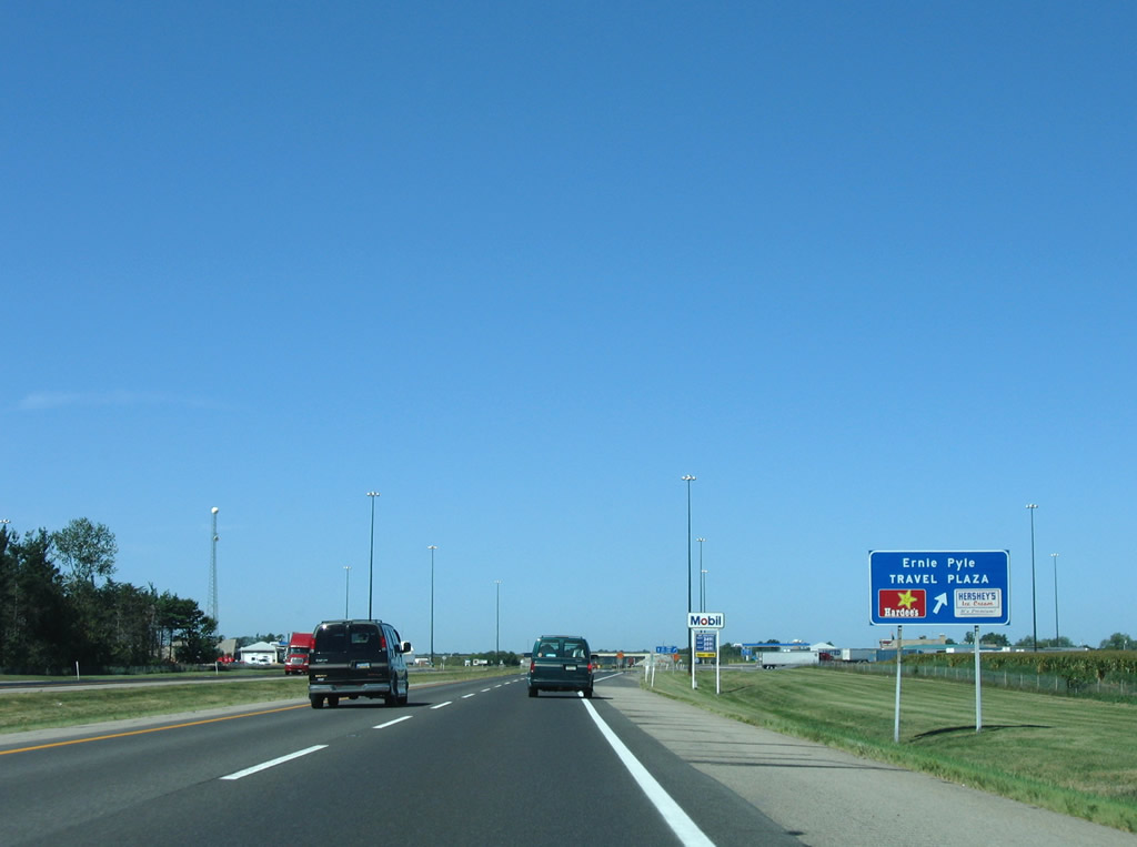
| I-80/90 westbound reach the Ernie Pyle Travel Plaza near the North 475 East (former SR 3). SR 3 used to travel across the toll road between Brighton (SR 120) and the Michigan state line. 09/02/05 |
|
| SR 9 crosses paths with I-80/90 near Star Mill one third of a mile south of the Michigan state line. The state road leads south 7.6 miles to Lagrange at U.S. 20 and north to a transition into M-66 (Centerville Road) south of Sturgis. 09/02/05 |
|
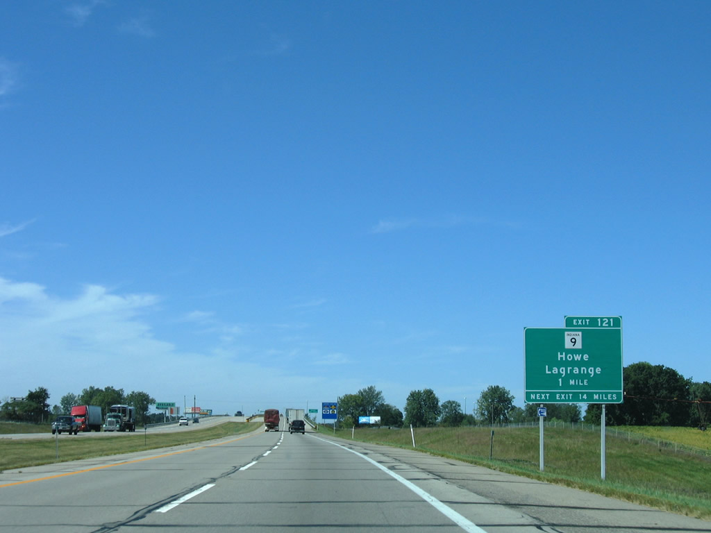
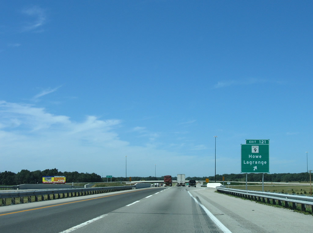
| The trumpet interchange (Exit 121) and access road to SR 9 are located west of the Fawn River on I-80/90. SR 9 enters Howe (SR 120) two miles to the south. SR 120 leads west to SR 5 south and Shipshewana. 09/02/05 |
|
| I-80/90 west pass over SR 9 before splitting with Exit 121. SR 9 constitutes a 196 mile route between the Michigan state line and SR 46 east of Columbus. M-66 travels 268.95 miles northward to U.S. 31 near Charlevoix, joining the toll road with Battle Creek and Interstate 194. 09/02/05 |
|
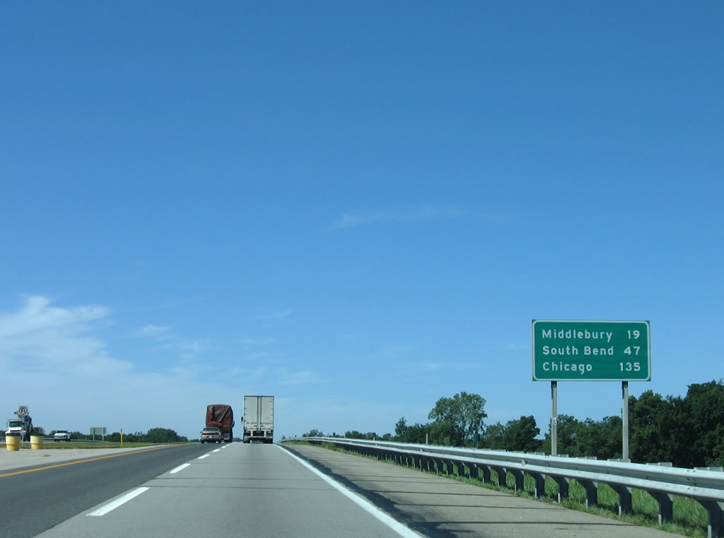
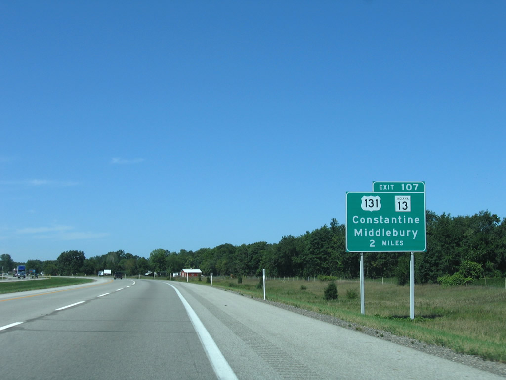
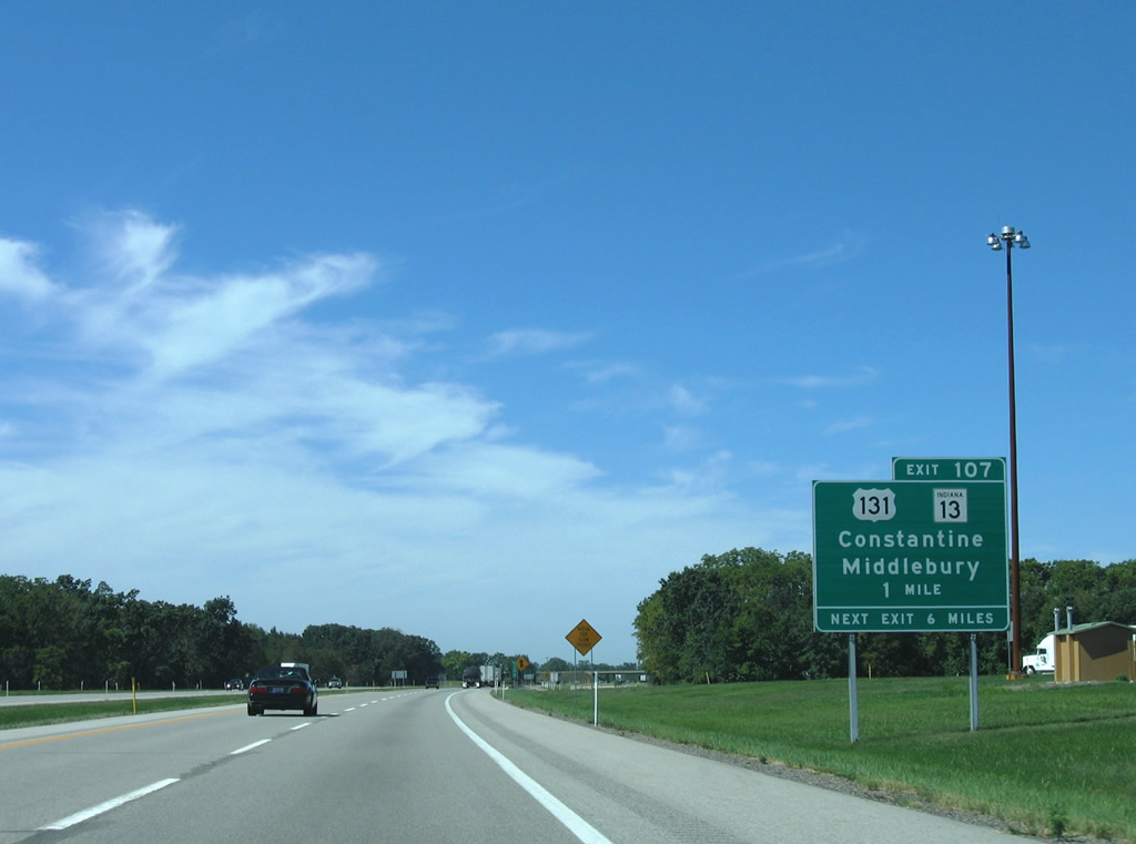
| Continuing west, I-80/90 span the Fawn River again beyond the SR 9 on-ramp. Middlebury lies 19 miles west and south via Exit 107 and SR 13. 09/02/05 |
|
| Two miles west of Exit 107 along I-80/90 west between Fish and Stone Lakes. The forthcoming trumpet interchange and access road connects with the joint termini of U.S. 131 south and SR 13 north. SR 13 leads south 5.2 miles to Middlebury and 1.5 miles to SR 120, 8.8 miles northwest of aforementioned Shipshewana. 09/02/05 |
|
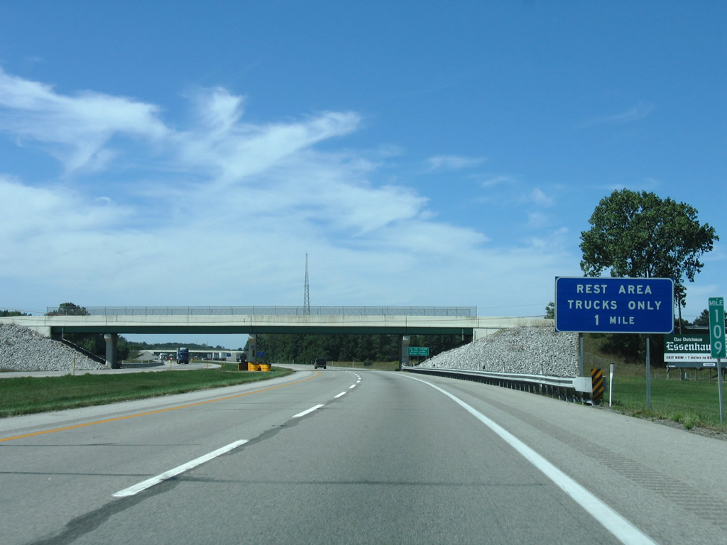
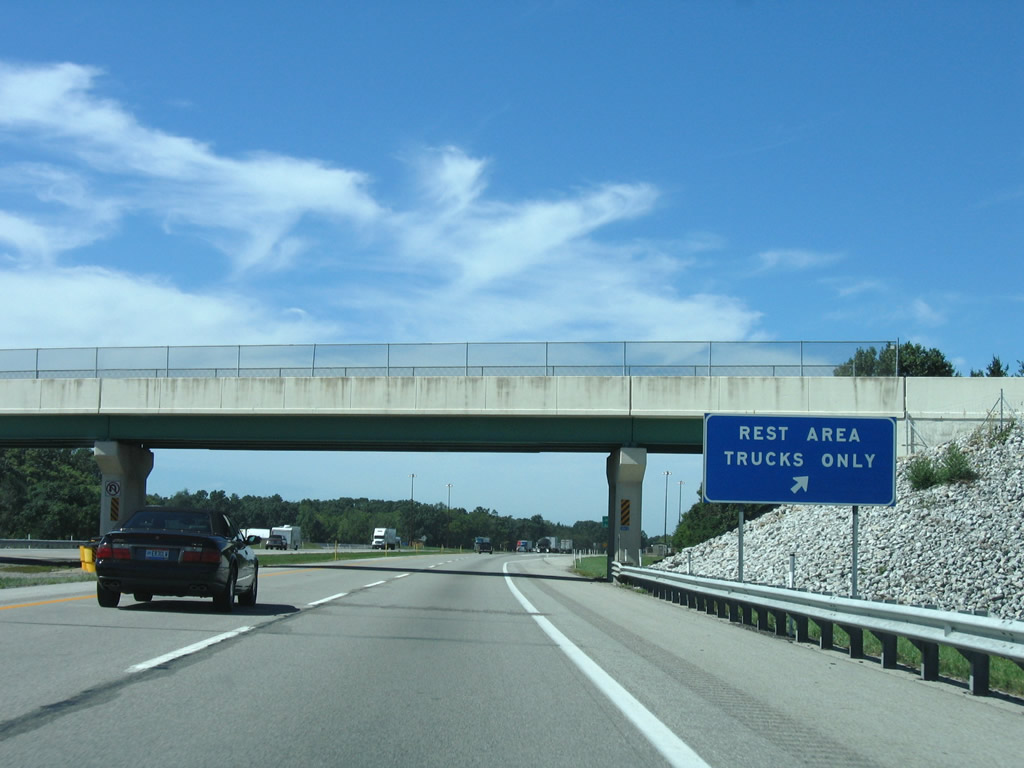
| Truck only rest areas reside along both directions of the Indiana Toll Road between the SR 13 and North 1200 West overpasses near Stone Lake. 09/02/05 |
|
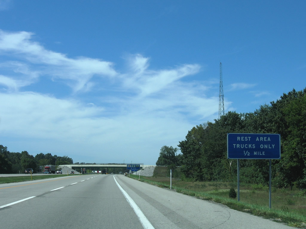
| Westbound at the truck only rest area off-ramp at the Elkhart County line (North 1200 West). 09/02/05 |
|
| SR 13 travels 138 miles from the Exit 107 access road to Fortville and U.S. 36. U.S. 131 meanwhile travels just 0.7 miles in Indiana and 271 miles overall between the Indiana Toll Road and Petoskey, Michigan. 09/02/05 |
|
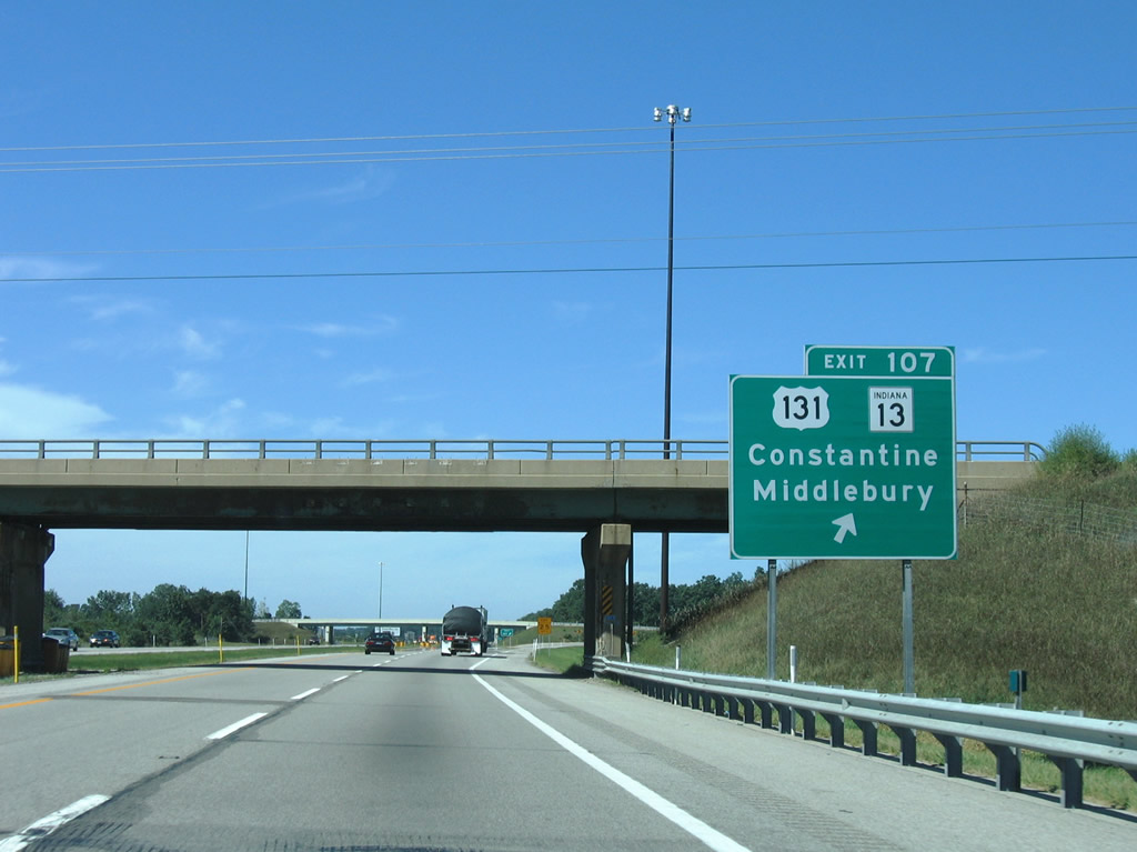
| Exit 107 departs the westbound toll road at the SR 13 overpass. U.S. 131 travels to White Pigeon (U.S. 12, a former terminus of the route), Constantine, and Three Rivers, Michigan. SR 13 continues south from Middlebury to Millersburg and U.S. 33. 09/02/05 |
|
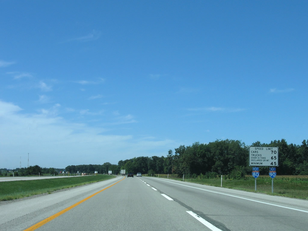
| Reassurance shields and speed limit sign posted between Exits 107 and 101 on I-80/90 west. Four interchange serve Elkhart County. 09/02/05 |
|
| SR 15 continues M-103 south from Mottville to the Exit 101 trumpet interchange with I-80/90. 09/02/05 |
|
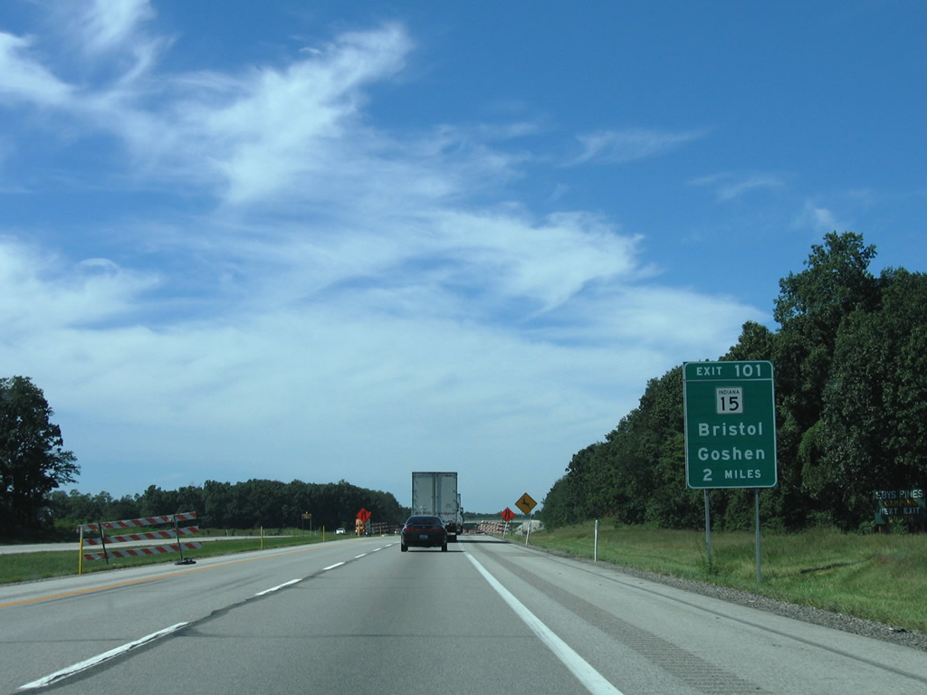
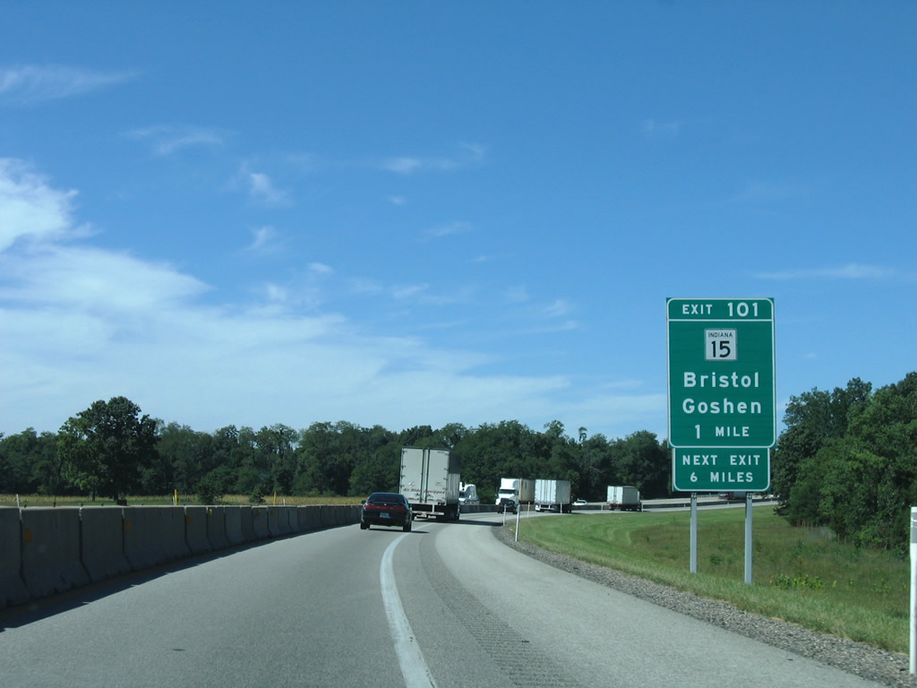
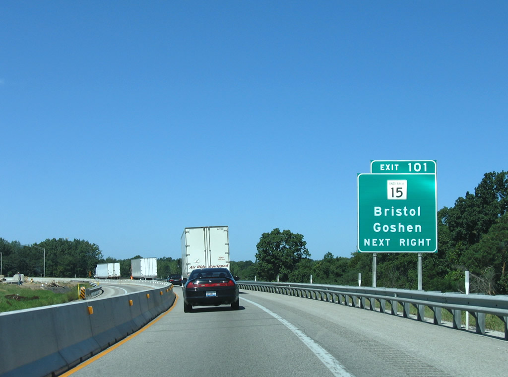
| SR 15 angles southwest into Bristol near Exit 101 at SR 120. South from there, the state road continues 9.7 miles to Goshen. 09/02/05 |
|
| Exit 101 parts ways with the Indiana Toll Road for SR 15. SR 15 travels 95 miles from the Michigan line to Gas City. M-103 connects the state road with U.S. 12, comprising a distance of just 3.1 miles. 09/02/05 |
|
| SR 15 passes over I-80/90 east of their crossing of the St. Joseph River. Downtown Elkhart is a 12 mile drive west. 09/02/05 |
|
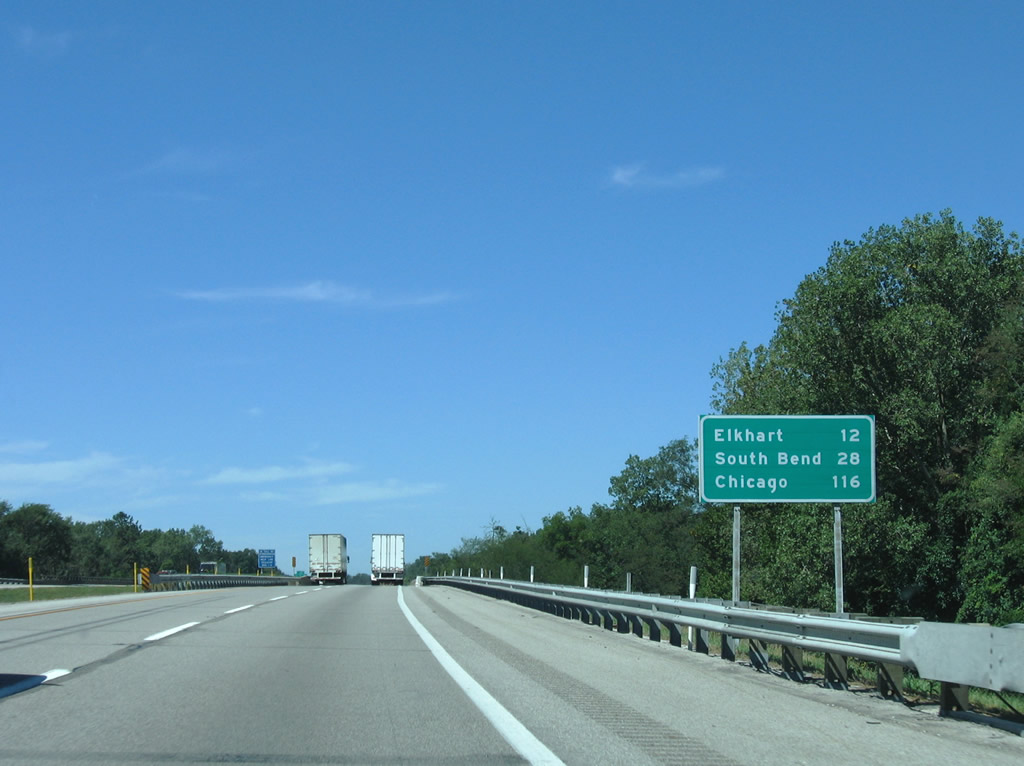
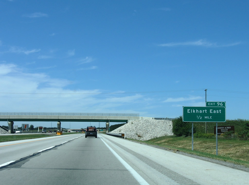
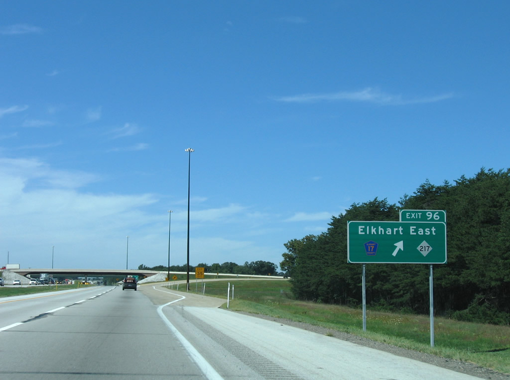
| The first of two Elkhart interchanges on the Indiana East West Toll Road connect the turnpike with Elkhart County Road 17 at Elkhart County Road 4 near Heaton Lake. Exit 96 serves the industrial north and east sides of Elkhart via Elkhart County Road 6 west and Elkhart County Road 17 south. 09/02/05 |
|
| Westbound at the Exit 96 trumpet interchange and access road to the intersection of County Road 4 and 17. Elkhart County 17 curves northeast to become M-217 at the state line. M-217 (Michiana Parkway) connects the county road with U.S. 12 near Union, its northern terminus after just 1.65 miles. 09/02/05 |
|
| Elkhart County 15 passes underneath I-80/90 at this reassurance shield assembly near Heaton Lake. 09/02/05 |
|
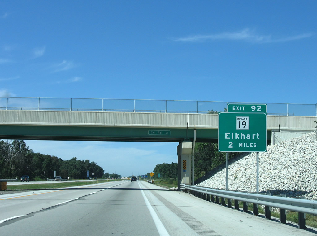
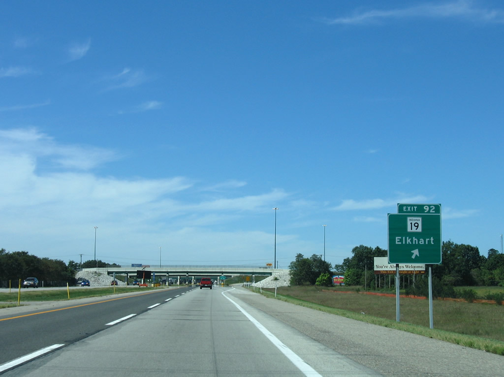
| SR 19 meets the Indiana Toll Road northeast of Elkhart Municipal Airport and south of its intersection with Elkhart County 4 at Exit 92. 09/02/05 |
|
| Heading south from Exit 92, SR 19 circumvents Downtown Elkhart along Cassopolis, Bristol, and Nappanee Streets to old U.S. 33 (Lincoln Way) southwest of downtown. The state road consists of a 143 mile route between the Michigan state line and Noblesville. 09/02/05 |
|
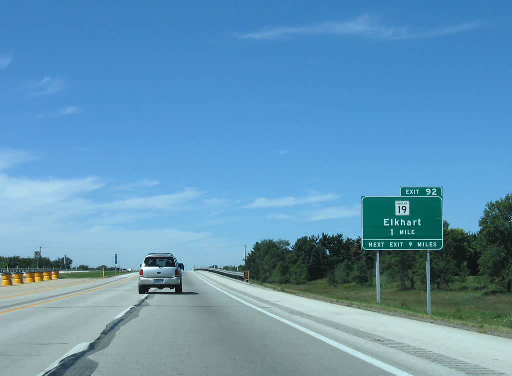
| Drivers bound for the city of Elkhart depart the Indiana Toll Road for Exit 92. SR 19 north transitions into former M-205 between Simonton Lake and Allenton, Michigan. M-205 was decommissioned in 2002 when M-217 was completed to the east; it used to travel just 1.74 miles to U.S. 12. 09/02/05 |
|
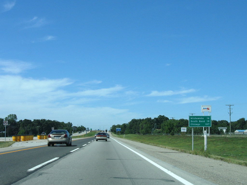
| A pair of service plazas serve both directions of I-80/90 west of Elkhart and east of the St. Joseph County line. St. Joseph County is home to both Mishawaka (16 miles) and South Bend (19 miles). 09/02/05 |
|
| I-80/90 span Christiana Creek and Adamsville Road ahead of the Henry F. Schricker Travel Plaza. 09/02/05 |
Page Updated 01-20-2012.


 West
West