|
| The first of two interchanges within Porter County joins I-80/90 with SR 49 at Exit 49 outside Chesterton. SR 49 leads 8.7 miles south to Valparaiso. 09/02/05 |
|
| Comprising a 44.2 mile route, SR 49 begins in Lewiston and ends at U.S. 12 within Indiana Dunes State Park. The state road utilizes an expressway bypass to circumvent Valparaiso between U.S. 30 (Morthland Drive) and U.S. 6 nearby. 09/02/05 |
|
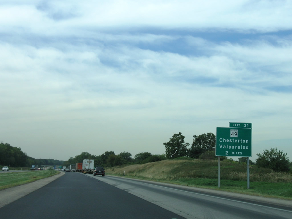
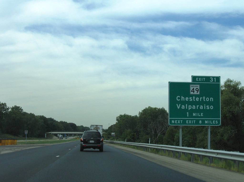
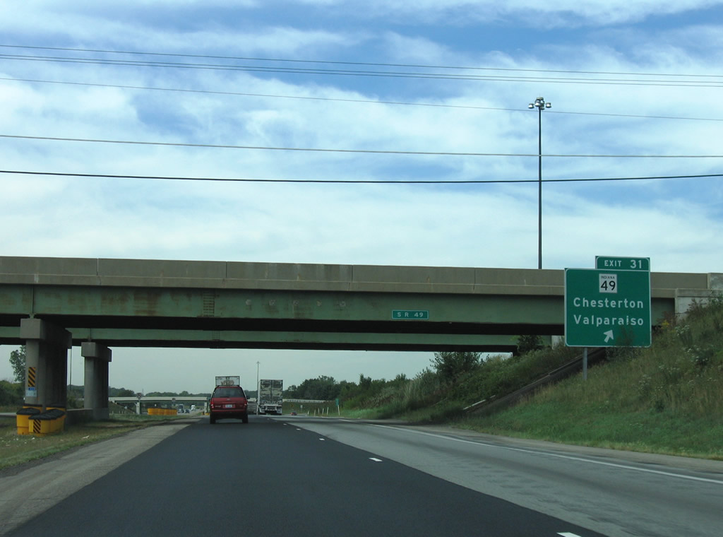
| Exit 31 facilitates movements between the Indiana East West Toll Road and SR 49 via a trumpet interchange and access road two miles south of Chesterton. SR 49 north to U.S. 12 serves interests to Indiana Dunes National Seashore, Dune Acres, and Tremont. 09/02/05 |
|
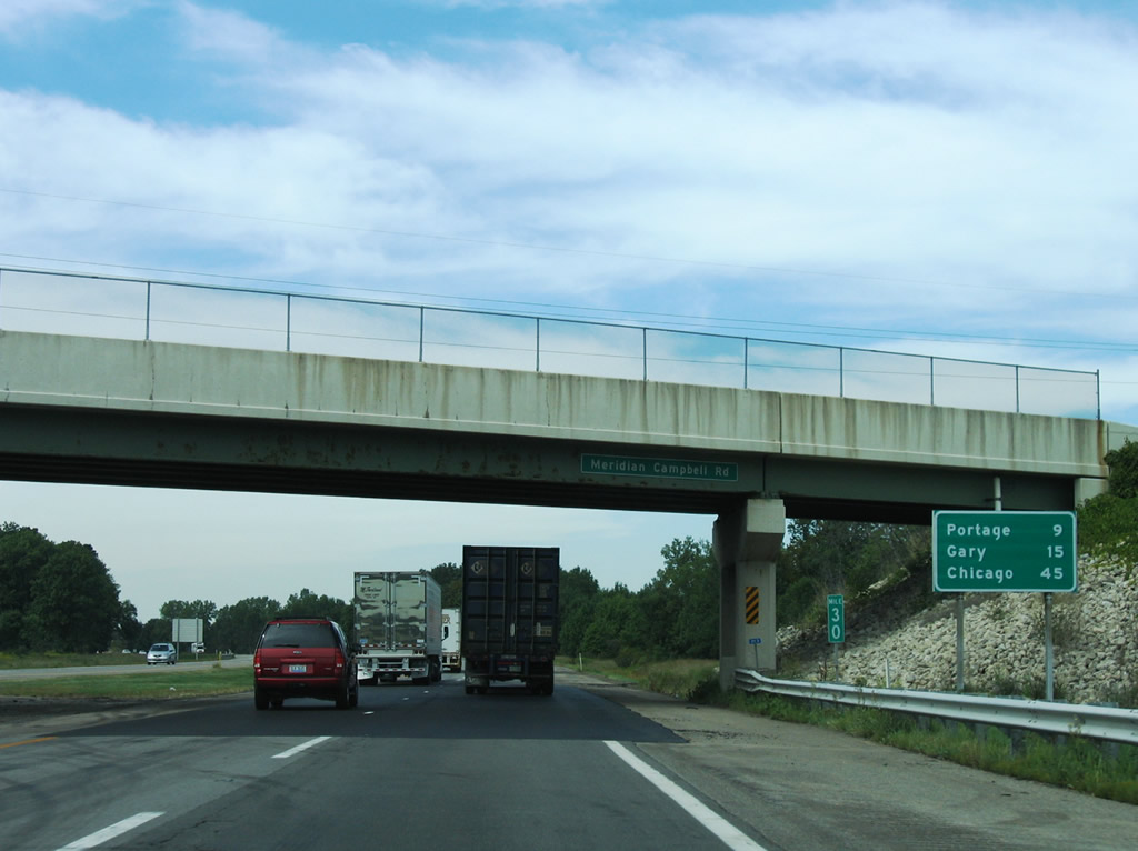
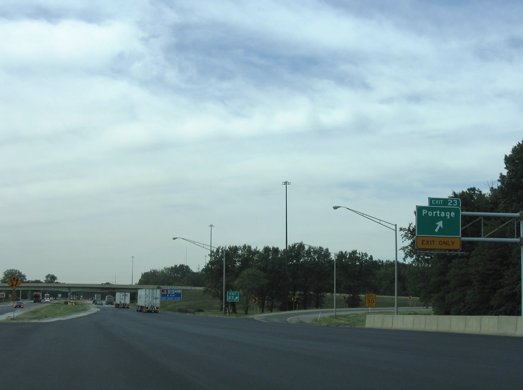
| I-80/90 pass by the wetlands of Mud Lake on the nine mile drive to Portage leading away from SR 49. 09/02/05 |
|
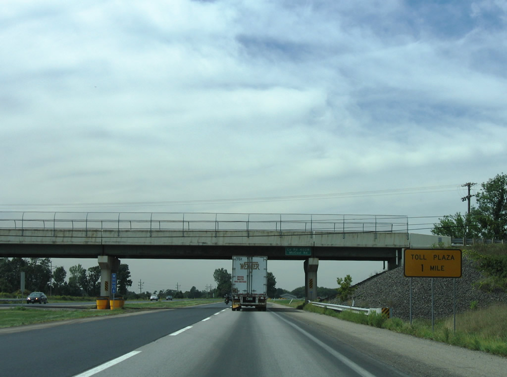
| Entering the city of Portage, westbound drivers approach a main line toll plaza one mile to the west of the McCool Road overpass. 09/02/05 |
|
| Exit 23 connects I-80/90 with Willowcreek Road after the main line toll plaza. Willowcreek Road travels north from County Road 700 and U.S. 6 north. 09/02/05 |
|
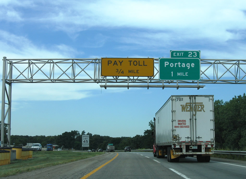
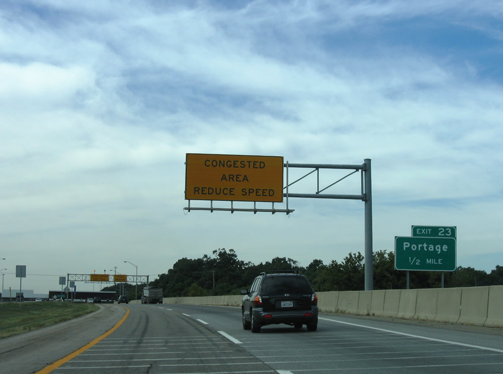
| One half mile east of the trumpet interchange (Exit 23) and access road to Willowcreek Road, drivers slow as they enter the Portage toll plaza. Willowcreek Road provides a four lane connection to Crisman Road north to U.S. 20 (Melton Road) and SR 249 north. SR 249 continues Crisman Road north 2.4 miles to the Indiana's International Port / Burns Harbor at Portage facility. 09/02/05 |
|
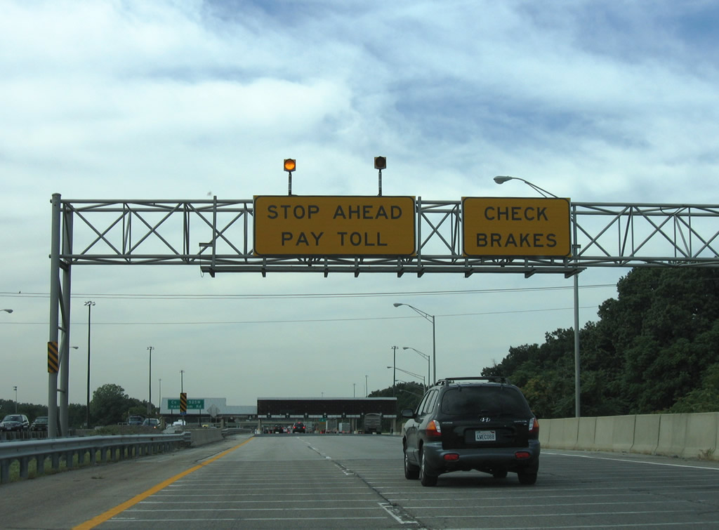
| Views of the Indiana East West Toll Road plaza at Portage. The facility represents the end of the ticketed system of toll collection; drivers continuing west are levied a static cash rate. IZoom and E-ZPass travelers may continue without stopping at attended booths however. 09/02/05 |
|
| Exit 23 follows to Willowcreek Road north to U.S. 20 and SR 249 and south to U.S. 6. SR 249 (Crisman Road) meets Exit 19 of Interstate 94 near its beginning at U.S. 20 (Melton Road). Interstate 94 west next meets the Indiana Toll Road... 09/02/05 |
|
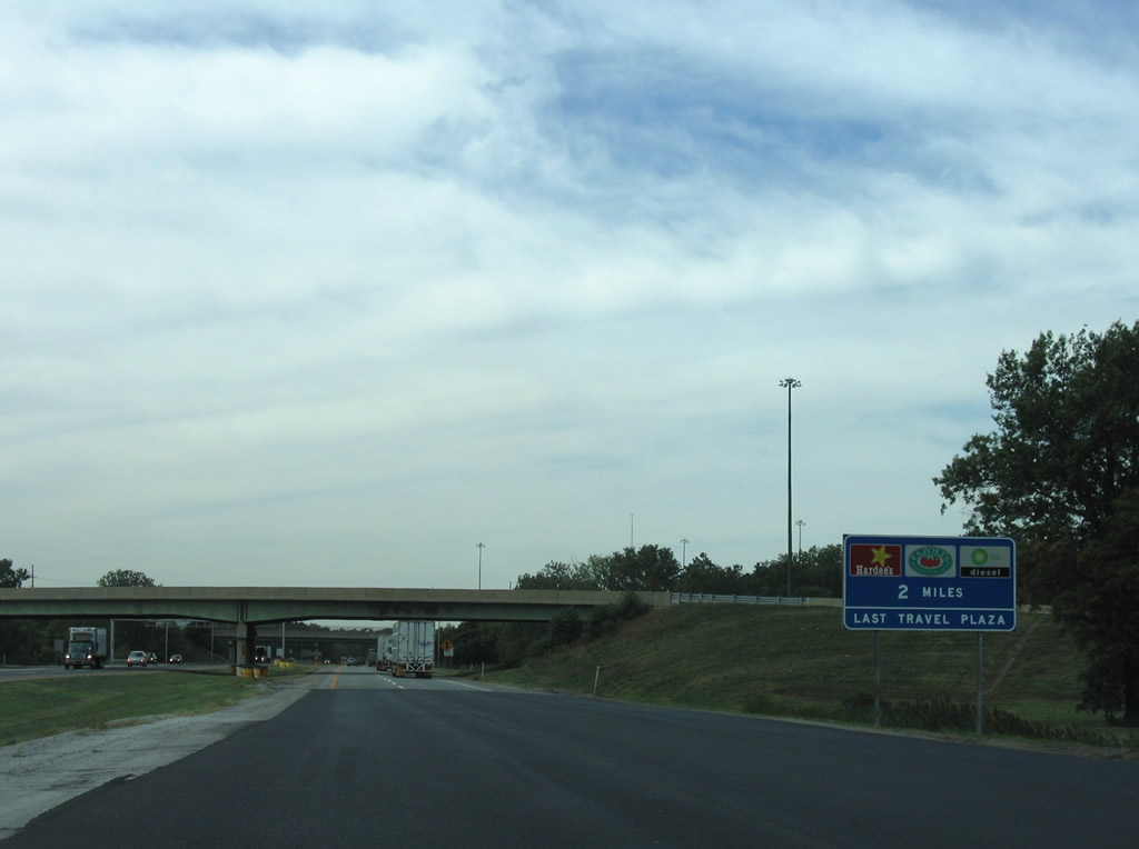
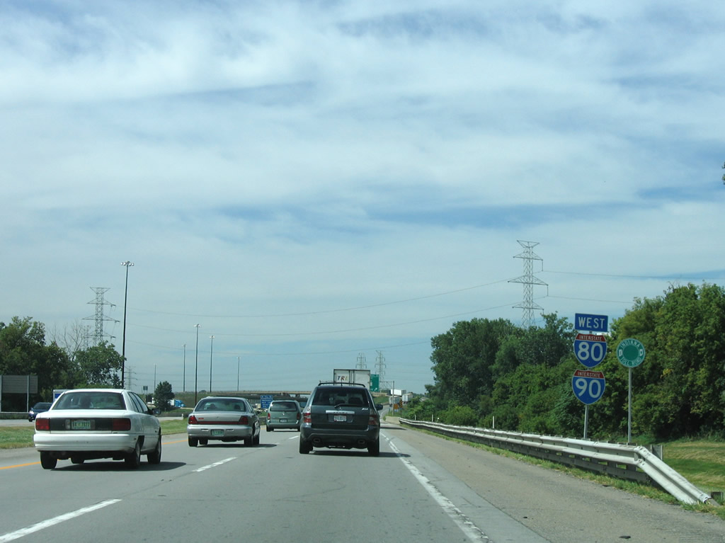
| The final Indiana East West Toll Road travel plaza lies along I-80/90 west ahead of their split at Exit 21. 09/02/05 |
|
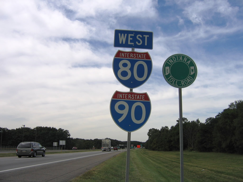
| Stand alone reassurance shields for I-80/90 posted alongside an Indiana East West Toll Road trailblazer. This was a rare assembly for the toll road main line as the signs do not double with a speed limit sign. 09/02/05 |
|
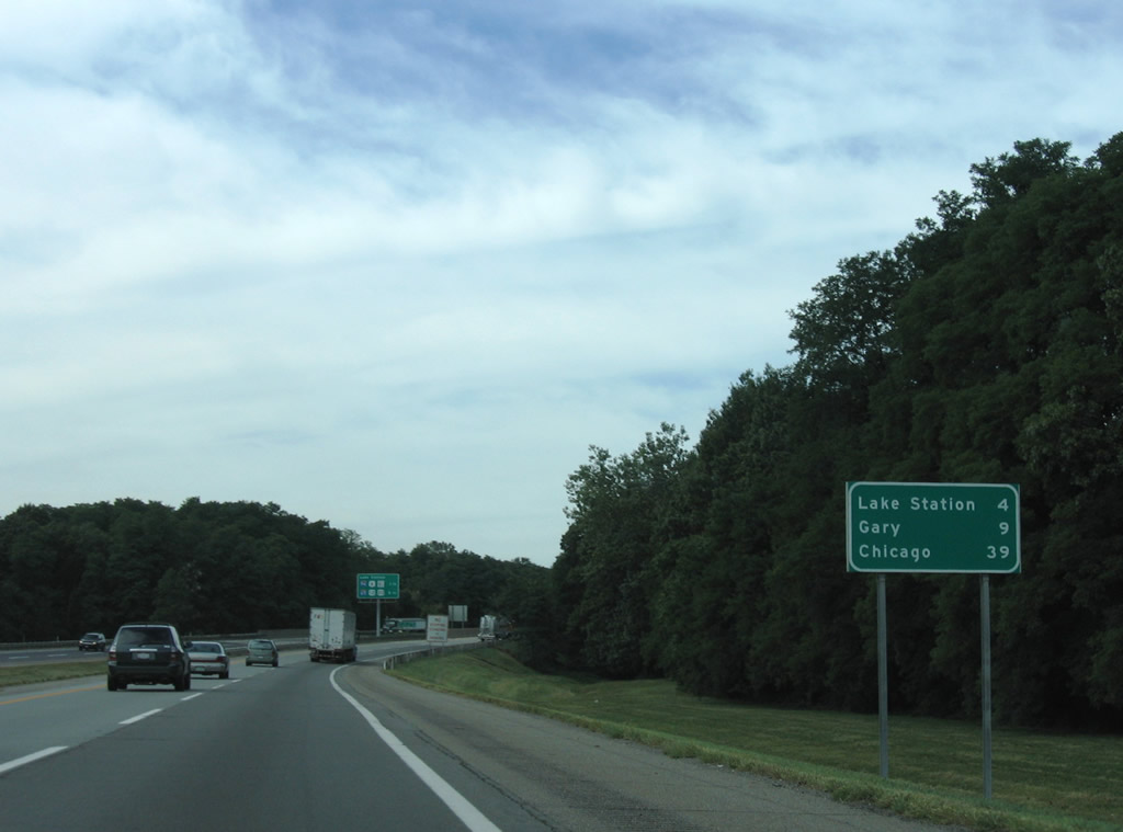
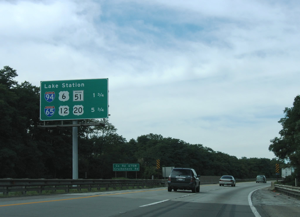
| The next nine miles of the Indiana Toll Road carry drivers into Lake County through the cities of Lake Station and Gary. 09/02/05 |
|
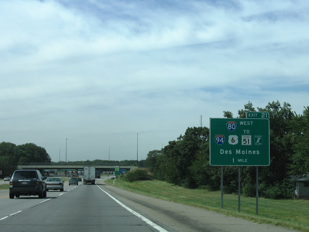
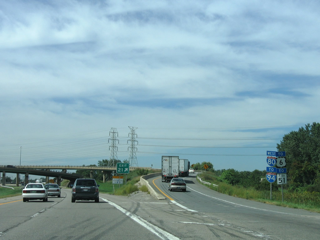
| Interchange sequence sign highlighting the distances to Lake Station interchanges (Exits 21 & 17). Interstate 94 bumps Interstate 80 west from the Toll Road next. U.S. 6 & SR 51 merge at Hobart and lead north to an adjacent cloverleaf interchange (Exit 15) with I-80/94. 09/02/05 |
|
| Interstate 80 joins Interstate 94 & U.S. 6 west from Lake Station to Gary and Hammond along the Frank Borman Expressway. The freeway provides part of a bypass of the Chicago area, but also doubles as a busy commuter route through the industrial cities of northwest Indiana and the southern suburbs of Chicago. 09/02/05 |
|
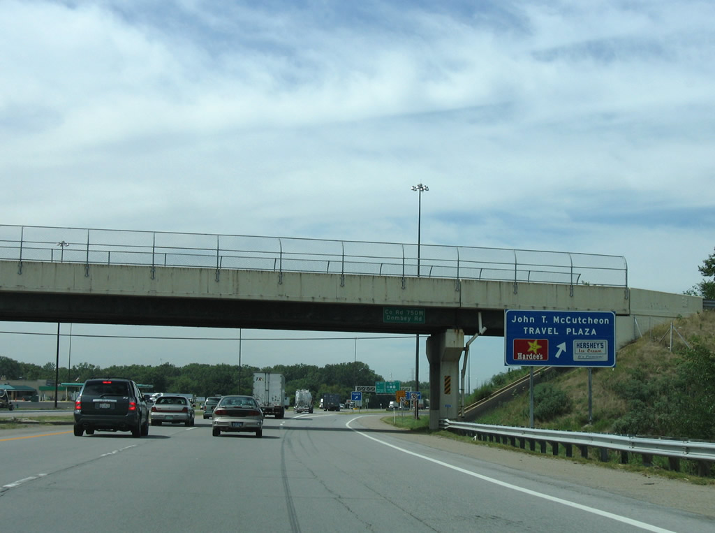
| Sandwiched between the Dornbey Road and Interstate 94 over crossings is the John T. McCutcheon Travel Plaza of I-80/90 west. 09/02/05 |
|
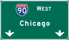
| Interstate 90 continues the Indiana Toll Road west through Gary, East Chicago, and Hammond onto the Chicago Skyway. Interstate 94 enters the Lake Station area from Portage, Burns Harbor, and Porter nearby. U.S. 6 merges with the freeway from SR 51 to Illinois. SR 51 otherwise continues north along Ripley Street from Interstate 94 to its end at U.S. 20 (Melton Road). The state road travels just 9.6 miles between Gary and U.S. 30 at Hobart. 09/02/05 |
|
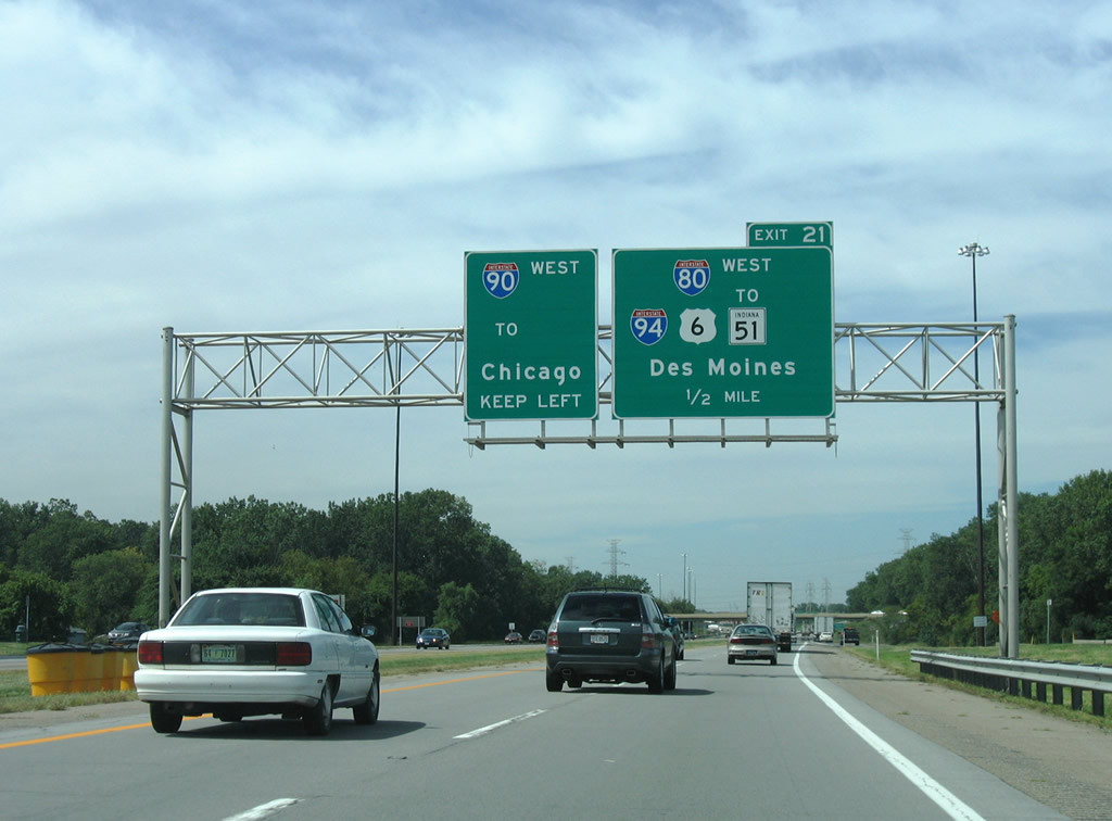
| The final reassurance shields posted for the Interstate 80 & 90 overlap at Lake Station. I-80/90 share 278.18 miles from Elyria, Ohio westward. 09/02/05 |
|
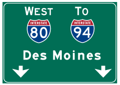
| A directional interchange facilitates the movements of Interstate 80 west from Exit 21 onto Interstate 94 west. The access road joining the two routes also ties into SR 51 & U.S. 6 east at Ripley Street. I-80/94 share 18.53 miles of pavement west to Interstate 294 & Illinois 394 (Bishop Ford [Calumet] Expressway) southwest of Lansing, Illinois. 09/02/05 |
|
| The westbound ramp to the Borman Expressway was damaged on November 1, 2010 when a truck overturned on the ramp, damaging a parapet wall. Temporary repairs were made, but later assessments led the Indiana Toll Road Concession Company (ITRCC) to close the ramp in August 2011. Interstate 80 traffic was detoured west along the Toll Road to Interstate 65 south for a period of time.1 This ramp reopened by November of 2011 however, but closed again in October 2013. A new ramp is planned for completion in spring 2015.
This view looks at a parting shot of Interstate 80's westbound departure from Interstate 90 and the Indiana East West Toll Road. A pair of toll plazas line the sides of Interstate 90 beyond Exit 21, collecting fares from motorists entering I-90 west or exiting I-90 east. 09/02/05 |
Page Updated 11-01-2011.


 West
West