
An unnumbered route, the Lake Pontchartrain Causeway holds the distinction as the longest over-water highway in the world. The 23.87 mile long bridge spans 1/1000th of the earth's circumference on its course between Metairie and Mandeville. The northbound span is actually slightly longer than the companion southbound span. The twin spans are situated 80 feet apart with seven crossovers / turnouts linking the two and providing space for breakdowns and other maintenance needs.1
The bridge system travels at an average height of 15 and 16 feet over the brackish waters of Lake Pontchartrain. Incorporated into the design are three main ship passes, where the bridges elevate to a height of 25 feet. Larger vessels can pass below two marine spans, each with a 50 foot clearance. A drawbridge accommodates the largest of ships at a location eight miles south of the north shore. The highest point of the bridge overall is no more than 60 feet.1
Tolls were charged in both directions of the Causeway until May of 1999, when northbound tolls ceased due to traffic congestion at the Metairie toll plaza along Causeway Boulevard. Rates at the Mandeville plaza then doubled to $3.00 per car.
Causeway Boulevard connects the north end of the bridge system as an at-grade route with U.S. 190 and LA 22 (Emerald Road). A freeway (Tammany Parkway) extends north from there to Interstate 12 near Covington. The south end of the causeway transitions into a heavily traveled commercial arterial (Causeway Boulevard) to Interstate 10 in Metairie. 2014 traffic counts to the south ranged from 75,708 to 123,111 vehicles per day (vpd) at the rebuilt interchange with I-10.
Tolls increases were approved by the Lake Pontchartrain Causeway Commission on August 10, 2016. The proposed increased from $2.00 to $3.00 for toll tag customers and $3.00 to $5.00 for cash customers will help pay for $103 million in safety improvements. These include two year construction of six, 672 foot long shoulders, lining the bridges between each of the seven crossovers, and a year long project to make guard rail improvements on the southbound span. The previous toll increase took place in 1995, when fares rose from $1.00 to $1.50 per direction.2
Traffic projections in the early 2000s forecast Lake Pontchartrain Causeway to reach capacity by 2018, leading to discussion for a third bridge. The proposal at the time called for a new bridge to be built to the east of the current northbound span with two travel lanes and a full right-hand shoulder. Coinciding with the plan was the addition of a new shoulder for the current southbound bridge and subsequent work to convert the 1969-span to a one-lane reversible roadway with a full shoulder.1
History1
As the 1718-founded city of New Orleans grew during the early 20th century, accessibility became an increasing problem. These issues culminated in the mid 1920's. During that time, proposals arose to address the need for improved access from the city of New Orleans to the North Shore of Lake Pontchartrain. Of these, one of the more popular at the time involved a north-south causeway across the middle of the lake. The relatively low depth of the lake, an average of 10-16 feet, led to an early concept for dredging a series of islands from north to south, for an eventual roadway between the two coast lines. Envisioners planned to connect these new islands with a series of land bodies, creating not only an overall crossing, but developable land. Before the project ever broke ground, several plots of land were actually sold.
It was at this time, that another proposal arose for a Lake Pontchartrain crossing. This concept involved the construction of a two-lane concrete bridge to the east. Then gubernatorial candidate Huey P. Long was in staunch opposition to this bridge proposal, as it was to include a $1.25 toll per car. His bid for office in 1924 was in vein, and the eastern crossing, named the Watson Williams Bridge (U.S. 11) eventually was built. By 1928 Huey P. Long ran successfully for the governorship of Louisiana. One of his first desires was to see a free bridge across the Pontchartrain, following the completion of the toll free Rigolets Bridge (U.S. 90) between Lakes Pontchartrain and Borgne to the east.
With the 1920's proposal to create islands for a causeway north-south abandoned and the succeeding new crossings to the east, new schemes arose for a crossing over the middle of the lake. New construction technology with pre-stressed concrete and increased demand led to the mid 1950's idea for what would become the Lake Pontchartrain Causeway. Success of the project to build the first pre-stressed bridge, the 1949 Walnut Street Bridge in Philadelphia, Pennsylvania, proved that the technique could work for much larger projects such as the Lake Pontchartrain Causeway.
The formation of the Louisiana Bridge Company in 1954 represents the formal beginning of the Lake Pontchartrain Causeway time line. Work began in 1955 on the first span, with the acquisition of 40 acres of land between Mandeville and Lewisburg for the operations that would create the pre cast bridge sections. The prefabricated bridge pieces created at the job site were easily transported by barge for assembly over water. The on-site location of these facilities allowed for quick construction of the bridges. The first pilings were sunk on May 23, 1955.
Pre-stressing the concrete piles allowed for hollow piles as opposed to solid piles. That meant that instead of having a maximum width of 24 inches for a support, engineers could now create 54 inch diameter piles. A revolutionary construction method allowed for the spinning of the new concrete supports at higher speeds. This compacted the concrete and removed excess water, allowing for stronger cured concrete. These actions produced piles with a load support of 10,000 pounds per inch.
Each pile was no longer than 16 feet in length. Holes bored within the concrete housed pre-stressed, high strength steel wire. Assembling the piles involved stacking each pile on top of one another until the desired height of 88 feet was reached. This length allowed for each pile to submerge 70 feet within the sand strata below. A steam pile driver did the job, and the 4 and 5/8th inch wall supports were sawed off to a consistent height.
Above the piles, concrete caps were mounted via steel posts. These supported 54 foot long concrete slabs that constitute the actual bridge deck and roadway surface.
The original design featured two separate drawbridges, each eight miles from shore. The $29 million, 23.83 mile project opened four months ahead of schedule to much fanfare. It took 200 engineers and workers to complete the job. The August 30, 1956 opening date culminated with the assembly of 2,243 piles, each supporting a 33 foot wide, 56 foot section of roadway. Users were charged a $1.00 toll per direction.
While the connection was welcomed by all, the convenience of the route and mileage it saved for travelers eventually overwhelmed the highway. Within a few years the bridge succumbed to 3,000 vehicles per day (vpd). This volume fueled mid 1960'ss preparations for a second lake crossing.
Work on span paralleling the 1956 bridge began during September of 1967. Breakthroughs in construction methods were evident with the design of the new bridge. Instead of two piles per support, designers increased the number of piles to three. The added strength increased the load support, so instead of 54 foot slabs used in the first bridge, 84 foot slabs were used instead. Accelerated construction created up to 20, 300-ton slabs during seven day periods, with the construction of 1,600 feet of bridge per day. Additionally, the increased diameter of the pile walls to 5 inches allowed for more cover over the steel reinforcement bars. This increase provided better insulation for the steel against the effects of the brackish water.
The construction of the new northbound bridge also brought about the creation of seven connecting spans / alleys. The $26 million project was completed in 25 months, with only two construction related deaths reported. Work also coincided at the time on the old bridge as well, with the installation of the draw bridge bascules, widening of the navigational channel to 125 feet, and the replacement of southern drawbridge with a ship channel. The expanded causeway opened to traffic on May 10, 1969.
Additions to the Causeway vicinity include the placement of "spare parts" at various locations alongside the bridges. These were placed in case of structural impairment due to boating collisions. A radar system was also implemented to alert officials when a boat entered a one mile buffer around the spans. 16 collisions were recorded at the causeway through 2003, some with fatalities.
Between 1961 and 2003, 55 people lost their lives along the causeway.1 Since 1994, 13 vehicles went over the side of the southbound span and one of from the northbound span. 11 lost their lives during this period.3 80 police units and 30 maintenance trucks patrol the causeway at any given time. Variable Message Signs (VMS) operating at the crossovers alert motorists of potential accidents and other hazards. Other safety precautions included a radio station and 102 call boxes. These operations in conjunction with yearly inspections improved safety along the bridge system.1
| Lake Pontchartain Causeway - North |
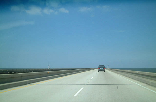 | Call boxes are placed at short intervals on each of the Causeway bridges. When eight miles from either shore, land no longer is visible. 10/03/01 |
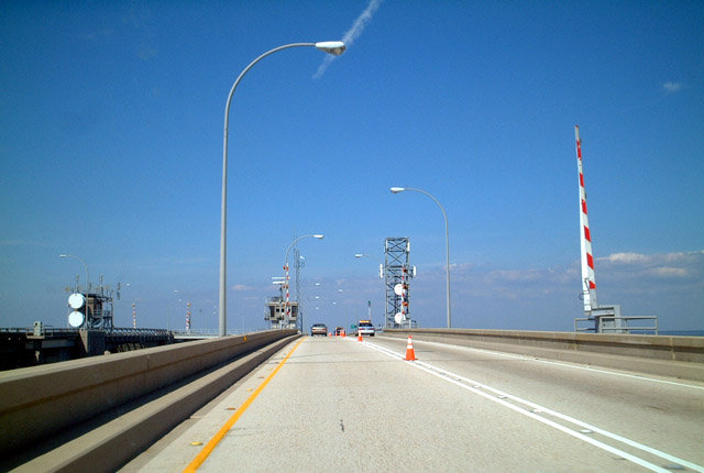
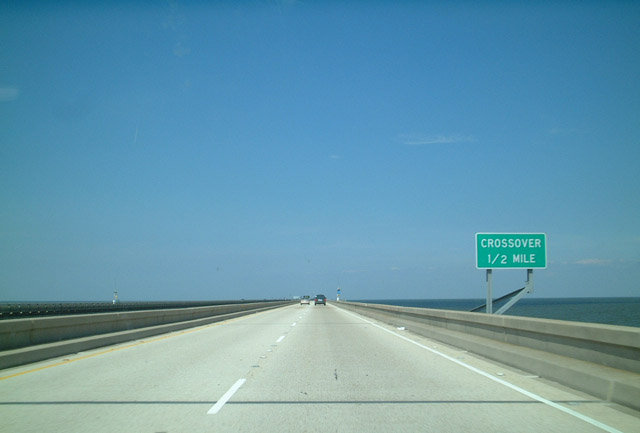 | Approaching one of the crossovers along Lake Pontchartain Causeway northbound. These turnouts are fairly wide and used by police or maintenance crews. There are seven crossovers along the 24 mile route. 10/03/01 |
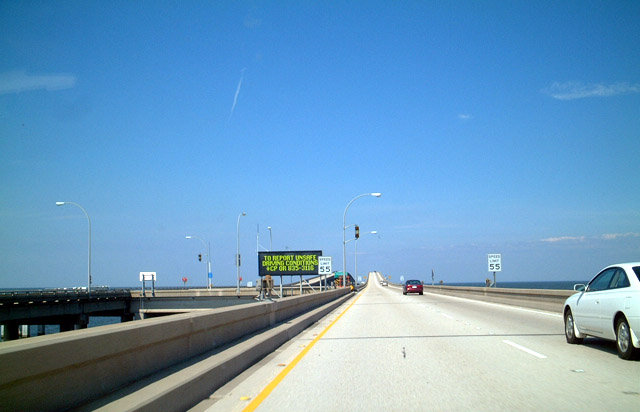 | Dynamic message sign posted at the crossover preceding the south maritime channel. The south channel is located eight miles north from the Lake Pontchartrain shoreline at Metairie. 10/03/01 |
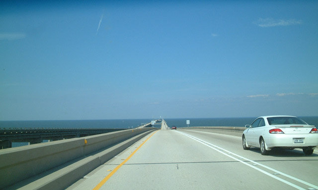 | Lowering from the crest over the south channel on Lake Pontchartrain Causeway northbound. The rise provides 50 feet of clearance for boats. 10/03/01 |
 | The movable bridge portion of the Lake Pontchartrain Causeway lies eight miles south of the North Shore. The draw bridge is one of the few stretches along the 24 mile causeway were passing is prohibited. 10/03/01 |
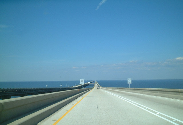 | Passing is permitted again along the causeway northbound once it levels out beyond the draw bridge. 10/03/01 |
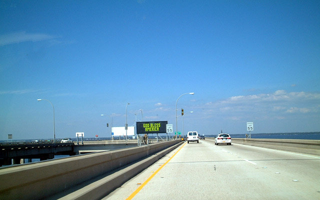 | Two crossovers / turnouts join the twin spans between the north channel and Mandeville. Speed limits along the causeway were increased to 65 miles per hour in 2004. 10/03/01 |
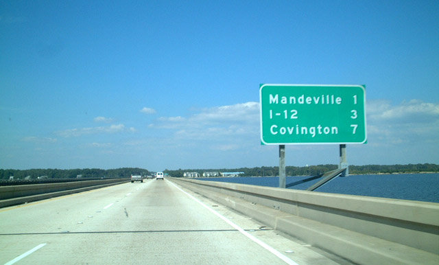 | Distance sign posted ahead of the Lake Pontchartrain Causeway north end, one mile form Mandeville and three miles from the U.S. 190 connection with Interstate 12. A succeeding sign touts the next five exits for Mandeville, but the ensuing stretch of Causeway Boulevard is not a full freeway. 10/03/01 |
| Causeway Boulevard - North |
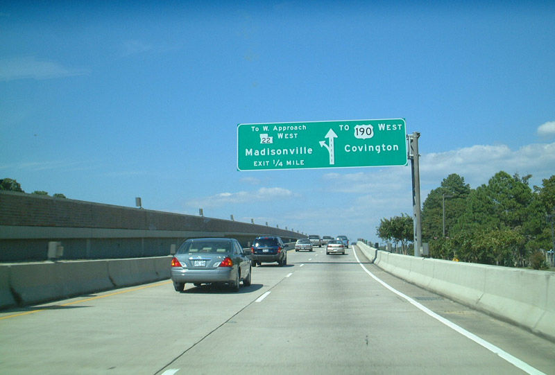 | Once on land, Lake Pontchartrain Causeway transitions into Causeway Boulevard and splits with the Causeway East Approach road for U.S. 190 (Florida Street) east into Mandeville. A viaduct then elevates over Monroe Street to a wye interchange with the Causeway West Approach road to LA 22 (Emerald Road) west to Madisonville. 10/03/01 |
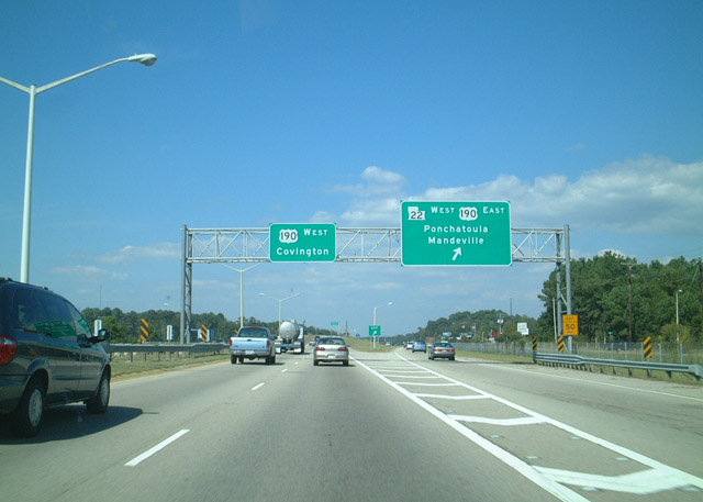 | A diamond interchange joins the north end of Causeway Boulevard with LA 22 west and U.S. 190 (Emerald Road) east. The arterial upgrades to a freeway as part of U.S. 190 north to Interstate 12 and Covington. 10/03/01 |
- "Modern Marvels - Lake Pontchartrain Causeway," The History Channel. October 15, 2003.
- "Lake Pontchartrain Causeway toll hike: 5 things to know." The Times-Picayune, August 11, 2016.
- "59-year-old Causeway bridge at a crossroads: Make it safer? Wider? Or keep as it is?" The Times-Picayune, July 16, 2015.
Photo Credits:
10/03/01 by AARoads
Page Updated 09-30-2016.