New Jersey Route 29 travels 34.71 miles from I-195/295 in Hamilton township to Frenchtown and Route 12. The state route is a nationally designated scenic by-way as it cruises along the beautiful Delaware River between the capital of Trenton and the city of Lambertville.
New Jersey Route 29 through Trenton includes a half mile tunnel beside Lamberton Street along the Delaware River. Opened on March 3, 2002, the tunnel was built as part of a $105 million project to reconstruct Route 29 southward from the city to Interstates 195 and 295. The tunnel project was delayed, taking four and a half years to complete with $15 million in additional costs. It was the final piece of the Trenton Complex project which included construction of Route 129 and the interchange between I-195/295 to the southeast.1
|
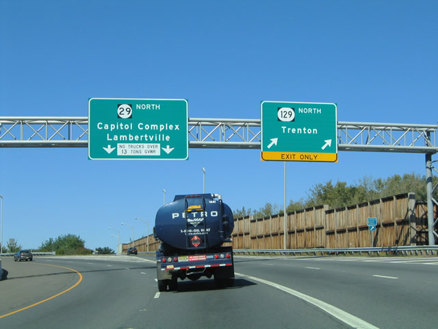
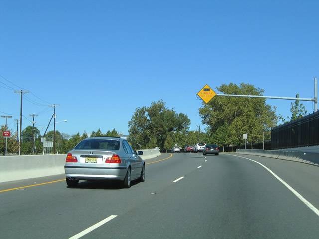
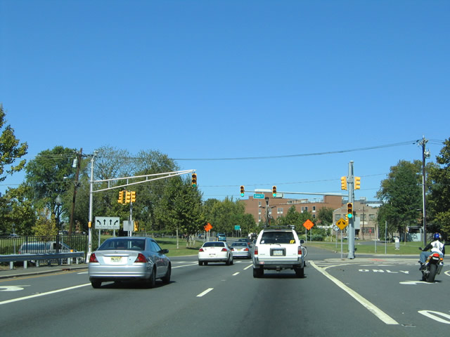
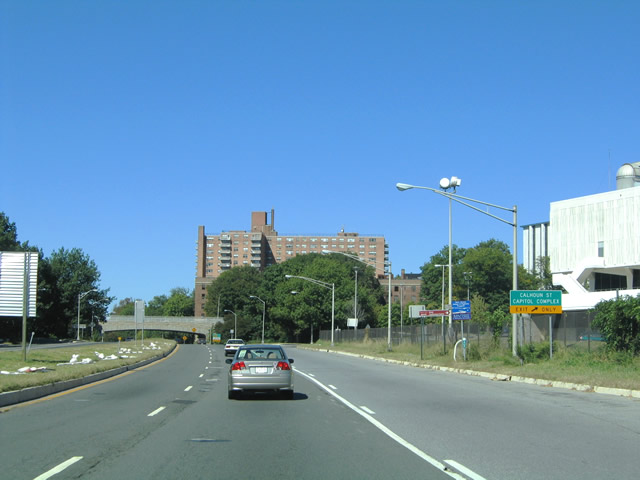
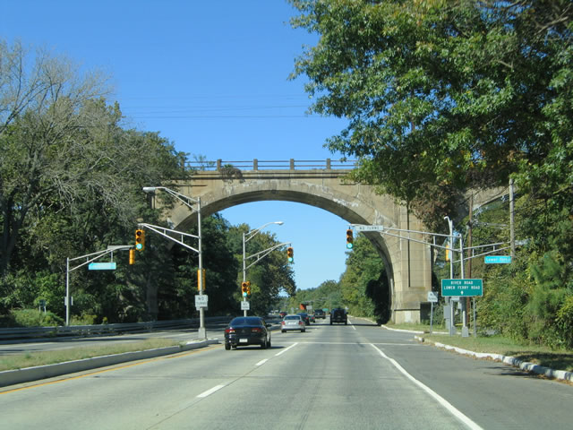
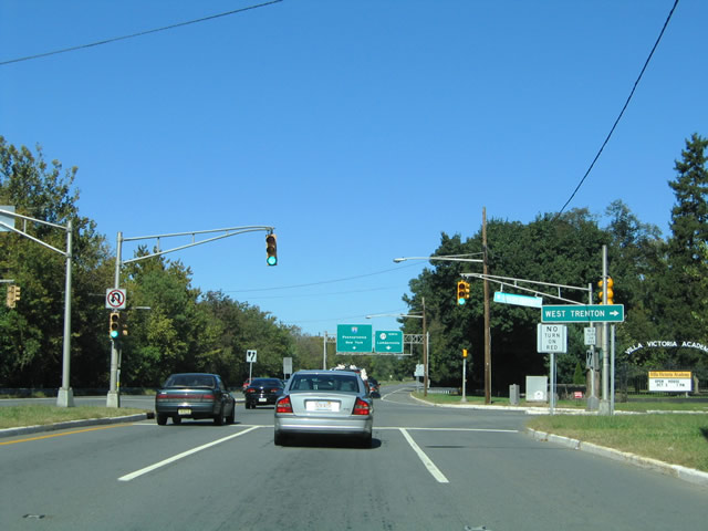
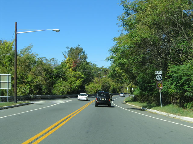
| New Jersey 29 extends the Interstate 195 freeway west from Interstate 295 (Exit 60) through John A. Roebling Memorial Park toward the Delaware River at Trenton. The state route meets Route 129 north at the Trenton city line in one mile. 10/03/04 |
|
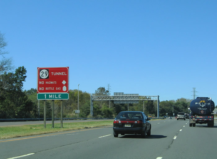
| All vehicles carrying either hazardous materials or propane tanks must exit onto Route 129 to bypass the forthcoming New Jersey 29 tunnel. A red and white sign lists the restrictions for the four lane tunnel. 10/03/04 |
|
| One half mile from the northbound ramp to Route 129 into Trenton. Route 129 comprises a multi-lane surface boulevard from the New Jersey 29 freeway northward to U.S. 1 (Trenton Freeway) at Downtown Trenton. 10/03/04 |
|
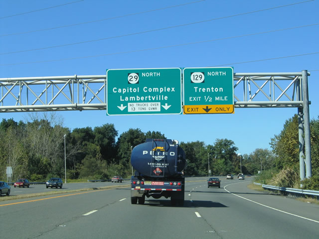
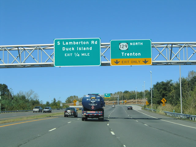
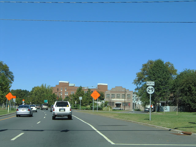
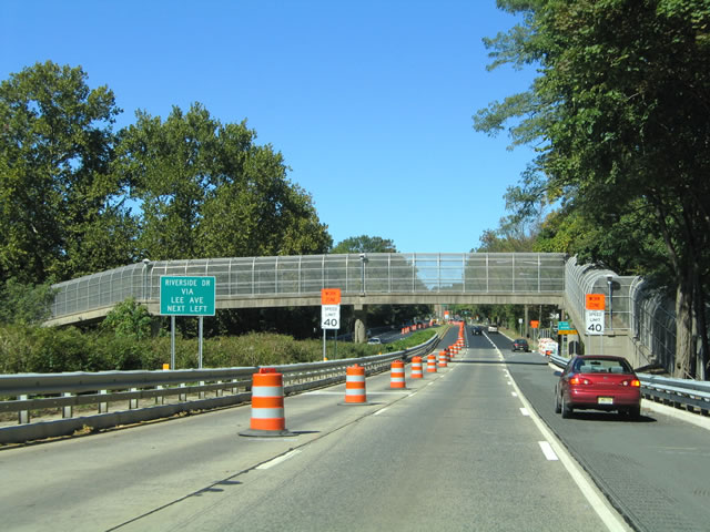
| New Jersey 29 north expands ahead of the two lane off-ramp for the half diamond interchange with Route 129. A loop ramp departs in one quarter mile for Route 129 south to South Lamberton Road and Duck Island. 10/03/04 |
|
| Route 129 leads north to the South Trenton, Chestnut Park and Chambersburg neighborhoods before concluding its 2.41 mile route at U.S. 1 and Route 33. Route 29 meanwhile curves west toward the banks of the Delaware River en route to the State Capital Complex. 10/03/04 |
|
| All restricted traffic must depart New Jersey 29 northbound by the loop ramp for Route 129 south to Duck Island. Lamberton Road straddles the Delaware River from the Route 129 south end northward to an on-ramp for Route 29 south. 10/03/04 |
|
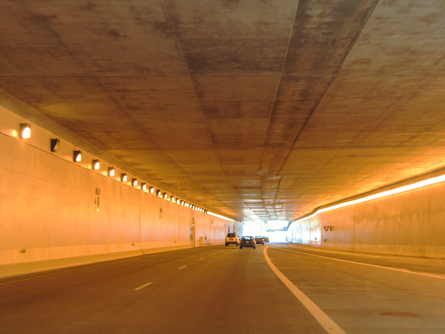
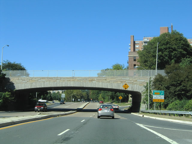
| New Jersey 29 curves northwest to parallel the Delaware River ahead of the four lane riverfront tunnel. 10/03/04 |
|
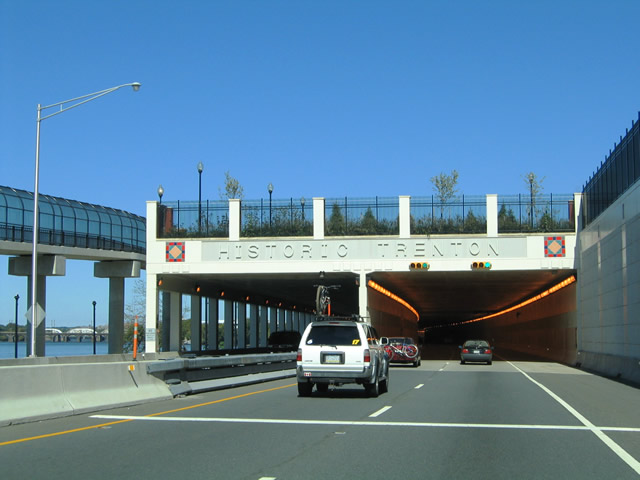
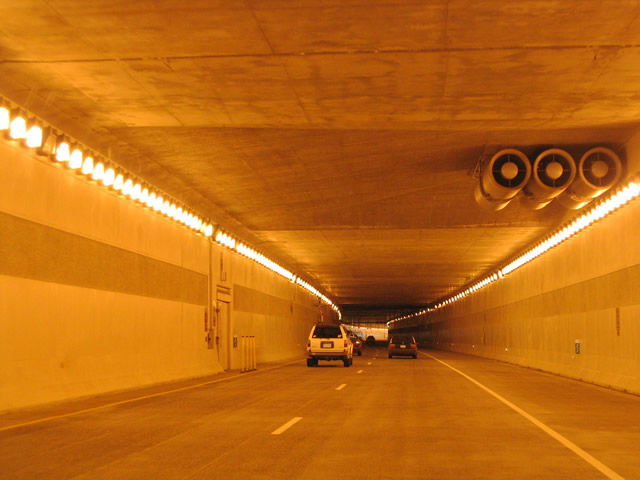
| Entering the New Jersey 29 riverfront tunnel underneath Lamberton Park along the Delaware River. The $94 million project saw construction between September 1998 and March 2002. The complex linked two segments of New Jersey 29 divided highway along a new 1.4 mile freeway, resulting in the construction of a waterfront park above.2 10/03/04 |
|
| Views of the northbound tube of the New Jersey 29 tunnel at Trenton. Completion of the tunnel alleviated traffic congestion along Lamberton Road between the two existing segments of New Jersey 29 in South Trenton. Started in the 1960s, the 3.2 mile New Jersey 29 freeway was planned all along between Downtown Trenton and the exchange between Interstates 195 and 295. Until 1998, all but the 1.4 mile gap between the two segments was complete. Traffic used the two lane residential surface street of Lamberton Road between the two segments until 2002. The street was never a part of New Jersey 29 officially.2 10/03/04 |
|
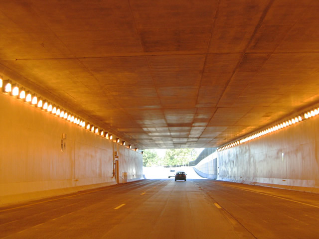
| New Jersey 29 (John Fitch Parkway) emerges from the riverfront tunnel ahead of its signalized intersection with Cass Street. Cass Street joins Waterfront Park Stadium to the west with Downtown Trenton, Route 129, and U.S. 206 (Broad Street) to the east. 10/03/04 |
|
| New Jersey 29 (John Fitch Parkway) north at Cass Street. Adjacent Waterfront Park Stadium is the home of the Trenton Thunder Double A baseball team. 10/03/04 |
|
| Traffic from Cass Street westbound merges onto New Jersey 29 north as the roadways of John Fitch Parkway converge ahead of Warren Street. 10/03/04 |
|
| New Jersey 29 (John Fitch Parkway) northbound at the signalized intersection with the south end of Warren Street. Warren Street connects Route 29 with Ferry Street alongside the AMTRAK Northeastern Corridor. 10/03/04 |
|
| Continuing north along New Jersey 29 (John Fitch Parkway) past the Warren Street traffic signal. The state route upgrades into a full freeway between Warren Street and Lee Avenue in northwest Trenton. 10/03/04 |
|
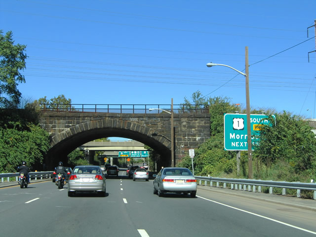
| John Fitch Parkway sees ramps to U.S. 1 (Delaware River Joint Toll Bridge) south across the Delaware River. A loop ramp departs New Jersey 29 north for U.S. 1 south to Morrisville, Pennsylvania just beyond the AMTRAK bridge. The span is tolled in the southbound direction. 10/03/04 |
|
| U.S. 1 leads west from Trenton to Morrisville and Langhorne, Pennsylvania as a freeway. U.S. 1 passes over John Fitch Parkway adjacent to Bridge Street (old U.S. 1), which links with the Trenton Makes / Lower Trenton Bridge across the Delaware River. 10/03/04 |
|
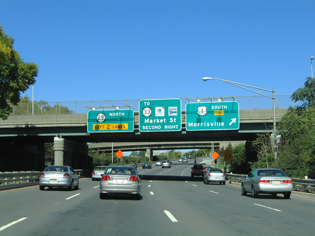
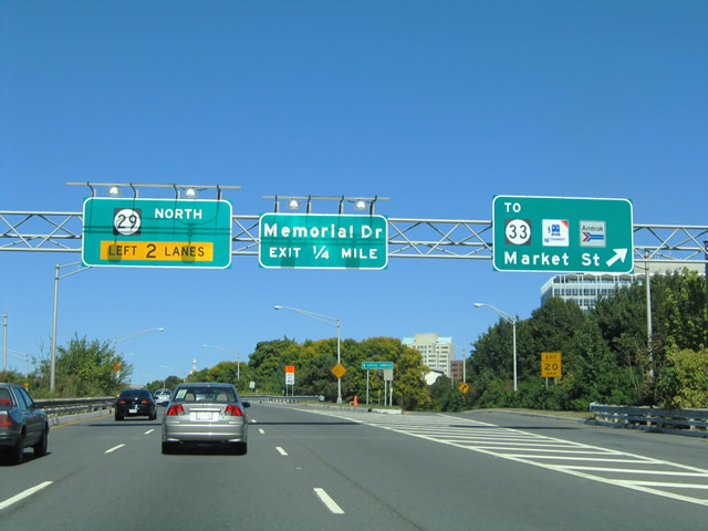
| The next northbound exit leaves New Jersey 29 for Market Street east. Market Street connects Route 29 with U.S. 206 (Broad Street), the AMTRAK and NJTransit stations and the eastbound beginning of Route 33 (Greenwood Avenue). Route 33 ventures east from U.S. 1 to Mercerville outside of Trenton. 10/03/04 |
|
| Memorial Drive loops southeast from Route 29 to the New Jersey State Capitol Complex from the next exit. 10/03/04 |
|
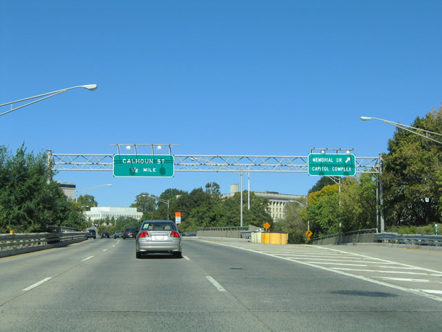
| A cloverleaf interchange joins New Jersey 29 with Calhoun Street and the Calhoun Street Bridge. Calhoun Street (CR 653) northbound travels 0.6 miles to Route 31 (Pennington Avenue) through the Central West neighborhood of Trenton. Connections with State Street provide a second route to the State Capitol Complex as well. 10/03/04 |
|
| Northbound at the loop ramp onto the Calhoun Street Bridge south across the Delaware River. A narrow two lane truss bridge links Calhoun Street with Trenton Avenue in Morrisville, Pennsylvania. Trucks are prohibited from using the span. 10/03/04 |
|
| New Jersey 29 straddles Stacy Park through northwest Trenton. The four lane parkway sees a slip ramp onto the adjacent Riverside Avenue just one half mile north of the Calhoun Street Bridge. 10/03/04 |
|
| Riverside Avenue begins and parallels New Jersey 29 northbound through adjacent residential areas of the West End neighborhood. 10/03/04 |
|
| A second slip ramp joins New Jersey 29 northbound with Riverside Drive ahead of its intersection with Hermitage Avenue. Hermitage Avenue stems northeast from Riverside Drive to State Street and Stuyvesant Avenue. 10/03/04 |
|
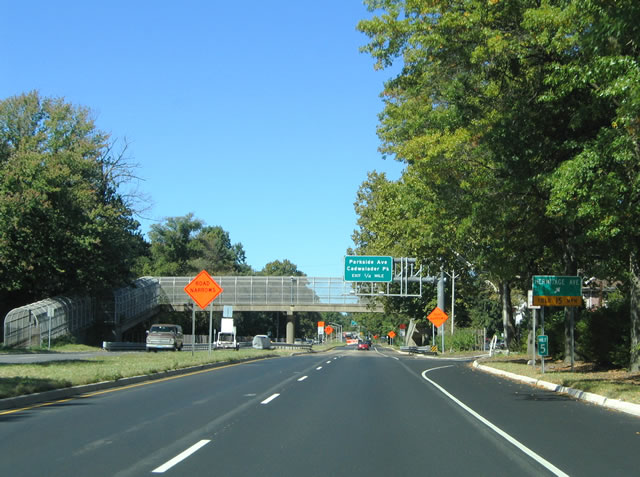
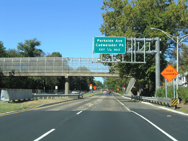
| 0.25 mile overhead for the Parkside Avenue wye interchange on New Jersey 29 north. A pedestrian overpass provides access to the Delaware Riverfront at Stacy Park from Hermitage Avenue. 10/03/04 |
|
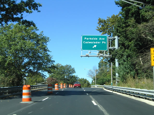
| Parkside Avenue ventures northward from New Jersey 29 to Cadwalader Park, the Pennington-Prospect neighborhood, and Ewingville. The surface boulevard doubles as CR 636 and meets Route 31 (Pennington Avenue) in 1.3 miles. 10/03/04 |
|
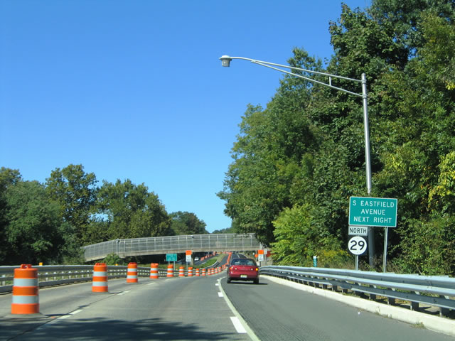
| New Jersey 29 continues north toward the Eastfield Avenue slip ramp from the Parkside Avenue southbound overpass. Riverside Drive again continues along the north side of the four lane parkway between Parkside Drive and Westfield Avenue. 10/03/04 |
|
| New Jersey 29 northbound leaves Stacy Park at the Eastfield Avenue slip ramp onto Riverside Drive. Riverside Drive turns onto Westfield Avenue in two blocks to the north. A third segment of the roadway begins south of New Jersey 29 near Lipton Avenue at Stacey Park. 10/03/04 |
|
| The limited-access portion of New Jersey 29 concludes at the signalized intersection with Lee Avenue. Lee Avenue travels between Riverside Drive at Stacy Park northward to State Street and Edgewood Avenue nearby. 10/03/04 |
|
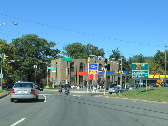
| Approaching the northbound beginning of Mercer County 579 (Sullivan Way) and the New Jersey 29 merge with Sanhican Drive. CR 579 parallels Route 31 between Trenton, West Trenton, Hopewell township, and Linvale. 10/03/04 |
|
| Crossing Sanhican Drive south along New Jersey 29 north ahead of the split with CR 579 (Sullivan Way) north. Sanhican Drive becomes State Street southward through the West End neighborhood of Trenton. 10/03/04 |
|
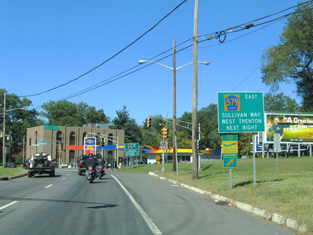
| Mercer County 579 (Sullivan Way) guide sign posted on New Jersey 29 northbound at the Sanhican Drive merge. Sullivan Way enters West Trenton 1.8 miles to the north. The county route continues from there to Trenton Mercer Airport (TTN). 10/03/04 |
|
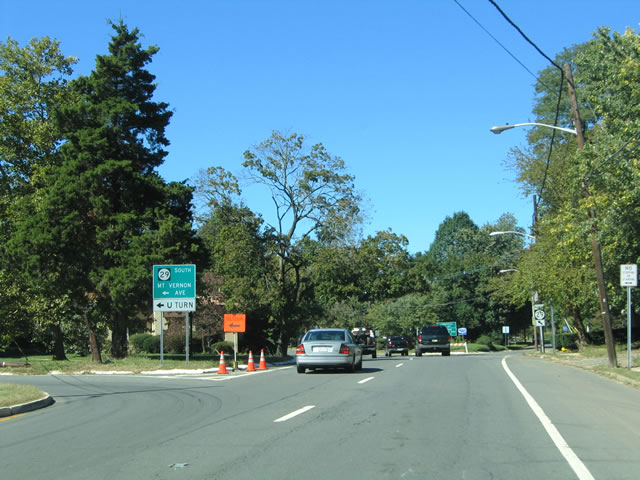
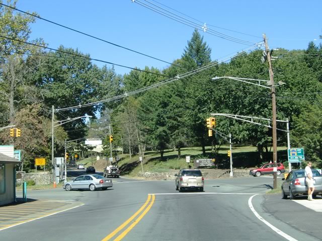
| Mercer County 579 crosses paths with Interstate 95 at Exit 2, three miles to the north. The 12.05 mile route ends at Route 31 in East Amwell township.
Mount Vernon Avenue ties into the intersection from the west. 10/03/04 |
|
| A u-turn lane joins New Jersey 29 south to Mt. Vernon Avenue while Morningside Drive splits from New Jersey 29 north to the right. Mt. Vernon Avenue connects Riverside Drive and Clearfield Avenue with the state route. 10/03/04 |
|
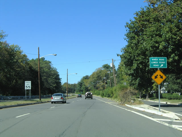
| A slip ramp departs New Jersey 29 (Sanhican Avenue) for River Road (Route 175) northbound near the Trenton Country Club. River Road parallels the four lane parkway between here and Upper Ferry Road. Turns are not permitted onto Lower Ferry Road northbound, so traffic bound for the road must use Route 175 to make the connection. 10/03/04 |
|
| The south end of Lower Ferry Road ties into New Jersey 29 at a signalized intersection near the SEPTA Regional Rail overpass. A second connection to Lower Ferry Road exists ahead via River Road (Route 175) southbound. 10/03/04 |
|
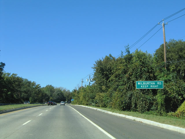
| Wilburtha Road is accessible from New Jersey 29 north via another connection with adjacent River Road (Route 175). 10/03/04 |
|
| New Jersey 29 northbound at the Wilburtha Road connector between the four lane parkway and adjacent River Road (Route 175). Wilburtha Road leads 1.2 miles north from River Road to CR 634 (Upper Ferry Road) at West Trenton. 10/03/04 |
|
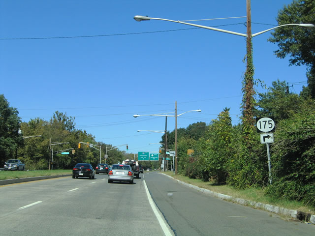
| Signs for Route 175 appear along Route 29 north ahead of the intersection with Upper Ferry Road. Route 175 loops east via Upper Ferry Road to a continuation of River Road west back to Route 29 beyond I-95. The route totals 2.95 miles. 10/03/04 |
|
| New Jersey 29 north at Route 175 (Upper Ferry Road). Upper Ferry Road east from Route 175 continues to Parkway Avenue in West Trenton as CR 634. 10/03/04 |
|
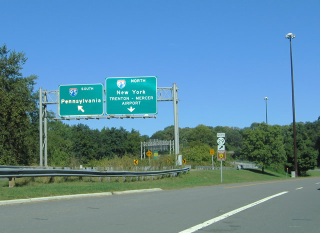
| The folded diamond interchange between Route 29 and I-95 lies between the Delaware River and Route 175 (River Road) at Scudder Falls. A left side off-ramp forms a collector distributor roadway for Interstate 95 while the roadways of Route 29 diverge to accommodate left side ramps. 10/03/04 |
|
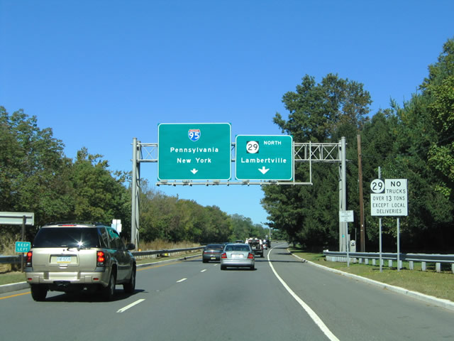
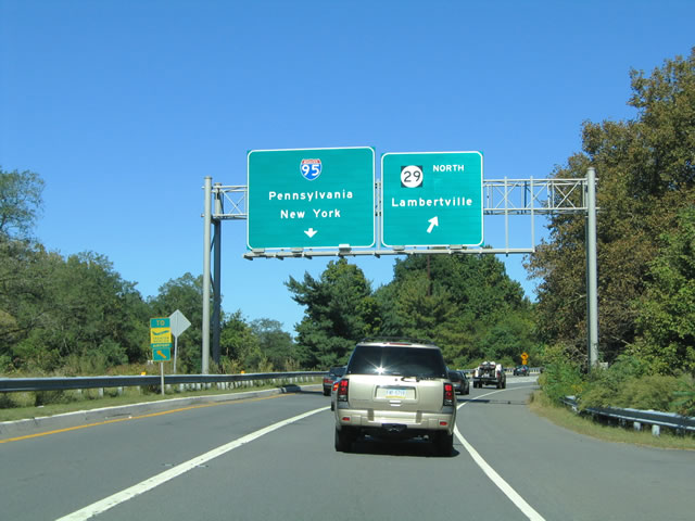
| Traffic to Interstate 95 leaves New Jersey 29 northbound. I-95 forms the northern half of the Trenton Belt Line between U.S. 1 at Lawrence Township and the Scudder Falls Bridge south to Yardley, Pennsylvania. 10/03/04 |
|
| A parting shot of the Interstate 95 ramp split from New Jersey 29 north. I-95 serves the Trenton Mercer Airport (TTN) at Exits 2 and 3. The Interstate ends prematurely in nine miles at Interstate 295 & U.S. 1, with connections onto I-295 south and I-195 east to the New Jersey Turnpike north for New York City. 10/03/04 |
|
| Departing the interchange with Interstate 95 on New Jersey 29 (River Road) north. The state route decreases in capacity to a two lane rural road as it straddles the Delaware River between Trenton, Washington Crossing, Titusville, and Lambertville. 10/03/04 |
|
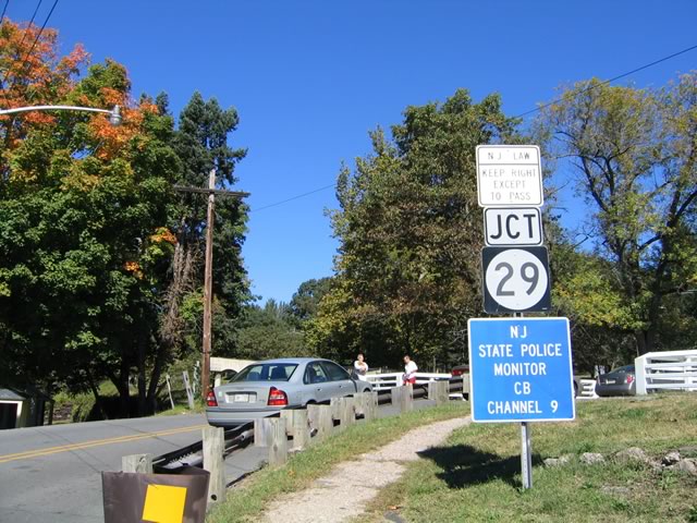
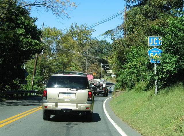
| Junction Mercer County 546 shield posted along New Jersey 29 north at Washington Crossing. CR 546 (Washington Crossing Pennington Road) loops 9.98 miles west from U.S. 1 at Lawrence township to end at New Jersey 29 opposite the Washington Crossing Bridge to PA 532. 10/03/04 |
|
| Mast-arm supported traffic signals govern the intersection between New Jersey 29 (River Road) and CR 546 (Washington Crossing Pennington Road). A narrow steel-truss bridge crosses the Delaware River between Washington Crossing, New Jersey and Pennsylvania to the left. PA 532 begins at the Pennsylvania state line and runs southward to Newtown. Trucks are prohibited from using the narrow span. 10/03/04 |
|
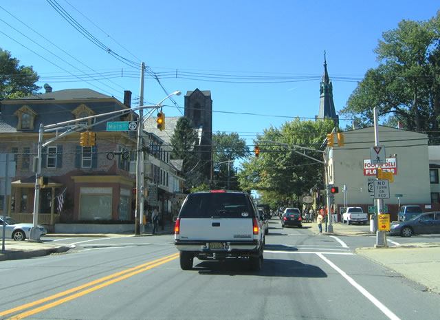
| 6.4 miles north of Washington Crossing along New Jersey 29 (River Road) is the city of Lambertville. New Jersey 29 widens into a four lane boulevard upon entering town as Main Street. A trailblazer for New Jersey 29 pictured here advises motorists of the upcoming dogleg from Main Street onto Bridge Street at Route 179. 10/03/04 |
|
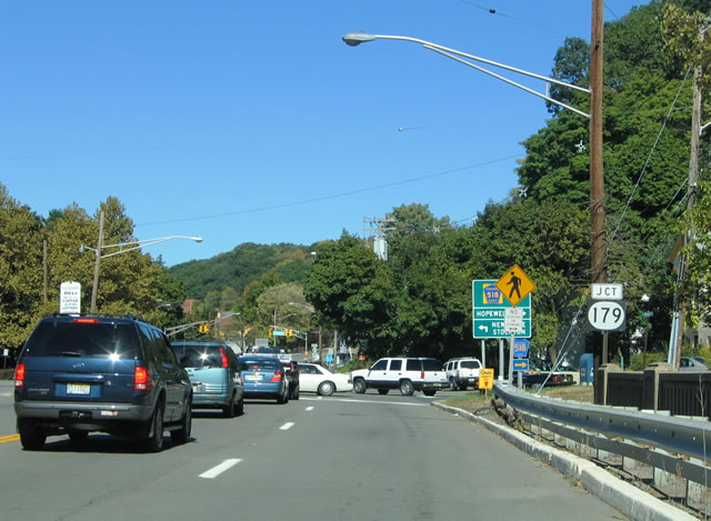
| New Jersey 29 (Franklin Street) northbound at the confluence of Route 165 and Hunterdon County 518 (Brunswick Avenue), two blocks south of Route 179 (Bridge Street). Route 165 overlays 0.26 miles of Route 29 between Mount Hope Street and CR 518 while Brunswick Avenue carries CR 518 east toward Hopewell township. 10/03/04 |
|
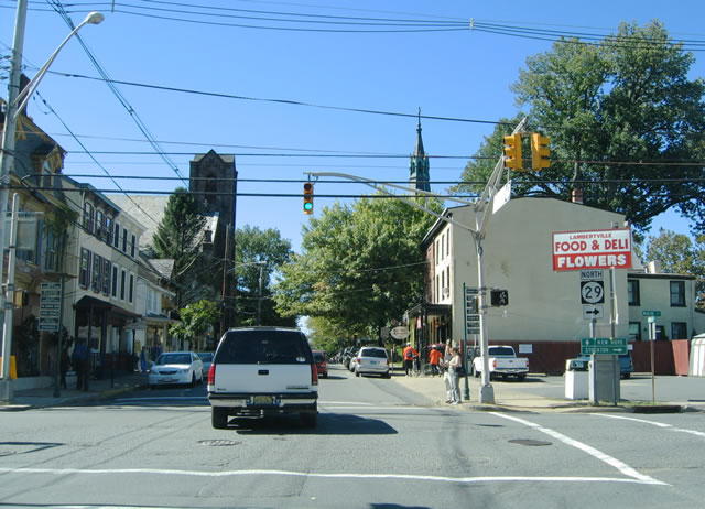
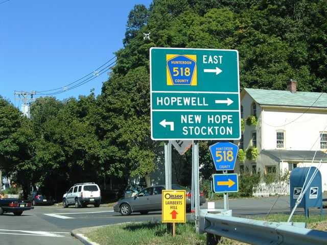
| Another look at the Hunterdon County 518 (Brunswick Avenue) guide sign posted on New Jersey 29 & 165 (Franklin) north in Lambertville. CR 518 meets CR 579 (Habourton Rocktown Road) in six miles and Route 31 in seven miles at Woodsville.
Forthcoming Route 179 becomes PA 179 across the Delaware River to New Hope. 10/03/04 |
|
| New Jersey 29 (Franklin Street) northbound at Route 179 (Bridge Street). Route 29 north turns left onto Bridge Street with Route 179 south to Main Street. Route 179 overtakes Franklin Street on the northeast drive to Mount Airy and Ringoes ahead. 10/03/04 |
|
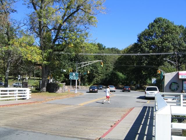
| New Jersey 29 north & 179 south along their two-block overlap on Bridge Street in Lambertville. Route 29 turns onto Main Street toward Delaware township and the borough of Stockton while Route 179 remains on Bridge Street west to the Delaware River crossing. 10/03/04 |
|
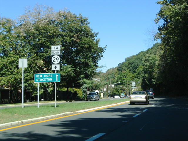
| Route 179 crosses the Delaware River to become PA 179 along a narrow two lane truss bridge between Lambertville and New Hope, Pennsylvania. New Jersey 29 continues north to the U.S. 202 freeway on the five mile drive to Stockton. 10/03/04 |
|
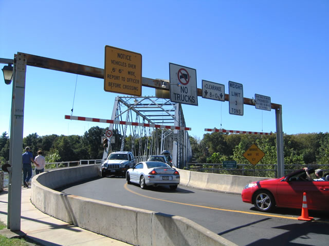
| Washington Crossing Road spans the Delaware River over the historic Washington Crossing Bridge between Washington Crossing, New Jersey and Pennsylvania. The two lane truss-bridge lies just west of the intersection between New Jersey 29 and County Route 546. 10/03/04 |
|
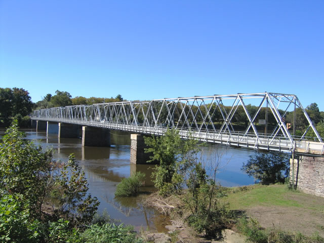
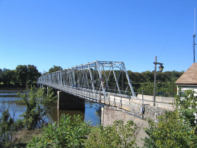
| A look at the Washington Crossing Bridge superstructure. The bridge has very narrow lanes, a steel deck, and a sidewalk along the south side. The truss yields a clearance of just 8'0". 10/03/04 |
|
| Viewing the Washington Crossing Bridge from the southeast. Washington Crossing Road becomes General Washington Memorial Boulevard on the Pennsylvania side of the river. The local road ties into the intersection of Pennsylvaina 32 and 532. 10/03/04 |
|
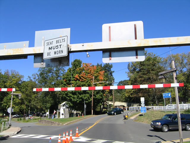
| Washington Crossing Road leaves the Washington Crossing Bridge and intersects River Drive. A wooden plank above the bridge end enforces a 6'6" height restriction for the bridge. Any car, truck, or van that hits the plank is subject to a moving violation and fine. Bridge officers staff a small office nearby and enforce the height restriction.
On our visit to the bridge, a mini van with a kayak strapped to its roof narrowly missed striking the plank. An officer we spoke with indicated that if the plank was hit, he would flag down the driver and call the state police who would then issue a traffic ticket. 10/03/04 |
|
| Washington Crossing Road intersects New Jersey 29 (River Road) to the immediate east of the span. New Jersey 29 straddles the Delaware River between the capital city of Trenton and Lambertville to the north. 10/03/04 |
|
| Washington Crossing Road crosses a short wooden bridge ahead of New Jersey 29 (River Road) and County Road 546 east. CR 546 follows Washington Crossing Pennington Road east three miles to Route 31, north of Ewingville. New Jersey 29 south meets Interstate 95 within two miles while River Road north enters Lambertville in six miles. 10/03/04 |
Page Updated 04-28-2014.

 North
North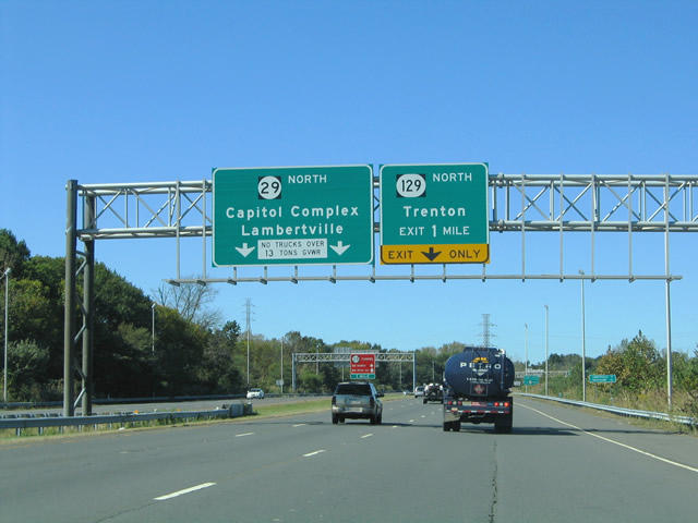


 South
South