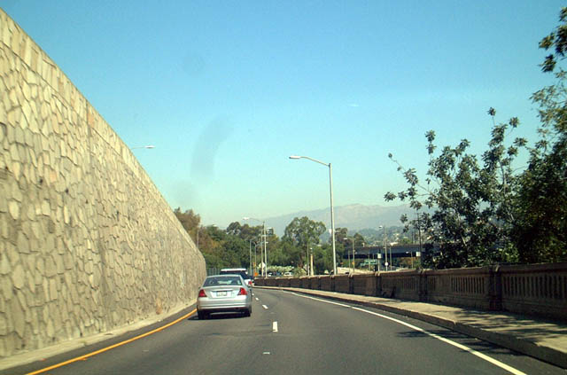
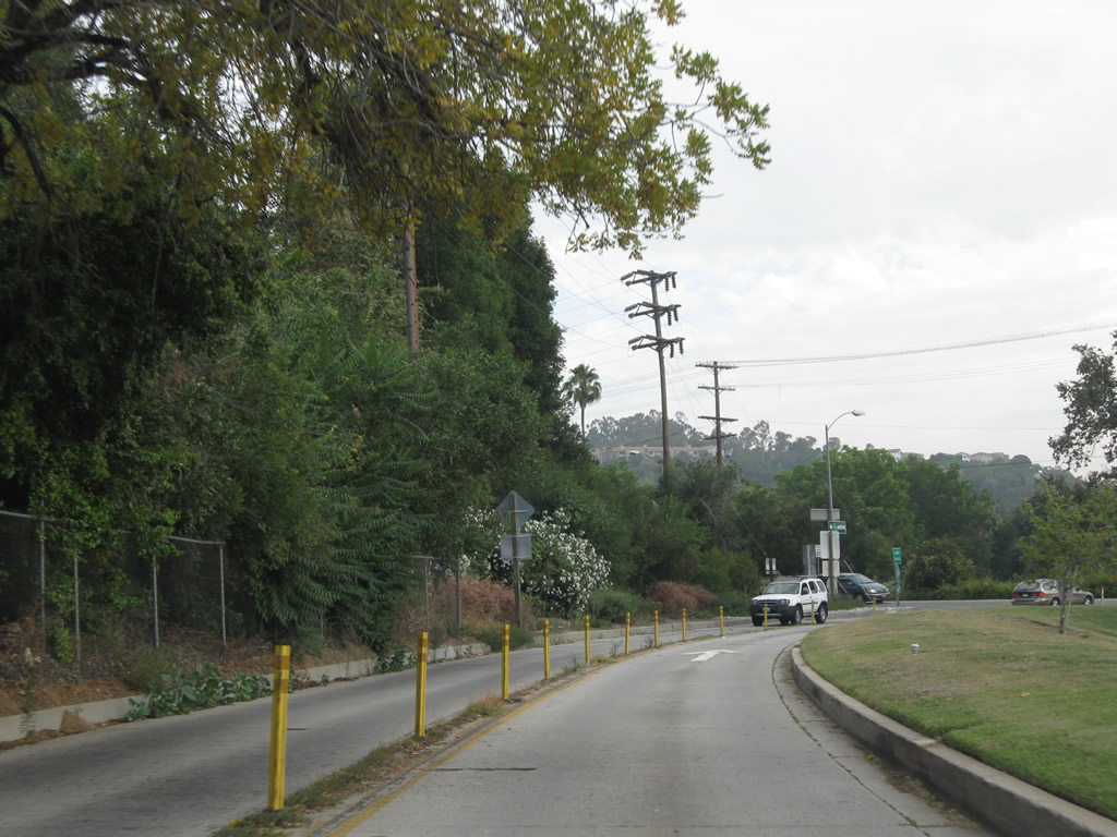
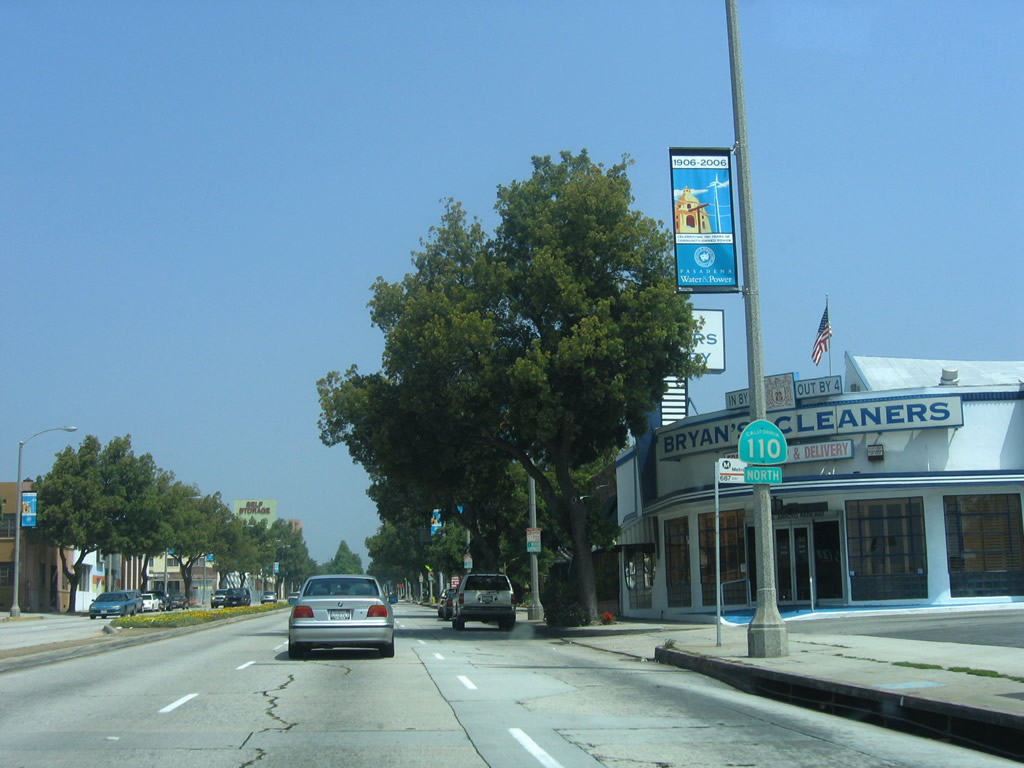
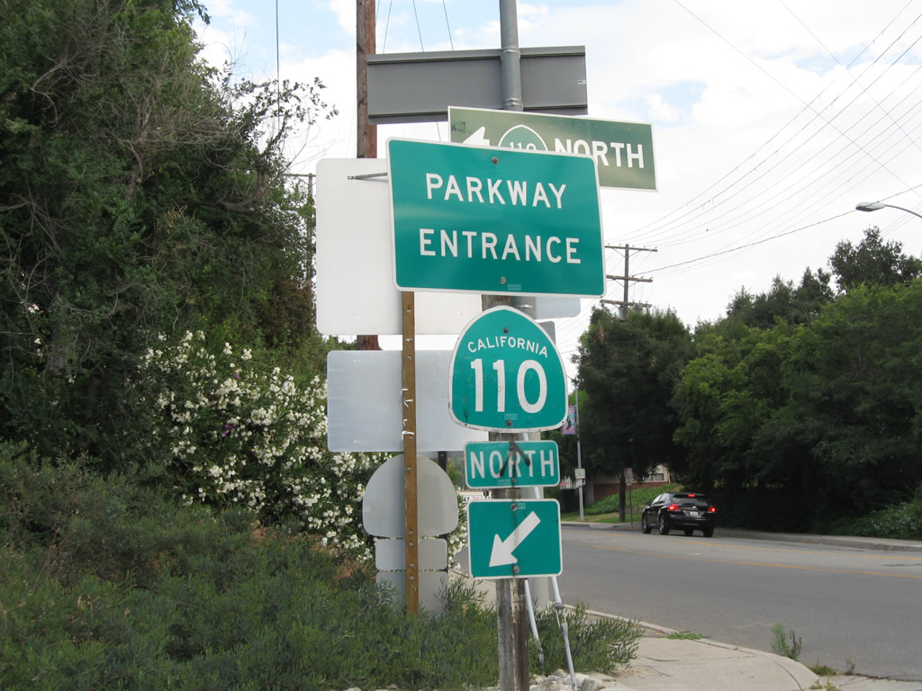
"Parkway Entrance" signs are now posted along the Arroyo Seco Parkway segment of California 110. This parkway entrance sign is posted along eastbound Avenue 60 in the Highland Park community of the city of Los Angeles. Photo taken 07/10/10.
|
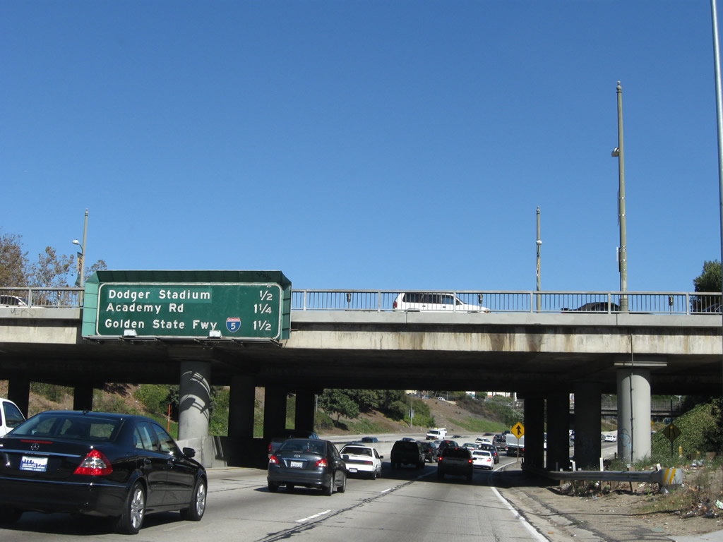
| This distance sign along northbound SR 110/Pasadena Freeway provides the distance to the next three exits: Exit 24B, Hill Street; Exit 25, Academy Road; and Exit 26A, Junction Interstate 5/Golden State Freeway (Historic U.S. 99) north. This sign is mounted on Cesar Chavez Boulevard, which connects to Sunset Boulevard northwest of here. Cesar Chavez Boulevard and Sunset Boulevard are parts of the original route of U.S. 66 before it was shifted onto the Arroyo Seco Parkway freeway route. The last official designation for U.S. 66 had the route follow today's SR 110 from the Four-Level Interchange northeast to Colorado Boulevard in Pasadena (including the city-maintained Arroyo Parkway segment). 11/08/08 |
|
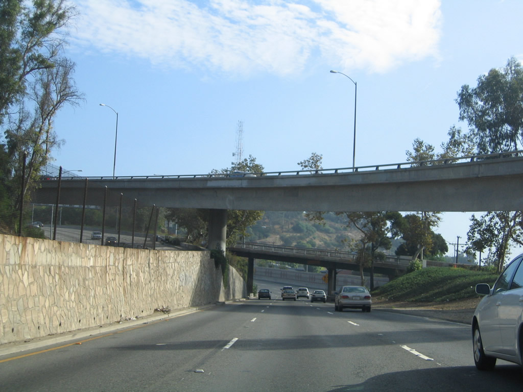
| s SR 110 curves northeast away from downtown Los Angeles, the freeway cuts between the Chinatown district to the southeast and Echo Park community to the northwest (home of Chavez Ravine and Dodger Stadium). Both communities are part of the city of Los Angeles. Use Exit 24B for Hill Street south to Chinatown and El Pueblo de los Angeles Historical Monument and Stadium Way north to Dodger Stadium. 07/10/10 |
|
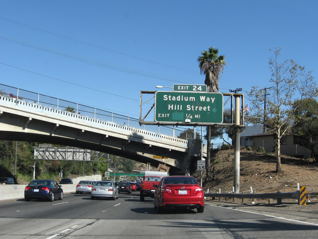
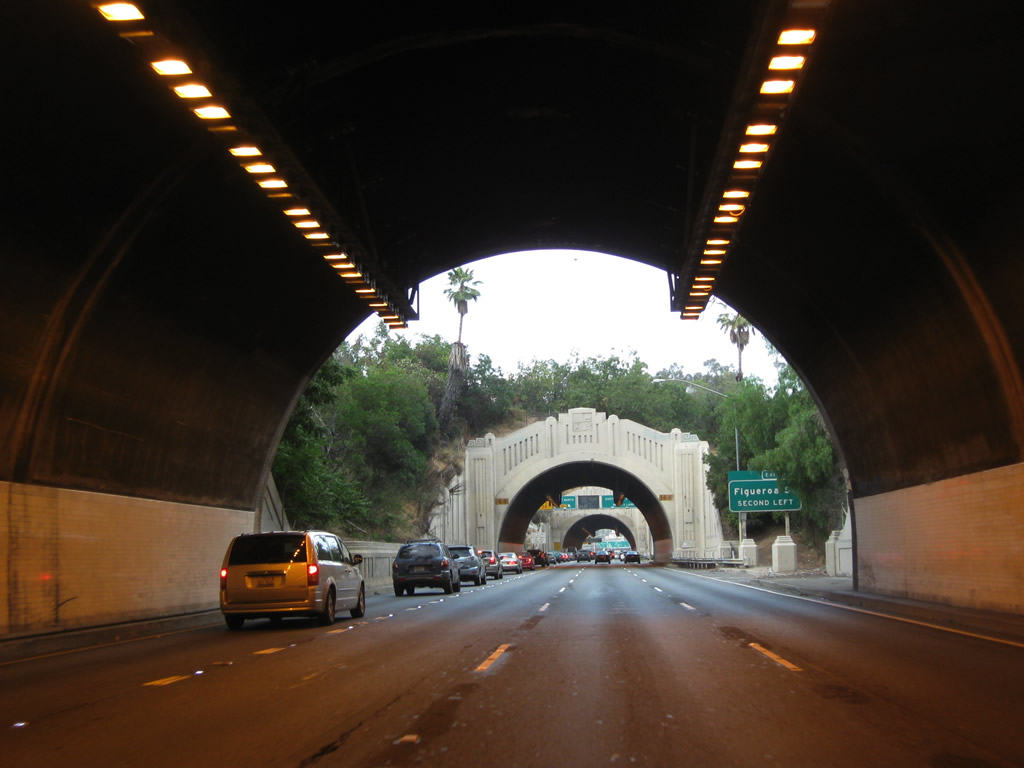
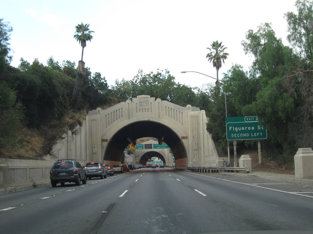
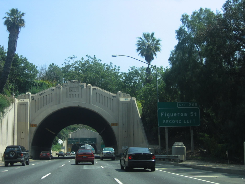
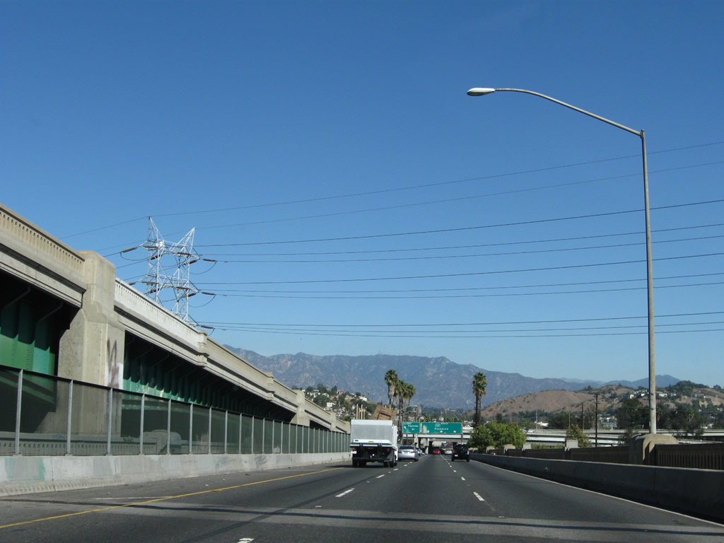
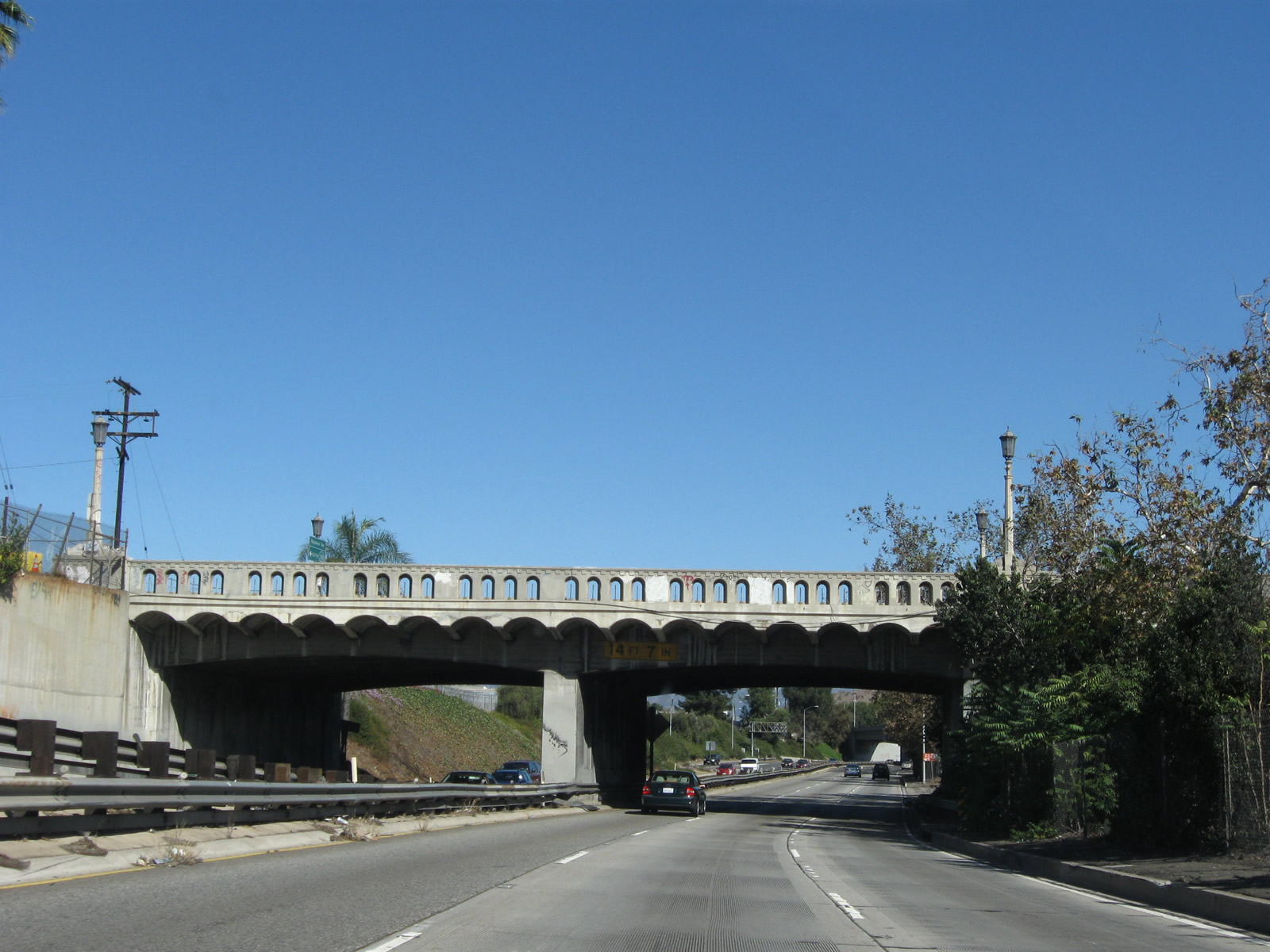
| Traffic from Figueroa Street merges onto SR 110 north at this point, just prior to passing under the arch bridge of College Street. The section of Arroyo Seco Parkway from here northeast to Interstate 5 was originally Figueroa Street, and the parkway was constructed on top of the existing roadway. The tunnels ahead were originally known as the Figueroa Street Tunnels, and they serve to connect the Four-Level Interchange with the original Arroyo Seco Parkway. The next exit on SR 110/Pasadena Freeway (Figueroa Street/Arroyo Seco Parkway) north is Exit 24B, Hill Street. This exit is the best route to reach the home of the Los Angeles Dodgers Major League Baseball Team's Stadium. 07/10/10 |
|
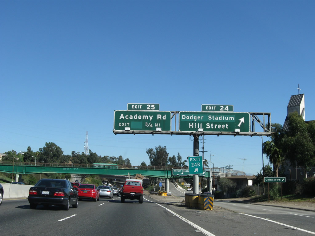
| Northbound SR 110/Pasadena Freeway reaches Exit 24B, Hill Street to Chinatown and Chinatown. Dodger Stadium is located to the northwest of the 110 freeway in what's popularly called "Chavez Ravine." The Los Angeles Dodgers (Major League Baseball) plays in the stadium during baseball season (August through September plus the postseason). The next exit is Exit 25, Solano Avenue, Casanova Street, and Academy Road. 11/08/08 |
|
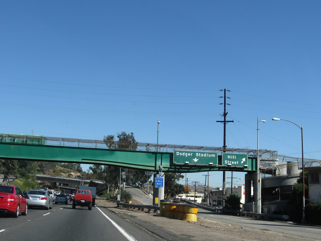
| The offramp from SR 110/Pasadena Freeway north to Exit 24B splits, with the left two lanes connecting to Stadium Way and the right lane connecting to Hill Street. 11/08/08 |
|
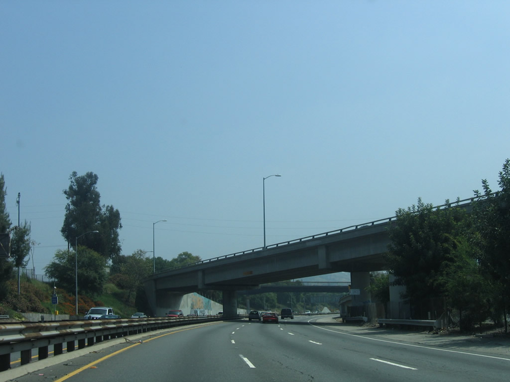
| A flyover ramp connects SR 110 north to Stadium Way. A retaining wall separates the two roadways of SR 110. The southbound lanes are higher than the northbound lanes. Ahead, the northbound lanes will pass through the Figueroa Street Tunnels, while the southbound lanes avoid the tunnels and pass above the hills. 11/08/08 |
|
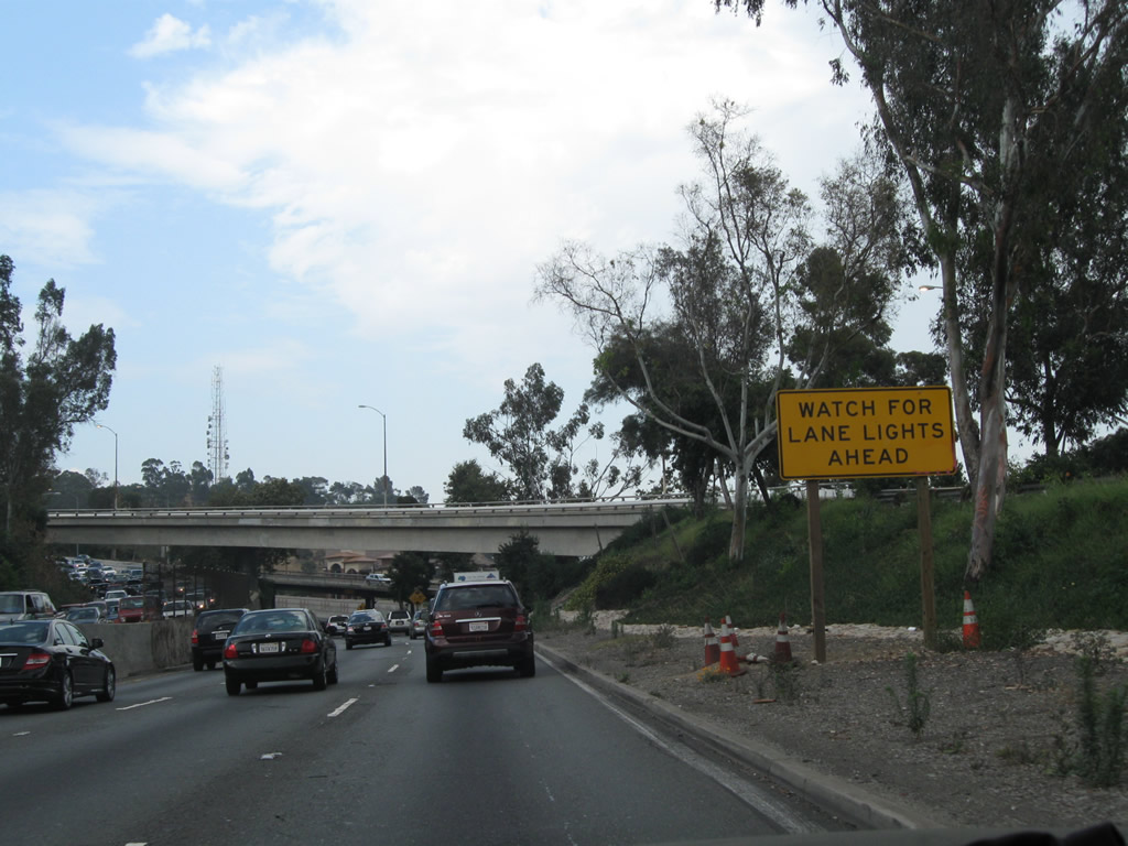
| Due to the curving section of parkway ahead, Caltrans engineers added internally lit lane markers along SR 110 north including the tunnels. Passing through Solano Canyon and Elysian Park, SR 110 will soon approach the junction with Interstate 5/Golden State Freeway (after the Figueroa Street Tunnels). 07/10/10 |
|
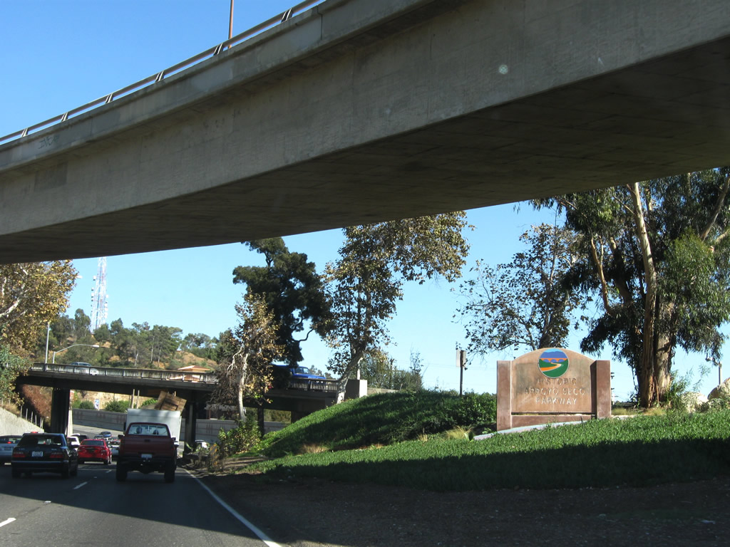
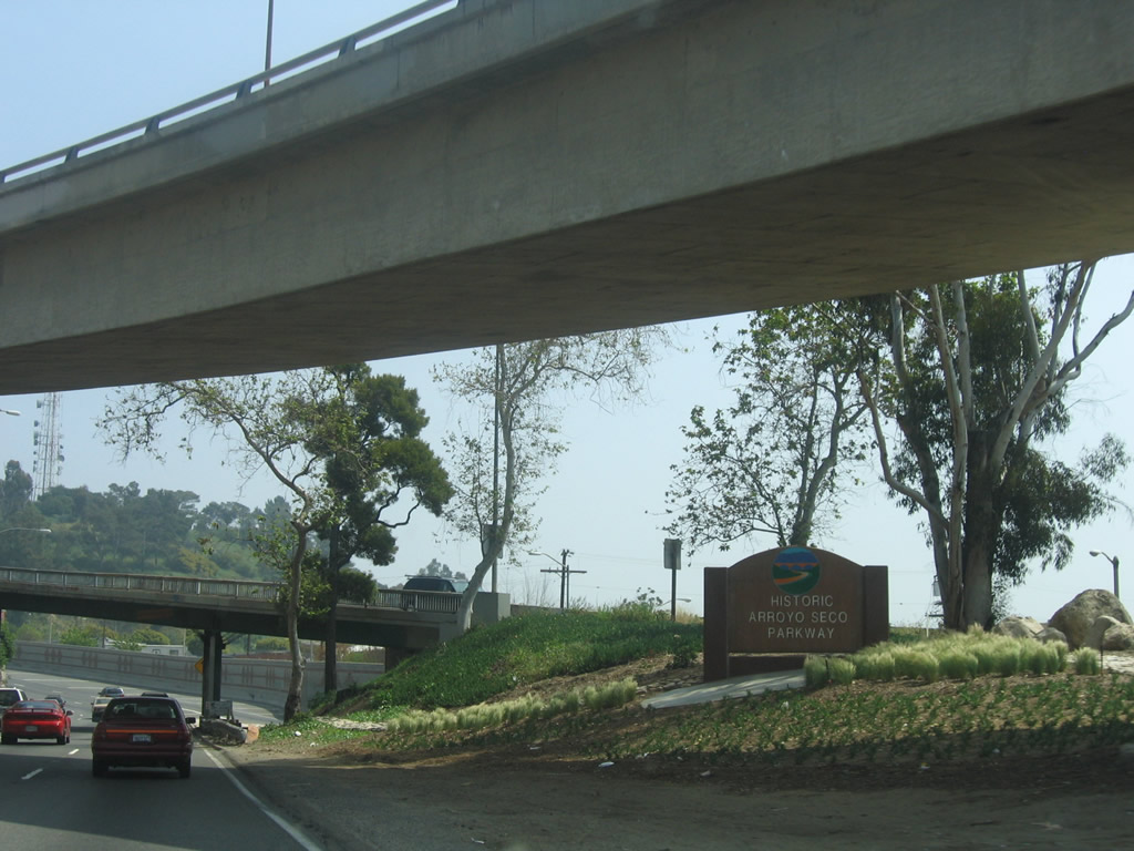
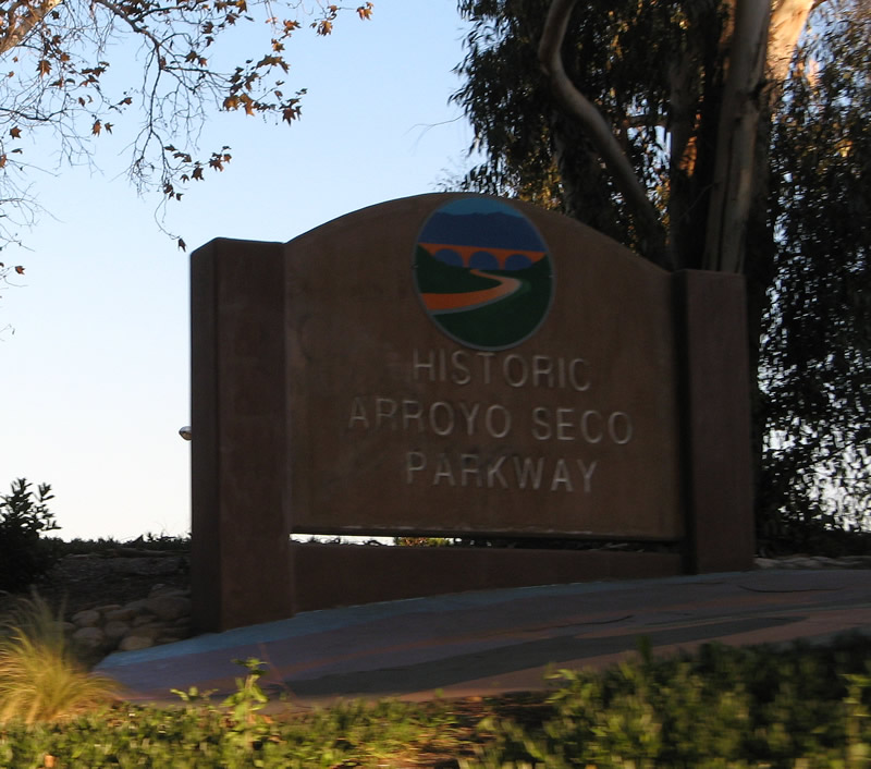
| Passing under the Stadium Way flyover ramp, a "Historic Arroyo Seco Parkway" concrete monument is found alongside the SR 110 parkway. 11/08/08, 04/30/06, 01/14/07 |
|
| This bridge carries traffic from SR 110 south to Hill Street. After this bridge, traffic from northbound Hill Street merges onto SR 110/Arroyo Seco Parkway north. 07/10/10, 04/30/06 |
|
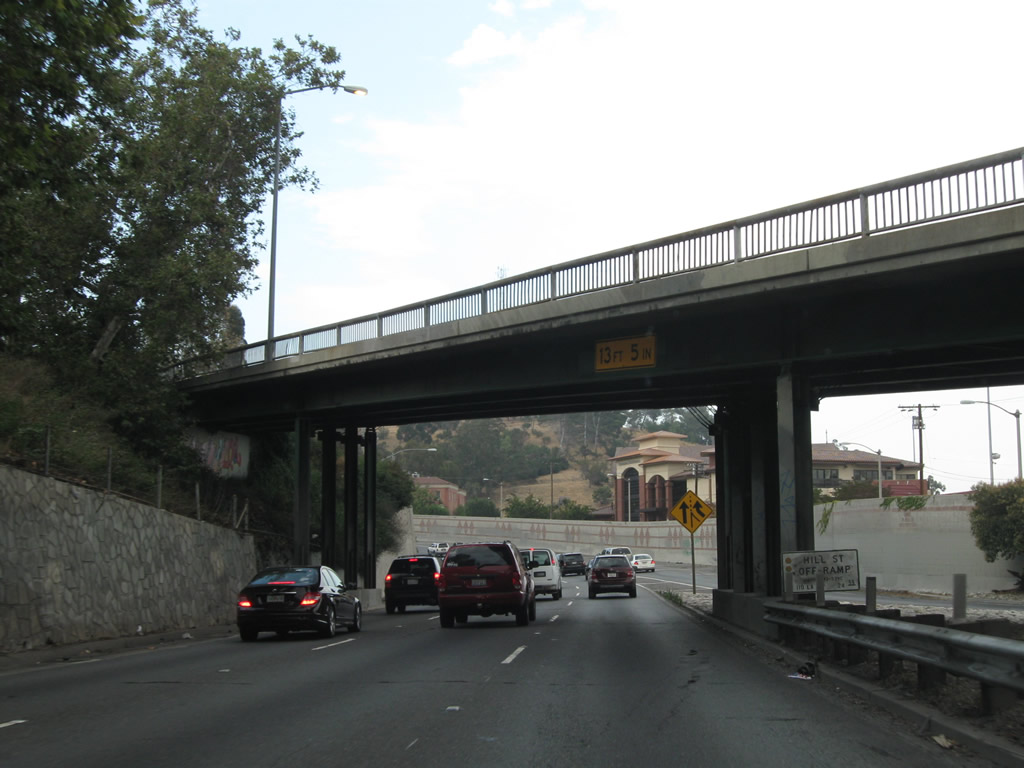
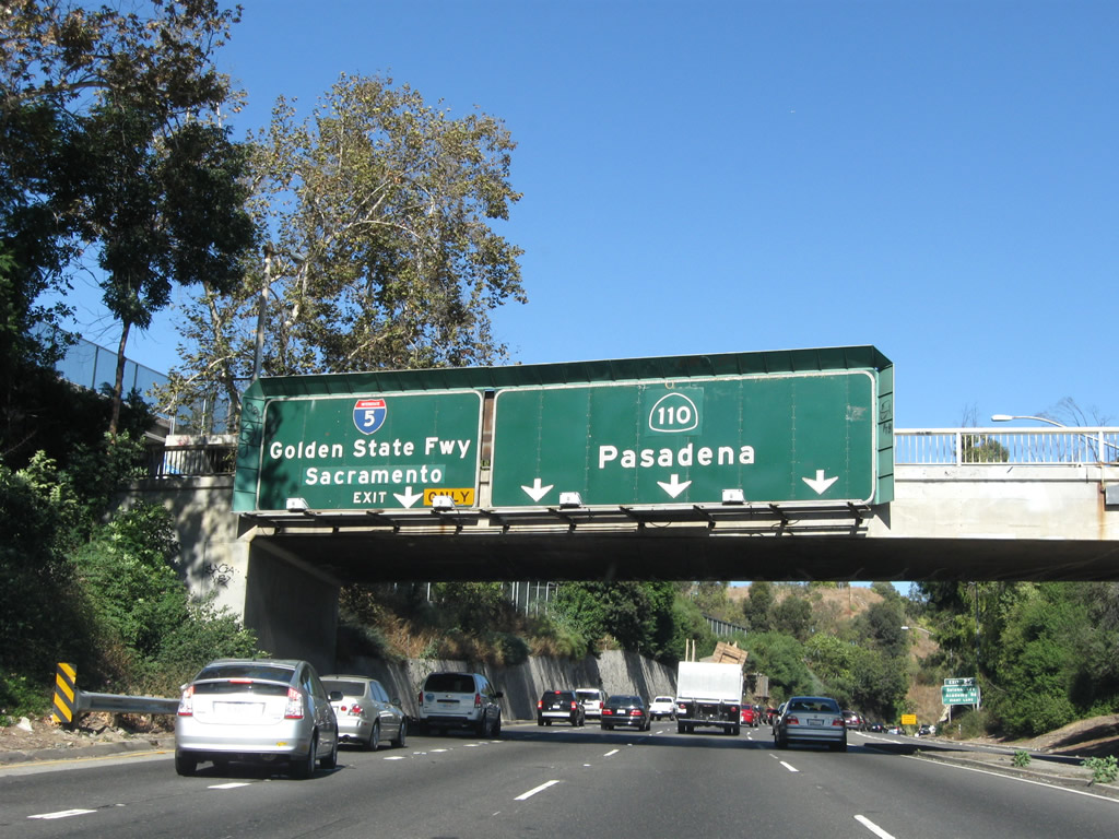
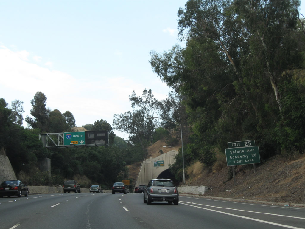
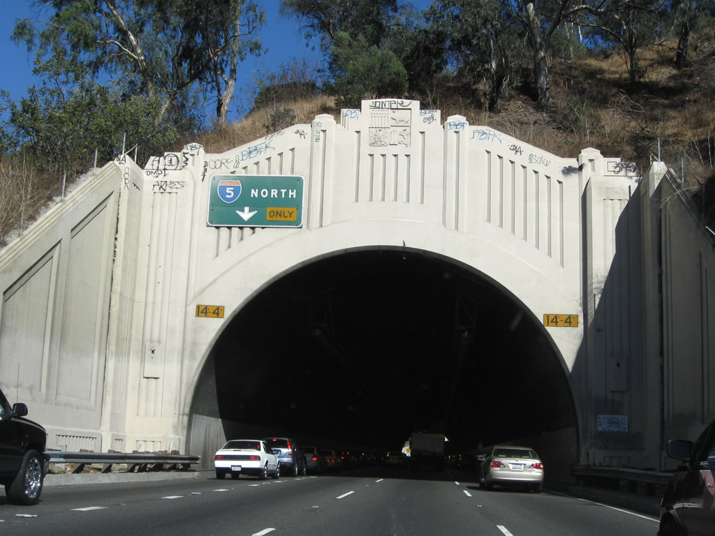
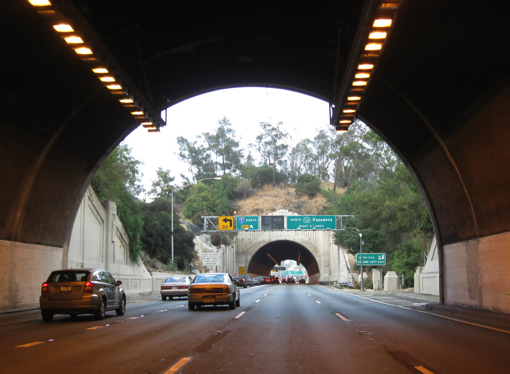
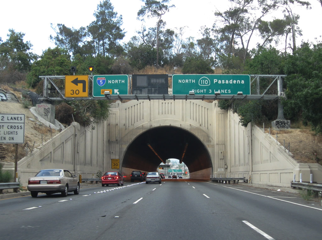
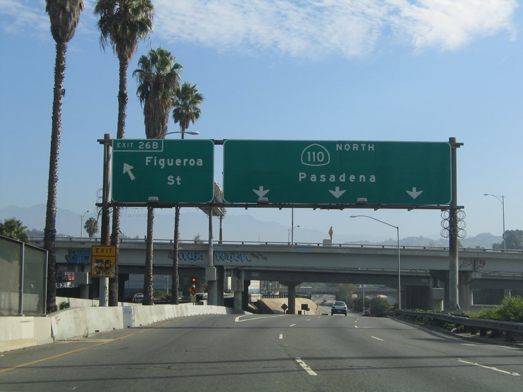
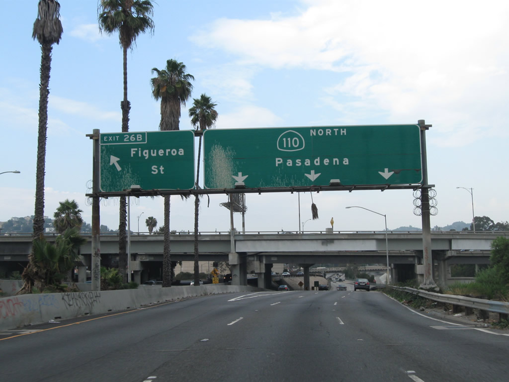
| The next two exits along SR 110/Arroyo Seco Parkway north are Exit 25, Solano Avenue and Academy Drive and Exit 26A, Junction Interstate 5/Golden State Freeway north. This overhead (replaced in late 2008 or early 2009) advises motorists for Interstate 5 to remain in the left lane while others continuing north on SR 110/Arroyo Seco Parkway should stay in the right three lanes. Things tend to get a bit confusing with the Figueroa Street tunnels ahead, so try to select your lane here. 07/10/10, 11/08/08 |
|
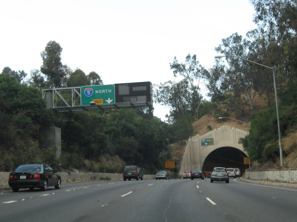
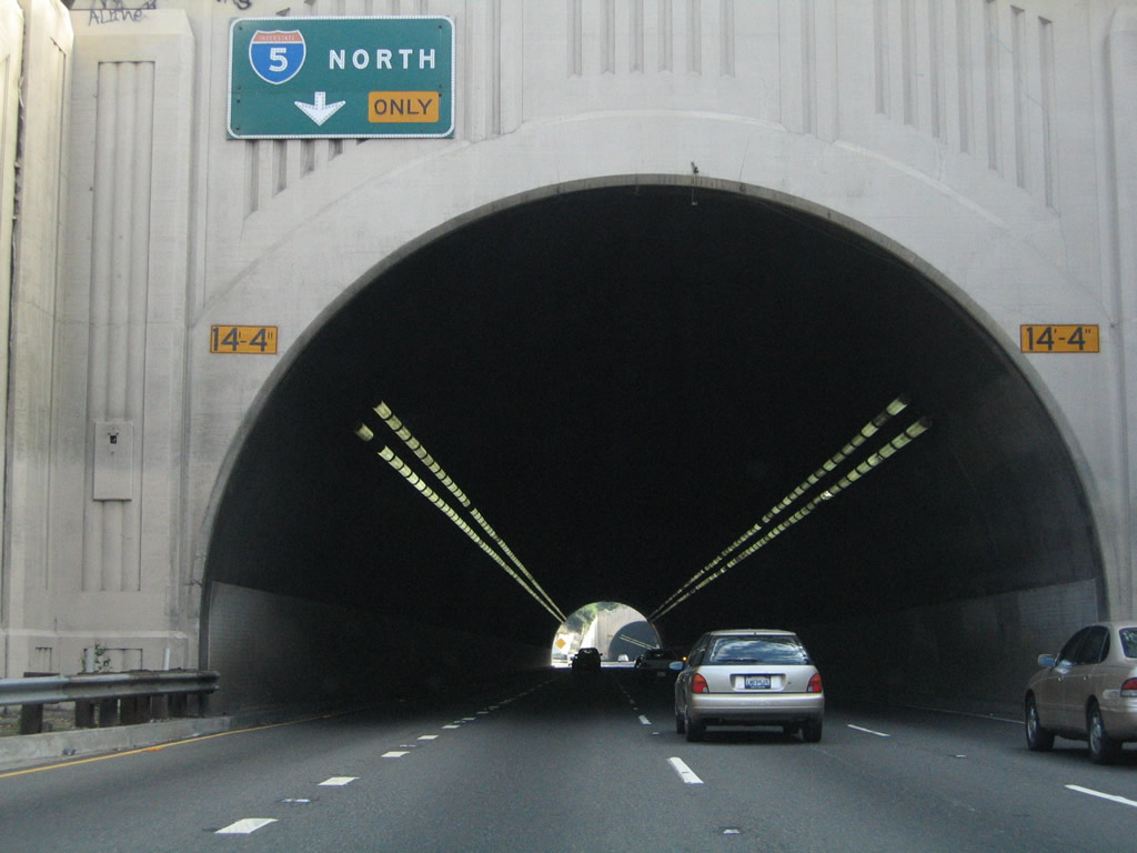
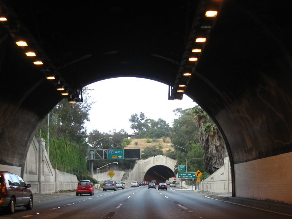
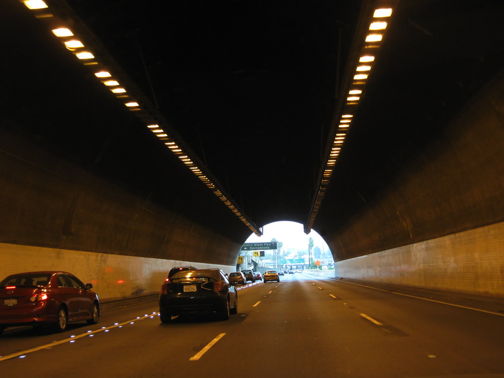
| Making another curve, the first of the Figueroa Street tunnels comes into view along SR 110/Arroyo Seco Parkway north. Stay right for Exit 25, Solano Avenue and Academy Drive and stay left for Exit 26A, Junction Interstate 5/Golden State Freeway north. An additional overhead sign for Exit 26A was added in 2008-2009 for the connection to Interstate 5 north. 07/10/10, 11/08/08 |
|
| The left lane of SR 110/Arroyo Seco Parkway north becomes exit only for Exit 26A, Junction Interstate 5/Golden State Freeway north. An unusual changeable message sign is posted next to the exit only guide sign. 07/10/10 |
|
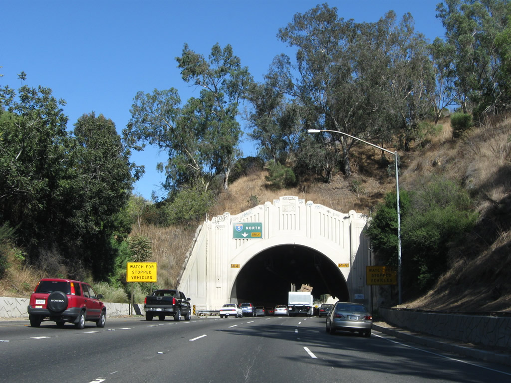
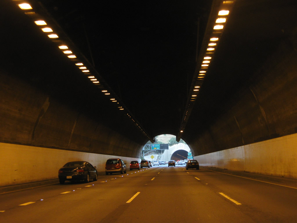
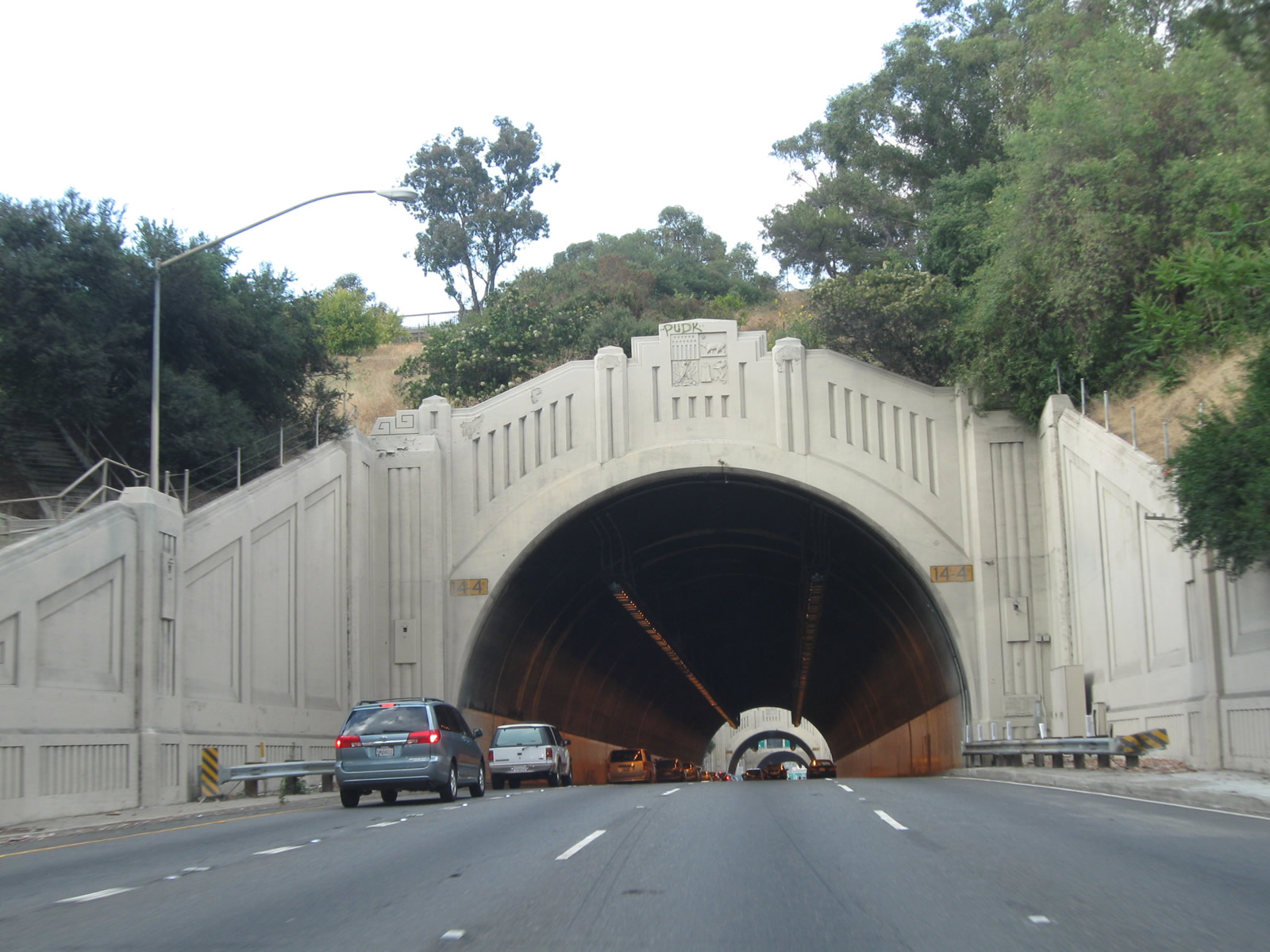
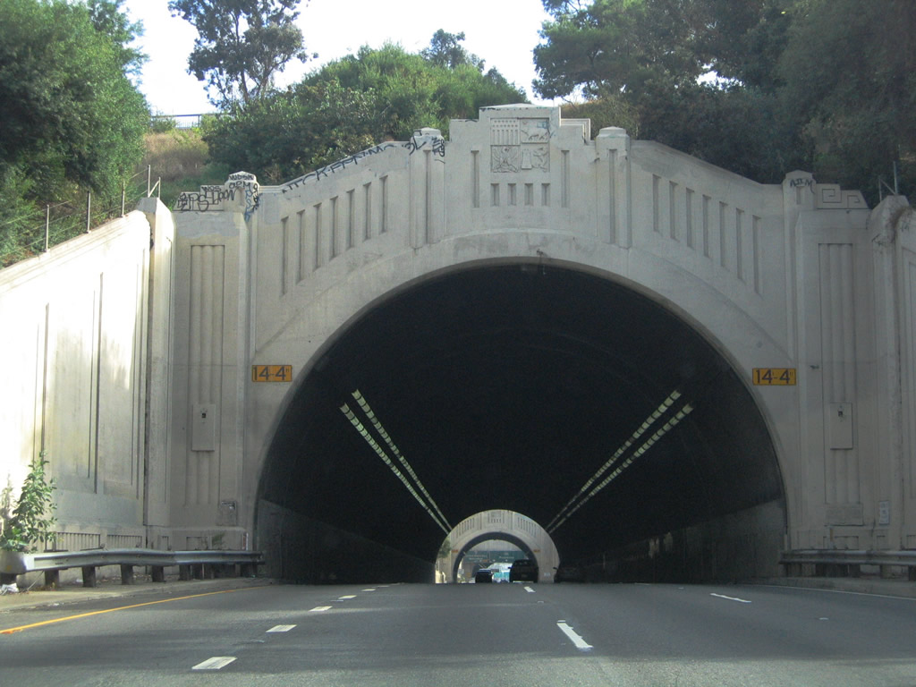
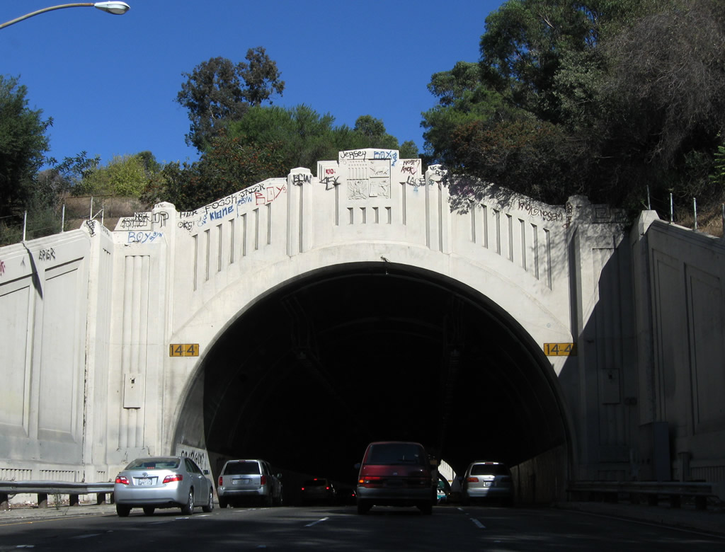
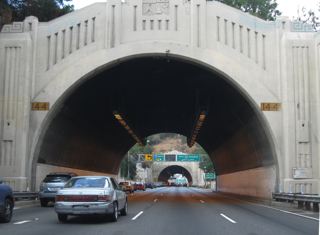
| This series of pictures profiles the first (southernmost) of the Figueroa Street Tunnels. Originally these tunnels were two-way; now they are one way northbound. The first tunnel, which carries four lanes of northbound SR 110/Arroyo Seco Parkway through Elysian Park, is the first of four tunnels found along SR 110 north. These tunnels were built in phases to provide a connection from downtown Los Angeles to Pasadena. 11/08/08, 09/25/05 |
|
| The southernmost is the longest and youngest of the tunnels, having opened in 1936. The other three tunnels opened in 1931. Connections to the Arroyo Seco Parkway were made on December 30, 1940, with the completion of the parkway. A southerly connection to the Four-Level Interchange was made on September 22, 1953, with the completion of that symmetrical stack interchange. While northbound traffic must use these tunnels, southbound traffic uses a separate alignment that avoids the tunnels (having been opened to traffic in 1943). 07/10/10 |
|
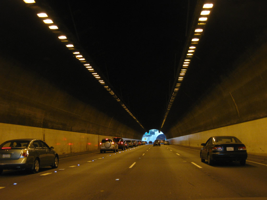
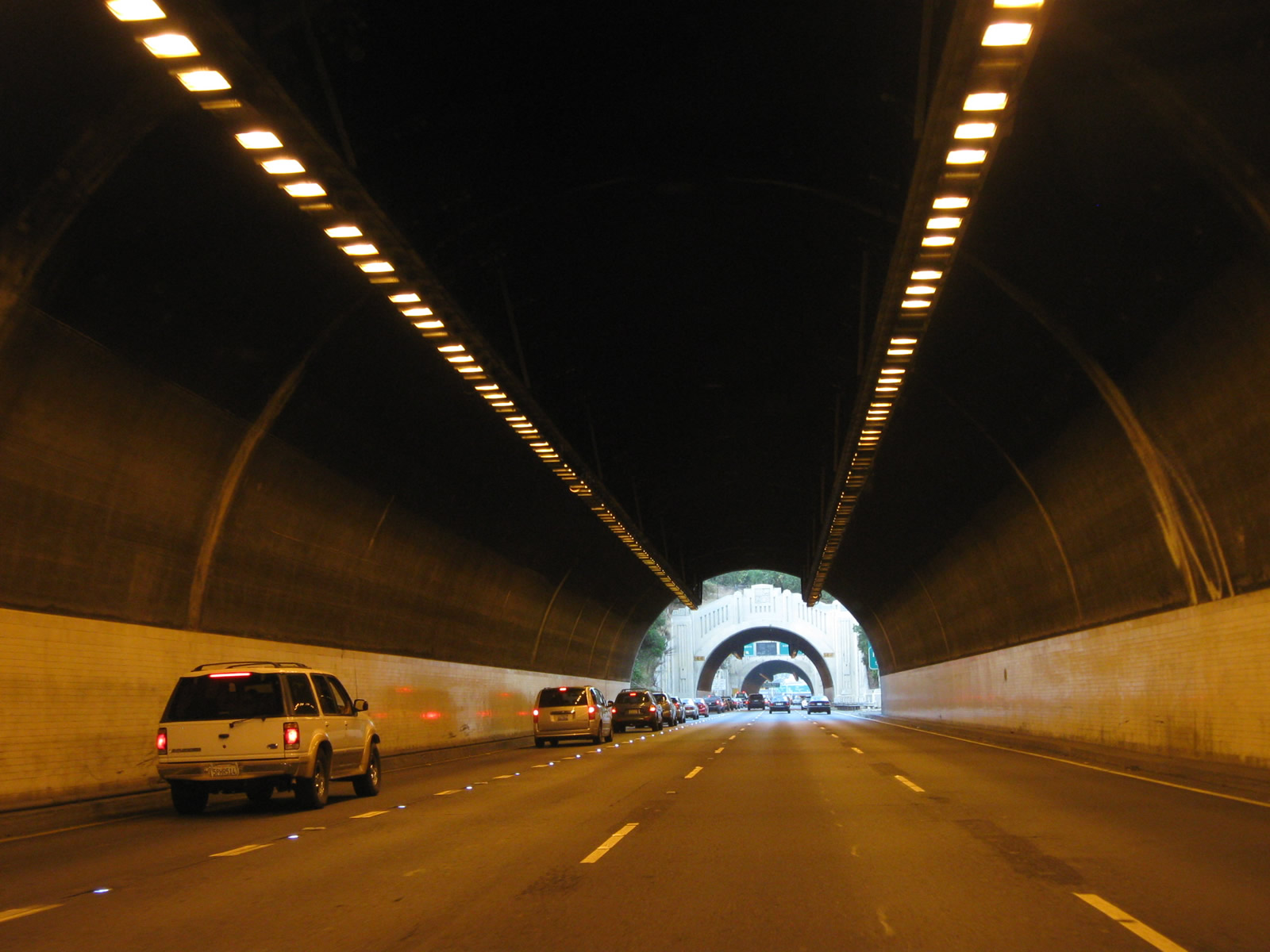
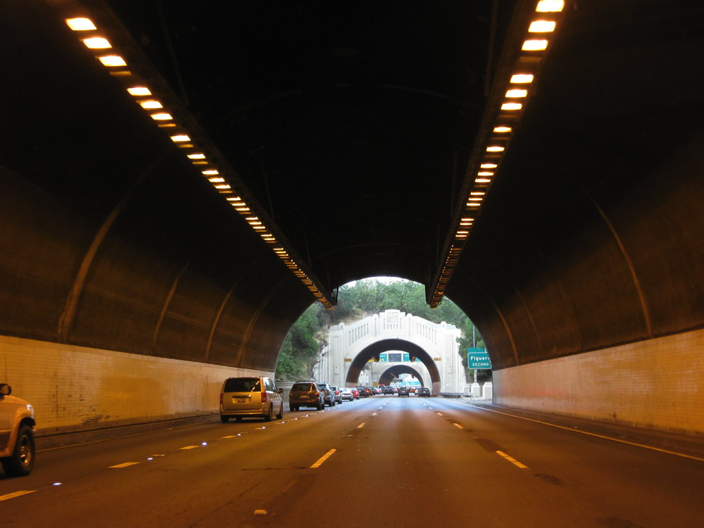
| The overhead lighting within the tunnel was changed from fluorescent lighting to a more energy effcient lighting system, with more of a pink or orange hue, by 2010. 07/10/10, 09/25/05 |
|
| After the offramp to Exit 25, northbound SR 110 enters the second of four tunnels along northbound. These tunnels are closely spaced, with brief glimpses of sunlight in between each tunnel. The left lane is still the exit-only lane for Exit 26A, Junction Interstate 5 north. Watch for slow or stopped traffic in the tunnels, especially as we near the left exit to Interstate 5/Golden State Freeway. Due to the open space nature of the park above the tunnels, graffiti on the tunnel entrances is quite common. 07/10/10, 09/25/05, 11/08/08 |
|
| After the left exit to Interstate 5 north at Exit 26A, the second left exit from SR 110/Arroyo Seco Parkway is Exit 26B, Junction Historic Alternate U.S. 66/Figueroa Street northeast. 07/10/10, 04/30/06 |
|
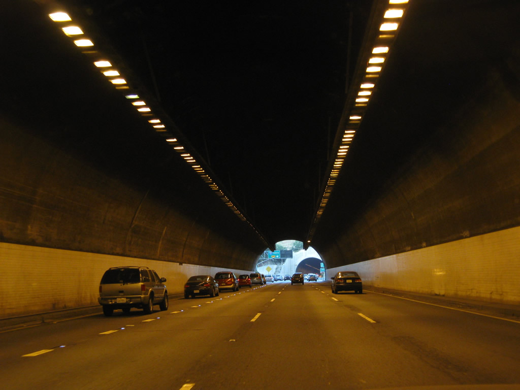
| Now entering the third tunnel, northbound SR 110 is completely separated from southbound lanes, which do not enter the tunnel system here on the original Arroyo Seco Parkway. The southbound lanes stay on-grade and therefore cut through the park. This historic route has limited shoulders and poor sight distance through this stretch. 07/10/10 |
|
| SR 110 north leaves the third tunnel in Elysian Park. Only one tunnel is left before the offramp to Interstate 5 north. Again note the illuminated lane markers that delineate the main lanes from the exit only lane. 07/10/10 |
|
| A lane allocation sign for Exit 26A, Junction Interstate 5 north is posted prior to the fourth tunnel. 07/10/10 |
|
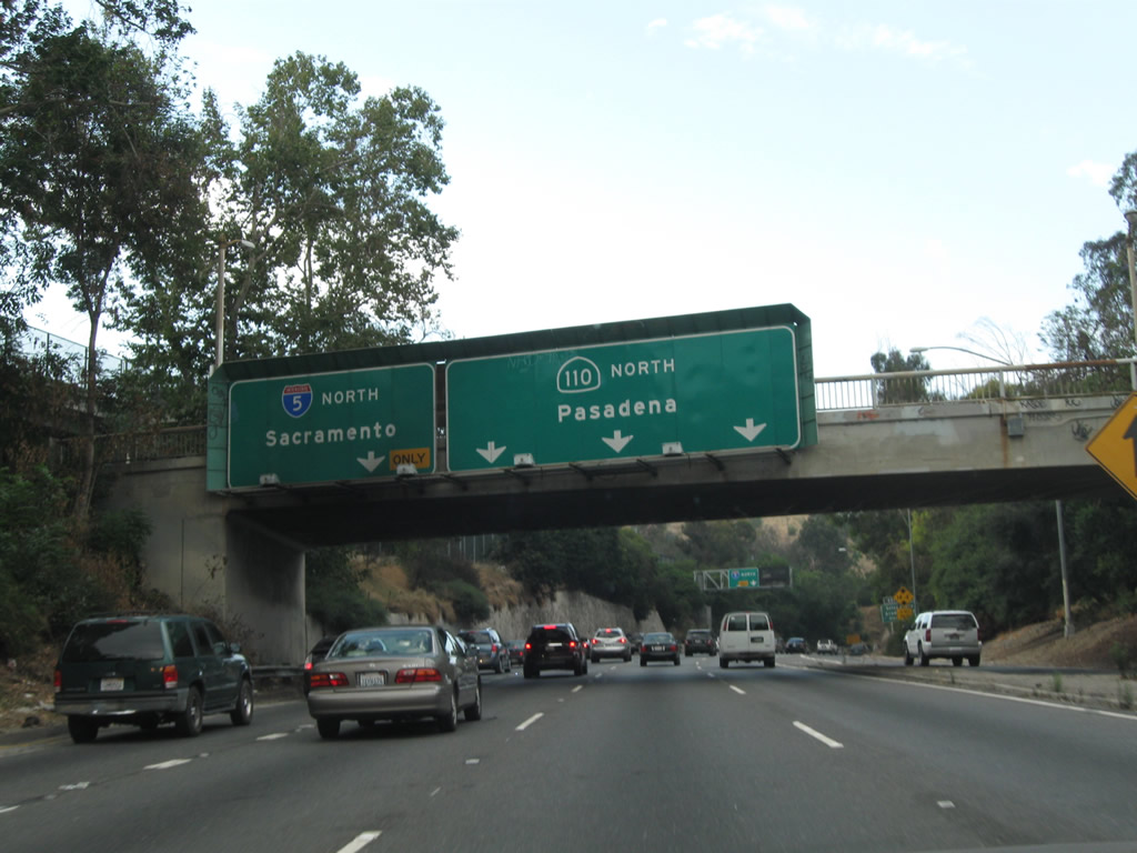
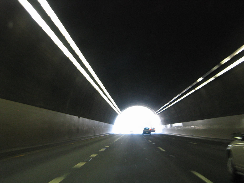
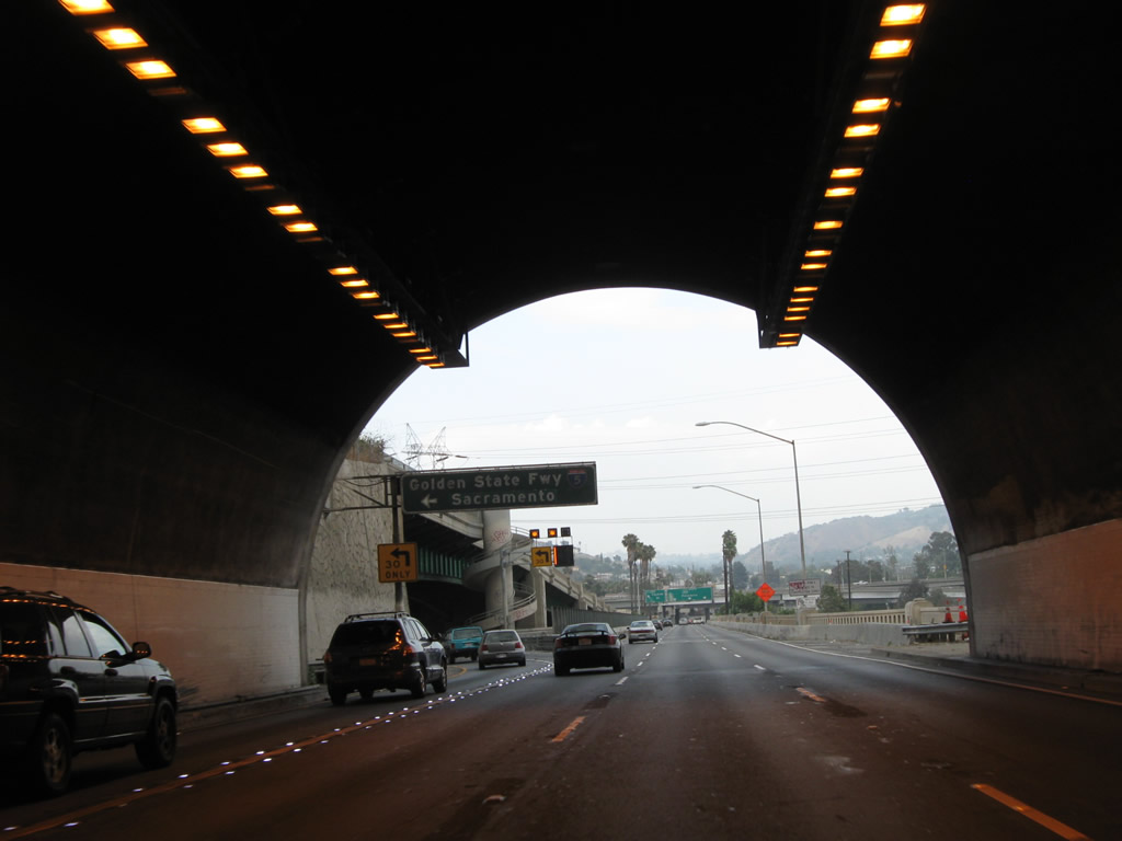
| Northbound SR 110 enters the fourth and last Figueroa Street Tunnel, with all traffic for Interstate 5 northbound placed in the left lane. Note that the control city for Interstate 5 was changed from Bakersfield to Sacramento to comply with national control city standards. A sign replacement was made here by 2009. 11/08/08, 09/25/05 |
|
| SR 110 continues through the fourth and last Figueroa Street Tunnel. With a solid white stripe separating the main lanes from the exit only lane for Exit 26A, motorists are not allowed to make the left exit unless they are in the exit-only lane. 07/10/10 |
|
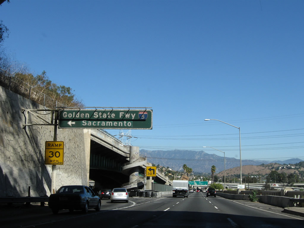
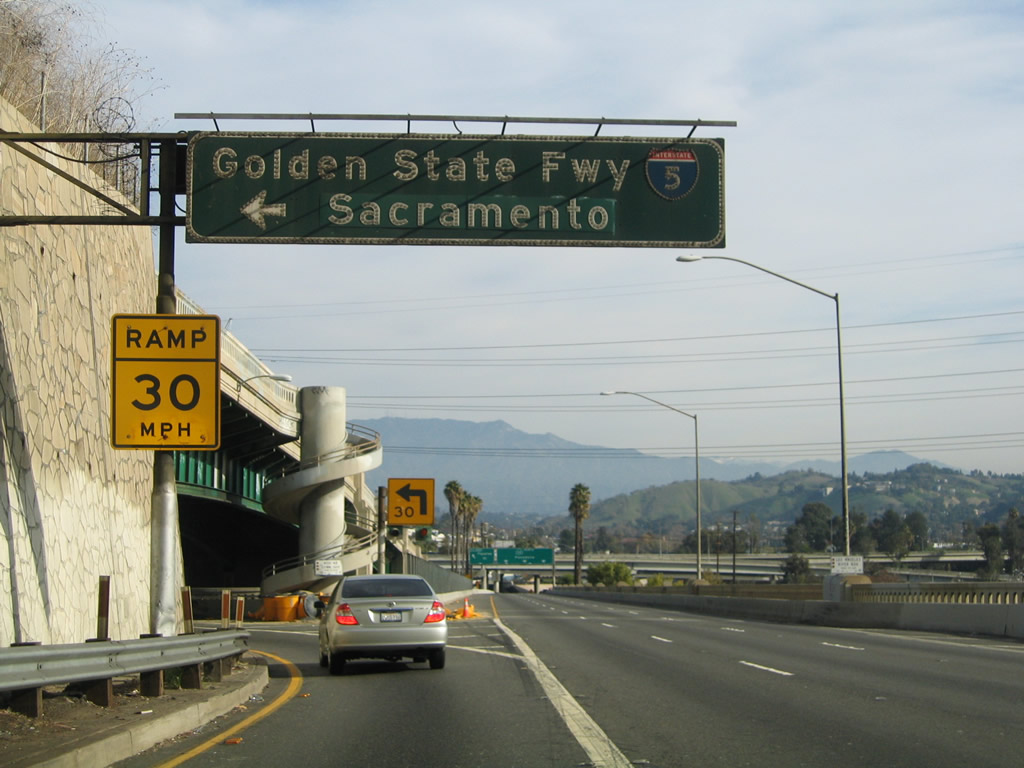
| Northbound SR 110/Arroyo Seco Parkway meets Exit 26A, Junction Interstate 5/Golden State Freeway (Historic U.S. 6-99) north to Bakersfield and Sacramento. Prior to 1964, U.S. 6 departed from the Arroyo Seco Parkway and turned north to follow U.S. 99 toward Newhall (Santa Clarita). This is a very sharp exit ramp, so motorists should watch their speed when departing SR 110. Left exits like this are uncommon and are being phased out for safety considerations; however, much of the Arroyo Seco Parkway remains in the same configuration as it had when built in the 1940s. Due to its slow transition ramp, this offramp can be a frequent choke point due to the deceleration occurring in the left lane. In addition to the older parkway design, this sign and sign bridge are both very old structures. 11/08/08, 11/25/04 |
|
| Now on the transition ramp from SR 110 north to Interrstate 5, the exit ramp follows this vintage alignment, with old-style guardrail on the right and intricate retaining wall on the left. Not visible to the right is the Los Angeles River, just over the precipice of the guardrail. 08/15/03 |
|
| View of the transition ramp between northbound SR 110 (Exit 26A) and Interstate 5. It is almost long enough to call it a freeway in its own right. 11/25/04 |
|
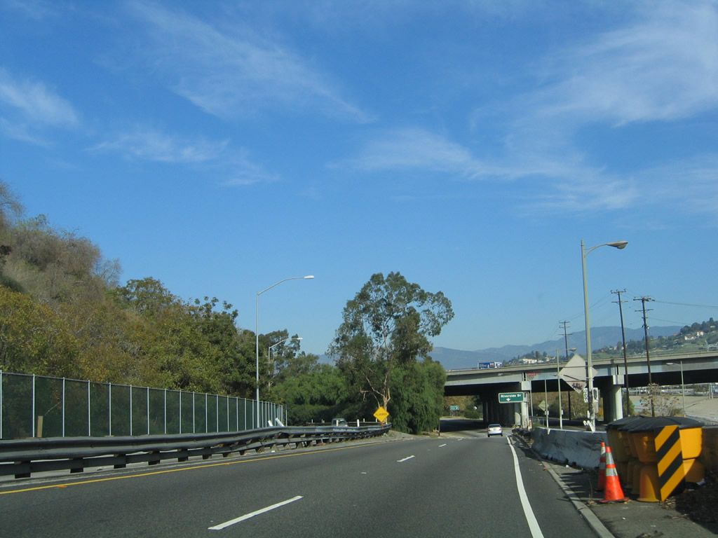
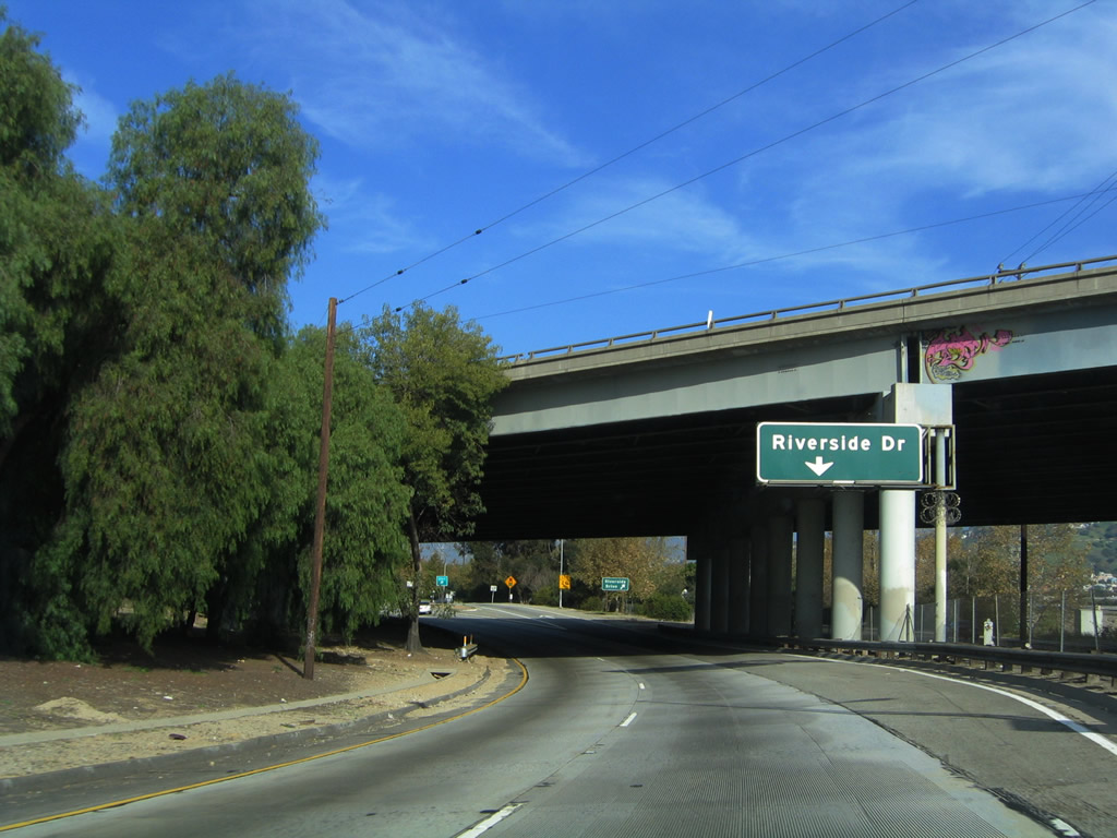
| The transition ramp between SR 110 north and Interstate 5 north at Exit 26A is so long that is has its own exit: Riverside Drive. After the exit to Riverside Drive, the two lane transition ramp finally merges onto northbound Interstate 5/Golden State Freeway (Historic U.S. 6 east and U.S. 99 north). 11/25/04 |
|
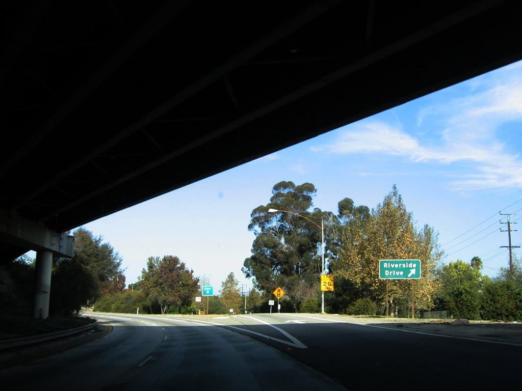
| The offramp to Riverside Drive begins in the shadow of the Golden State Freeway (Interstate 5) overpass. A roadside guide sign advises of the exit. The left two lanes will swing left to merge onto northbound Interstate 5/Golden State Freeway. 11/25/04 |
|
| Immediately after leaving the fourth Figueroa Street Tunnel and after the offramp to Interstate 5 north (Exit 26A), SR 110 immediately passes over the Los Angeles River. The parkway leaves Elysian Park at this point and travels between the communities of Cypress Park and Montecito Heights (both within the City of Los Angeles). 11/08/08 |
|
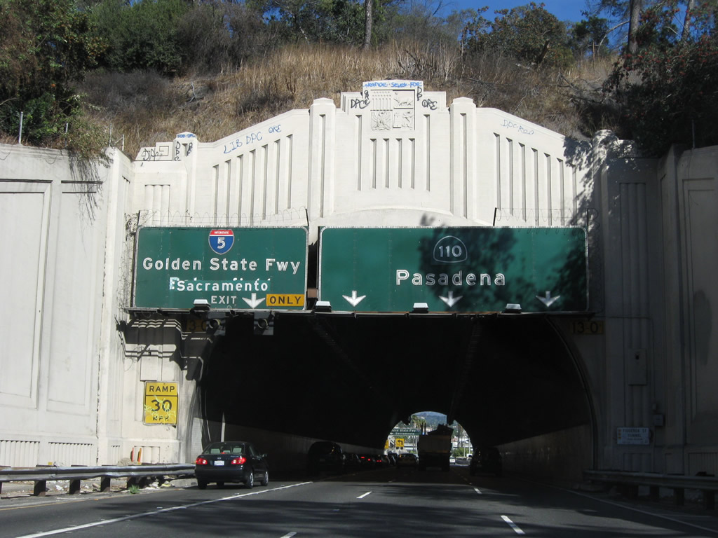
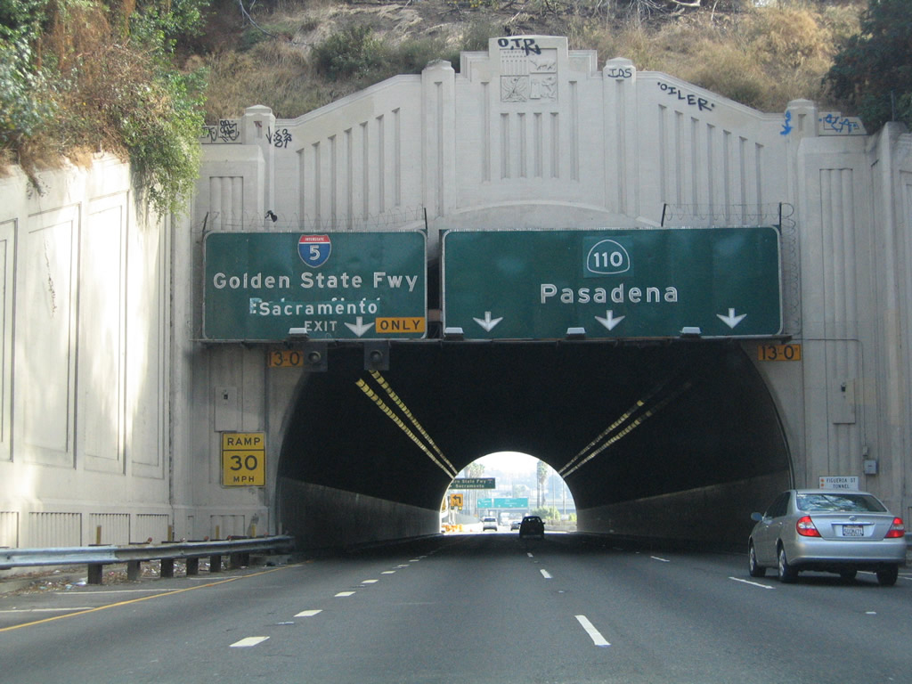
| Northbound SR 110/Arroyo Seco Parkway reaches Exit 26B, Figueroa Street. Prior to the completion of the Arroyo Seco Parkway in 1940, Figueroa Street carried U.S. 66 and SR 11 northeast to Pasadena. With the parkway's completion, both routes were transferred onto the then-nascent freeway, and Figueroa Street was designated as Alternate U.S. 66. Both the Arroyo Seco Parkway and Figueroa Street are considered to be bona fide old alignments of U.S. 66 en route to Pasadena. Behind this sign, Interstate 5 passes over SR 110/Arroyo Seco Parkway. The signs here are a little worse for the wear after five years, with stains on the signs by 2010. 09/25/05, 07/10/10 |
|
| The actual offramp to Exit 26B is located under the shadow of the Interstate 5 overpass. 09/25/05 |
|
| SR 110/Arroyo Seco Parkway passes under Avenue 26; this bridge was built in 1939 per a date stamp visible on Avenue 26 itself. Although not visible from the northbound lanes, the Arroyo Seco Parkway parallels the Arroyo Seco itself, a concrete lined stream along the east side of the parkway. The Avenue 26 bridge over Arroyo Seco opened to traffic in 1926. Avenue 26 is noteworthy for being the route of former SR 163, which existed briefly between 1963 and 1965 as a state highway linking SR 110 and Interstate 5 along a former alignment of U.S. 99. 11/08/08 |
|
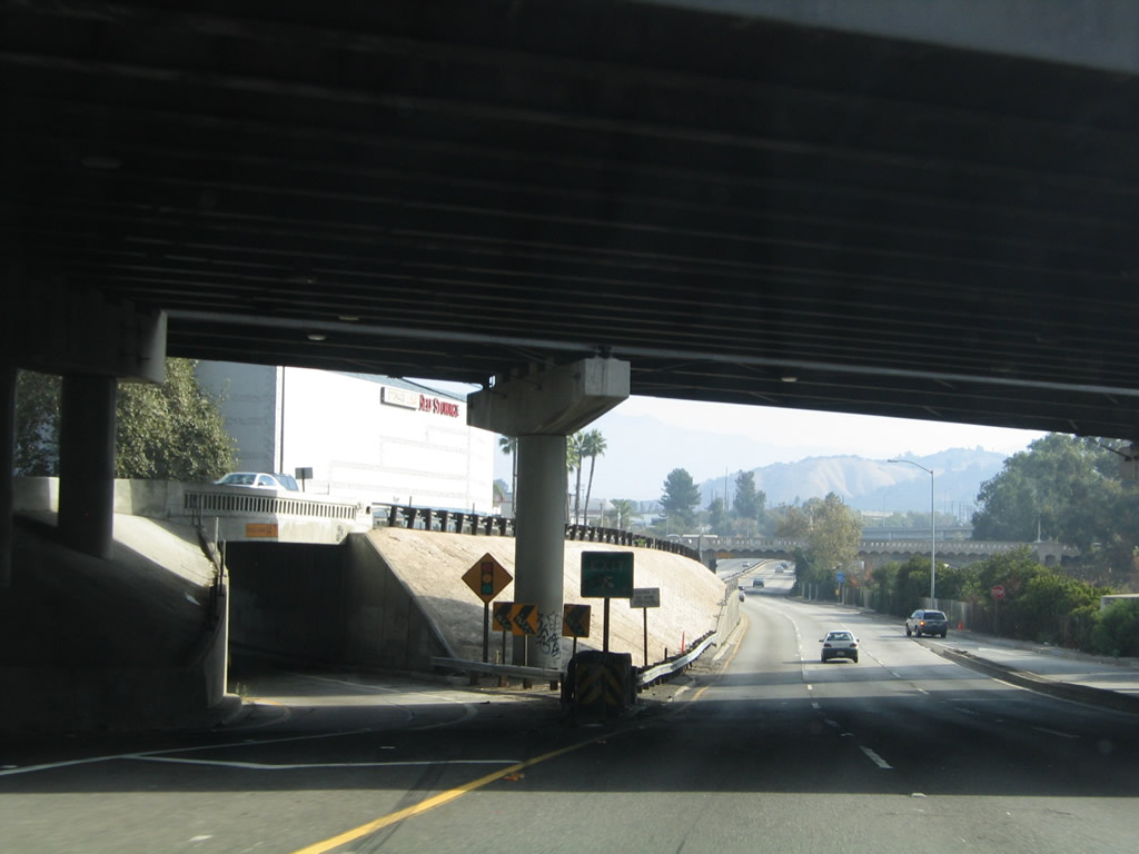
| The next overpass provides a connection between SR 110 south and Interstate 5 north/south. 09/25/05 |
|
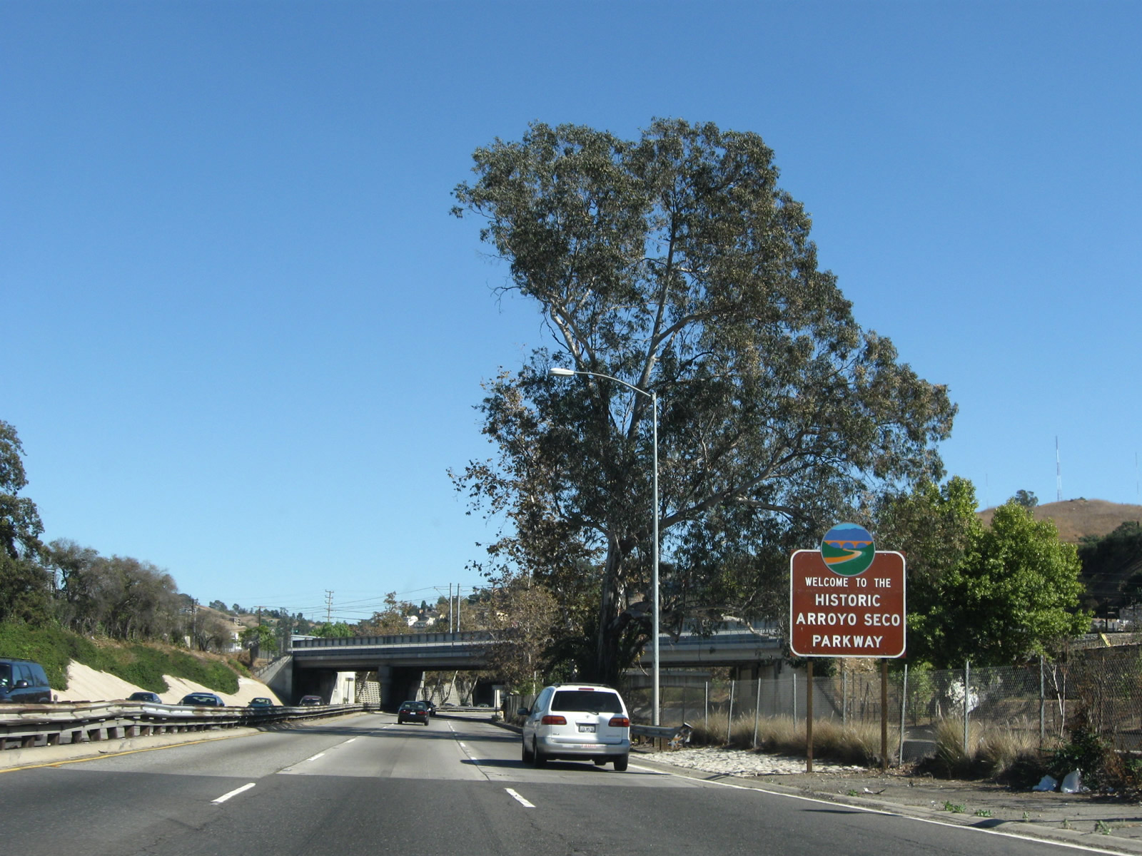
| As traffic from Interstate 5 merges onto SR 110 north, a sign welcomes motorists to the historic Arroyo Seco Parkway. 11/08/08 |
|
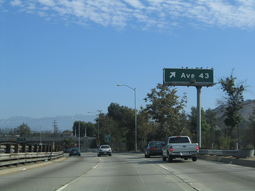
| The next exit along SR 110/Arroyo Seco Parkway north is Exit 27, Avenue 43. 11/08/08 |
|
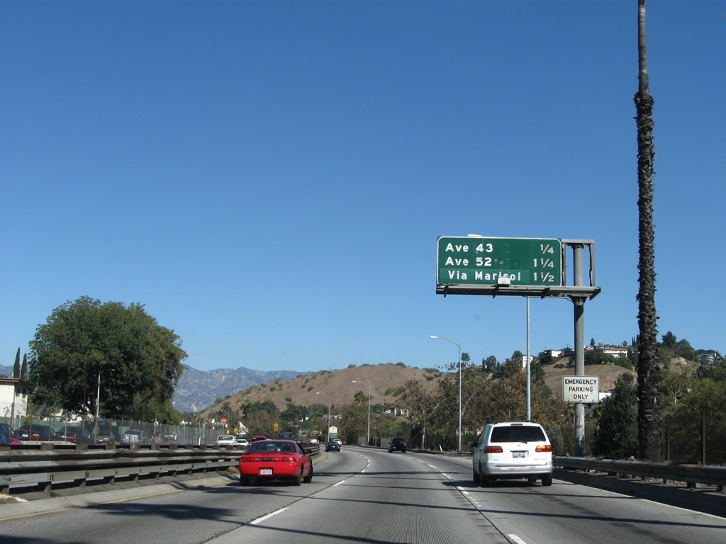
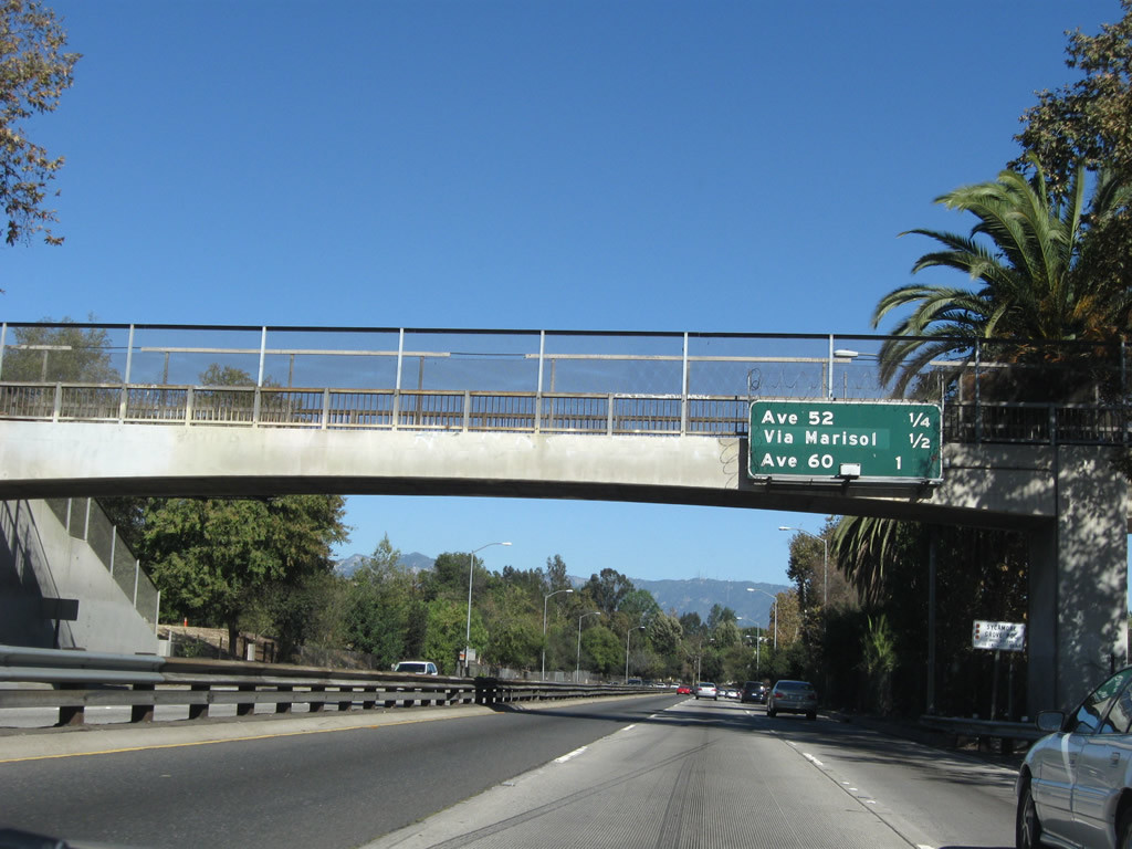
| This distance sign provides the distance to the next three exits along SR 110/Arroyo Seco Parkway (Pasadena Freeway) north: Exit 27, Avenue 43; Exit 28A, Avenue 52; and Exit 28B, Via Marisol. 11/08/08 |
|
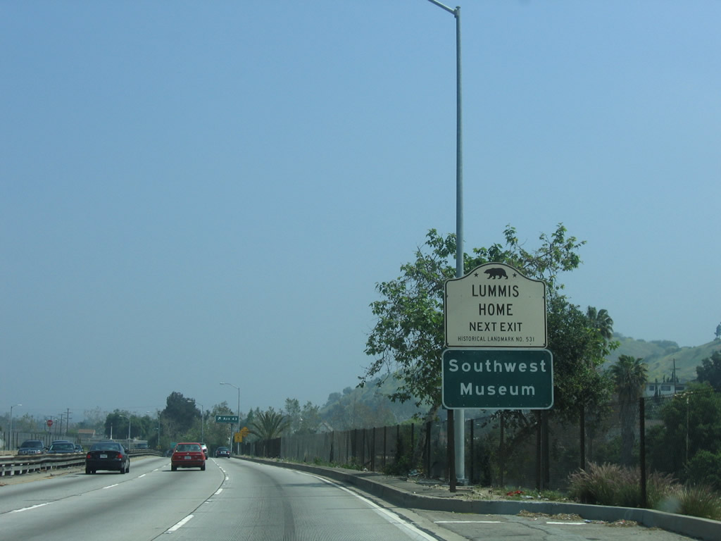
| Use Exit 27 for Avenue 43 to the Lummis Home (located just west of the parkway on the banks of the Arroyo Seco), Heritage Square Museum (upon exiting, turn right/south on Homer Street), the Audubon Center at Ernest E. Debs Regional Park (turn east on Avenue 43, then north on Griffin Avenue), and the Southwest Museum of the American Indian (part of the Autry Museum; use Avenue 43 west to Figueroa Street northeast to Avenue 45 west to Marmion Way north to Museum Drive west). 04/30/06 |
|
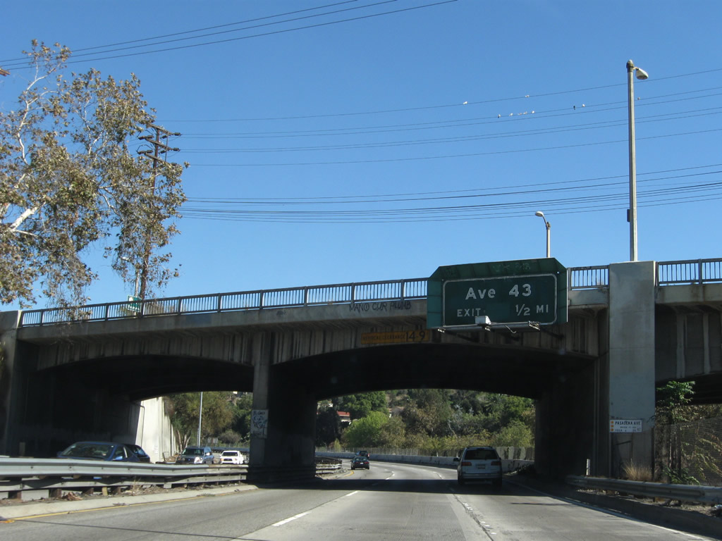
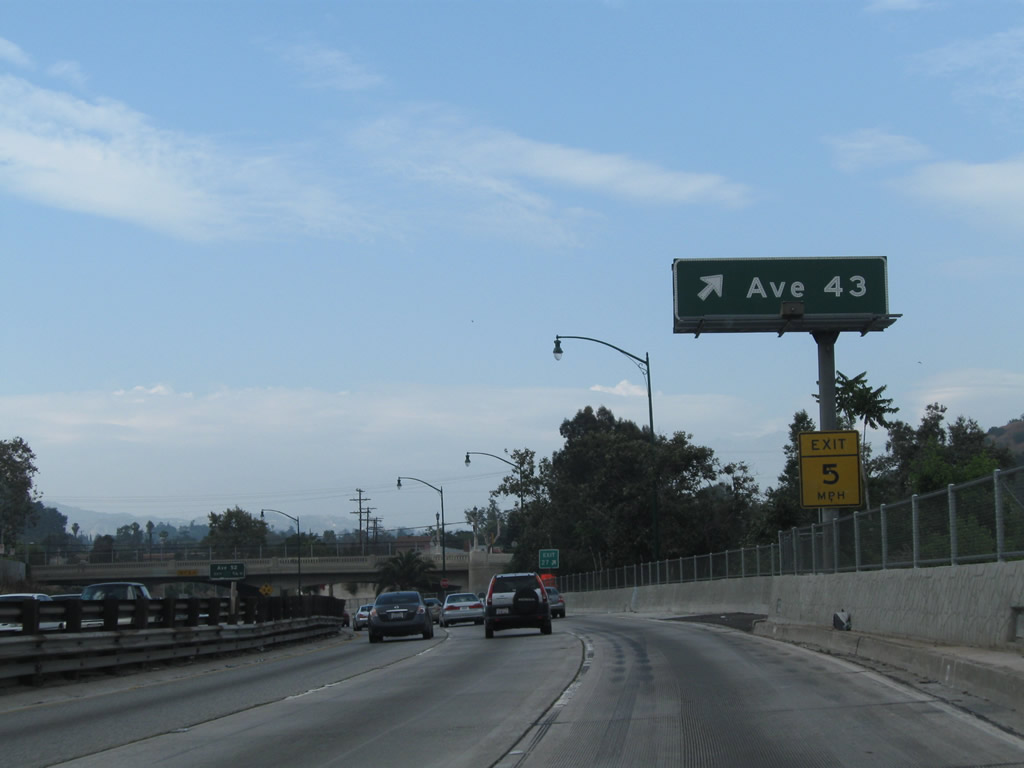
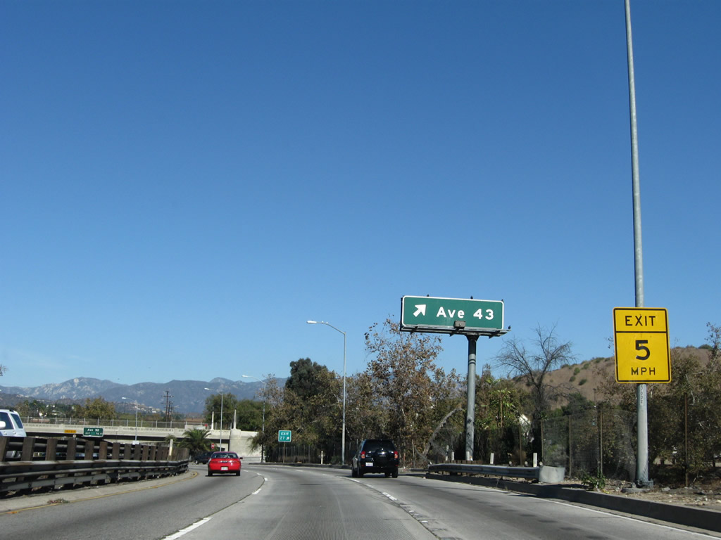
| Northbound SR 110/Arroyo Seco Parkway (Pasadena Freeway) reaches Exit 27, Avenue 43. In addition to installing a new concrete barrier on the right shoulder and decorative street lights, signage was modified at the offramp to incorporate the exit number. 07/10/10, 11/08/08, 09/25/05 |
|
| Exit 27 is the first offramp of several to feature sharp exits with limited space for deceleration. The offramp is labeled for 5 miles per hour. Immediately upon exiting to Avenue 43, the offramp crosses the parallel Arroyo Seco. Similarly, traffic entering the parkway also have limited space to accelerate to the full parkway speed. 04/30/06 |
|
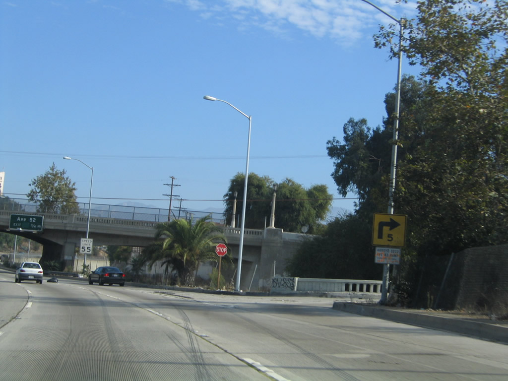
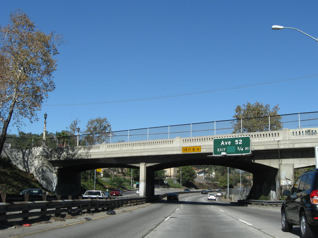
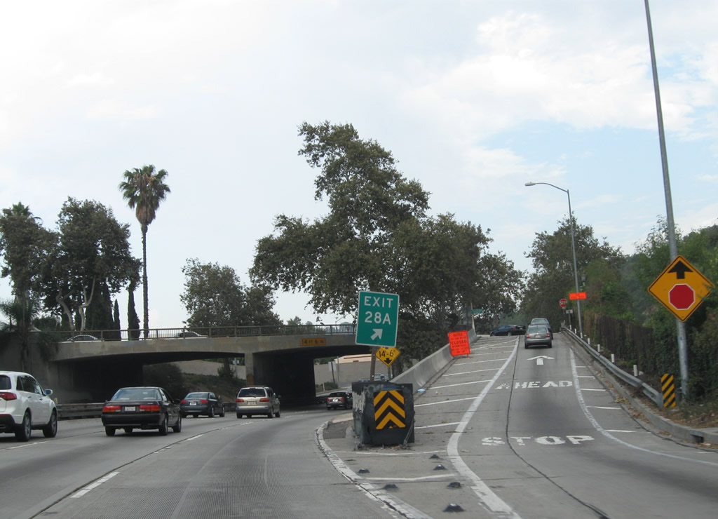
| The next exit along SR 110/Arroyo Seco Parkway (Pasadena Freeway) north is Exit 28A, Avenue 52. This sign is posted on the Avenue 43 overpass. 11/08/08 |
|
| Straightening out briefly, SR 110 proceeds northeast with three through lanes after the Avenue 43 interchange. The Arroyo Seco continues to follow the parkway. Decorative touches to the parkway, including ornate walls and street lighting, were added to the parkway between 2008 and 2010. 09/25/05 |
|
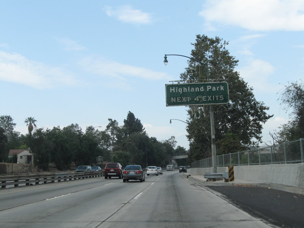
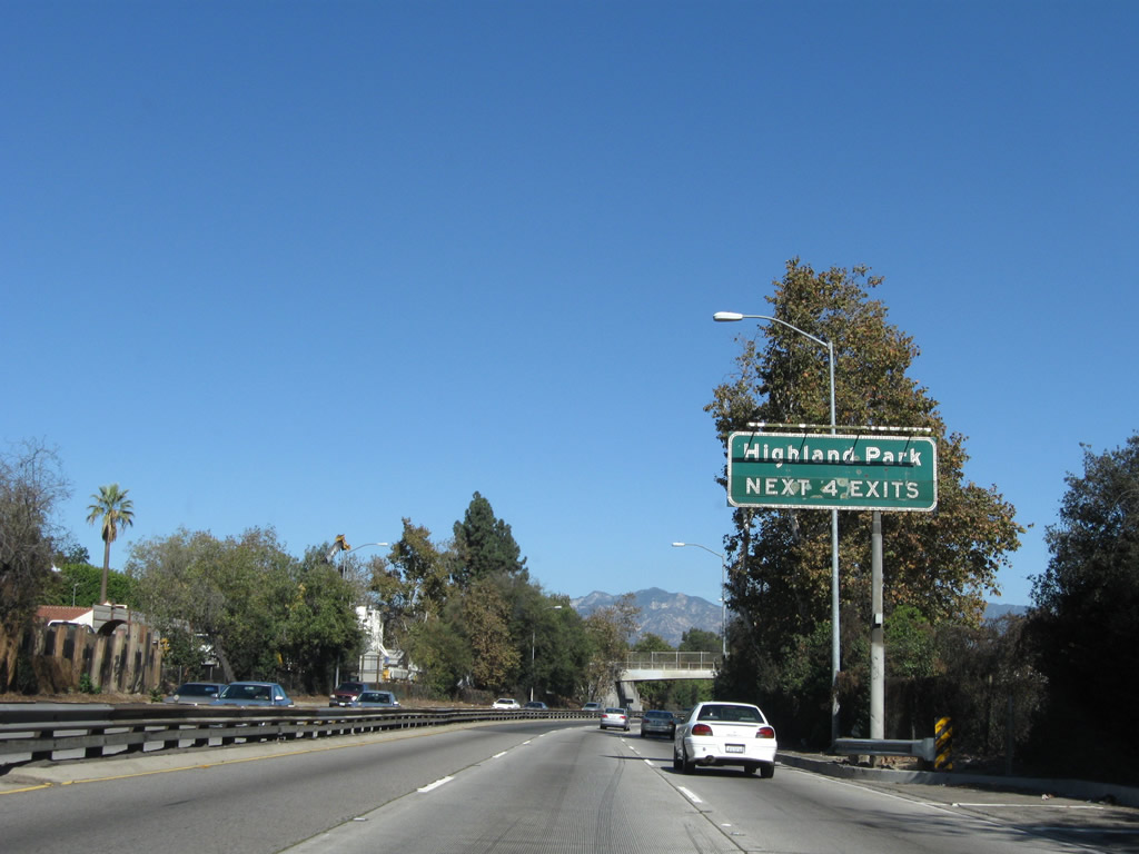
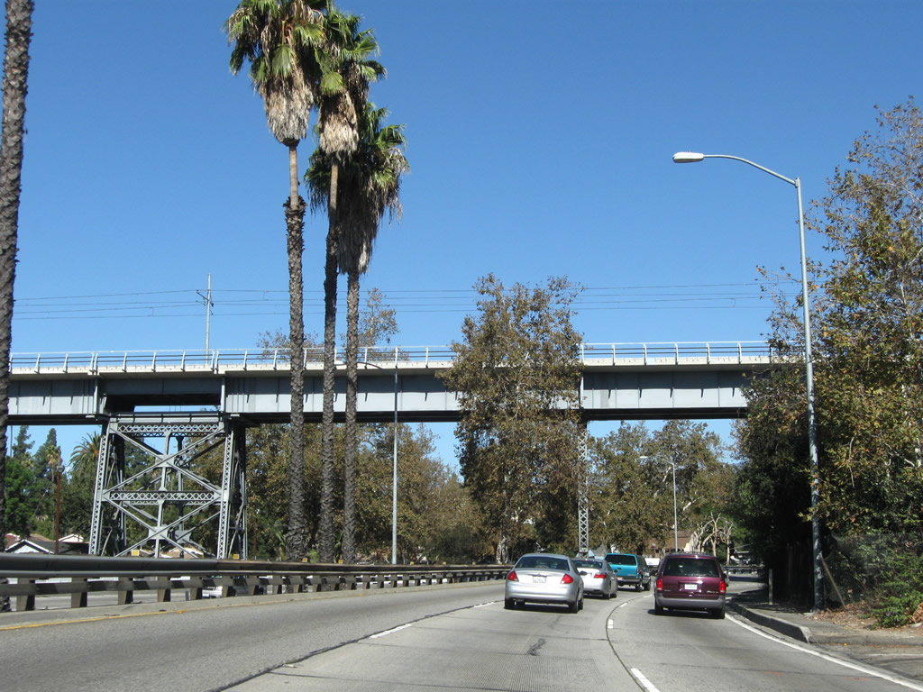
| The next four exits from SR 110/Arroyo Seco Parkway (Pasadena Freeway) north serve the Highland Park district of the city of Los Angeles: Exit 28A, Avenue 52; Exit 28B, Via Marisol; Exit 29, Avenue 60; and Exit 30A, Marmion Way and Avenue 64 to York Boulevard and Pasadena Avenue. 07/10/10, 11/08/08 |
|
| This distance sign provides the distance to the next three exits from SR 110/Arroyo Seco Parkway (Pasadena Freeway) north: Exit 28A, Avenue 52; Exit 28B, Via Marisol; and Exit 29, Avenue 60. 11/08/08 |
|
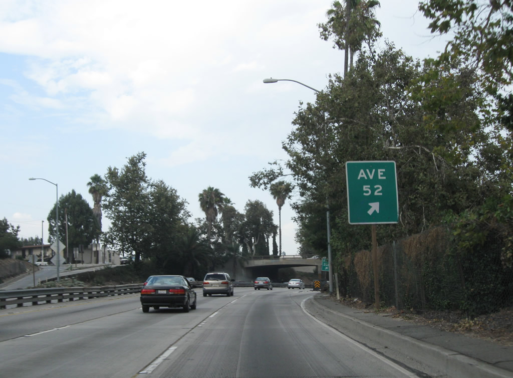
| An older, porcelain enamel sign is posted on SR 110/Arroyo Seco Parkway (Pasadena Freeway) north for the connection to Exit 28A, Avenue 52. 11/08/08 |
|
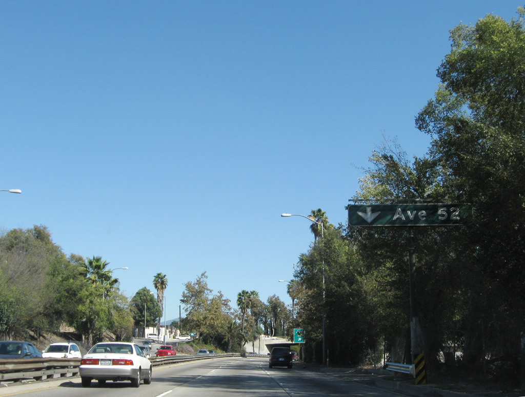
| Northbound SR 110/Arroyo Seco Parkway (Pasadena Freeway) meets Exit 28A, Avenue 52. This sign is posted immediately after the previous sign. Since the offramp is located on a curve, motorists have a limited sight distance to the gore point. 07/10/10 |
|
| The gore point sign for Avenue 52 includes the exit number. SR 110 turns briefly due east to pass through this interchange. 07/10/10 |
|
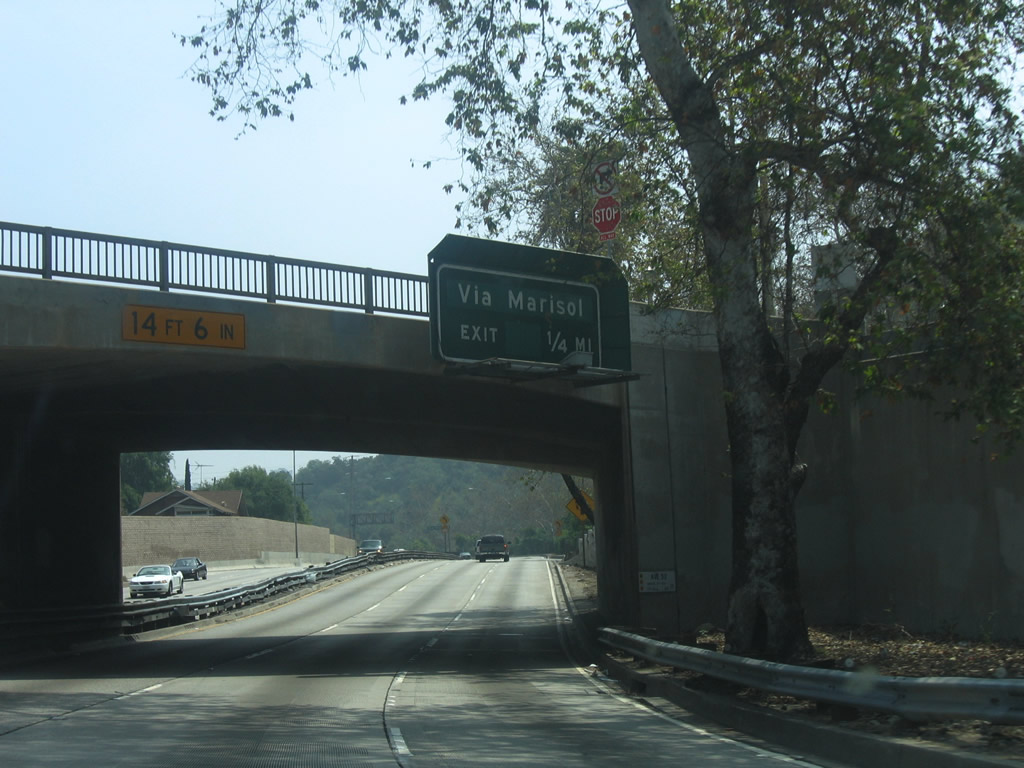
| Passing under the Avenue 52 overpass, this guide sign advises that the next exit along SR 110 north is Exit 28B, Via Marisol. 04/30/06 |
|
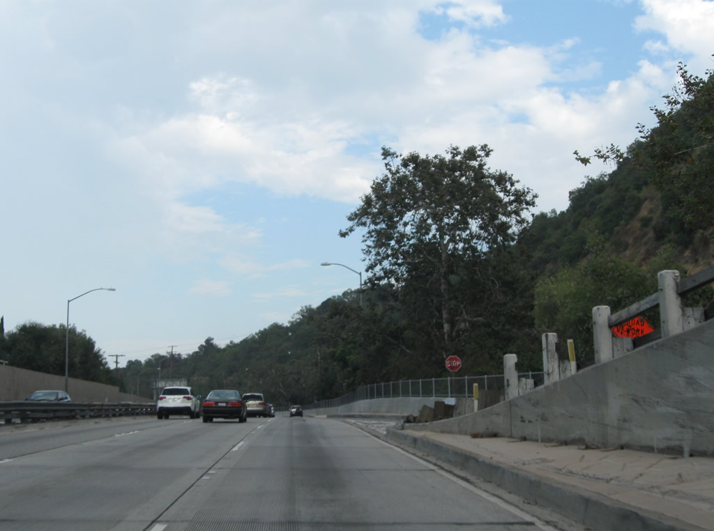
| The white wooden railing that used to separate the onramp from Avenue 52 to SR 110 north has deteriorated over the years. It is likely this will be restored in some fashion along with other improvements seen along the Arroyo Seco Parkway. 07/10/10 |
|
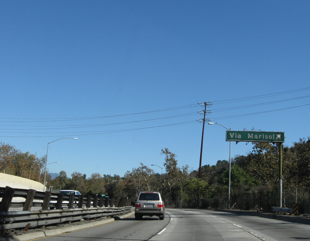
| Northbound SR 110/Arroyo Seco Parkway reaches Exit 28B, Via Marisol to Highland Park. Use this offramp to Hermon Park, which is located adjacent to the parkway and offers an opportunity to see some of the decorative parkway features while walking rather than driving. These features include a pedestrian bridge over the Arroyo Seco and the Via Marisol bridge over the parkway itself. To the park, turn right at the top of the offramp. 07/10/10 |
|
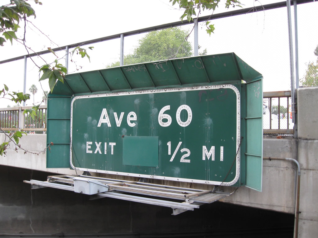
| Passing under the Via Marisol overpass, this guide sign advises that the next exit along SR 110 north is Exit 29, Avenue 60. 04/30/06, 07/10/10 |
|
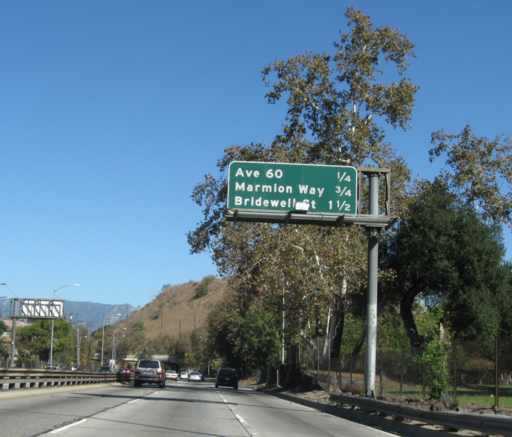
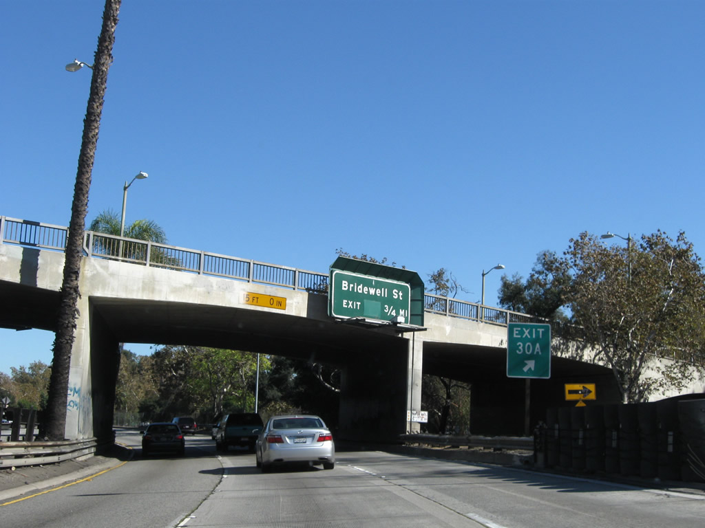
| This distance sign provides the distance to the next three exits along SR 110/Arroyo Seco Parkway (Pasadena Freeway) north: Exit 29, Avenue 60; Exit 30A, Marmion Way and Avenue 64 to York Boulevard and Pasadena Avenue; and Exit 30B, Bridewell Street. Hermon Park lines the parkway on the east side of SR 110. 11/08/08 |
|
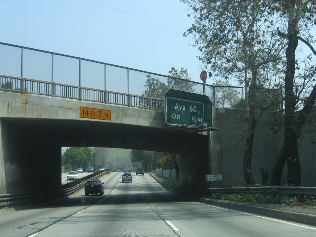
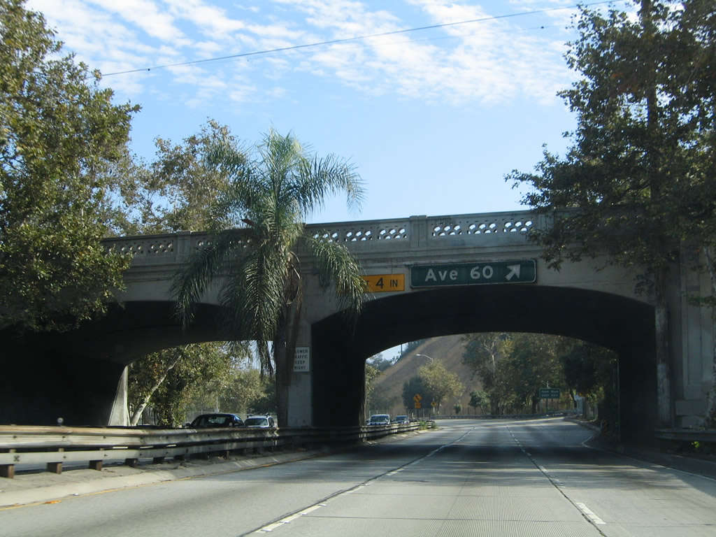
| Northbound SR 110/Arroyo Seco Parkway (Pasadena Freeway) reaches Exit 29, Avenue 60. SR 110 passes under Avenue 60 at this point; the offramp will loop back to link with Avenue 60. 09/25/05 |
|
| The offramp to Exit 29, Avenue 60 is another sharp right turn with limited deceleration/acceleration lanes; note the five mile-per-hour suggested speed for exiting traffic. 07/10/10 |
|
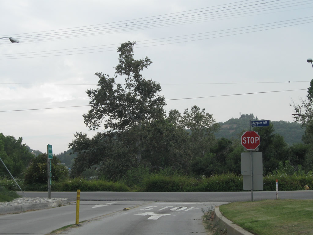
| This series of pictures follows the connection from SR 110 north to Exit 29, Avenue 60. Upon departing the parkway, the offramp becomes two lanes (one exiting the parkway and the other entering the parkway) before crossing the Arroyo Seco and then meeting a stop sign at Avenue 60. Turn left for Avenue 60 east or right for Avenue 60 west. 07/10/10 |
|
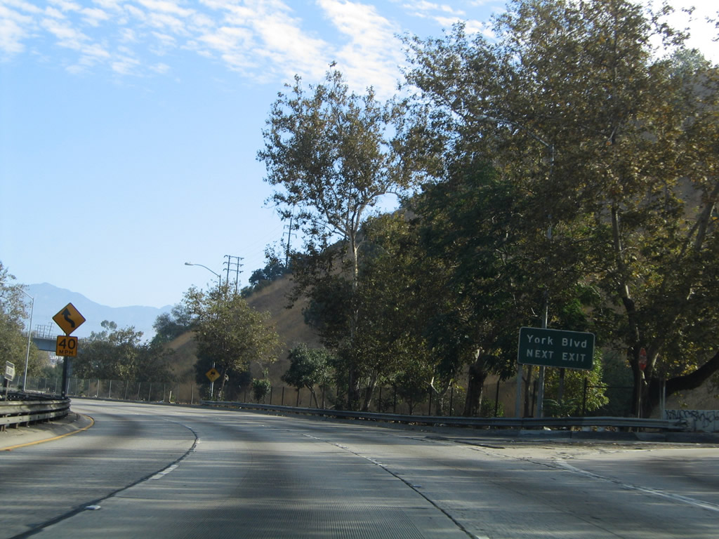
| Back on the mainline of SR 110 north, the next offramp will be Exit 30A, Marmion Way and Avenue 64 to York Boulevard and Pasadena Avenue. 09/25/05 |
|
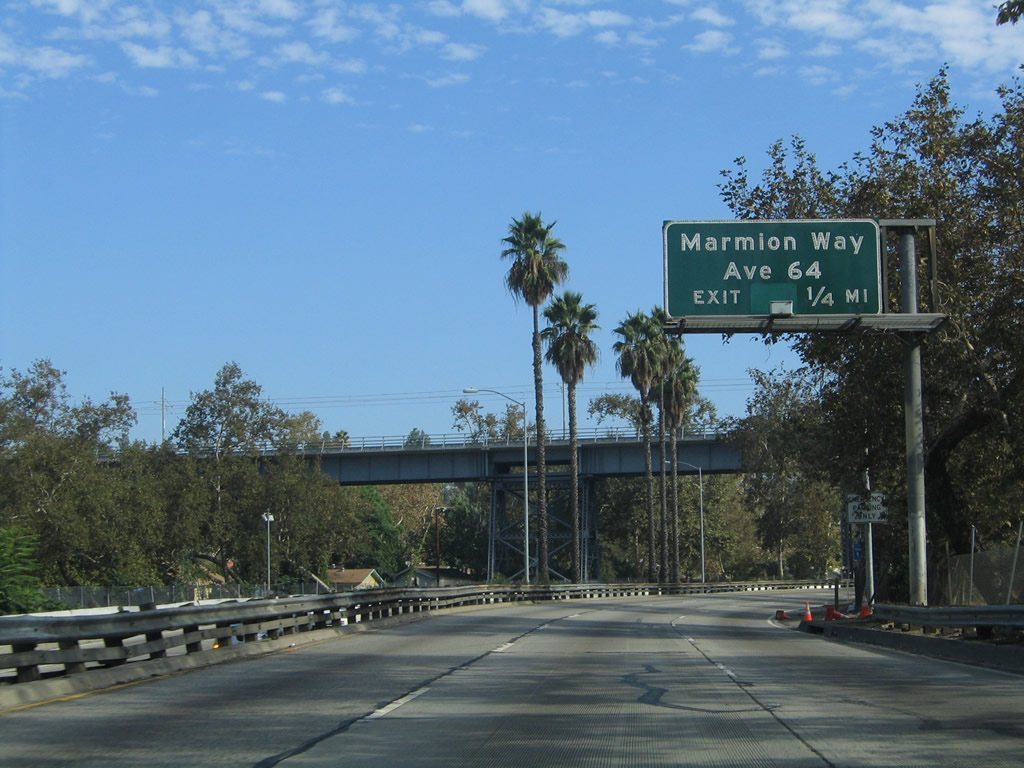
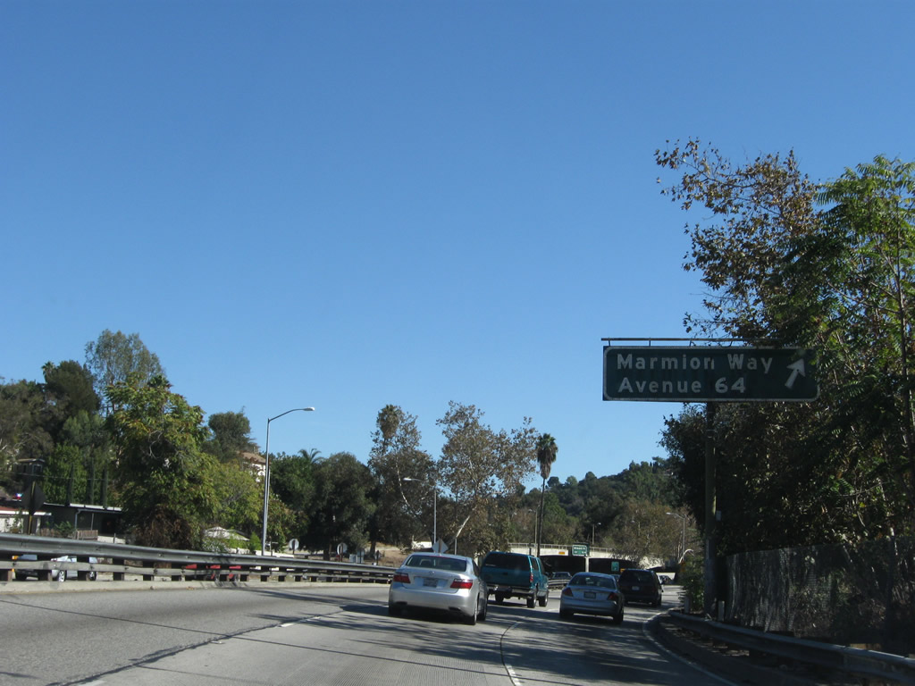
| The next exit along SR 110/Arroyo Seco Parkway north is Exit 30A, Marmion Way and Avenue 64 to York Boulevard and Pasadena Avenue. 09/25/05 |
|
| The Metro Gold Line crosses over SR 110 via this steel bridge. 11/08/08 |
|
| Northbound SR 110/Arroyo Seco Parkway (Pasadena Freeway) reaches Exit 30A, Marmion Way and Avenue 64 to York Boulevard and Pasadena Avenue. 11/08/08 |
|
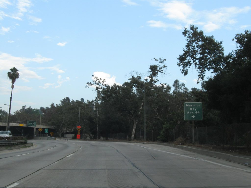
| An auxiliary roadside guide sign for Exit 30A is posted shortly thereafter. 07/10/10 |
|
| The ramp from SR 110 north to Exit 30A, Marmion Way and Avenue 64 is sharp. 09/25/05 |
|
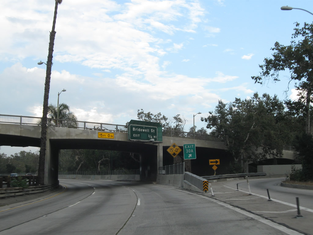
| The next exit along SR 110/Arroyo Seco Parkway north is Exit 30B, Bridewell Street. 09/25/05 |
|
| A dual-arch span crosses over SR 110/Arroyo Seco Parkway. 04/30/06 |
|
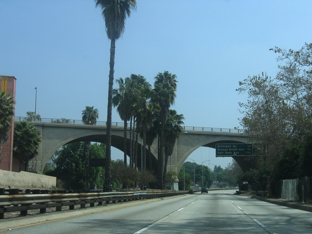
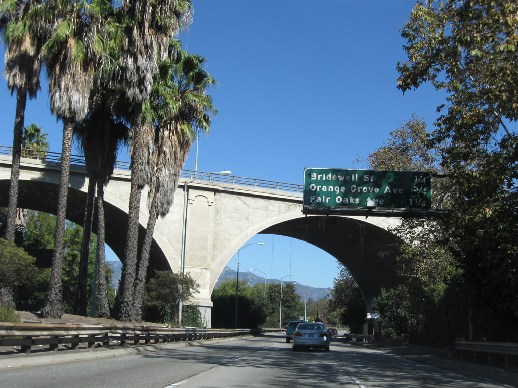
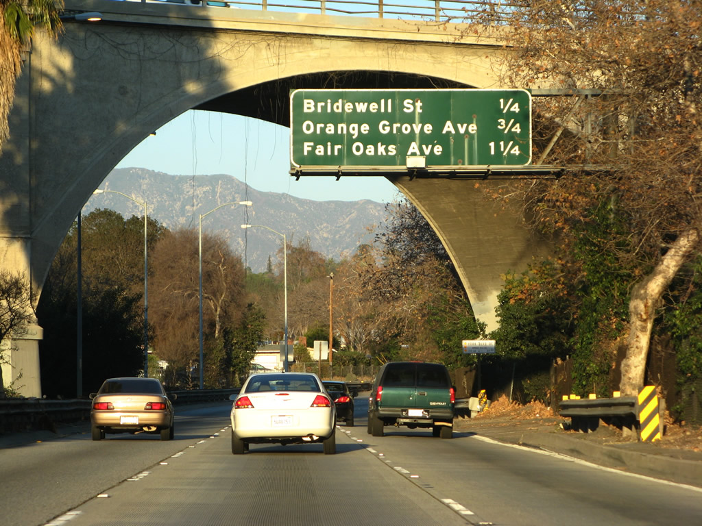
| This distance sign along SR 110/Arroyo Seco Parkway north provides the distance to the final three exits: Exit 30B, Bridewell Street; Exit 31A, Orange Grove Avenue; and Exit 31B, Fair Oaks Avenue. 11/08/08, 01/14/07 |
|
| Stay right for the offramp from SR 110/Arroyo Seco Parkway north to Bridewell Street. 09/25/05 |
|
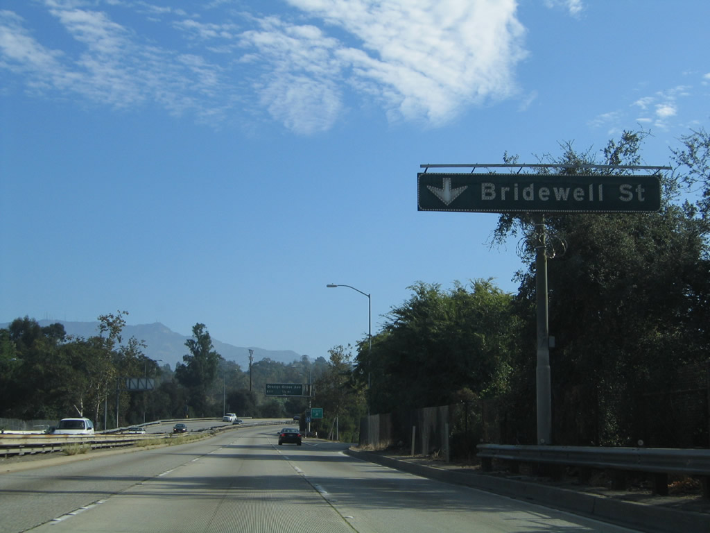
| Northbound SR 110/Arroyo Seco Parkway reaches Exit 30B, Bridewell Street. 07/10/10 |
|
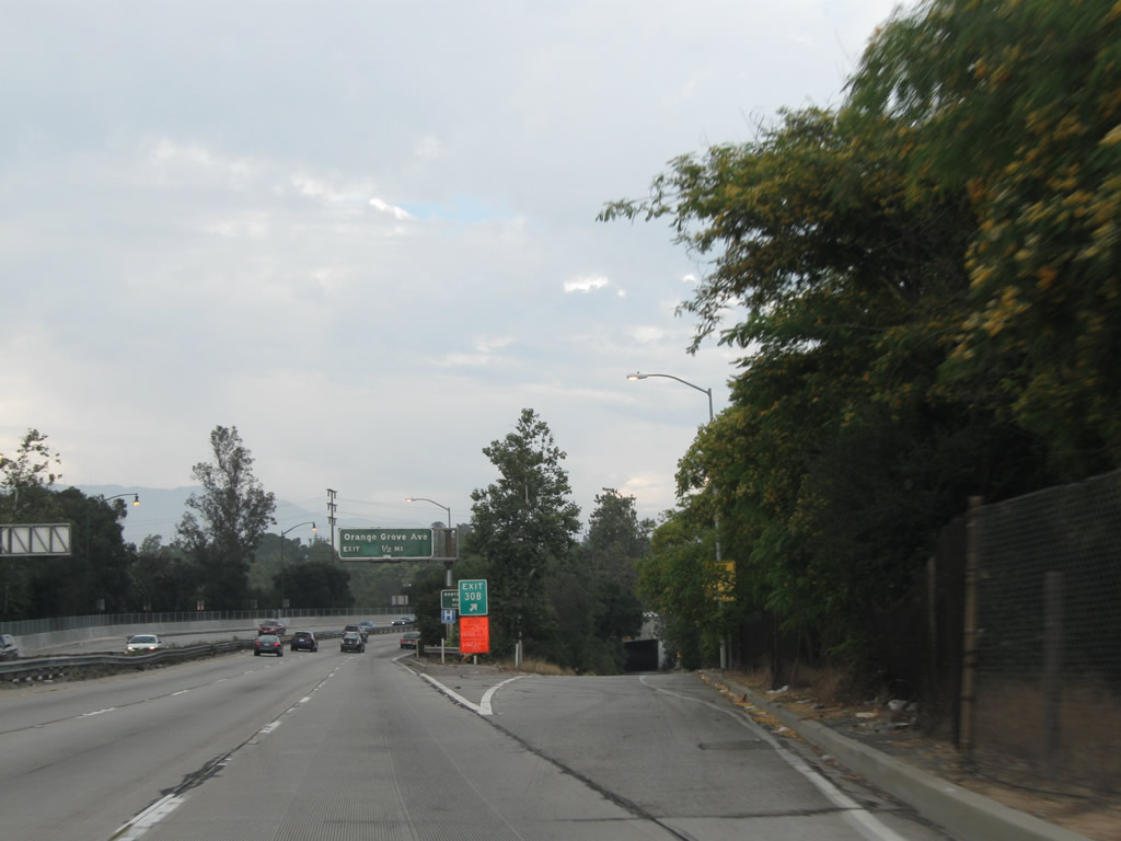
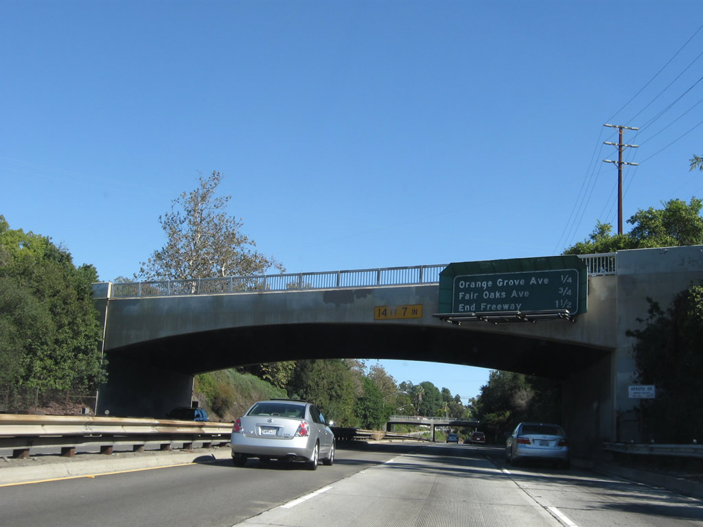
| The next exit along SR 110/Arroyo Seco Parkway north is Exit 31A, Orange Grove Avenue. Use this exit to the Norton Simon Museum. 11/08/08 |
|
| SR 110/Arroyo Seco Parkway leaves the city of Los Angeles and enters the city of South Pasadena (population 24,292 as of 2000 Census). 07/10/10 |
|
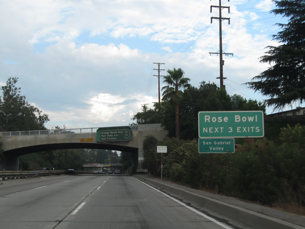
| The next three exits from SR 110/Arroyo Seco Parkway all serve the Rose Bowl in Pasadena. 07/10/10 |
|
| This distance sign along SR 110/Arroyo Seco Parkway north provides the distance to the final two exits: Exit 31A, Orange Grove Avenue and Exit 31B, Fair Oaks Avenue. 11/08/08 |
|
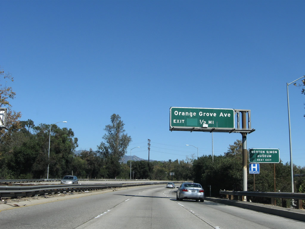
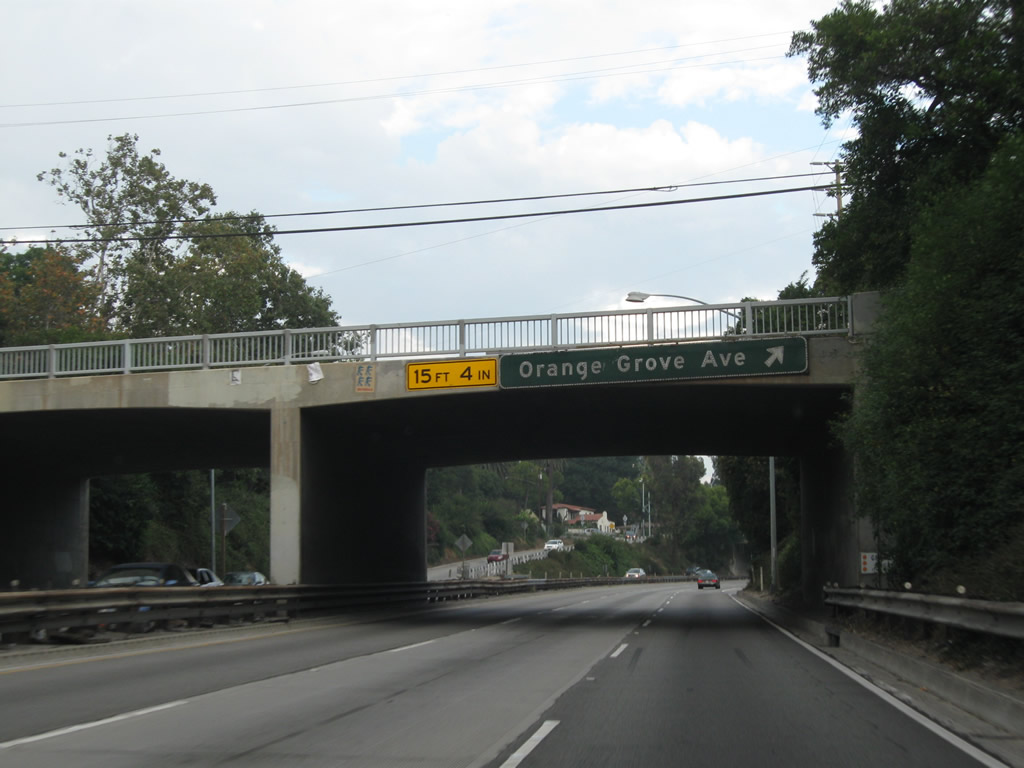
| Northbound SR 110/Arroyo Seco Parkway meets Exit 31A, Orange Grove Avenue. The final exit will be Exit 31B, Fair Oaks Avenue. 07/10/10 |
|
| The offramp from SR 110/Arroyo Seco Parkway north to Exit 31A, Orange Grove Avenue widens to two lanes. Turn left at the top of the ramp to the Rose Bowl and North Simon Museum. 07/10/10 |
|
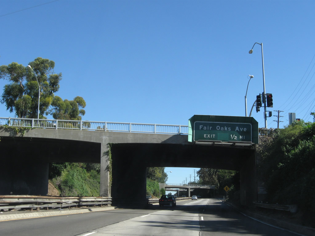
| The next exit along SR 110/Arroyo Seco Parkway north is Exit 31B, Fair Oaks Avenue. 11/08/08 |
|
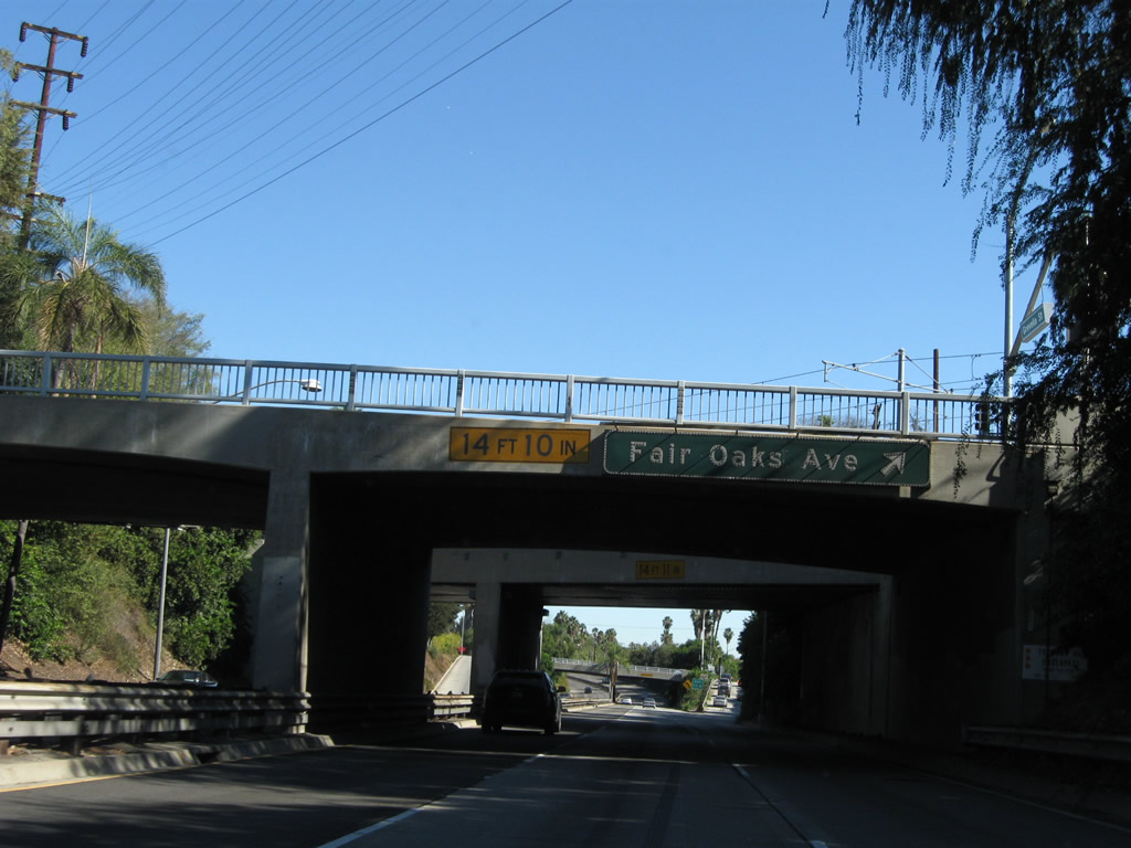
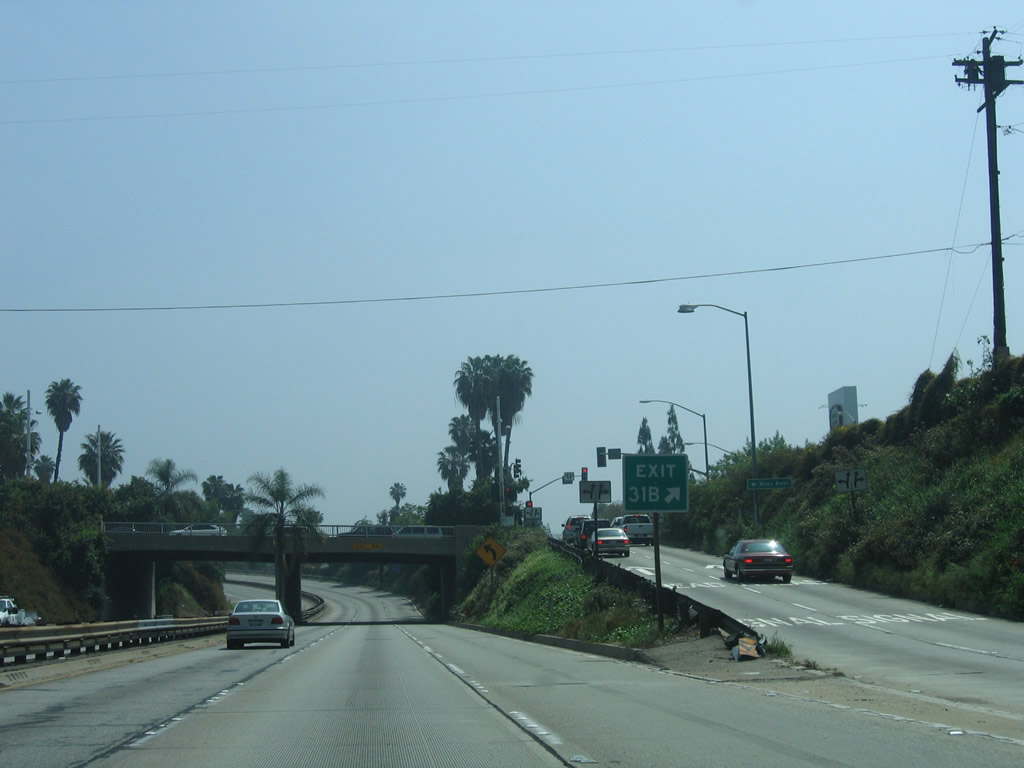
| Northbound SR 110/Arroyo Seco Parkway reaches Exit 31B, Fair Oaks Avenue. 11/08/08 |
|
| The offramp to Exit 31B (Fair Oaks Avenue) is again two lanes. 04/30/06 |
|
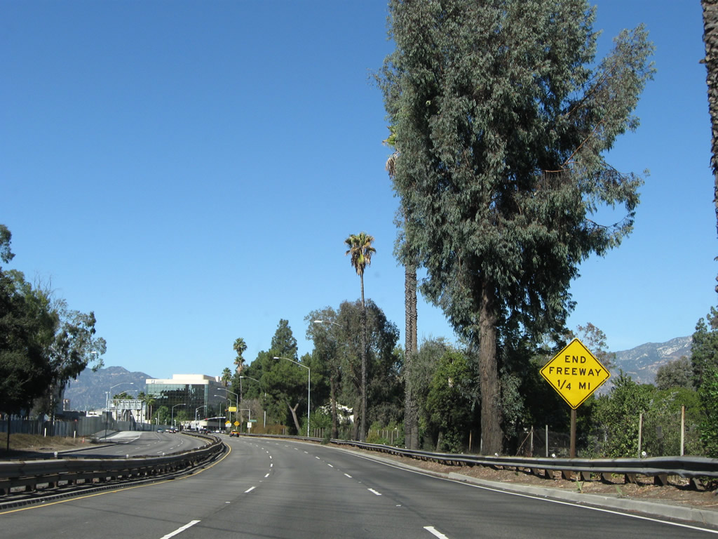
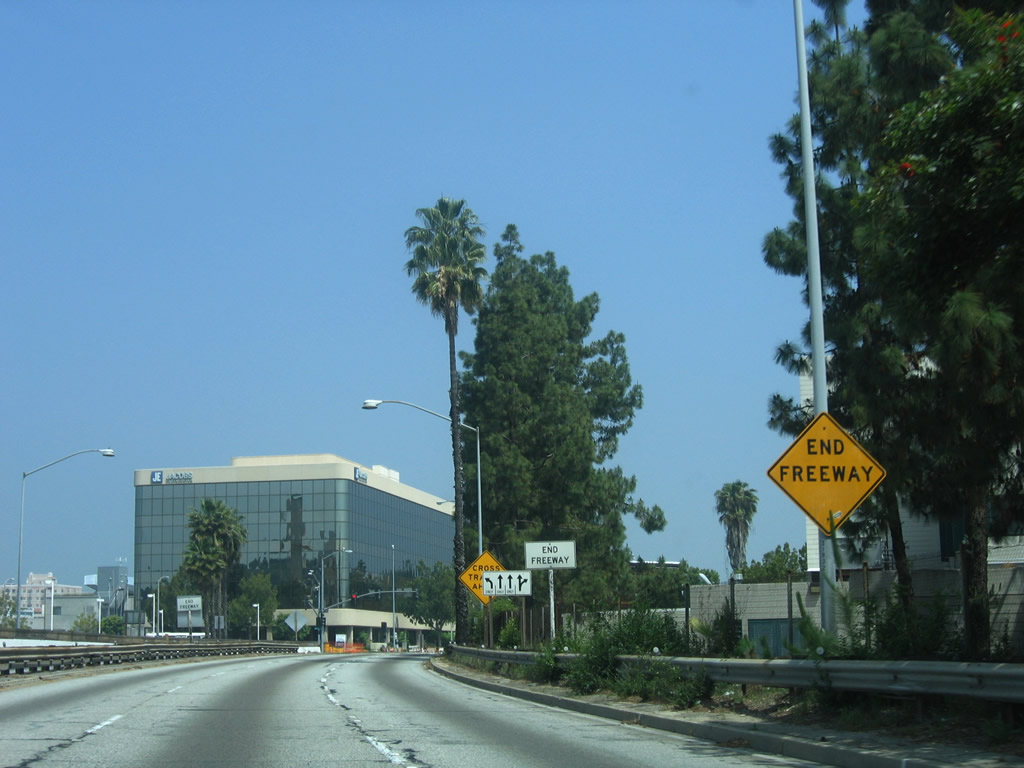
| After the Fair Oaks Avenue interchange, a yellow END FREEWAY sign is posted. 11/08/08 |
|
| As the parkway curves north, a second END FREEWAY sign is posted. 11/08/08 |
|
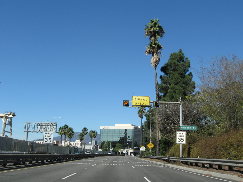
| Northbound SR 110/Arroyo Seco Parkway approaches its northern terminus at Glenarm Street. A traffic signal governs the flow of traffic at this intersection. 11/08/08 |
|
| Two END FREEWAY signs are posted shortly thereafter. Perhaps these should say END PARKWAY? There is no END SR 110 shield assembly here. 04/30/06 |
|
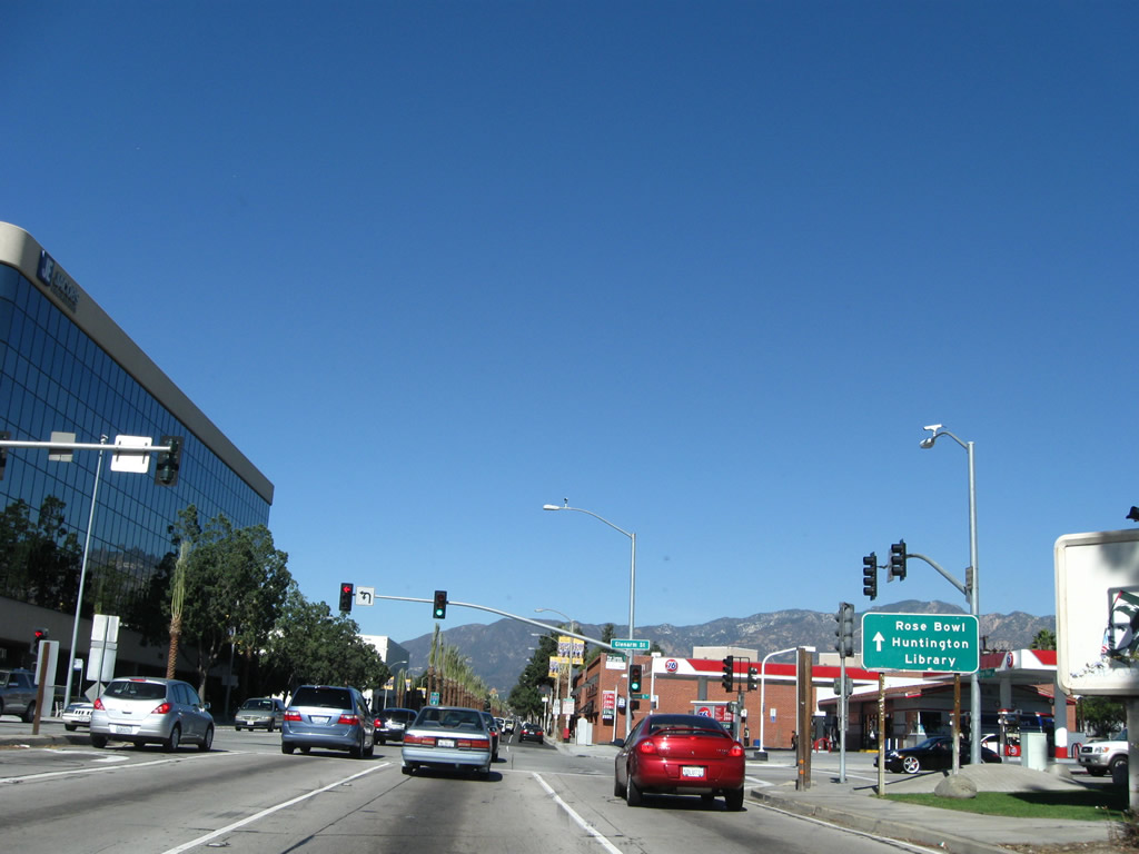
| SR 110/Arroyo Seco Parkway changes into Arroyo Parkway at this point. The state highway ends at this traffic signal. Continue north on Arroyo Seco Parkway to the Huntington Library in San Marino and the Rose Bowl in Pasadena. 11/08/08 |
|
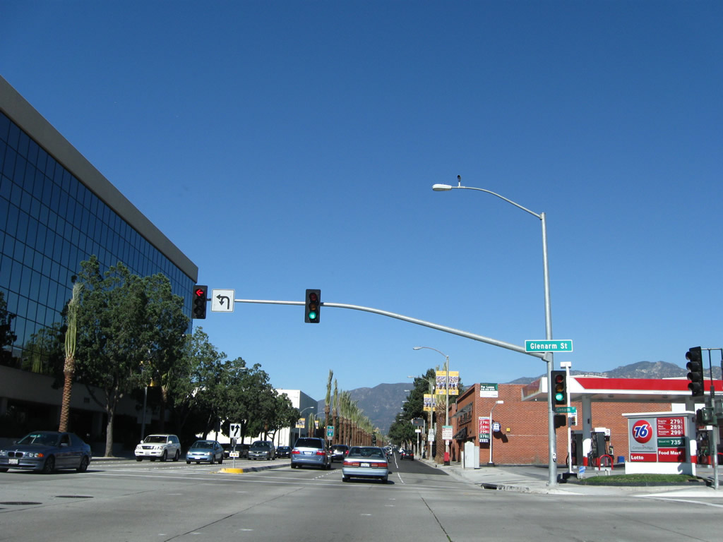
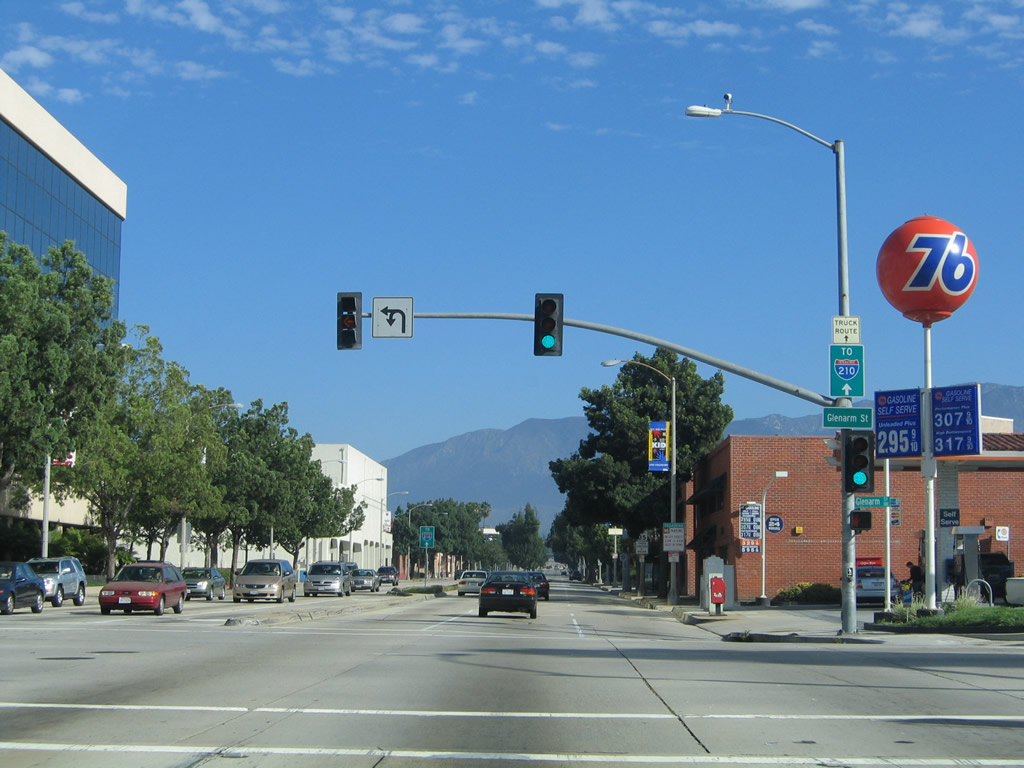
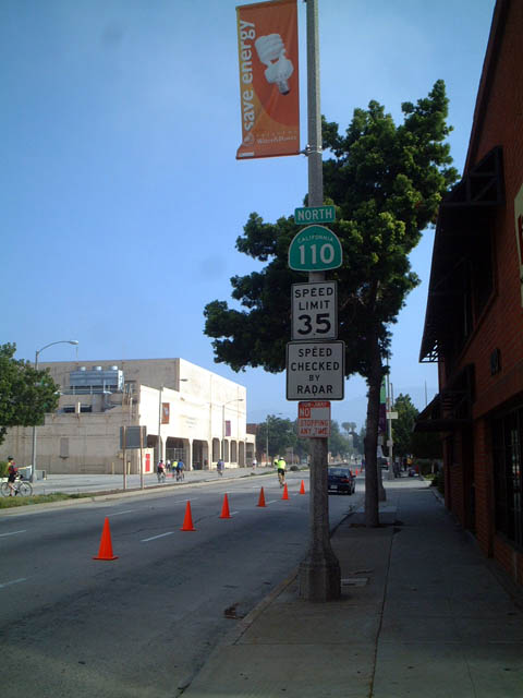
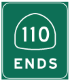
| Northbound SR 110/Arroyo Seco Parkway meets Glenarm Street at this traffic signal. This marks the northern terminus of the Pasadena Freeway and of SR 110. The state highway used to continue north all the way to Historic U.S. 66 at Colorado Boulevard, but that segment was decommissioned to the city of Pasadena. Note the changes into signage between 2005 and 2008; the reference to Interstate 210 was removed from the traffic signal mast arm. 11/08/08, 09/25/05 |
|
| Northbound Arroyo Parkway continues north after the Glenarm Street intersection. Caltrans used to maintain Arroyo Parkway as part of SR 110 north of the end of Pasadena Freeway in the city of Pasadena, but this portion of the route was removed from the state system in the mid-2000s. Most if not all reassurance shields have since been removed, including the one located here. The city of Pasadena was incorporated on June 19, 1886, and it had a population of 133,936 as of the 2000 Census. 11/08/08, 06/15/03 |
|
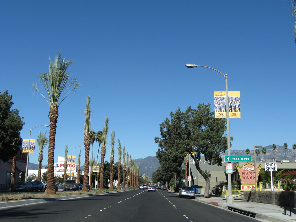
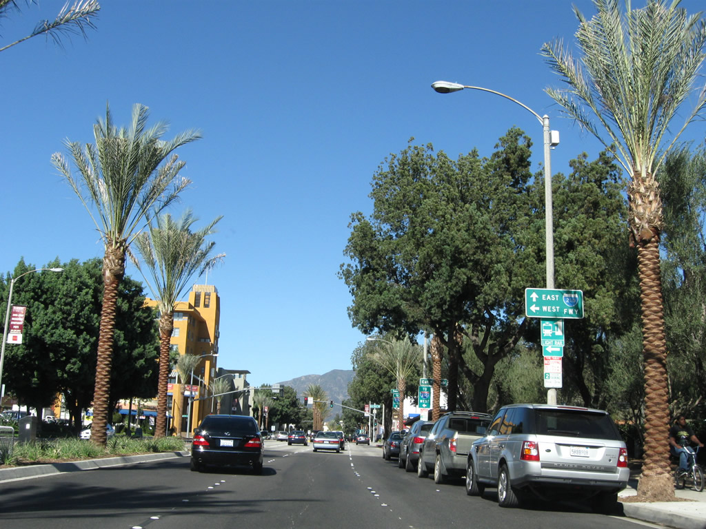
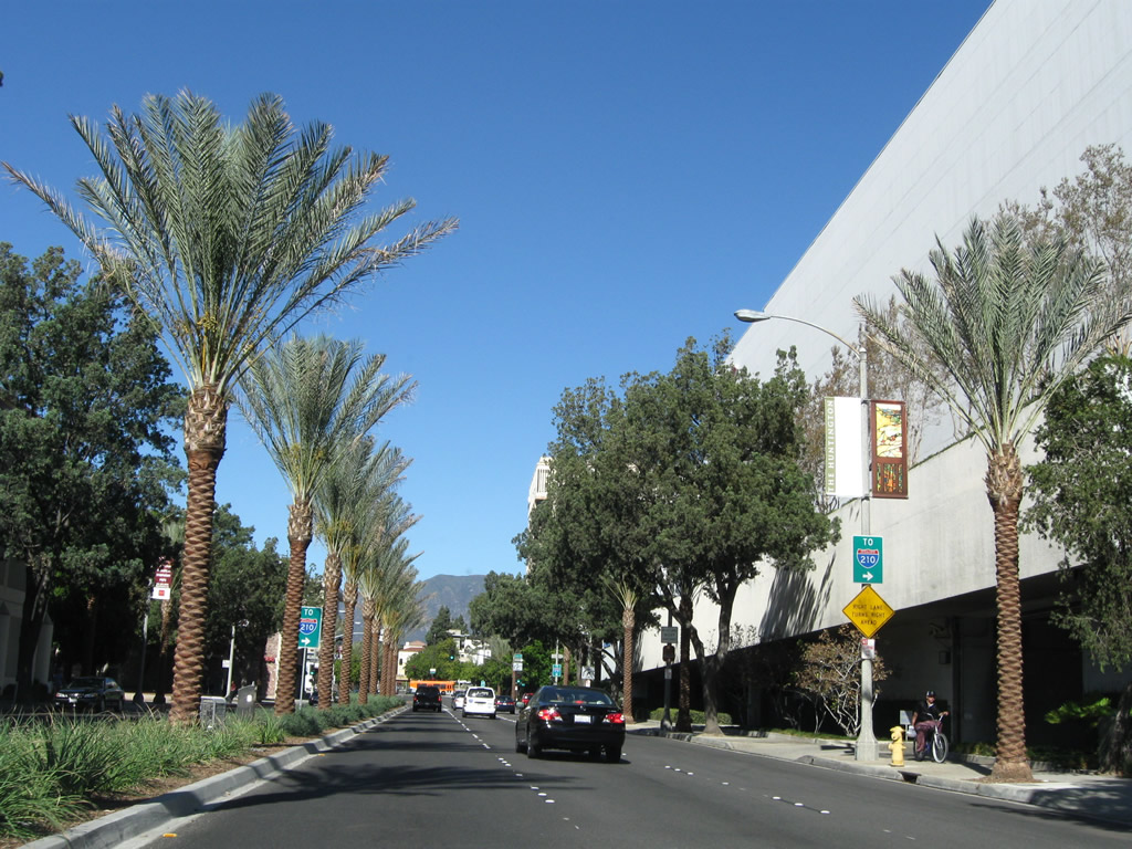
| As part of the shift of Arroyo Parkway from state to local maintenance, a major streetscape project was underway in 2007 and 2008 to add palms in the median and improve the overall aesthetics of the road. Old concrete was paved over by fresh asphalt, which adds to a smoother driving surface but loses the historical pavement of the original roadway. 11/08/08 |
|
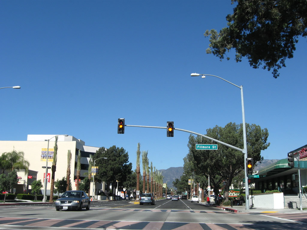
| Northbound Arroyo Parkway meets Fillmore Street at this traffic signal. Former SR 110 had its final segment perforated by city blocks until reaching U.S. 66/Colorado Boulevard. 11/08/08 |
|
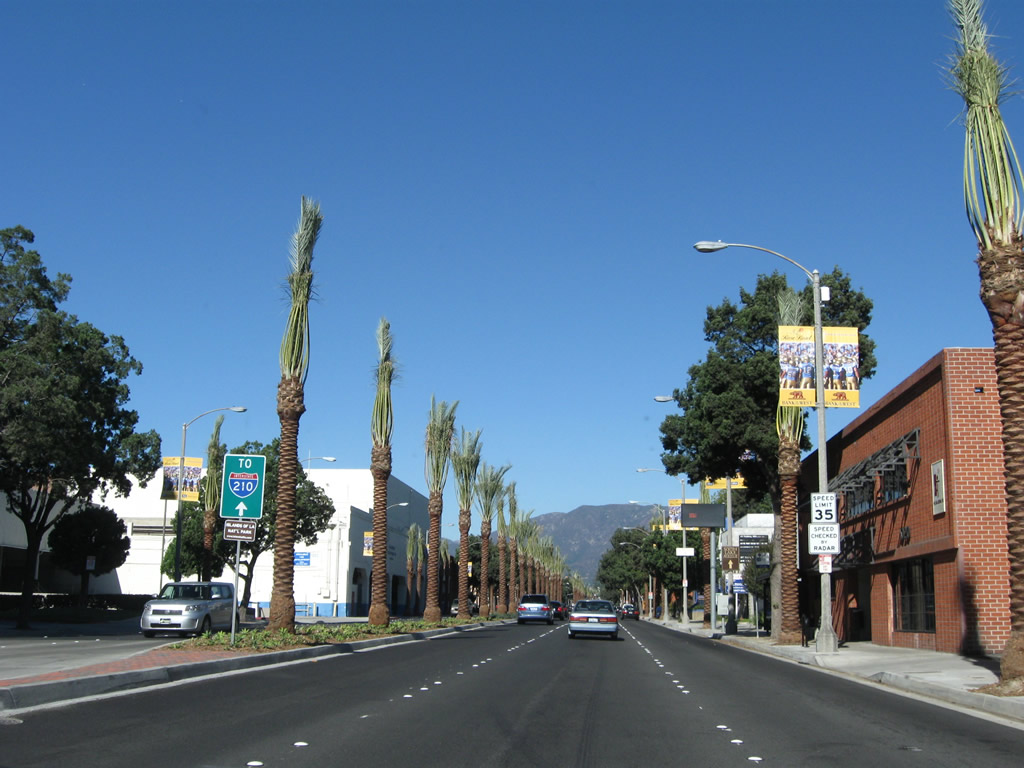
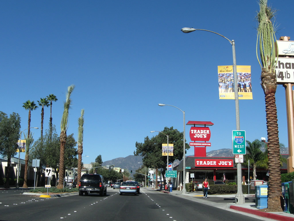
| At the northeast corner of Arroyo Parkway and Pico Street (shown here) is the Original Trader Joe's. Trader Joe's is a specialty grocery chain that opened its first store in 1967 at this location, and the store still operates today. The next traffic signal is with California Boulevard; turn left at the light to connect to Interstate 210 west. 11/08/08 |
|
| Turn left (west) on California Boulevard to the Rose Bowl; turn right (east) on California Boulevard to the Huntington Library and Gardens. 11/08/08 |
|
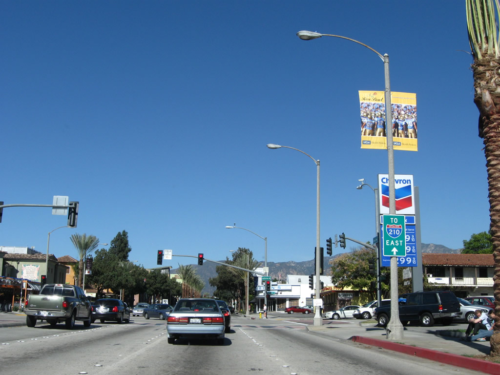
| Turn left at the upcoming traffic signal to Interstate 210 west (via the unsigned SR 710 spur). Continue north on Arroyo Parkway for Interstate 210 east. 11/08/08 |
|
| Northbound Arroyo Parkway (former SR 110) meets California Boulevard. 11/08/08 |
|
| Another SR 110 north reassurance shield used to be posted on northbound Arroyo Parkway after the California Boulevard traffic signal in 2005, but it was gone by 2008. The shields were removed around the same time the concrete pavement was overlaid in asphalt and new streetscaping and street trees (including palms in the median) were added. 09/25/05, 04/30/06 |
|
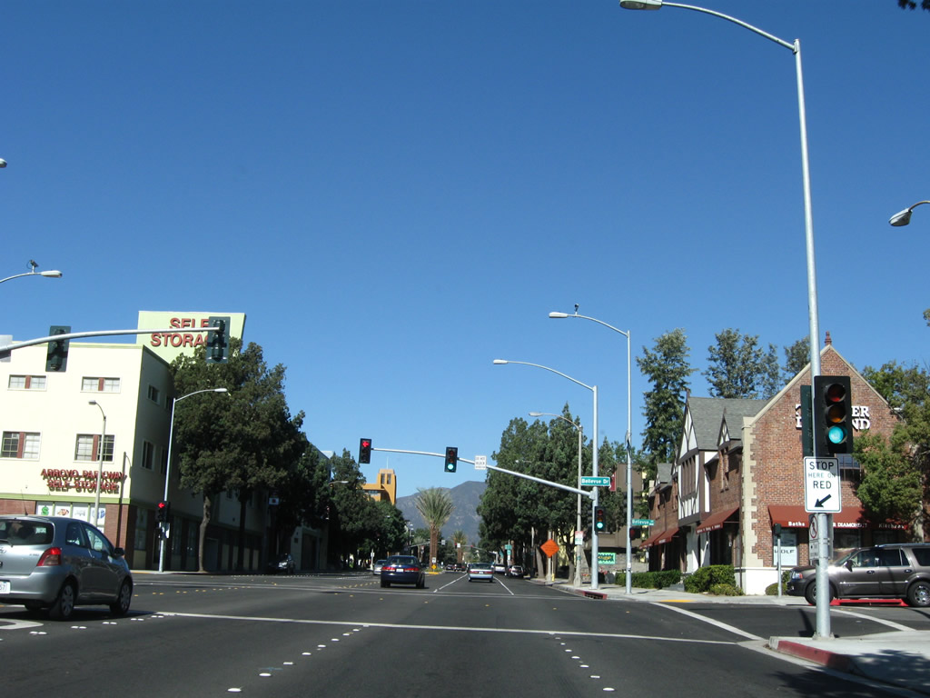
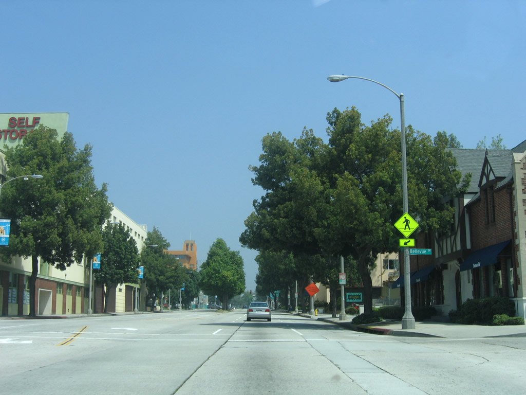
| The next signalized intersection is with Bellevue Drive. The traffic signal was added at the time when the Arroyo Parkway improvement project was underway, as seen when comparing the 2006 and 2008 pictures. 11/08/08, 04/30/06 |
|
| Another set of Interstate 210 trailblazer signs is posted in advance of the Del Mar Boulevard intersection (next traffic signal). Turn left for Del Mar Boulevard west to Interstate 210 west or continue straight ahead for Interstate 210 east. 11/08/08 |
|
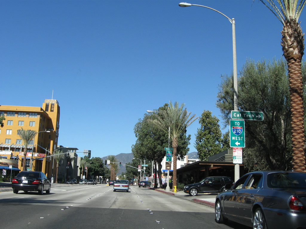
| Turn right at the Del Mar Boulevard intersection to Cal Tech. 11/08/08 |
|
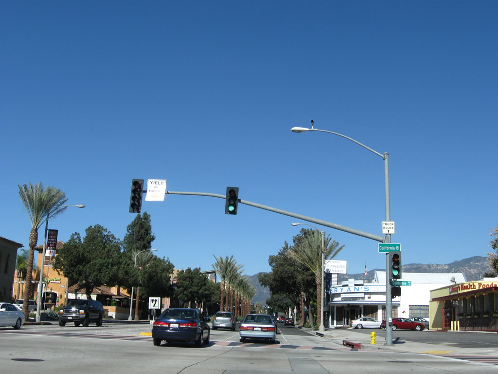
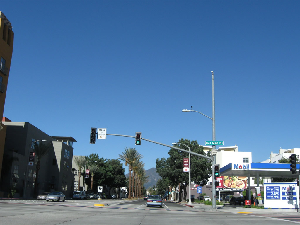
| Northbound Arroyo Parkway (former SR 110, SR 11, and U.S. 66) meets Del Mar Boulevard. 11/08/08 |
|
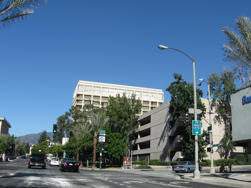
| The next major intersection from Arroyo Parkway is with Green Street in the city of Pasadena. Turn right here for the best route to Interstate 210 east. 11/08/08 |
|
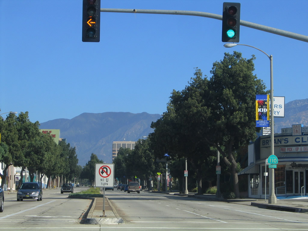
| Northbound Arroyo Parkway meets Green Street in the city of Pasadena. 11/08/08 |
|
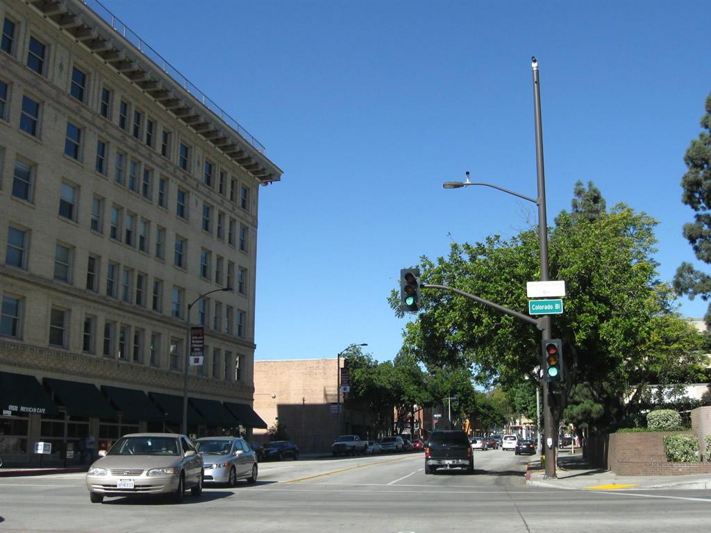
| Northbound Arroyo Parkway (former SR 110) next approaches and meets U.S. 66/Colorado Boulevard in the heart of Pasadena. This intersection marks the former northern terminus of SR 110. 11/08/08 |
06/15/03, 08/15/03, 11/25/04, 09/25/05, 04/30/06, 01/14/07, 11/08/08, 07/10/10 by AARoads
Page Updated 08-25-2011.

 North
North