|
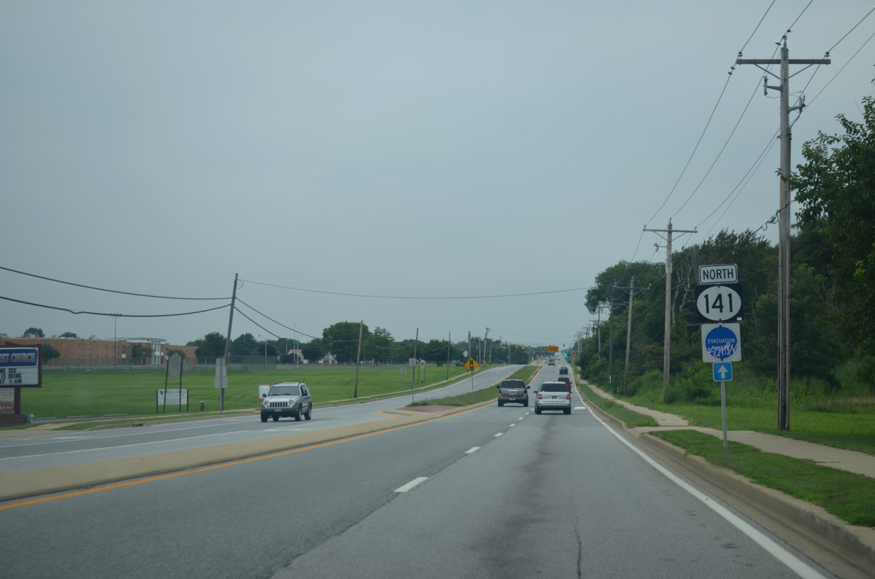
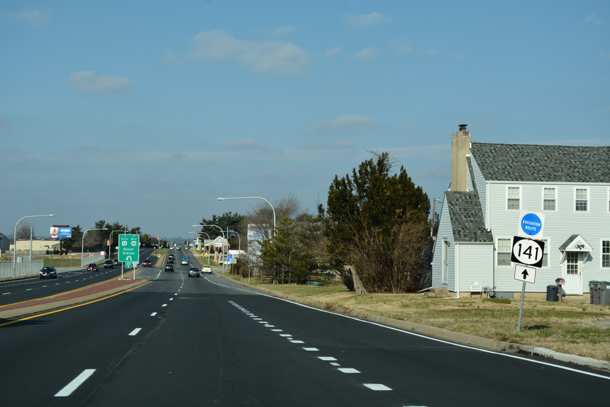
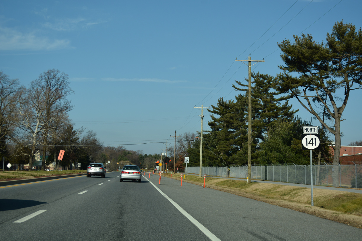
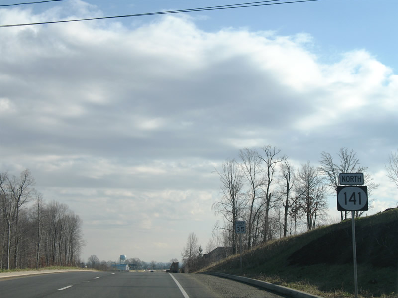
| The first confirming marker for SR 141 north. Basin Road passes by William Penn High School and wetland areas associated with Broad Dyke Canal on the initial stretch north from New Castle.
This assembly was removed by 2018. 08/03/13 |
|
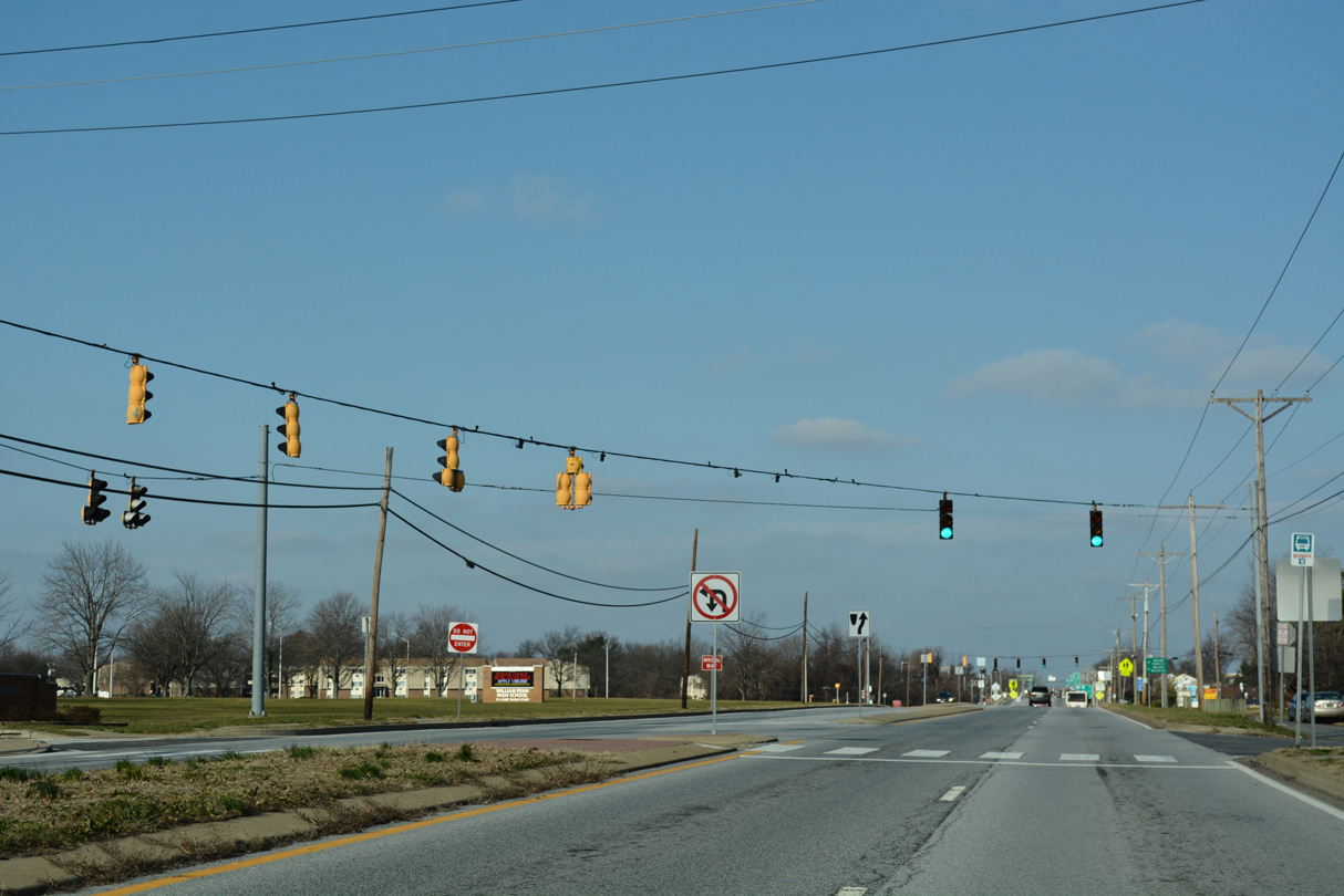
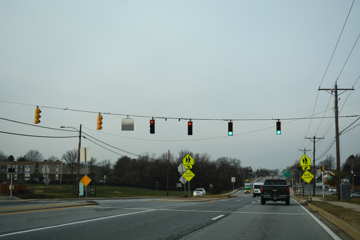
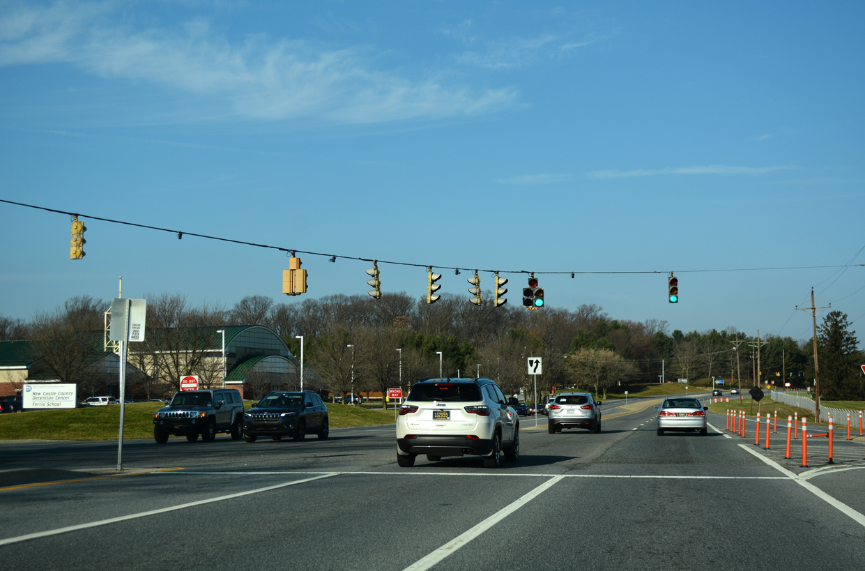
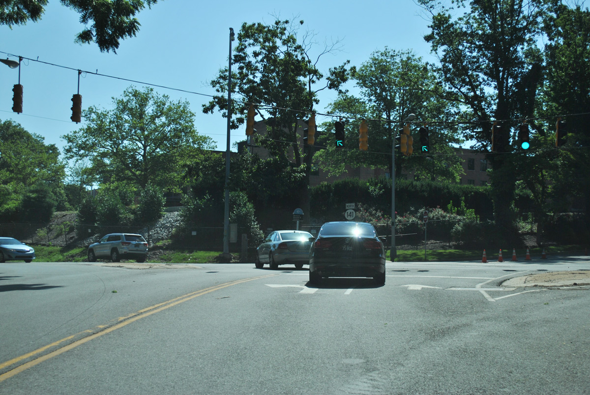
| Succeeding signals operate at William Penn High on SR 141 (Basin Road) north. The first light also serves Stockton Drive and the Stockton subdivision. 12/23/18, 12/23/16 |
|
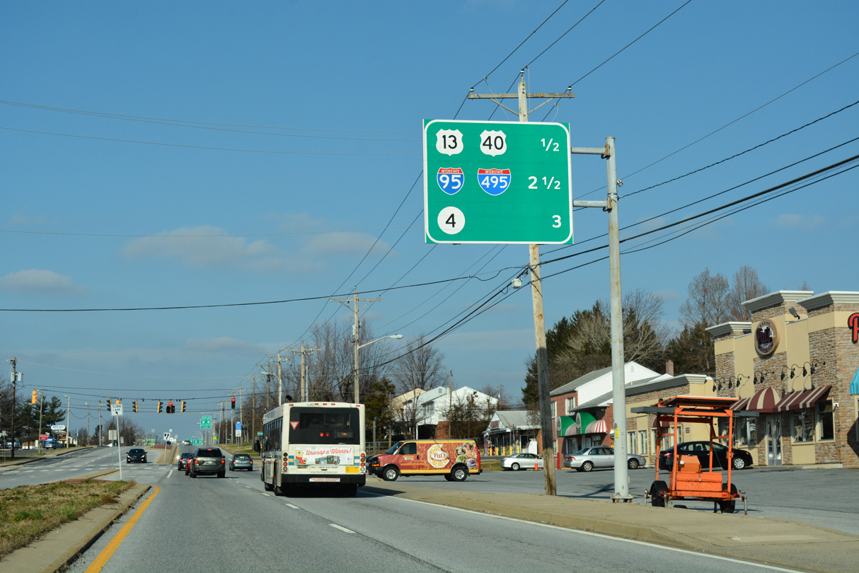
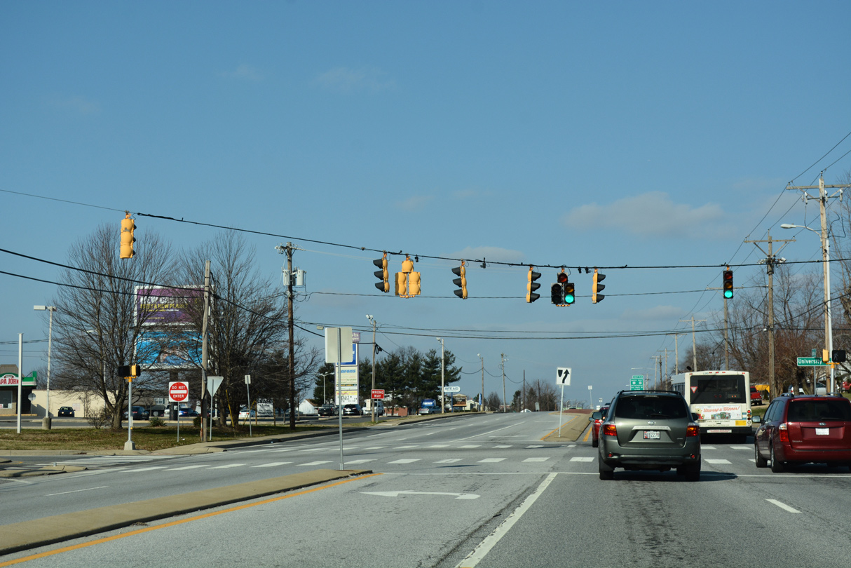
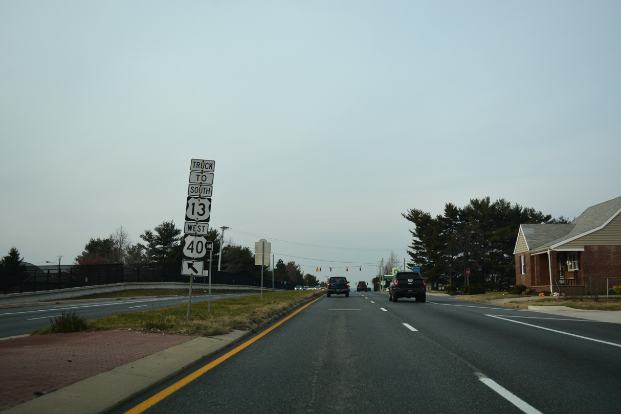
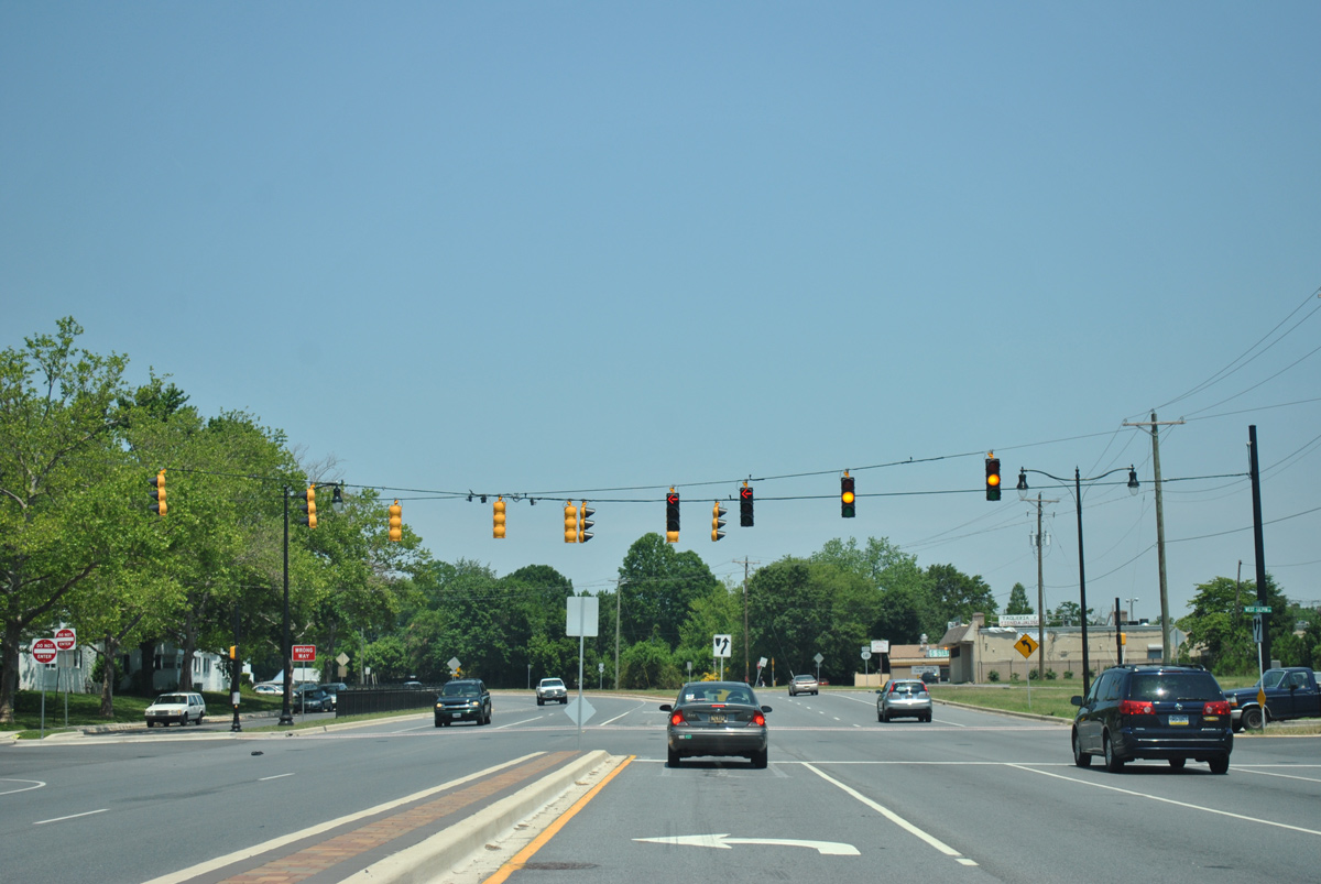
| An interchange sequence sign precedes the traffic light with University Avenue along SR 141 (Basin Road) north. Exit 1A connects with U.S. 13 north / U.S. 40 (Dupont Highway) east in a half mile. The subsequent exits are along the Newport Freeway. 12/23/18 |
|
| University Avenue east provides one of two roads from SR 141 into the Wilmington Manor Gardens subdivision. An apartment complex lies west from the intersection. 12/23/18 |
|
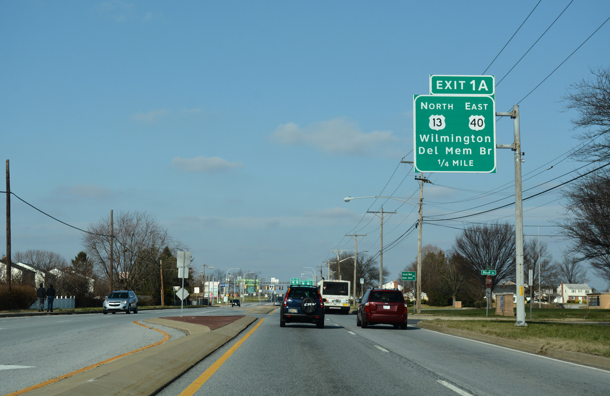
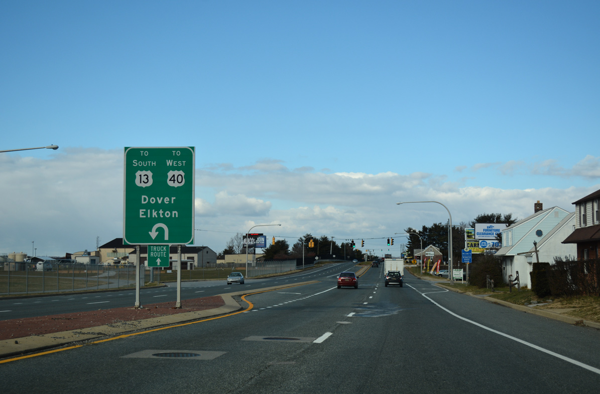
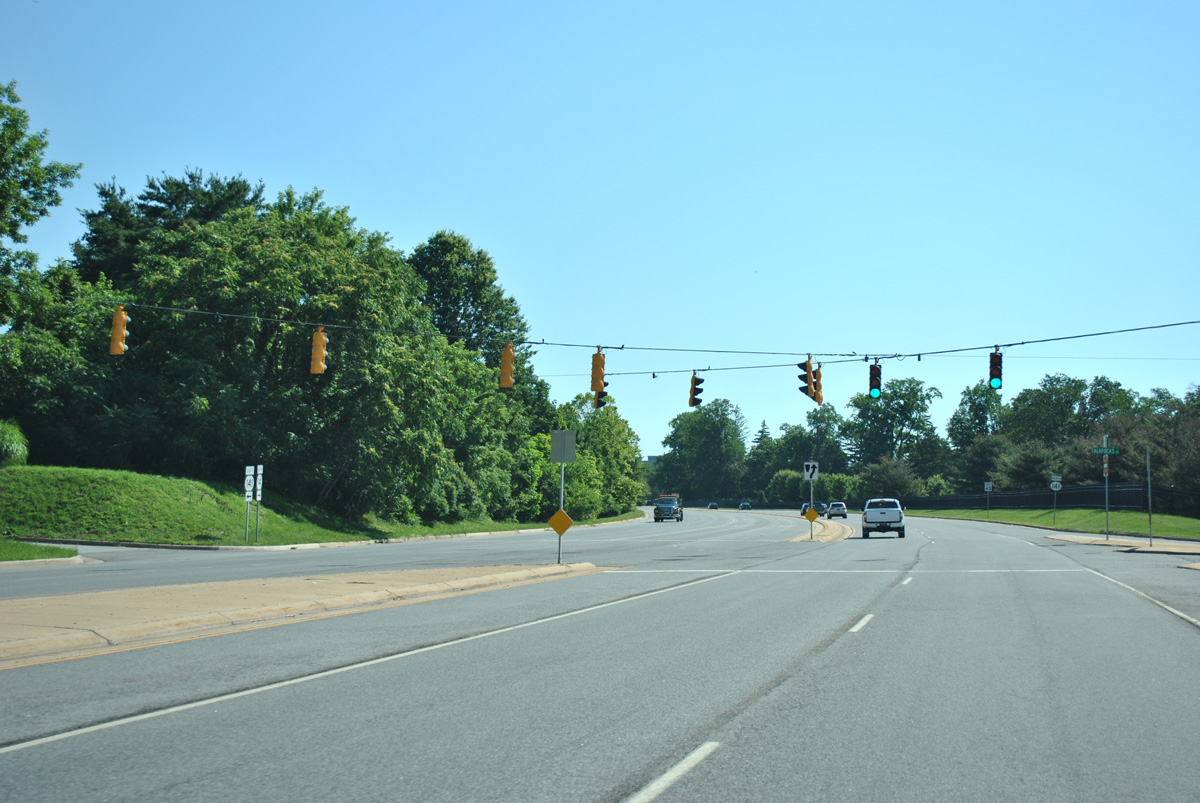
| Advancing north, SR 141 continues one quarter mile to a lane drop at Exit 1A for U.S. 13 north / U.S. 40 (Dupont Highway) east to Wilmington and New Jersey. 12/23/18 |
|
| The SR 141 Basin Road improvement project in 2003-04 rebuilt the arterial north from New Castle to U.S. 13/40 with a new concrete/brick median, curbing and sidewalks. The state route intersects Crippen Drive east to Penn Acres and the entrance to Pencader Shopping Center just ahead of Dupont Highway. 12/23/18 |
|
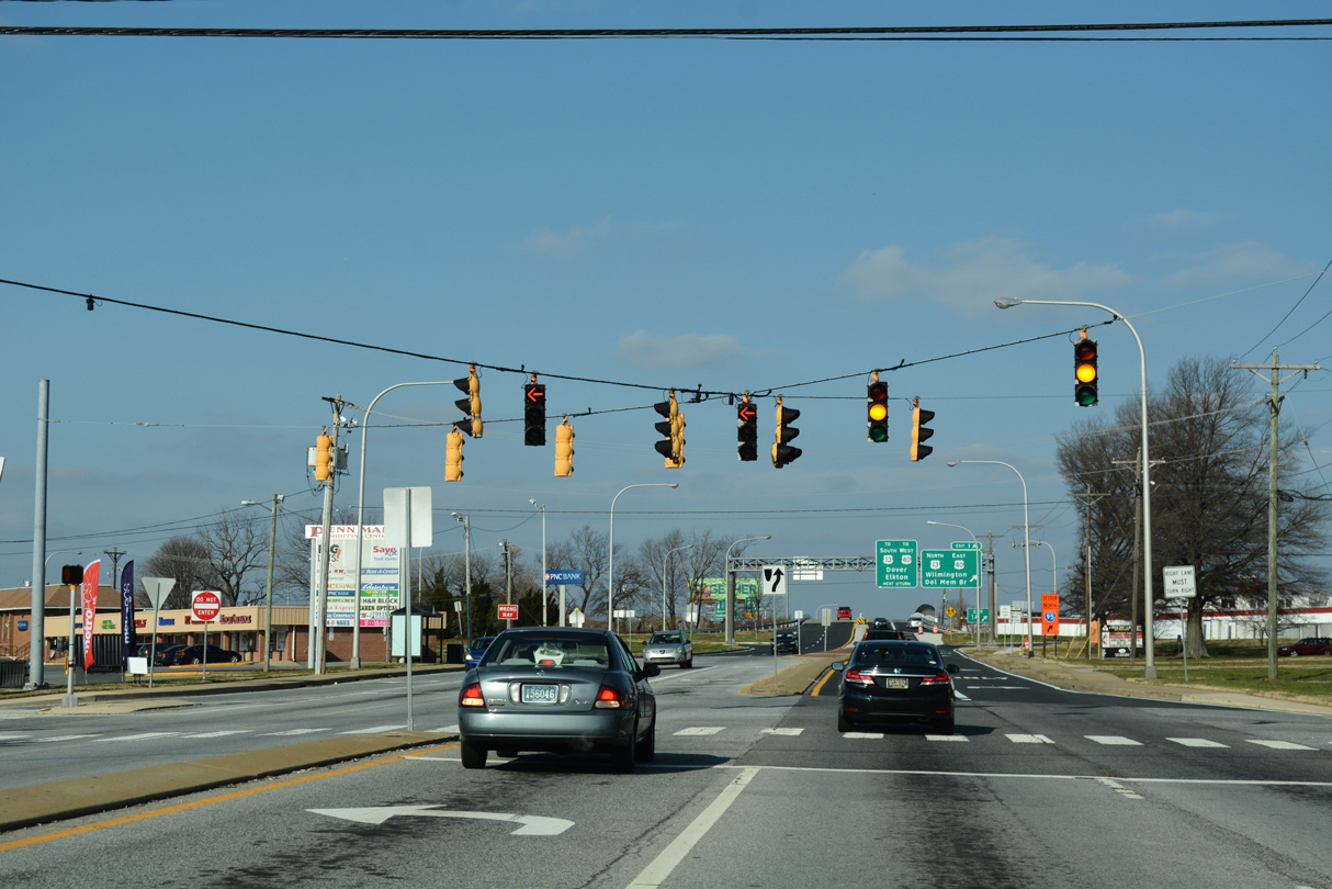
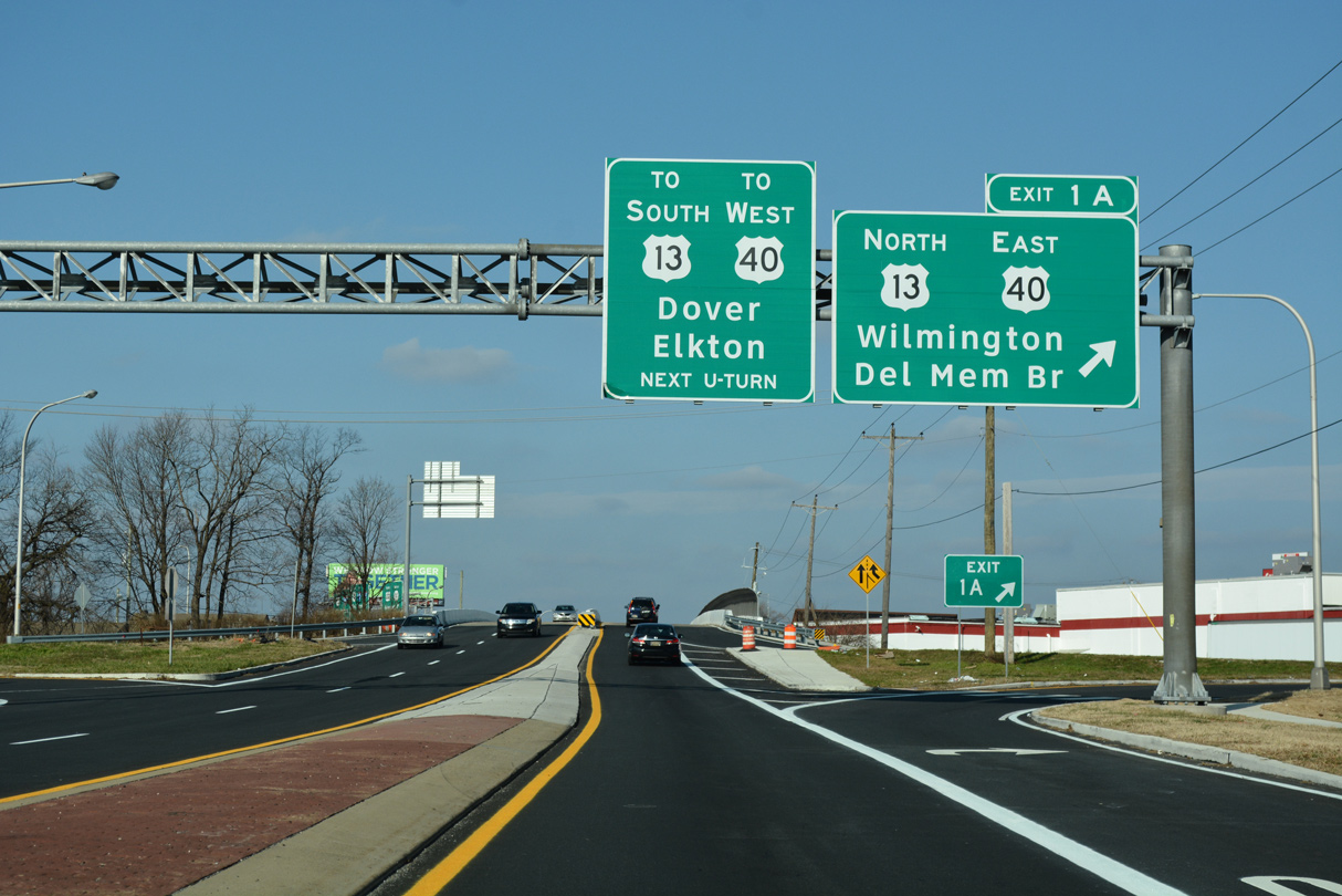
| A three quarter cloverleaf interchange joins SR 141 with U.S. 13/40. Exit 1A provides direct access to Dupont Highway northbound to Farnhurst, where U.S. 40 turns east alongside I-295 north to the Delaware Memorial Bridge. 12/23/18 |
|
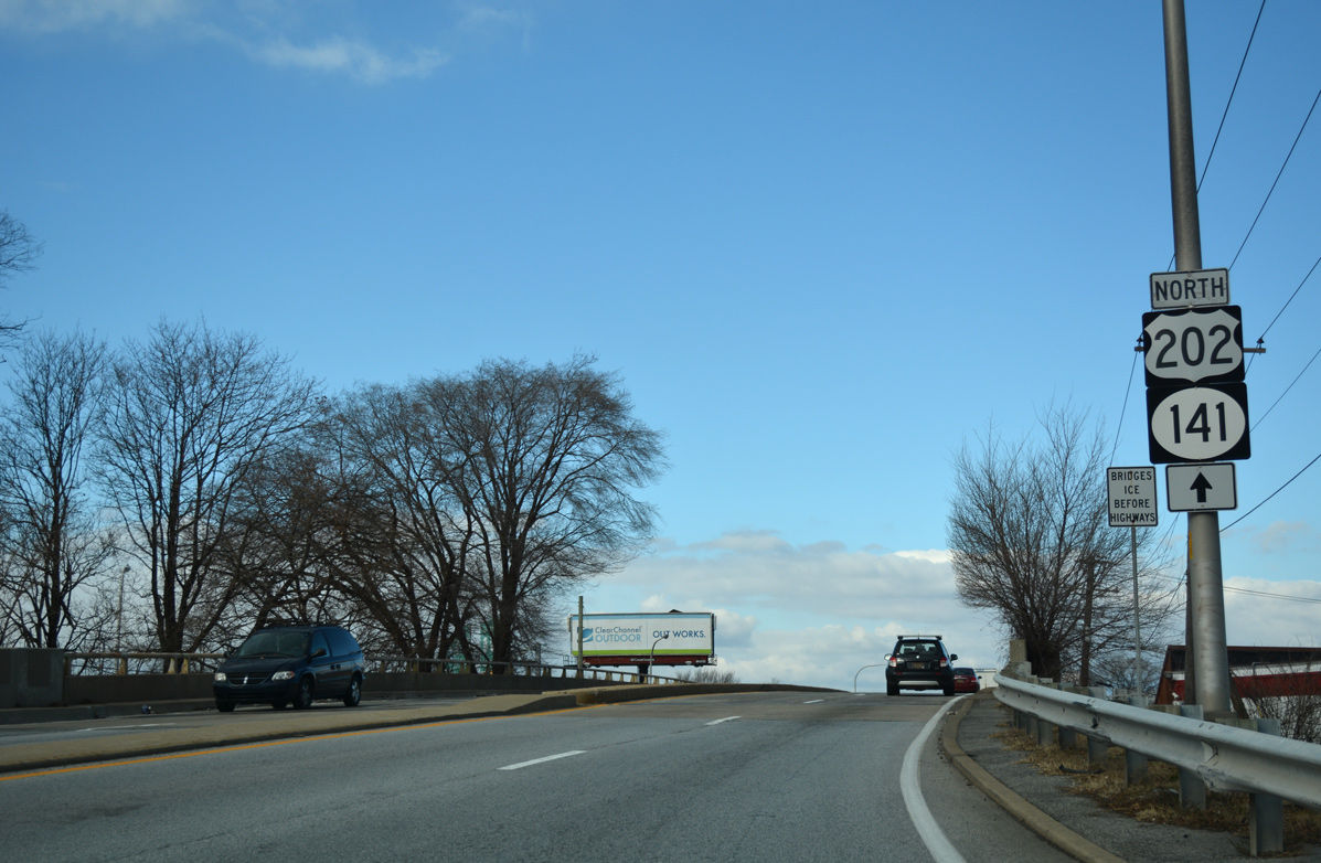
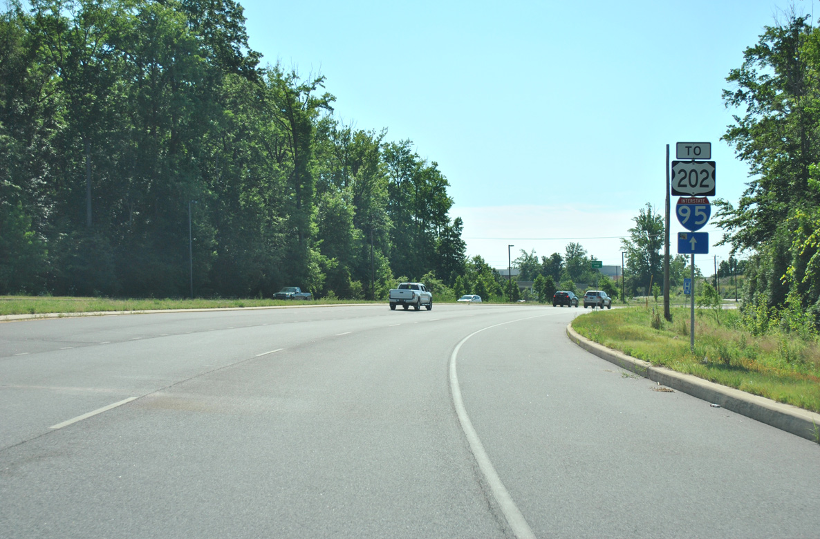
| U.S. 202 begins at the exchange with U.S. 13/40. The first shield appeared at the on-ramp from Dupont Highway north. 2017-18 redecking of the Basin Road span here added a sidewalk along the northbound lanes and reduced through lanes from four to two. This assembly was also removed. 12/30/16 |
|
| Exit 1B previously utilized Delaware and Washington Avenues through the Wilmington Manor community for the movement of SR 141 (Basin Road) north to U.S. 13 south / U.S. 40 (Dupont Highway) west. This SR 141 shield replaced a trailblazer for SR 41. 12/23/18 |
|
| Changes made by 2004 added a signalized intersection and a truck turnaround at Washington Avenue to accommodate a U-turn for the U.S. 13/40 southbound on-ramp to Dupont Highway. 12/30/16 |
|
| Washington Avenue arcs east into Wilmington Manor. The street formerly tied into the c/d lanes of Dupont Highway southbound for SR 141 (Basin Road). 12/30/16 |
|
| Trailblazers remain along Basin Road north for the former truck U-turn area midway between Jay Drive and Commons Boulevard. The forthcoming area closed when the new turnaround was completed at Washington Avenue in 2004. 12/23/16 |
|
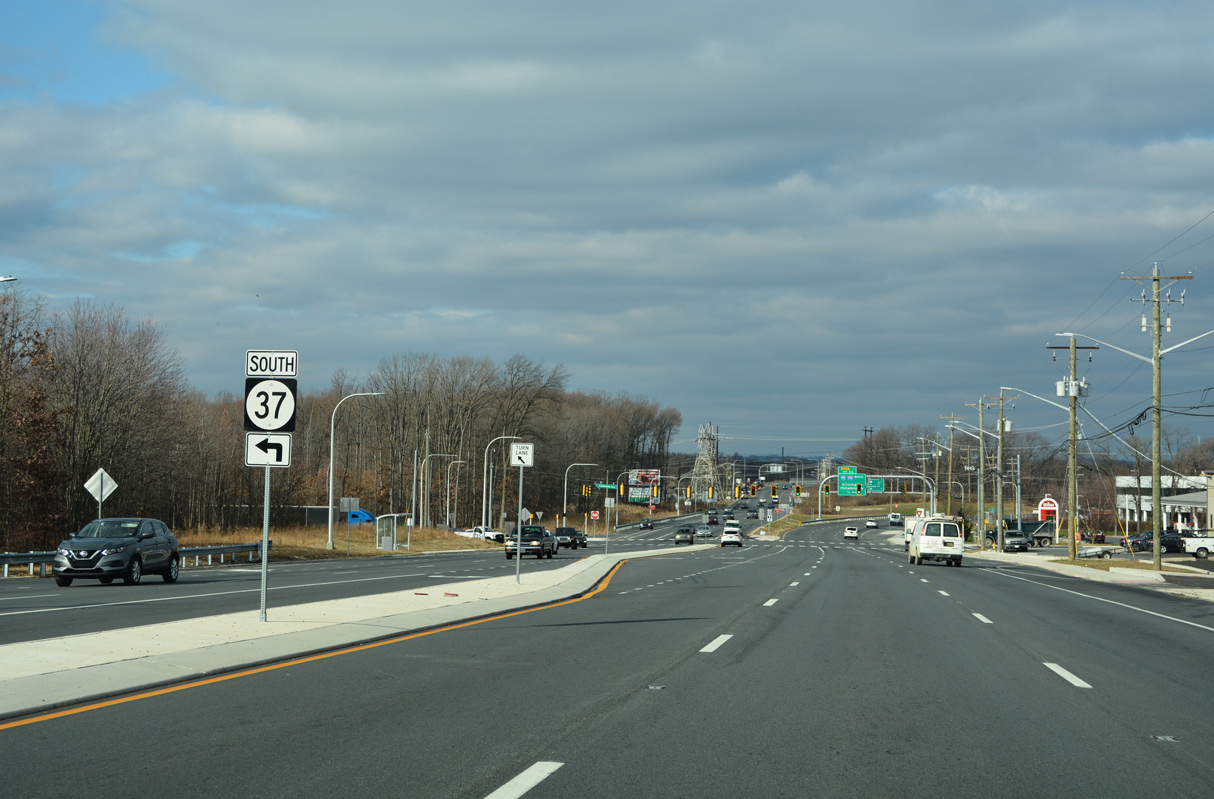
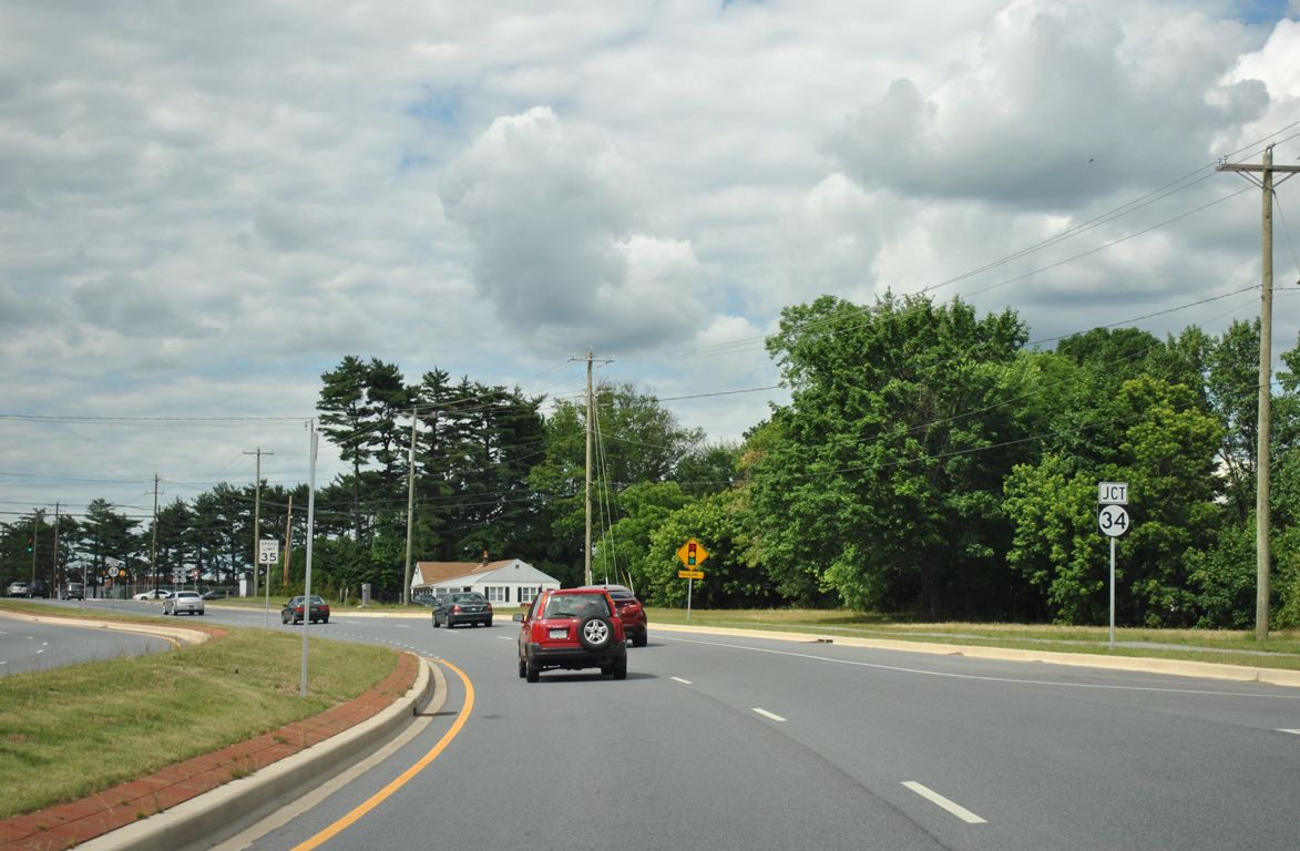
| Continuing north from Jay Drive and the Chelsea Estates community, SR 141 next meets the north end of SR 37 (Commons Boulevard). 12/19/22 |
|
| SR 37 (Commons Boulevard) heads 1.16 miles west along a four lane parkway through Corporate Commons business park. SR 37 joins Airport Road from there along the west side of New Castle County Airport (ILG) en route to SR 273 near Christiana. 12/19/22 |
|
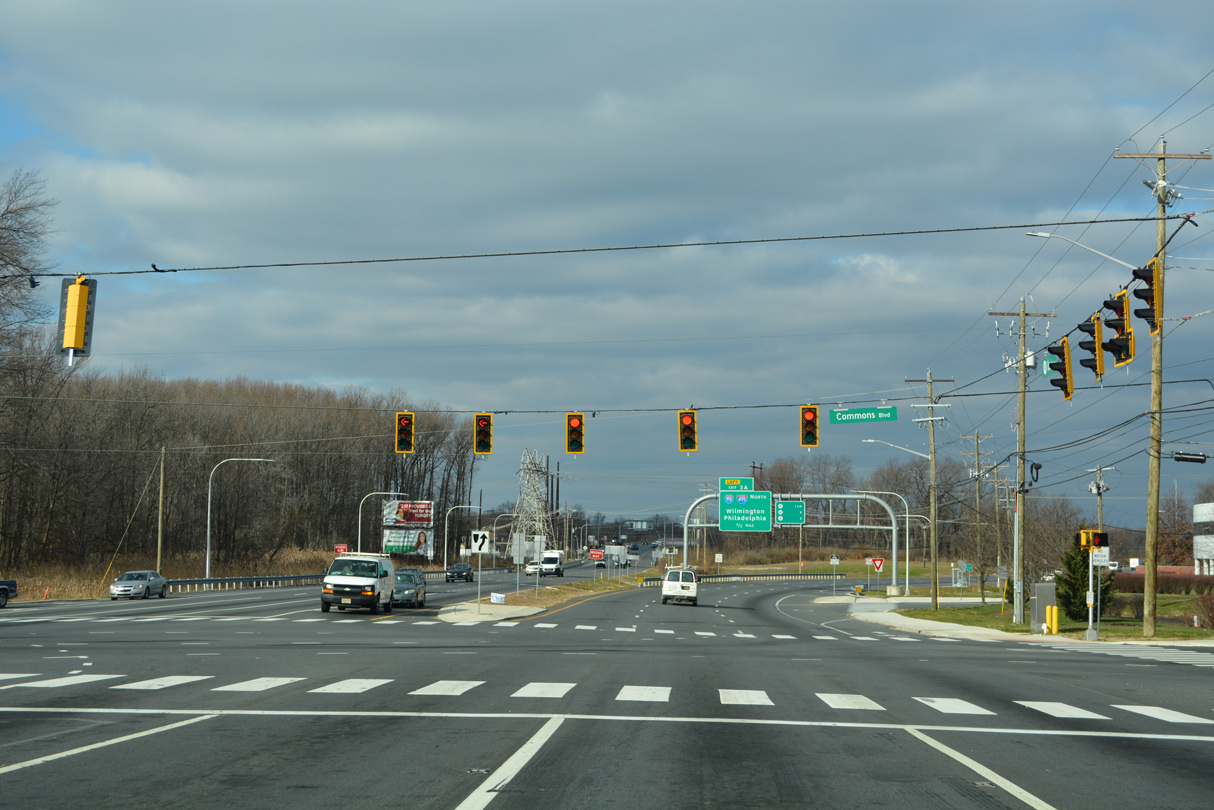
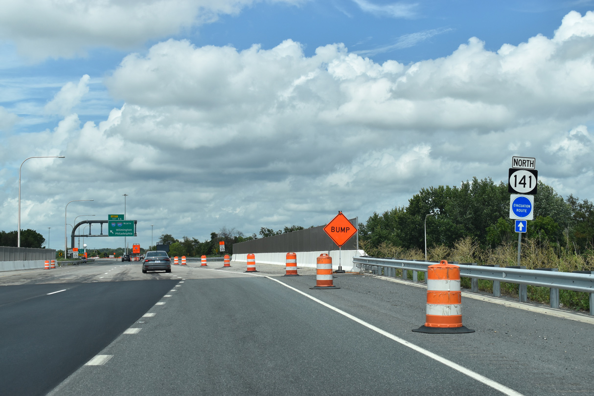
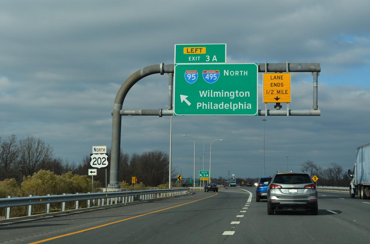
| SR 141 upgrades to a freeway north of Commons Boulevard into a large cloverleaf interchange with I-95. U.S. 202 overlaps with I-95 north from Left Exit 3 A on SR 141 to Exit 8 / Concord Pike, while I-495 bypasses Wilmington to the east via Edgemoor and Claymont. 12/19/22 |
|
| Separate projects from early 2016 to 2019 and from Fall 2019 to Spring 2022 added a third northbound lane to Newport. This work did not include the planned exit ramp to I-295 north. 12/19/22 |
|
| The exchange joining SR 141 with Interstate 95 (Delaware Turnpike) was constructed from 1961 to 1964. It included rerouting and straightening a section of the Christina River. 08/18/21 |
|
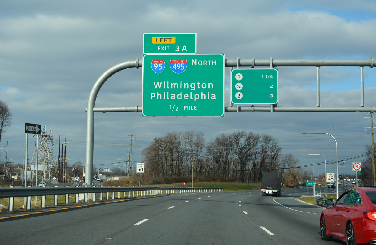
| Left Exit 3 A ramps from both SR 141 roadways combine before merging onto I-95 northbound. 2016-20 construction lengthened the deceleration lane and expanded the loop ramp to two lanes after it combines with the southbound off-ramp. 12/19/22 |
|
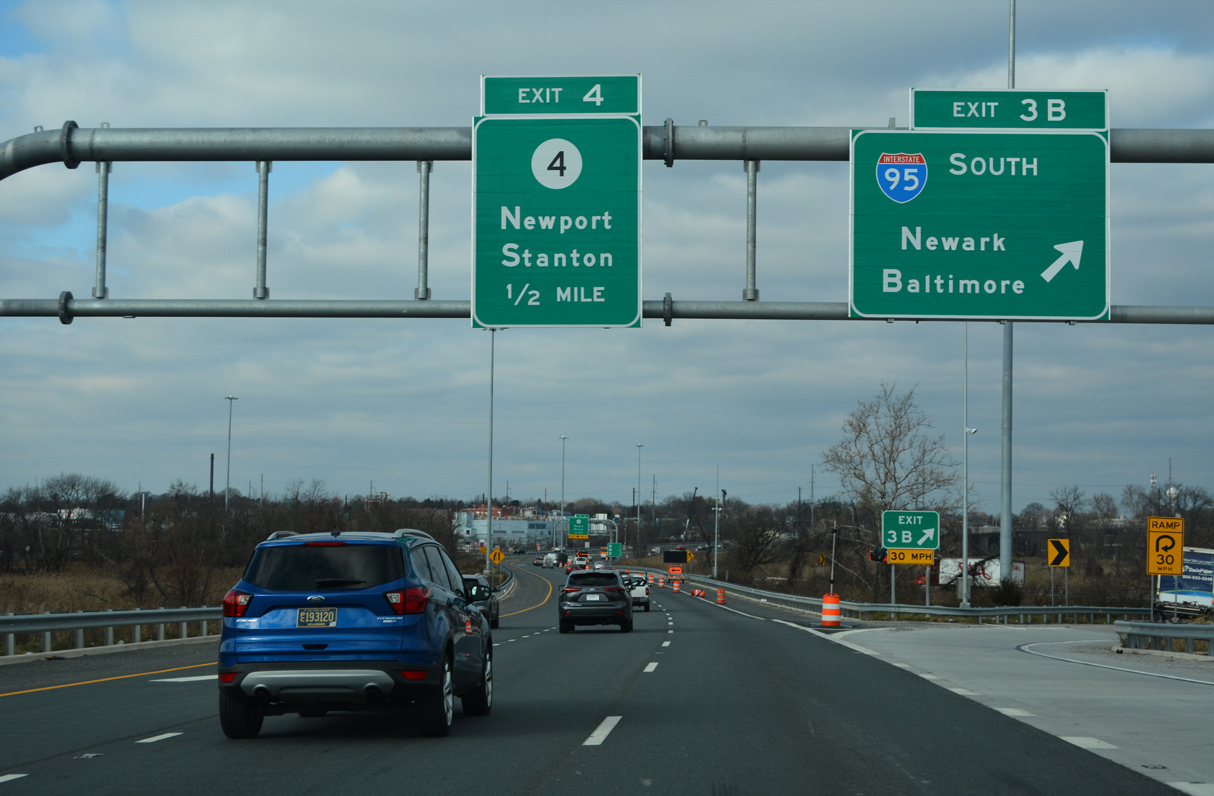
| The entrance ramp from I-295 south to SR 141 adds a short auxiliary lane to Exit 3 B for I-95 south. 2016-20 construction realigned the ramp further south to lengthen the weaving area to Exit 3 B. Exit 3 B joins a c/d roadway ahead of the ten lane stretch on I-95 to SR 1, Churchmans Crossing and Newark. 12/19/22 |
|
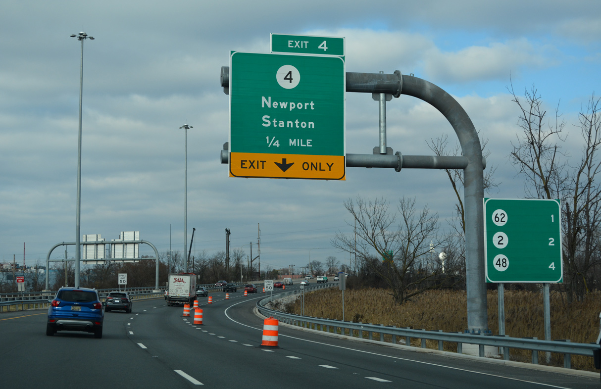
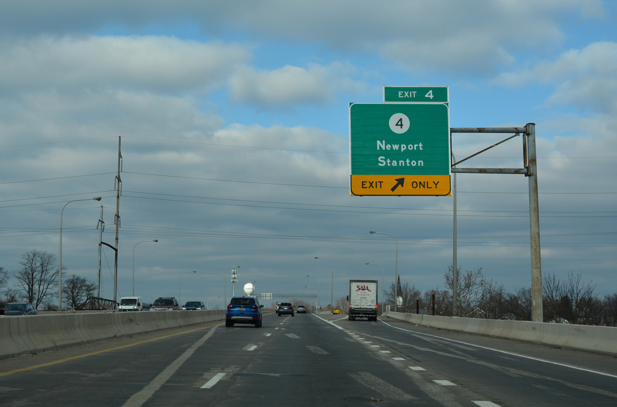
| SR 141 north continues with three lanes across the Christiana River into the town of Newport. A split diamond interchange (Exit 4) lies ahead with SR 4 (Justis / Market Streets). 12/19/22 |
|
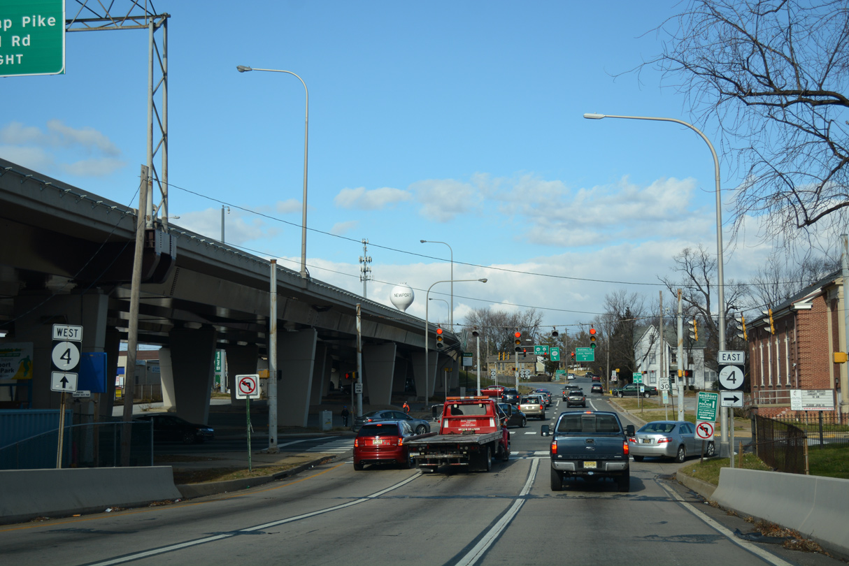
| SR 4 constitutes a four lane boulevard (Newport Pike) west to the community of Stanton and east to Richardson Park. SR 4 separates through Downtown Newport below the SR 141 viaduct. The Newport Freeway viaduct and bridge across the Christina River were redecked in 2012. 12/19/22 |
|
| Exit 4 lowers from SR 141 north to form Marshall Street, an east side frontage street connecting with SR 4 (Justis Street) west. The service road system extends north to SR 62 (Boxwood Road). Routed mostly through suburban or urban areas, SR 4 travels 14 miles overall between west Newark and Browntown in Wilmington. 12/30/16 |
|
| SR 62 (Boxwood Road) angles northwest 1.2 miles from SR 4 (Maryland Avenue) at Richardson Park to converge with SR 141 (Newport Freeway) in a half mile. This overhead was removed in 2022. 08/18/21 |
|
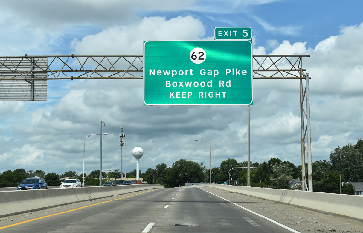
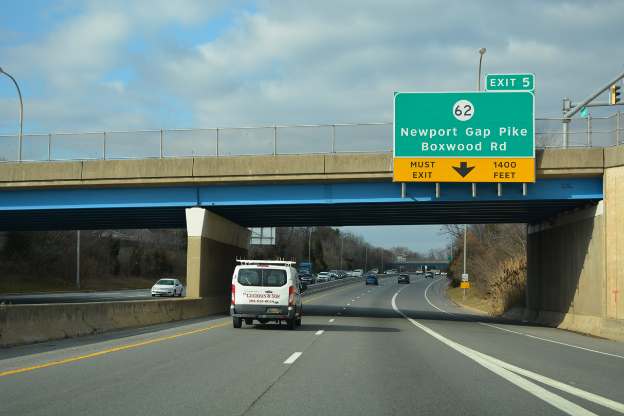
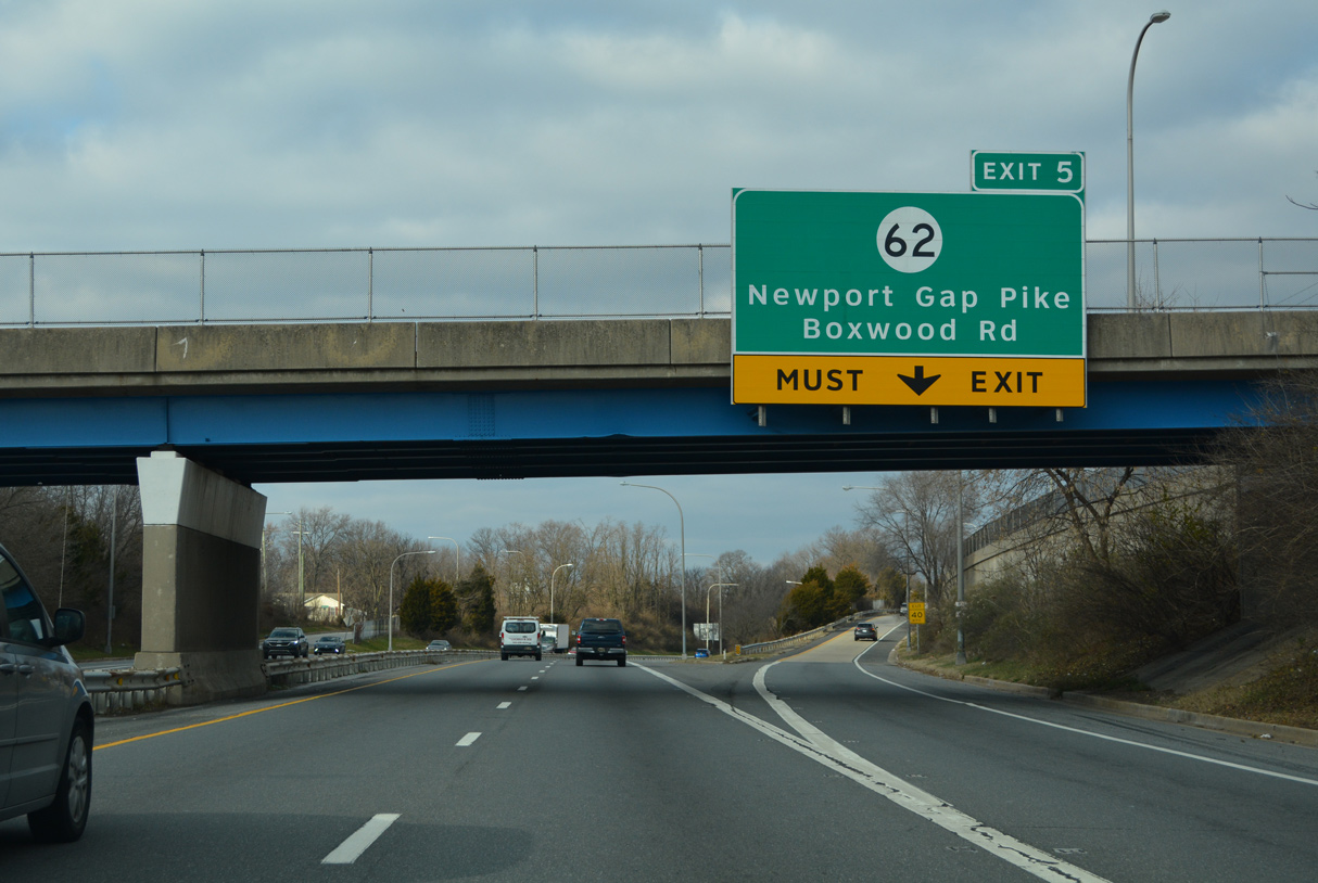
| SR 141 drops below grade between the Westview and Gordy Estates subdivisions to the split diamond interchange (Exit 5) with SR 62. 12/19/22 |
|
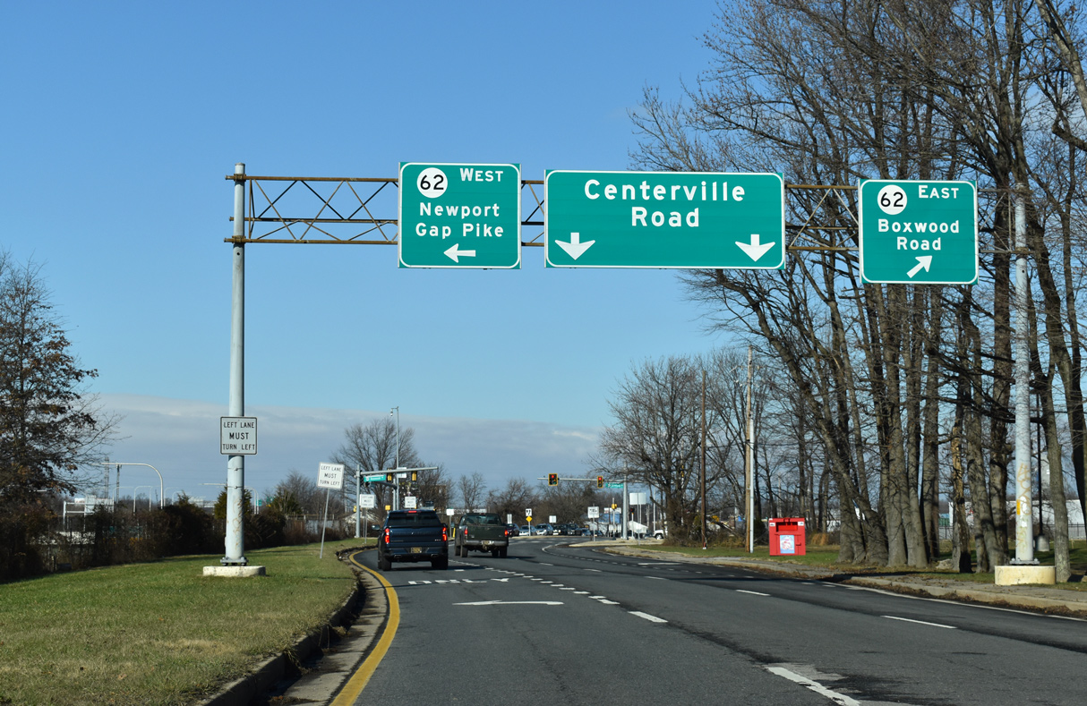
| Exit 5 rises to adjacent Centerville Road (east side frontage road) ahead of SR 62 (Boxwood Road). SR 62 follows Newport Gap Pike (the historic alignment of SR 41) northwest to SR 2/41 at Prices Corner. 12/19/22 |
|
| Centerville Road extends north from SR 62 (Boxwood Road) at the site of a General Motors plant that shut down in 2009 to Prices Corner as the former alignment of SR 141. SR 62 angles northwest to Belvedere and Marshallton. 12/22/20 |
|
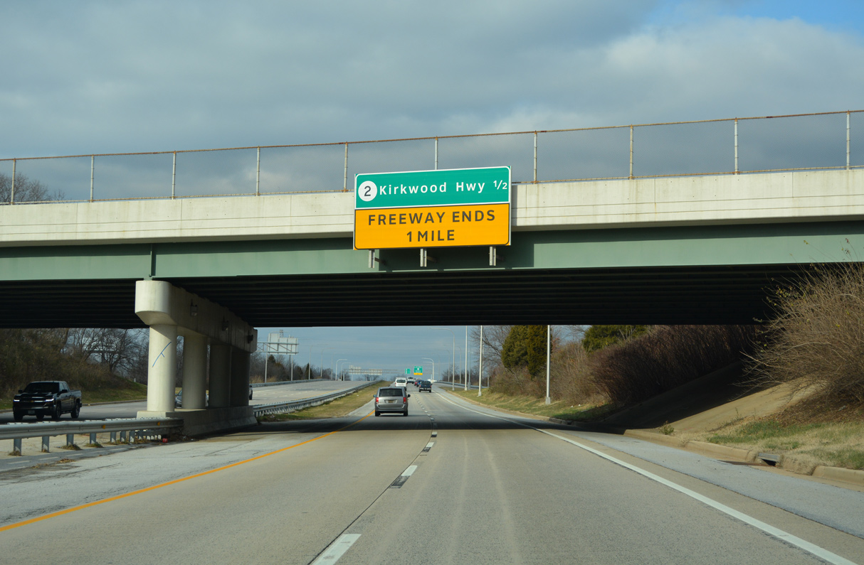
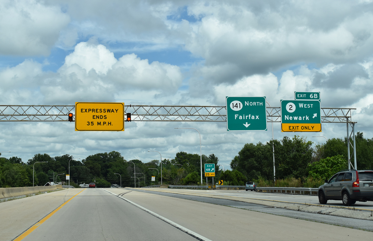
| The Newport Freeway ends one mile north of SR 62 at a directional cloverleaf interchange (Exit 6) with SR 2 (Kirkwood Highway). 12/19/22 |
|
| SR 141 expands to seven lanes from SR 62 to the c/d roadway (Exits 6 A/B) to SR 2 (Kirkwood Highway). An array of sign changes were made in 2015 to reflect the short truncation of SR 41 west to Newport Gap Pike. The change eliminated a redundant overlap leftover from the decades old truncation of SR 41 north from New Castle. 12/19/22 |
|
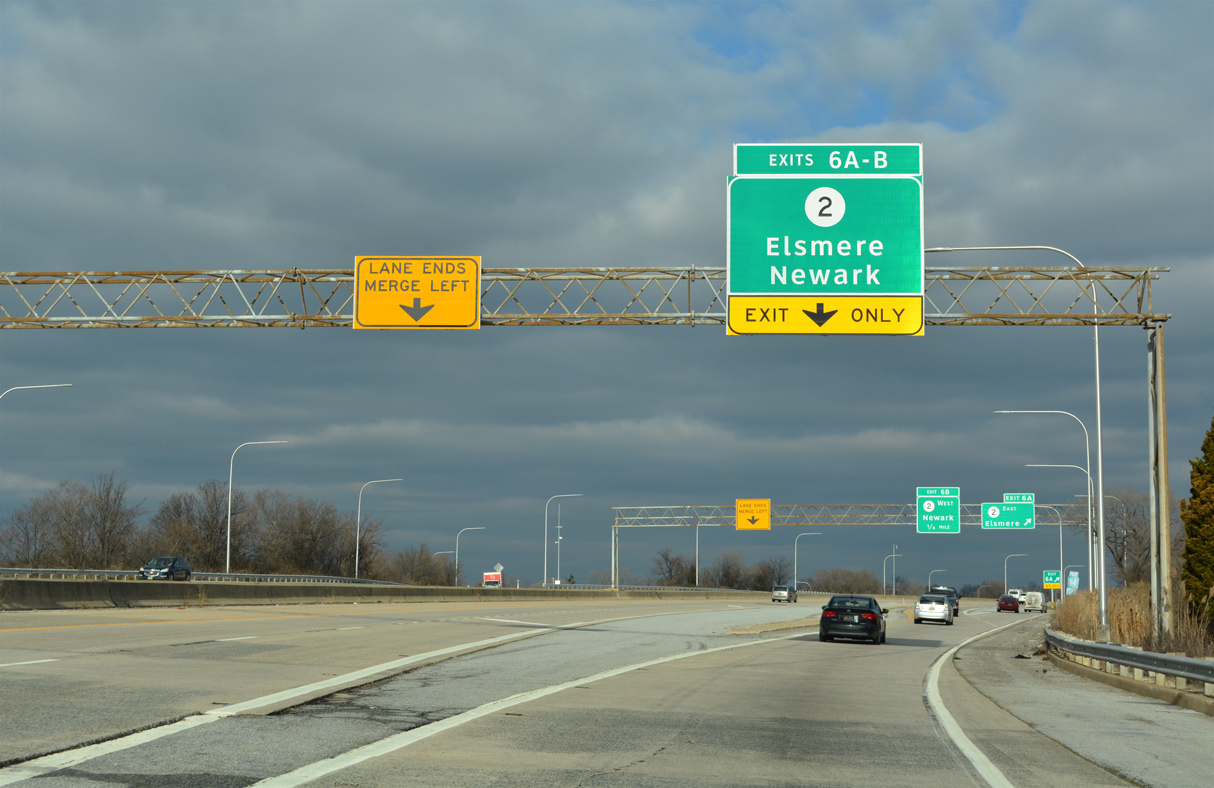
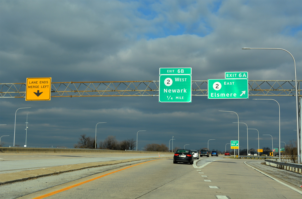
| The c/d roadway for SR 2 (Kirkwood Highway) separates from SR 141 north as the mainline reduces to one lane. Better known as Kirkwood Highway, SR 2 constitutes the main arterial route linking Newark with Elsmere and Wilmington. 12/19/22 |
|
| Exit 6 A departs for SR 2 (Kirkwood Highway) east through the town of Elsmere. The state route enters Wilmington in 2.5 miles, where it separates into a one way couplet en route to SR 52 (Pennsylvania Avenue). 12/19/22 |
|
| Exit 6 B loops onto SR 2 (Kirkwood Highway) west to Prices Corner, the Pike Creek Valley and Newark. The Newport Freeway ends as SR 141 transitions onto a divided four lane boulevard. 08/18/21 |
|
| The c/d roadway combines with SR 141, bringing the northbound roadway back to two lanes. Prior to the SR 141 improvement project along Centre Road, the westbound entrance ramp from SR 2 ended at a stop sign. 06/10/12 |
|
| Reconstruction of SR 141 (Centre Road) north from Kirkwood Highway to Faulkland Road was completed on November 9, 2010. Work expanded the roadway with wider travel lanes, full shoulders and a median. 06/05/12 |
|
| A traffic light was added at Lowry Drive and West Gilpin Drive to provide protected turns into the adjacent Willow Run and Woodland Apartments communities. The west side frontage road was also rebuilt while the east side frontage road was replaced with a new alignment of Gilpin Drive and Montgomery Road. 06/10/12 |
|
| A reassurance marker for SR 141 was added after Gilpin Drive by 2010. 06/10/12 |
|
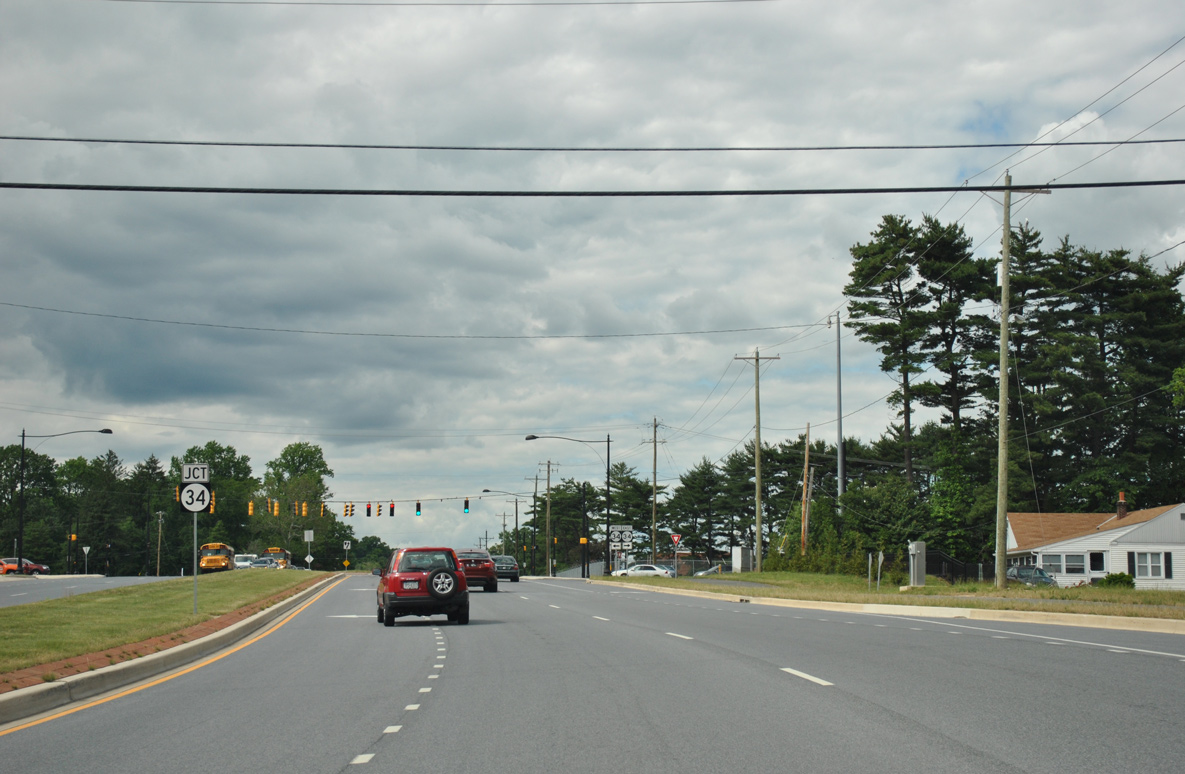
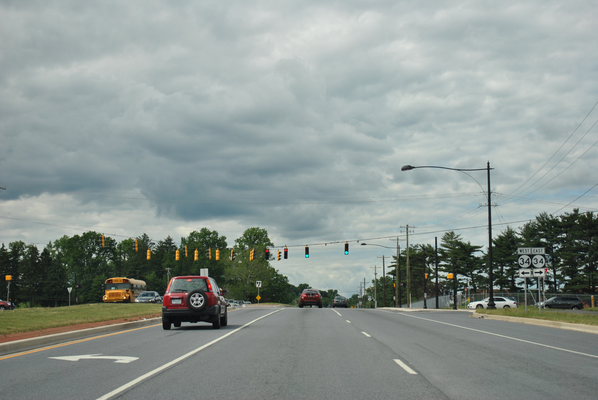
| Curving northward, SR 141 (Centre Road) next intersects Faulkand Road, formerly SR 34 east toward Wilmington and west to SR 41 (Newport Gap Pike). 06/10/12 |
|
| Faulkland Road (old SR 34) winds east to SR 100 (Dupont Road) and west to Brandywine Springs Park and Duncan Road near Delcastle Park. 06/10/12 |
|
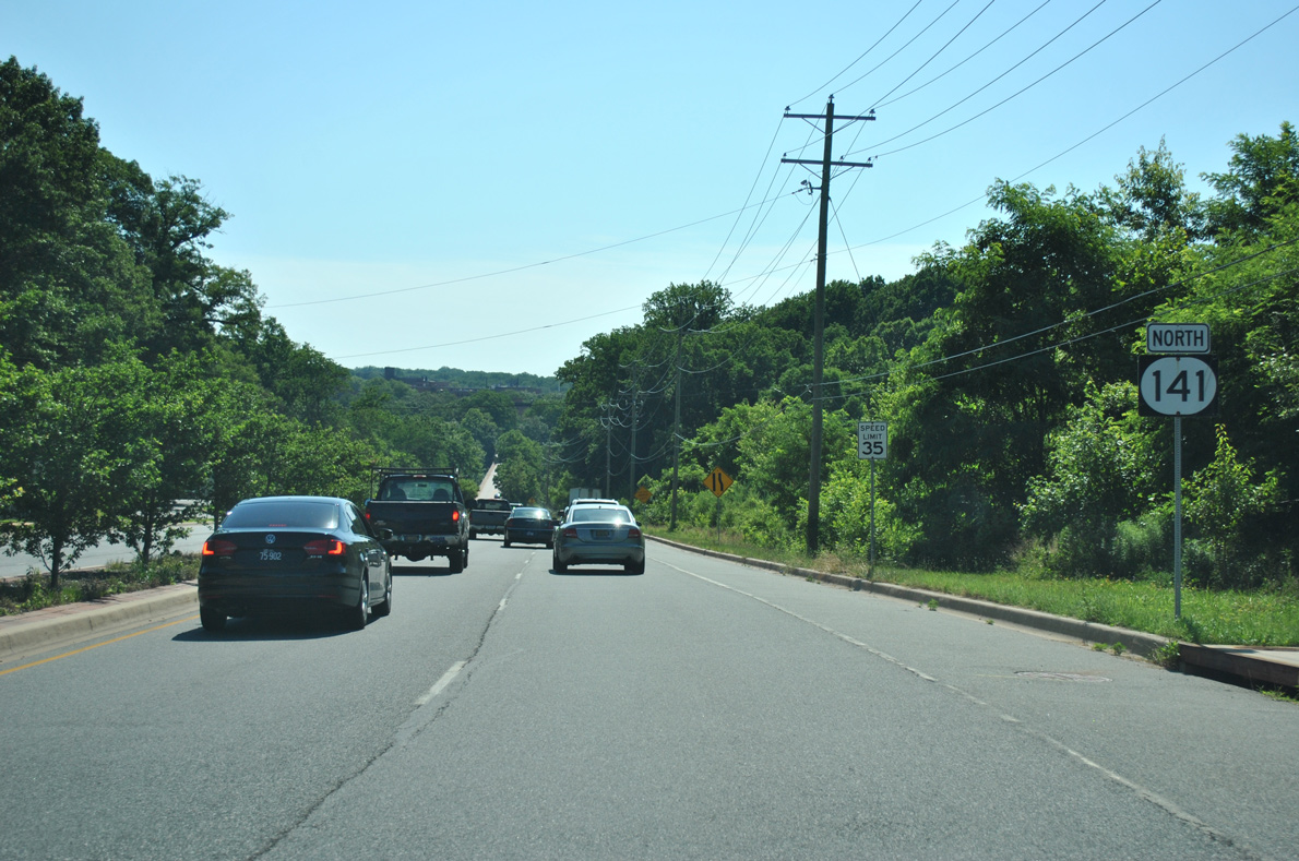
| Confirming marker for SR 141 north of Faulkland Road. A multi use path was added along this stretch by 2007. 12/23/18 |
|
| SR 141 (Centre Road) constitutes a controlled access arterial northward from Faulkand Road to Barley Mill Road. The first of four signals operates at the entrance to the Delle Donne Corporate Center. 12/23/18 |
|
| Chestnut Run and a frontage road connects SR 141 with the north side of the Delle Donne Corporate Center at the ensuing northbound signal. 12/23/18 |
|
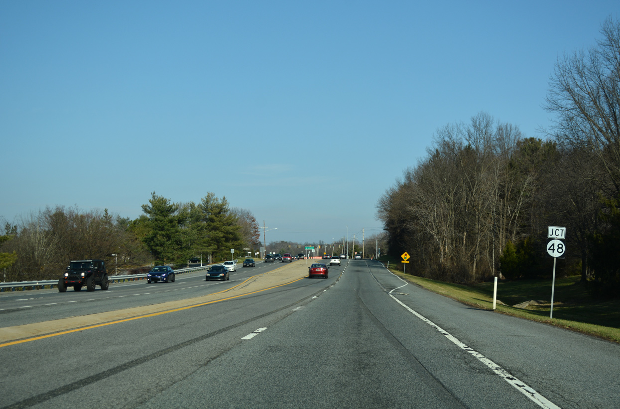
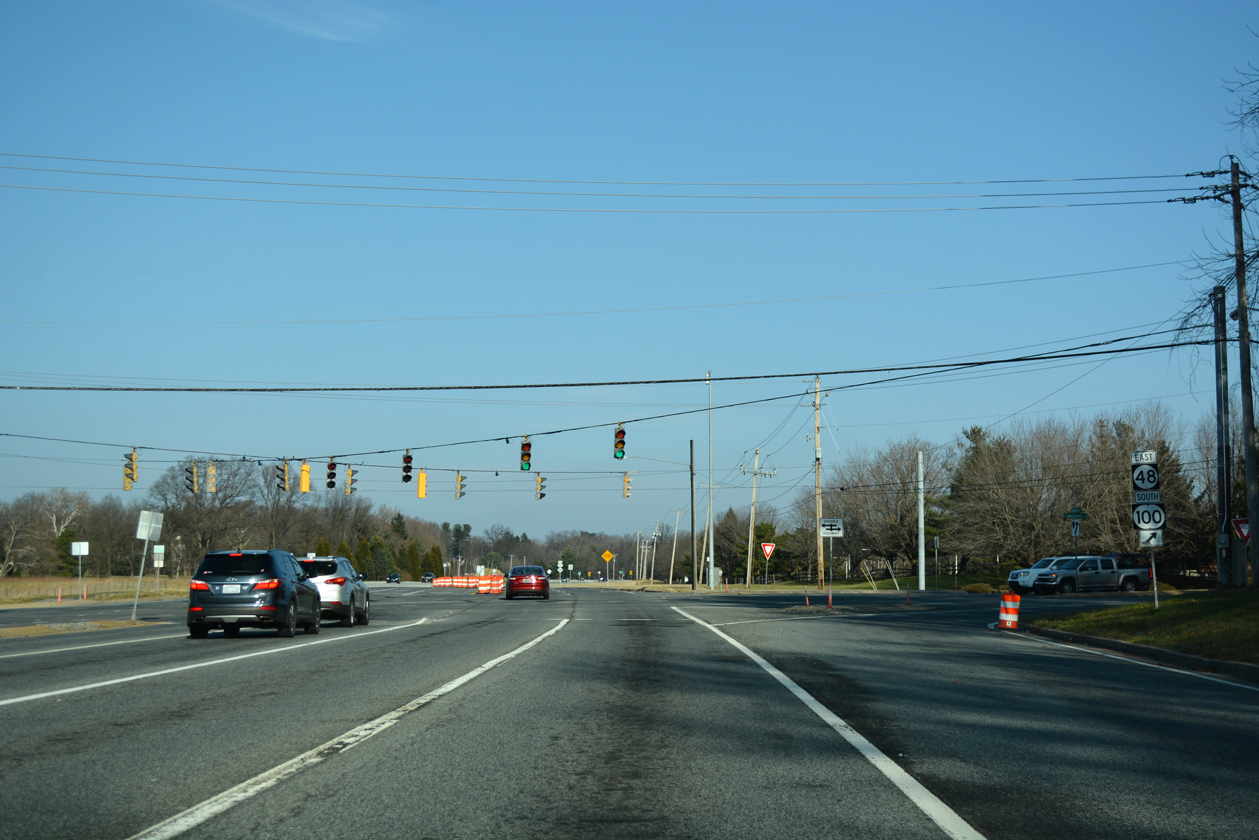
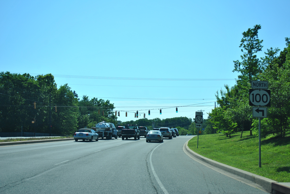
| Turning more northeasterly, SR 141 (Centre Road) nears the expansive intersection with SR 48 (Lancaster Pike) and SR 100 south. 12/23/18 |
|
| SR 48/100 combine for one mile south along Lancaster Pike to Dupont Road in Wilmington. SR 48 proceeds southeast to the Greenhill and Hilltop neighborhoods of the city before ending at U.S. 13 Business south of Downtown. 12/23/18 |
|
| Undeveloped tracts allude to a former planned interchange with SR 48. SR 48 (Lancaster Pike) leads west through a mixture of upper end subdivisions and forested hills to a wye intersection with SR 41 ahead of Hockessin. 06/23/12 |
|
| Until 1989, SR 100 followed Dupont Road north from Wilmington through the Westover Hills community to SR 52 (Kennett Pike) and a dogleg north to Montchanin Road. The state route was realigned onto overlaps with SR 48 and SR 141 north to Greenville to move truck traffic away from Westover Hills. 12/23/18 |
|
| Centre Road becomes Barley Mill Road at the SR 100/141 intersection with Barley Mill Plaza. The western segment of Barley Mill Road heads north and then west to Ashland. 12/23/18 |
|
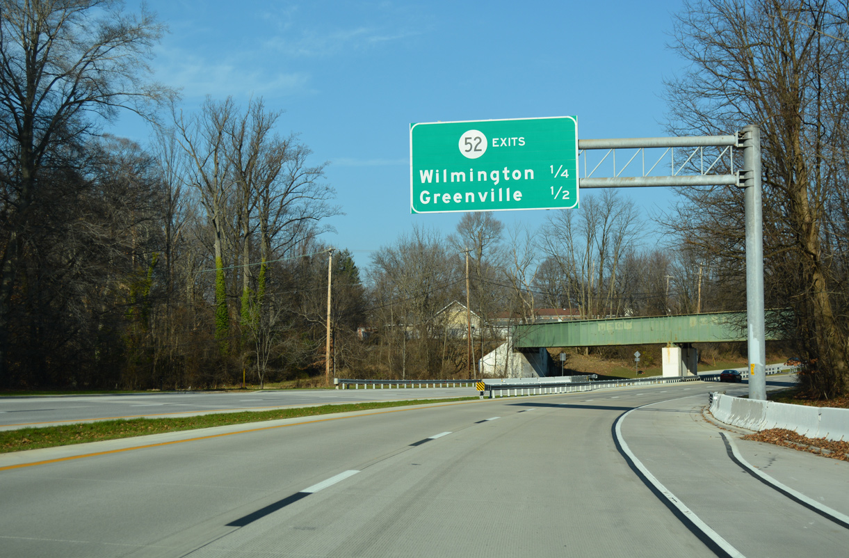
| SR 100/141 (Barley Mill Road) upgrade to a 0.9 mile long expressway. The limited access highway passes underneath the Brandywine Valley Railroad ahead of the parclo interchange with SR 52 (Kennett Pike). 12/23/18 |
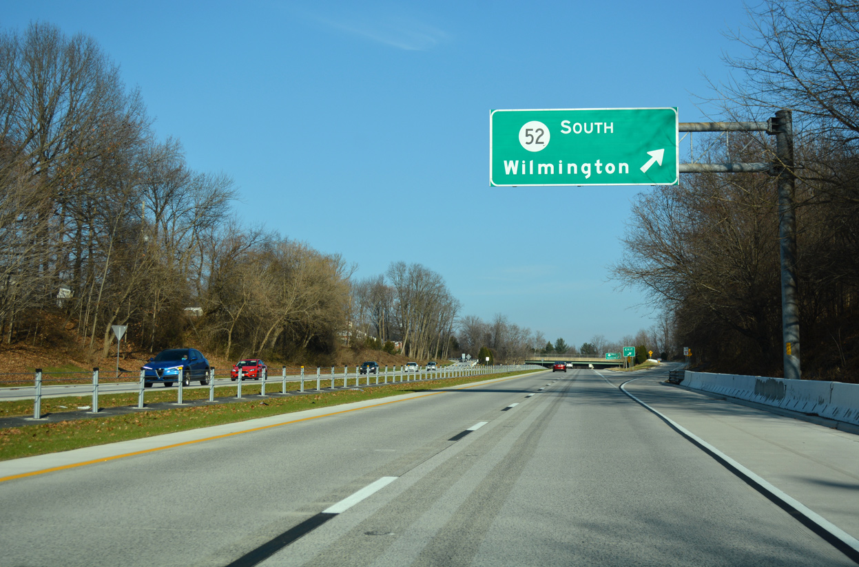
|
| SR 52 (Kennett Pike) leads south to Wilmington. The state route follows Pennsylvania Avenue, a four lane boulevard, southeast from Highlands and Wawaset in north Wilmington to a couplet through Downtown. 12/23/18 |
|
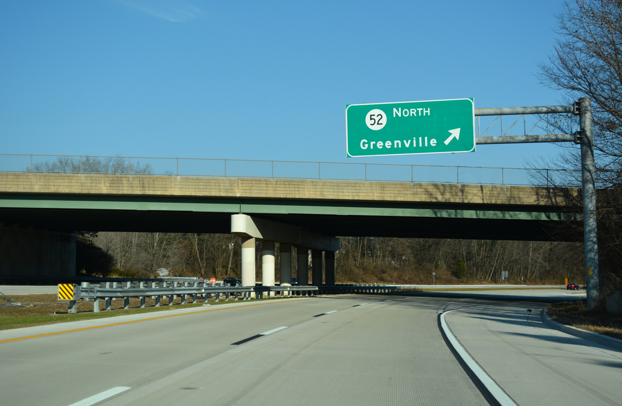
| A loop ramp follows at the 1976-built overpass for Kennett Pike to SR 52 north through Greenville. The state route extends north from Centerville to Fairville and Mendenhall as PA 52. 12/23/18 |
|
| 2004-05 construction expanded both the intersection with Montchanin Road and the succeeding stretch of Barley Mill Road east. SR 100 turns north ahead to resume its course to Montchanin and Chester County, Pennsylvania. 06/23/12 |
|
| Road work in 2004 included the installation of the SR 92 Truck trailblazer ahead of Montchanin Road. SR 92 stems east from SR 100 at Brandywine Creek State Park to the Brandywine Hundred area and U.S. 202. While the truck route is unmarked east of here, it likely follows SR 141 north to U.S. 202, as SR 92 west of U.S. 202 (Concord Pike) consists of a winding rural road. 06/23/12 |
|
| SR 100 takes a scenic route 4.8 miles north to the state line. PA 100 continued the multi state route from there to West Chester until 2002. 06/23/12 |
|
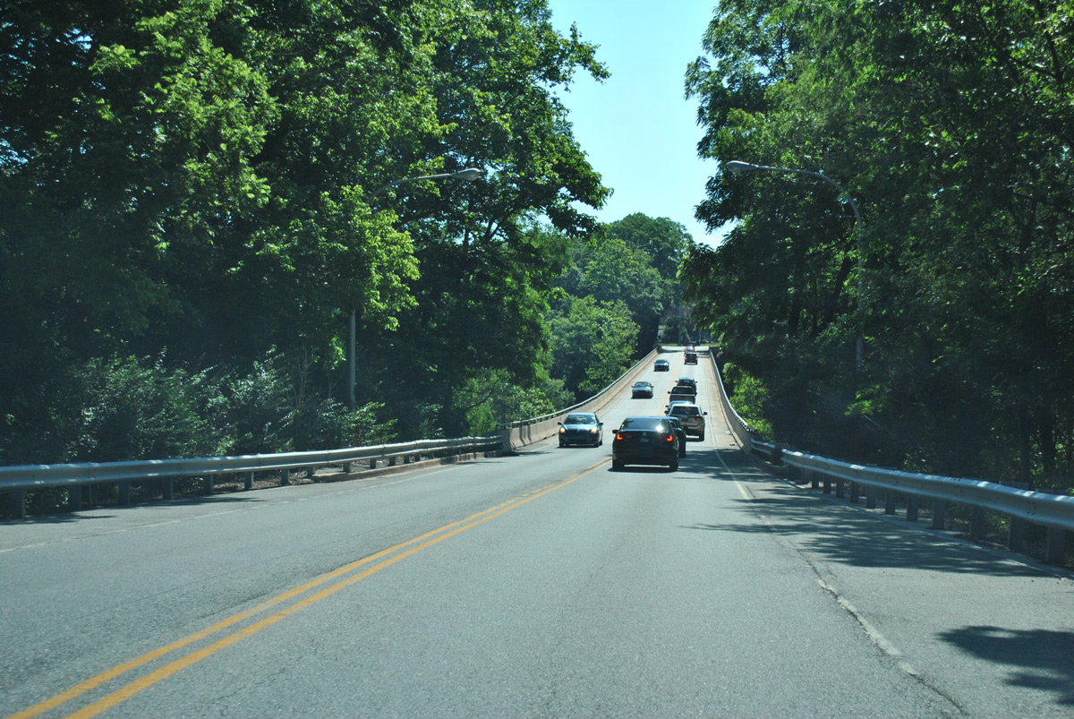
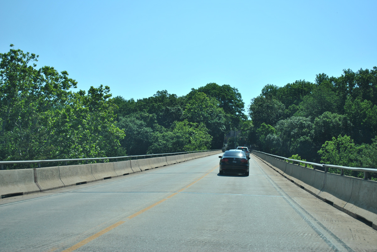
| SR 141 lowers around 50 feet in elevation to the Tyler McConnell Bridge, a third of mile east of SR 100 (Montchanin Road). 06/23/12 |
|
| Despite several proposals to either widen or replace the Tyler McConnell Bridge with a new four lane span, the steel-girder bridge remains in operation with just two lanes. 06/23/12 |
|
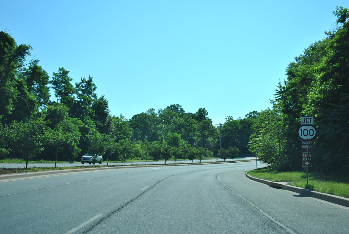
| The Tyler McConnell Bridge opened to traffic in December 1952. It crosses high above Brandywine Creek, just south of the historic Hagley Museum. 06/23/12 |
|
| SR 141 turns northward onto Powder Mill Road from the end of the Tyler McConnell Bridge. The intersection ties into the entrance for the Dupont Experimental Station and New Bridge Road south to the Rising Sun Lane bridge into Wilmington. 06/23/12 |
|
| SR 141 (Powder Mill Road) expands into a controlled access expressway ahead of Alapocas Drive. Alapocas Drive meanders south to Alapocas Run State Park and Augustine Cutoff outside Wilmington. 06/23/12 |
|
| The SR 141 expressway passes south of Dupont Country Club and north of A.I. Dupont Hospital for Children to the Rockland Road underpass. 06/23/12 |
|
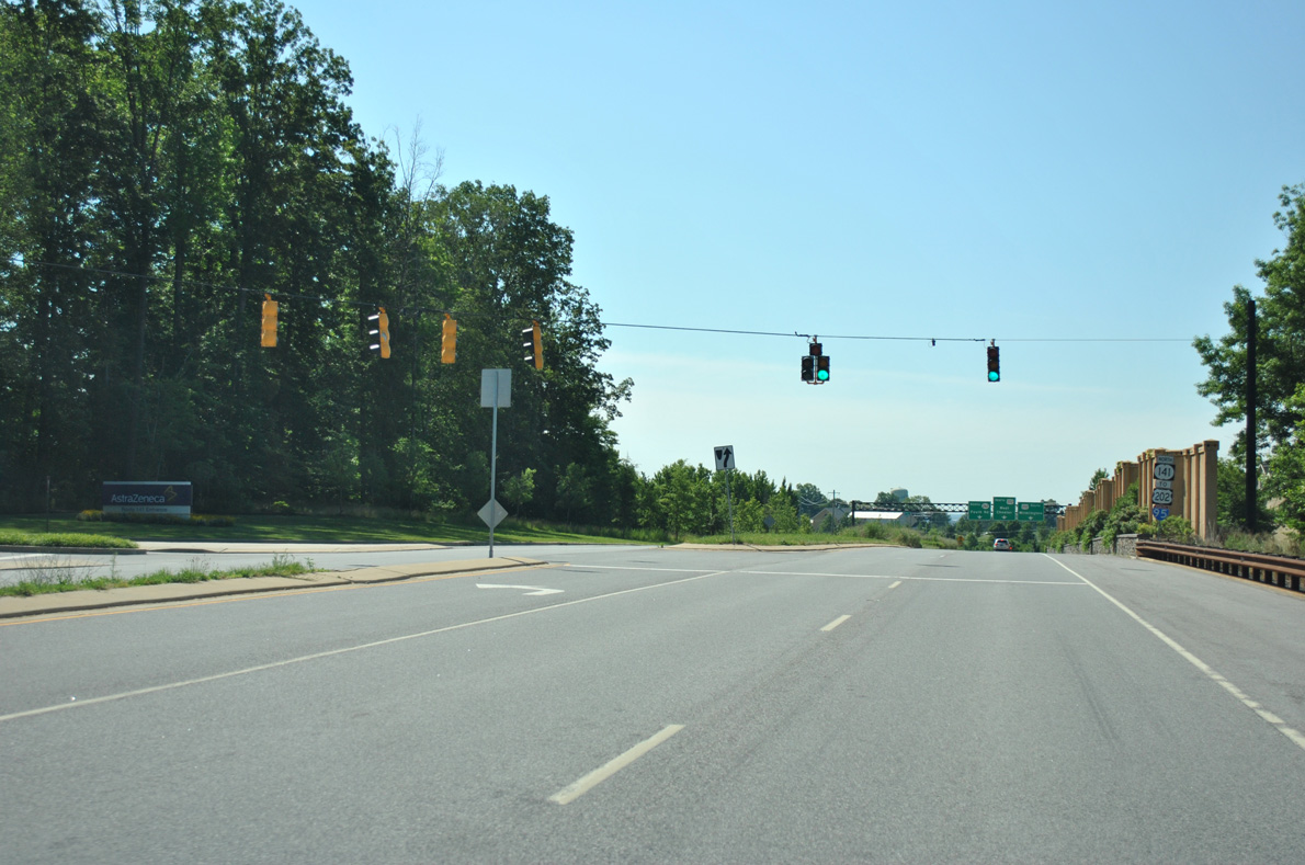
| Trailblazers for U.S. 202 and Interstate 95 stand along the SR 141 southward curve ahead of Childrens Drive west and Powder Mill Road east. The state route formerly continued east from here directly to U.S. 202 (Concord Pike). It shifted south to accommodate construction of the AstraZenica campus by 2000, and again onto Route 141 Spur during the Blue Ball projects in 2006. 06/23/12 |
|
| Powder Mill Road branches east from SR 141 as an unnumbered arterial to U.S. 202 (Concord Pike) at Murphy Road in Fairfax. Childrens Drive links the state route with Rockland Road and A.I. Dupont Hospital for Children to the west. 06/23/12 |
|
| SR 141 northbound actually travels southeast for the next 0.6 miles to U.S. 202 along Route 141 Spur. 12/23/06 |
|
| The JP Morgan Chase campus spreads south of Powder Mill Road to two entrances along Route 141 Spur. 06/23/12 |
|
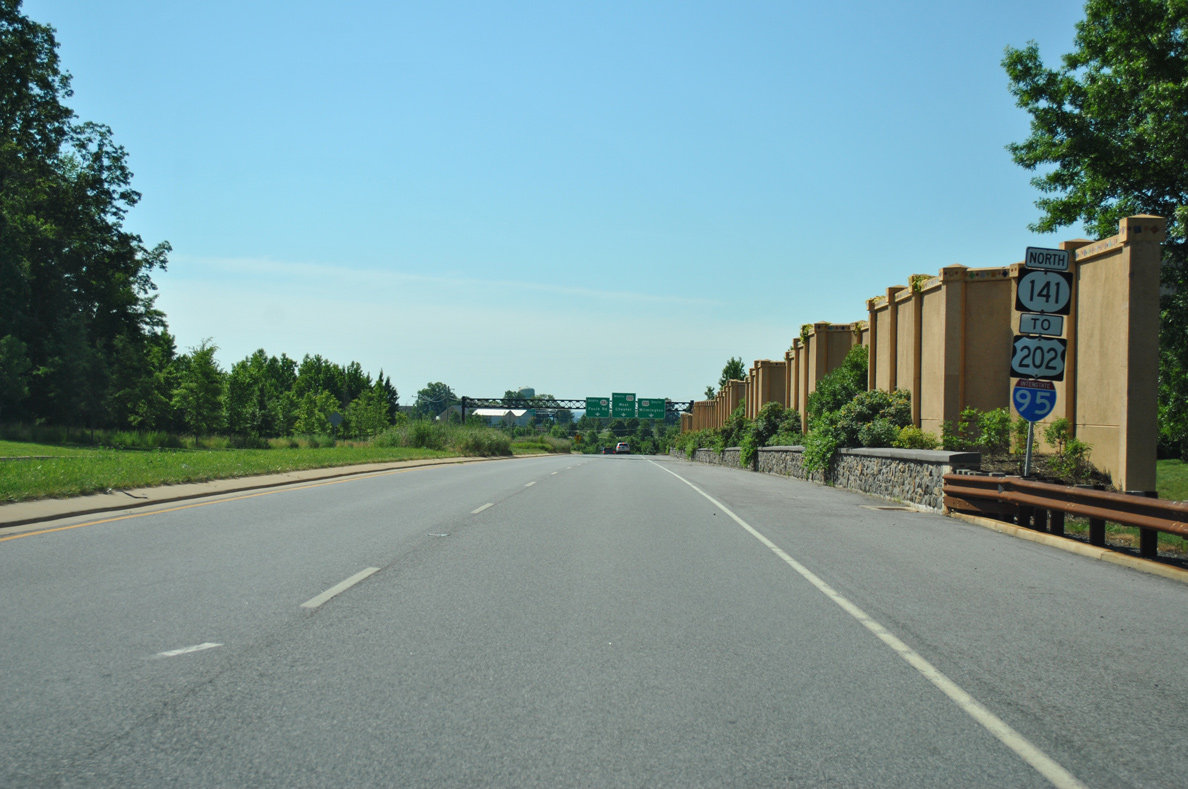
| The last confirming marker for SR 141 north appears alongside sound barriers separating Route 141 Spur from parallel Rockland Road. 06/23/12 |
|
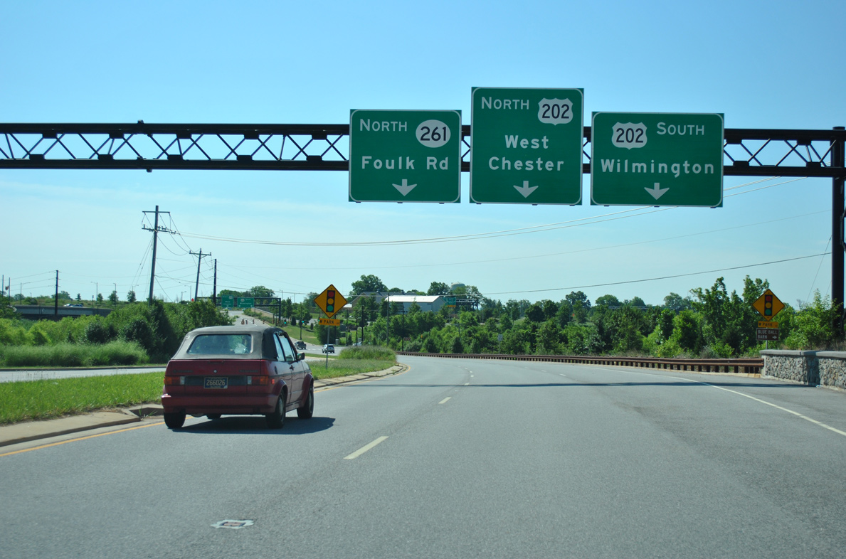
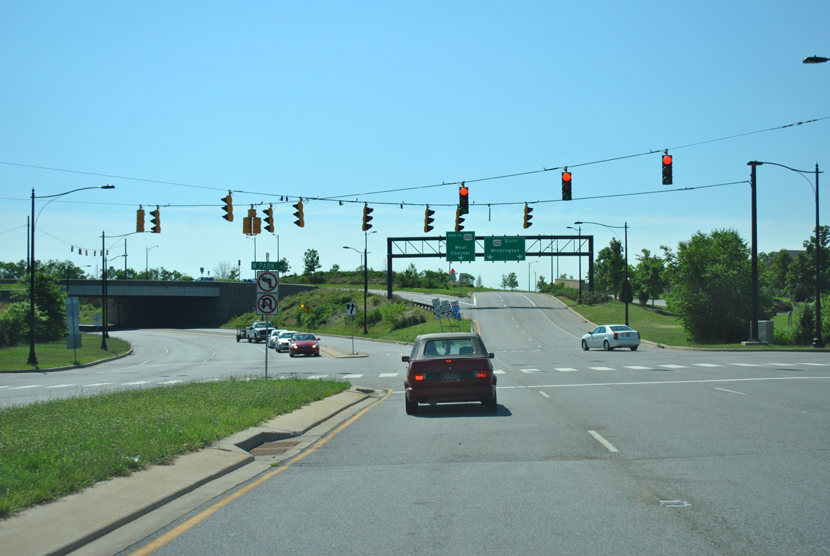
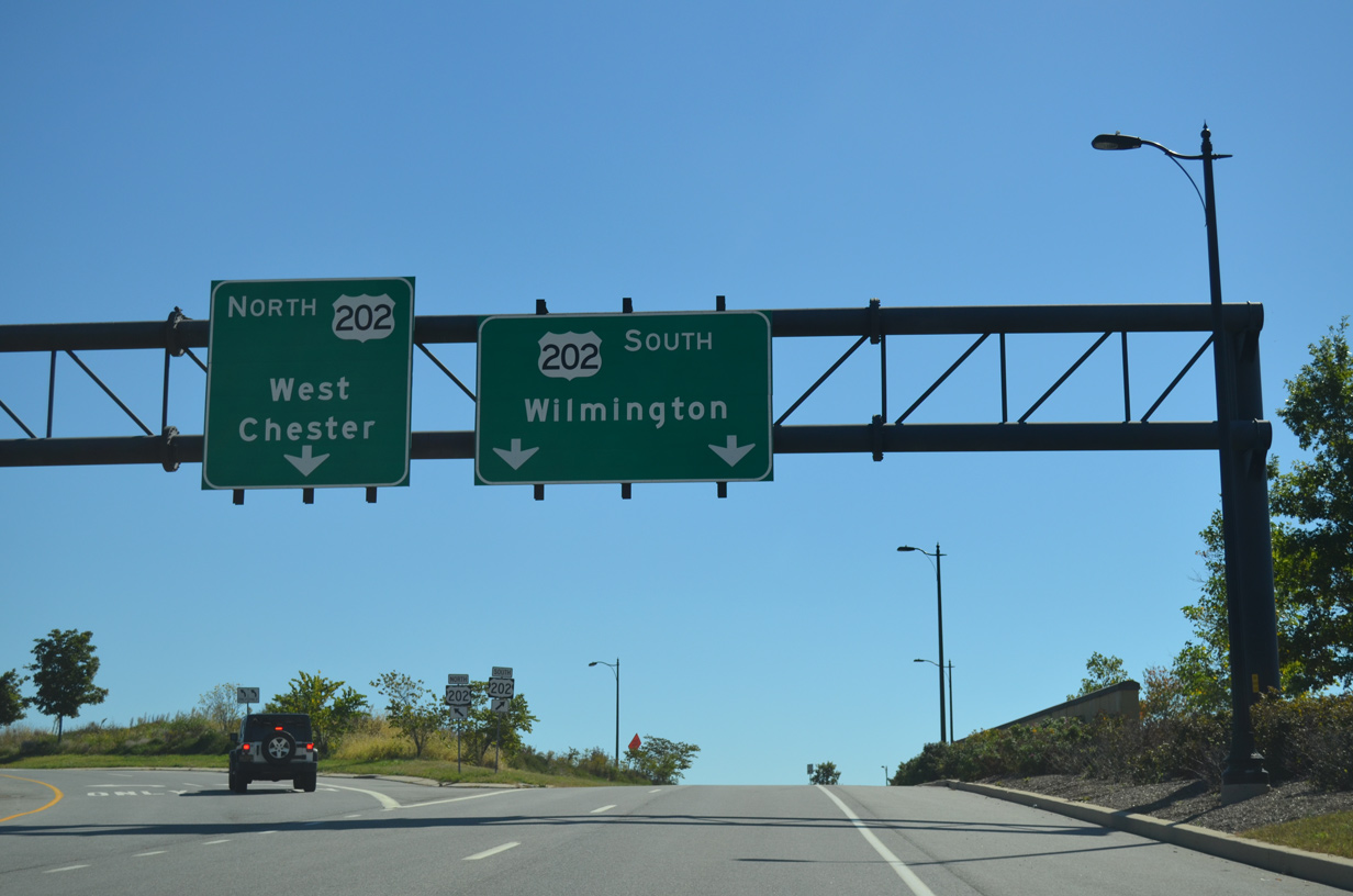
| A third lane opens ahead of West Park Drive and the grade separated intersection with U.S. 202 (Concord Pike). A two lane ramp departs ahead for U.S. 202 north to Talleyville and West Chester, Pennsylvania and south to Wilmington. 06/23/12 |
|
| The southbound off-ramp from U.S. 202 forms West Park Drive beyond SR 141. West Park Drive wraps around the Blue Ball parkland to Augustine Cut Off. 06/23/12 |
|
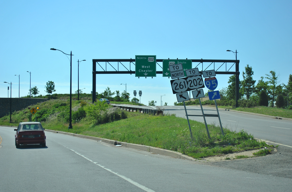
| Two lanes arc northeast from the U.S. 202 gore point to SR 261 (Foulk Road) north at Weldin Road. 06/23/12 |
|
| U.S. 202 leads south directly to Interstate 95 and the 9th Ward Area of Wilmington. North from Blue Ball, Concord Pike constitutes a busy commercial arterial to Concord Mall and Brandywine Town Center. 09/27/14 |
|
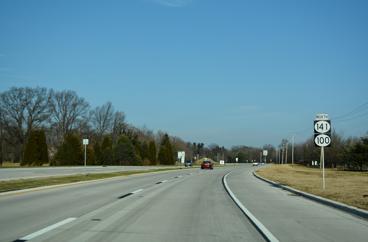
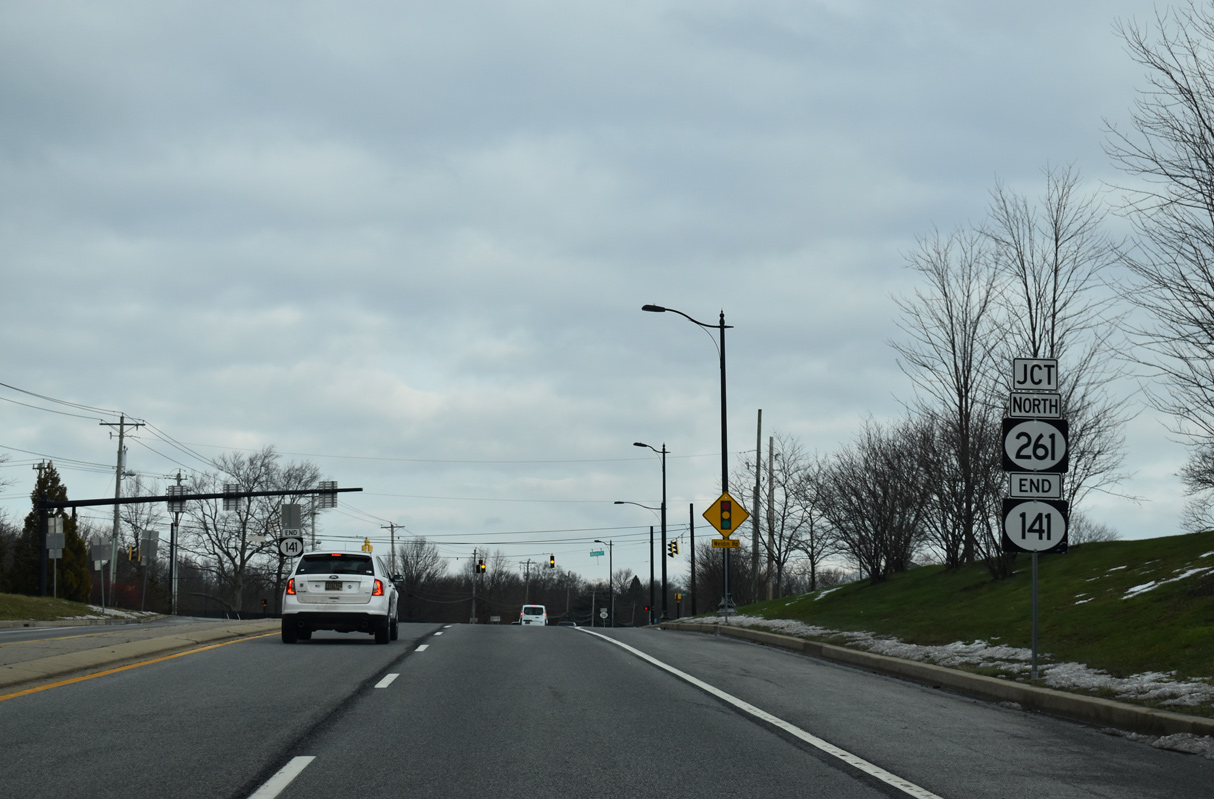
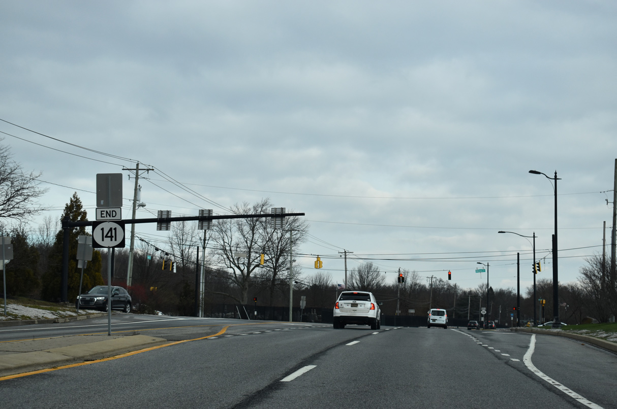
| SR 141 north ends at Weldin Road (Rd 215), opposite from the northbound beginning of SR 261 (Foulk Road). 12/22/20 |
|
| A second end sign stands within the median of SR 141 at Weldin Road. Foulk Road leads SR 261 north to Fairfax and Brandywine Hundred. The state route continues as PA 261 to Booths Corner and U.S. 322. 12/22/20 |
Page Updated 01-09-2023.

 North
North