|
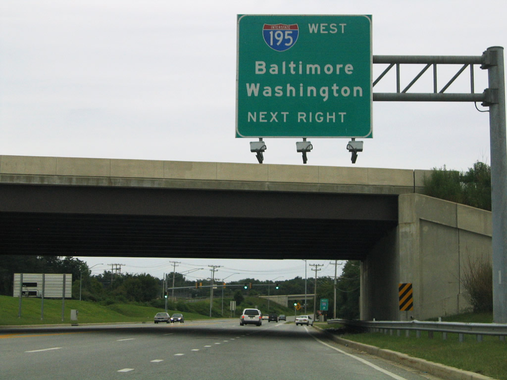
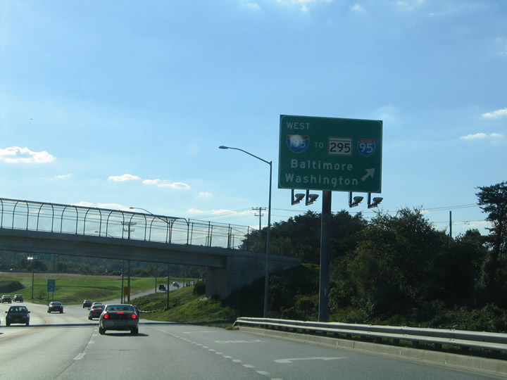
| Northbound MD 170 (Aviation Boulevard) approaches Interstate 195 west to MD 295, Interstate 95, and MD 166/Rolling Road.
This overhead was replaced with a new sign featuring Clearview font by 2010. 08/27/05 |
|
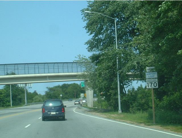
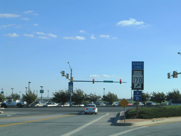
| Airport Loop banners were placed with MD 170 shield assemblies within the vicinity of Baltimore-Washington International Airport (BWI). The airport loop follows MD 170 (Aviation Boulevard) north, MD 162 (Aviation Boulevard) southeast, and MD 176 (Dorsey Road) west. This shield assembly stands just north of I-195 along northbound MD 170. 06/01/03 |
|
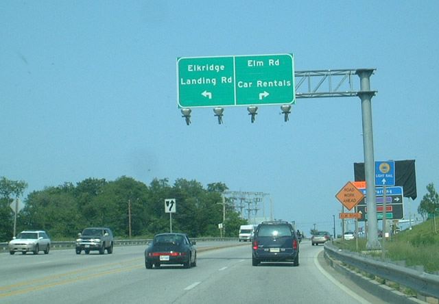
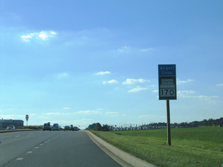
| This photo shows northbound MD 170 approaching the former car rental location for Baltimore-Washington International Airport. The car rental location has since been moved south, near the intersection of MD 170 and MD 995 and the CSX/MARC station. 06/02/03 |
|
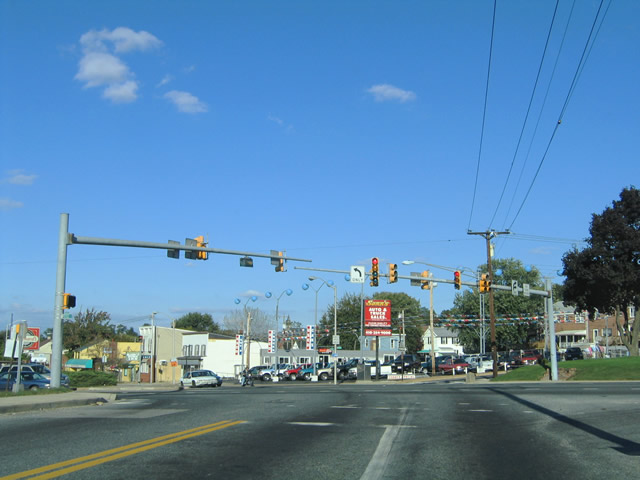
| MD 170 (Belle Grove Road) northbound concludes at the intersection of Potee Street, Hanover Street, Jack Street, and the Governor Ritchie Highway at the Baltimore city line. MD 2 enters from the south via the Ritchie Highway and continues past Belle Grove Road and Jack Street to the north via Potee Street and Hanover Street to Cherry Hill. 10/10/04 |
|
| MD 170 (Belle Grove Road) travels southwest from MD 2 (Ritchie Highway / Potee Street) at the Baltimore city line to MD 648 (Baltimore Annapolis Boulevard) at Pumphrey. MD 648 constitutes the original alignment of MD 3 between Carroll Park in south Baltimore to Glen Burnie. MD 170 follows Camp Meade Road southwest to I-695 north and Linthicum. 10/10/04 |
|
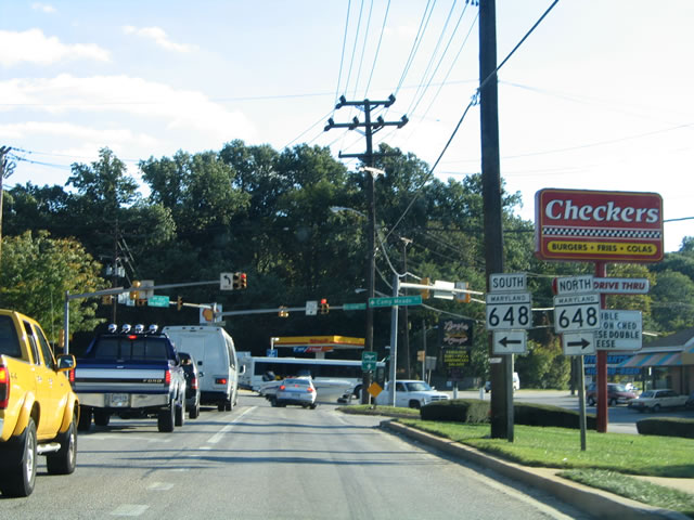
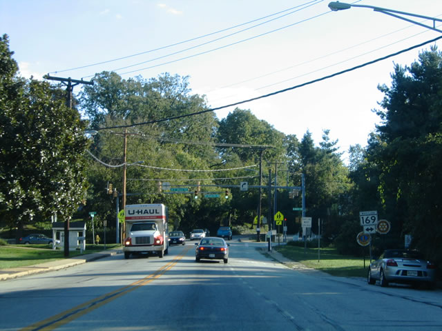
| Southbound on Camp Meade Road at MD 169 (Maple Road) in Linthicum. MD 169 comprises just 0.97 miles between Hammonds Ferry Road to the west and MD 648 (Baltimore Annapolis Boulevard) to the east. 10/10/04 |
|
| Continuing southward to MD 162 (Aviation Boulevard) at Baltimore-Washington International Airport (BWI). Camp Meade Road ends at Aviation Boulevard with MD 170 southbound turning west around the airport. MD 162 follows Aviation Boulevard east and south to MD 176 (Dorsey Road) and Interstate 97 at Glen Burnie. MD 162, 170, and 176 represent the signed Airport Loop around BWI Airport. 10/10/04 |
|
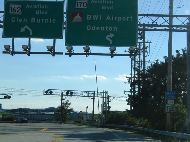
| MD 170 enters the Airport Loop via Aviation Boulevard. MD 162 southbound begins and travels Aviation Boulevard 2.31 miles southeast to MD 175 (Dorsey Road) adjacent to the Exit 16 interchange of Interstate 97. Use MD 162 southbound for the nearby community of Ferndale as well as Glen Burnie. 10/10/04 |
|
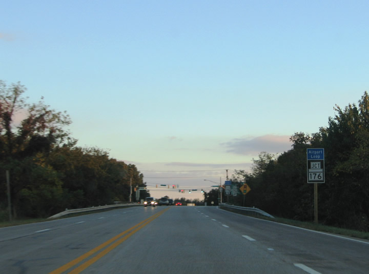
| The Airport Loop features small guide signs for its reassurance markers. Pictured here is the MD 170 southbound shield posted after its overtaking of Aviation Boulevard from MD 162. The loop constitutes a four lane divided highway. 10/10/04 |
|
| MD 170 meets Interstate 195 (Exit 1) via a six-ramp parclo interchange adjacent to the Baltimore-Washington International Airport terminal. Interstate 195 provides the main access point to the terminal from the nearby freeways of Interstate 95, Interstate 895, and MD 295 (Baltimore-Washington Parkway) in addition to U.S. 1 (Washington Boulevard). 10/10/04 |
|
| MD 170 (Aviation Boulevard) continues south through a partial-interchange with Stoney Run Road to MD 176 (Dorsey Road) at Harmans. MD 176 continues the Airport Loop east from MD 170 to MD 162 (Aviation Boulevard). The state route meets Interstate 97 (Exit 15) adjacent to its eastern terminus at MD 648 (Baltimore-Annapolis Boulevard) in Glen Burnie. 10/10/04 |
|
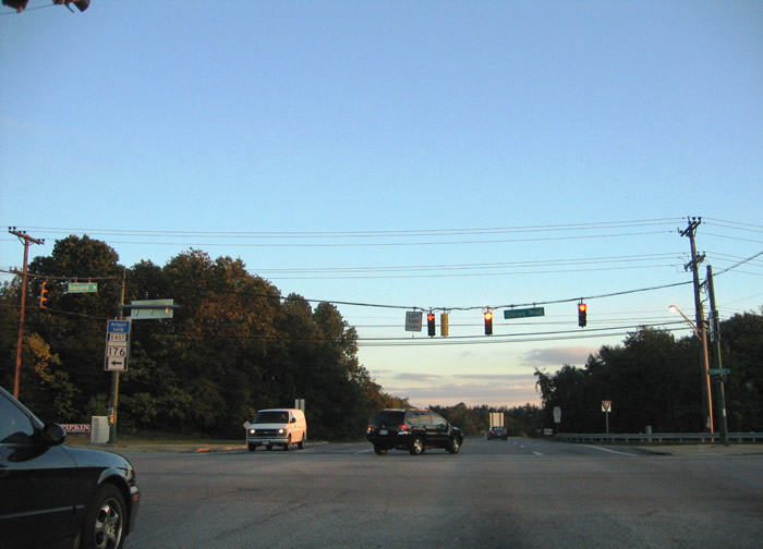
| MD 170 (Aviation Boulevard) intersects MD 176 (Dorsey Road) at Harmans. MD 176 travels 5.68 miles west from Glen Burnie to a dead end near the MD 100 interchange with Baltimore-Washington Parkway (MD 295). MD 176 originally continued west to U.S. 1 (Washington Boulevard) near Waterloo. The state route was severed into two segments with completion of the MD 100 freeway. MD 103 travels over the portion of former MD 176 west of MD 295. 10/10/04 |
|
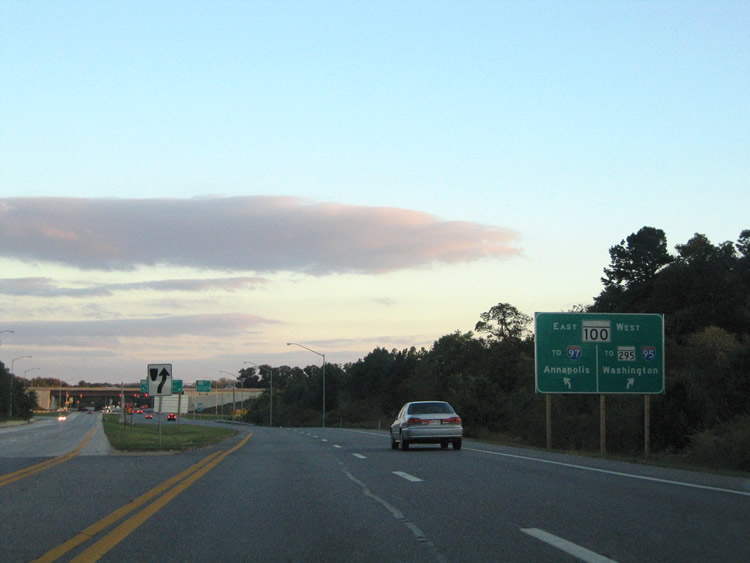
| MD 170 follows Telegraph Road south from MaD 176 (Dorsey Road) and the Airport Loop. Telegraph Road ties into the MD 100 freeway nearby at Exit 11. MD 100 constitutes a 22 mile long limited access highway between U.S. 29 near Ellicott City and MD 177 (Mountain Road) near Lake Shore. 10/10/04 |
|
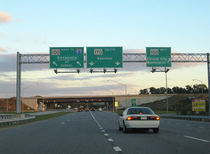
| MD 170 (Telegraph Road) enters the SPUI with MD 100 (Exit 11). MD 100 meets Interstate 97 two miles to the east for traffic interests south to Annapolis. The freeway turns northwest two miles to MD 295 and five miles to I-95. MD 170 continues along Telegraph Road southward to Severn and Odenton. 10/10/04 |
Page Updated 08-31-2010.