State Route 234 travels 34.37 miles within Prince William County, extending northwest from Dumfries to Manassas and Woolsey. Beginning at U.S. 1 (Richmond Highway) in northern reaches of Dumfries, SR 234 (Dumfries Road) proceeds northwest along a four lane route 0.33 miles to a six ramp parclo interchange with I-95. Dumfries Road (Route 234) lines Prince William Forest Park and Montclair beyond the commercial area surrounding the exchange with I-95, turning north at Independent Hill. Crossing the Occoquan River ahead of Manassas, State Route 234 resumes a northwest course to bypass the independent city to the south.
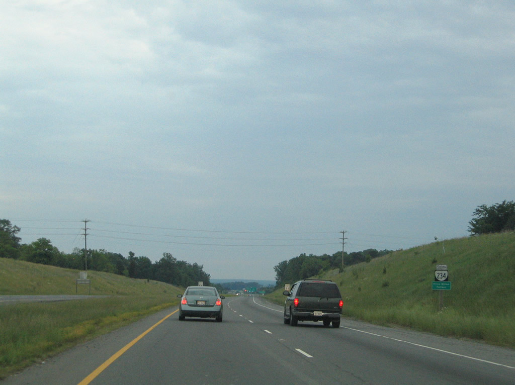
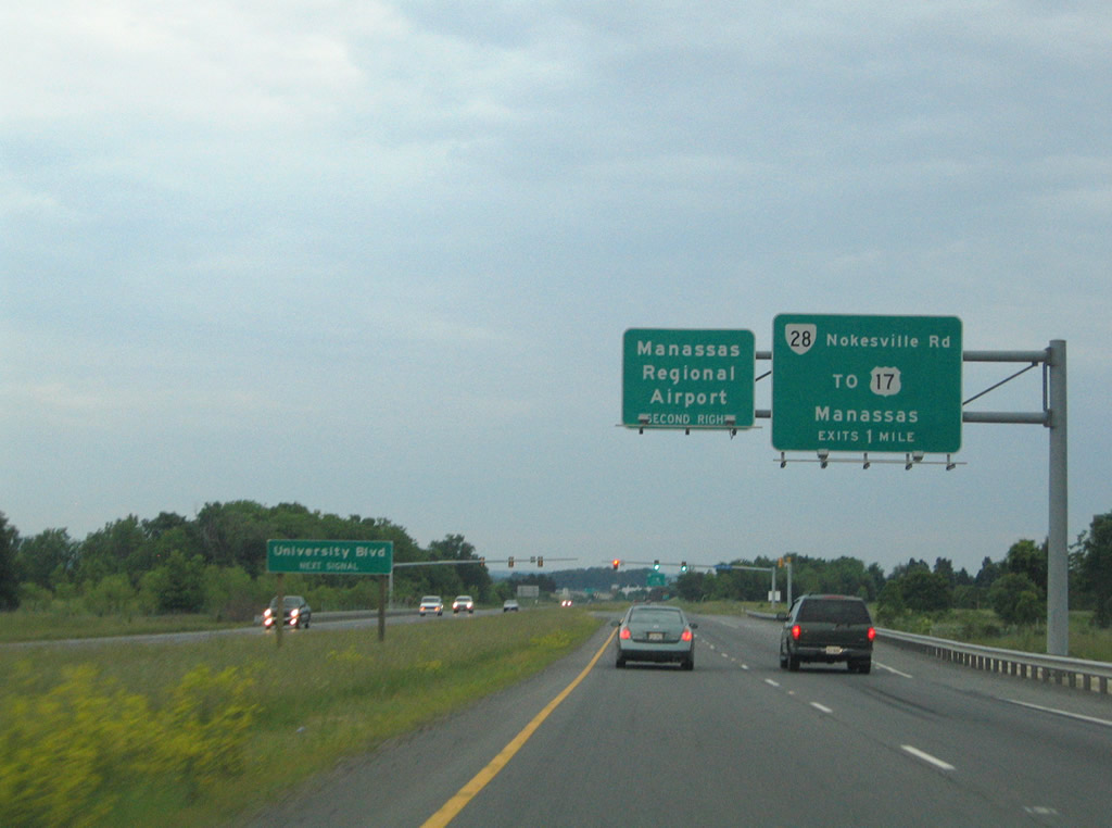
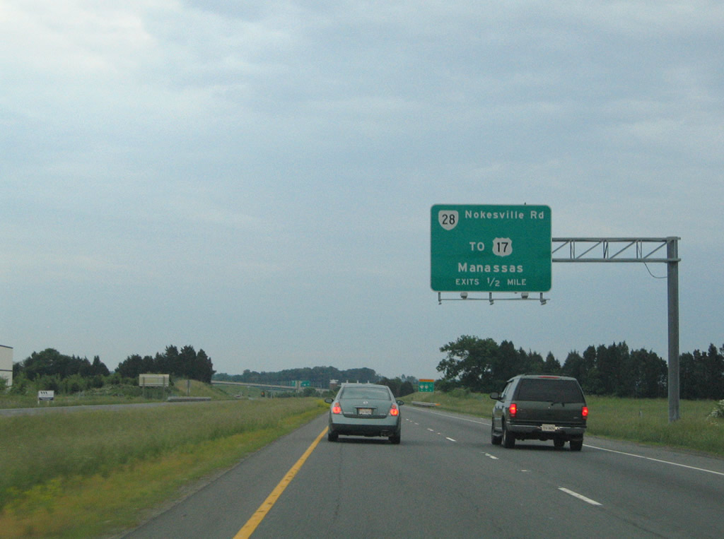
Prince William Parkway (SR 294) angles southwest to meet SR 234 ahead of Dumfries Road, which leads SR 234 Business into downtown. Prince William Parkway joins SR 234, continuing the route northwest as a four lane controlled access expressway to Manassas Regional Airport (HEF) and SR 28. State Route 28 enters Manassas from the southwest, meeting Route 234 (Prince William Parkway) at a cloverstack interchange north of HEF Airport. Beyond SR 28 (Nokesville Road), Prince William Parkway advances SR 234 northwest through business and industrial parks on a 4.57 mile long course to a trumpet interchange with I-66 near Conway Robinson State Forest.
SR 234 combines with I-66 for a 2.58 mile overlap east to the succeeding interchange with SR 234 Business (Sudley Road), turning north toward Sudley Springs. Sudley Road (SR 234) reduces to two lanes north of Interstate 66, entering Manassas National Battlefield Park en route to U.S. 29 (Lee Highway). Route 234 passes through the 5,073 acre historic park, meeting U.S. 29 near its center. Sudley Road bends westerly at Sudley Springs, leading SR 234 an additional 5.32 miles to its conclusion at U.S. 15 (James Madison Highway) in Woolsey, 3.89 miles north of I-66.
SR 234 (Prince William Parkway) Improvement Projects
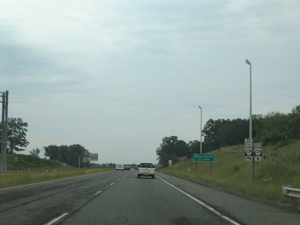
The Balls Ford Road Interchange project, part of the Transform I-66 Outside the Beltway initiative, will consist of building a new diverging diamond interchange (DDI) between Prince Williams Parkway (SR 234) and a realigned Balls Ford Road. The DDI will allow for easier access to a new park and ride facility and nearby I-66.1 Initial construction began Summer 2020 with an anticipated completion set for November 2022.2
Improvements at University Boulevard within Innovation Park industrial complex will construct a new connector road (Discovery Boulevard Extension) in order to eliminate all left turn movements at the intersection. Prince William Parkway (SR 234) will also be widened to six lanes in the vicinity. The project is slated to wrap up by Fall 2022.3
Interchanges will replace at-grade intersections at Route 234 Business (Dumfries Road) and Brentsville Road/Prince William Parkway (SR 294) south of Manassas. Brentsville Road will be realigned to meet Dumfries Road as a part of the project, and Bradley Cemetery Way will serve as a connector route between SR 294 (Prince William Parkway) and SR 234 Business. Construction is scheduled for completion by Summer 2023.4
|
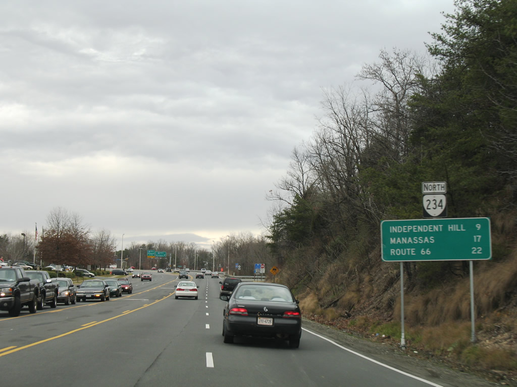
| SR 234 (Dumfries Road) north leaves U.S. 1 (Fraley Boulevard) at Dumfries, nine miles from Independent Hill. 12/26/06 |
|
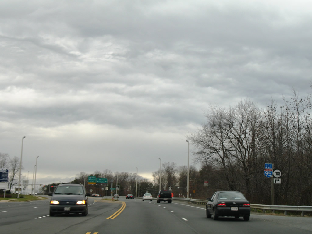
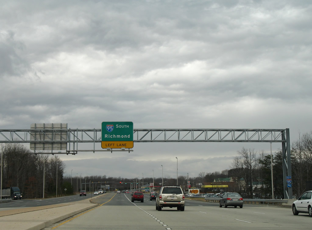
| Just north of U.S. 1 is the six-ramp parclo interchange with Interstate 95. SR 788 also stems northward via Interstate Drive, a northbound side frontage road to the freeway. 12/26/06 |
|
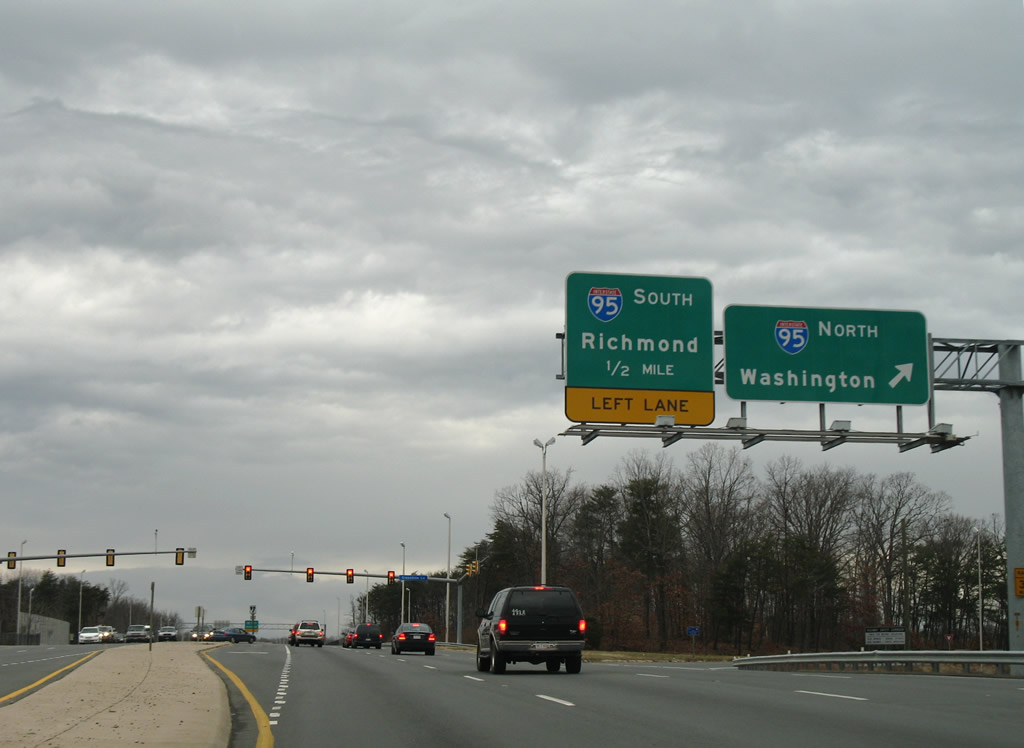
| I-95 constitutes a heavily traveled freeway northward from Dumfries to Woodbridge, Dale City, Springfield and Franconia where it joins the Capital Beltway. 12/26/06 |
|
| Heading south, I-95 remains a busy route to Fredericksburg and Richmond. 12/26/06 |
|
| SR 234 continues northwest along Dumfries Road from the southbound on-ramp to Interstate 95 to Prince William Forest Park. 12/26/06 |
|
| SR 234 leaves a 2.58 mile overlap with I-66 west for Prince William Parkway south. Prince William Parkway constitutes a controlled access bypass around the independent city of Manassas. Forthcoming Balls Ford Road links SR 234 with industrial parks and SR 234 Business (Sudley Road) near I-66 at Exit 47. 05/30/05 |
|
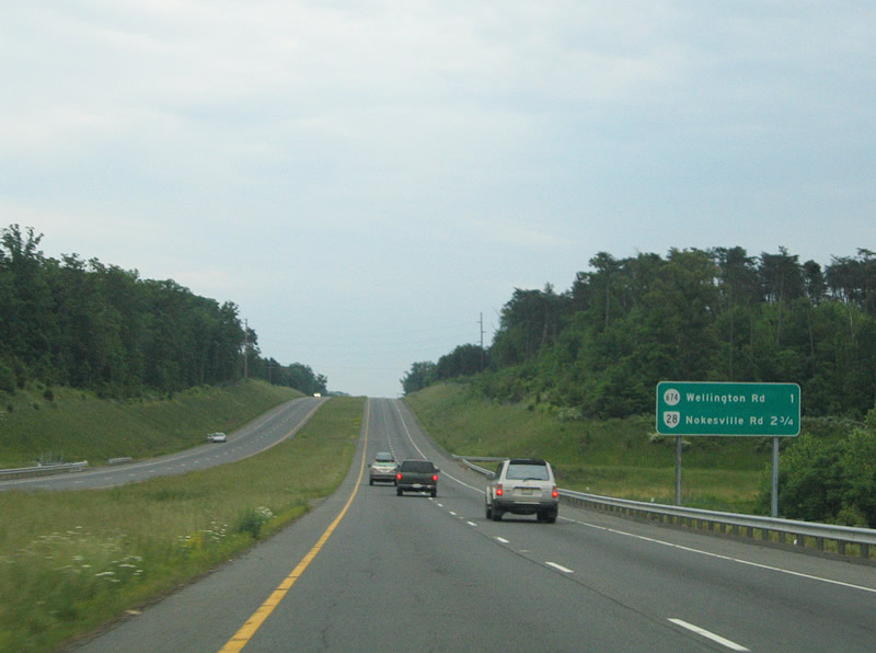
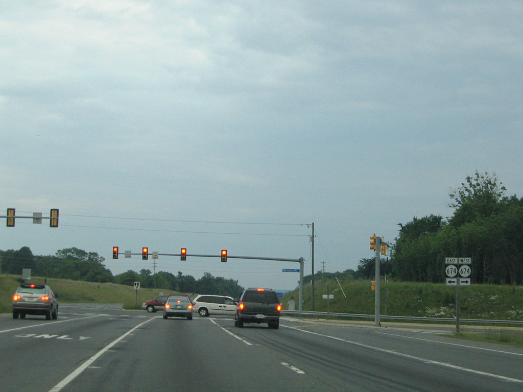
| SR 234 (Prince William Parkway) next meets Sudley Manor Drive and SR 674 (Wellington Road). 05/30/05 |
|
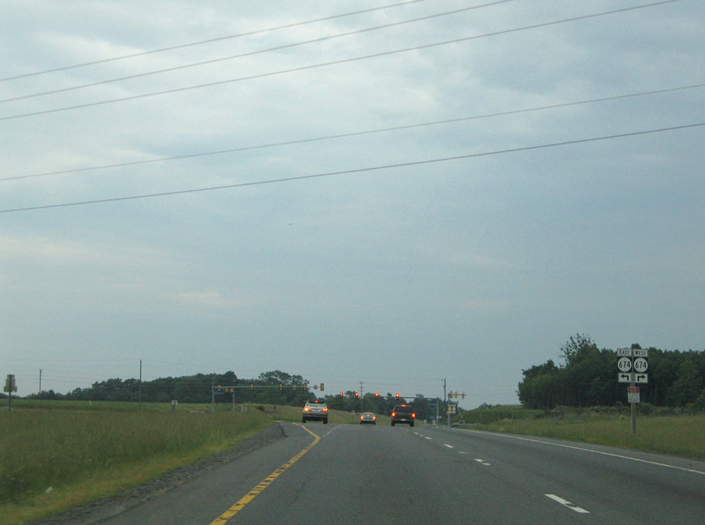
| SR 674 (Wellington Road) meanders west to an industrial park area, the Nissan Pavilion and Gainesville. 05/30/05 |
|
| Wellington Road continues east to Godwin Drive at Manassas and meets Prince William Parkway again at Liberia Avenue. 05/30/05 |
|
| Prince William Parkway (SR 294) winds eastward from Manassas to U.S. 1 near Woodbridge. 05/30/05 |
|
| Connecting SR 234 (Prince William Parkway) with the Prince William Campus of George Mason University, University Boulevard is the next signalized intersection. 05/30/05 |
|
| SR 28 (Nokesville Road) meets SR 234 at a cloverstack interchange north of Manassas Regional Airport (HEF). 05/30/05 |
|
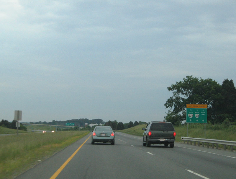
| Prince William Parkway (SR 234/294) and Liberia Avenue serve as an alternate route for truck traffic through Manassas. 05/30/05 |
|
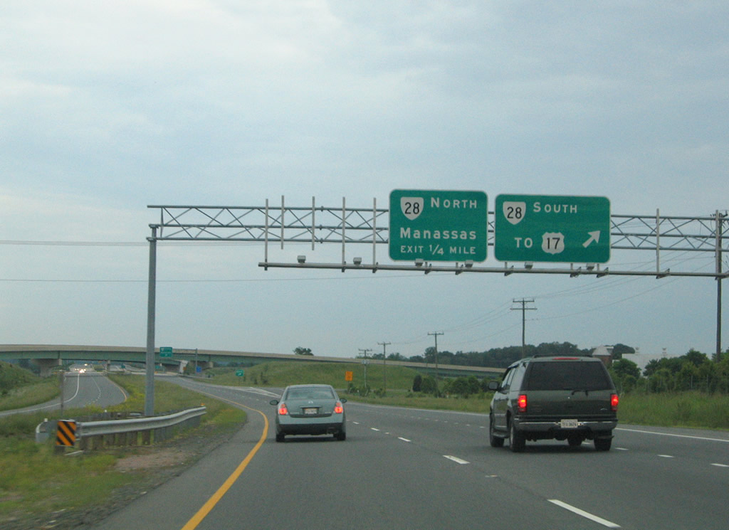
| The ramp leading to SR 28 (Nokesville Road) southbound partitions into a separate lane for Pennsylvania Avenue. SR 28 continues 18 miles southwest to U.S. 17 at Bealeton. 05/30/05 |
|
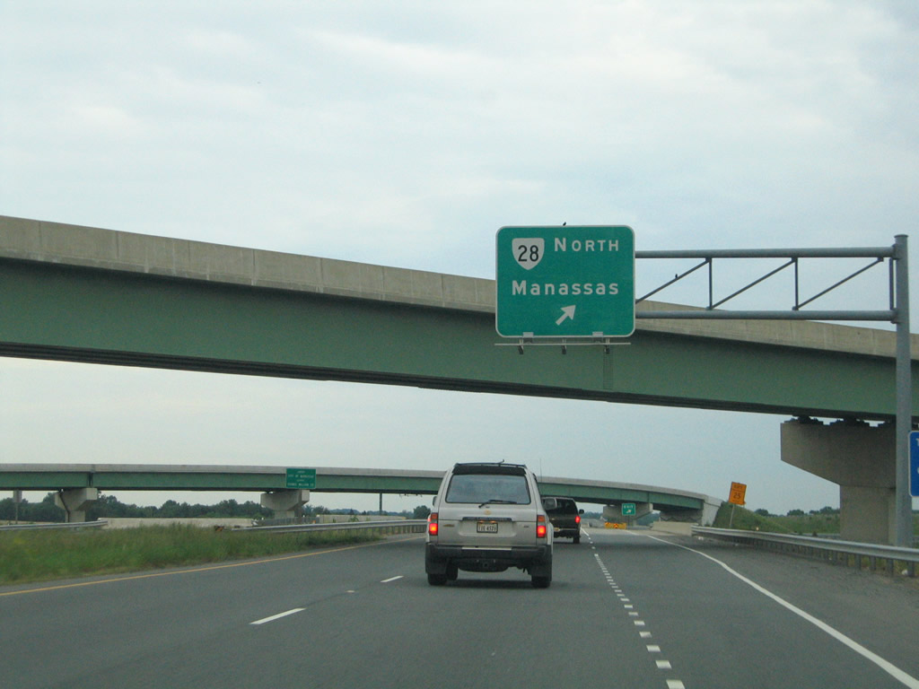
| SR 28 (Nokesville Road) leads north into Downtown Manassas, connecting with Center Street. SR 28 stretches 45 miles from U.S. 15/29 near Remington to SR 7 at Sterling. 05/30/05 |
Sources:
- Concession Fee Projects, Transform I-66 Outside the Beltway Project website (outside.transform66.org).
- Prince William Parkway Interchange at Realigned Balls Ford Road (project brochure), Prince William County official website (pwcva.org).
- Intersection Improvements at Prince William Parkway and University Boulevard (Quadrant Road Intersection) (project brochure), Prince William County official website (pwcva.org).
- Route 234-Brentsville Road Interchange Project, Prince William County official website (pwcva.org).
05/30/05, 12/26/06 by AARoads
Connect with:
Interstate 66
Interstate 95
U.S. 1
U.S. 29
State Route 28
Page Updated 05-09-2021.