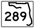
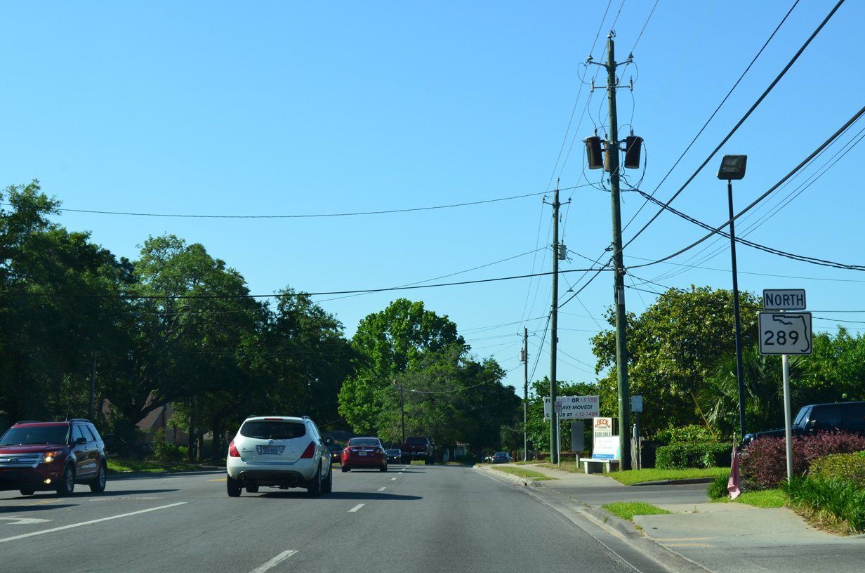
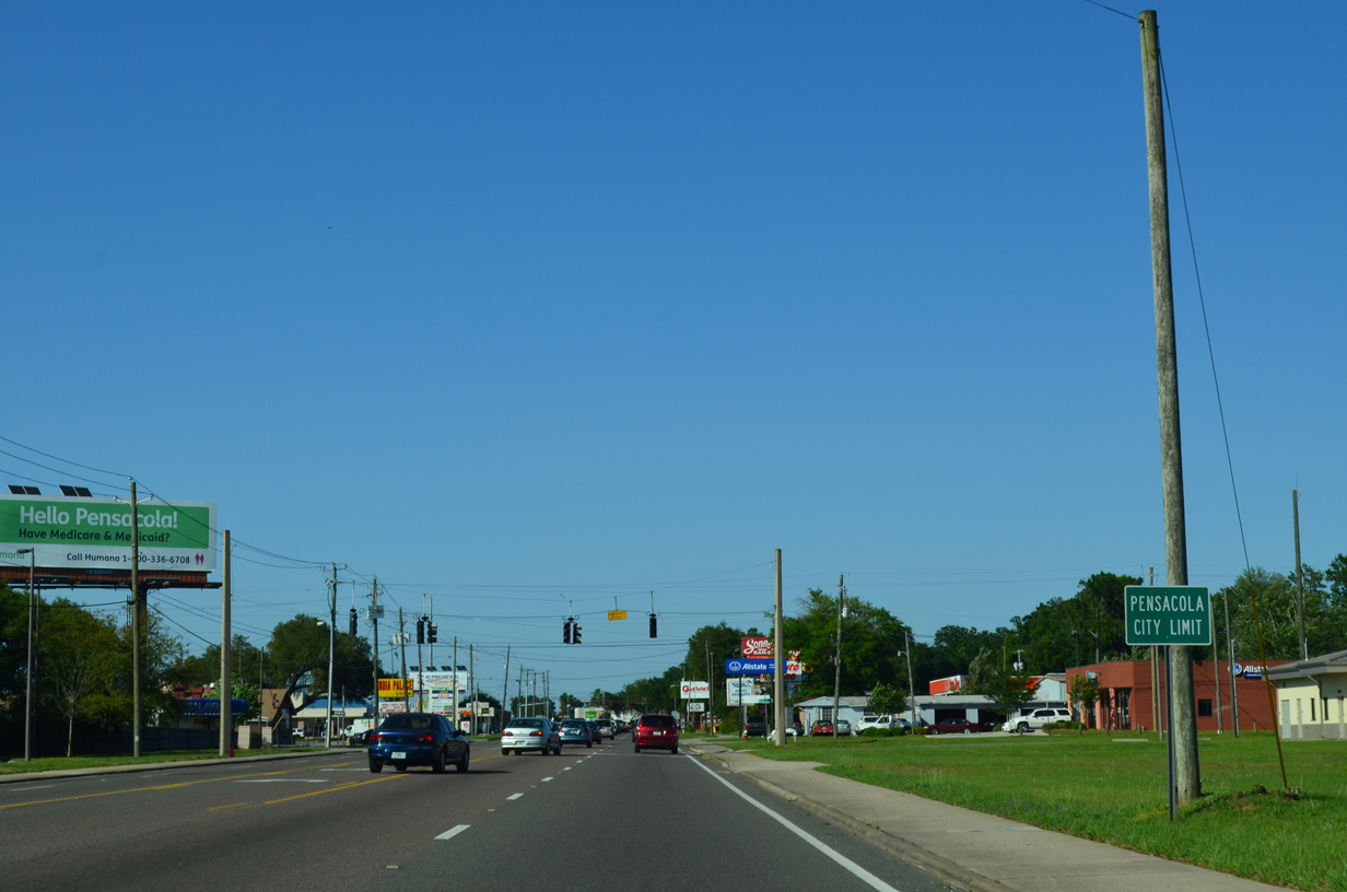
One of the main north-south corridors within the city of Pensacola, SR 289 follows Ninth Avenue from Chase Street (U.S. 98 east) northward to Olive Road just outside of the city limits. SR 289 is the unsigned state road counterpart of U.S. 98 between Cerventes Street (SR 10A) and the couplet of Chase and Gregory Streets (SR 30). North of there, SR 289 shields appear as the highway passes through the Pensacola residential street grid to become a commercial arterial at SR 296 (Bayou Boulevard). Commercial frontage, including Cordova Mall, lines the route northward to SR 742 (Creighton Road).
The northern terminus was reconstructed in 2001 to provide a protected turn lane from Olive Road (former SR 290) west to SR 289 south. The movement of SR 289 north onto Olive Road west was expanded to two turn lanes as well. This project coincided with widening SR 289 north of the Interstate 10 underpass, bringing the entire length of Ninth Avenue to four lanes.
|
| 9th Avenue originates from Bayfront Parkway (SR 196) by Admiral Mason Park. 0.4 miles north at Chase Street (U.S. 98 Business / U.S. 98 east), the avenue expands to four lanes and becomes a part of SR 289. 05/16/14 |
|
| SR 289 is unsigned along 9th Avenue between Chase Street and Cerventes Street. U.S. 98 lines the avenue north from Gregory Street to its merge with U.S. 90. Gregory Street otherwise leads west as U.S. 98 Business to the northbound beginning of Interstate 110. 05/16/14 |
|
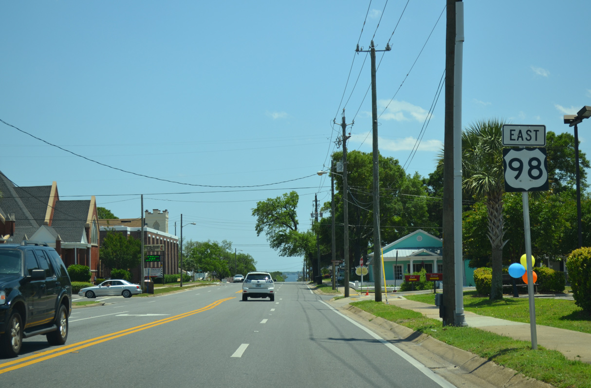
| U.S. 98 joins SR 289 along Ninth Avenue for a 0.4 mile overlap. Neither route is signed along their seven block stint. 05/16/14 |
|
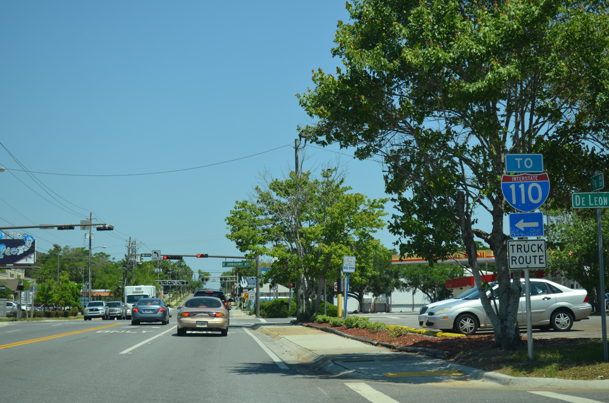
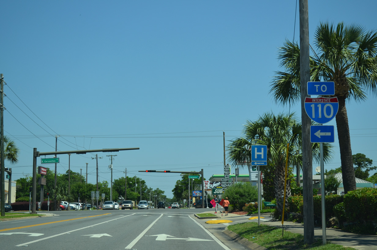
| A second I-110 trailblazer along Ninth Avenue directs motorists onto Cerventes Street west for its northbound on-ramp. U.S. 98 leaves SR 289 here to combine with U.S. 90 west as part of its bypass route around Downtown. 05/16/14 |
|
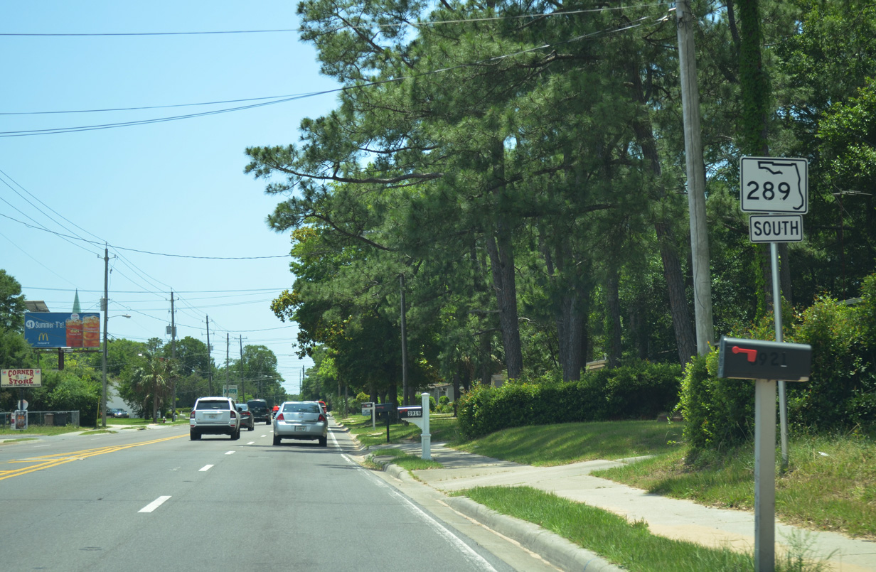
| A new shield was added for SR 289 north of Cerventes Street by August 2011. Previously SR 289 signage was not posted along Ninth Avenue until after Fairfield Drive. 05/16/14 |
|
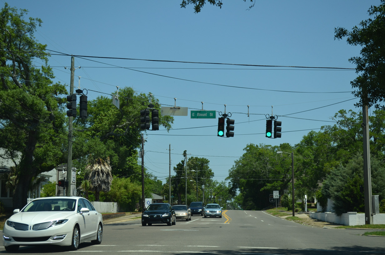
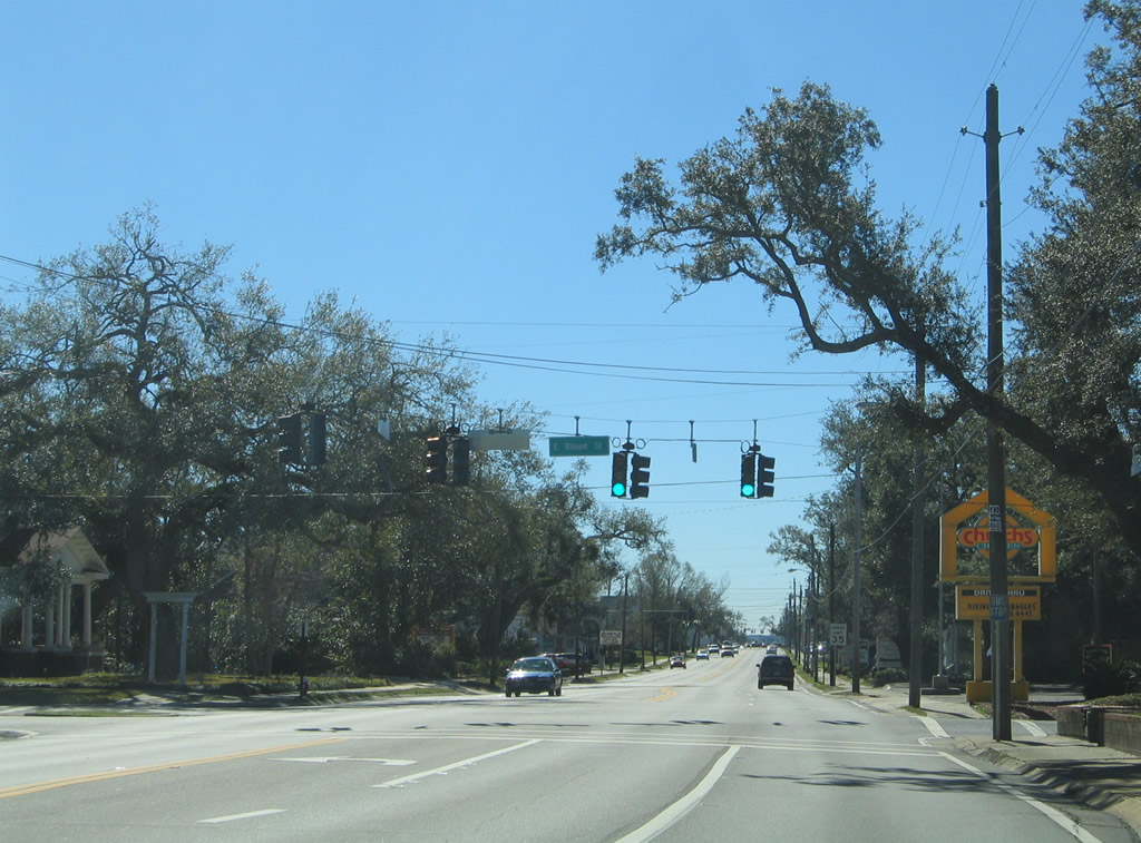
| Blount Street intersects SR 289 (Ninth Avenue) at this traffic light near the Scotland Yard neighborhood of Pensacola. East, the street heads to Bayview Park and west to the Cecil T. Hunter Pool between Interstate 110 and A Street. 05/16/14 |
|
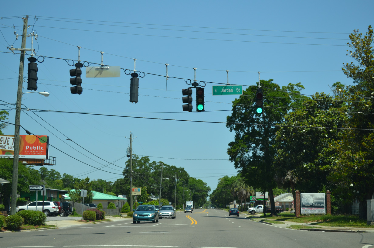
| Jordan Street, along with Maxwell Street, forms a one way street couplet between A Street, U.S. 29 (Palafox Street) and the half diamond interchange (Exit 3) with Interstate 110 to the west. 05/16/14 |
|
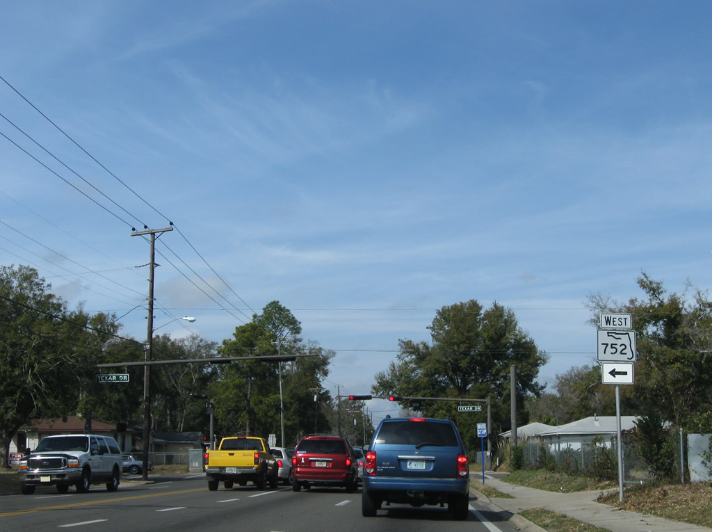
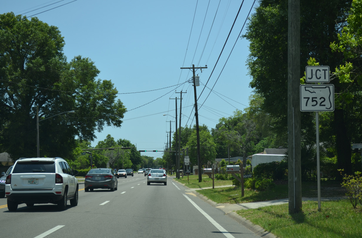
| Texar Drive meets SR 289 (Ninth Avenue) at the next signal. The intersection marks the east end of State Road 752. 02/09/09 |
|
| SR 752 travels west 1.18 miles, passing under Interstate 110 to U.S. 29 (Palafox Street) and SR 295 (Fairfield Drive) outside the city limits. 02/09/09 |
|
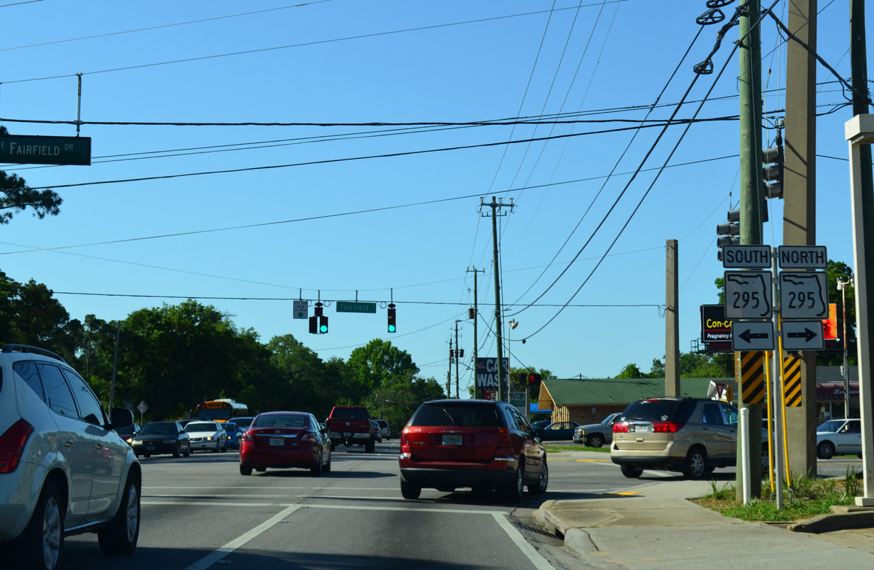
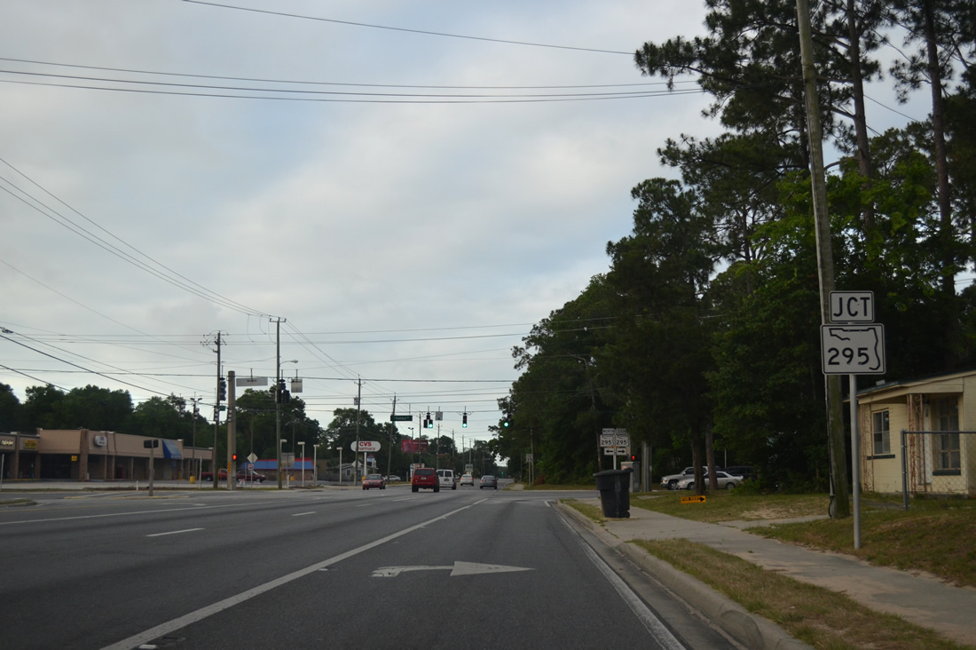
| SR 295 (Fairfield Drive) angles northward from SR 752 to end at SR 289 (Ninth Avenue). 05/15/14 |
|
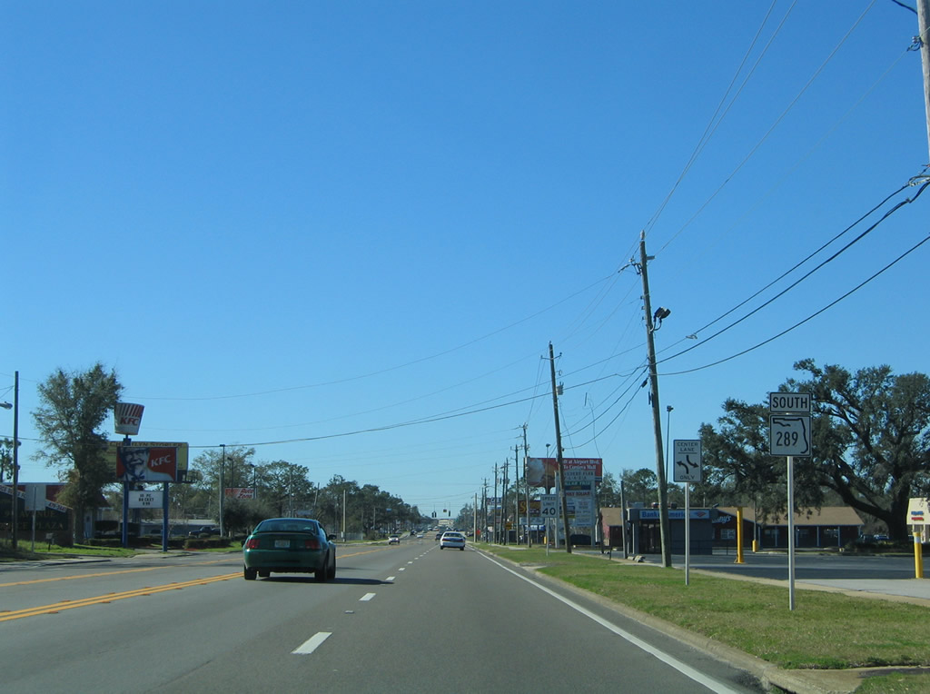
| While signs indicates SR 295 continues east of Ninth Avenue, this is in fact an error as Fairfield Drive is locally maintained to its merge with adjacent 12th Avenue. 12th Avenue provides a direct route to Pensacola International Airport (PNS) from SR 289. Southwest from here, SR 295 totals 8.23 miles to West Pensacola, Warrington and Pensacola NAS. 05/15/14 |
|
| A reassurance marker for SR 289 north follows the intersection with Fairfield Drive. 05/15/14 |
|
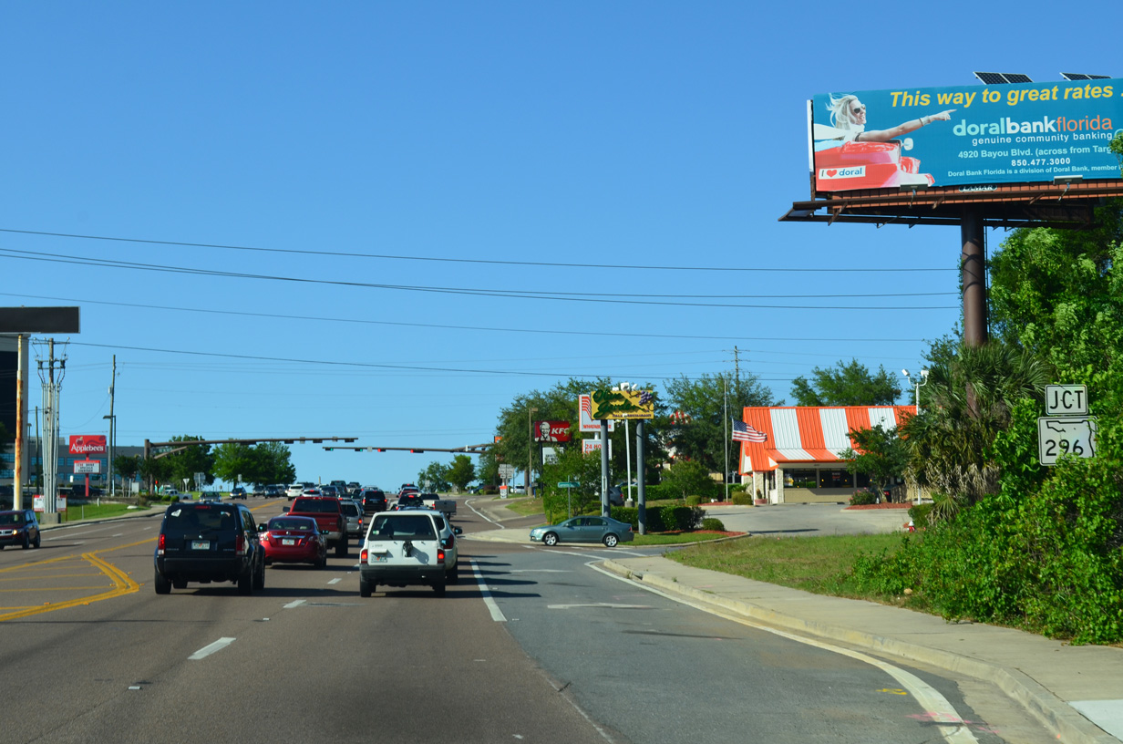
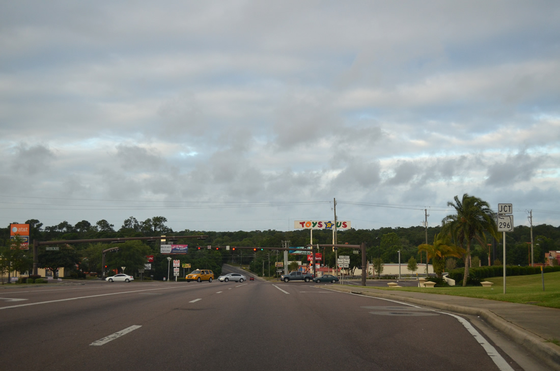
| Motorists climb northward from a crossing of Carpenter Creek to intersect SR 296 (Bayou Boulevard) along SR 289. 05/15/14 |
|
| SR 296, like SR 295, constitutes an arc shaped routing through the Pensacola area. Beginning at U.S. 90 (Cerventes Street) near Bayou Texar, SR 296 travels north to Bayou Boulevard and junction SR 289 by Cordova Mall. West from Ninth Avenue, SR 296 continues to an interchange with Interstate 110 and the community of Brent before ending at U.S. 90 (Mobile Highway) near Bellview. 05/15/14 |
|
| Ninth Avenue travels between Sacred Heart Hospital to the west and Cordova Mall to the east beyond Bayou Boulevard. 02/09/09 |
|
| A set of span wire signals operate at an entrance to Cordova Mall across from Sacred Heart Hospital along SR 289 (Ninth Avenue). Cordova Mall is the regional shopping center for the Pensacola area. 12/15/12 |
|
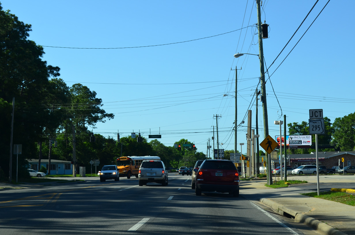
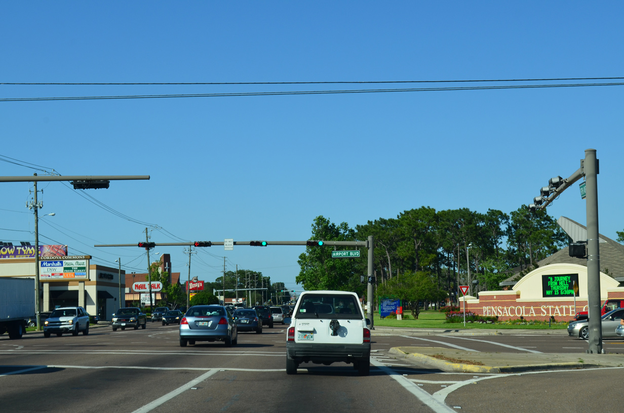
| Airport Boulevard (SR 750) meets SR 289 (Ninth Avenue) on the north side of Cordova Mall. 3.27 miles in length, SR 750 connects the passenger terminal at Pensacola International Airport (PNS) with Interstate 110 and U.S. 29 (Pensacola Boulevard). 05/15/14 |
|
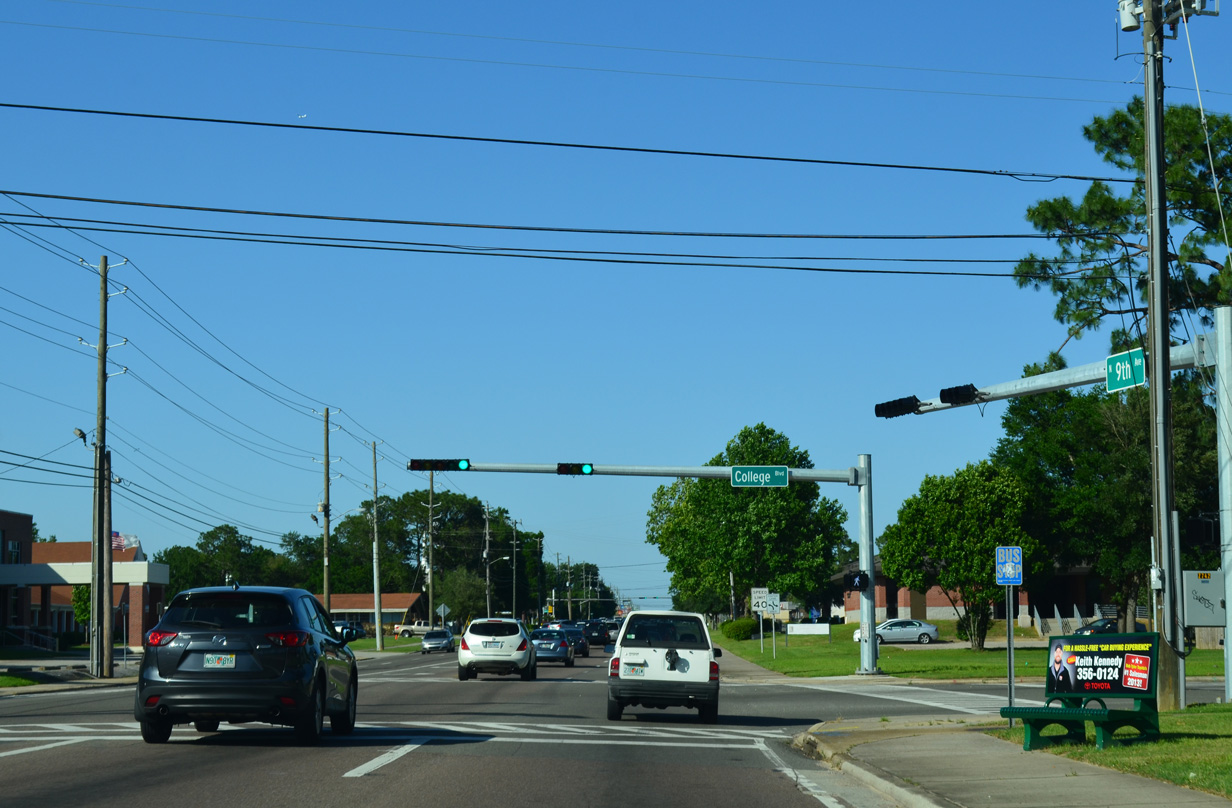
| College Boulevard intersects SR 289 at the next signal from Pensacola State College to the east. 05/15/14 |
|
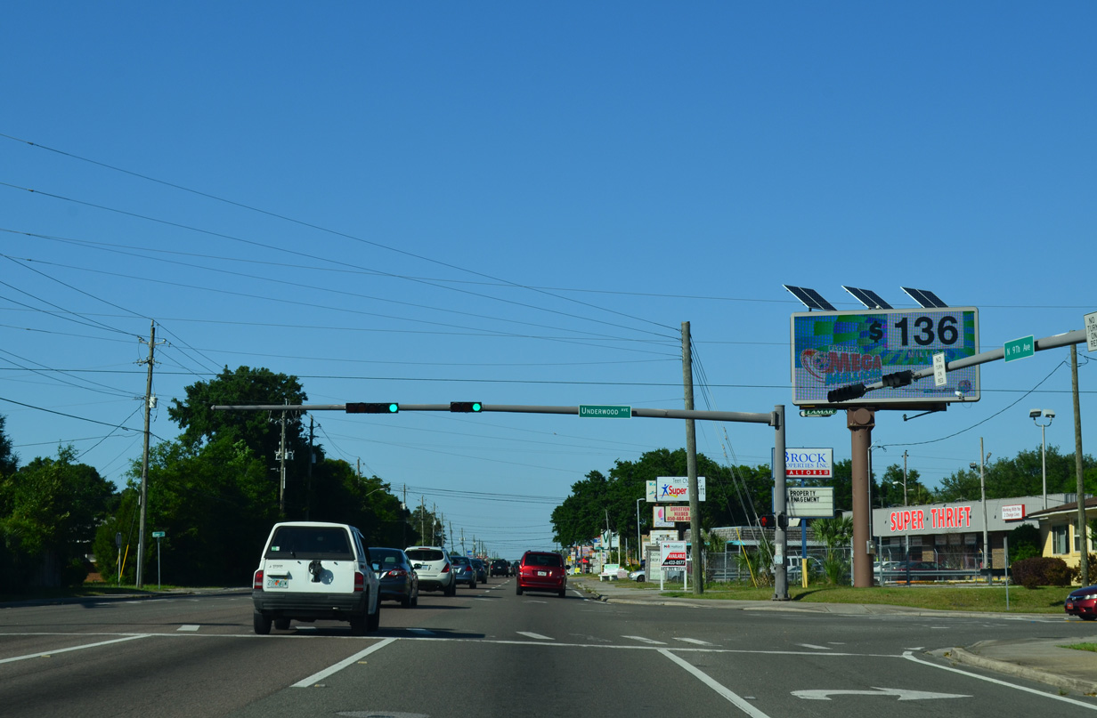
| Underwood Avenue stems west from 12th Avenue to cross Ninth Avenue at this traffic light en route to Lanier Drive nearby. Lanier Drive continues the road north to Creighton Road (SR 742) and Fairchild Street by Interstate 10. 05/15/14 |
|
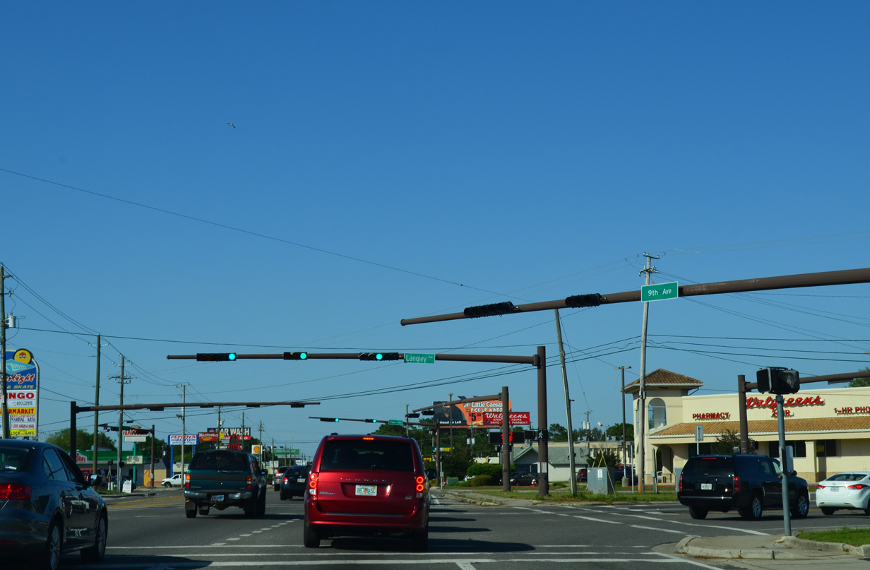
| Ninth Avenue angles northeast across Langley and Tippin Avenues at back to back signals. Langley Avenue heads west to SR 291 (Davis Highway) and east to U.S. 90 at Escambia Bay. Tippin Avenue extends 12th Avenue north from PNS Airport to Dunmire Street along I-10. 05/17/14 |
|
| SR 289 (Ninth Avenue) reenters the Pensacola city limits northeast of Tippin Avenue. The arterial lines northern reaches of the PNS runway approach along this stretch. 05/17/14 |
|
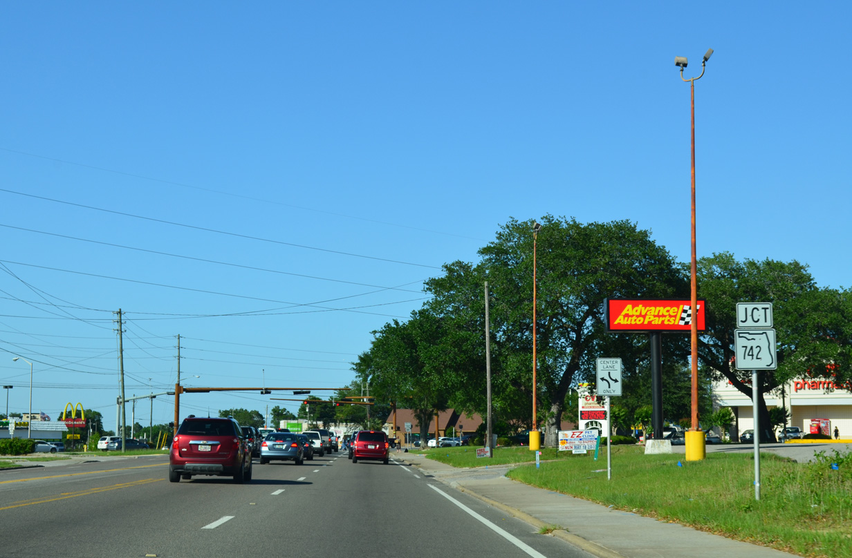
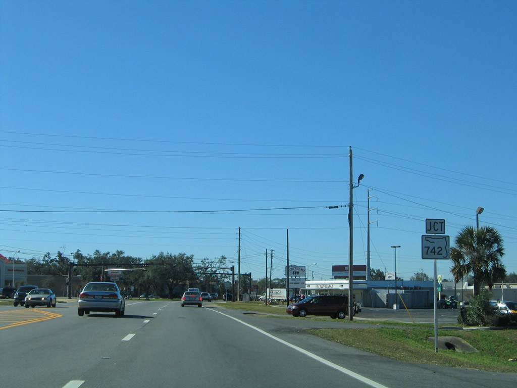
| Advancing to the commercialized intersection with SR 742 (Creighton Road) along SR 289 (Ninth Avenue) north. Belvedere Park and Eastgate Plazas shopping centers line the western half of this intersection. Further retail joined the area with an adjacent Wal-mart opened in 2002. 05/15/14 |
|
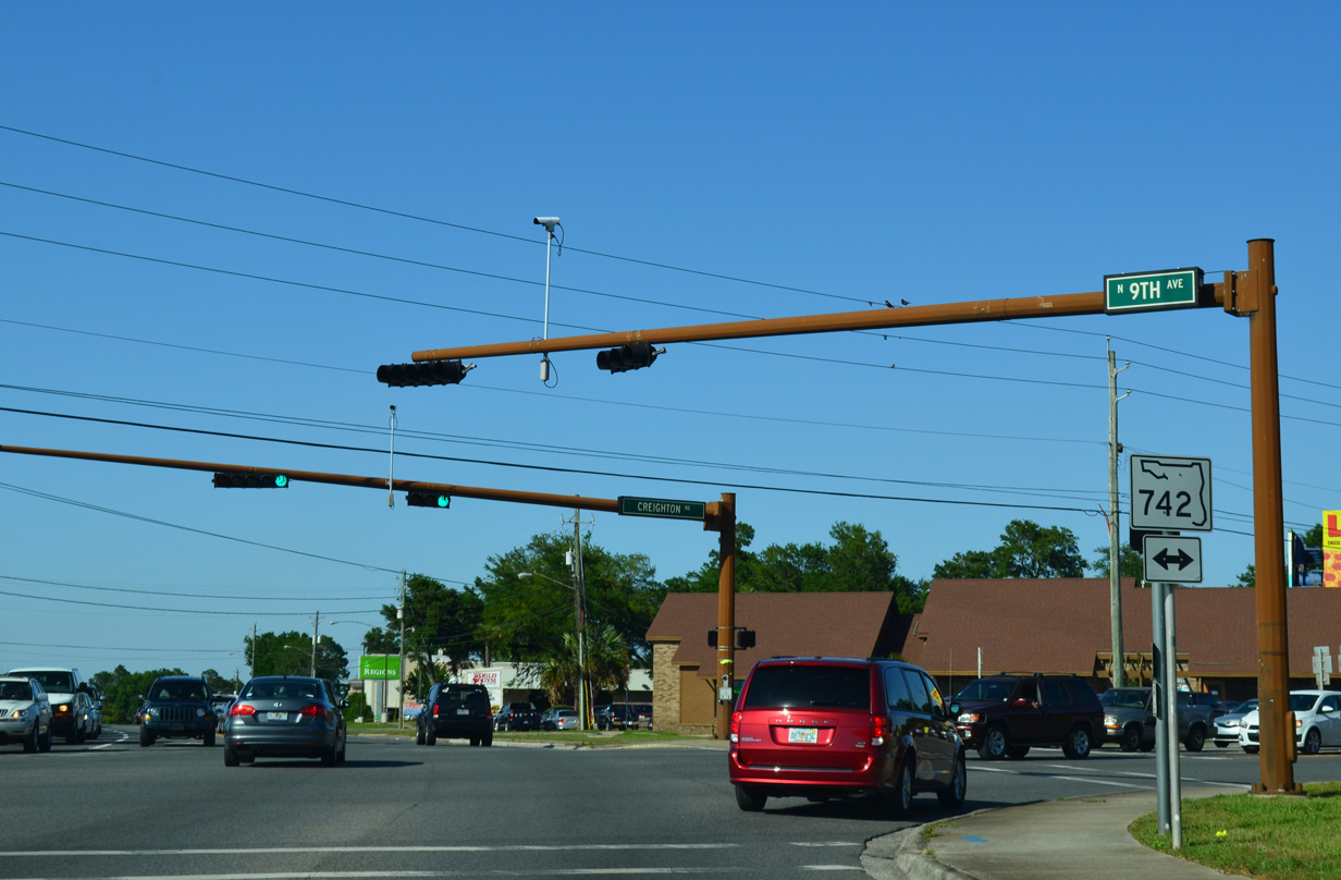
| Creighton Road (SR 742) constitutes a multi lane boulevard between the bridge across I-110 and Shades Drive nearby. SR 742 overall measures 6.89 miles in length west to U.S. 29 near Ensley and east to U.S. 90 beyond Scenic Heights. 05/15/14 |
|
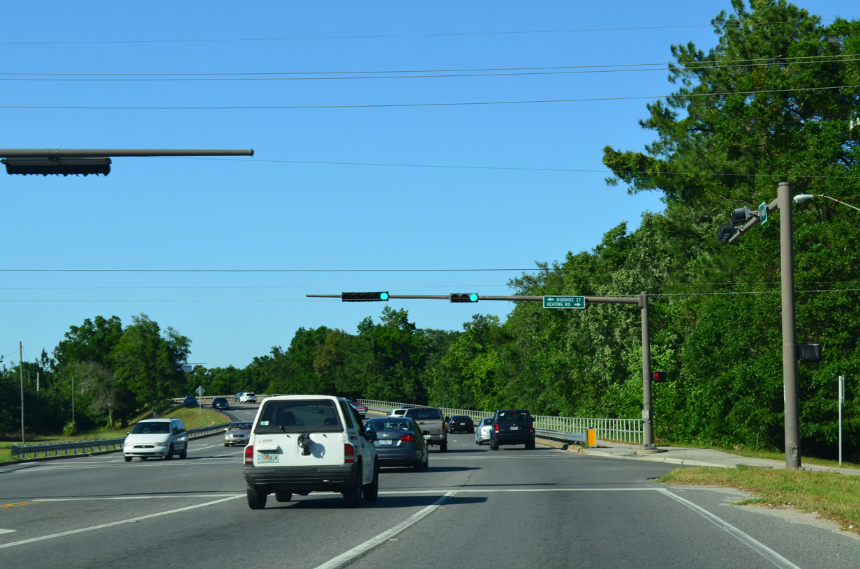
| Keating Road provides a local shortcut from Ninth Avenue east to SR 742 (Creighton Road). Dunmire Street stems west to a number of town home communities south of I-10. A traffic light was added at their intersection with SR 289 by 2007. 05/15/14 |
|
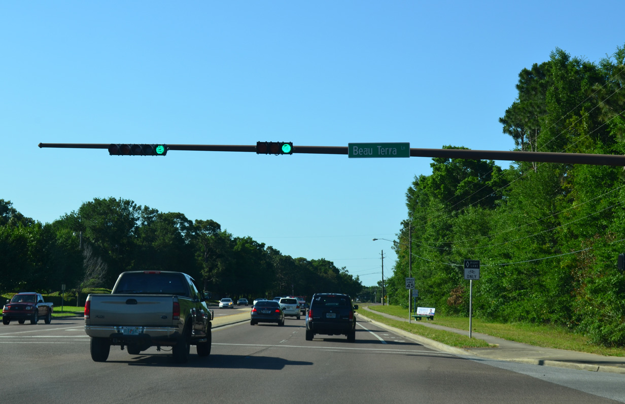
| Just north of Interstate 10, the signal with Beau Terra Lane and The Flats Apartment complex was added to SR 289 by 2007. 05/15/14 |
|
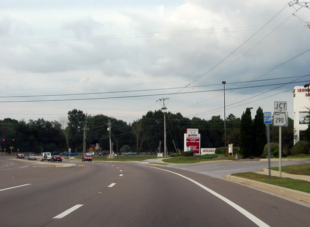
| SR 289 ends at Olive Road (former SR 290) just outside the Pensacola city limits. SR 290 along Olive Road was eliminated during a mileage swap between FDOT and Escambia County in June 2011 that added SR 750 along Airport Boulevard west of SR 289. 11/16/03 |
|
| Olive Road (CR 290) links the north end of SR 289 (Ninth Avenue) with U.S. 90 (Scenic Highway) to the east and parallel SR 291 (Davis Highway) by University Parkway to the west. 05/15/14 |
|
| Heading south from Olive Road (former SR 290), motorists along Ninth Avenue see the first southbound shield for SR 289. Widening in 2001 expanded SR 289 to four overall lanes to the Interstate 10 underpass. 01/31/06 |
|
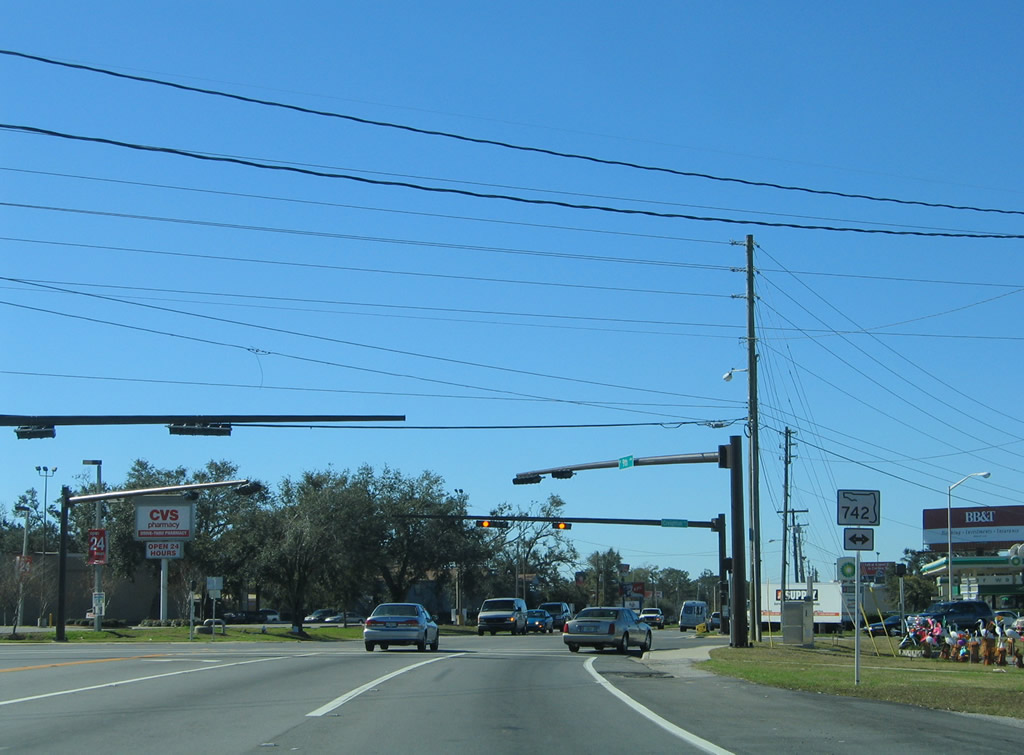
| A short distance south of Interstate 10 is the SR 289 (Ninth Avenue) intersection with SR 742 (Creighton Road). SR 742 comprises a busy arterial west from SR 289 to SR 291 (Davis Highway). This stretch of Creighton Road was expanded from two to five lanes in 1995. 01/31/06 |
|
| SR 742 leads east from Ninth Avenue through the Scenic Heights community and U.S. 90 (Scenic Highway) by Gull Point on Escambia Bay. Westward, the state road follows Creighton Road to Interstate 110 and Burgess Road west from there to U.S. 29 near Ensley. 01/31/06 |
|
| SR 289 (Ninth Avenue) leaves SR 742 (Creighton Road) and continues with essentially uninterrupted commercial frontage to Bayou Boulevard. A gap in the development exists along the east side between McAllister and Langley Avenues for the runaway approach to Pensacola International Airport (PNS). 01/31/06 |
|
| Airport Boulevard crosses SR 289 midway between Pensacola State College and Cordova Mall. The east-west arterial doubles as SR 750 east to Pensacola International Airport (PNS) and west to U.S. 29 (Pensacola Boulevard). Until 2011, SR 750 only applied to Airport Boulevard east from SR 289. An extension west to U.S. 29 includes the 2009-opened interchange with Interstate 110. 01/31/06 |
|
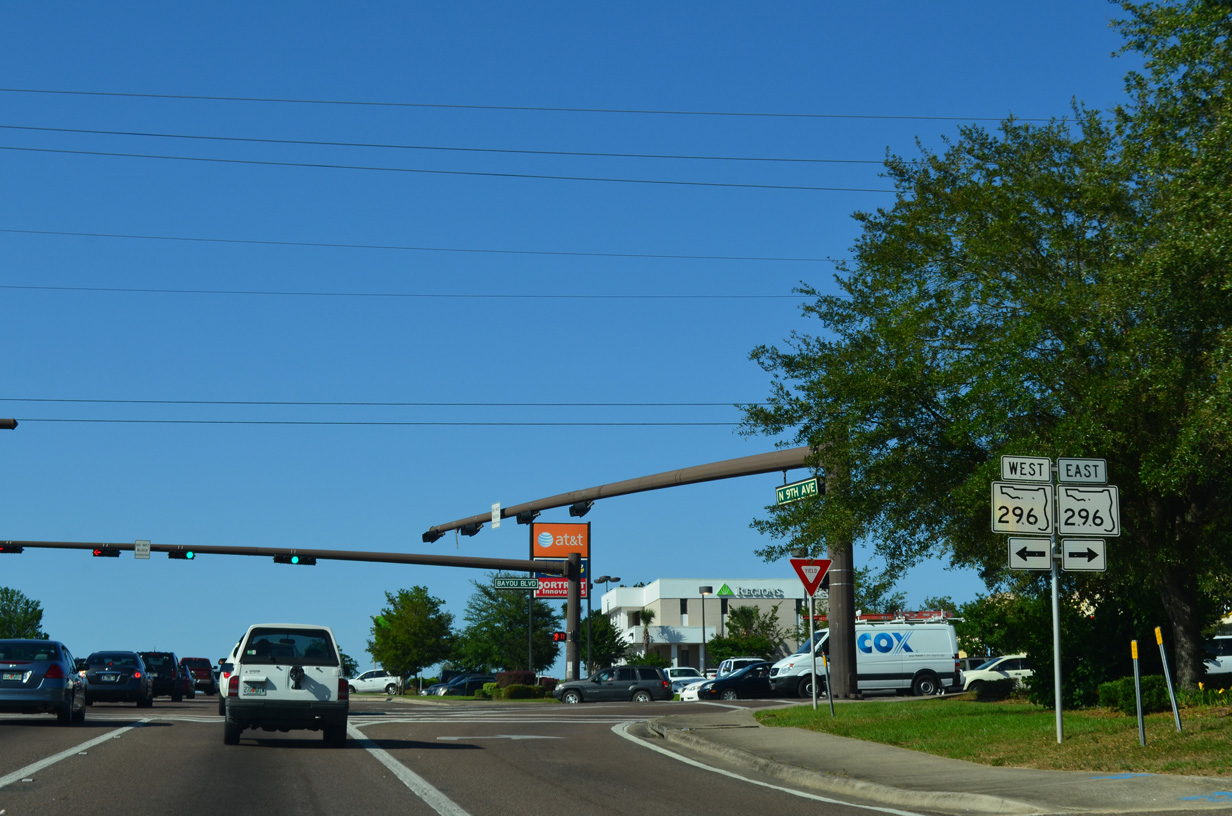
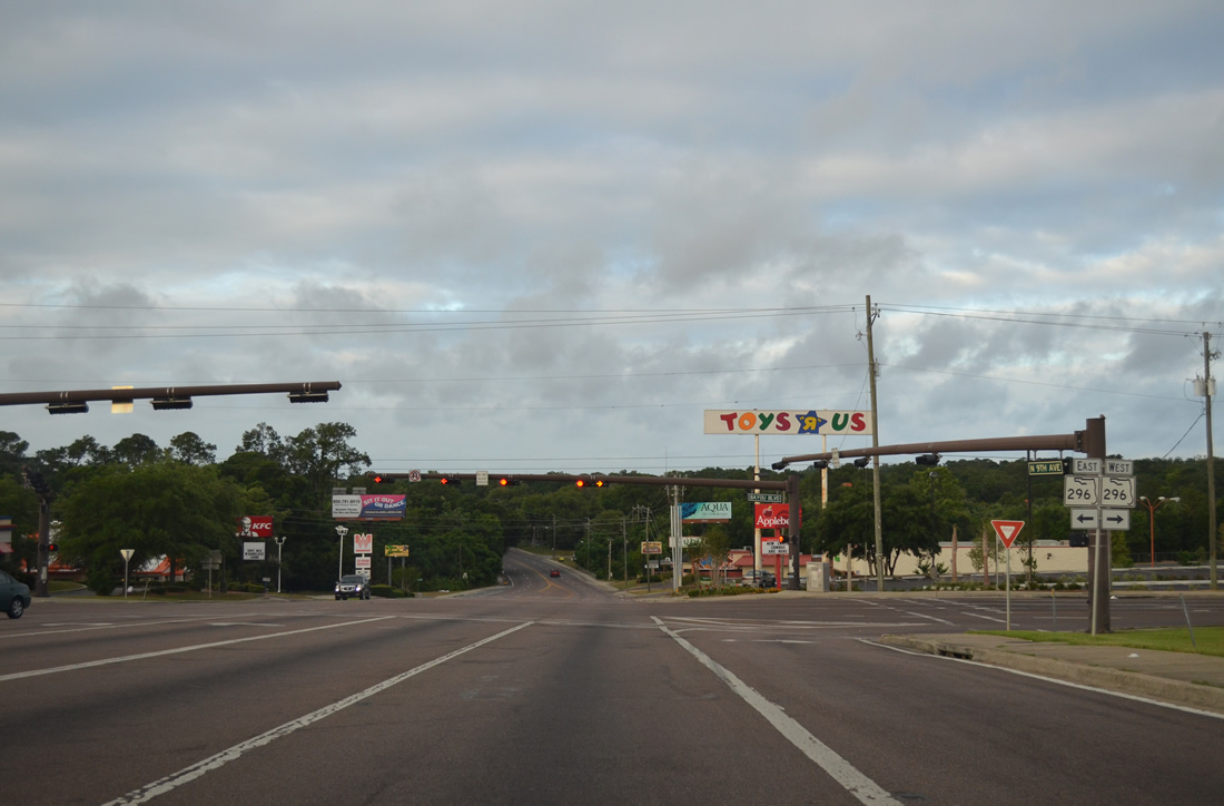
| Trailblazers for Interstates 10 and 110 precede the intersection of SR 289 south with SR 296 (Bayou Boulevard). SR 296 meets Interstate 110 at a diamond interchange one mile to the west. 06/01/13 |
|
| SR 296 follows Bayou Boulevard east by Cordova Mall before turning south to Bayou Texar. Westward the state road becomes Brent Lane after Carpenter Creek to U.S. 29 at Brent. 06/01/13 |
|
| Drivers lower from SR 296 (Bayou Boulevard) to a crossing of Carpenter Creek. SR 296 loops 9.60 miles overall between U.S. 90 (Cerventes Street) in Pensacola and U.S. 90 (Mobile Highway) near Bellview. CR 296 extends the road west from Mobile Highway to Saufley Field. 06/01/13 |
|
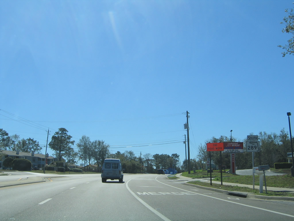
| 1.3 miles further south along Ninth Avenue is the SR 289 intersection with the northern terminus of SR 295 (Fairfield Drive). Fairfield Drive carries the state road southwest to West Pensacola and junction SR 727. 06/01/13 |
|
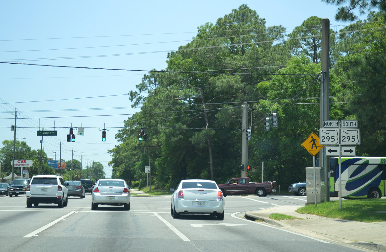
| SR 289 southbound at Fairfield Drive and SR 295 south. The shield assembly is incorrect in that SR 295 does not continue north to the left. Fairfield Drive continues as a locally maintained road one third of a mile to merge with 12th Avenue. Motorists turning south onto SR 295 reach the confluence of SR 291 and Interstate 110 within one half mile. 05/17/14 |
|
| SR 289 loses its middle turn lane from SR 295 southward. 05/17/14 |
|
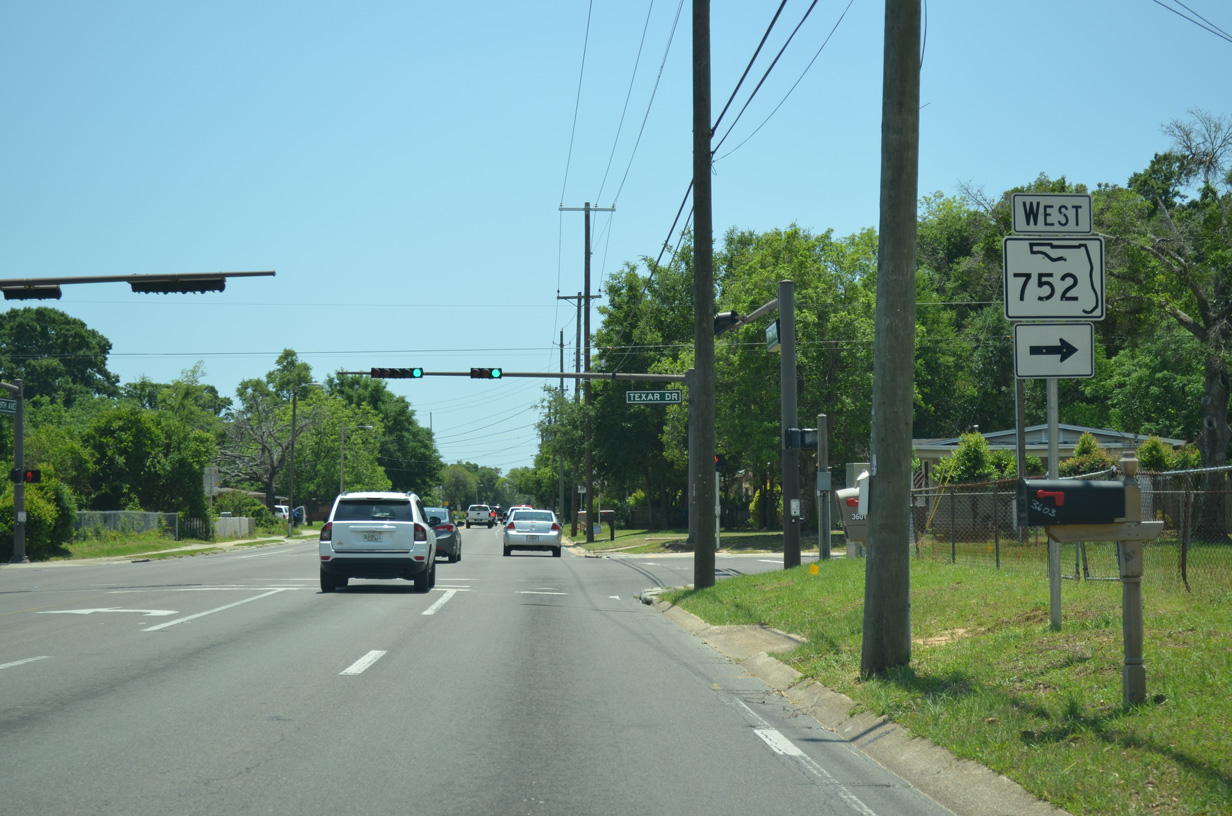
| Nearing SR 752 (Texar Drive) along SR289 (Ninth Avenue) south. SR 752 stems west 1.18 miles from SR 289 across Interstate 110 to SR 295 (Fairfield Drive). 05/17/14 |
|
| Use SR 752 west to access U.S. 29 (Palafox Street) and SR 295 at H Street. SR 752 also intersects the one way street couplet of SR 291 three blocks to the west. Texar Drive continues east 0.8 miles to 18th Avenue through a residential area. 05/17/14 |
|
| SR 289 enters an older neighborhood of Pensacola and the city street grid southward from Texar Drive. Pictured here is the signalized intersection with Jordan Street. Jordan Street, along with Maxwell Street one block to the north, constitute a couplet to and from Interstate 110, five blocks to the west. 01/31/06 |
|
| Blount Street travels 0.6 miles west from this traffic light at Ninth Avenue underneath the Interstate 110 viaduct to U.S. 29 (Palafox Street). 01/31/06 |
|
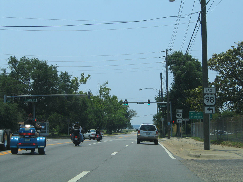
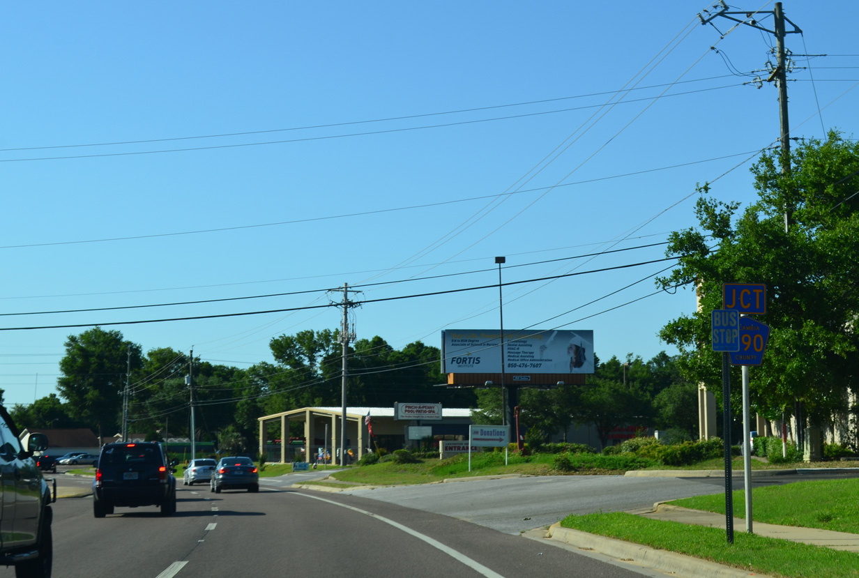
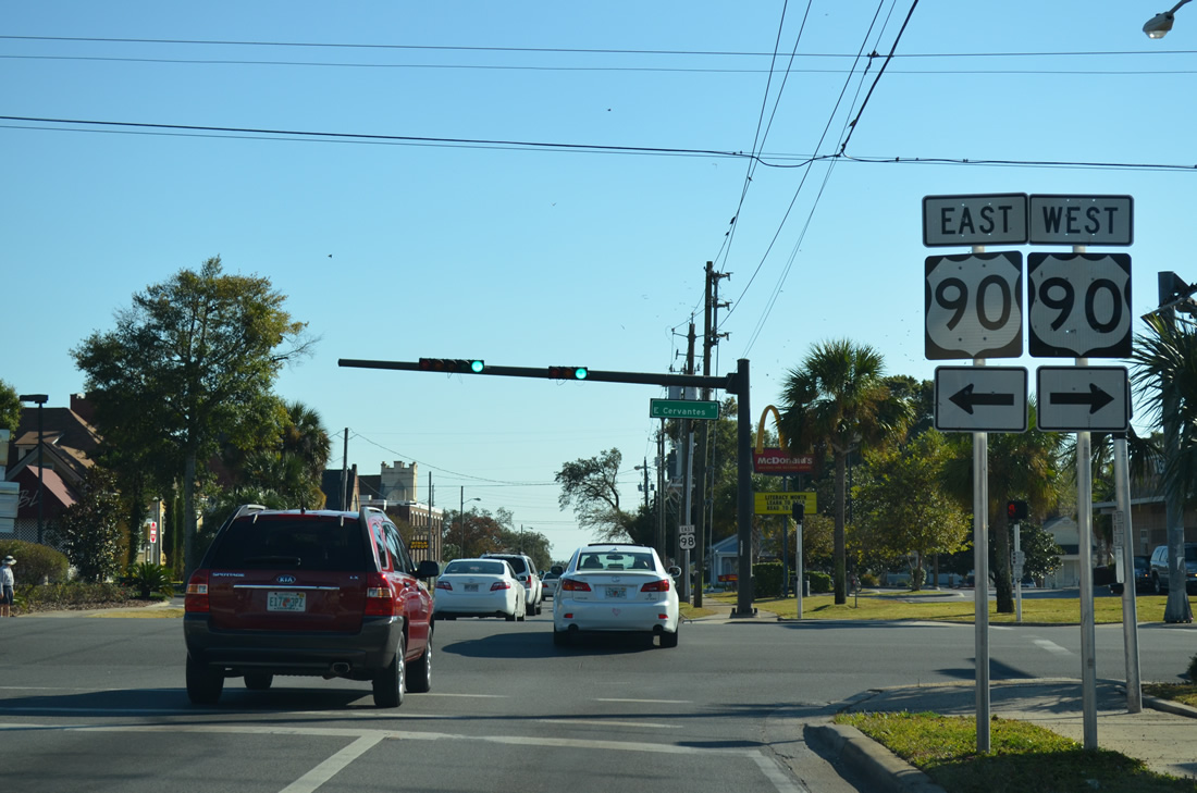
| The signed portion of SR 289 concludes at the merge with U.S. 98 east at Cervantes Street (U.S. 90). Cervantes Street ventures east to Scenic Highway and west as U.S. 90/98 to Pace Boulevard. 11/17/12 |
|
| U.S. 98 eastbound turns south onto Ninth Avenue, joining unsigned SR 289 to Chase Street east. 05/16/14 |
|
| An overhead once directed motorists of U.S. 98 east at Gregory Street (U.S. 98 Business west). 01/31/06 |
|
| U.S. 98 east & SR 289 (Ninth Avenue) southbound approach Chase Street (U.S. 98 Business east) at De Leon Street. 05/09/04 |
|
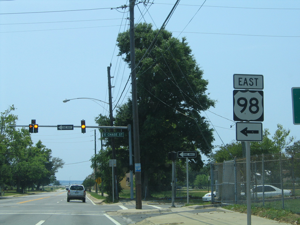
| SR 289 ends, U.S. 98 Business ends, and U.S. 98 turns eastward toward Gulf Breeze and Pensacola Beach. 05/09/04 |
Photo Credits:11/16/03, 05/09/04, 01/31/06, 02/09/09, 11/17/12, 12/15/12, 06/01/13, 05/15/14, 05/16/14, 05/17/14 by AARoads
Connect with:
U.S. 90
U.S. 98
Former State Road 290 - Olive Road
State Road 295
State Road 296
State Road 742 - Burgess Road / Creighton Road
State Road 750 - Airport Boulevard
State Road 752 - Texar Drive
Page Updated 11-19-2014.

 North
North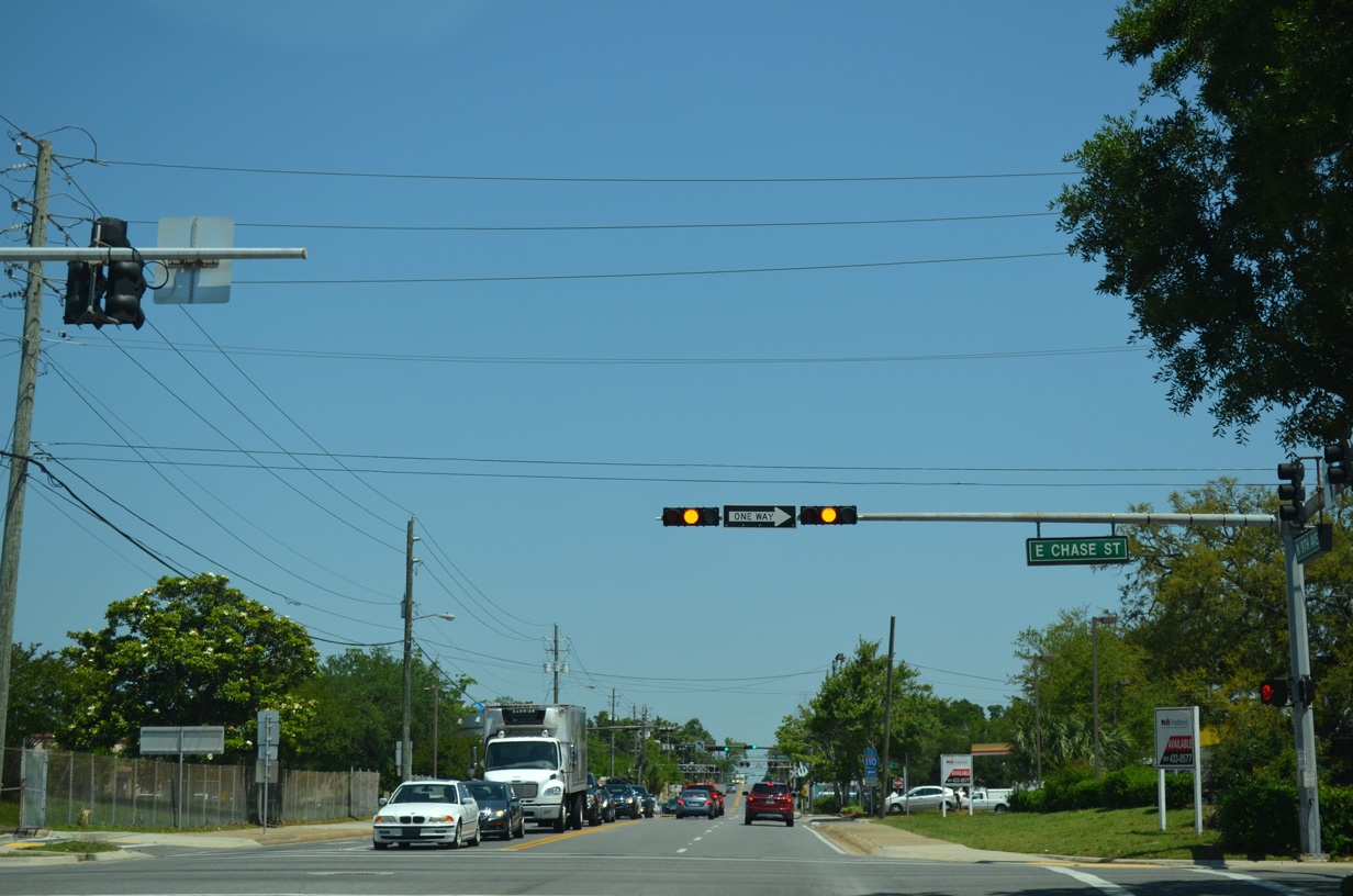


 East
East