|
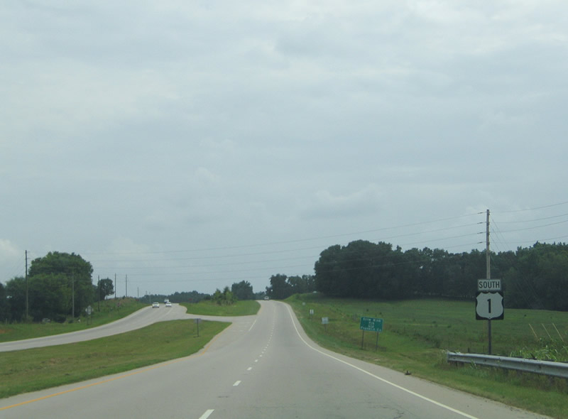
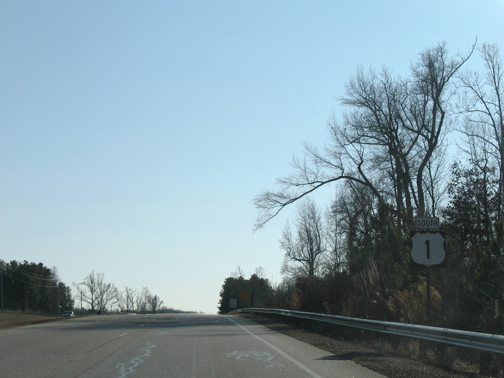
| U.S. 1 shield posted south after the Tar River and Vance County. 07/12/05 |
|
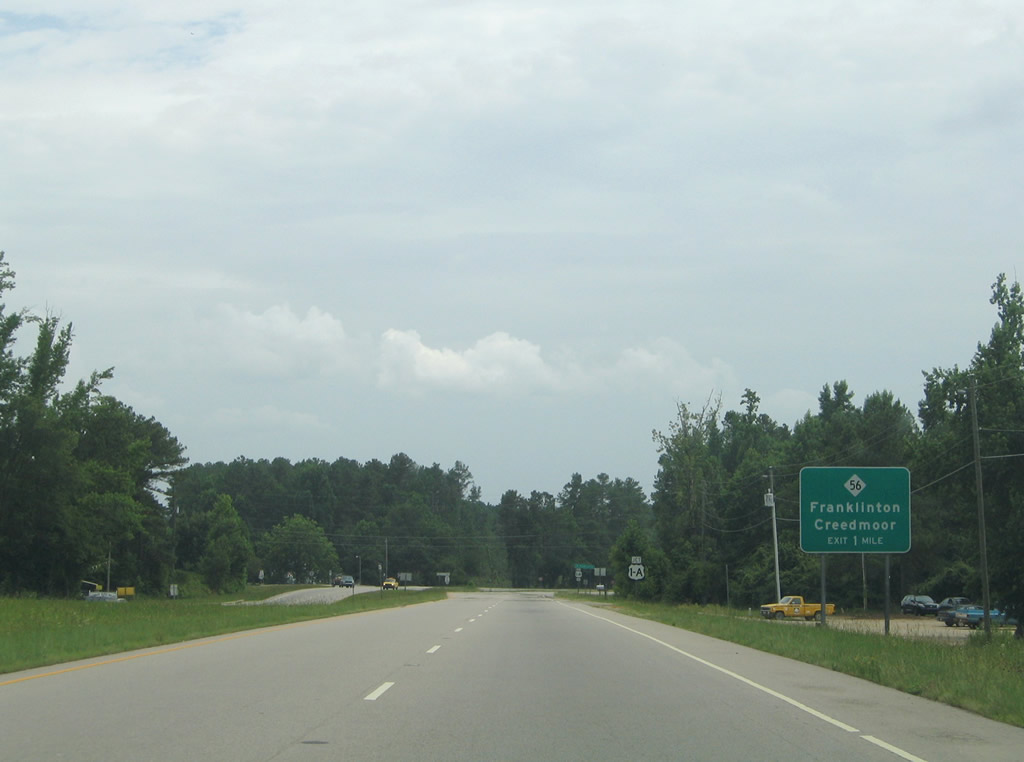
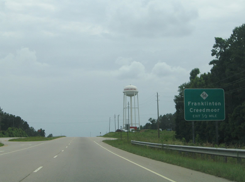
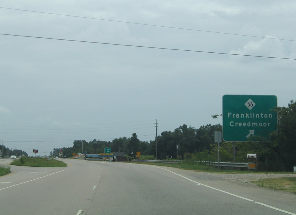
| U.S. 1 advances to the town of Franklinton and NC 56 (Green Street). NC 56 connects the four lane bypass along U.S. 1 with Downtown to the east and Creedmoor, 14 miles to the west. 07/12/05 |
|
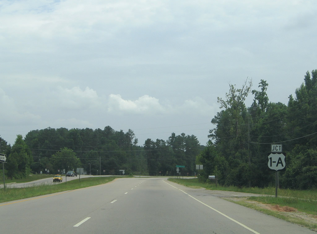
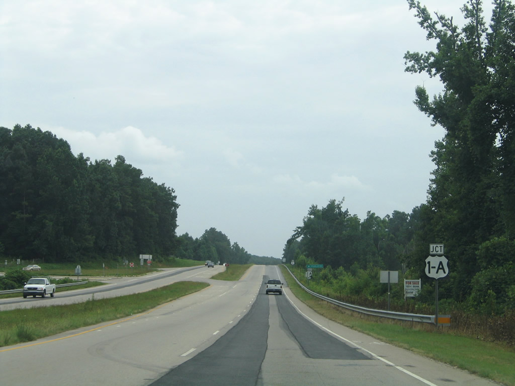
| U.S. 1 Alternate follows the original U.S. 1 alignment along Main Street through Franklinton. 07/12/05 |
|
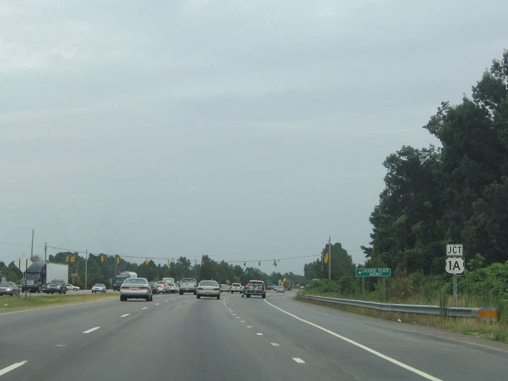
| 2.7 miles in length, U.S. 1-A follows Main Street through the heart of Franklinton east of U.S. 1. 07/12/05 |
|
| A diamond interchange links U.S. 1 south with NC 56 (Green Street) in a half mile. 07/12/05 |
|
| NC 56 travels 42 miles between Butner and NC 58 near Castalia. Heading east though most of the growth of Franklinton, NC 56 follows Green Street. NC 56 combines with U.S. 401 outside the Franklin County seat of Louisburg in eight miles. 07/12/05 |
|
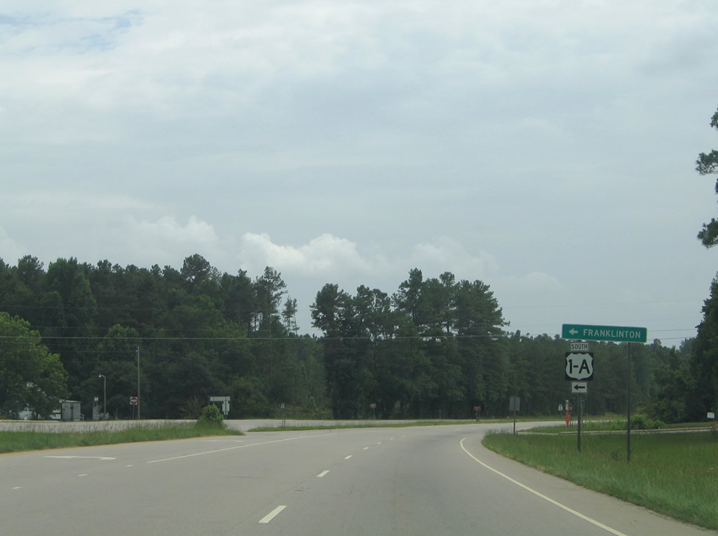
| U.S. 1 Alternate (Main Street) returns to U.S. 1 in a rural area south of Franklinton. 07/12/05 |
|
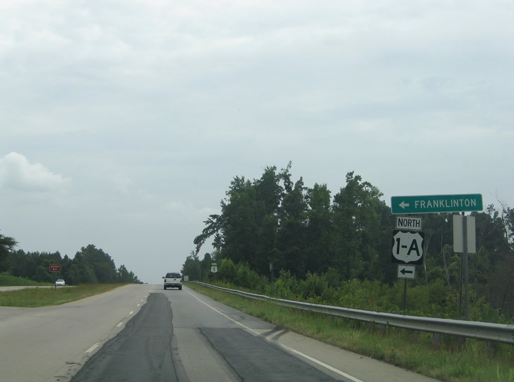
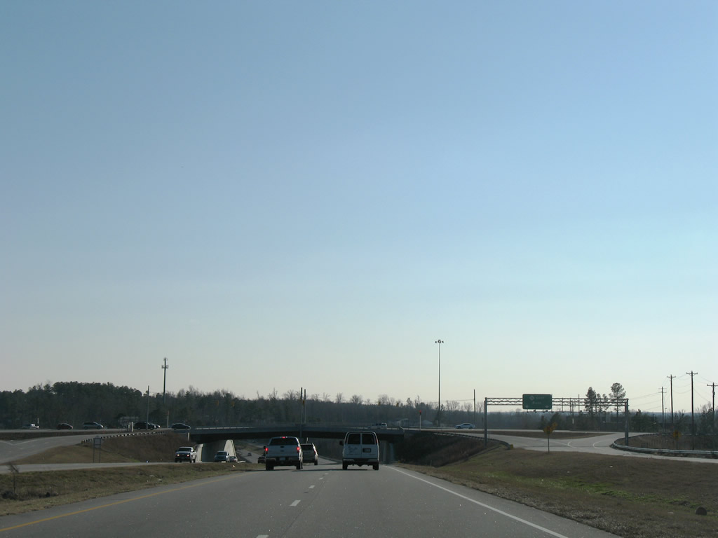
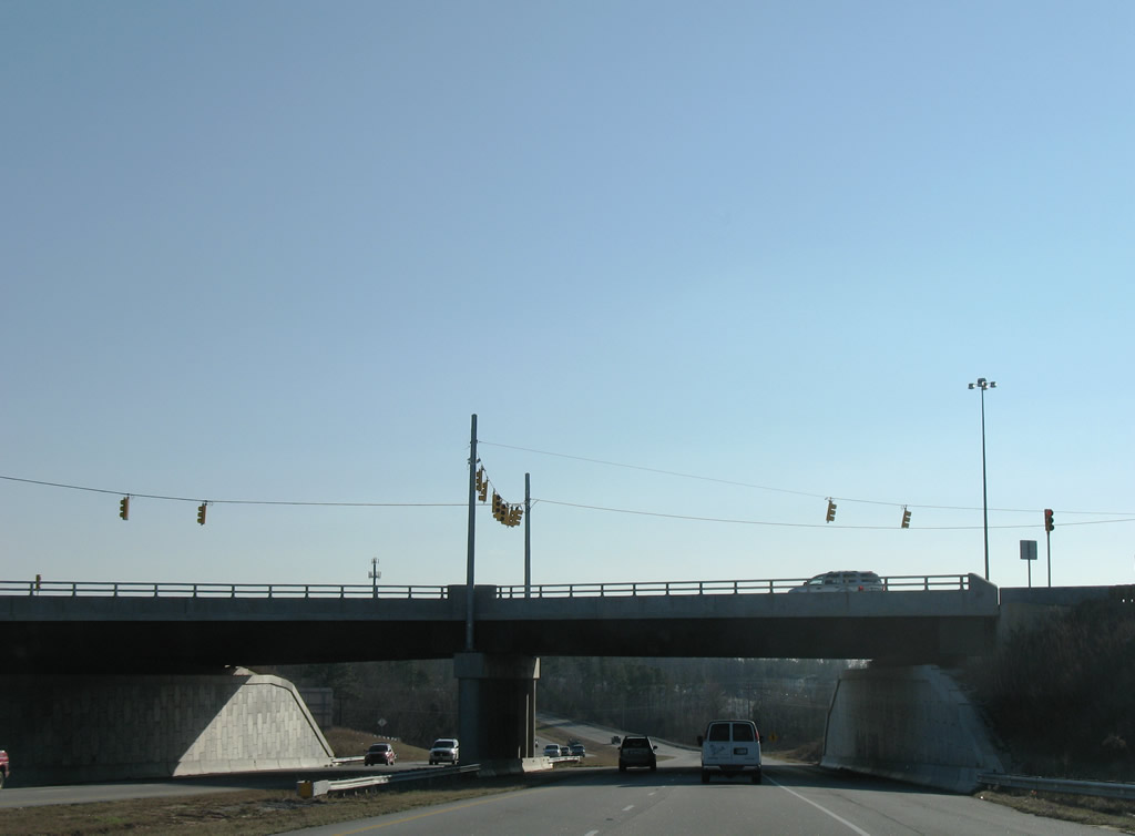
| Southbound at the end of U.S. 1A. U.S. 1 bypassed Franklinton in 1953.1 07/12/05 |
|
| U.S. 1 continues 2.2 miles south to another split with its original alignment. 01/02/08 |
|
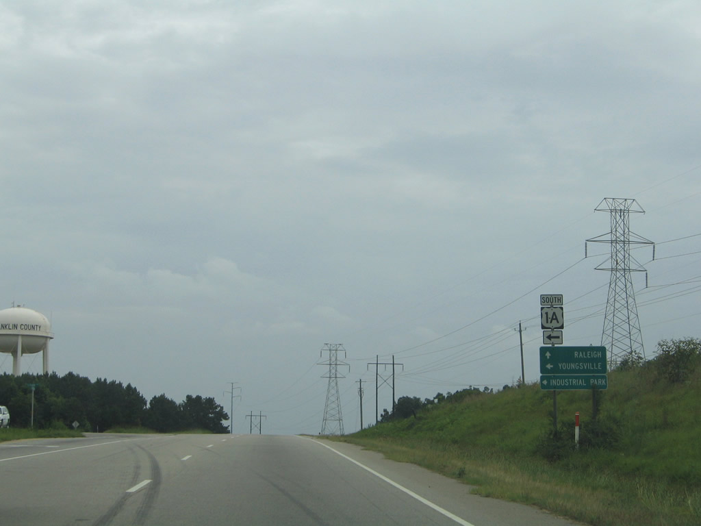
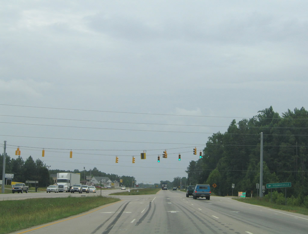
| A second U.S. 1A route separates from U.S. 1 south ahead of Youngsville in southwestern Franklin County. U.S. 1A loops nine miles through both Youngsville and Wake Forest before returning to U.S. 1 in the north Raleigh suburbs. 07/12/05 |
|
| U.S. 1 bypassed Youngsville in 1953. The four lane highway serves a handful of industrial businesses at the junction with NC 96. 07/12/05 |
|
| NC 96 joins Youngsville with Oxford 25 miles to the north. The state route travels 108 miles between the Virginia state line and NC 55 west of Newton Grove. 07/12/05 |
|
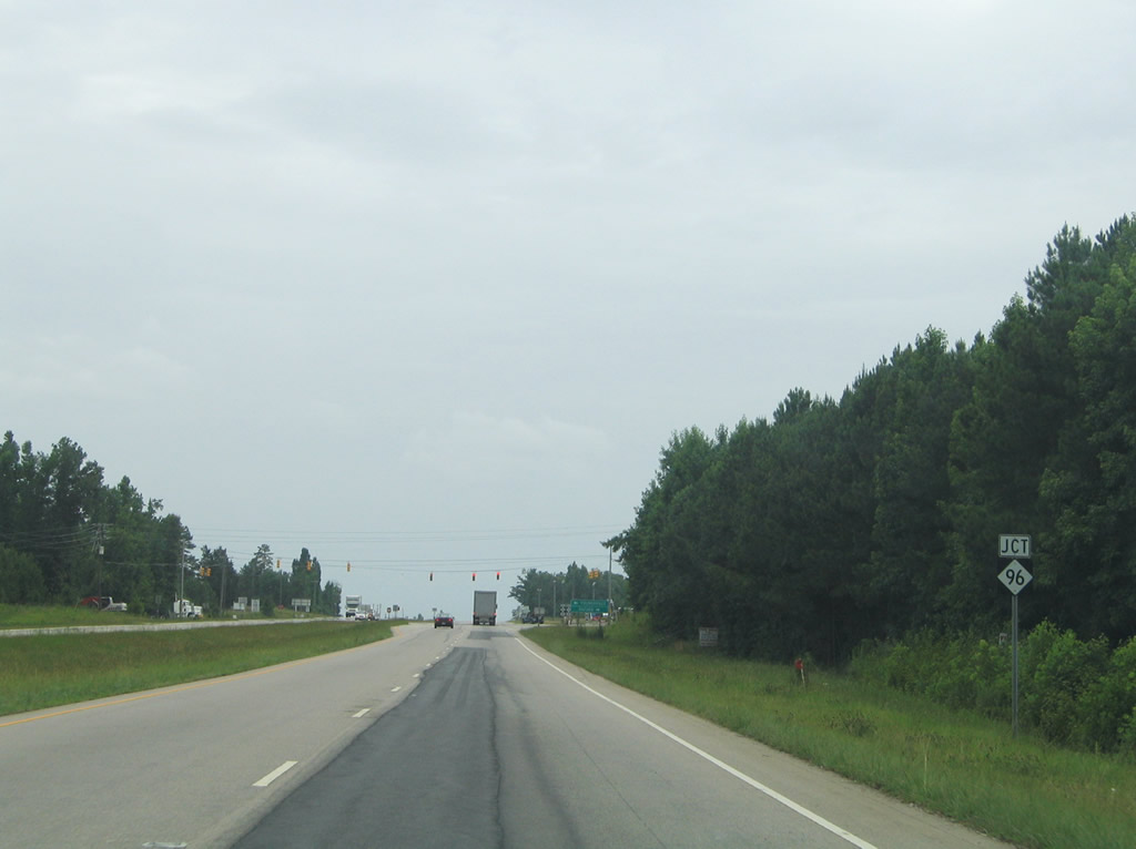
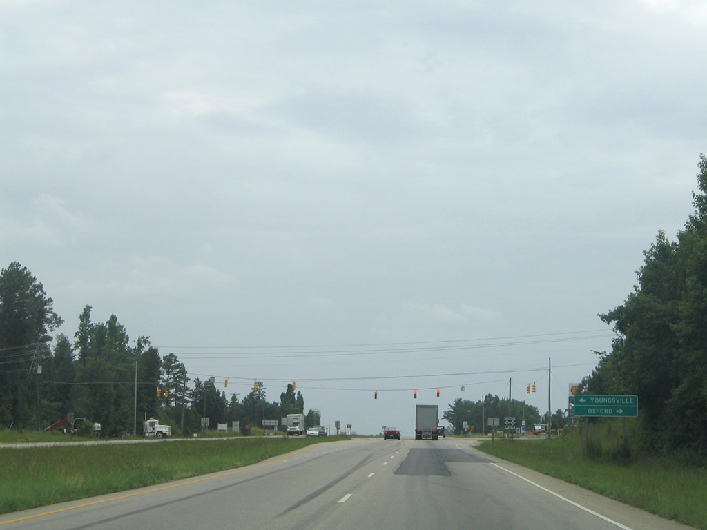
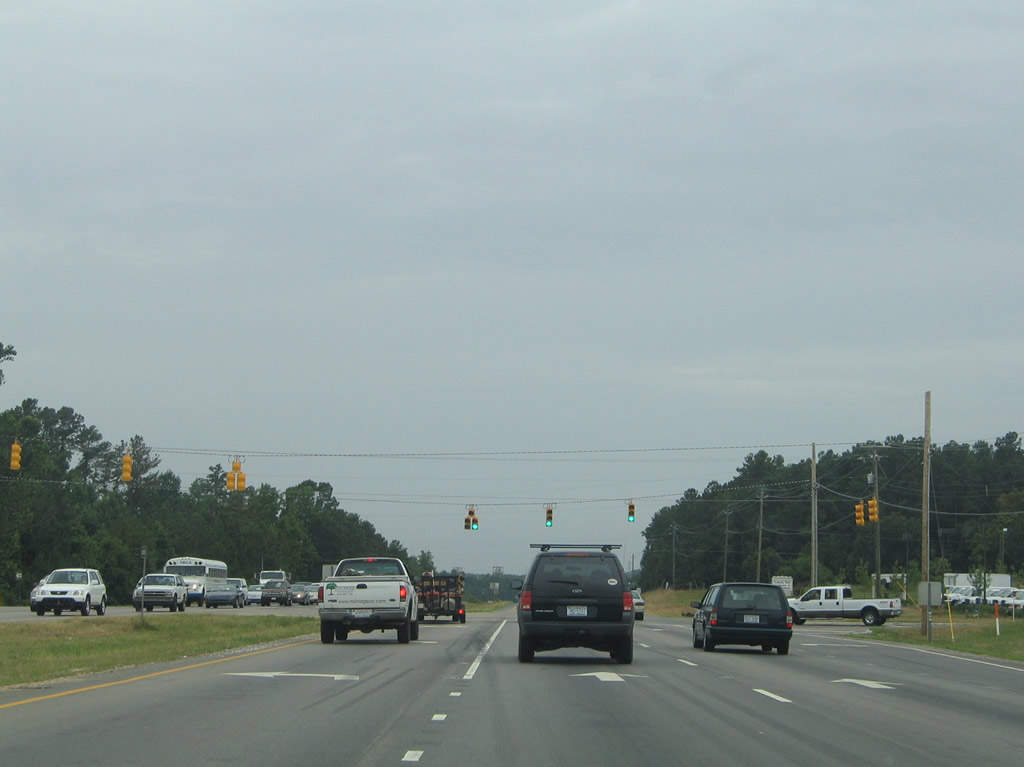
| NC 96 is the first traffic light on southbound U.S. 1 since Norlina. NC 96 combines with U.S. 1A along College Street before turning east onto Main Street. Ten miles separate U.S. 1 from Wilton via NC 96. 07/12/05 |
|
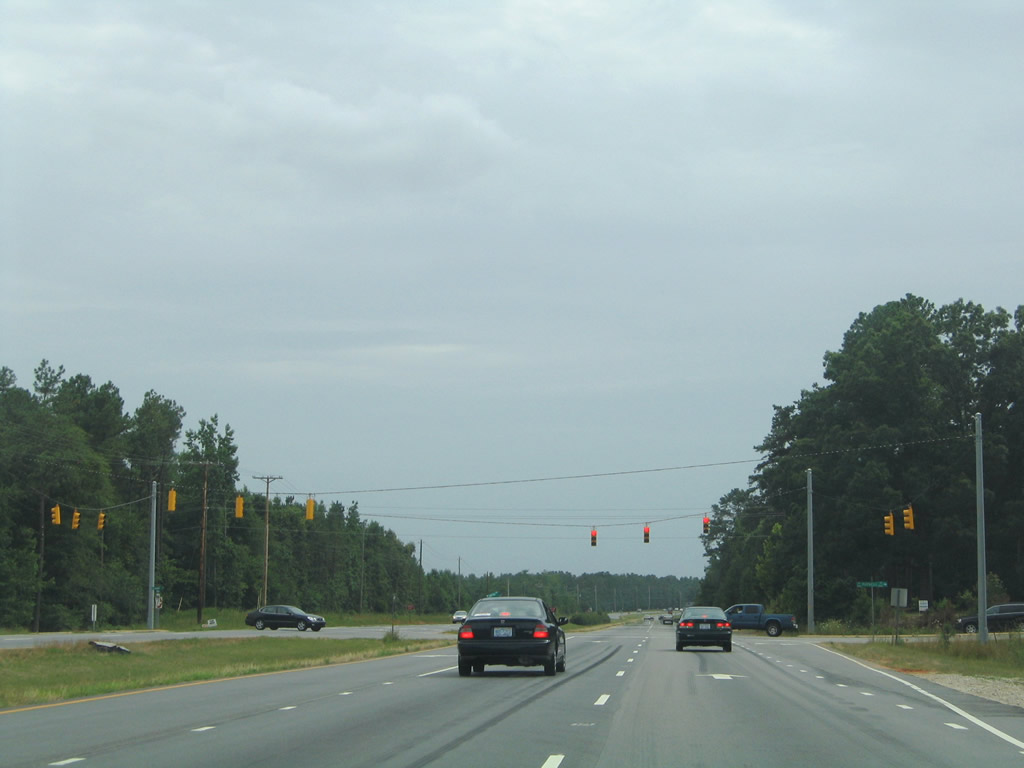
| Holden Road intersects U.S. 1 at the next traffic light. Holden Road extends west from Main Street to rural subdivisions at Jonah Davis Road. 07/12/05 |
|
| Progressing southward through increasing suburbanization toward Raleigh, U.S. 1 enters Wake County along Capital Boulevard. 07/12/05 |
|
| Purnell Road west and Harris Road east come together at U.S. 1 south near the county line. Harris Road connects with U.S. 1 Alternate in suburban Wake Forest; Purnell Road meanders westward to Purnell and New Light through a mixture of rural subdivisions and forest. 07/12/05 |
|
| Continuing south on U.S. 1 along the outskirts of Wake Forest toward Wake Forest Golf Course. 07/12/05 |
|
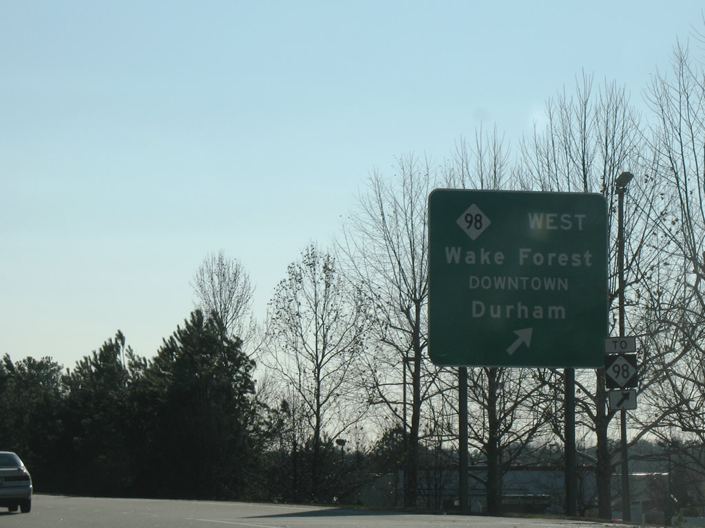
| One mile north of the diamond interchange with NC 98 west and NC 98 Business (Durham Road). NC 98 travels 50 miles between Durham and U.S. 64 Alternate/NC 231 near Spring Hope. 07/12/05 |
|
| Jenkins Road and Stadium Drive meet U.S. 1 (Capital Boulevard) at the succeeding signal. Stadium Drive connects with North Avenue and U.S. 1 Alternate (Main Street) in Wake Forest. Jenkins Road stems northwest to Thompson Mill Road. 07/12/05 |
|
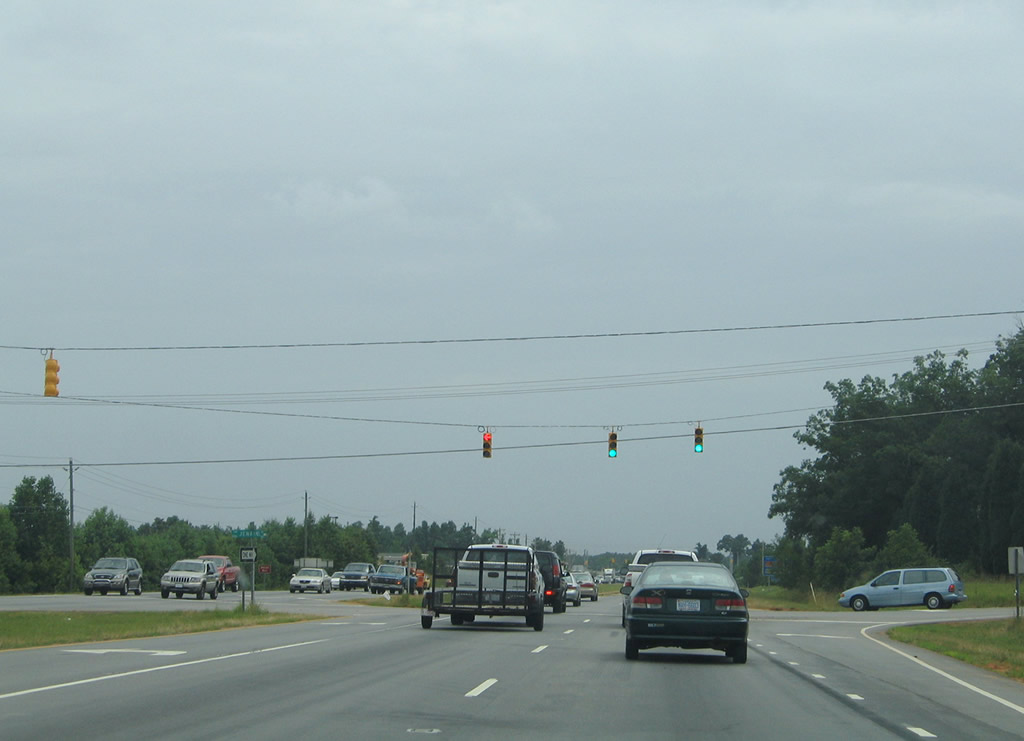
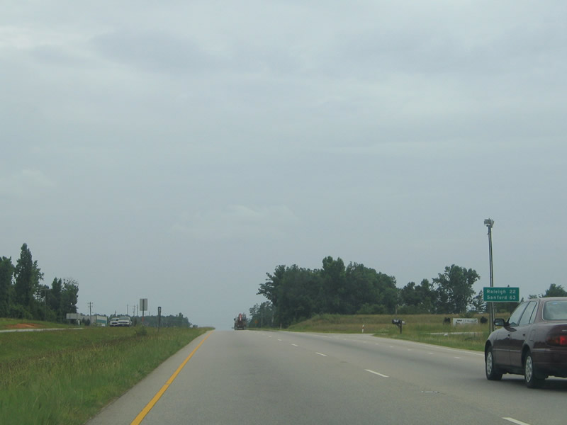
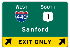
| Sign with the distances to Raleigh and Sanford posted after Stadium Drive. 07/12/05 |
|
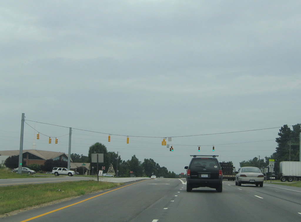
| Wake Union Church Road provides a back route to NC 98 (Durham Road) behind shopping centers along U.S. 1 (Capital Boulevard) southbound. 07/12/05 |
|
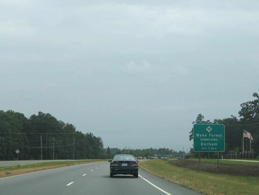
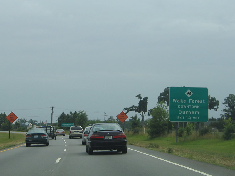
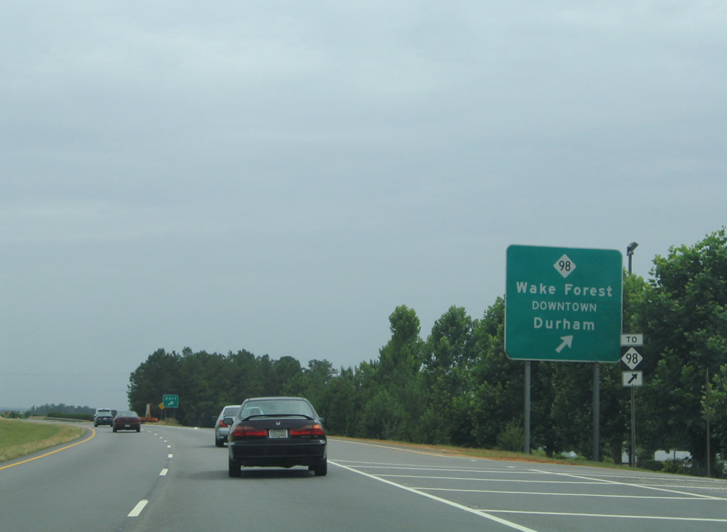
| NC 98 Business (Durham Road) east comprises the preferred route to Downtown Wake Forest from U.S. 1 south. Durham Road carries NC 98 Business to U.S. 1A on Front Street before entering the business district. 07/12/05 |
|
| NC 98 was partially relocated in 2005 with the opening of a southern bypass of Wake Forest. The four lane route was extended west from U.S. 1 to Durham Road with construction underway by March 2008. 07/12/05 |
|
| By 2008 guide sighs for NC 98 were altered to only reference westbound. NC 98 east temporarily followed U.S. 1 south one mile to the bypass route. 01/02/08 |
|
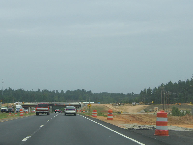
| Looking south at the SPUI with NC 98 during construction. Completion of the 1.55 mile western segment of NC 98 was expected by January 2010.2 07/12/05 |
|
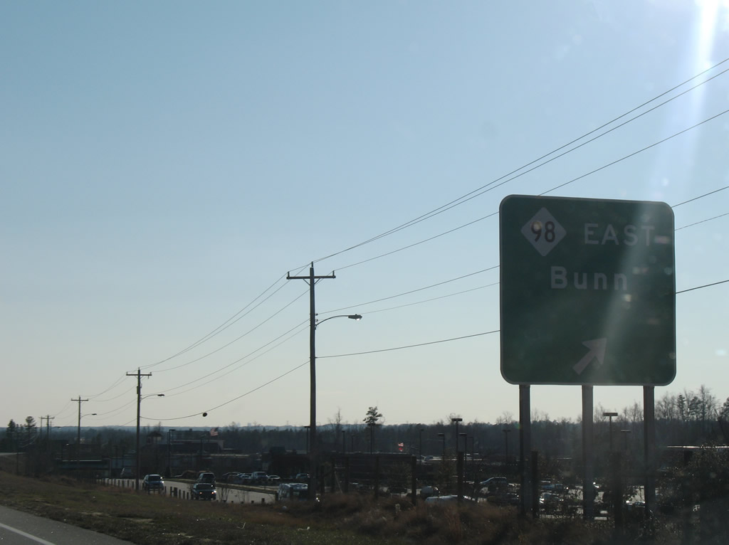
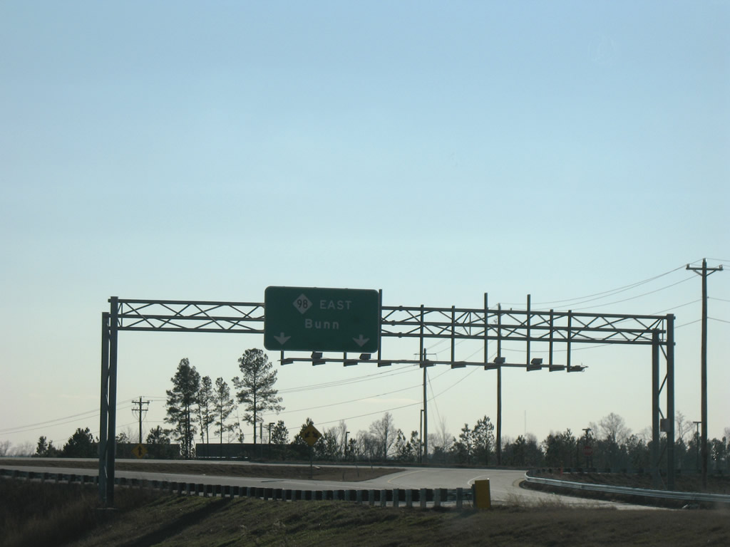
| NC 98 heads east past Wake Forest to Wait Avenue, New Hope, and Bunn. 01/02/08 |
|
| NC 96 west from U.S. 1 serves a bevy of new retail added from 2005 onward along Retail Drive, the adjacent service road for U.S. 1. 01/02/08 |
|
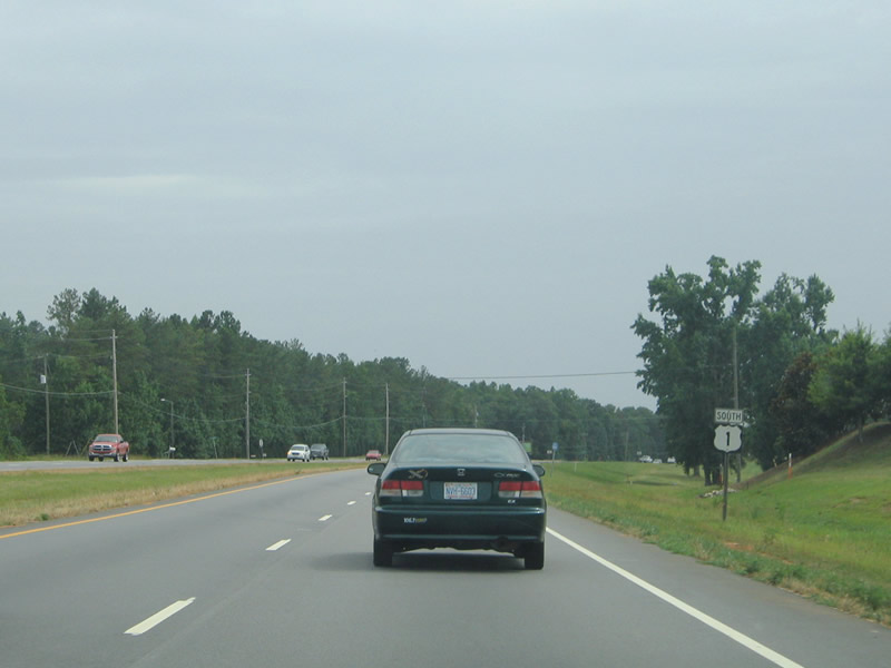
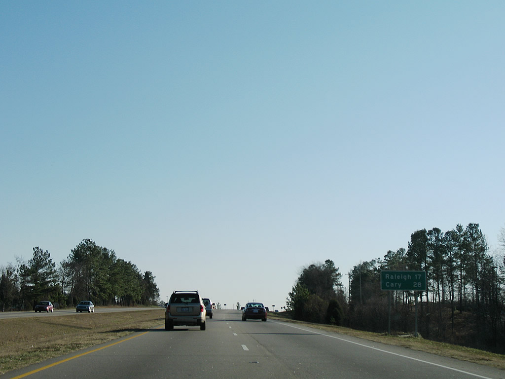
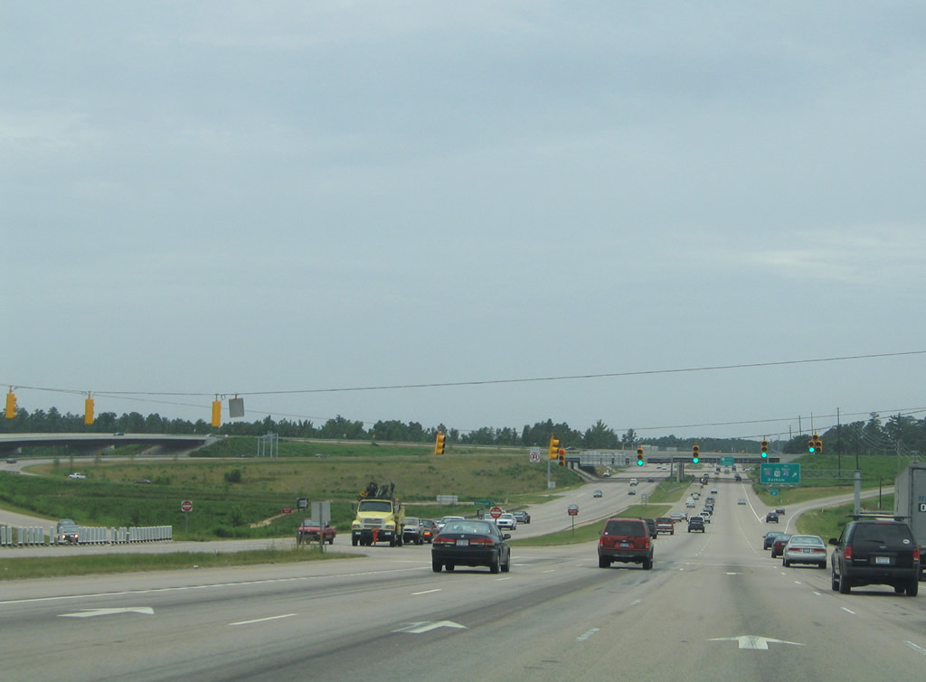
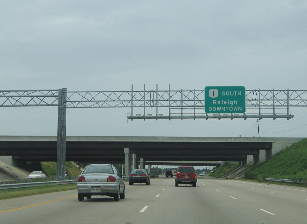
| Cary replaces Sanford as the second control city on U.S. 1 southbound distance signs. Cary neighbors Raleigh to the west where U.S. 1 leaves the Cliff Benson Beltline. 01/02/08 |
|
| U.S. 1 Alternate (S Main Street) returns to U.S. 1 from Wake Forest opposite Falls of Neuse Road. Falls of Neuse Road connects U.S. 1 with Wakefield Pines Road in northern sections of Raleigh. 07/12/05 |
|
| Burlington Mills Road leads east from U.S. 1 (Capital Boulevard) to Walkers Crossroads and U.S. 401 (Louisburg Road) near Rolesville. 07/12/05 |
|
| Spurring east to the tightly packed subdivisions surrounding Thornton Commons Drive, Thornton Road follows from the ensuing traffic light on U.S. 1 south. 07/12/05 |
|
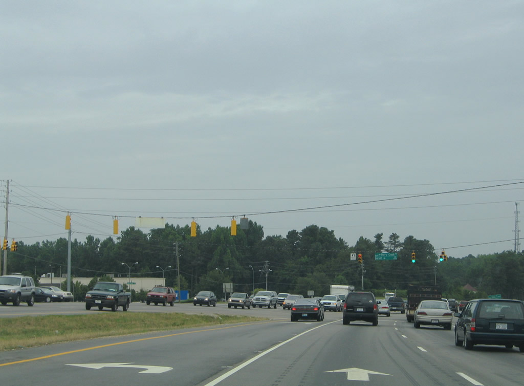
| Durant Road heads northwest from U.S. 1 at Neuse Crossroads to Six Forks Road through suburban north Raleigh. Perry Creek Road links Capital Boulevard with U.S. 401 (Louisburg Road) north of I-540. 07/12/05 |
|
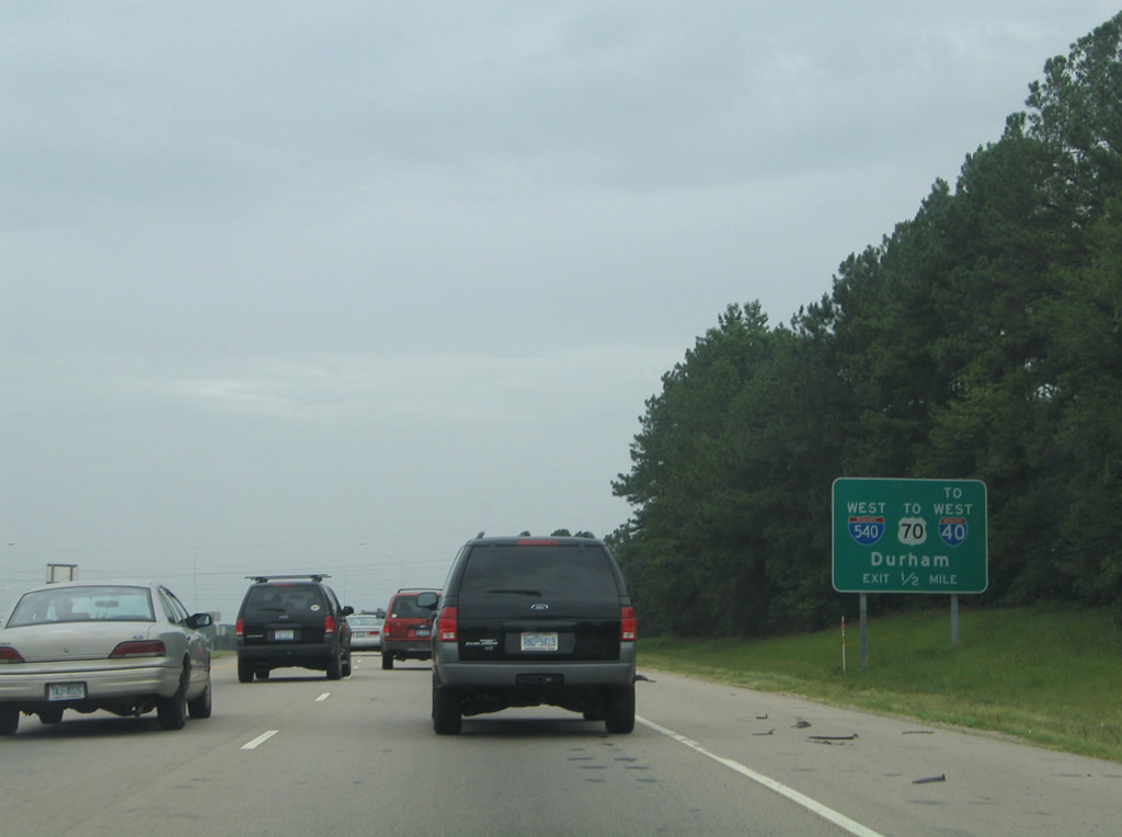
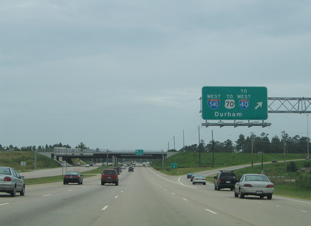
| The first sign for I-540 on U.S. 1 south precedes the intersection with Gresham Lake Road (SR 2013). I-540 (Northern Wake Expressway) provides a direct connection between U.S. 1 and Raleigh Durham International Airport (RDU). 07/12/05 |
|
| U.S. 1 enters the directional cloverleaf interchange with Interstate 540 just beyond Gresham Lake Road. Gresham Lake Road (SR 2013) arcs west through industrial parks north of Greshams Lake. 07/12/05 |
|
| I-540 (Northern Wake Expressway) travels west to U.S. 70 and Interstate 40 for the city of Durham. Interstate 540 was completed between U.S. 1 and I-40 near Research Triangle Park (RTP) by August 12, 2002. 07/12/05 |
|
| Interstate 540 continues east three miles to U.S. 401 (Louisburg) and ten miles to I-87/U.S. 64-264 at Knightdale. This section of the Northern Wake Expressway opened on January 16, 2007. 07/12/05 |
Page Updated 04-16-2009.


 South
South