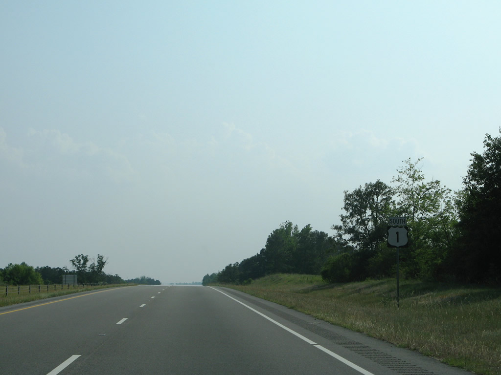
None of U.S. 1 in Moore County is a full freeway. While several grade separated interchanges are located along the four lane corridor, there are superstreet at-grades along the Southern Pines and Vass-Cameron bypasses.4
|
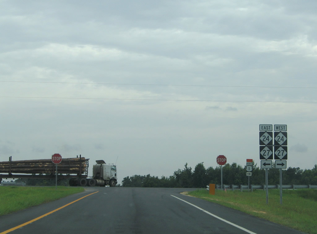
| NC 24/27 overlap nine miles east from U.S. 1 to Johnsonville and eight miles west to U.S. 15/501 outside Carthage. 05/30/07 |
|
| NC 24/27 combine for 108 miles overall along a rural route west from Johnsonville to Albemarle and a four lane corridor into the city of Charlotte. 05/30/07 |
|
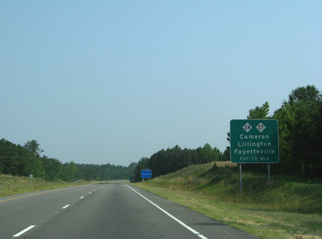
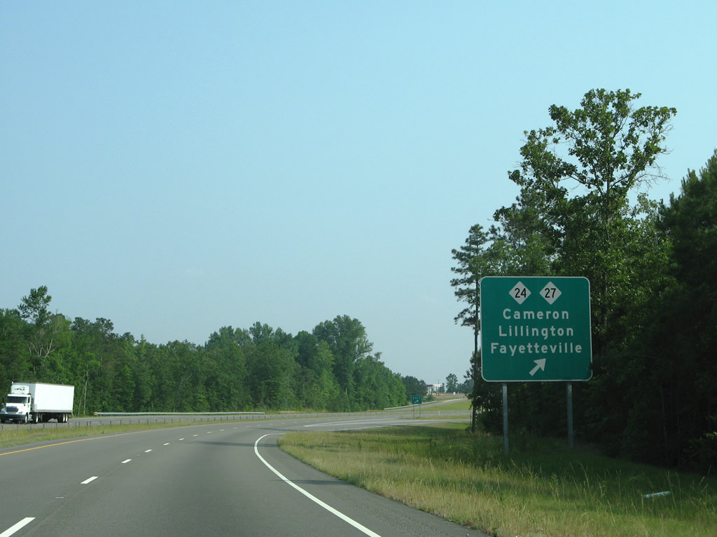
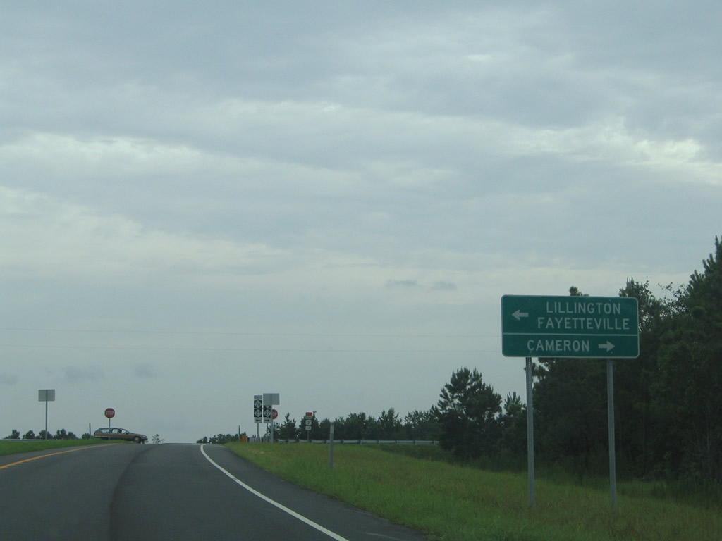
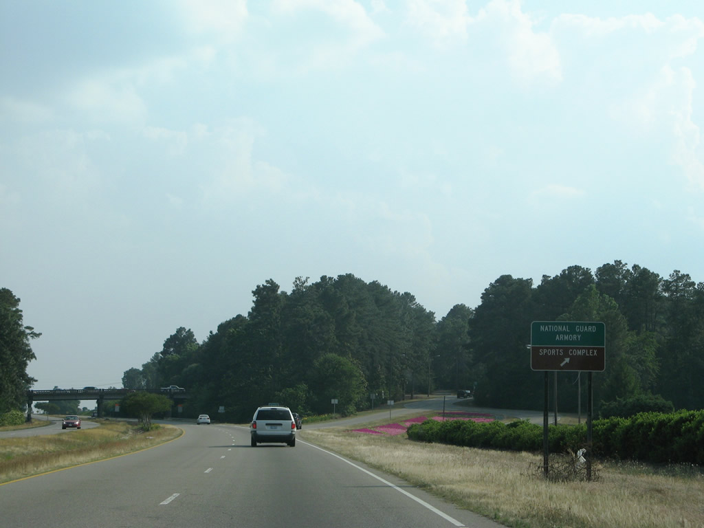
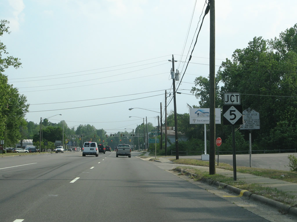
| NC 24/27 join Cameron with Lillington, the Harnett County seat, and Fayetteville to the east beyond their split. The nearby town of Cameron is the hometown of professional wrestlers Matt Hardy, Jeff Hardy and Shannon Moore. 07/12/05 |
|
| NC 24 runs 287 miles from the north Charlotte suburbs to Morehead City. NC 27 measures 197 miles west to Toluca and east to Benson. 07/12/05 |
|
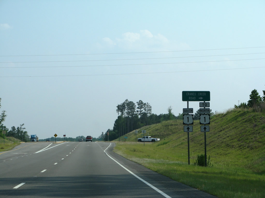
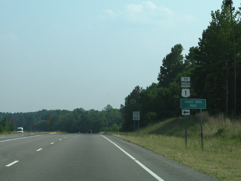
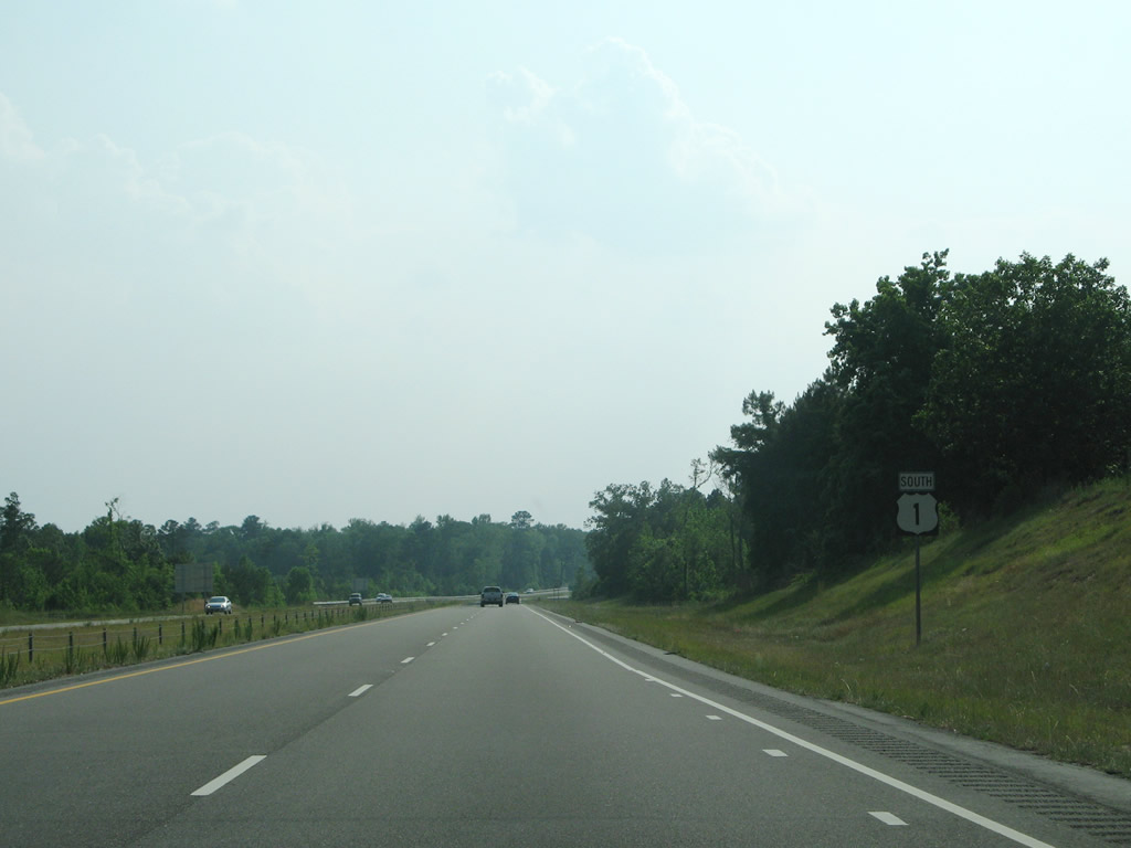
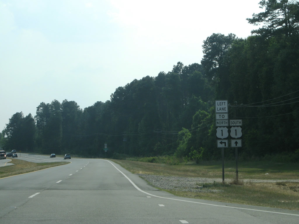
| U.S. 1 continues uninterrupted 2.5 miles south from NC 24/27 to the J-turn intersection with Cranes Creek Road (SR 2199). 05/30/07 |
|
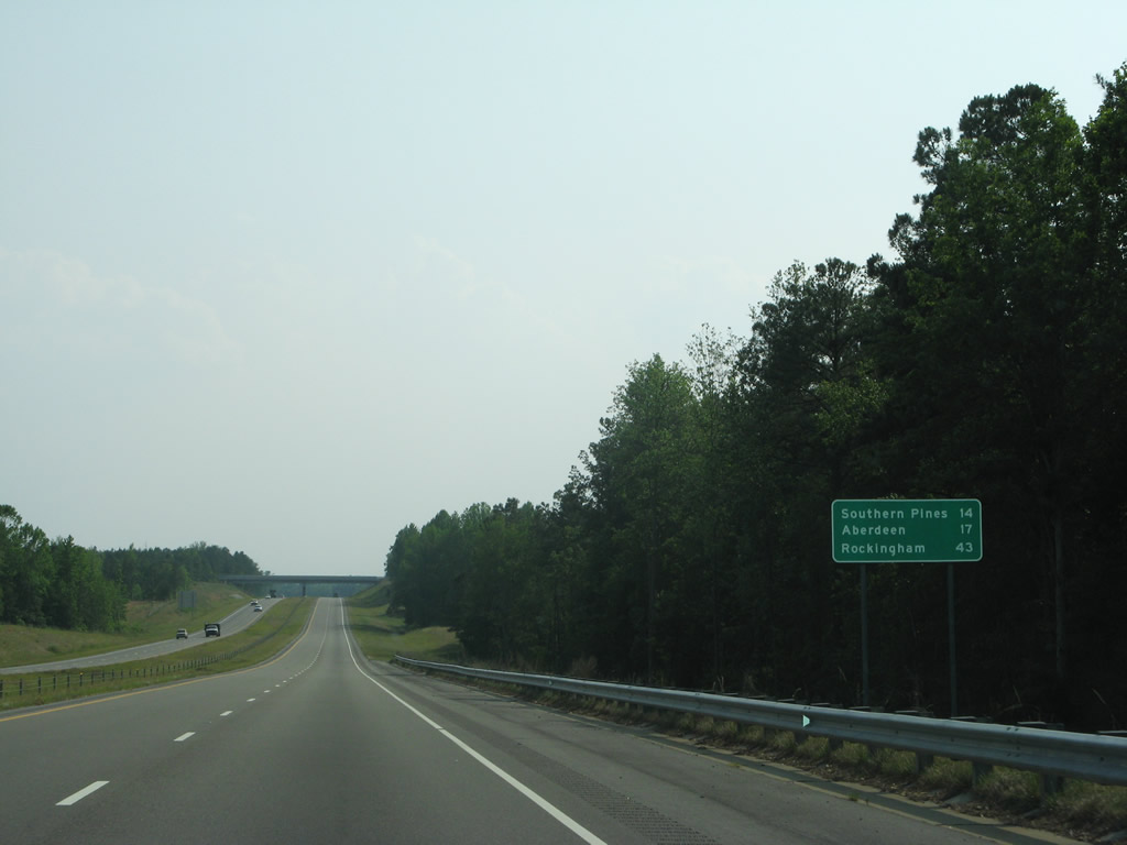
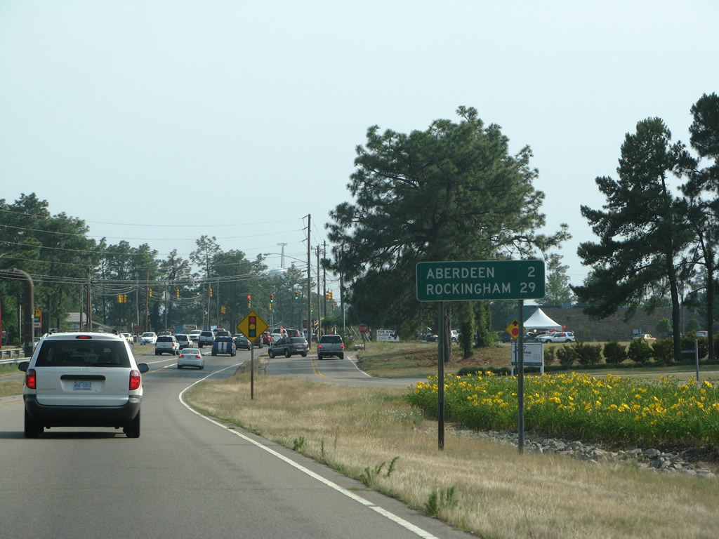
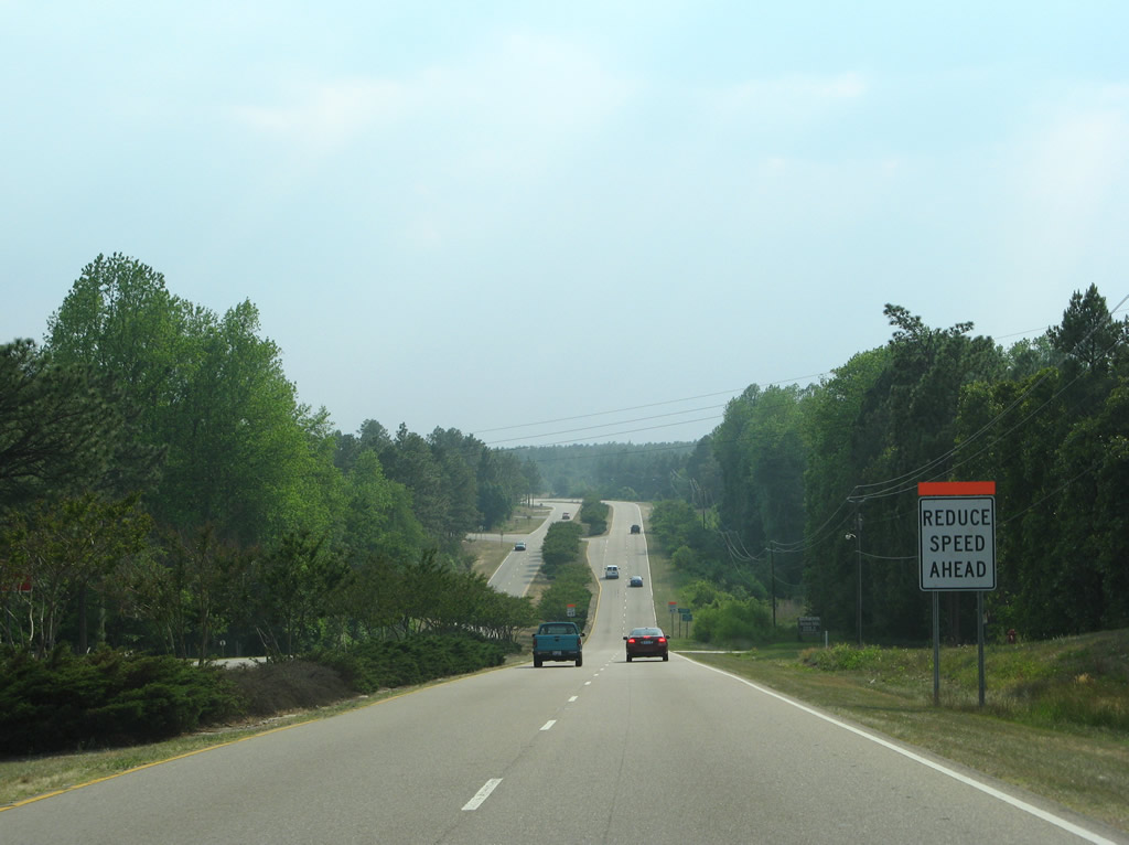
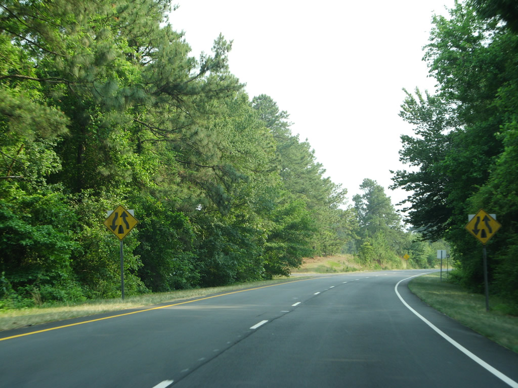
| Southern Pines and neighboring Aberdeen are located within 17 the next 17 miles of U.S. 1 south. Rockingham is 43 miles to the southwest. 05/30/07 |
|
| Cranes Creek Road (SR 1825) travels northwest to U.S. 1 Business and NC 24/27 west of Cameron and southeast to Cypress Church Road. 05/30/07 |
|
| When the U.S. 1 Cameron bypass opened in June 2005, the intersection with Cranes Creek Road (SR 1825) was converted to use J-turns. 05/30/07 |
|
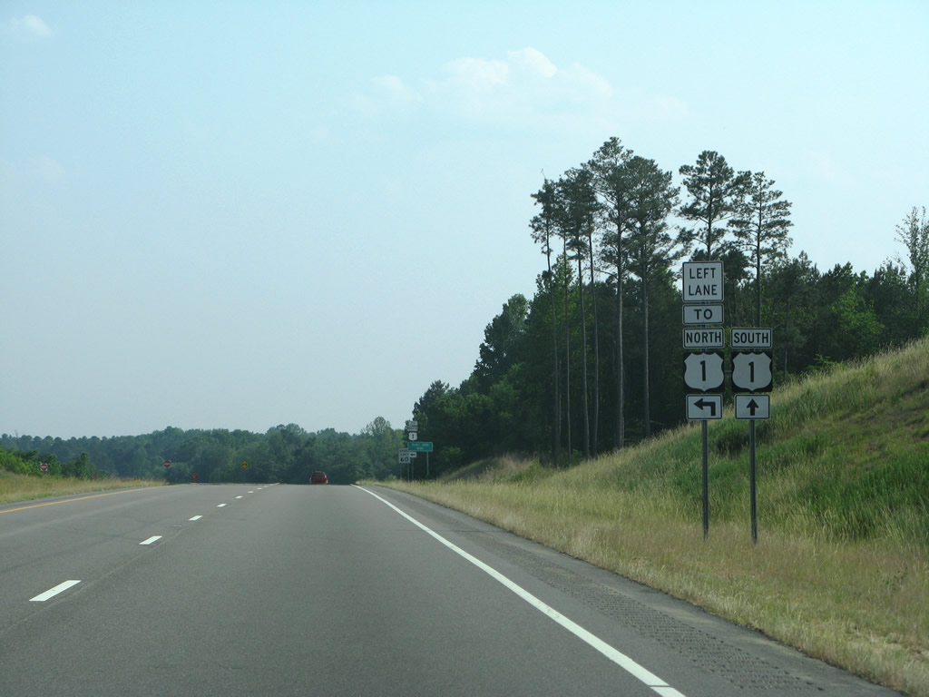
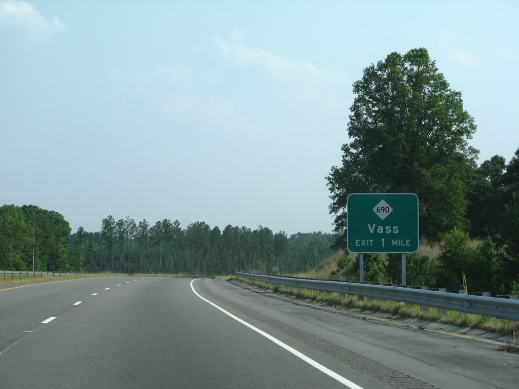
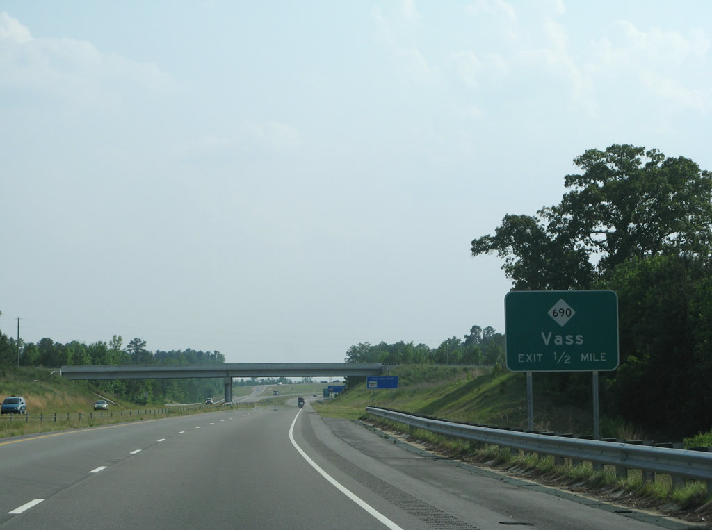
| Advancing south across Crane Creek, U.S. 1 continues to a diamond interchange with NC 690. 05/30/07 |
|
| Leading east from U.S. 1, NC 690 provides a direct route to Pope Air Force Base. The state route ends at NC 24/87 in Spring Lake outside Fort Bragg. 05/30/07 |
|
| U.S. 1 passes under Alma Street within the town limits of Vass on the half mile approach to NC 690 (Main Street). NC 690 concludes north at U.S. 1 Business. 05/30/07 |
|
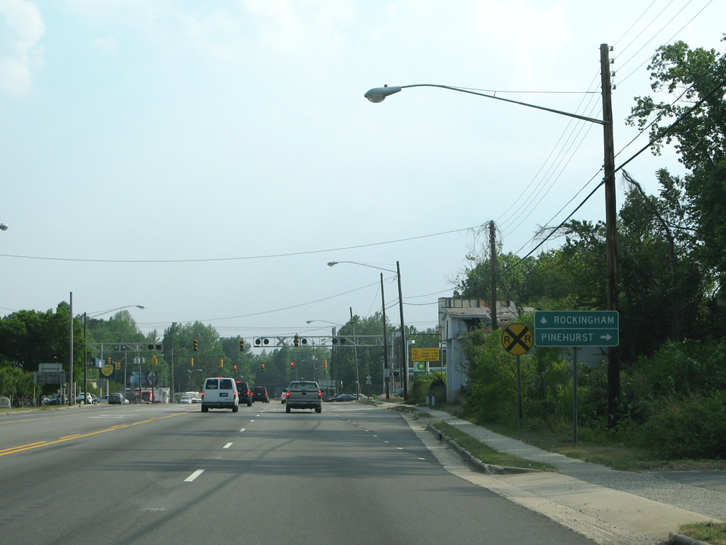
| NC 690 travels 19.34 miles overall east from Vass to the Lake Surf area at Lobella and NC 24/27 at Spring Lake. The state route was commissioned in 1999.1 05/30/07 |
|
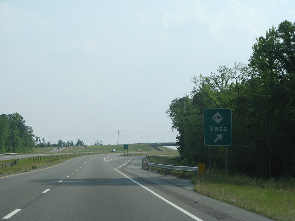
| U.S. 1 continues southwest from NC 690 toward Lakeview and Crystal Lake. 05/30/07 |
|
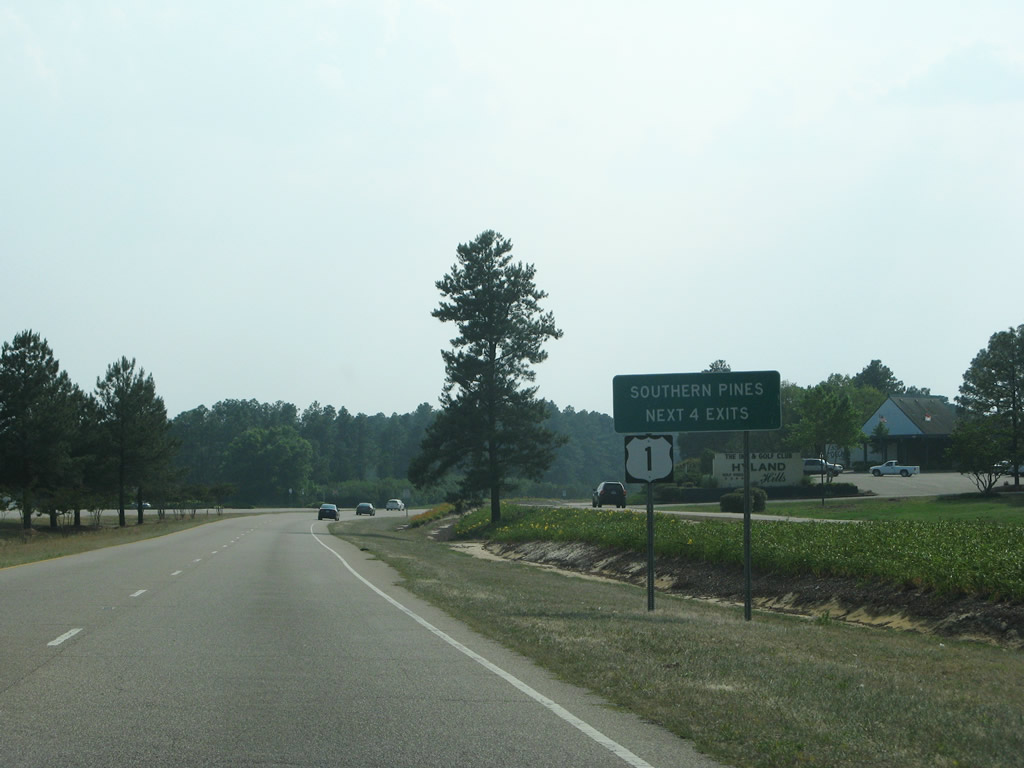
| Southern Pines is nine miles south from NC 690 and Vass along U.S. 1. 05/30/07 |
|
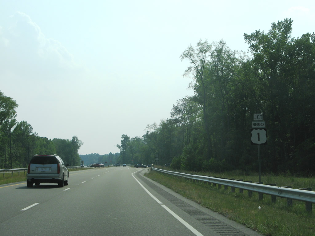
| U.S. 1 Business returns from Vass at the end of the expressway along U.S. 1 south. 05/30/07 |
|
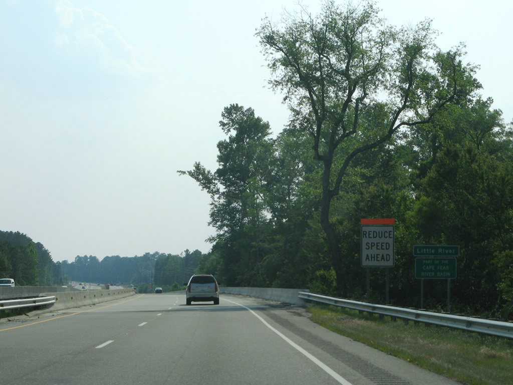
| Bypassed in June 2005, U.S. 1 Business travels 9.4 miles through Vass and Cameron. The south end of the business loop was relocated to meet U.S. 1 at a 90 degree angle. A short section of original U.S. 1 was abandoned at the Little River due to construction. 05/30/07 |
|
| Spanning Little River on U.S. 1 southbound. This set of bridges opened to traffic in 2006. 05/30/07 |
|
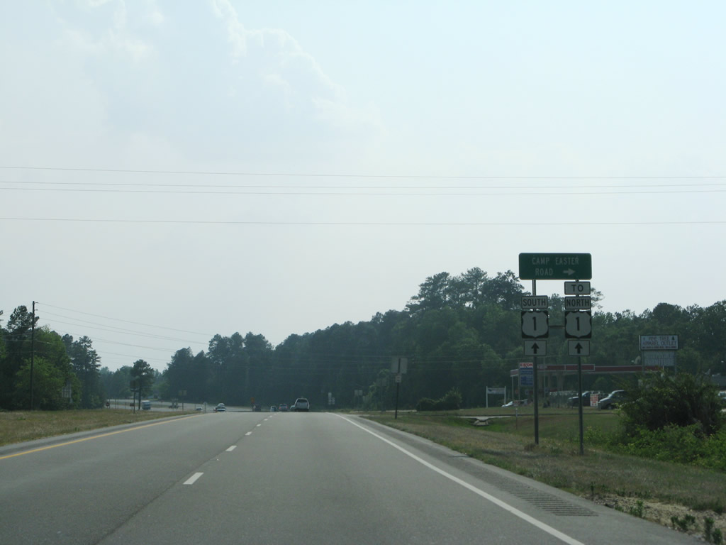
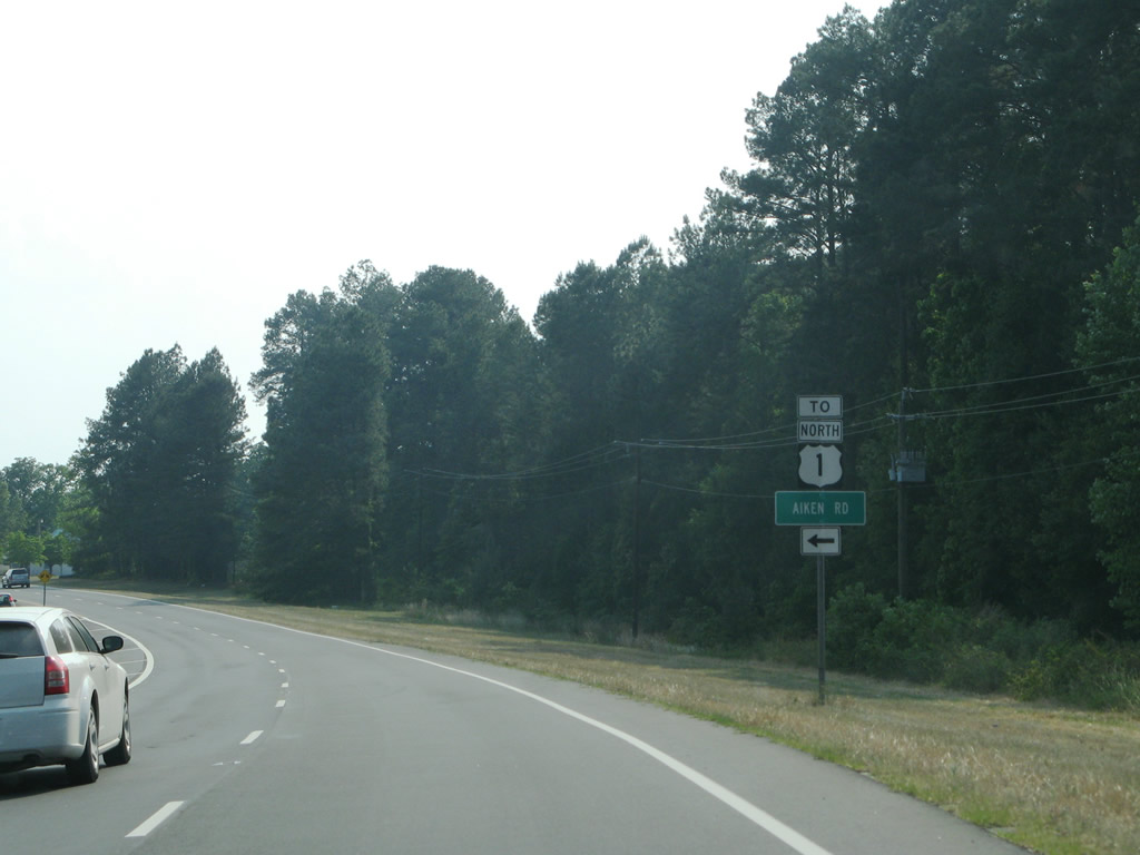
| Camp Easter Road south and Aiken Road north come together at U.S. 1 in Lakeview. Camp Easter Road travels north to Lakeview and west to Southern Pines. 05/30/07 |
|
| Traffic from Camp Easter Road bound for Aiken Road south or U.S. 1 north utilizes U.S. 1 south to a U-turn lane. 05/30/07 |
|
| Aiken Road leads southeast from U.S. 1 to Griffin Lake and Lakebay Road. 05/30/07 |
|
| U.S. 1 transitions from a expressway into an arterial through northern reaches of Southern Pines. 05/30/07 |
|
| Forthcoming May Street represents the original alignment of U.S. 1, and later an alignment of U.S. 1A, through Southern Pines. May Street was bypassed by an expressway by 1957.2 05/30/07 |
|
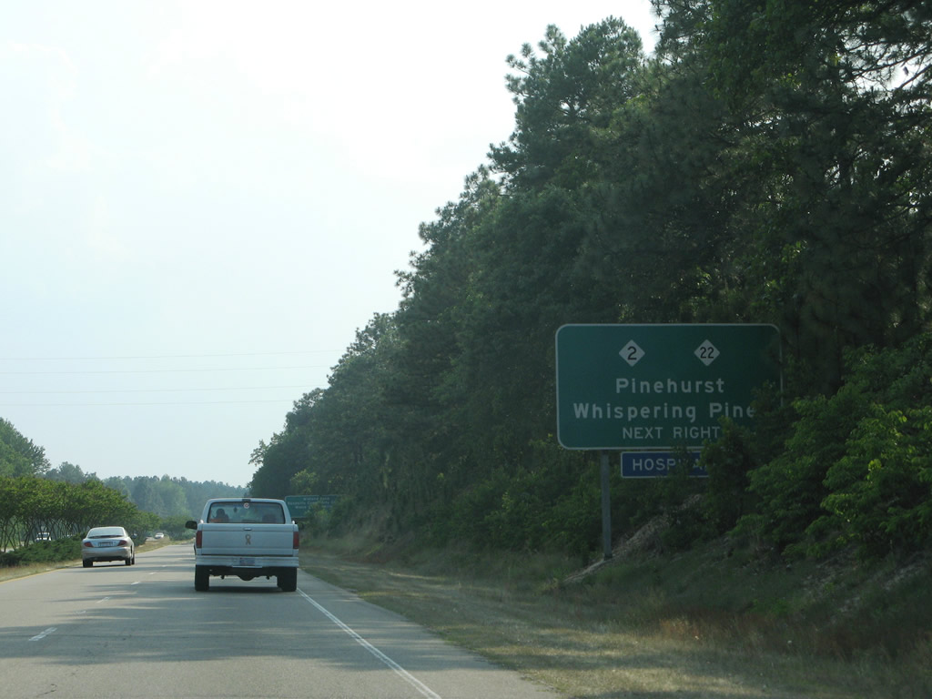
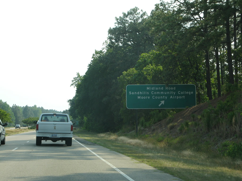
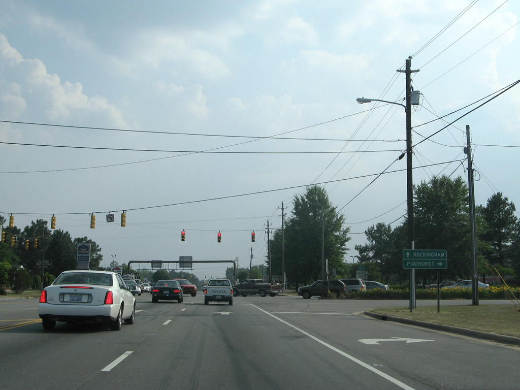
| A parclo interchange joins U.S. 1 with NC 2 (Midland Road) in Southern Pines. NC 2 heads west along Midland Road to a traffic circle with U.S. 15/501 in Pinehurst. NC 22 commences northward from NC 2 nearby to Whispering Pines, Sandhills Community College, Moore County Airport and U.S. 15/501 in Carthage. 05/30/07 |
|
| Midland Road (former NC 2A) continues south from U.S. 1 and NC 2 to Broad Street and Downtown Southern Pines. Yadkin Road (former NC 2) stems southeast from Midland Road to May Street (former U.S. 1) and Manly.3 NC 2 ends at NC 5 in central Pinehurst, 5.5 miles to the west. 05/30/07 |
|
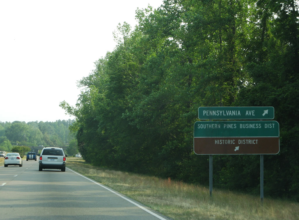
| A diamond interchange joins U.S. 1 south next with Pennsylvania Avenue northwest of the Southern Pines central business and historic districts. Pennsylvania Avenue north becomes Pee Dee Road to NC 2 (Midland Road) and south leads to Ridge Street and Orchard Road. 05/30/07 |
|
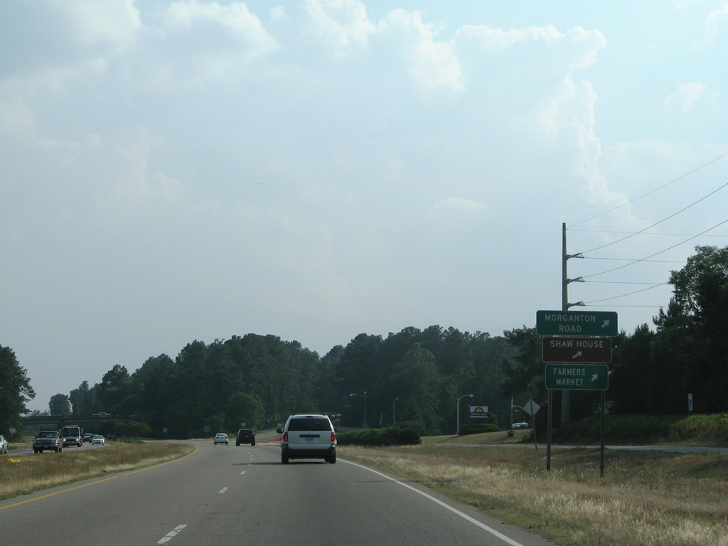
| Morganton Road meets U.S. 1 at the succeeding southbound exit. Morganton Road crosses old U.S. 1 (Broad Street) toward Indiana Avenue in Southern Pines.
Revisions to U.S. 1 completed here by 2014 include the addition of guard rails and an updated guide sign. The adjacent frontage road no longer connects with the exit ramp to Morganton Road.4 05/30/07 |
|
| 2013-14 construction to upgrade the interchange into a parclo included the replacement of the Morganton Road overpass. Morganton Road continues north from the U.S. 1 to U.S. 15-501/NC 201 and NC 5 at Pinehurst. 05/30/07 |
|
| U.S. 1 transitions from a freeway into a commercial arterial two miles ahead of central Aberdeen. The merge of U.S. 1 and Old US Highway 1 here was expanded to two lanes by 2014.4 05/30/07 |
|
| Old U.S. 1 and U.S. 1 combine at Saunders Boulevard. Old U.S. 1 follows Broad Street from Downtown Southern Pines 05/30/07 |
|
| Revisions made along U.S. 1 by 2014 included the addition of a concrete median to Murray Hill Road. Saunders Boulevard was also realigned to intersect U.S. 1 opposite Murray Hill Road, eliminating a signalized intersection.
Murray Hill Road leads west to U.S. 15-501/NC 211. Saunders Boulevard heads south to Fort Bragg and Bethesda Roads away from the commercial corridor through Southern Pines and Aberdeen.4 05/30/07 |
|
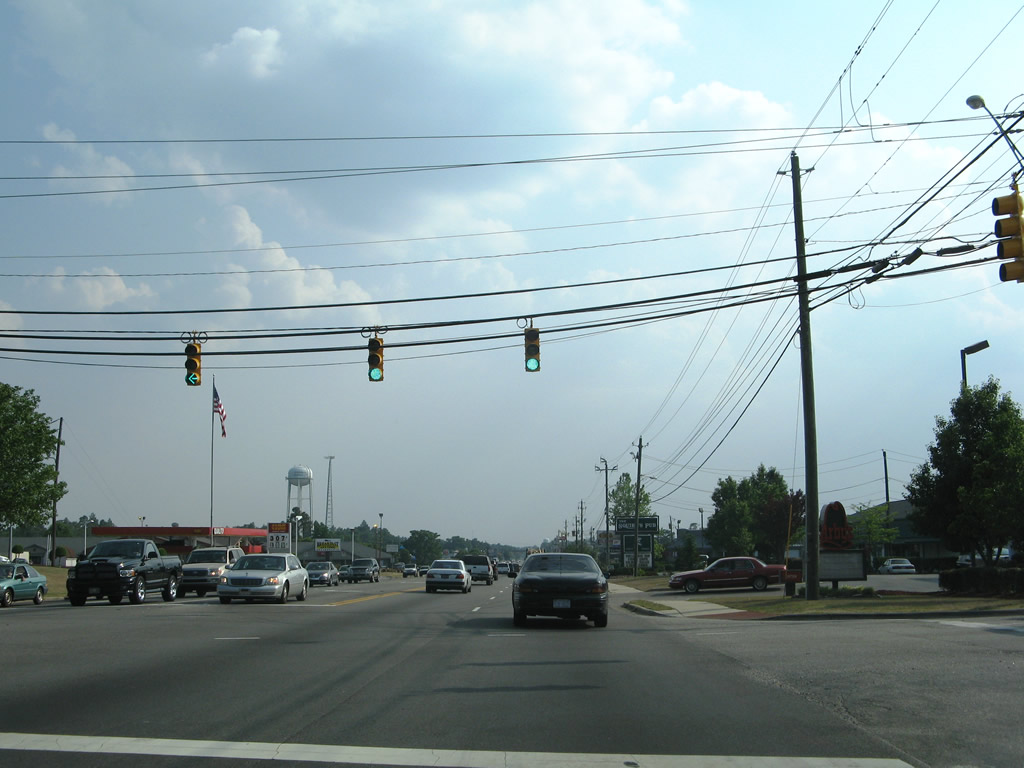
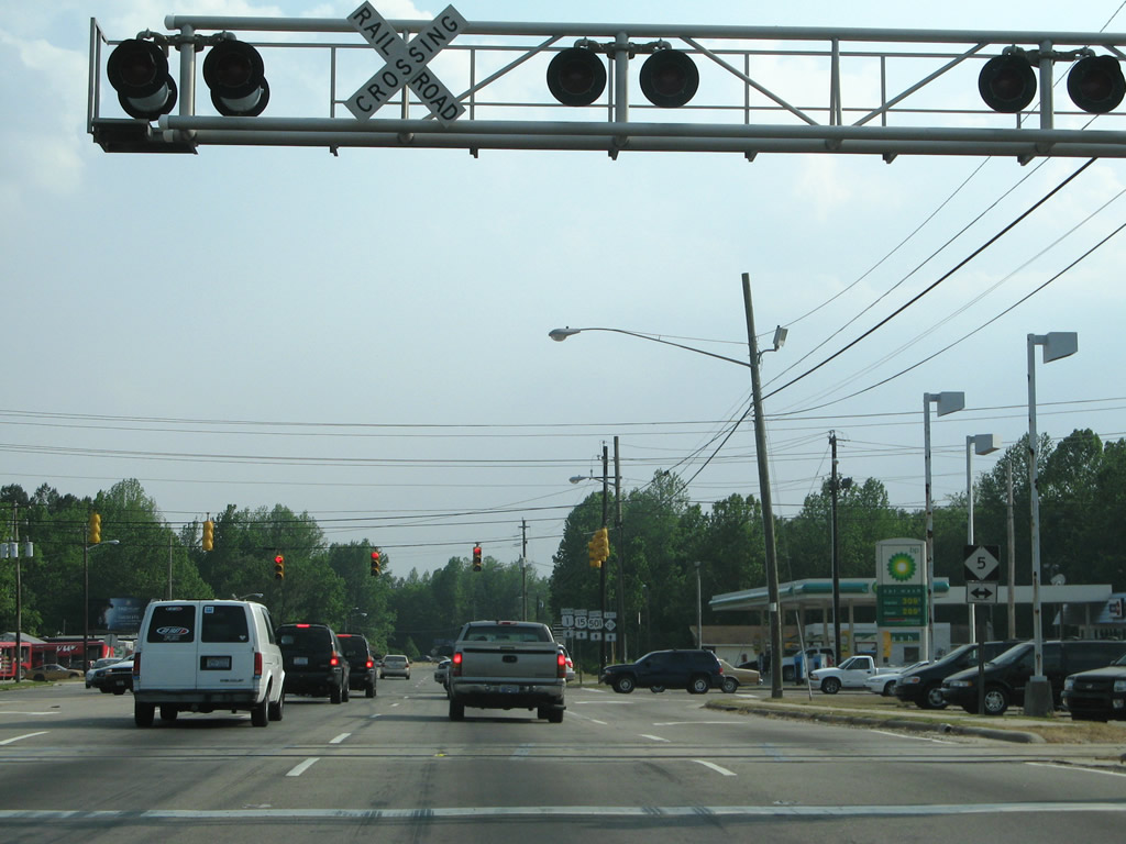
| A heavily commercialized area bound by U.S. 1 and U.S. 15-501/NC 201 spreads along the Aberdeen town line. Pinehurst Avenue intersects U.S. 1 at this traffic light. 05/30/07 |
|
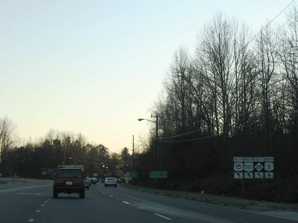
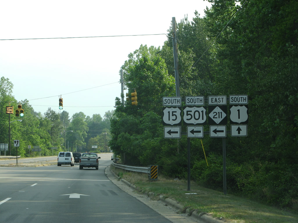
| 22.5 miles beyond the previous separation with U.S. 1, U.S. 15/501 return to the highway alongside NC 211 in Aberdeen. 05/30/07 |
|
| Johnson Street provides a connector to U.S. 15-501 north / NC 211 west between two shopping centers from this signal on U.S. 1 south. 05/30/07 |
|
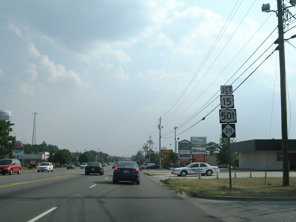
| U.S. 15-501/NC 211 join U.S. 1 south briefly through Aberdeen. NC 211 overlaps with U.S. 15/501 from the Pinehurst traffic circle at NC 2 southward to a point just beyond Aberdeen. 05/30/07 |
|
| U.S. 15-501/NC 211 head 3.9 miles into Pinehurst. NC 211 branches west from Pinehurst to Taylortown, West End and Candor while U.S. 15-501 continues north to Eastwood and Carthage. 05/30/07 |
|
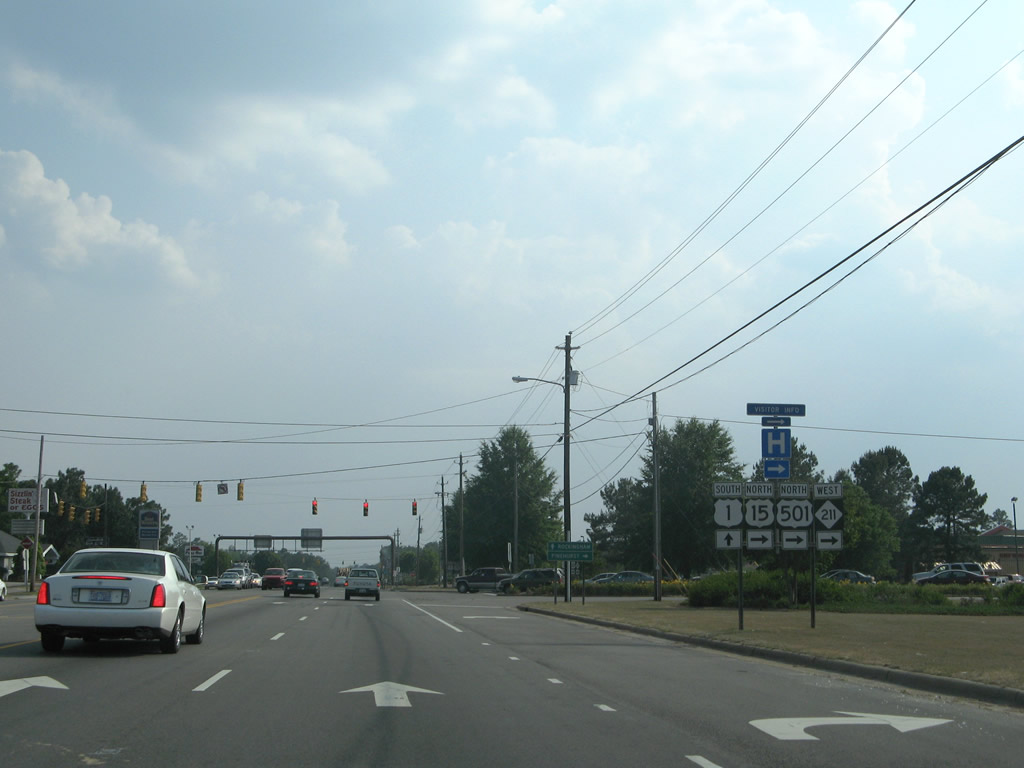
| U.S. 1-15-501/NC 211 combine along an arterial 1.8 miles through Aberdeen. 05/30/07 |
|
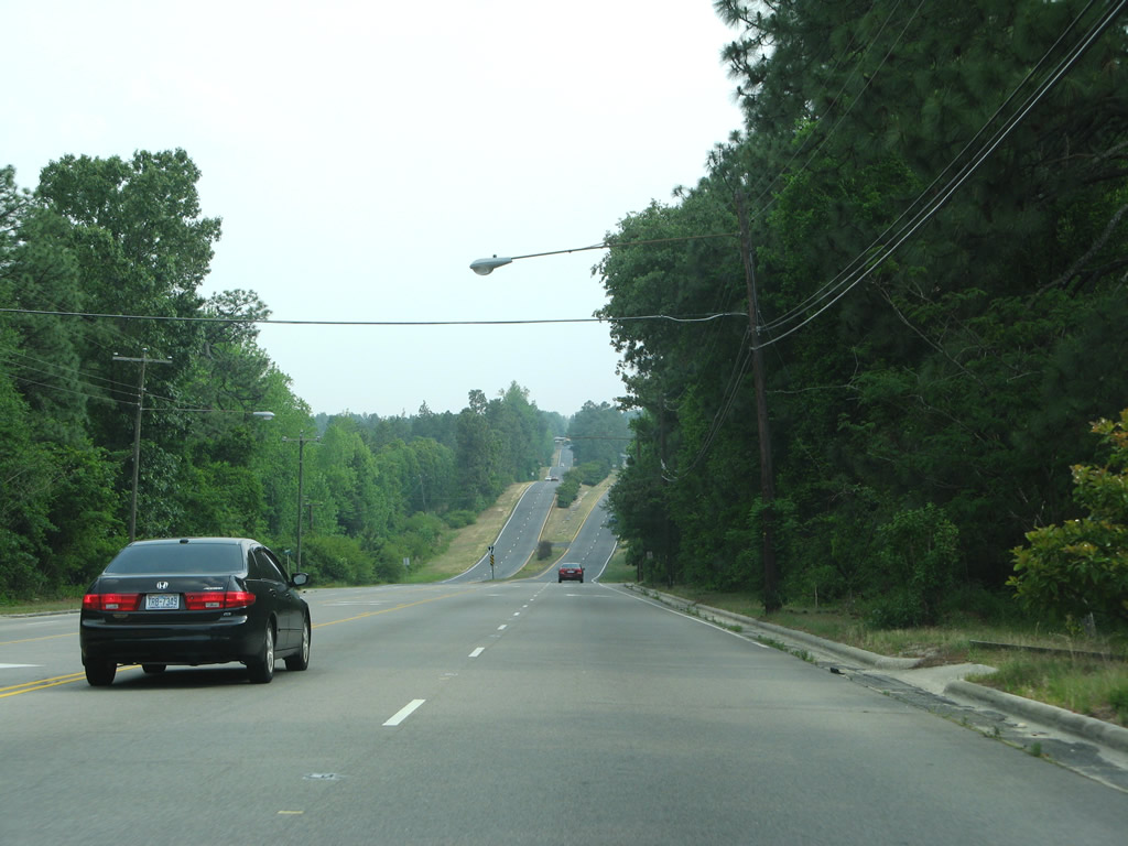
| Continuing south through Aberdeen toward the traffic light at Magnolia Drive and the Town and Country Shopping Center. U.S. 1-15-501/NC 211 carry five overall lanes through the town of 5,000. 05/30/07 |
|
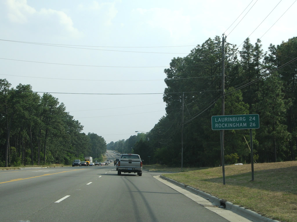
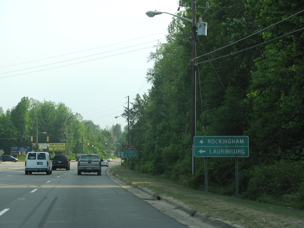
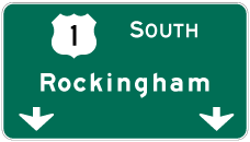
| Southbound distance sign for Laurinburg (via U.S. 15/501 south) and Rockingham (U.S. 1 south of Aberdeen). U.S. 1-15-501 (Sandhills Boulevard) leave the commercialized area of north Aberdeen ahead of Downtown. 05/30/07 |
|
| Lakeshore Drive crosses U.S. 1-15-501/NC 211 (Sandhills Boulevard) from Pages Lake into historic Downtown Aberdeen. 05/30/07 |
|
| The four routes next meet NC 5 at South Street. NC 5 arcs northwest from Aberdeen to Pinehurst, connecting U.S. 1-15-501 with NC 211 beyond their separation. 05/30/07 |
|
| NC 5 travels 6.8 miles north from Aberdeen to Pinehurst. Heading east, NC 5 navigates along South Street one block and then Poplar Street (former U.S. 1-15-501) north one block to Main Street east. NC 5 turns north onto Blue Street and east onto Bethesda Avenue for Bethesda Road north and the Malcolm Blue Farm & Museum historical attraction. 05/30/07 |
|
| U.S. 1-15-501/NC 211 (Sandhills Boulevard) south at NC 5 (South Street). South Street continues east from NC 5 to NC 211 (Raeford Road) after the split with U.S. 15/501 south. 05/30/07 |
|
| U.S. 1-15-501/NC 211 partition 0.2 miles south of NC 5 and Downtown Aberdeen. 05/30/07 |
|
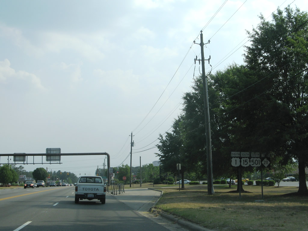
| Leaving Aberdeen, U.S. 15-501 south / NC 211 east shift onto a two lane road. NC 211 branches eastward from nearby along Raeford Road to the Hoke County seat of Raeford. 01/02/08 |
|
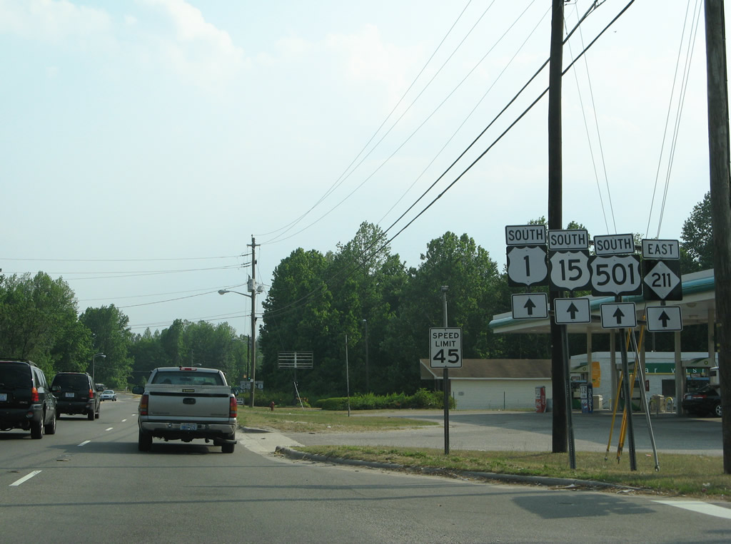
| U.S. 15/501 overlap another 28 miles south to Laurinburg, where they combine with U.S. 401, in Scotland County. 05/30/07 |
|
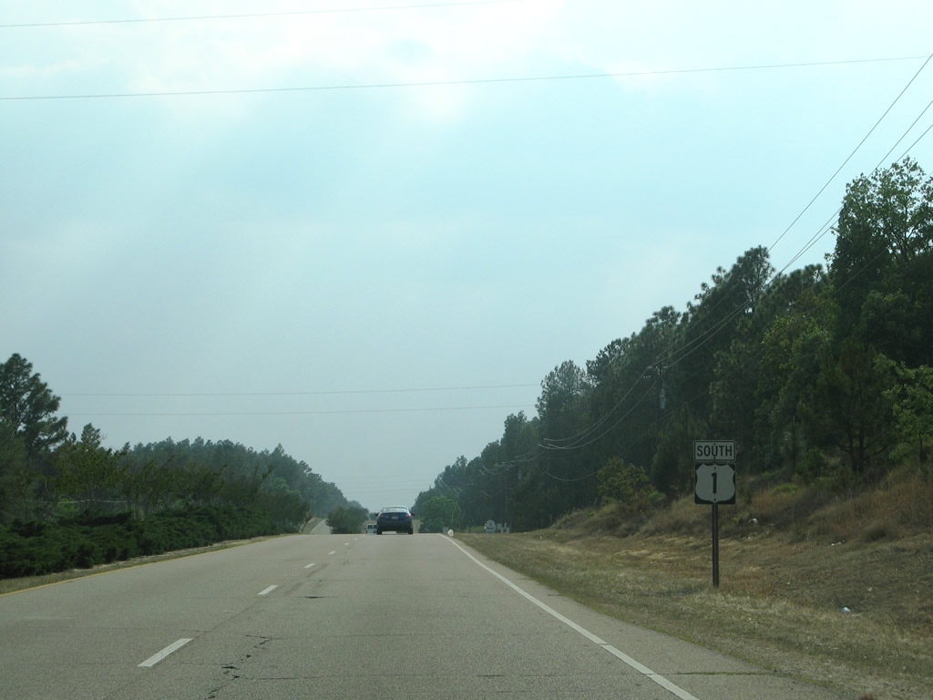
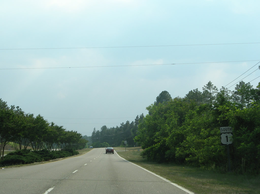
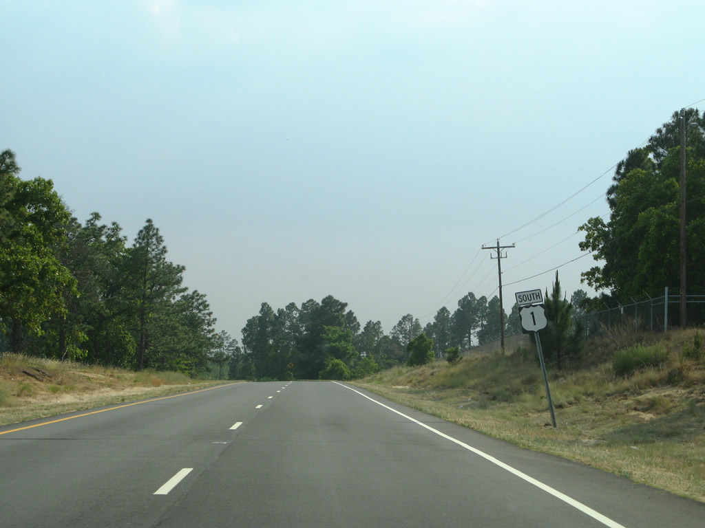
| U.S. 15/501 follow a rural course southward from Aberdeen. U.S. 1 remains four laned to the Richmond County line. NC 211 enters Raeford in 16.2 miles where it overlaps with U.S. 401 Bypass. 05/30/07 |
|
| Pinehurst Street (SR 1108) converges with U.S. 1 southbound, 0.7 miles after U.S. 15-501/NC 211. Pinehurst Street is the pre-1944 alignment of U.S. 1.2 05/30/07 |
|
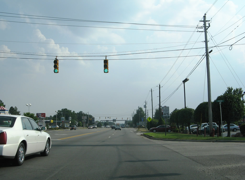
| Entering the city limits of Pinebluff, the speed limit on U.S. 1 south reduces to 45 MPH. 05/30/07 |
|
| Reassurance marker posted after the intersection with Currant Street in Pinebluff on U.S. 1 south. 05/30/07 |
|
| U.S. 1 (Walnut Street) transitions into a five lane arterial through Pinebluff. This southbound shield appears beyond Baltimore Avenue. 05/30/07 |
|
| Leaving the street grid of Pinebluff, U.S. 1 again widens into a four lane parkway. 05/30/07 |
|
| The median widens along U.S. 1 at Thunder Road west and Addor Road east. Addor Road links U.S. 1 with the settlement of Addor. Thunder Road stems west into undeveloped timberland. 05/30/07 |
|
| Until 2012, U.S. 1 reduced to two overall lanes just north of the Richmond County line. U.S. 1 continues as a four lane highway towards NC 177 by Rockingham Speedway. Long range plans call for a Rockingham and Hamlet bypass. Initial construction (project R-2501BC) on the five section project was previously anticipated for 2021.4 05/30/07 |
Page Updated 02-03-2016.


 South
South