|
| U.S. 11/19 confirming markers posted after the intersection with Commonwealth Avenue (U.S. 11E-11W-421/SR 381). 05/26/21 |
|
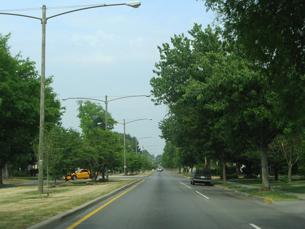
| A landscaped median separates single lanes of traffic along U.S. 11/19 (Euclid Avenue) east to Chester Street. 05/31/07 |
|
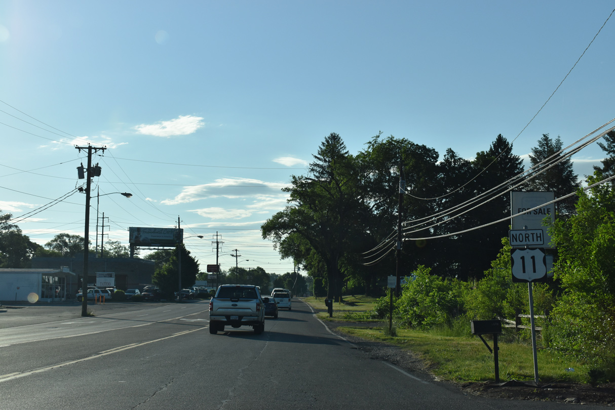
| U.S. 11/19 shift onto Lee Highway north from Euclid Avenue beyond U.S. 11-19 Truck (Moore Street). 03/05/17 |
|
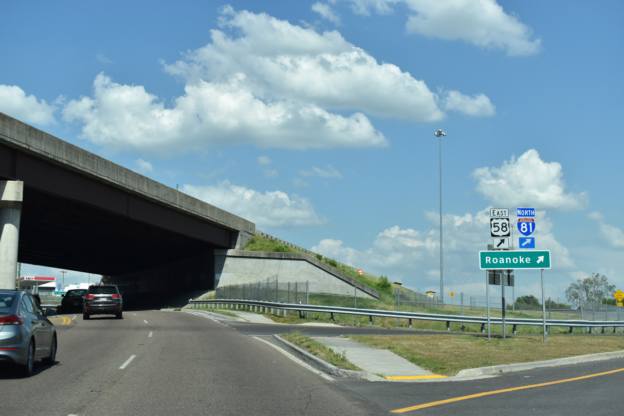
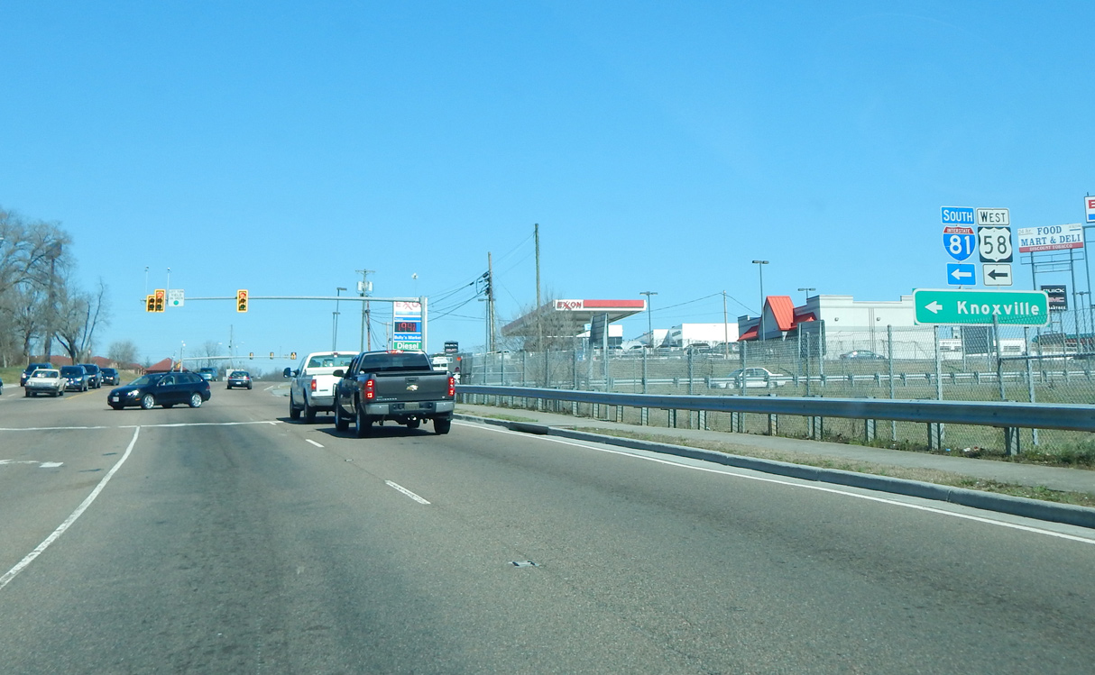
| U.S. 58 follows I-81 between Exit 1 at Bristol and Exit 19 at Abingdon. Prior to 1966, U.S. 58 overlapped with U.S. 11/19 eastward from Bristol.1 05/26/21 |
|
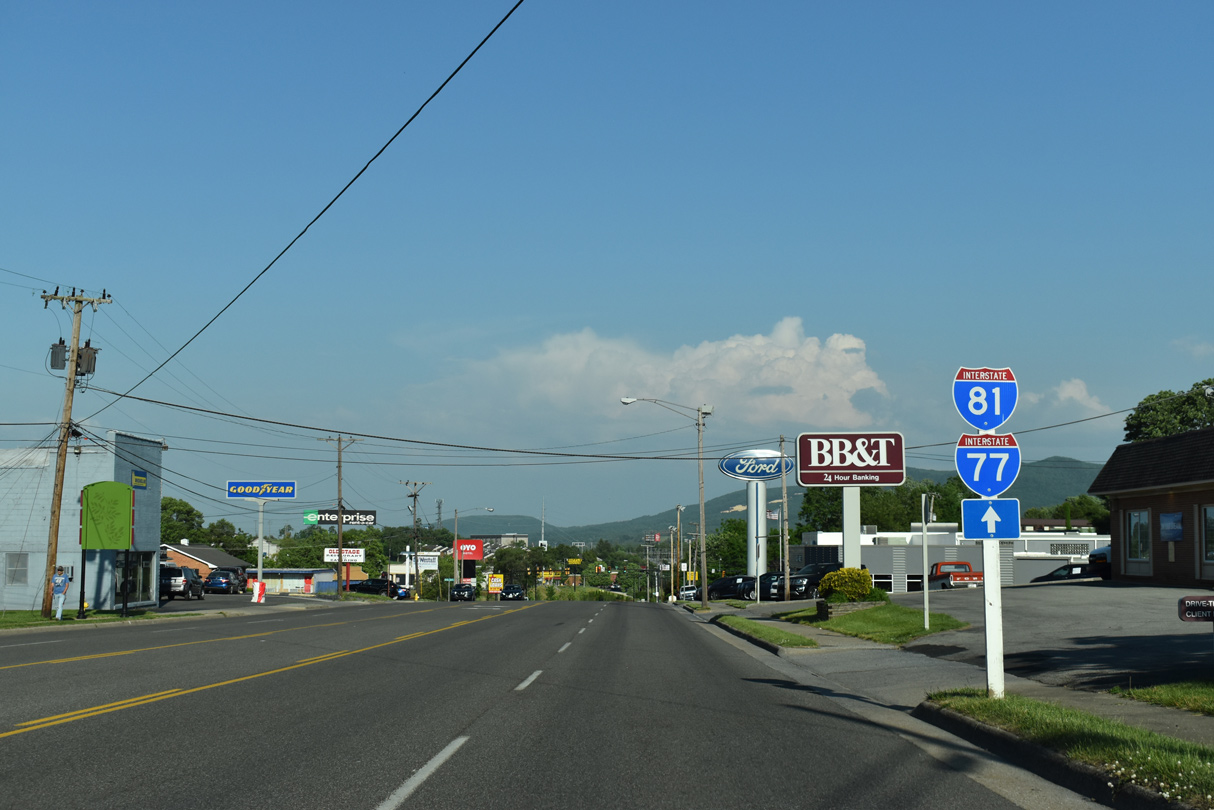
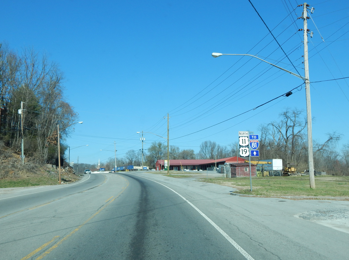
| U.S. 11/19 (Lee Highway) proceed east from the exchange with I-81/U.S. 58 by The Falls retail complex. I-81/U.S. 58 south connect with Interstate 381 nearby. 03/05/17 |
|
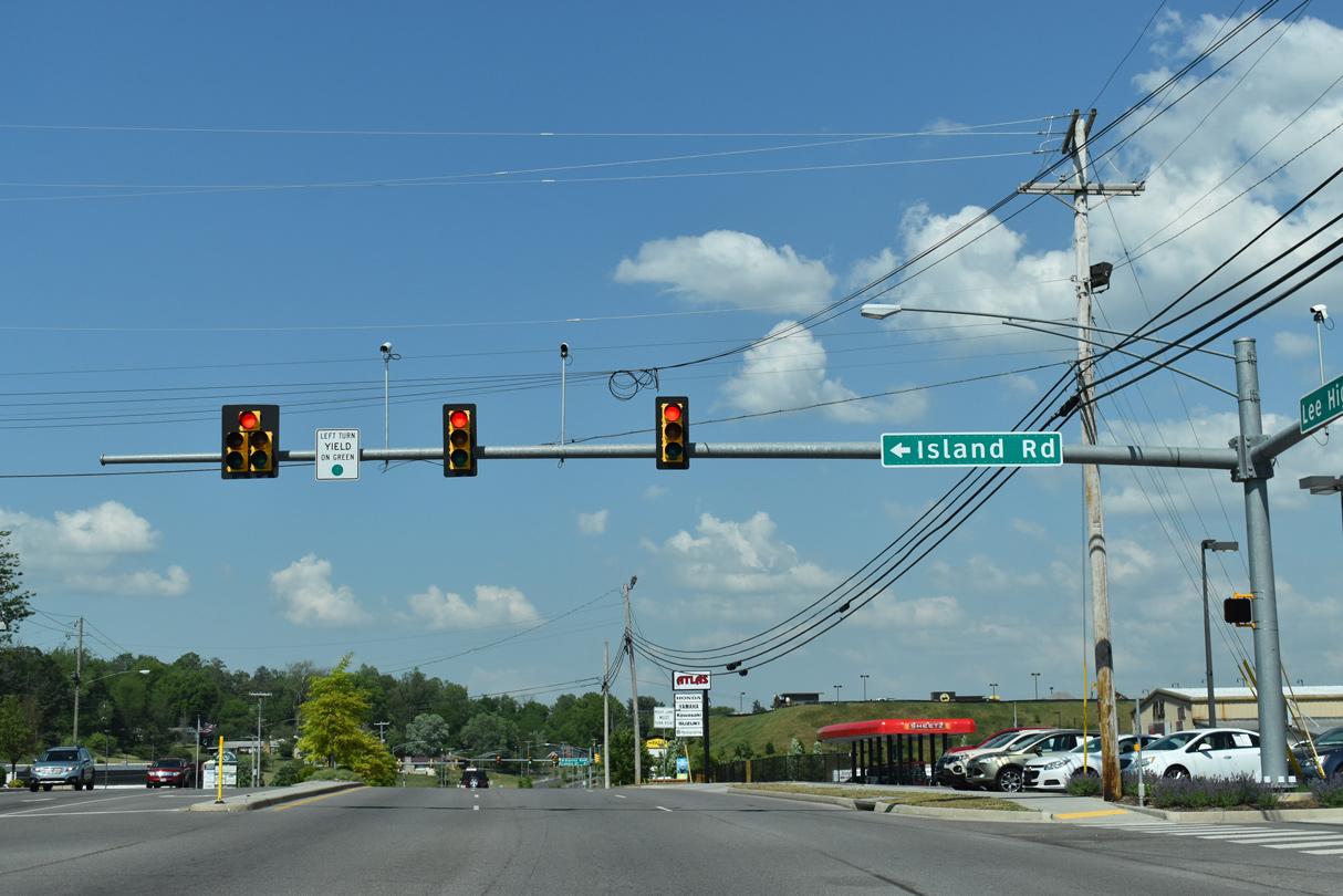
| Island Road comprises a 2.32 mile long frontage road along the north side of I-81/U.S. 58 west from U.S. 11/19 to Benhams Road. 05/26/21 |
|
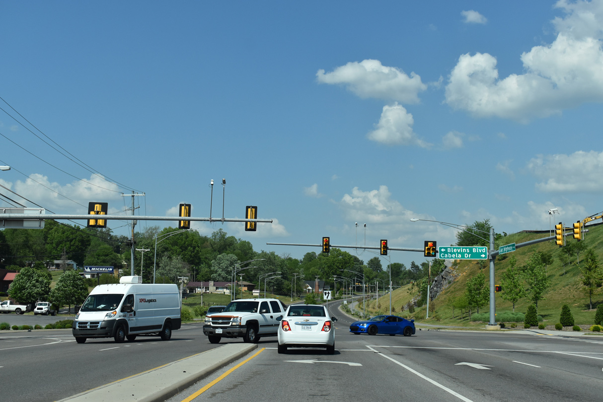
| Blevins Boulevard intersects U.S. 11/19 (Lee Highway) across from one of the two entrances for The Falls. 05/26/21 |
|
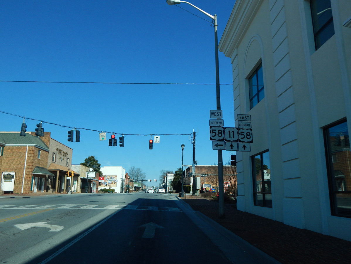
| U.S. 58 ALT branches 1.01 miles southeast from U.S. 19 along Russell Road to U.S. 11 (W Main Street) in Downtown Abingdon. 03/05/17 |
|
| U.S. 58 ALT joins U.S. 11 (Main Street) for 0.24 miles between Russell Road and Cummings Street. 03/05/17 |
|
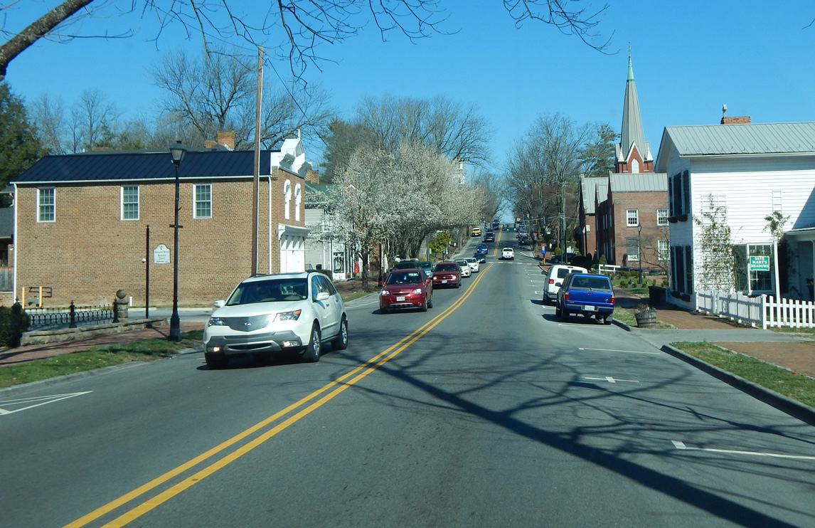
| U.S. 11 (Main Street) north ahead of the traffic lights with Pecan Street in Abingdon. 03/05/17 |
|
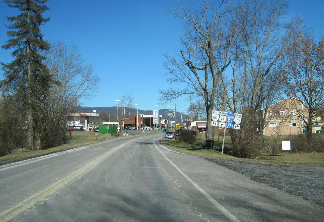
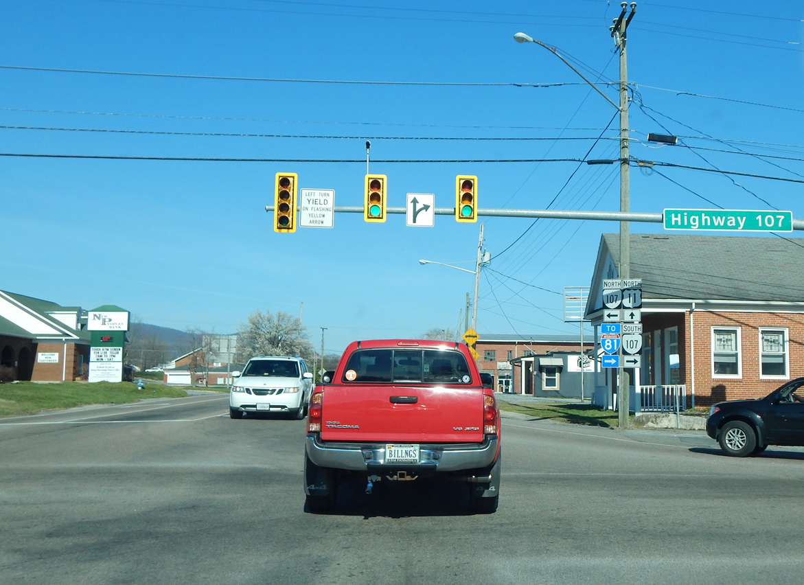
| U.S. 11 (Lee Highway) meets SR 107 (Whitetop Road) 1.17 miles east into Smythe County at the town of Chilhowie. 02/11/14 |
|
| SR 107 (Whitetop Road) concludes 0.32 miles south of U.S. 11 (Lee Highway) at a diamond interchange (Exit 35) with Interstate 81 across from SR 762. 03/05/17 |
|
| Vintage traffic lights on U.S. 11 (Main Street) north at Chestnut Street in Downtown Marion. 03/05/17 |
|
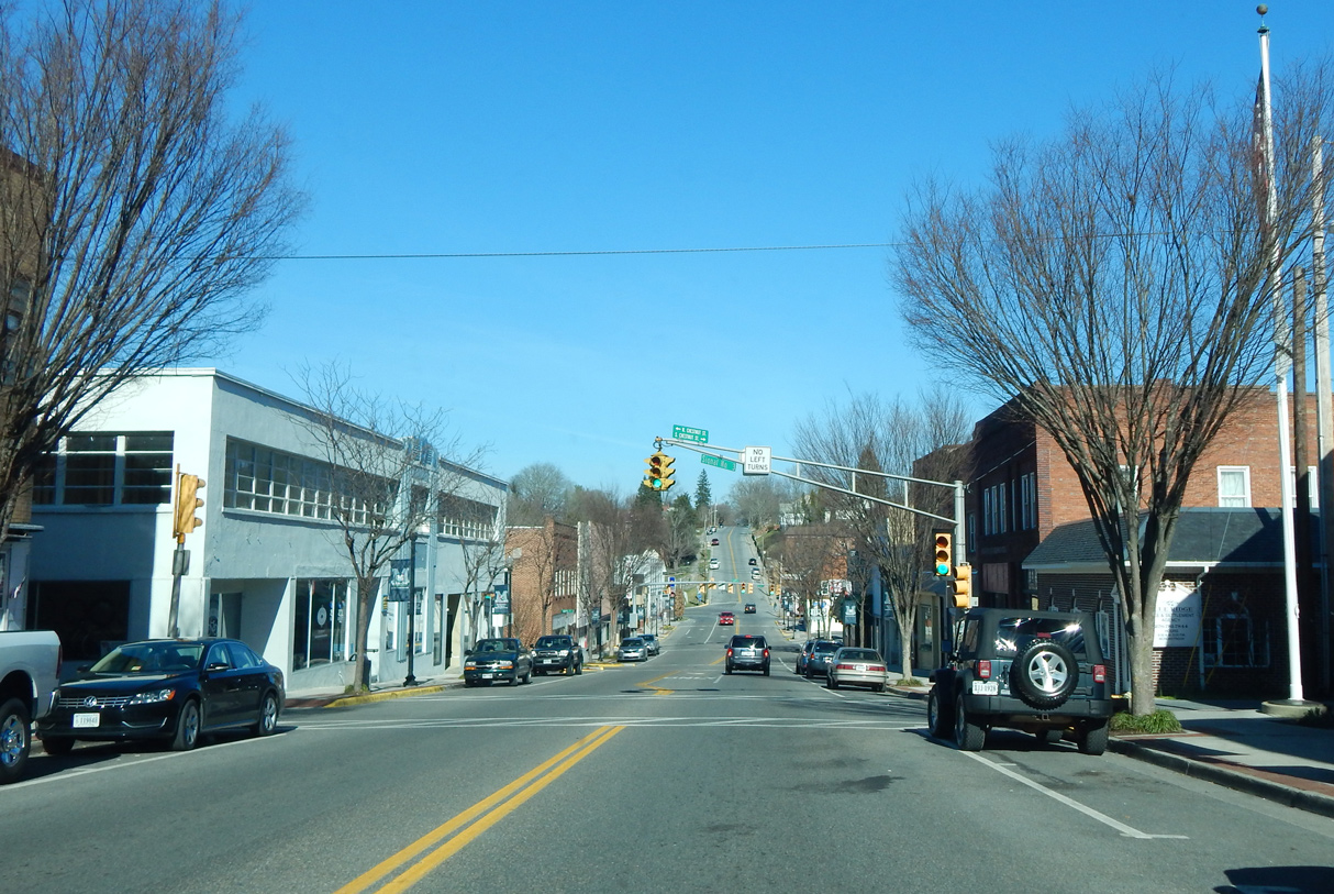
| U.S. 11 (Main Street) converges with SR 16 north at Commerce Street in Downtown Marion. Measuring 77.58 miles in Virginia, SR 16 is part of a multi state highway north to Beckley, West Virginia and south to Charlotte, North Carolina. 03/05/17 |
|
| U.S. 11/SR 16 briefly combine along E Main Street before turning onto N Main Street. 03/05/17 |
|
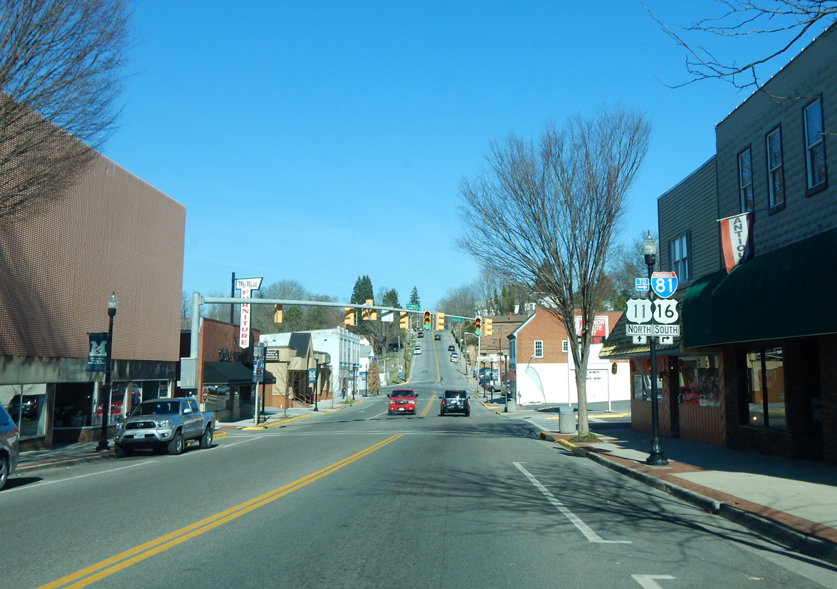
| U.S. 11/SR 16 overlap for 1.19 miles in Marion. 03/05/17 |
|
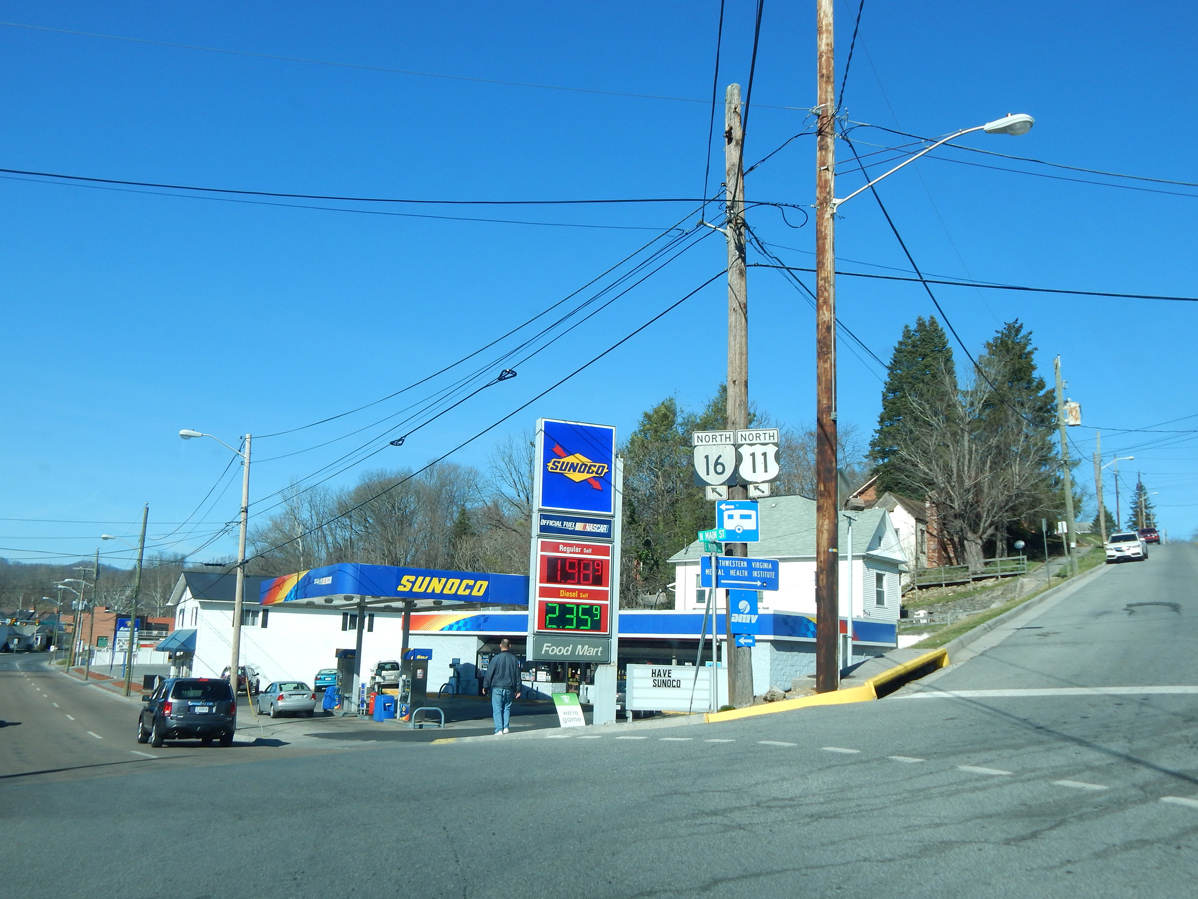
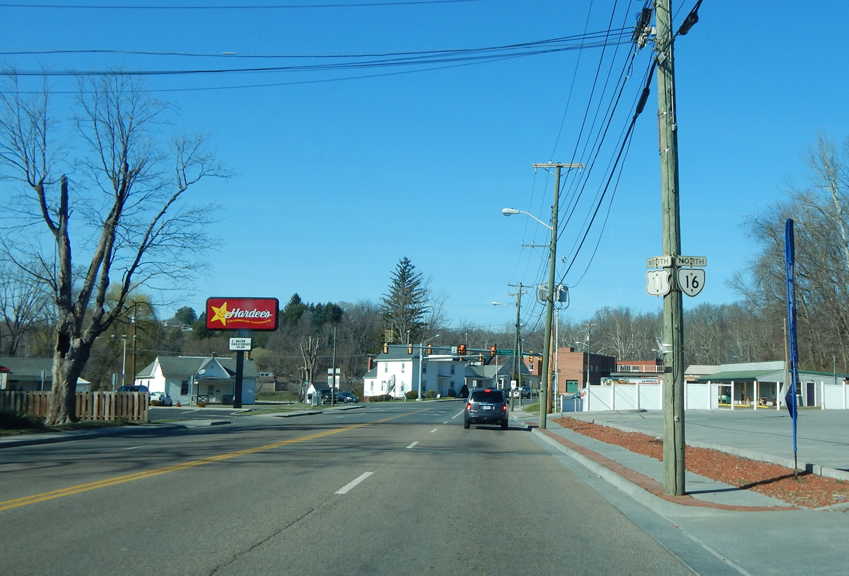
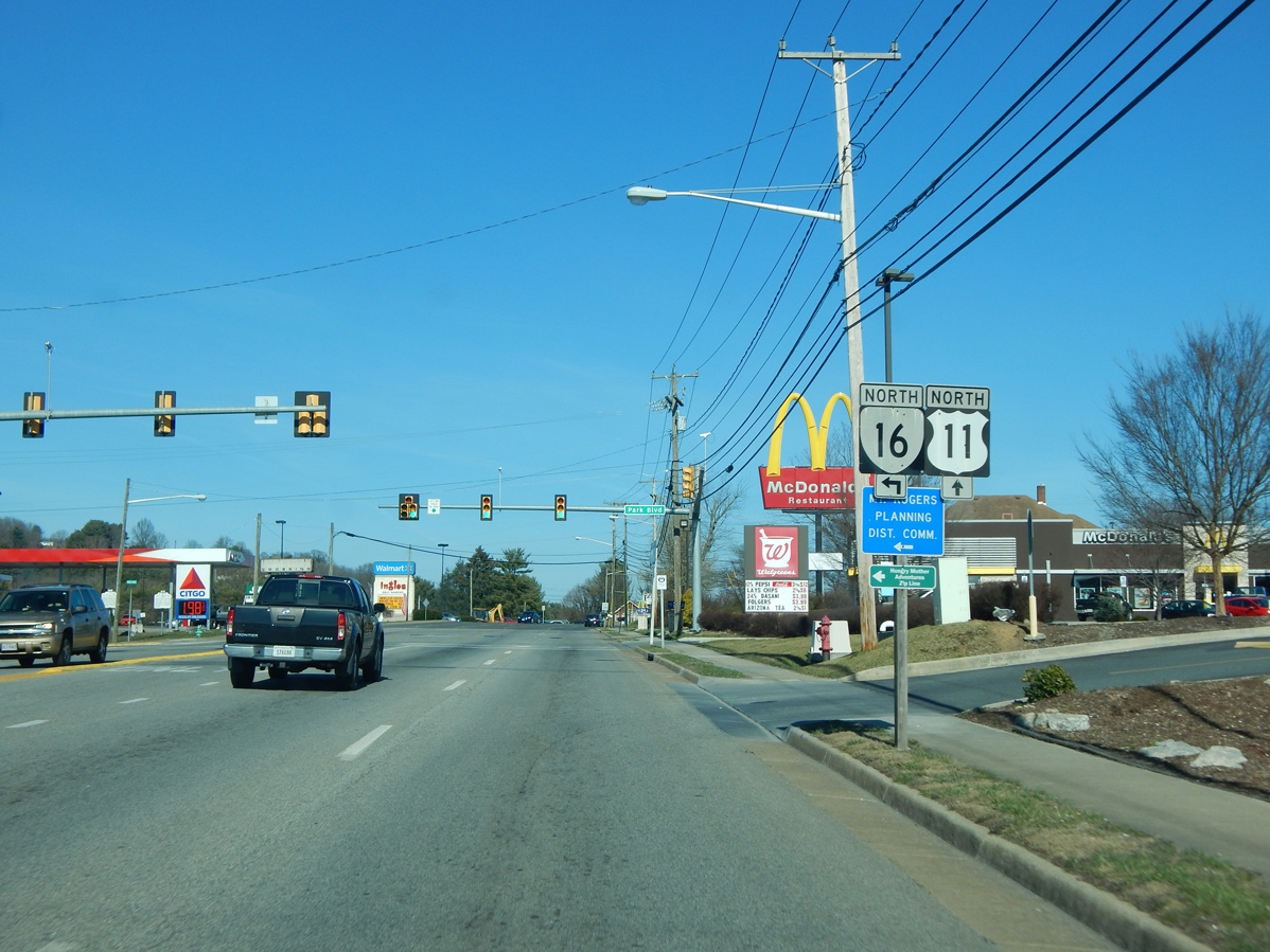
| SR 16 splits with U.S. 11 (N Main Street) at Park Boulevard in Marion. MSR 16 continues north across Walker Mountain and Clinch Mountain to Tazewell. 03/05/17 |
|
| Turning south from Pine Ridge, U.S. 11 (Lee Highway) enters the Wytheville street grid ahead of U.S. 21 (W Main Street). 07/16/05 |
|
| U.S. 11/21 combine along W Main Street 0.31 miles north to Downtown Wytheville from 12th Street. U.S. 21 enters Wytheville from Independence, 30 miles to the south. U.S. 52 made this movement as well until its relocation onto area freeways. 05/26/21 |
|
| U.S. 21 is omitted from this confirming marker posted along W Main Street ahead of 10th Street. 05/26/21 |
|
| U.S. 11/21 part ways after just four blocks at W Main Street and 4th Street in Downtown Wytheville. All route markers for the separation were removed by 2018. 07/16/05 |
|
| Since relocated onto I-77/81 to bypass Wytheville, U.S. 52 previously followed U.S. 21 south from Crowgeys and U.S. 11 north to Fort Chiswell. 07/16/05 |
|
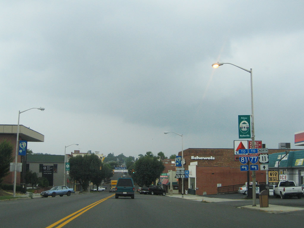
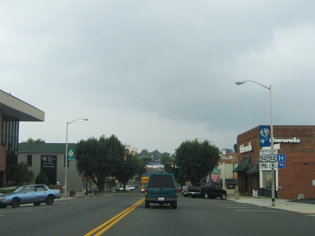
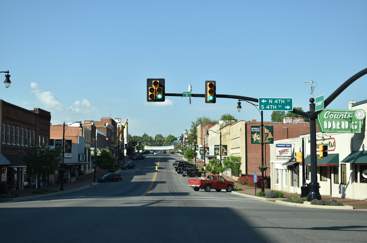
| U.S. 11 continues along Main Street through the Wytheville central business district. U.S. 21 follows N 4th Street 1.21 miles north to conclude at I-81/U.S. 52 (Exit 70). 05/26/21 |
|
| The reassurance marker for U.S. 11 posted beyond U.S. 21 (4th Street) was removed by 2018. U.S. 11/52 were originally cosigned eight miles east to Fort Chiswell. 07/16/05 |
|
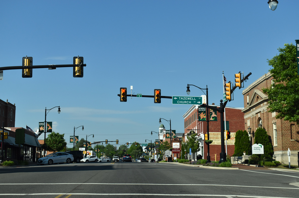
| U.S. 11 (Main Street) north at Church and Tazewell Streets in Downtown Wytheville. 05/26/21 |
|
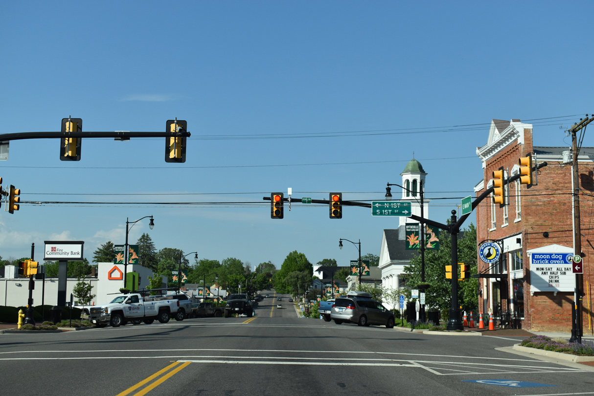
| Main Street at 1st Street in Downtown Wytheville. 05/26/21 |
|
| Replaced by 2011, vintage shields for I-77/81 appeared along U.S. 11 (E Main Street) north at a shopping center entrance in east Wytheville. 09/29/10 |
|
| U.S. 11 north at Wythe Shopping Plaza. 05/26/21 |
|
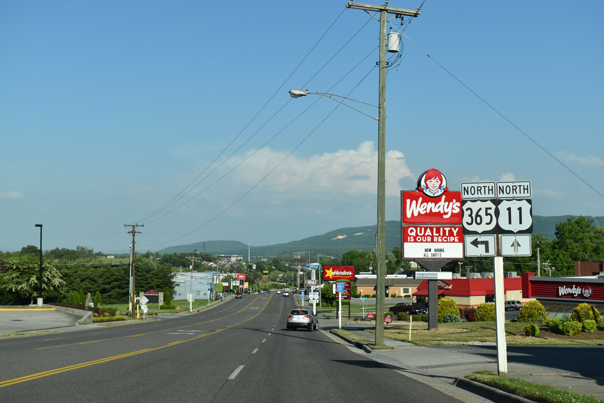
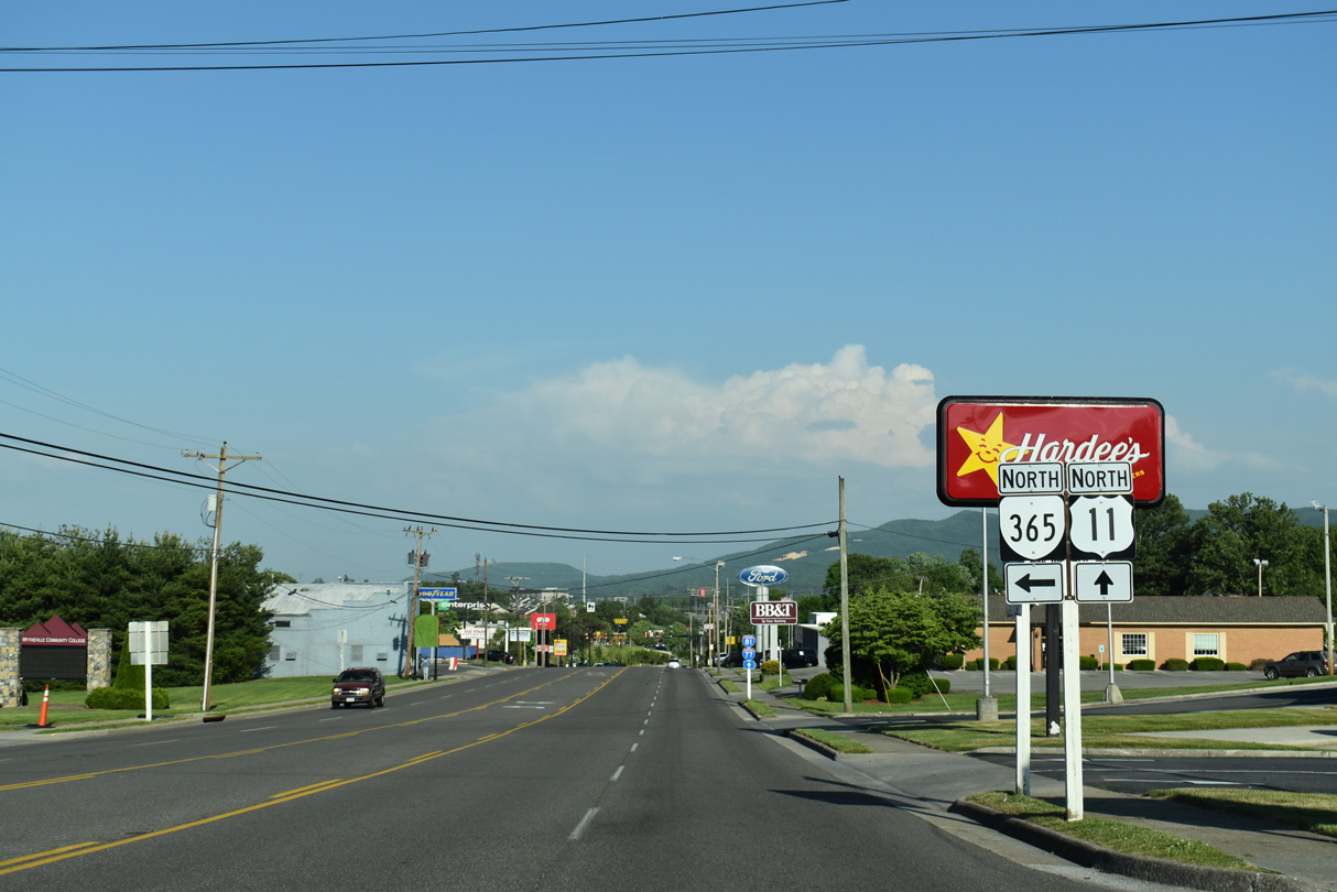
| U.S. 11 sinks eastward from the Wytheville street grid along a commercialized stretch leading to I-77/81. Signed here erroneously as U.S. 365, U.S. 11 next meets SR 365, a major collector to Wytheville Community College. 05/26/21 |
|
| SR 365 spurs north 0.57 miles from U.S. 11 (E Main Street) to the college campus. 05/26/21 |
|
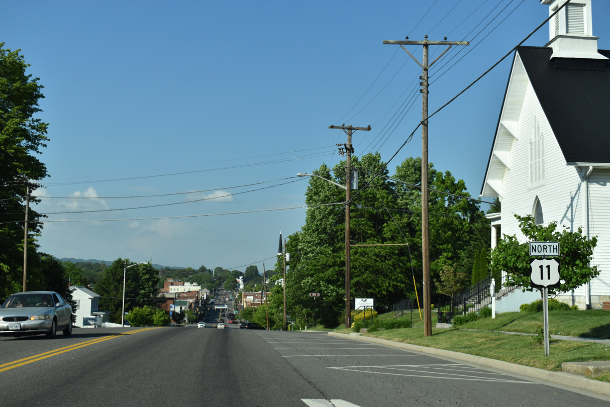
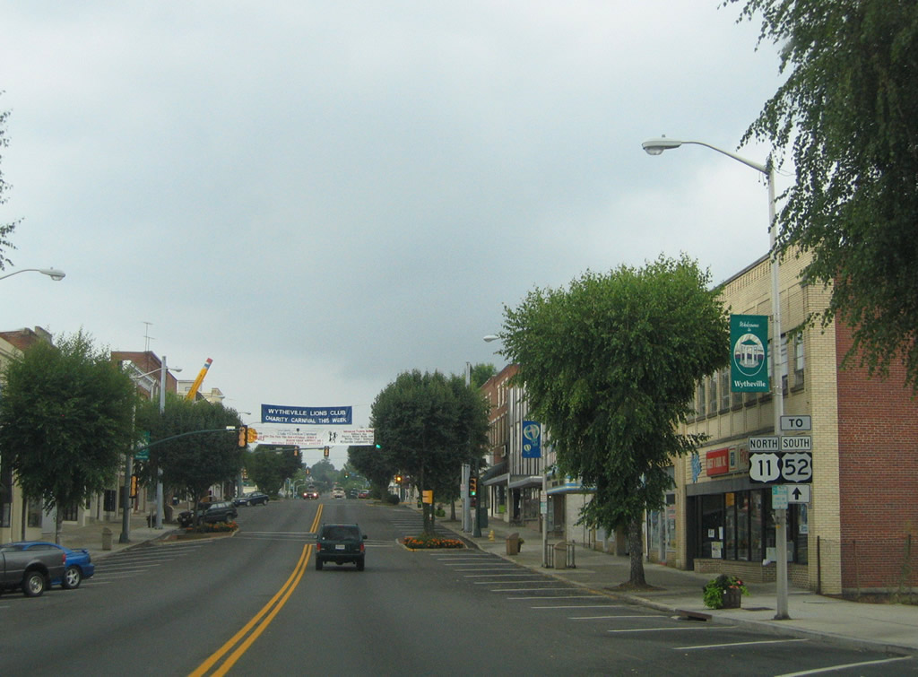
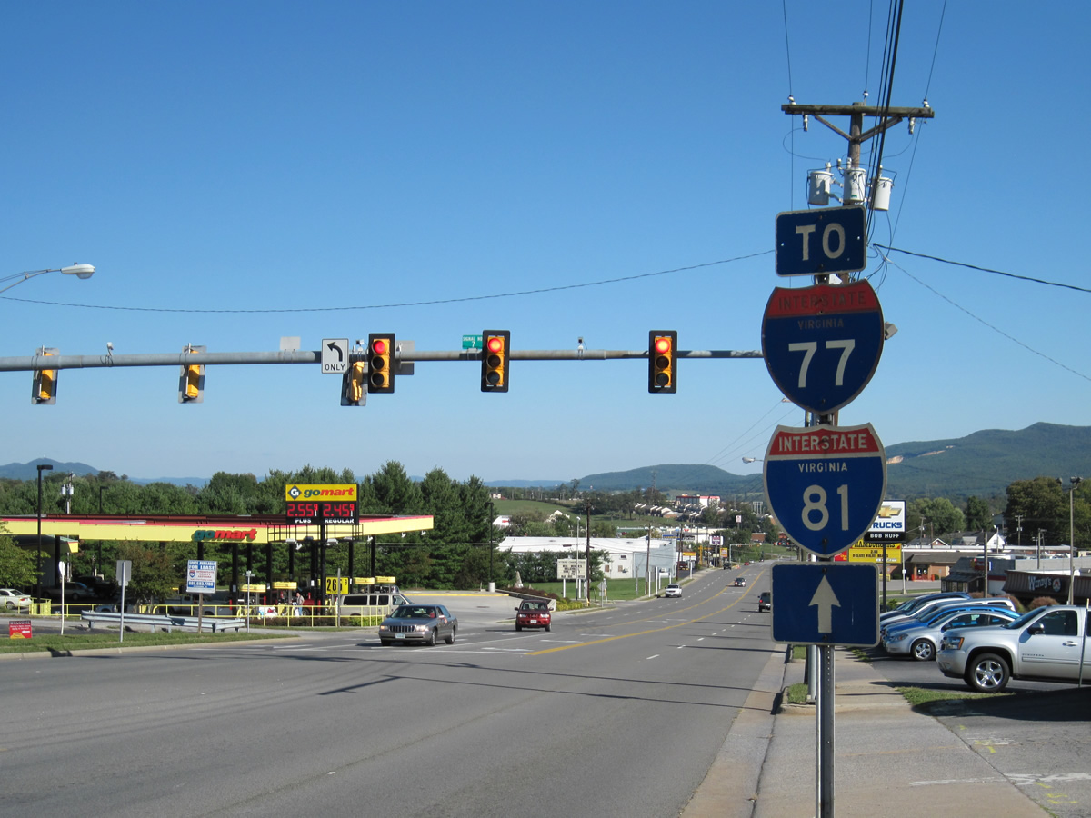
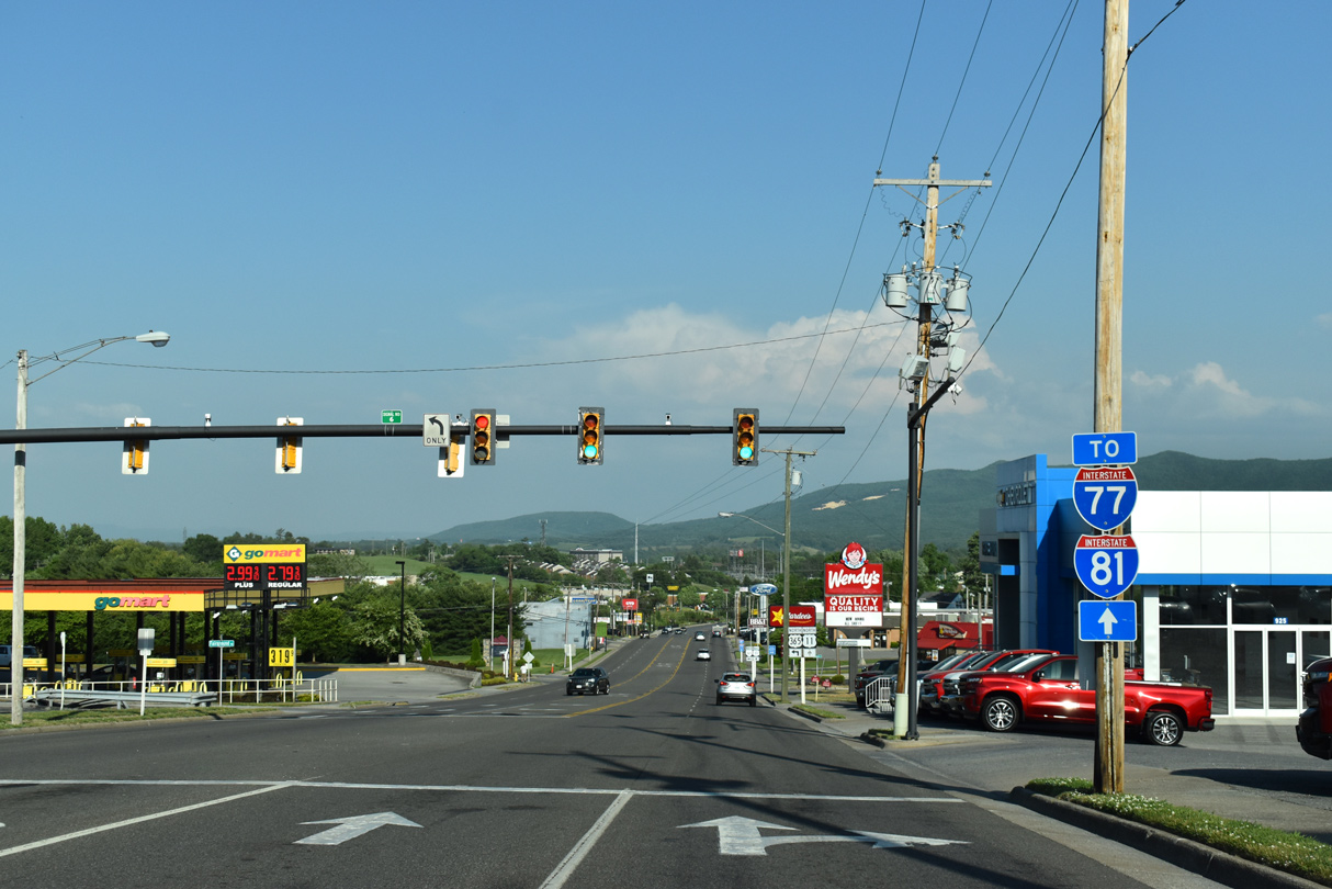
| Additional trailblazers for I-77/81 stand beyond the intersection with SR 365. U.S. 11 (Lee Highway) is the gateway to Wytheville from the west, a route once cosigned with U.S. 52. 05/26/21 |
|
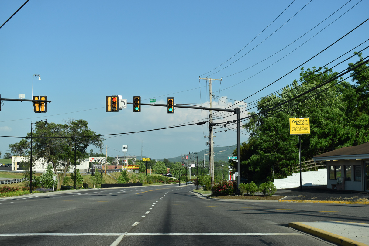
| Withers Road loops 0.25 miles east from 11th Street to intersect U.S. 11 at signal number 7 across from Cassell Road north to Community Boulevard. 05/26/21 |
|
| U.S. 11 splits with Chapman Road, a former alignment, ahead of Marshall Street and the entrance to Mountain View Square shopping center. 09/29/10 |
|
| These two sets of shields formerly partitioned traffic into ramps for I-77-81/U.S. 52. 09/29/10 |
|
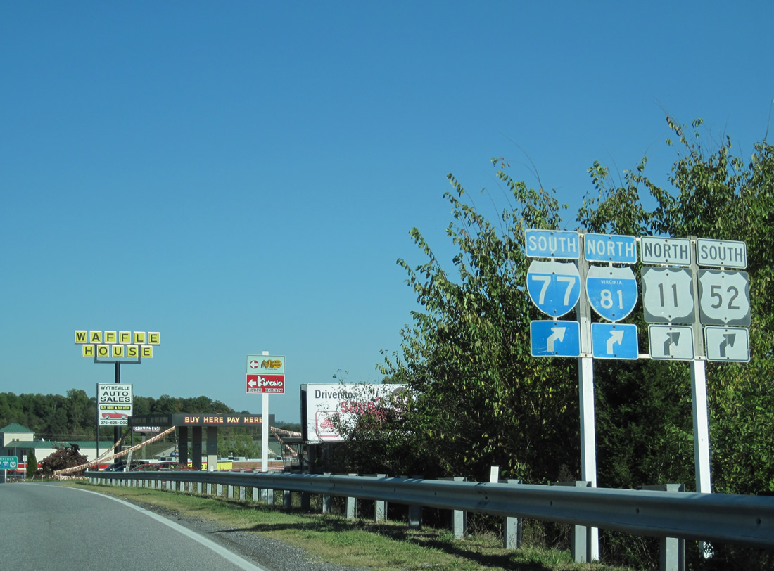
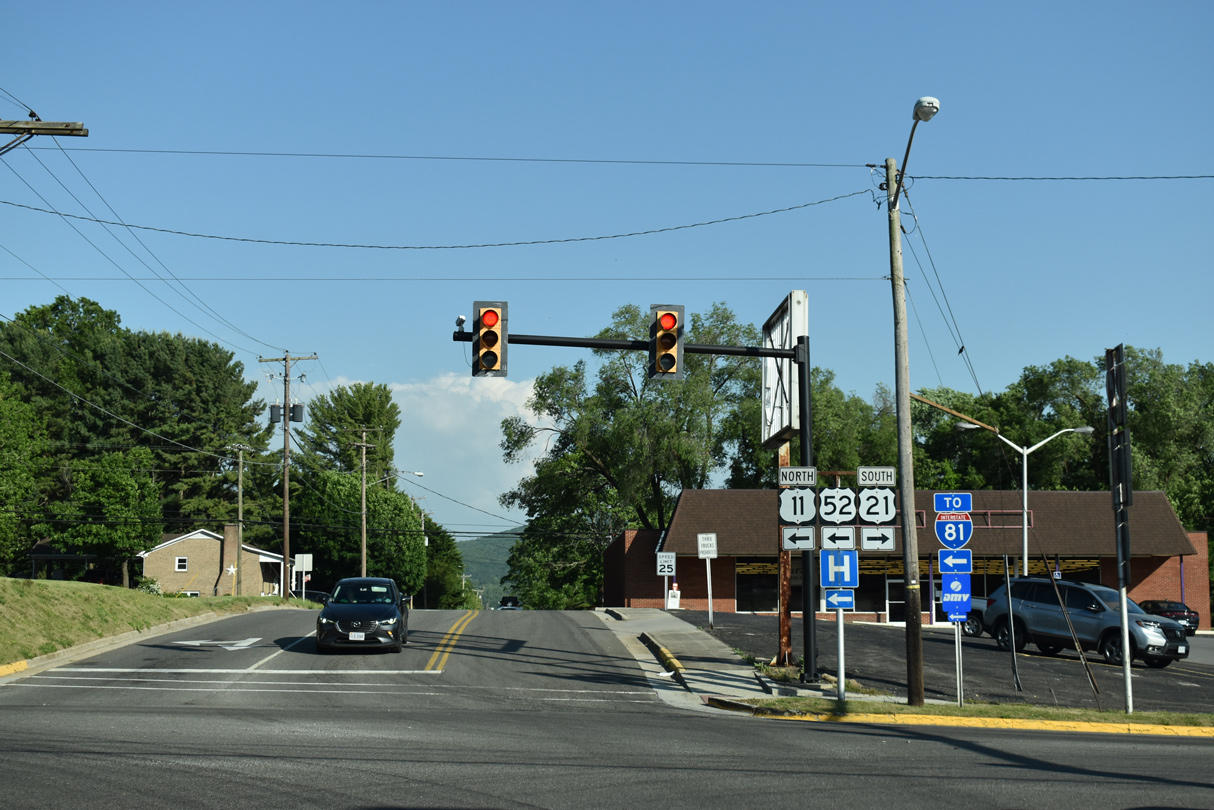
| U.S. 52 follows I-81 south to Exit 70 and north to Exit 80. 05/26/21, 09/29/10 |
|
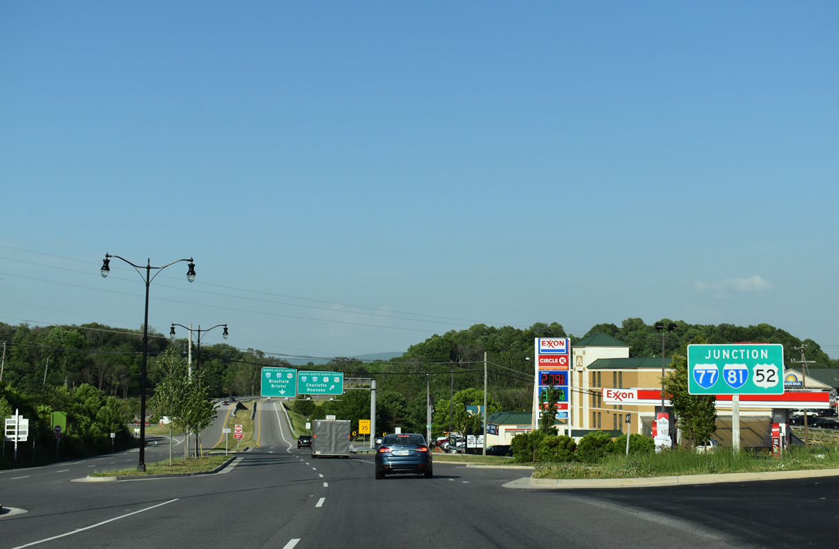
| A number of travel amenities line U.S. 11 leading into the trumpet interchange with I-77/81-U.S. 52. 05/26/21 |
|
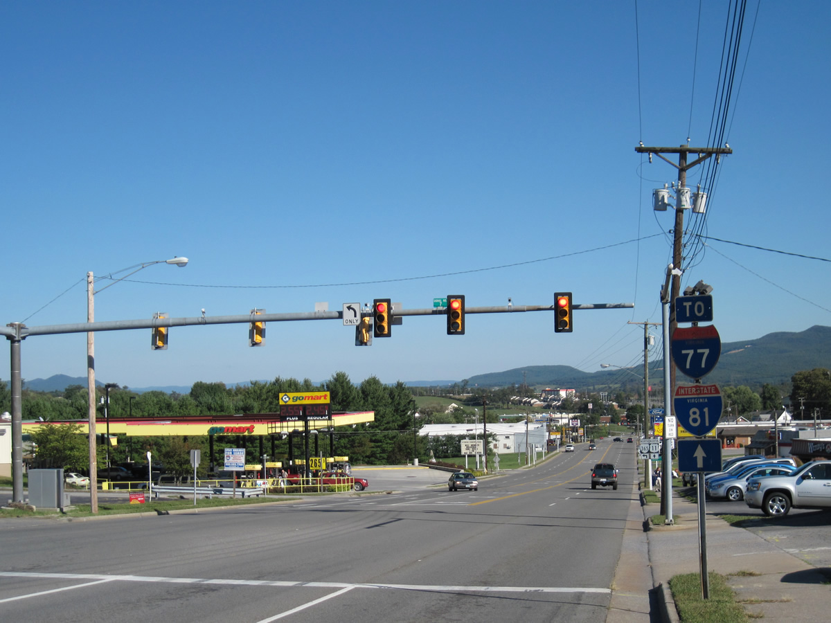
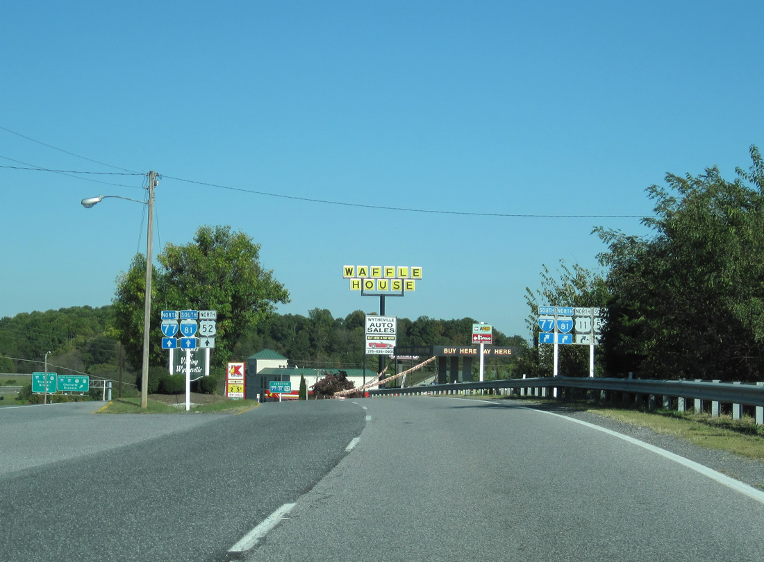
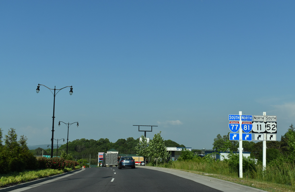
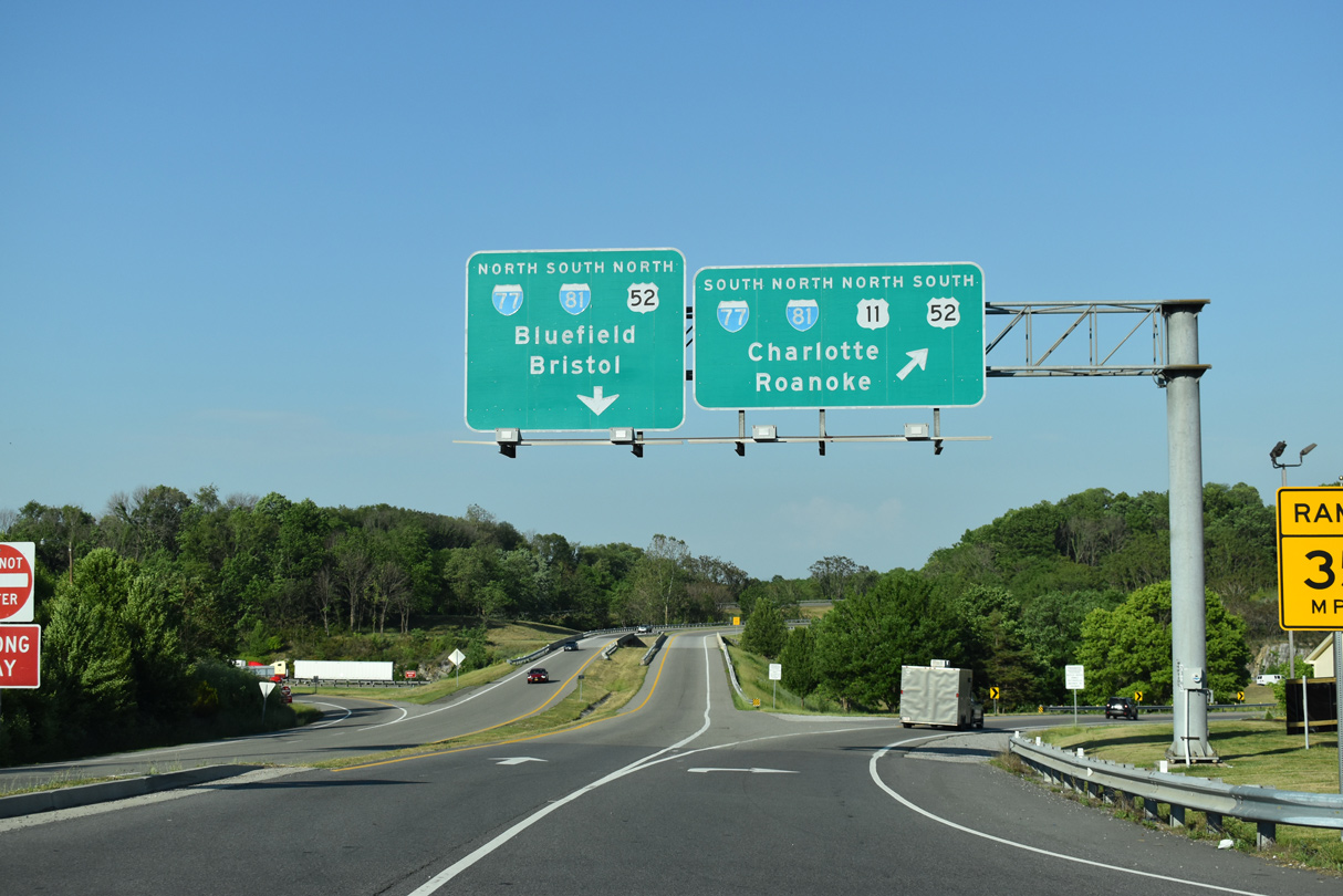
| U.S. 11 combines with I-77 south and I-81 north to Fort Chiswell. I-77/81 part ways for Bluefield and Bristol respectively at succeeding interchange to the west. 05/26/21 |
|
| U.S. 11 (Lee Highway) north of SR 419 (Electric Road) in the city of Salem. 05/27/21 |
|
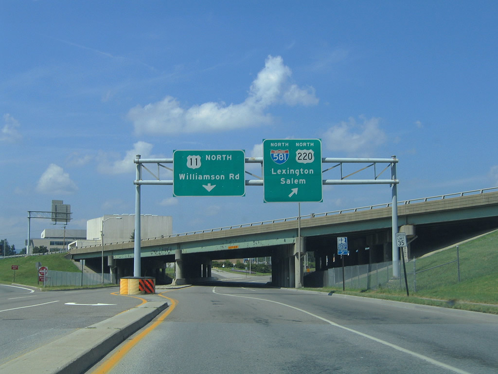
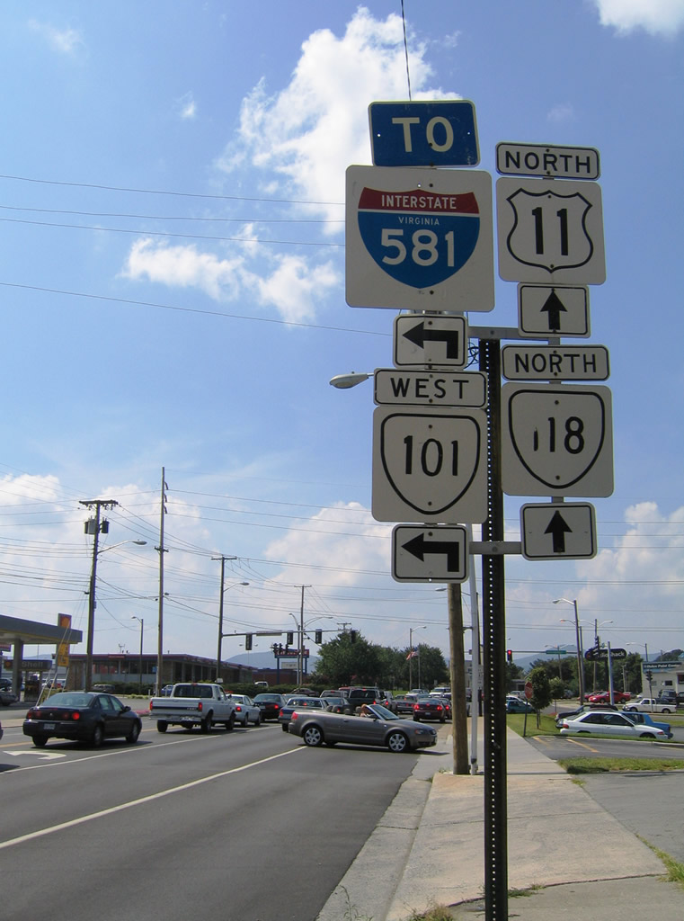
| U.S. 11/221/220 Business and SR 116 (Williamson Road) ascend onto a viaduct over Norfolk Southern Railroad tracks between Salem and Shenandoah Avenues. A loop ramp follows onto I-581/U.S. 220 north to I-81 after Kimball Avenue. 07/24/04 |
|
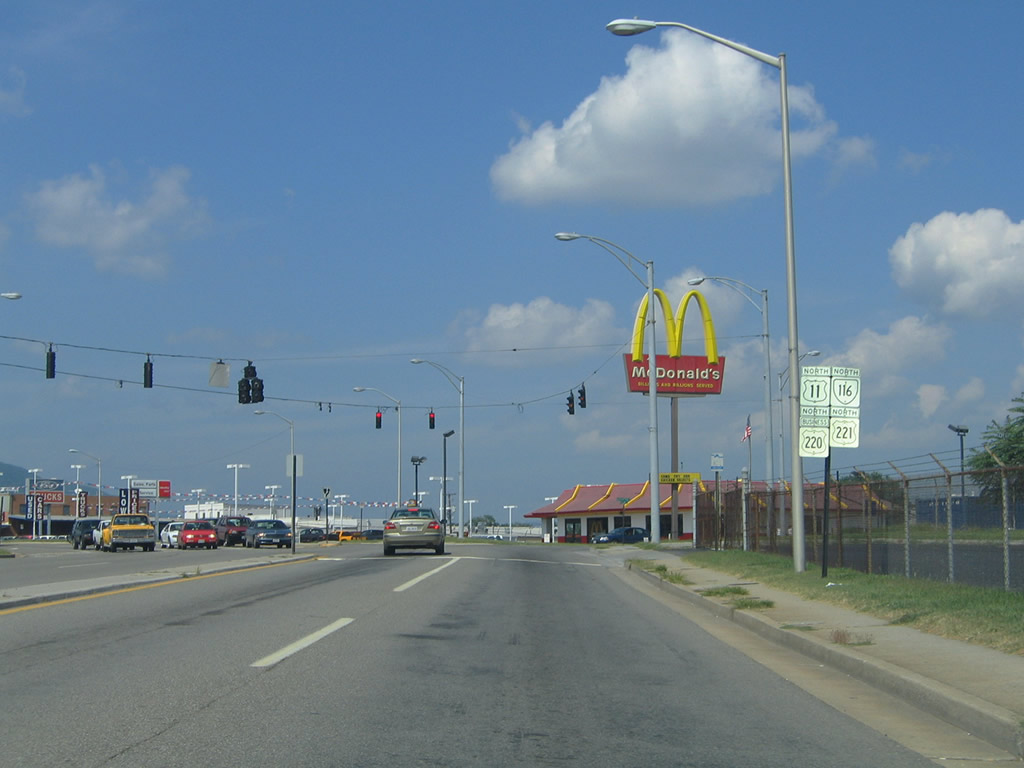
| Confirming markers for the four route overlap stand along Williamson Road at Rutherford Avenue. Rutherford Avenue heads east from Berglund Center to Kimball Avenue, which curves north to U.S. 460 (Orange Avenue). 07/24/04 |
|
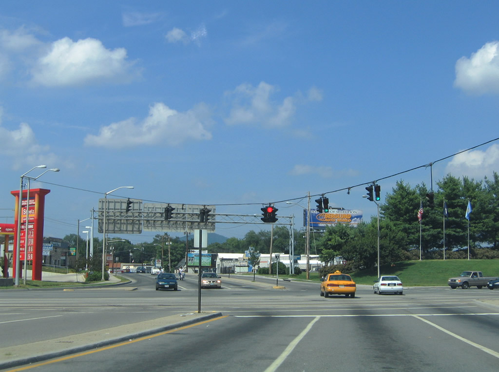
| Williamson Road northbound at the entrance to Berglund Center (Roanoke Civic Center). 07/24/04 |
|
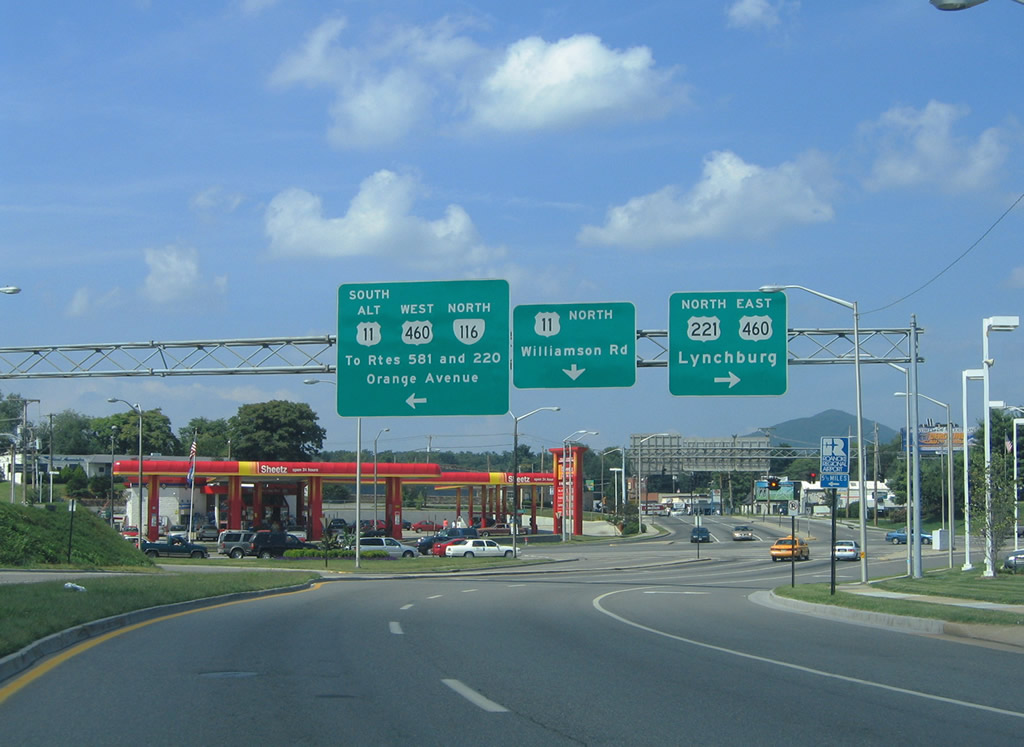
| U.S. 11 continues north along Williamson Road toward Roanoke-Blacksburg Regional Airport (ROA). U.S. 221 joins U.S. 460 (Orange Avenue) east to Bedford. U.S. 11 ALT/SR 116 north join U.S. 460 west to I-581/U.S. 220 at Exit 4, where U.S. 220 Business ends. 07/24/04 |
|
| U.S. 221/460 overlap east from Roanoke to Bonsack near the Botetourt County line. U.S. 220 ALT branches north from there to I-81 at Exit 150. U.S. 11 ALT follows U.S. 460 west to SR 419 (Electric Road) south in Salem. SR 116 connects U.S. 460 with SR 101 (Hershberger Road) via Lafayette Boulevard north. 07/24/04 |
|
| U.S. 11 (Williamson Road) north at SR 101 (Hershberger Road) west. SR 101 comprises a 3.17 mile long arterial west from U.S. 11 at Crossroads Corporate Business Center to I-581/U.S. 220 and SR 116 (Lafayette Boulevard). 07/24/04 |
|
| SR 118 (Airport Road) branches west from U.S. 11 just beyond SR 101 (Hershberger Road). Running along the east side of Roanoke-Blacksburg Regional Airport (ROA), SR 118 leads 1.84 miles north to SR 117 (Peters Creek Road). 07/24/04 |
|
| Spanning the Maury River, U.S. 11 (Lee Highway) continues from the city of Lexington to SR 631 (Furrs Mill Road west / Old Buena Vista Road east) at East Lexington. SR 631 was historically a part of SR 39 west to Greenhouse Road (SR 681) north. When I-64 was built, the south end of SR 39 was relocated north to U.S. 11 (Lee Highway) at Maury River Road.2 07/24/04 |
|
| North of Greenhouse Road, U.S. 11 (Lee Highway) enters a diamond interchange (Exit 55) with Interstate 64. 07/24/04 |
|
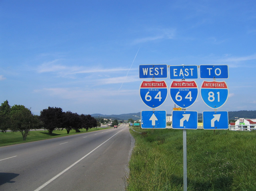
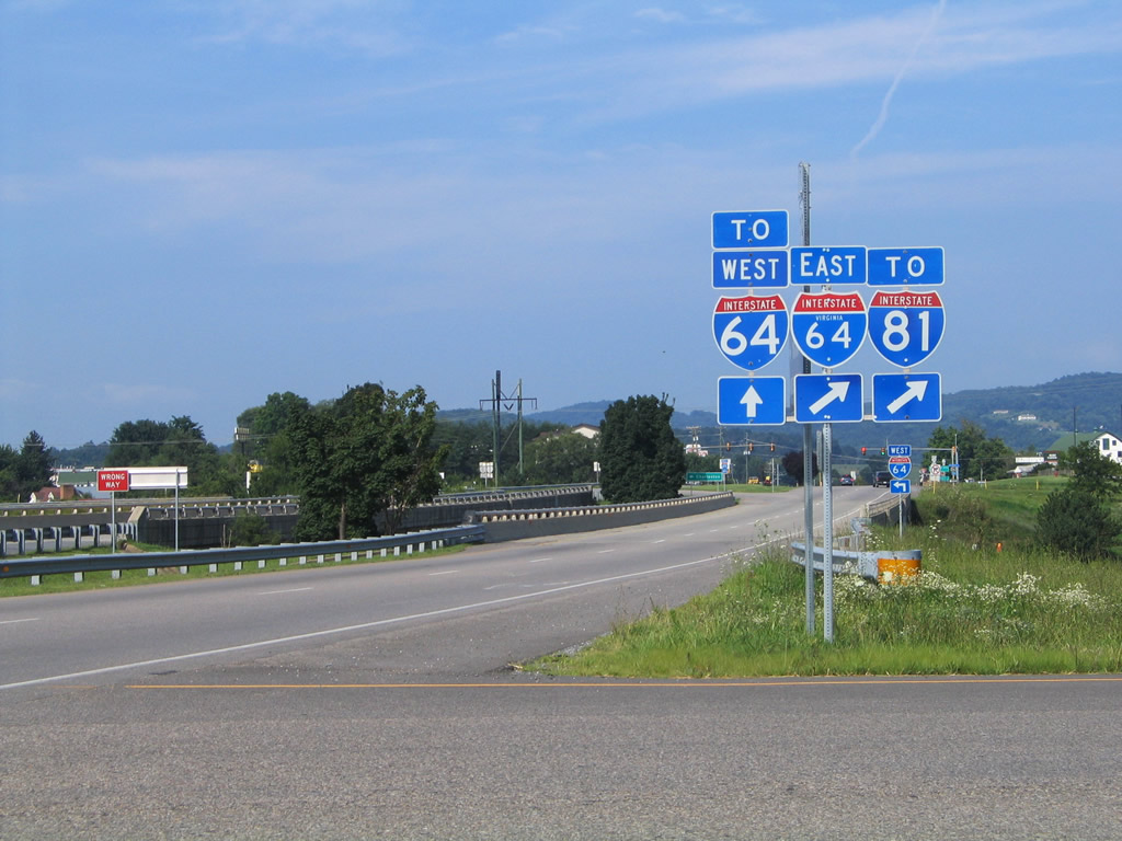
| Interstate 64 combines with I-81 north just east of U.S. 11 to Staunton. I-81 south leads back to Roanoke. 07/24/04 |
Page Updated 08-09-2021.


 North
North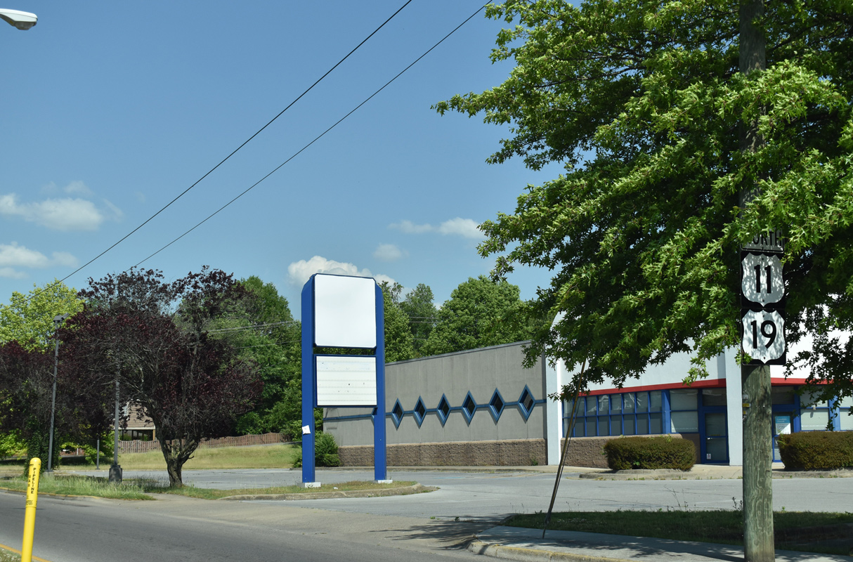
 East
East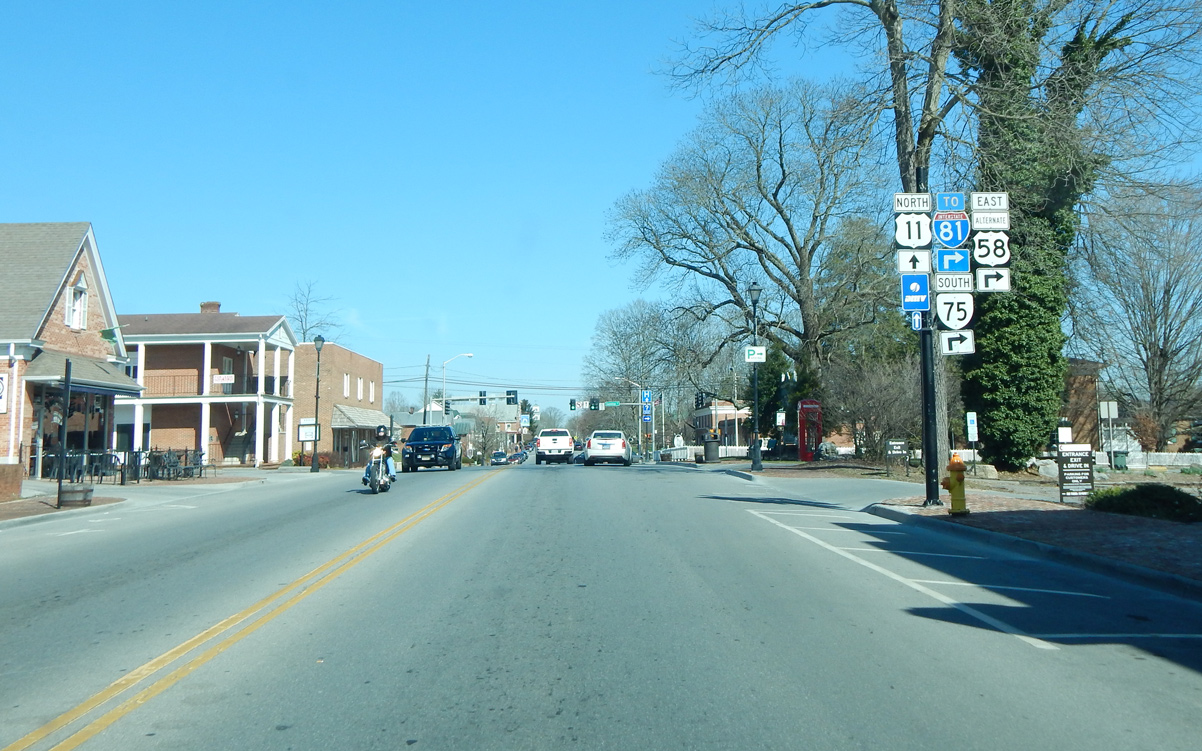
 North
North