

U.S. 18 travels 182 miles across southern Wisconsin from Prairie du Chien to the Lake Michigan waterfront in Downtown Wisconsin. The route enters the state on the Marquette-Joliet Bridge across the Mississippi River between Marquette, Iowa and Island Number 172. The tied arch bridge opened in 1975. A couplet takes the route from the East Channel bridge over the Mississippi River to Main Street south through Prairie du Chien. This alignment forms part of a bypass of Downtown along the river to the west as STH-35 follows the former U.S. 18 along Marquette Road. The two combine southeast to a series of ridges south of the Wisconsin River near Patch Grove.
U.S. 18 resumes an eastern heading across Military Ridge to Fennimore in rural Grant County. The US route straightens out as it continues from there to Dodgeville, where it merges with U.S. 151. U.S. 18/151 combine for 37.5 miles along a freeway and expressway to the Madison belt line freeway (U.S. 12/14). A four way overlap ensues there to Park Street, where U.S. 151 turns north toward the state capitol while U.S. 14 heads south to Fitchburg.
U.S. 12/18 remain paired along a freeway to I-39/90 in east Madison and overall to Cambridge. U.S. 12 curves southeast to Fort Atkinson as U.S. 18 advances toward Jefferson. Travelers along the highway reach the outer suburbs of Milwaukee at Dousman. Once at Waukesha, U.S. 18 becomes more urban along Summit Avenue and Delafield Street toward Downtown. A couplet takes the route east to Moreland Boulevard, which expands U.S. 18 into a commercial arterial to Interstate 94 and the city of Brookfield.
U.S. 18 parallels Interstate 94 to the north along Bluemound Road to Elm Grove, Wauwatosa and Story Hill in Milwaukee. This stretch doubles also as former U.S. 16. An L-shaped route runs U.S. 18 northeast through Miller Valley along Wisconsin Avenue, 35th Street and Highland Boulevard. Highland Boulevard comprises an urban parkway carrying U.S. 18 east to Avenues West and Kilbourn Town across Interstate 43.
Historically U.S. 16/18 separated into a couplet using 17th and Wells Street for eastbound and State and 9th Streets to Highland Avenue for westbound. U.S. 18 today turns south from Highland Avenue along 6th Street to the State and Wells Street couplet. Another couplet sees U.S. 18 overlap with STH-32 along Broadway south and Milwaukee Street north to Michigan Street, which extends U.S. 18 to its terminus at Lincoln Memorial Drive.
U.S. 18 Wisconsin Guides
 scenes scenes |
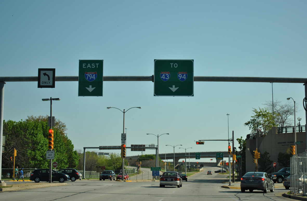
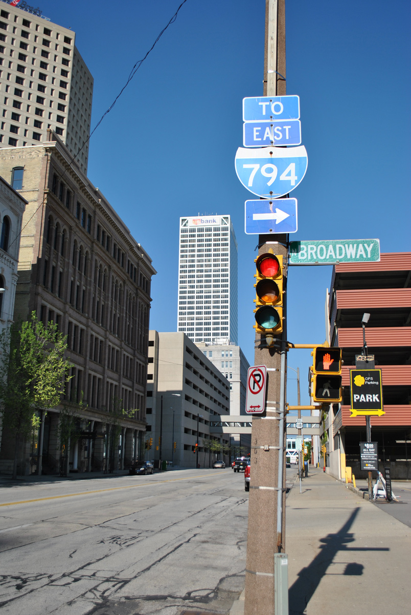 | Michigan Street east intersects Broadway where U.S. 18 east splits with Wis 32 south. Wis 32 travels one block south to Clybourn Street at the on-ramp for I-794 east to Jones Island. 05/30/11 |
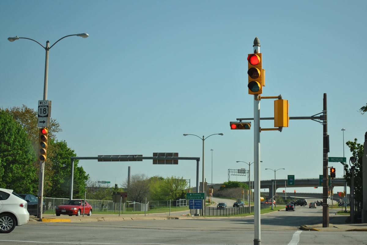
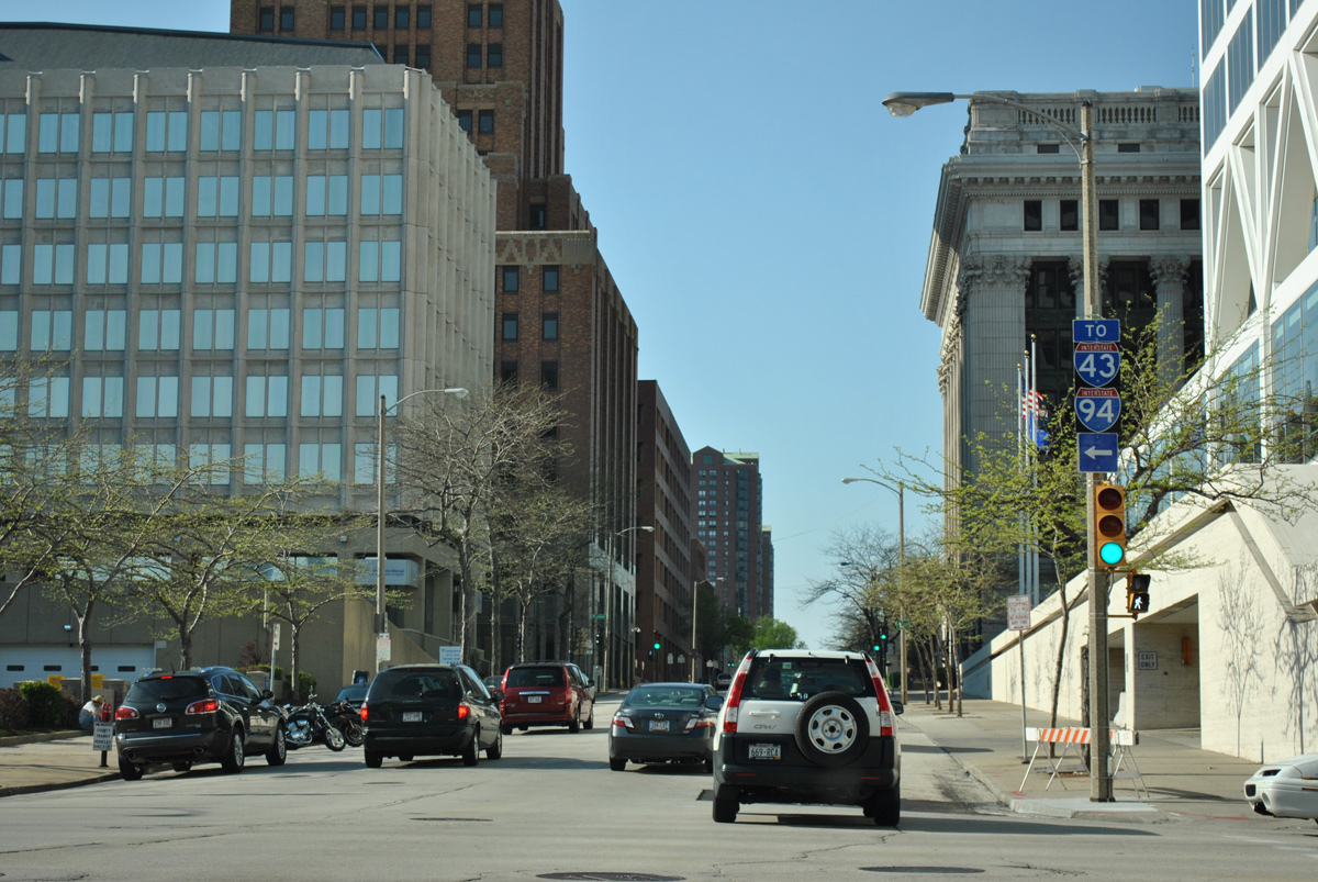 | Trailblazers direct motorists onto U.S. 18 (Michigan Street) west from Van Buren Street to Interstates 43 and 94. Jackson Street, one block to the south, connects U.S. 18 with I-794 west to the Marquette Interchange. 05/30/11 |
 | Entering Downtown, Wis 32 (Milwaukee Street) approaching U.S. 18 (Michigan Street) from below the I-794 viaducts. 05/30/11 |
 | Wisc 32 (Milwaukee Street) north combines with U.S. 18 west at Michigan Street. The pair share five blocks to State Street. This assembly was replaced with a unisign by 2014. 05/30/11 |
 | Lincoln Memorial Drive south at the eastern terminus of U.S. 18 (Michigan Street). Overheads here changed in 2015 during the Hoan Bridge Project to rebuild I-794. 05/30/11 |
 | The U.S. 18 shield posted within the median at Michigan Street was removed by 2013. A new shield was posted on the north side of the intersection. U.S. 18 travels 1,043 miles from this intersection to Orin, Wyoming. 05/30/11 |
Photo Credits:
05/30/11 by AARoads
Connect with:
Interstate 39
Interstate 41 / U.S. 41
Interstate 90
Interstate 94
U.S. 151
Page Updated 02-17-2016.