|
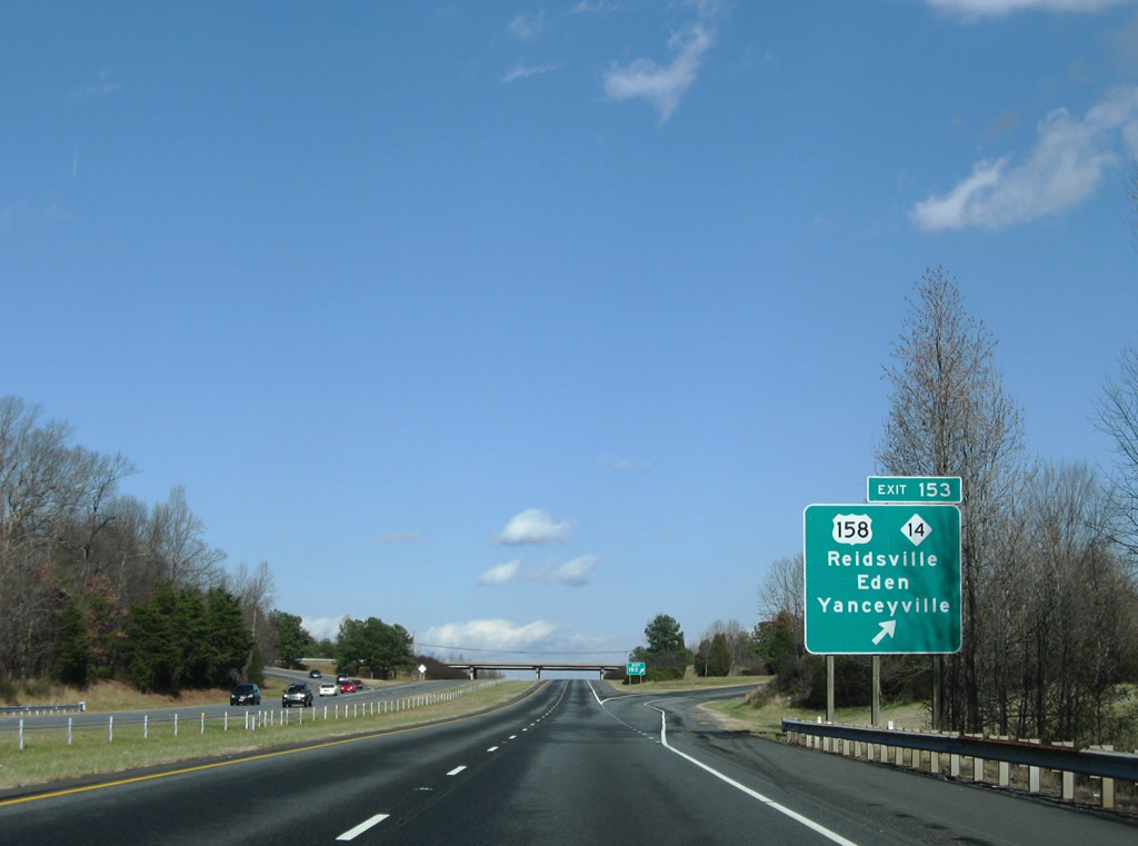
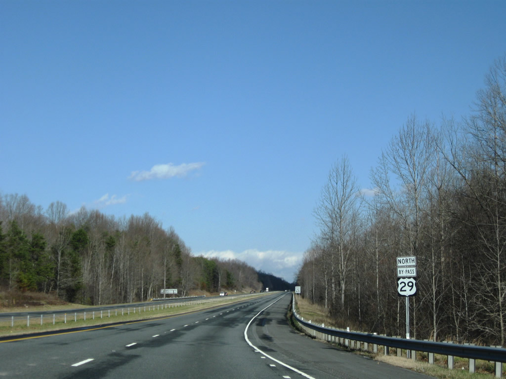
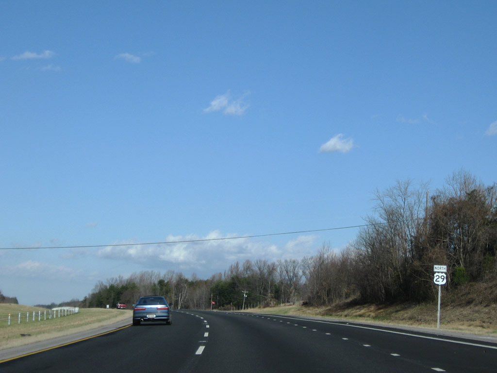
| Service roads accompany the expressway along U.S. 29 north from the Guilford County line to the trumpet interchange with U.S. 29 Business. Motorists headed to Eden are directed to remain on U.S. 29 north to Exit 153 in lieu of U.S. 29 Business around the west side of Reidsville. 06/15/15 |
|
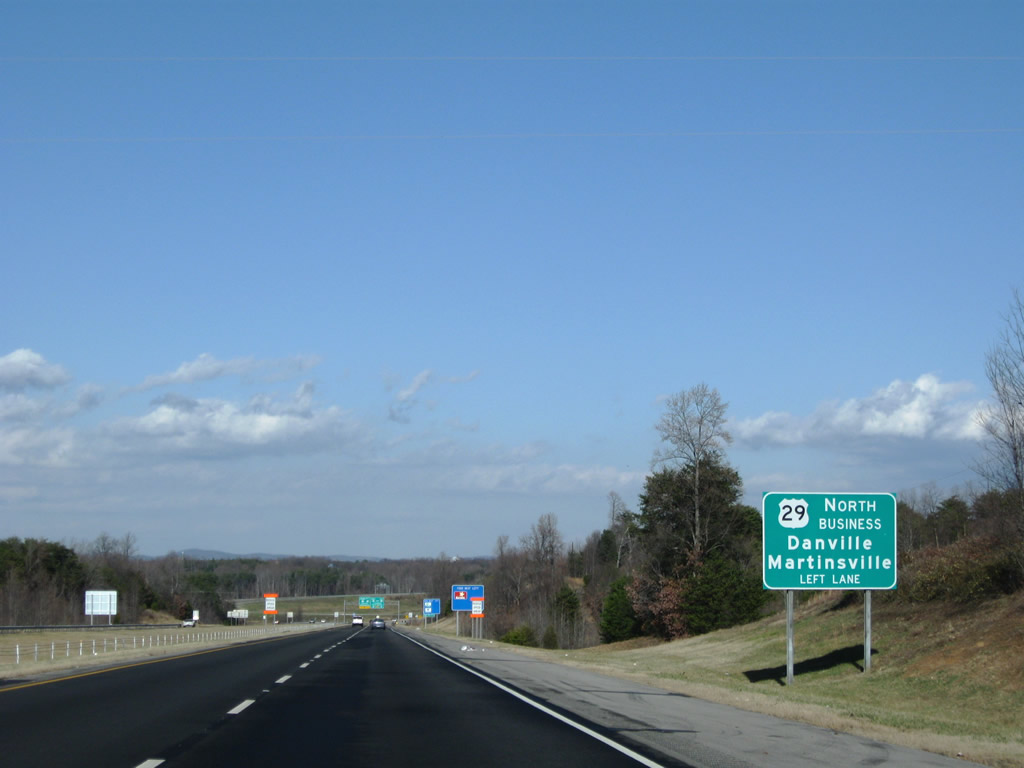
| Representing the pre-1970s alignment of U.S. 29, the 18.73 mile long route of U.S. 29 Business encircles Reidsville to the west before returning to U.S. 29 ahead of Ruffin. U.S. 29 Business also follows what was U.S. 29 Bypass, as it circumvented an even older section of U.S. 29 through Downtown Reidsville on Scales Street.1 06/15/15 |
|
| North of the intersection with Cornelius Road (SR 2665) and McWalker Road (SR 2486), U.S. 29 transitions into a full freeway. Several residences line the adjacent service roads that otherwise do not connect with any other road. 12/21/08 |
|
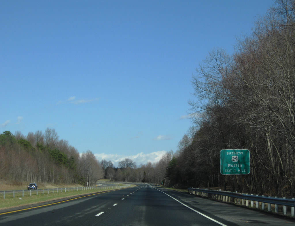
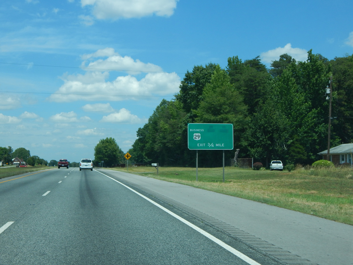
| Branching north from U.S. 29 ahead of the Haw River, U.S. 29 Business travels 4.05 miles to U.S. 158/NC 87 (Freeway Drive) in south Reidsville. 06/15/15 |
|
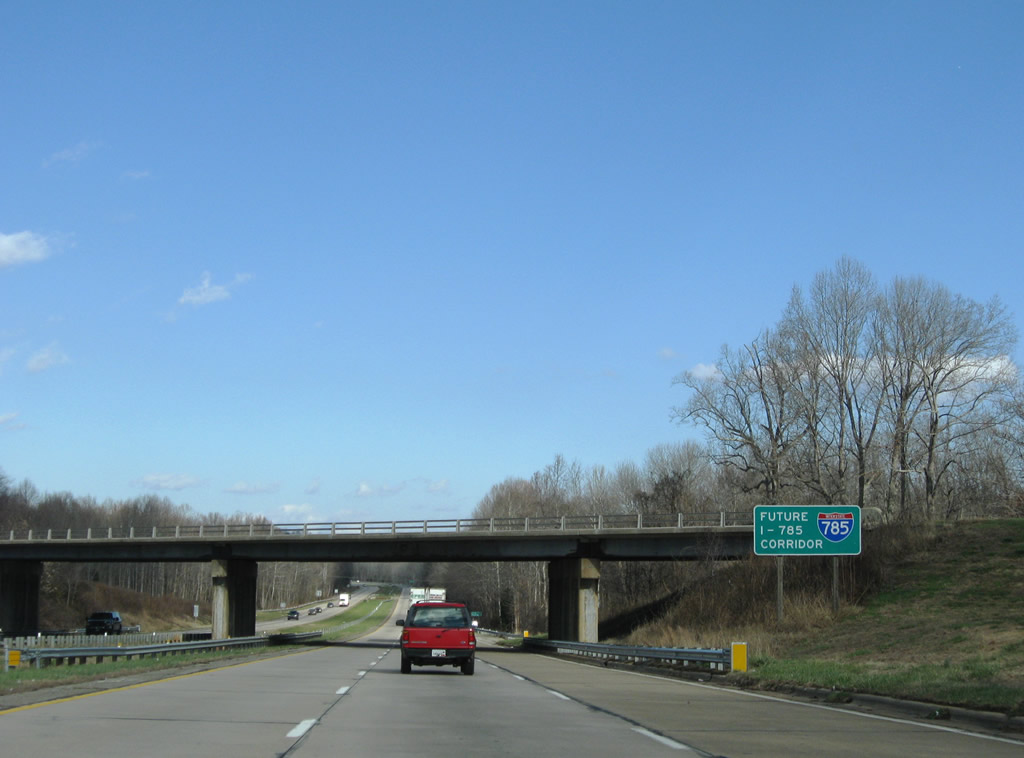
| Since replaced, a Future I-785 Corridor sign appeared within the exchange for U.S. 29 Business. 12/21/08 |
|
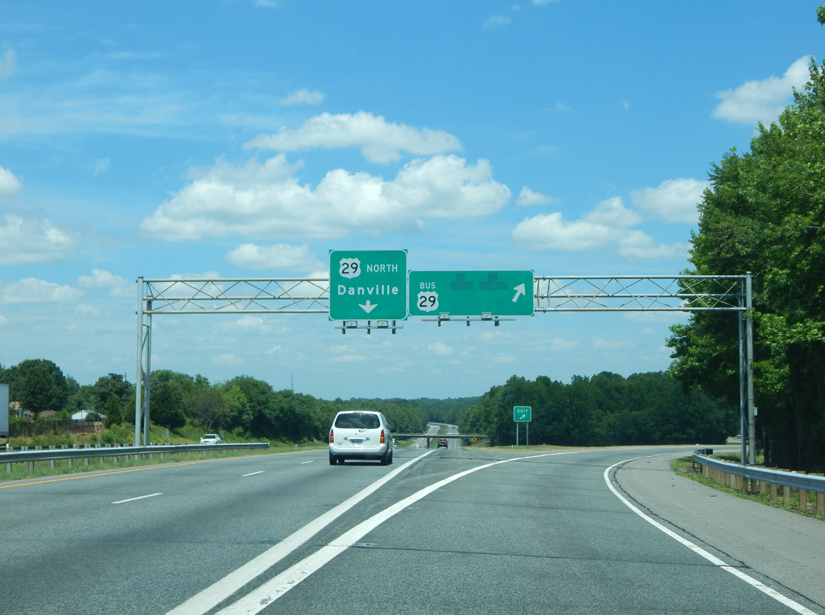
| The freeway bypass for U.S. 29 around Reidsville opened in the early 1970s.1 05/30/05 |
|
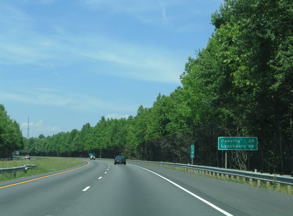
| Distance sign for Danville and Lynchburg, Virginia on the Reidsville bypass. U.S. 29 generally follows a four lane corridor throughout central Virginia. 05/30/05 |
|
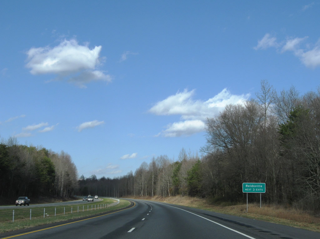
| Three interchanges serve the city of Reidsville over the next six miles from U.S. 29 north. 12/21/08 |
|
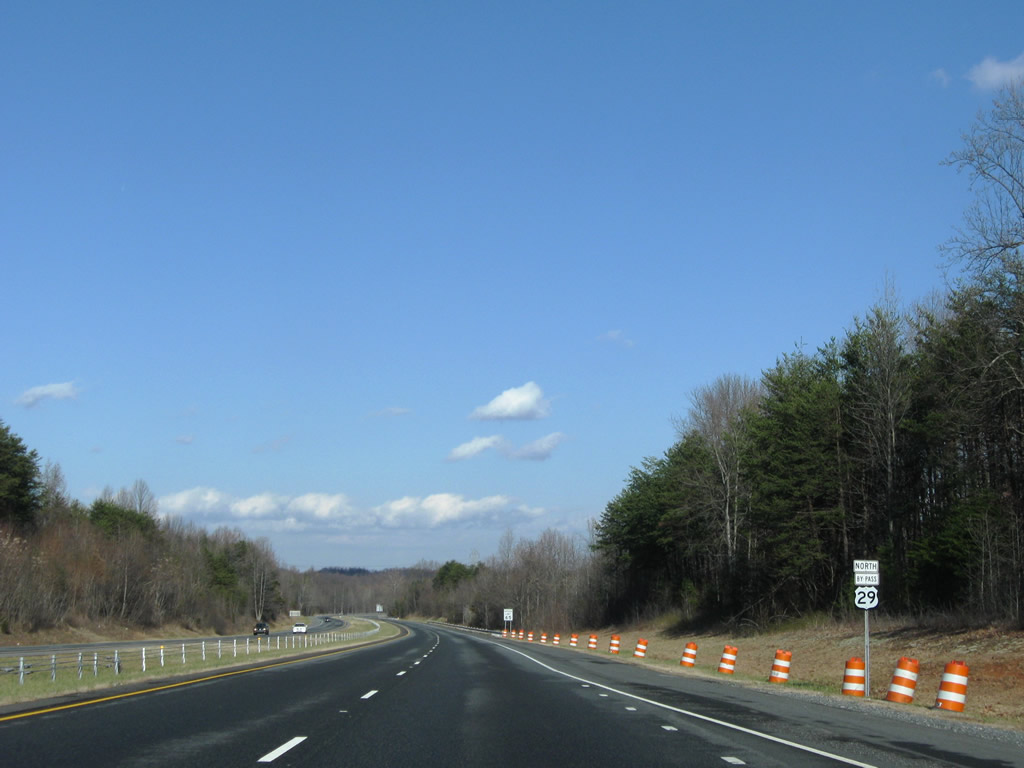
| U.S. 158/NC 87 (Freeway Drive) constitute a four lane bypass leading west from Barnes Street (SR 2817) to Richardson Drive and NC 65 (Harrison Street). U.S. 158 was relocated from NC 14 on the north side of Reidsville onto a 3.38 mile long overlap with NC 87 by 2018. 12/21/08 |
|
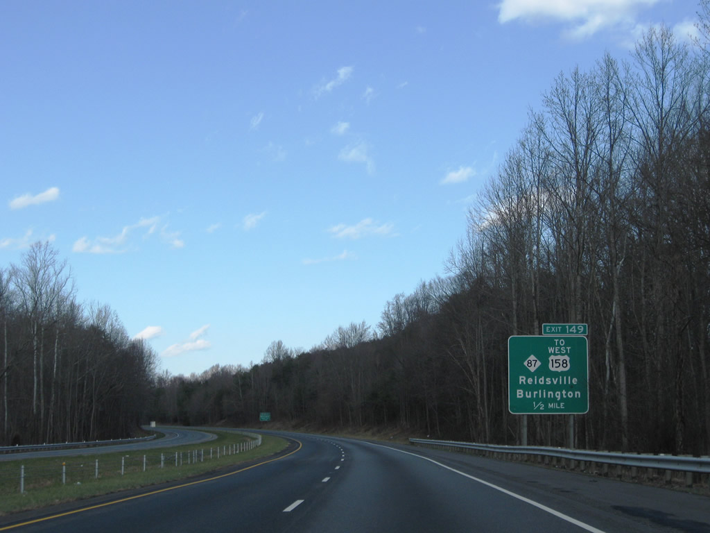
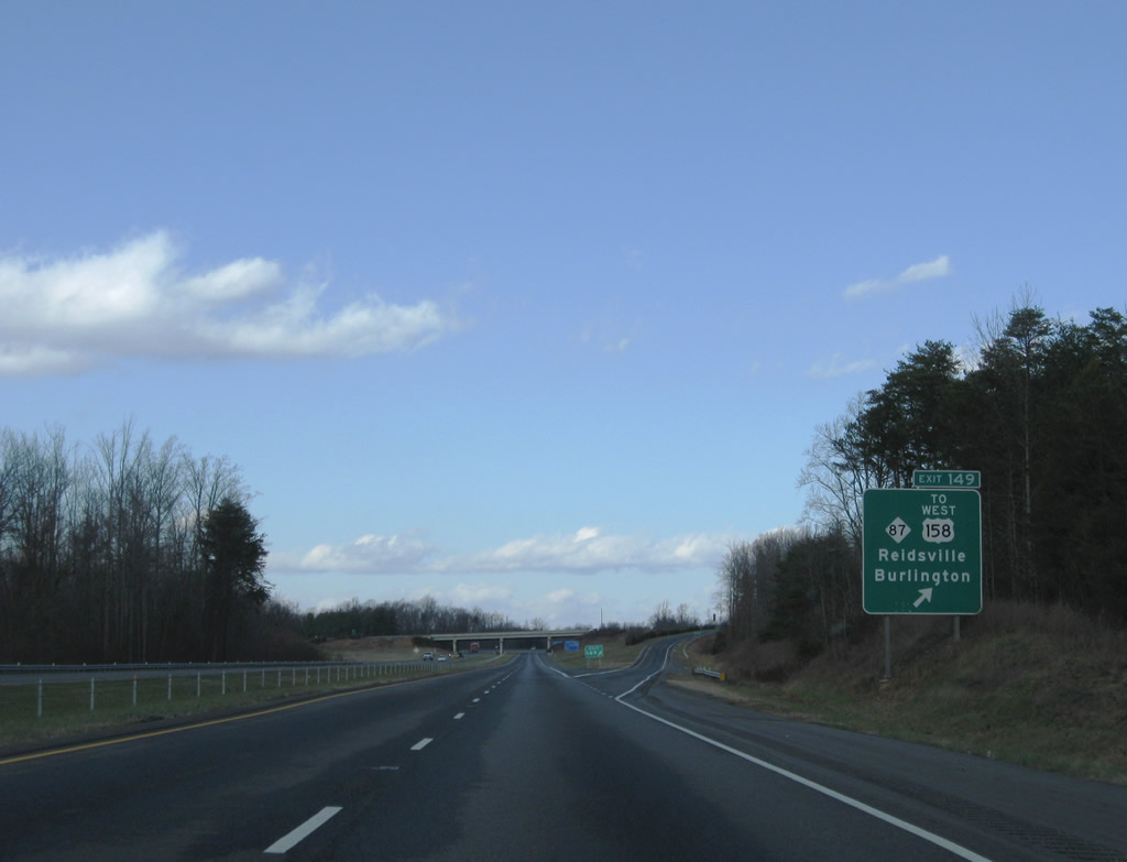
| A diamond interchange joins U.S. 29 with U.S. 158 west and NC 87 (Freeway Drive) at Exit 149. NC 87 shifted from through Reidsville to Freeway Drive in 2000.2 NC 87 connects Reidsville with Williamsburg and Burlington to the south and the county seat of Wentworth and Rockingham Community College to the north. 12/21/08 |
|
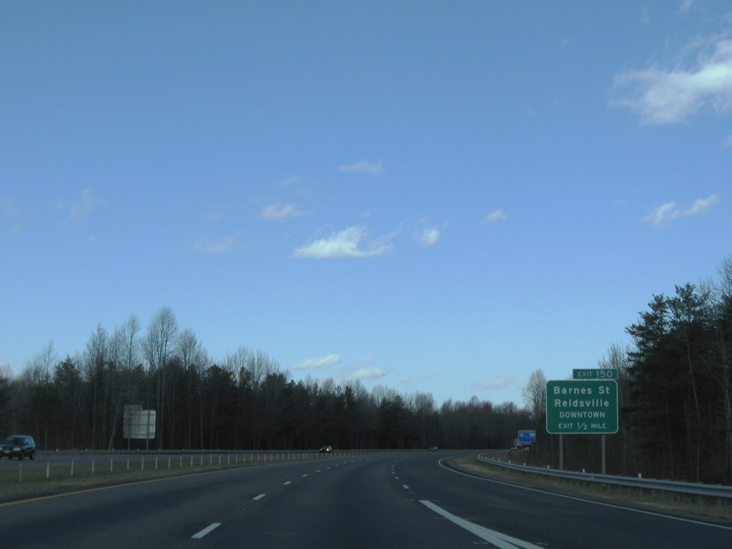
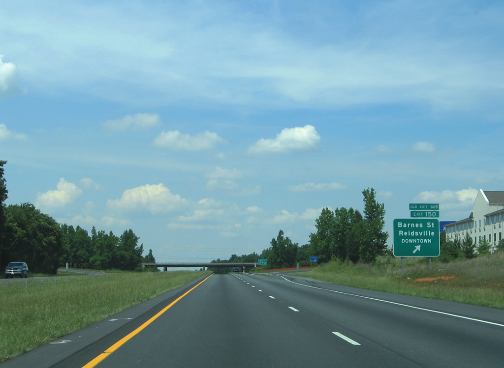
| Barnes Street (former NC 87) meets U.S. 29/158 north at Exit 150. The forthcoming diamond interchange serves industrial parks on both sides of the freeway and interests to Downtown Reidsville. 12/21/08 |
|
| NC 87 formerly followed Barnes Street (SR 2817) north to Harrison Street. Harrison Street also carried NC 65 to Main Street (former U.S. 158) at one point. 05/30/05 |
|
| U.S. 29 north and U.S. 158 east overlap for 3.56 miles. U.S. 29 was previously marked with bypass banners. 12/21/08 |
|
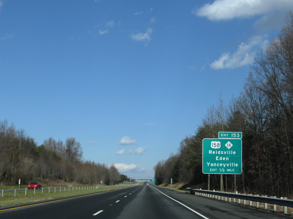
| U.S. 158 parts ways with U.S. 29 at Exit 153 east of the Reidsville city limits. Prior to 2018, U.S. 158/NC 14 overlapped 2.43 miles west from U.S. 29 to U.S. 29 Business. 12/21/08 |
|
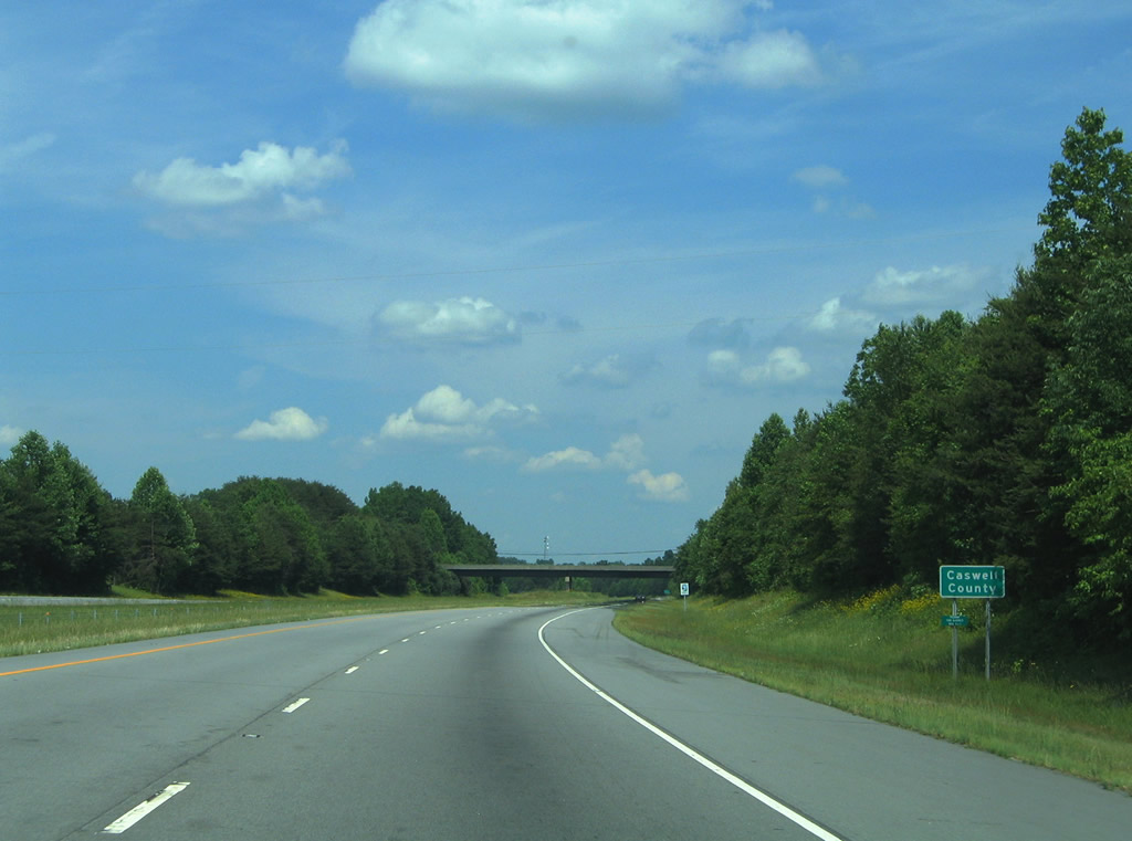
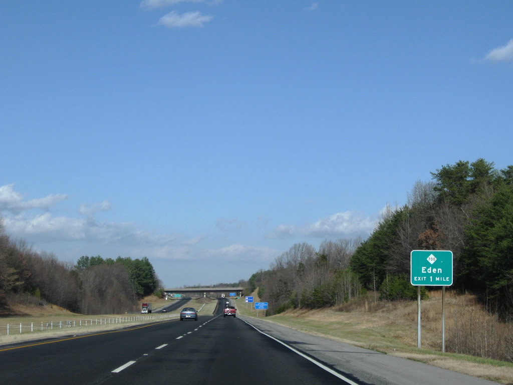
| U.S. 158 continues east eight miles to Casville and 18 miles to the Caswell County seat of Yanceville. NC 14 constitutes a five lane boulevard leading northwest from U.S. 29 Business 7.6 miles to U.S. 311/NC 770 just outside Eden. 12/21/08 |
|
| Paralleling Lick Fork, U.S. 29 navigates through an S-curve northeast from Reidsville. 12/21/08 |
|
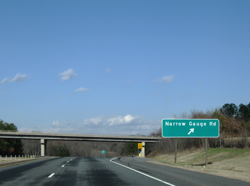
| Narrow Gauge Road (SR 2552) meanders 3.25 miles northeast from U.S. 29 Business and north Reidsville to a parclo interchange (Exit 156) with U.S. 29. 05/30/05 |
|
| East of U.S. 29, Narrow Gauge Road (SR 2552) runs 2.52 miles to U.S. 158 at Lawsonville. 12/21/08 |
|
| Turning northeast, U.S. 29 advances toward Stacey. 12/21/08 |
|
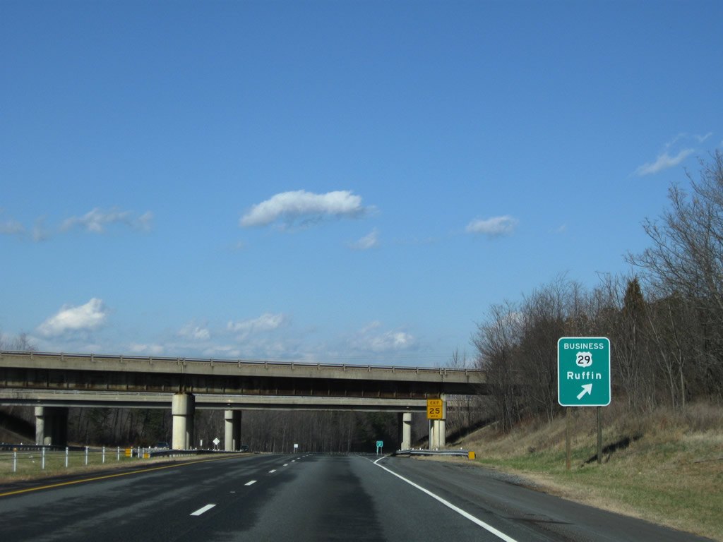
| U.S. 29 Business switches sides with U.S. 29 Bypass between Stacey and the unincorporated community of Ruffin. 12/21/08 |
|
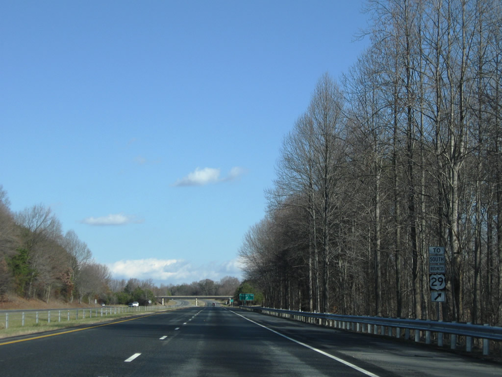
| A folded diamond interchange (Exit 159) links U.S. 29 and U.S. 29 Business north of a Norfolk Southern Railroad line. U.S. 29 Business loops 2.47 miles through Ruffin. 12/21/08 |
|
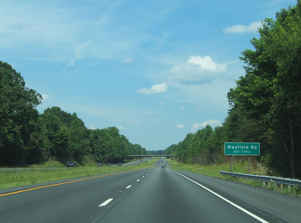
| U.S. 29 passes under Estes Road (SR 1929) and Worsham Mill Road (SR 1925) to the west of Ruffin. The freeway next meets Mayfield Road (SR 1767) north and U.S. 29 Business south. 05/30/05 |
|
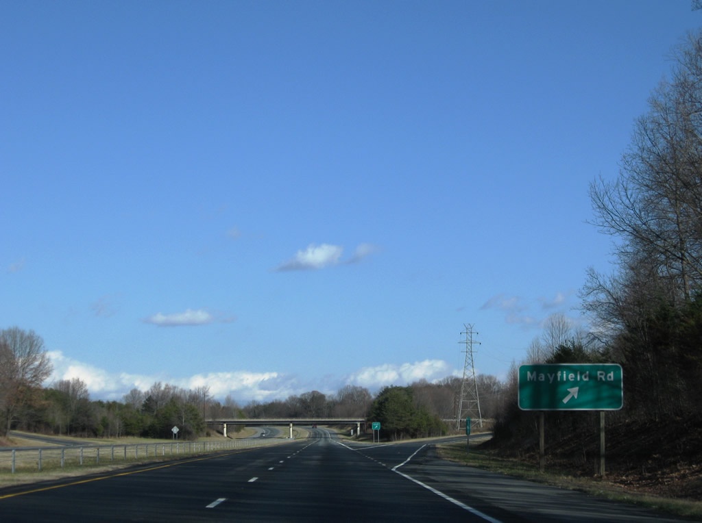
| U.S. 29 and U.S. 29 Business converge at a diamond interchange (Exit 161) with Mayfield Road(SR 1767). Old Highway 29 (SR 2562) continues along a Norfolk Southern Railroad line northeast to Pelham and Danville, Virginia. 12/21/08 |
|
| Mayfield Road extends 4.21 miles north from U.S. 29/29 Business at Ruffin to NC 700 at Mayfield. 12/21/08 |
|
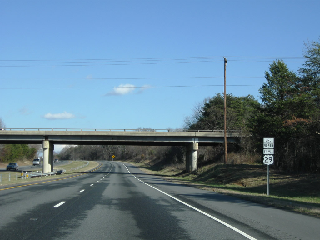
| The final confirming marker for U.S. 29 Bypass north was replaced with an end shield ahead of the Mayfield Road overpass by 2008. That assembly was subsequently removed when U.S. 29 Bypass was redesignated as just U.S. 29. 12/21/08 |
|
| A service road (SR 2708/1371) runs along the north side of U.S. 29 from Mayfield Road 2.12 miles east to Chandler's Mill Road (SR 1343). 12/21/08 |
|
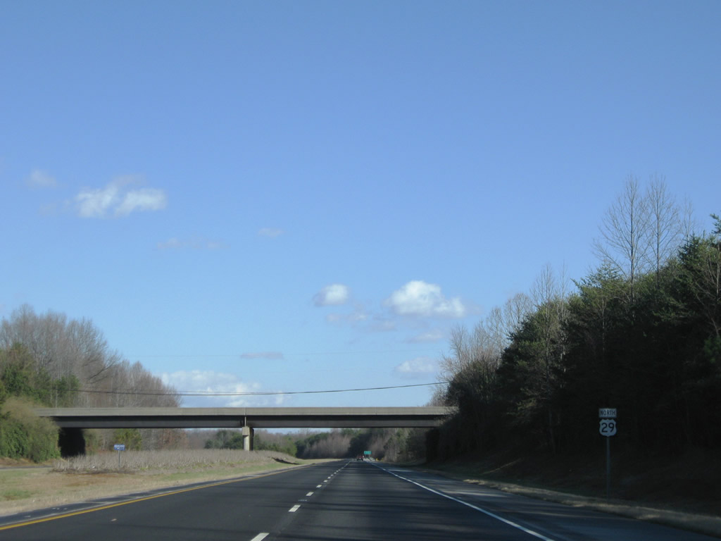
| The final 5.98 miles along U.S. 29 northbound in North Carolina are within Caswell County. 05/30/05 |
|
| Chandler's Mill Road (SR 1343) spans U.S. 29 by this reassurance marker. 12/21/08 |
|
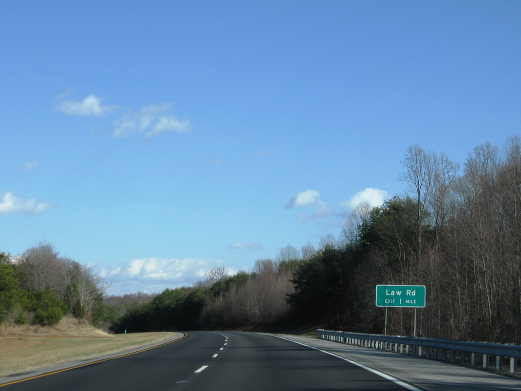
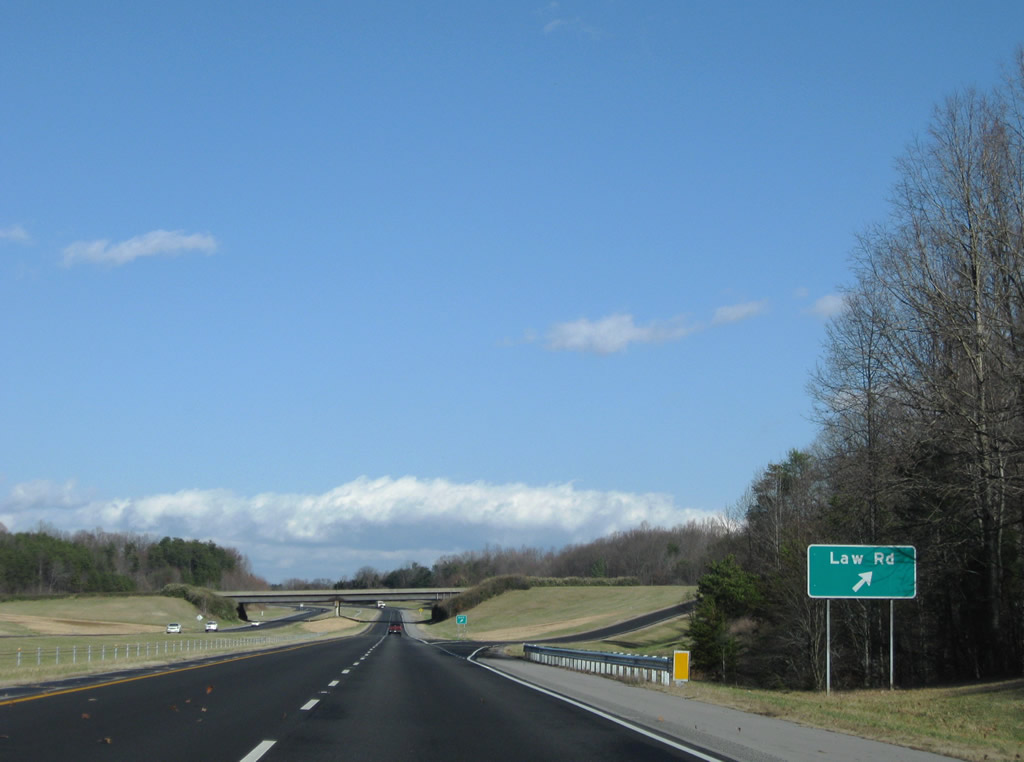
| The first of two diamond interchanges in Caswell County joins U.S. 29 north with Law Road (SR 1314) near the settlement of Swann. 12/21/08 |
|
| Law Road spurs 0.40 miles west from Exit 165 into a forested area and intersects Old U.S. 29 (SR 1353) 0.28 miles to the east. Law Road meanders 3.47 miles southeast to Park Springs Road (SR 1300) at Bethel. 12/21/08 |
|
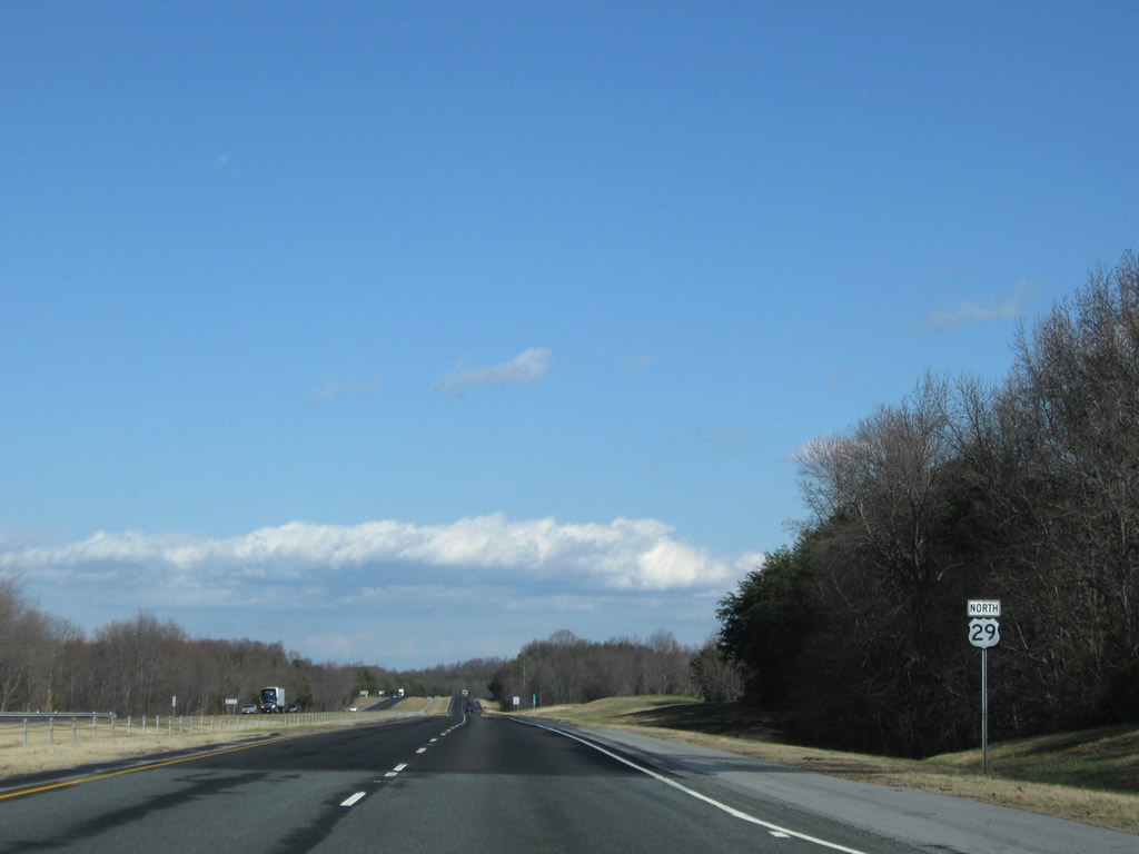
| U.S. 29 advances north past Swann to Pelham. 12/21/08 |
|
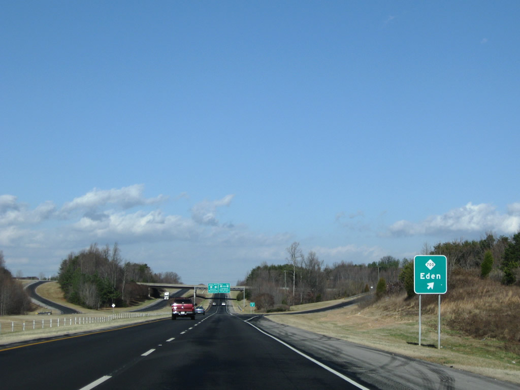
| An 18.88 mile long highway west to Mayfield and the city of Eden, NC 700 begins from U.S. 29 at Exit 167. 12/21/08 |
|
| The Piedmont Triad Visitor Center lies adjacent to Exit 167 along NC 700 west. 12/21/08 |
|
| Exit 167 departs U.S. 29 north for NC 700 west to Eden and Shady Grove Road east to Old U.S. 29 at Pelham. Old U.S. 29 remains east of the freeway into south Danville. 12/21/08 |
|
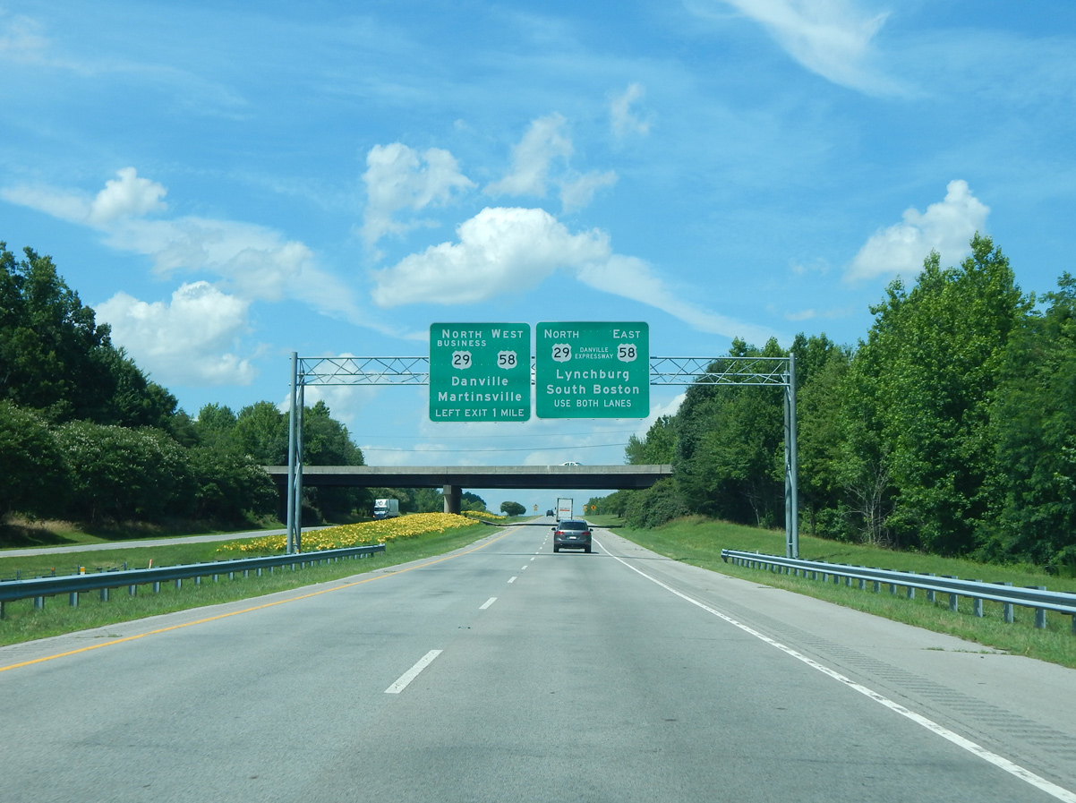
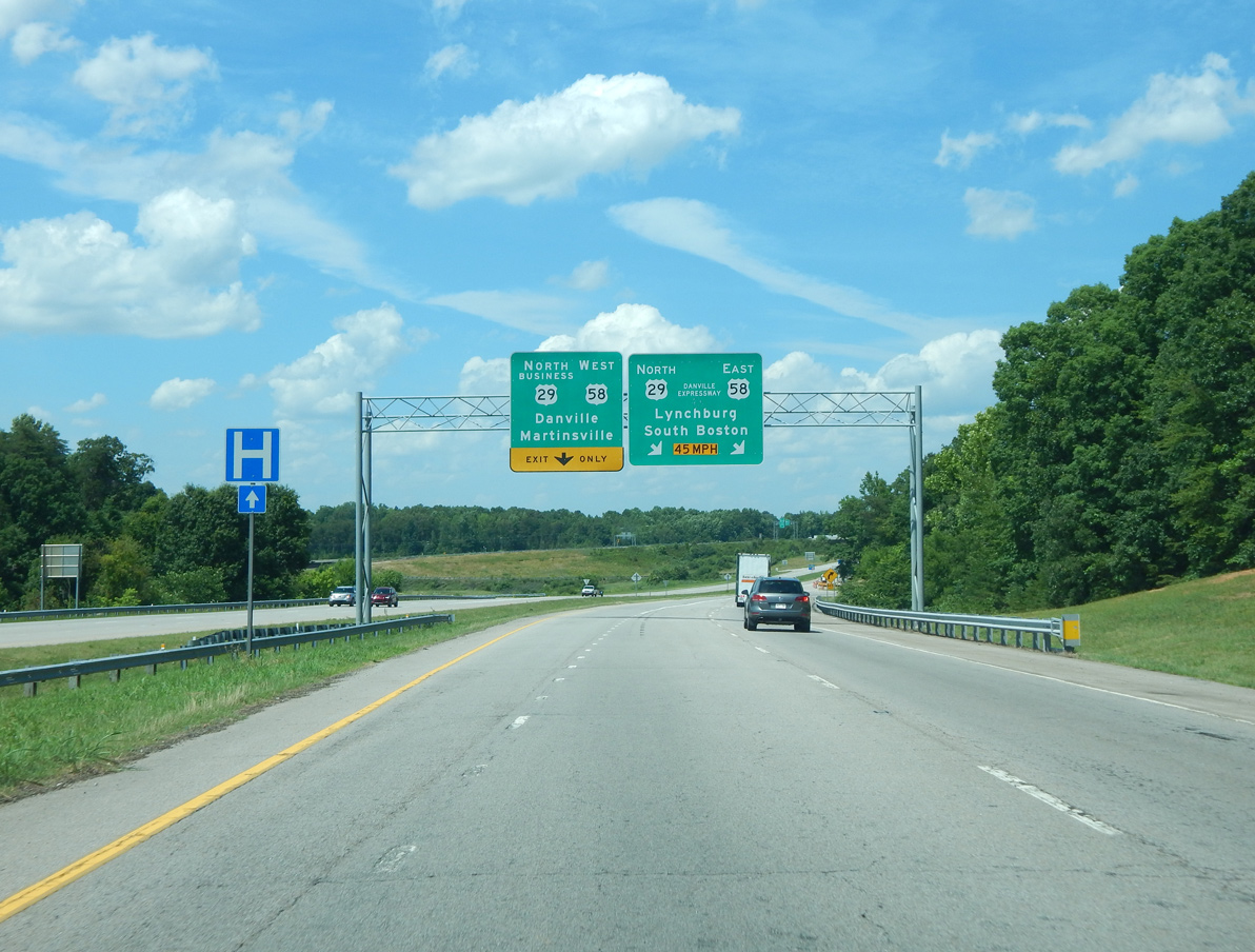
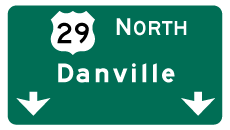
| U.S. 29 joins U.S. 58 east along the Danville Expressway in one mile. The expressway bypasses the independent city of Danville to the south while U.S. 29 Business branches north from Left Exit 169 toward Downtown. 06/15/15 |
|
| U.S. 29 Business follows the former route of U.S. 29 through western reaches of Danville. U.S. 58 joins Danville with Martinsville 26 miles to the west. 12/21/08 |
|
| A directional cloverleaf interchange (Exit 169) connects U.S. 29 north with U.S. 58 (Danville Expressway). U.S. 29 Business follows W Main Street through southwest Danville. U.S. 29/58 overlap east 7.4 miles. Danville Expressway opened in 1998 as the new alignment for U.S. 29 around the city. 06/15/15 |
|
| U.S. 58 overlays the Danville Expressway between the split with Martinsville Highway (U.S. 58 Business) and U.S. 360 (Boston Road) east of Downtown. U.S. 58 represents Virginia's longest route, stretching from the Tennessee state line near Cumberland Gap to the Atlantic Ocean in Virginia Beach. 05/30/05 |
|
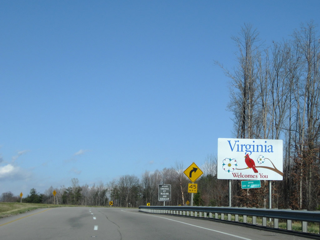
| Half of the exchange joining U.S. 29, U.S. 58 and U.S. 29 Business lies within North Carolina. The welcome sign accompanies a city limits sign for Danville on the northbound ramp taking U.S. 29 onto the Danville Expressway eastbound. 12/21/08 |
Page Updated 11-29-2021.

 North
North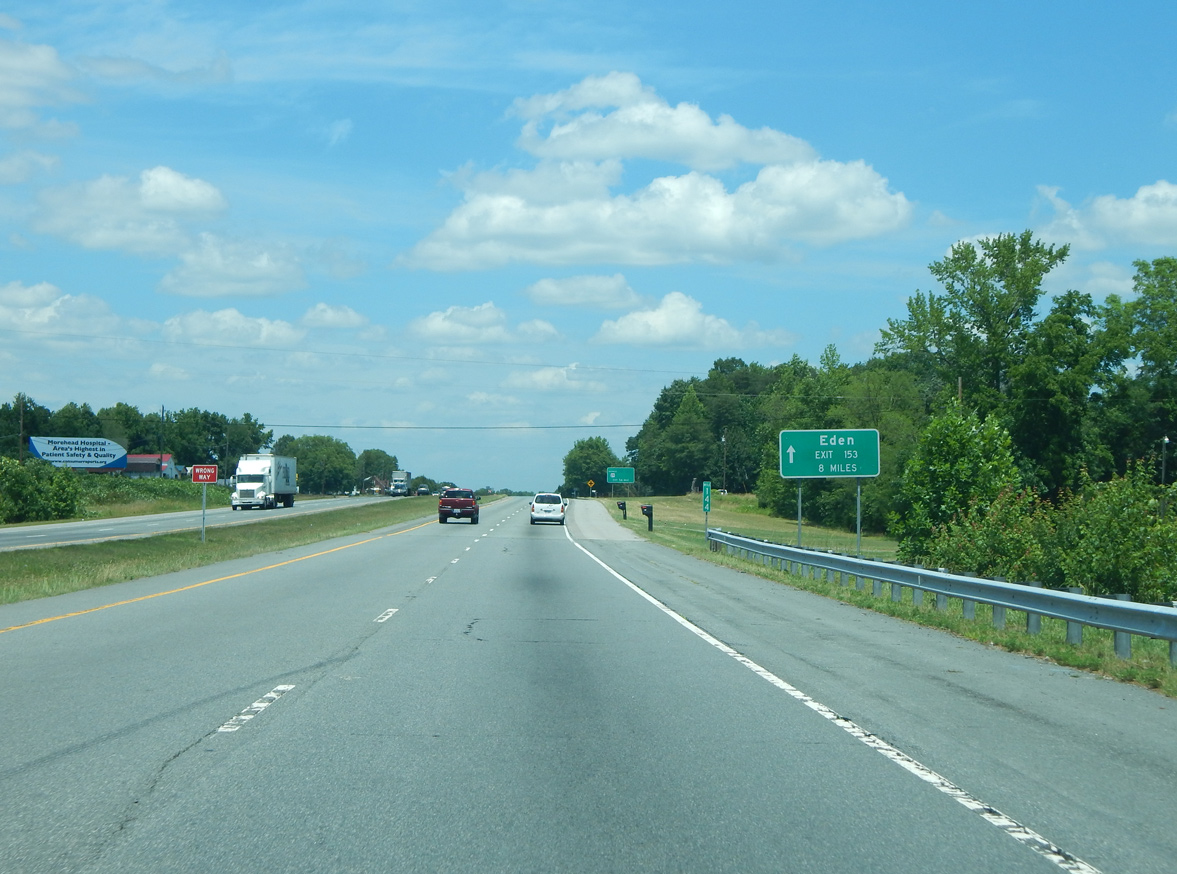


 East
East