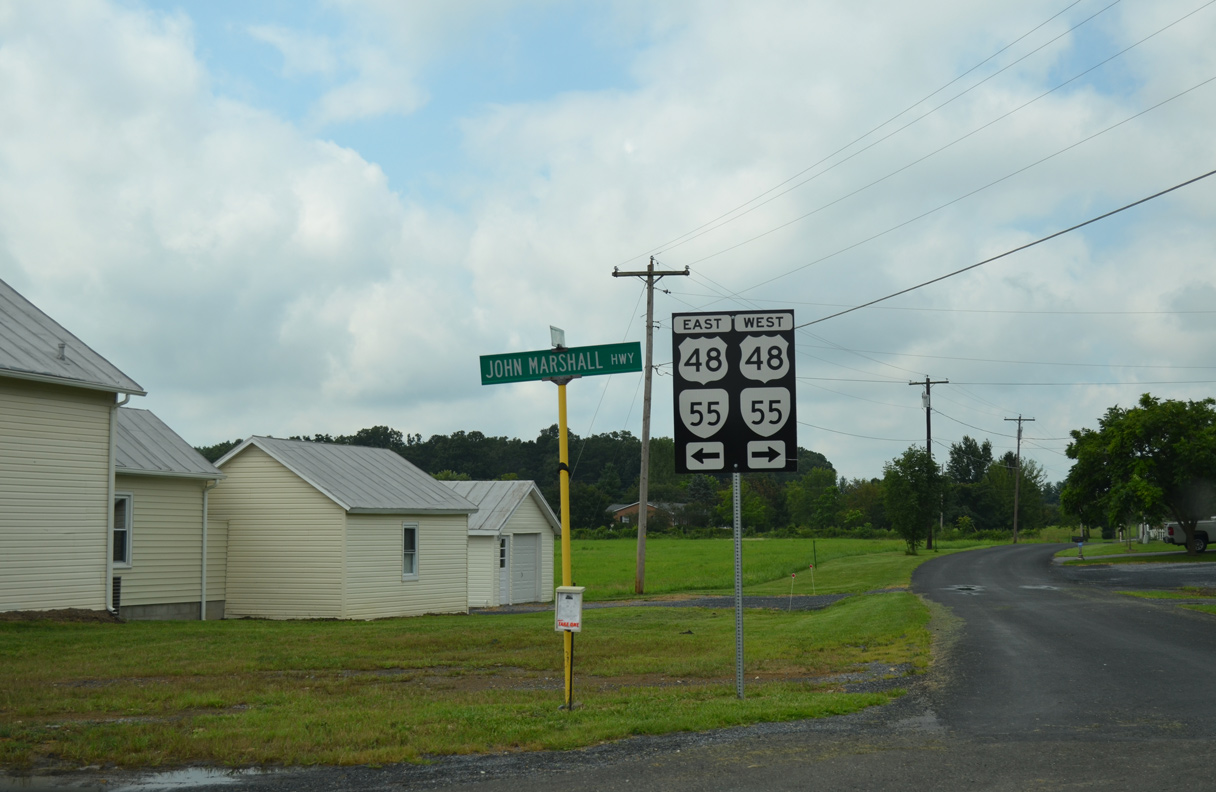
U.S. 48 in Virginia represents the eastern leg of Appalachian Development Highway System Corridor H, which originates along Interstate 79 near Weston, West Virginia. The 14.42 mile long, two lane section in the Old Dominion overlaps with SR 55 (John Marshall Highway). The two routes cross the state line on Great North Mountain between Wardensville and Star Tannery. East from there, U.S. 48/SR 55 pass through Wheatland over Little North Mountain and then turn south to Lebanon Church, Clara and Interstate 66 outside the town of Strasburg.
The Virginia Department of Transportation (VDOT) requested for the establishment of U.S. 48 to the American Association of State Highway and Transportation Officials (AASHTO) in support of a separate application from the West Virginia Department of Transportation (WVDOT) for U.S. 48 in the Mountain State. Both applications for U.S. 48 were approved on December 15, 2002. Within West Virginia at that time, 34.8 miles of U.S 48 was opened to traffic, 23.4 miles was under construction and 74.1 miles were in the final design stages.
|
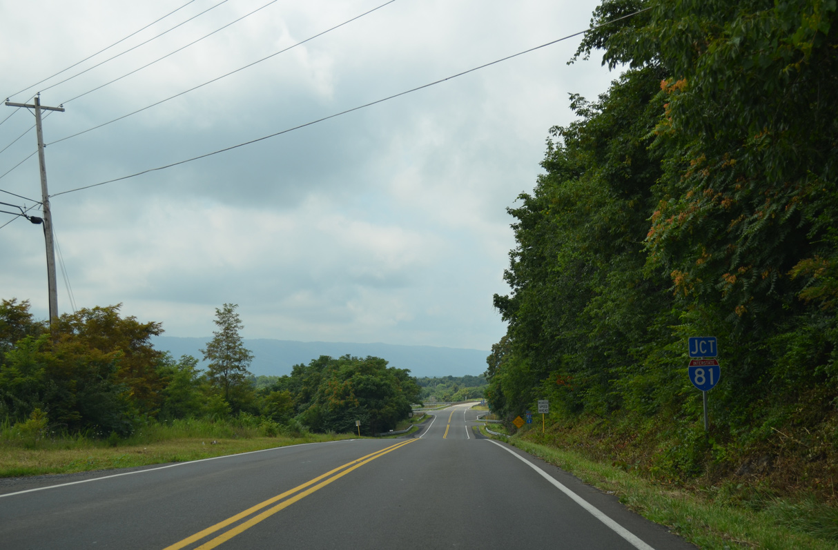
| Appalachian Redevelopment Corridor H overlays U.S. 48 and MSR 55 southeast from the West Virginia state line to Interstate 81 just west of Strasburg. 08/06/13 |
|
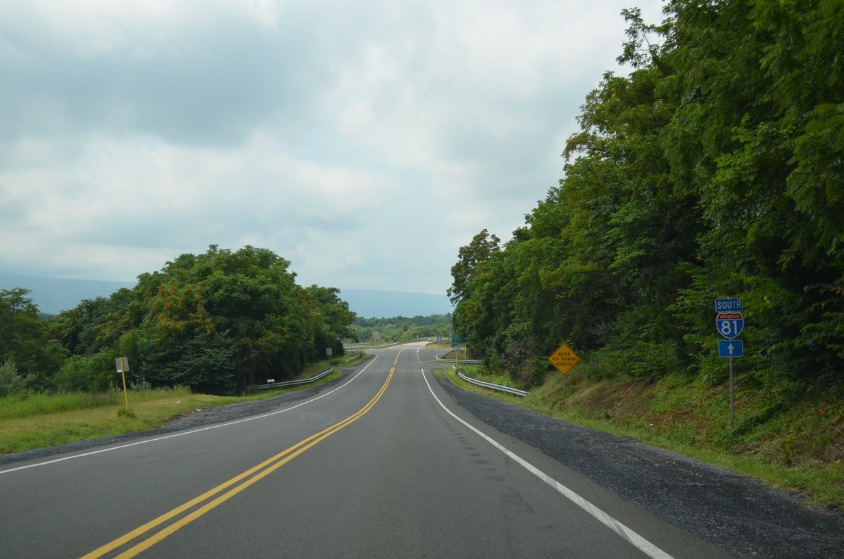
| Interstate 81 circumvents Strasburg southwest en route to Woodstock and New Market. 06/01/04 |
|
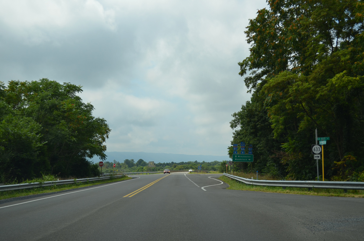
| SR 633 (Red Bud Road) ties into U.S. 48/SR 55 just ahead of the diamond interchange with Interstate 81. 08/06/13 |
|
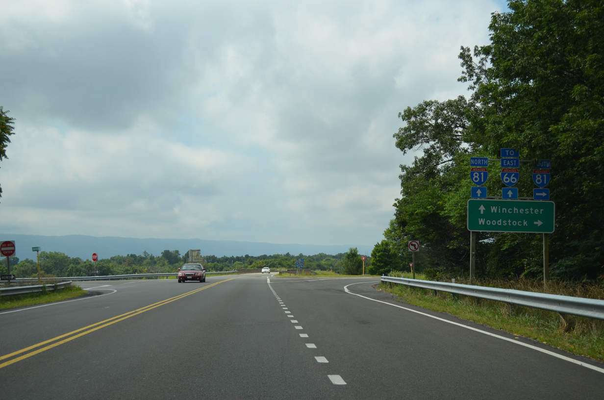
| I-81 connects U.S. 48/SR 55 with Interstate 66 east to Front Royal and Washington, D.C. just north of Strasburg. 08/06/13 |
|
| U.S. 48 ends at the northbound entrance ramp to Interstate 81. SR 55 (John Marshall Highway) continues 1.47 miles southeast to an overlap with U.S. 11 (Massanutten Street) into Downtown Strasburg. 06/01/04 |
|
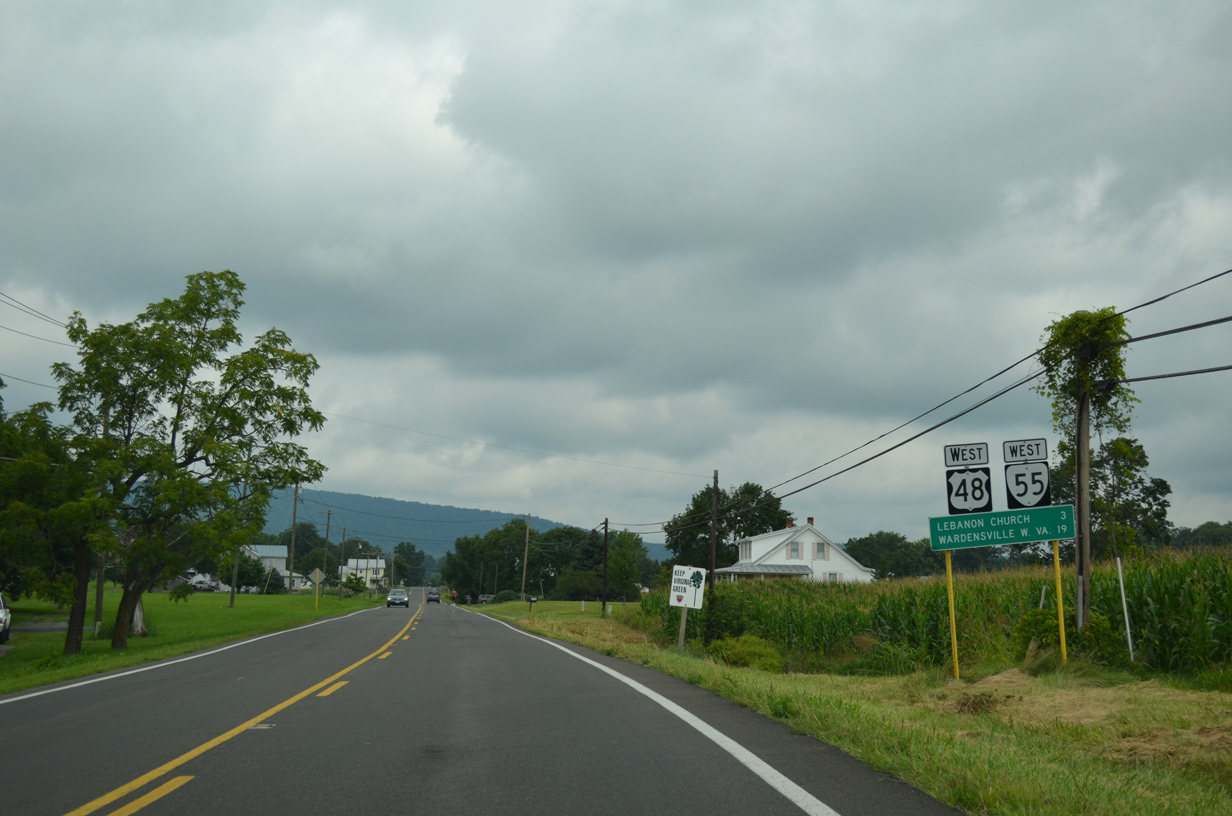
| The first confirming marker for U.S. 48 west stands just beyond the exchange with Interstate 81. The unincorporated community of Lebanon Church is three miles to the northwest. 08/06/13 |
|
| U.S. 48/SR 55 curve westward to SR 622 (Clary Road), a minor collector running 2.40 miles east from SR 633 (Red Bud Road) to SR 629 (Oranda Road) near Oranda. 08/06/13 |
|
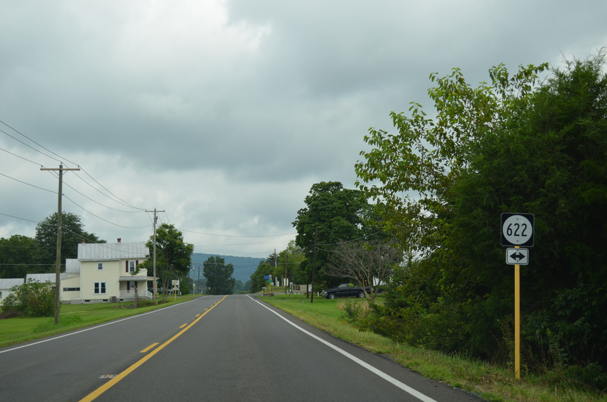
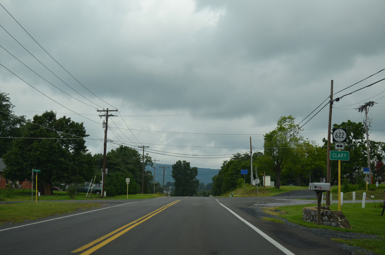
| Clara is the crossroads of U.S. 48/SR 55 (John Marshall Highway) and SR 622 (Clary Road). 08/06/13 |
|
| SR 622 (Clary Road) east meets U.S. 48/SR 55 (John Marshall Highway) at the settlement of Clary. 08/06/13 |
Photo Credits:06/01/04, 08/06/13 by AARoads
Connect with:
Interstate 81
U.S. 11
Page Updated 05-05-2021.