|
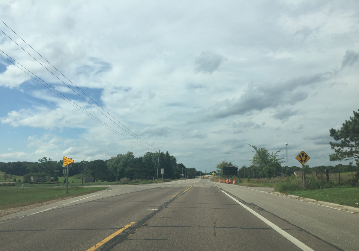
| U.S. 53 reaches the outskirts of the Eau Claire city limits at the Prairie Park apartment and town home community prior to the expansion to a four lane divided highway. 09/04/16 |
|
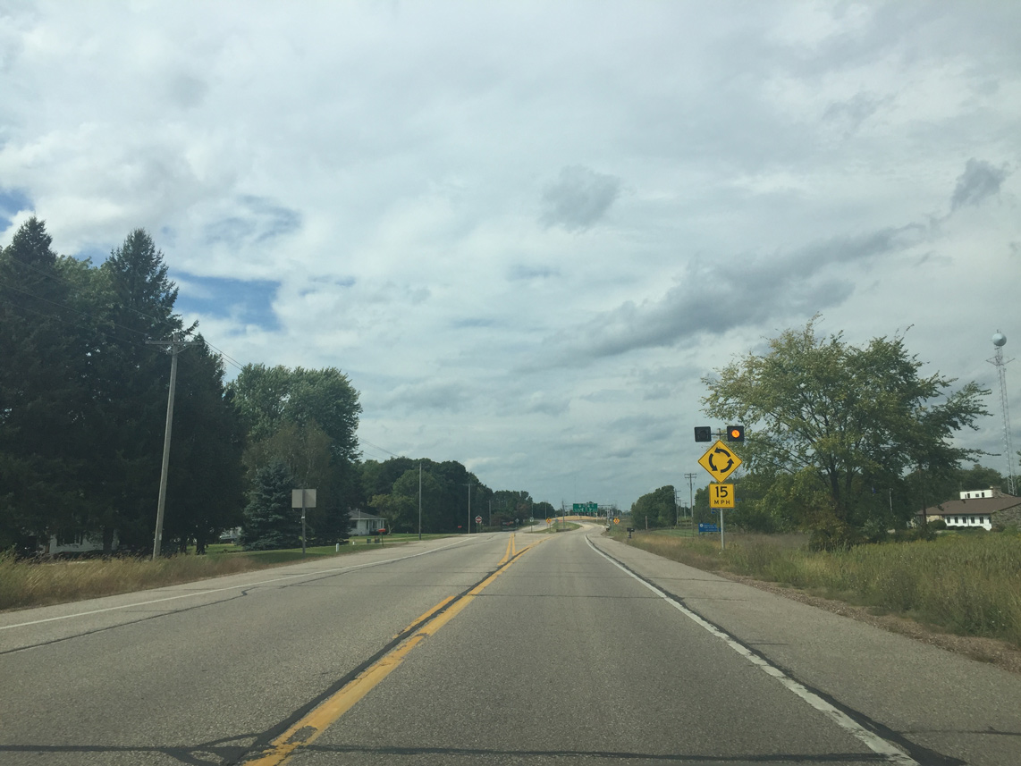
| Flashing lights accompany this sign ahead of the roundabout joining U.S. 53 with Old Town Hall Road west and Scully Drive. 09/04/16 |
|
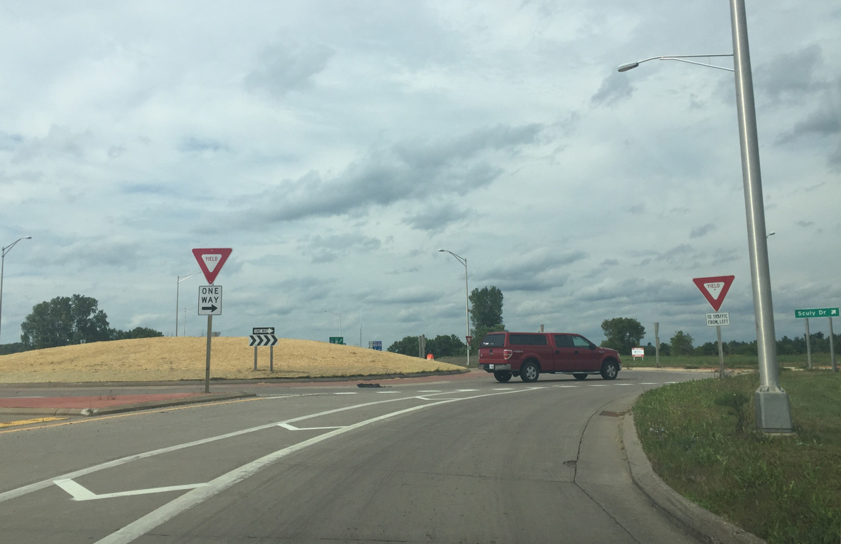
| Northbound U.S. 53 expands to two lanes through the roundabout with Old Town Hall Road. The rotary was added in 2008 as a new Gander Mountain store opened at the end of Scully Drive. 09/04/16 |
|
| A higher mound was placed in the center of the roundabout in 2016 to make it more visible. Frequent crashes initiated the changes as the U.S. 53 freeway begins after the roundabout. 09/04/16 |
|
| U.S. 53 widened further into a full freeway from Old Town Hall Road north 09/04/16 |
|
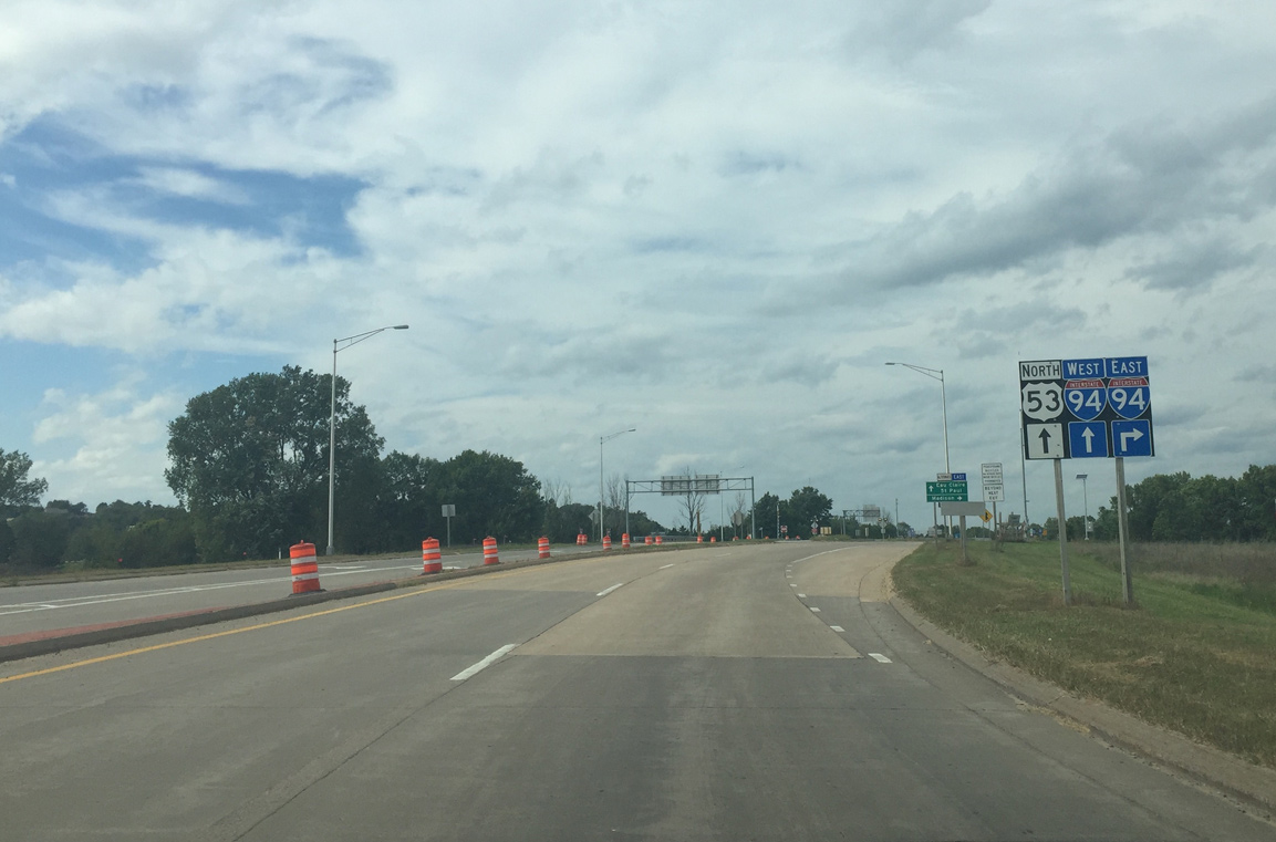
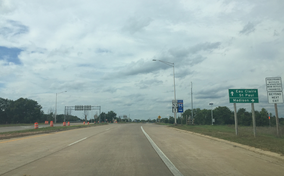
| Interstate 94 runs along the south side of Eau Claire, remaining relatively rural east to Tomah, Portage and Madison and west to Menomonie, Hudson and St. Paul, Minnesota. 09/04/16 |
|
| The swooping exit for Interstate 94 east was replaced with a right turn to allow more spacing between the ramp and the Old Town Hall Road roundabout. 09/04/16 |
|
| The first ITS mile marker for U.S. 53 north appears as the on-ramp from I-94 east merges. The interchange with Interstate 94 is a cloverleaf. 09/04/16 |
|
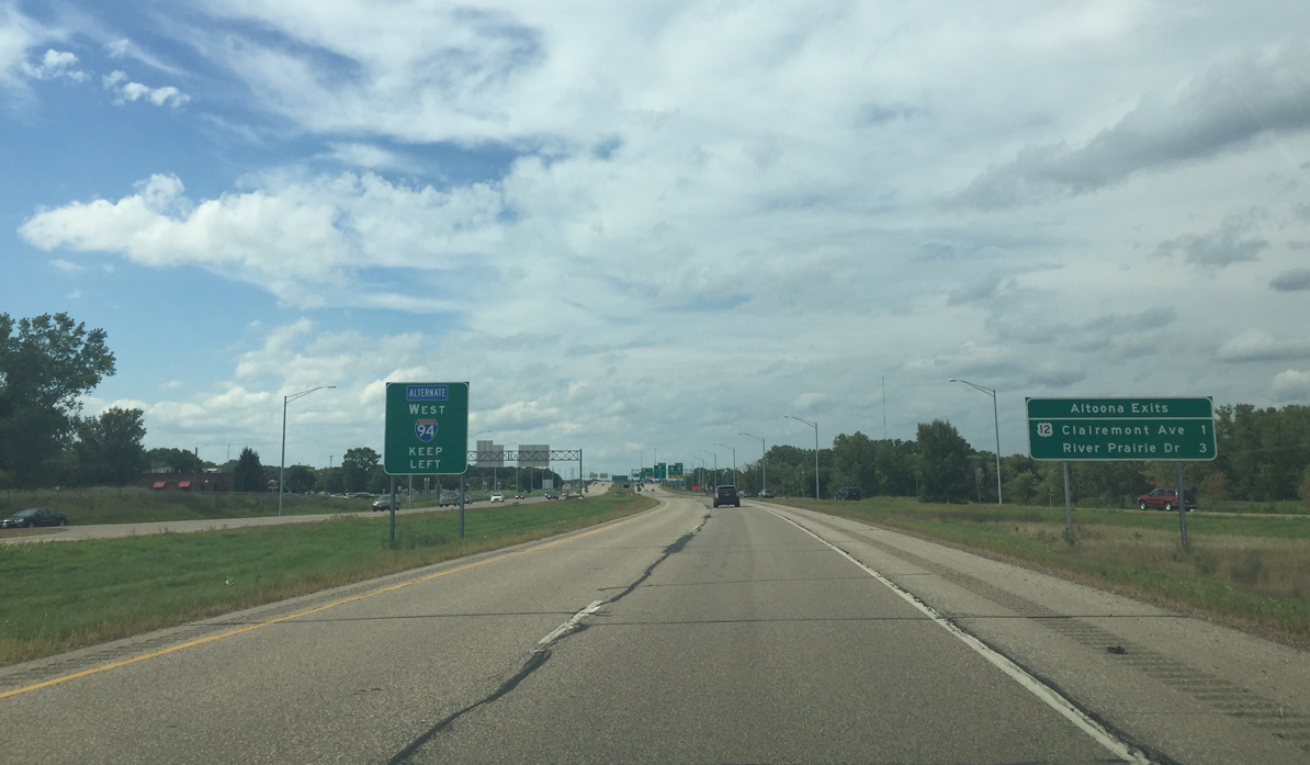
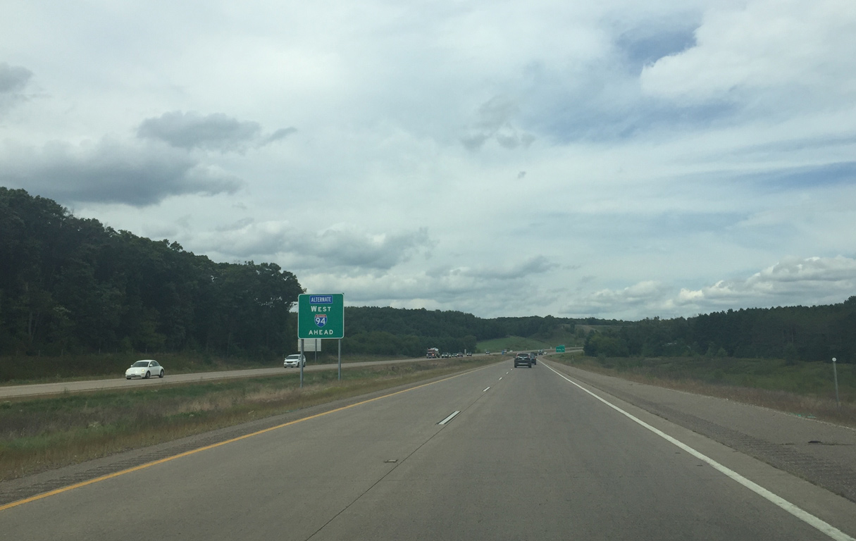
| I-94 west also provides an alternate route for US 53. The alternate follows Wis 96 north from the next exit. 09/04/16 |
|
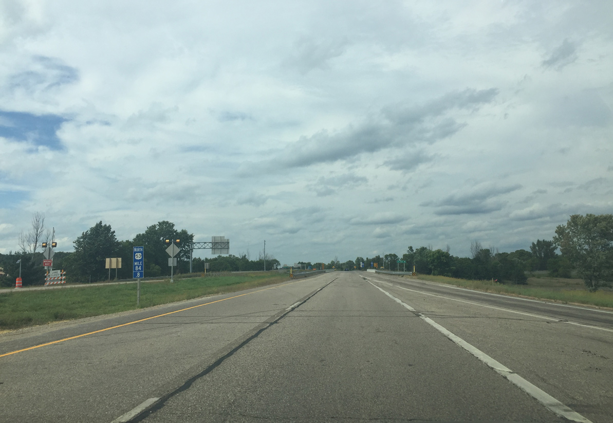
| U.S. 53 northbound narrows to a single lane as traffic from Interstate 94 west forms the right lane ahead. The majority of the traffic on this part of US 53 originates from I-94 west. 09/04/16 |
|
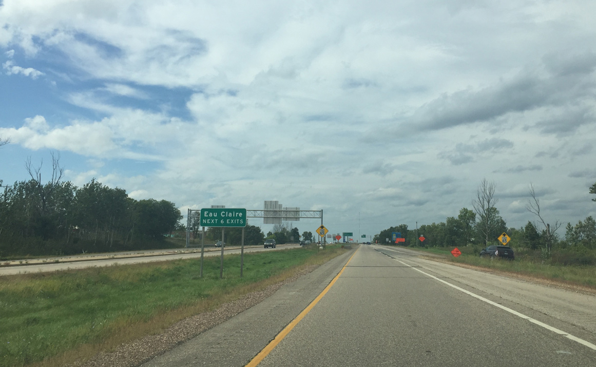
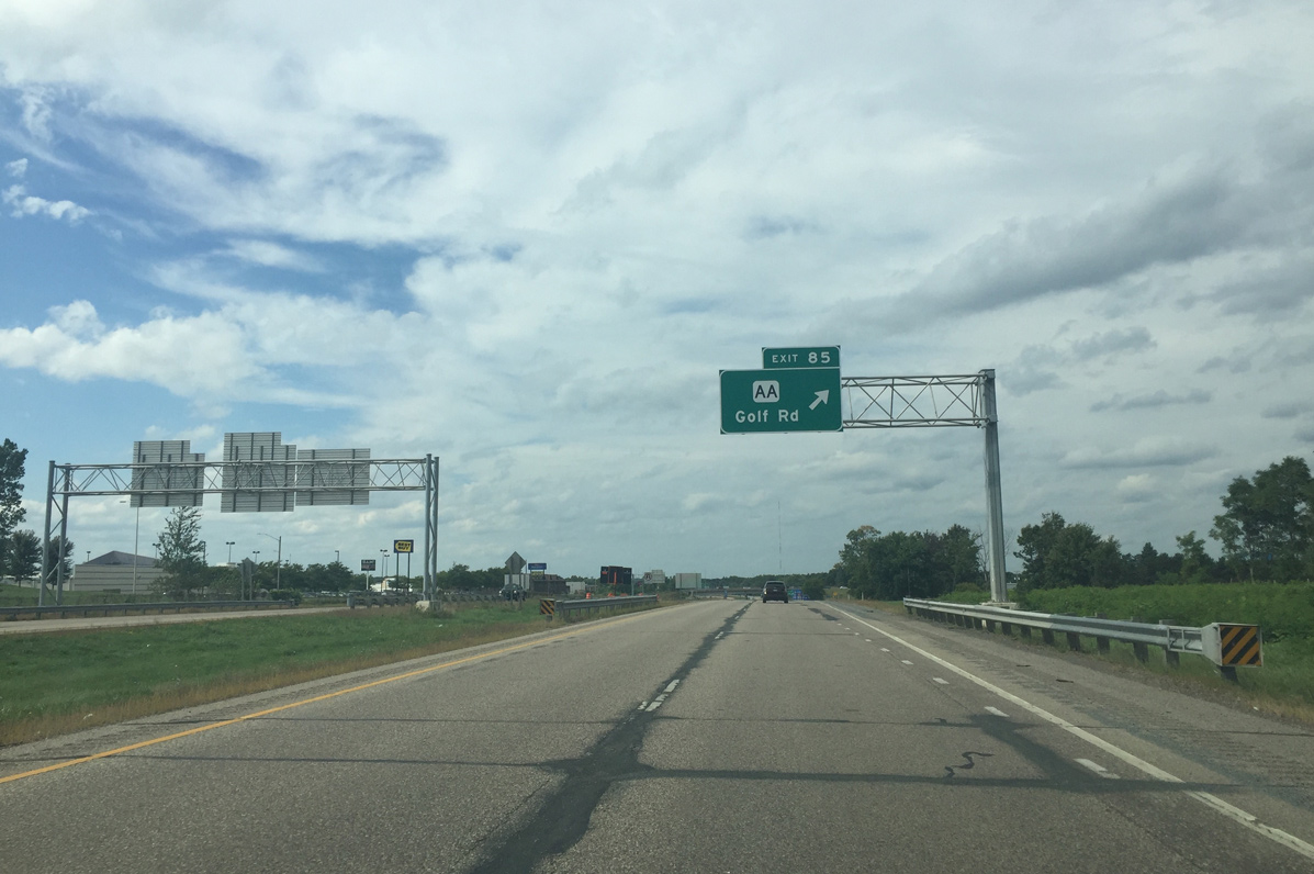
| Crossing over Keystone Crossing, an interchange sequence sign outlines the first three of six interchanges for the city of Eau Claire. 09/04/16 |
|
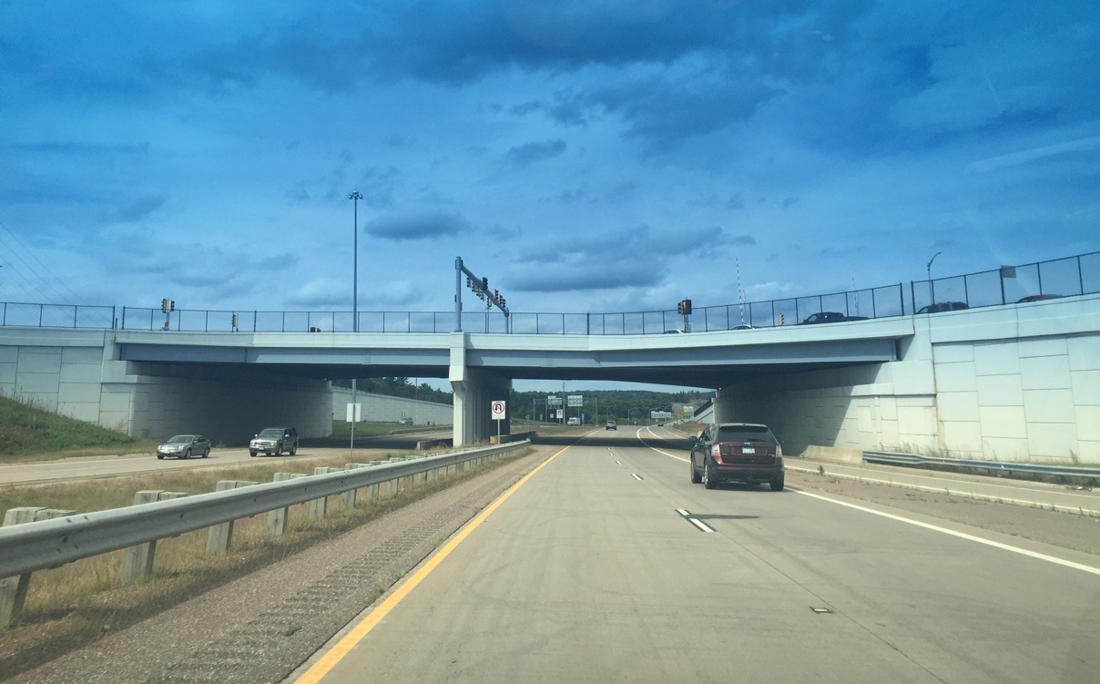
| A diamond interchange (Exit 85) follows with County AA east and Golf Road west. The cross roads of CTH-AA and Golf Road is both the largest commercial area of Eau Claire and the busiest local interchange. Built in 1986, Oakwood Mall lies just west of the exchange with U.S. 53. 09/04/16 |
|
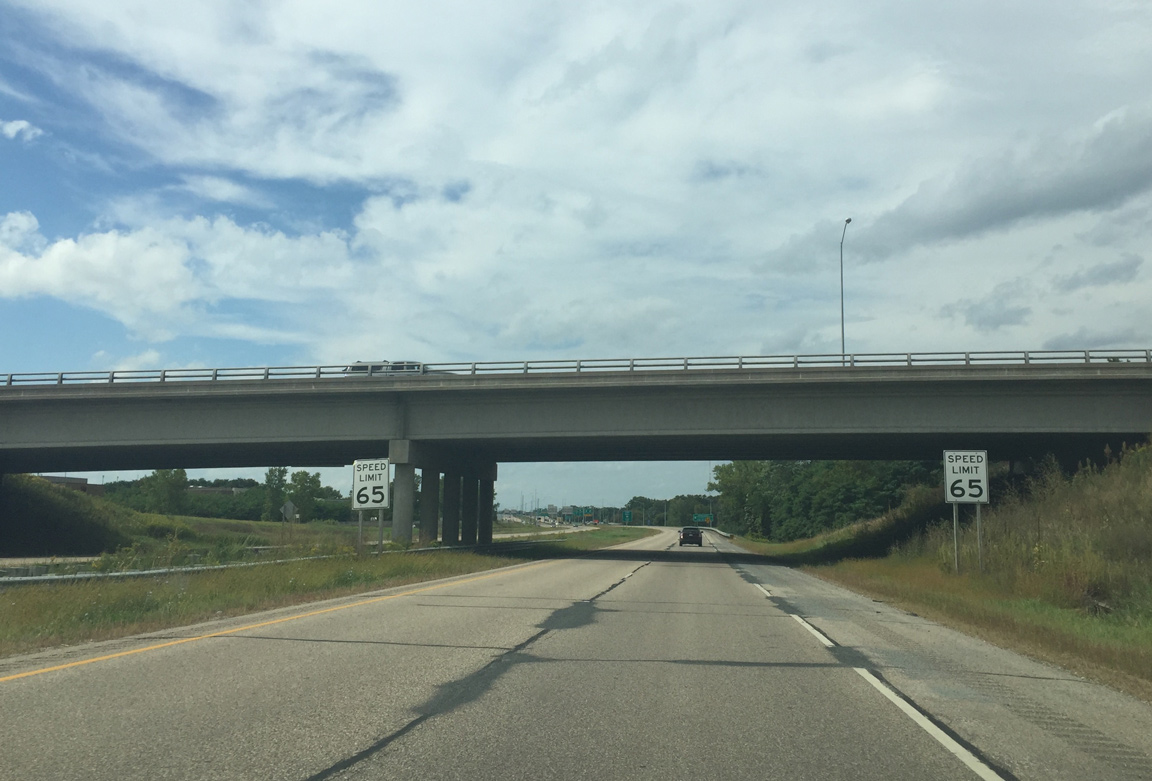
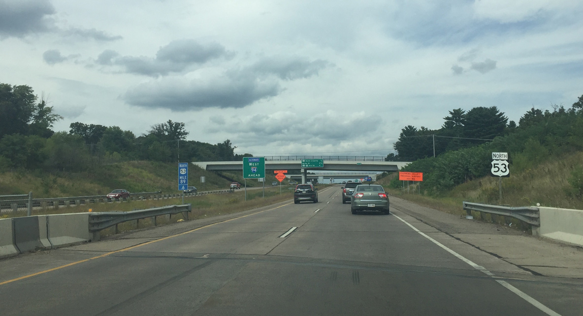
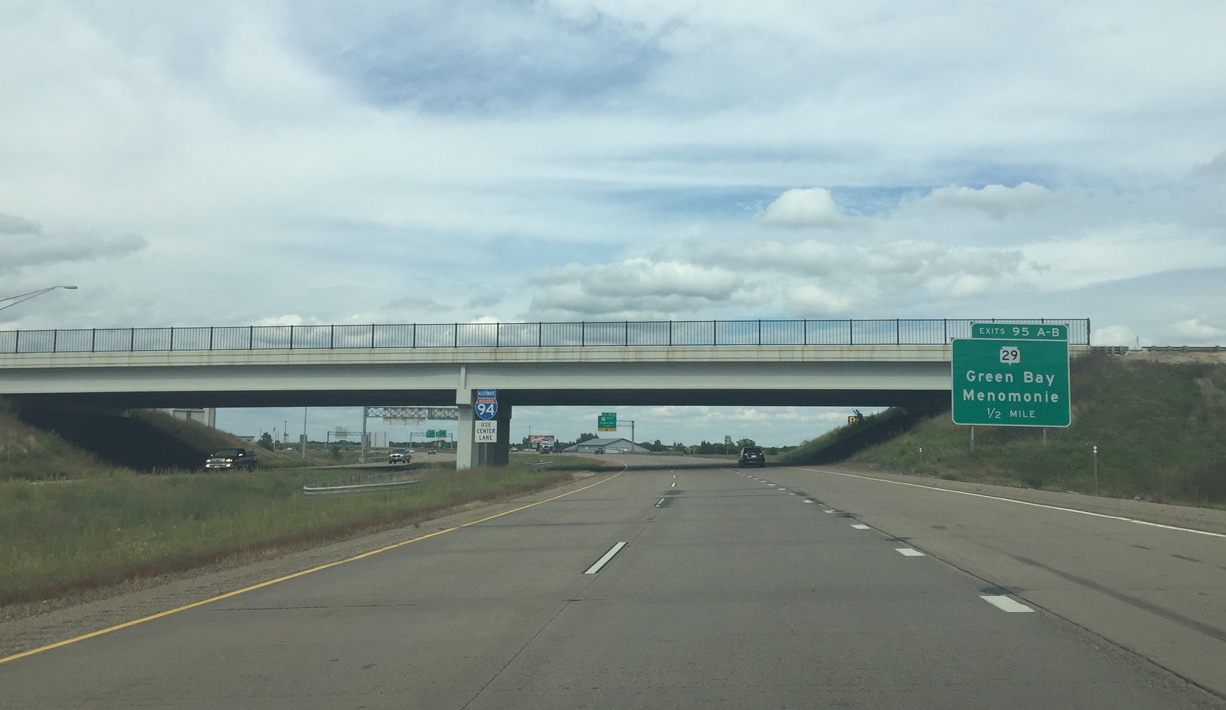
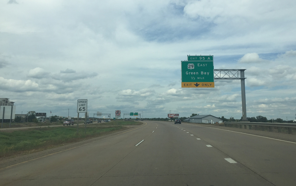
| Speed limit 65 signs are posted to warn drivers of the reduction from 70 miles per hour on I-94. Since the freeway is more urban in this area, WISDOT decided to not raise the speed limit between I-94 and Wis 29. The limit will pick back up to 70 mph north of Wis 29. 09/04/16 |
|
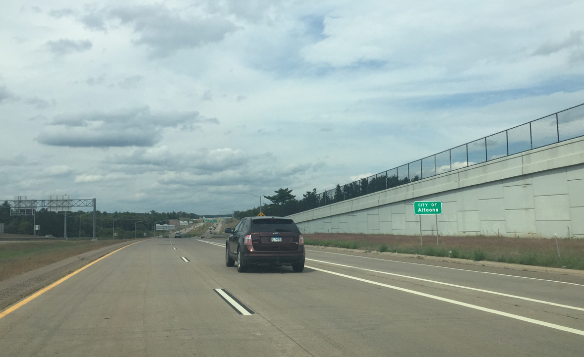
| US 53, along with Wis 29, serves as an alternate for I-94. The freeway otherwise continues north with two exits through Altoona, a city of 6,000 to the immediate east of Eau Claire. 09/04/16 |
|
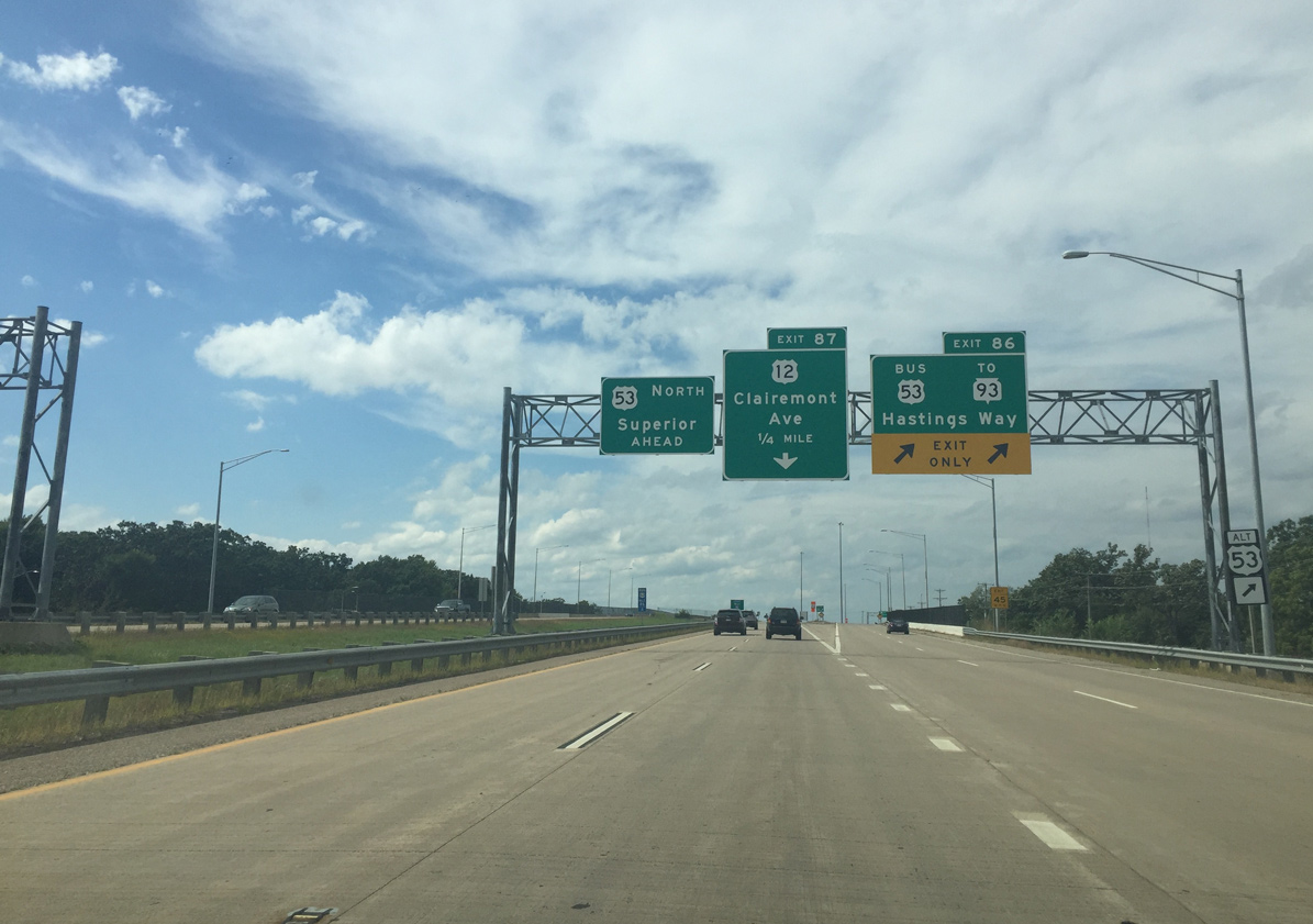
| Two lanes from the CTH-AA and Golf Road on-ramp form northbound auxiliary lanes. They will split from US 53 onto Business US 53, which is the pre-freeway route of US 53 through Eau Claire Freeway. Exit 86 also connects with Wis 93, but mainly for local traffic in the immediate area since Wis 93 travels south in the opposite direction of the freeway. 09/04/16 |
|
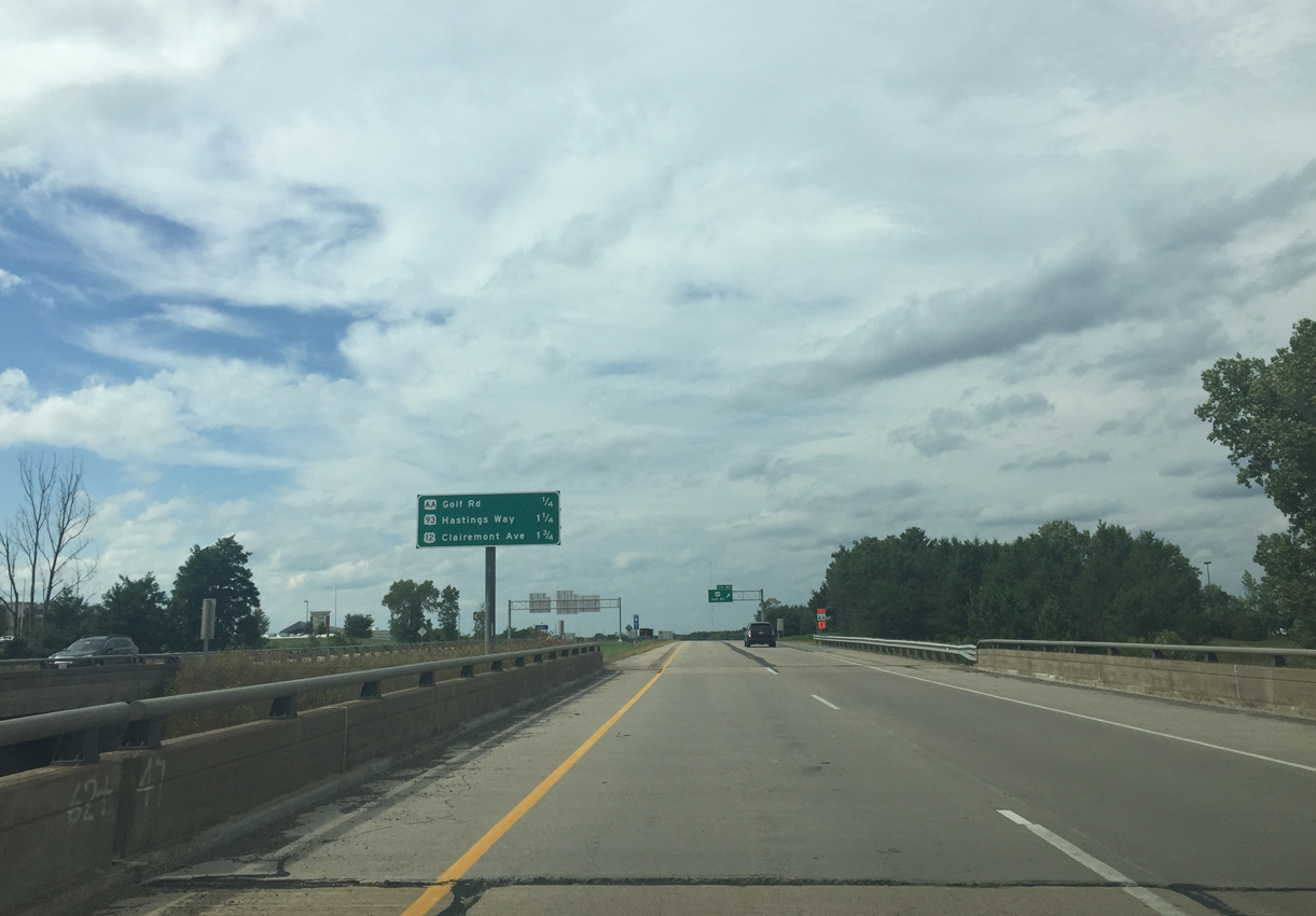
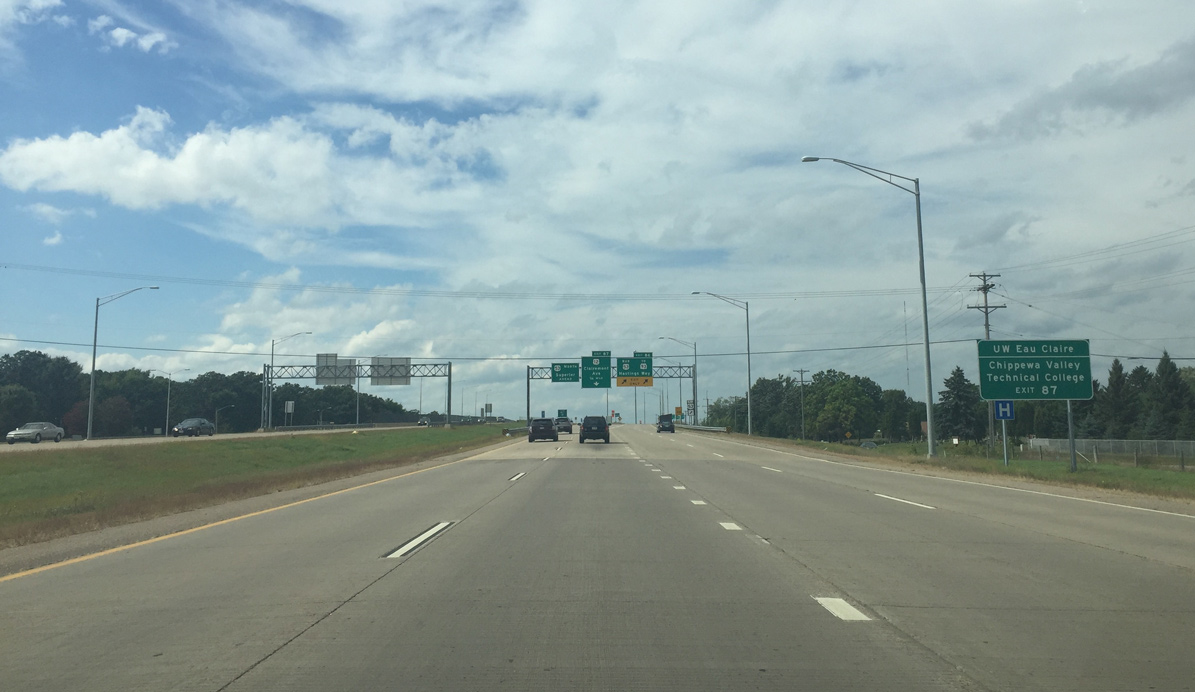
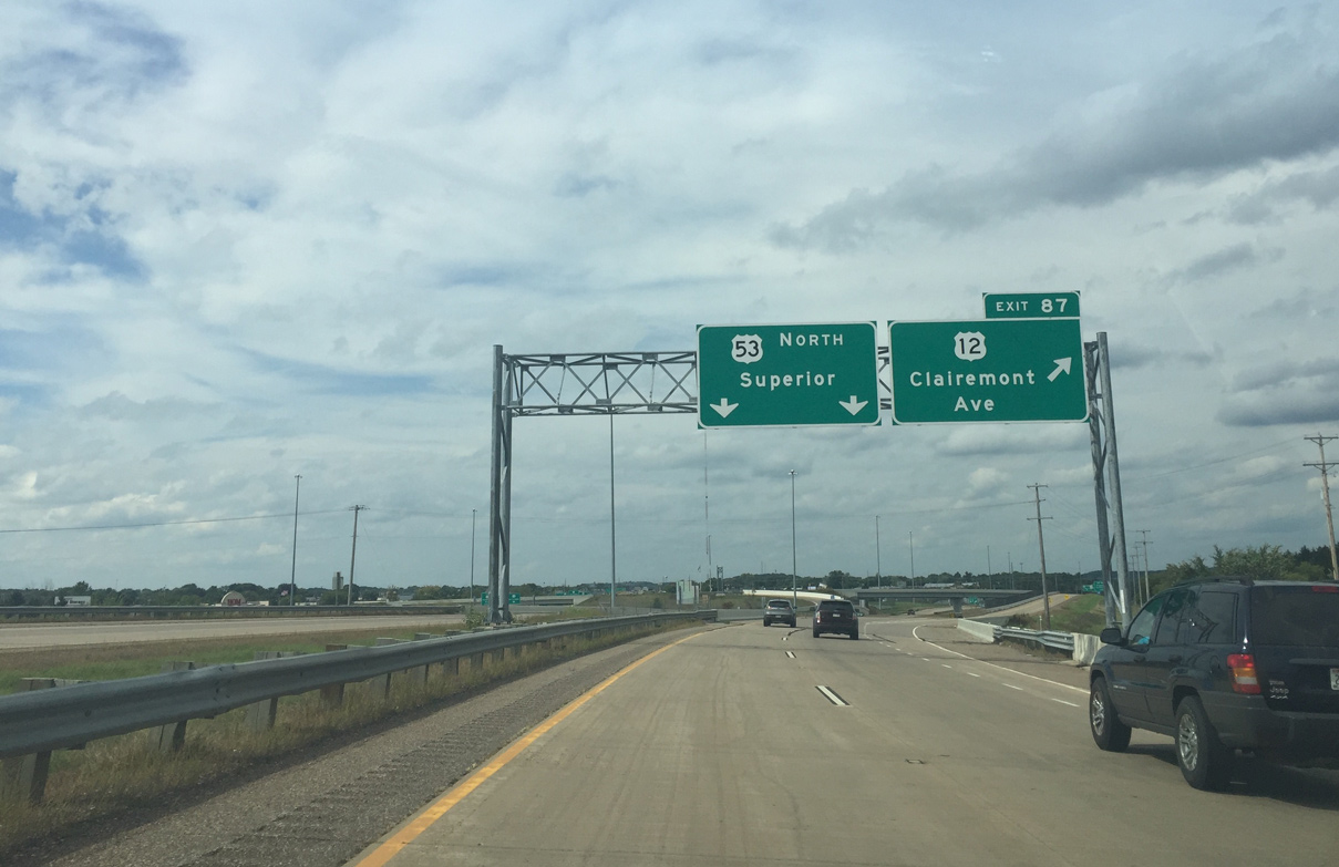
| U.S. 12 (Clairemont Avenue) crosses paths with U.S. 53 at a single point urban interchange (SPUI). A collector distributor roadway departs for Clairemont Avenue in a half mile ahead of the northbound end of Wis 93. 09/04/16 |
|
| Interests to UW Eau Claire and Chippewa Valley Tech are advised to use Exit 87 for U.S. 12 (Clairemont Avenue) west. Despite telling university traffic to use the U.S. 12 exit, it is shorter to take U.S. 53 Business directly to Clairemont Avenue. 09/04/16 |
|
| U.S. 53 Business (Hastings Way) branches northwest from U.S. 53 at a wye interchange (Exit 86). The bannered route is also a freeway to U.S. 12 (Clairemont Avenue). 09/04/16 |
|
| U.S. 53 bends northward over the departing lanes to Hastings Way as the c/d roadway (Exit 87) for U.S. 12 (Clairemont Avenue) partitions from the freeway. U.S. 12 is mainly a six lane urban expressway encircling the west and south sides of Eau Claire, as well as the south side of Altoona. 09/04/16 |
|
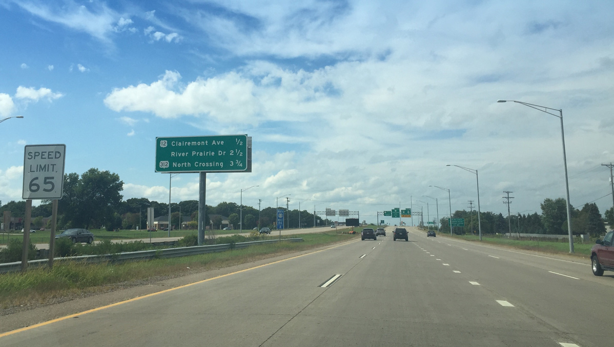
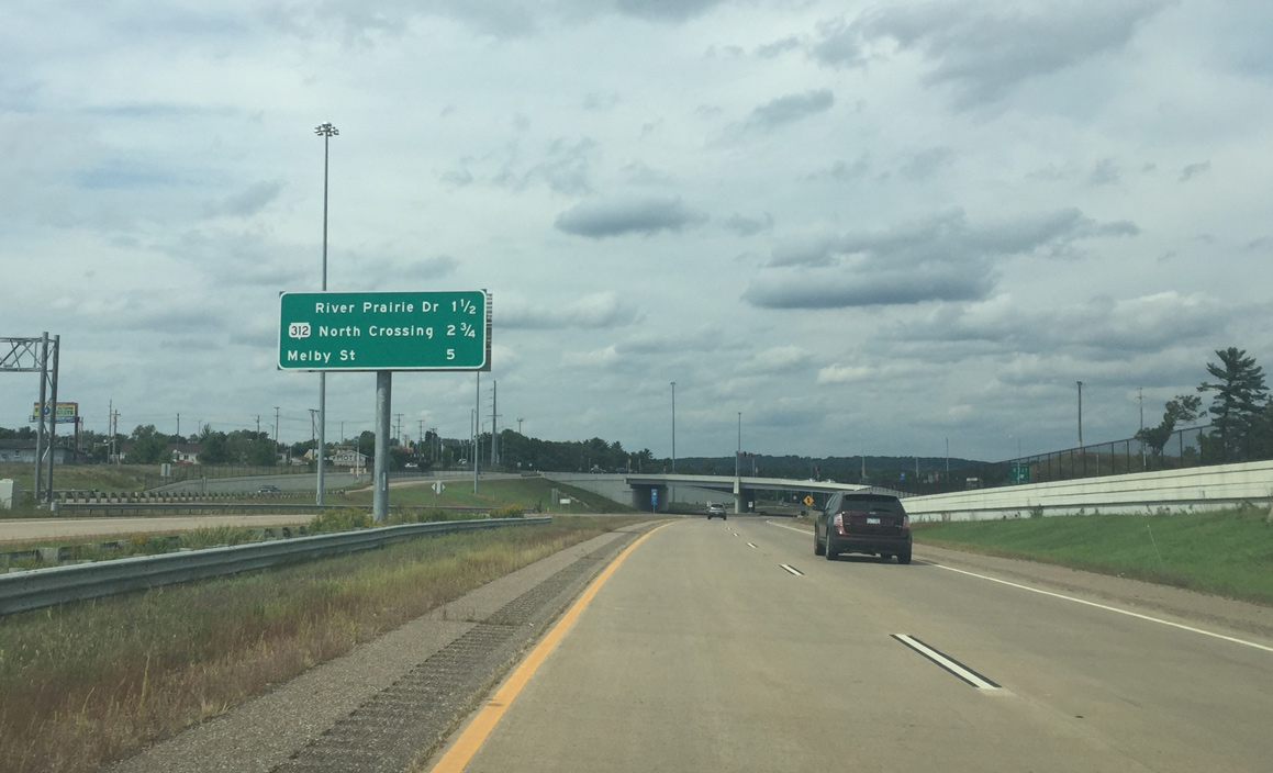
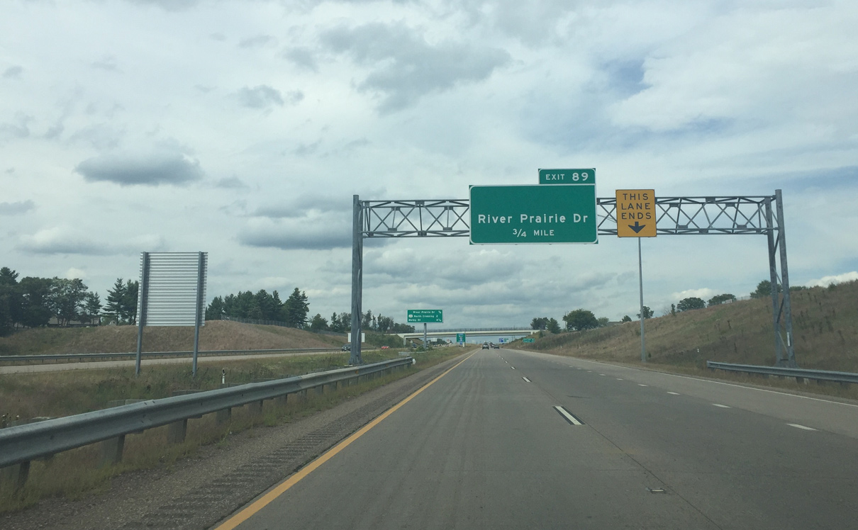
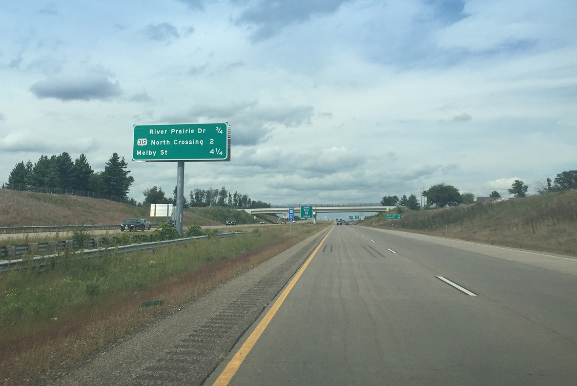
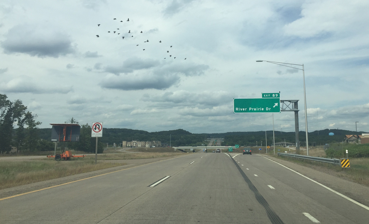
| The subsequent northbound exit lies 1.5 miles ahead with River Prairie Drive (Exit 89). 09/04/16 |
|
| Wis 93 also ends and merges from the right as U.S. 53 passes under Wisconsin's first single point interchange at U.S. 12. 09/04/16 |
|
| U.S. 53 crosses the Altoona city line at U.S. 12 (Clairemont Avenue). The freeway runs in between Altoona and Eau Claire to the Eau Claire River. 09/04/16 |
|
| River Prairie Drive is a new road created along with the U.S. 53 freeway. It was built to give access to Birch Street in Eau Claire, encourage development, and provide another exit to Altoona. 09/04/16 |
|
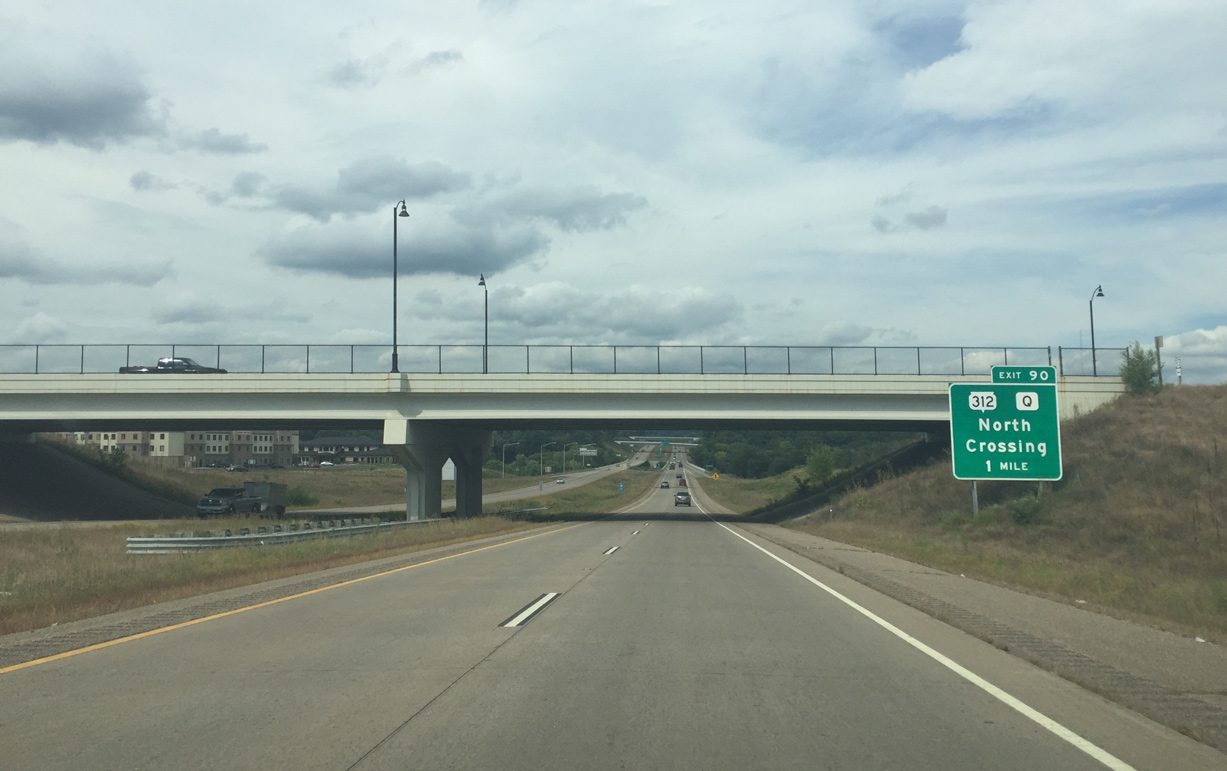
| The freeway drops below grade between Otter Creek and the Altoona street grid. Northward, U.S. 53 reenters Eau Claire at the east end of Wis 312 (North Crossing) in two miles. 09/04/16 |
|
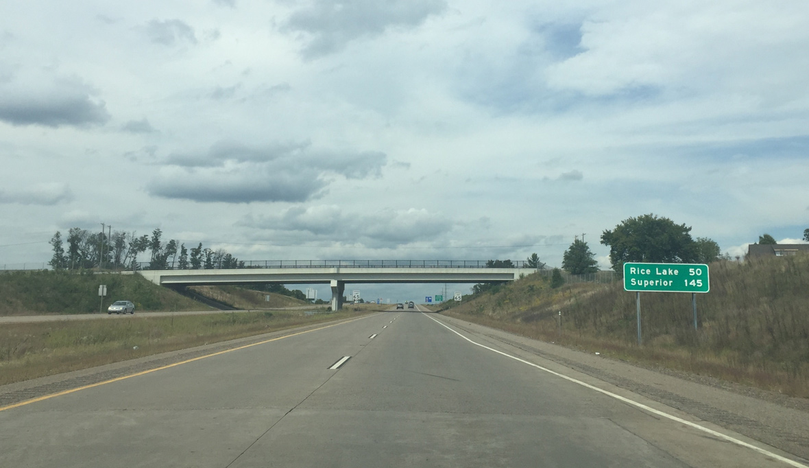
| U.S. 53 remains a freeway to Rice Lake (50 miles), where it becomes an expressway. Superior, 145 miles to the northwest, is where the next traffic signal along the US highway is located. 09/04/16 |
|
| Altoona and Downtown Eau Claire are accessible off of River Prairie Drive. River Prairie Drive crosses the Eau Claire River to end at Birch Street to the west. 09/04/16 |
|
| New development is visible as U.S. 53 enters the diamond interchange (Exit 89) with River Prairie Drive. 09/04/16 |
|
| Wis 312 (North Crossing) is the next exit of U.S. 53 north. Wis 312 was extended east from Hastings Way to connect with the new freeway. It is named North Crossing because it provides a northern Chippewa River crossing for Eau Claire. 09/04/16 |
|
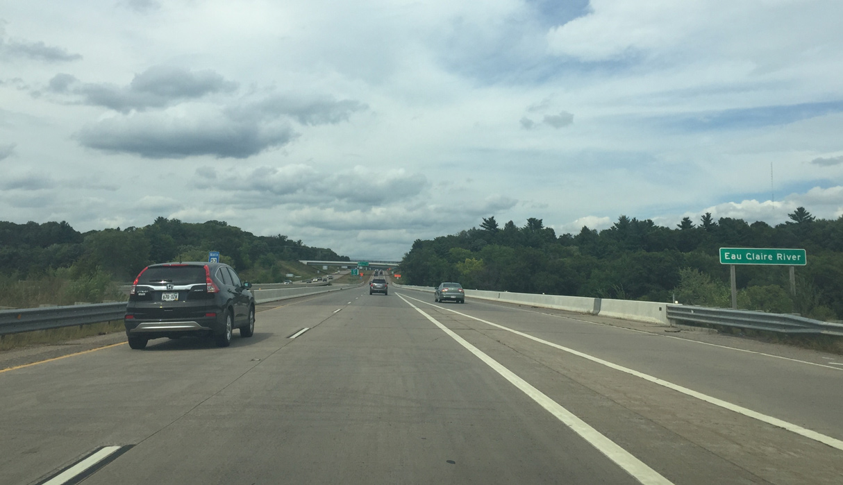
| Spanning the Eau Claire River, U.S. 53 enters unincorporated Eau Claire County. The clear water of the river is how Eau Claire got its name, as Eau Claire means clear water in French. 09/04/16 |
|
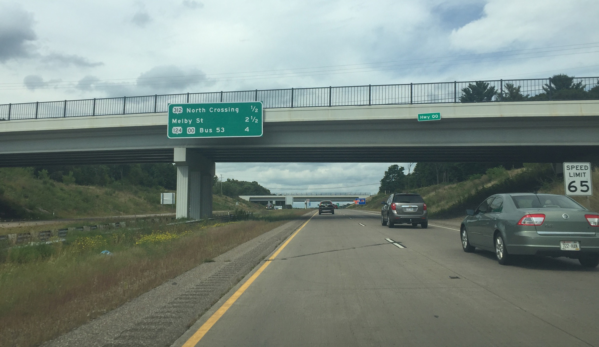
| U.S. 53 reassurance marker and a sign informing motorists to remain on the freeway for Alternate I-94 west stand between the river and the CTH-QQ (North Shore Drive) overpass. 09/04/16 |
|
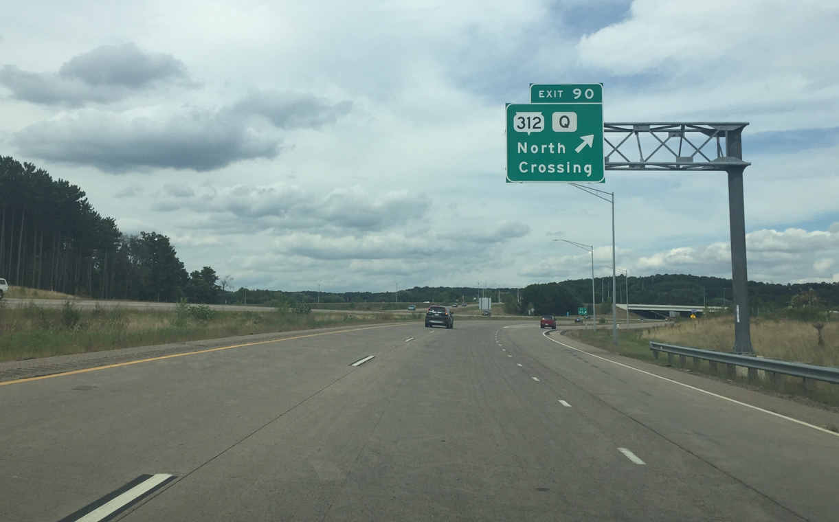
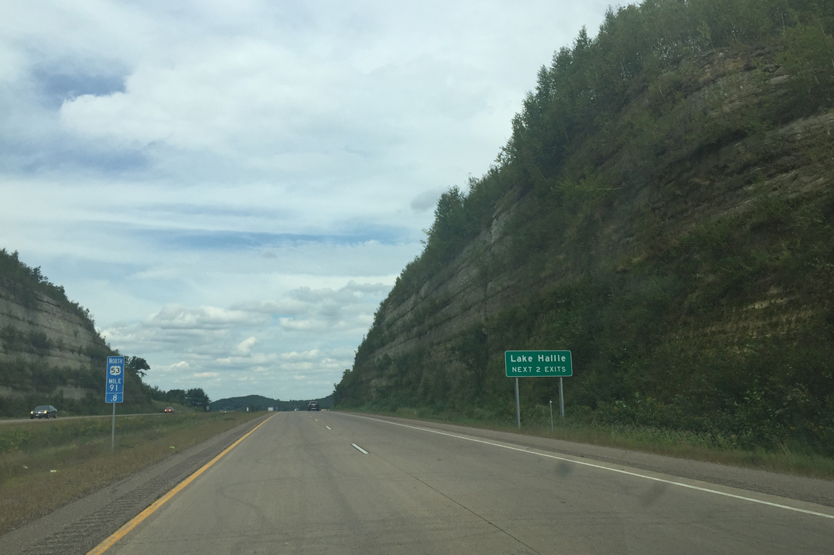
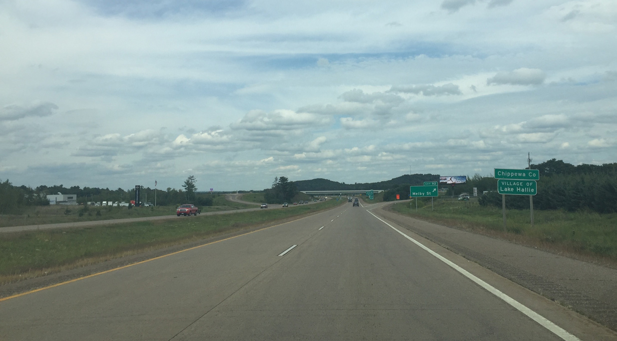
| Exits for Melby and Wis 124 fall within the village of Lake Hallie over the next four miles. Wis 312 begins at the forthcoming diamond interchange (Exit 90). 09/04/16 |
|
| Wis 312 provides an urban expressway across the north side of Eau Claire as it connects with US 12 and I-94. The trunk highway is the main western entrance to the city.
County Q extends east from Exit 90 into rural Eau Claire County and passes by Tower Ridge and Big Falls County Parks. 09/04/16 |
|
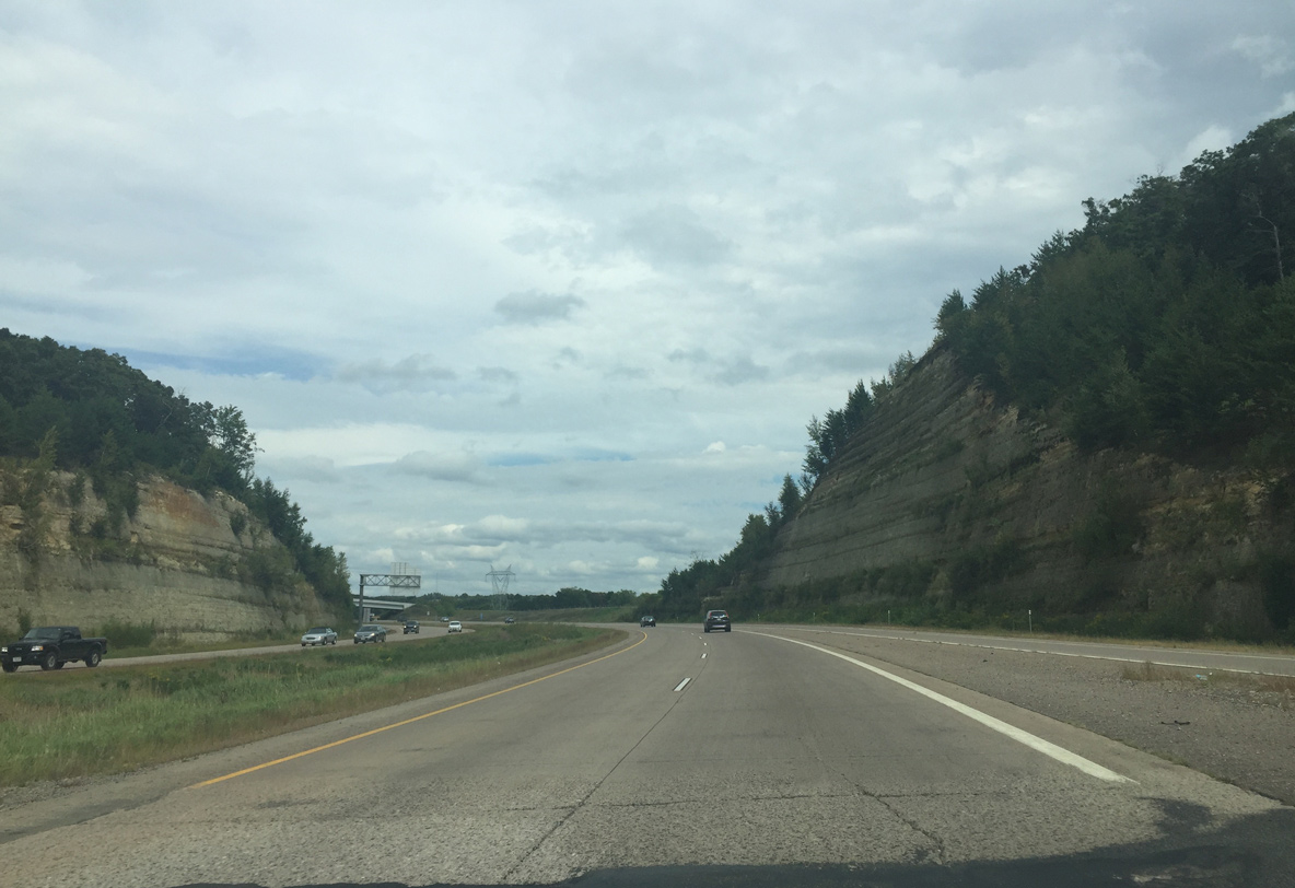
| The freeway traverses a large rock just to the northeast of Wis 312. The bluff line rises to over 150 feet above U.S. 53. 09/04/16 |
|
| Winding northeast, U.S. 53 leaves the city of Eau Claire along a rural stretch near the Chippewa County line. The alternate route for I-94 continues northward to Exit 95. 09/04/16 |
|
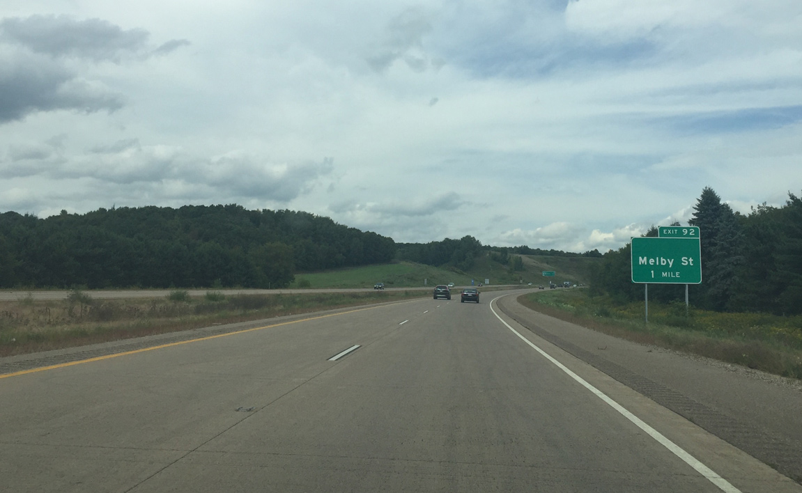
| Melby Street is the final Eau Claire exit along U.S. 53 north. It leads west to the Chippewa Valley Regional Airport (EAU). 09/04/16 |
|
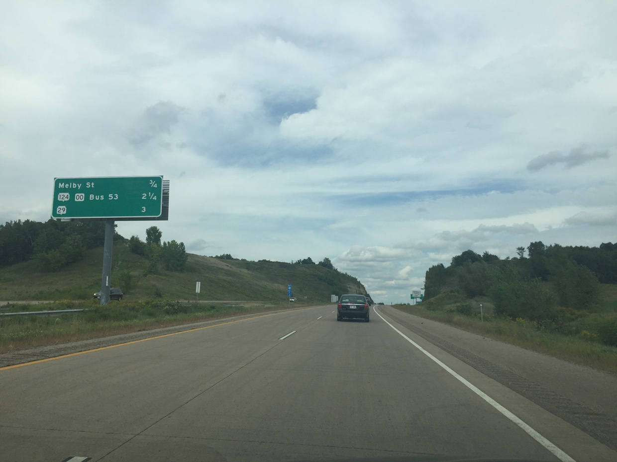
| U.S. 53 Business returns to U.S. 53 alongside Wis 124 in 2.25 miles while the Wis 29 expressway debuts to motorists at three miles out. 09/04/16 |
|
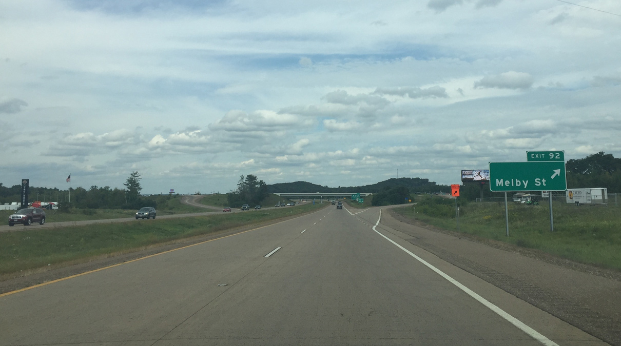
| U.S. 53 angles northeast across another bluff line on the half mile approach to Melby Street (Exit 92). These hills top out over 1,100 feet above sea level. 09/04/16 |
|
| Entering both the village of Lake Hallie and Chippewa County on U.S. 53 north. 09/04/16 |
|
| Exit 92 departs from U.S. 53 north to Melby Street east to parallel 122nd Street and west to U.S. 53 Business (Hastings Way) near Pinehurst in north Eau Claire. 09/04/16 |
|
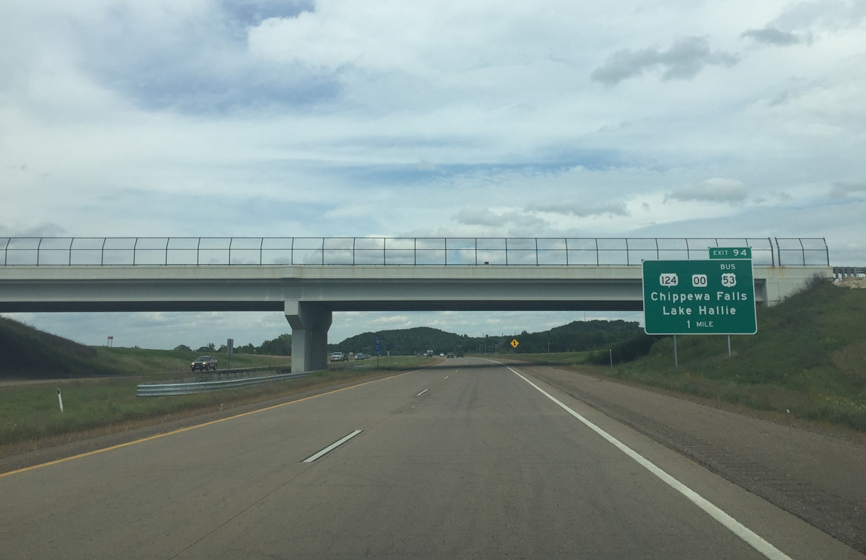
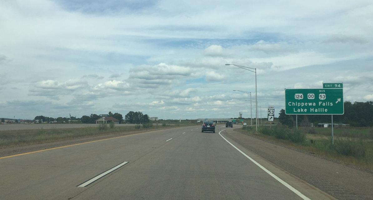
| Wis 124 commences a 17.6 mile route northward from upcoming Exit 94. The state trunk highway follows the pre-freeway alignment of U.S. 53 into downtown Chippewa Falls and up to Wis 64. 09/04/16 |
|
| U.S. 53 arcs northwest from Wis 124 and County OO to cross paths with the Wis 29 expressway at a modified cloverleaf interchange. STH-29 bypasses the city of Chippewa Falls to the south while a business route follows the old alignment to the north. 09/04/16 |
|
| A folded diamond interchange (Exit 94) joins U.S. 53 north with U.S. 53 Business south & Wis 124 north into Lake Hallie and County OO east into rural Chippewa County. 09/04/16 |
|
| The Wis 29 expressway west to Interstate 94 was completed in 2005 along with the Chippewa Falls freeway for U.S. 53. With the opening of Wis 29, the four lane connection between the Twin Cities and Green Bay was complete. 09/04/16 |
|
| An auxiliary lane forms from the Wis 124 on-ramp north to Exit 95A for Wis 29 east. Wis 29 winds northeast through Lake Hallie as a full freeway to County J (Exit 81), south of Lake Wissota. 09/04/16 |
|
| Travelers taking STH-29 east from Exit 95A reach Wausau in 90 miles and Green Bay in 183 miles. 09/04/16 |
|
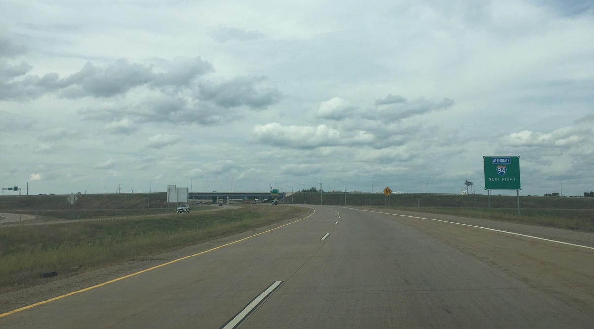
| Alternate I-94 utilizes the Wis 29 freeway and expressway west from Lake Hallie for the 15 mile return to Interstate 94. 09/04/16 |
|
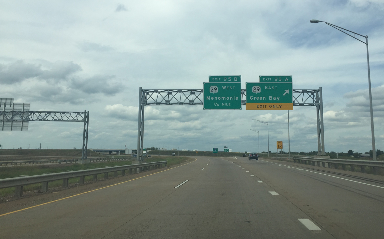
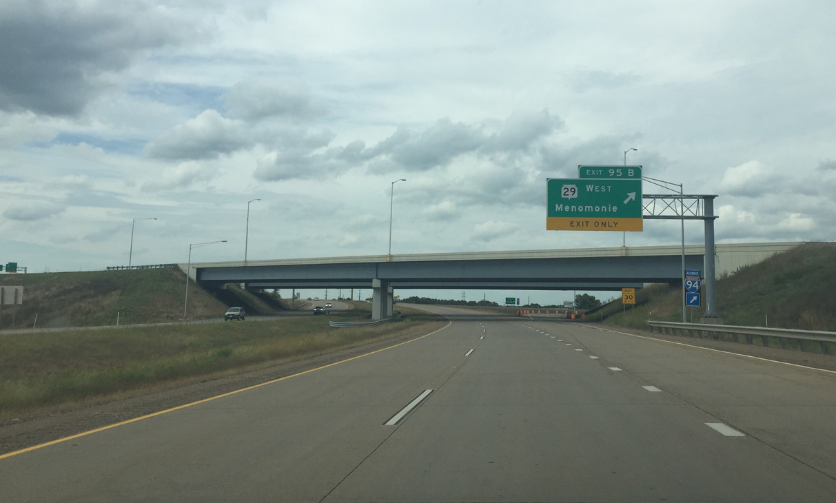
| Exit 95 loops away from U.S. 53 north for STH-29 west. The trunk highway combines with U.S. 12 west from near Elk Mound to the city of Menomonie. 09/04/16 |
|
| U.S. 53 passes over its former alignment (Wis 124). Prior to the construction of the Wis 29 freeway, a trumpet interchange connected Wis 124 north with the departing U.S. 53 Chippewa Falls bypass. 09/04/16 |
|
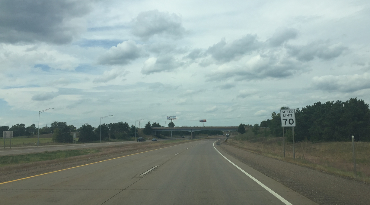
| The speed limit increases to 70 miles per hour as U.S. 53 shifts westward to bypass the Chippewa Falls street grid. 09/04/16 |
|
| The newer concrete transitions into asphalt as US 53 meets back with its 1970 freeway alignment. Two interchanges follow over the next 4.5 miles. 09/04/16 |
|
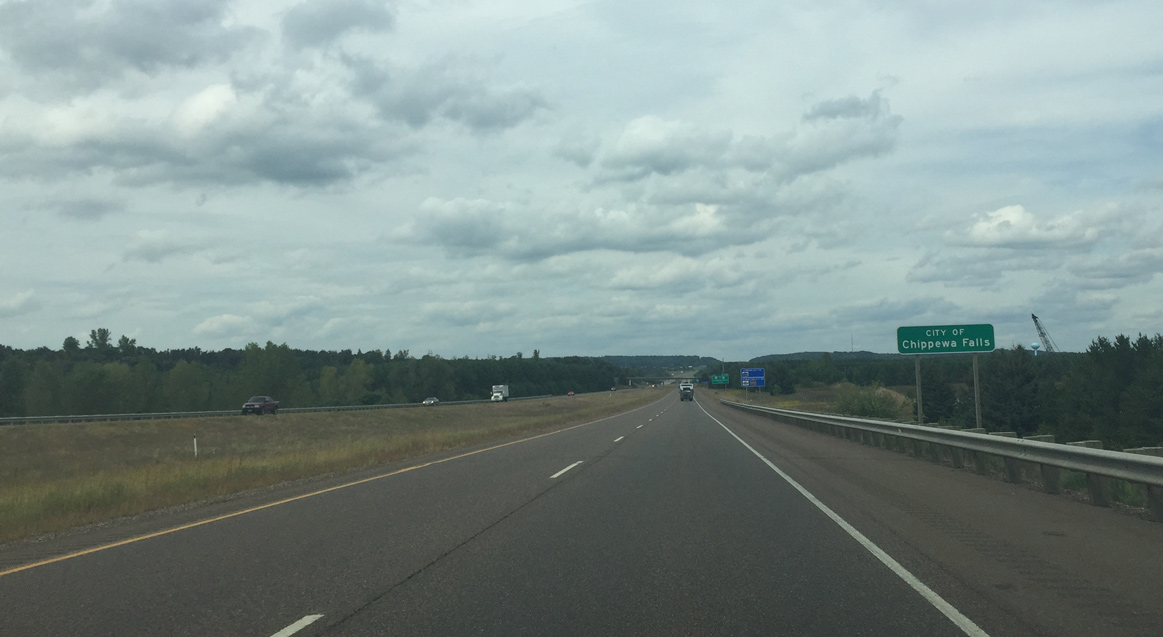
| Motorists cross the Chippewa Falls city limits as U.S. 53 leaves Lake Hallie. 09/04/16 |
|
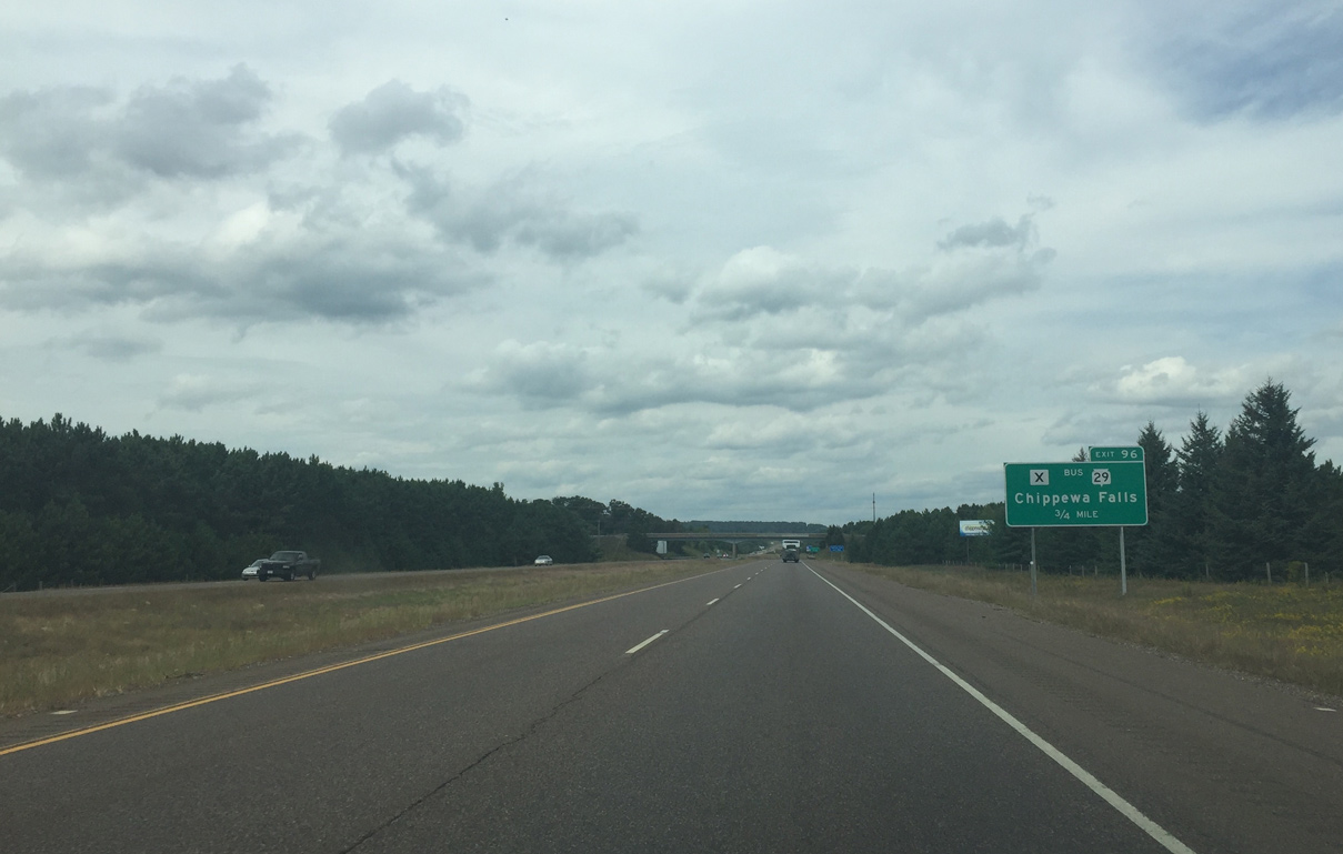
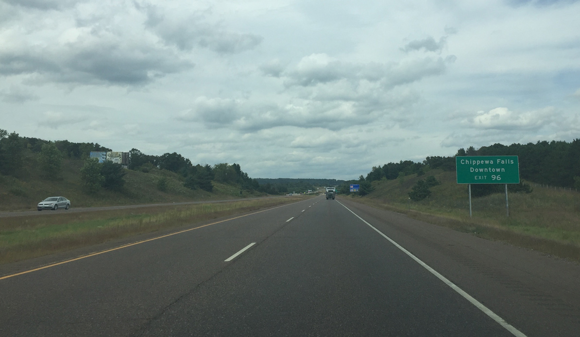
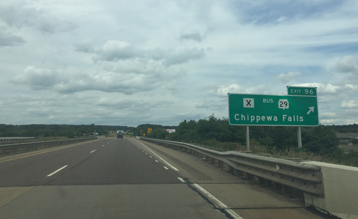
| 0.75 miles south of Exit 96 with County X & Wis 29 Business (River Street) on U.S. 53 north. The business route was Wis 29 until 2005.
Chippewa County signs all former alignments of Wis 29 as County X. Like most business routes in Wisconsin, it is locally designated and maintained. 09/04/16 |
|
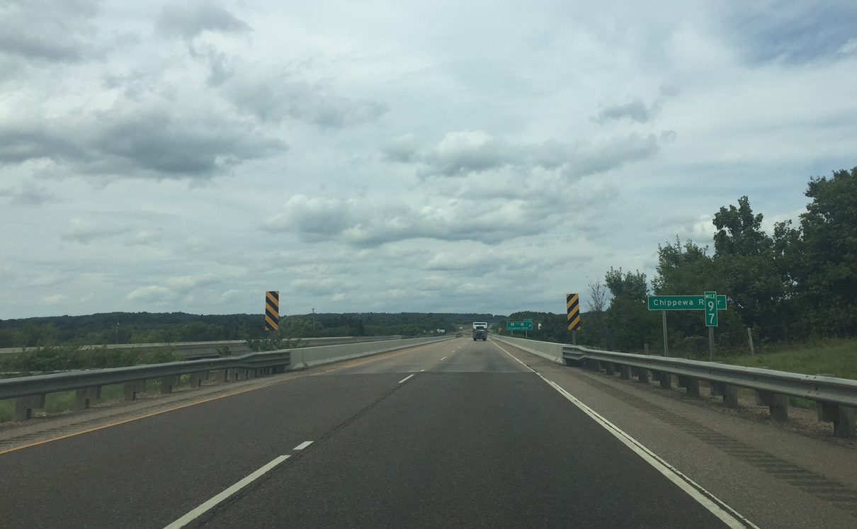
| Wis 29 Business parallels the Chippewa River east to intersect Wis 124 (Bridge Street) at a roundabout in Downtown Chippewa Falls. 09/04/16 |
|
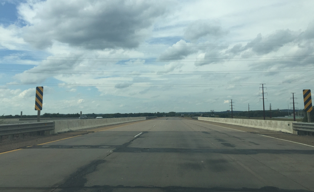
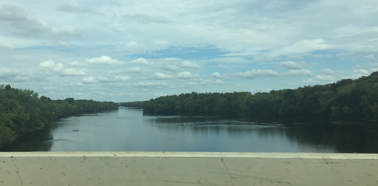
| A pair of two lane bridges built in 1968 carry U.S. 53 across the Chippewa River. 09/04/16 |
|
| The Chippewa River flows 183 miles south from northern Wisconsin to the Mississippi River by Durand. 09/04/16 |
|
| The folded diamond interchange (Exit 96) connecting U.S. 53 with Wis 29 Business & County X lies to the immediate north of the river. Wis 29 Business ventures 4.5 miles southwest to end at the Wis 29 freeway (Exit 72). 09/04/16 |
Page Updated 09-15-2016.

 North
North